Pictures taken from driver's perspective appear offset from centre-line pictures:
Bound
Bound
County of Lanark
Photo taken: July 24th, 2011.

County of Lanark
Photo taken: July 24th, 2011.
 (720x480)
(1440x960)
(2400x1600)
AsphaltPlanet.ca > OntHighways >
Highway 7B (Carleton Place) > Images
King's Highway 7B (Carleton Place) - Images
Photos shown in this table are arranged from West to East:
| Proper Municipality Name | Photo Description | Photo | |
|
Pictures taken from driver's perspective appear offset from centre-line pictures: |
East- Bound |
West- Bound |
|
| Highway 7B ends at Highway 7 west of Carleton Place. Click here for Highway 7 images | |||
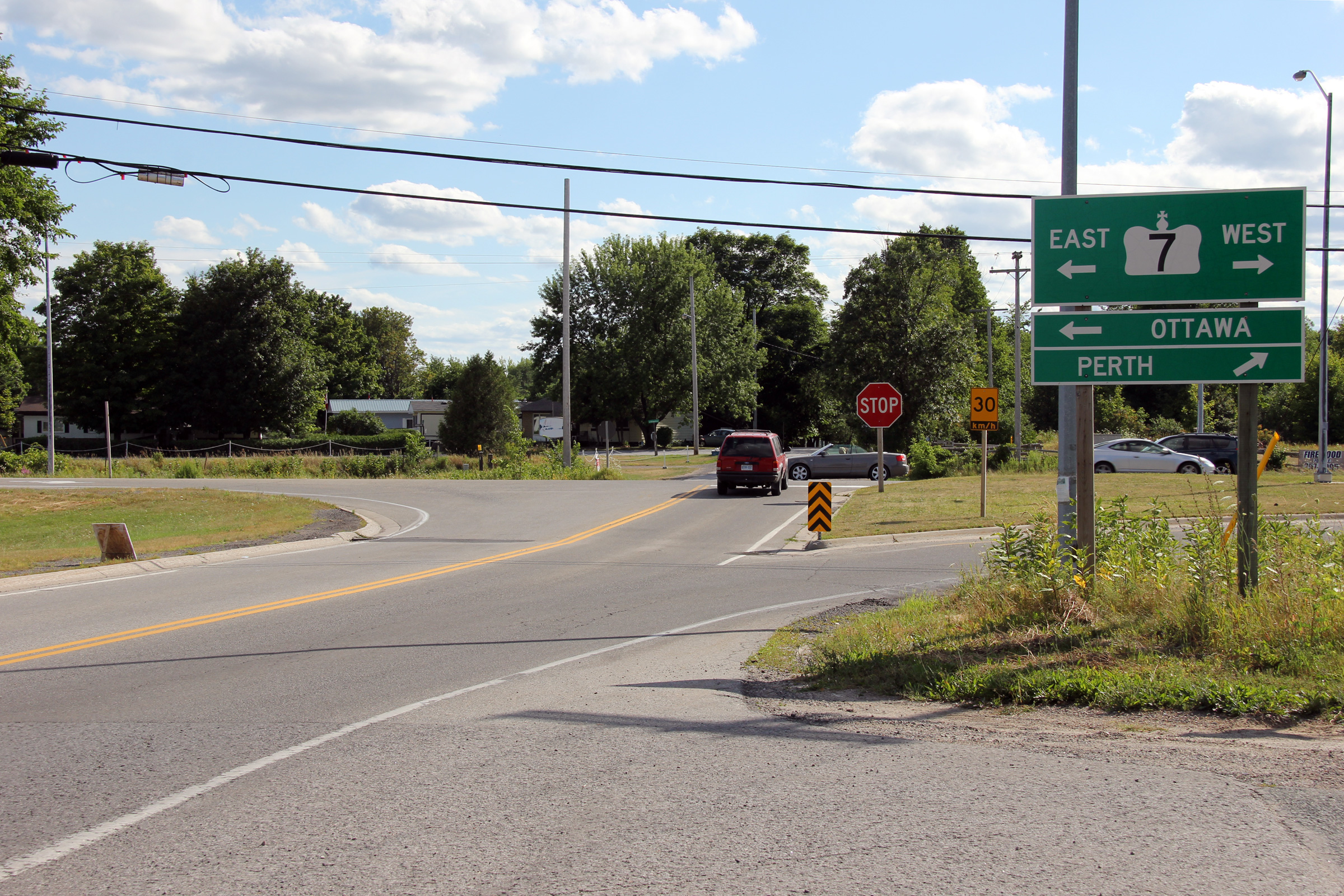
| Township of Beckwith County of Lanark |
View looking westerly at the western terminus of
Highway 7B at Highway 7 west of Carleton Place. Photo taken: July 24th, 2011. |
|
|
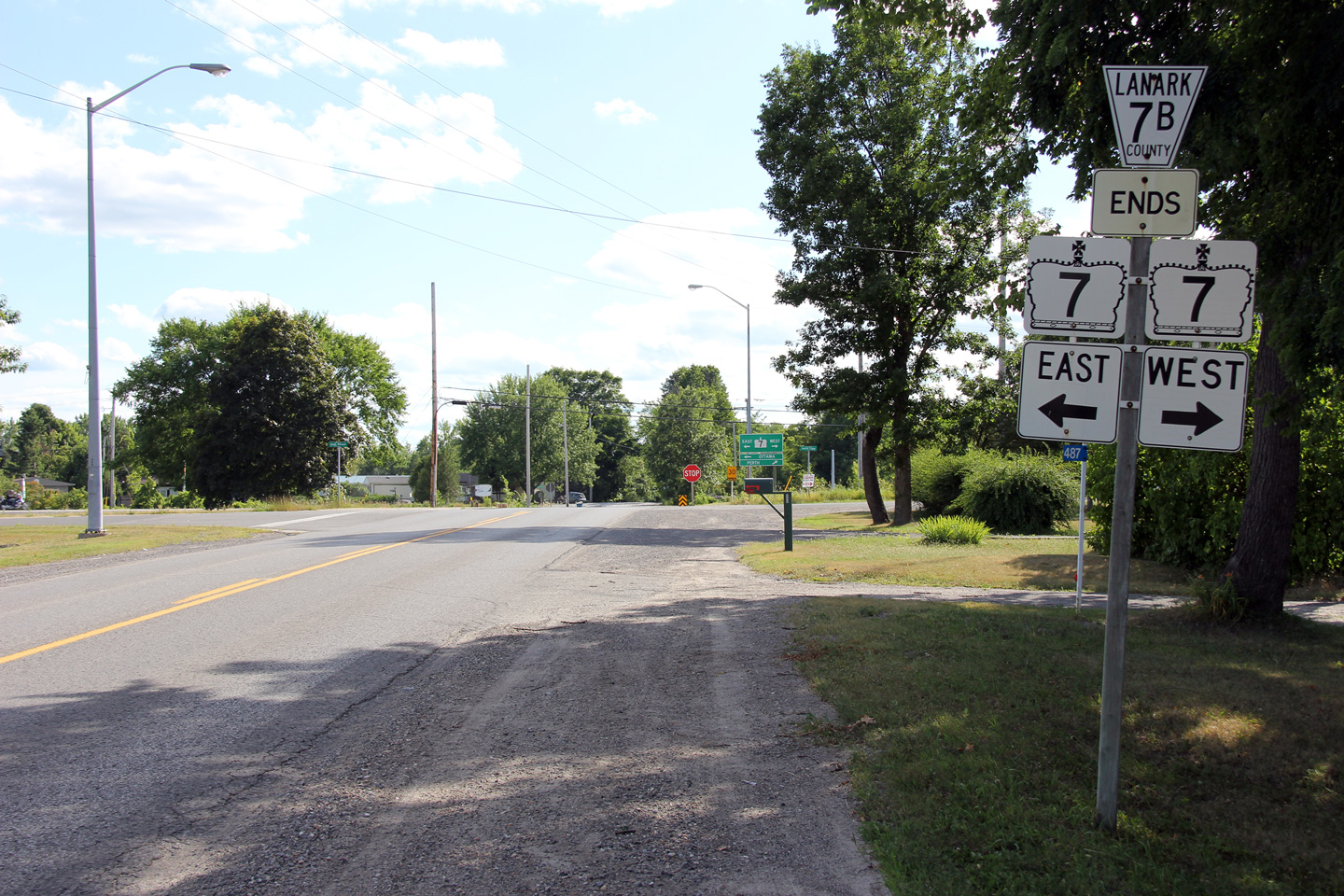
| Township of Beckwith County of Lanark |
Junction assembly for the former Highway 7B at
Highway 7 west of Carleton Place. Photo taken: July 24th, 2011. |
(720x480) (1440x960) (2400x1600) |
|
| Highway 7B ends at Highway 15 to the east of Carleton Place. Click here for Highway 15 images. | |||
<- Highway 7B (Peterborough) Images Back to Highway 7B (Carleton Place) Highway 8 Images ->
Copyright (c) 2004-2012, Scott Steeves (Webmaster) AsphaltPlanet@asphaltplanet.ca