King's Highway 7 - Images
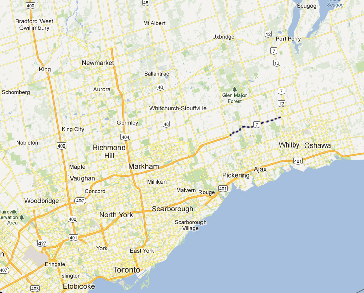
Hwy 7 Widening - Pickering to Brooklin
The Ministry of Transportation is widening Hwy 7 between Hwy 407 in Pickering and Hwy 12 in Brooklin. Traffic volumes along this segment of Hwy 7 have increased rapidly since the extension of Hwy 407 opened to Brock Road in 2001. This project is a pre-cursor to the extension of Hwy 407 through Pickering to Oshawa which is slated to start in 2013. Construction on Hwy 7 is expected to be completed by the fall of 2013.
Photos taken during construction:
| Photos taken September 25th, 2012 | |||
 |
 |
 (720x480) (1440x960) (2400x1600) |
 (720x480) (1440x960) (2400x1600) |
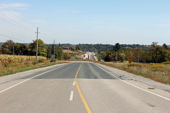
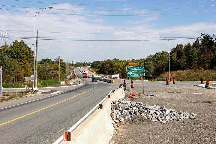
| View looking easterly along Sideline 16 towards Highway 7. This short section of Sideline 16 is a former alignment of Highway 7 that was abandoned when Highway 407 was linked directly with Highway 7. | Similar photo to the previous with a more focused perspective. Highway 407 will cross Highway 7's alignment at this location once its extended. | Easterly view at Concession 6 at the start of the Greenwood By-pass. Highway 7 swings to the north of the hamlet of Greenwood. | Westerly view from the Westney Road intersection. Highway 7 crosses Duffins Creek between Concession 6 and Westney Road. |
 (720x480) (1440x960) (2400x1600) |
 (720x480) (1440x960) (2400x1600) |
 (720x480) (1440x960) (2400x1600) |
 (720x480) (1440x960) (2400x1600) |
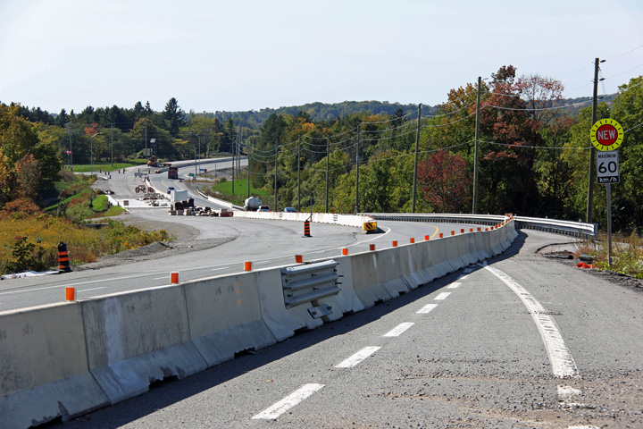
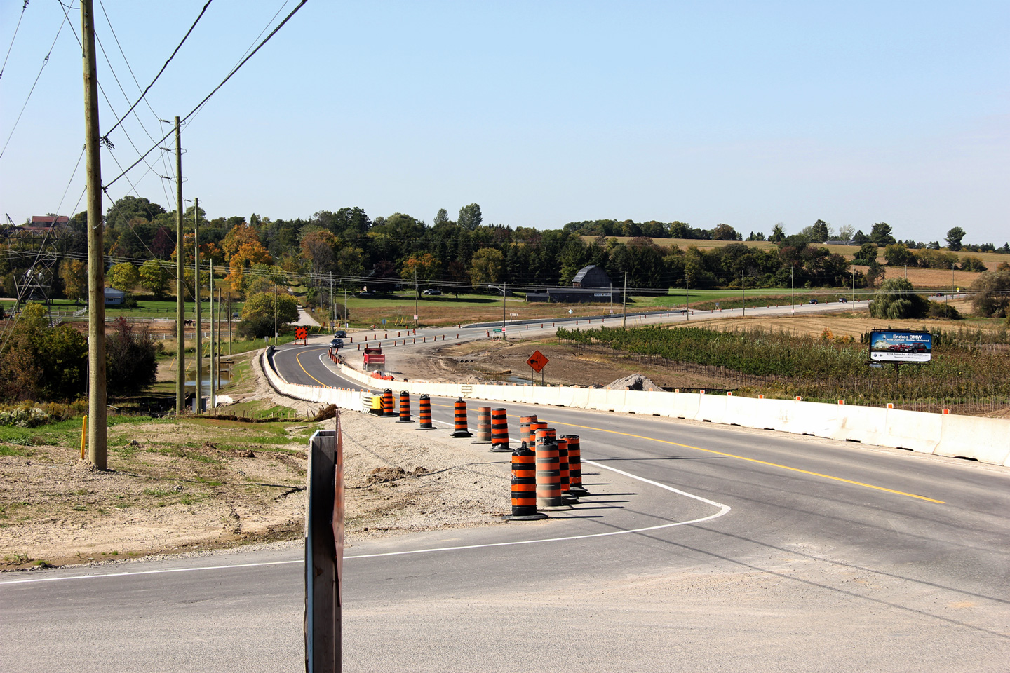
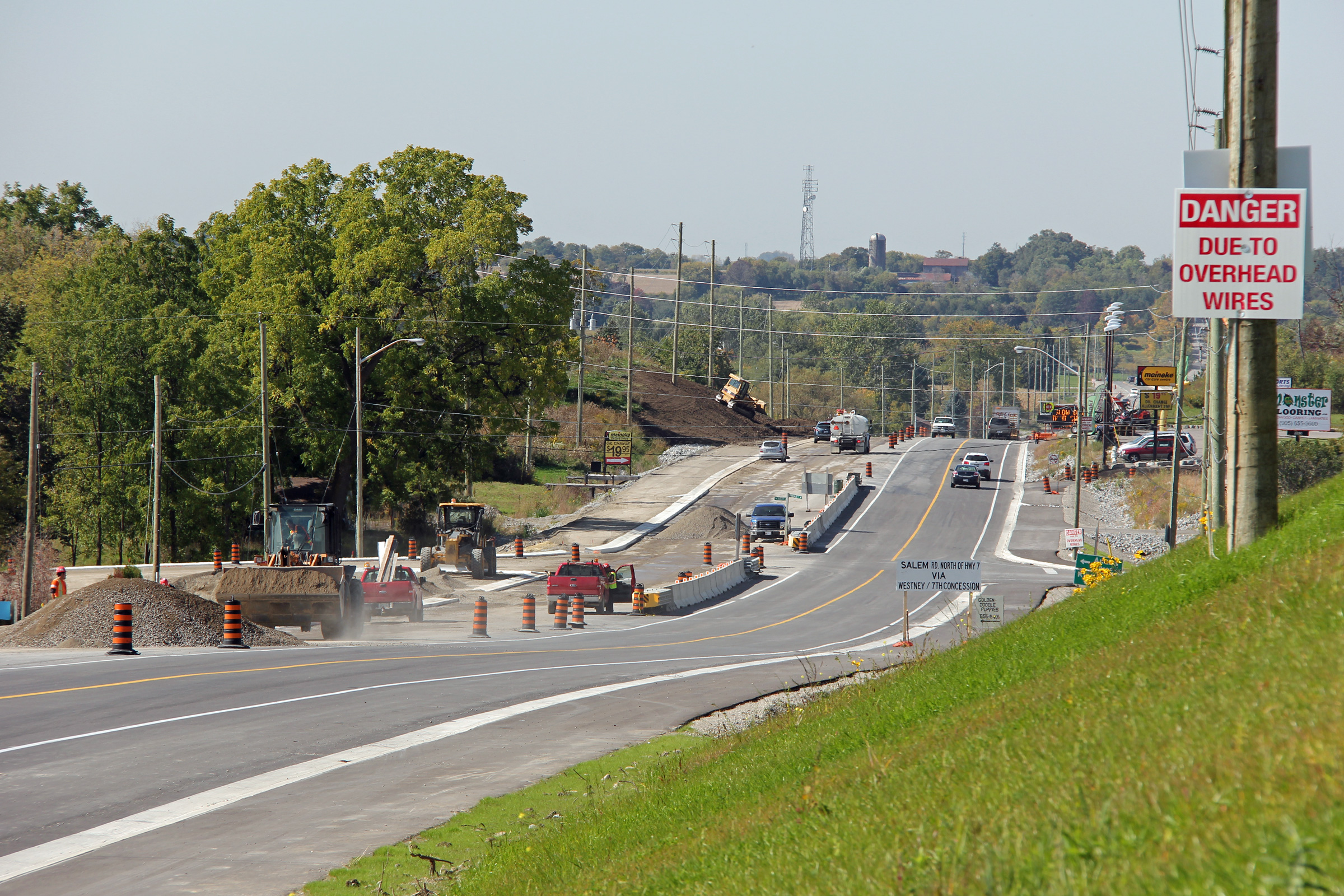
| Easterly view towards the Westney Road intersection. The auxiliary lanes at the Westney Road intersection were shortened considerably due to the construction | View looking westerly approaching Westney Road. Base course asphalt has been laid for much of the eastern leg of the Greenwood By-pass. | Westerly view from the Salem Road intersection towards Greenwood. Highway 7 was lowered in the vicinity of Salem Road. | View looking easterly from just east of the Salem Road intersection. A considerable kink in Highway's alignment was required to replace a highway culvert. |
 (720x480) (1440x960) (2400x1600) |
 (720x480) (1440x960) (2400x1600) |
 (720x480) (1440x960) (2400x1600) |
|
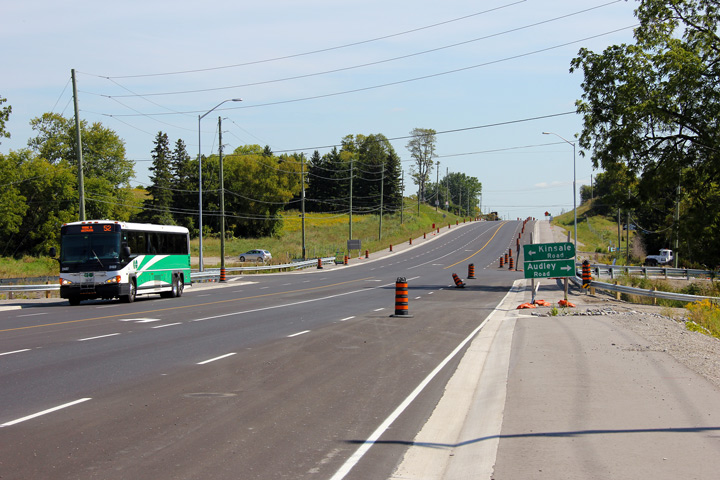
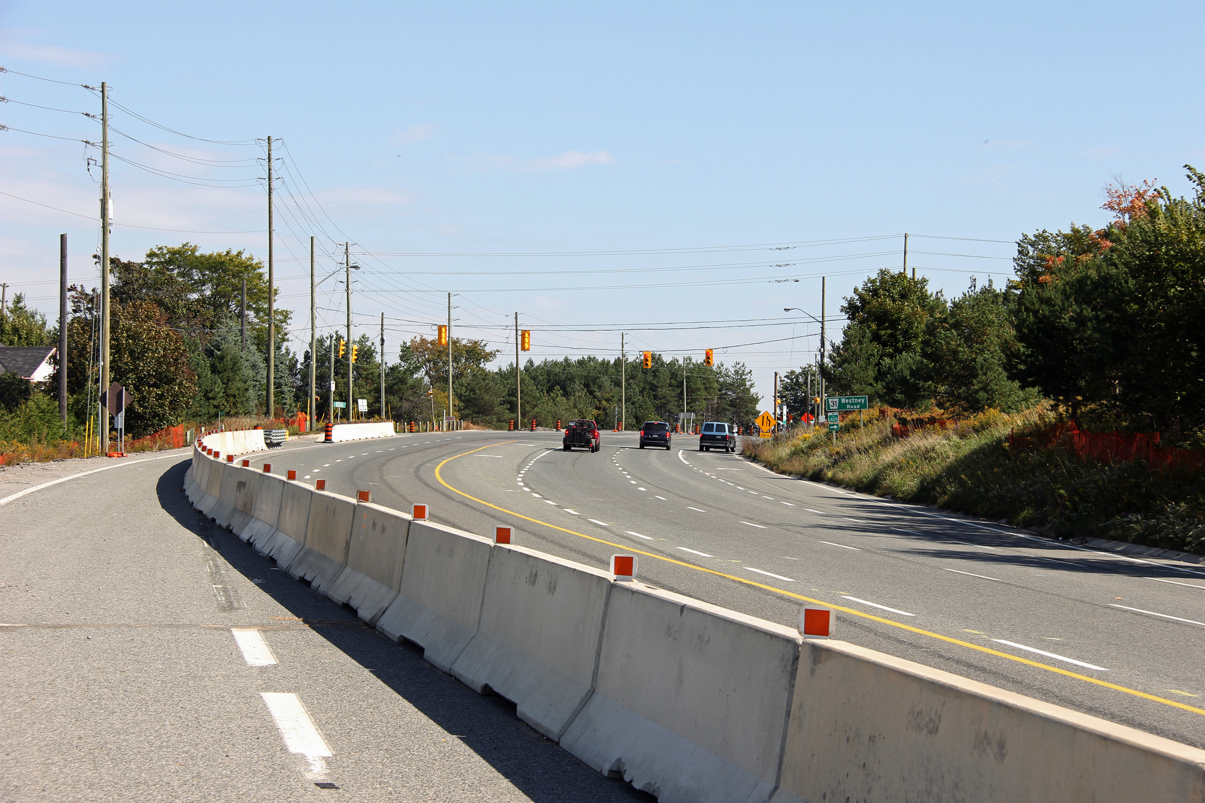
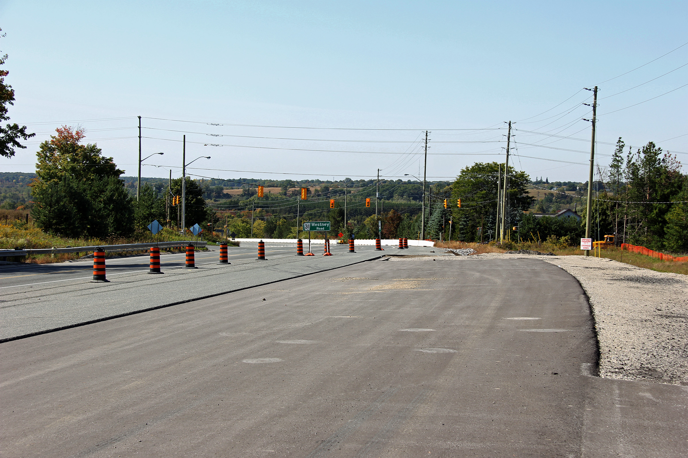
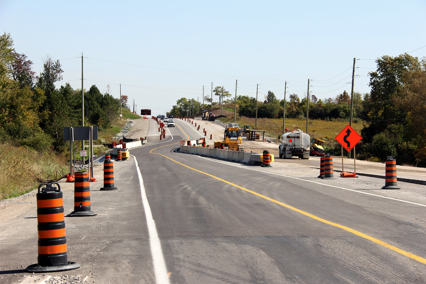
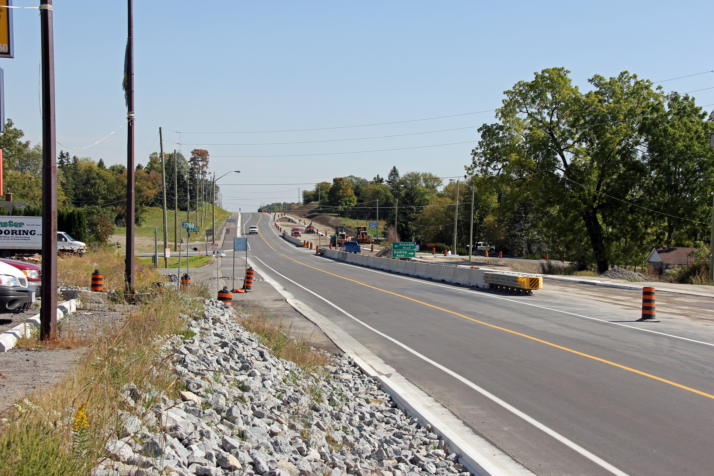
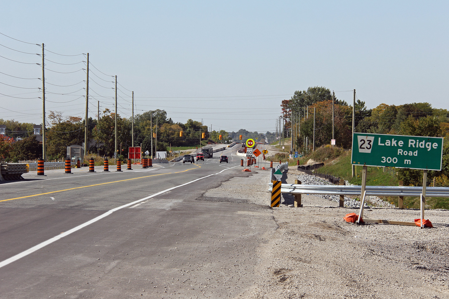
| Westerly view from Kinsale towards the Sideline 4 intersection. | Easterly view at the Audley Road intersection in Kinsale. Highway 7's alignment was raised considerably through Kinsale. | Easterly view through Kinsale. | Easterly view approaching the Lake Ridge Road intersection. Similarly to the Westney Road intersection, the Lake Ridge Road intersection had an existing four lane cross-section prior to construction start. |
 (720x480) (1440x960) (2400x1600) |
 (720x480) (1440x960) (2400x1600) |
 (720x480) (1440x960) (2400x1600) |
 (720x480) (1440x960) (2400x1600) |
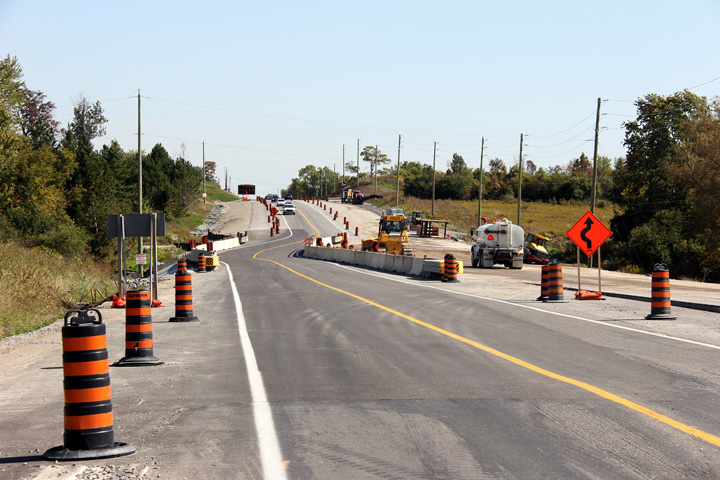
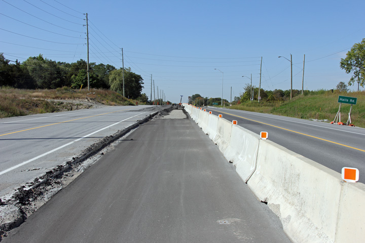
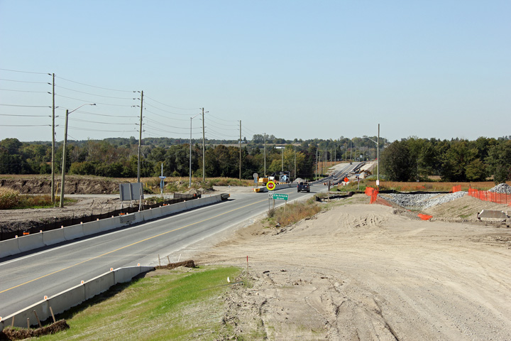
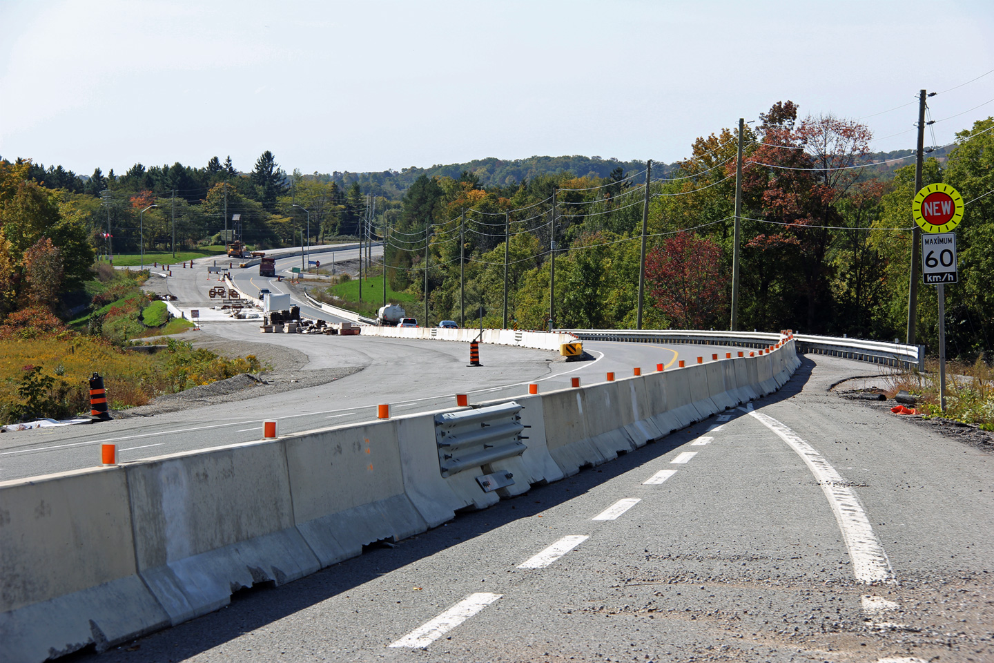
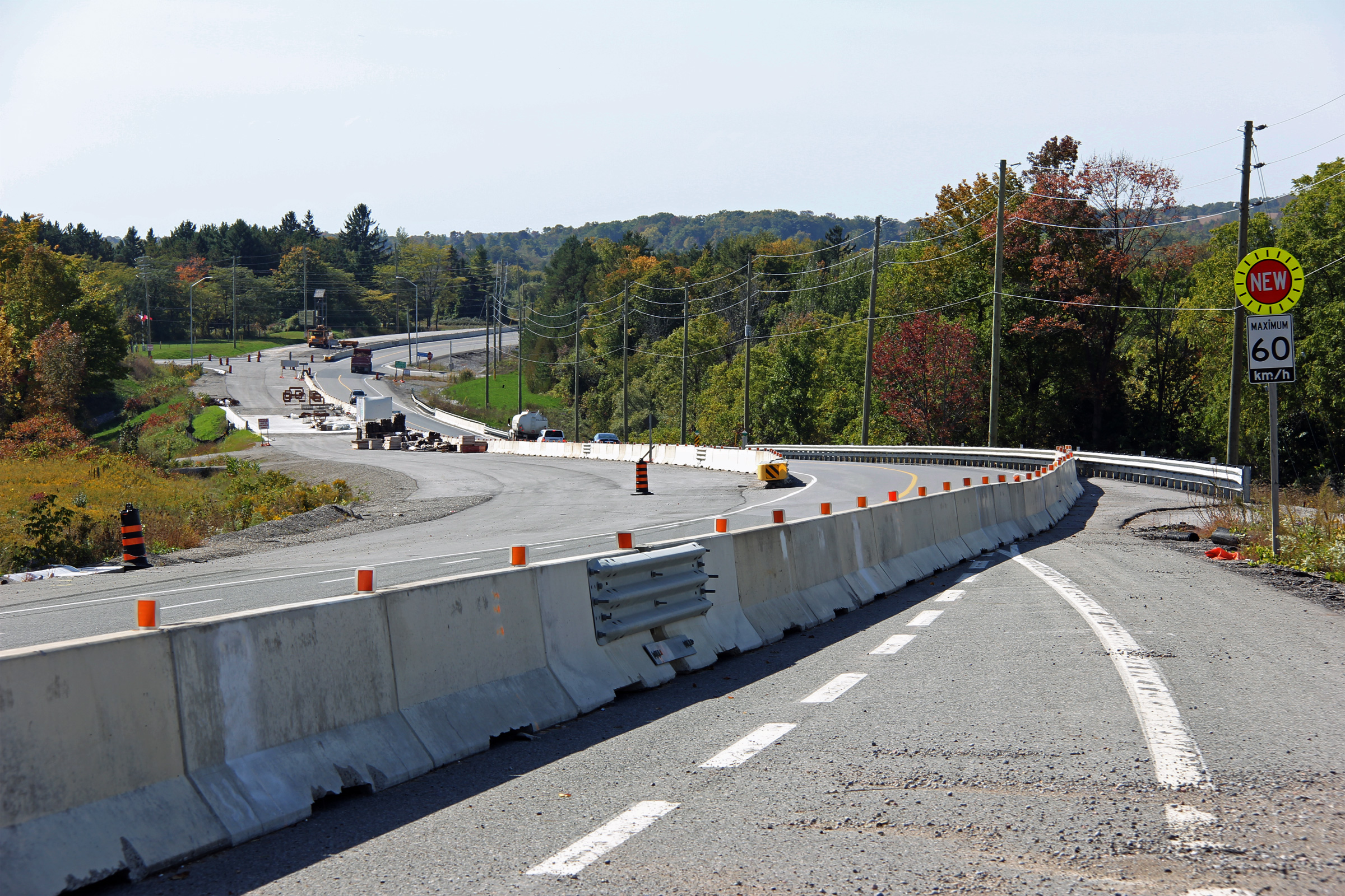
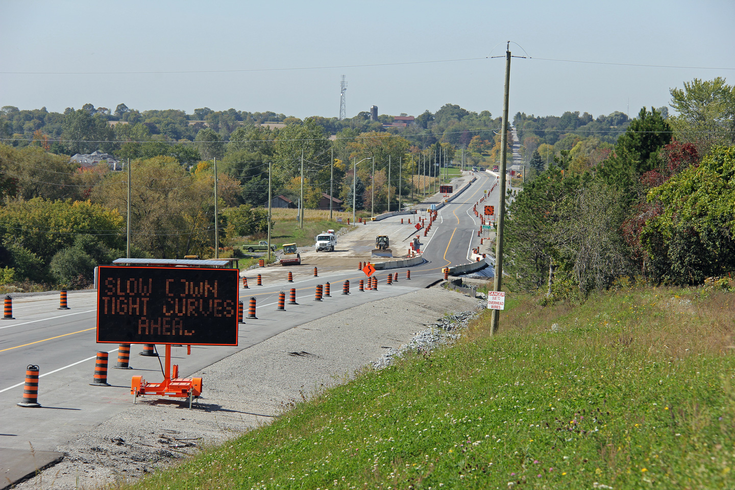
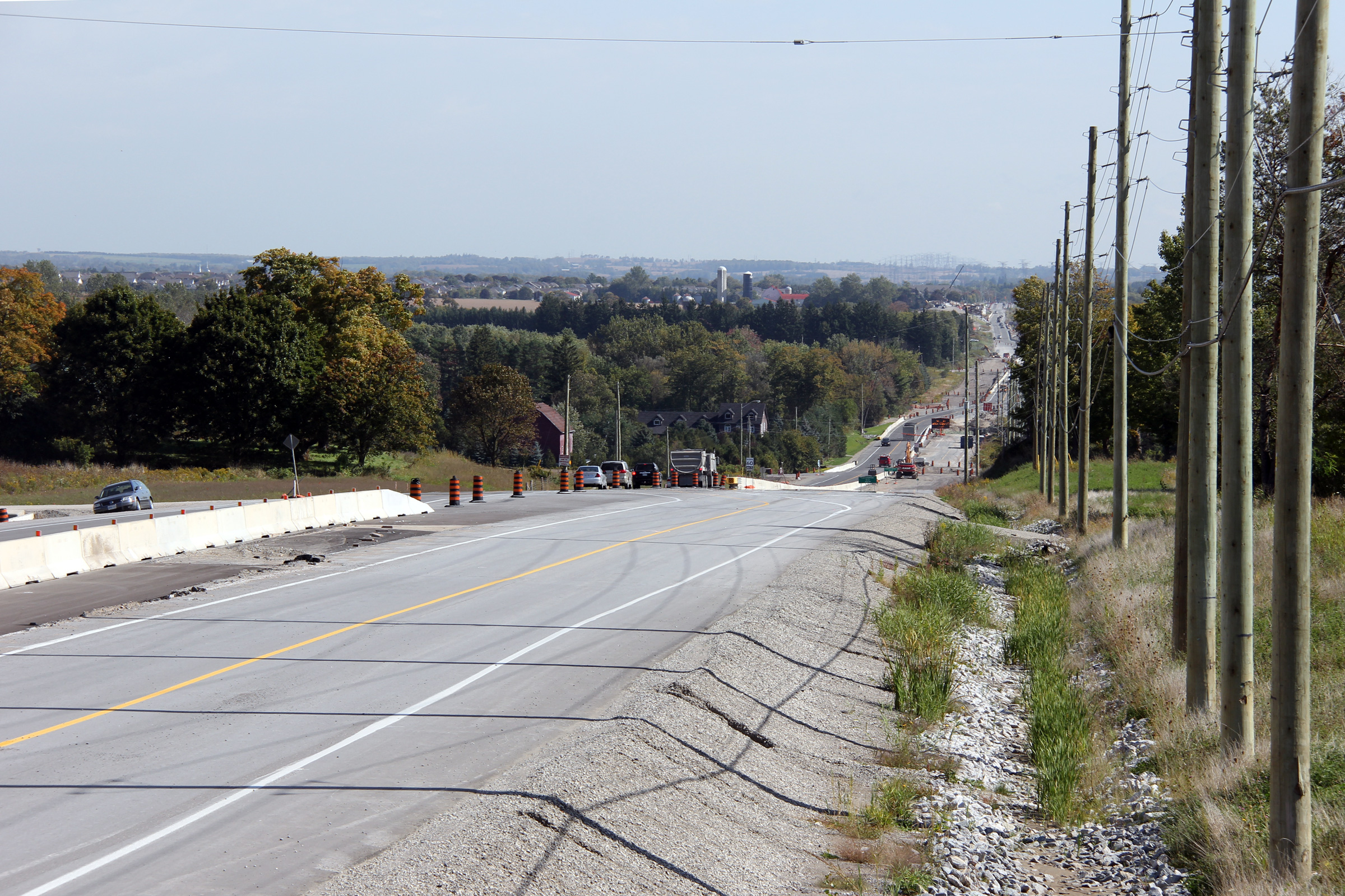
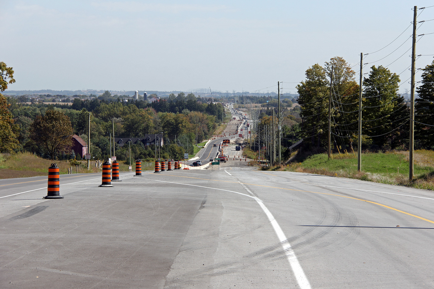
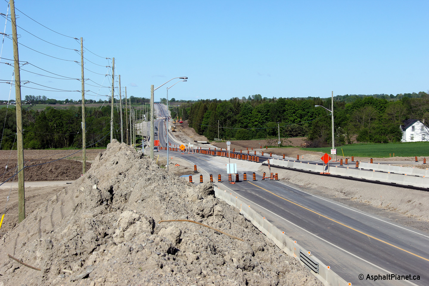
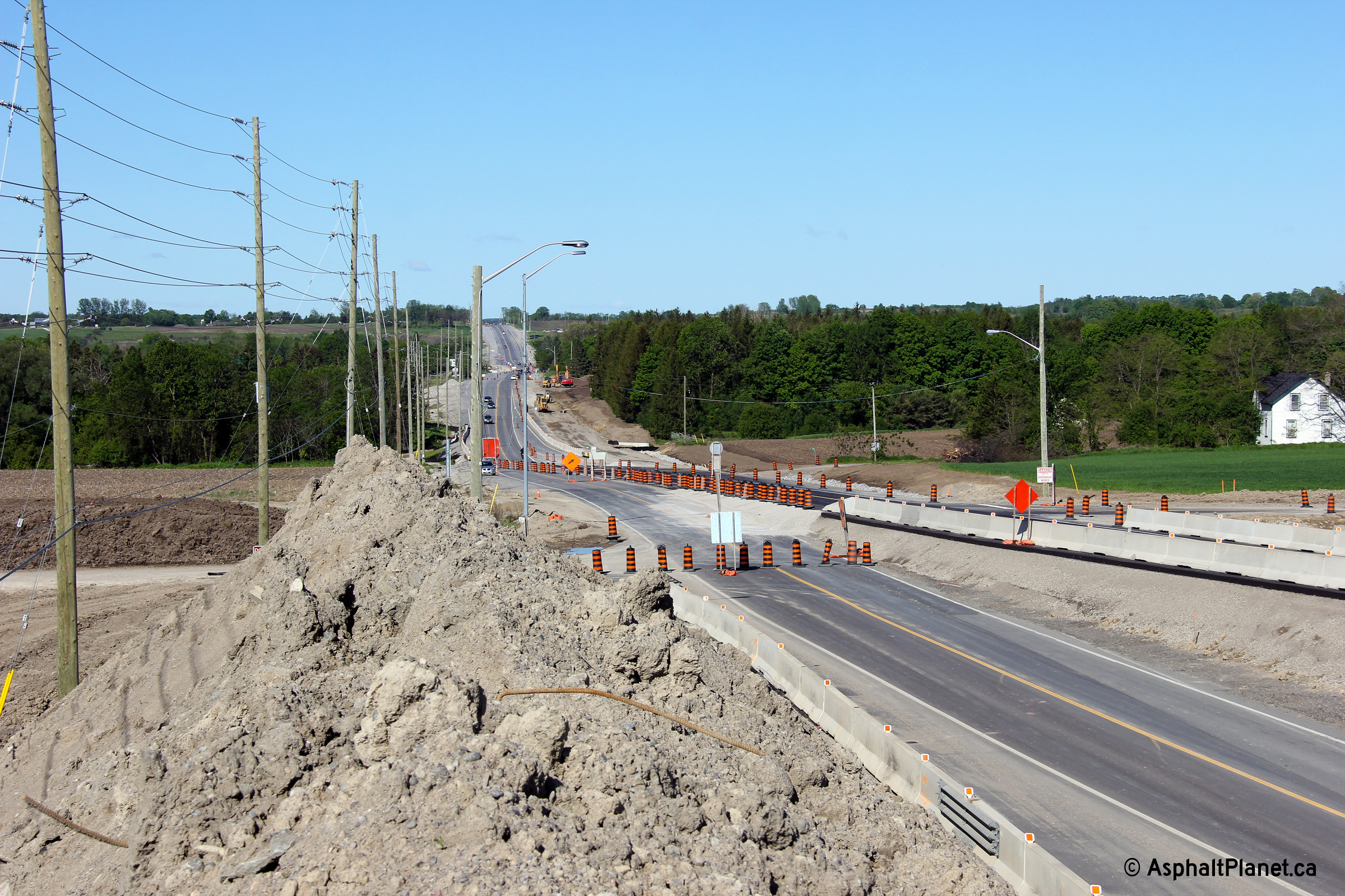
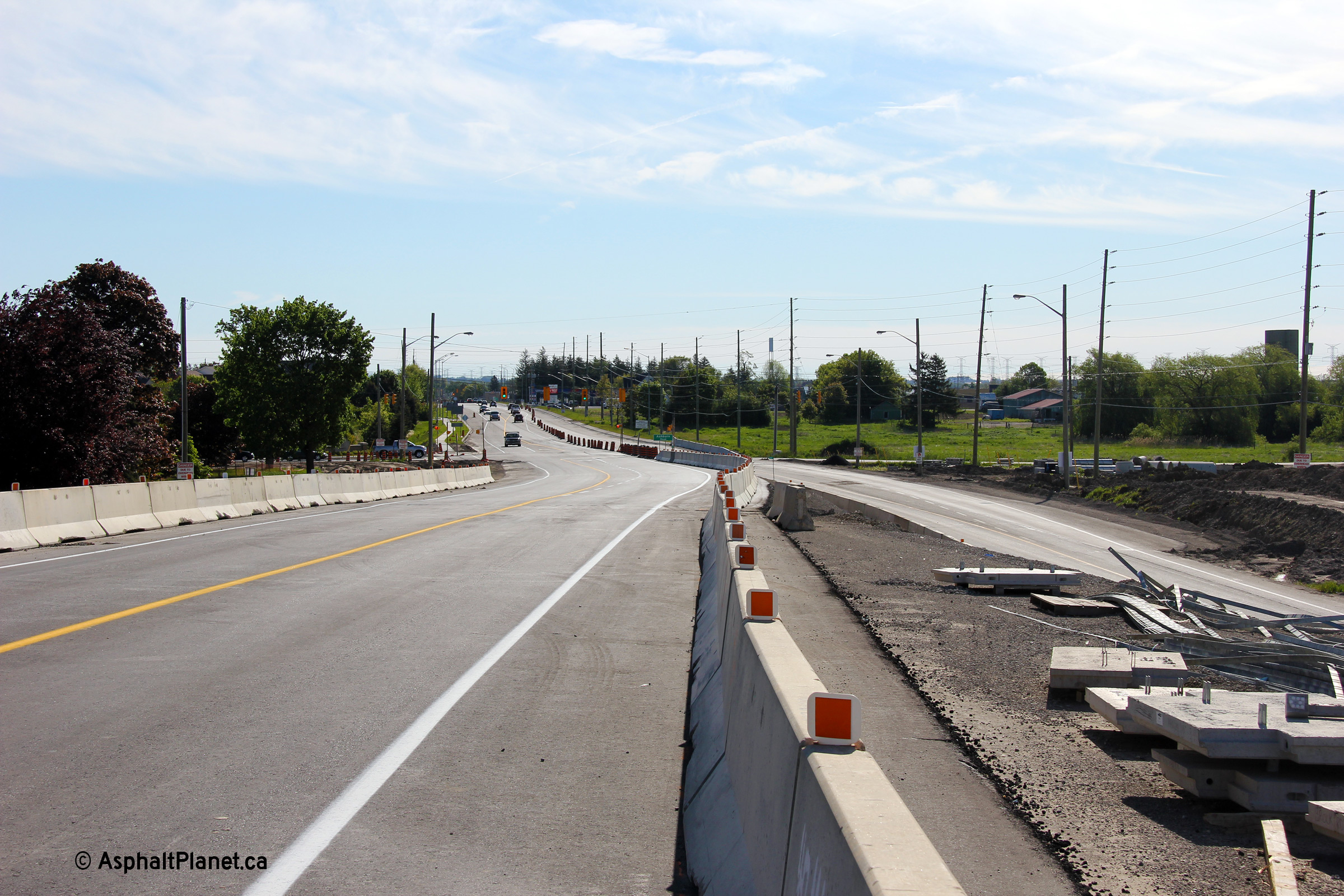
| Westerly view approaching the Lake Ridge Road intersection. | Westerly view approaching the Halls Road intersection. Highway 7 is being lowered in the vicinity of Halls Road. | Easterly view as Highway 7 descends the long hill east of Halls Road. A new freeway between Highway 401 and Highway 407 will cross overtop of Highway 7 at this location. | Another photo looking down the hill east of Halls Road. The line striping along the road provides a clue of how traffic has been staged through the widening project. |
 (720x480) (1440x960) (2400x1600) |
 (720x480) (1440x960) (2400x1600) |
 (720x480) (1440x960) (2400x1600) |
 (720x480) (1440x960) (2400x1600) |
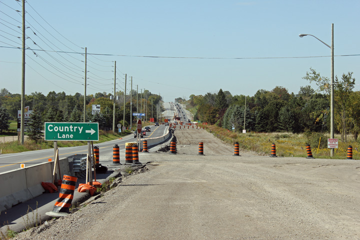
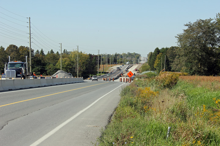
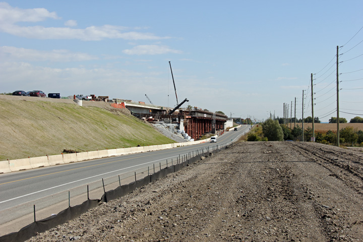
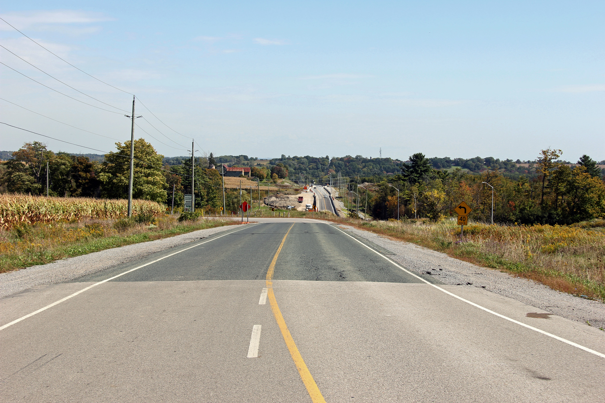
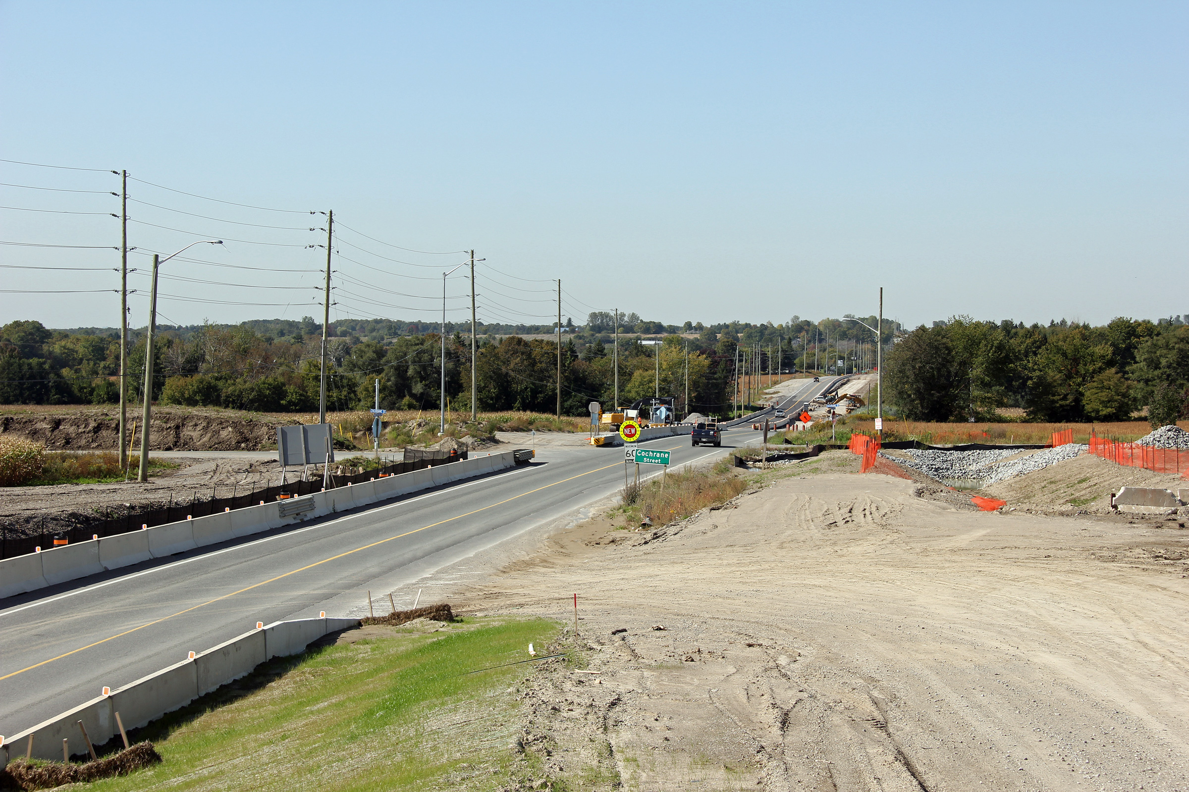
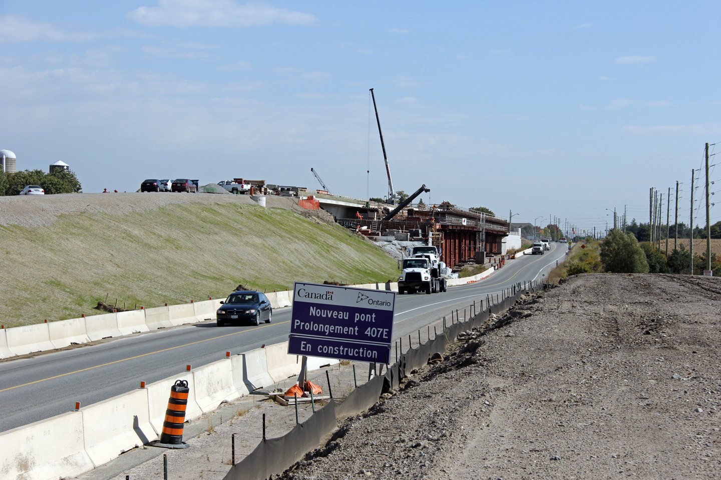
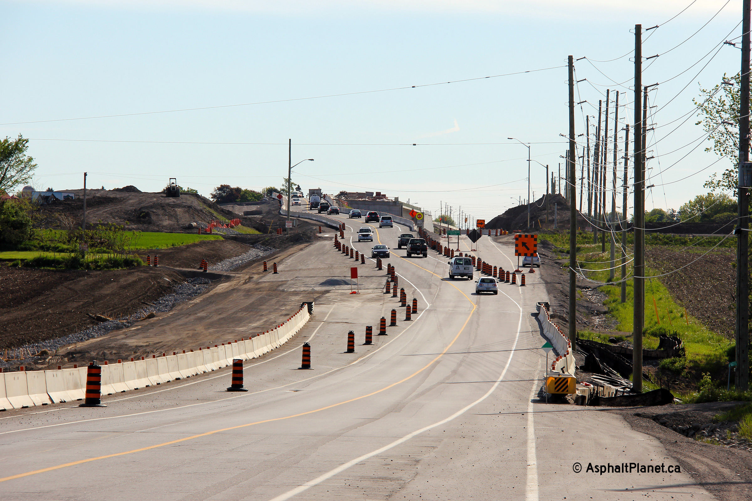
| Westerly view at the Country Lane intersection. The vertical alignment of Highway 7 was lowered at Country Lane. | Westerly view along Highway 7 from west of Cochrane Street. | View looking westerly at the Cochrane Street intersection. Cochrane Street's jog at Highway 7 is being eliminated as part of this construction project. | Easterly view as Highway 7 passes alongside the future Highway 407 overpass. |
 (720x480) (1440x960) (2400x1600) |
 (720x480) (1440x960) (2400x1600) |
 (720x480) (1440x960) (2400x1600) |
 (720x480) (1440x960) (2400x1600) |
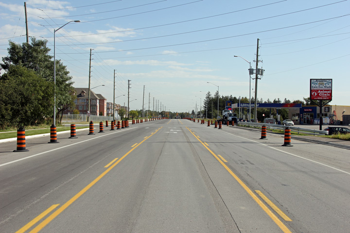
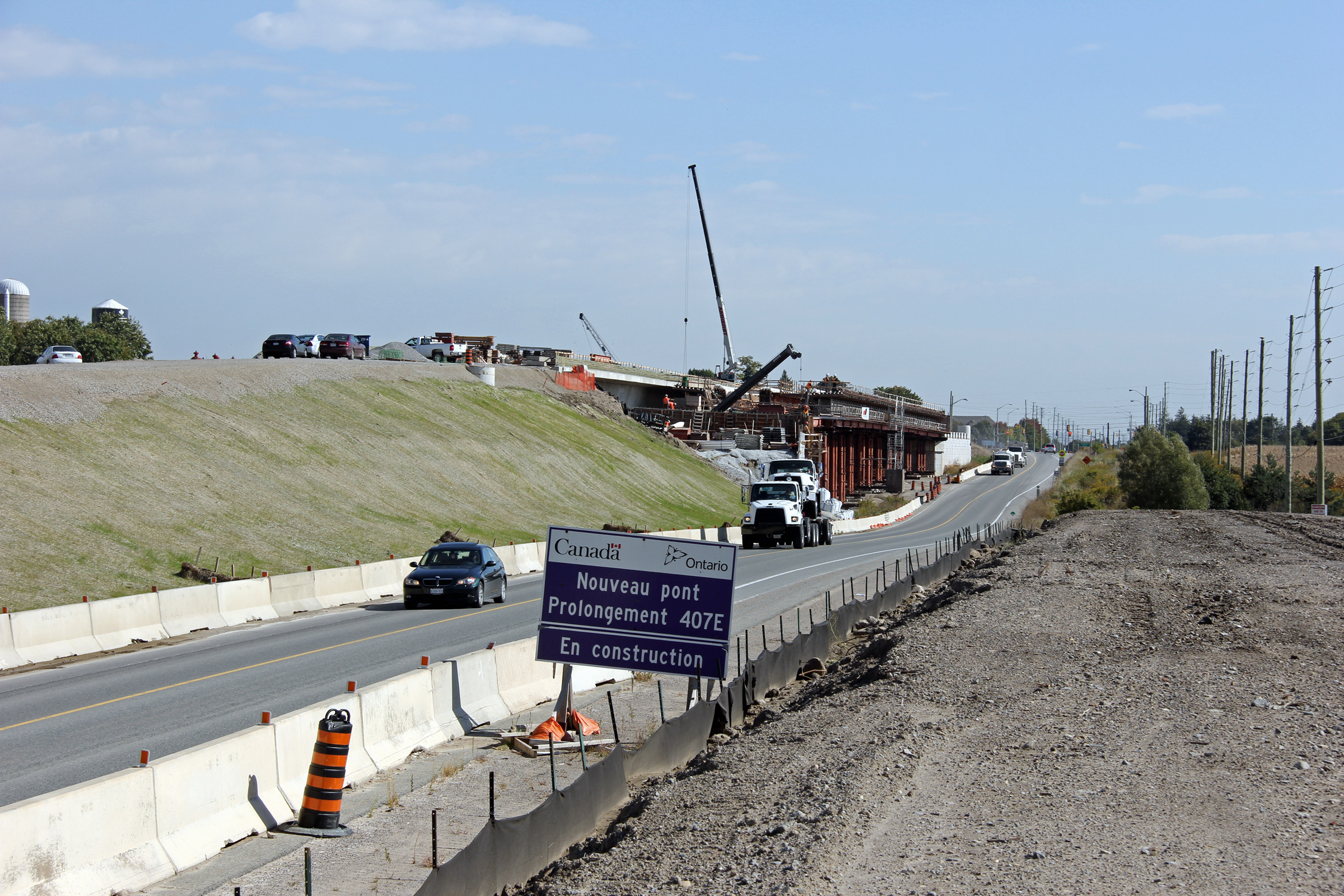
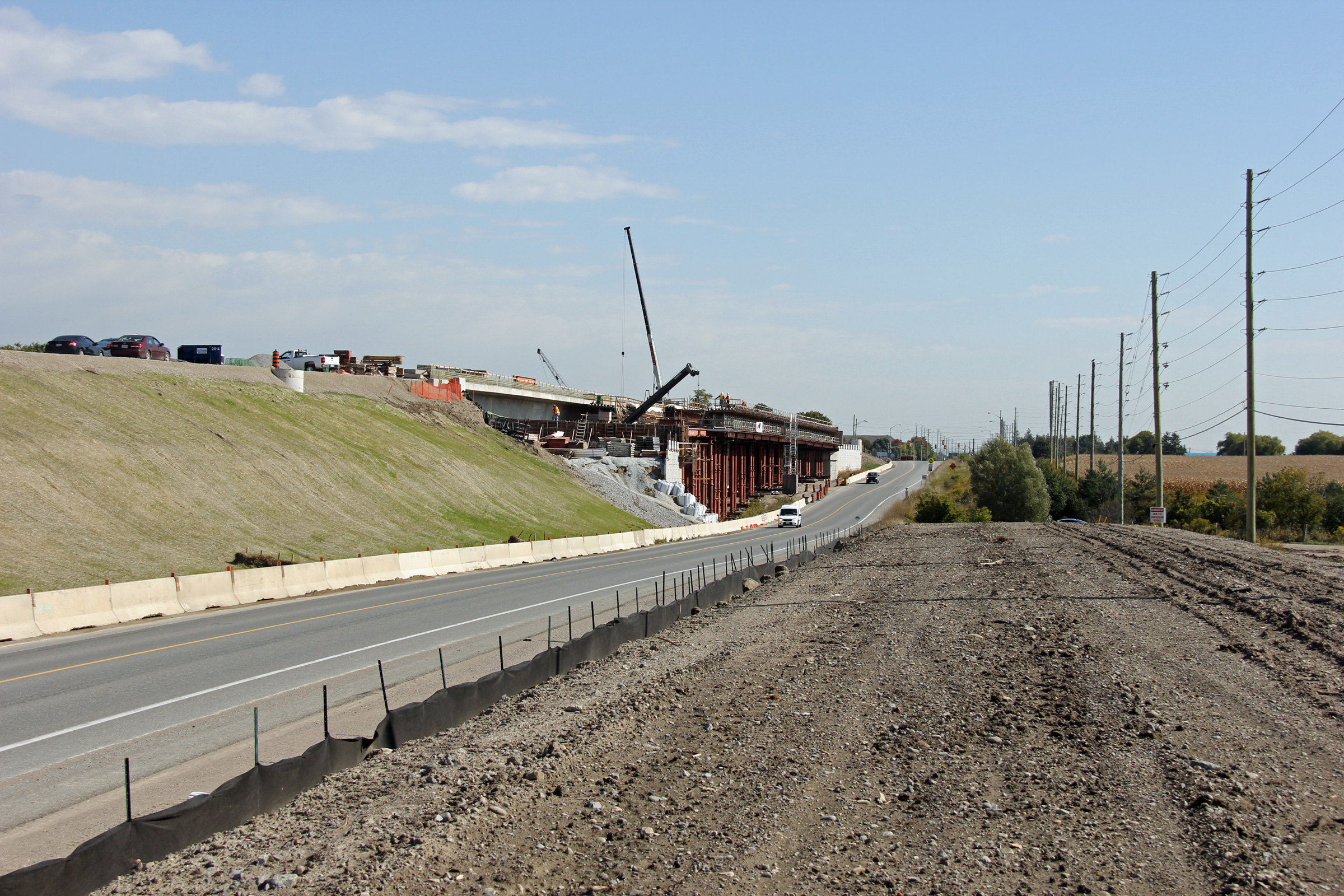
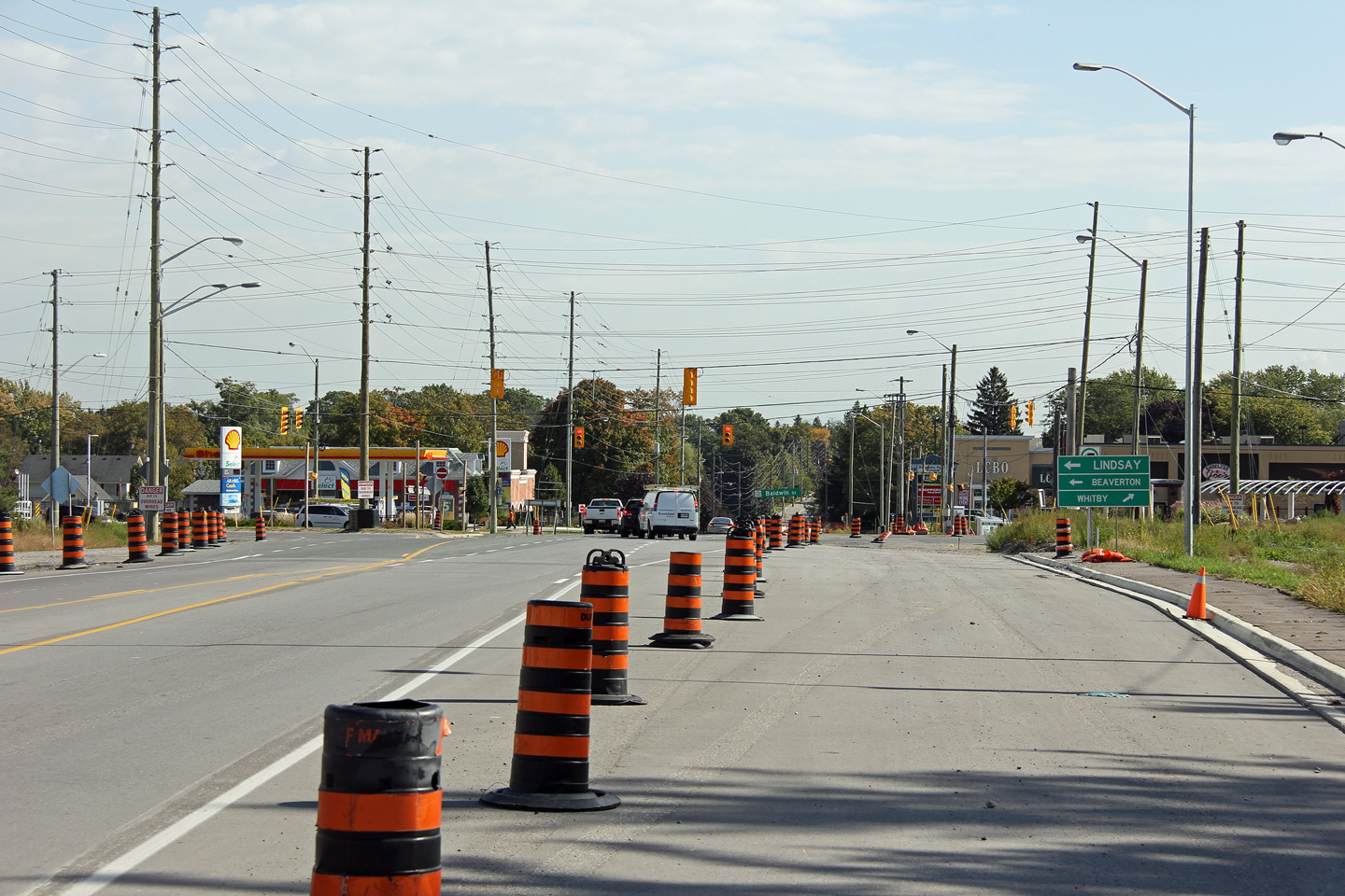
| A similar perspective to the previous photo of the new Hwy 407 overpass. | Westerly view in Brooklin towards the Ashburn Road intersection and future Highway 407 overpass. | Once construction has been completed, Highway 7 will have a five lane cross-section through Brooklin. | View looking easterly approaching the Highway 12 intersection. Highway 7 turns left at this intersection towards Lindsay. |
| Photos taken March 5th, 2013 | |||
 |
 |
 (720x480) (1440x960) (2400x1600) |
 (720x480) (1440x960) (2400x1600) |
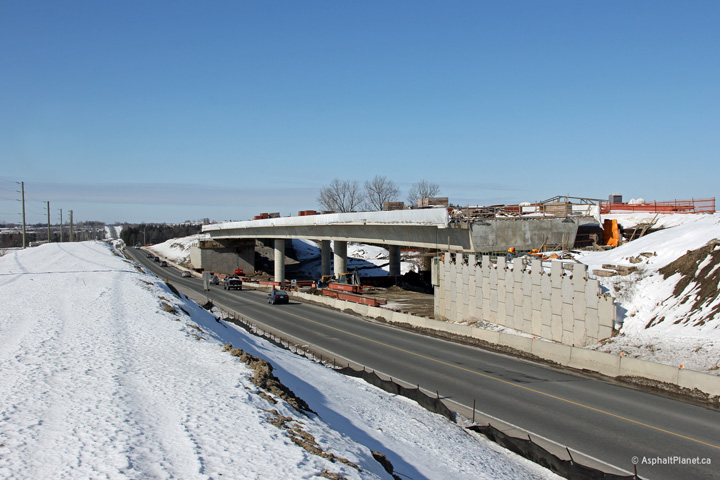
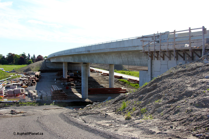
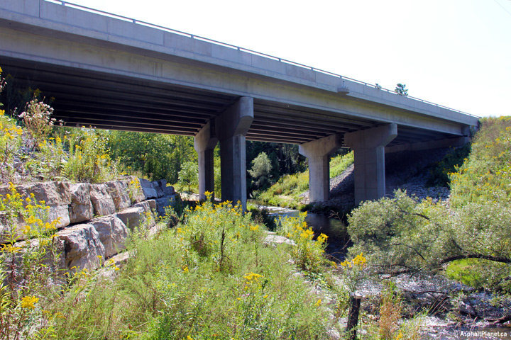
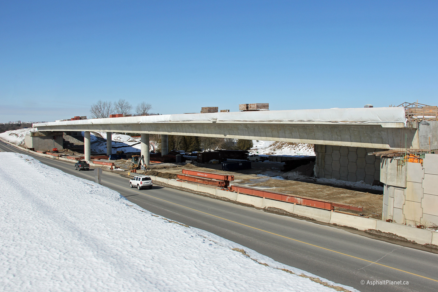
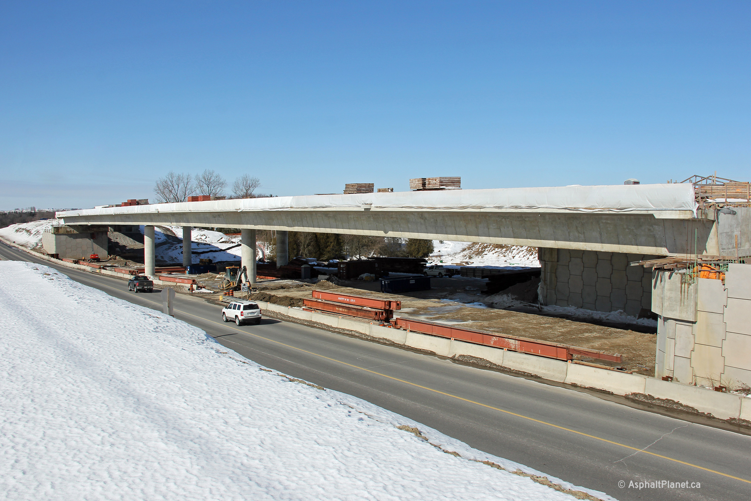
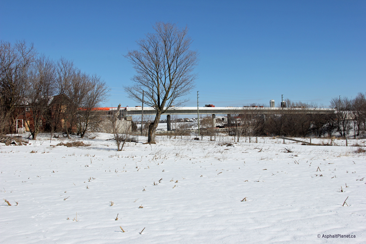
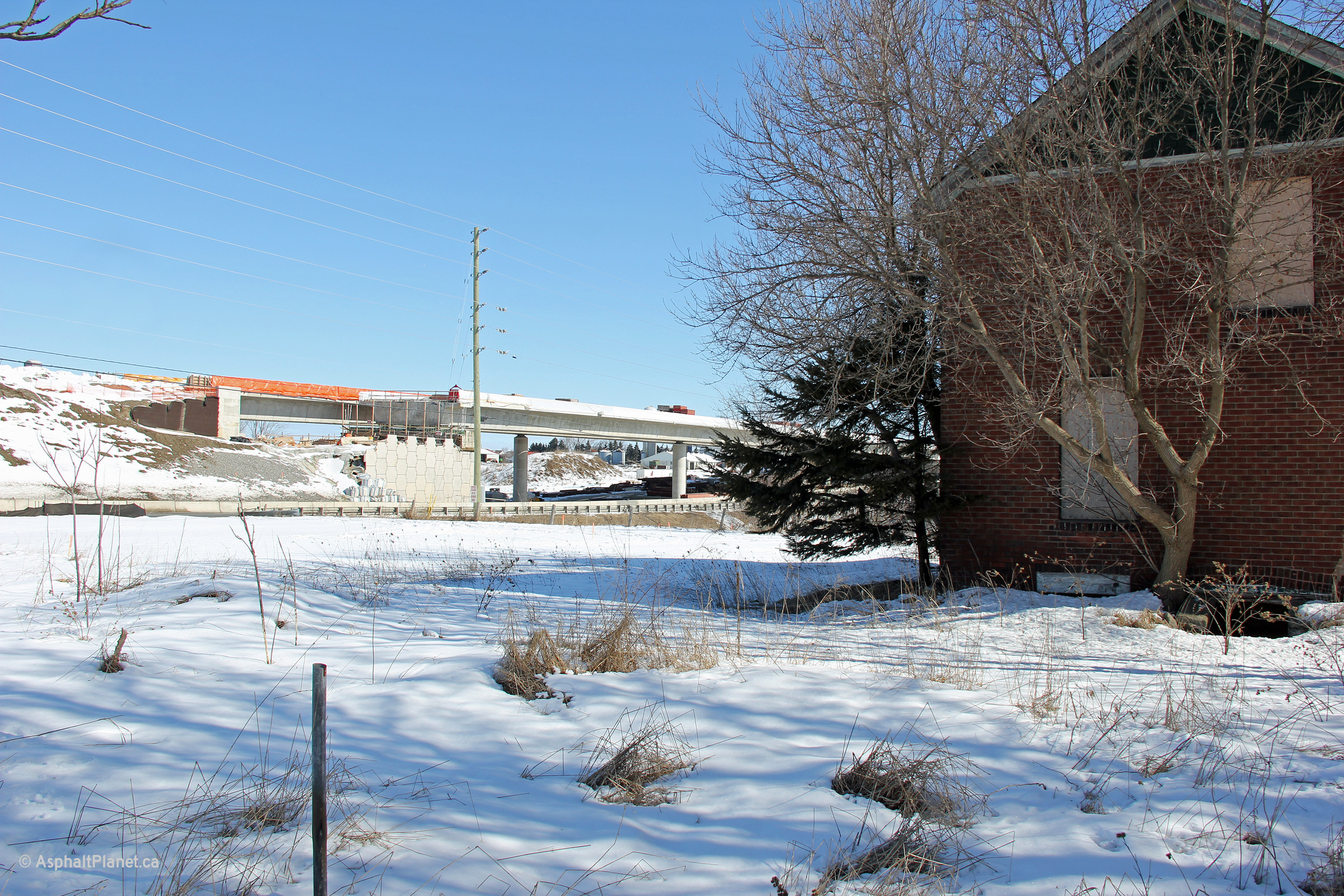
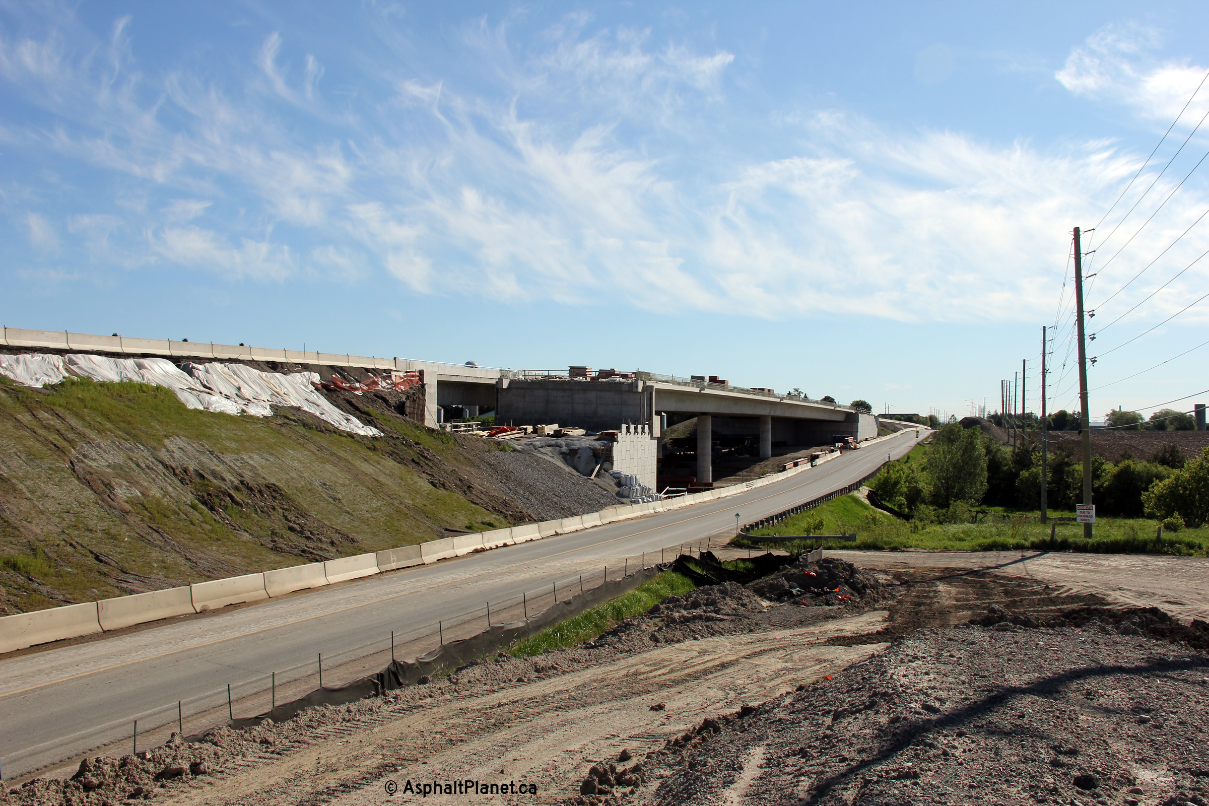
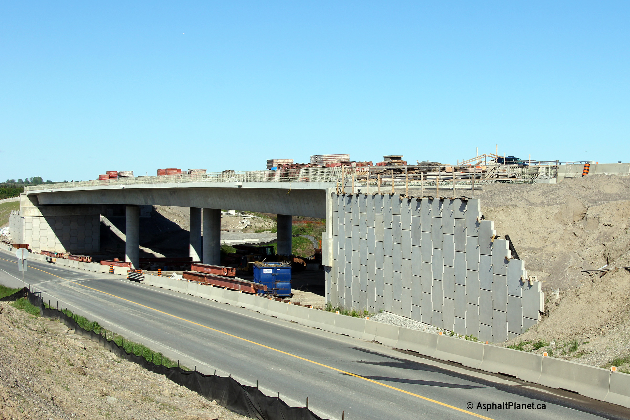
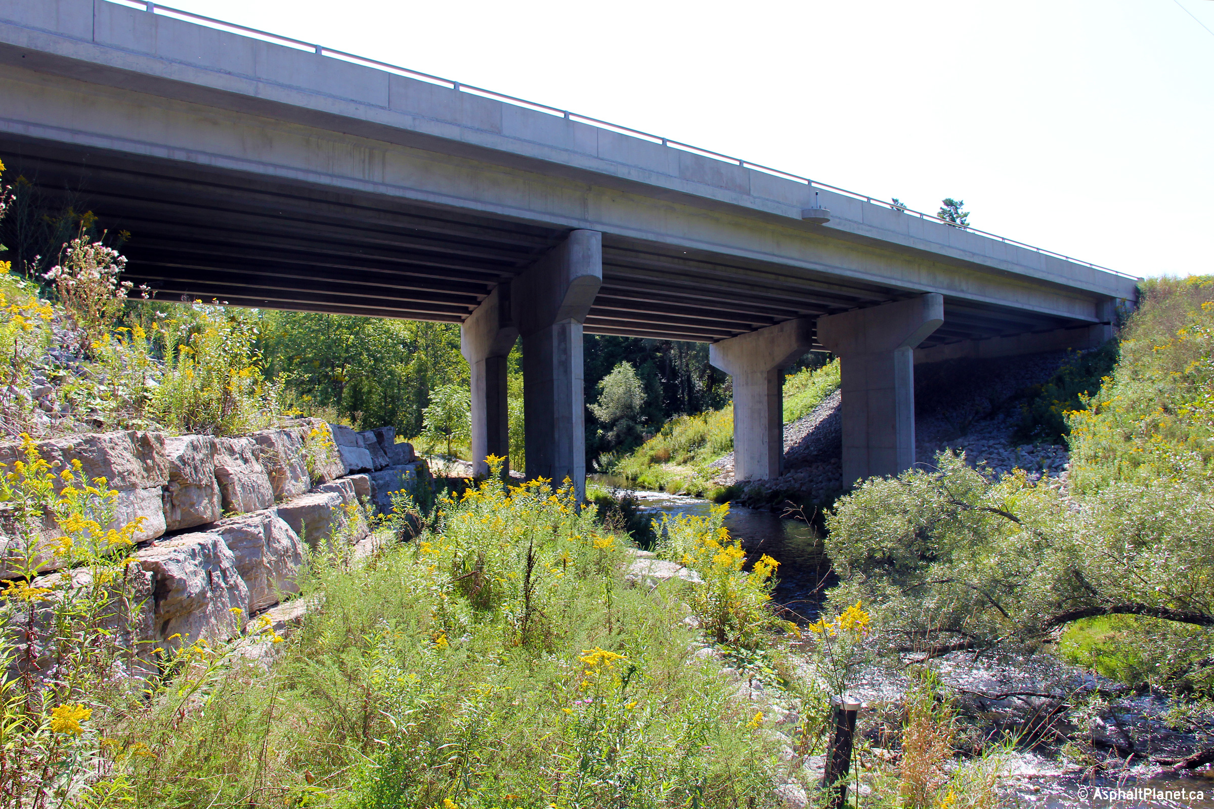
| Westerly view towards the future Highway 407 grade separation along Highway 7. Over the winter, crews worked to remove the falsework that supported the forms for the concrete from the underside of the structure. | A similar view to the previous photo. Compare the span length of the structure to the cars passing adjacent along Highway 7. | View looking northerly towards the new Highway 7 flyover. | A small rural farmhouse has been abandoned and faces demolition due to its close proximity to the 407's alignment. Several similar properties will face a similar fate at the hands of Highway 407. |
 |
 (720x480) (1440x960) (2400x1600) |
|
|
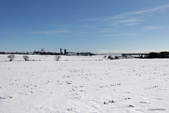
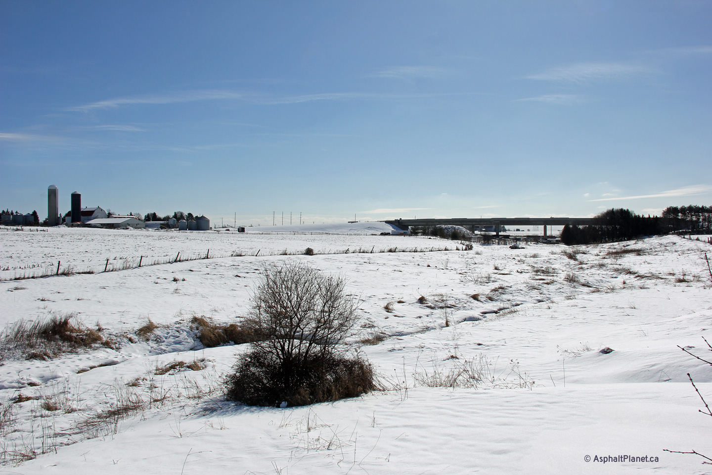
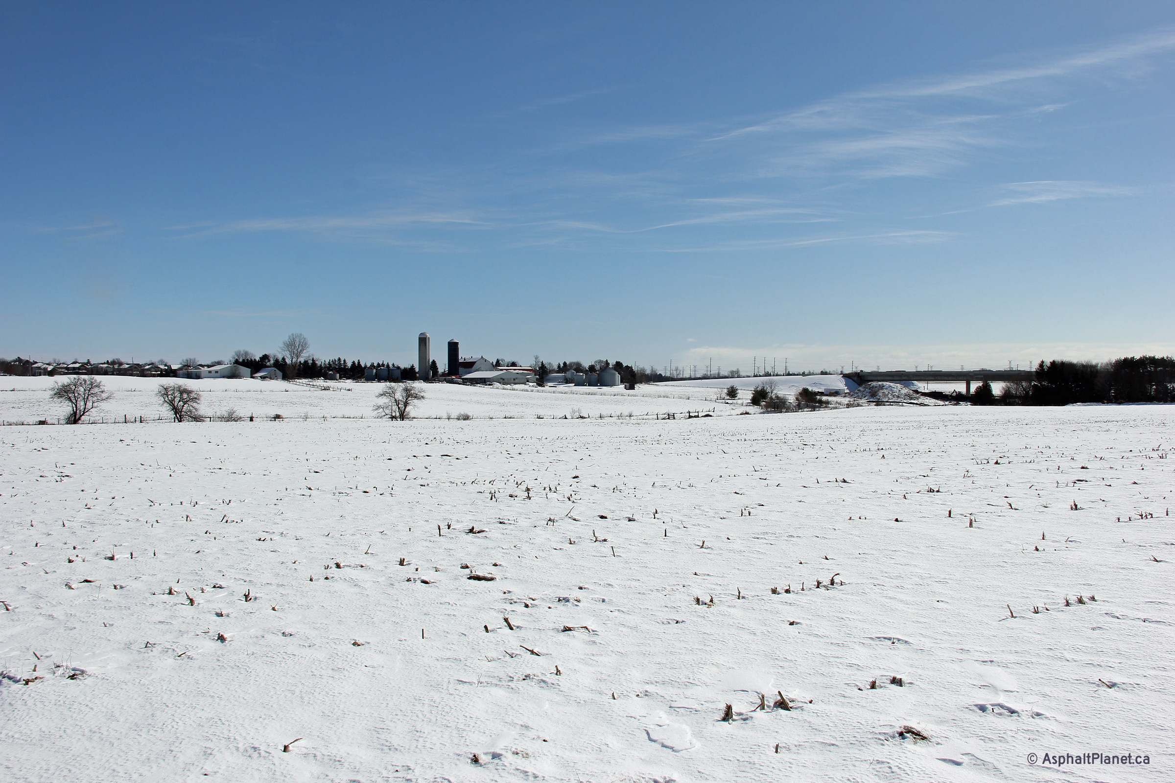
| Southerly view towards the future Highway 7 overpass. | Overview photo looking easterly. The wall of suburbia is visible beyond the snow-covered farm land. | ||
| Photos taken May 25th, 2013 | |||
 (720x480) (1440x960) (2400x1600) |
 (720x480) (1440x960) (2400x1600) |
 (720x480) (1440x960) (2400x1600) |
 (720x480) (1440x960) (2400x1600) |
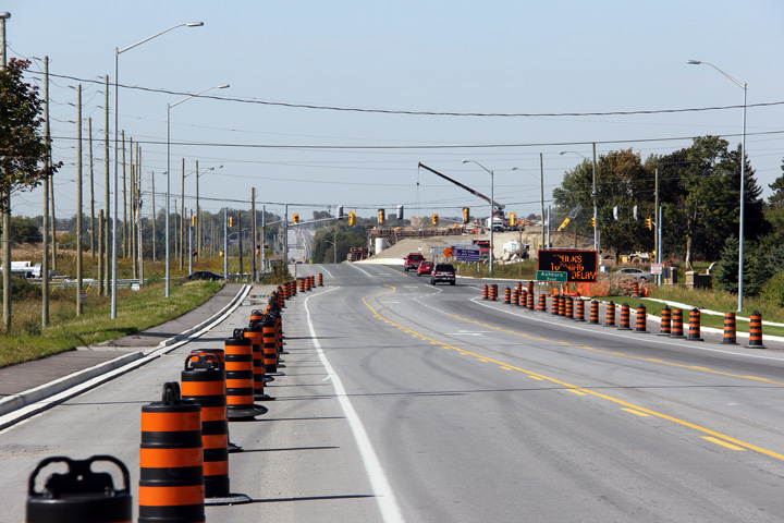
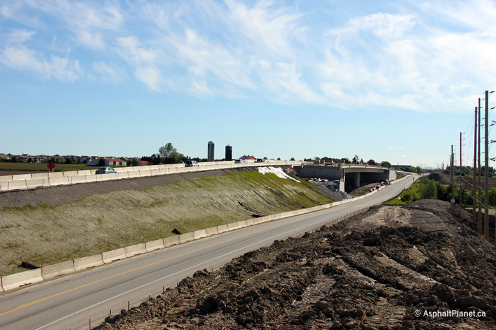
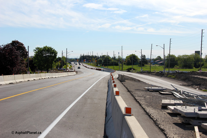
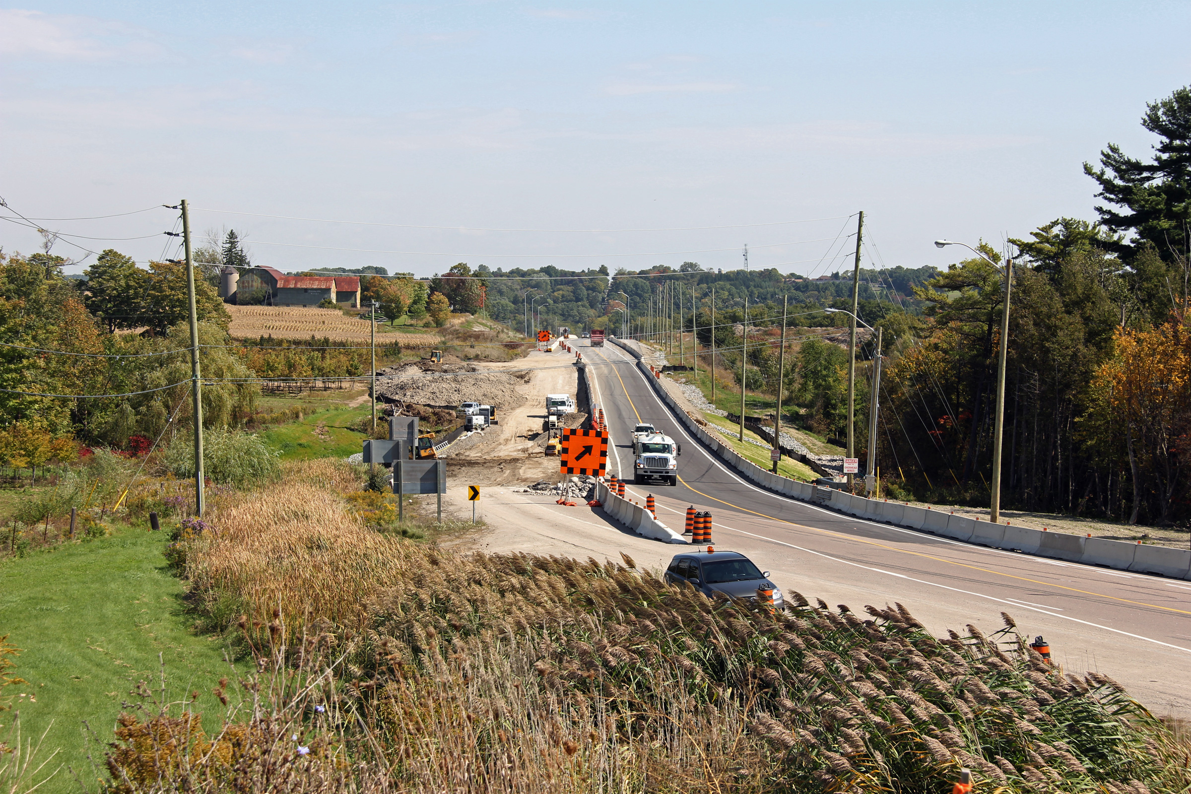
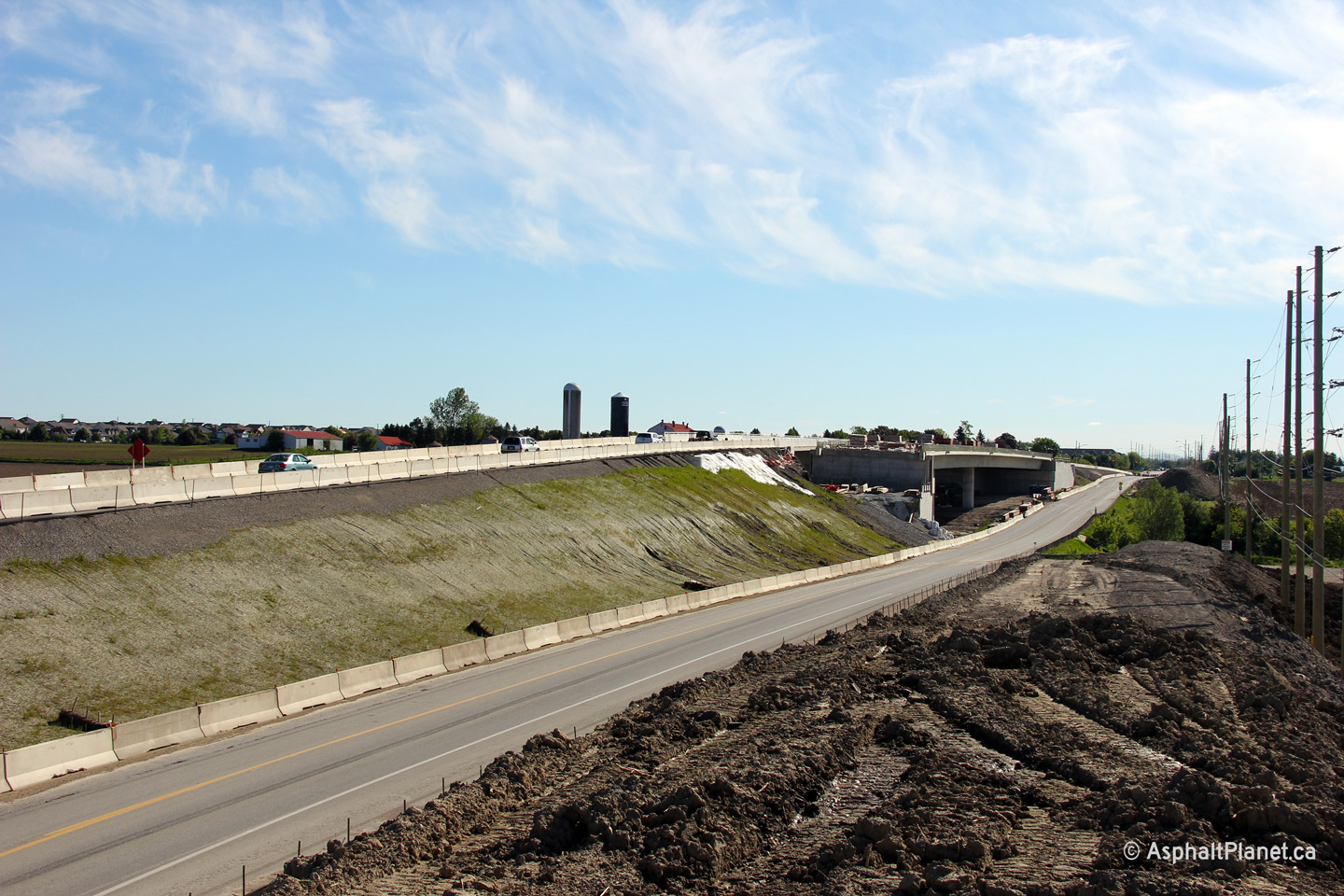
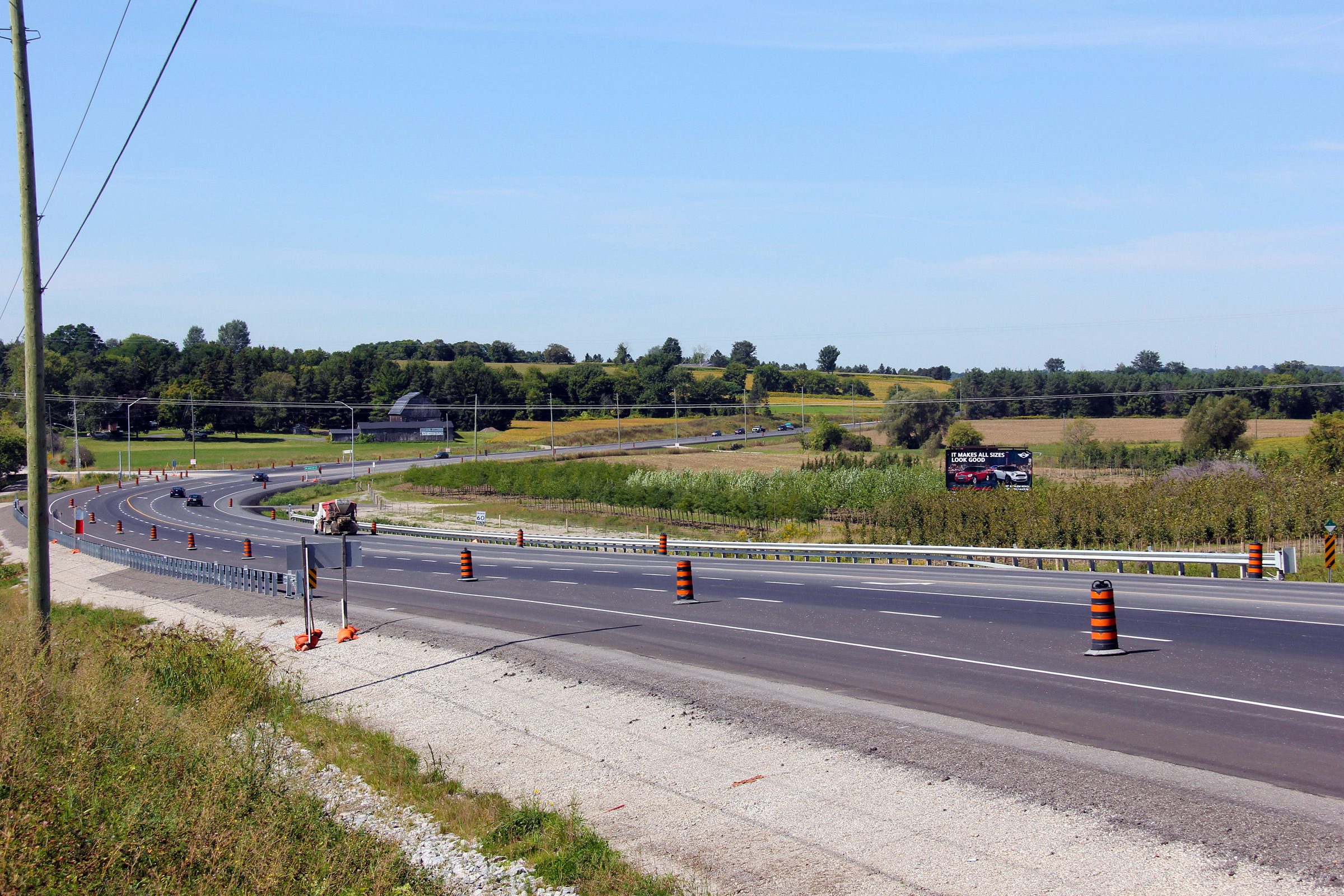
| Easterly view towards the newly opened Highway 407 overpass from just east of the Country Road intersection. The alignment of the western approach to the overpass features several rather abrupt horizontal curves. | View looking westerly from just west of the Highway 407 overpass from a large fill stockpile. | Easterly view towards the Highway 407 structure. Highway 7 traffic was diverted onto the westbound Highway 407 span on May 24th, 2013, one day before these photos were taken. | Easterly view at the Highway 407 structure. The pre-existing alignment of Highway 7 will need to be obliterated before the approach to the future eastbound span can be graded and paved. |
 (720x480) (1440x960) (2400x1600) |
 (720x480) (1440x960) (2400x1600) |
 (720x480) (1440x960) |
 (720x480) (1440x960) (2400x1600) |
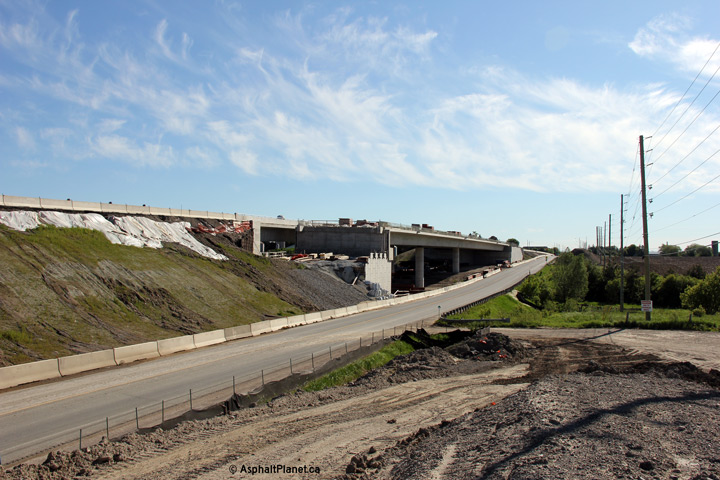
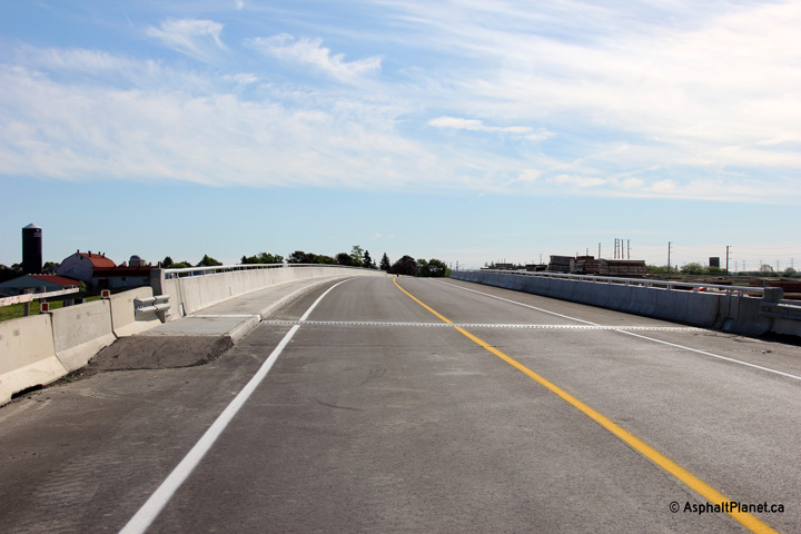
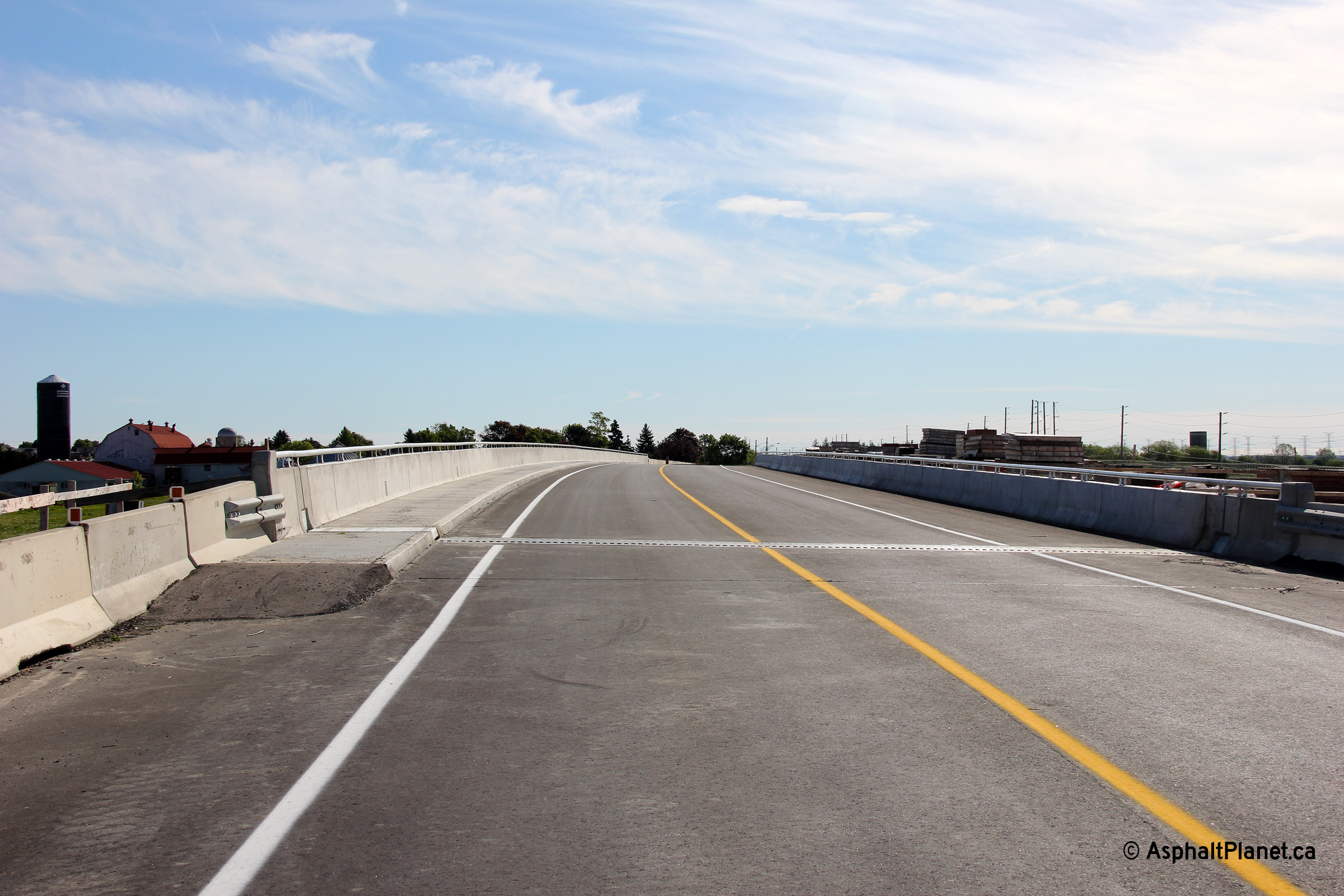
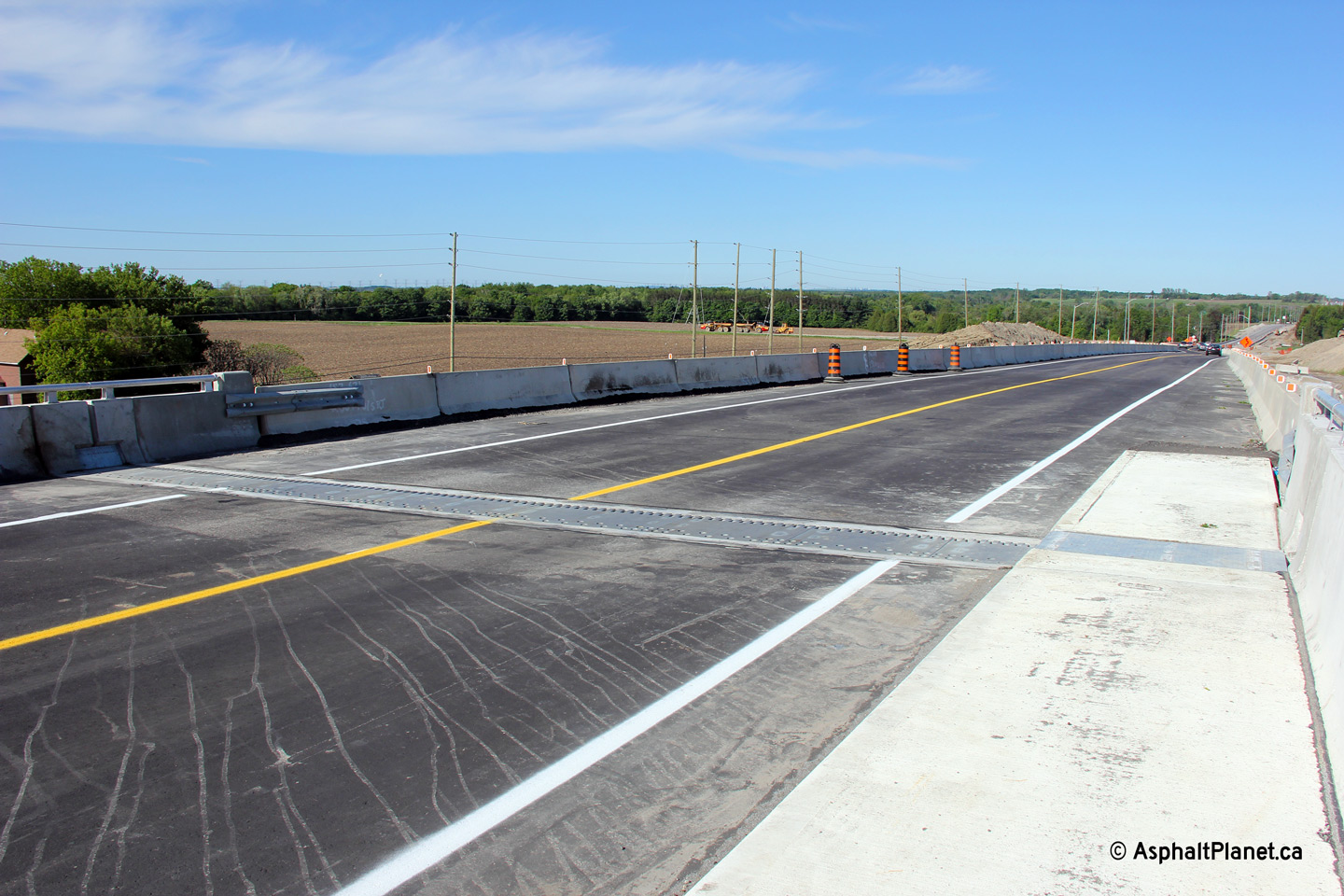
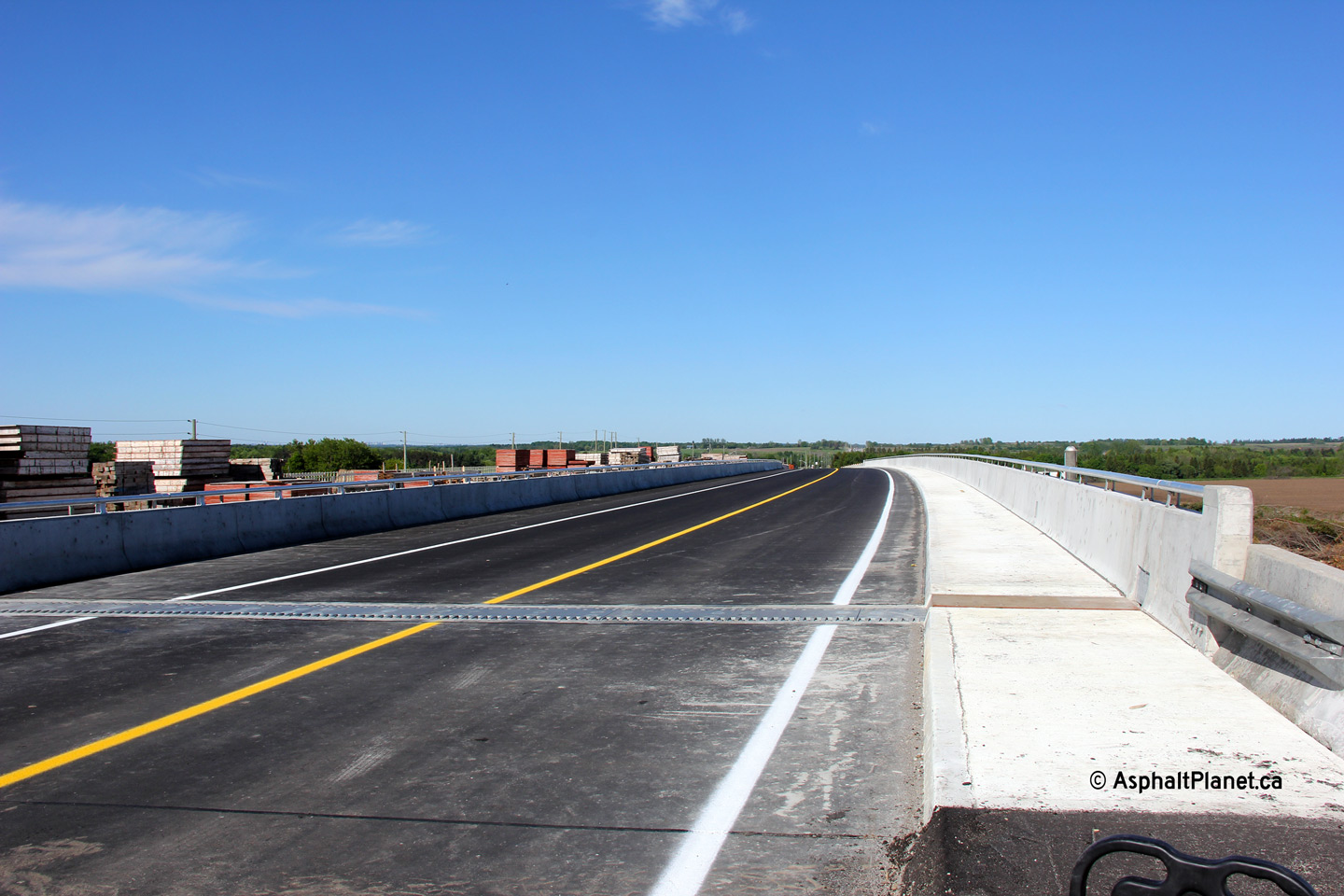
| Looking easterly on the northern side of the Highway 407 structure. Aside from some minor work remaining at the bridge abutments the westbound span has been completed after over 18 months of construction. | Eastbound view over the new westbound Highway 407 structure. Two way traffic is temporarily using the future westbound span while crews complete work on the abutting future eastbound lanes. | Westerly view at the western expansion joint. A similarly designed expansion joint was recently installed along the northbound lanes of Highway 11 at the Magnetawan River bridge in Burk's Falls. | Westerly view across the newly opened Highway 407 overpass. Interestingly, a concrete barrier was poured in the median of this overpass despite an abutting parallel span. |
 (720x480) (1440x960) (2400x1600) |
 (720x480) (1440x960) (2400x1600) |
|
|
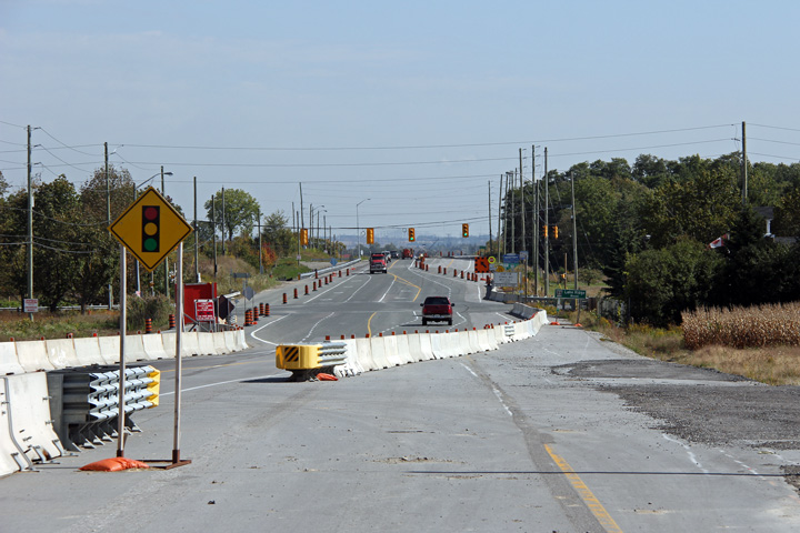
| Westerly view towards the Highway 7 structure. | Easterly view from east of the Highway 7 overpass where the newly constructed diversion rejoins the pre-existing Highway 7 alignment. | ||
| Photos taken September 6th, 2013 | |||
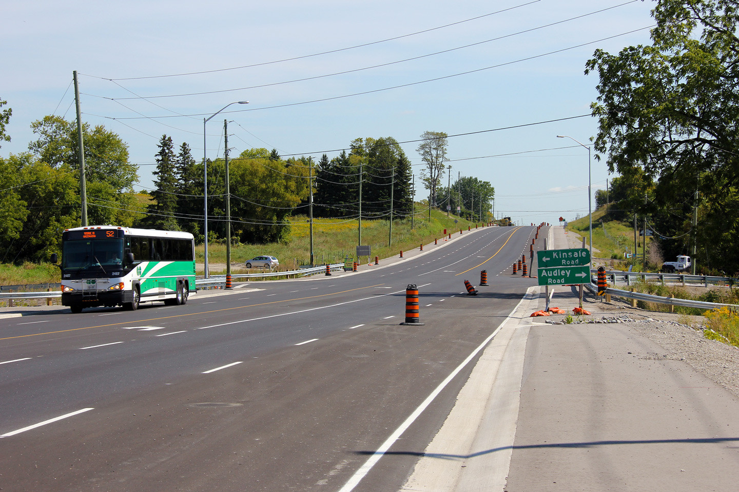
 (720x480) (1440x960) (2400x1600) |
 (720x480) (1440x960) (2400x1600) |
||
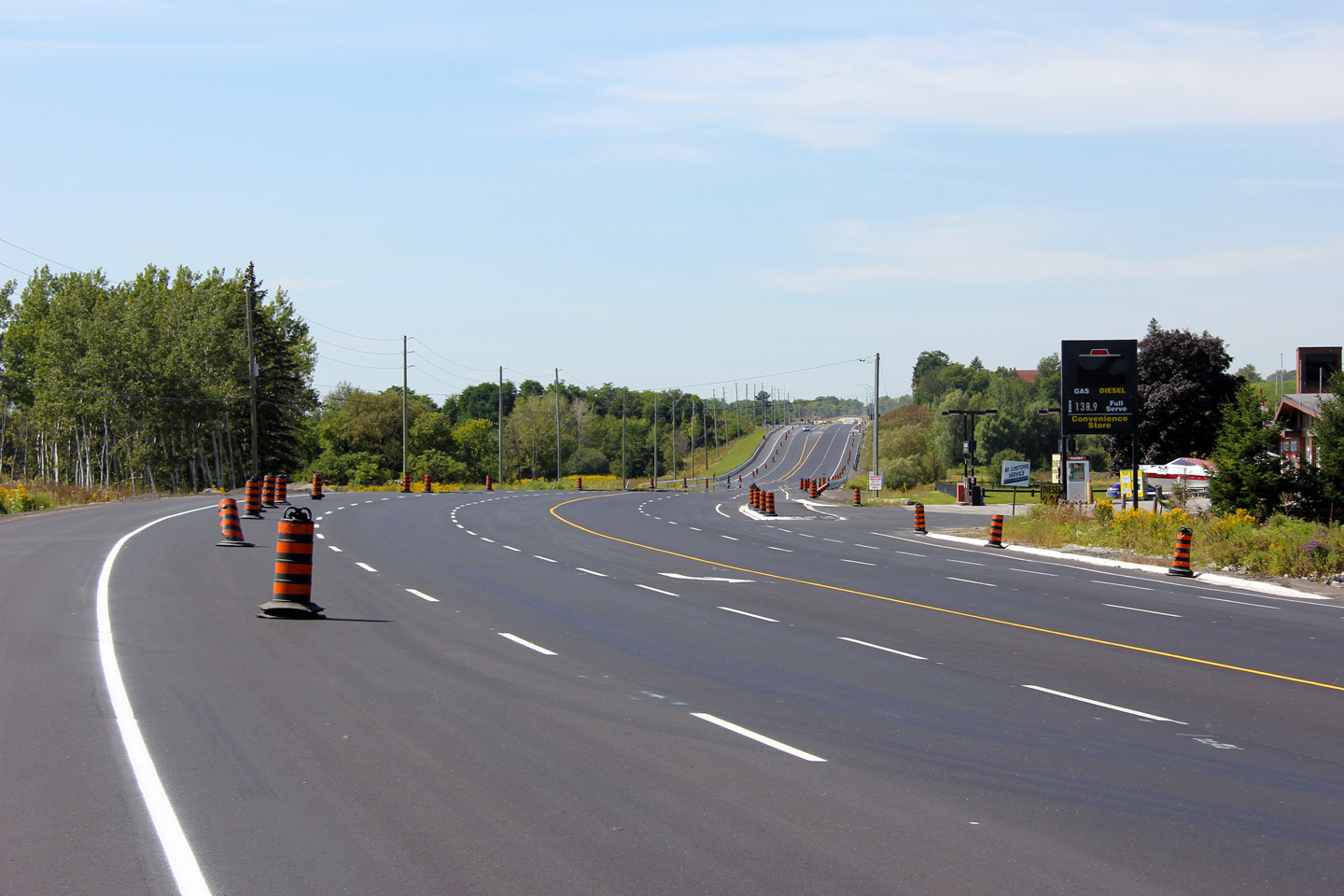
| Westerly view from the Paddock Road intersection. | View looking southerly beneath the West Duffins Creek structure. | Westerly view from just west of the Salem Road intersection. | Westerly view through Kinsale. |
Copyright (c) 2004-2013, AsphaltPlanet.ca AsphaltPlanet@asphaltplanet.ca
