Secondary
Highway 502 - www.OntHighways.com
Highway 502 is a long secondary
highway stretching from Highway 11 east of Rainy Lake to Highway 594 south of
Dryden. Despite being a secondary highway it is one of Northwestern
Ontario's major thoroughfares, serving as the route between Fort Frances and
Dryden -- two of Northwestern Ontario's largest communities.
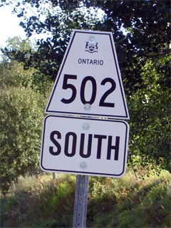
Secondary Highway 502 Shield
|
|
Southern Terminus:
Junction Highway 11 east of Fort Frances
Northern Terminus: Junction Highway 594 southwest of Dryden
Length: 151.3km
Multiplexes: None
Orientation: North-South
Regions
Served: Rainy River and Kenora Districts
AADT (2002): Highest:
680, from north of Contact Bay Road to Highway 594;
Lowest: 410, from The Rainy River/Kenora Boundary to north of Contact
Bay Road.
Road Info: Coming Soon! |
Communities and Intersections along and Highway 502 from South to North:
|
Proper
Municipality Name |
Community Name |
Distance |
Intersecting
Road |
| District of Rainy River |
----- |
0km / 151.3km |
King's Highway 11 |
| Rainy River - Kenora District Boundary |
----- |
51.2km / 100.1km |
----- |
| District of Kenora |
----- |
151.3km / 0km |
Secondary Highway 594 |
|
Highway 502 ENDS |
<-
Highway 427
www.OntHighways.com - Home
Highway 503 ->
Copyright (c) 2004-2007, Scott Steeves (Webmaster)
webmaster@onthighways.com
Page last updated: April 4th, 2005
Page created: April 2nd, 2005