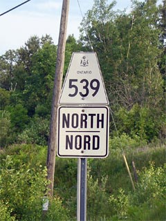
Secondary
Highway 539 - www.OntHighways.com
Highway 539 has sort of an odd
routing. While it has a clear western and eastern terminus, the route is
in many ways a circuitous loop. From the west, the highway proceeds
northerly from Highway 17 at Warren to Highway 539A at River Valley. River
Valley is the most northerly point that the 539 reaches. At River
Valley, the highway then turns southeasterly and heads towards Highway 64 at
Field. Clearly, Highway 539 takes very little in the way of through
traffic. Rather it serves both local traffic, and as the primary access route
to and from Highway 539A from points both east and west of River Valley in Central Ontario.

Secondary Highway 539 Shield
|
|
Western Terminus:
Junction Highway 17 at Warren
Eastern Terminus:
Junction Highway 64 at Field
Length: 37.0km
Multiplexes: None
Freeway: No
AADT (2002):
Highest: 680 from Highway 17 at Warren northerly to Highway 539A at
River Valley;
Lowest: 500 from Highway 539A southeasterly to Highway 64 at Field.
Road Info: Coming Soon! |
Communities and Intersections along and Highway 539 from West to East:
|
Proper
Municipality Name |
Community Name |
Distance |
Intersecting
Road |
| Township of Markstay Warren |
Warren |
0km / 37.0km |
King's Highway 17 |
| Sudbury - Nipissing District Boundary |
----- |
5.4km / 31.6km |
----- |
|
At Highway 539A: EB: Turn
Right (southbound) towards Field. WB: Turn Left (south) towards
Warren. |
| Township of West Nipissing |
River Valley |
23.4km / 13.6km |
Secondary Highway 539A |
| Township of West Nipissing |
Desaulniers |
--- |
----- |
| Township of West Nipissing |
Field |
37.0km / 0km |
King's Highway 64 |
|
Highway 539 Ends |
<- Highway 538
www.OntHighways.com - Home
Highway 539A ->
Copyright (c) 2004-2007, Scott Steeves (Webmaster)
webmaster@onthighways.com
Page last updated: June 26th, 2007
Page created: January 31st, 2006
