Secondary Highway 620 -   O N T   H I G H W A Y S

Highway 620 was downloaded in its entirety on January 1st, 1998.  Highway 620 primarily serves tourist traffic headed towards the Chandos Lake region.  620 is also the major provincial connection to the small communities of Glen Alda and Coe Hill.


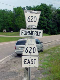
Formerly Highway 620 shield

  Western Terminus:  Junction Highway 28 on the Apsley Bypass

Eastern Terminus:  Junction Highway 62 east of Ormsby

Length:  39.4 km

Multiplexes:  None

Freeway: No

Status:  Entirely downloaded.  New names are Peterborough Road 620, Wollaston Twp Road 620 and Road 620.

AADT (1994):  Highest:  750, from Highway 620A (Burleigh Street) to the west Clydesdale Road junction;

                             Lowest:  450, from the West Clydesdale Road junction easterly to Highway 504.

Road Info:  Highway 620 is paved for its entire length.  Peterborough County has totally rehabilitated its stretch of Highway 620, it is now to the highest standard.  In Hastings, Highway 620 is still in good condition, but is notably worse then the Peterborough County maintained section.


Communities and Major Intersections Located on Highway 620 from West to East:

Proper Municipality Name Community Name Distance Intersecting Road

In Peterborough County Highway 620 is now known as Peterborough Road 620

Township of North Kawartha Apsley 0 km / 39.4 km King's Highway 28

At Burleigh Street (Highway 620A):  EB:  Turn left at stop sign, WB:  Turn Right away from downtown Apsley (and away from Highway 504).

Township of North Kawartha ----- 0.5 km / 38.9 km Highway 620A (Peterborough Road 620A, Burleigh Street)
Township of North Kawartha ----- --- Balmer Road (Peterborough Road 54)
Township of North Kawartha Glen Alda --- -----

In the Township of Wollaston Highway 620 is known as Wollaston Road 620

North Kawartha - Wollaston Boundary ----- 20.4 km / 19.0 km Highway 504 (Peterborough Road 504)
Township of Wollaston ----- --- Lower Faraday Road
Township of Wollaston Coe Hill --- -----

In the Township of Tudor and Cashel Highway 620 is known as Road 620

Township of Limerick Ormsby --- -----
Township of Limerick ----- 39.4 km / 0 km King's Highway 62

Highway 620 ENDS

Highway 620 - Images

O N T   H I G H W A Y S - Home


Copyright (c) 2004-2007, Scott Steeves (Webmaster)  webmaster@onthighways.com

Page last updated:  January 29th, 2005

Page created:  July 19th, 2004