|
Proper Municipality Name |
Photo Description |
Photo |
|
Pictures taken
from driver's perspective appear offset from centre-line pictures: |
East-
Bound |
West-
Bound |
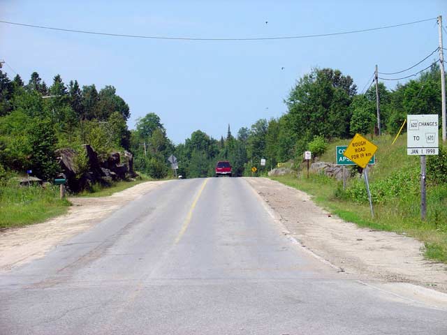
| Municipality of North Kawartha
County of Peterborough |
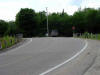
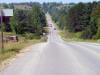
This photo shows the rather bland western
Terminus of Highway 620 with Highway 28 in northern Apsley. This is
also the end of the northern approach to downtown Apsley from Highway 28 and
Bancroft.
Picture taken July 18th, 2004. Size: 35kb. |
 |
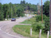
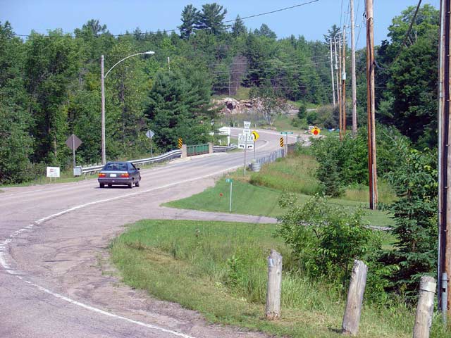
| Municipality of North Kawartha
County of Peterborough |
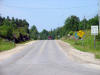
This picture is taken looking west along Highway
620 from the Burleigh Street intersection. The Bridge in the photo
shows Highway 620 crossing the Eels Creek. Prior to c.1954 this
section of Highway 620 was Highway 28. Highway 28 was routed through
downtown Apsley until this bypass was opened.
Picture taken July 17th,
2004. Size: 65kb. |
 |
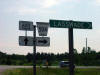
| Municipality of North Kawartha
County of Peterborough |
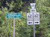
This picture shows the junction assembly and
other signage for the junction of Highway 620 and Burleigh Street (Highway
620A). It is unclear if Burleigh Street was ever actually signed as Highway
620A in the field. Originally Highway 504 was a
circular route around Chandos Lake that joined Highway 28 twice at Apsley.
At that time Highway 620 only exsisted from Glen Alda easterly to Highway
62, it was in the early 1960s that Highway 620 took over the northern part
of Highway 504 making it continuous from Highway 28 to Highway 62. At
that time Burleigh Street was given the Highway 620A
designation for internal inventory purposes only.
Picture taken July
17th, 2004. Size: 45kb. |
_small.jpg) |
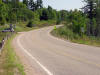
| Municipality of North Kawartha
County of Peterborough |
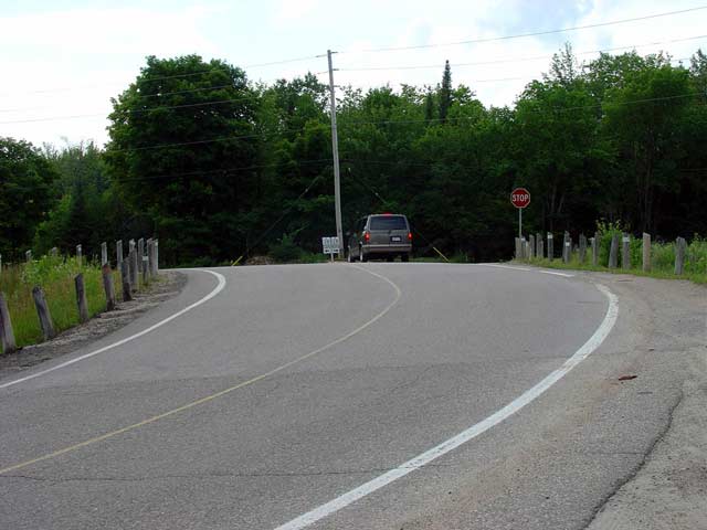
This picture shows Highway 620 looking east from
the Burleigh Street junction. This is the first section of Highway 620
that was not part of Highway 28 at one point (although the intersection with
Burleigh Street was likely altered when the Apsley Bypass opened).
This is a fairly typical looking section of Highway 620 in Peterborough
County.
Picture taken July 17th, 2004. Size: 55kb. |
 |
|
Municipality of North Kawartha
County of Peterborough |
This picture shows the junction assembly looking
east along Highway 620 at the Highway 504 junction just east of Glen Alda.
Before downloading this assembly would have shown secondary shields,
instead of a flowerpot and a rather odd municipal highway shield.
Prior to the early 1960s this was the western terminus of Highway 620, as
504 at that point circled all around Chandos Lake and back to Apsley.
Picture taken July 17th, 2004. Size: 35kb. |
 |
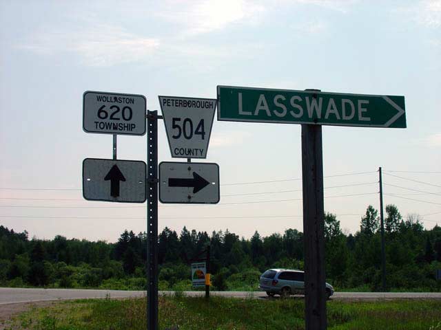
| Township of Wollaston County of
Hastings |
This is from South Road in the township of
Wollaston looking west. This is fairly typical looking section of
Highway 620 in this area. For a municipality, Wollaston is taking
pretty good care of this secondary highway.
Picture taken July 17th,
2004. Size: 50kb. |
 |
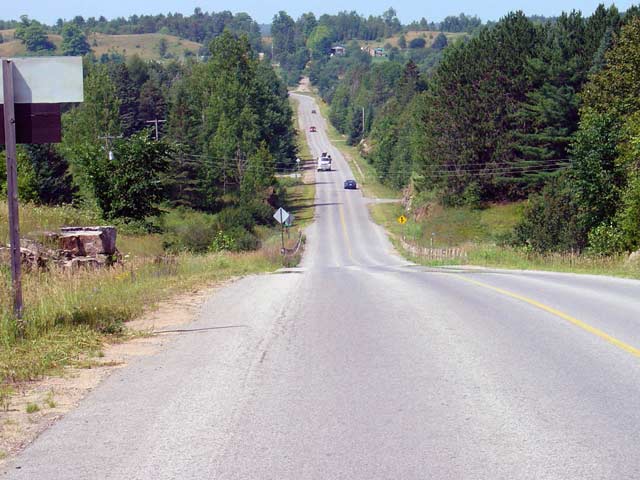
| Township of Limerick
County of Hastings |
This picture shows Highway 620 looking west from
Highway 62. This section of Highway 620 is now maintained by the
Township of Tudor and Cashel. Tudor and Cashel have been doing a
decent job with the upkeep of this highway, however not as good as the
Township of Wollaston.
Picture taken July 17th, 2004. Size: 40kb. |
 |
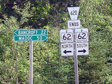
| Township of Limerick
County of Hastings |
This is the junction assembly showing the
eastern terminus of Highway 620 junction Highway 62. Interestingly,
Highway 620 is shown as a county road on this junction assembly. This
is in actuality not the case. In 1998, the County of Hastings
downloaded all of its former county roads onto the local municipalities that
the roads pass through.
Picture taken July 17th, 2004. Size: 30kb. |
 |
.jpg)