AsphaltPlanet.ca > Quebec > Autoroute 55 > Page 1
|
Autoroute 55 USA to Drummondville |
| <- I-91 |
|
Page 2 -> |
Pictures on this page are arranged in order from south to north. A-55 North photos are left-aligned in the last column, while A-55 South photos are right-aligned. Center-line pictures are centered within the last column.
|
Location |
Description |
Photo |
||
|
North- |
South- |
|||
|
MRC de Memphrémagog |
Northbound signage at the off-ramp to Route 112. |
 |
||
|
Date: 10/3/2014 |
High-res: (1440x960) (2400x1600) | |||
|
MRC de Memphrémagog |
Northbound advanced signage for the upcoming Autoroute 10 interchange. |
|
||
|
Date: 10/3/2014 |
High-res: (1440x960) (2400x1600) | |||
|
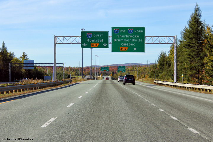
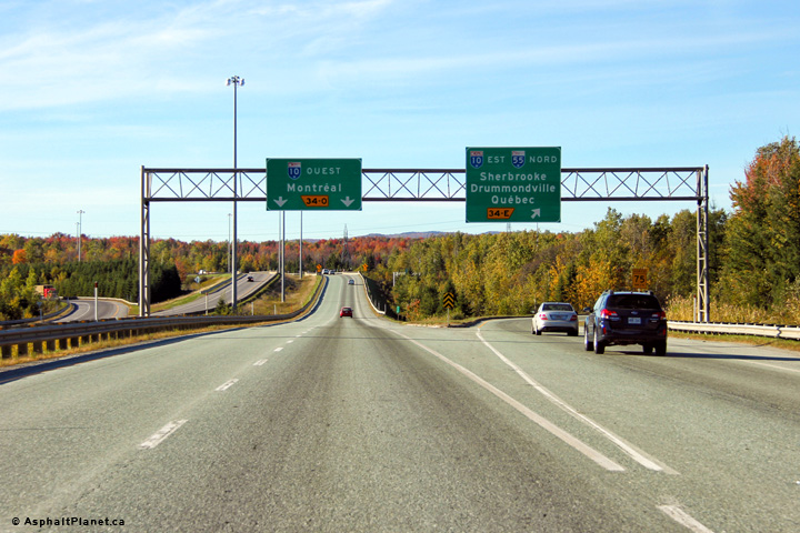
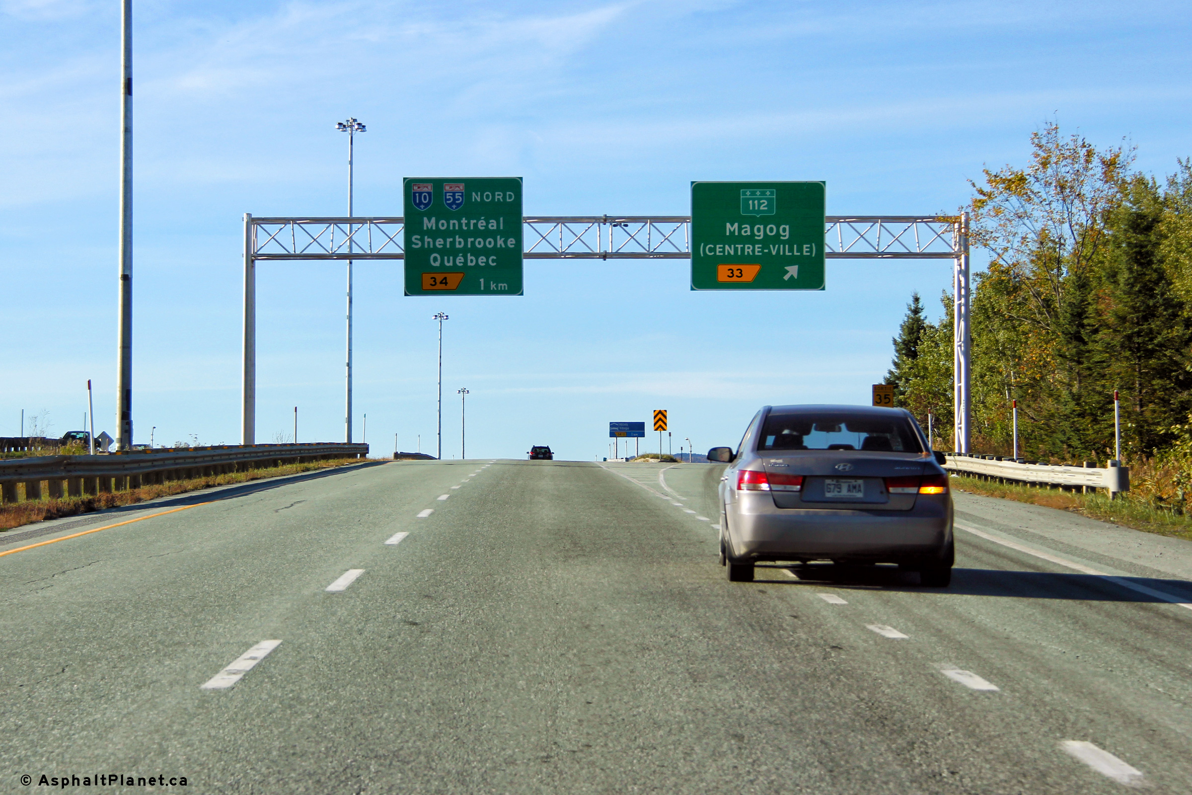
MRC de Memphrémagog |
Northbound signage at the western A-10 interchange. Through traffic along A-55 must follow the ramp to the right towards Sherbrooke and Drummondville. |
|
||
|
Date: 10/3/2014 |
High-res: (1440x960) (2400x1600) | |||
|
West of this interchange, Autoroute 10 leads travelers west towards Montreal. Click here for A-10-West images. |
||||
|
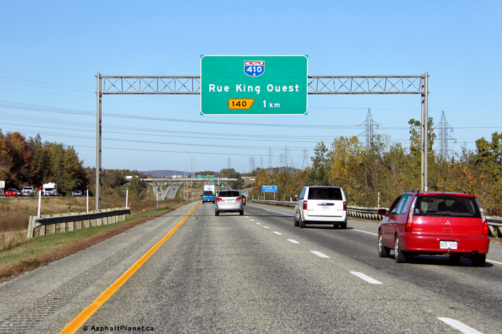
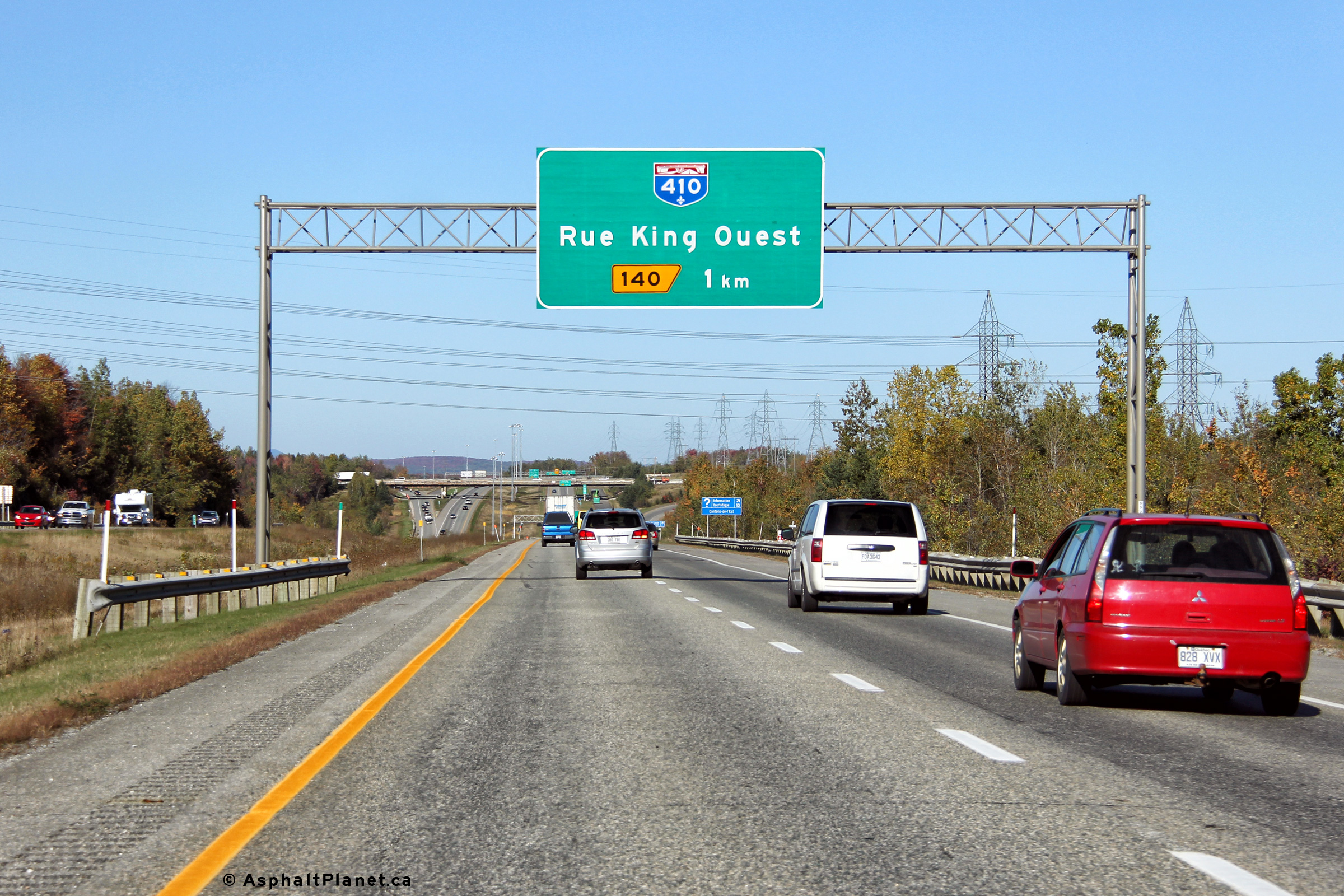
MRC de Sherbrooke |
Northbound advanced signage 1km upstream of the off-ramp to Autoroute 410. |
 |
||
|
Date: 10/3/2014 |
High-res: (1440x960) (2400x1600) | |||
|
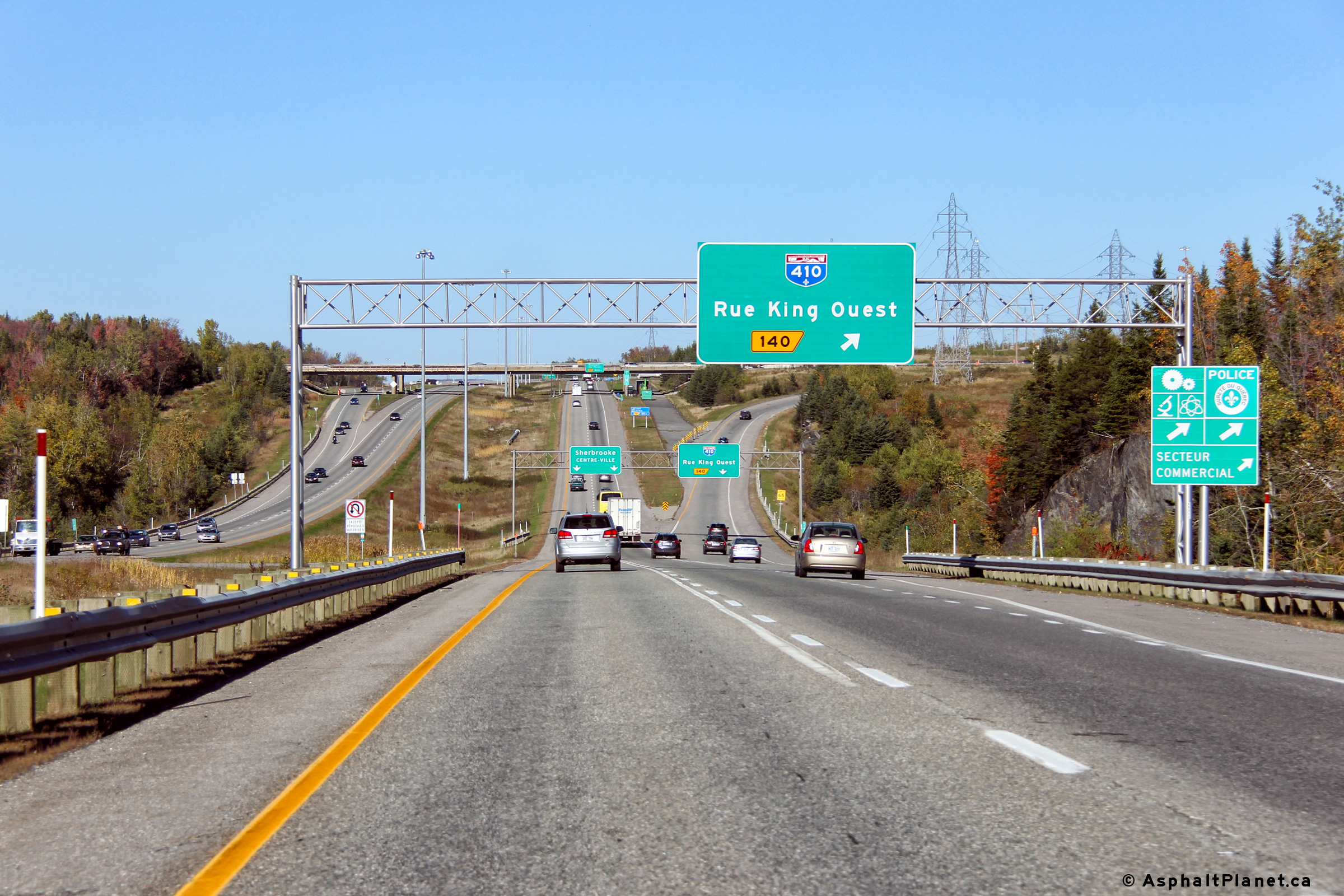
MRC de Sherbrooke |
Advanced signage for the ramp to Autoroute 410. If you look closely at the ramp on the other side of the hill, you can see the never used collector segment that would have been utilized had the western extension of A-410 been constructed. |
 |
||
|
Date: 10/3/2014 |
High-res: (1440x960) (2400x1600) | |||
|
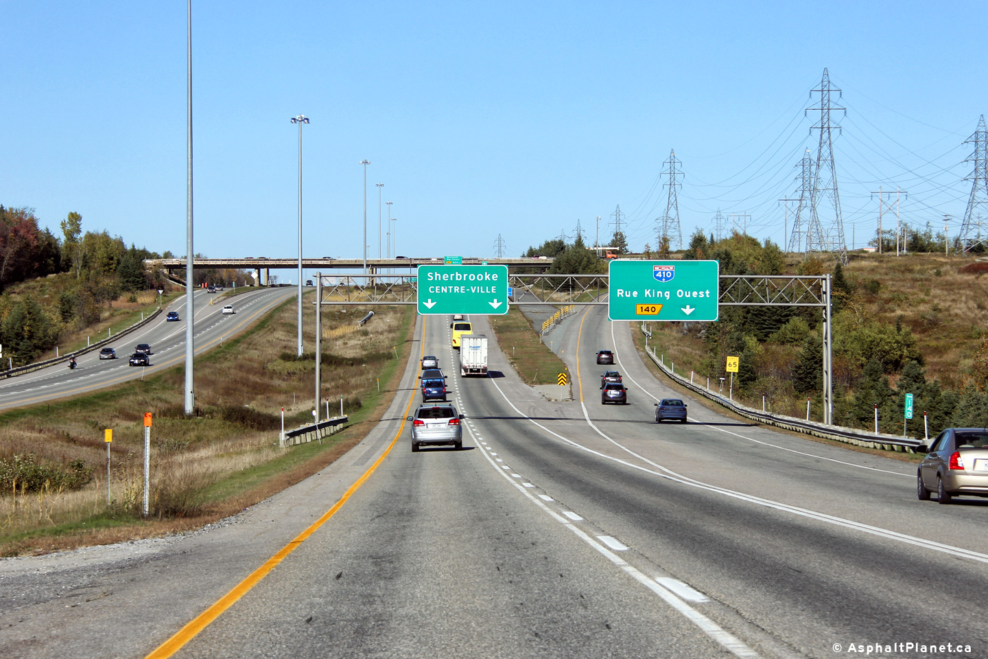
MRC de Sherbrooke |
Northbound signage at the off-ramp to Autoroute 410. |
|
||
|
Date: 10/3/2014 |
High-res: (1440x960) (2400x1600) | |||
|
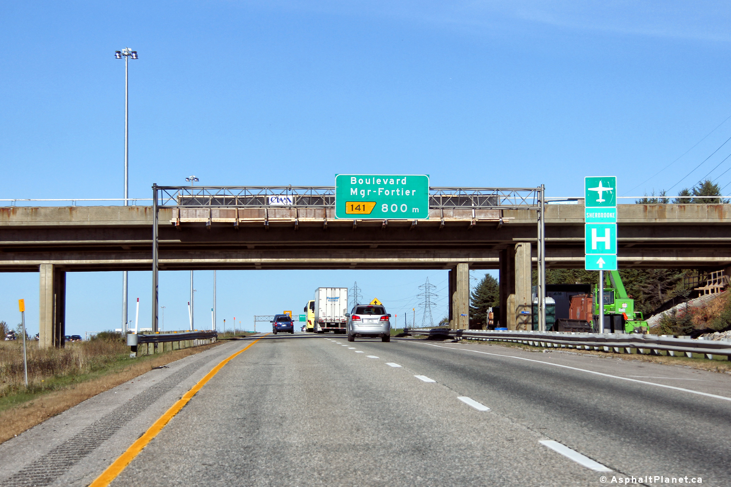
MRC de Sherbrooke |
Northbound advanced signage for the off-ramp to Boulevard Mgr-Fortier. |
 |
||
|
Date: 10/3/2014 |
High-res: (1440x960) (2400x1600) | |||
|
Autoroute 410 is a short spur highway that leads travelers easterly around the southern edge of Sherbrooke. Click here for A-410-West images. |
||||
|
MRC de Sherbrooke |
Advanced signage for the off-ramp to Boulevard Mgr-Fortier. Autoroute 10 ends unceremoniously at the A-610 interchange ahead. |
|
||
|
Date: 10/3/2014 |
High-res: (1440x960) (2400x1600) | |||
|
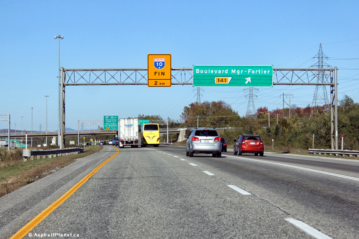
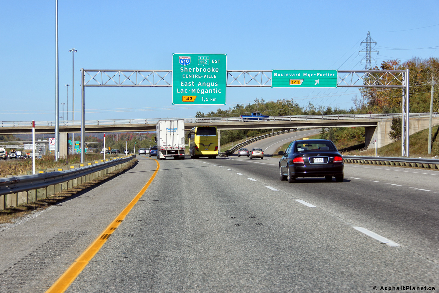
MRC de Sherbrooke |
Northbound signage at the off-ramp to Boulevard Mgr-Fortier. |
|
||
|
Date: 10/3/2014 |
High-res: (1440x960) (2400x1600) | |||
|
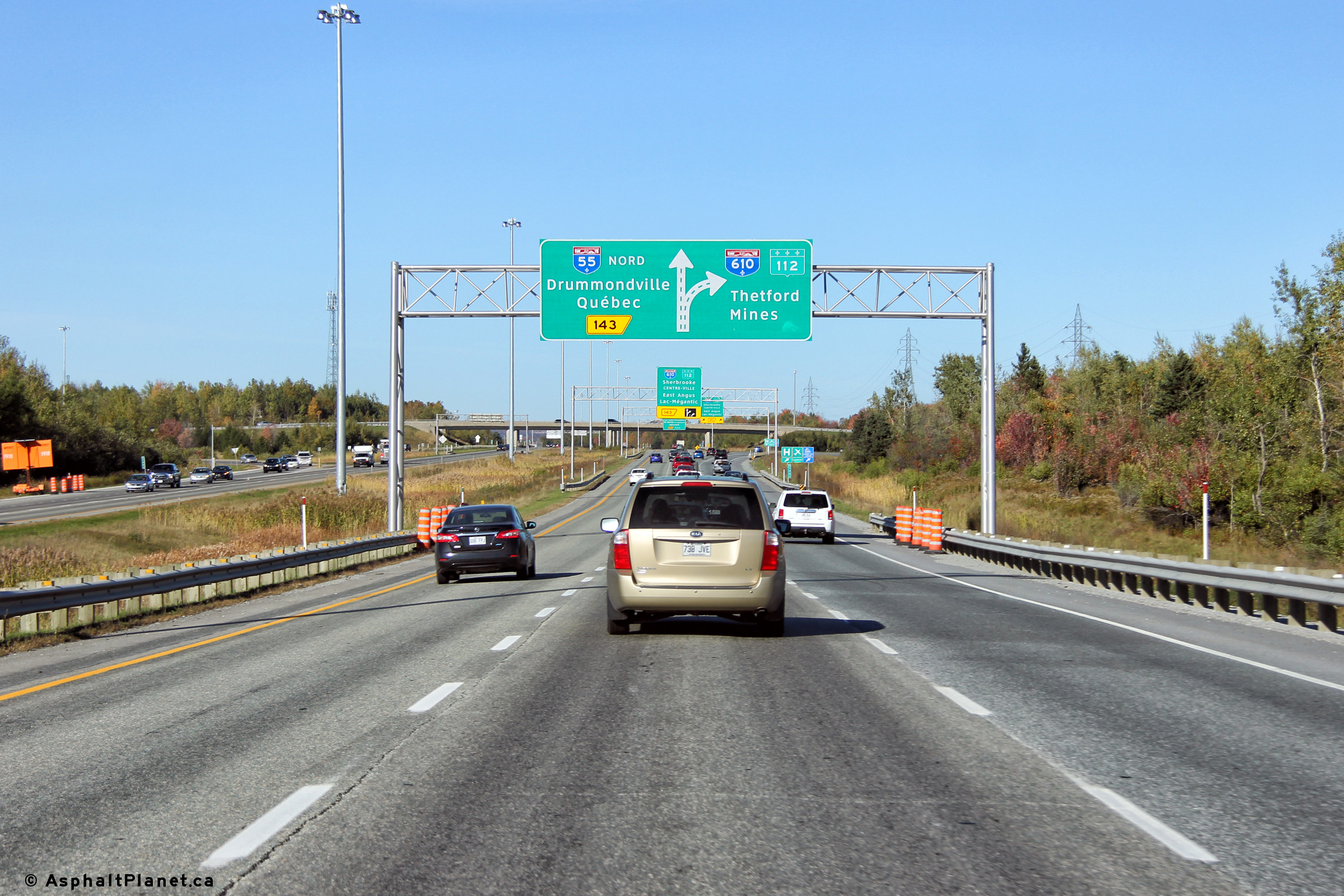
MRC de Sherbrooke |
Northbound advanced signage for the off-ramp to Autoroute 610. A third lane exists linking the on-ramp from Boulevard Mgr-Fortier to the A-610 interchange. |
 |
||
|
Date: 10/3/2014 |
High-res: (1440x960) (2400x1600) | |||
|
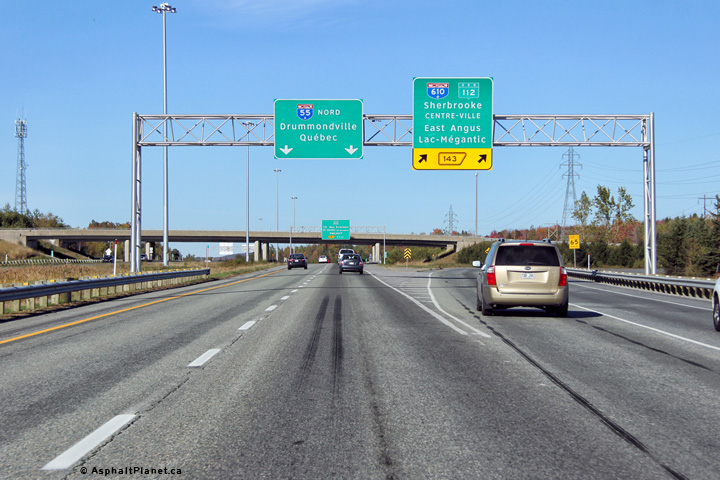
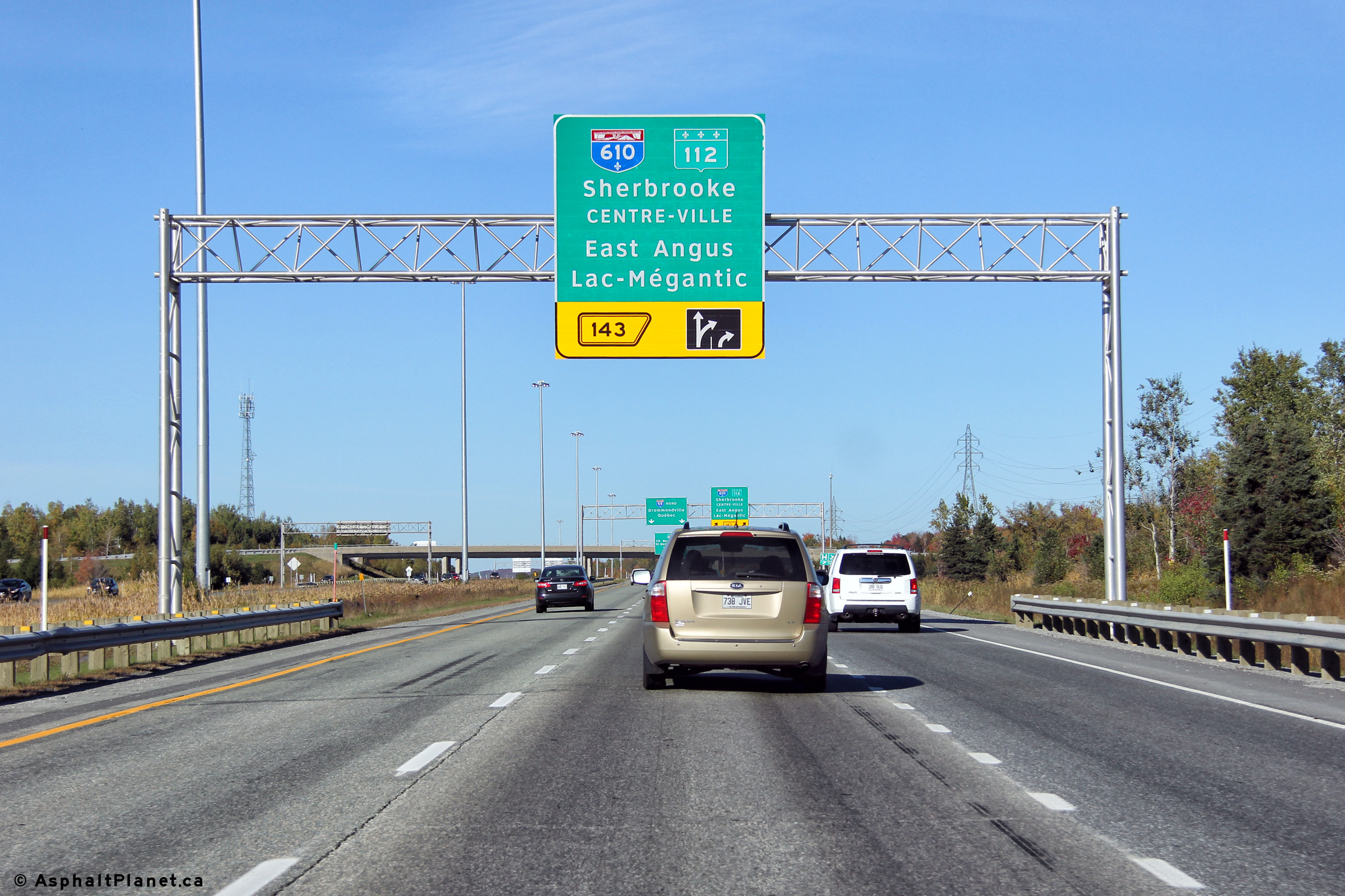
MRC de Sherbrooke |
Advanced signage for the off-ramp to Autoroute 610. Autoroute 610 was formerly designated as the eastern leg of Autoroute 10. Autoroute 10 now ends at this interchange. |
|
||
|
Date: 10/3/2014 |
High-res: (1440x960) (2400x1600) | |||
|
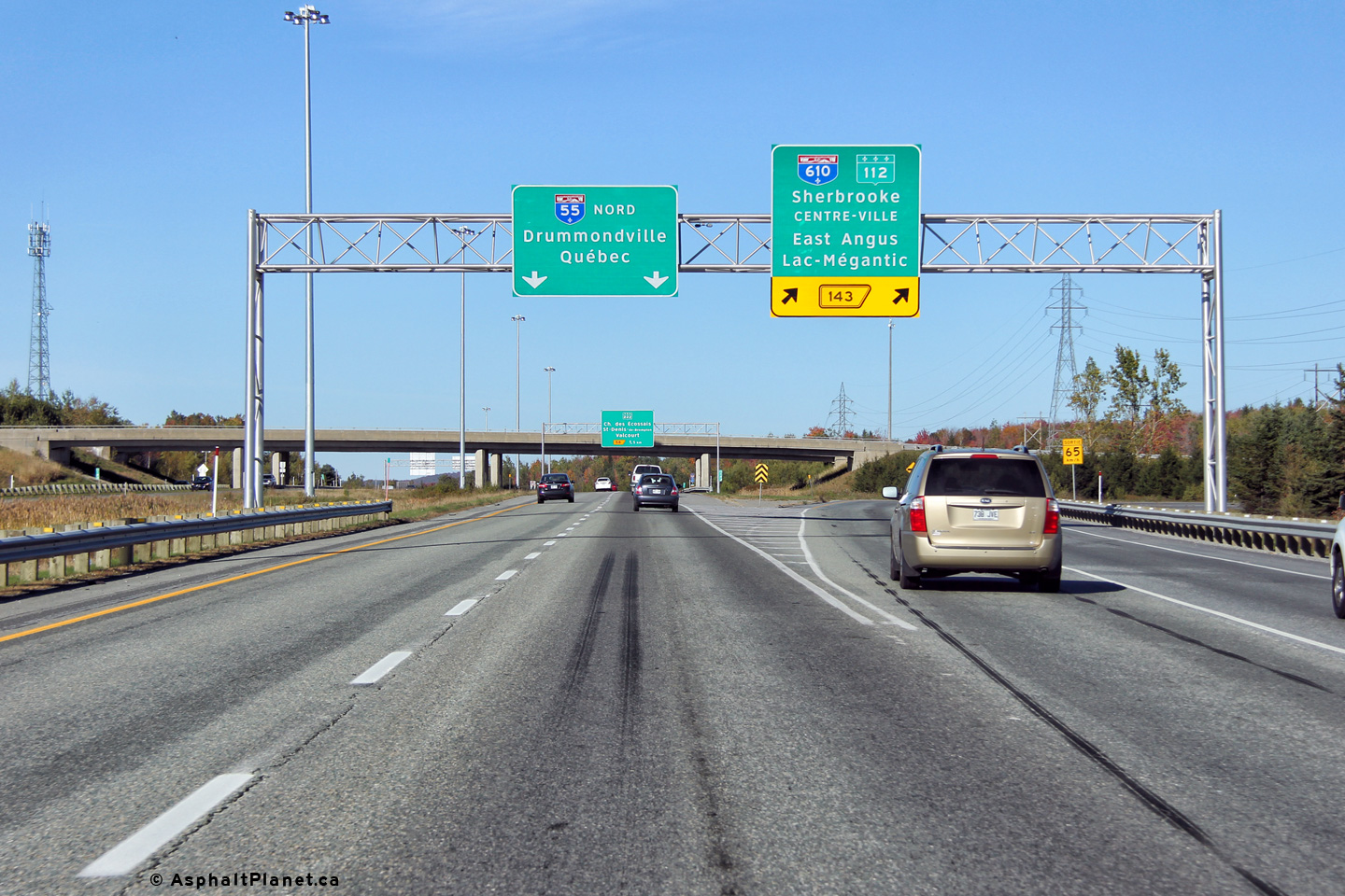
MRC de Sherbrooke |
Signage at the northbound off-ramp to Autoroute 610. Autoroute 10 ends at this interchange, so through traffic now continues northerly on Autoroute 55. |
|
||
|
Date: 10/3/2014 |
High-res: (1440x960) (2400x1600) | |||
|
MRC de Sherbrooke |
Northbound advanced signage for the Route 222 interchange. The Autoroute 10 ends sign is visible on the right hand side of the freeway, beneath the A-610 overpass. |
|
||
|
Date: 10/3/2014 |
High-res: (1440x960) (2400x1600) | |||
|
Autoroute 610 is the former routing of A-10 and carries traffic along the northern edge of Sherbrooke to Route 112. Click here for A-610-West images. |
||||
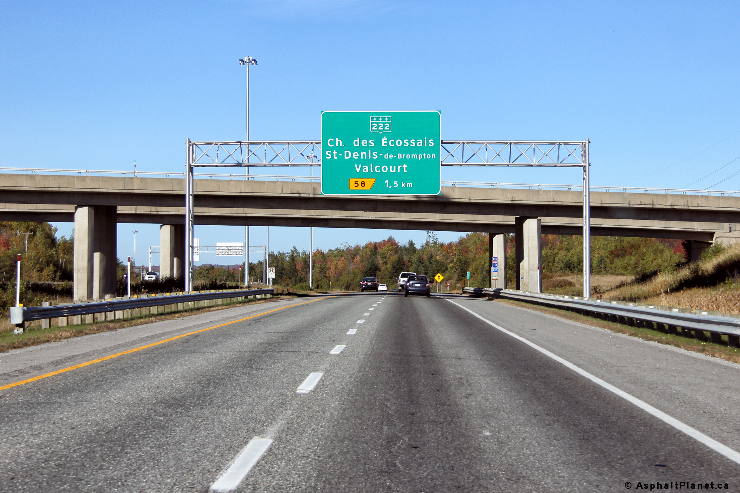
|
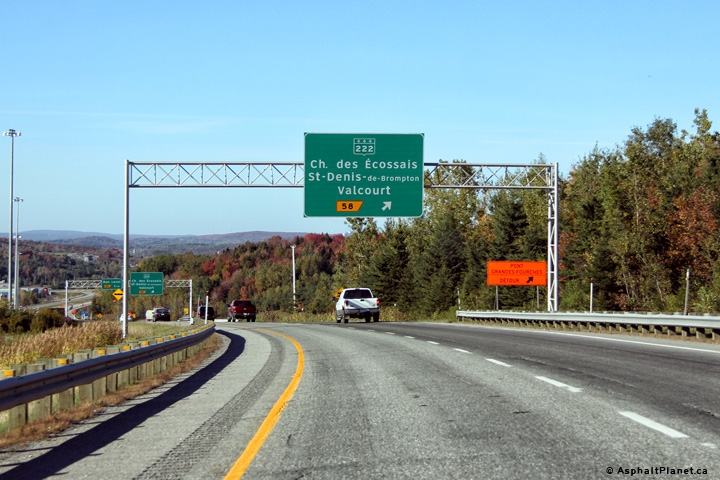
MRC de Sherbrooke |
Northbound advanced signage for the Route 222 interchange. |
|
||
|
Date: 10/3/2014 |
High-res: (1440x960) (2400x1600) | |||
|
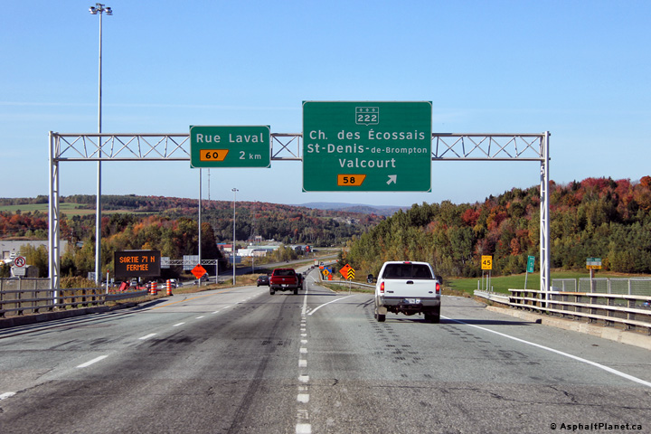
MRC de Sherbrooke |
Signage at the northbound off-ramp to Route 222. |
|
||
|
Date: 10/3/2014 |
High-res: (1440x960) (2400x1600) | |||
<- I-91 (VT) Back to Autoroute 55 Index Page 2 ->
© 2006-2016 AsphaltPlanet.ca.
AsphaltPlanet@asphaltplanet.ca
Page Created: August 6, 2016.
Last Updated: August 6, 2016.


