AsphaltPlanet.ca > Québec > Autoroute 73
|
Southern Terminus: The Route du Golf interchange just north of
Beauceville.
Northern Terminus: Route 371 interchange just south of Stoneham. Regions: MRC de Robert-Cliche, MRC de Nouvelle-Beauce, Levis, Quebec, MRC de la Jacques-Cartier Routing: A-73 is a north-south route starting in Beauceville aside the Chaudiere River. The highway runs riverside into Quebec City where it crosses the Saint Lawrence River across the Pierre-Laporte Bridge. The freeway runs concurrent with Autoroute 40 for several kilometres, jogging easterly. At R-175 the freeway continues northerly, terminating in Stoneham. |
Pictures on this page are arranged in order from south to north. A-73 North photos are left-aligned in the last column, while A-73 South photos are right-aligned. Center-line pictures are centered within the last column.
|
Location |
Description |
Photo |
||
|
North- |
South- |
|||
|
Route 204 is a long highway running through southeastern Québec from Lac-Mégantic to Saint-Jean-Port-Joli. Click here for R-204 images. |
||||
|
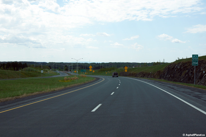
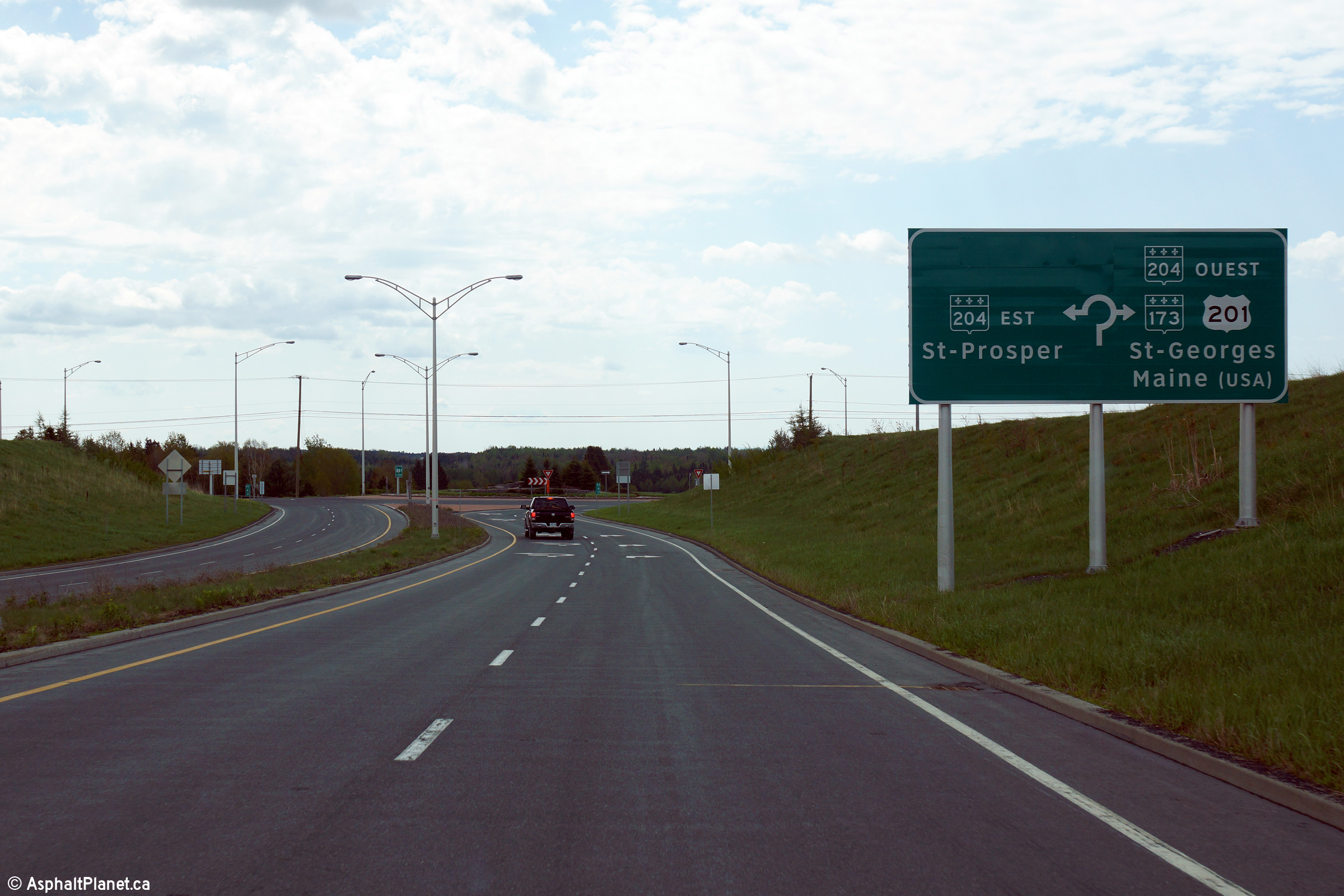
MRC des Etchemins Saint-Georges |
Southerly view approaching the roundabout with Route 204. Autoroute 73 ends at the Route 204 roundabout. Motorists continuing south towards US-201 and Maine must follow Route 204 to the west, passing through Downtown St-Georges. |
 |
||
|
Date: 23/5/2015 |
High-res: (1440x960) (2400x1600) | |||
|
MRC des Etchemins Saint-Georges |
Northerly along Autoroute 73 from just north of the Route 204 roundabout. |
|
||
|
Date: 23/5/2015 |
High-res: (1440x960) (2400x1600) | |||
|
MRC des Etchemins Saint-Georges |
Southerly view on approach to the Route 204 roundabout. |
 |
||
|
Date: 23/5/2015 |
High-res: (1440x960) (2400x1600) | |||
|
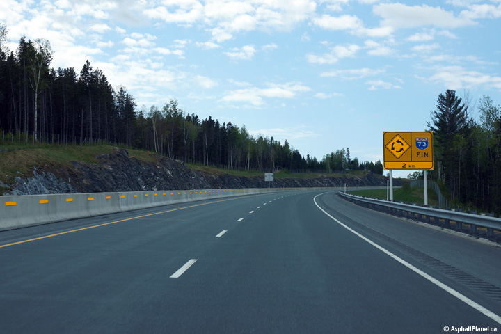
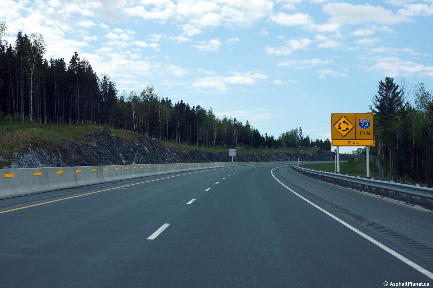
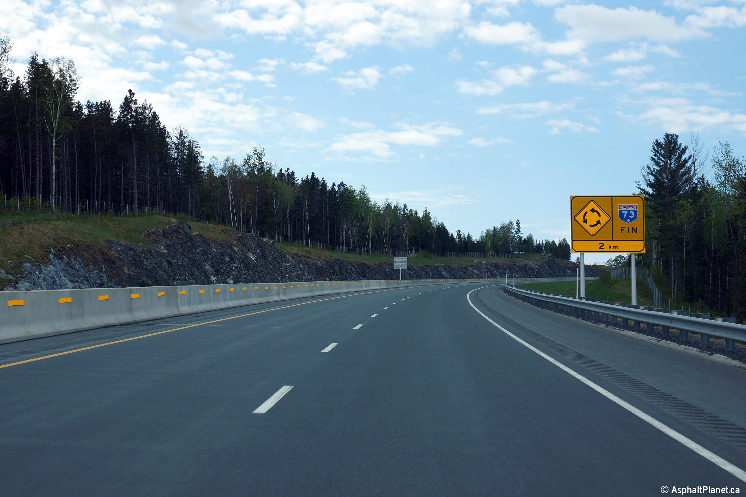
MRC des Etchemins Saint-Georges |
Southerly view as Autoroute 73 climbs out of the Famine River Valley. The Autoroute ends at a roundabout with Route 204 approximately 2km downstream of this signage. |
 |
||
|
Date: 23/5/2015 |
High-res: (1440x960) (2400x1600) | |||
|
MRC des Etchemins Saint-Georges |
This view looks northerly approaching the Famine River. Autoroute 73 is known as the Robert-Cliche Autoroute. |
|
||
|
Date: 23/5/2015 |
High-res: (1440x960) (2400x1600) | |||
|
MRC des Etchemins Saint-Georges |
Southerly view as Autoroute 73 descends into the Famine River Valley. |
 |
||
|
Date: 23/5/2015 |
High-res: (1440x960) (2400x1600) | |||
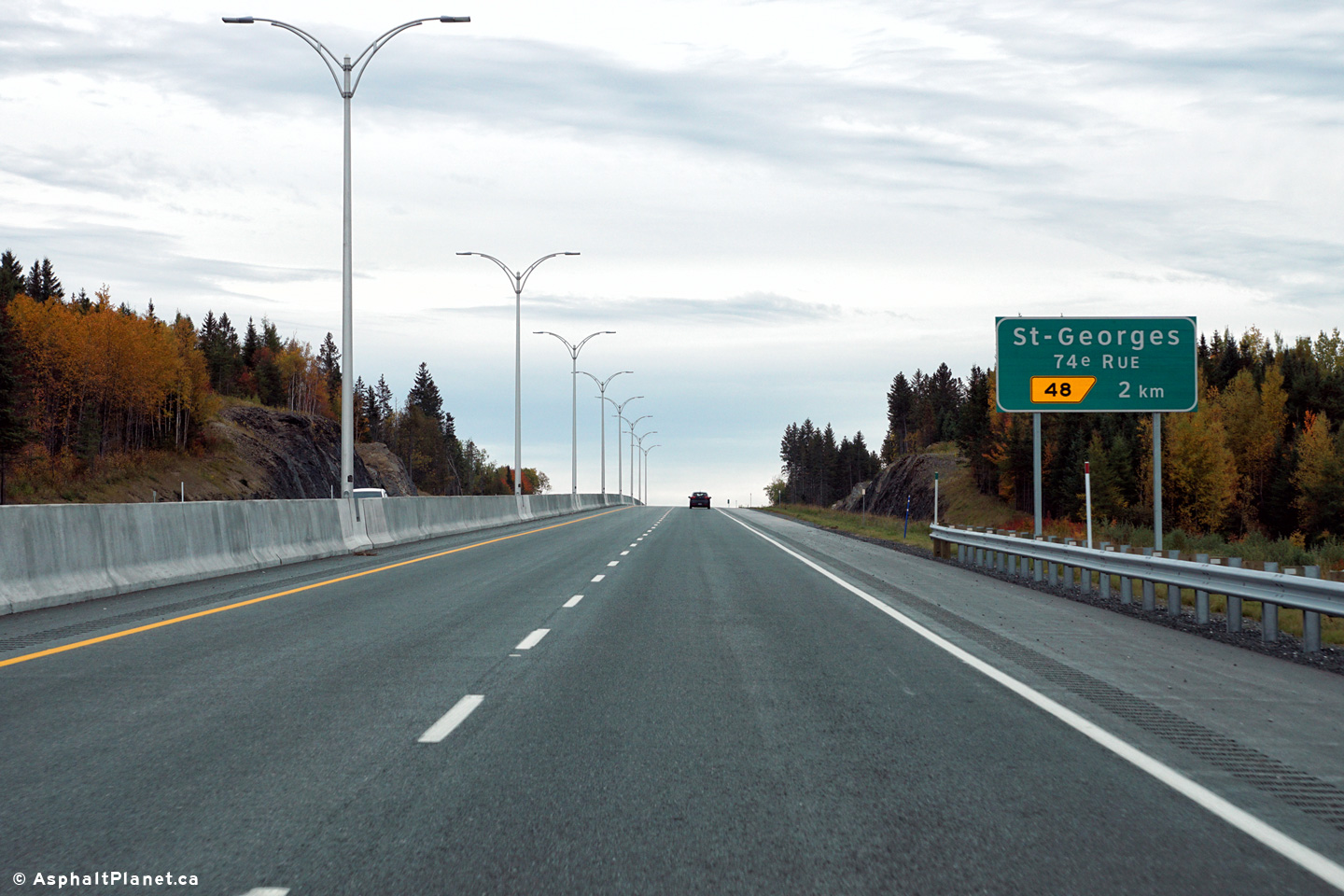
|
MRC des Etchemins Saint-Georges |
Northbound view along Autoroute 73 approaching the 74th Street interchange in St-Georges. When this photo was taken during the spring of 2015, Autoroute 73 ended at 74th Street, only to resume once again at Golf Street north of Beauceville. Construction to complete the remaining length of Autoroute 73 is scheduled to be completed later in 2015. |
|
||
|
Date: 23/5/2015 |
High-res: (1440x960) (2400x1600) | |||
|
MRC des Etchemins Saint-Georges |
Because the autoroute ends at this interchange, the northbound carriageway is narrowed to a single lane approaching the off-ramp to 74th Street. |
|
||
|
Date: 23/5/2015 |
High-res: (1440x960) (2400x1600) | |||
|
MRC des Etchemins Saint-Georges |
Southbound view at the off-ramp to 74th Street in St-Georges. |
 |
||
|
Date: 8/10/2016 |
High-res: (1440x960) (2400x1600) | |||
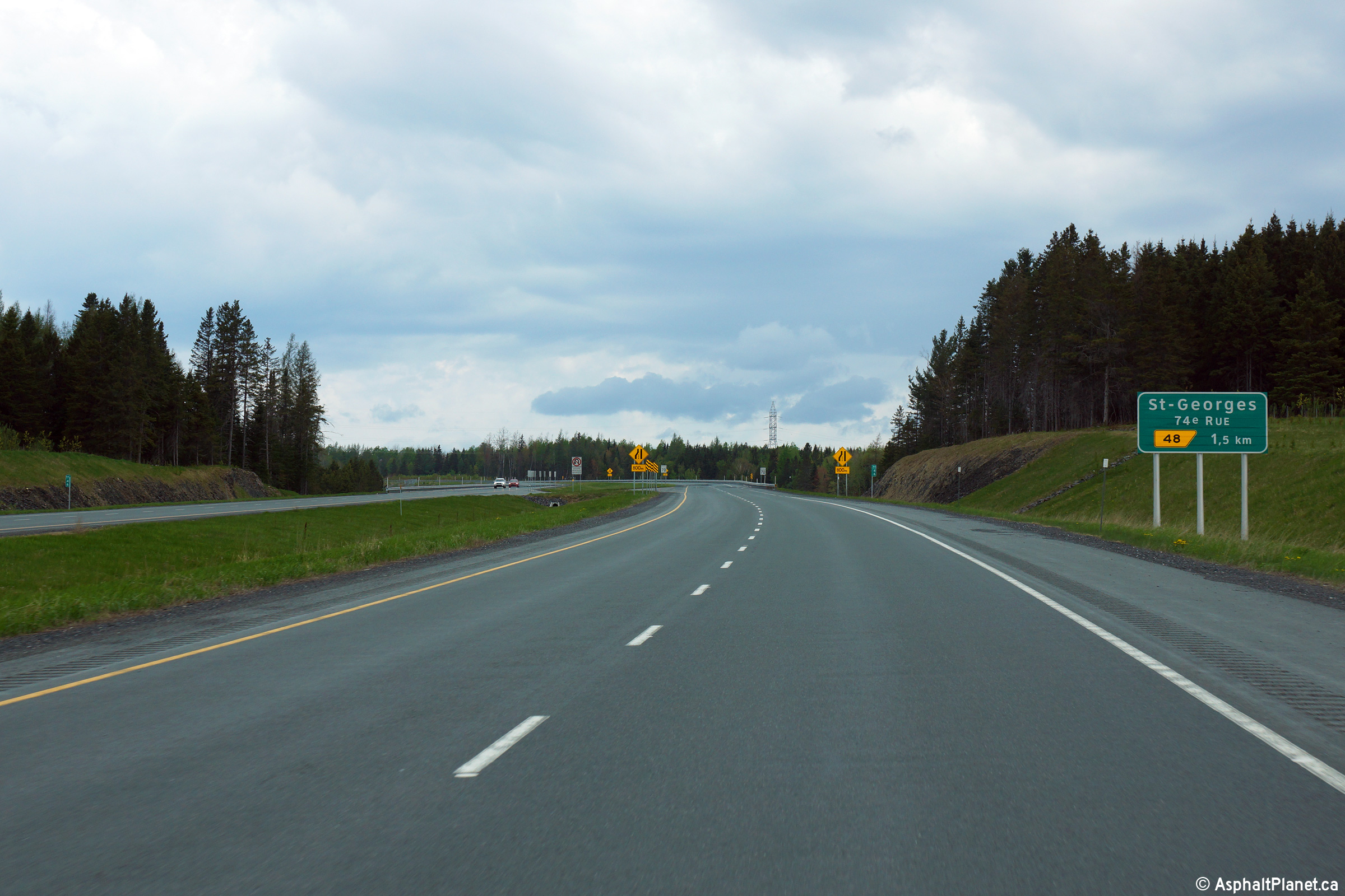
|
MRC des Etchemins Notre-Dame-des-Pins |
Southbound advanced signage for the off-ramp to 74th Street. |
 |
||
|
Date: 8/10/2016 |
High-res: (1440x960) (2400x1600) | |||
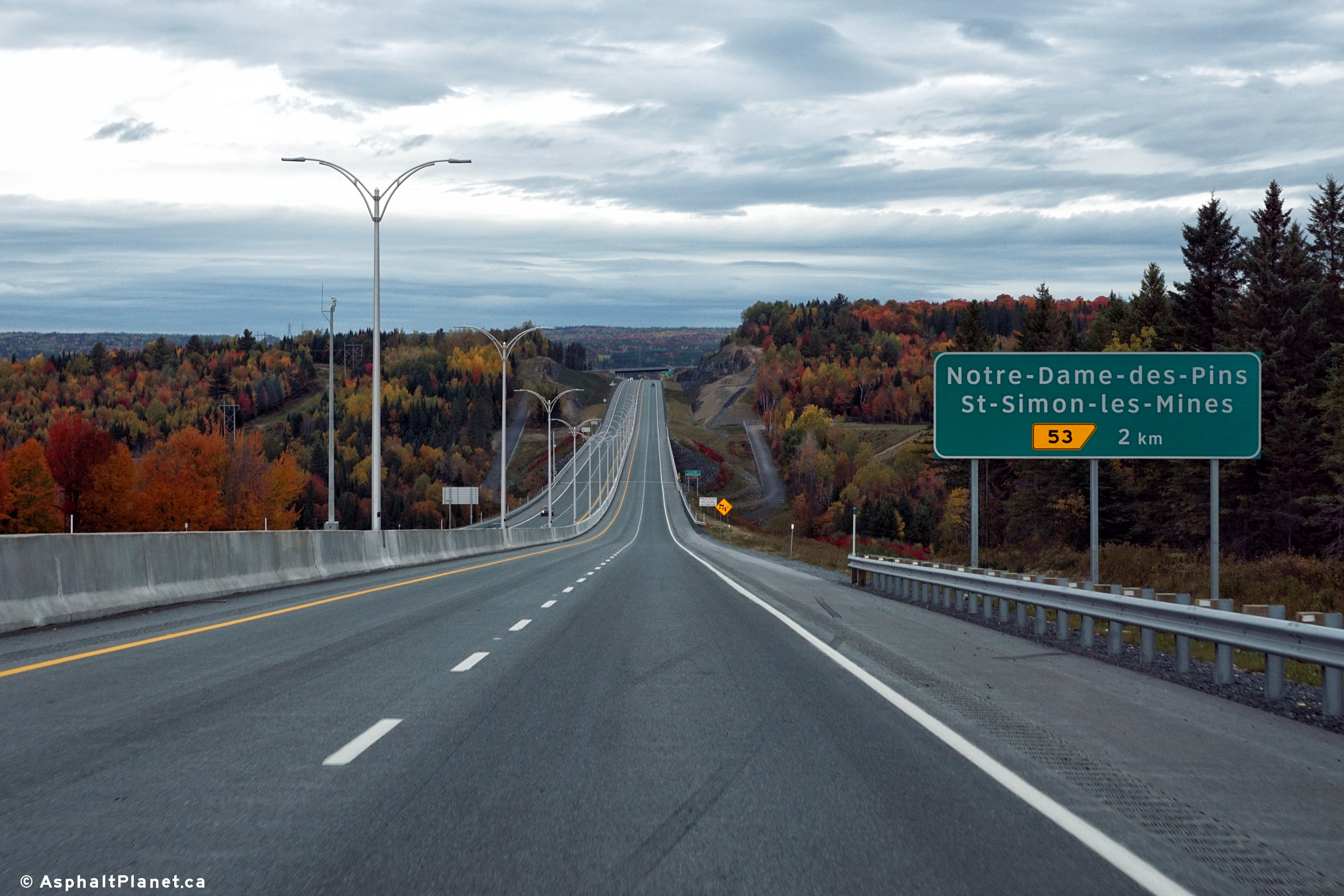
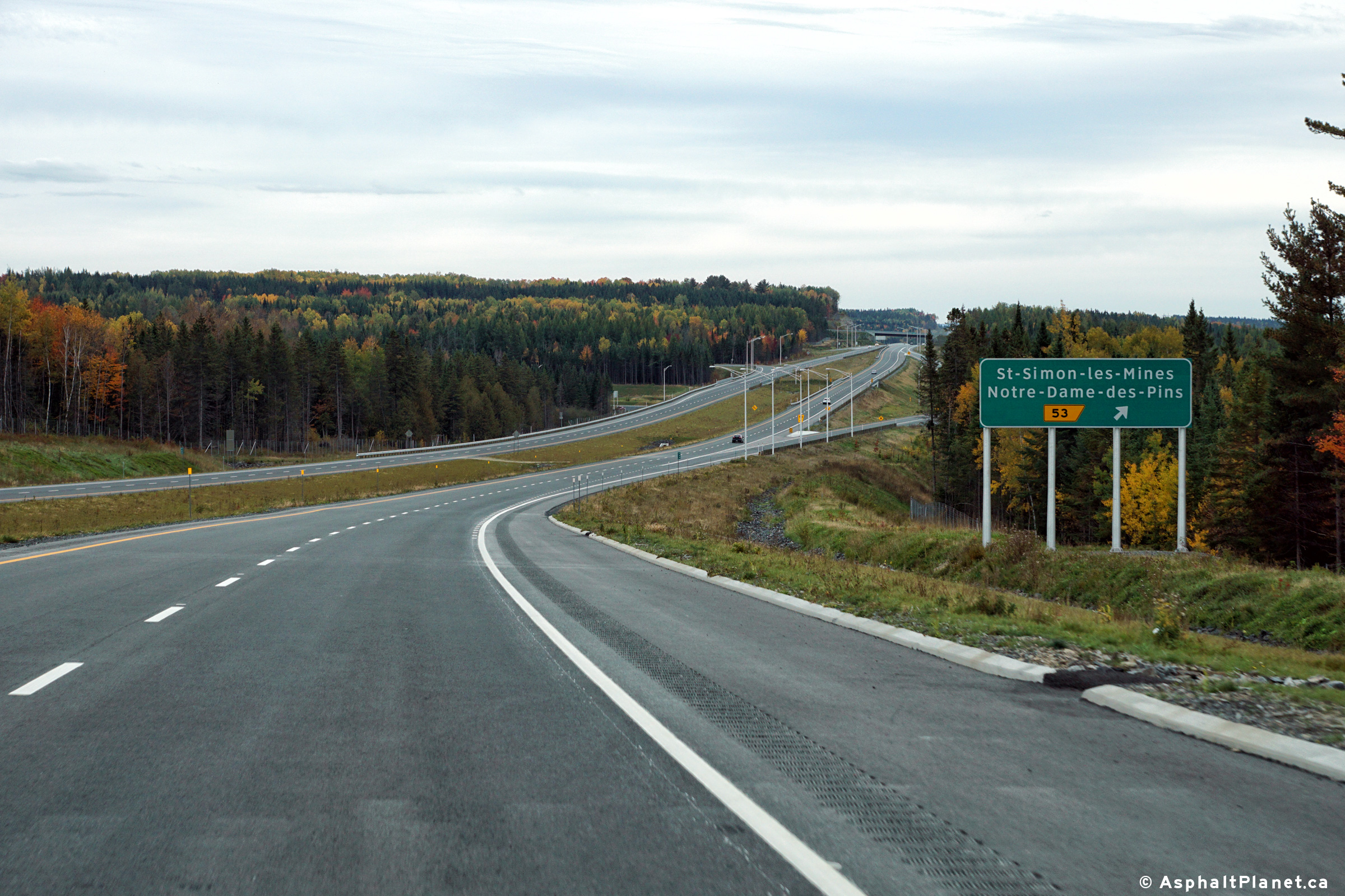
|
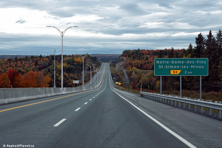
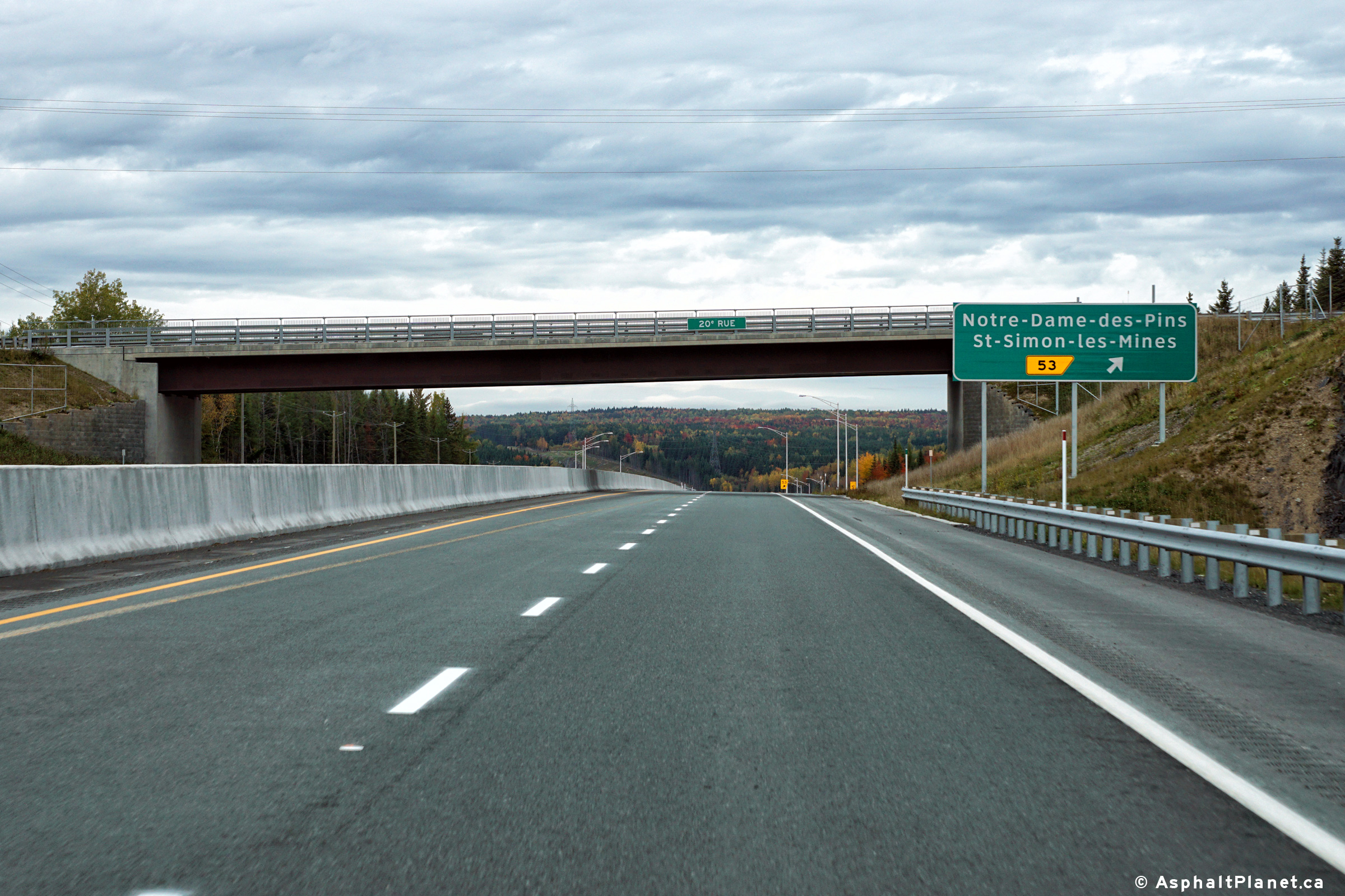
MRC des Etchemins Notre-Dame-des-Pins |
View looking northerly at the signage to the off-ramp to Notre-Dame-des-Pins and St-Simon-les-Mines. The interchange is situated on the in a valley on the northern side of the 20th Street overpass. Exit 53 does not directly connect to 20th Street. |
 |
||
|
Date: 8/10/2016 |
High-res: (1440x960) (2400x1600) | |||
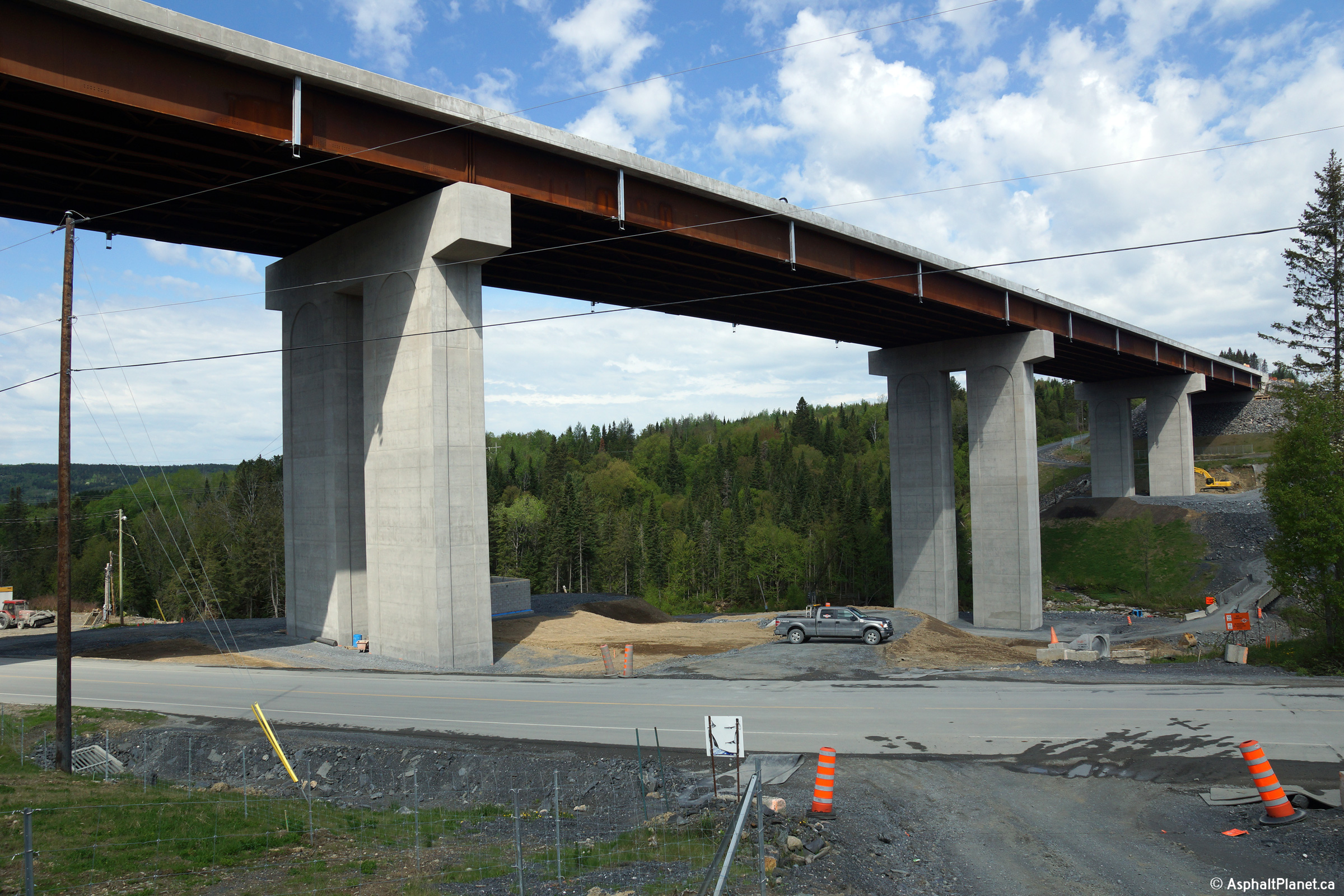
|
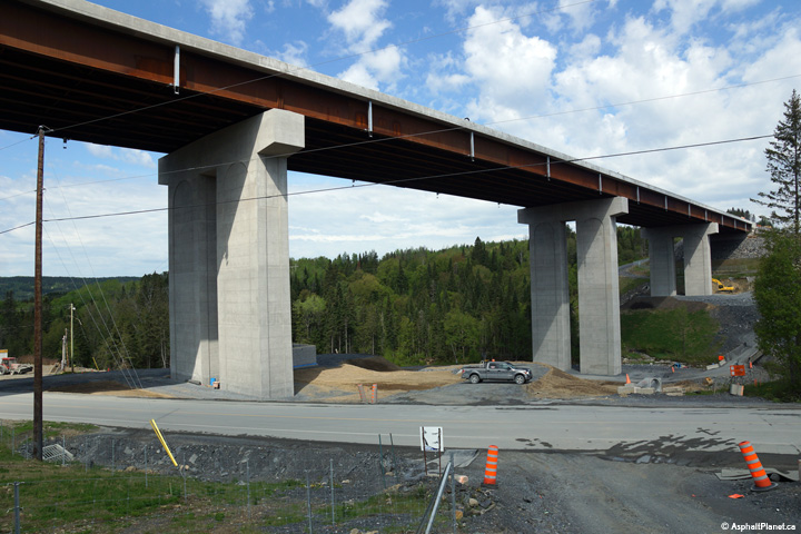
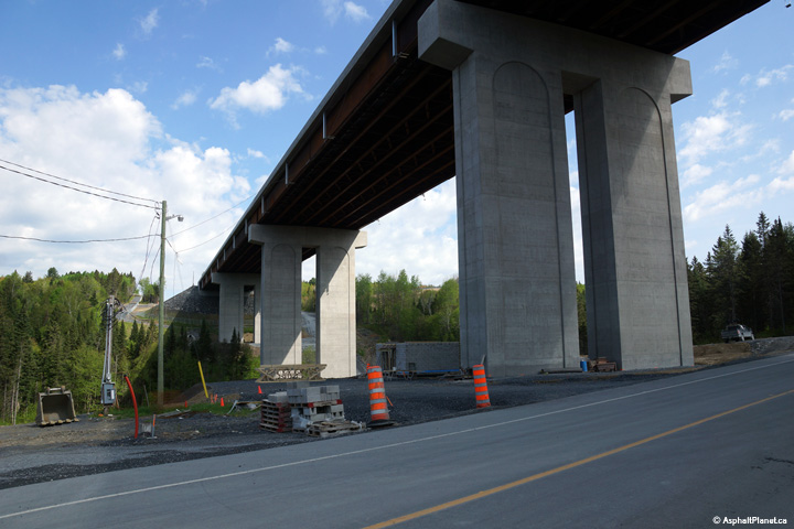
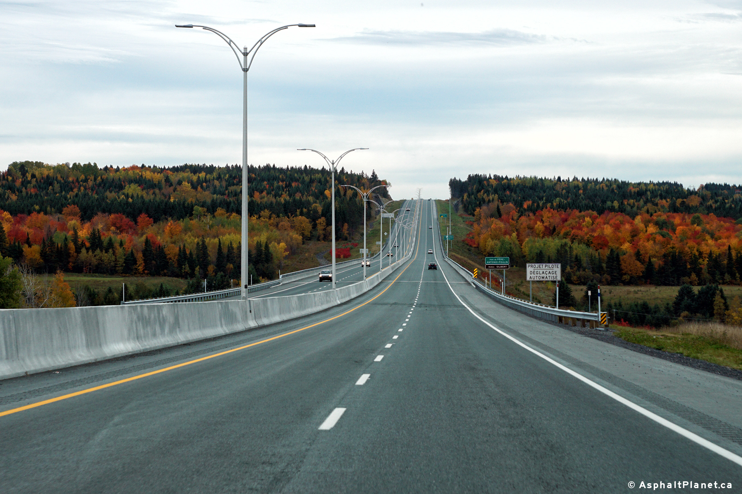
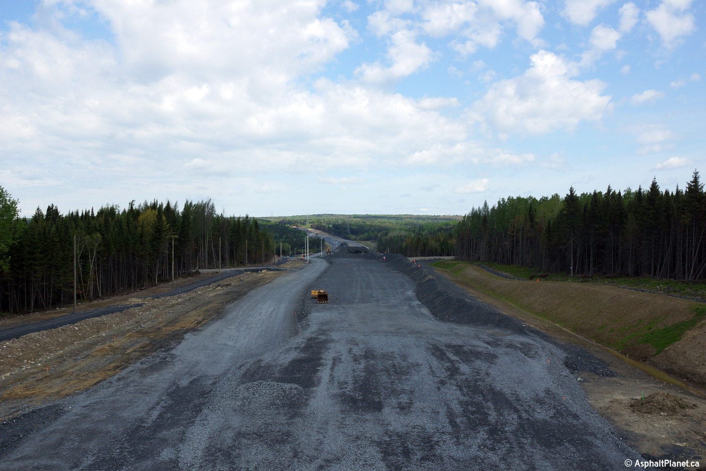
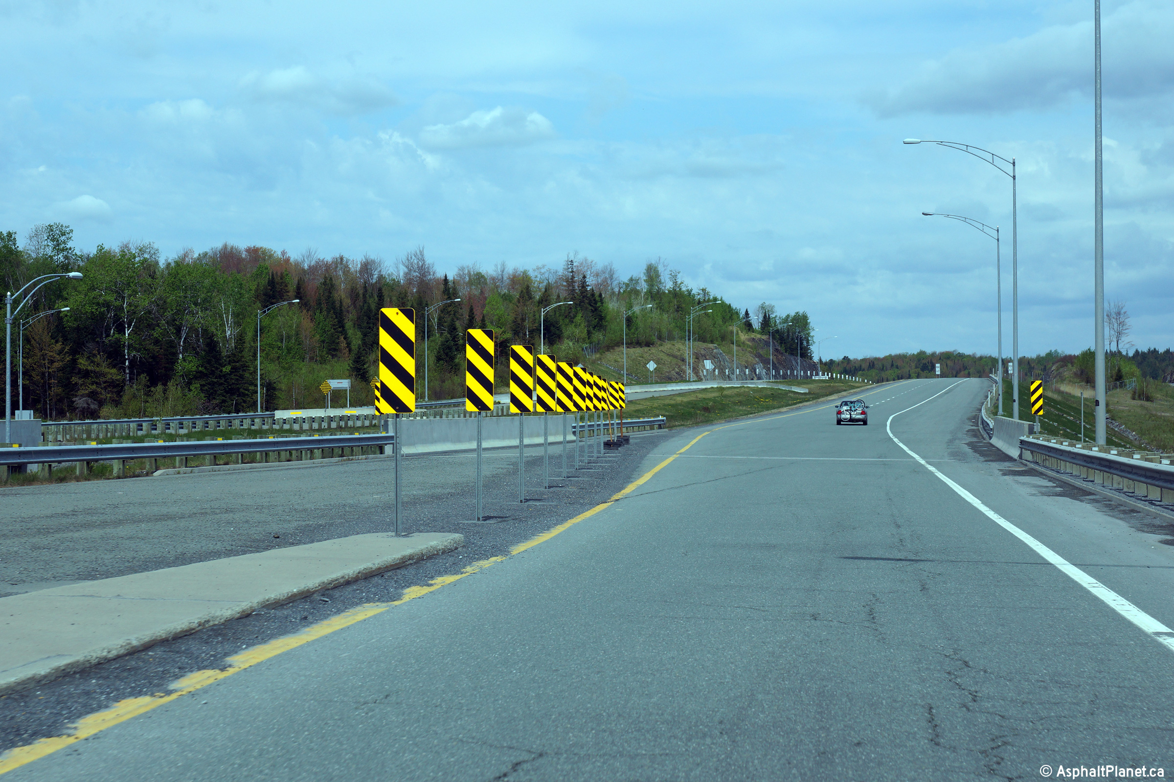
MRC des Etchemins Notre-Dame-des-Pins |
Two views looking northerly at the large structure that will carry Autoroute 73 overtop of both Route Bernard and the Gilbert River. |
|
||
| High-res: (1440x960) (2400x1600) | ||||
|
|
||||
|
Date: 23/5/2015 |
High-res: (1440x960) (2400x1600) | |||
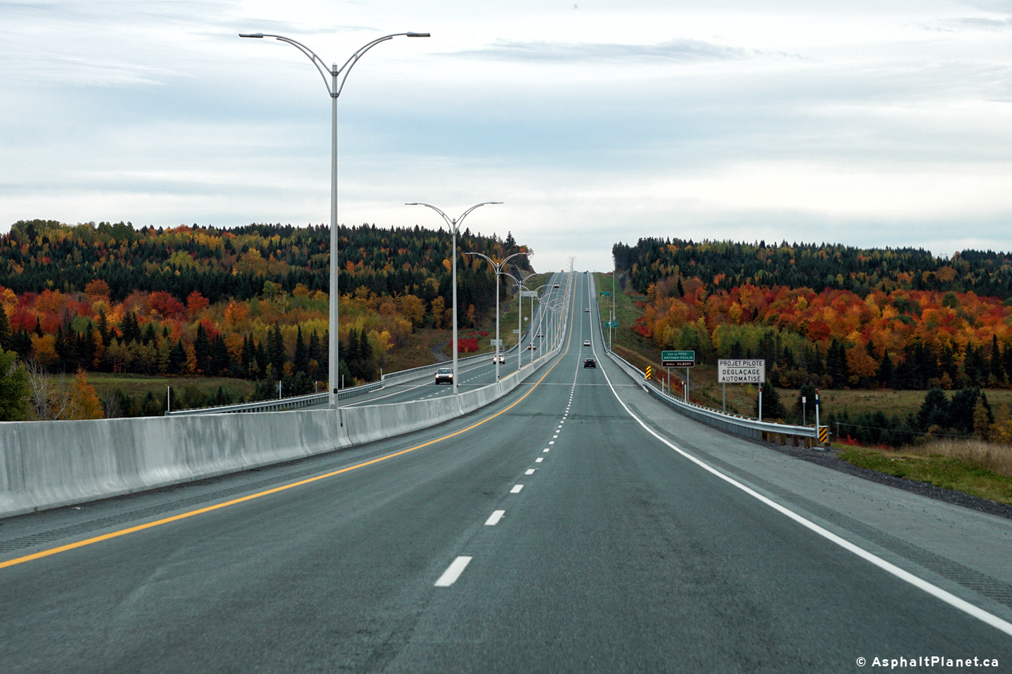
|
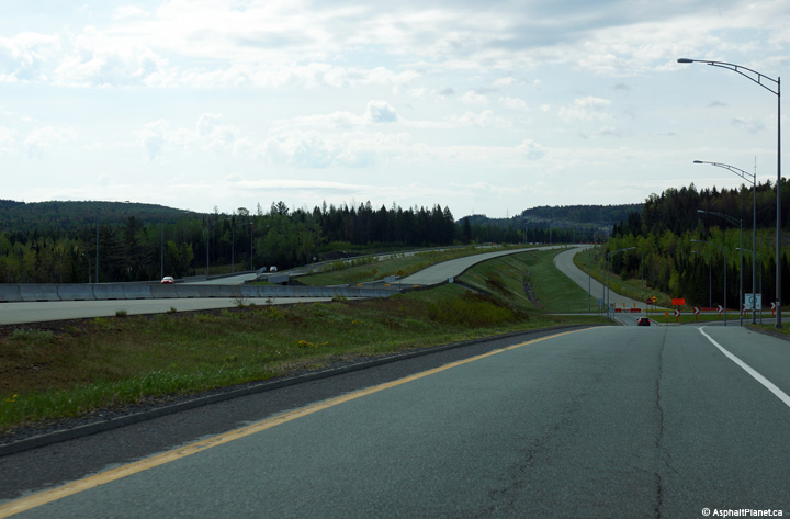
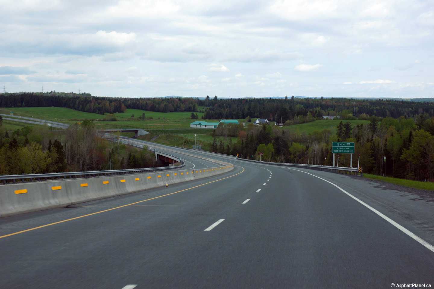
MRC de Robert-Cliche Beaucville |
Southerly view as Autoroute 73 passes overtop of the long Gilbert River viaduct. |
 |
||
|
Date: 8/10/2016 |
High-res: (1440x960) (2400x1600) | |||
|
MRC des Etchemins Saint-Georges |
View looking northerly at the signage to the off-ramp to Notre-Dame-des-Pins and St-Simon-les-Mines. The interchange is situated on the in a valley on the northern side of the 20th Street overpass. Exit 53 does not directly connect to 20th Street. |
|
||
|
Date: 8/10/2016 |
High-res: (1440x960) (2400x1600) | |||
|
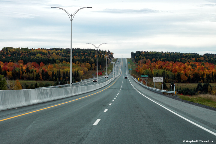
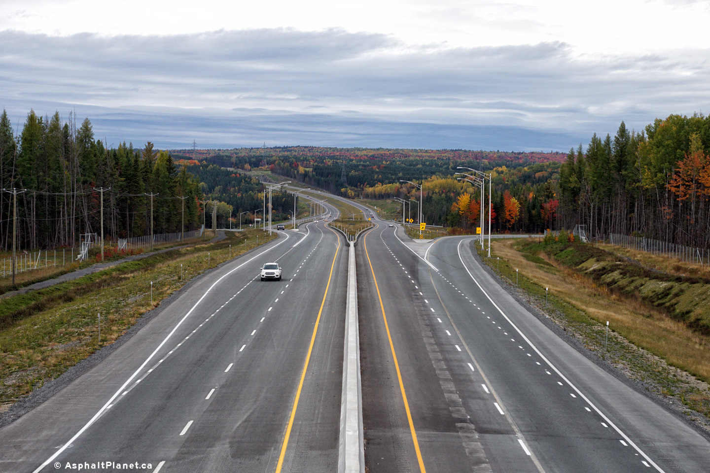
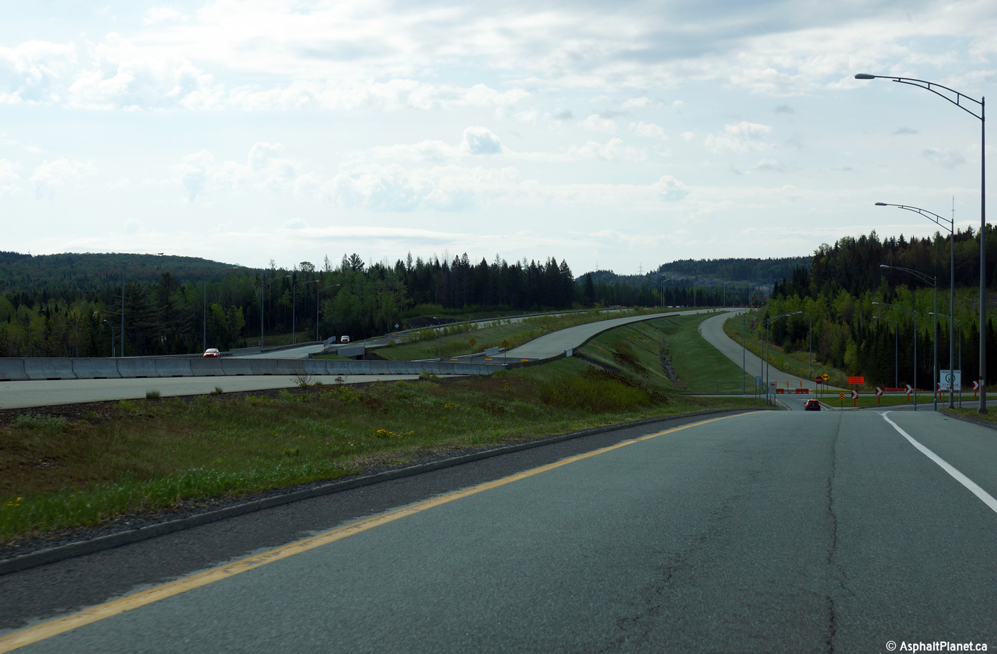
MRC des Etchemins Notre-Dame-des-Pins |
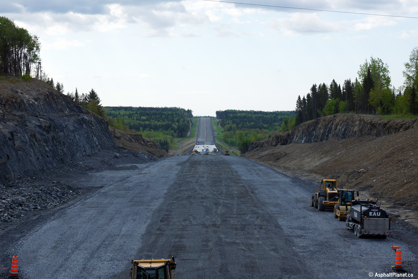
A series of views looking southerly from the 20th Street overpass along Autoroute 73. The upper photo was taken a year before the freeway opened to traffic, while the lower photos were taken just after the highway had opened to traffic. Two views looking southerly along the future alignment of Autoroute 73 from the 20th Street overpass.
Photo # 1 taken: 23/5/2015
Photos # 2 and 3 taken: 8/10/2016 |
|
||
| High-res: (1440x960) (2400x1600) | ||||
|
|
||||
| High-res: (1440x960) (2400x1600) | ||||
|
|
||||
|
Date: as noted above |
High-res: (1440x960) (2400x1600) | |||
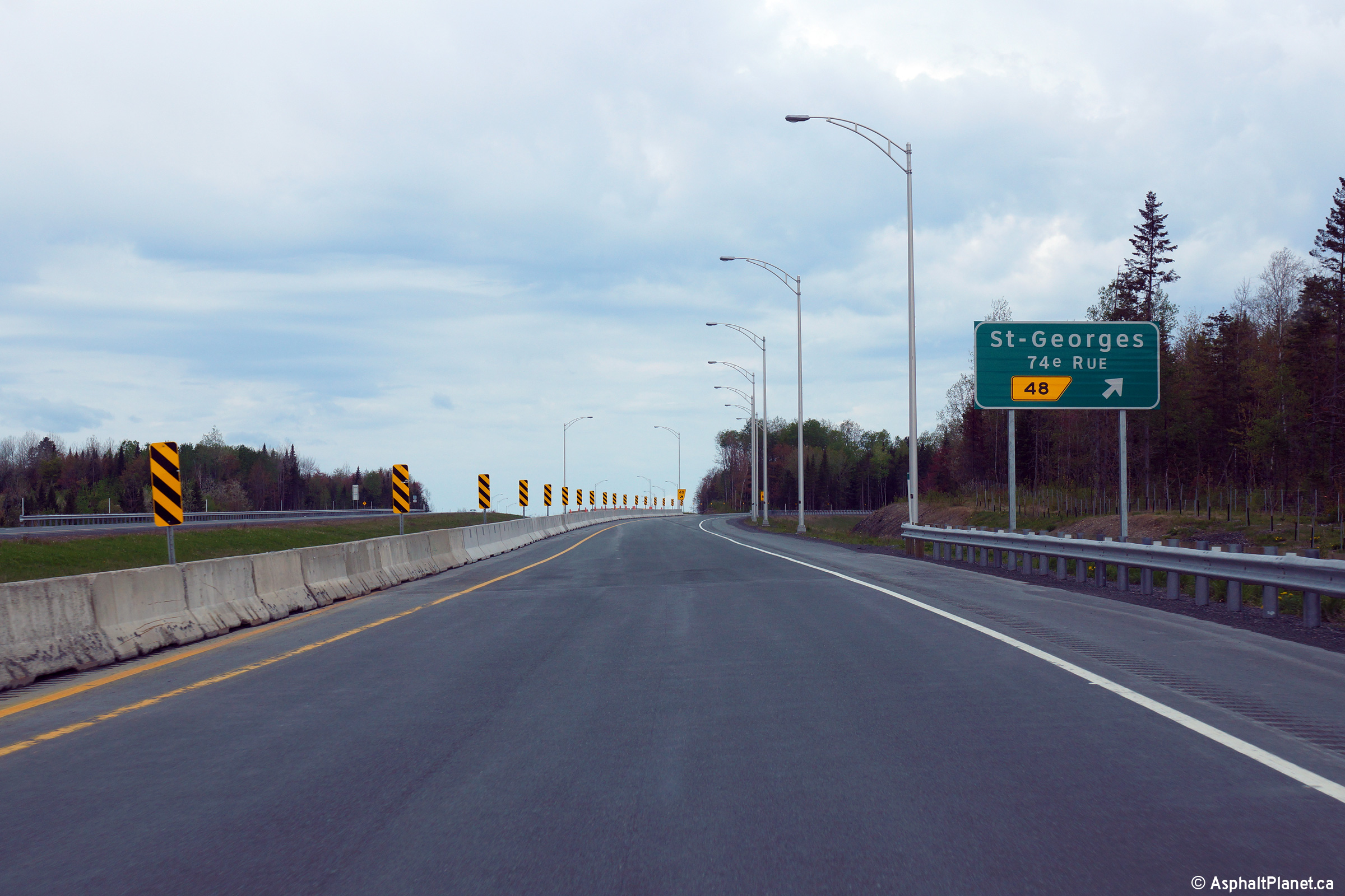
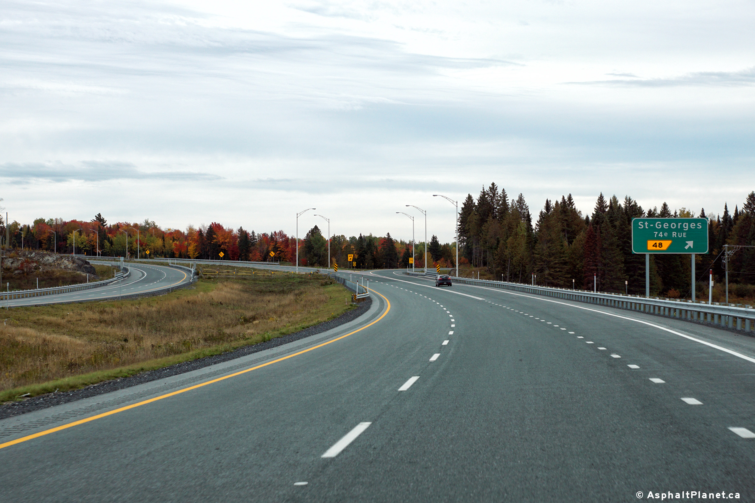
|
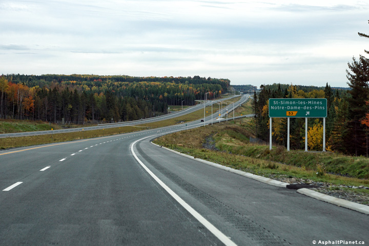
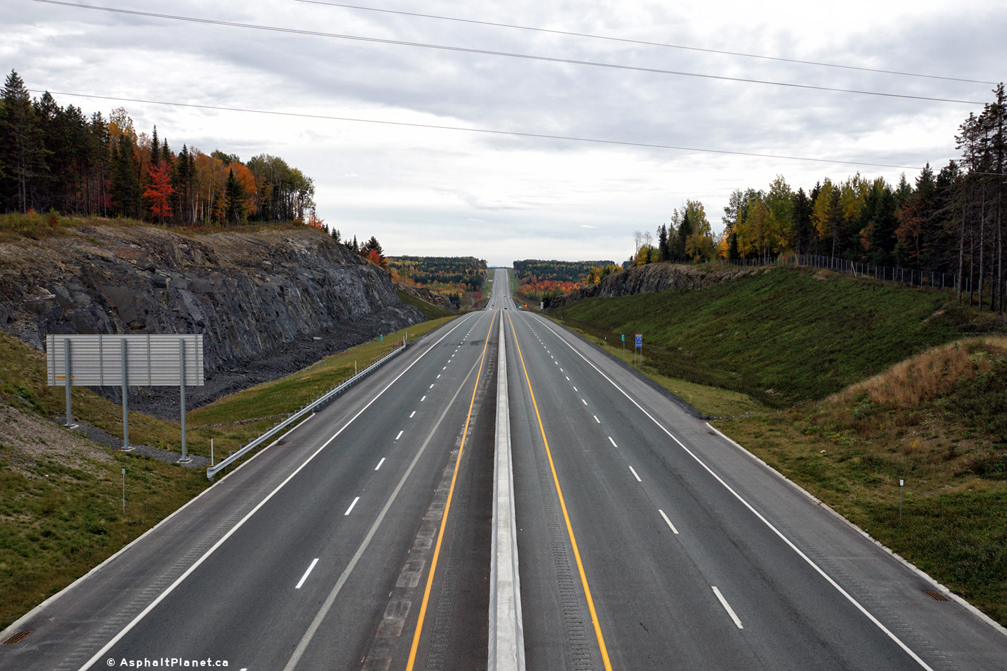
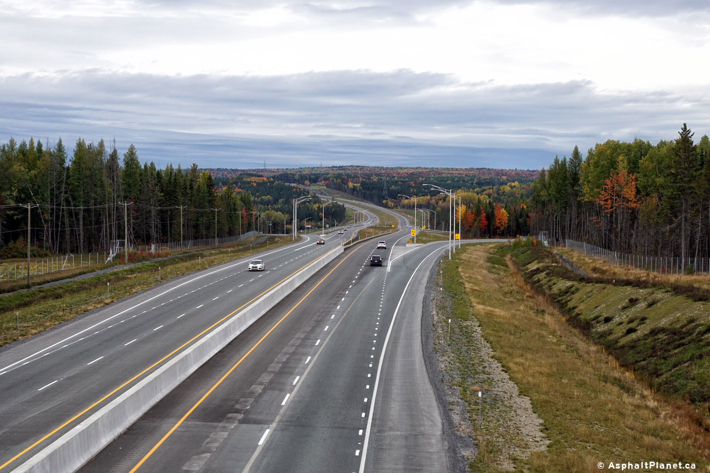
MRC des Etchemins Notre-Dame-des-Pins |
View looking northerly along Autoroute 73 from the 20th Street overpass. A new diamond interchange was constructed that links road between Autoroute 73 to Route 173 north of Notre-Dame-des-Pins.
Photo # 1 taken: 23/5/2015
Photos # 2 and 3 taken: 8/10/2016 |
|
||
| High-res: (1440x960) (2400x1600) | ||||
|
|
||||
| High-res: (1440x960) (2400x1600) | ||||
|
|
||||
|
Date: 23/5/2015 |
High-res: (1440x960) (2400x1600) | |||
|
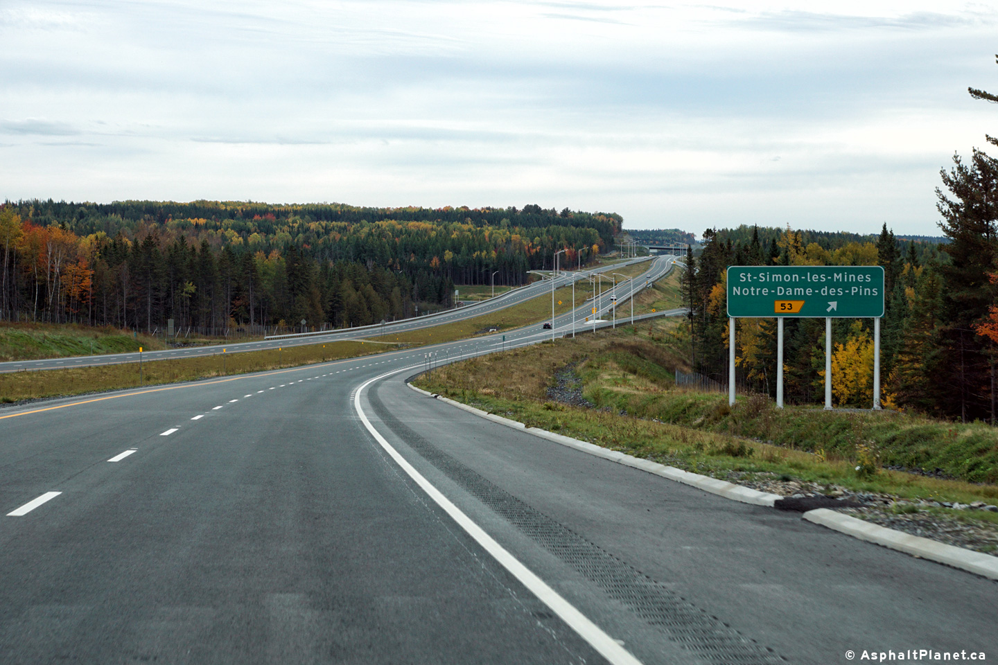
MRC des Etchemins Notre-Dame-des-Pins |
Southbound signage at the off-ramp to St-Simon-les-Mines and Notre Dame-des-Pins. At the time that this photo was taken, a southbound advanced sign for this interchange was not present. This photo was taken shortly after this portion of Autoroute 73 had opened to traffic however, so it is entirely possible contractors have simply yet to install the advanced sign. |
 |
||
|
Date: 8/10/2016 |
High-res: (1440x960) (2400x1600) | |||
|
MRC des Etchemins Saint-Georges |
Northbound advanced signage for the interchange to Beauceville. |
|
||
|
Date: 8/10/2016 |
High-res: (1440x960) (2400x1600) | |||
|
MRC des Etchemins Saint-Georges |
View looking northerly at the turn-off signage to Beauceville. The off-ramp departs the freeway just beyond the crest of the pictured hill. |
 |
||
|
Date: 8/10/2016 |
High-res: (1440x960) (2400x1600) | |||
|
MRC des Etchemins Saint-Georges |
View looking northerly along Autoroute 73 from the on-ramp from Chemin du Golf. This photo was taken during the time that Autoroute 73 ended at the Chemin du Golf Road in Beauceville. |
|
||
|
Date: 23/5/2015 |
High-res: (1440x960) (2400x1600) | |||
|
MRC de Robert-Cliche Beauceville |
View from the southbound ramp to the Chemin du Golf Road interchange from before Autoroute 73 was extended southerly. |
 |
||
|
Date: 23/5/2015 |
High-res: (1440x960) (2400x1600) | |||
|
MRC de Robert-Cliche Beauceville |
Southbound signage at the off-ramp to St-Simon-les-Mines and Notre Dame-des-Pins. At the time that this photo was taken, a southbound advanced sign for this interchange was not present. This photo was taken shortly after this portion of Autoroute 73 had opened to traffic however, so it is entirely possible contractors have simply yet to install the advanced sign. |
 |
||
|
Date: 8/10/2016 |
High-res: (1440x960) (2400x1600) | |||
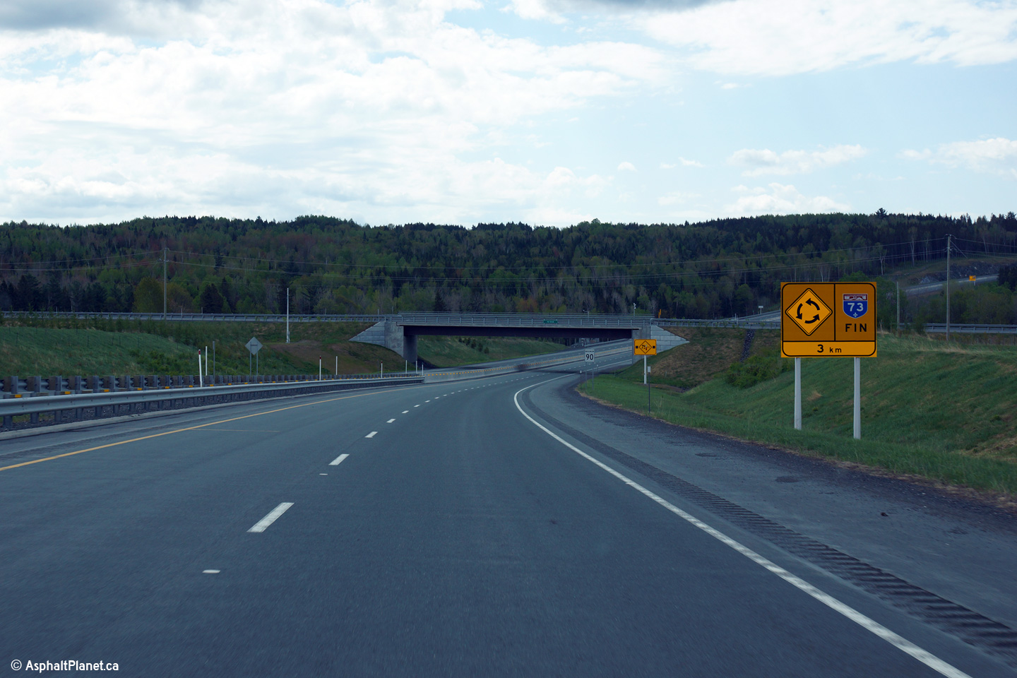
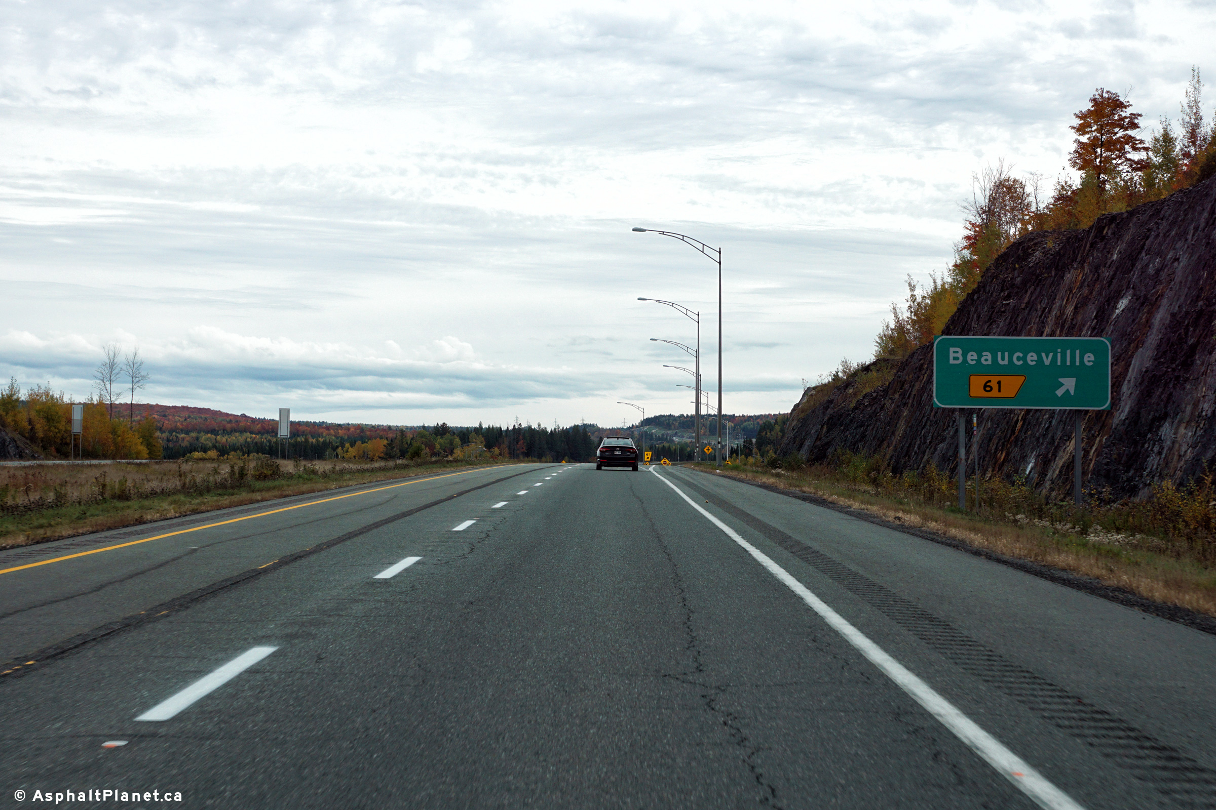
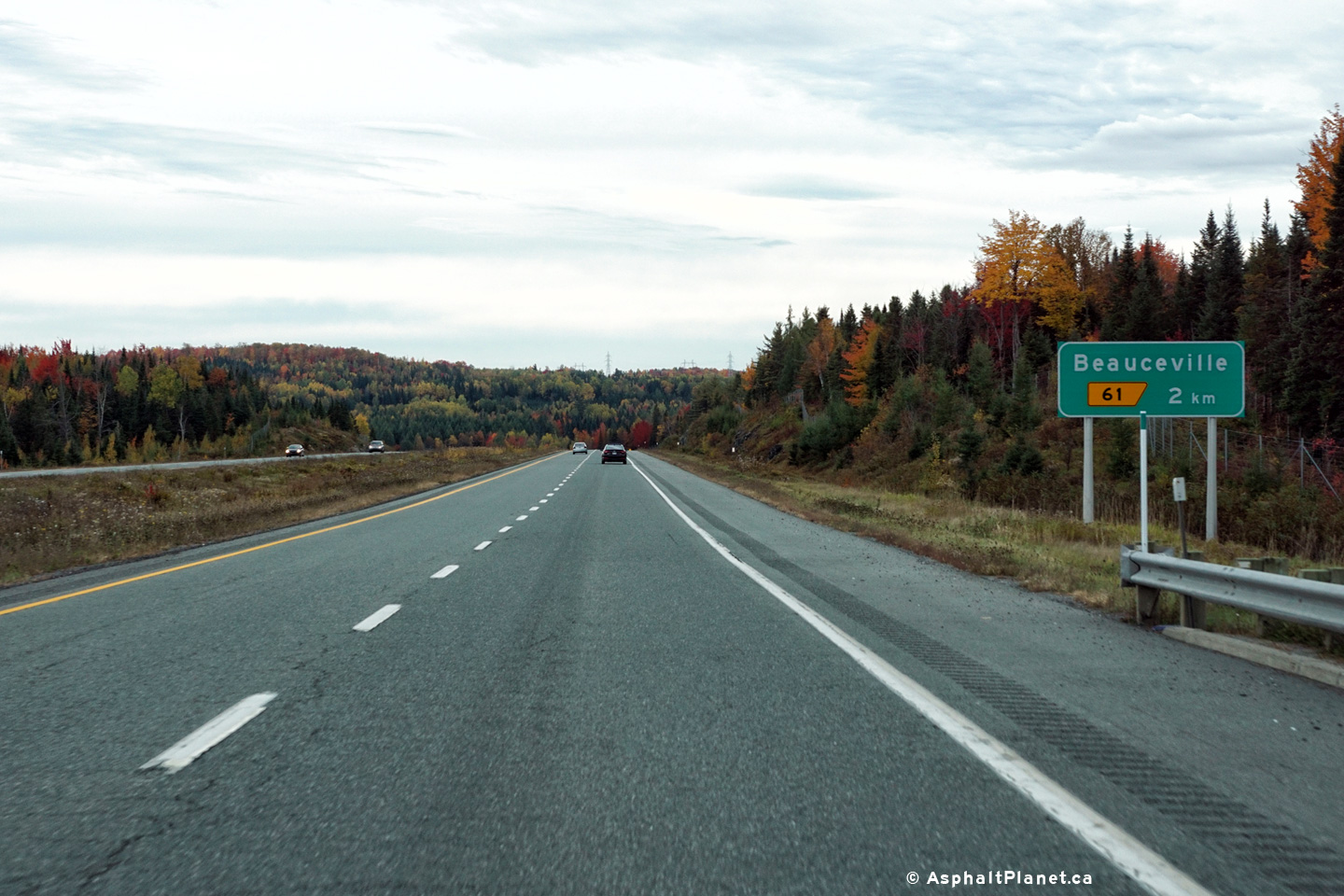
|
MRC de Robert-Cliche Beaucville |
Southbound advanced signage in advance of the Beauceville interchange. |
 |
||
|
Date: 8/10/2016 |
High-res: (1440x960) (2400x1600) | |||
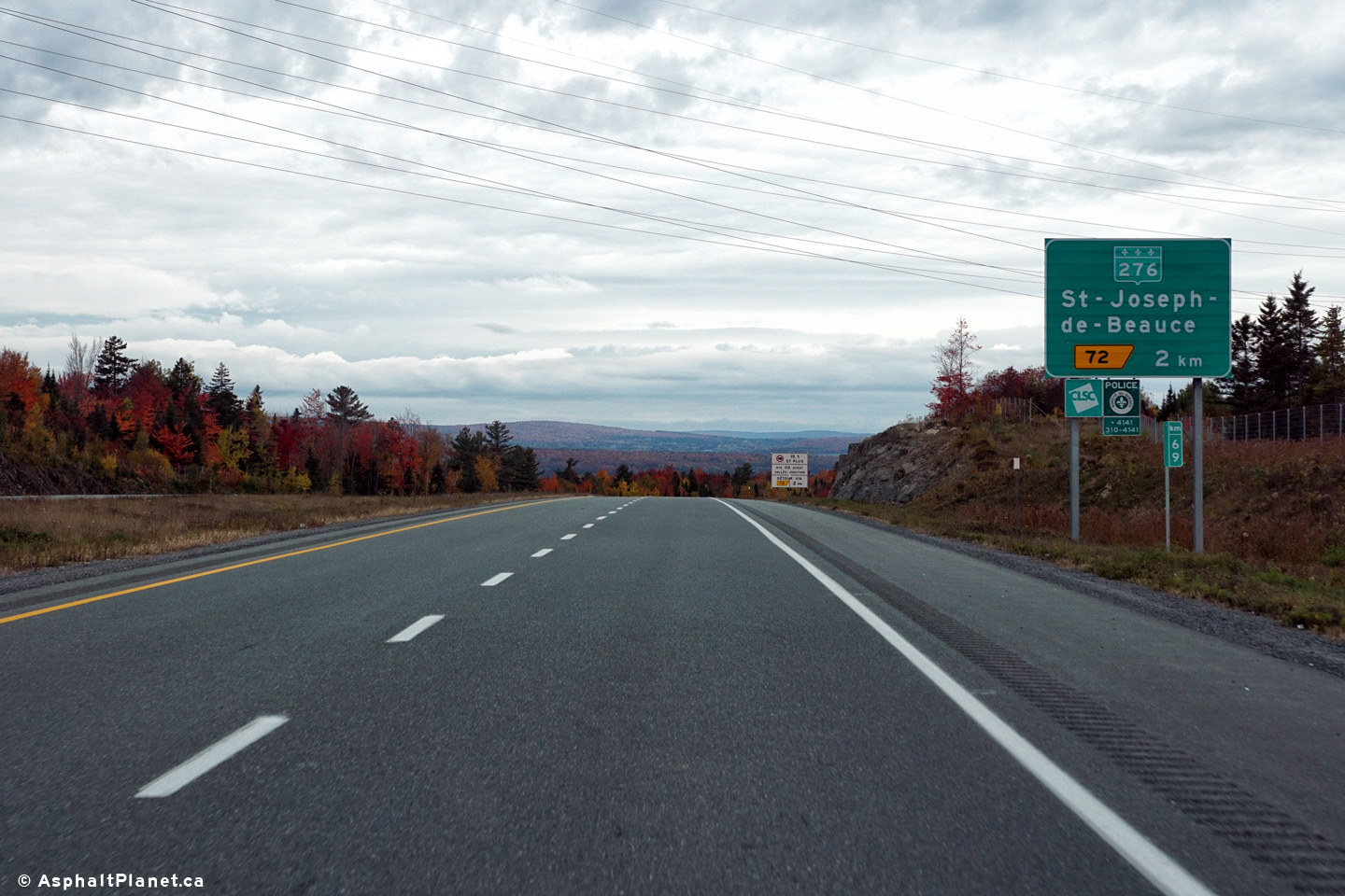
|
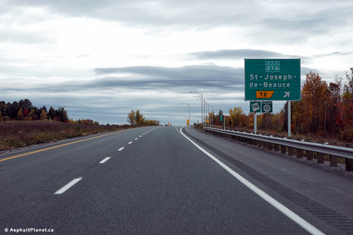
MRC de Robert-Cliche Beauceville |
Northbound signage in advance of the Route 276 interchange. |
 |
||
|
Date: 8/10/2016 |
High-res: (1440x960) (2400x1600) | |||
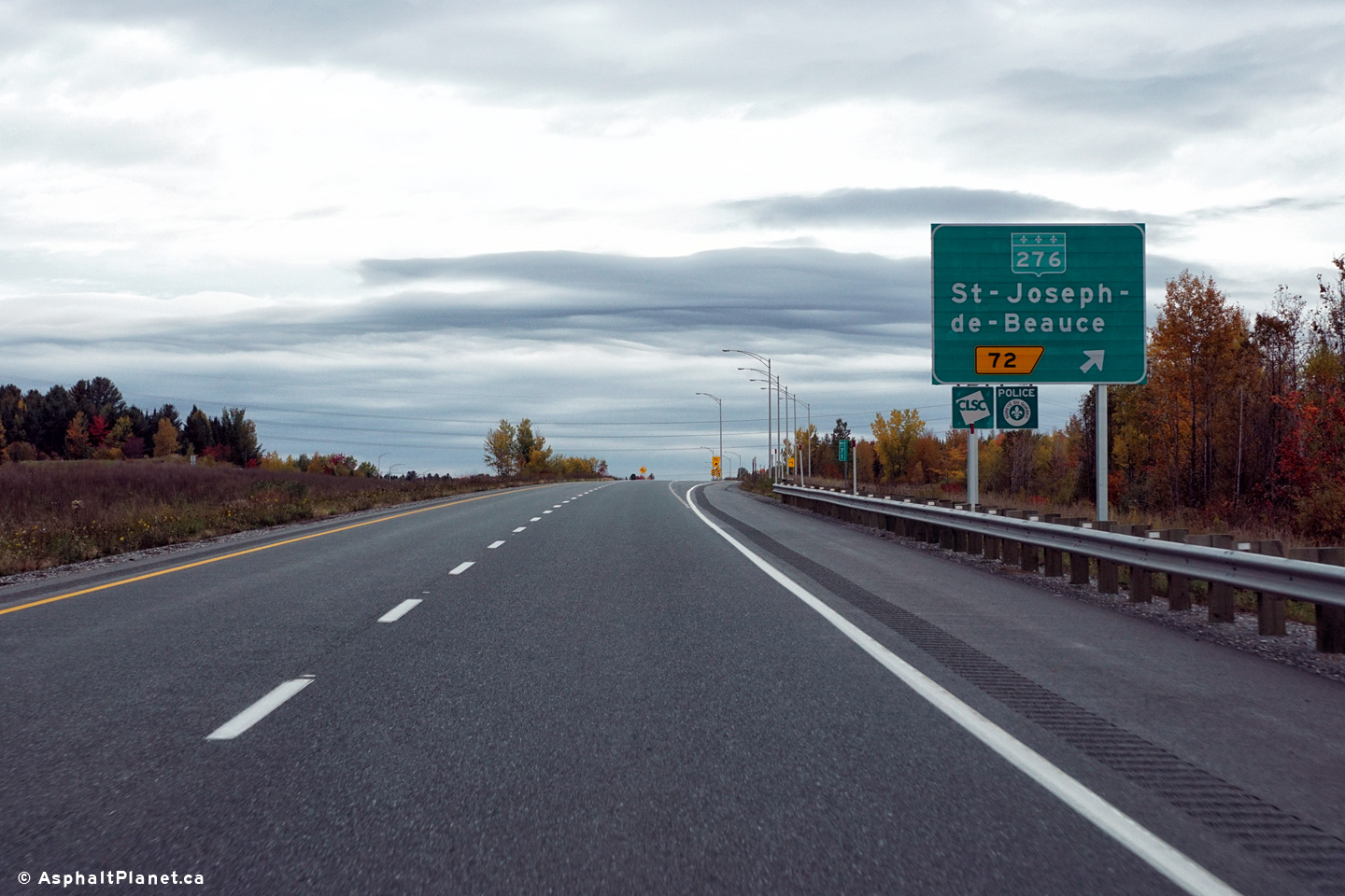
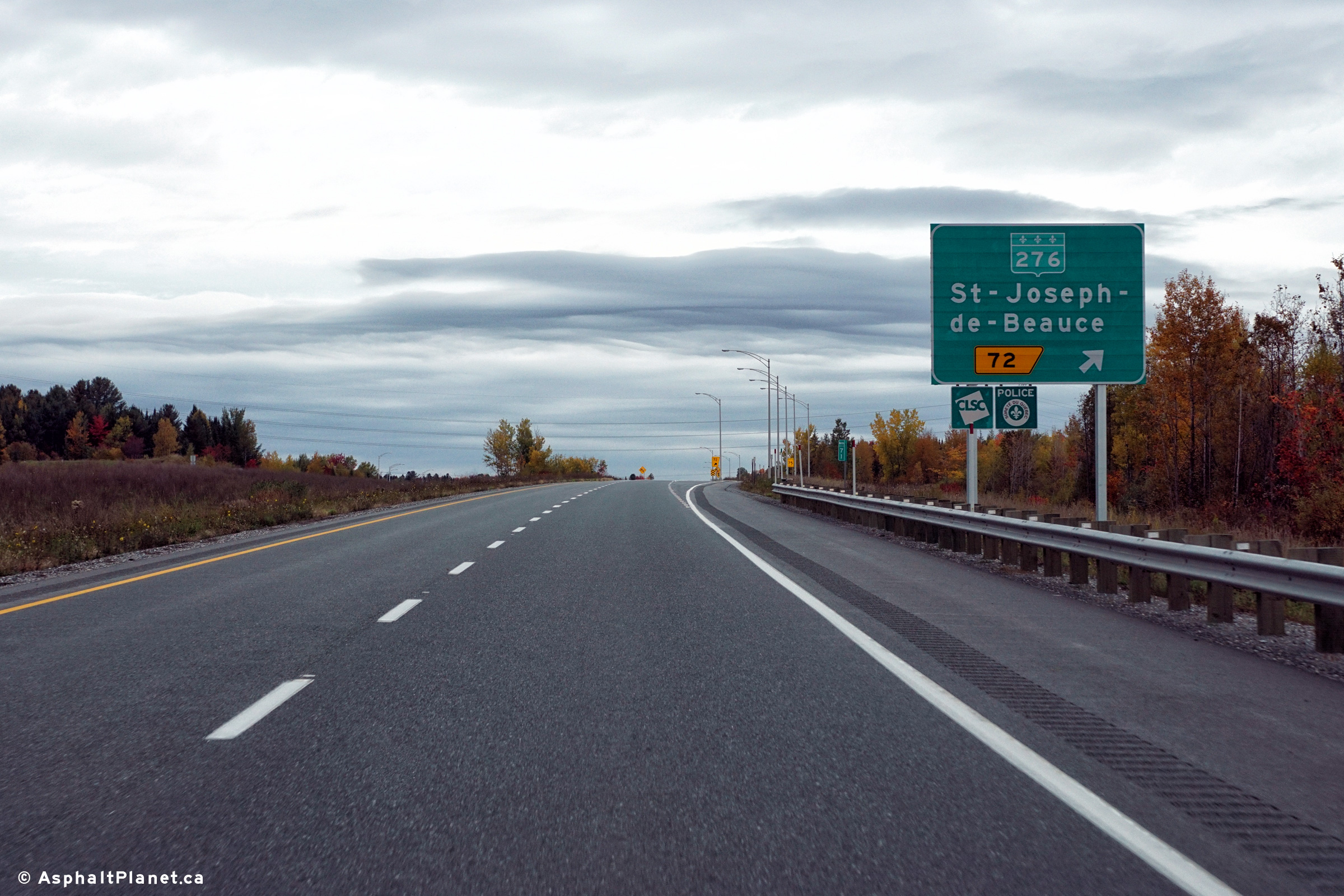
|
MRC de Robert-Cliche Beauceville |
Northbound signage at the off-ramp to Route 276. |
 |
||
|
Date: 8/10/2016 |
High-res: (1440x960) (2400x1600) | |||
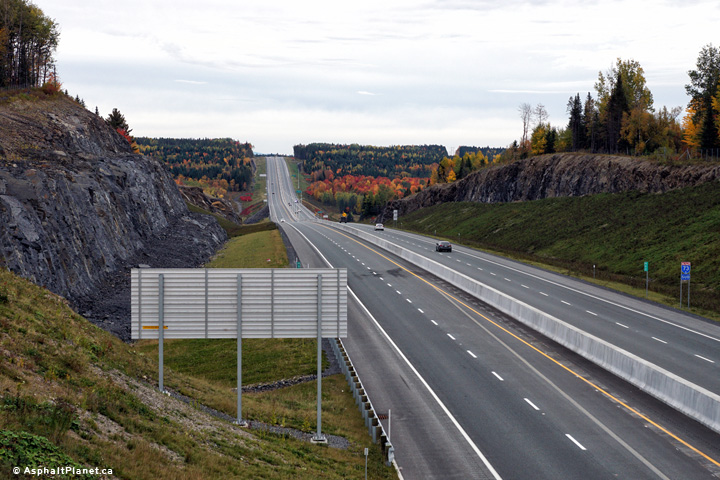
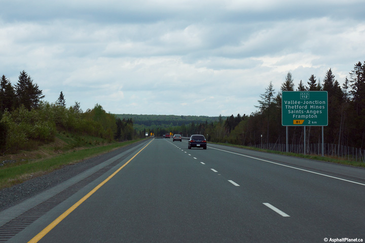
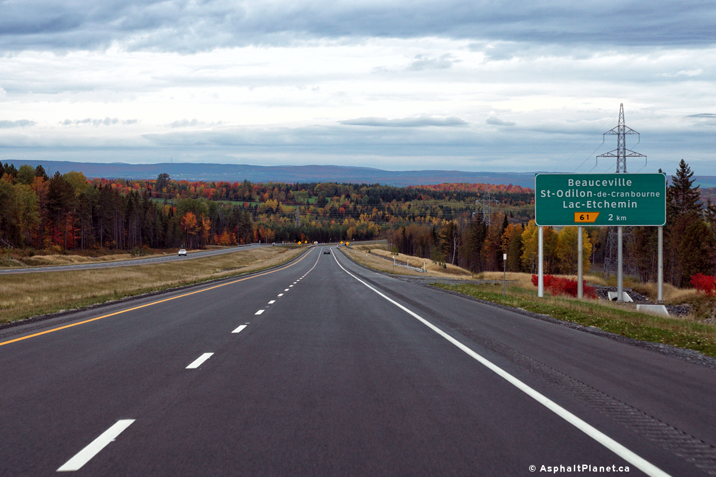
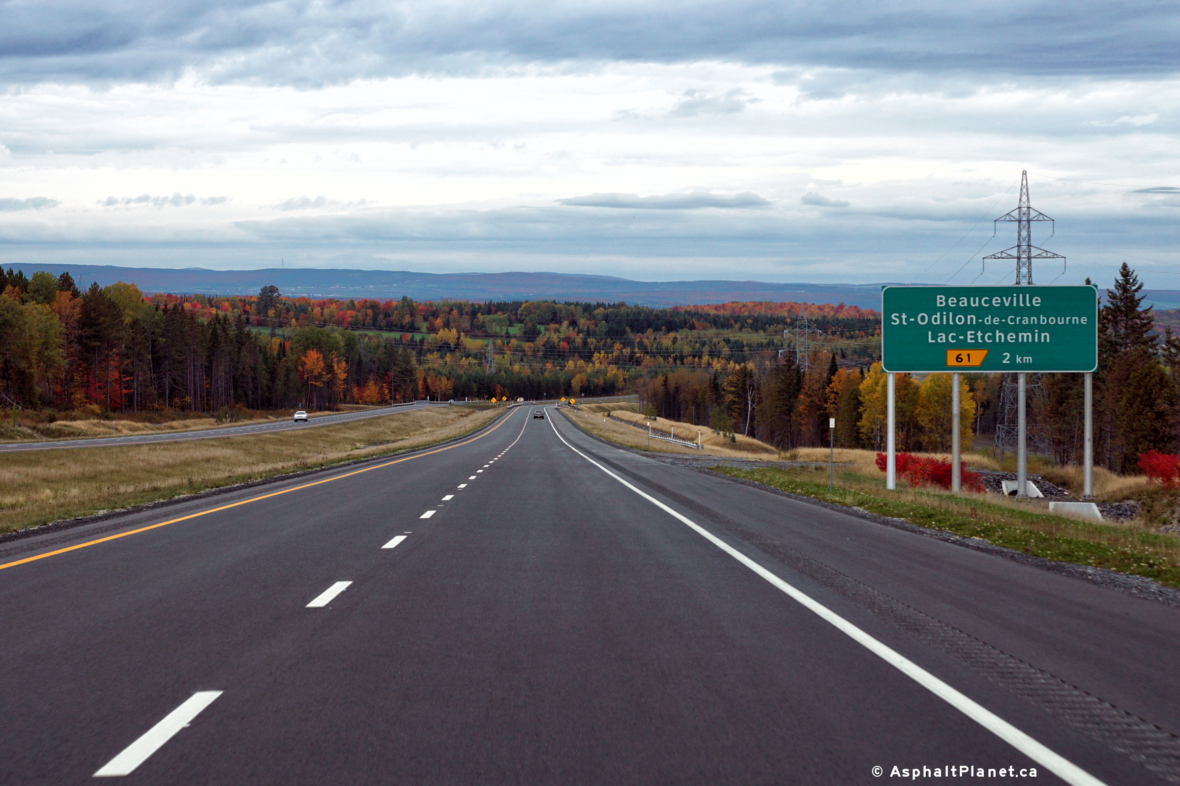
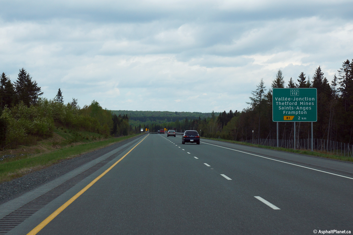
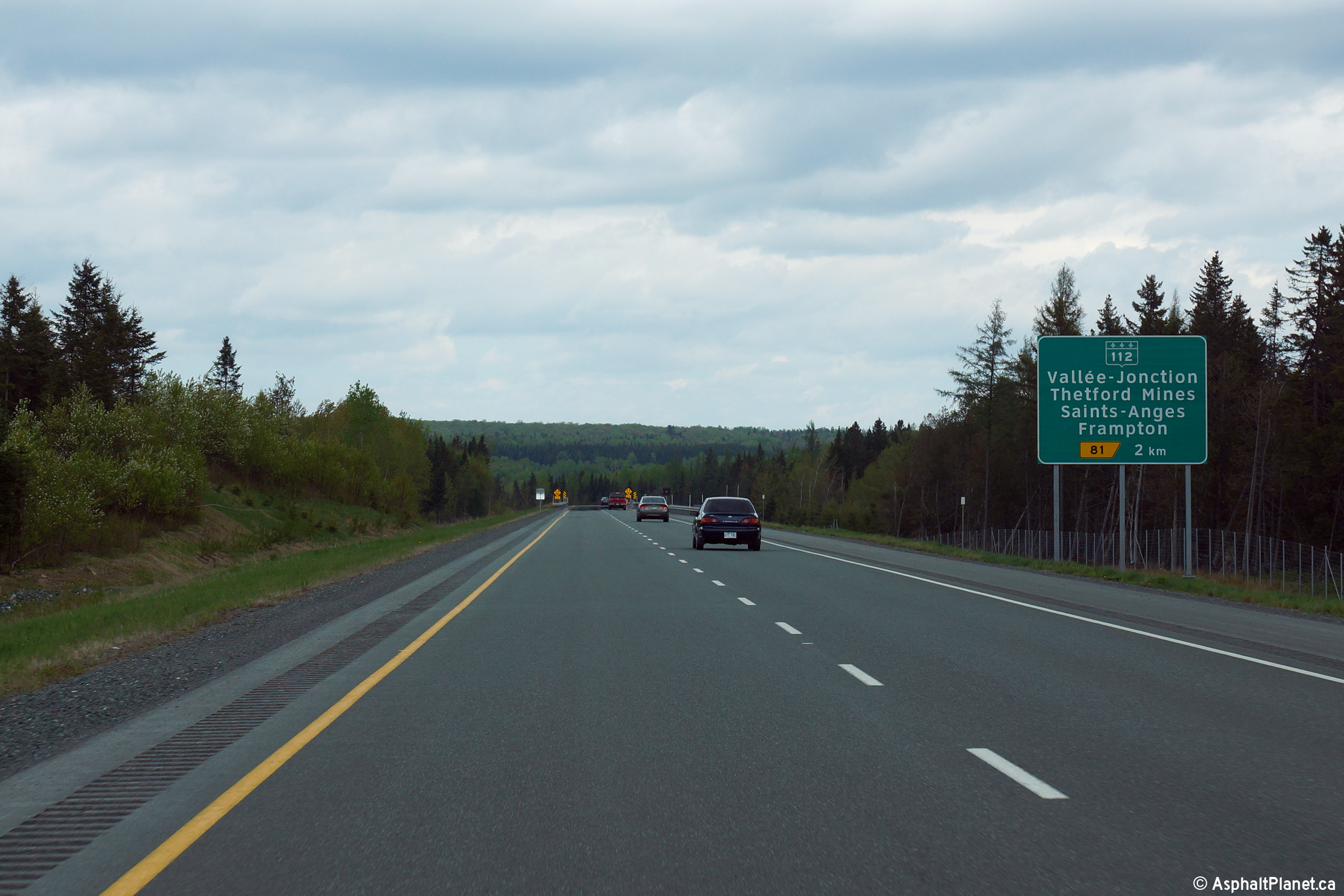
|
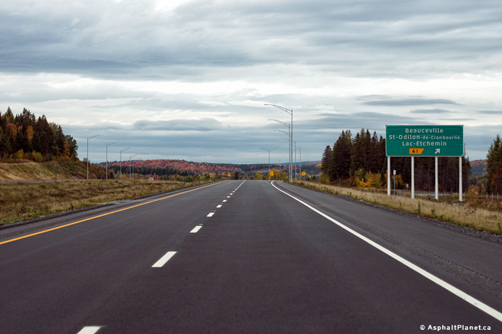
MRC de Nouvelle-Beauce Vallée-Jonction |
Northbound advanced signage for the ramp to Route 112. |
|
||
|
Date: 23/5/2015 |
High-res: (1440x960) (2400x1600) | |||
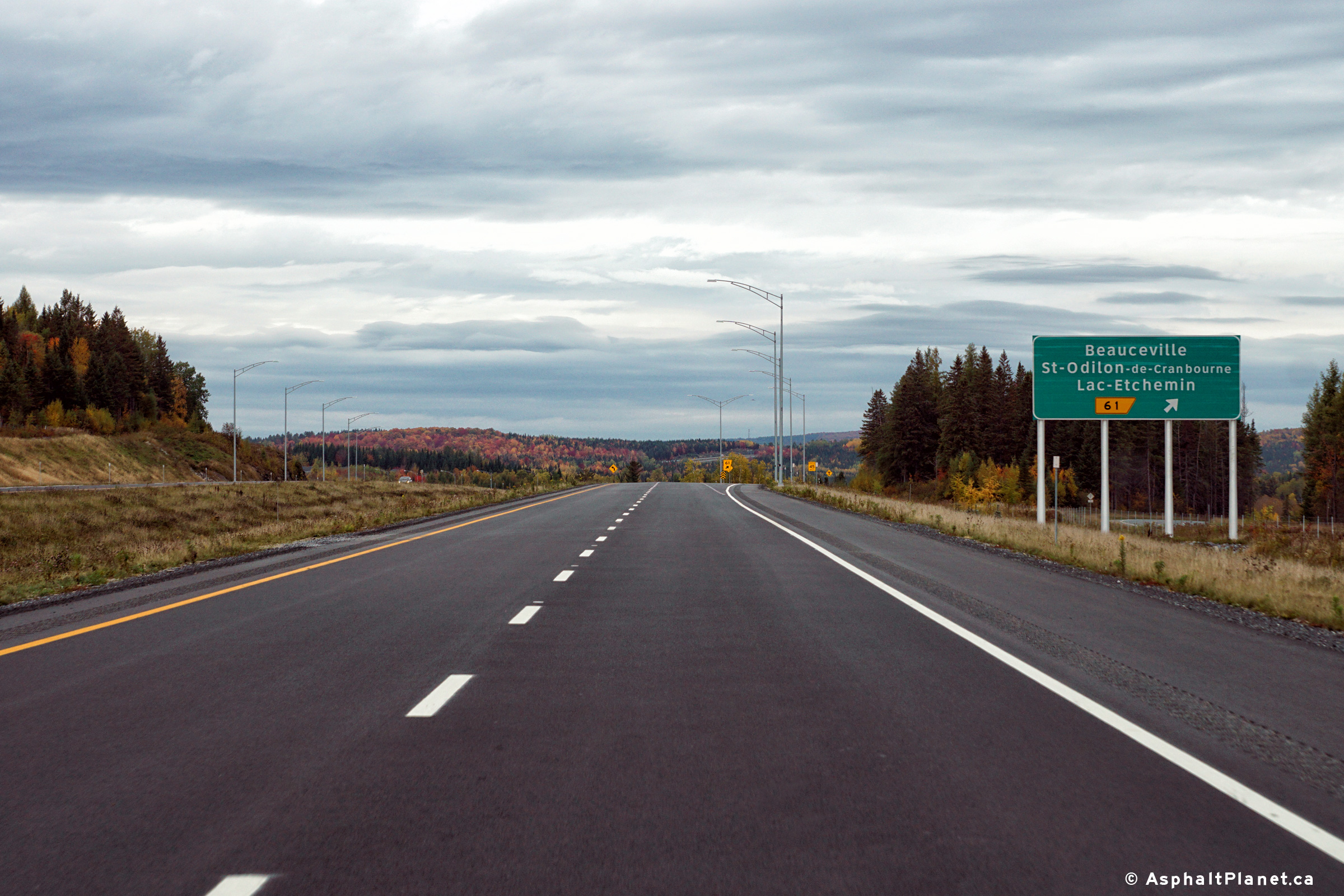
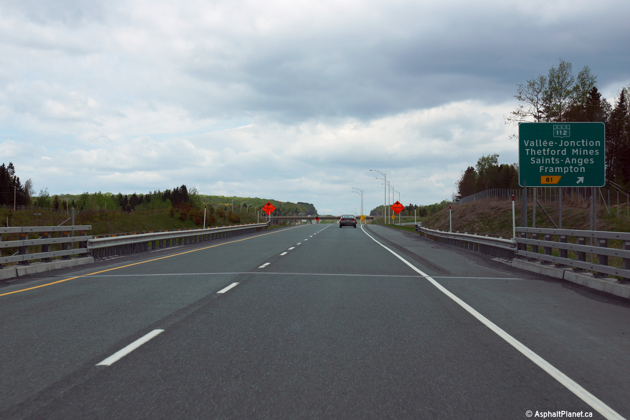
|
MRC de Nouvelle-Beauce Vallée-Jonction |
Signage at the off-ramp to Route 112. |
|
||
|
Date: 23/5/2015 |
High-res: (1440x960) (2400x1600) | |||
| Lévis |
View looking northerly along Autoroute 73 from the on-ramp from Chemin du Golf. |
 |
||
|
Date: 23/5/2015 |
High-res: (1440x960) (2400x1600) | |||
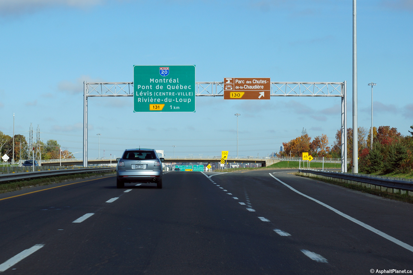
| Lévis |
Northbound advanced signage approaching the A-20 interchange. |
|
||
|
Date: 23/5/2015 |
High-res: (1440x960) (2400x1600) | |||
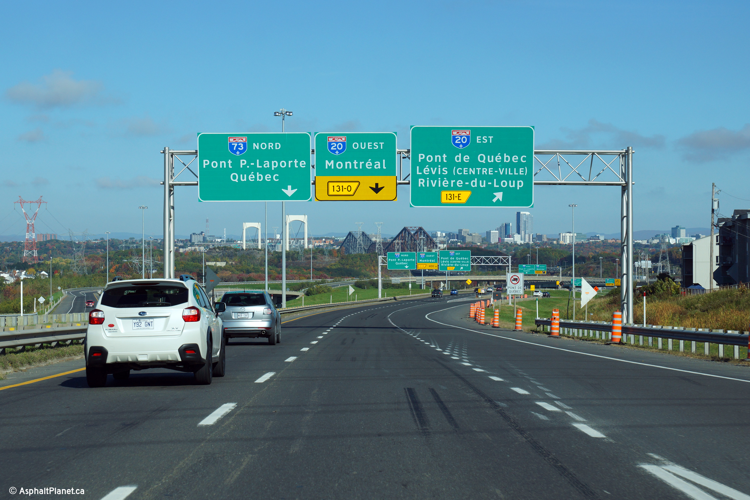
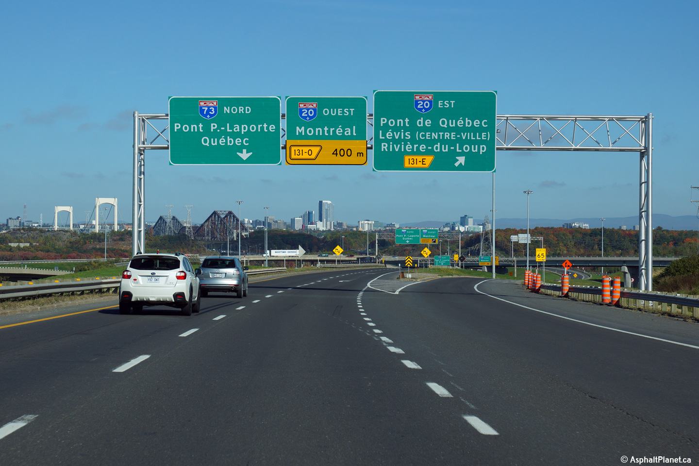
| Lévis |
Signage at the off-ramp to Autoroute 20 East. |
|
||
|
Date: 23/5/2015 |
High-res: (1440x960) (2400x1600) | |||
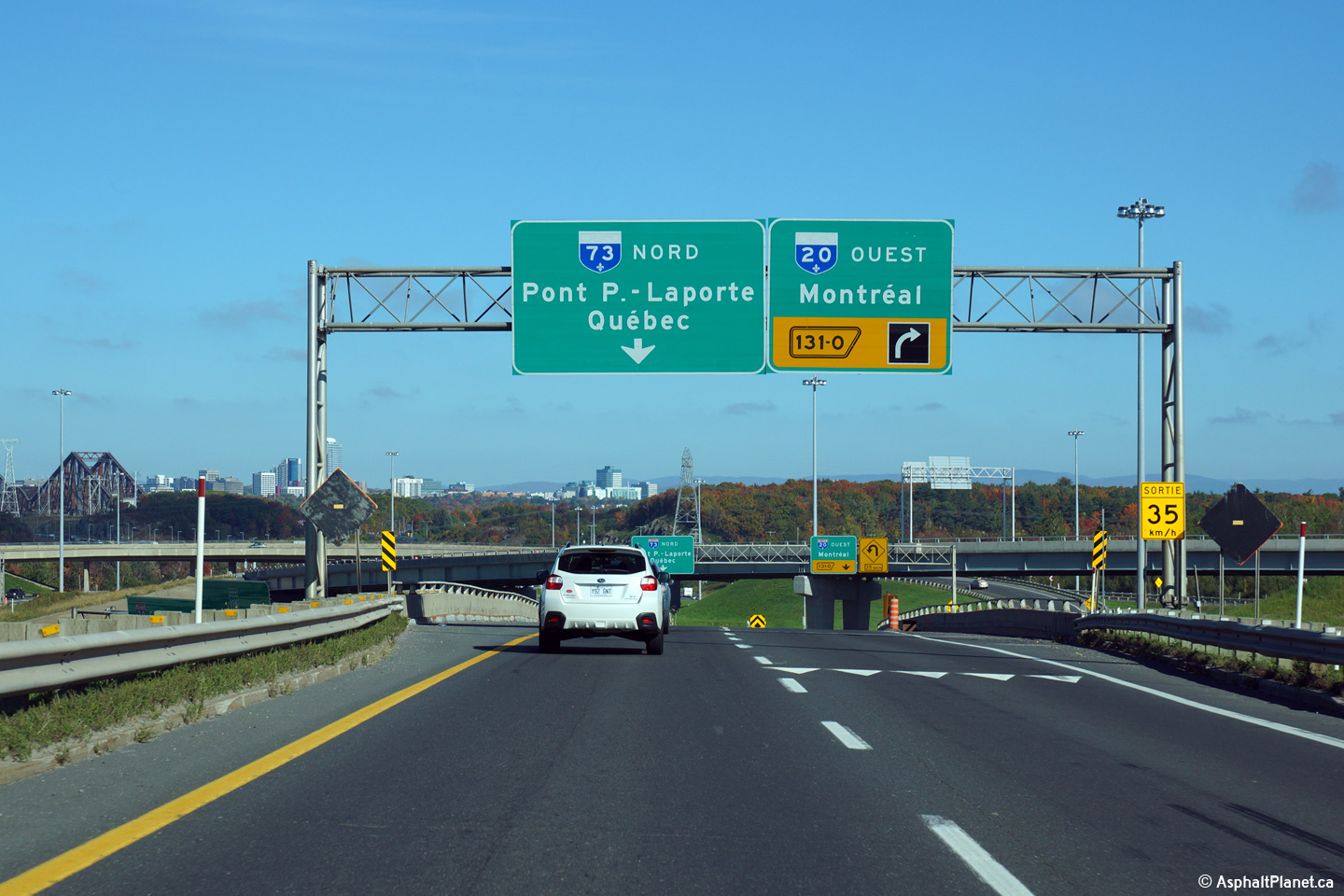
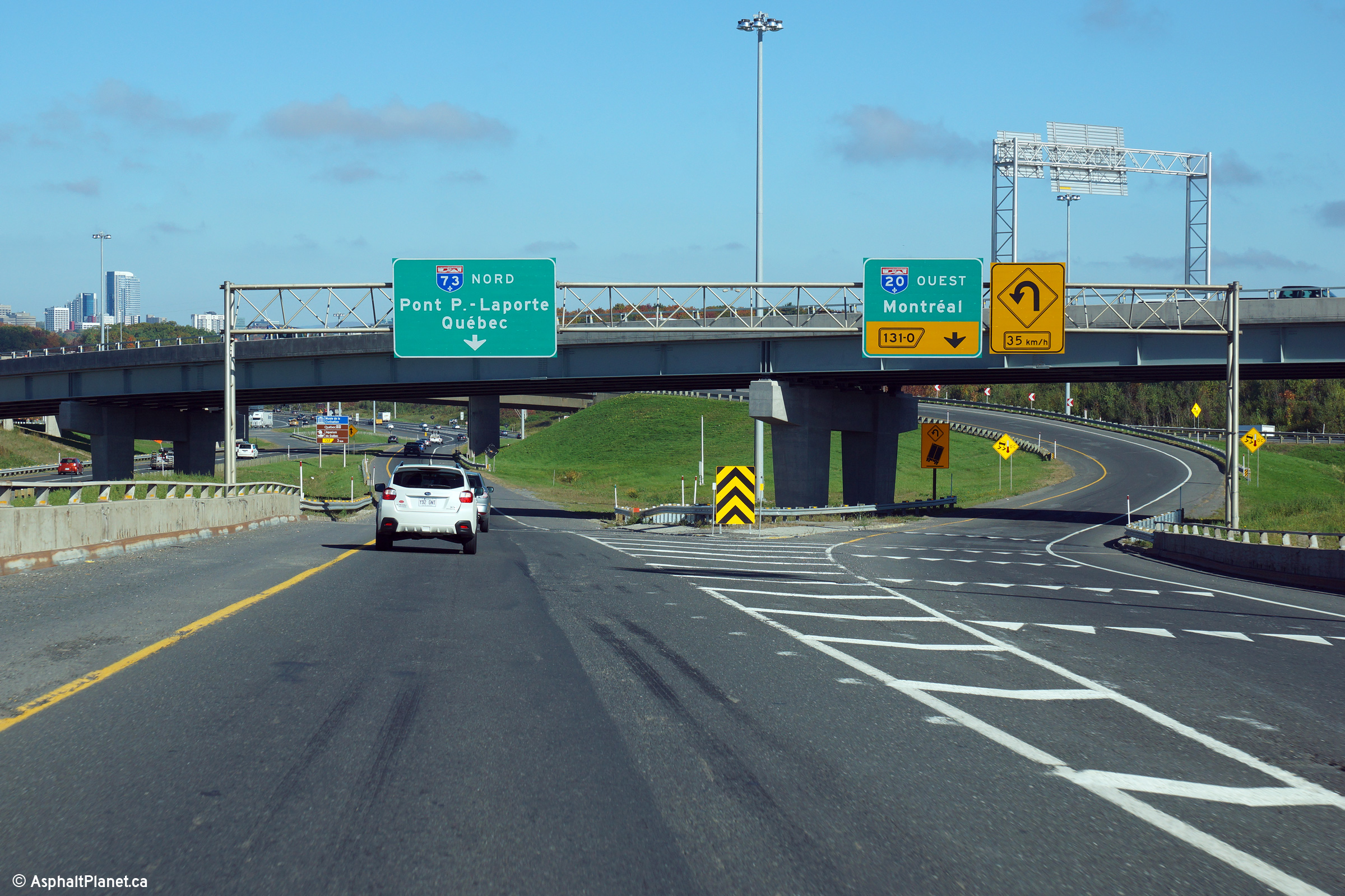
| Lévis |
Northbound advanced signage for the ramp to Autoroute 20 West. The right lane of Autoroute 73 exits the freeway mainline at the ramp to Autoroute 20 West, leaving only a single lane for northbound traffic on Autoroute 73 to use. |
 |
||
|
Date: 23/5/2015 |
High-res: (1440x960) (2400x1600) | |||
| Lévis |
Signage at the off-ramp to Autoroute 20 West from Autoroute 73 North. Traffic bound for Autoroute 20 West must follow a sharp horseshoe shaped ramp that passes overtop of Autoroute 73. Considering how sharp this ramp is, it is somewhat surprising the MTQ didn't elect to construct a more economical loop ramp instead of the long elevated structure. |
|
||
|
Date: 23/5/2015 |
High-res: (1440x960) (2400x1600) | |||
|
Autoroute 20 is the principle route along the south shore of the Saint Lawrence. Click here for A-20 images. |
||||
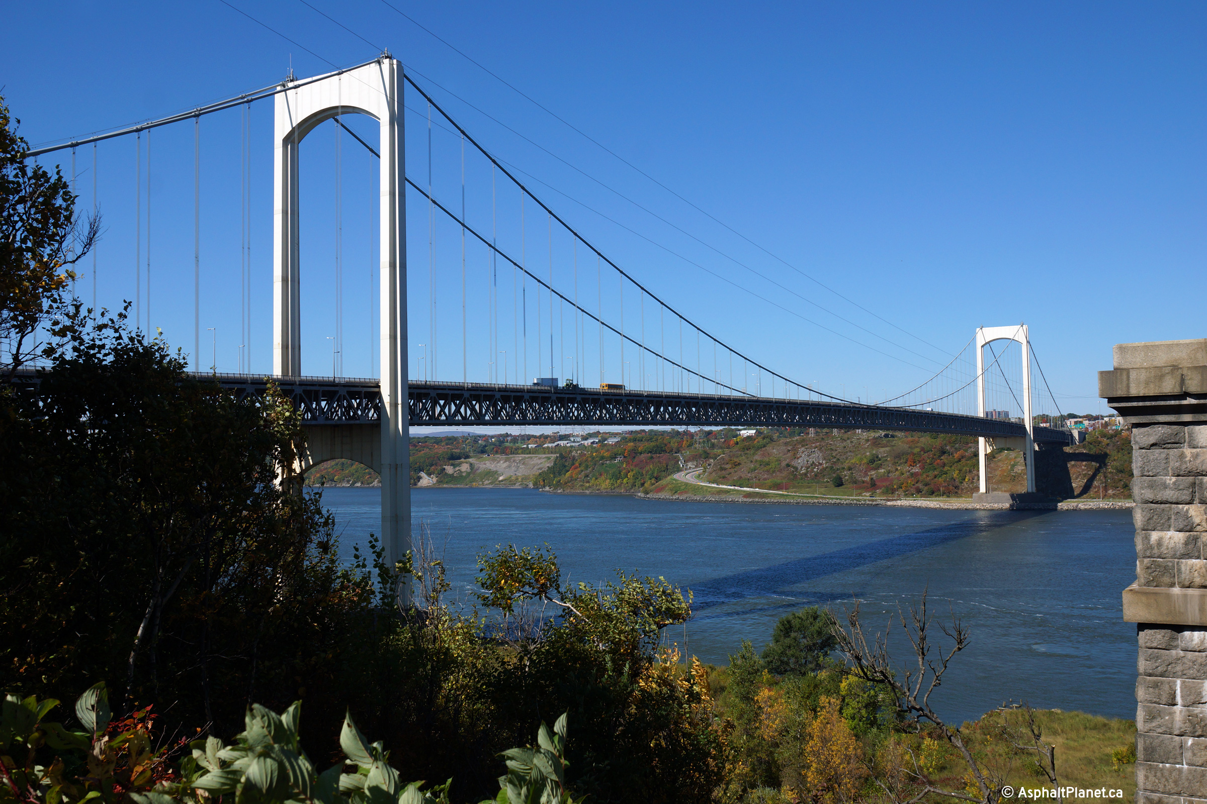
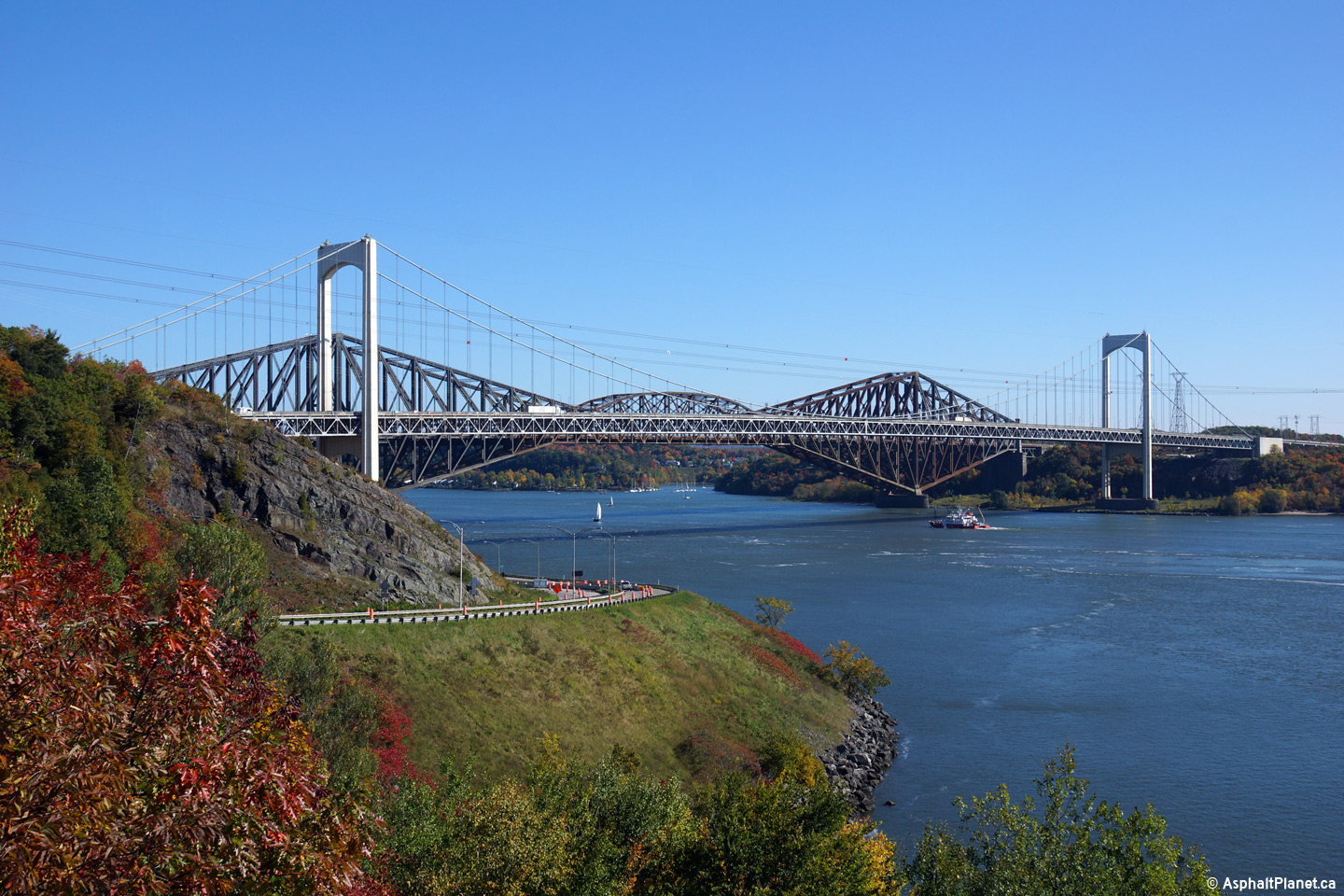
| Lévis |
View looking northerly towards both the Pierre Laporte Bridge and the Québec Bridge from a high rock outcropping immediately to the west of Autoroute 73. |
|
||
|
Date: 2/10/2014 |
High-res: (1440x960) (2400x1600) | |||
| Lévis |
View looking to the northwest towards the Pierre Laporte Bridge from the southern abutment of the adjacent old Quebec Bridge. |
 |
||
|
Date: 2/10/2014 |
High-res: (1440x960) (2400x1600) | |||
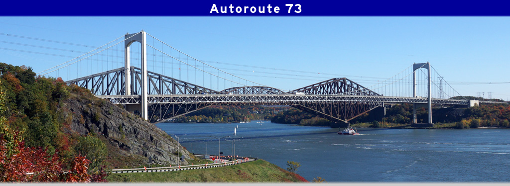
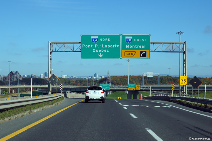
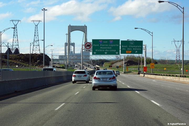
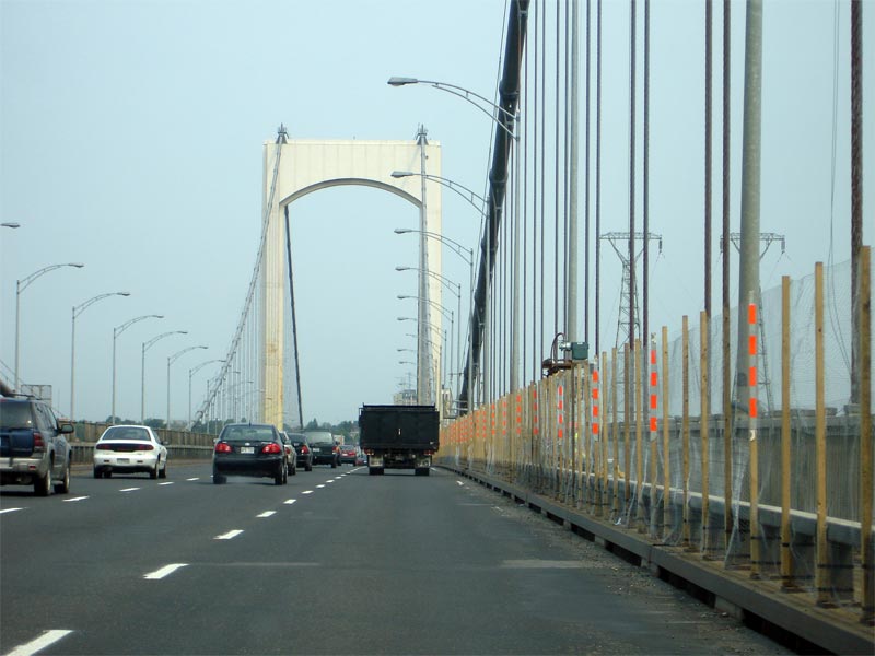
| Lévis |
View looking northerly along A-73 at the approach to Pierre Laporte Bridge, The Laporte Bridge is a 6-lane suspension bridge, and is the main link between the North and South shore of the St. Lawrence River in Quebec City. |
|
||
|
Date: 12/7/2008 |
||||
| Lévis |
Mid-span view of the Laporte bridge on A-73. The Laporte bridge is the longest suspension bridge in Canada. |
|
||
|
Date: 12/7/2008 |
||||
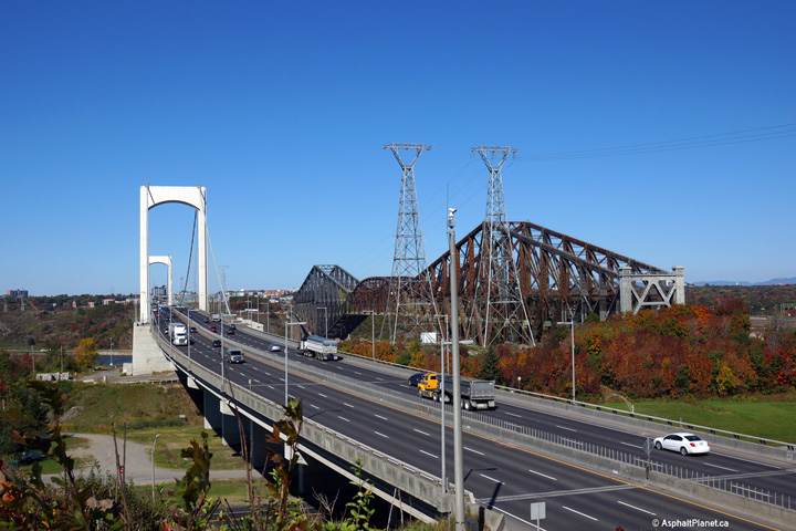
|
Québec |
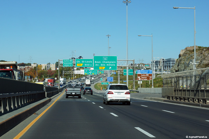
View looking easterly towards the Pierre Laporte Bridge from Parc Gagnon. |
|
||
|
Date: 2/10/2014 |
High-res: (1440x960) (2400x1600) | |||
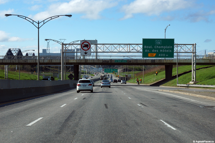
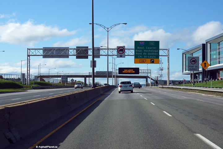
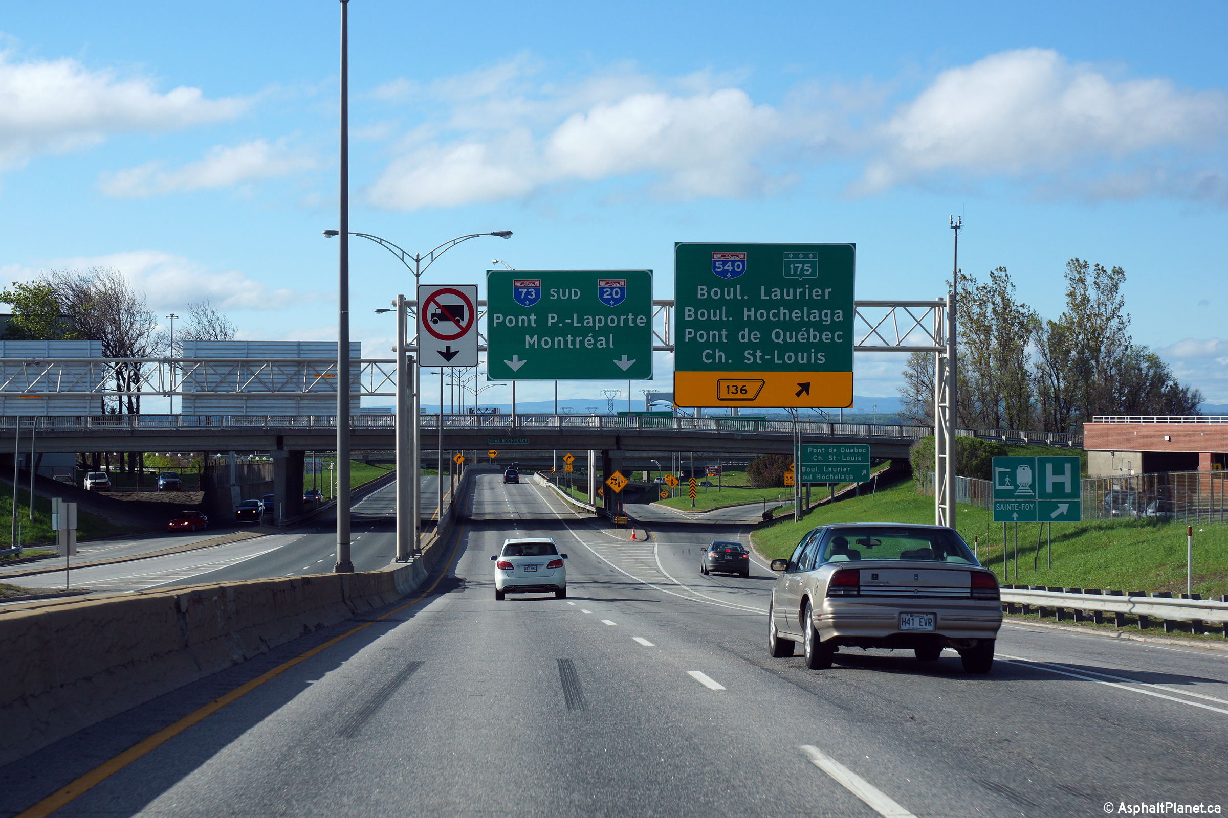
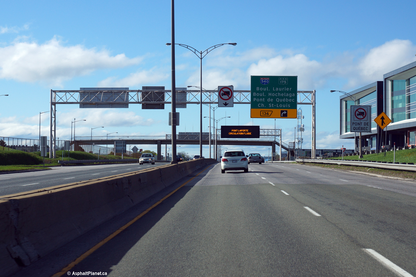
|
Québec |
The northbound off-ramp to Route 136 is situated just beyond the northern touchdown of the Laporte Bridge. Route 136 is a scenic road that follows the north shore of the Saint Lawrence into the heart of old town Québec City. Click here for a photo of this signage as it existed in July, 2008. |
 |
||
|
Date: 2/10/2014 |
High-res: (1440x960) (2400x1600) | |||
|
Québec |
This advanced diagram sign stands just beyond the northbound off-ramp to Route 136. |
 |
||
|
Date: 2/10/2014 |
High-res: (1440x960) (2400x1600) | |||
|
Québec |
Southerly view as Autoroute 73 descends into the Famine River Valley. |
 |
||
|
Date: 23/5/2015 |
High-res: (1440x960) (2400x1600) | |||
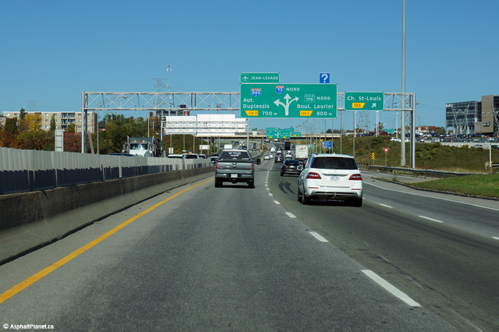
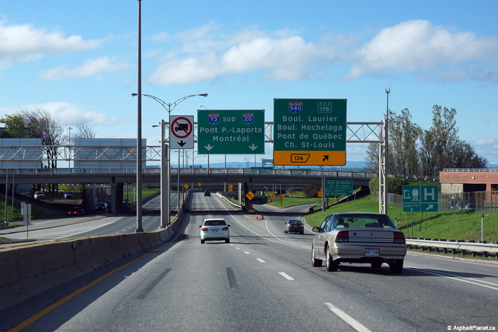
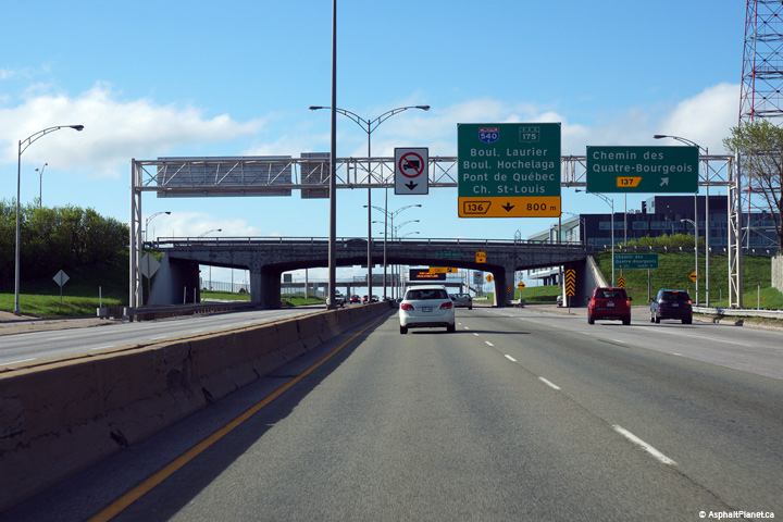
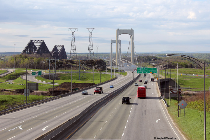
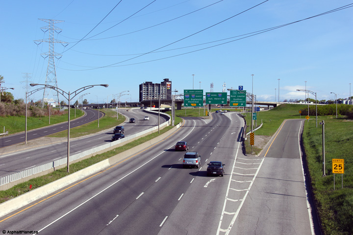
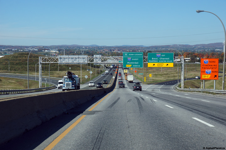
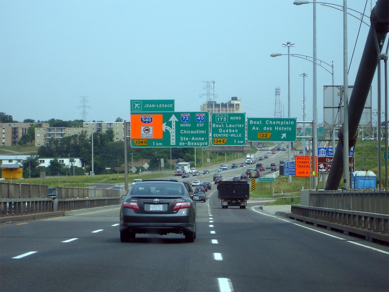
|
Québec |
A-73 meets A-540 and Route-175 at a large three level interchange with high-speed movements favouring to and from the south. |

|
||
|
Date: 12/7/2008 |
||||
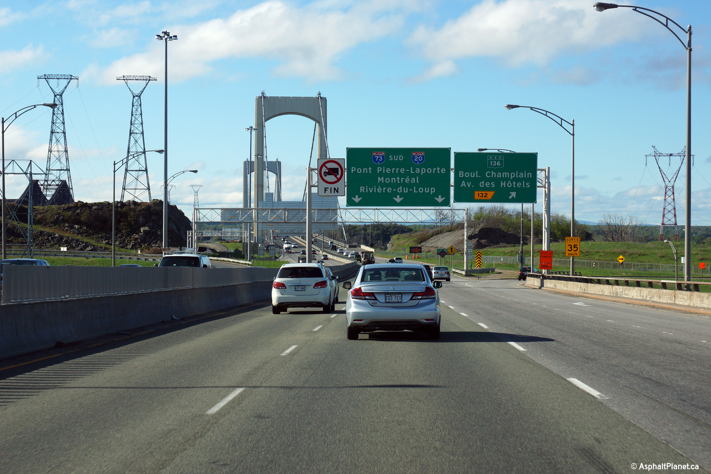
|
Québec |
View looking southerly towards the approach to Pierre Laporte Bridge, The Laporte Bridge is a 6-lane suspension bridge, and is the main link between the North and South shore of the St. Lawrence River in Quebec City. |
|
||
| High-res: (1440x960) (2400x1600) | ||||
|
|
||||
|
Date: 24/5/2015 |
High-res: (1440x960) (2400x1600) | |||
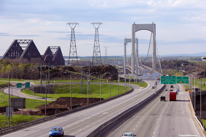
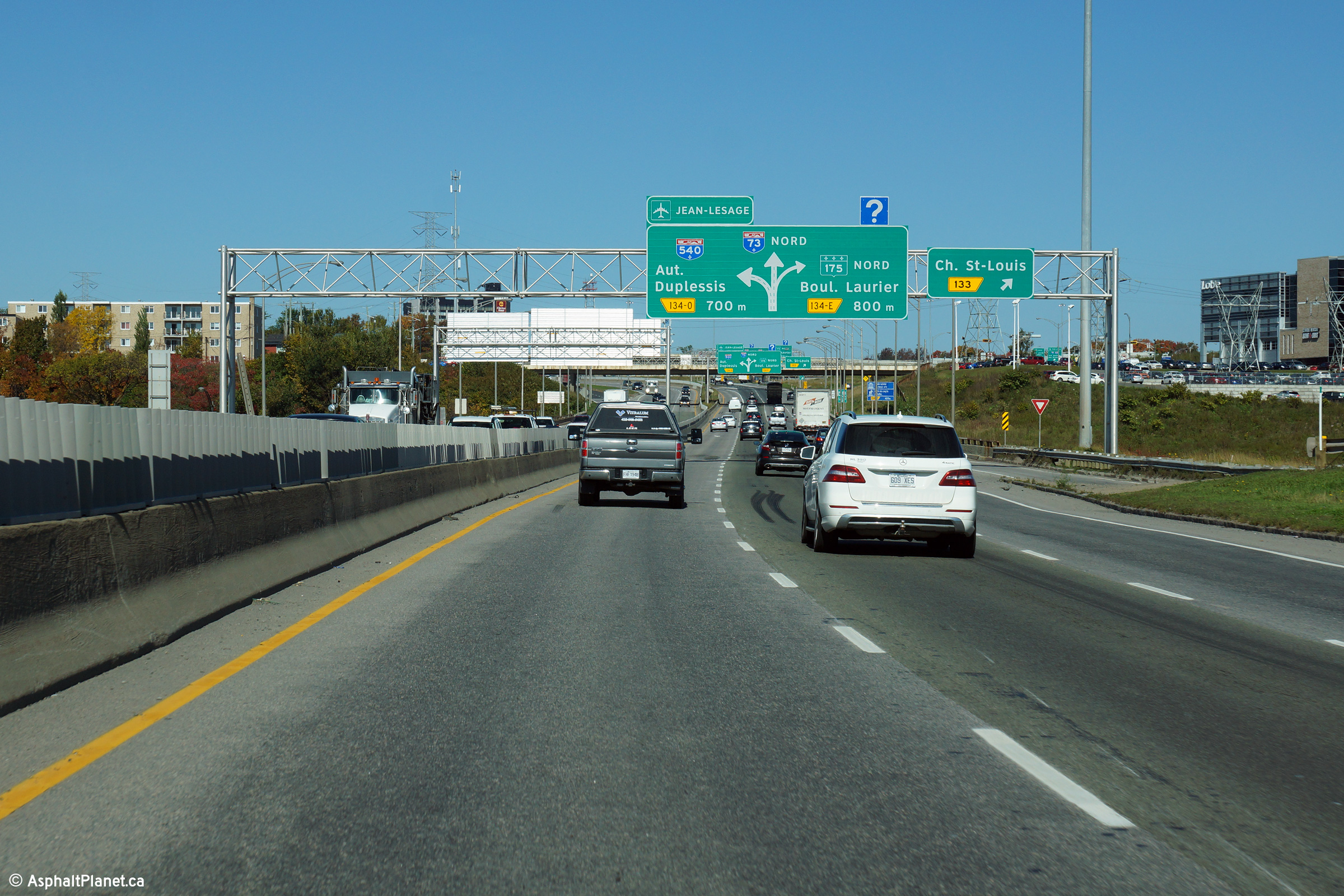
|
Québec |
View looking northerly to the Autoroute 540 interchange from the Chemin Saint-Louis overpass. |
|
||
|
Date: 24/5/2015 |
High-res: (1440x960) (2400x1600) | |||
|
Québec |
Southerly view as Autoroute 73 descends into the Famine River Valley. |
 |
||
|
Date: 23/5/2015 |
High-res: (1440x960) (2400x1600) | |||
|
Québec |
Two lanes continue north through the A-540/R-175 interchange. |
|
||
|
Date: 12/7/2008 |
High-res | |||
|
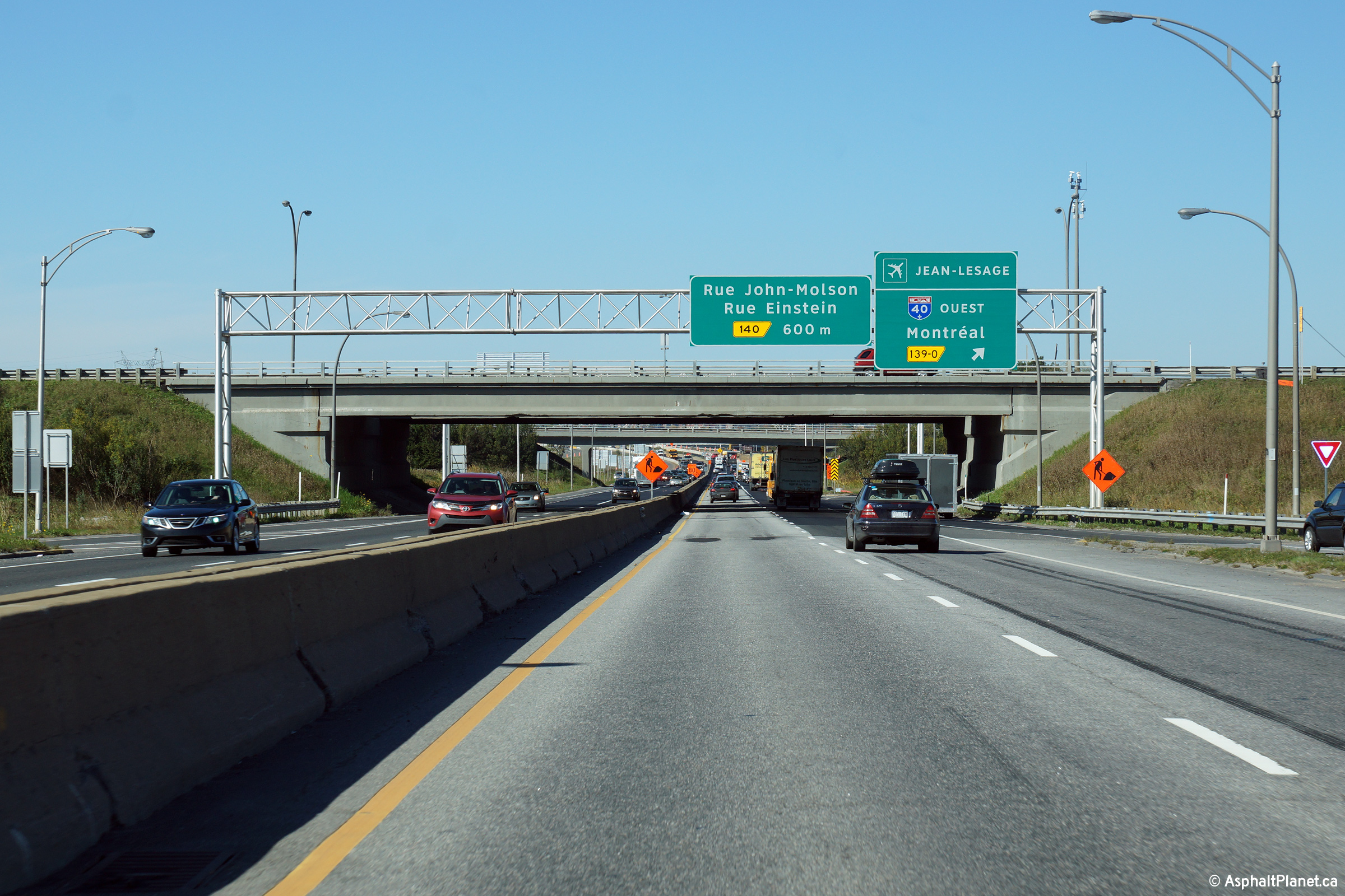
Autoroute 540 is a short connector highway that runs through western Ste-Foy northerly from A-73 to A-40 and Jean Lasage Airport. Click here for A-540 images. |
||||
|
Québec |
View looking southerly as the off-ramp to Autoroute 540 departs from the southbound side of Autoroute 73. The off-ramp to Autoroute 540 splits several times before eventually leading traffic to both Autoroute 540 and Route 175 South. |
 |
||
|
Date: 23/5/2015 |
High-res: (1440x960) (2400x1600) | |||
|
Québec |
Southbound advanced signage approaching the Autoroute 540 interchange. The right-most lane from Autoroute 73 exits the freeway mainline at this interchange destined for Autoroute 540. |
 |
||
|
Date: 23/5/2015 |
High-res: (1440x960) (2400x1600) | |||
|
Québec |
Southerly view at the off-ramp to Chemin des Quatre-Bourgeois. |
 |
||
|
Date: 23/5/2015 |
High-res: (1440x960) (2400x1600) | |||
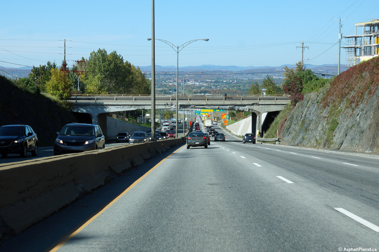
|
Québec |
North of the A-540/R-175 interchange, A-73 descends down a large hill towards the A-40/A-440 interchange. |

|
||
|
Date: 12/7/2008 |
||||
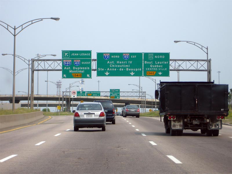
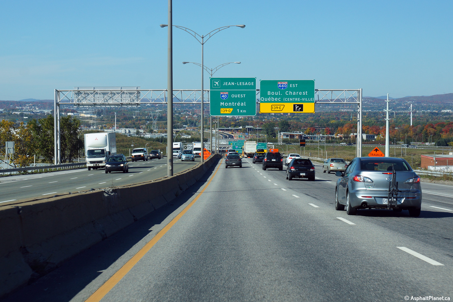
|
Québec |
Again through the A-40/A-440 interchange only 2 northbound lanes continue through the interchange. |
|
||
|
Date: 12/7/2008 |
||||
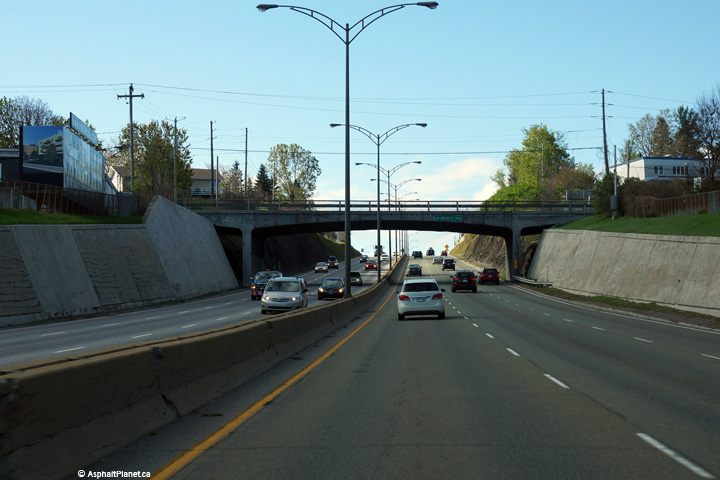
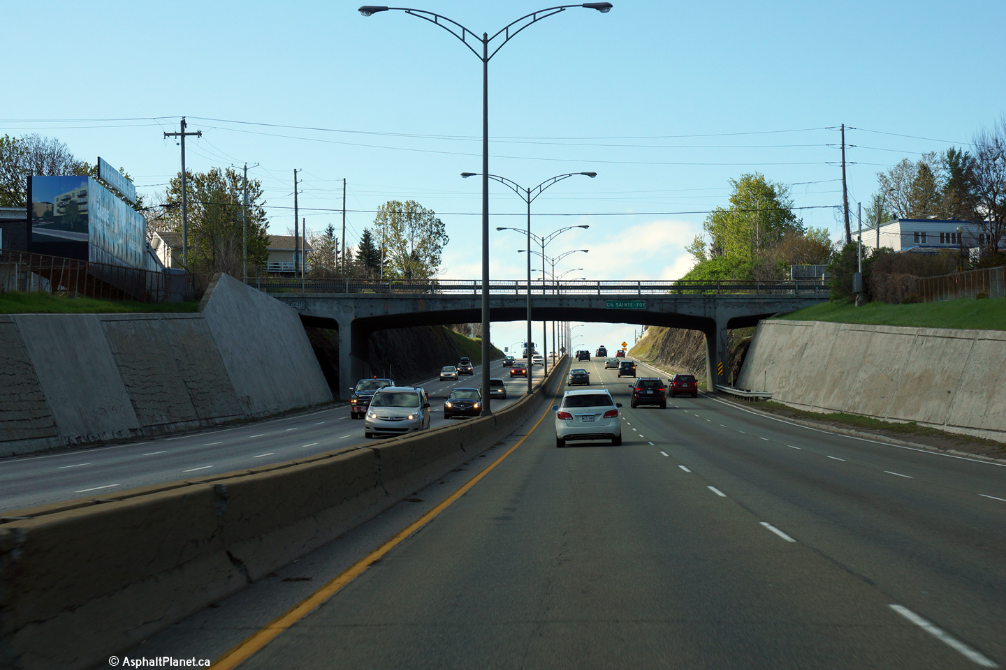
|
Québec |
View looking northerly as Autoroute 73 passes beneath the Chemin Ste-Foy overpass as the highway descends the long grade towards the Autoroute 40 interchange. As is evident from the photos, this section of Autoroute 73 is due for some upgrades and modernization. |
 |
||
|
Date: 12/7/2008 |
High-res: (1440x960) (2400x1600) | |||
|
Québec |
Southerly view as Autoroute 73 passes beneath the Chemin Ste-Foy overpass. |
 |
||
|
Date: 23/5/2015 |
High-res: (1440x960) (2400x1600) | |||
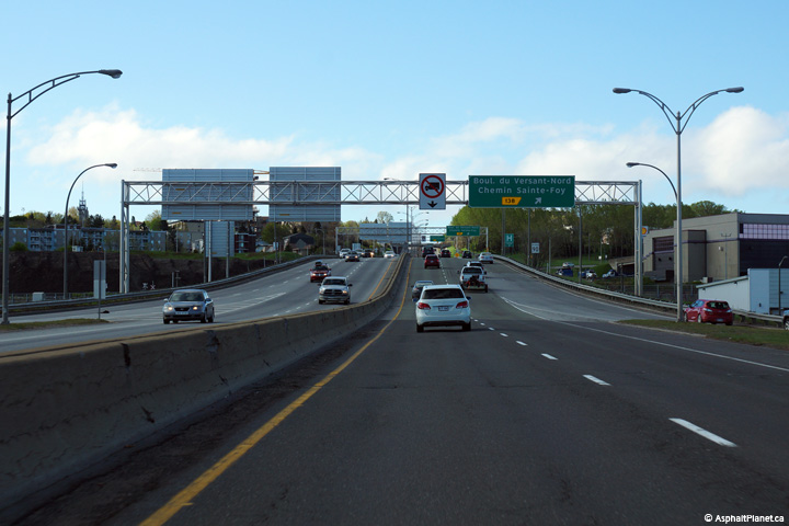
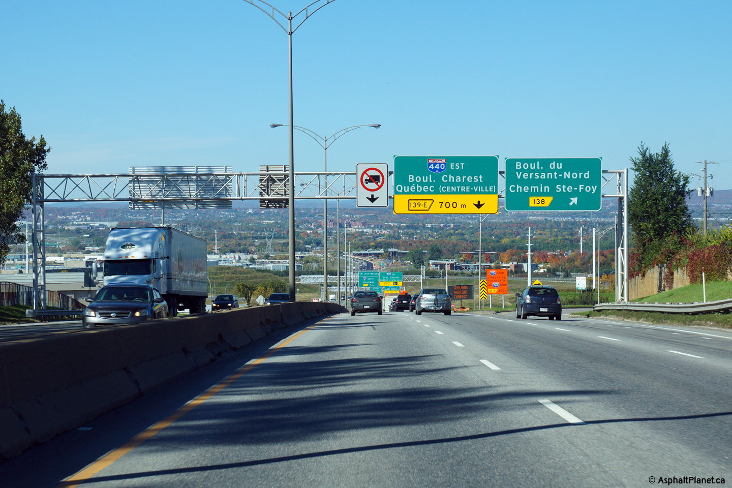
|
Quebec |
Northbound view at the off-ramp to Chemin Ste-Foy and Boul. du Versant-Nord. |
|
||
|
Date: 2/10/2014 |
High-res: (1440x960) (2400x1600) | |||
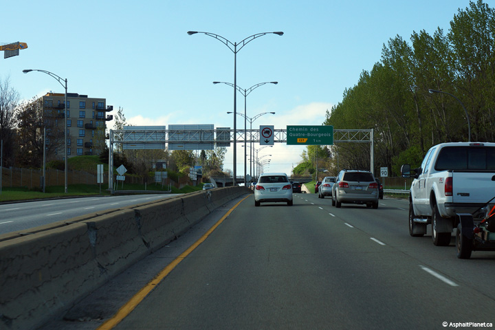
|
Québec |
Southbound advanced signage for the Chemin des Quatre-Bourgeois interchange. |
 |
||
|
Date: 23/5/2015 |
High-res: (1440x960) (2400x1600) | |||
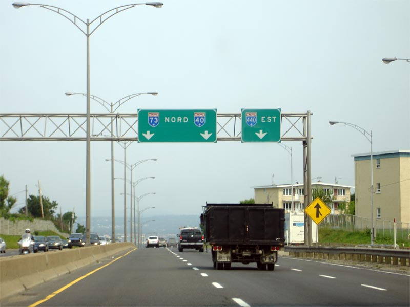
|
Québec |
Advanced signage for the off-ramp to A-440 East. |
|
||
|
Date: 2/10/2014 |
High-res: (1440x960) (2400x1600) | |||
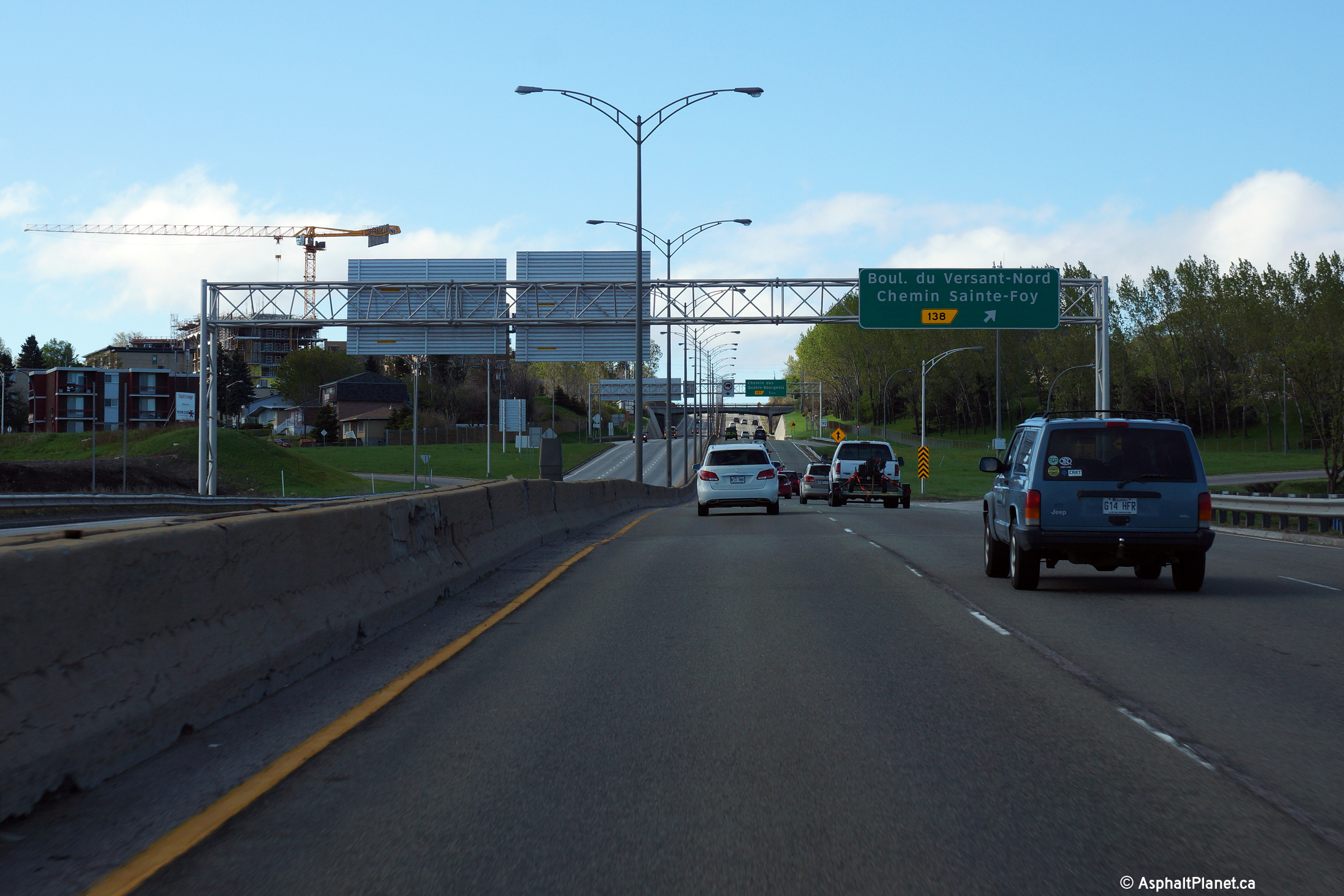
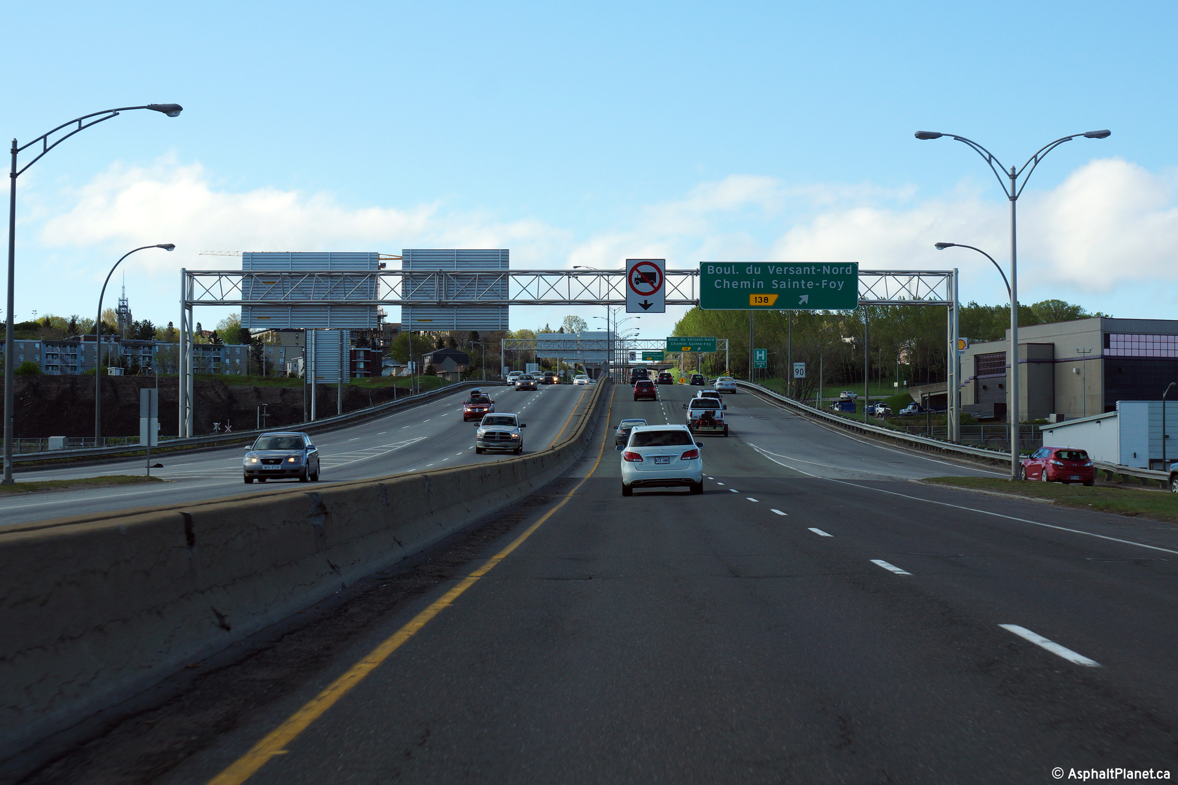
|
Québec |
Southbound view at the off-ramp to Chemin Ste-Foy and Boul. du Versant-Nord. |
 |
||
|
Date: 23/5/2015 |
High-res: (1440x960) (2400x1600) | |||
|
Quebec |
Signage for the northbound off-ramp to A-440. A-73 meets A-40/A-440 at a three-quarter cloverleaf interchange with a directional ramp instead of a loop ramp for westbound to southbound movements. |
|
||
|
Date: 2/10/2014 |
High-res: (1440x960) (2400x1600) | |||
|
Québec |
Southbound view along Autoroute 73 as the on-ramp from Autoroute 40 West joins the southbound lanes of the freeway. Notice that the right lane from the freeway merges directly with the left-lane from the incoming lane at this interchange. |
 |
||
|
Date: 23/5/2015 |
High-res: (1440x960) (2400x1600) | |||
|
Québec |
Signage for the northbound off-ramp to A-440. A-73 meets A-40/A-440 at a three-quarter cloverleaf interchange with a directional ramp instead of a loop ramp for westbound to southbound movements. |
 |
||
|
Date: 2/10/2014 |
High-res: (1440x960) (2400x1600) | |||
|
Autoroute 40 is the principle route along the north shore of the Saint Lawrence. Click here for A-40 images. |
||||
<- A-70
PQ Highways
A-85 ->
Asphaltplanet.ca
© 2008-2016 AsphaltPlanet.ca.
AsphaltPlanet@asphaltplanet.ca
Page Created: December 13, 2008.
Last Updated: October 14, 2016.


