|
|
|
|
|
|
South-
Bound
|
|
Both Autoroute 73 and Route 175 are accessible from
the southern terminus of Autoroute 540. Click
here for A-73 images and
here for R-175 images.
|
|
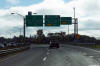
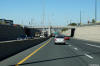
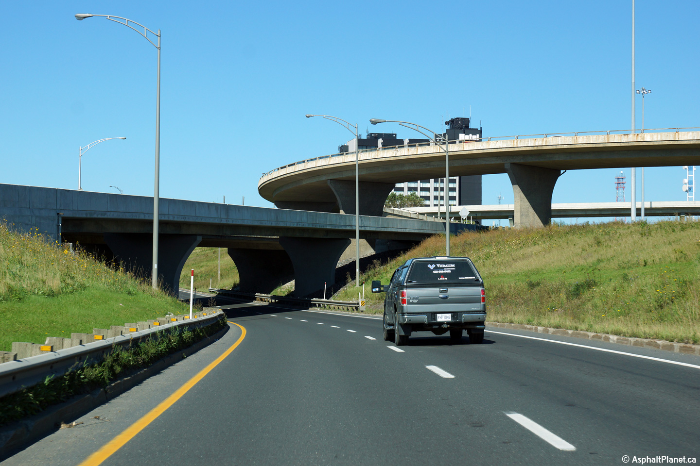
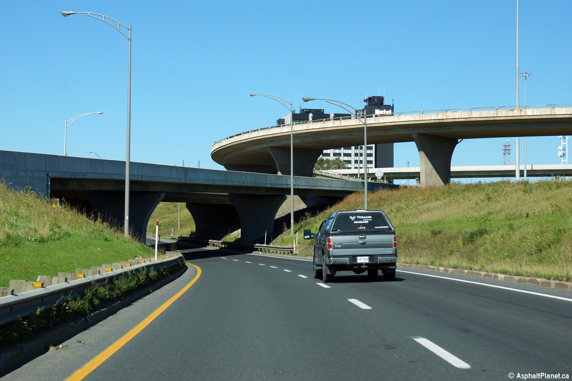
Ville de Québec
|
View of the A-73/A-540 interchange as seen from the ramp from A-73 north
to A-540 north. |
 |
|
Photographed by: AsphaltPlanet.ca |
Date: 10/02/2014 |
High-res:
(1440x960)
(2400x1600) |
|
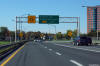
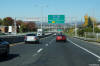
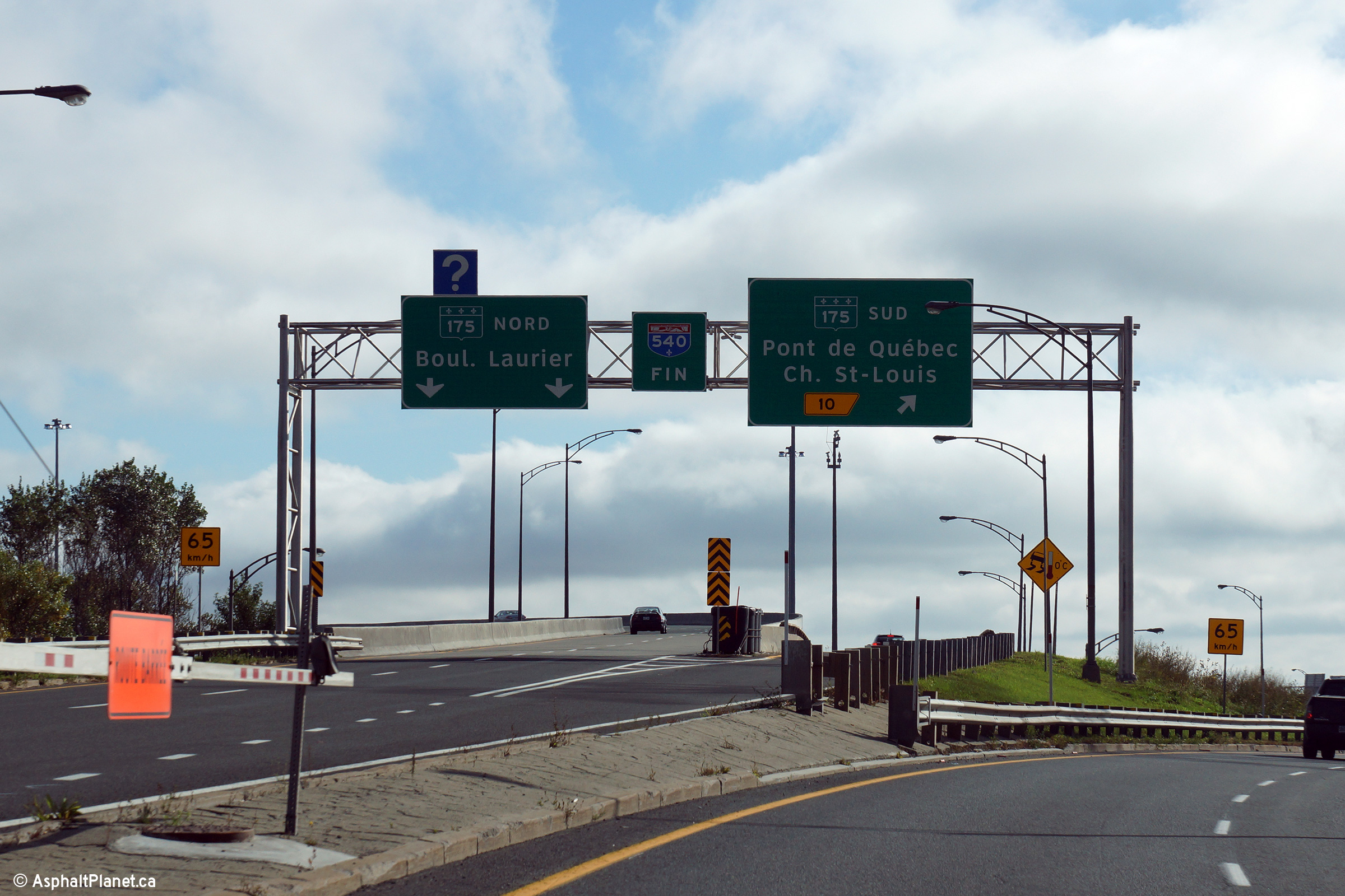
Ville de Québec
|
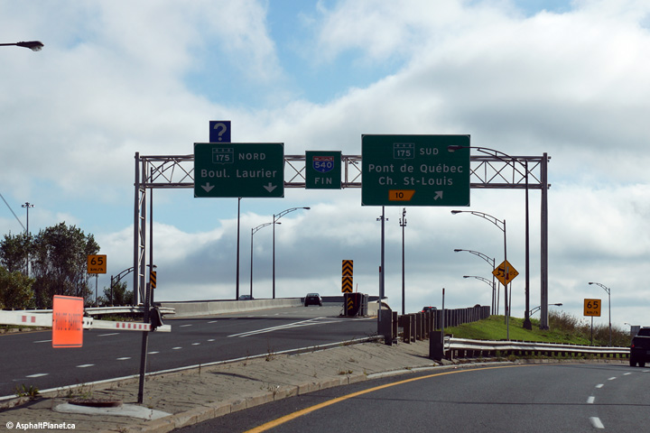
Signage as the southbound lanes of Autoroute 540 split into ramps to
both directions of Route 175. |
 |
|
Photographed by: AsphaltPlanet.ca |
Date: 10/03/2014 |
High-res:
(1440x960)
(2400x1600) |
|
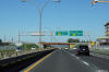
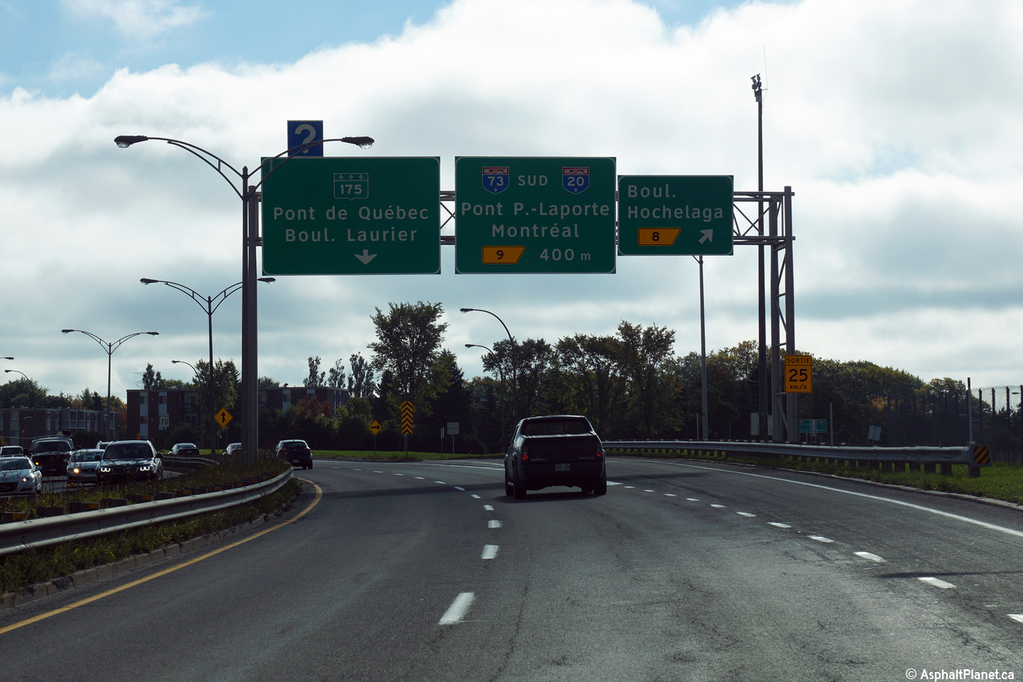
Ville de Québec
|
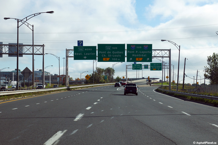
Southbound signage at the off-ramp to Autoroute 73 South. |
 |
|
Photographed by: AsphaltPlanet.ca |
Date: 10/03/2014 |
High-res:
(1440x960)
(2400x1600) |
|
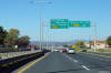
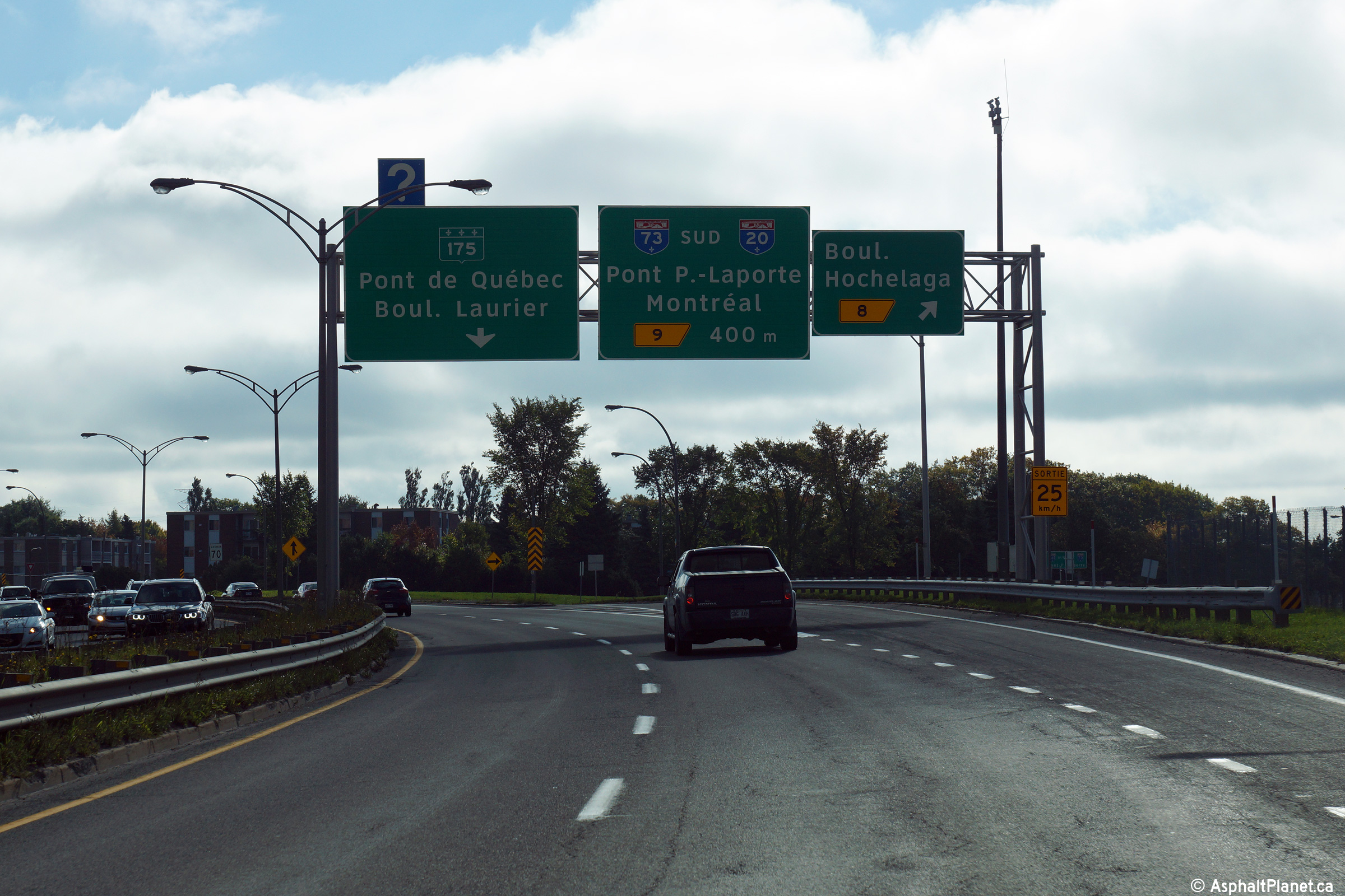
Ville de Québec
|
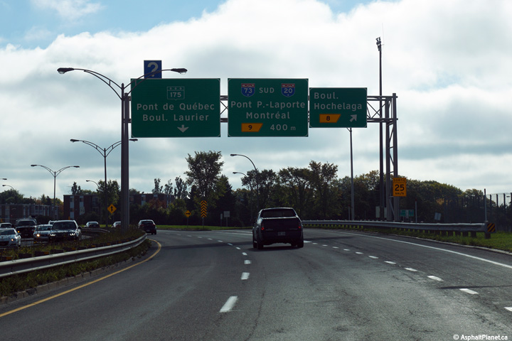
Southbound signage at the off-ramp to Boulevard Hochelaga. |
 |
|
Photographed by: AsphaltPlanet.ca |
Date: 10/03/2014 |
High-res:
(1440x960)
(2400x1600) |
|
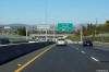
Ville de Québec
|
This sign stands as the ramp from Autoroute 73 north joins the mainline
lanes of Autoroute 540 North. |
 |
|
Photographed by: AsphaltPlanet.ca |
Date: 10/02/2014 |
High-res:
(1440x960)
(2400x1600) |
|
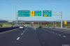
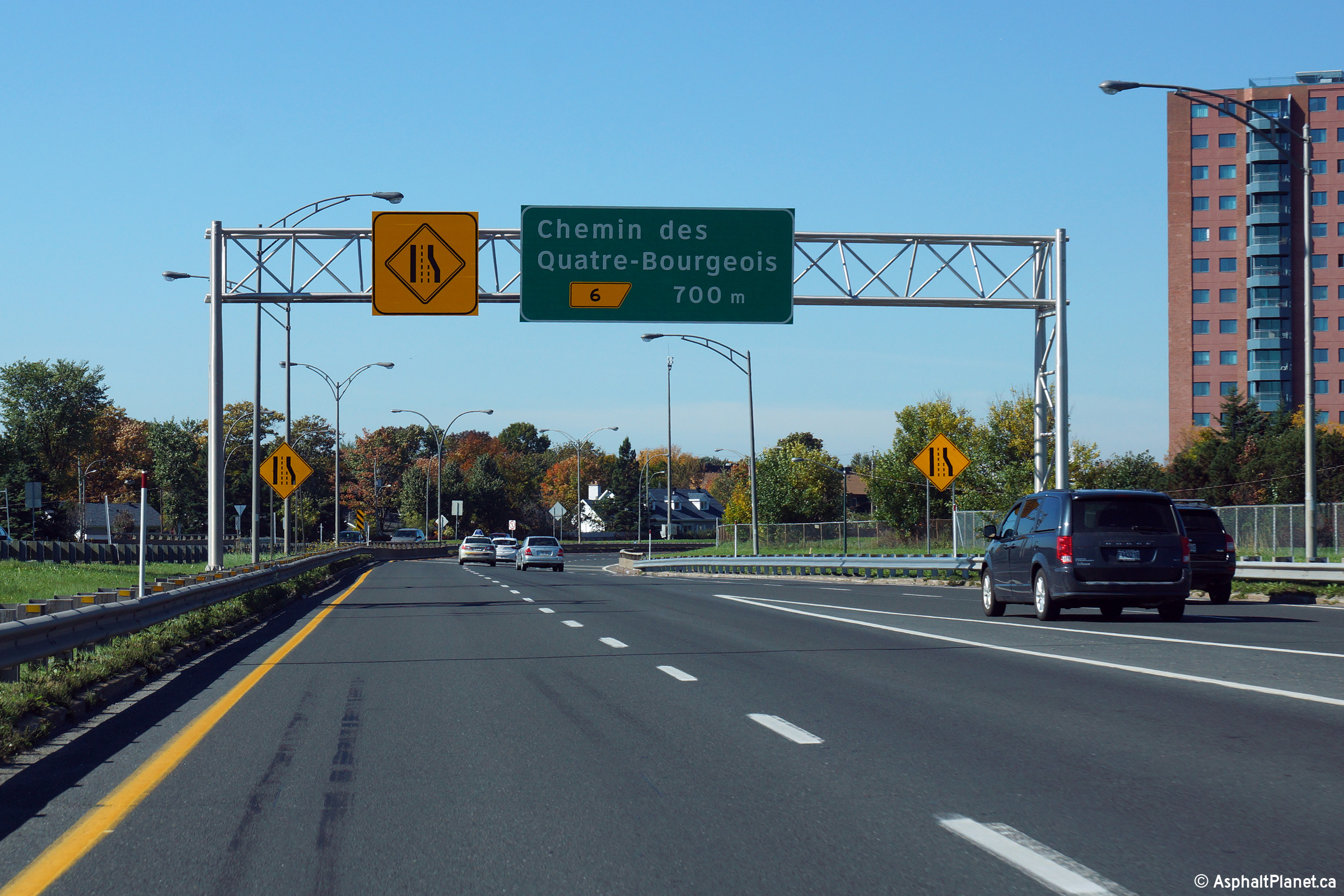
Ville de Québec
|
Northbound signage at the off-ramp to Chemin des Quatres-Bourgeois. |
 |
|
Photographed by: AsphaltPlanet.ca |
Date: 10/02/2014 |
High-res:
(1440x960)
(2400x1600) |
|
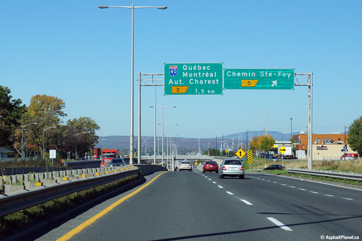
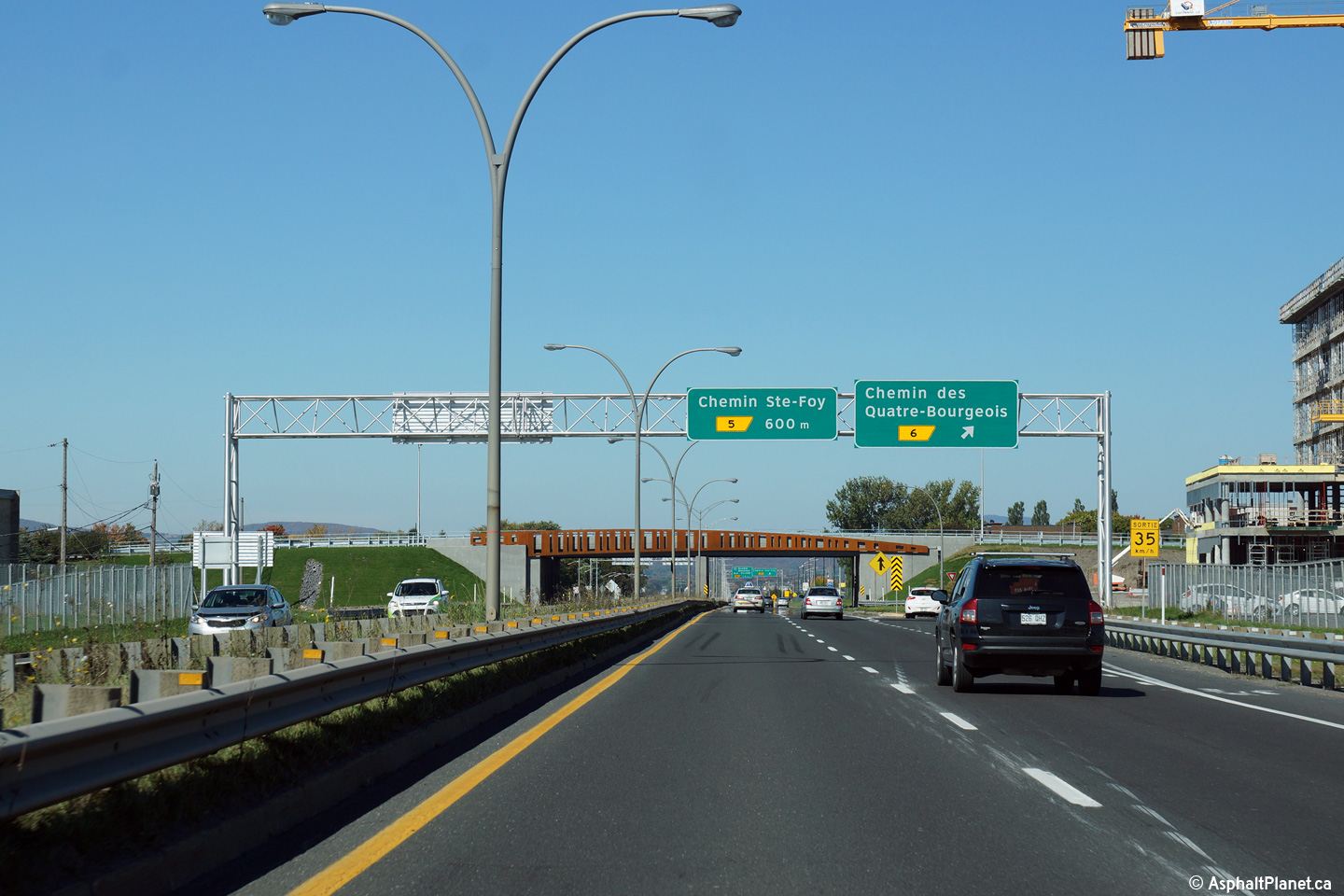
Ville de Québec
|
Northbound signage at the off-ramp to Chemin Ste-Foy. |
 |
|
Photographed by: AsphaltPlanet.ca |
Date: 10/02/2014 |
High-res:
(1440x960)
(2400x1600) |
|
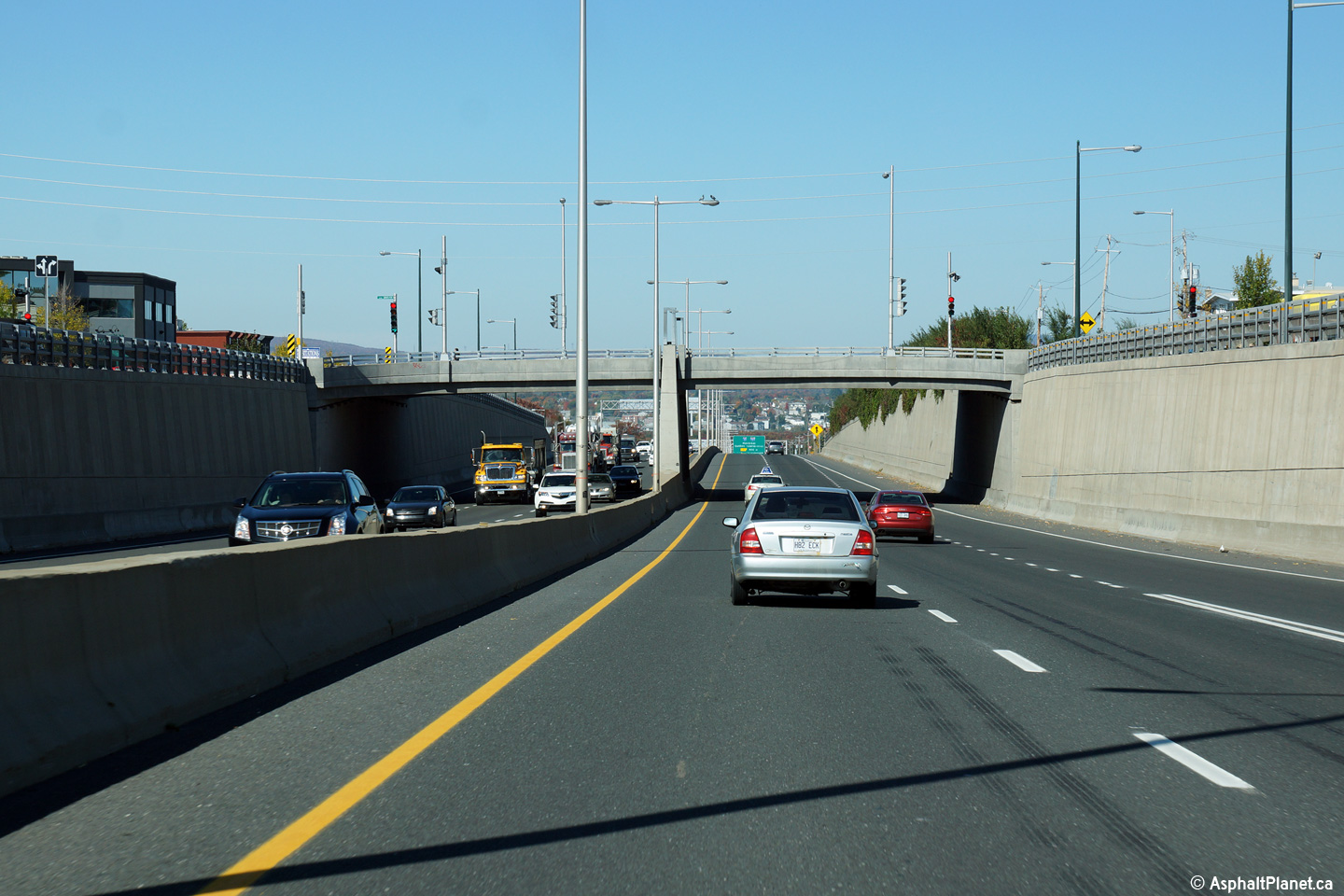
Ville de Québec
|
View looking northerly through the Chemin Ste-Foy overpass. |
 |
|
Photographed by: AsphaltPlanet.ca |
Date: 10/02/2014 |
High-res:
(1440x960)
(2400x1600) |
|
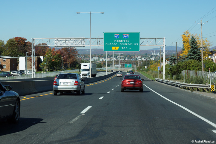
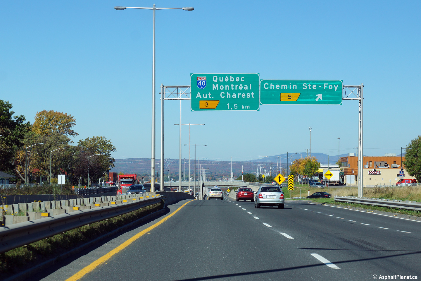
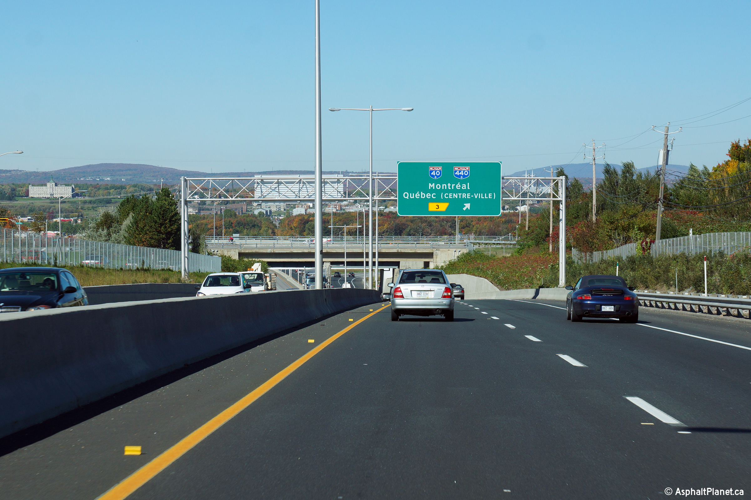
Ville de Québec
|
Northbound advanced signage for the Autoroute 40/440 interchange located
beyond the Chemin Ste-Foy interchange. |
 |
|
Photographed by: AsphaltPlanet.ca |
Date: 10/02/2014 |
High-res:
(1440x960)
(2400x1600) |
|
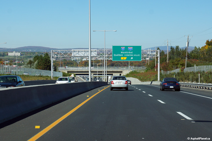
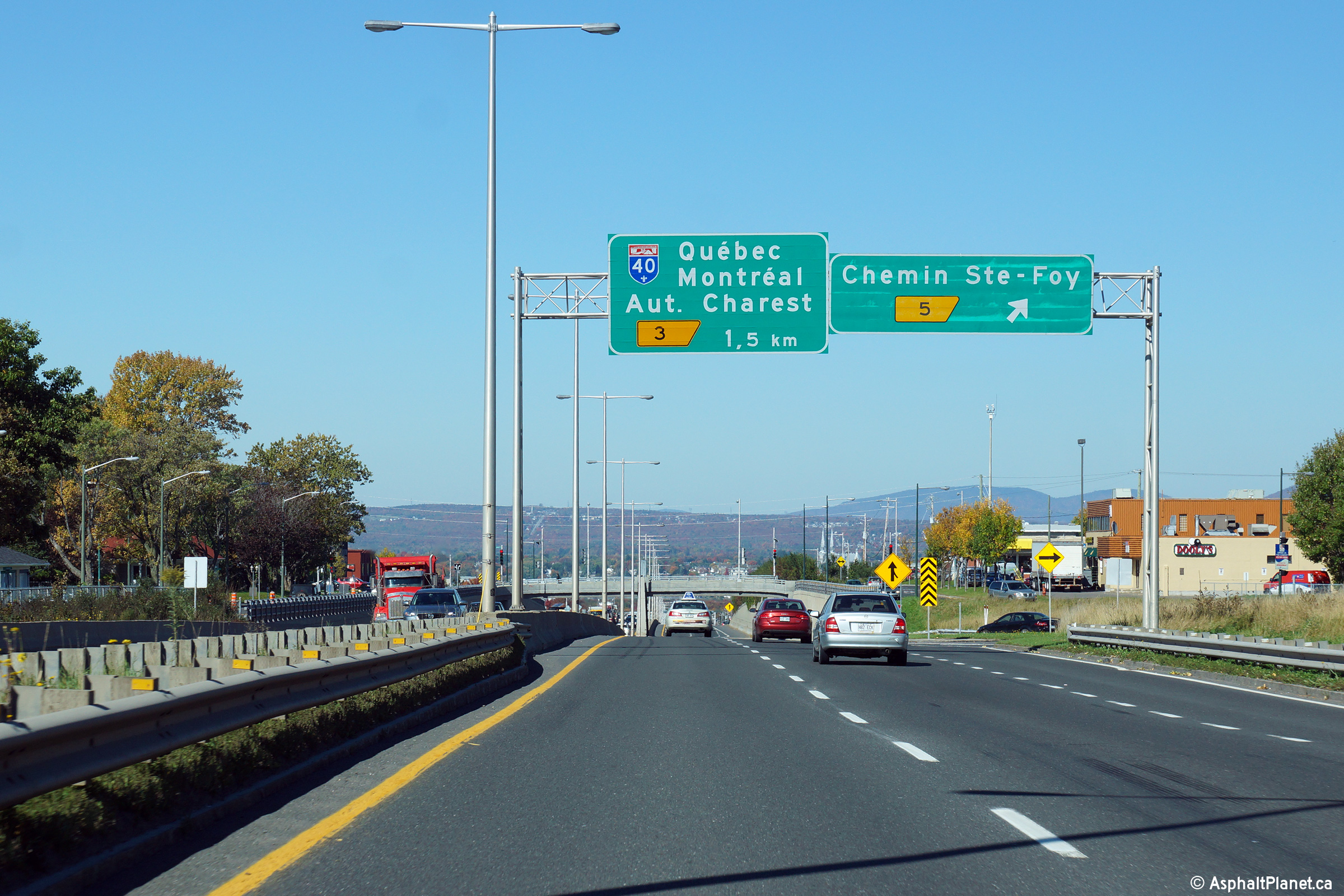
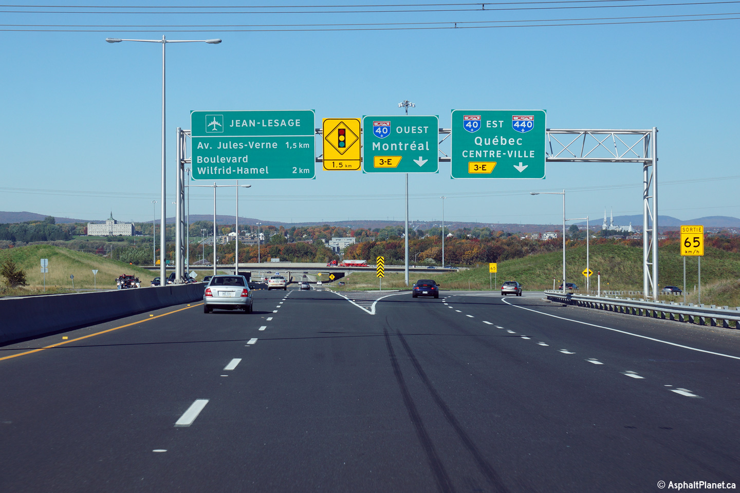
Ville de Québec
|
Second advanced sign for the Autoroute 40/440 interchange.
Autoroute 40 is signed with Autoroute 440 at this interchange as
Autoroute 40 was initially supposed to be completed on a new northerly
alignment along the southern boundary of Jean-Lesage International
Airport. Given today's urban realities, it seems unlikely that the
once proposed Autoroute 40 by-pass will ever be completed. |
 |
|
Photographed by: AsphaltPlanet.ca |
Date: 10/02/2014 |
High-res:
(1440x960)
(2400x1600) |
|
Ville de Québec
|
Northbound signage at the off-ramp to Autoroute 40/440. |
 |
|
Photographed by: AsphaltPlanet.ca |
Date: 10/02/2014 |
High-res:
(1440x960)
(2400x1600) |
|
Autoroute 40 is the the principal east-west autoroute
across the north-shore of the Saint Lawrence River.
Click here for A-40 images.
|
|
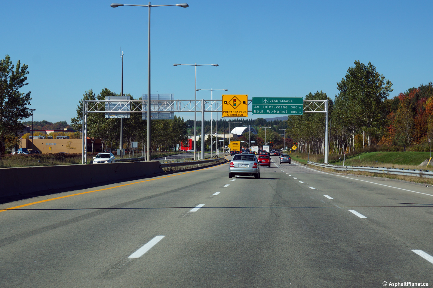
Ville de Québec
|
Northbound signage at the northern terminus of Autoroute 540 at the
signalized intersection with Rue Jules-Verne. |
 |
|
Photographed by: AsphaltPlanet.ca |
Date: 10/02/2014 |
High-res:
(1440x960)
(2400x1600) |


