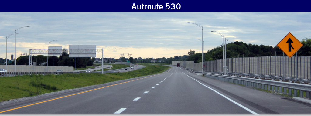
AsphaltPlanet.ca > Quebec > Autoroute 530
|
Western Terminus: Route 132-West, Route 201 South intersection in Salaberry-de-Valleyfield. Eastern Terminus: Autoroute 30 interchange in Salaberry-de-Valleyfield. Routing: Autoroute 530 runs along the south shore of the Saint Lawrence River within Salaberry-de-Valleyfield. About half of the autoroute is divided with four lanes, with the other half being a two lane at-grade highway (complete with four-way stops). A-530 was formerly included in Autoroute 30's routing but was renumbered A-30 during the fall of 2012 once A-30 was extended across the Saint Lawrence River to Autoroute 40 at Vaudreuil. Links:
|
Pictures on
this page are arranged in order from south to north. A-530 East photos are
left-aligned in the last column, while A-530 West photos are right-aligned.
Center-line pictures are centered within the last column.
|
Location |
Description |
Photo |
||
|
East- |
West- |
|||
|
M.R.C. de Beauharnois-Salaberry |
This view looks easterly at the CSX railway crossing east of Sainte-Marie Boulevard
Vue en direction est à la passage à niveau de CSX est du boul. Sainte-Marie. |
 |
||
|
Date: 6/17/2013 |
High-res: (1440x960) (2400x1600) | |||
|
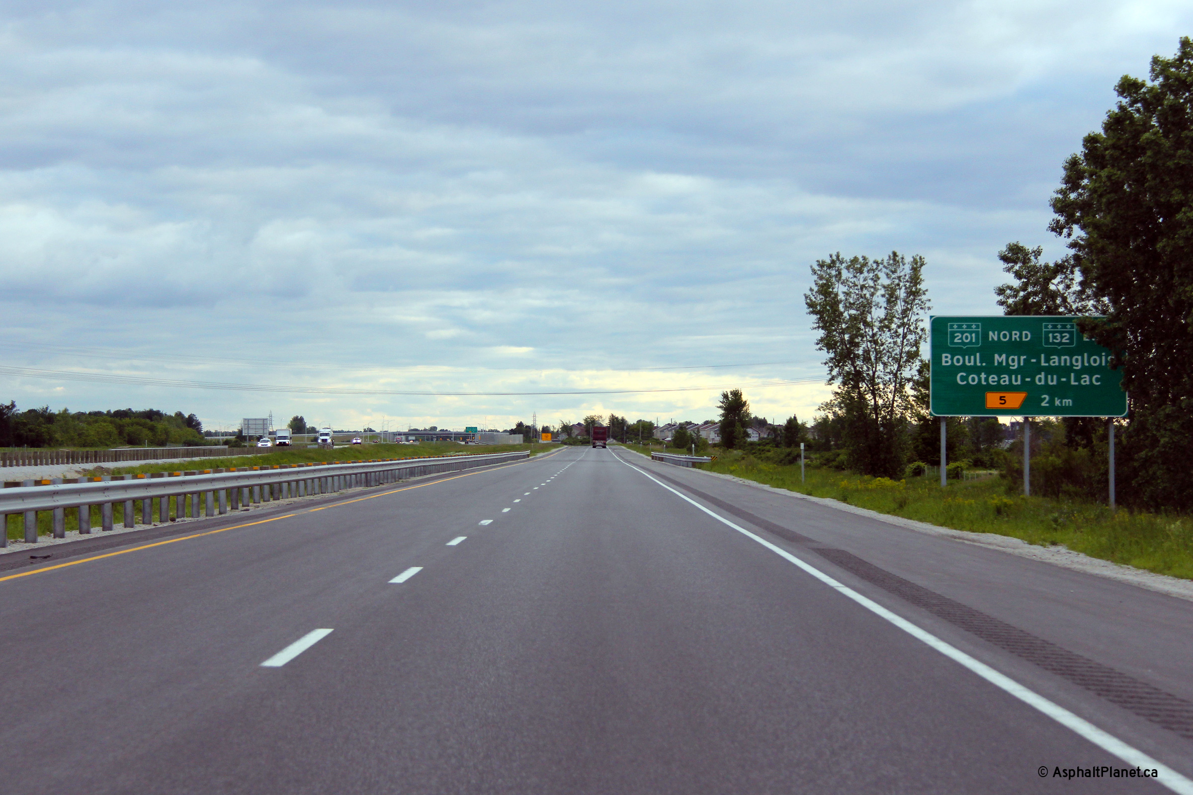
M.R.C. de Beauharnois-Salaberry |
Advanced signage for the Highway 201 and 132 interchange.
Signalisation avancée pour l'échangeur avec les routes 201 et 132. |
|
||
|
Date: 6/17/2013 |
High-res: (1440x960) (2400x1600) | |||
|
M.R.C. de Beauharnois-Salaberry |
For eastbound traffic, the divided highway begins about 1km west of the Highway 201 and 132 interchange.
La route à quatre voies début 1km à l'ouest de l'échangeur avec les route 201 et 132. |
 |
||
|
Date: 6/17/2013 |
High-res: (1440x960) (2400x1600) | |||
|
M.R.C. de Beauharnois-Salaberry |
The divided highway ends.
La route à quatre voies se termine. |
 |
||
|
Date: 6/17/2013 |
High-res: (1440x960) (2400x1600) | |||
|
M.R.C. de Beauharnois-Salaberry |
The westbound carriageway narrows to a single lane before the end of the divided highway.
La chaussée en direction ouest se rétrécit à une seule voie avant la fin de la route à quatre voies. |
 |
||
|
Date: 6/17/2013 |
High-res: (1440x960) (2400x1600) | |||
|
M.R.C. de Beauharnois-Salaberry |
Route 201 serves as a toll free alternate to A-30, hence this sign in advance of the Route 201 interchange.
Panneau indiquant le pont à péage sur l'A-30. Ce panneau est situé en avance de l'échangeur à la route 201. La route 201 traverse la fleuve Saint-Laurent sur un pont sans frais. |
|
||
|
Date: 6/17/2013 |
High-res: (1440x960) (2400x1600) | |||
|
M.R.C. de Beauharnois-Salaberry |
This view looks easterly approaching the trumpet interchange with Highways 201 and 132.
Cette vue regarde vers l'est à l'échangeur en trompette avec les routes 201 et 132. |
|
||
|
Date: 6/17/2013 |
High-res: (1440x960) (2400x1600) | |||
|
M.R.C. de Beauharnois-Salaberry |
View as the exit ramp for Highways 201 and 132 departs the freeway.
Vue vers l'ouest que la bretelle de sortie vers les routes 201 et 132 quitte l'autoroute. |
 |
||
|
Date: 6/17/2013 |
High-res: (1440x960) (2400x1600) | |||
|
M.R.C. de Beauharnois-Salaberry |
Overhead signage for the ramp to Route 201-North and 132-East
Signalisation aérienne pour la bretelle vers les routes 201-nord et 132-est. |
 |
||
|
Date: 6/17/2013 |
High-res: (1440x960) (2400x1600) | |||
|
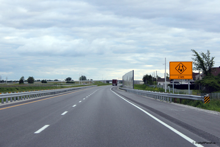
M.R.C. de Beauharnois-Salaberry |
Advanced signage warning motorists that the divided highway ends in 2 kilometres.
Panneau qui inform les conducteurs que l'autoroute se rétrécit à une chaussée à 2km. |
 |
||
|
Date: 6/17/2013 |
High-res: (1440x960) (2400x1600) | |||
|
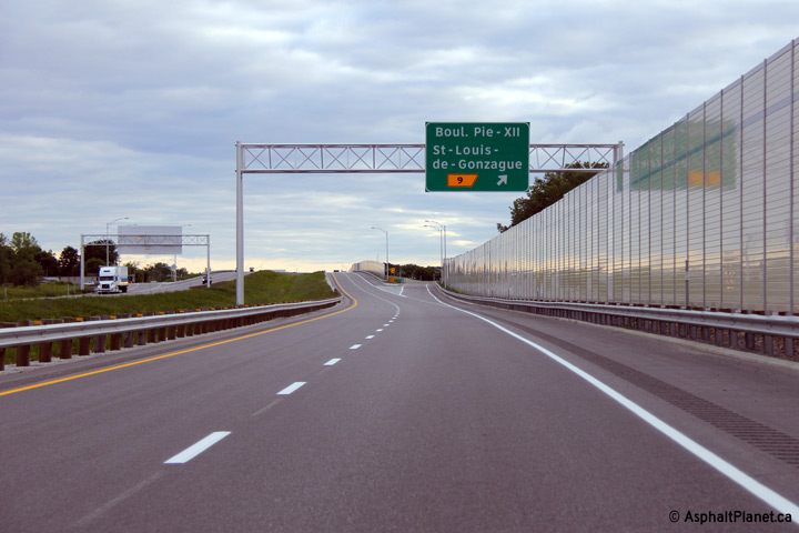
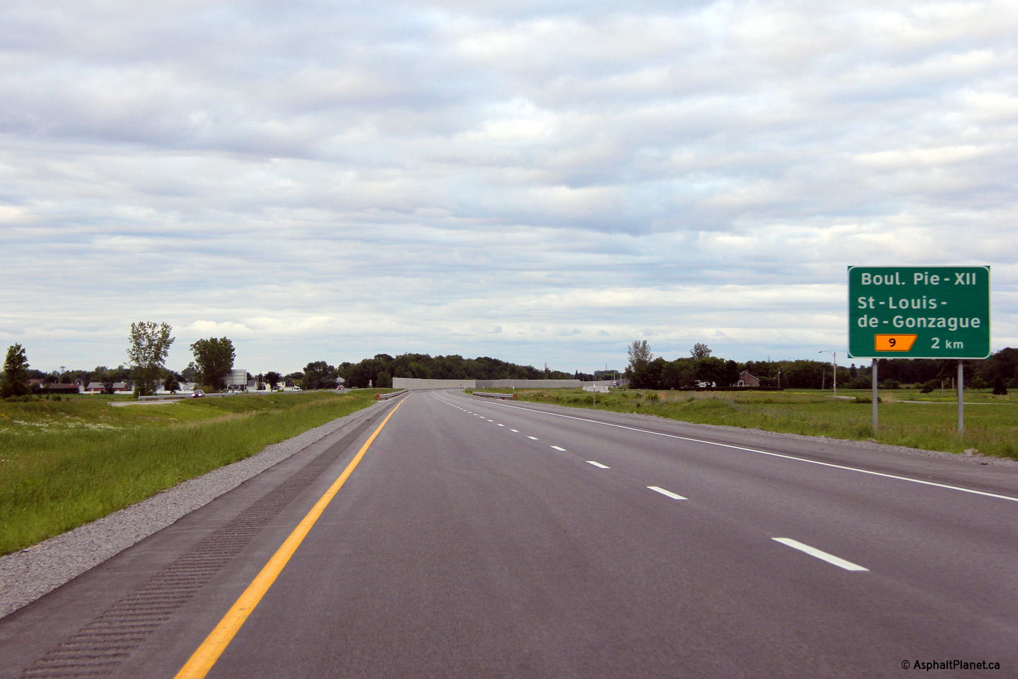
M.R.C. de Beauharnois-Salaberry |
Eastbound signage at the off-ramp to boul Pie-XII.
Signalisation en direction est à la sortie pour le boul. Pie-XII. |
 |
||
|
Date: 6/17/2013 |
High-res: (1440x960) (2400x1600) | |||
|
M.R.C. de Beauharnois-Salaberry |
Advanced signage for the boul Pie-XII interchange.
Signalisation avancée pour l'échangeur avec le boul. Pix-XII. |
|
||
|
Date: 6/17/2013 |
High-res: (1440x960) (2400x1600) | |||
|
M.R.C. de Beauharnois-Salaberry |
Overhead guide signage at the off-ramp to boul Pie-XII (Pope Pius XII) in advance of the interchange with A-30.
Signalisation aérienne à la bretelle de sortie vers le bou. Pie-XII. Le boul. Pie-XII est la dernier échangeuer avant l'autoroute 30. |
 |
||
|
Date: 6/17/2013 |
High-res: (1440x960) (2400x1600) | |||
|
M.R.C. de Beauharnois-Salaberry |
Eastbound signage at the off-ramp to boul Pie-XII.
Signalisation en direction est à la sortie pour le boul. Pie-XII. |
 |
||
|
Date: 6/17/2013 |
High-res: (1440x960) (2400x1600) | |||
|
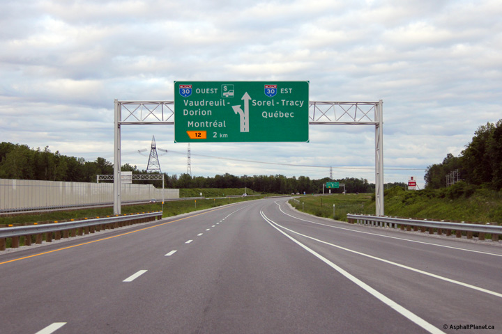
M.R.C. de Beauharnois-Salaberry |
Advanced signage for the A-30 interchange beyond the Pie-XII interchange
Signalisation avancée pour l'échangeur avec l'autoroute 30 juste au-delà de l'échangeur du boul. Pie-XII. |
 |
||
|
Date: 6/17/2013 |
High-res: (1440x960) (2400x1600) | |||
|
M.R.C. de Beauharnois-Salaberry |
Second advanced sign for the A-30 interchange
Deuxième panneau pour l'échangeur avec l'autoroute 30. |
 |
||
|
Date: 6/17/2013 |
High-res: (1440x960) (2400x1600) | |||
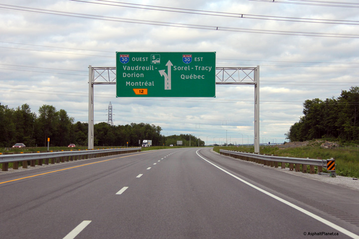
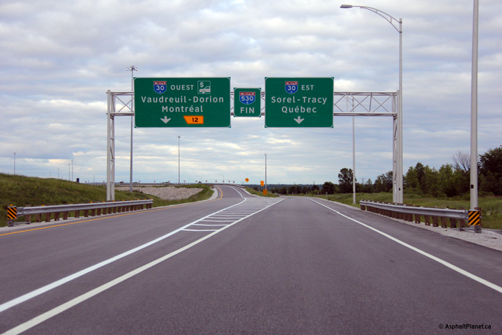
|
M.R.C. de Beauharnois-Salaberry |
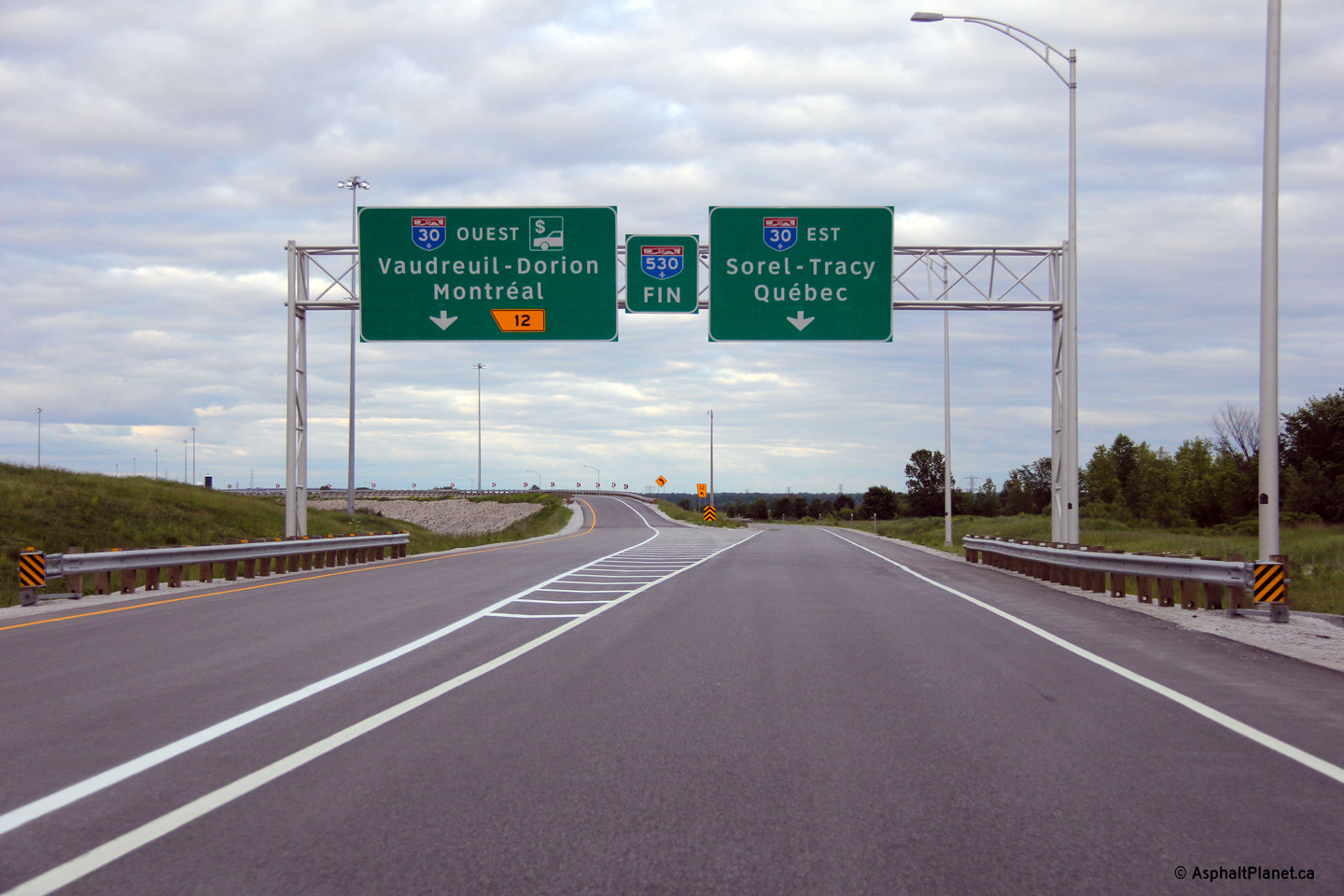
Autoroute 530 ends at the Autoroute 30 interchange.
Autoroute 530 se termine à l'échangeur avec l'autoroute 30. |
 |
||
|
Date: 6/17/2013 |
High-res: (1440x960) (2400x1600) | |||
|
Autoroute 30 serves as a by-pass of Montreal running from A-40 at Vaudreuil to Sorel-Tracy. Click here for A-30 images. |
||||
<- A-520
PQ Highways
A-540 ->
Asphaltplanet.ca
© 2013 AsphaltPlanet.ca.
AsphaltPlanet@asphaltplanet.ca
Page Created: August 6, 2013.
Last Updated: August 6, 2013.


