AsphaltPlanet.ca > Texas > US-183
|
Southern Terminus: US-77 in Refugio, TX.
Northern Entrance: Oklahoma Border. Length in TX: 428.382Miles (689.414km). |
Pictures on this page are arranged in order from south to north. US-75 North photos are left-aligned in the last column, while US-75 South photos are right-aligned. Center-line pictures are centered within the last column.
|
Location |
Description |
Photo |
||
|
North- |
South- |
|||
|
Travis County Austin |
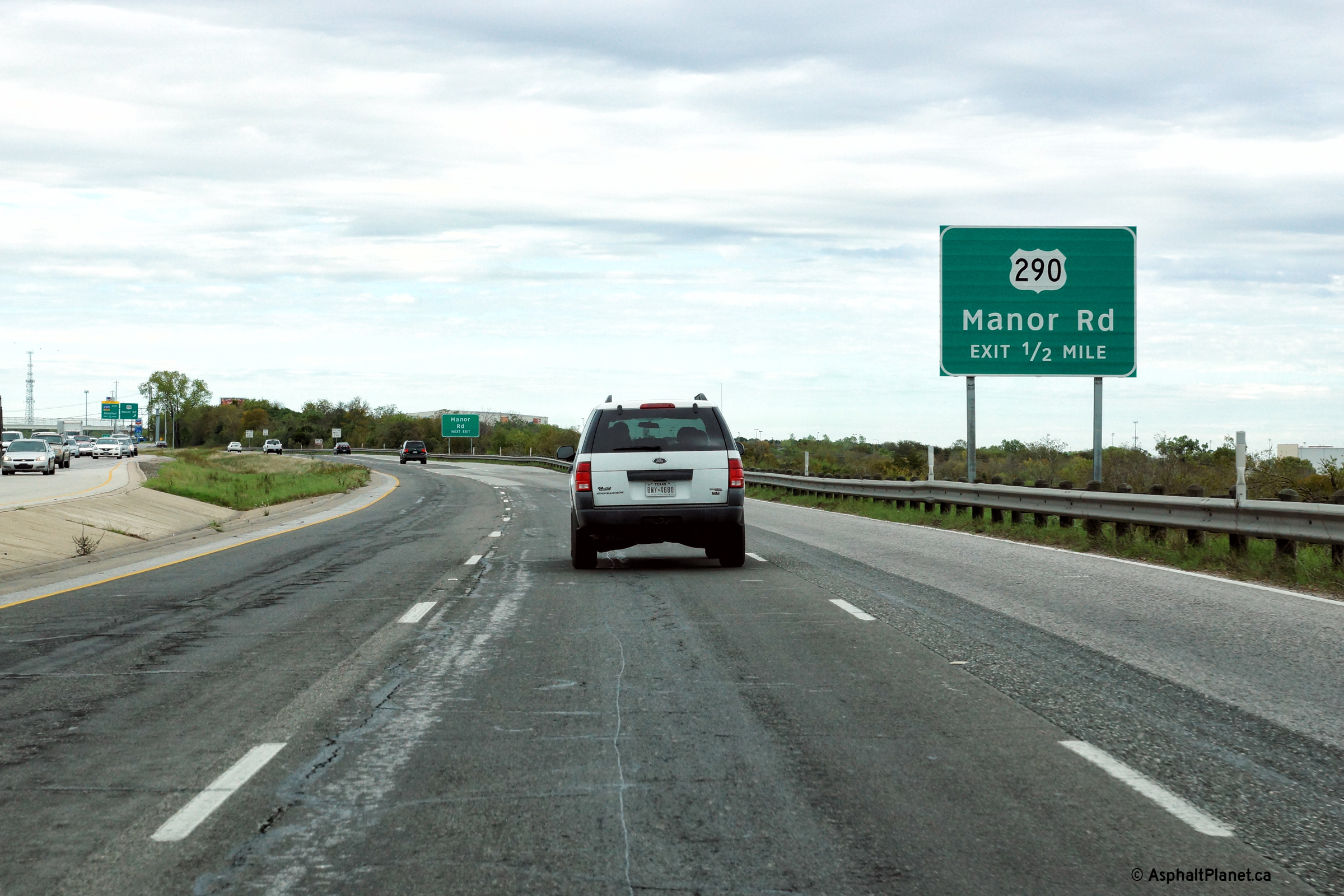
Northbound advanced signage for the US-290 interchange. This signage is located immediately north of the northern-most signalized intersection along US-183 south of Austin. |
 |
||
|
Date: 11/13/2015 |
High-res: (1440x960) (2400x1600) | |||
|
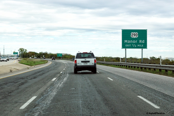
Travis County Austin |
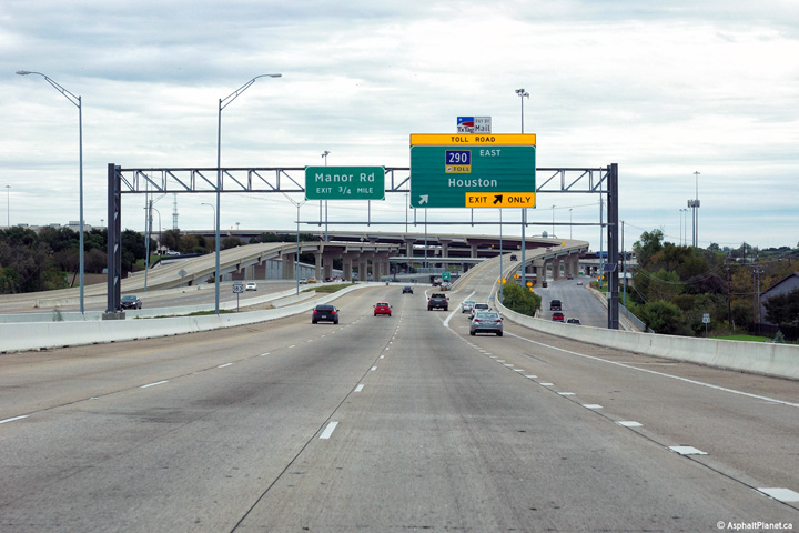
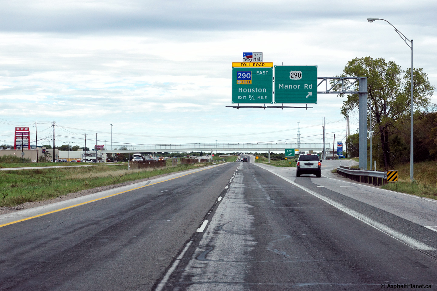
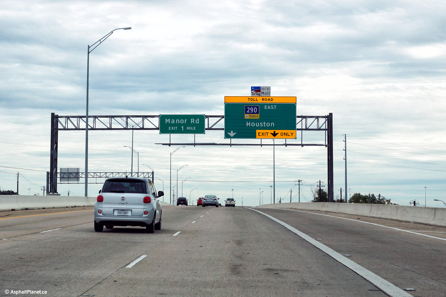
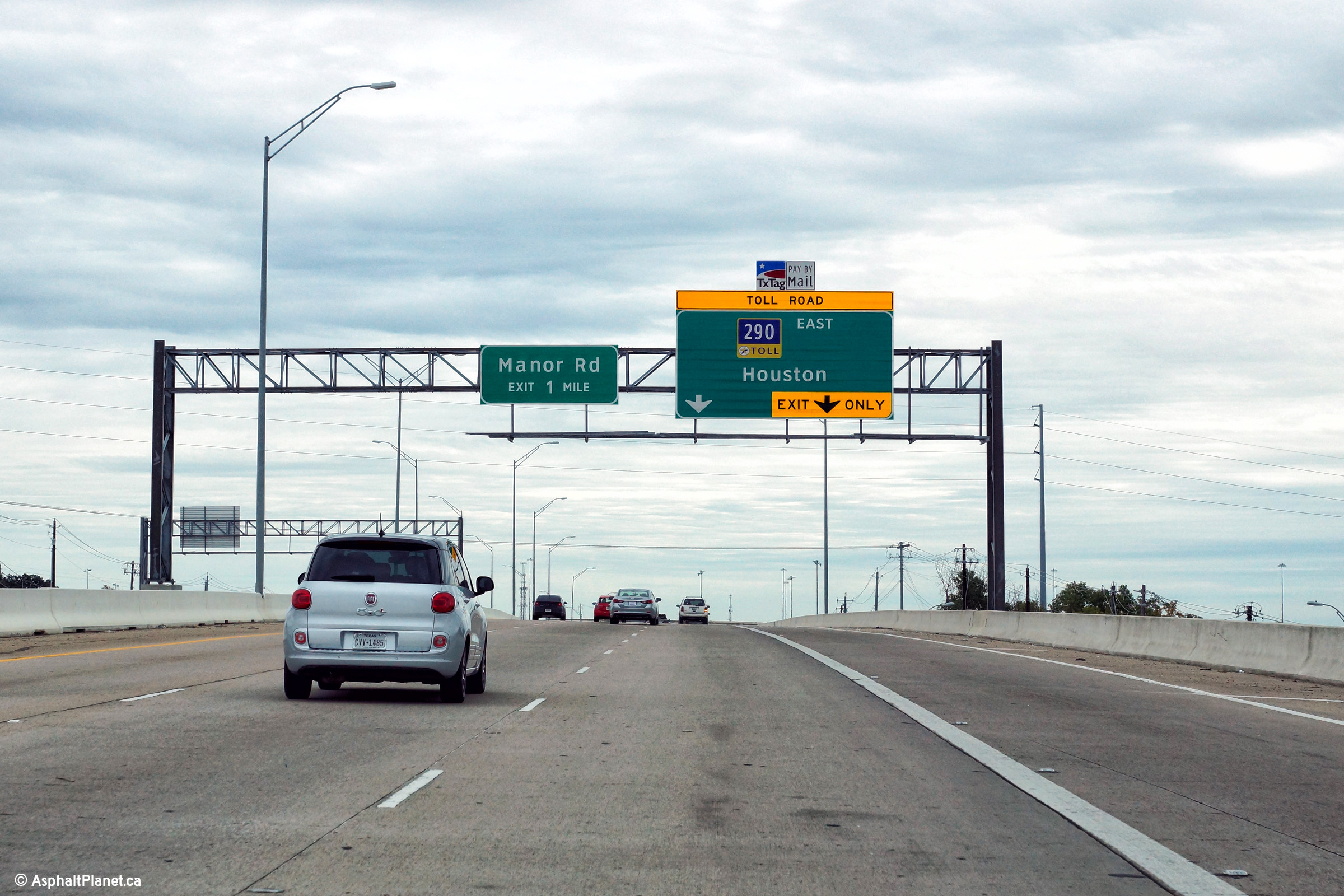
Northerly view at the off-ramp to Manor Road and US-290. US-290 follows the frontage roads alongside Toll-290 east of the US-183 interchange. |
 |
||
|
Date: 11/13/2015 |
High-res: (1440x960) (2400x1600) | |||
|
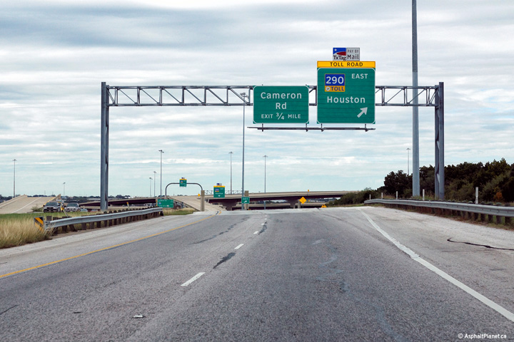
Travis County Austin |
Northbound view at the off-ramp to the 290 Toll Road. East of US-183, the US-290 follows the frontage roads of the 290 Toll Road. |
 |
||
|
Date: 11/13/2015 |
High-res: (1440x960) (2400x1600) | |||
|
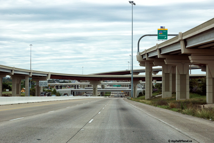
Travis County Austin |
View looking northerly through the 290 Toll Road interchange. While there is no direct connection from US-183 to the 290 Freeway west, the ramp has been roughed in so that such a connection could be constructed when traffic volumes warrant at a later date. |
 |
||
|
Date: 11/13/2015 |
High-res: (1440x960) (2400x1600) | |||
|
Travis County Austin |
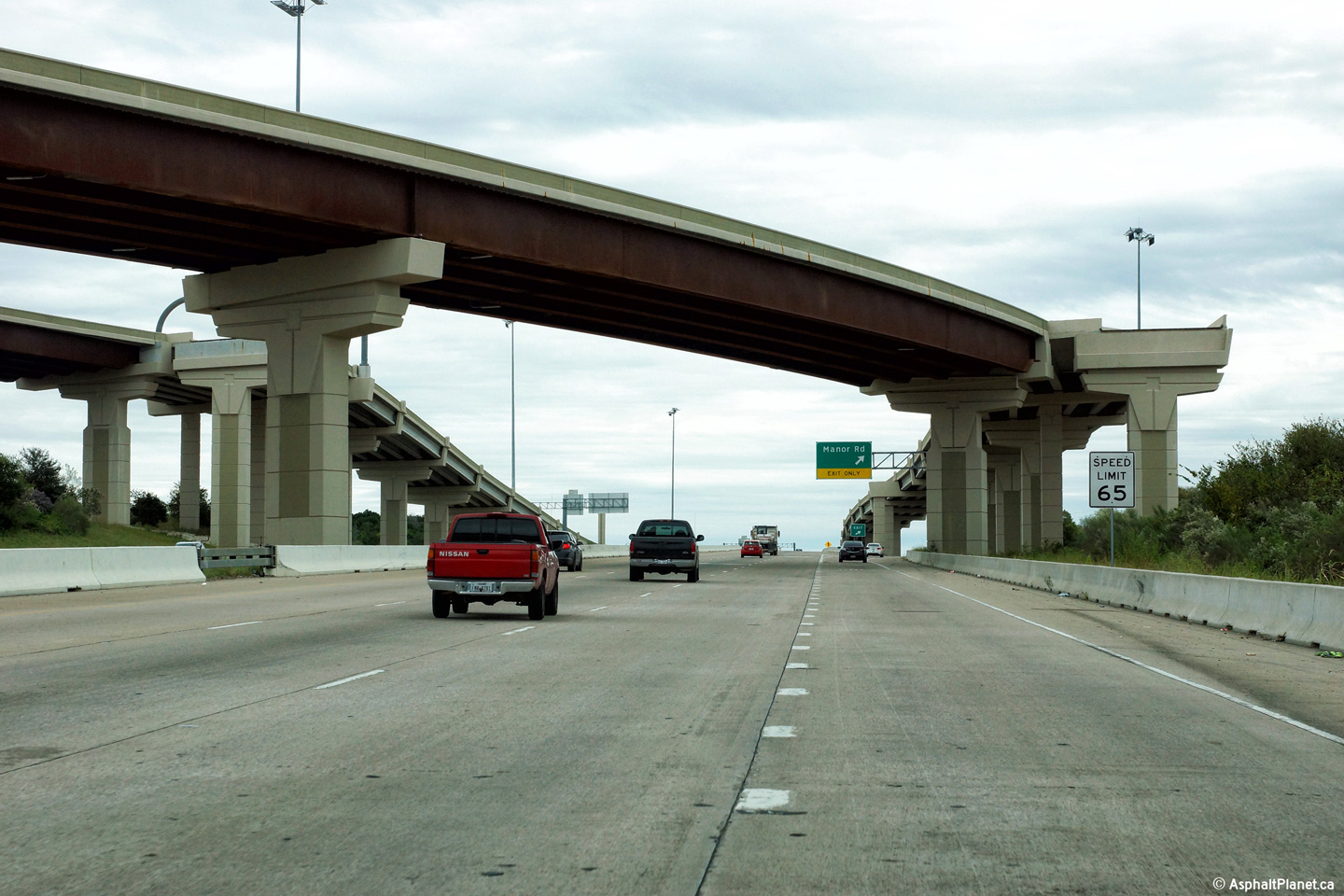
Southerly view along US-183 approaching the Manor Road off-ramp. The high-speed flyover ramp from the westbound lanes of the 290 Tollway is visible overhead. |
 |
||
|
Date: 11/13/2015 |
High-res: (1440x960) (2400x1600) | |||
|
Travis County Austin |
Southerly view along US-183 from the eastbound lanes of the US-290 frontage road. |
 |
||
|
Date: 11/3/2012 |
High-res: (1440x960) (2400x1600) | |||
|
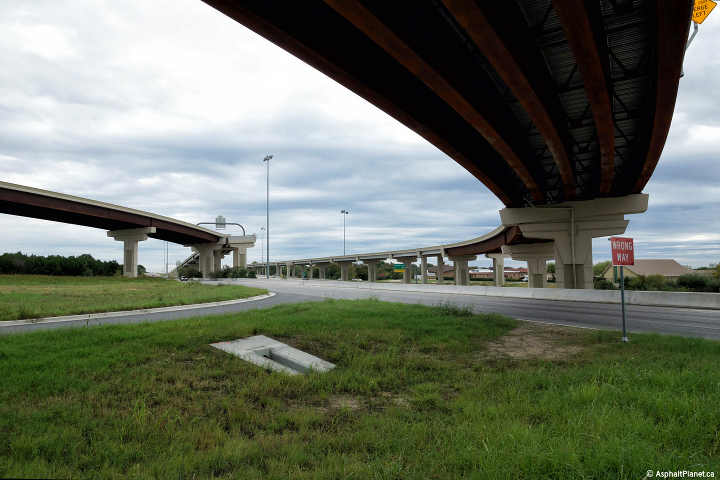
Travis County Austin |
A series of views looking beneath the high-speed connector ramps that link the US-183 and 290 Toll freeways. |
 |
||
| High-res: (1440x960) (2400x1600) | ||||
 |
||||
|
Date: 11/13/2015 |
High-res: (1440x960) (2400x1600) | |||
| US-290 runs from Junction to Houston. Click here for US-290 images. | ||||
|
Travis County Austin |
Northerly view along US-183 from the US-290 frontage road. |
 |
||
|
Date: 11/13/2015 |
High-res: (1440x960) (2400x1600) | |||
|
Travis County Austin |
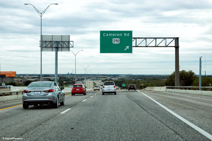
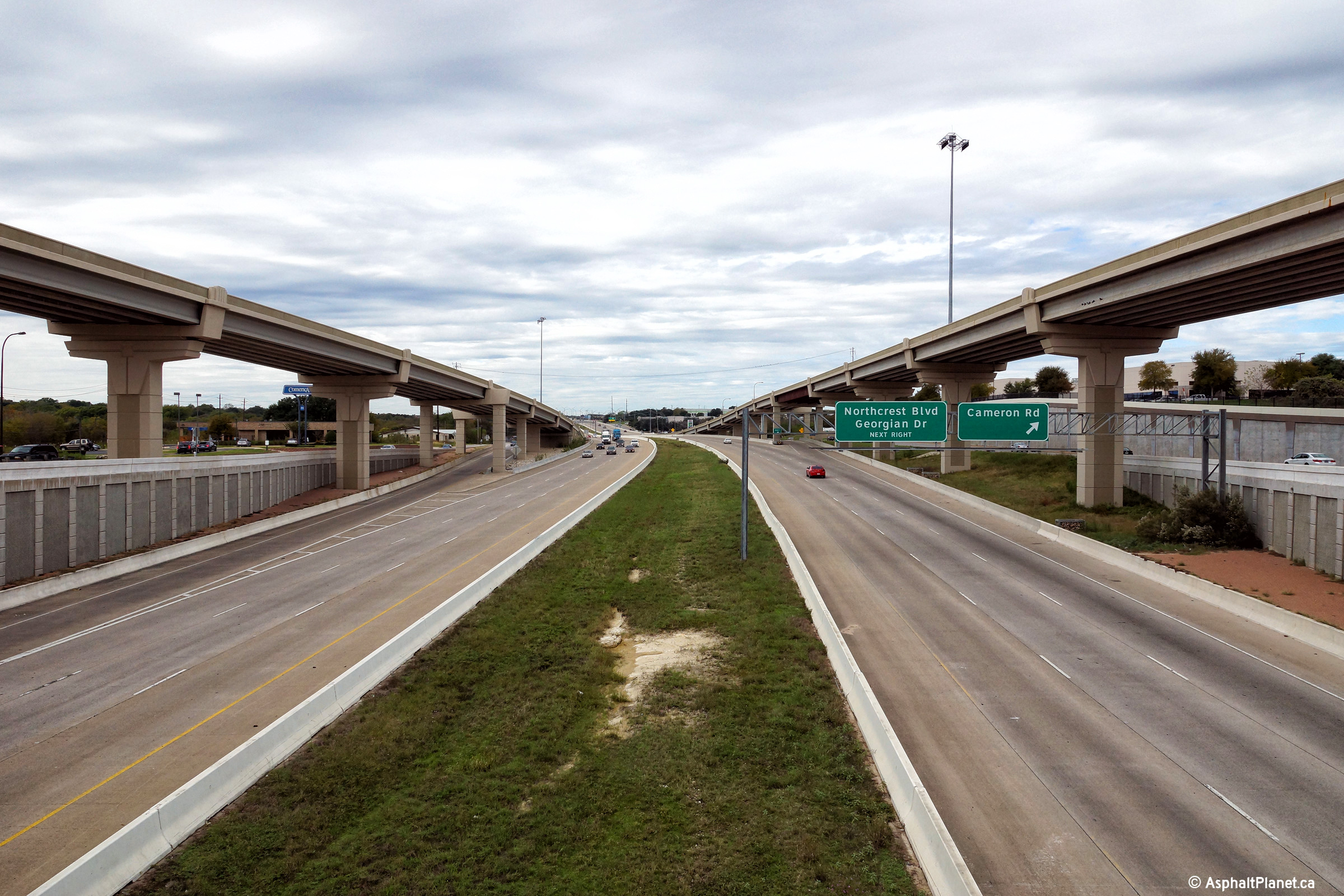
View looking northerly at the exit to Cameron Road. |
 |
||
|
Date: 11/13/2015 |
High-res: (1440x960) (2400x1600) | |||
|
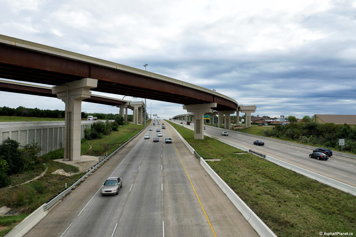
Travis County Austin |
Southerly view along the US-183 Freeway as the highway passes through the large 290 Freeway interchange. |
 |
||
|
Date: 11/13/2015 |
High-res: (1440x960) (2400x1600) | |||
|
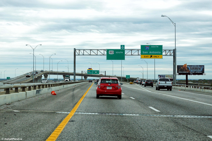
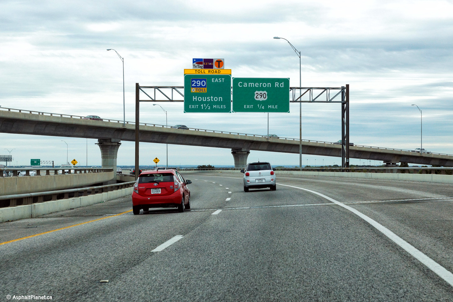
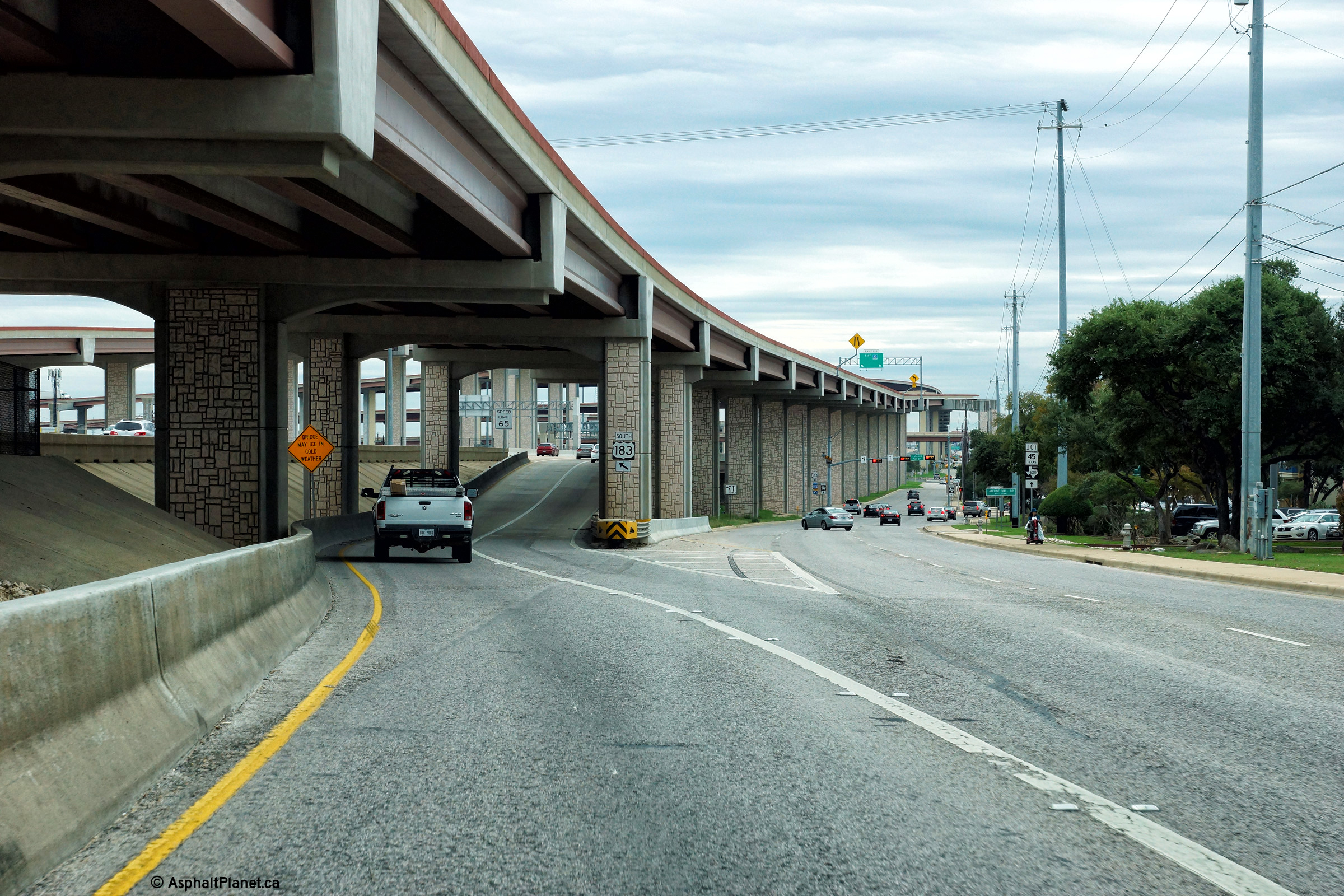
Travis County Austin |
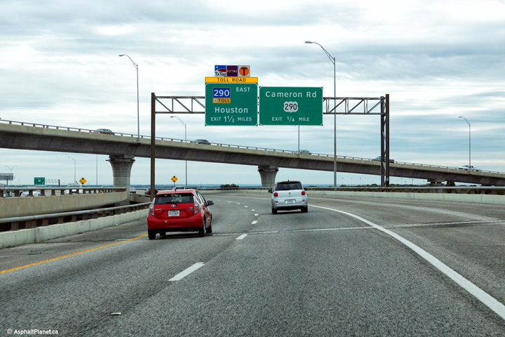
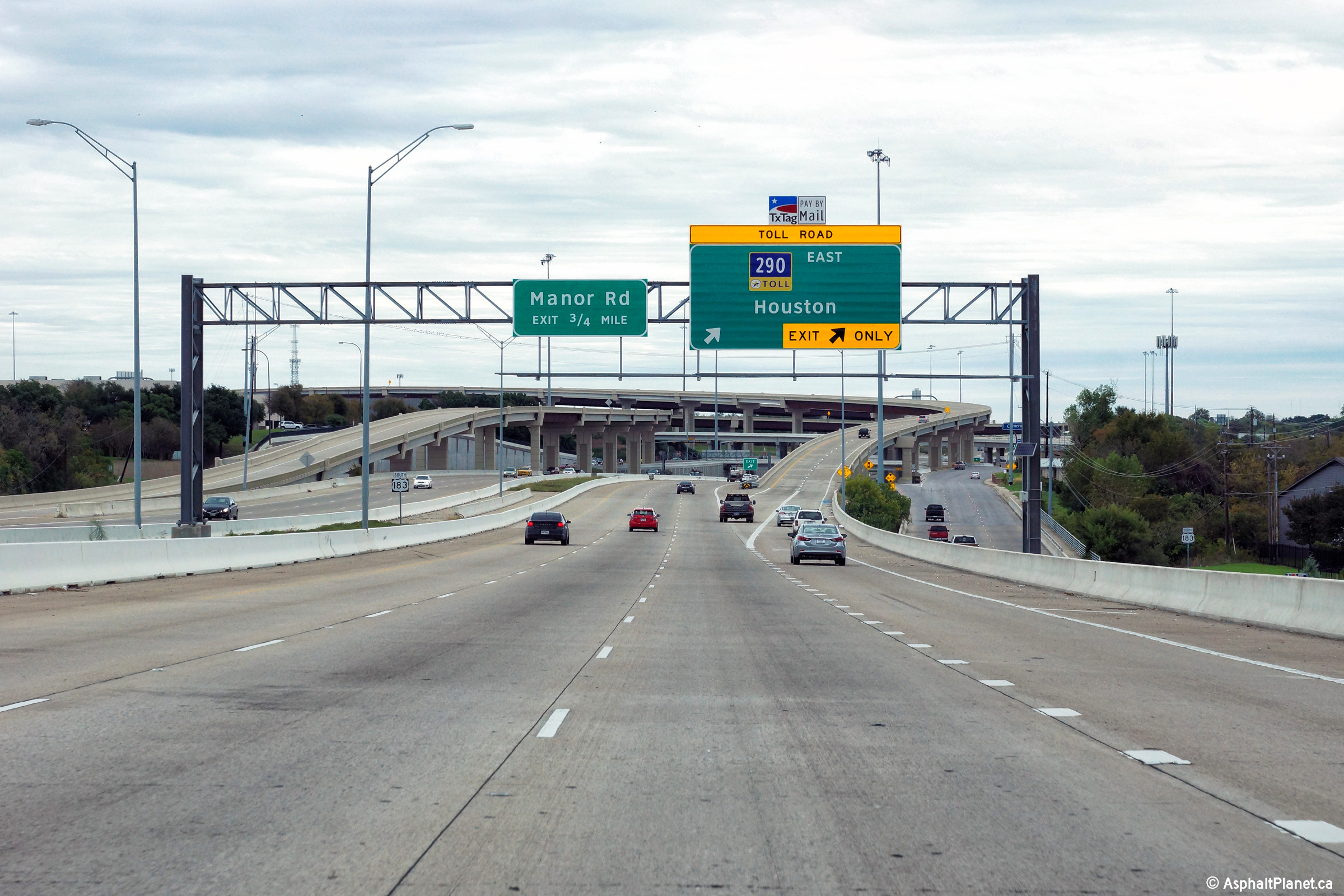
Southerly view along US-183 approaching the US-290 interchange. US-290 is a toll highway east of the US-183 interchange, as is indicated on the pictured signage. |
 |
||
|
Date: 11/13/2015 |
High-res: (1440x960) (2400x1600) | |||
|
Travis County Austin |
Southbound advanced signage for the Toll US-290 interchange. |
 |
||
|
Date: 11/13/2015 |
High-res: (1440x960) (2400x1600) | |||
|
Travis County Austin |
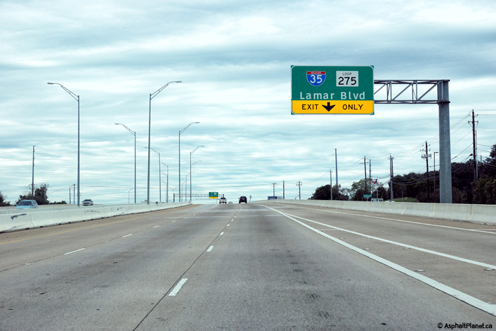
The on-ramp that joins the US-183 Freeway from 290 Tollway quickly departs from the I-35 interchange. |
 |
||
|
Date: 11/13/2015 |
High-res: (1440x960) (2400x1600) | |||
|
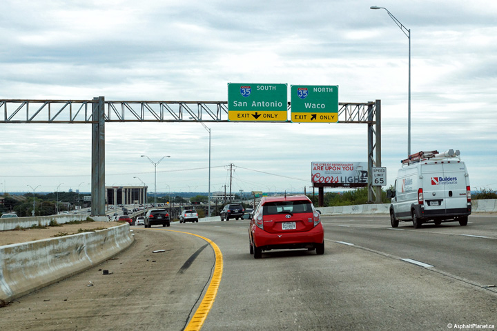
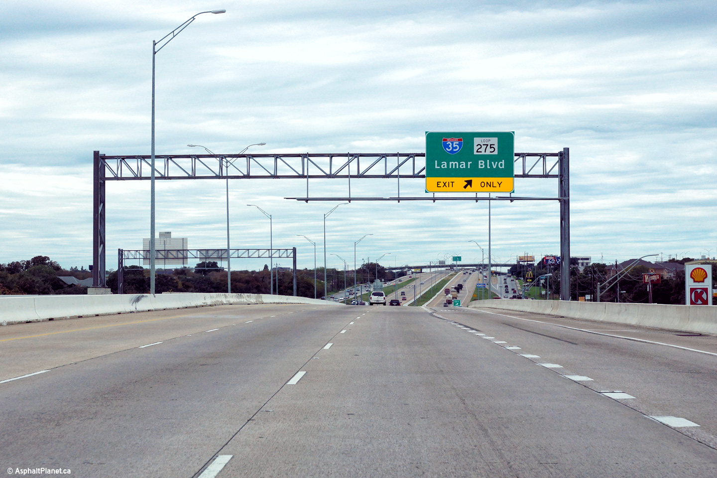
Travis County Austin |
Southerly view at the off-ramp to I-35 from the southbound lanes of the US-183 Freeway. There are no direct connections between the southern leg of US-183 and I-35 so traffic making the connection is forced to use the frontage road network. |
 |
||
|
Date: 11/13/2015 |
High-res: (1440x960) (2400x1600) | |||
|
Travis County Austin |
Signage located beyond the I-35 interchange directing traffic to the frontage road for access to US-290. |
 |
||
|
Date: 11/13/2015 |
High-res: (1440x960) (2400x1600) | |||
|
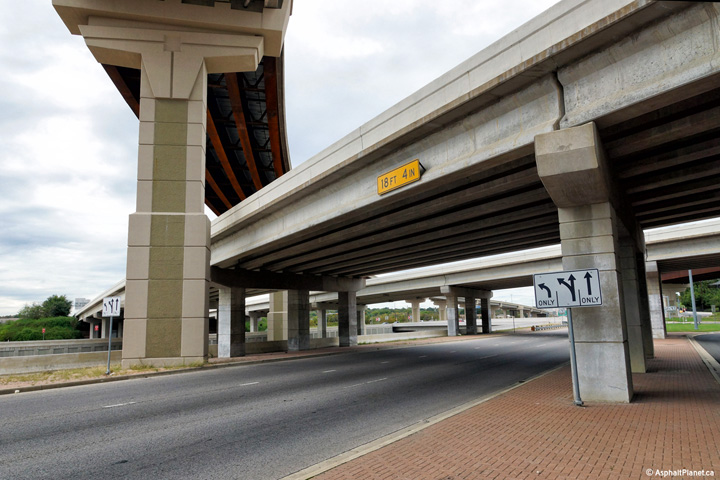
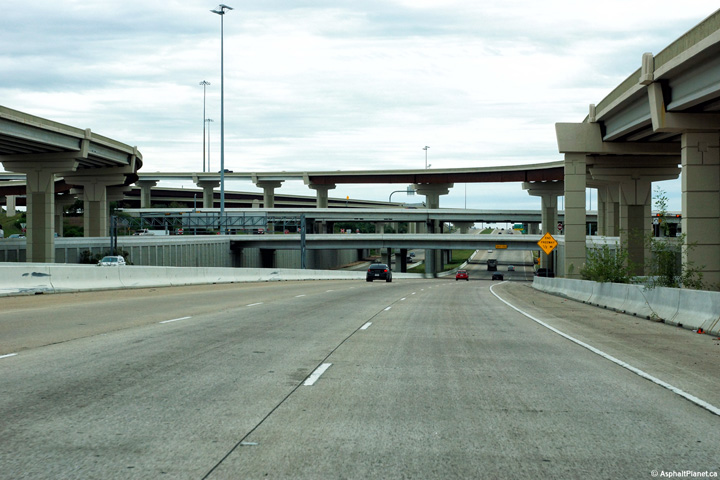
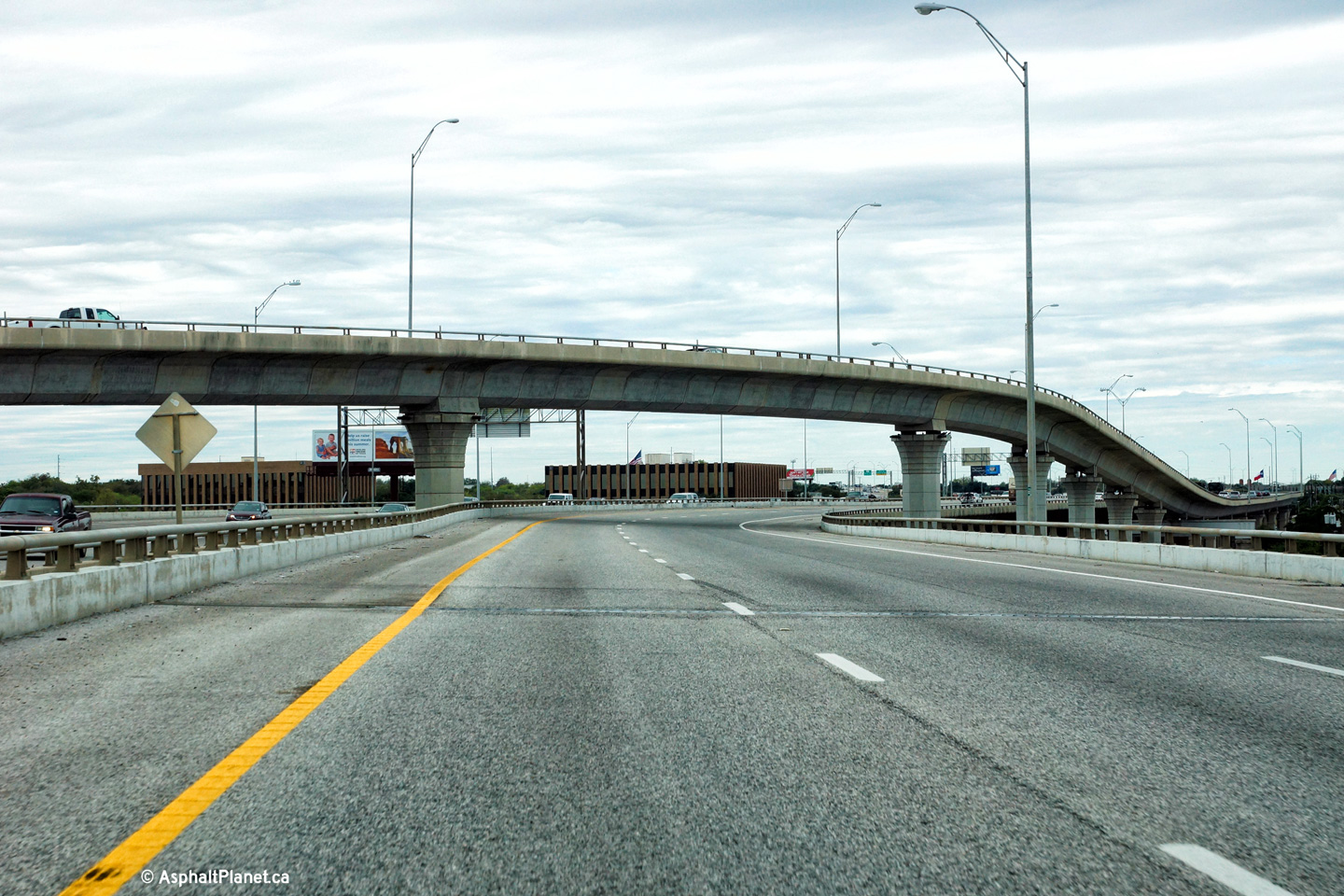
Travis County Austin |
Northerly view through the I-35 interchange. US-183 is the second level of this three level interchange. |
 |
||
|
Date: 11/13/2015 |
High-res: (1440x960) (2400x1600) | |||
|
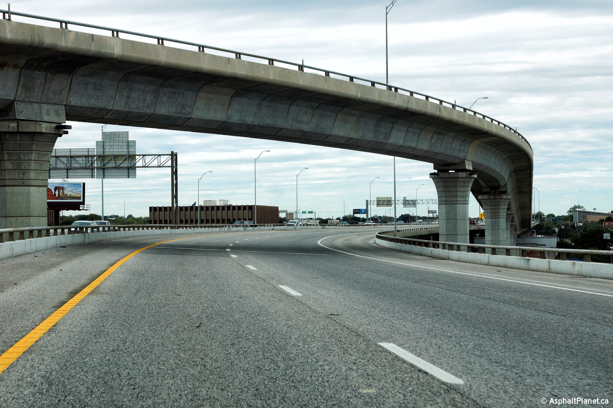
Travis County Austin |
An additional northerly view as US-183 passes underneath the flyover ramp that links northbound I-35 to northbound US-183. |
 |
||
|
Date: 11/13/2015 |
High-res: (1440x960) (2400x1600) | |||
|
Travis County Austin |
Southbound signage in advance of the off-ramp to US-290. The high-level flyover that links northbound I-35 to northbound US-183 is visible beyond the overhead signage. |
 |
||
|
Date: 11/13/2015 |
High-res: (1440x960) (2400x1600) | |||
|
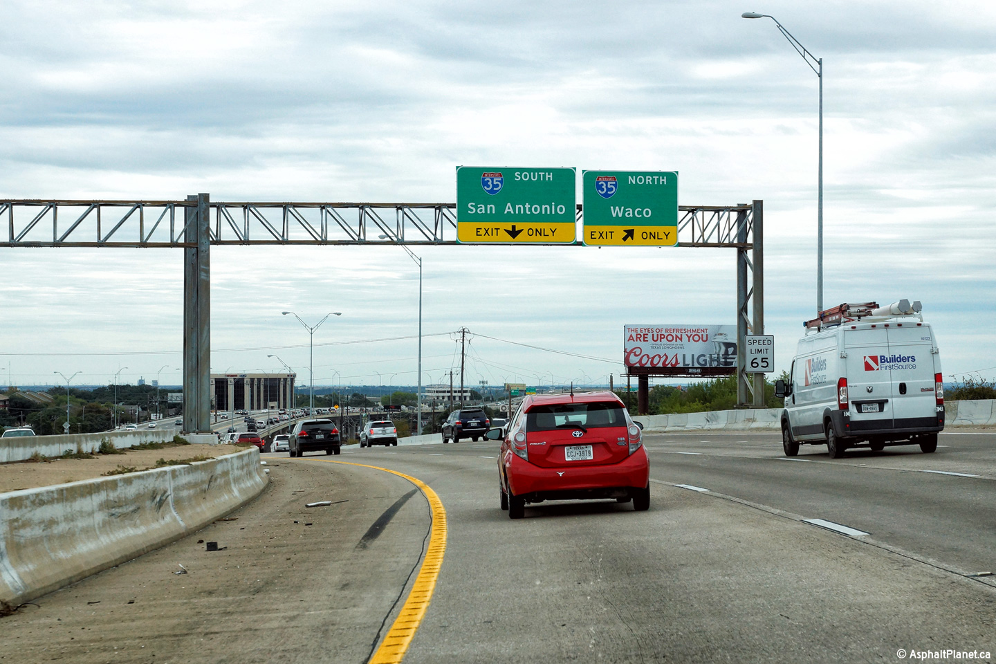
Travis County Austin |
View looking southerly at the ramp to I-35 South. |
 |
||
|
Date: 11/13/2015 |
High-res: (1440x960) (2400x1600) | |||
|
Travis County Austin |
Southbound signage at the off-ramp to I-35 North. There is not a direct connection between US-183 South and I-35 North, so traffic making this connection is forced to use the frontage road network. |
 |
||
|
Date: 11/13/2015 |
High-res: (1440x960) (2400x1600) | |||
|
Travis County Austin |
Northbound view in advance of the Toll 45 interchange. |
 |
||
|
Date: 11/13/2015 |
High-res: (1440x960) (2400x1600) | |||
|
Travis County Austin |
Signage at the northbound off-ramp to Toll 45 East. |
 |
||
|
Date: 11/13/2015 |
High-res: (1440x960) (2400x1600) | |||
|
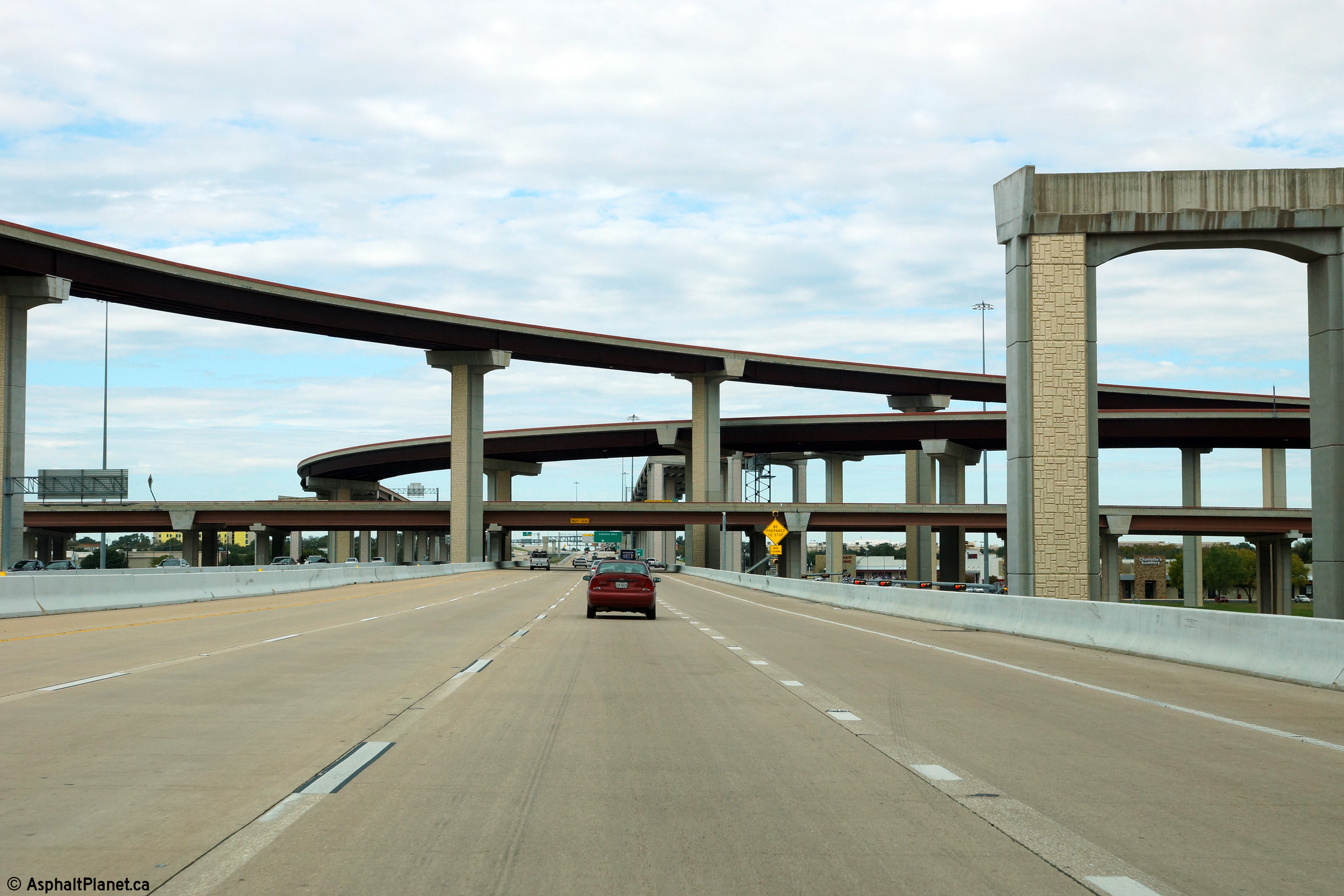
Travis County Austin |
View looking northerly through the Toll 45 interchange. |
 |
||
|
Date: 11/13/2015 |
High-res: (1440x960) (2400x1600) | |||
|
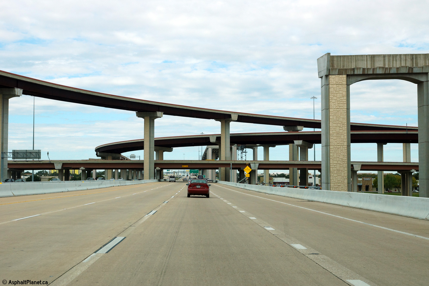
Travis County Austin |
Northerly view through the 45 Tollway interchange. A pier has been constructed for a future ramp that will eventually link US-183 North to Toll 45 West. |
 |
||
|
Date: 11/13/2015 |
High-res: (1440x960) (2400x1600) | |||
|
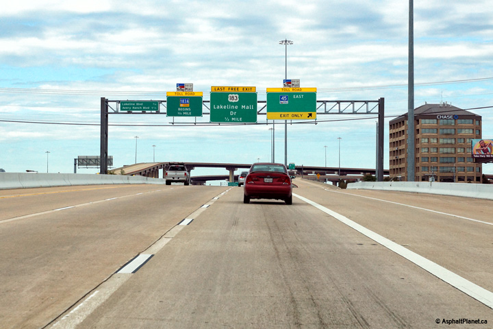
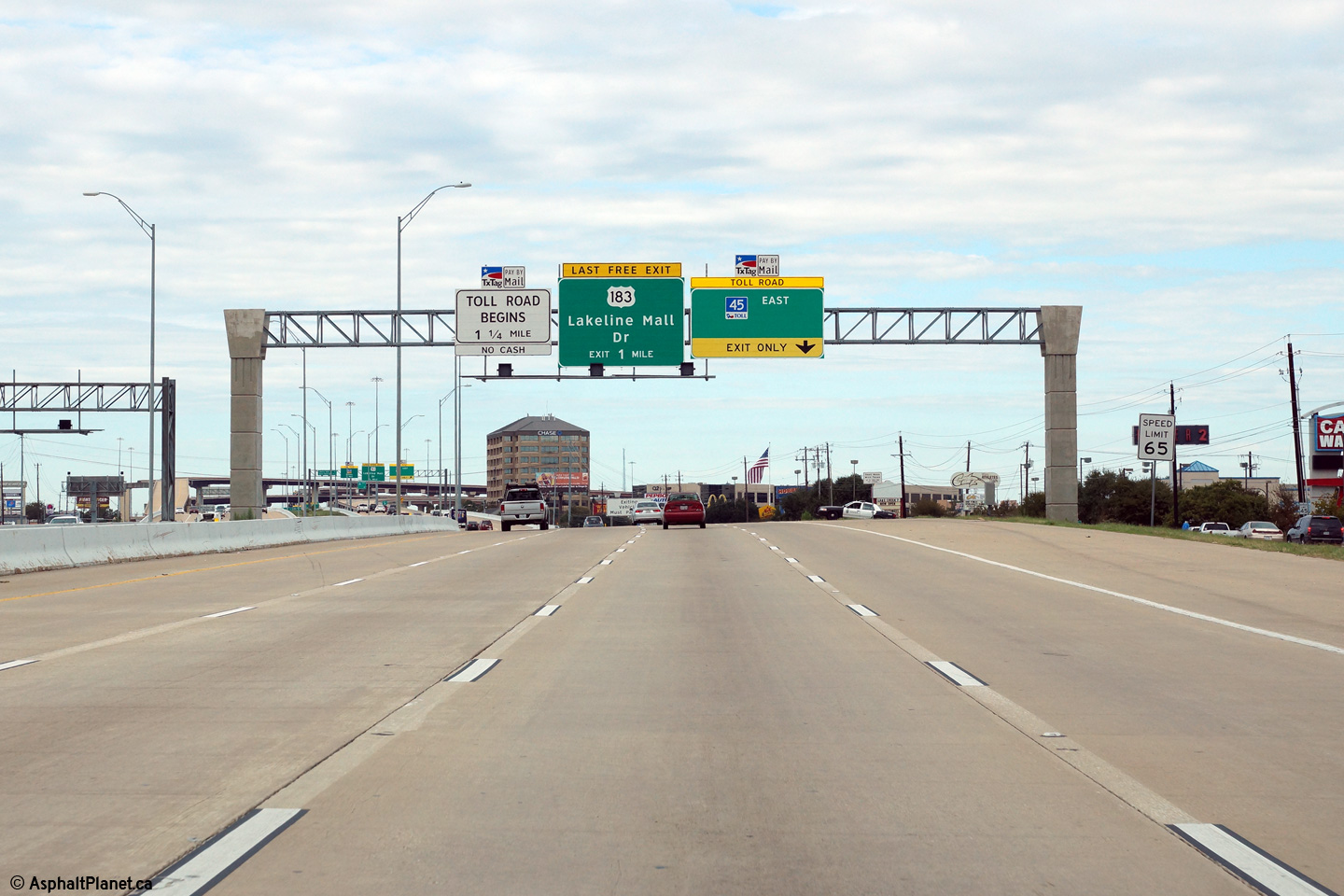
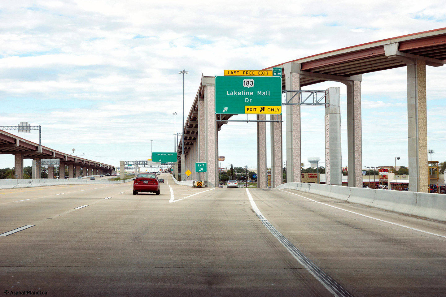
Travis County Austin |
US-183 exits the freeway just beyond the Toll 45 Freeway interchange. Beyond the Lakeline Mall Road interchange the expressway continues as the 183A Tollway. |
 |
||
|
Date: 11/13/2015 |
High-res: (1440x960) (2400x1600) | |||
|
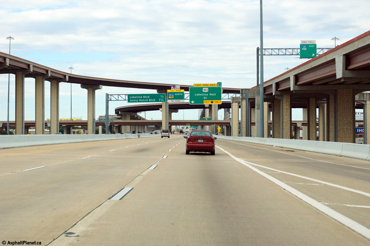
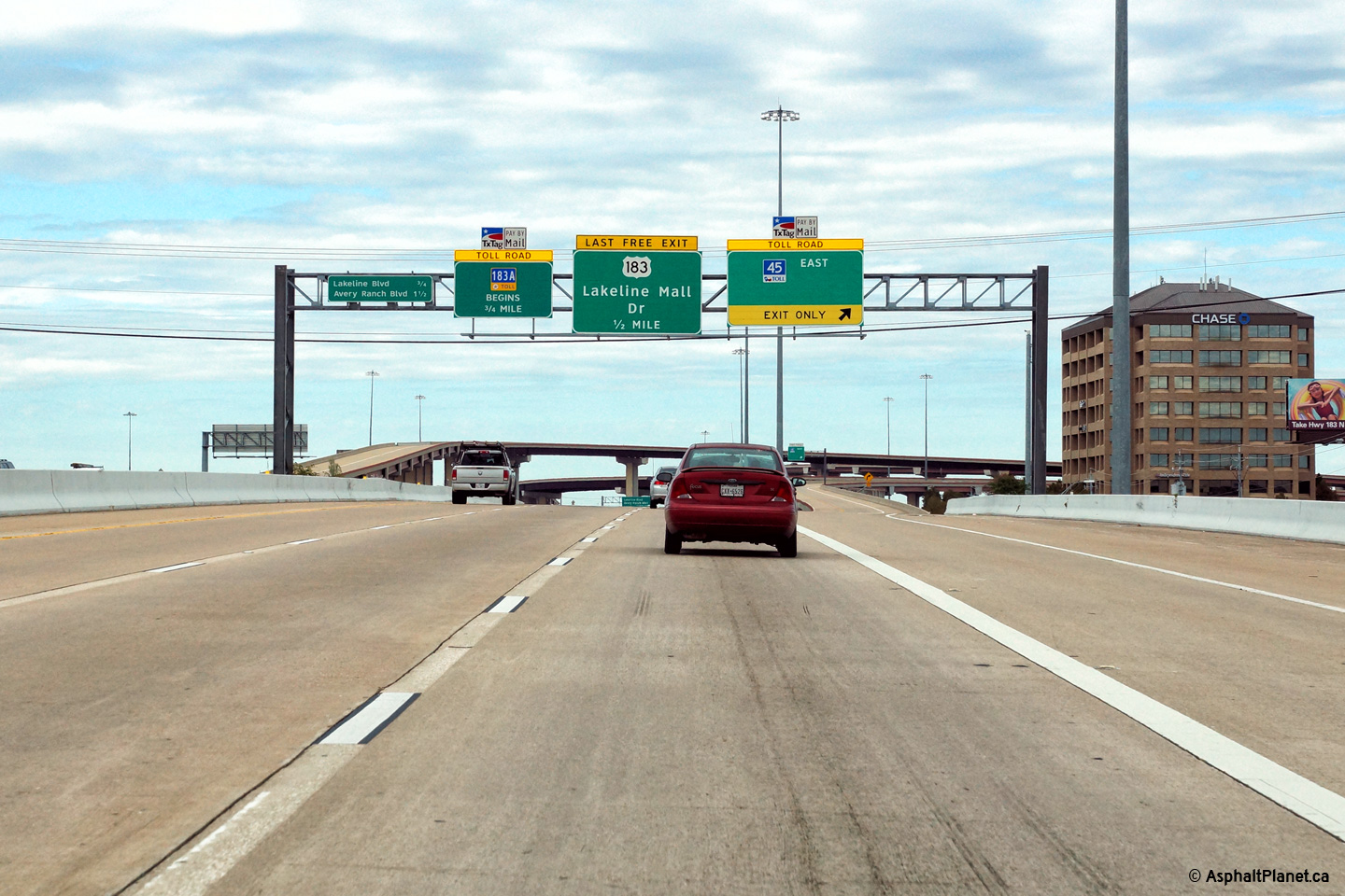
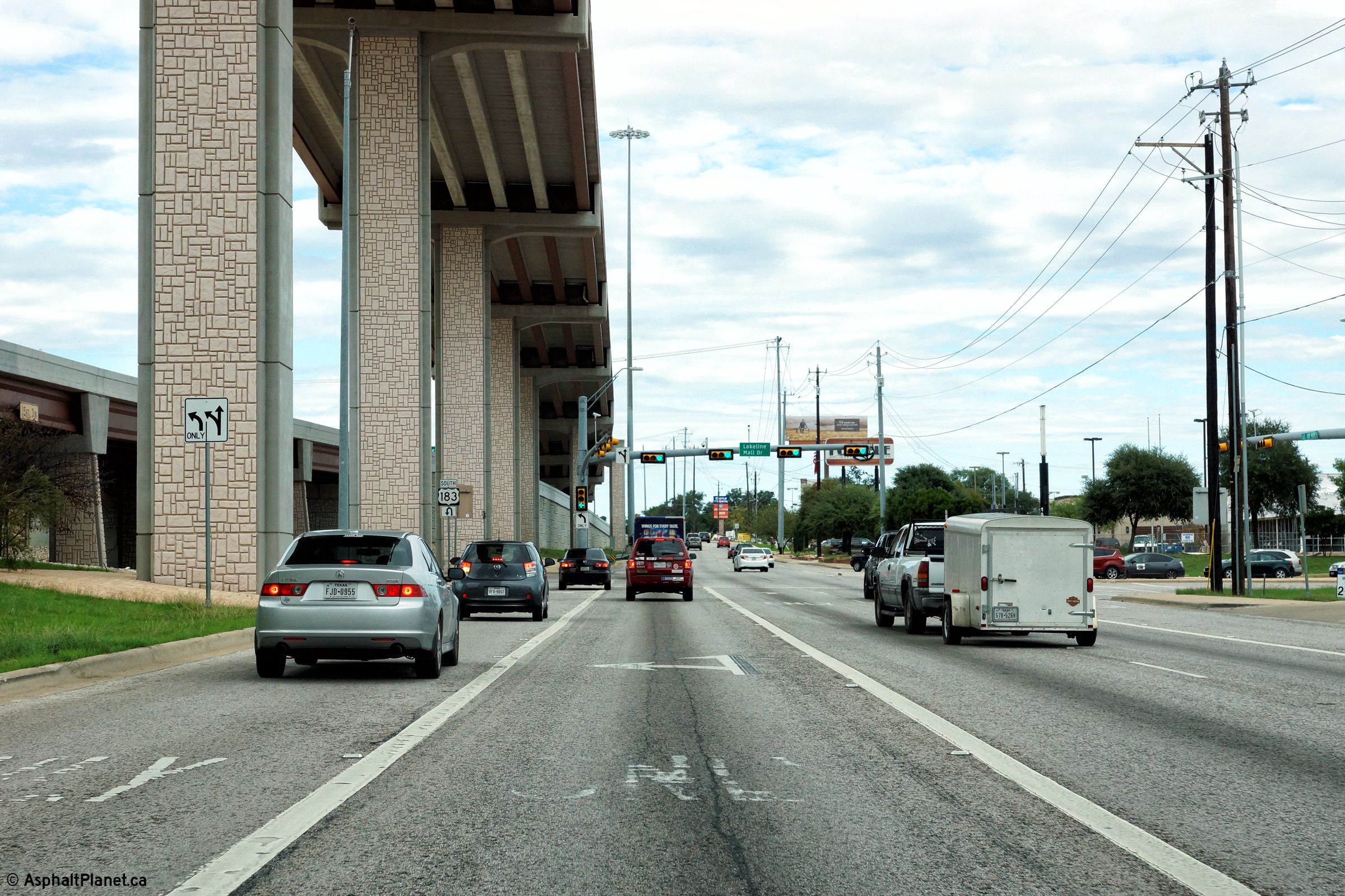
Travis County Austin |
View looking northerly along US-183 at the traffic signals for Lakeline Mall Drive. US-183 follows the frontage road for a short distance along the 183A Tollway before the highway branches off on its own alignment. |
 |
||
|
Date: 11/13/2015 |
High-res: (1440x960) (2400x1600) | |||
|
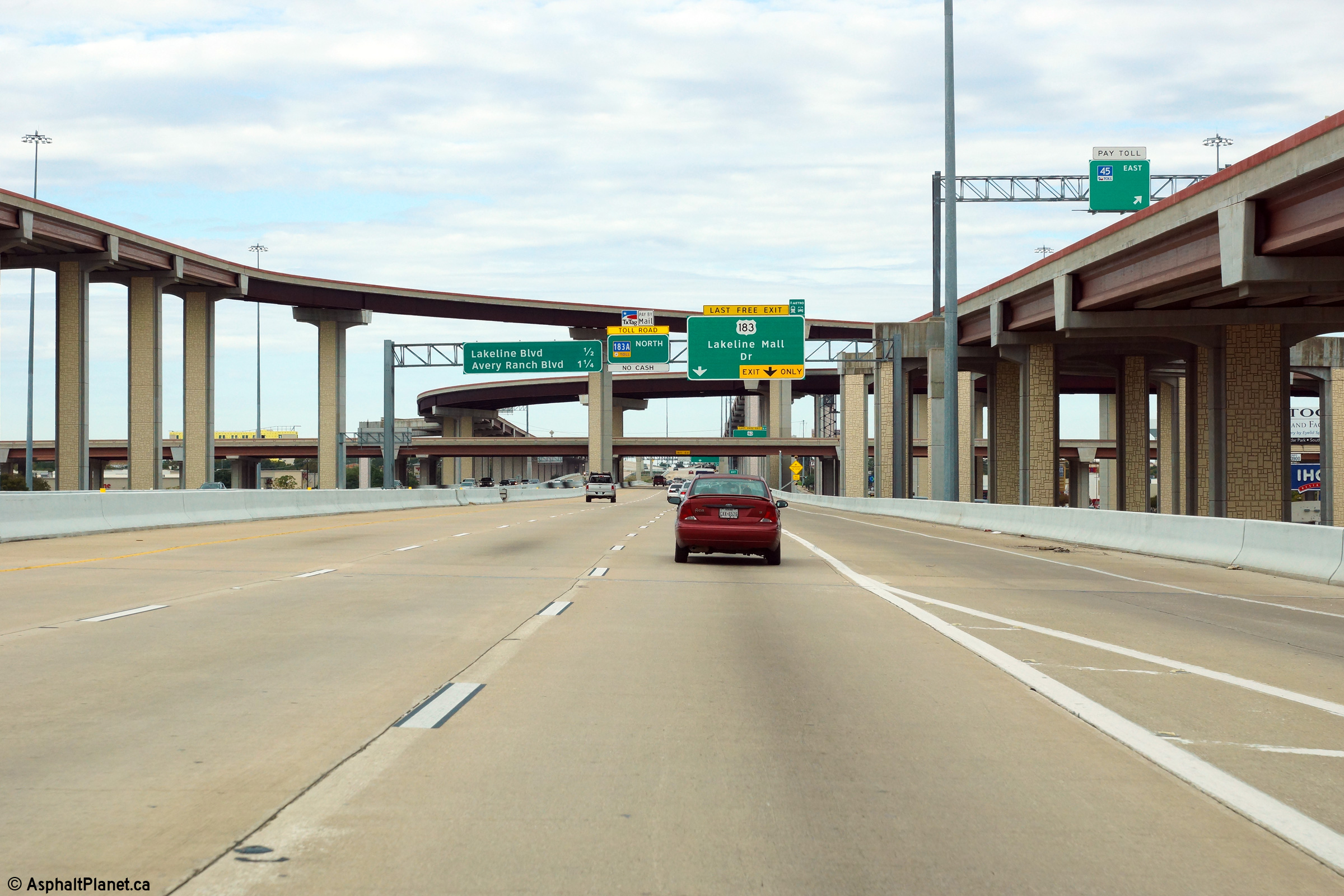
Travis County Austin |
Southerly view along US-183 from just south of the Lakeline Mall Drive intersection. Beyond Lakeline Mall Drive, US-183 rejoins the freeway as the 183A Tollway ends at the Lakeline Mall Drive interchange. |
 |
||
|
Date: 11/13/2015 |
High-res: (1440x960) (2400x1600) | |||
<- US-181
TX
Highways
US-190 ->
AsphaltPlanet.ca
© 2006-2016 AsphaltPlanet.ca.
AsphaltPlanet@asphaltplanet.ca
Page Created: April 4, 2016.
Last Updated: April 4, 2016.