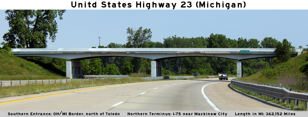
AsphaltPlanet.ca > Michigan > US-23
Pictures on this page are arranged in order from west to east. US-23 North photos are left-aligned in the last column, while US-23 South photos are right-aligned. Center-line pictures are centered within the last column.
|
Location |
Description |
Photo |
||
|
North- |
South- |
|||
|
Monroe County |
Advanced signage for the Consear Road interchange at the Sterns Road overpass. |
 |
||
|
Date: 05/21/2012 |
High-res: (1440x960) (2400x1600) | |||
|
Monroe County |
Signage at the northbound off-ramp to Consear Road. |
 |
||
|
Date: 05/21/2012 |
High-res: (1440x960) (2400x1600) | |||
|
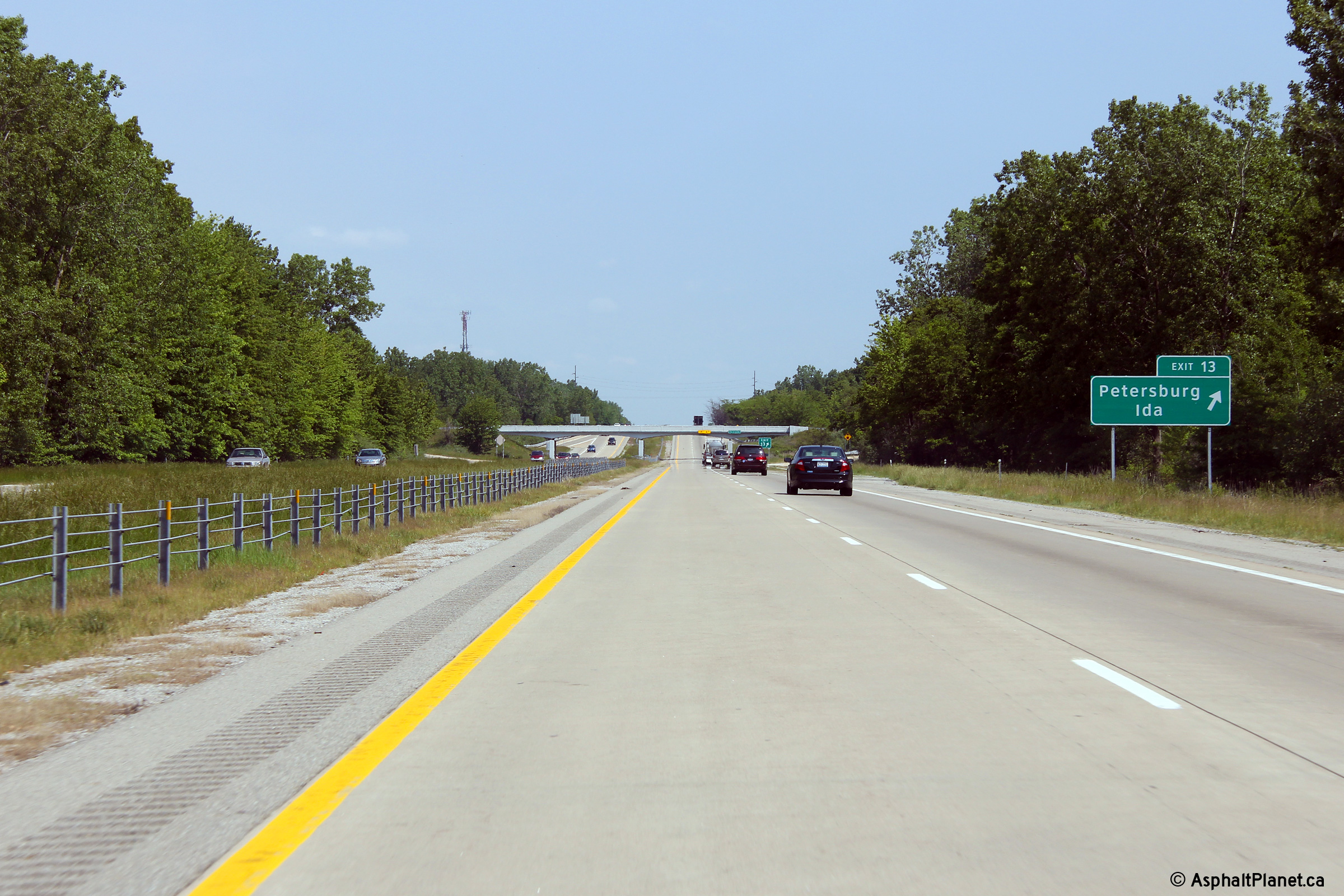
Monroe County |
Two views at the US-223 interchange. The first at the northbound off-ramp to US-223, and the second at the US-223 overpass. |
 |
||
| High-res: (1440x960) (2400x1600) | ||||
 |
||||
|
Date: 05/21/2012 |
High-res: (1440x960) (2400x1600) | |||
|
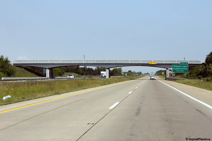
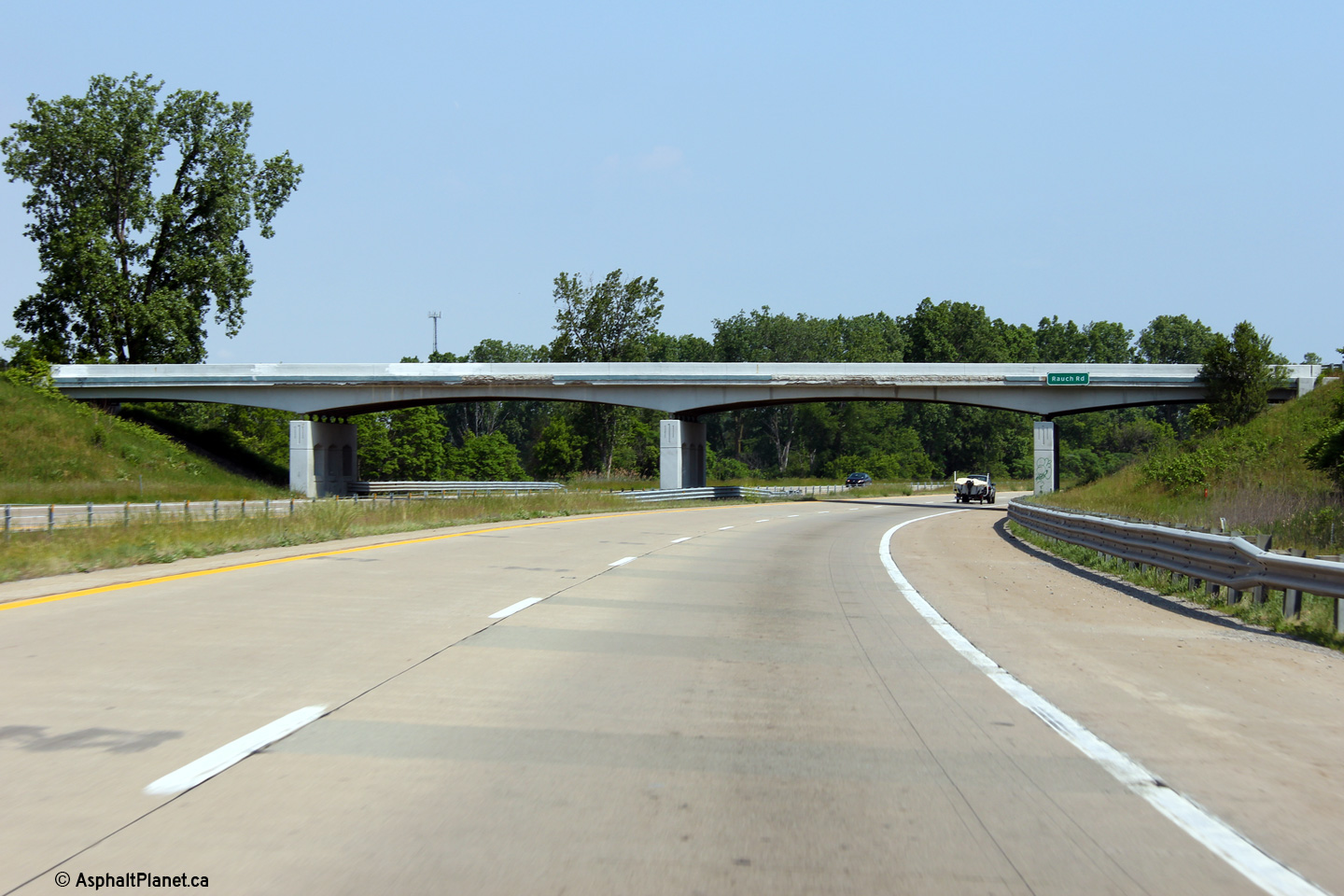
Monroe County |
View looking northerly at the Rauch Road overpass. |
 |
||
|
Date: 05/21/2012 |
High-res: (1440x960) (2400x1600) | |||
|
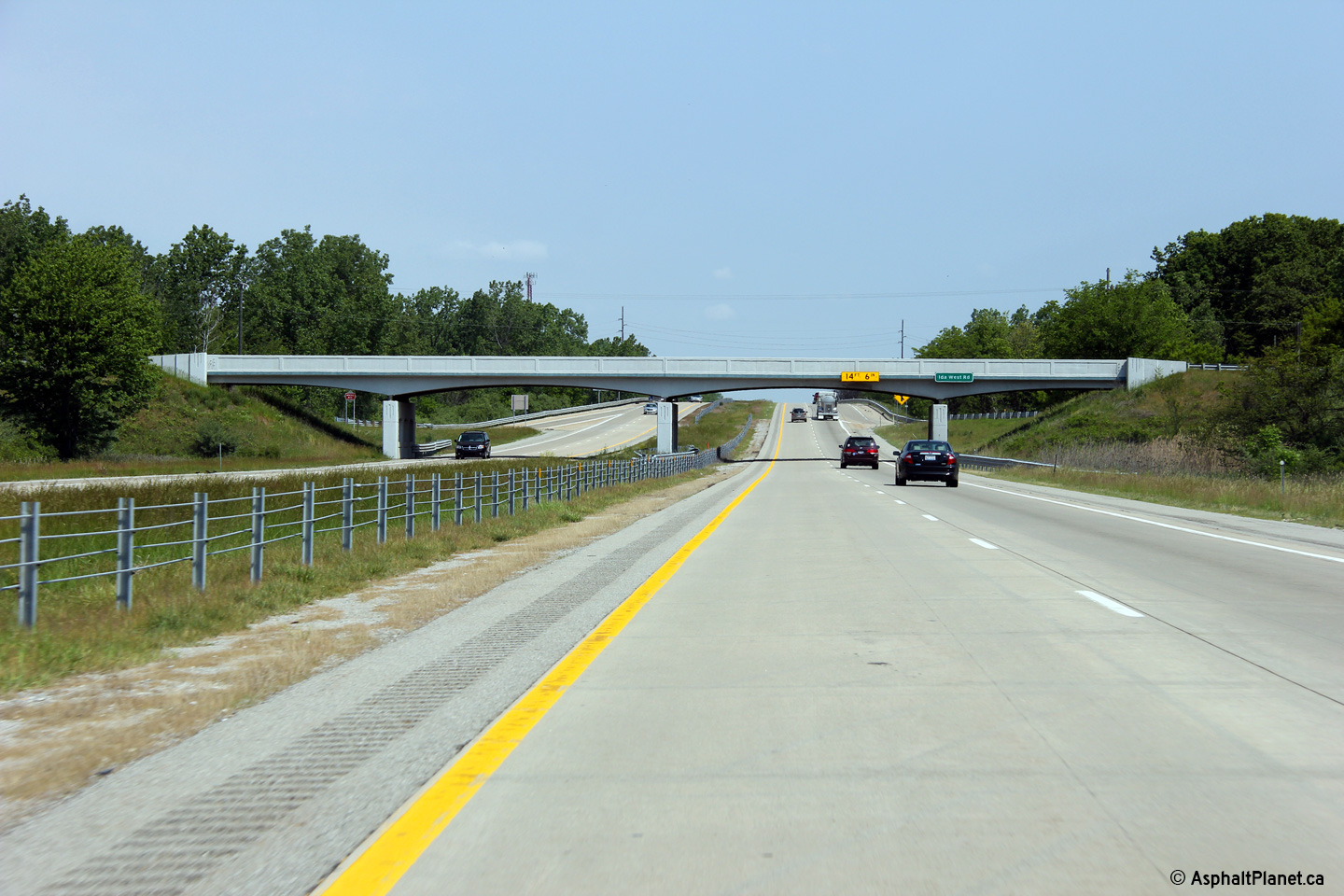
Monroe County |
Northerly view at both the northbound off-ramp to Ida West Road as well as the Ida Weest Road overpass. |
 |
||
| High-res: (1440x960) (2400x1600) | ||||
 |
||||
|
Date: 05/21/2012 |
High-res: (1440x960) (2400x1600) | |||
|
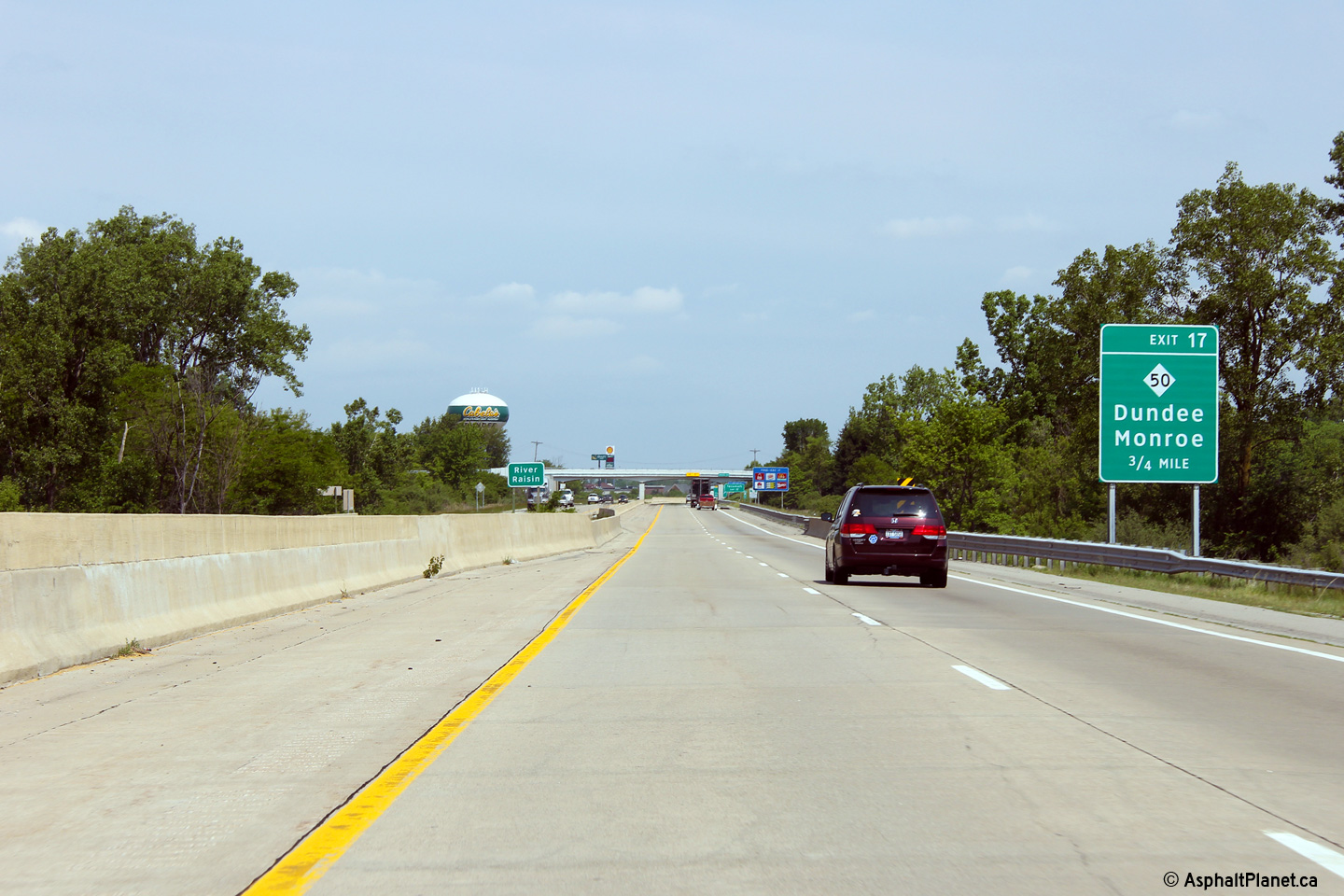
Monroe County |
Northbound advanced signage for the M-50 interchange. |
 |
||
|
Date: 05/21/2012 |
High-res: (1440x960) (2400x1600) | |||
|
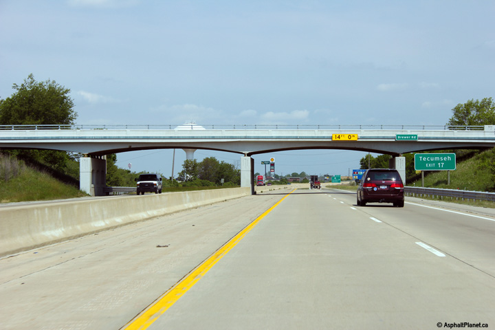
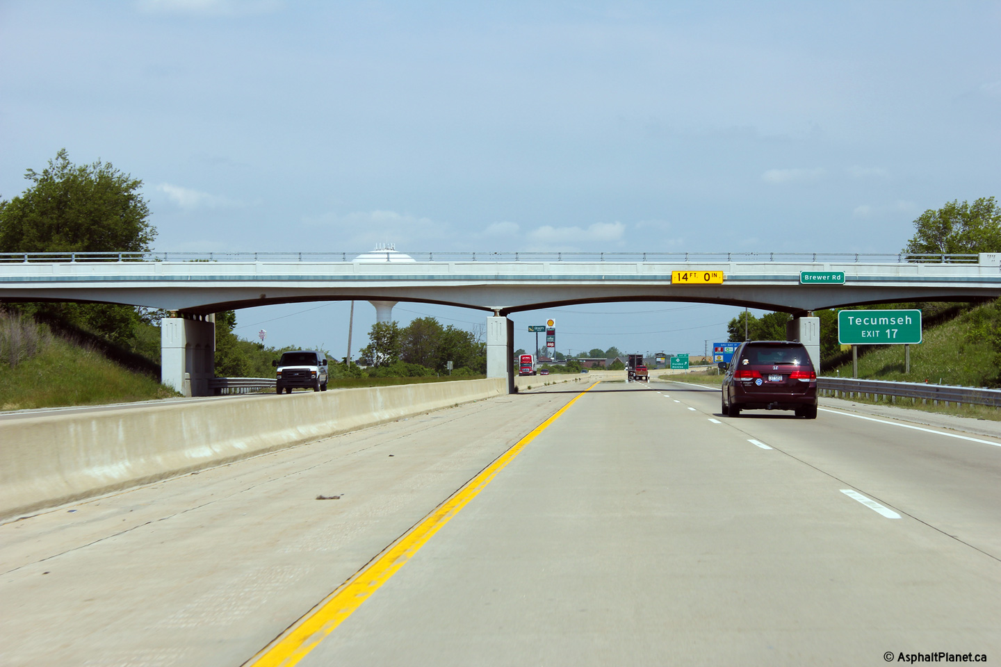
Monroe County |
View looking northerly through the Brewer Road overpass. Judging from the condition of the overpass, it has been recently rehabilitated. |
 |
||
|
Date: 05/21/2012 |
High-res: (1440x960) (2400x1600) | |||
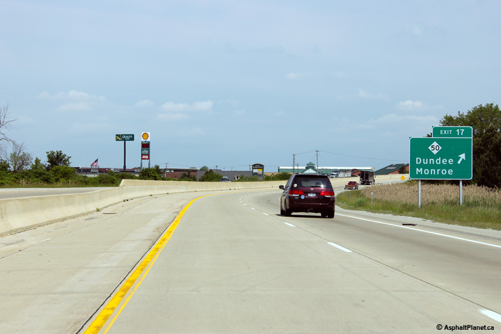
|
Monroe County |
Northbound signage at the off-ramp to M-50 |
 |
||
|
Date: 05/21/2012 |
High-res: (1440x960) (2400x1600) | |||
|
Monroe County |
Northerly view through the Cone Road overpass. |
 |
||
|
Date: 05/21/2012 |
High-res: (1440x960) (2400x1600) | |||
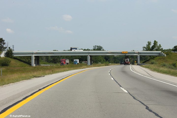
|
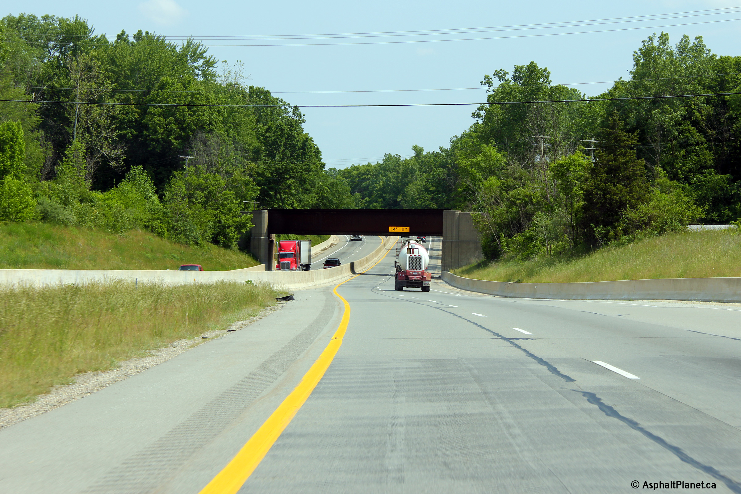
Monroe County |
A short distance north of the Kone Road interchange, US-23 passes beneath the Ann Arbor Railway via a narrow overhead. |
 |
||
|
Date: 05/21/2012 |
High-res: (1440x960) (2400x1600) | |||
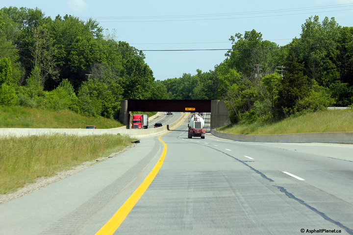
|
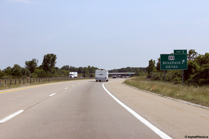
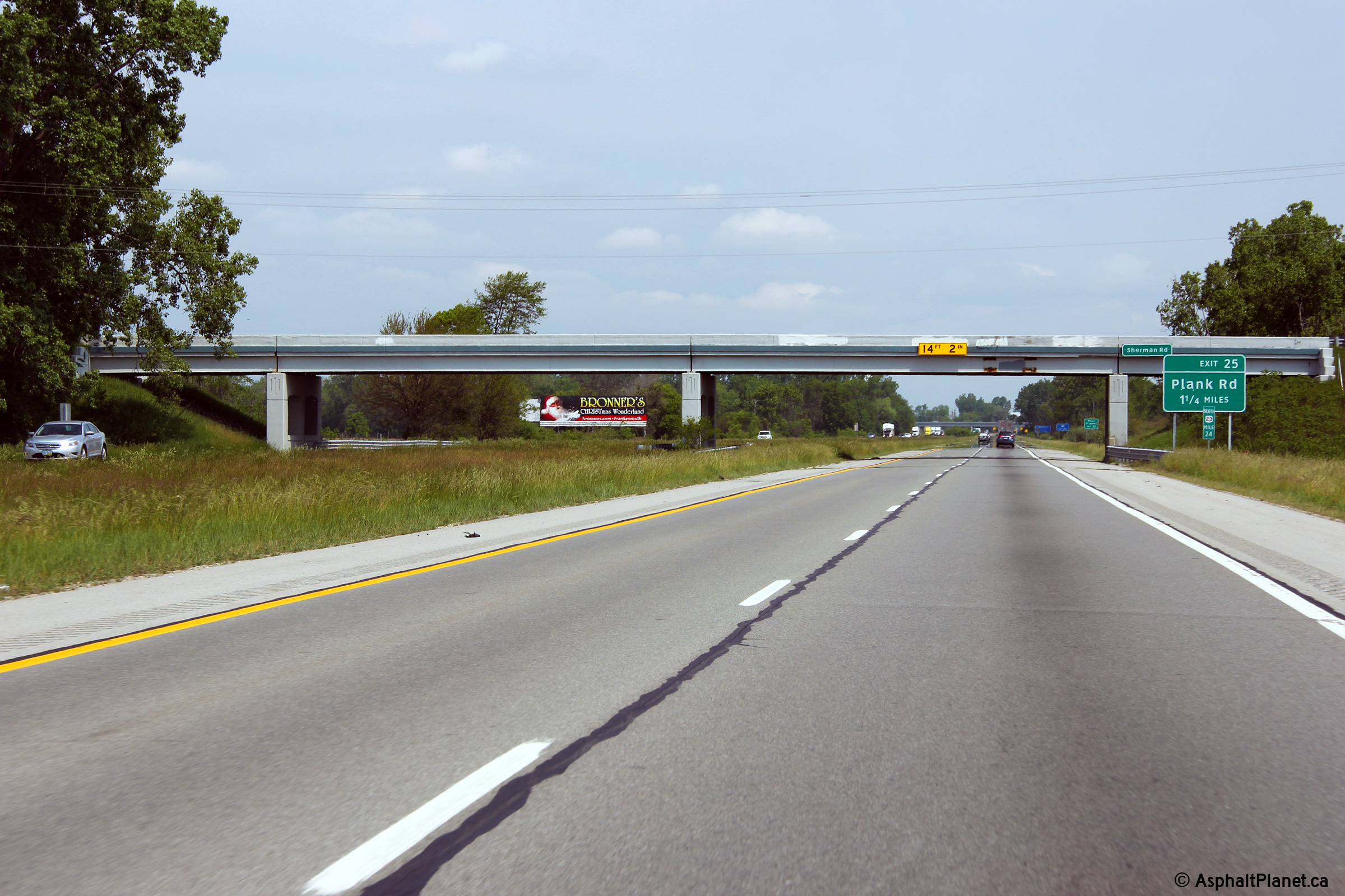
Monroe County |
Northbound advanced signage to the Plank Road interchange located at the Sherman Road overpass. |
 |
||
|
Date: 05/21/2012 |
High-res: (1440x960) (2400x1600) | |||
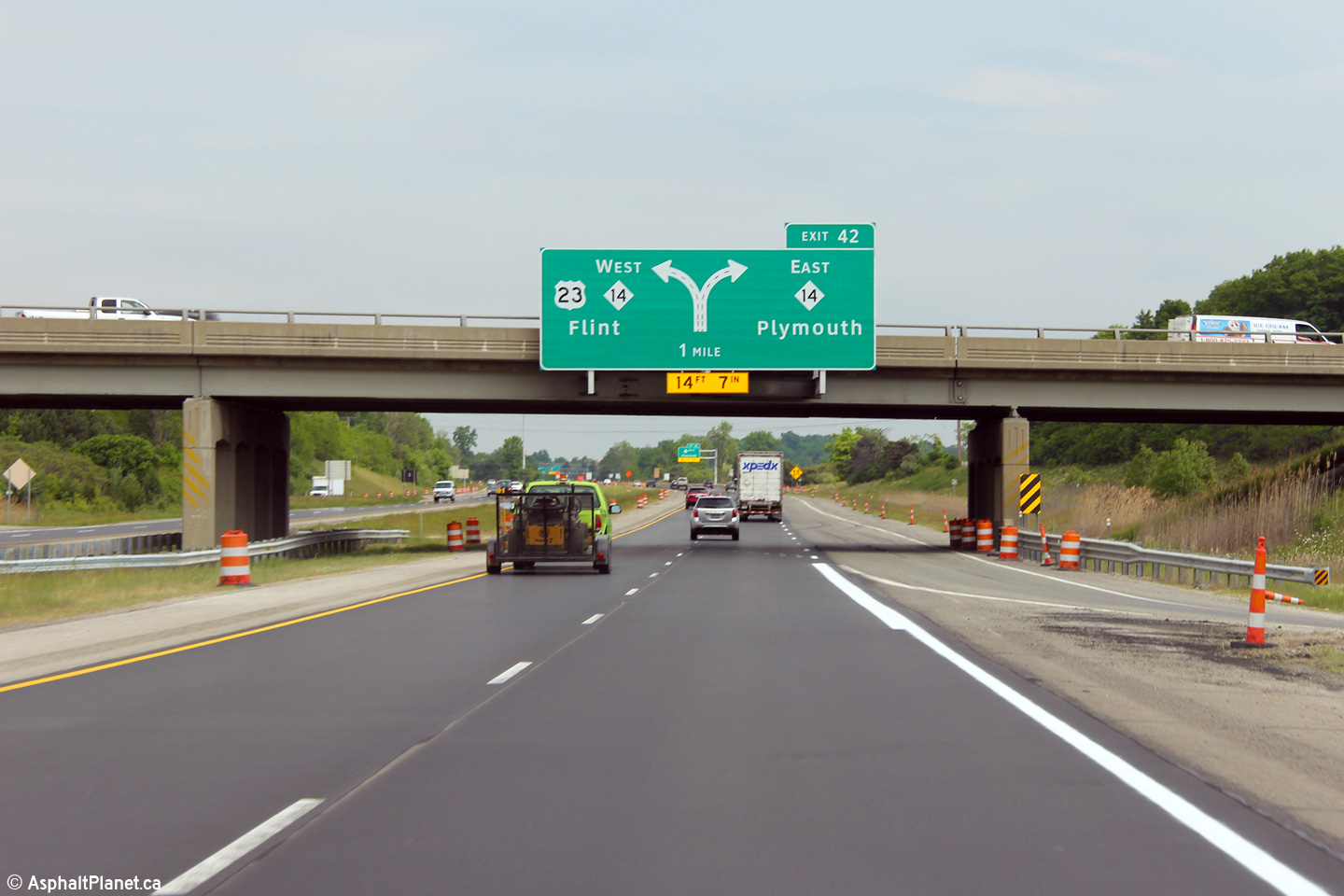
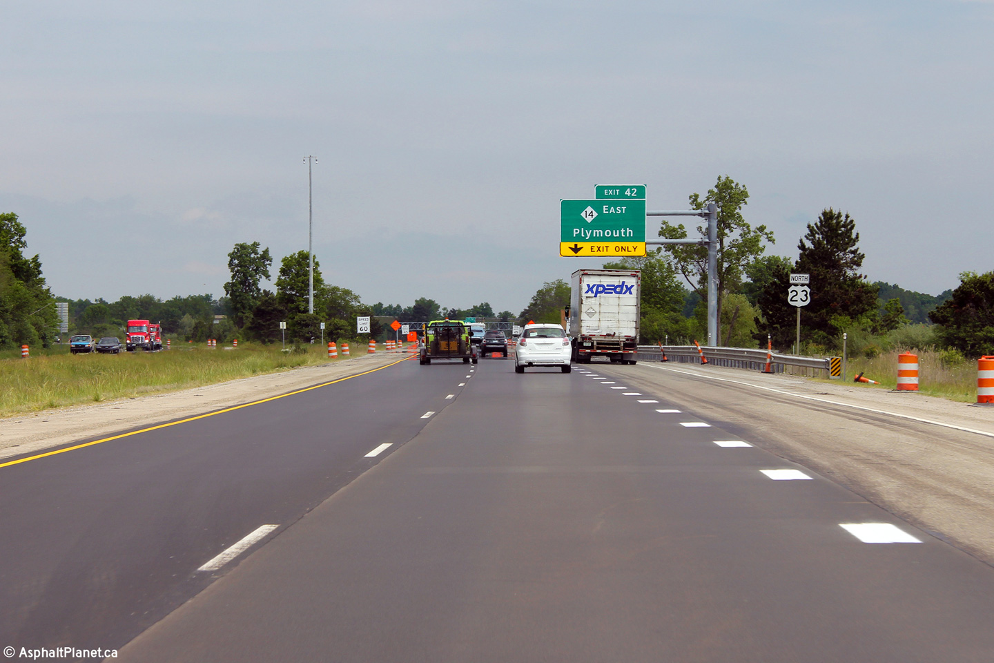
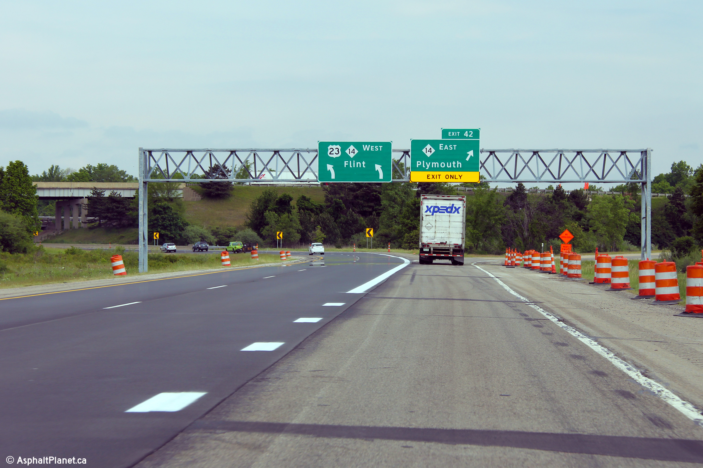
|
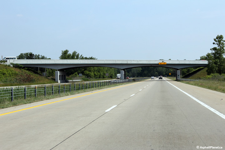
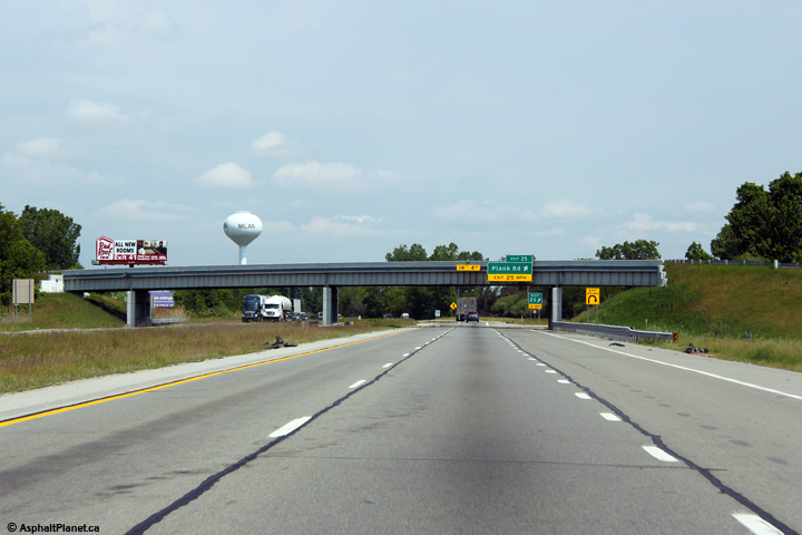
Monroe County |
View at the Plank Road interchange -- looking northerly. |
 |
||
|
Date: 05/21/2012 |
High-res: (1440x960) (2400x1600) | |||
|
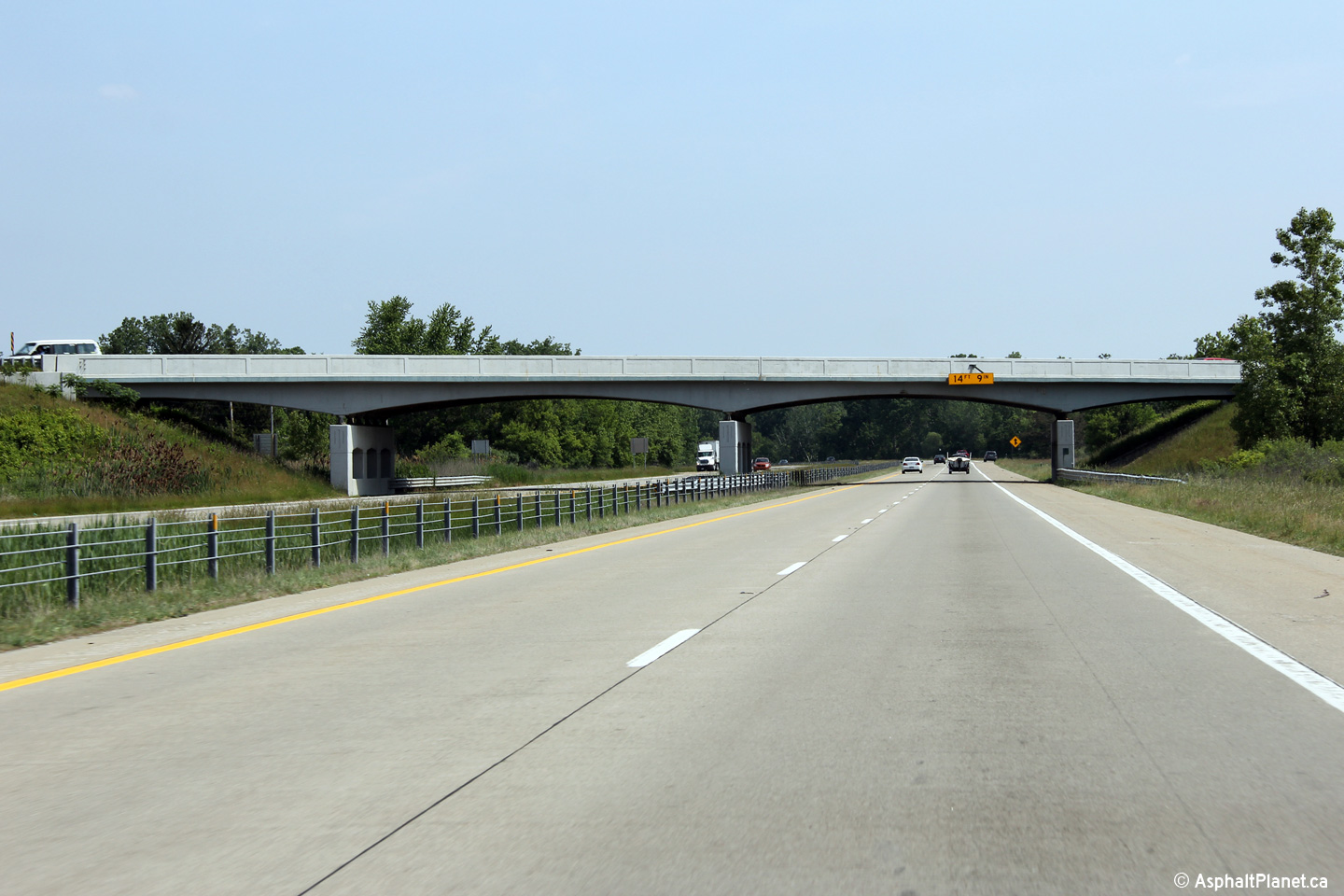
Washtenaw County |
This view looks northerly as US-23 passes beneath the Milan-Oakville Road. The Milan-Oakville Road overpass is one of the few structures that retains their original steel railings along this portion of US-23 |
 |
||
|
Date: 05/21/2012 |
High-res: (1440x960) (2400x1600) | |||
|
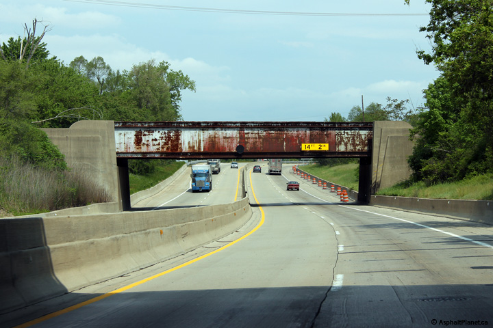
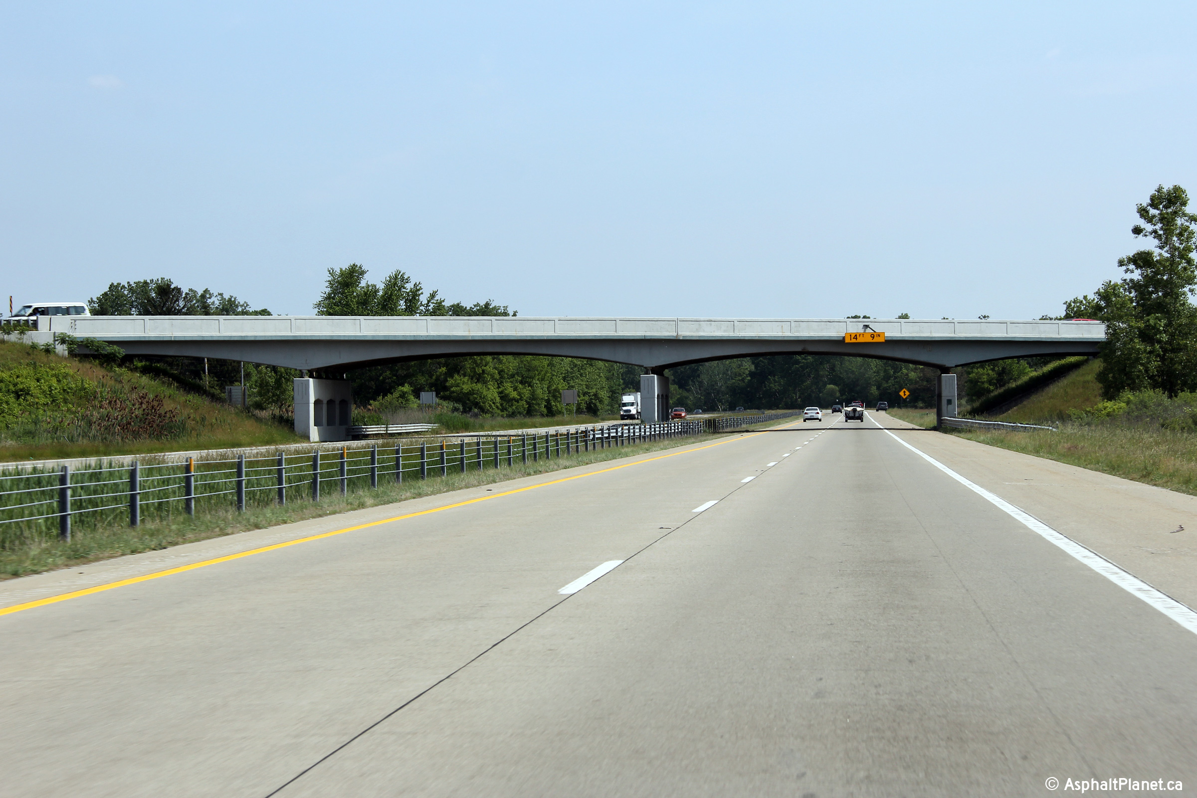
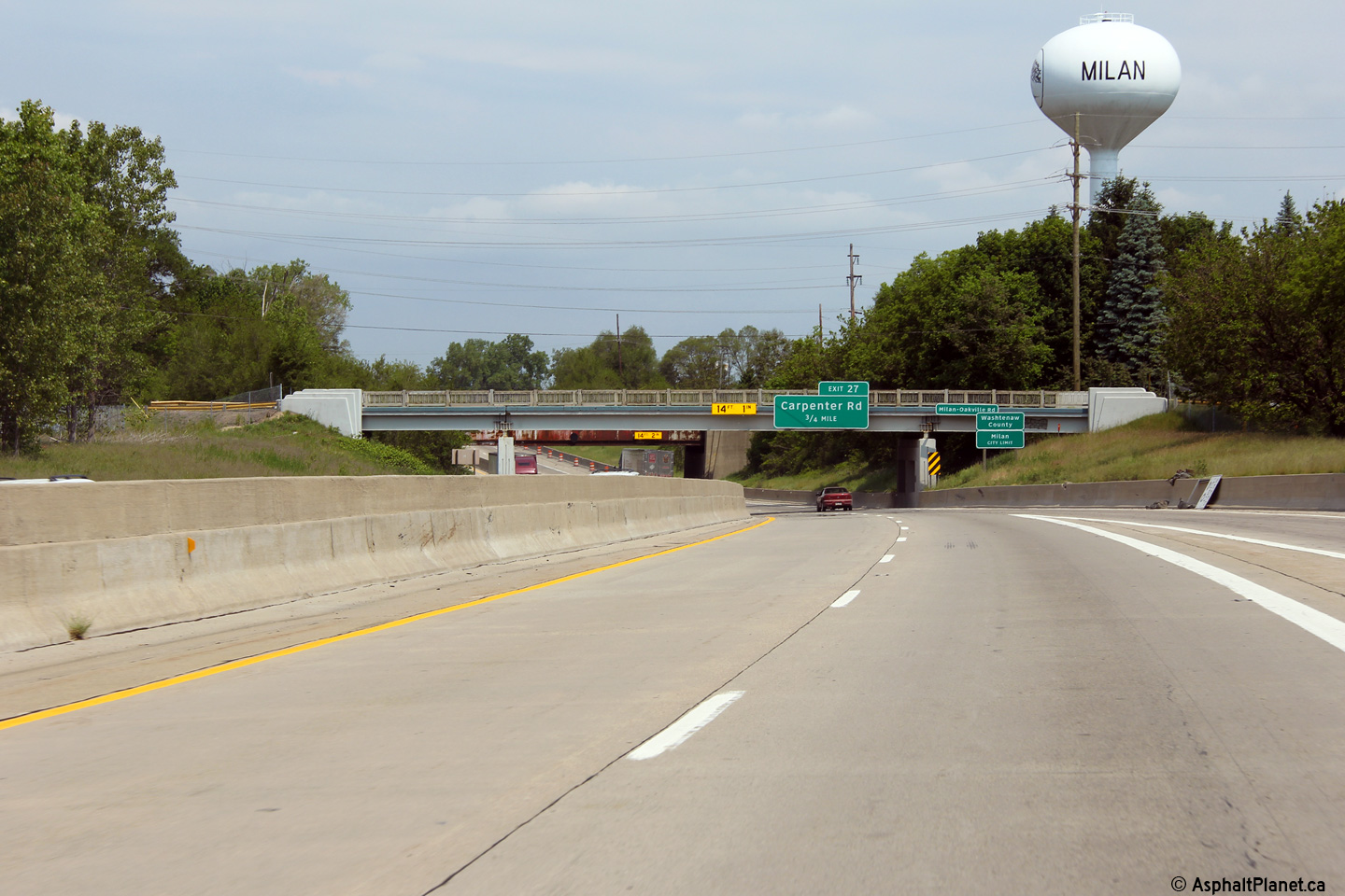
Washtenaw County |
View looking northerly through the Milan Railway overhead. The Milan Railway overhead is located immediately north of the Milan-Oakville Road, and was constructed during 1951 as part of a non-freeway Milan by-pass. |
 |
||
|
Date: 05/21/2012 |
High-res: (1440x960) (2400x1600) | |||
|
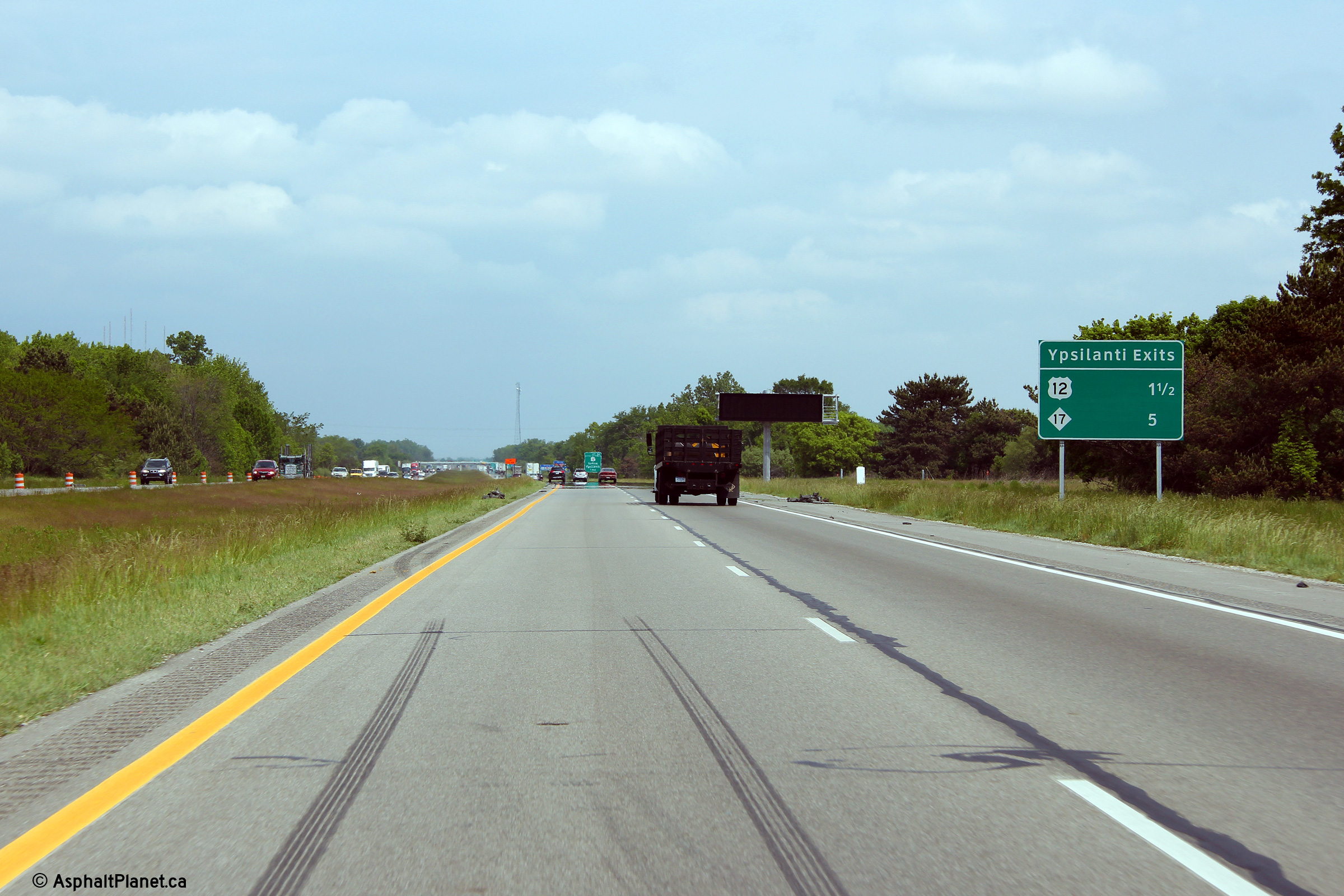
Washtenaw County |
Interchange sequence signage listing the various access points to Ypsilanti. |
 |
||
|
Date: 05/21/2012 |
High-res: (1440x960) (2400x1600) | |||
|
Washtenaw County |
One mile advanced signage for the US-12 interchange. |
 |
||
|
Date: 05/21/2012 |
High-res: (1440x960) (2400x1600) | |||
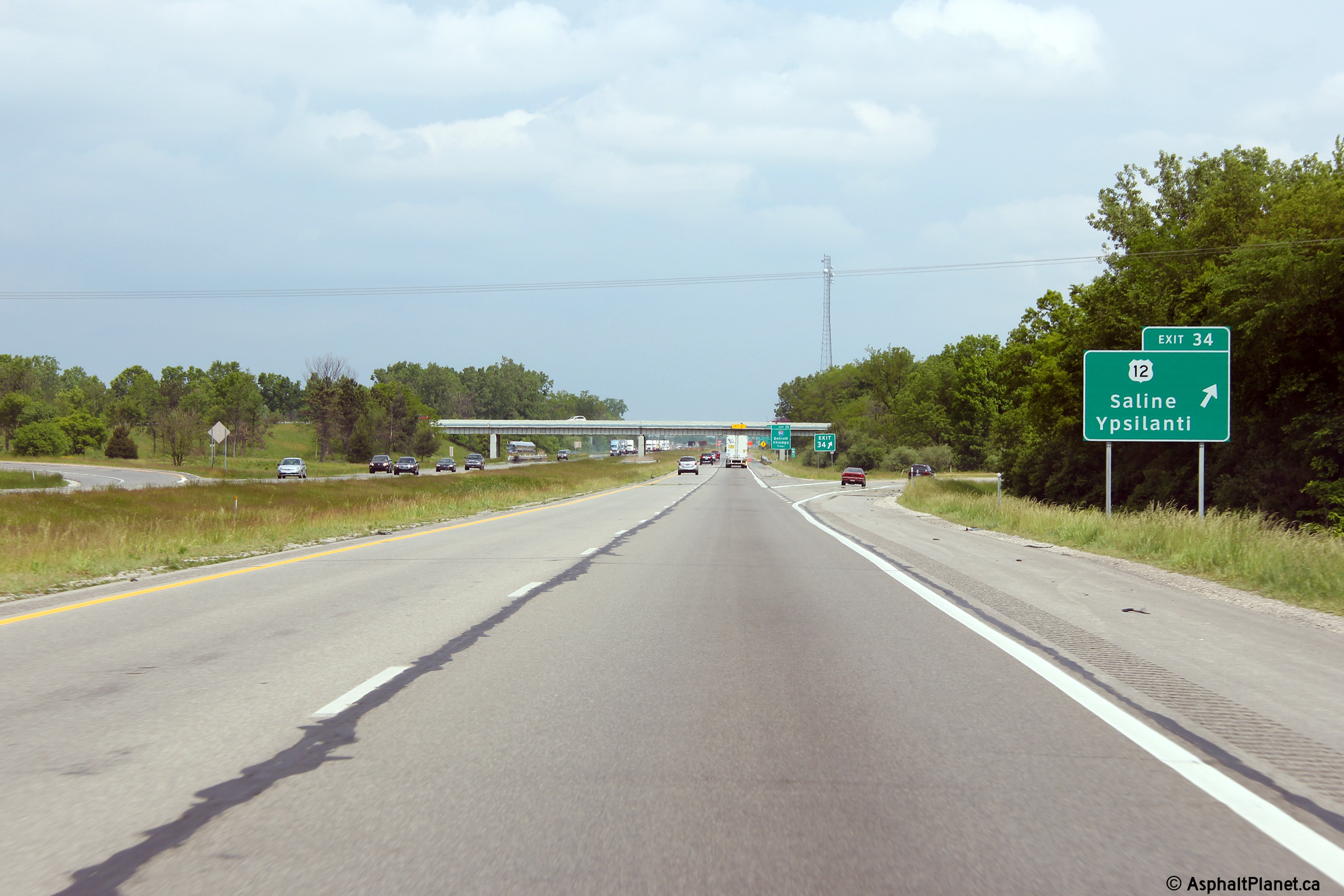
|
Washtenaw County |
Signage at the northbound off-ramp to US-12. |
 |
||
|
Date: 05/21/2012 |
High-res: (1440x960) (2400x1600) | |||
|
Washtenaw County |
One mile advanced signage for the I-94 interchange located at the Michigan Avenue (US-12) overpass. |
 |
||
|
Date: 05/21/2012 |
High-res: (1440x960) (2400x1600) | |||
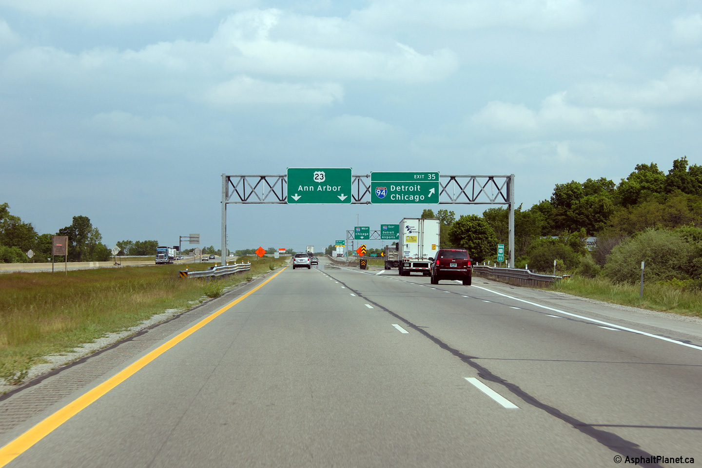
|
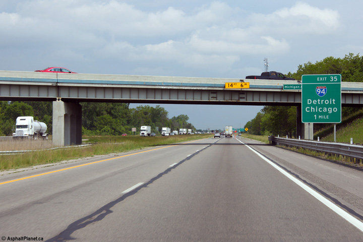
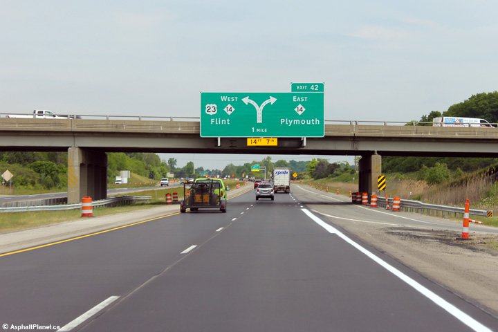
Washtenaw County |
Northbound overhead signage at the ramp to I-94. US-23 meets I-94 at a cloverleaf interchange. |
 |
||
|
Date: 05/21/2012 |
High-res: (1440x960) (2400x1600) | |||
| I-94 is the principal east-west interstate through southern Michigan, running from the Indian Border near New Buffalo, to the Ontario Border at Port Huron. Click here for I-94-West and here for I-94-East images. | ||||
|
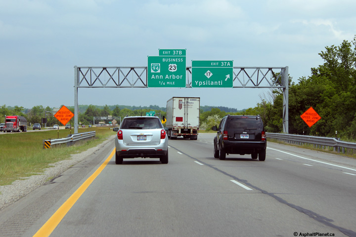
Washtenaw County |
Overhead signage at the off-ramp to M-17. |
 |
||
|
Date: 05/21/2012 |
High-res: (1440x960) (2400x1600) | |||
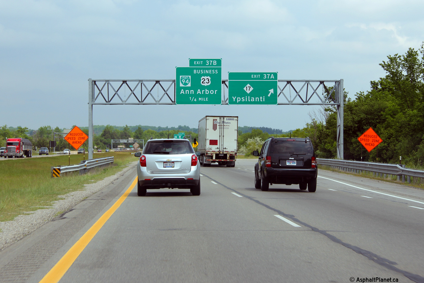
|
Washtenaw County |
Signage in advance of the southern M-14 interchange. |
 |
||
|
Date: 05/21/2012 |
High-res: (1440x960) | |||
|
Washtenaw County |
Advanced lane assignment signage for the ramp to M-14 east. |
 |
||
|
Date: 05/21/2012 |
High-res: (1440x960) (2400x1600) | |||
|
Washtenaw County |
Overhead signage at the ramp to M-14 east from US-23 North. |
 |
||
|
Date: 05/21/2012 |
High-res: (1440x960) (2400x1600) | |||
| M-14's Western Terminus is at I-94 on the west side of Ann Arbor. M-14 West defaults onto I-94 West, which heads toward Jackson. Click here for M-14 images. | ||||
<- US-12
MI Highways
US-24 ->
AsphaltPlanet.ca
© 2010-14 AsphaltPlanet.ca.
AsphaltPlanet@asphaltplanet.ca
Page Created: September 8, 2014.
Last Updated: September 8, 2014.