King's Highway 11B (Atikokan) - www.OntHighways.com

Atikokan's Highway 11B is a short spur route that leads into the small community from Highway 11. 


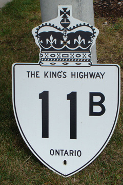
Old Style Highway 11B Shield

  Southern Terminus:  Junction Highway 11 south of Cobalt

Northern Terminus:  Zuke Street, just beyond the Highway 622 intersection

Length:  3.4km

Multiplexes:  None

Freeway:  No

Orientation: North-South

Regions Served: Rainy River District

AADT (2002):  Highest:  8,300, from Highway 576 east to the Timmins connecting link;

                             Lowest:  310, from Highway 651 to the Algoma-Sudbury District Boundary.

Road info:  Highway 11B is a short highway that links the Voyaguer Route of Highway 11 to Atikokan.  There is not much to Highway 11B, it is a short highway that is generally in good condition, that terminates almost immediately upon entering the urban section of Atikokan.  Highway 11B is part of a through route that links Highway 11 South of Atikokan to Highway 17 east of Dryden via Highway 622.  Speed limits along Highway 11B range from 50km/h to 80km/h.


Highway 11B information:


OntHighways.com  

Detailed Route information available below
Virtual Tour of Highway 11B (Atikokan)


TheKingsHighway.ca   History of Highway 11B (Atikokan)
Photographic History of Highway 1
1B (Atikokan)

Communities and Major Intersections located along Highway 111B from South to North:

Proper Municipality Name Community Name Distance Intersecting Road
King's Highway 11
Secondary Highway 622
Atikokan Zuke Street
Highway 11B ENDS

<-Highway 11B (Thunder Bay)          www.OntHighways.com - Home          Highway 12->


Copyright (c) 2004-2010, AsphaltPlanet.ca  AsphaltPlanet@asphaltplanet.ca

Page last updated:  February 26th, 2007

Page created:  February 26th, 200