King's Highway 141 - www.OntHighways.com

Highway 141 runs the distance between Highways 400 and 11 from just south of Parry Sound to Port Sydney.  Highway 141 was extended in the Fall of 2003 concurrent with the newly opened Highway 400 extension south of Parry Sound.  This extension lengthened the route by 4.4km along Highway 69 and the former Airport Road alignment.  This alignment was unexpected as the more logical extension to Highway 400 would have followed Highway 69 northwesterly from Hayes Corners instead of this more southern routing.


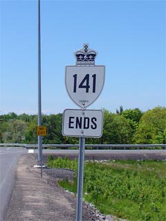
King's Highway 141 Shield


Western Terminus:  Current: At the Highway 400 interchange south of Parry Sound.
                                       Pre 2003: Junction Highway 69 at Hayes Corners

Eastern Terminus:  Junction King's Highway 11 just west of Port Syney

Length:  Current: 55.2km.  Pre-2003: 49.8km

Multiplexes:  A 3.5km multiplex was created in 2003 when Highway 141 was extended concurrent with Highway 69 towards Highway 400.

Freeway:  No

AADT (2002):  Highest:  2,200 from Muskoka Road 35 easterly to Highway 11;

                             Lowest:  1,250 from Highway 632 easterly to Muskoka Road 24.

Road Info:  Highway 141 is in reasonably good condition for all of its length.  Much of the route has been rehabilitated fairly recently, though it should be noted that some of the older sections of highway are reminiscent of a secondary highway.  (Much of Highway 141 was part of Ontario's first Secondary Highway 532).  Rural speed limits along Highway 141 are posted at 80km/h.


Highway 141 information:


OntHighways.com  

Detailed Route information available below
Virtual Tour of Highway 141


TheKingsHighway.ca   History of Highway 141
Photographic History of Highway 141

Communities and Major Intersections along Highway 141 from East to West:

Proper Municipality Name Community Name Distance Intersection Road
Township of Seguin ----- 0km / 54.2km King's Highway 400
Township of Seguin ----- 0.9km / 53.3km King's Highway 69-South

At Highway 69-North:  EB: Turn Right towards Rosseau.  WB: Turn Left towards Highway 400-South.

Township of Seguin Hayes Corners 4.4km / 49.8km King's Highway 69-North
Township of Seguin Humphrey --- -----
Township of Seguin (Former) Rosseau North Limits 20.8km / 33.4km -----
Township of Seguin Rosseau 21.6km / 32.6km Secondary Highway 632
Township of Seguin Rosseau 22.2km / 32.0km Cardwll Road
Seguin - Muskoka Lakes Boundary Rosseau South Limits 22.7km / 31.5km -----
Township of Muskoka Lakes Ullswater 36.4km / 17.8km Deebank Road (Muskoka Road 24)
Township of Muskoka Lakes Raymond --- -----

At Muskoka Road 35:  EB: Turn Left towards Huntsville and Highway 11.  WB: Turn Right towards Rosseau and Parry Sound.

Muskoka Lakes - Huntsville Boundary Huntsville West Limits 46.5km / 7.7km Raymond Road (Muskoka Road 35)
Town of Huntsville Utterson --- -----
Town of Huntsville ----- 54.2km / 0km King's Highway 11 & Port Sydney Road (Muskoka Road 10)

Highway 141 Ends

www.OntHighways.com - Home


Copyright (c) 2004-2015, AsphaltPlanet.ca  AsphaltPlanet@asphaltplanet.ca

Page last updated:  January 18th, 2005

Page created:  January 18th, 2004