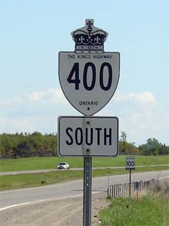
|
Proper Municipality Name |
Exit # |
Interchange Name |
North / West Control City* |
South / East Control City* |
|
Highway 400 ends 400m south of
the Jane Street interchange at the Maple Leaf Drive overpass |
| City of Toronto |
20 |
Jane Street |
City of Toronto |
| City of Toronto |
21 |
King's Highway 401 (Autoroute
Macdonald-Cartier Freeway) |
| City of Toronto |
25 |
Finch Avenue |
| City of Vaughan |
26 |
Highway 407 ETR |
----- |
----- |
| Toronto - Vaughan Boundary |
27 - NB Partial Interchange |
Steeles Avenue |
City of Toronto |
| City of Vaughan |
29 |
Highway 7 (York Road
7, Highway 7) |
City of Vaughan
Population: 231 000
4(SB),
6(NB) Interchanges
Vaughan City Centre Via Major Mackenzie Drive |
| City of Vaughan |
31 - NB Partial interchange |
Langstaff Road (York Road 72) |
| City of Vaughan |
32 - NB Partial Interchange |
Bass Pro Mills Road |
| City of Vaughan |
33 |
Rutherford Road (York Road 73) |
| City of Vaughan |
35 |
Major Mackenzie Drive (York Road 25) |
| Township of King |
43 |
King Road (York Road 11) |
Nobleton |
King City |
| Township of King |
52 |
Lloydtown-Aurora Road (York Road 16) |
Pottageville |
Aurora |
| Township of King |
55 |
King's Highway 9 |
Orangeville |
Newmarket |
| Township of Bradford- West Gwillimbury |
58 |
Canal Road |
----- |
----- |
| Township of Bradford- West Gwillimbury |
64 (A-B) |
Highway 88 (Simcoe
Road 88) |
Bond Head |
Bradford |
| Town of Innisfil |
75 |
King's Highway 89 /
Simcoe Road 89 |
Cookstown |
----- |
| Town of Innisfil |
85 (A-B) |
Innisfil Beach Road (Simcoe Road 21) |
Thornton |
----- |
| City of Barrie |
90 |
Molson Park Drive |
City of Barrie
Population: 125 000
5 InterchangesDowntown Via: Bayfield
Street -SB, Essa Road -NB. |
| City of Barrie |
94 |
Highway 27 (Essa Road) |
| City of Barrie |
96 |
Highway 90 (Dunlop Street) |
| City of Barrie |
98 |
King's Highway 26/Highway 27 (Bayfield Road) |
| City of Barrie |
102 |
Duckworth Street |
| Township of Springwater |
--- |
King's Highway 11 (Formerly Highway 400A) |
Orillia, North Bay |
|
| Township of Springwater |
111 |
Forbes Road (Simcoe Road 11) |
Midhurst |
|
| Springwater - Oro- Medonte Boundary |
117 |
Horseshoe Valley Road (Simcoe Road 22) |
----- |
Craighurst |
| Springwater - Oro- Medonte Boundary |
121 |
King's Highway 93 /
Simcoe Road 93 |
Penetanguishene, Hillsdale |
----- |
| Township of Oro- Medonte |
131 |
Mount St Louis Road |
----- |
----- |
| Township of Oro- Medonte |
136 |
Moonstone Road (Simcoe Road 19) |
----- |
----- |
| Township of Severn |
137 - NB Partial Interchange |
Lower Big Chute Road |
Coldwater |
----- |
| Severn - Tay Boundary |
141 |
King's Highway 12-East
& Vasey Road (Simcoe Road 23) |
Waverly |
Coldwater |
| Severn - Tay Boundary |
147 |
King's Highway 12-West
& Simcoe Road 16 |
Victoria Harbour, Midland |
Orillia |
| Township of Severn |
149 |
Quarry Road |
----- |
----- |
| Township of Severn |
153 |
Port Severn Road S. |
----- |
Port Severn |
| Township of Georgian Bay |
156 |
Muskoka Road 5 & Port Severn Road N. |
Honey Harbour |
Port Severn |
| Township of Georgian Bay |
162 |
South Bay Road (Muskoka Road 48) & Muskoka Road
34) |
Honey Harbour -SB |
|
| Township of Georgian Bay |
168 |
Georgian Bay Road & Crooked Bay Road |
|
|
| Township of Georgian Bay |
174 |
South Gibson Lake Road (Muskoka Road 33) |
|
|
| Township of Georgian Bay |
177 |
Go Home Lake Road (Muskoka Road 32) & Muskoka Road 38 |
Bala |
----- |
| Township of Georgian Bay |
182 |
Iroquois Cranberry Growers Drive |
|
----- |
| Township of Georgian Bay |
185 |
12 Mile Bay Road (Muskoka Road 12) |
----- |
|
| Township of Georgian Bay |
189 |
King's Highway 69
(South JCT) |
MacTier,
Gravenhurst |
|
| Township of Seguin |
207 |
King's Highway 141 |
Rosseau, Huntsville |
|
| Township of Seguin |
213 |
King's Highway 69
(North JCT) & Rankin Lake Road |
----- |
----- |
| Township of Seguin |
214 |
Horseshoe Lake Road |
----- |
----- |
| Township of Seguin |
217 |
Oastler Park Drive & Bagger Road |
----- |
----- |
| Township of Seguin |
220 |
Secondary Highway 518 & Hunter Drive |
----- |
Orrville |
| Town of Parry Sound |
224 |
Bowes Street & McDougall Road |
Parry Sound |
----- |
| Town of Parry Sound |
229 |
Parry Sound Drive / Hall's Quarry Road |
Parry Sound |
----- |
| Municipality of McDougall |
231 |
King's Highway 124 / Parry Sound Drive |
Parry Sound, Nobel |
Sundridge |
| Municipality of McDougall |
236 |
Avro Arrow Road |
Nobel |
|
| Township of Carling |
241 |
Secondary Highway 559 |
Killbear PP |
|
|
Highway 400 ENDS
just north of Bowes Street, where it becomes Highway 69.
Click here
for Highway 69 information. |
