|
Proper
Municipality Name |
Community Name |
Distance |
Intersecting
Road |
|
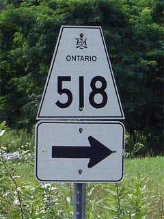
Highway 518 is known as Hunter
Drive between Oastler Park Drive and Highway 400 |
| Township of Seguin |
----- |
--- (0km) / --- (90.0km) |
Oastler Park Drive (Formerly Highway 69. Highway 7241) |
|
Current Western Terminus of Highway 518 is located
at Highway 69/400. West of Highway 69/400, Highway 518 is known as
Hunter Drive. |
| Township of Seguin |
----- |
0km (1.8km) / 73.1km (88.2km) |
King's Highway 69/400 |
| Township of Seguin |
Haines Lake |
----- |
|
|
AT Star Lake Road: EB: Turn Left towards
Kearney. WB: Turn Right towards Parry Sound |
| Township of Seguin |
Orrville |
16.7km (18.5km) / 56.4km (71.5km) |
Star Lake Road |
| Township of Seguin |
----- |
30.9km (32.1km) / 42.8km (57.9km) |
Nipissing Road |
| Township of McMurrich/Monteith |
Bear Lake |
----- |
----- |
| Township of McMurrich/Monteith |
Whitehall |
----- |
----- |
| Township of McMurrich/Monteith |
Sprucedale |
50.4km (52.2km) / 22.7km (37.8km) |
Stisted Road |
| Township of Perry |
----- |
62.8km (64.6km) / 10.3km (25.4km) |
King's Highway 11 |
|
At Deer Lake Road: EB: Turn Right towards Emsdale.
WB: Turn Left towards the Highway 11 interchange |
| Township of Perry |
----- |
63.0km (64.8km) / 10.1km (25.2km) |
Deer Lake Road |
|
At Scotia Road (Formerly Highway 11): EB:
Turn left towards Emsdale and Kearney. WB: Turn Right towards Highway
11 North. |
| Township of Perry |
----- |
64.9km (66.7km) / 8.4km (23.3km) |
Scotia Road (Formerly Highway 11) |
| Township of Perry |
Emsdale |
65.2km (67.0km) /.7.9km (23.0km) |
Secondary Highway 592 |
|
Current Eastern terminus of Highway 518 is located
at te Kearney Town Limits. Within Kearney, Highway 518 is still known as such. |
| Perry - Kearney Boundary |
Kearney West Limits |
73.1km (74.9km) / 0km (15.1km) |
----- |
| Town of Kearney |
(Former) Kearney East
Limits |
--- (76.3km) / --- (13.7km) |
----- |
| Town of Kearney |
Sand Lake |
--- (90km) / --- (0km) |
----- |
|
Highway 518 ENDS |