King's Highway 54 - www.OntHighways.com

Highway 54 follows the Grand River Valley from Brantford southeasterly to Highway 3 at Cayuga.  Because of the close proximity to the river, the Highway meanders along its course for the highways length.  Highway 54 was downloaded in its entirety in 1998.  The routes new names are Brant Road 18, Brant Highway 54 and Haldimand Highway 54.


King's Highway 54 Crown

  Western Terminus:  Junction Highway 
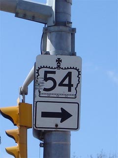
2/53 in the east side of Brantford.

Eastern Terminus:  Junction Highway 3 in Downtown Cayuga.

Length:  43.8km

Multiplexes:  None

Freeway: No

AADT (1994):  Highest: 7,450, from Blossom Road in Cainsville to Brant Road 18;

                             Lowest: 1,800, from Brant Road 18 to Caledonia.

Status:  Entirely downloaded:  New names are Brant Road 18, Brant Highway 54, and Haldimand Highway  54.

Road Condition:  Highway 54 is in acceptable condition for its entire length, though it is for the most part built to a lower standard, that was quite common the road is not particularly well suited for long distance travel, as it meanders fairly excessively following the banks of the Grand River.  The highway has a rural posted speed limit of 80km/h.


Highway 54 information:


OntHighways.com  

Detailed Route information available below
Virtual Tour of Highway 54


TheKingsHighway.ca   History of Highway 54
Photographic History of Highway 54

Communities and Major Intersections along Highway 54 from from West to East:

Proper Municipality Name Community Name Distance Intersecting Road
The westernmost portions of Highway 54 is now known as Brant Road 18
City of Brant County Cainsville --- (0km) / --- (43.8km) King's Highway 2/53 & Garden Avenue

At Brant Road 18-South:  EB: Turn left towards Caledonia onto Brant Road 54.  WB: Follow the ramp to the right towards Brantford onto Brant Road 18.

City of Brant County ----- --- (2.6km) / --- (41.2km) Brant Road 18-South
City of Brant County Onondaga --- -----
City of Brant County Middleport --- -----
City of Brant County ----- --- Brant Road 22

Brant - Haldimand Boundary:  In Haldimand County Highway 54 is now known as Haldimand Highway 54.  In Brant County Highway 54 is known as Brant Highway 54.

Brant - Haldimand-Norfolk Boundary ----- --- (21.6km) / --- (22.2km) -----
City of Haldimand County (Former) Caledonia West Limits --- (26.0km) / ---(17.8km) -----
City of Haldimand County Caledonia --- Argyle Street
City of Haldimand County (Former) Caledonia East Limits --- (29.2km) / --- (14.6km) -----
City of Haldimand County Sims Lock Road --- -----
City of Haldimand County York --- York Road (Haldimand-Norfolk Road-East)
City of Haldimand County York --- York Road (Haldimand-Norfolk road 9-West)
City of Haldimand County Indiana --- -----
City of Haldimand County (Former) Cayuga North Limits --- (43.2km) / --- (0.6km) -----
City of Haldimand County Cayuga --- (43.8km) / --- (0km) King's Highway 3 (Talbot Road)
Highway 54 ENDS

<- Highway 53         www.OntHighways.com - Home         Highway 55 ->


Copyright (c) 2004-2010, AsphaltPlanet.ca  AsphaltPlanet@asphaltplanet.ca

Page last updated:  September 6th, 2007

Page created:  September 6th, 2007