King's Highway
72 - www.OntHighways.com
Highway 72 leads northeast from
Highway 17 through the Northwestern Ontario wilderness to Sioux Lookout.
The highway was unaffected by provincial downloading.
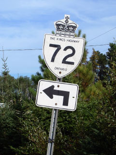
King's Highway 72 Shield.
|
|
Southern Terminus: Junction Highway
17 just west of Dinorwic Northern Terminus:
Junction Highway 642 in Sioux Lookout.
Length: 68.7km
Multiplexes: None
Freeway: No
AADT (2004): Highest: 3,300, from
Highway 664, northerly to Sioux Narrows;
Lowest: 980, from Highway 17 north to Highway 664 Road Info:
Not Available. |
Communities and Major Intersections along Highway 72 from South to North:
|
Proper Municipality Name |
Community Name |
Distance |
Intersection Name |
| District of Kenora |
----- |
0km / 68.7km |
King's
Highway 17 |
|
At Melgund Road: NB: Turn
Left towards Sioux Lookout. SB: Follow the ramp to the right towards
Highway 17. |
| District of Kenora |
Dinorwic |
--- |
Melgund Road |
| District of Kenora |
----- |
16.1km / 52.6km |
(Brown's Fairview Camp Road) |
| District of Kenora |
Timber Edge Camp |
32.2km / 36.5km |
----- |
| District of Kenora |
Patricia Corners |
60.54km / 8.2km |
Secondary Highway 664 |
| Municipality of Sioux Lookout |
Sioux Lookout South Limits |
66.6km / 2.1km |
----- |
| Municipality of Sioux Lookout |
Sioux Lookout |
68.7km / 0km |
Secondary Highway 642 |
|
Highway 72 ENDS |
<- Highway 71
www.OntHighways.com - Home
Highway 73 ->
Copyright (c) 2004-2010, AsphaltPlanet.ca
AsphaltPlanet@asphaltplanet.ca
Page last updated: September 28h, 2007
Page created: September 28th, 2007