AsphaltPlanet.ca > OntHighways > Highway 71 > Images
< Hwy 70    Hwy 72 >

King's Highway 71 - www.OntHighways.com

Highway 71 is a primary highway that runs through Northwestern Ontario.  The highway has a north-south trajectory for much of its length, following the eastern side of The Lake of the Woods.  Highway 71 runs east-west where it piggy backs along Highway 11 between Emo and Fort Frances.  Highway 71 continues southerly into the United States as United States Highway 71.


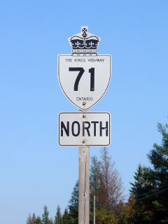
King's Highway 71 Shield.

  Southern Terminus:  At the International Bridge in Fort Frances

Northern Terminus:  Junction Highway 17 east of Kenora.

Length:  194.3km

Multiplexes:  40.1km with Highway 11 and 2.0km with Highway 611.

Freeway: No

Trans-Canada Highway:  Until recently, Highway 11 was part of the Voyager Route which extended westerly from Shabaqua Corners to the western Highway 71 junction.  However despite being indicated on road maps, this routing of the Trans-Canada Highway is no longer signed in the field.

AADT (2002): Highest: 5,300, from Fort Frances westerly to Highway 611(concurrent with Highway 11);
                             Lowest:  990, from Highway 600/615 northerly to the Kenora District boundary.

Road Info: Highway 71 is in typical condition for a king's highway in northwestern Ontario.  Where Highway 71 runs concurrent with Highway 11, the route is very well built to modern Trans-Canada highway standards.  North of Highway 11, Highway 71 still has generally has a smooth surface, however the driving surface is notably narrower.  Rural posted speed limits along Highway 71 range from 80km/h to 90km/h


Highway 71 information:


OntHighways.com  

Detailed Route information available below
Virtual Tour of Highway 71


TheKingsHighway.ca   History of Highway 71
Photographic History of Highway 71

Communities and Major Intersections along Highway 71 from South to North:

Proper Municipality Name Community Name Distance Intersection Name
Canada - USA Boundary Fort Frances / International Falls 0km / 194.3km US Highway 53 & 71 via International Bridge

At Highway 11-East:   EB: Keep right towards the International Bridge.  WB: Keep Left towards Rainy River.

City of Fort Frances Fort Frances 0.3km / 194.0km King's Highway 11-East
City of Fort Frances Fort Rrances 2.3km / 192.0km Secondary Highway 602 (Colonization Road) & McIrvine Road
Fort Frances - Crozier Boundary Fort Frances West Limits 4.3km / 190.0km -----
Township of Crozier ----- 9.5km / 184.8km Secondary Highway 611-South
Township of Crozier ----- 11.5km / 182.8km Secondary Highway 611-North
Township of La Vallee La Vallee --- -----
Township of La Vallee Devlin 21.4km / 172.9km Secondary Highway 613
Township of Emo Emo 34.1km / 160.2km Secondary Highway 602

At Highway 11-West:  NB: Turn Right towards Kenora.  WB: Turn Left heading east towards Fort Frances.

District of Rainy River ----- 40.4km / 153.9km King's Highway 11-West
District of Rainy River ----- 58.8km / 135.5km Secondary Highway 600 & Secondary Highway 615
Township of Nestor Falls Sioux Narrows Caliper Lake --- -----
Township of Nestor Falls Sioux Narrows Nestor Falls 95.2km / 99.1km -----
Township of Nestor Falls Sioux Narrows Crow Lake --- -----
Township of Nestor Falls Sioux Narrows Blubsey Bay --- -----
Township of Nestor Falls Sioux Narrows (Former) Sioux Narrows South Limits 137.7km / 56.6km -----
Township of Nestor Falls Sioux Narrows Sioux Narrows 139.1km / 55.2km Government Dock Road
Nestor Falls Sioux Narrows Boundary Sioux Narrows North Limits 140.3km / 54.0km -----
District of Kenora ----- 194.3km / 0km King's Highway 17

Highway 71 ENDS


<- Highway 70        www.OntHighways.com - Home          Highway 72 ->


Copyright (c) 2004-2010, AsphaltPlanet.ca  AsphaltPlanet@asphaltplanet.ca

Page last updated:  September 27h, 2007

Page created:  May 16th, 2006