Secondary Highway 611 - www.OntHighways.com

Highway 611 is the first of a series of north-south secondary highways that drivers encounter along Highway 11 leaving Fort Frances.  Highway 611 serves primarily local traffic between its termini at Highway 602 and Lake Wasaw Road.


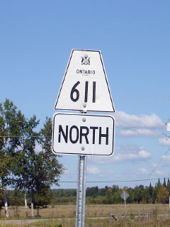
Secondary Highway 611 Shield

  Southern Terminus: Junction Highway 602 West of Fort Frances

Northern Terminus:  Lake Wasaw Road

Length:  22.2km

Multiplexes:  2.0km with Highway 11/71

Orientation: North-South

Regions Served: Rainy River District

AADT (2004):  Highest: 3,800, concurrent with Highway 11/71;

                             Lowest: 200, from Highway 602 to Highway 11/71.

Road Info:  Highway 611 is another unremarkable secondary highway in Rainy River District.  South of Highway 11/71, the highway is very straight, and paved, while north of Highway 11 the terrain gets slightly more rugged, and the highway ends up being gravel surfaced for its northern most few kilometres.  Highway 611 has a posted speed limit of 80km/h


Highway 611 information:


OntHighways.com  

Detailed Route information available below
Virtual Tour of Highway 611


Communities and Intersections along and Highway 611 from South to North:

Proper Municipality Name Community Name Distance Intersecting Road
Township of Alberton ----- 0km / 22.2km Secondary Highway 602

At Highway 11/71 East:  NB: Turn Left towards Rainy River.  SB: Turn Right towards Highway 602

Township of Alberton ----- 7.4km / 14.8km King's Highway 11/71-East

At Highway 11/71 West:  NB: Turn Right towards Lake Wasaw Road.  SB: Turn Left towards Fort Frances.

Township of Alberton ----- 9.4km / 12.8km King's Highway 11/71-West
Township of Alberton ----- 22.2km / 0km Lake Wasaw Road
Highway 611 ENDS

<- Highway 610         www.OntHighways.com - Home          Highway 612 ->


Copyright (c) 2004-2011, Scott Steeves (Webmaster)  scott@asphaltplanet.ca

Page last updated:  September 26h, 2007

Page created:  September 26h, 2007