|
Proper Municipality Name |
Photo Description |
Photo |
|
Pictures taken
from driver's perspective appear offset from centre-line pictures: |
North-
Bound |
South-
Bound |
| Township of Edwardsburgh / Cardinal
United Counties of Leeds & Grenville |
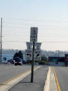
One of the ends assemblies for the southern
terminus of Highway 16 at the Highway 2 junction in Johnstown. It is
very rare for a Highway in Southern Ontario to have dual ends signage at one
terminus. This is also the only junction assembly located in a median
that I have ever seen in the province. |

|
| Township of Edwardsburgh / Cardinal
United Counties of Leeds & Grenville |
A centralized view of the SB Highway 16 lanes approaching the Highway 2
intersection. The Highway 2 intersection is slightly hidden from view
in this picture. The rightmost SB Highway 16 lane actually has a small
ramp to WB Highway 2 (which leads to Johnstown). Picture taken: October
22nd, 2004 |

|
| Township of Edwardsburgh / Cardinal
United Counties of Leeds & Grenville |
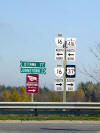
The MGS for NY Highway 37 (erroneously showed in
a US highway shield) via the Prescott-Ogdensburg bridge. The
suspension bridge can also be seen in the distance. |

|
| Township of Edwardsburgh / Cardinal
United Counties of Leeds & Grenville |
Highway 16 looking north from the
Prescott-Ogdensburg bridge access. This section of Highway 16 seems to
be fairly under-traveled south of Highway 401. The MTO very seldom
overbuilds highways (usually Ontario highways are at the opposite end of the
spectrum), but in this case it makes for a very unique drive. The
Highway 401 interchange is just out of view in this picture.
Picture taken: October 22nd, 2004 |

|
| Township of Edwardsburgh / Cardinal
United Counties of Leeds & Grenville |
A very unique shield assembly located at the end
of the Highway 16 off ramp from the EB 401. Its not typical MTO
practice to mix King's Highway shields and squares. However to the
MTO's credit, the assembly is clear and easy to read. Again, US 37 is
erroneously indicated instead of NY 37. One wonders if the MTO is
choosing to show US 37 shields instead of New York shields to ensure
travelers looking for a Highway 37 know it involves crossing an
international boundary. |

|
| Township of Edwardsburgh / Cardinal
United Counties of Leeds & Grenville |
Southerly view along Highway 16 from mid-span of the Highway 401 overpass.
Photo taken: May 23rd, 2010. |

(720x480)
(1440x960)
(2400x1600) |
|
Highway 401 carries
trans-provincial traffic between Windsor and the Quebec Border.
Click here for Highway 401 images. |
| Township of Edwardsburgh / Cardinal
United Counties of Leeds & Grenville |
Highway 16 looking north from the
Highway 401 interchange. In the distance you can see modern Highway 16
curving towards the left, where it heads to the 416. Before the early
1970's Highway 16 would have continued straight ahead via what is now Leeds
& Grenville Road 44.
Picture taken: May 23rd, 2010. |

(720x480)
(1440x960)
(2400x1600) |
|
Highway 16 was supplanted by
Highway 416 as the main route between Highway 401 and Ottawa.
Click here for Highway 416 images. |


