King's Highway 6 - Images
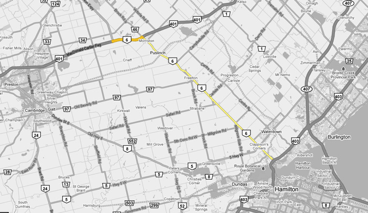
<- Page 1 Page 2A - Burlington to Guelph Page 2B ->
Photos shown in this table are arranged from South to North:
| Proper Municipality Name | Photo Description | Photo | |
|
Photos taken from driver's perspective appear offset from centre-line Photos: |
North- bound |
South- bound |
|
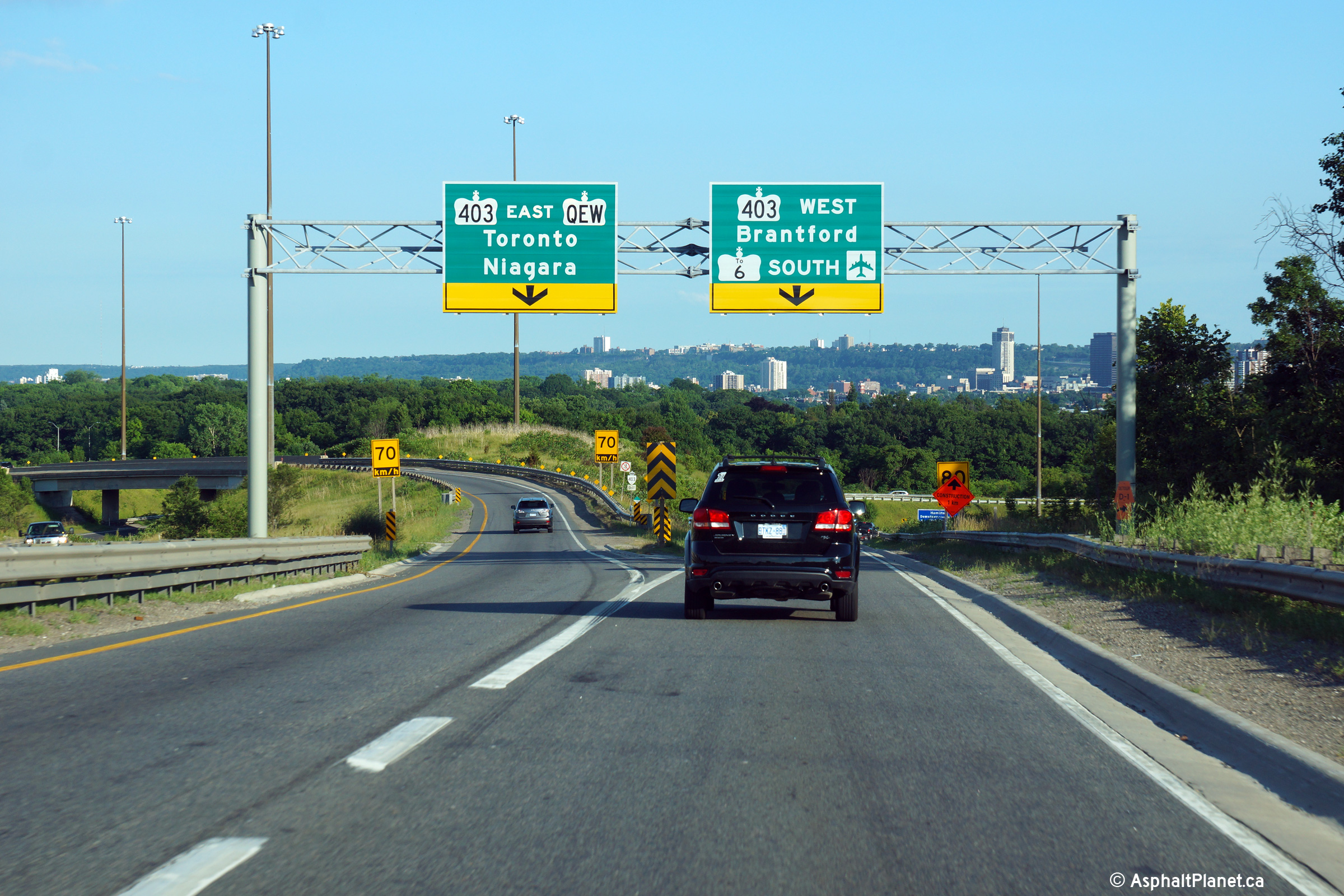
| Highway 6 Photos continue via Highway 403 Images and Highway 6: Highway 24 to Hamilton Images | |||
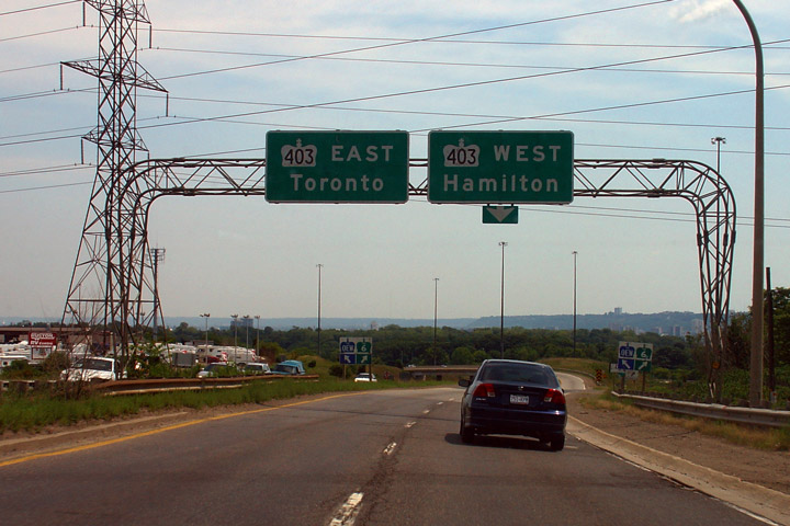
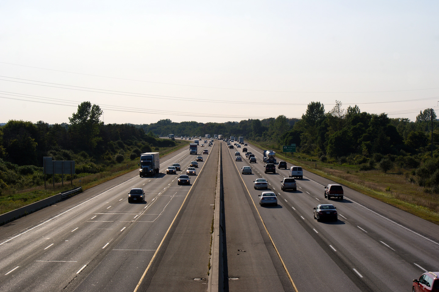
| Hamilton - Burlington Boundary |
Driving south approaching the Highway 403
interchange along Highway 6. Notice that the old overhead signage makes no
reference to Highway 6 continuing further southerly than this interchange.
New signage includes references to both Highway 6-South and the
Queen Elizabeth Way. Upper photo taken: July 31st, 2005. Lower photo taken: July 10th, 2014. |
 |
|
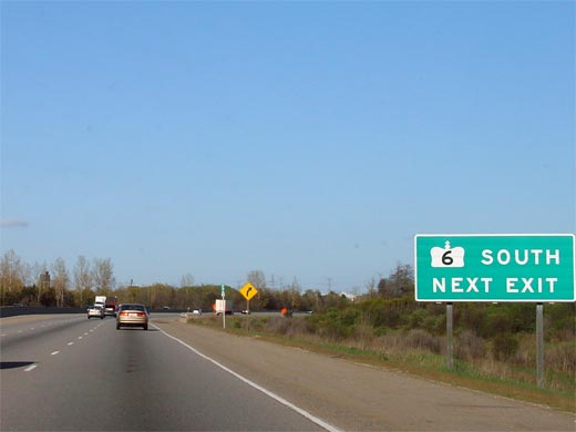
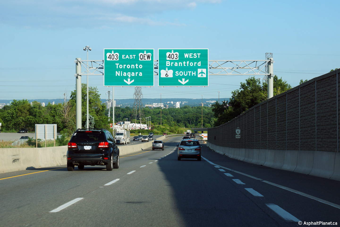
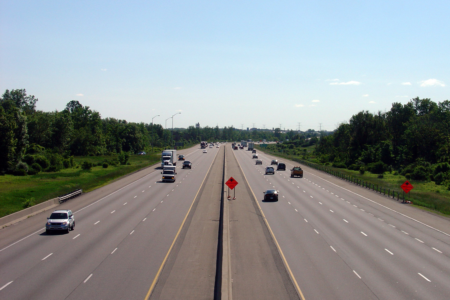
| Hamilton - Burlington Boundary |
New advanced signage for the Highway 403 interchange. Notice, unlike
previous signage incarnations, Highway 6 traffic is signed westbound along
Highway 403. Photo taken: July 10th, 2014. |
||
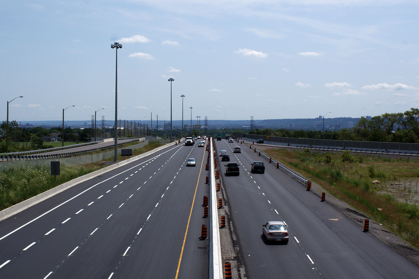
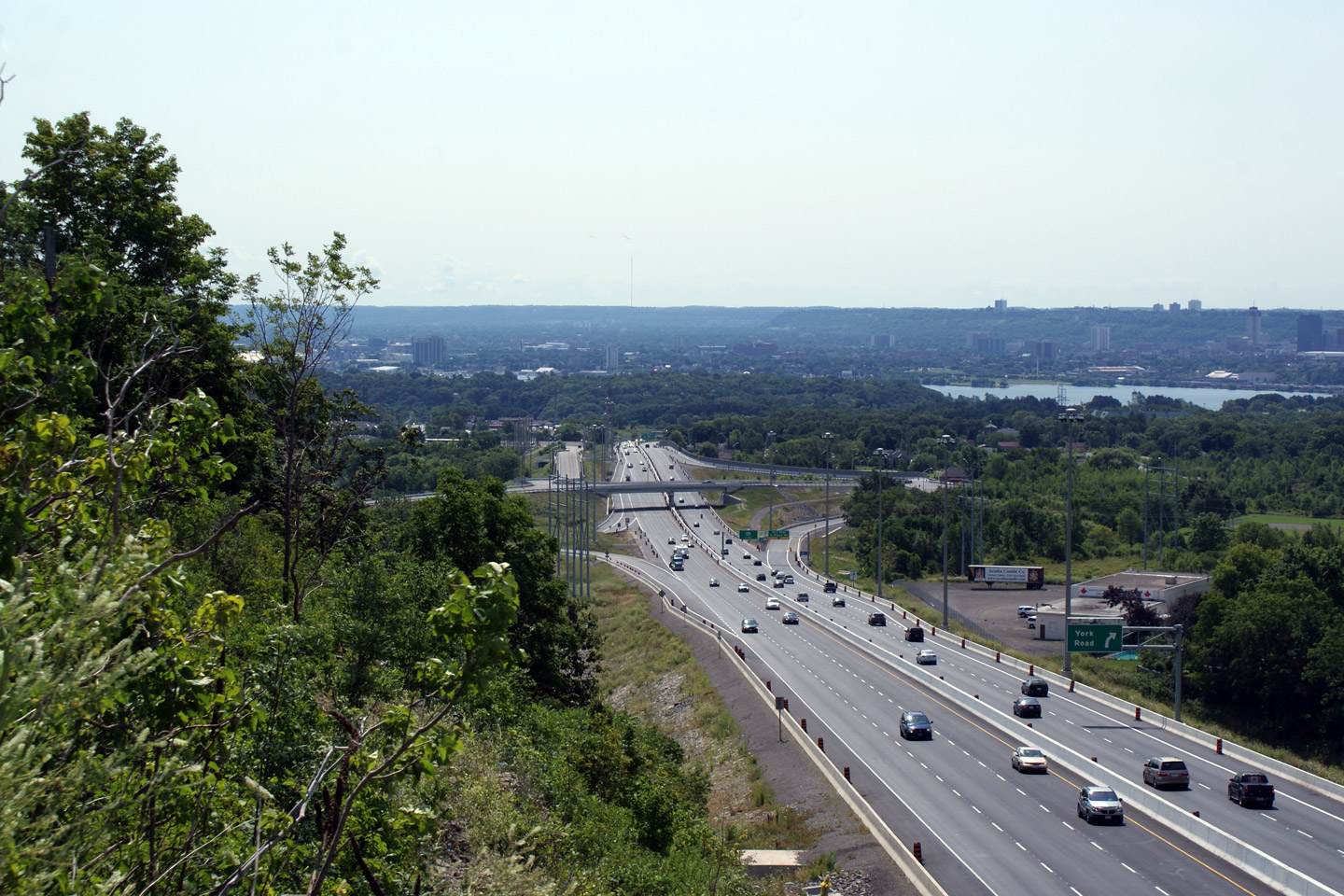
| Hamilton - Burlington Boundary |
View looking southerly from the York Road overpass. Note the start of
the northbound climbing lane just before the deceleration lane for the York
Road Road interchange. I was a little pre-emptive taking photos of
this roadway, there was about a weeks worth of paving left when this photo
was taken. Photo taken: August 3rd, 2009. |
 Low-res High-res |
|
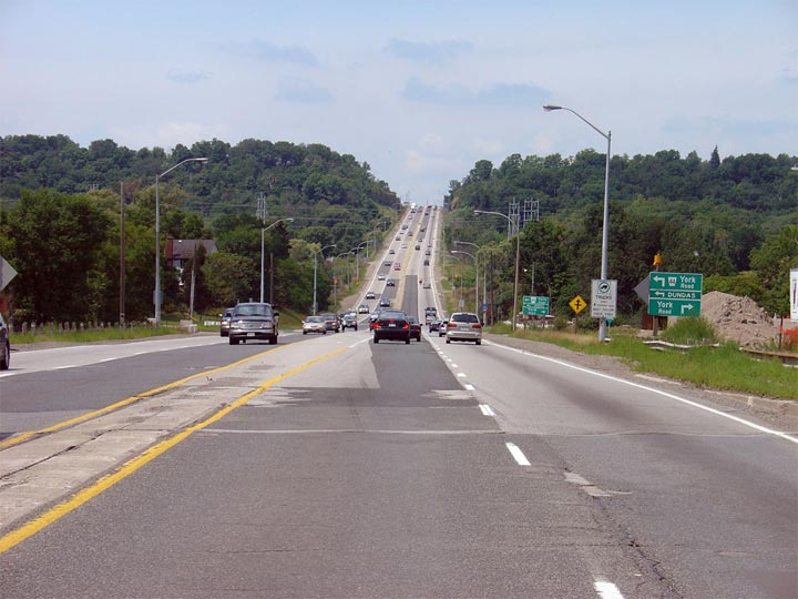
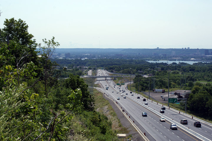
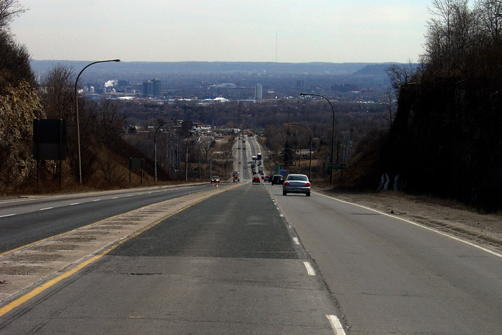
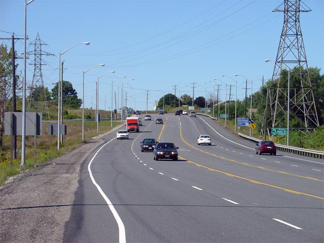
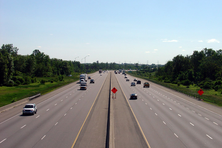
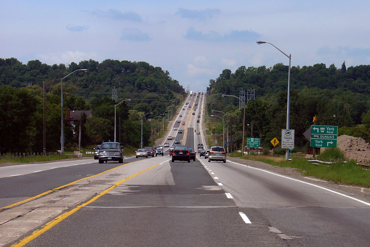
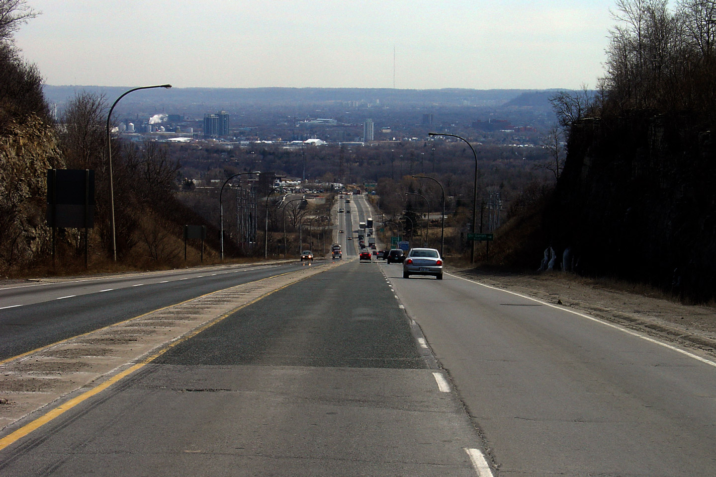
| Hamilton - Burlington Boundary |
The upper photo looks north along Highway 6 towards Clappison's Corners and
the Niagara Escarpment. Highway 6 was first four-laned between Highway
403 and Highway 5 in 1965, at a time when massive highway expansion was
taking place across the province. The lower two photos highlight the view looking northerly from the recently constructed York Road overpass. Upper photo taken: July 31st, 2005. Lower photos taken: August 3rd, 2009. |
 Low-res High-res 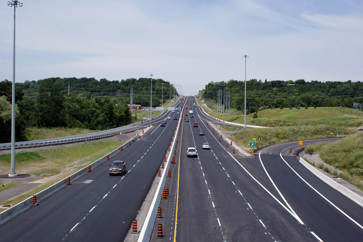 Low-res High-res 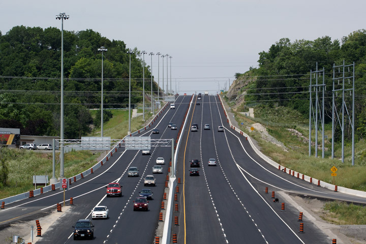 Low-res High-res |
|
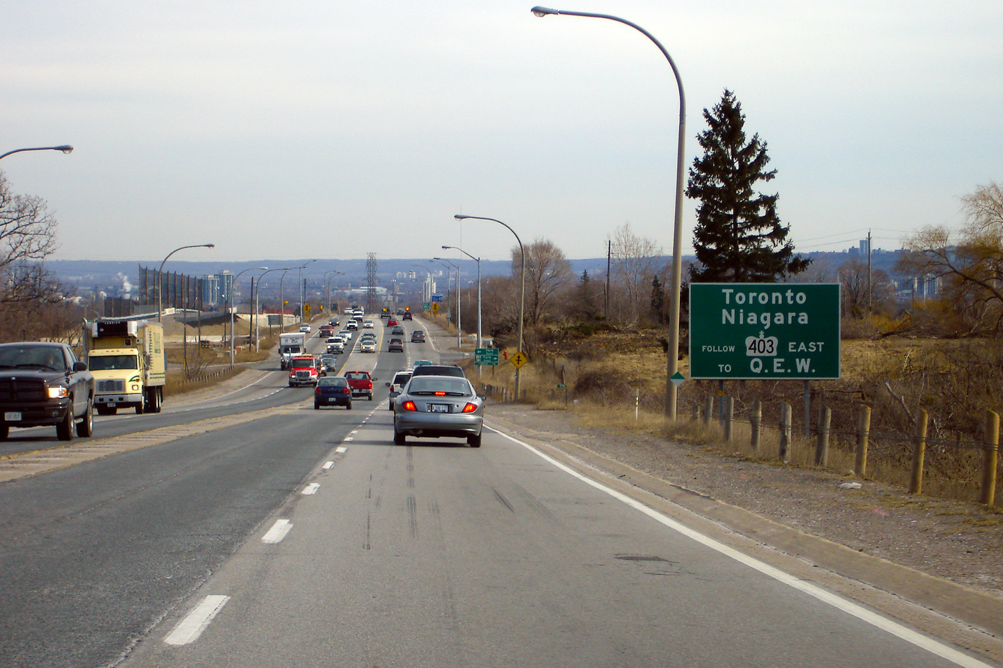
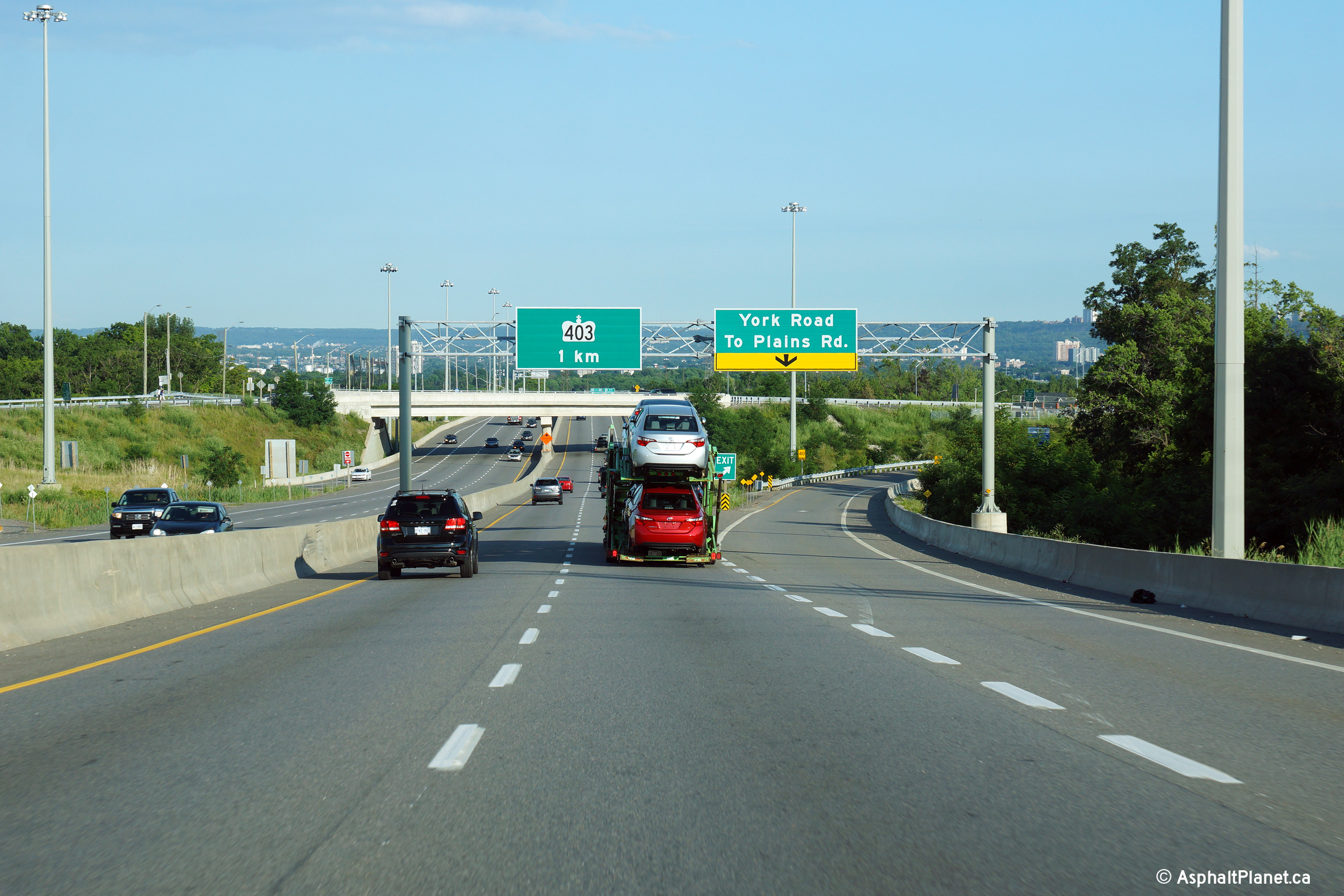
| Hamilton - Burlington Boundary |
Southbound signage at the off-ramp to York Road. Before the York Road
interchange was constructed, there was not an advanced sign for the Highway
403 interchange. There was, however,
this sign advising motorists bound for the QEW to follow Highway 403
East. Photo taken: July 10th, 2014. |
 (720x480) (720x480)(1440x960) (2400x1600) |
|
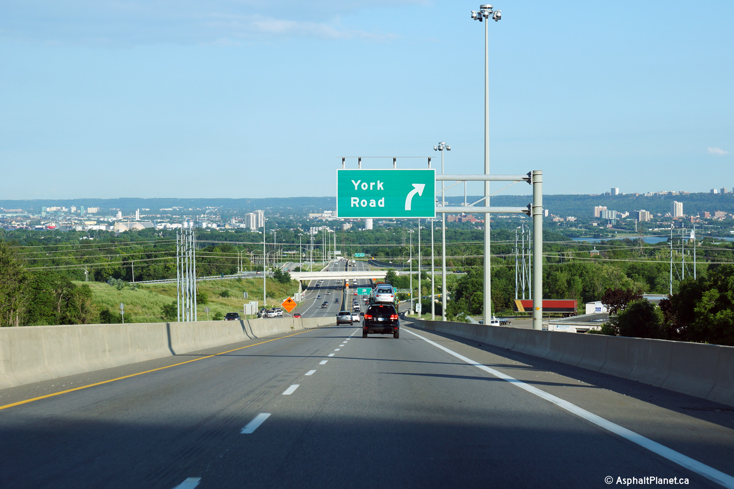
| Hamilton - Burlington Boundary |
Southbound advanced signage for the York Road off-ramp. Photo taken: July 10th, 2014. |
 (720x480) (720x480)(1440x960) (2400x1600) |
|
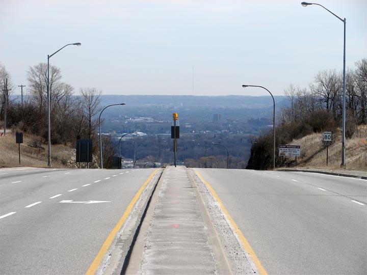
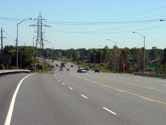
| Hamilton - Burlington Boundary |
This view looks southerly from the top of the Escarpment looking into
Hamilton and the Dundas Valley. Photos taken: August 3rd, 2009. |
 Low-res High-res 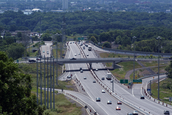 Low-res High-res |
|
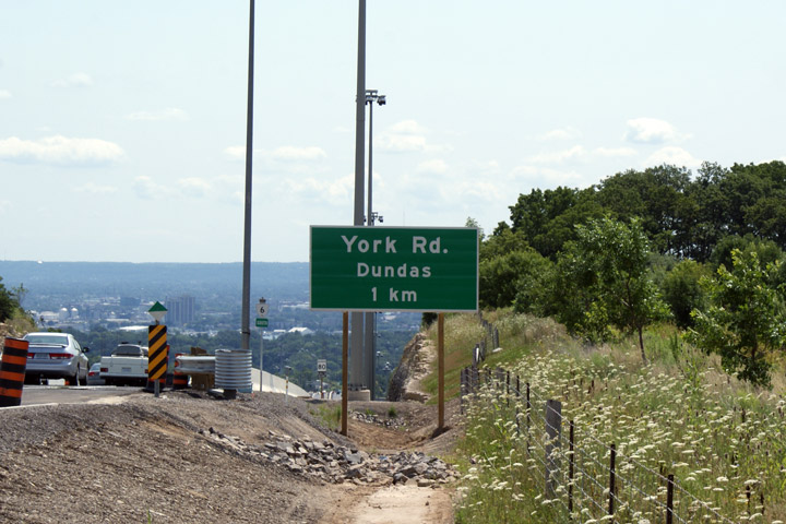
| Hamilton - Burlington Boundary |
Advanced signage for the York Road interchange. Dare I say it, but
freeway signage in Hamilton looks a little bit barren since the de-numbering
of most of the Region's Regional Roads took place. York Road was
formerly Regional Road 44. Photos taken: August 3rd, 2009. |
 |
|
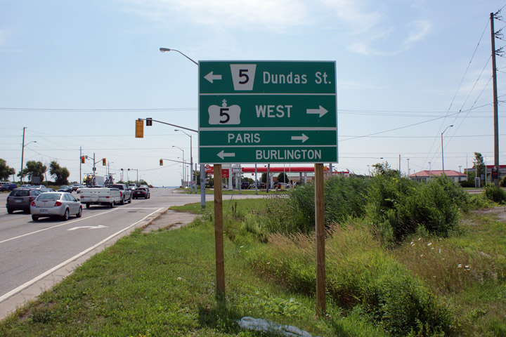
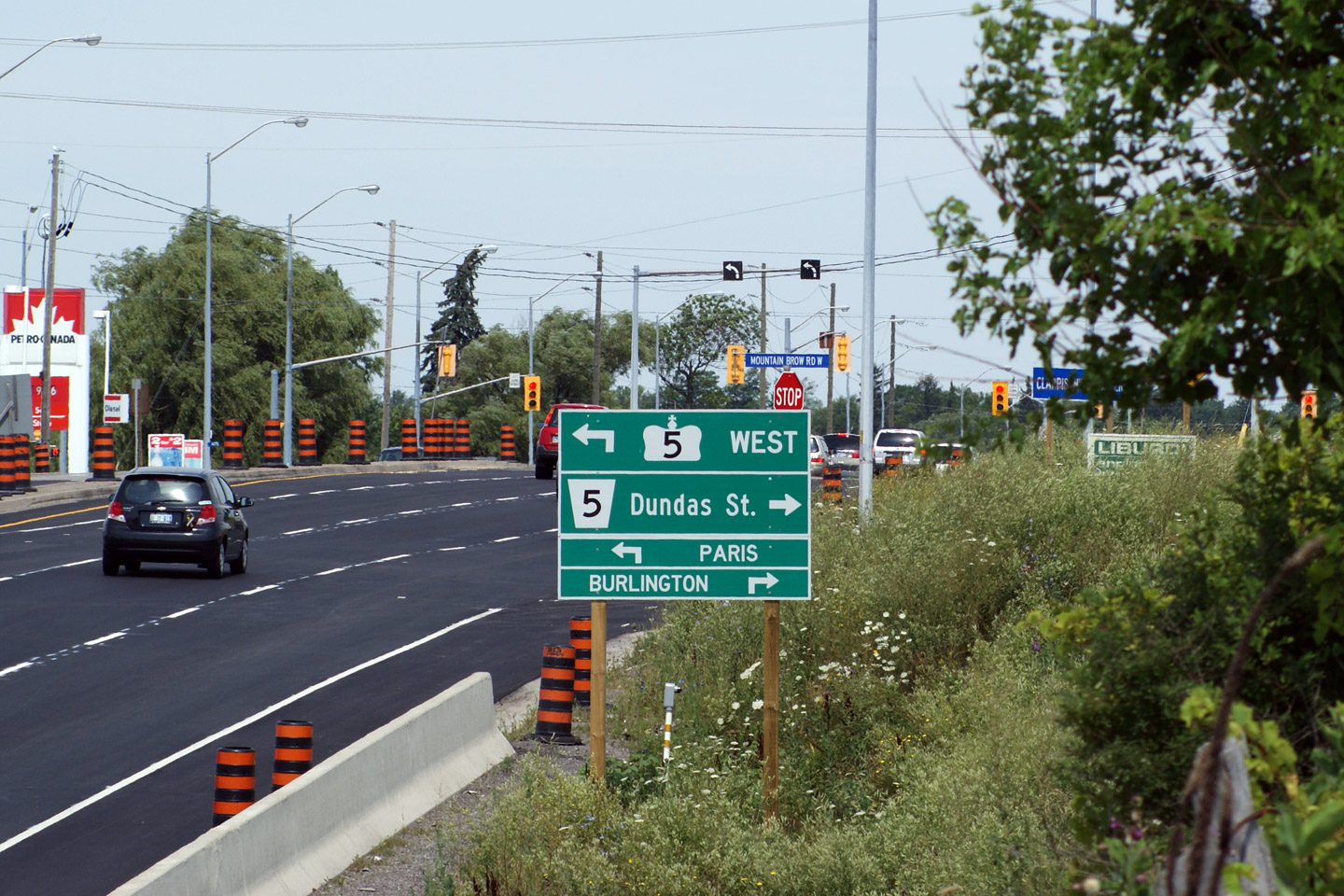
| Hamilton - Burlington Boundary |
Green signage for Highway 5 looking north at the top of the Escarpment.
Before Highway 6 was widened up the escarpment, no signs existed for this
intersection. The Highway 5 and 6 intersection is the busiest
non-freeway intersection between two King's Highways. Photos taken: August 3rd, 2009. |
||
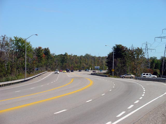
| City of Hamilton |
Looking southerly from just south of Clappison's Corners towards
Highway 403. Before conversion to a controlled access facility, this
portion of Highway 6 had changed very little
since it was first constructed in 1965. Construction was completed in
the Summer of 2009 to upgrade Highway 6 to a freeway south of Clappison's
Corners. Upper photo taken: March 21st, 2006. Lower photo taken: August 3rd, 2009. |
 Low-res High-res 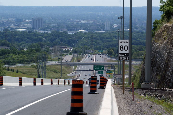 Low-res High-res |
|
| City of Hamilton |
Looking south along Highway 6 towards the Niagara Escarpment. Highway
6 disappears down the Niagara Escarpment down a steep 7% grade. Photo courtesy: Josh Anderchek. Taken: March 21st, 2006. |
 |
|
| City of Hamilton |
Looking north towards the signalized intersection with
Highway 5 at Clappison's Corners.
Because of the high amount of turning traffic at this intersection, two-way
left turns facilitate movement from westbound to southbound and from
northbound to westbound. Upper photo taken: March 21st, 2006. Lower photo taken: August 3rd, 2009. |
 Low-res High-res 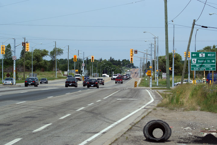 Low-res High-res |
|
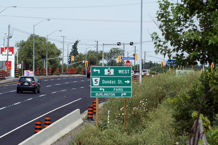
| Highway 6 crosses Highway 5 at Clappison's Corner; Highway 5 is bound for Waterdown and Peters Corners. Click here for Highway 5 images. | |||
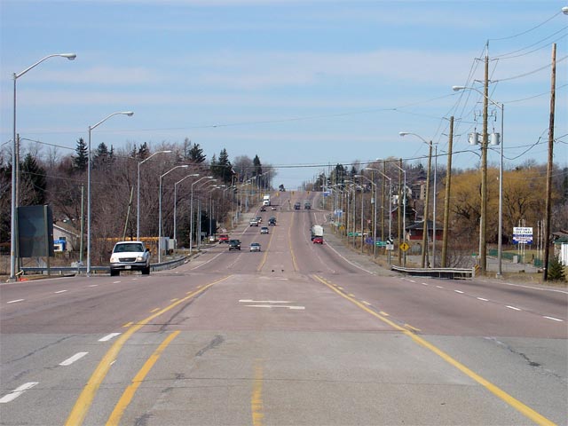
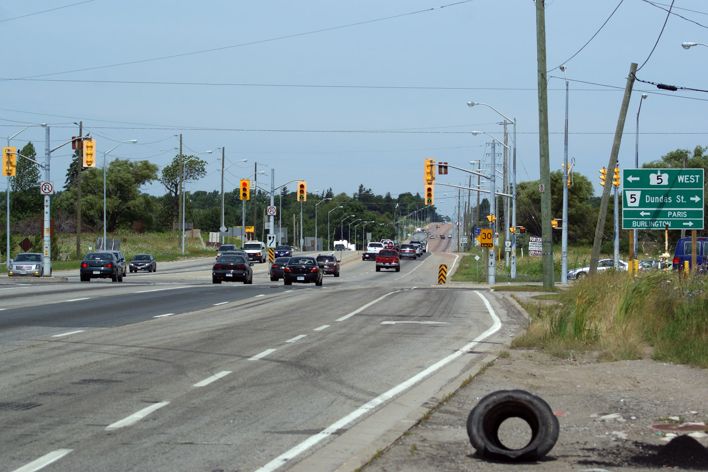
| City of Hamilton |
Looking south towards the Highway 5 intersection. This intersection is one of the busiest
between two active king's highways in Ontario. Unfortunately, it is
not being altered as part of the Highway 6 freewayalization project between
Highway 403 and
Highway 5. Photo taken: March 21st, 2006. |
 Low-res High-res |
|
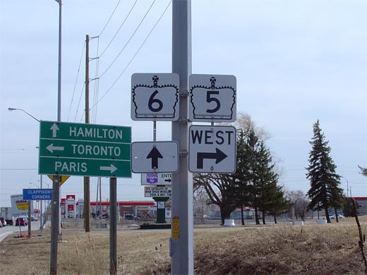
| City of Hamilton |
The top sign shows the former junction assembly for Highway 5 heading
southbound along Highway 6. Before downloading, this assembly would
have reflected Highway 5 continuing east of Highway 6 into Waterdown.
As part of the Highway 6 upgrades, the Clappison's Corner intersection was
resigned with proper green signs with the signs showin in the lower photo. Upper photo taken: March 21st, 2006. Lower photo taken: August 3rd, 2009. |
  |
|
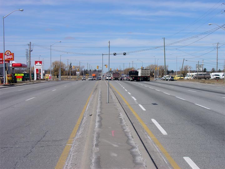
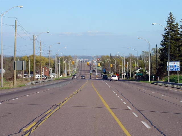
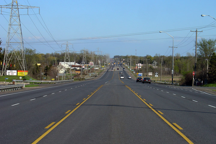
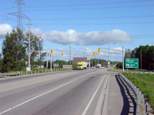
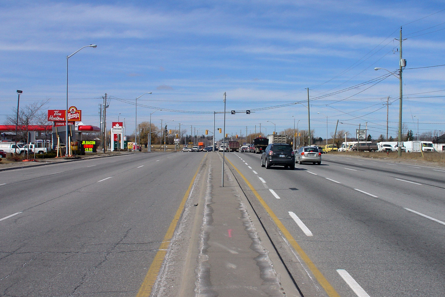
| City of Hamilton |
Looking north along Highway 6 towards Guelph. Highway 6 has been
constructed with this 5-lane suburban configuration from Clappison's Corners
northerly to just north of Regional Road 97 on the Freelton By-pass. Photo taken: March 21st, 2006. Size: 50kb. |
 Low-res High-res |
|
| City of Hamilton |
Looking south along Highway 6 towards Clappison's Corners and the Parkside
Drive intersection. Parkside Drive serves as the northern access route
into Waterdown and has a busy intersection with Highway 6. Photo taken: May 6th, 2006. |
 |
|
| City of Hamilton |
Looking north along Highway 6 from just north of Parkside Drive. The
section of Highway 6 immediately north of Parkside Drive is fairly built up
with numerous residential and commercial accesses. Photo taken: July 31st, 2006. |
 |
|
| City of Hamilton |
Looking north towards Harper Coerners from just south of the Concession Road
6W junction. Photo taken: July 31sts, 2005. |
 |
|
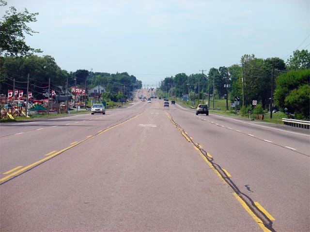
| City of Hamilton |
Looking south from about 1km south of the Hamilton Road 97 junction towards
Beezy's Corners. Photo taken: May 6th, 2006. |
 Low-res High-res |
|
| City of Hamilton |
Looking north along Highway 6 towards the Hamilton Road 97 junction and the
southern start of the Freelton By-pass. Photo taken: September 24th, 2005. |
 |
|
| City of Hamilton |
Looking south towards the Hamilton Road 97 junction. Before the mid
1980s, Hamilton Road 97 was a provincial highway designated as
97. Photo taken: September 24th, 2005. |
 |
|
| City of Hamilton |
Looking north along the Freelton By-pass from just north of the Hamilton
Road 97 junction. The Freelton By-pass is a controlled access highway.
Because of the lack of residential and business entrances, the centre turn
lane narrows to a flush median along the by-pass. Photo taken: September 24th, 2005. |
 |
|
| City of Hamilton |
Looking southerly from the northern junction of Freelton Road at the
northern start of the Freelton By-pass. Photo taken: September 24th, 2005. |
 |
|
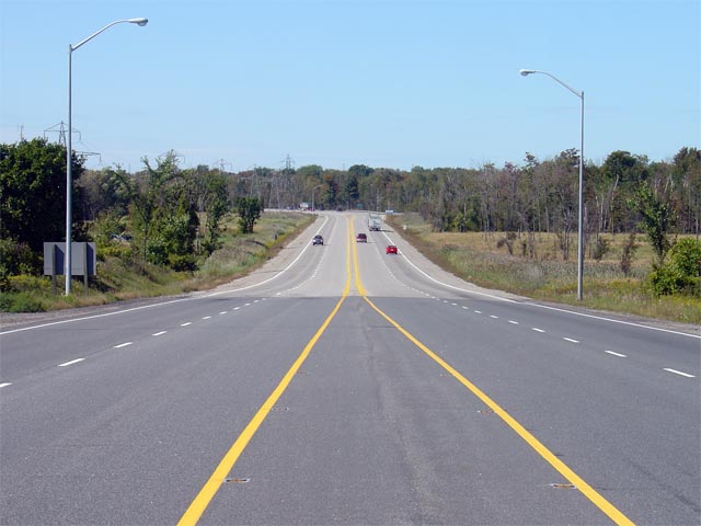
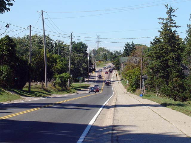
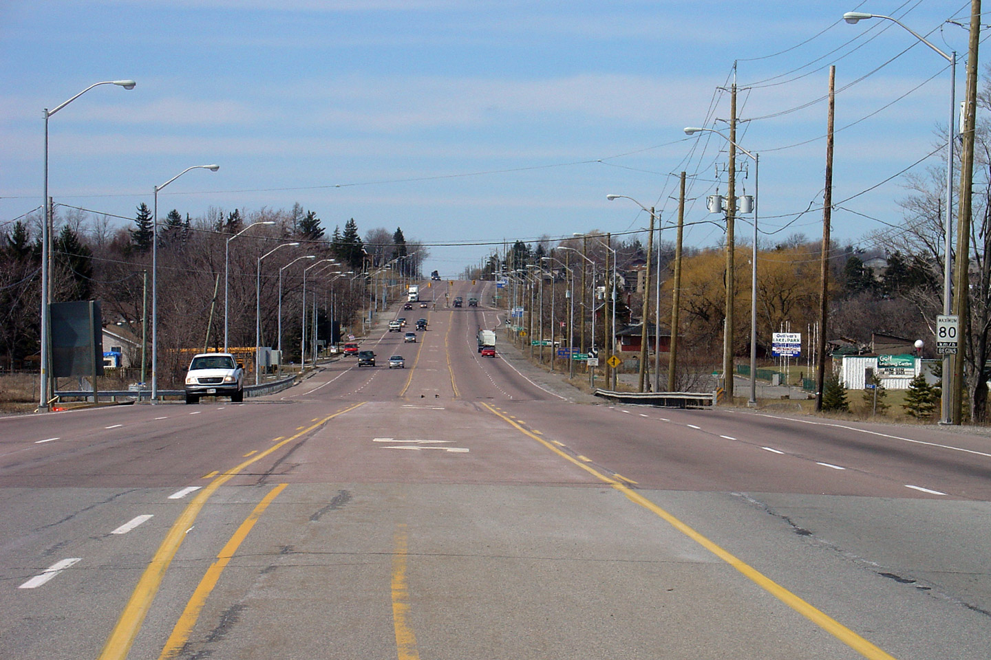
| City of Hamilton |
Looking northerly along Highway 6 towards the Flamborough - Puslinch
Townline Road. As is visible in the photo, Highway 6 narrows from a 4-
to 2-lanes at the boundary. The MTO is planning to eventually bypass
both Morriston and Puslinch to the west with a new Highway 6 alignment that
would link up to the existing highway at the end of the 4-lane
highway. Photo taken: September 24th, 2005. |
 |
|
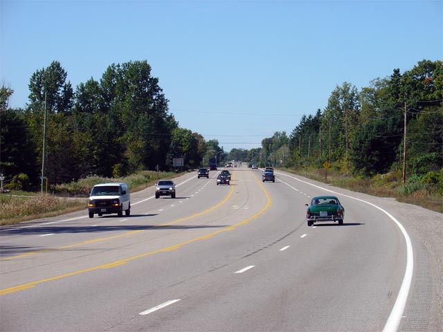
| Township of Puslinch County of Wellington |
Looking south through Puslinch towards the 4-lane portion of highway.
Northbound traffic bunches up very quickly through Puslinch as Highway 6
becomes a very congested 2-lane route. Photo taken: September 24th, 2005. |
 |
|
| Township of Puslinch County of Wellington |
Looking northerly through Puslinch towards the CP railway overhead.
This railway overhead is being replaced in 2006, and the surrounding highway
is being reconstructed. This construction project will not see Highway
6 widened through Puslinch. Photo taken: September 24th, 2005. |
 |
|
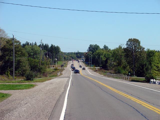
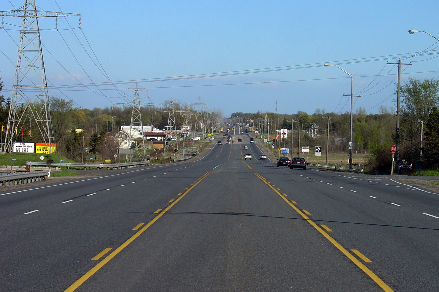
| Township of Puslinch County of Wellington |
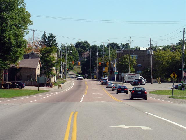
Looking north through Morriston along Highway 6. Morriston is the most
notable community along Highway 6 between Hamilton and Guelph, and features
the only 50km/h speed limit through this section of highway. The
portion of Highway 6 between Puslinch and Morriston will be resurfaced
during the summer of 2006. Photo taken: September 24th, 2005. |
 |
|
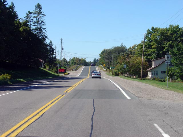
| Township of Puslinch County of Wellington |
Looking south towards the signalized intersection with Wellington Road 36 in
Morriston. This traffic signal causes significant backups during peak
travel periods on Highway 6. Morriston is located about 1km south of
Highway 401. Photo taken: September 24th, 2005. |
 |
|
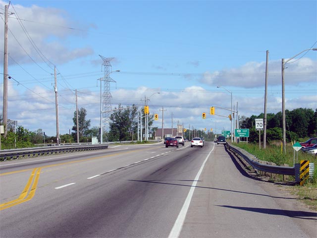
| Township of Puslinch County of Wellington |
Looking northerly towards the Highway 401 interchange from just north of Morriston. Highway 6 meets Highway 401 at a parclo-A2 interchange.
Surprisingly, this interchange was never a cloverleaf design, it was the
only interchange between two highways to not have been originally constructed
as a cloverleaf between Kitchener and Toronto. Photo taken: June 10th, 2006. |
 Low-res High-res |
|
| Township of Puslinch County of Wellington |
View of the end of the ramp terminal for southbound Highway 6 travelers. At
these signals, traffic must turn right to continue southerly along Highway
6. Surprisingly, a channel was never constructed
at this intersection so that southbound traffic could by-pass the traffic
signal. Photo taken: May 6th, 2006. |
 Low
Res Low
ResHigh Res |
|
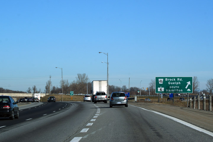
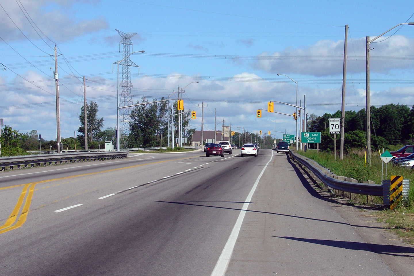
| Township of Puslinch County of Wellington |
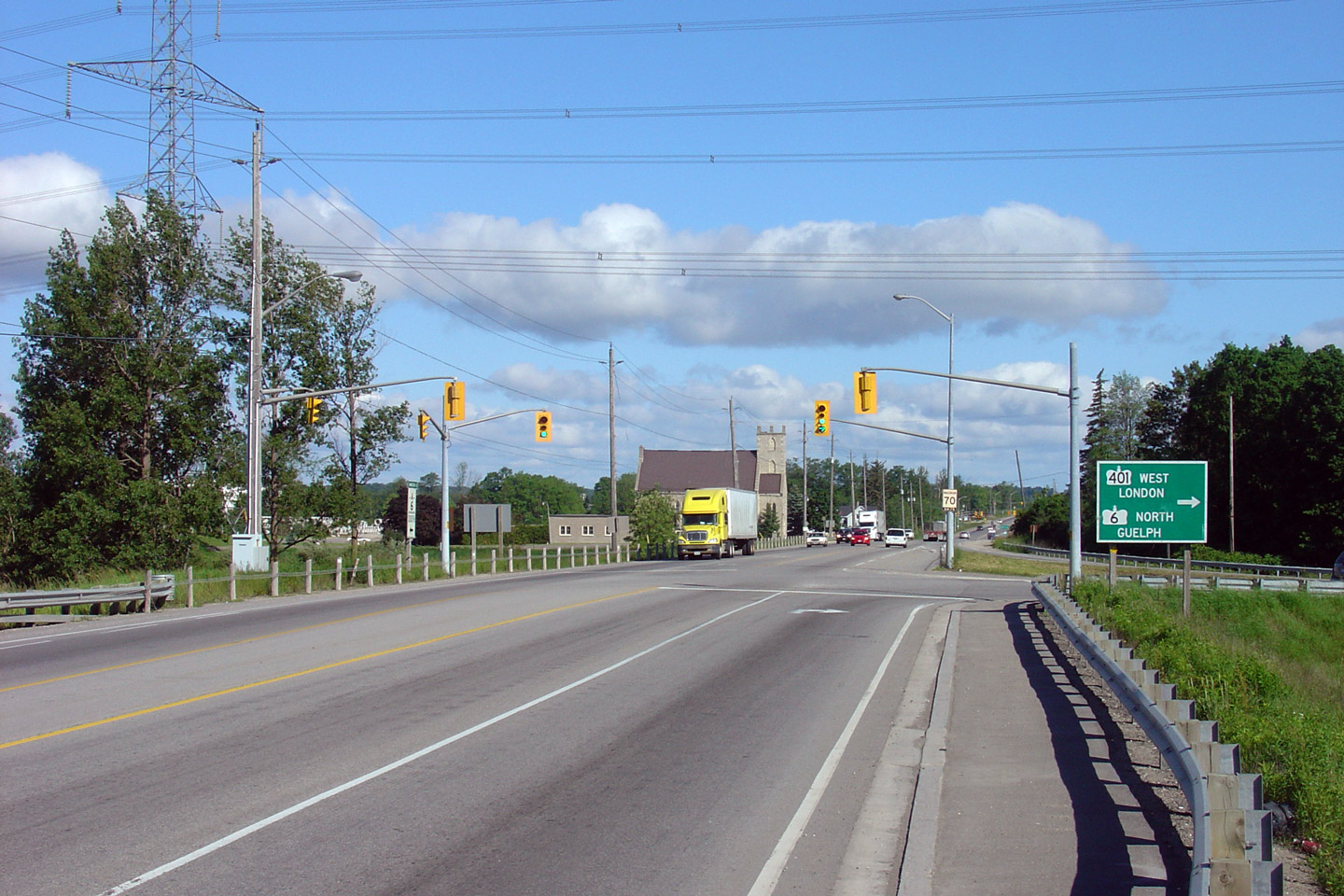
Advanced signage for the westbound Highway 401 ramp. As noted by the
sign, Highway 6 follows Highway 401 westerly for roughly 4km before heading
north through the west side of Guelph via the Hanlon Parkway. Photo taken: June 10th, 2006. |
 |
|
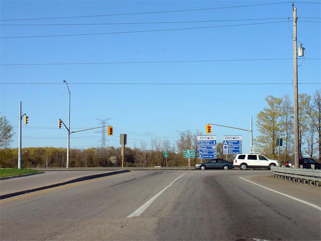
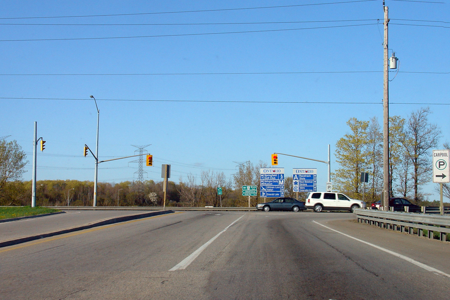
| Township of Puslinch County of Wellington |
Looking north towards the northern Highway 401
ramp terminals. Traffic must turn right at this intersection to continue
northerly along Highway 6. Wellington Road 46 is straight ahead;
Wellington Road 46 is the former alignment of Highway 6 into Guelph. Photo taken: June 10th, 2006. |
 Low
Res Low
ResHigh Res |
|
| Highway 6 meets Highway 401 north of Morriston. Highway 6 piggy backs along Highway 401 for a short distance south of Guelph. Click here for Highway 401-East images. | |||
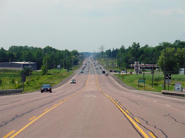
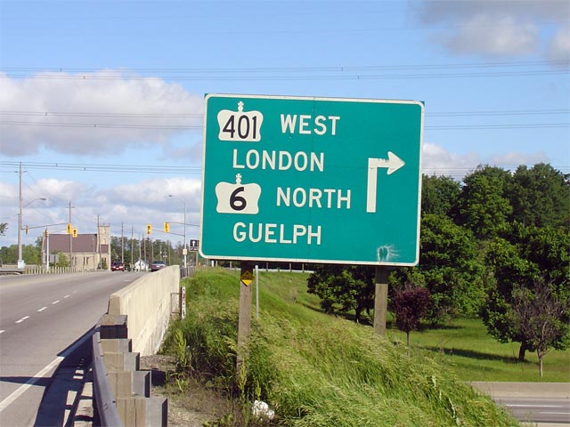
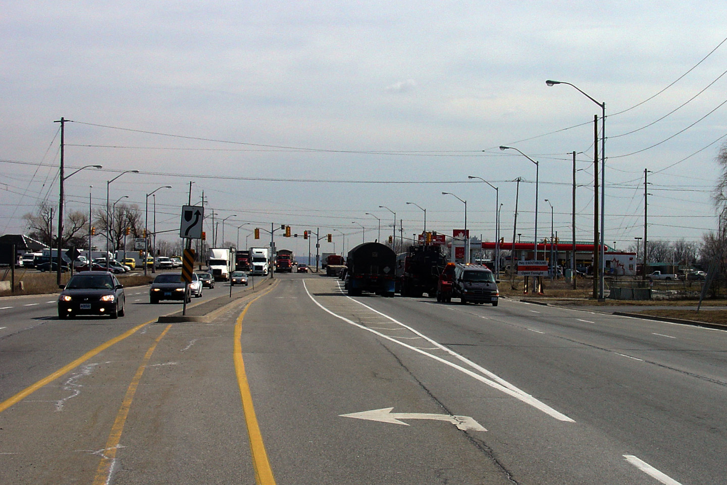
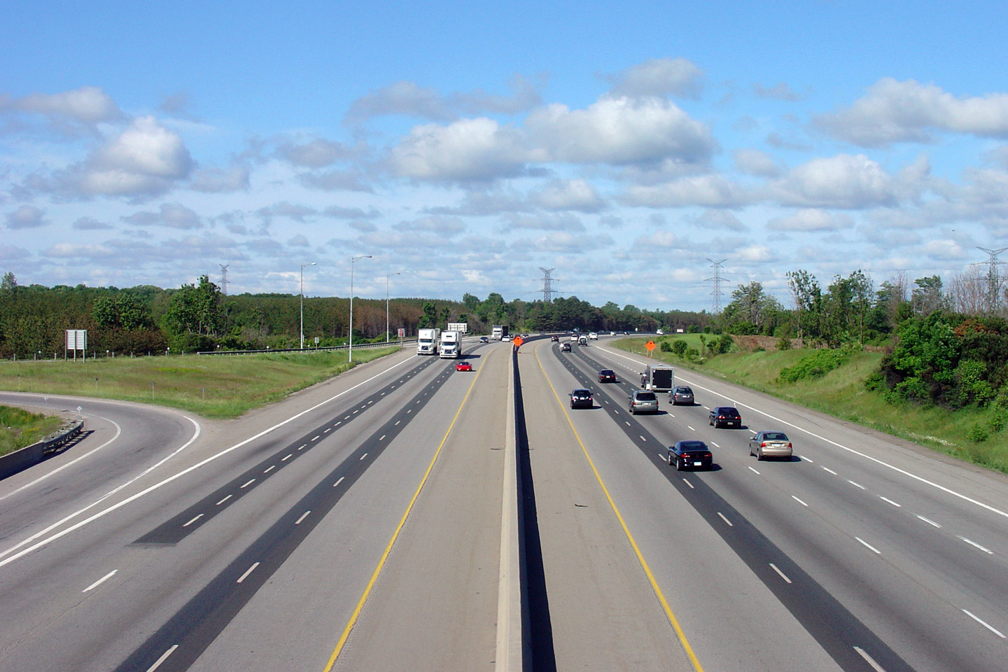
| Township of Puslinch County of Wellington |
Looking west along Highway 6/401 towards London. Highway 6 piggybacks
along Highway 401 for roughly 4km to the south of Guelph. Photo taken: June 10th, 2006. |
 Low-res High-res |
|
| Township of Puslinch County of Wellington |
Signage at the eastbound ramp at the southern Highway 6/401 interchange. Photo taken: May 6th, 2006. |
 Low
Res Low
ResHigh Res |
|
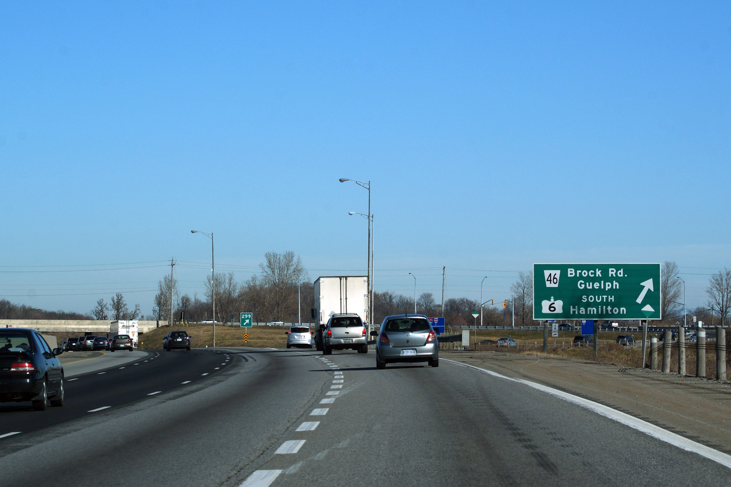
| Township of Puslinch County of Wellington |
Advanced signage for the southern Highway 6/401
interchange. Photo taken: May 6th, 2006. |
 Low
Res Low
ResHigh Res |
|
| Township of Puslinch County of Wellington |
Looking east along Highway 6/401 from the Concession Road 7 overpass. Photo taken: September 24th, 2005. |
 |
|
| Township of Puslinch County of Wellington |
Looking west towards London from the Concession Road 7 overpass. The
Concession Road 7 overpass is located about halfway between the Highway 6
interchanges at 401 kilometre marker 297. Photo taken: September 24th, 2005. |
 |
|
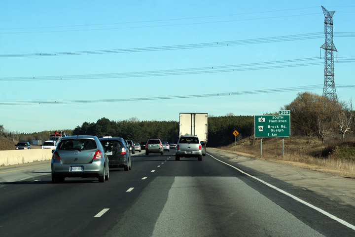
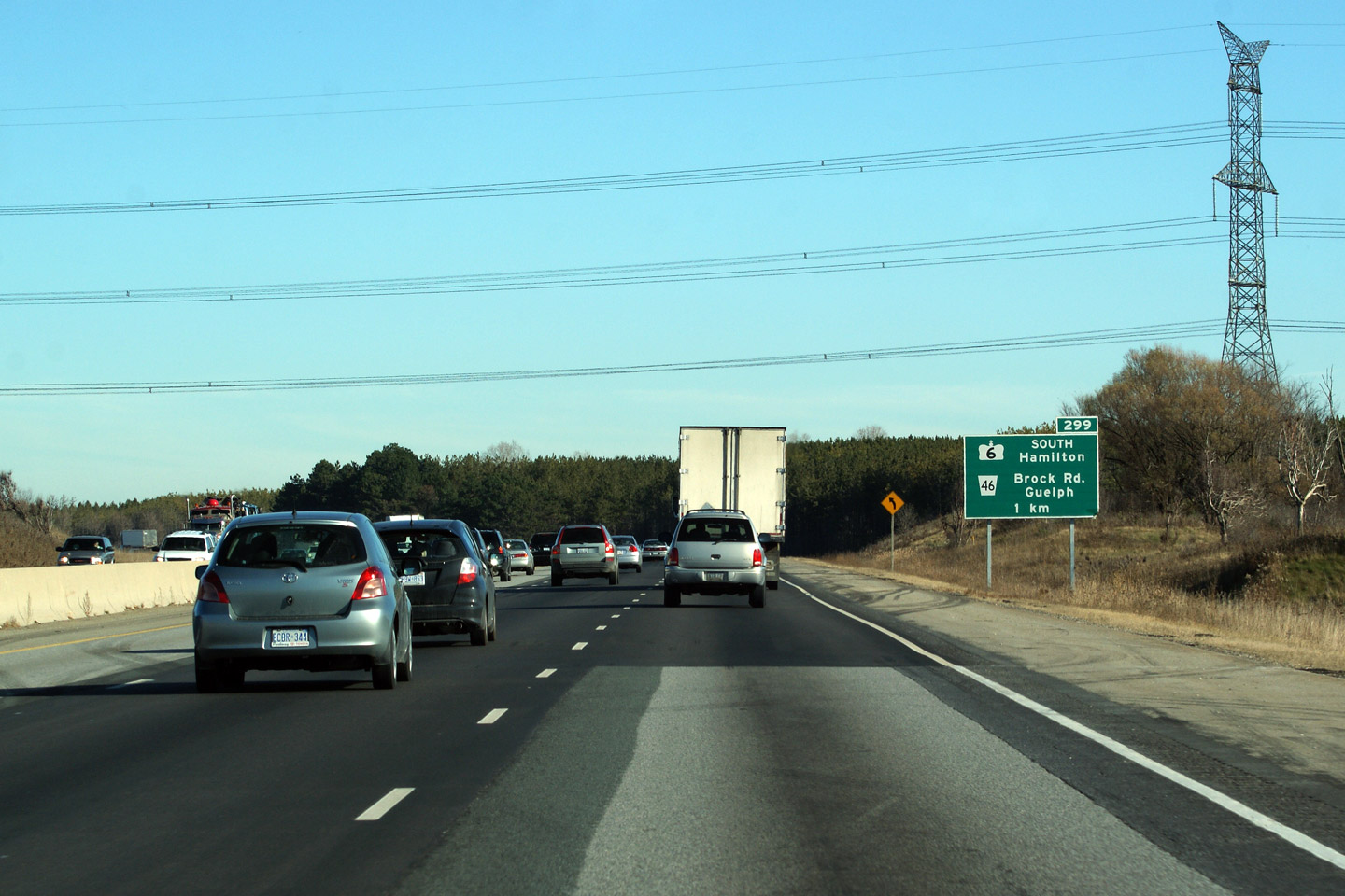
| Township of Puslinch County of Wellington |
Signage eastbound along Highway 401 taken
from just beyond the northern Highway 6 interchange. Signs reading
"next exit" are not generally used on provincial freeways, however it is
useful in this application as a reassurance sign for Highway 6 traffic. Photo taken: May 6th, 2006. |
 |
|
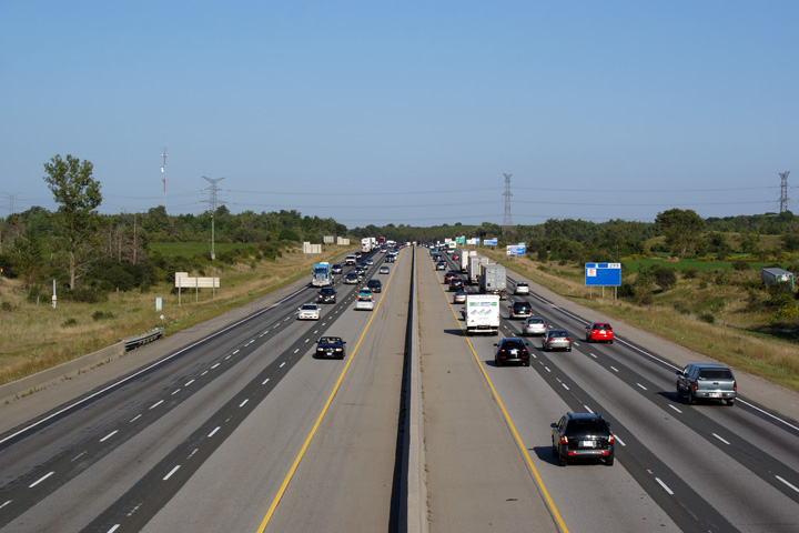
| Township of Puslinch County of Wellington |
Looking east towards Toronto from the western Highway 6 overpass. The
western Highway 6 overpass is located roughly at kilometer marker 295 along
Highway 401. Photo taken: June 10th, 2006. |
 Low-res High-res |
|
| Highway 6 Images continue on Guelph Images Page | |||
<- Page 1 Images Highway 6 Images Index Page 2B Images ->
<- Highway 5 Images Back to Highway 6 Highway 7 Images ->
Copyright (c) 2004-2014, AsphaltPlanet.ca AsphaltPlanet@asphaltplanet.ca

