|
Proper Municipality Name |
Photo Description |
Photo |
|
Pictures taken
from driver's perspective appear offset from centre-line pictures: |
North-
bound |
South-
bound |
| Township of Minden Hills County
of Haliburton |
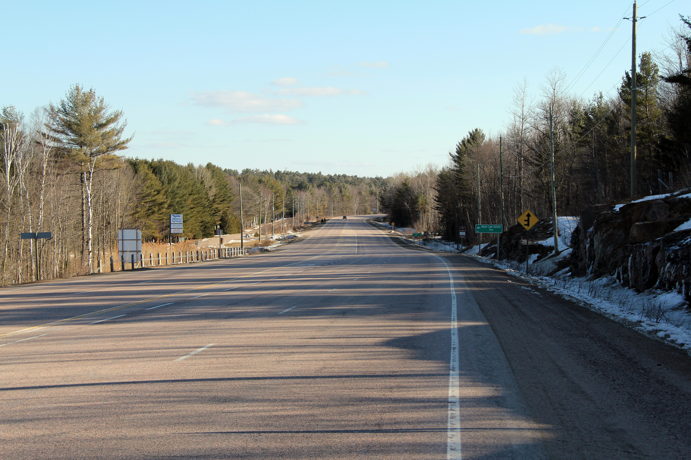
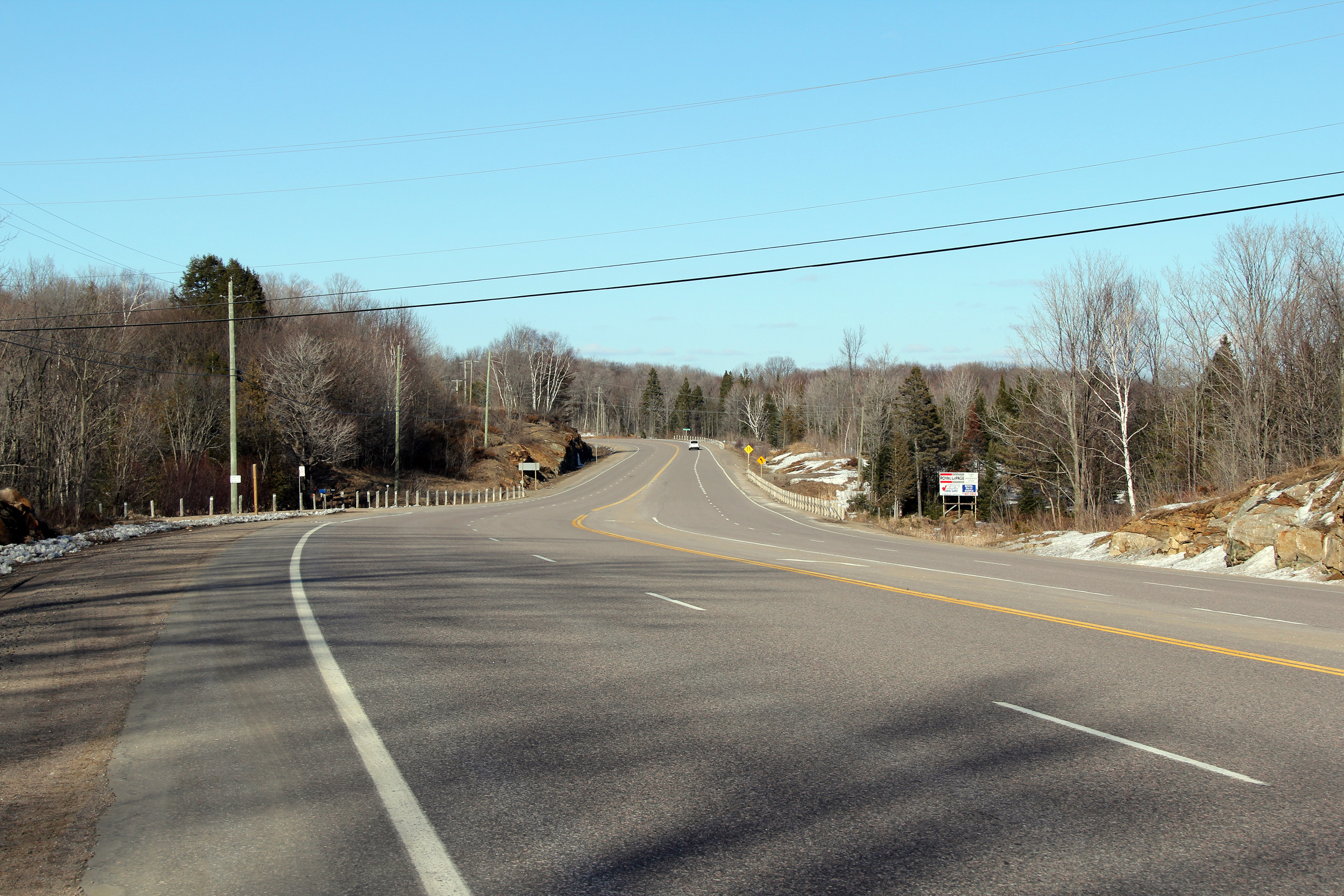
This view looks southerly along Highway 35 from south of Moore Falls.
Highway 35 maintains this four lane section of highway for several
kilometres where the highway runs along the western shore of Moore Lake.
Photo taken: March 19th, 2011. |
(720x480)
(1440x960)
(2400x1600) |
| Township of Minden Hills County
of Haliburton |
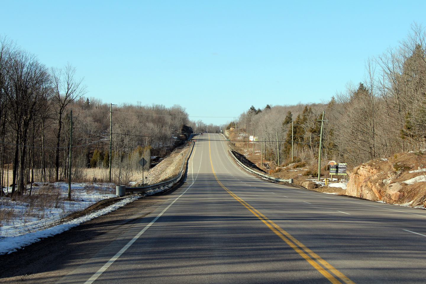
This view looks northerly from the Pine Ridge Road intersection along
Highway 35. This intersection is found about halfway between Miners
Bay and Kilcoo Harbour.
Photo taken: March 19th, 2011. |
(720x480)
(1440x960)
(2400x1600) |
| Township of Minden Hills County
of Haliburton |
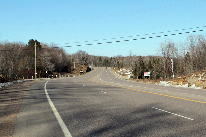
Another view of the same four lane section of Highway 35 as the previous
photo. This view still looks north, only this time is closer to Kilcoo
Harbour.
Photo taken: March 19th, 2011. |

(720x480)
(1440x960)
(2400x1600) |
| Township of Minden Hills County
of Haliburton |
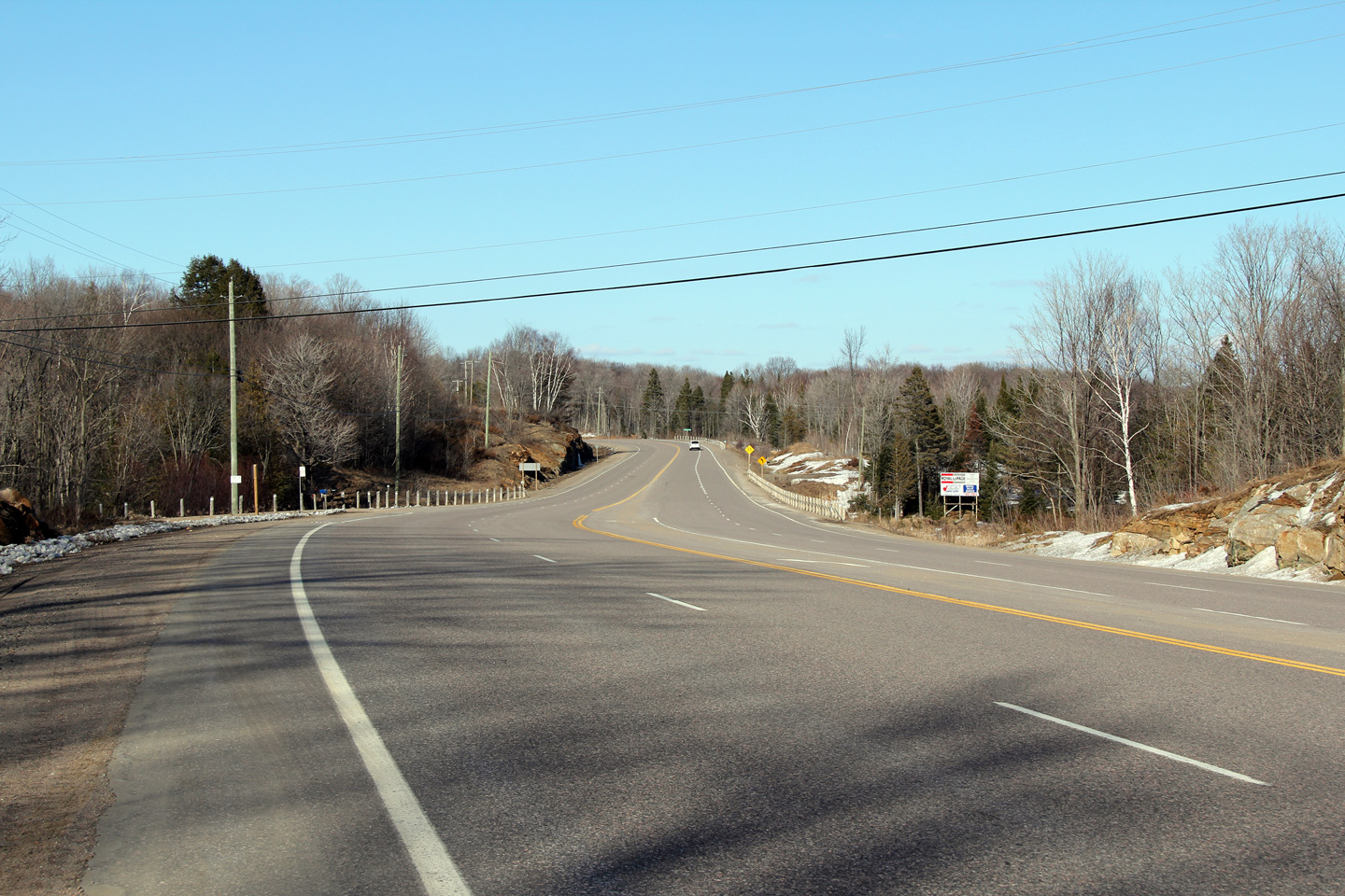
Another northerly view as Highway 35 passes by Kilcoo Harbour.
Photo taken: March 19th, 2011. |
(720x480)
(1440x960)
(2400x1600) |
| Township of Minden Hills County
of Haliburton |
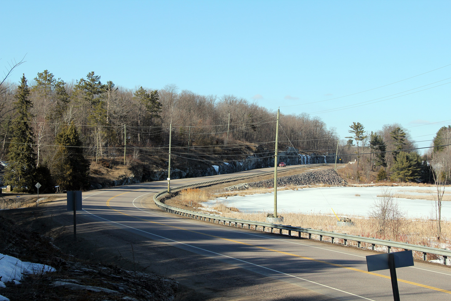
This view looks northerly from the north junction of Henderson's Road.
Henderson's Road is one of many old alignments to be found along Highway 35
through Haliburton County.
Photo taken: March 19th, 2011. |

(720x480)
(1440x960)
(2400x1600) |
| Township of Minden Hills County
of Haliburton |
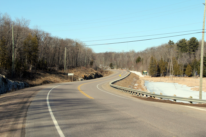
This view looks northerly as Highway 35 passes beside a tiny lakelet north
of the Deena Lake Road intersection.
Photo taken: March 19th, 2011. |
(720x480)
(1440x960)
(2400x1600) |
| Township of Minden Hills County
of Haliburton |
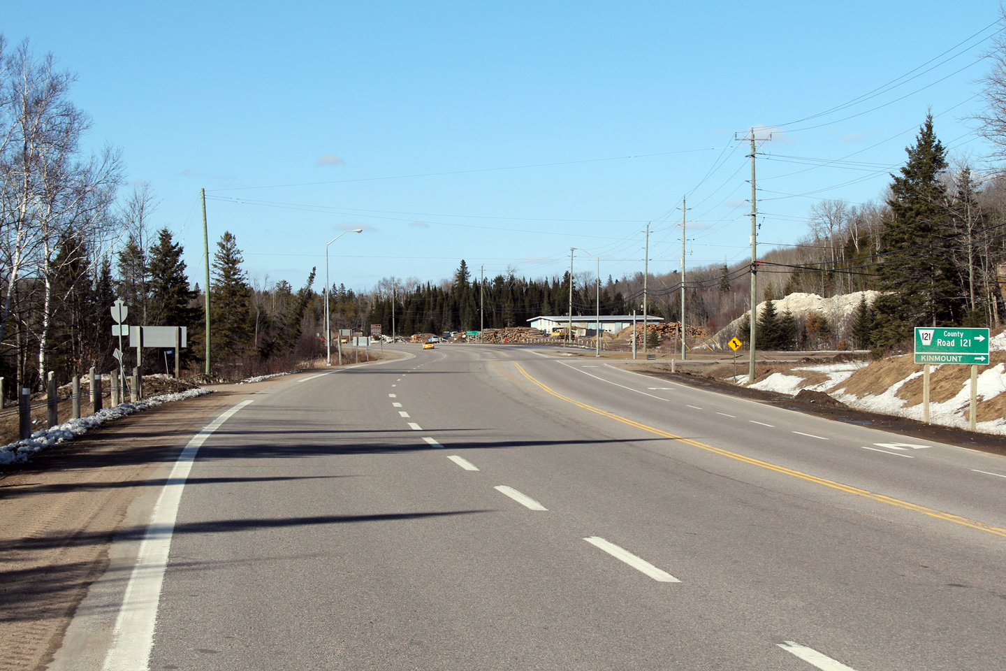
View looking northerly approaching the Highway 121-South junction.
Photo taken: March 19th, 2011. |

(720x480)
(1440x960)
(2400x1600) |
| Township of Minden Hills County
of Haliburton |
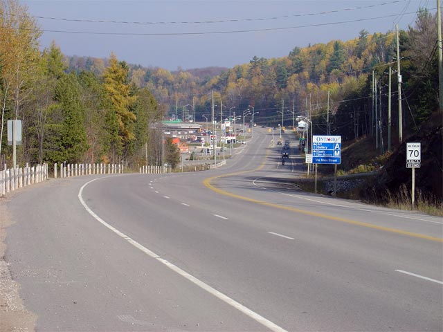
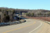
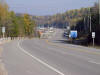
View looking south along Highway 35 towards the southern
Highway 121
junction, south of Minden. Picture taken: September 30th, 2005. Size:
35kb. |
 |
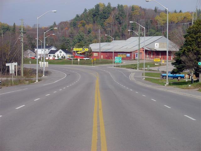
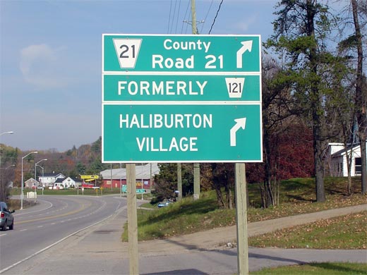
| Township of Minden Hills County
of Haliburton |
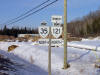
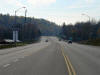
Signage facing motorists heading northbound along Highway 35 just
north of the southern Highway 121 junction.
A formerly tab was tacked up above the Highway
121 route marker when the route was decommissioned in 1998.
Picture size: 45kb. |
 |
| Township of Minden Hills County
of Haliburton |
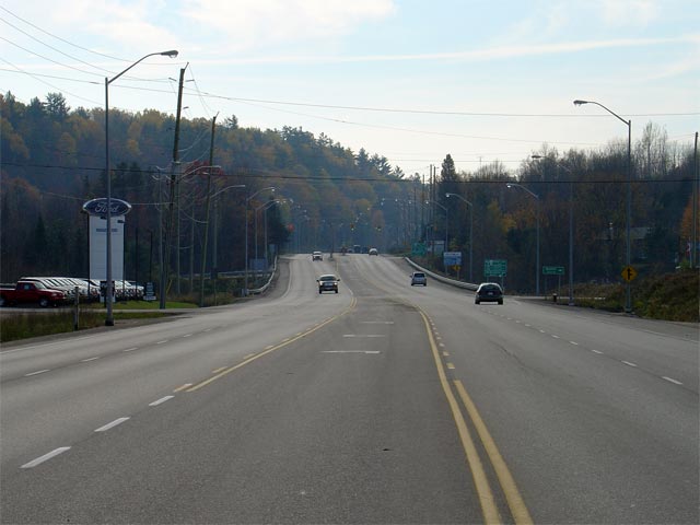
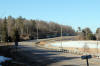
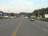
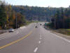
Looking northerly along Highway 35/121 approaching Minden. There is a
southbound passing lane extending south from Minden to just south of the
Highway 121 junction. Picture taken:
October 30th, 2005. Size: 55kb. |
 |
| Township of Minden Hills County
of Haliburton |
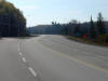
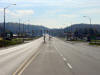
Looking south from just south of the Water Street intersection towards the
South Lake Road intersection. Picture taken: October 30th, 2005.
Size: 40kb. |
 |
| Township of Minden Hills County
of Haliburton |
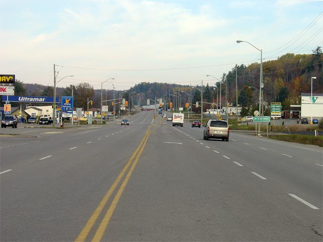
Looking northerly towards the signalized intersection with Water Street
along the Minden By-pass. Water Street is the the northern-most
traffic signal of the three along the Minden By-pass. Picture taken:
October 30th, 2005. Size: 45kb. |
 |
| Township of Minden Hills County
of Haliburton |
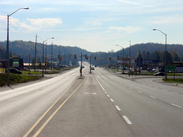
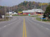
Looking south towards the Water Street intersection along Highway 35/121.
Water Street leads traffic to Downtown Minden, and was part of Highway 35's
original alignment before the Minden By-pass was constructed. Though
Highway 35/121 skirts the eastern side of Downtown Minden, considerable
development has sprung up along the by-pass.
Picture taken: October 30th, 2005. Size: 45kb. |
 |
| Township of Minden Hills County
of Haliburton |
Looking northerly along Highway 35/121 towards the northern
Highway 121
junction. Highway 121 departs northeasterly from
Minden leading to Haliburton Village. From Haliburton.
Highway 121 once
continued easterly to Highway 28 at Paudash.
The eastern leg of Highway 121 was incorporated into an extension of
Highway 118's routing in the Summer of 2003.
Picture taken: October 30th, 2005. Size: 50kb. |
 |
| Township of Minden Hills County
of Haliburton |
Green signage denoting the northern Highway 121 junction in Minden.
When Highway 121 was downloaded in 1998,
Haliburton County had originally designated the entire route as County Road
121. When the eastern leg of Highway 121
was redesignated as Highway 118, this leg
of Highway 121 was renumbered as County Road 21.
Picture size: 45kb. |
 |
| Township of Minden Hills County
of Haliburton |
View looking south towards the Haliburton Road 20 and
Highway 121 junctions. Picture taken:
October 30th, 2005. Size: 50kb. |
 |
| Township of Minden Hills County
of Haliburton |
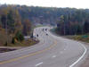
Broader view of the same scene as the previous photo. Beyond the
right-hand curve in the photo is Minden. Picture taken: October 30th,
2005. Size: 55kb. |
 |
| Township of Minden Hills County
of Haliburton |
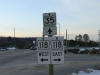
Northbound signage denoting the Highway 118 junction
at Carnavon. Picture size: 30kb. |
 |
|
Highway 118 leads both east and
west of Highway 35 through Central Ontario.
Click here for Highway 118 images. |


