King's Highway 420 - Images
Photos shown in this table are arranged from West to East:
| Proper Municipality Name | Photo Description |
Photo |
|
|
Photos taken from driver's perspective appear offset from centre-line photos: |
East- Bound |
West- Bound |
|
| Highway 420 derives its designation from Highway 20, located a short distance to the south via Montrose Road. Click here for Highway 20 images. | |||
| City of Niagara Falls Regional Municipality of Niagara |
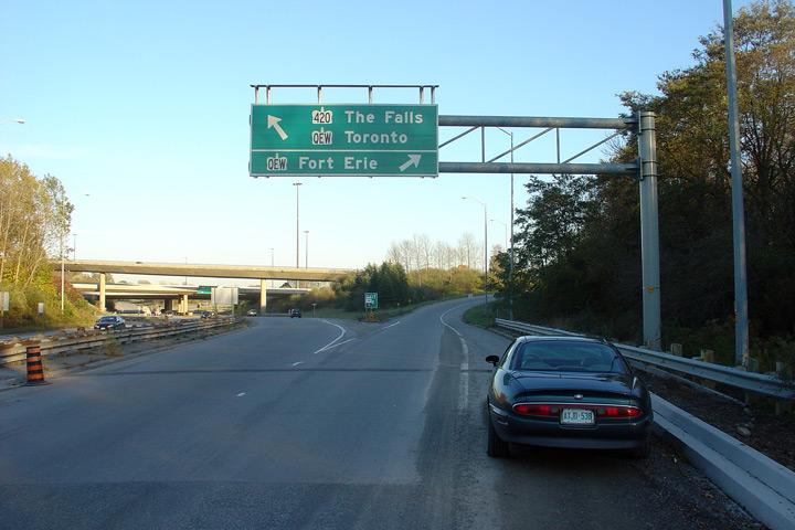
Easterly view along Highway 420 approaching the QEW interchange. This
was an early installation of a partial overhead gantry. Photo taken: October 30th, 2007. |
 (720x480) (720x480)(1440x960) |
|
| City of Niagara Falls Regional Municipality of Niagara |
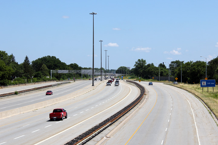
Easterly view along Highway 420 towards the QEW interchange. The high speed
flyover ramp that links Highway 420 West to the Fort Erie bound QEW
dominates this photo. Photo taken: October 30th, 2007. |
 (720x480) (1440x960) |
|
| The QEW runs between Fort Erie and and Toronto along the short of Lake Ontario. Click here for Queen Elizabeth Way images. | |||
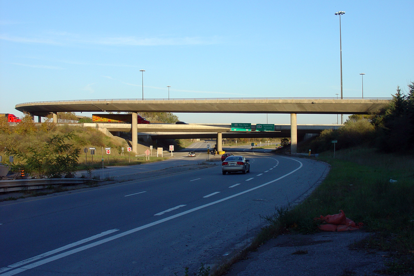
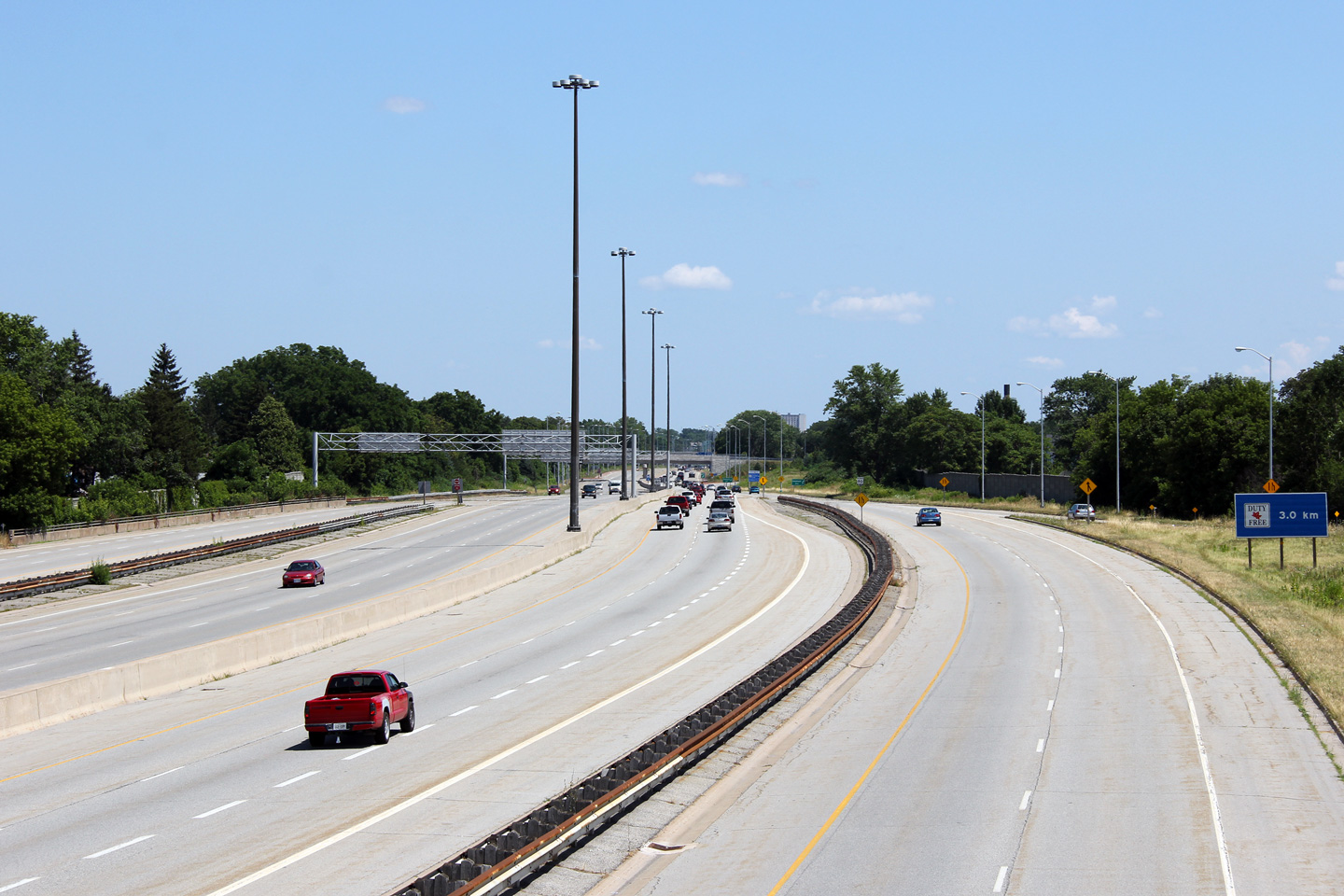
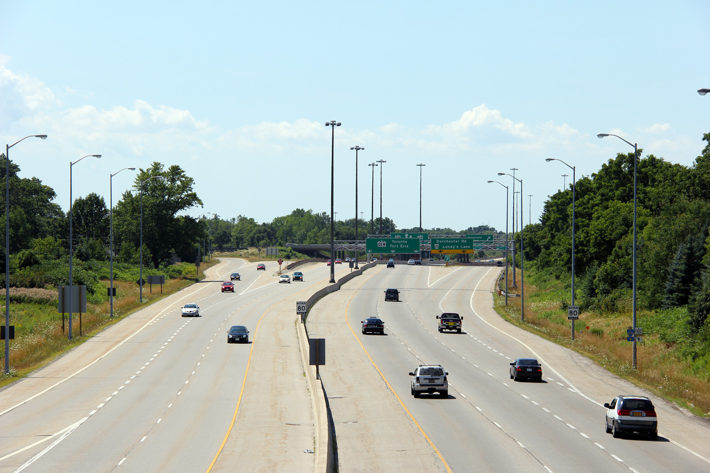
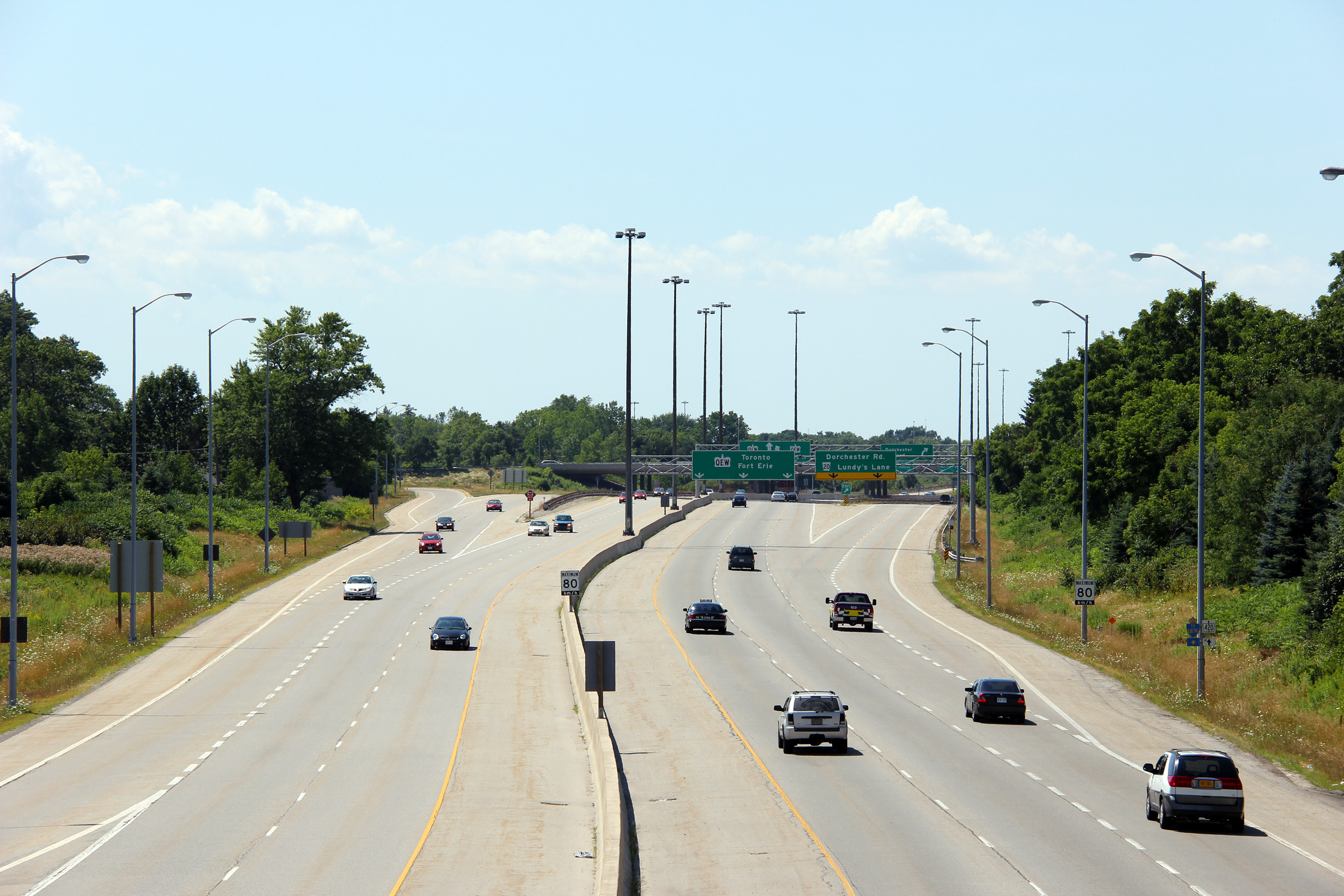
| City of Niagara Falls Regional Municipality of Niagara |
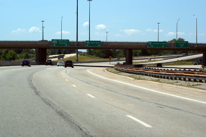
Looking west from the Dorchester Road overpass towards the
QEW interchange. The QEW
interchange was completed in 1972, and is the largest and only four level, interchange in Ontario outside of the Greater Toronto Area. Photos taken: July 30th, 2011. |
 (720x480) (1440x960) (2400x1600)  (720x480) (1440x960) (2400x1600) |
|
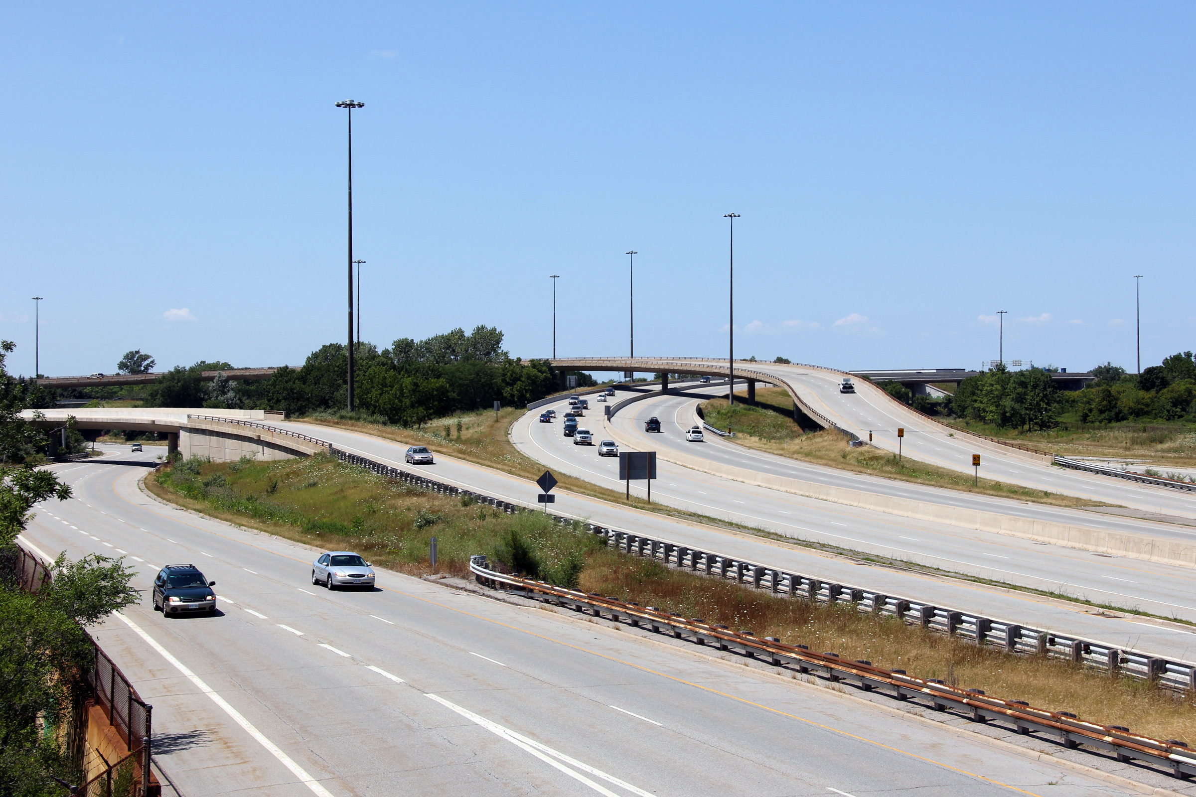
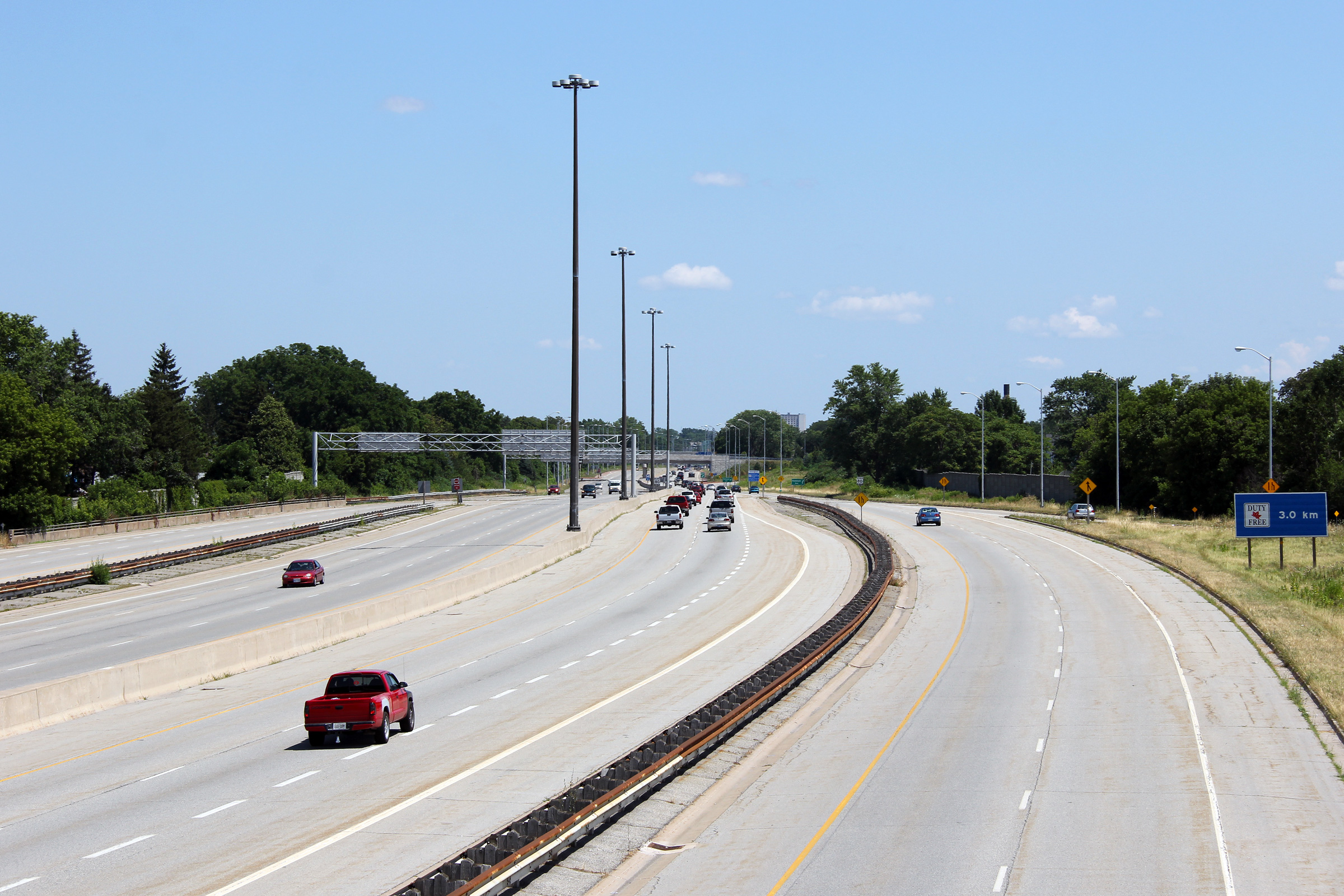
| City of Niagara Falls Regional Municipality of Niagara |
Looking east towards the Rainbow Bridge from the Dorchester Road overpass.
Highway 420 is quite an impressive highway in the vicinity of the
QEW. The inside (core) lanes pictured here
are the mainline ramps to and from the QEW, while
the outer lanes connect to the Dorchester Road interchange, Montrose Road,
and also provide access to and from the QEW. Photo taken: July 30th, 2011. |
 (720x480) (1440x960) (2400x1600) |
|
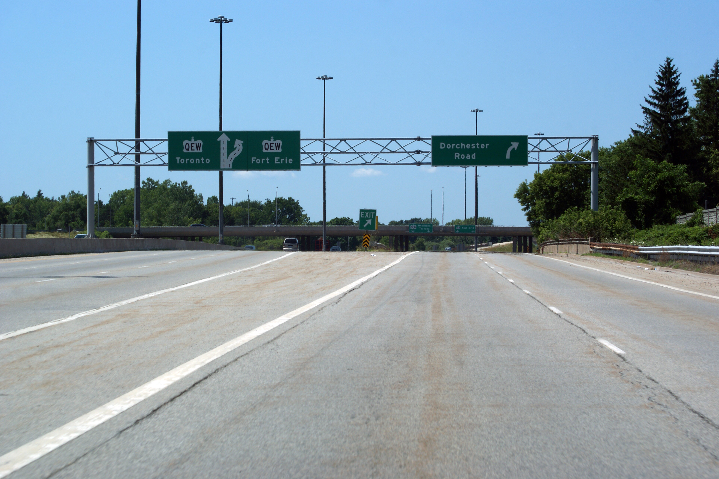
| City of Niagara Falls Regional Municipality of Niagara |
Westbound overhead lane assignment signage affixed to the Dorchester Road
overpass. Photo taken: July 30th, 2011. |
 (720x480) (720x480)(1440x960) (2400x1600) |
|
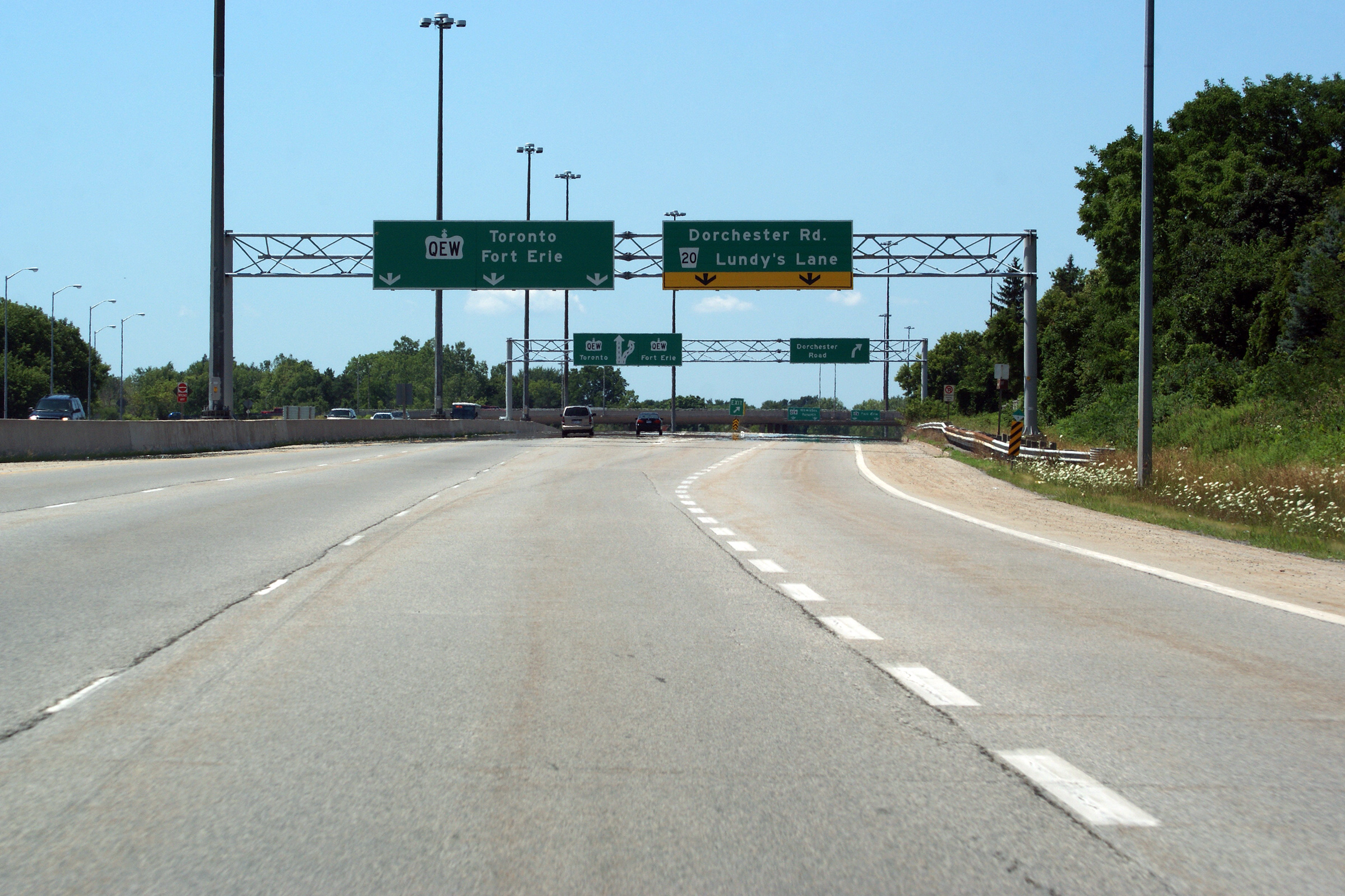
| City of Niagara Falls Regional Municipality of Niagara |
Overhead signage outlining the lane assignments for both the Queen Elizabeth
Way interchange and the Dorchester Road interchange. Photo taken: July 30th, 2011. |
 (720x480) (720x480)(1440x960) (2400x1600) |
|
| City of Niagara Falls Regional Municipality of Niagara |
The ramp to the QEW departs from the left side of Highway 420 between the
Dorchester Road and Drummond Street underpasses. Photo taken: July 30th, 2011. |
 (720x480) (720x480)(1440x960) (2400x1600) |
|
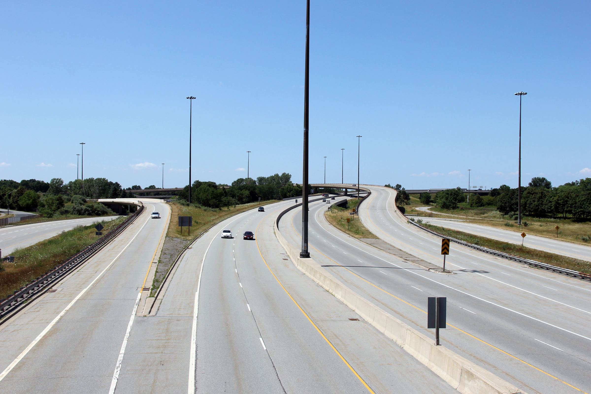
| City of Niagara Falls Regional Municipality of Niagara Falls |
Looking west from the Drummond Road overpass towards the QEW interchange.
Drummond Street meets Highway 420 with a tight pair of "J"-ramps that are
reminiscent of a RIRO interchange. Photos taken: July 30th, 2011. |
 (720x480) (1440x960) (2400x1600)  (720x480) (1440x960) (2400x1600) |
|
|
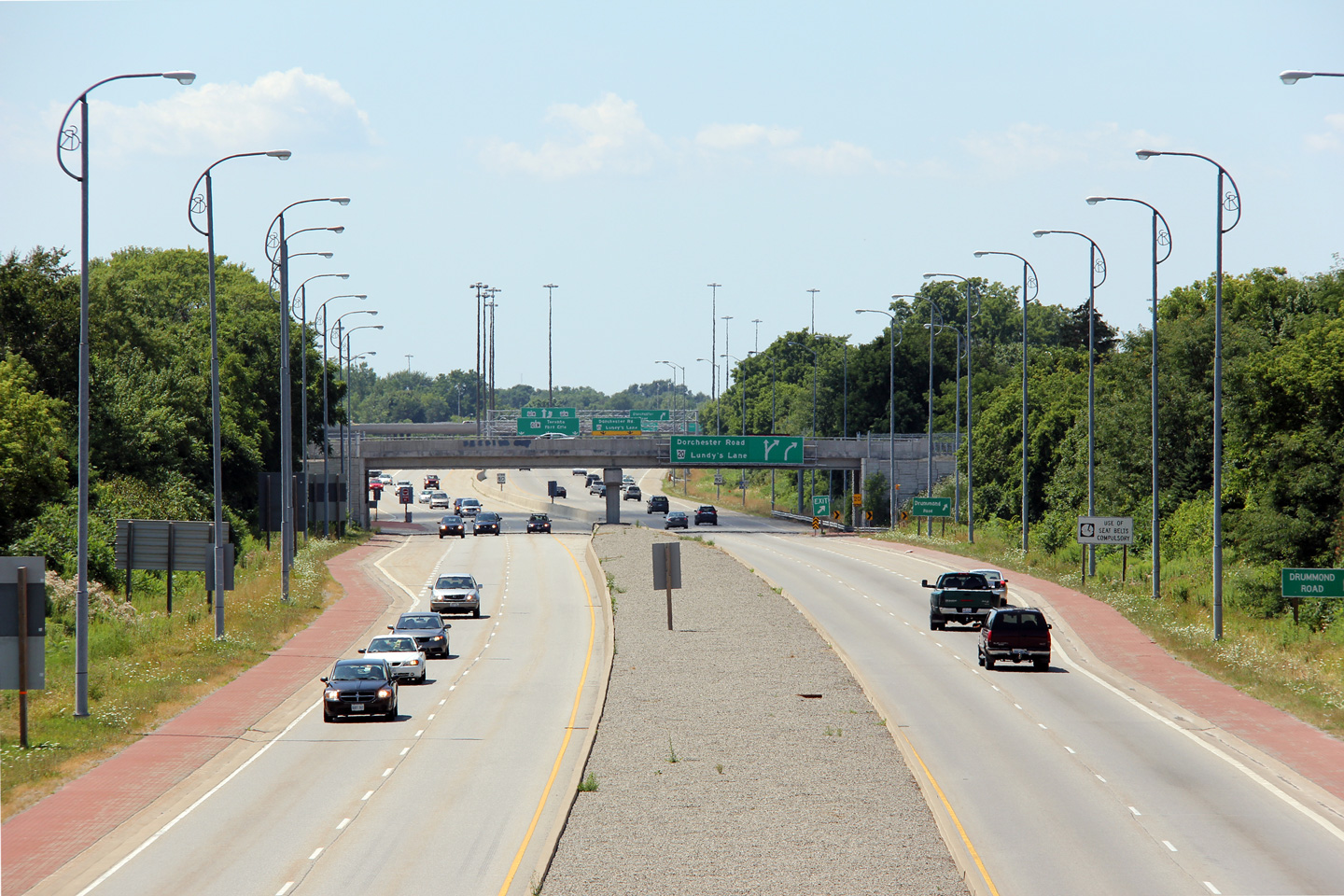
City of Niagara Falls Regional Municipality of Niagara |
Looking east from the Drummond Road overpass. Highway 420 was
extensively reconstructed in 2003 and 2004 and now contains several
decorative elements, such as embossed concrete median, and ER light
standards. Before 1972, highway 420 was a leg of the Queen Elizabeth
Way. Photos taken: July 30th, 2011 |
 (720x480) (1440x960) (2400x1600)  (720x480) (1440x960) (2400x1600) |
|
|
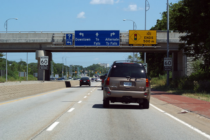
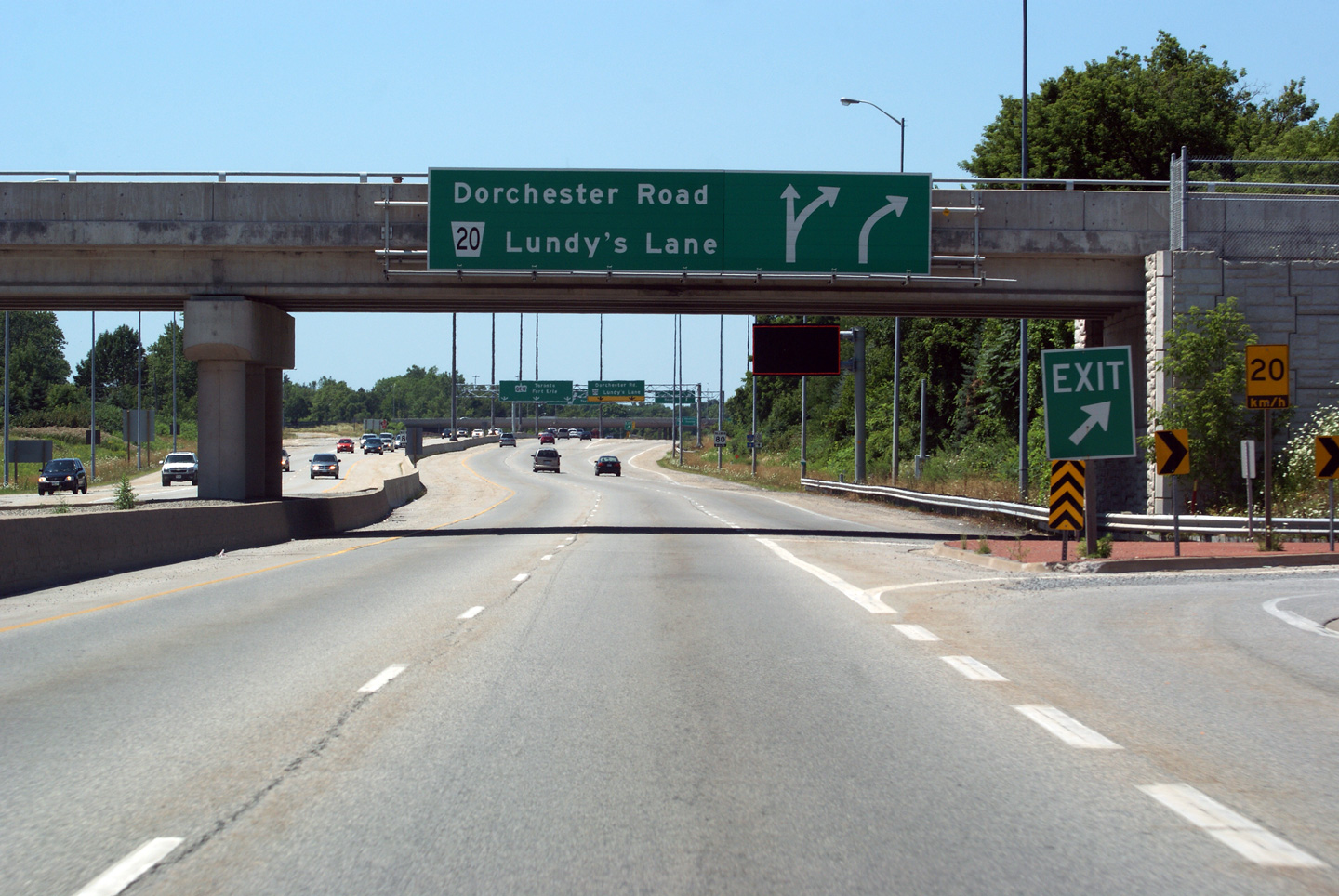
City of Niagara Falls Regional Municipality of Niagara |
The westbound advanced signage for the ramp to Dorchester Road and Lundy's
Lane is affixed to the Drummond Street overpass. Photo taken: July 30th, 2011. |
 (720x480) (720x480)(1440x960) (2400x1600) |
|
|
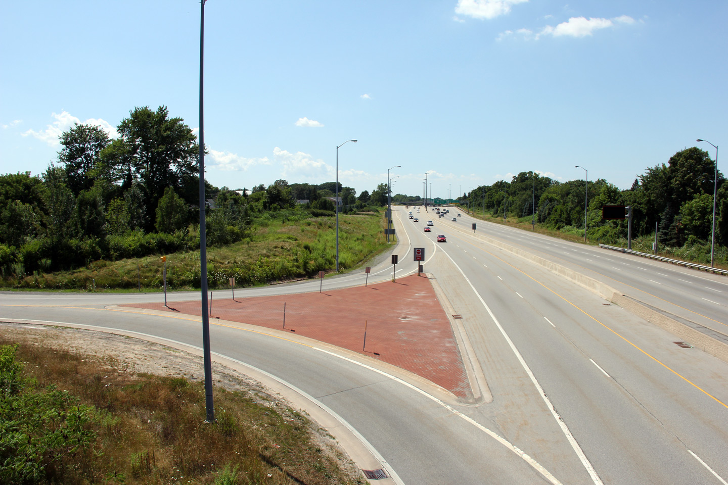
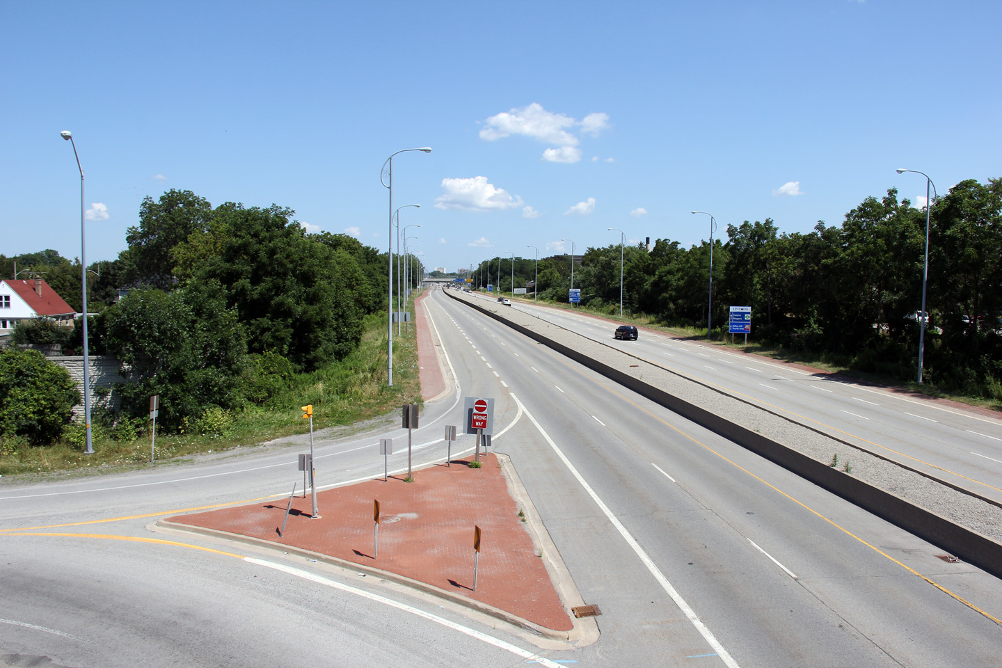
City of Niagara Falls Regional Municipality of Niagara |
Looking west towards from the Portage Street overpass. Photo taken: July 30th, 2011 |
 (720x480) (1440x960) (2400x1600) |
|
|
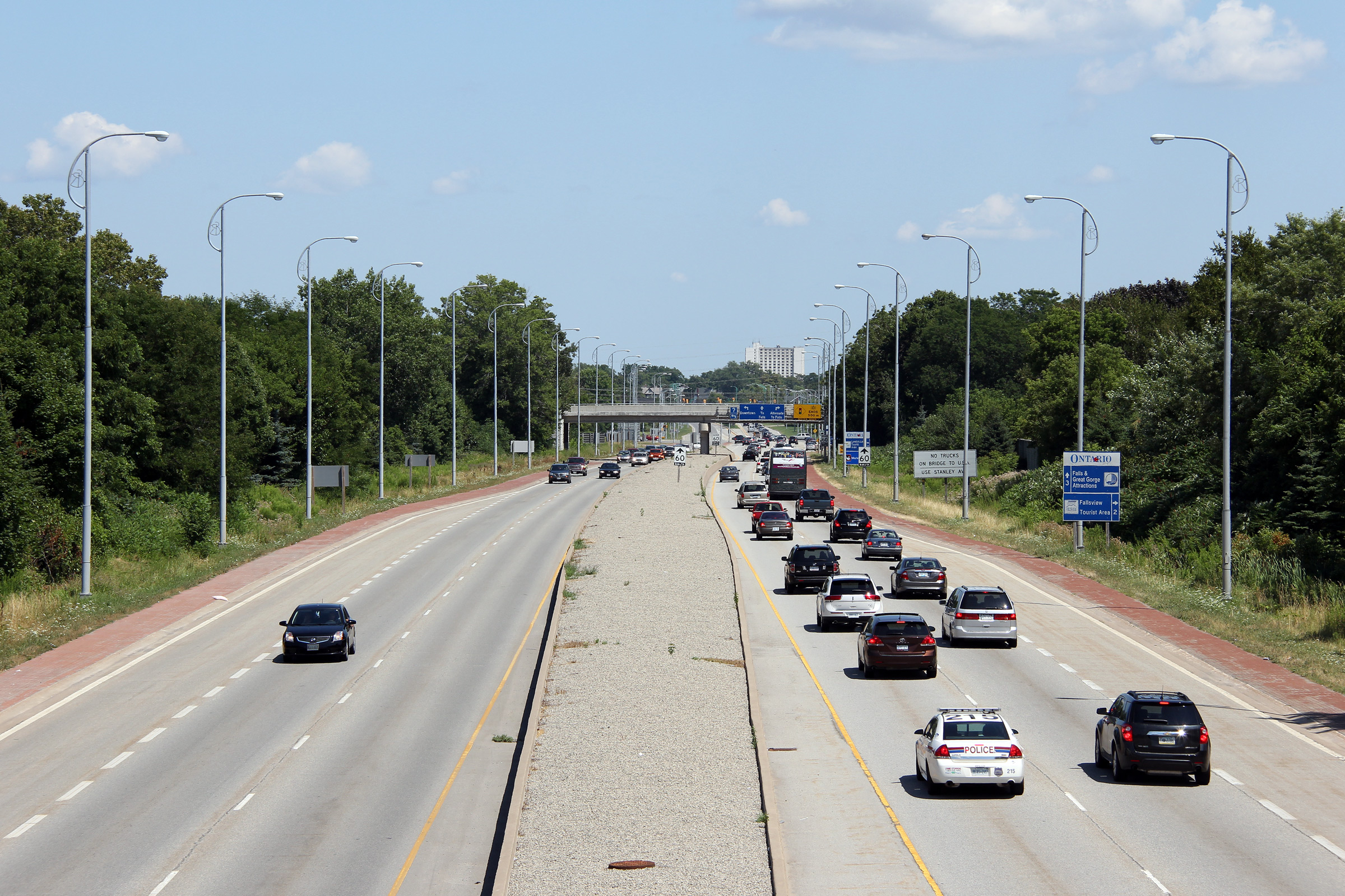
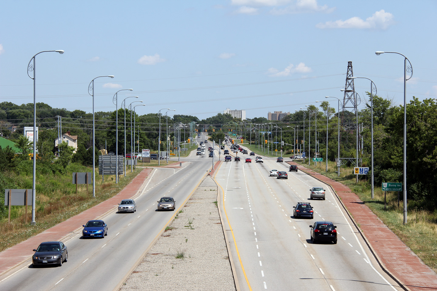
City of Niagara Falls Regional Municipality of Niagara |
Driving eastbound on Highway 420 at the Portage Street overpass. The MTO's jurisdiction over the highway
ends at Stanley Avenue, however there is a connecting link agreement in
effect for Highway 420 between Stanley Avenue and the Rainbow Bridge. Photo taken: July 30th, 2011. |
 (720x480) (720x480)(1440x960) (2400x1600) |
|
|
City of Niagara Falls Regional Municipality of Niagara |
Looking east from the Portage Road overpass towards the signalized
intersection with Stanley Avenue. Highway 420 meets both Stanley
Avenue and MacDonald Avenue at signalized at-grade intersections. Photo taken: July 30th, 2011. |
 (720x480) (1440x960) (2400x1600) |
|
|
Highway 420 was extensively reconstructed during 2003 and 2004. Click here for construction images.. |
|||
<- Highway 417 Images Back to Highway 420 Highway 427 Images ->
Copyright (c) 2004-2013, AsphaltPlanet.ca scott@asphaltplanet.ca