Secondary Highway 540 - www.OntHighways.com

Highway 540 is a long secondary highway that spans the entire east-west distance of Manitoulin Island.  This long highway is quite busy (by secondary standards) between West Bay and Little Current, and as such, at times resembles a lesser traveled King's Highway.  Highway 540 was not affected by provincial downloading.


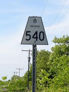
Secondary Highway 540 Shield

  Western Terminus:  Meldrum Bay

Eastern Terminus:  Junction Highway 6 in Little Current

Length:  132.0km

Multiplexes:  None

Freeway: No

Orientation: East-West

Regions Served: Manitoulin District

AADT (2002):  Highest:  1,950 from Highway 551 at M'Chigeeng easterly to Little Current;

                             Lowest:  570 from Meldrum Bay easterly to Evansville.

Road Info:  Highway 540 is in good shape for its entire length.  From Meldrum Bay to Gore Bay, Highway 540 very much resembles a secondary, as it is covered with tar and chip and sees little traffic.  From Gore Bay easterly to Little Current, Highway 540 is in much better shape, as it is covered with asphalt, and actually resembles a lesser traveled King's Highway.  Rural speed limits along Highway 540 are posted at 80km/h.


Highway 540 information:


OntHighways.com  

Detailed Route information available below
Virtual Tour of Highway 540

Communities and Intersections along and Highway 540 from West to East:

Proper Municipality Name Community Name Distance Intersecting Road
District of Manitoulin Meldrum Bay 0 km / 132.0 km -----

At Silver Water:  WB: Turn Left towards Gore Bay.  EB: Turn Right towards Meldrum Bay

District of Manitoulin Silver Water 27.9 km / 104.1 km Burnt Island Road
District of Manitoulin Fernlee --- -----
Township of Burpee and Mills Elizabeth Bay --- -----
Township of Burpee and Mills Evansville 48.9 km / 83.1 km Evansville Road

At Highway 540A:  WB: Turn Right towards Gore Bay.  EB: Turn Left away from Highway 540A.

Township of Gordon ----- 63.6 km / 68.4 km Secondary Highway 540A (Airport Road)
Township of Gordon ----- 69.1 km / 62.9 km Secondary Highway 540B (Poplar Road)
Township of Gordon ----- 70.3 km / 61.7 km Secondary Highway 540B & Secondary Highway 542
Township of Gordon Ice Lake --- -----

At Kagawong:  EB: Turn Right towards West Bay.  WB:  Turn Left towards Gore Bay.

Township of Billings Kagawong 86.9 km / 45.1 km Maple Point Road
Township of Billings Billings --- -----
Township of Billings Bowser's Corner --- -----
West Bay First Nation M'Chigeeng 101.7 km / 30.3 km Secondary Highway 551
Township of Northwestern Manitoulin and the Islands Cold Springs --- -----
Township of Northwestern Manitoulin and the Islands (Former) Little Current Southern Limits 131.0 km / 1.0 km -----

At Worthington Street:  WB: Turn Right towards Highway 6.  EB: Turn Left towards Gore Bay

Township of Northwestern Manitoulin and the Islands Little Current --- Worthington Street-North
Township of Northwestern Manitoulin and the Islands Little Current 132.0 km / 0 km King's Highway 6
Highway 540 Ends

<- Highway 539A         www.OntHighways.com - Home         Highway 540A ->


Copyright (c) 2004-2011, Scott Steeves (Webmaster)  scott@asphaltplanet.ca

Page last updated:  July 7th, 2005

Page created:  July 7th, 2005