AsphaltPlanet.ca > OntHighways >
Highway 540 > Images
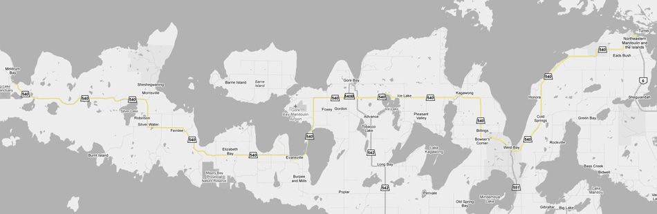
Secondary Highway 540 - Images
Photos shown in this table are arranged from West to East:
| Proper Municipality Name |
Photo Description |
Photo | |
|
Pictures taken from driver's perspective appear offset from centre-line pictures: |
East- Bound |
West- Bound |
|
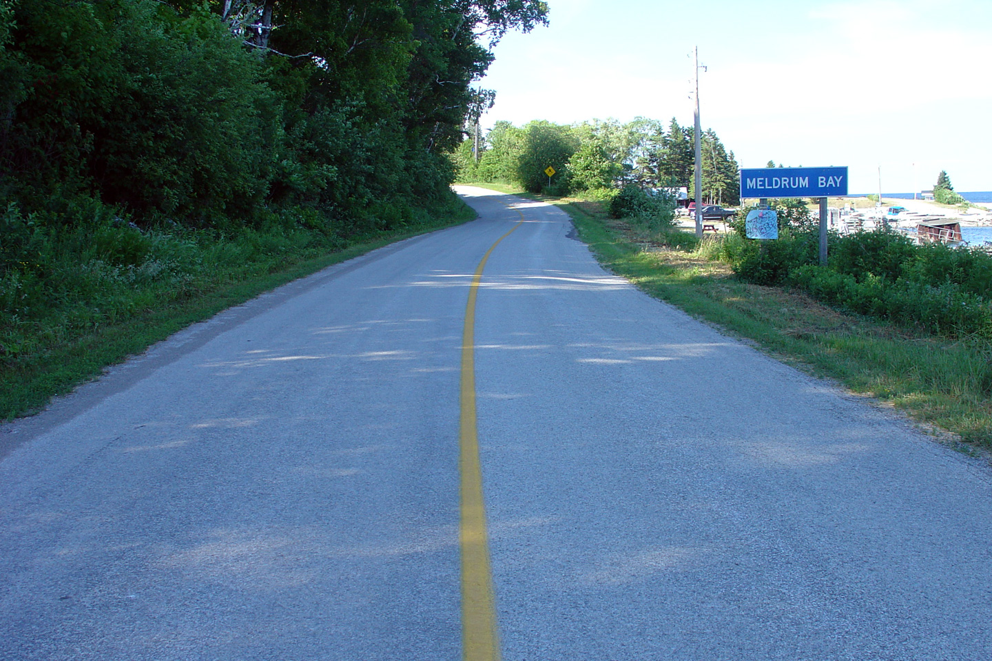
| District of Manitoulin (Geographical Township of Dawson) |
This is the western terminus of Highway 540 at Meldrum Bay. It seems a
little bit odd to be starting the the Highway 540 images page at Meldrum
Bay, since it is not possible to have found Meldrum Bay by automobile,
unless the motorist had driven to Meldrum Bay along Highway 540 from the
east. Photo taken: July 2nd, 2005 |
 (720x480) (1440x960) |
|
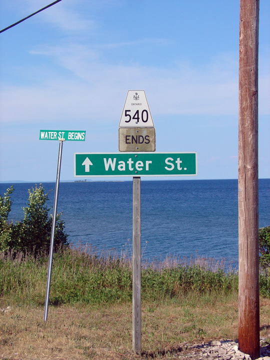
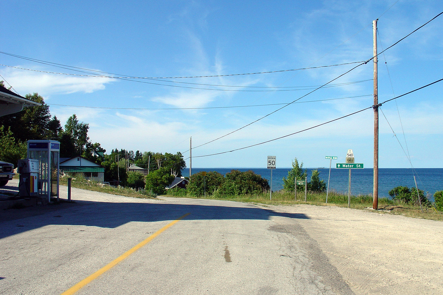
| District of Manitoulin (Geographical Township of Dawson) |
Westbound ends sign along Highway 540. Water Street continues westerly
as a shore road along the same alignment as Highway 540 along the cusp of Meldrum Bay for a few kilometres before
itself terminating. Meldrum Bay truly is the end of the road. Photo taken: July 2nd, 2005. |
 |
|
| District of Manitoulin (Geographical Township of Dawson) |
This is the eastbound start of Highway 540. It is a long way to the
rest of Ontario from Meldrum Bay. In fact, as the crow flies, Meldrum
Bay is almost as close to
Interstate 75 in Michigan as it is to
Highway 6 in
Little Current. That said, because of the indirect highway access, a
traveler from Meldrum Bay bound for I-75 in Michigan would have to endure a
five hour, 415km drive to complete the 110km distance. Photo taken: July 2nd, 2005. |
 (720x480) (1440x960) |
|
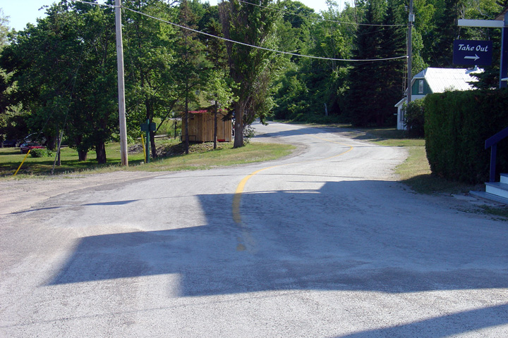
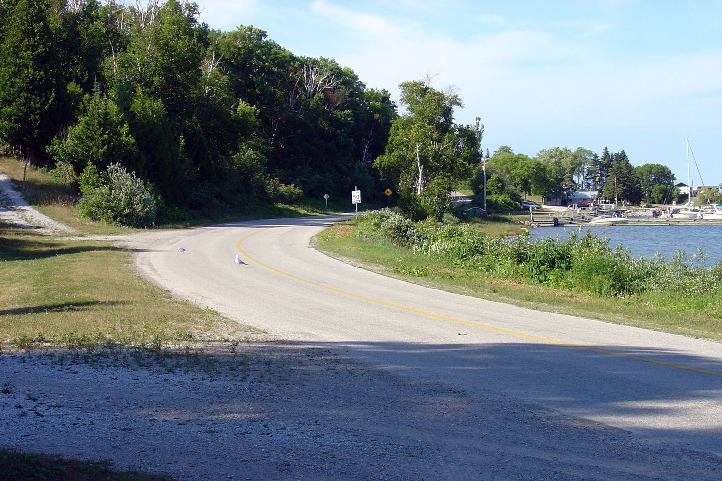
| District of Manitoulin (Geographical Township of Dawson) |
View looking westerly along Highway 540 as it enters Meldrum Bay from the
east. Photo taken: July 2nd, 2005. |
 (720x480) (1440x960) |
|
| District of Manitoulin (Geographical Township of Dawson) |
View looking westerly along Highway 540 as it runs alongside the Meldrum Bay
shoreline. Photo taken: July 2nd, 2005. |
 (720x480) (1440x960) |
|
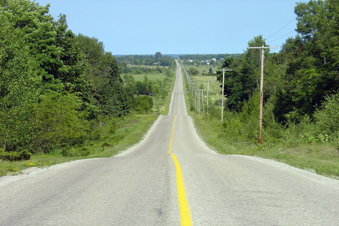
| Township of Burpee and Mills District of Manitoulin |
This view looks easterly, some 40km east of Meldrum Bay. The Western Half
of Manitoulin Island is predominantly forested, with only sporadic farms
dotting the landscape. Agriculture is far more prevalent on the
eastern part of the island. Photo taken: July 2nd, 2005. |
 (720x480) (1440x960) |
|
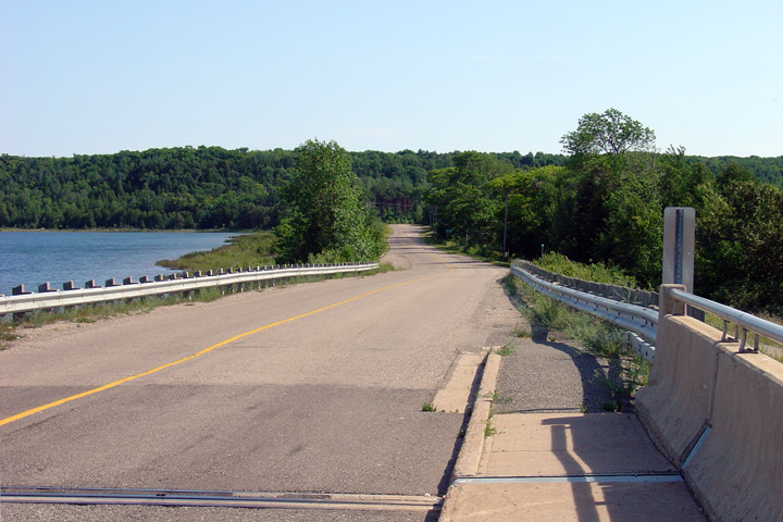
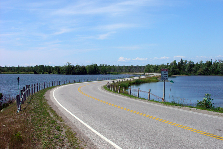
| Township of Burpee and Mills District of Manitoulin |
This view looks westerly from the top of the structure that carries Highway
540 over the Lake Wolsey Narrows. Highway 540 traverses a narrow peninsula that separates Bayfield Sound from Lake Wolsey. Photo taken: July 2nd, 2005. |
 (720x480) (1440x960) |
|
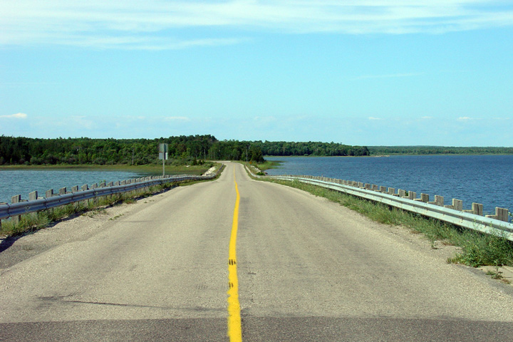
| Municipality of Gordon / Barrie
Island District of Manitoulin |
Reverse (easterly) view from the previous vantage point. This is a
particularly scenic section of Highway 540. Photo taken: July 2nd, 2005. |
 (720x480) (1440x960) |
|
| Municipality of Gordon / Barrie
Island District of Manitoulin |
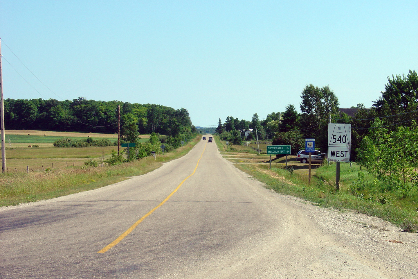
This view looks westerly along Highway 540 from the Highway 540A turn-off. Photo taken: July 2nd, 2005. |
 (720x480) (1440x960) |
|
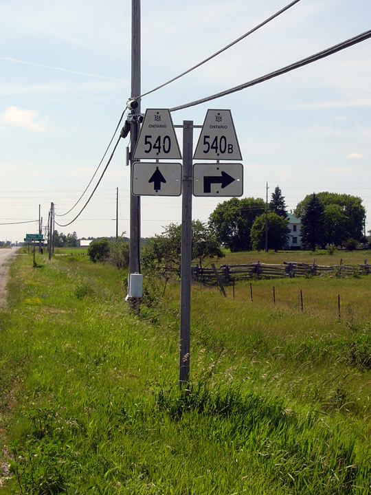
| Municipality of Gordon / Barrie
Island District of Manitoulin |
Eastbound junction assembly for the Highway 540A junction. As is
evident by the signage, eastbound traffic wishing to continue along Highway
540 must turn right at this junction. Despite the 'A' designation,
Highway 540A is a spur route, and not an alternate. It is common for
spur secondary highways in Ontario to have an 'A' suffix designation. Photo taken: July 2nd, 2005. |
 |
|
| Highway 540A is a short spur highway that accesses Gore Bay Airport, and Barrie Island. Click here for Highway 540A Images. | |||
| Municipality of Gordon / Barrie
Island District of Manitoulin |
Easterly view along Highway 540 from the Highway 540A junction. Photo taken: July 2nd, 2005. |
 (720x480) (1440x960) |
|
| The Western junction of Highway 540B carries traffic into the western side of Gore Bay. Click here for Highway 540B Images. | |||
| Municipality of Gordon / Barrie
Island District of Manitoulin |
Eastbound view along Highway 540 from the Highway 540B junction. Note
how much damage the turning traffic has caused to the tar and chip surface
of the highway. It becomes quickly very apparent why tar and chip has
limited use as a roadway surface. Photo taken: July 2nd, 2005 |
 (720x480) (1440x960) |
|
| Municipality of Gordon / Barrie
Island District of Manitoulin |
Westbound junction assembly for the western Highway 540B intersection. Photo taken: July 2nd, 2005 |
 |
|
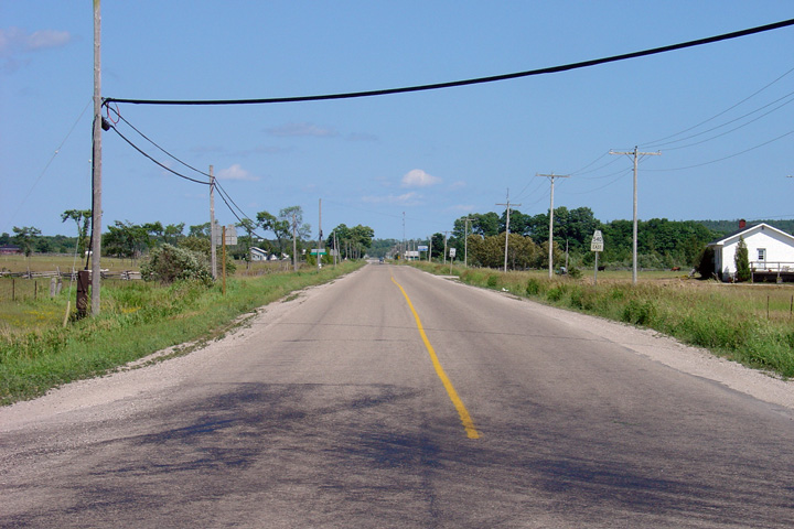
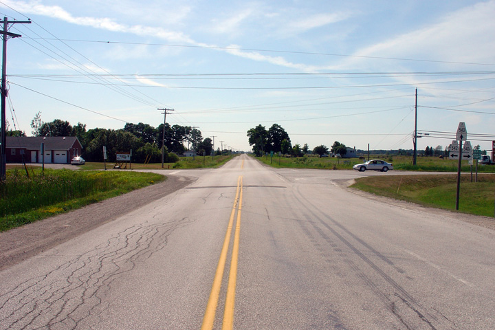
| Municipality of Gordon / Barrie
Island District of Manitoulin |
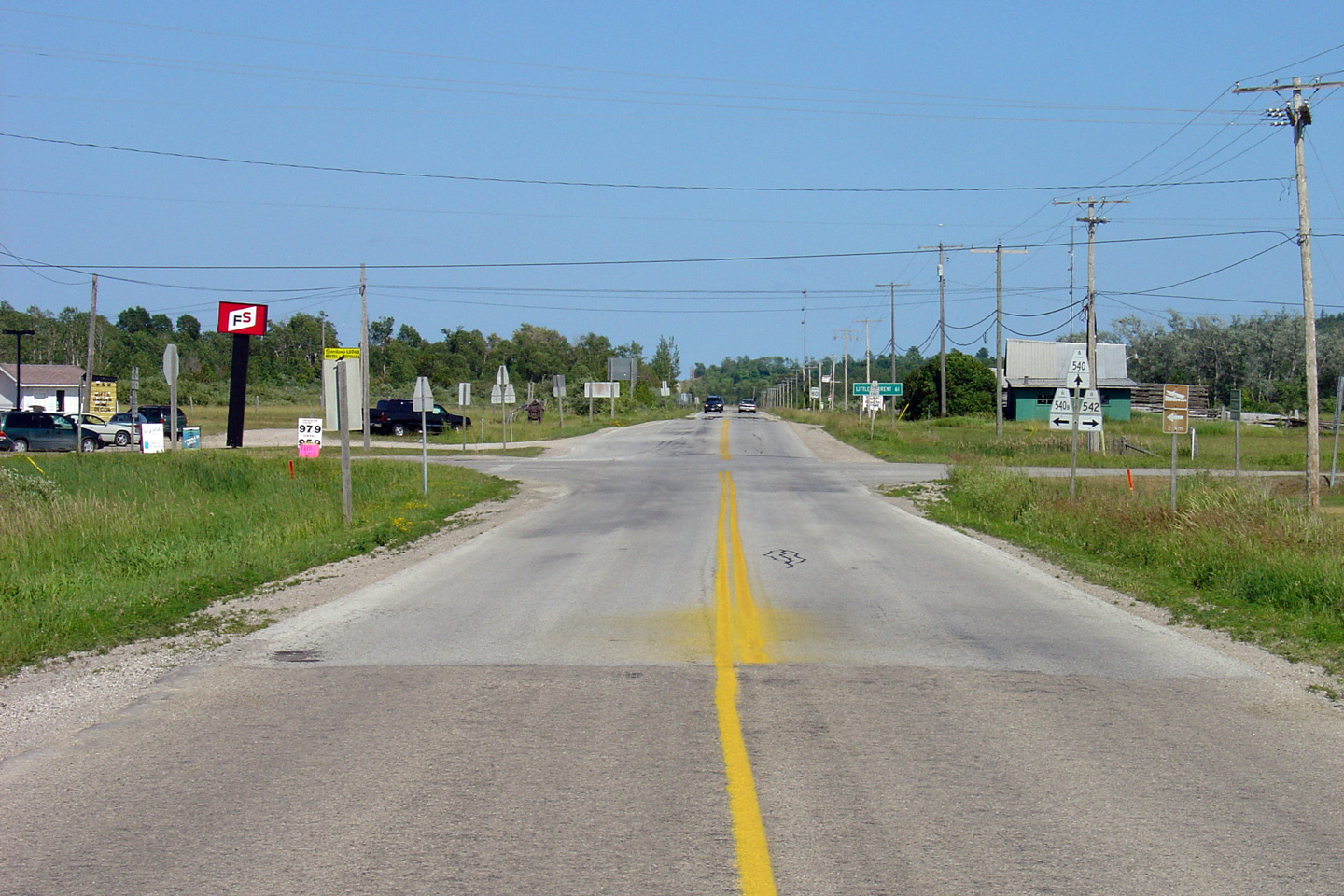
Easterly view approaching the Highway 542 junction. Notice the
transition from a tar and chip road surface to an asphalt paved surface.
This photo is taken just south of Gore Bay, the western-most of three major
Manitoulin Island Towns. Traffic volumes increase fairly significantly
east of Gore Bay. Photo taken: July 2nd, 2005 |
 (720x480) (1440x960) |
|
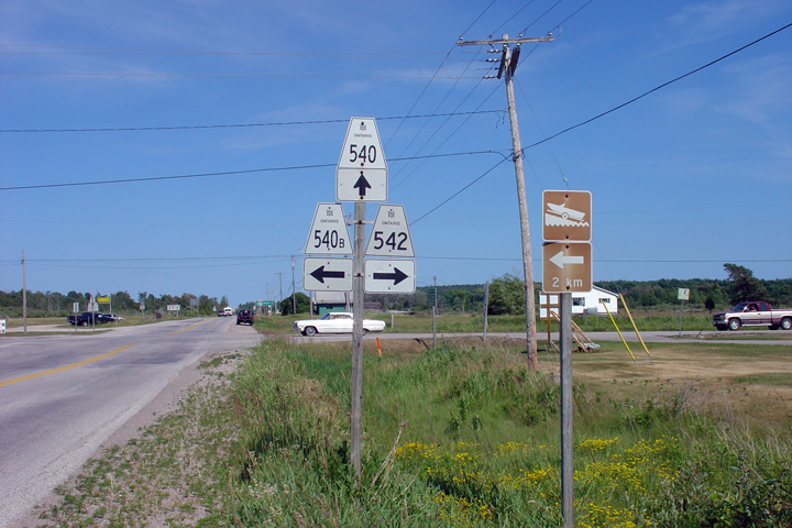
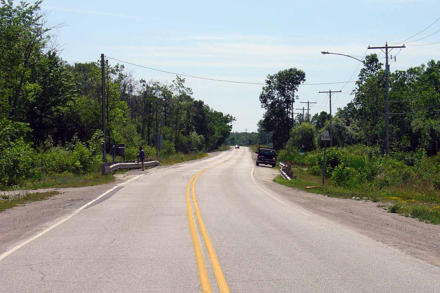
| Municipality of Gordon / Barrie
Island District of Manitoulin |
Eastbound junction assembly for the Highway 540B and Highway 542
intersection. Note the lack of cardinal directions along the signage.
Direction tabs are often omitted from secondary highway assemblies in
Ontario. Photo taken: July 2nd, 2005. |
 |
|
|
The Eastern junction of Highway 540B carries
traffic into the eastern side of Gore Bay. Highway 542 also carries
traffic bound for Highway 6, though via a Southern alignment through
Mindemoya. Click here for Highway 540B Images and here for Highway 542 Images |
|||
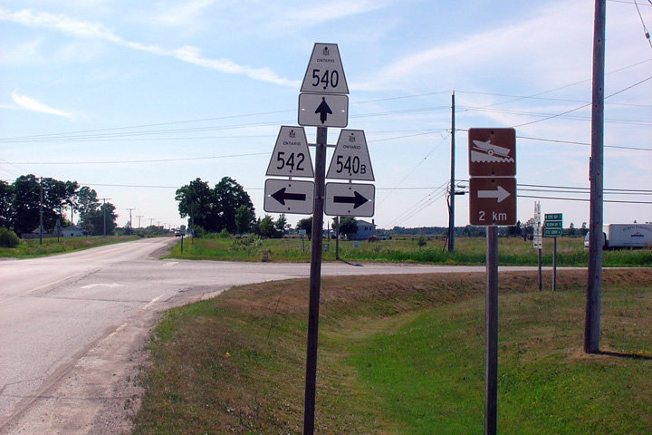
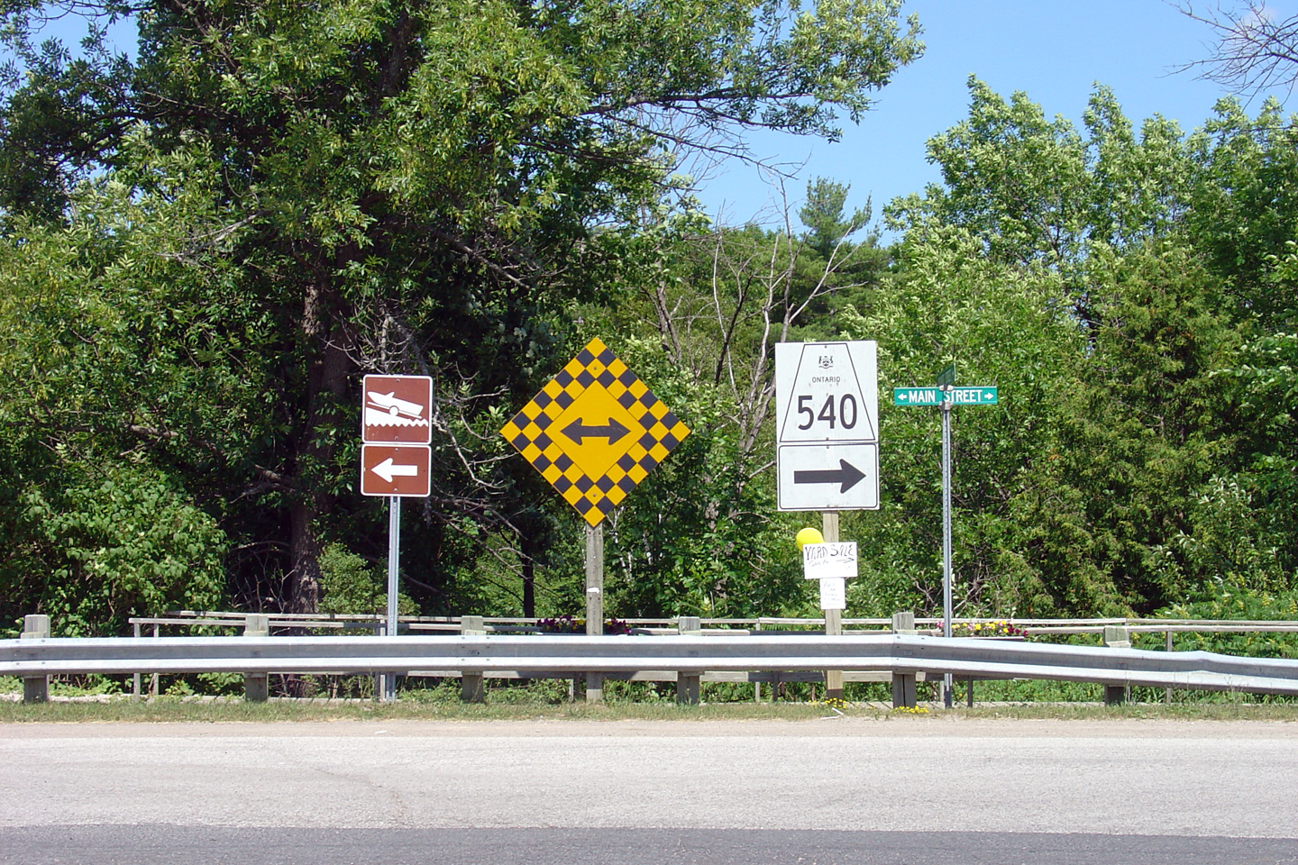
| Municipality of Gordon / Barrie
Island District of Manitoulin |
Westbound assembly for the same intersection as above. Highway 540
intersects Highway 540B (The Gore Bay Business Loop) twice in just over two
kilometers. Gore Bay is found just over a kilometre from Highway 540
on the North Channel. Photo taken: July 2nd, 2005 |
 |
|
| Municipality of Gordon / Barrie
Island District of Manitoulin |
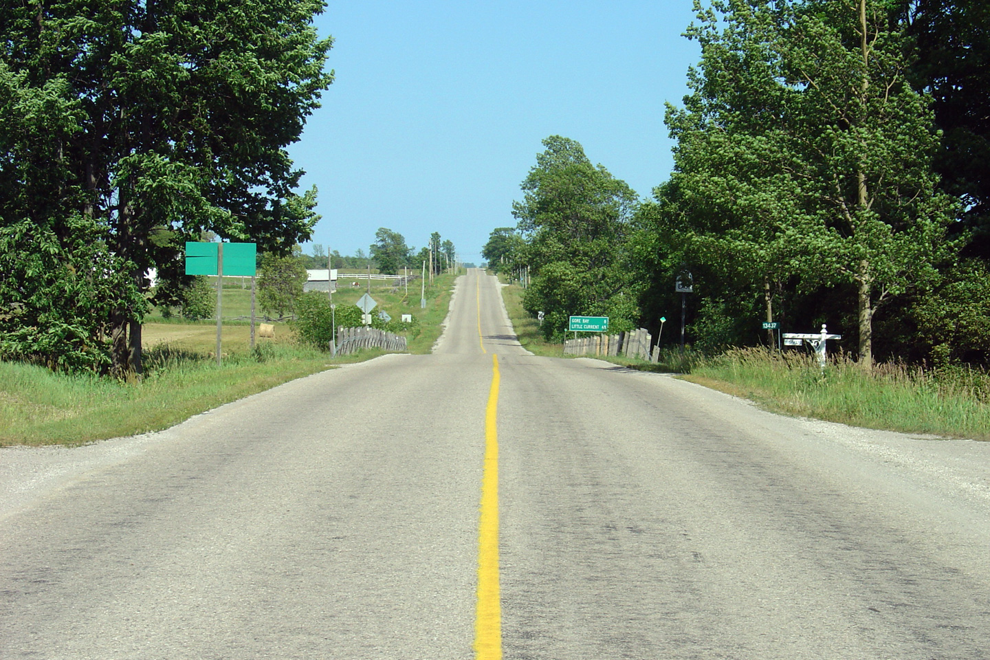
This view looks westerly approaching the Highway 542 intersection. Photo taken: July 2nd, 2005. |
 (720x480) (1440x960) |
|
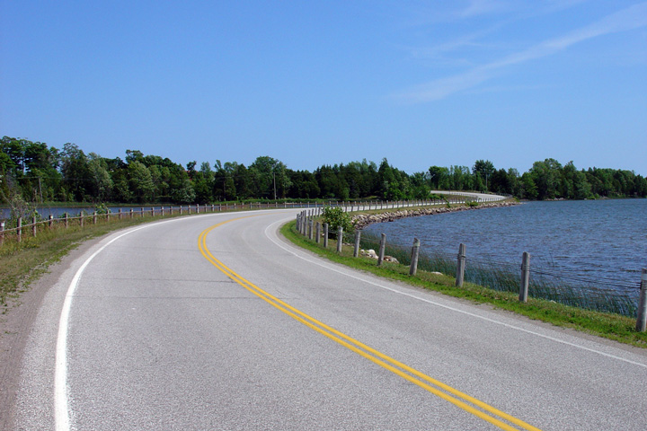
| Municipality of Gordon / Barrie
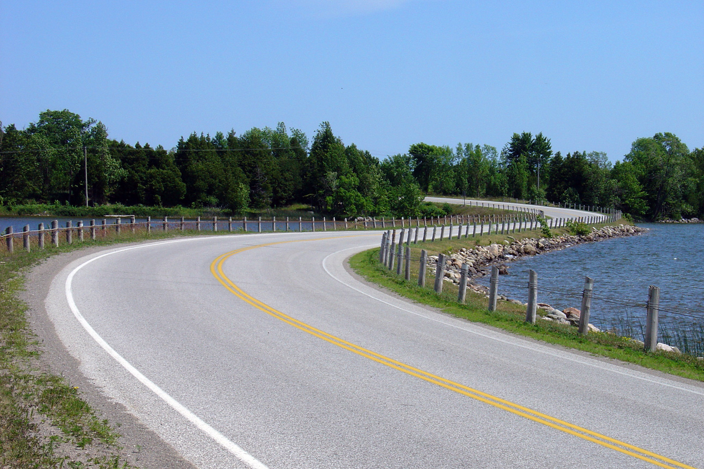
Island District of Manitoulin |
Two views looking easterly as Highway 540 crosses the northern shore of Ice
Lake on a small causeway. Ordinarily, I would have selected only one
of these photos to include on this page, however, the section of Highway 540
is particularly scenic as it crosses Ice Lake, and I rather like both
photos. Photos taken: July 2nd, 2005. |
 (720x480) (1440x960)  (720x480) (1440x960) |
|
| Municipality of Gordon / Barrie
Island District of Manitoulin |
Opposing view as Highway 540 crosses the Ice Lake Causeway. Field
evidence suggests that Highway 540 once diverted around the north side of
Ice Lake, prior to the construction of the pictured causeway. As a
casual observer, it is somewhat surprising that the MTO would have elected
to construct a causeway over a small portion of the lake, lake rather than construct
an overland route further north. Photo taken: July 2nd, 2005. |
 (720x480) (1440x960) |
|
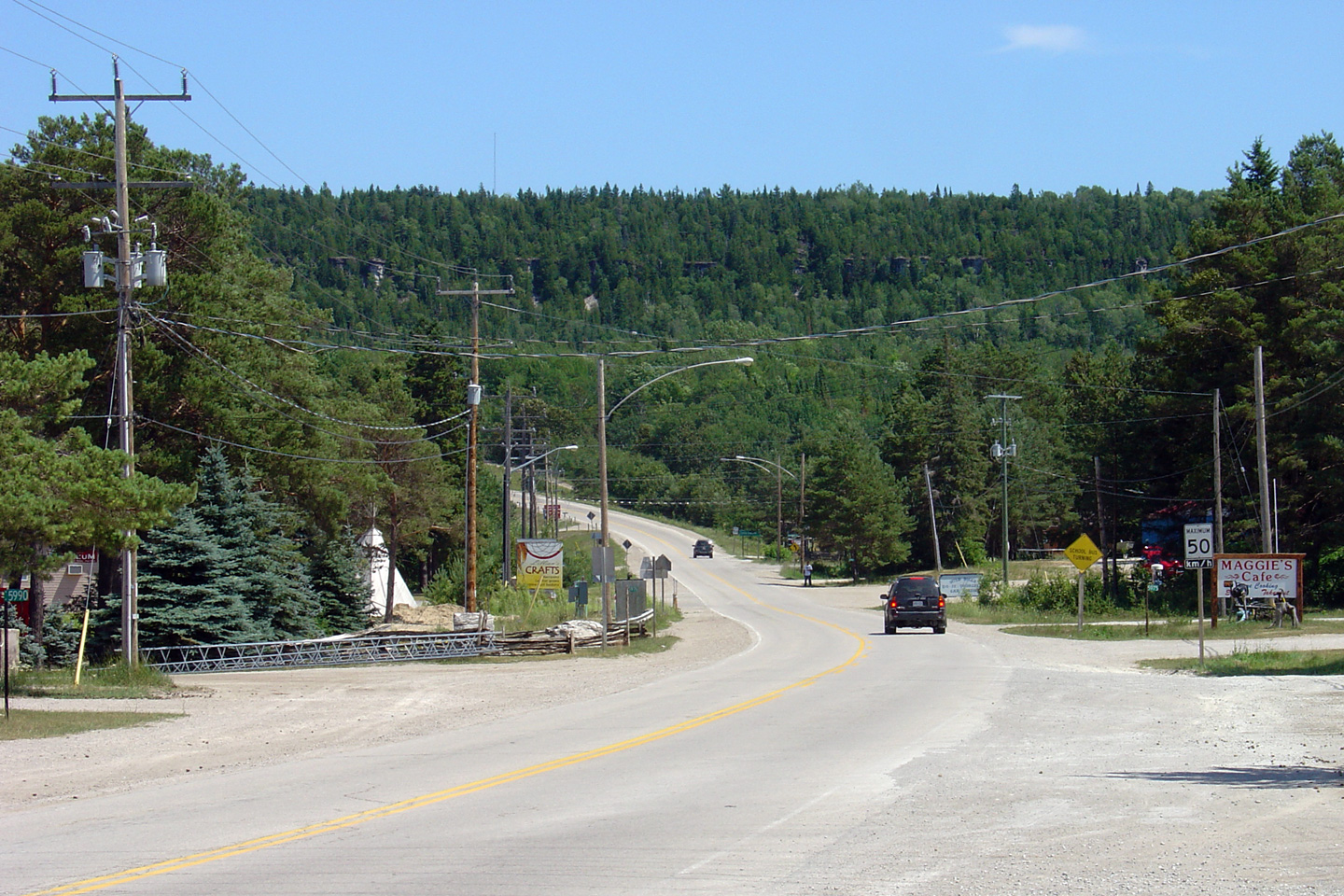
| Township of Billings District of Manitoulin |
This view looks westerly from the Main Street intersection in Kagawong. Photo taken: July 2nd, 2005. |
 (720x480) (1440x960) |
|
| Township of Billings District of Manitoulin |
Eastbound junction oversized sign directing Highway 540 traffic around the
right turn at Kagawong. Photo taken: July 2nd, 2005. |
 (720x480) (720x480)(1440x960) |
|
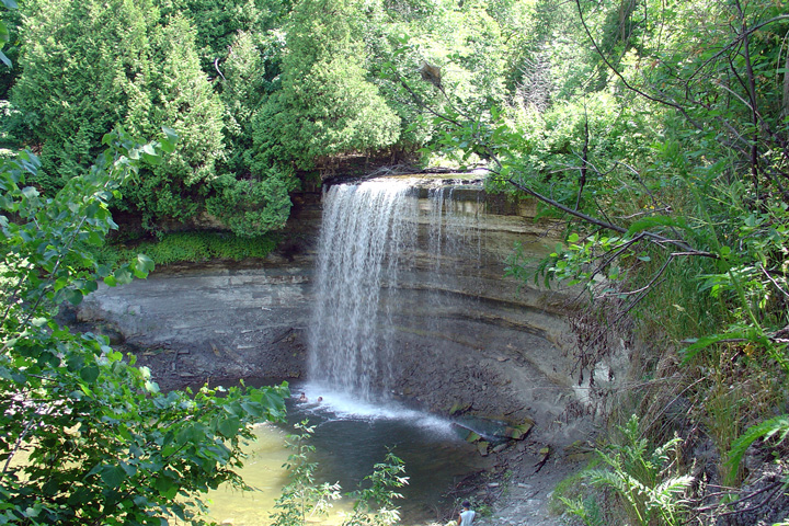
| Township of Billings District of Manitoulin |
This view is obviously not of Highway 540. Bridal Veil Falls is found
on the small river that empties Lake Kagawong into the North Channel at
Kagawong. Highway 540 is so close to this picturesque water fall that
the MTO practically paved it over. Manitoulin Island is a beautiful
place, and is certainly worth the drive from anywhere in Ontario. Photo taken: July 2nd, 2005. |
 (720x480) (1440x960) |
|
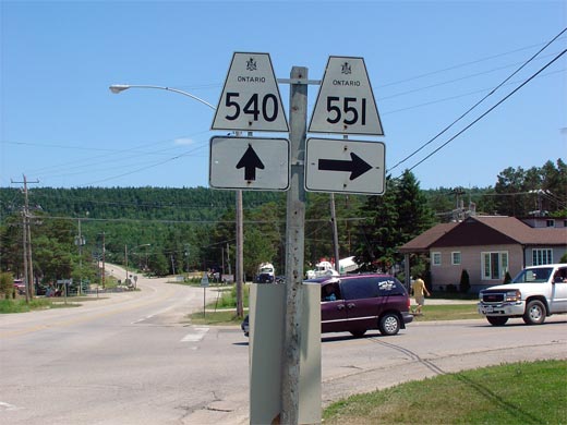
| West Bay IR 22 District of Manitoulin |
Junction assembly along Highway 540 eastbound for the Highway 551 junction. Photo taken: July 2nd, 2005. |
 |
|
| Highway 551 is a short but important highway that runs south from Highway 540 through Mindemoya, bound for Providence Bay. Click here for Highway 551 Images. | |||
| West Bay IR 22 District of Manitoulin |
Looking west along Highway 540 to the junction of Highway 551. Highway
551 leads travelers south from M'Chigeeng southerly towards Mindemoya and
Providence Bay. Picture taken: July 2nd, 2005. |
 (720x480) (1440x960) |
|
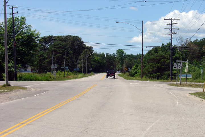
| West Bay IR 22 District of Manitoulin |
Looking east from just east of the Highway 551 junction through the small
native community of M'Chigeeng. M'Chigeeng was formerly known as the
community of West Bay. Picture taken: July 2nd, 2005. |
 (720x480) (1440x960) |
|
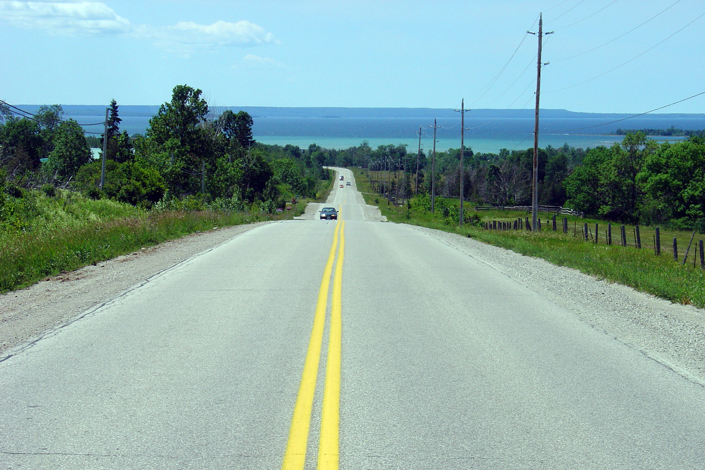
| Town of Northeastern Manitoulin
and the Islands District of Manitoulin |
Scenic view of Highway 540 as it overlooks the north shore of Lake Huron
about 10km west of Little Current. Picture taken: July 2nd, 2005. |
 (720x480) (1440x960) |
|
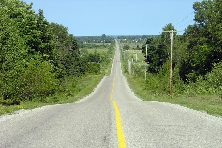
| Town of Northeastern Manitoulin
and the Islands District of Manitoulin |
Easterly view from the opposing vantage point of the previous photo.
The eastern most section of Highway 540 is reminiscent of an older standard
of King's Highway than a secondary highway. Photo taken: July 2nd, 2005. |
 (720x480) (1440x960) |
|
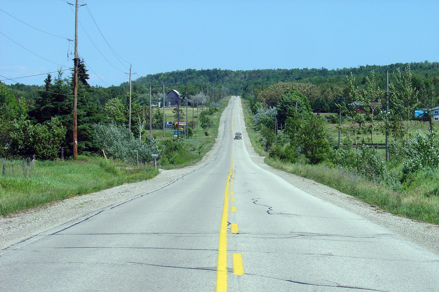
| Town of Northeastern Manitoulin
and the Islands District of Manitoulin |
Two views of Highway 540 and the North Channel of Lake Huron from McLean's
Mountain Lookout. The La Cloche Mountains dominate the mainland
shoreline. Photos taken: July 2nd, 2005. |
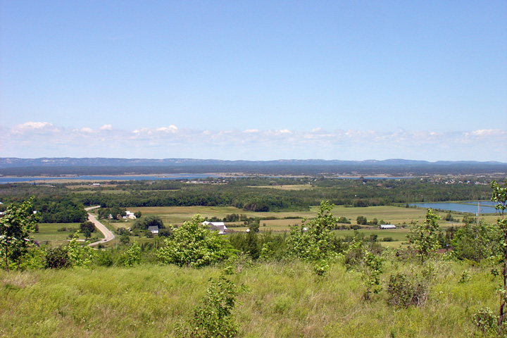 (720x480) (1440x960) 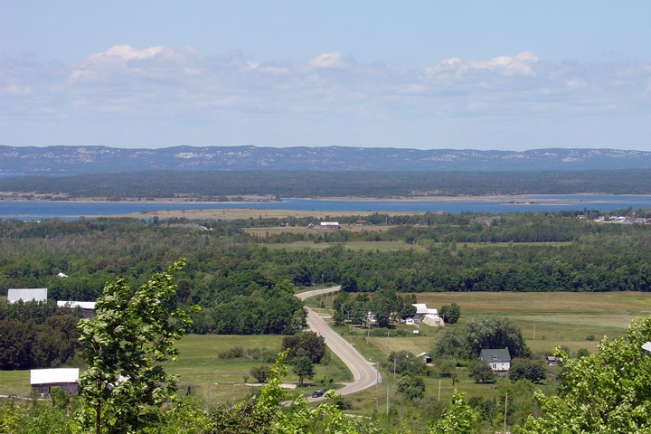 (720x480) (1440x960) |
|
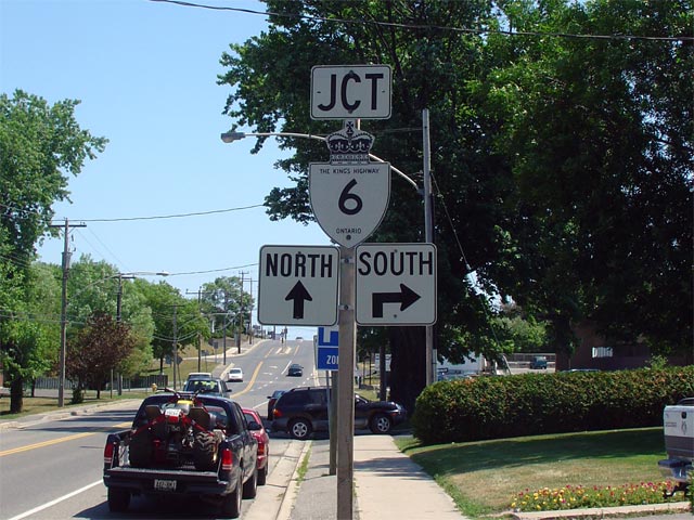
| Town of Northeastern Manitoulin
and the Islands District of Manitoulin |
Rather odd junction assembly for the upcoming
Highway 6 junction in
Little Current. Highway 540 ends at the
Highway 6 junction in Little Current. Picture size: 80kb. |
 |
|
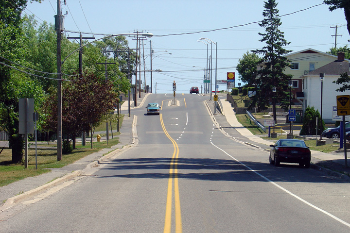
| Town of Northeastern Manitoulin
and the Islands District of Manitoulin |
Looking east towards the eastern terminus of Highway 540 at the
Highway 6 junction in
Little Current. The
Highway 6 junction is located at the top of this hill near the pictured
Shell gas station. Picture taken: July 2nd, 2005. Size: 70kb. |
 (720x480) (1440x960) |
|
| Highway 6 is a principal highway that extends from Lake Erie northerly to Highway 17 at Espanola. Click here for Highway 6 Images. | |||
<- Highway 539A Images Back to Highway 540A Highway 540A Images ->
Copyright (c) 2004-2011, Scott Steeves (Webmaster) scott@asphaltplanet.ca