|
Proper Municipality Name |
Photo Description |
Photo |
|
Pictures taken
from driver's perspective appear offset from centre-line pictures: |
East-
Bound |
West-
Bound |
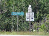
| Township of the North Shore
District of Algoma |
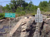
Junction assembly denoting the western terminus of Highway
538 at Highway 17
east of Blind River.
Click here for Highway 17 Images. Picture size: 90kb. |
 |
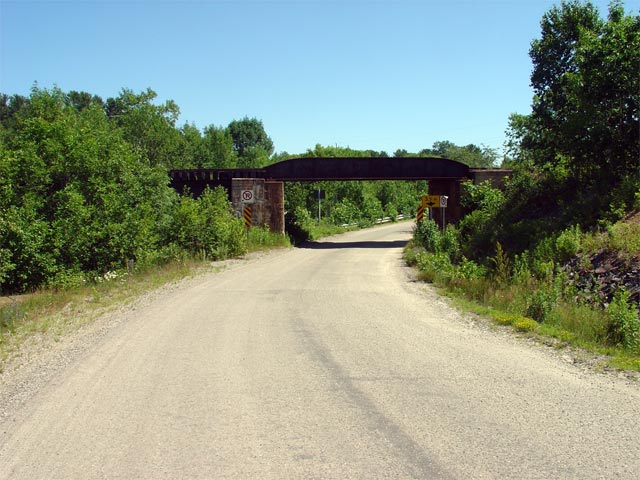
| Township of the North Shore
District of Algoma |
View looking easterly through the HCR railway
overhead that is located roughly 500m east of
Highway 17 along
Highway 538. Picture taken: July 3rd, 2005. Size: 70kb |
 |
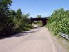
| Township of the North Shore
District of Algoma |
To the average motorist, a railway overhead here might seem out of place on
this minor secondary highway, however Highway 538 was once part of
Highway 17 and its
predecessor, the original Sault Ste. Marie Trunk Road.
Picture taken: July 3rd, 2005. Size: 75kb. |
 |
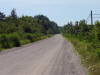
| Township of the North Shore
District of Algoma |
View looking westerly along Highway 538 from just west of the at-grade HCR
and the western Highway
17 junction. This is very typical looking view of Highway 538.
Picture taken: July 3rd, 2005. Size: 65kb. |
 |
| Township of the North Shore
District of Algoma |
View of the eastern junction assembly denoting the eastern terminus of
Highway 538 at Highway
17.
Click here for Highway 17 Images. Picture size: 105kb. |
 |