Photo Description
Pictures taken from driver's perspective appear offset from centre-line pictures:
Bound
Bound
Picture size: 55kb.
Picture taken: July 2nd, 2004. Size: 80kb.
Picture taken: July 3rd, 2005. Size: 50kb.
Picture size: 35kb.
Secondary Highway 554 - Images
Photos shown in this table are arranged from West to East:
| Proper Municipality Name |
Photo Description |
Photo | |
|
Pictures taken from driver's perspective appear offset from centre-line pictures: |
East- Bound |
West- Bound |
|
| Highway 129 is a long desolate highway that links Thessalon northerly to Chapleau. Click here for Highway 129 images. | |||
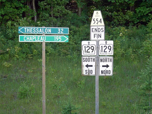
| District of Algoma |
Ends assembly for the western terminus of Highway 554 at the
Highway 129 junction. Picture size: 55kb. |
|
|
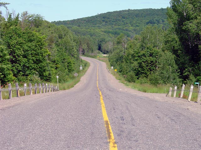
| District of Algoma |
Looking east along Highway 554 from the
Highway 129
junction. Highway 554 follows rugged terrain as it progresses through
the Algoma Region of Ontario. This is a fairly typical looking view of
Highway 554. Picture taken: July 2nd, 2004. Size: 80kb. |
|
|
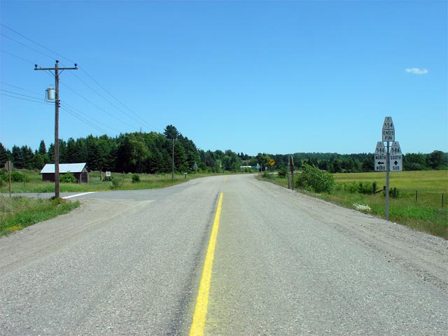
| District of Algoma |
Looking east along Highway 554 towards the junction with Highway 546.
As evident in the photo, Highway 554 favours travel to and from Iron Bridge
along Highway 546. This makes one question why Highway 554 actually
ends at this junction, instead of continuing further southeast along Highway
546's alignment to join Highway 17 at Iron Bridge. Picture taken: July 3rd, 2005. Size: 50kb. |
|
|
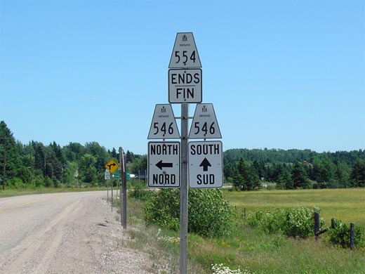
| District of Algoma |
Junction assembly at the eastern terminus of Highway 554 at the Highway 546
junction. Through traffic heads to Iron Bridge which is located roughly
11km southerly of this junction. A left turn leads travelers into the
wilderness to the north of Elliot Lake. Picture size: 35kb. |
|
|
| Highway 546 leads northerly from Iron Bridge following the Little White River. Click here for Highway 546 images. | |||
<- Highway 553 Images Back to Highway 554 Highway 555 Images ->
Copyright (c) 2004-2012, Scott Steeves (Webmaster) scott@asphaltplanet.ca