
|
Autoroute 20 |
| <- Page 1 |
|
Page 3 -> |
Pictures on this page are arranged in order from west to east. A-20 East photos are left-aligned in the last column, while A-20 west photos are right-aligned. Center-line pictures are centered within the last column.
|
Location |
Description |
Photo |
||
|
East- |
West- |
|||
|
A-540 is a short freeway linking A-20 and 40 to the West of Montreal. Click here for Autoroute 540 images |
||||
|
MRC de Vaudreuil-Soulangnes |
Overhead signage for the the only interchange found on L'Ile-Perrot. The Quebec Government has committed itself to completing A-20 as a freeway through Dorion and Ile Perrot. Presumably this would happen on a new alignment, and this interchange would be by-passed. |
|
||
|
Date: 7/9/2009 |
High-res | |||
|
MRC de Vaudreuil-Soulangnes |
This is a photo of the signage for the Don-Quichotte Boulevard Intersection. Boul. Don-Quichotte is one of four signalized intersections along Autoroute 20 ion Ile Perrot. Fortunately, A-40 is located within a stones throw to the north of A-20 so through traffic is not required to pass through either Dorion or Ile Perrot. |
|
||
|
Date: 7/9/2009 |
High-res | |||
|
Agglomeration de Montreal |
Overhead signage for Rue Morgan. |
|
||
|
Date: 7/9/2009 |
High-res | |||
|
Agglomeration de Montreal |
Overhead signage for Rue Woodland. Rue Woodland is one of two interchanges for Beaconsfield from A-20. Beaconsfield is a predominantly English speaking suburb of Montreal. Montreal is a fantastic cosmopolitan city. Toronto may have surpassed Montreal in terms of population, Montreal is far culturally superior to Toronto. |
|
||
|
Date: 7/9/2009 |
High-res | |||
|
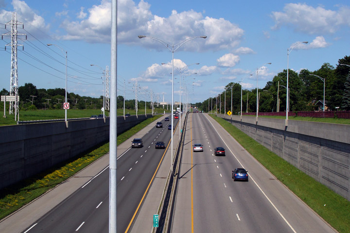
Agglomeration de Montreal |
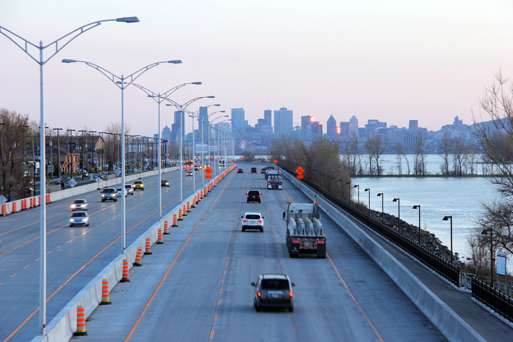
View looking westerly along A-20 from Woodland Avenue. A-20 follows a narrow corridor through Western Montreal bounded by both the CN and CP Railways. |
 |
||
|
Date: 7/9/2009 |
High-res | |||
|
Agglomeration de Montreal |
This view looks easterly towards Montreal from Woodland Avenue. The Woodland Avenue interchange was built in the early 200s replacing an out-dated signalized intersection. During the 1960s and 1970s Quebec spent its money by-passing the former Route 2 with A-40 instead of converting Highway 2 directly into a freeway in Western Montreal. |
 |
||
|
Date: 7/9/2009 |
High-res | |||
|
Agglomeration de Montreal |
Pretty standard overhead signage board facing traffic along the road into Downtown Montreal. |
|
||
|
Date: 7/9/2009 |
High-res | |||
|
Agglomeration de Montreal |
Eastbound overhead signage in Dorval. Dorval International Airport was renamed Trudeau Airport during Jean Cherest's tenure as Premier of Quebec. |
 |
||
|
Date: 7/9/2009 |
High-res | |||
|
Agglomeration de Montreal Dorval |
Advanced overhead sign marking the A-520 interchange. The A-20/520 interchange is undergoing major reconstruction at the time of this photo. Presently vehicles must navigate a signalized rotary to travel between the freeways. MTQ is constructed a new set of directional ramps to create a free-flow connection for the west to west and east to east movements. |
 |
||
|
Date: 7/9/2009 |
High-res | |||
|
Agglomeration de Montreal |
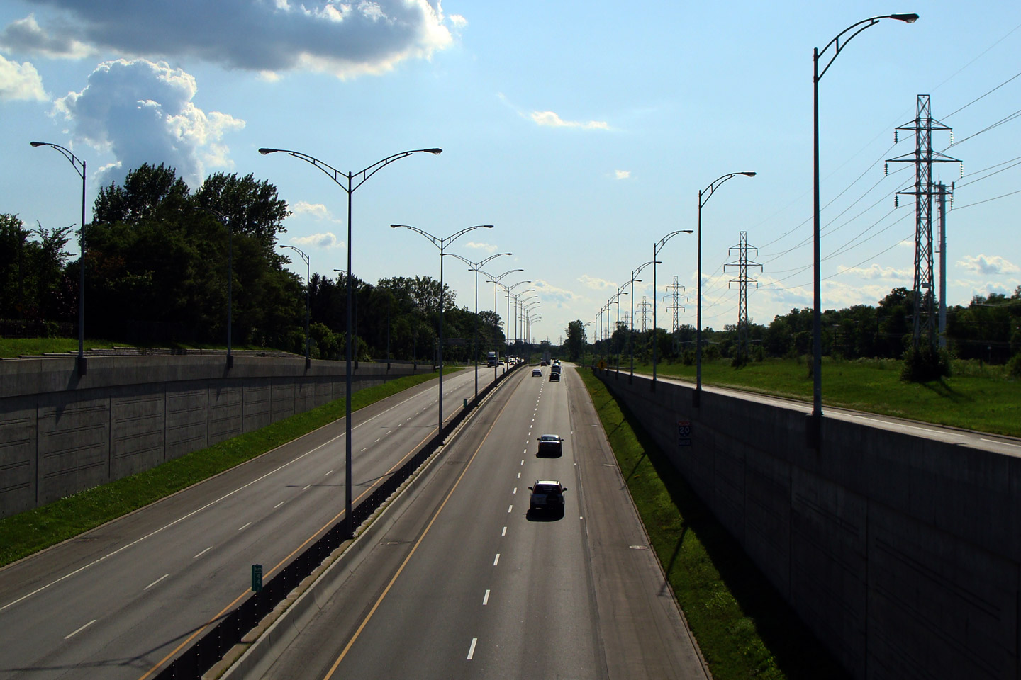
View of the ramp to 55th Avenue, in advance of the A-13 interchange. A-13 is a north-south freeway that runs through the western Montreal suburbs, north from A-20 to A-640. |
 |
||
|
Date: 7/9/2009 |
High-res | |||
|
Autoroute 13 carries traffic northerly from Lachine to Broisbriand. Click here for Autoroute 13 images. |
||||
|
Agglomeration de Montreal |
Overhead signage at the off-ramp to Autoroute 13 North. As is indicated on the overhead signage, this freeway ramp makes a very sharp curve to pass underneath of the adjacent railway lines. |
 |
||
|
Date: 5/5/2012 |
High-res: (1440x960) (2400x1600) | |||
|
Agglomeration de Montreal |
Westbound advanced signage for the Autoroute 13 interchange. |
 |
||
|
Date: 5/5/2012 |
High-res: (1440x960) (2400x1600) | |||
|
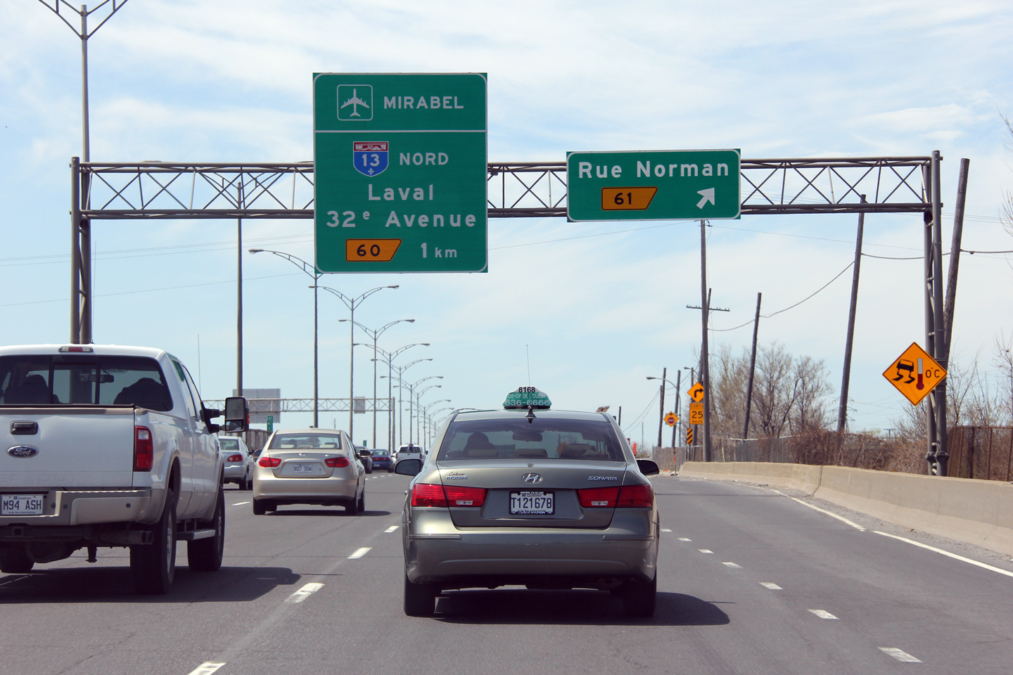
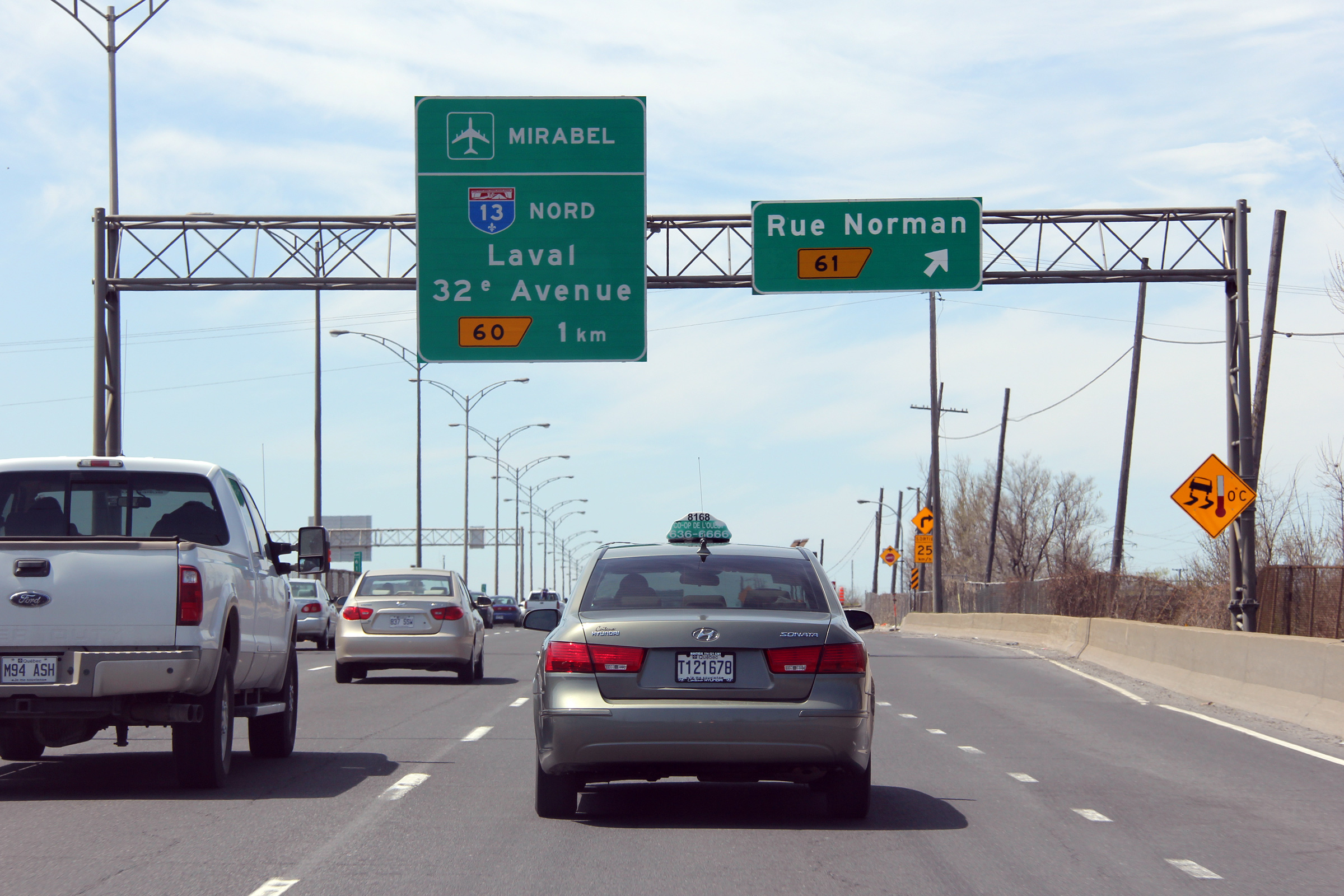
Agglomeration de Montreal |
Westbound off-ramp to rue Norman. |
 |
||
|
Date: 5/5/2012 |
High-res: (1440x960) (2400x1600) | |||
|
Agglomeration de Montreal |
Overhead signage at the First Avenue interchange in Western Montreal. A-20 can be quite congested through this part of the city due to the close proximity of the A-13 and R-138 interchanges. |
|
||
|
Date: 7/9/2009 |
High-res | |||
|
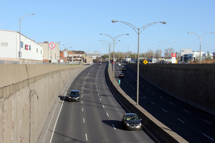
Agglomeration de Montreal |
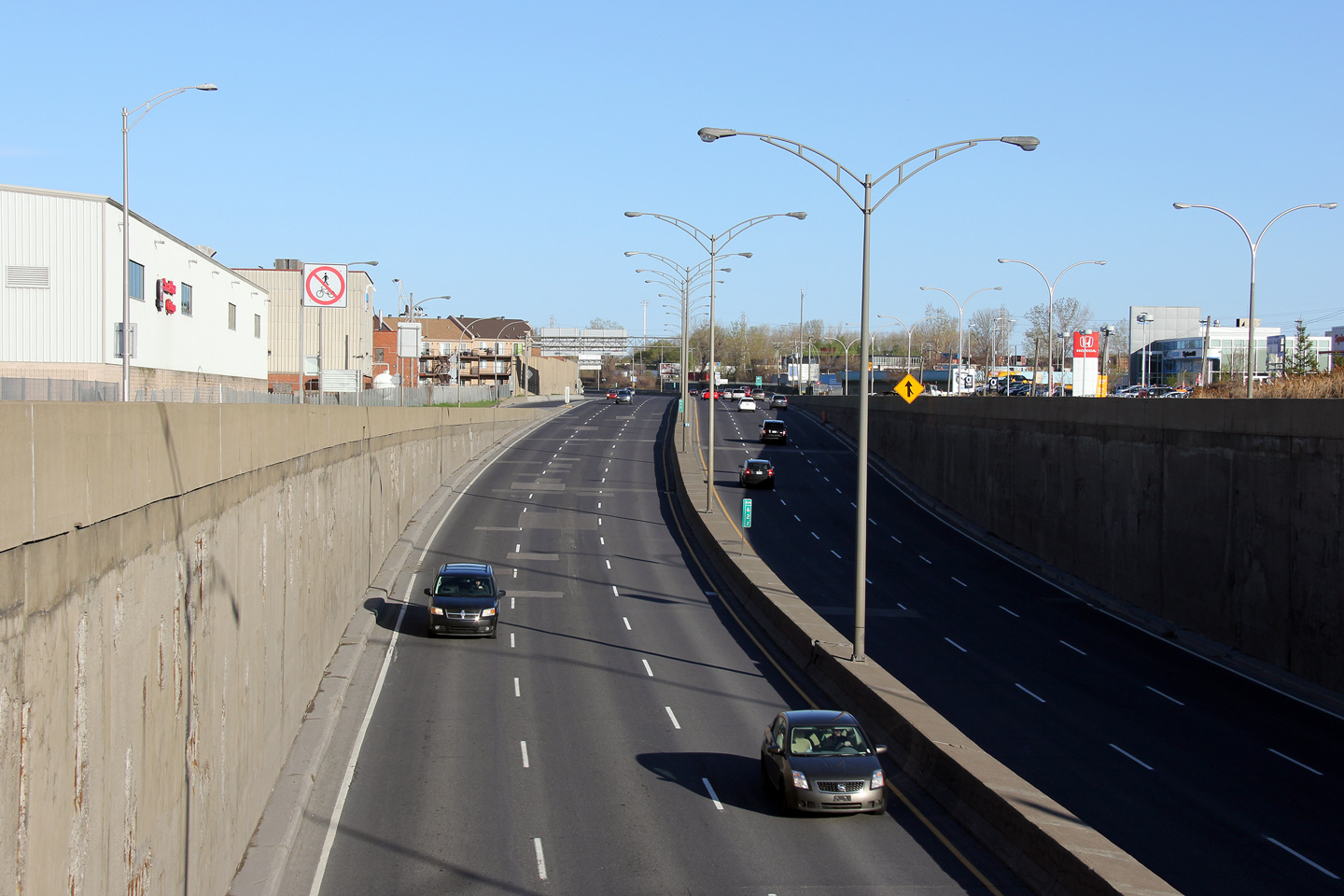
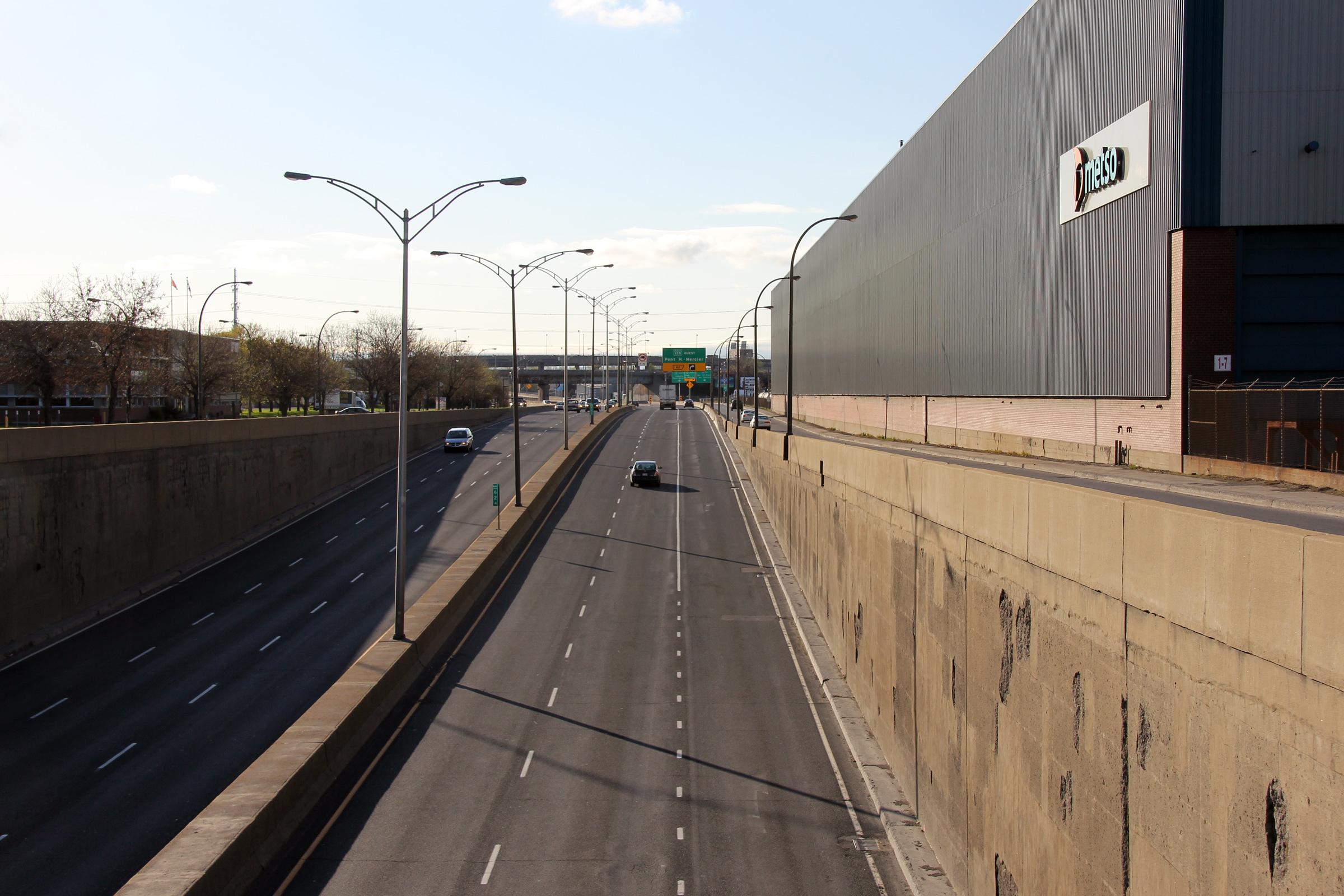
Westerly view from 1st Avenue in Lachine. Autoroute 20 has a very tight cross-section through Lachine. |
 |
||
|
Date: 5/5/2012 |
High-res: (1440x960) (2400x1600) | |||
|
Agglomeration de Montreal |
Easterly view towards the Highway 138 interchange and Downtown Montreal from 1st Avenue. |
 |
||
|
Date: 5/5/2012 |
High-res: (1440x960) (2400x1600) | |||
|
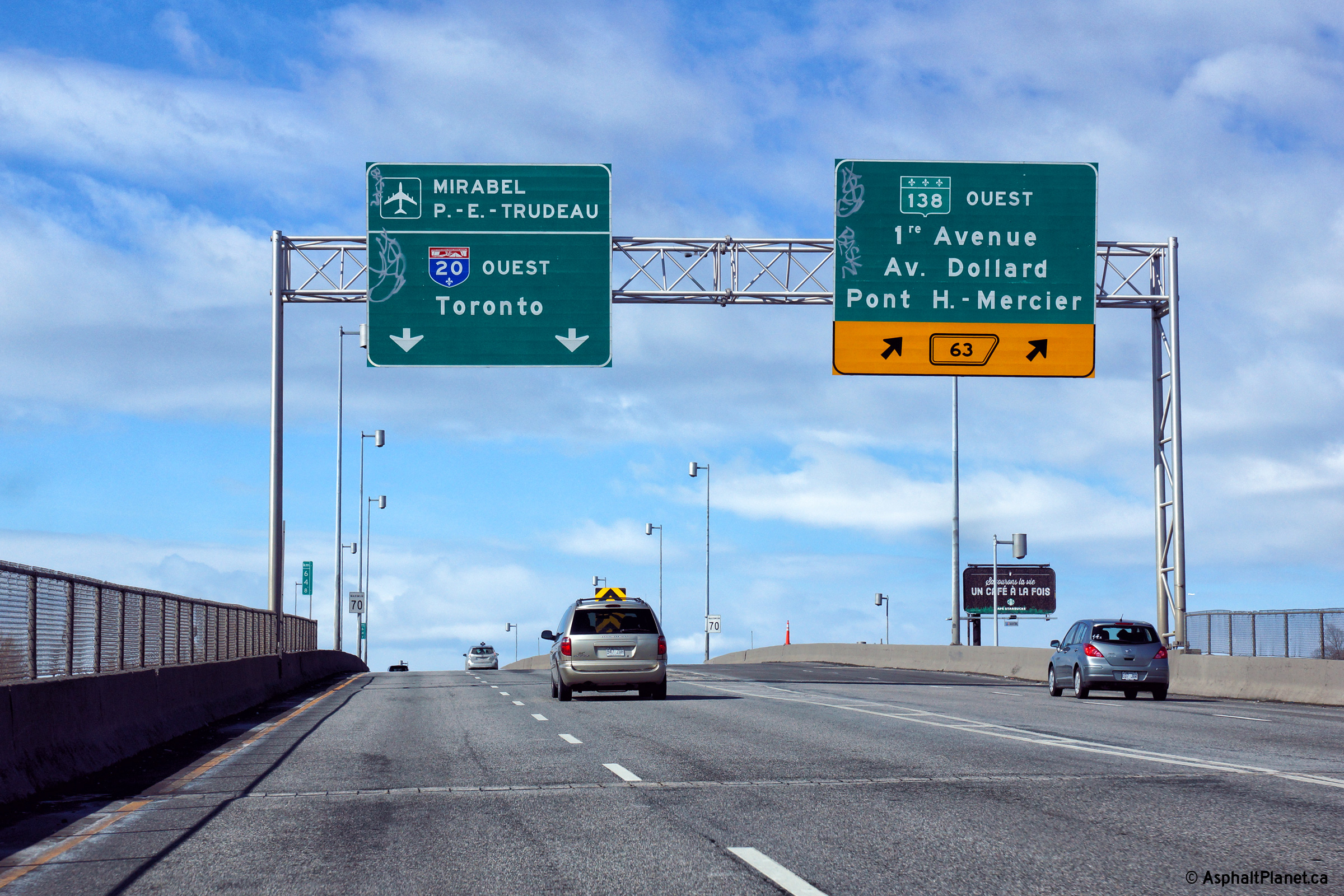
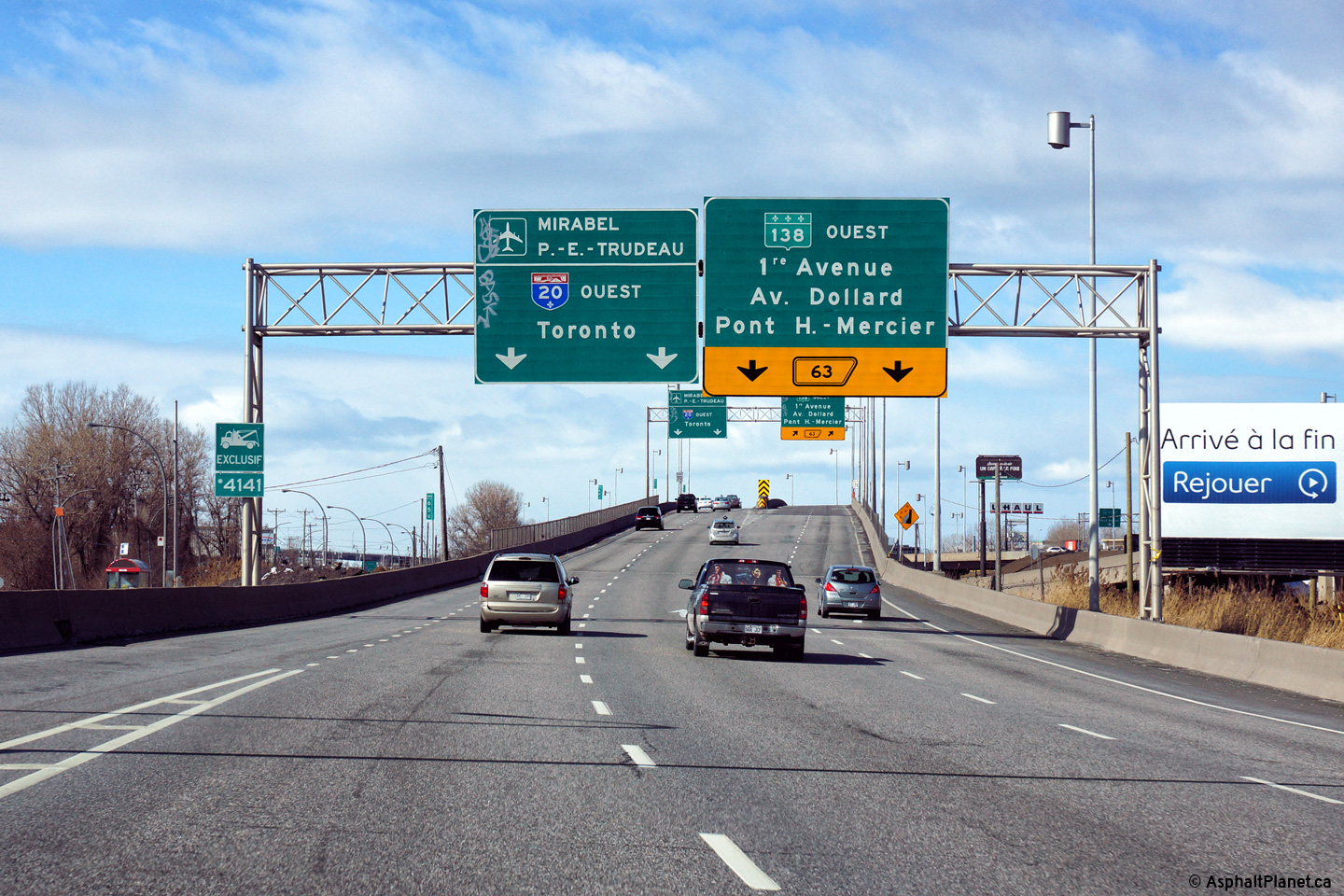
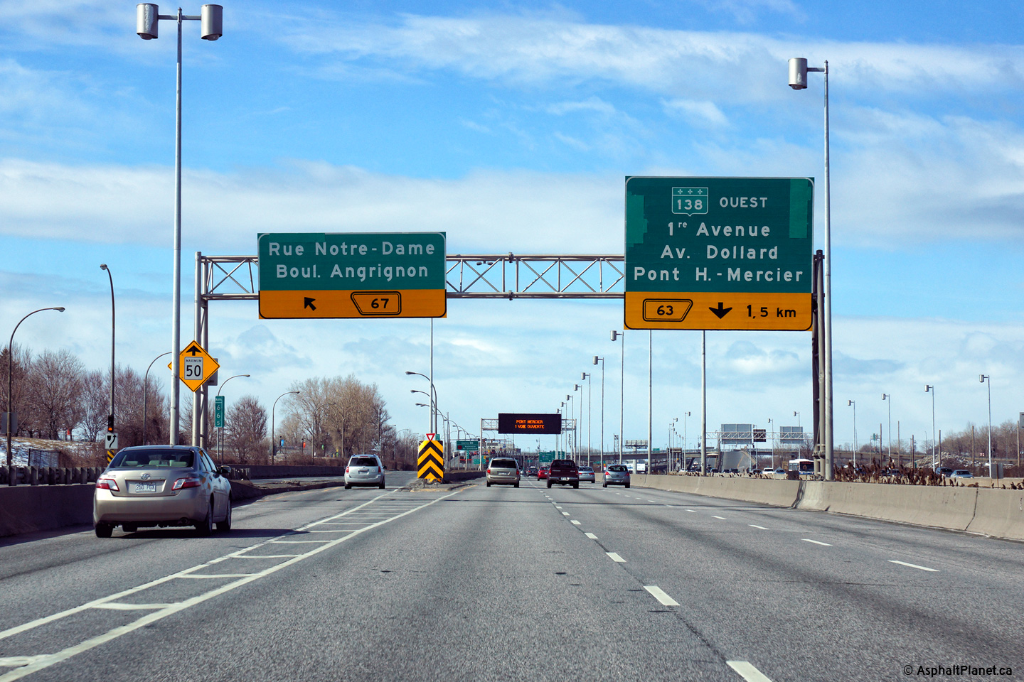
Agglomeration de Montreal |
The outermost eastbound lane departs A-20 for R-138 West, and the Mercier bridge. The 'right-turn sign' is typical on overhead signage where a thru-lane exits the Autoroute. |
 |
||
|
Date: 7/9/2009 |
High-res | |||
|
Agglomeration de Montreal |
Eastbound exit for Route 138-West. R-138 is a short freeway west of A-20 where it crosses the Mercier Bridge. East of A-20, R-138 is a conventional city street, one of Montreal's most predominant -- Shrerbroke Street. |
 |
||
|
Date: 7/9/2009 |
High-res | |||
|
Agglomeration de Montreal Lachine |
View of the R-138 interchange from the eastbound lanes of A-20. This interchange begins a series of large interchanges along A-20 through Western Montreal. |
 |
||
|
Date: 7/9/2009 |
High-res | |||
|
Agglomeration de Montreal Lachine |
Signage for Route 138-East. Notice the wire-mesh netting that is affixed to the overpass structure, this netting is designed to stop large pieces of concrete from falling from the structure onto the freeway below. Quebec has fallen far behind its infrastructure curve. |
 |
||
|
Date: 7/9/2009 |
High-res | |||
|
Route 138 is one of the Southern Quebec's principal non freeway east-west routes. Click here for R-138 images. |
||||
|
Agglomeration de Montreal |
Overhead signage at the off-ramp to Autoroute 13 North. As is indicated on the overhead signage, this freeway ramp makes a very sharp curve to pass underneath of the adjacent railway lines. |
 |
||
|
Date: 4/5/2015 |
High-res: (1440x960) (2400x1600) | |||
|
Agglomeration de Montreal |
Overhead signage at the off-ramp to Autoroute 13 North. As is indicated on the overhead signage, this freeway ramp makes a very sharp curve to pass underneath of the adjacent railway lines. |
 |
||
|
Date: 4/5/2015 |
High-res: (1440x960) (2400x1600) | |||
|
Agglomeration de Montreal |
Overhead signage at the off-ramp to Autoroute 13 North. As is indicated on the overhead signage, this freeway ramp makes a very sharp curve to pass underneath of the adjacent railway lines. |
 |
||
|
Date: 4/5/2015 |
High-res: (1440x960) (2400x1600) | |||
|
Agglomeration de Montreal |
Overhead signage for Route 138-East from eastbound A-20. R-138 runs beside A-20 as a short collector lane between the two interchanges. |
 |
||
|
Date: 7/9/2009 |
High-res | |||
|
Agglomeration de Montreal |
View looking easterly through the eastern Route 138 interchange. It is at this interchange where the westbound lanes pass overtop of the eastbound lanes for the short segment where the carriageways are reversed. Driving into Montreal along A-20 really is a unique experience.. |
 |
||
|
Date: 7/9/2009 |
High-res | |||
|
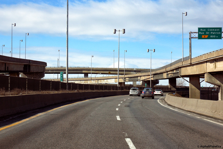
Agglomeration de Montreal |
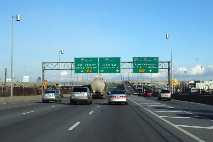
At the eastbound merge between A-20 and R-138, sits this sign. It is the first of many First in a series of overhead signs detailing lane specifics for the Turcot Interchange. A-20 exits to the right at this interchange. The through lanes default on A-720 -- Montreal`s downtown expressway spur. |
|
||
|
Date: 7/9/2009 |
High-res | |||
|
Agglomeration de Montreal |
Two views looking westerly from Angrignon Boulevard. As is very evident from the photo, the westbound lanes are departing Montreal to the South of the Eastbound lanes, which both straddle the CN Mainline into Montreal. The R-138-East interchange is visible in the distance. This interchange is built overtop of the CN Railine. |
 |
||
| High-res | ||||
 |
||||
|
Date: 7/9/2009 |
High-res | |||
|
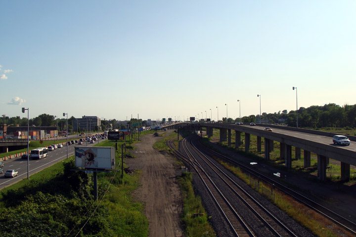
Agglomeration de Montreal |
Easterly view from Angrignon Boulevard towards the Turcot Interchange. The Turcot interchange is a massive interchange complex. Notice the now abandoned CN Turcot Intermodal facility disused along the left side of the photo. this land is to incorporated into the new highway, and be redeveloped as part of the Turcot Interchange replacement project. |
 |
||
|
Date: 7/9/2009 |
High-res | |||
|
Agglomeration de Montreal |
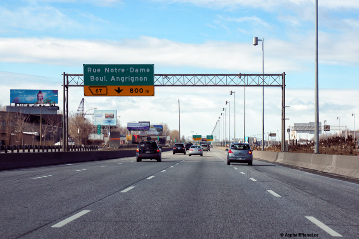
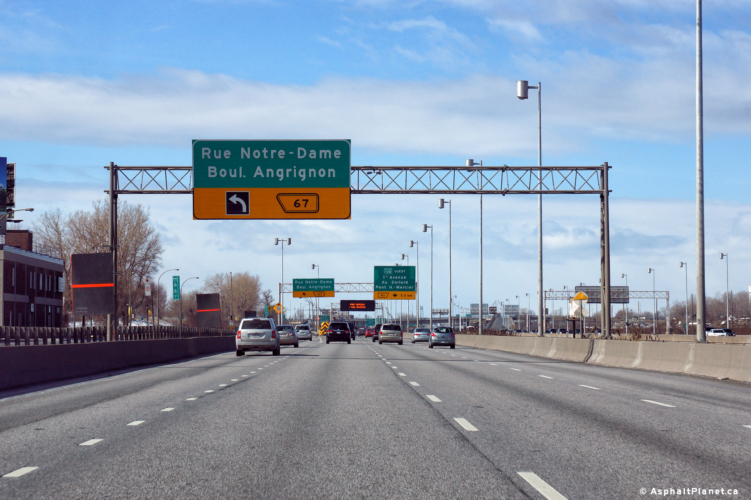
Westbound view at the left-exit to Notre-Dame Street and Angrignon Boulevard. The fourth westbound lane of Autoroute 20 exits at this interchange. |
 |
||
|
Date: 4/5/2015 |
High-res: (1440x960) (2400x1600) | |||
|
Agglomeration de Montreal |
Westbound advanced signage for the off-ramp to Notre-Dame Street and Angrignon Boulevard. |
 |
||
|
Date: 4/5/2015 |
High-res: (1440x960) (2400x1600) | |||
|
Agglomeration de Montreal |
Westbound pre-advanced signage for the off-ramp to Notre-Dame Street and Angrignon Boulevard. |
 |
||
|
Date: 4/5/2015 |
High-res: (1440x960) (2400x1600) | |||
|
Agglomeration de Montreal |
First in a series of overhead signs detailing lane specifics for the Turcot Interchange. A-20 exits to the right at this interchange. The through lanes default on A-720 -- Montreal`s downtown expressway spur. |
 |
||
|
Date: 12/7/2008 |
High-res | |||
|
Agglomeration de Montreal |
First in a series of overhead signs detailing lane specifics for the Turcot Interchange. A-20 exits to the right at this interchange. The through lanes default on A-720 -- Montreal`s downtown expressway spur. |
|
||
|
Date: 12/7/2008 |
High-res | |||
|
Agglomeration de Montreal |
Second round of overhead signs for the Turcot interchange. I almost omitted this sign from the gallery seeing as its exactly the same layout as the previous image. |
|
||
|
Date: 12/7/2008 |
High-res | |||
|
Agglomeration de Montreal |
Third round of overhead signs for the Turcot Interchange. |
 |
||
|
Date: 12/7/2008 |
High-res | |||
|
Agglomeration de Montreal |
A-20 departs the mainline freeway at this junction following an extremely substandard section of A-15 to the Champlain Bridge. |
|
||
|
Date: 12/7/2008 |
High-res | |||
|
Click here for A-10 images, here for A-15 images and here for A-720 images. |
||||
|
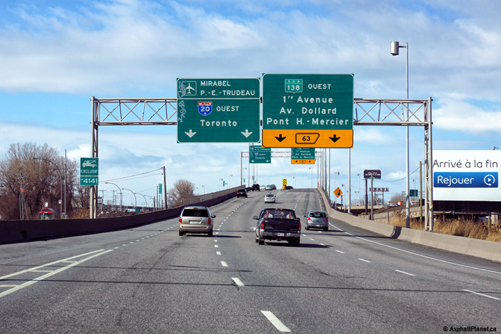
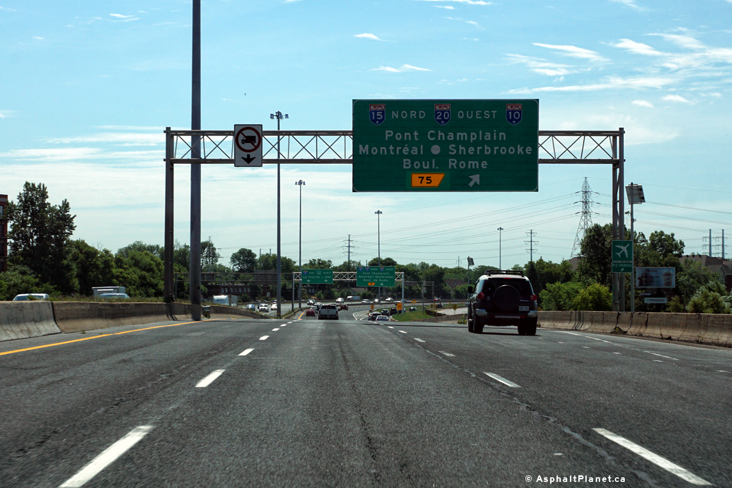
Agglomeration de Longueuil |
Signage at the Pont Champlain Interchange. At this interchange, westbound Autoroute 20 traffic must exit on a single lane ramp to the service road. Traffic continuing straight ahead on the freeway is now traveling west along Route 132 and south along Autoroute 15. |
 |
||
|
Date: 7/12/2016 |
High-res: (1440x960) (2400x1600) | |||
|
Agglomeration de Longueuil |
Westbound advanced signage for the Pont Champlain Interchange. Traffic bound for Autoroute 20 West, Autoroute 10 North and both directions of Autoroute 10 must follow this interchange. |
 |
||
|
Date: 7/12/2016 |
High-res: (1440x960) (2400x1600) | |||
|
Agglomeration de Longueuil Longueuil |
East of the Pont Champlain, A-20 is multiplexed with R-132. Route 132 is the former principal highway between Montreal and Quebec City on the South Shore. |
 |
||
|
Date: 12/7/2008 |
||||
|
Agglomeration de Longueuil |
Overhead signage for the first interchange east of Pont Champlain on the South Shore. |
 |
||
|
Date: 12/7/2008 |
High-res | |||
|
Agglomeration de Montreal |
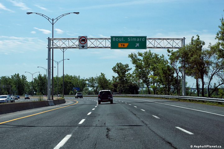
Westbound signage for the ramp to Simard Boulevard. |
 |
||
|
Date: 7/12/2016 |
High-res: (1440x960) (2400x1600) | |||
|
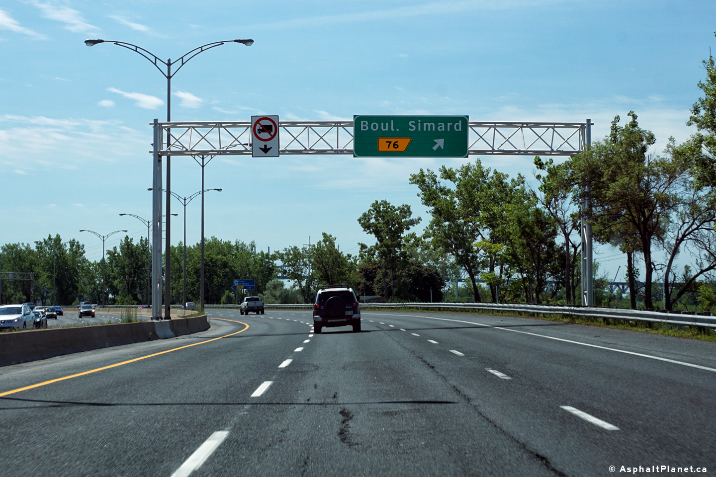
Agglomeration de Montreal |
Westbound advanced signage for the off-ramp to Simard Boulevard. |
 |
||
|
Date: 7/12/2016 |
High-res: (1440x960) (2400x1600) | |||
|
Agglomeration de Longueuil |
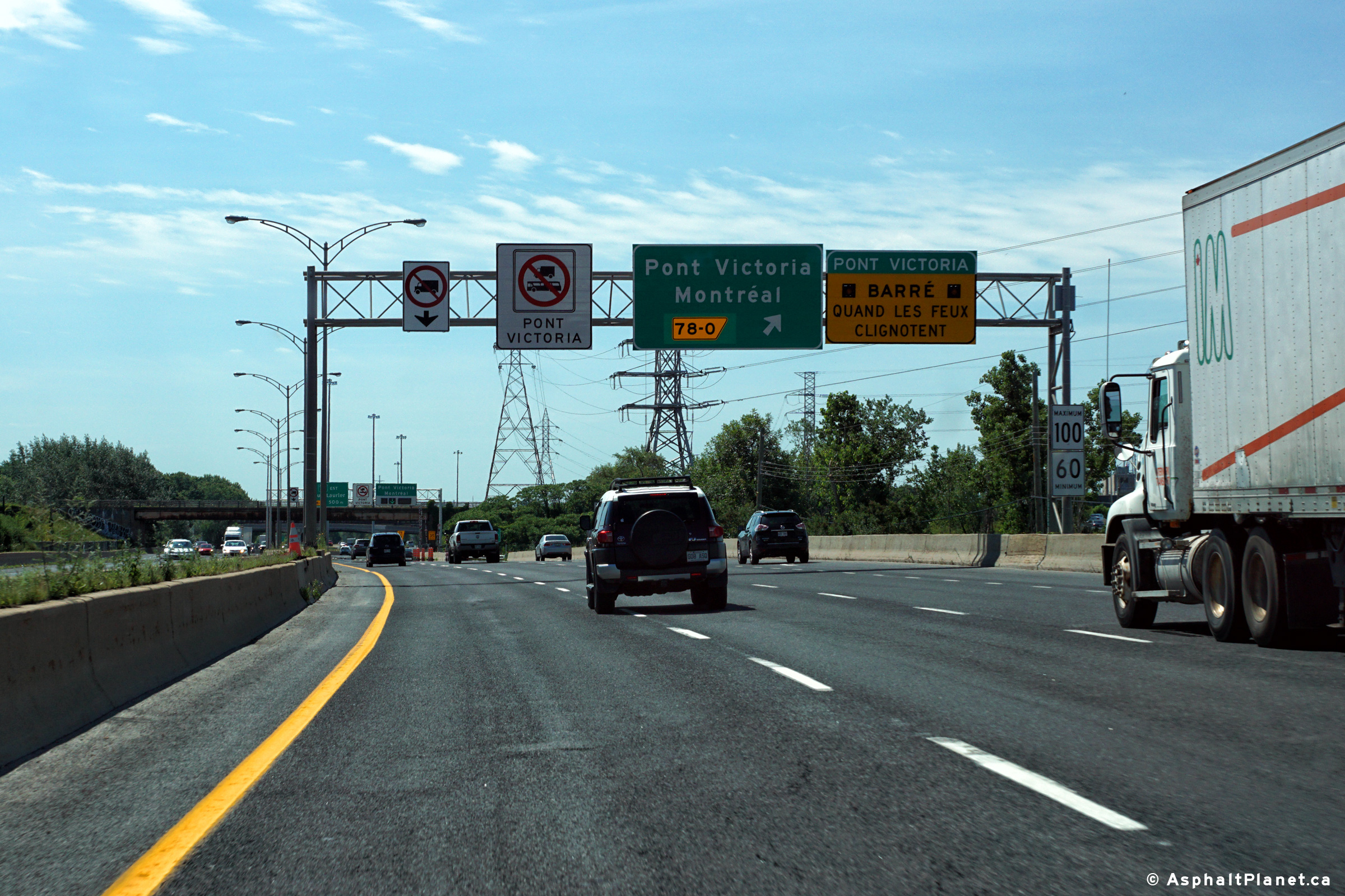
Pont Victoria carries single direction traffic in and and out of Montreal during peak travel times. |
 |
||
|
Date: 12/7/2008 |
High-res | |||
|
Agglomeration de Longueuil |
Clearview signage for R-112. |
 |
||
|
Date: 12/7/2008 |
High-res | |||
|
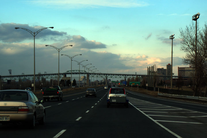
Agglomeration de Longueuil |
A-20 provides for some spectacular views of Pont Jacques-Cartier from the South Shore. Pont Jacques Cartier is arguably Montreal's most spectacular of many very impressive river crossings. |
 |
||
|
Date: 12/7/2008 |
High-res | |||
|
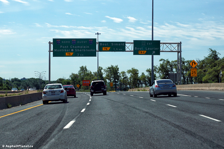
Agglomeration de Longueuil |
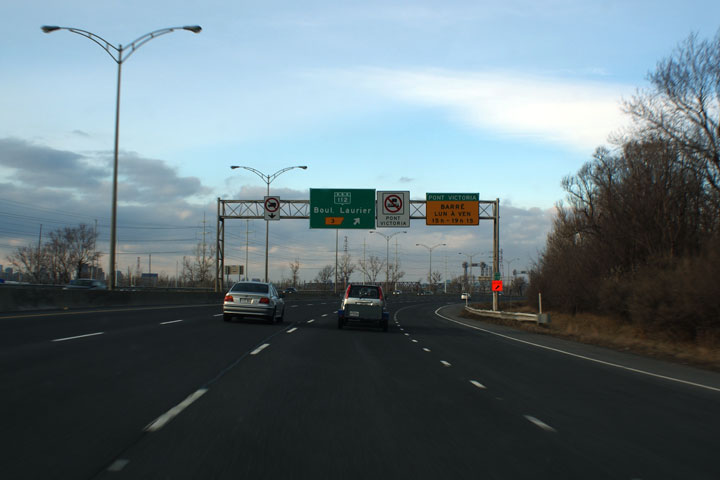
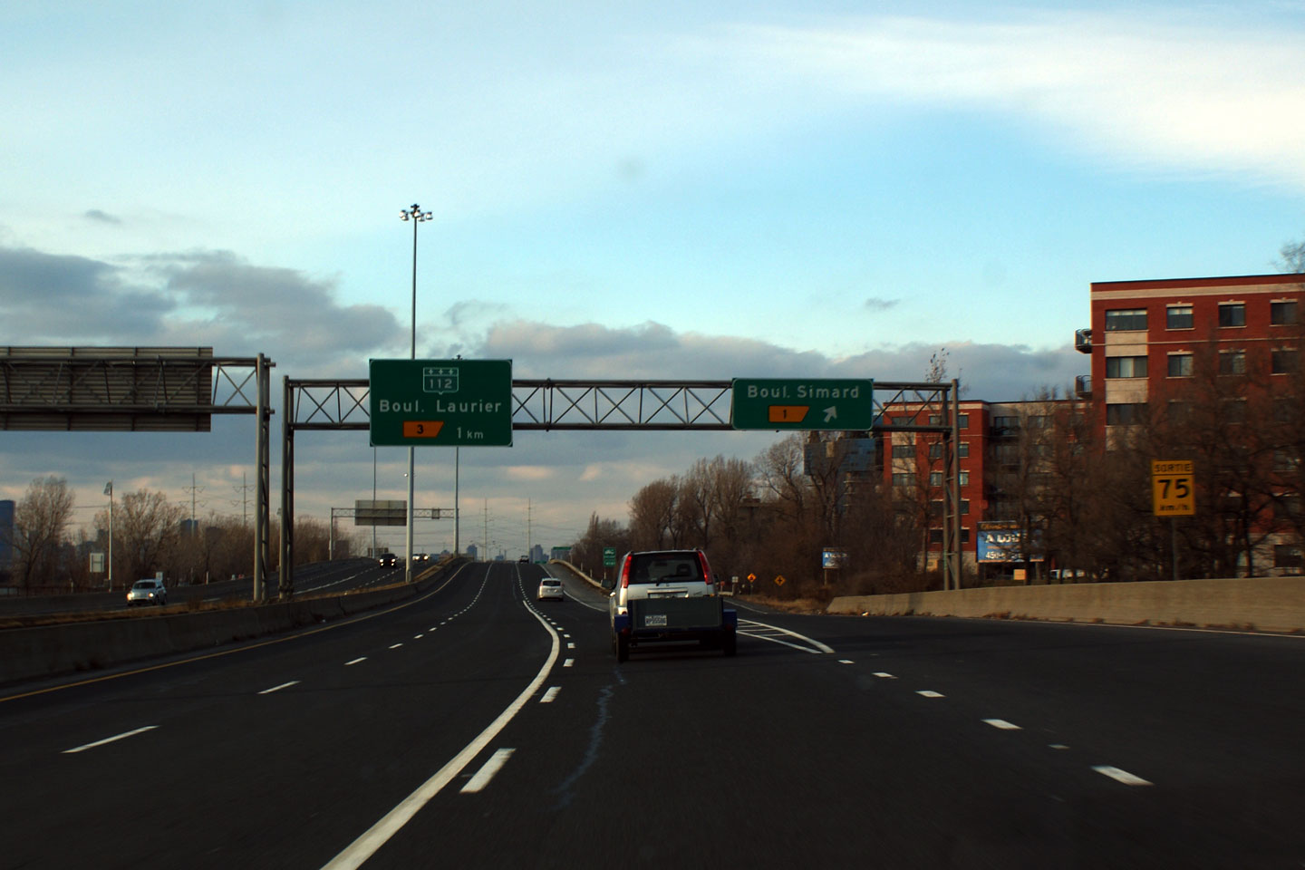
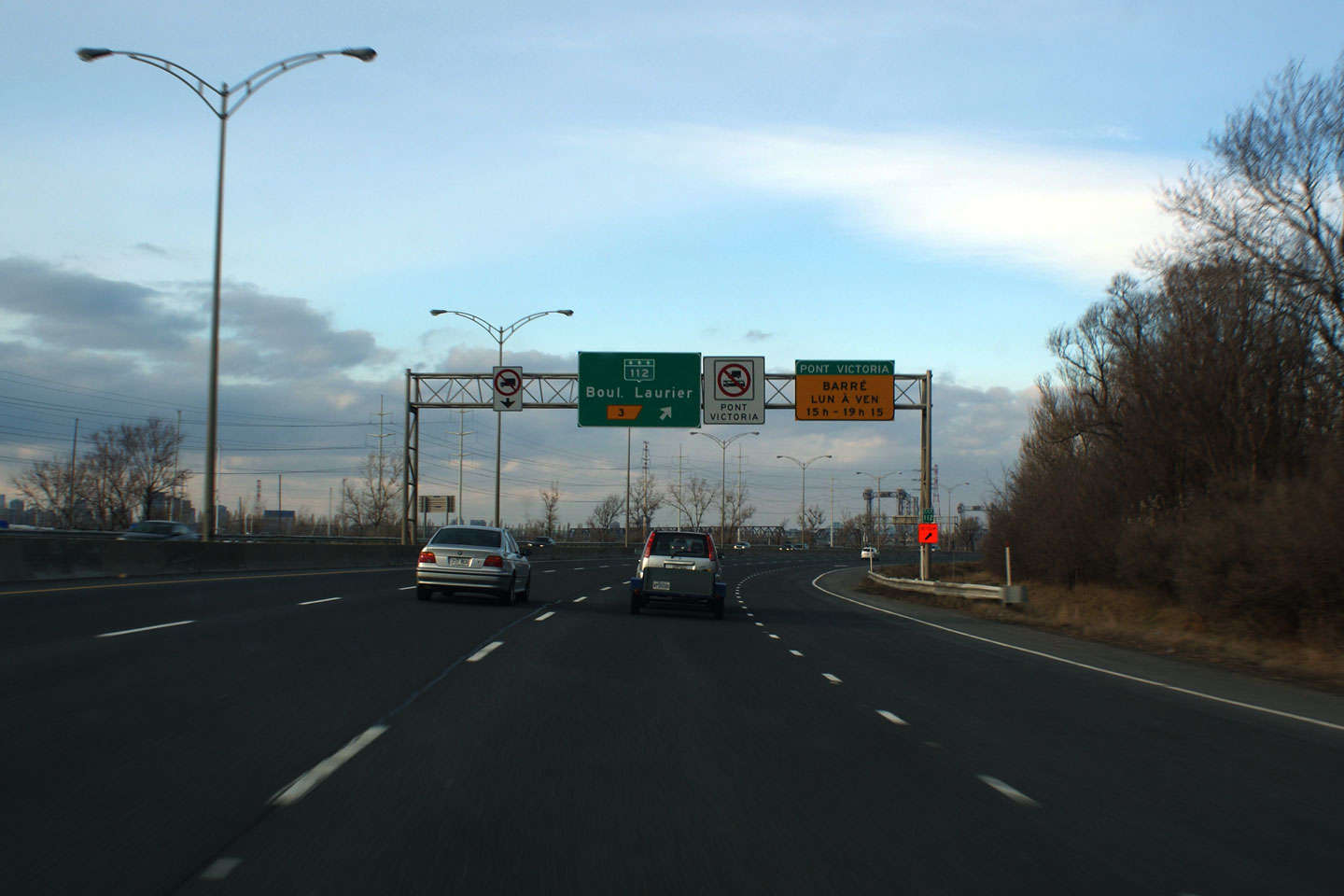
Westerly view at the off-ramp to Route 112 East. Laurier Boulevard is a major arterial street that links Pont Victoria to the Route 112/116 freeway several kilometres to the east of Autoroute 20. |
 |
||
|
Date: 7/12/2016 |
High-res: (1440x960) (2400x1600) | |||
|
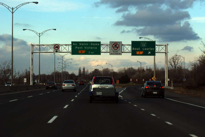
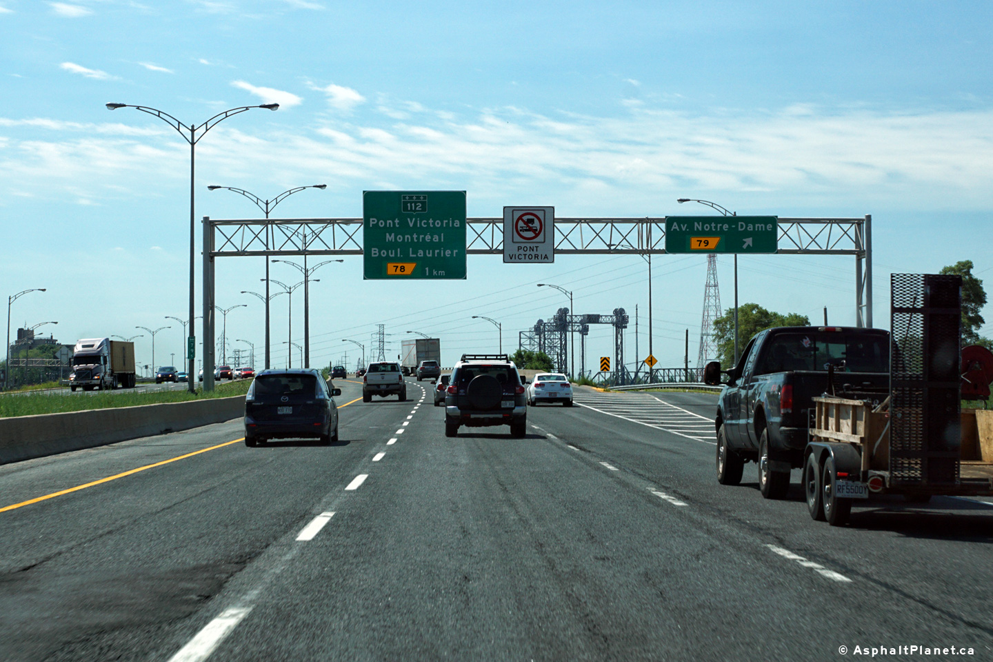
Agglomeration de Longueuil |
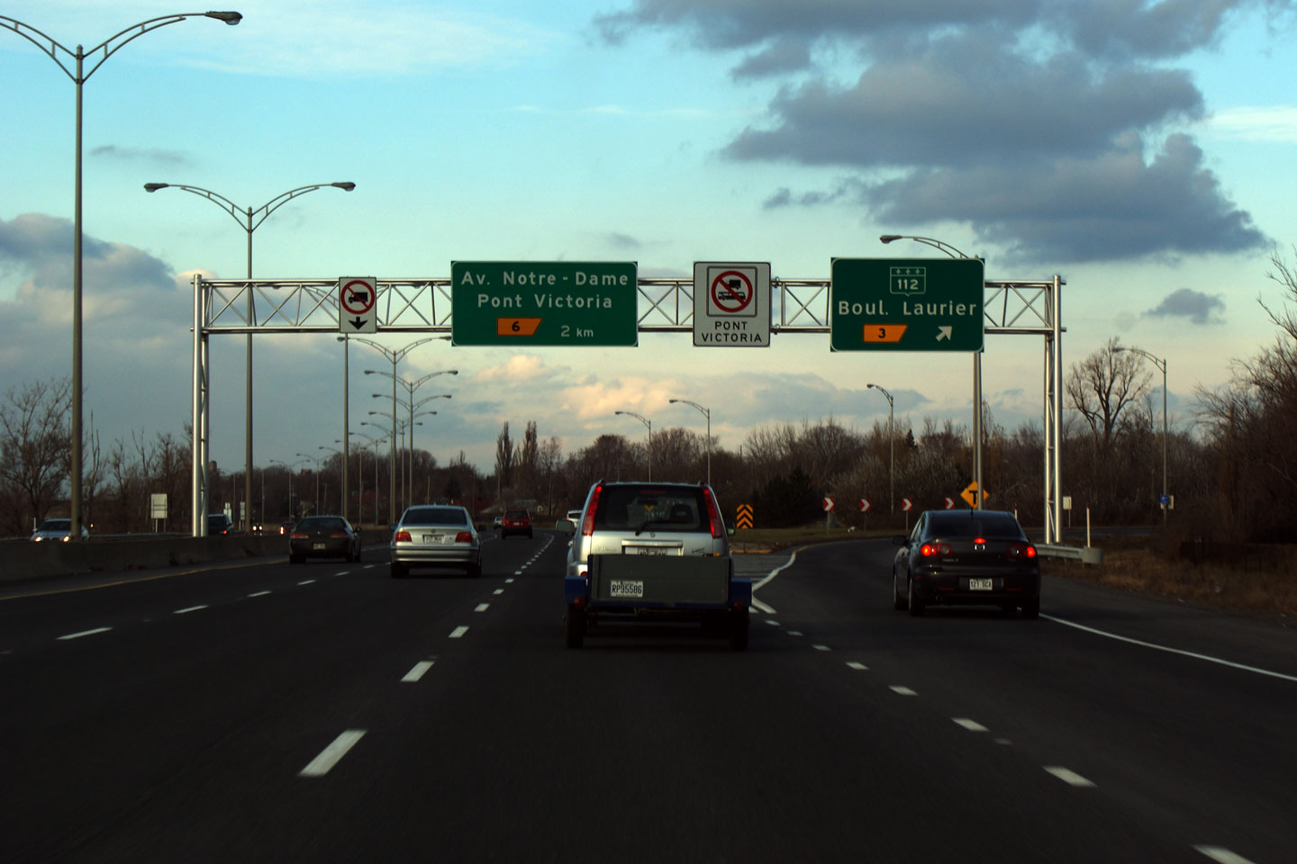
Signage at the westbound off-ramp to Pont Victoria. Pont Victoria operates in a single direction only during morning and afternoon rush hours, explaining the electronic down arrow on the overhead signage. |
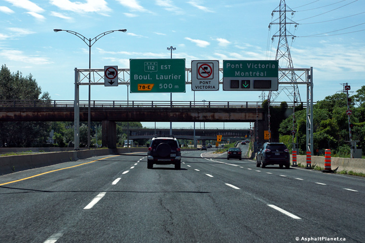 |
||
|
Date: 7/12/2016 |
High-res: (1440x960) (2400x1600) | |||
|
Agglomeration de Longueuil |
Westbound advanced signage for the off-ramp to Pont Victoria. |
 |
||
|
Date: 7/12/2016 |
High-res: (1440x960) (2400x1600) | |||
|
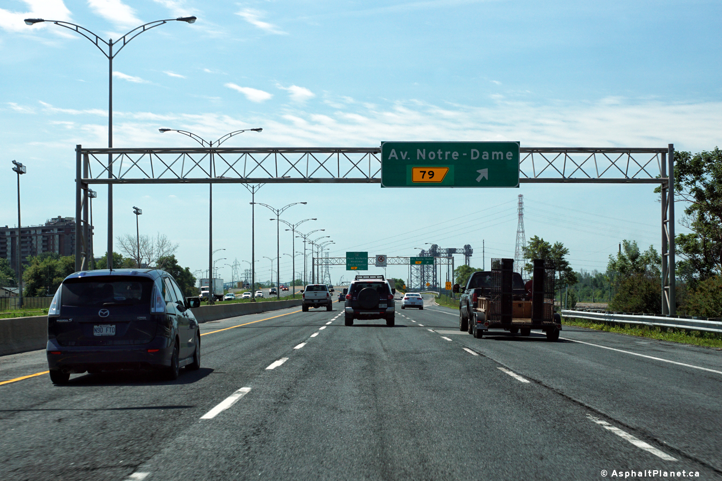
Agglomeration de Longueuil |
Westbound signage at the off-ramp to Notre-Dame Avenue. |
 |
||
|
Date: 7/12/2016 |
High-res: (1440x960) (2400x1600) | |||
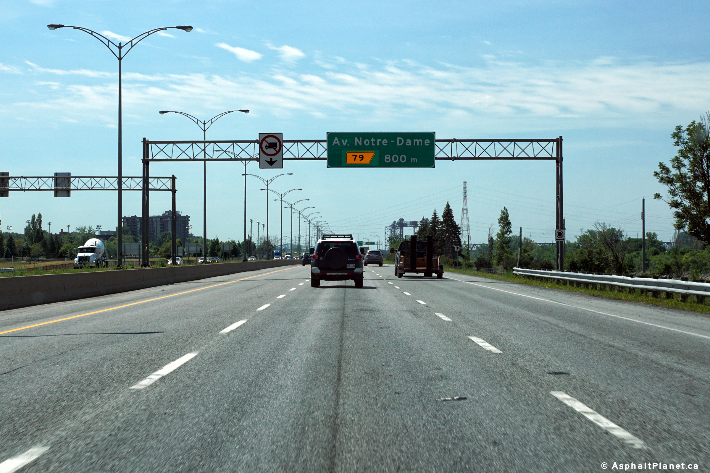
|
Agglomeration de Longueuil |
Westbound advanced signage for the off-ramp to Notre-Dame Avenue. |
 |
||
|
Date: 7/12/2016 |
High-res: (1440x960) (2400x1600) | |||
|
Agglomeration de Longueuil |
Pre-advanced signage for the Notre-Dame Avenue interchange. |
 |
||
|
Date: 7/12/2016 |
High-res: (1440x960) (2400x1600) | |||
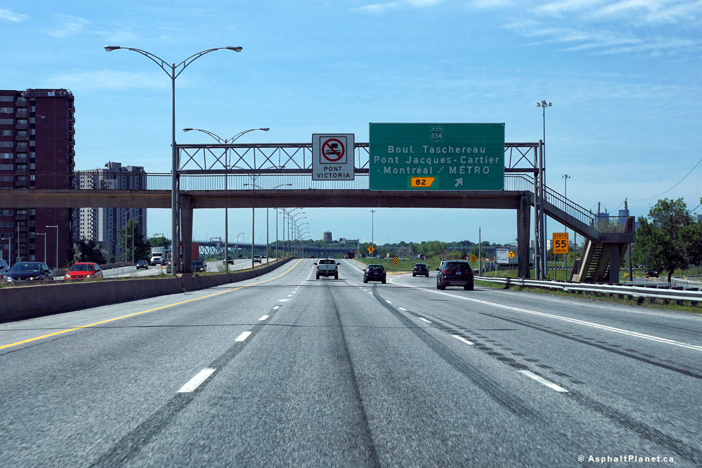
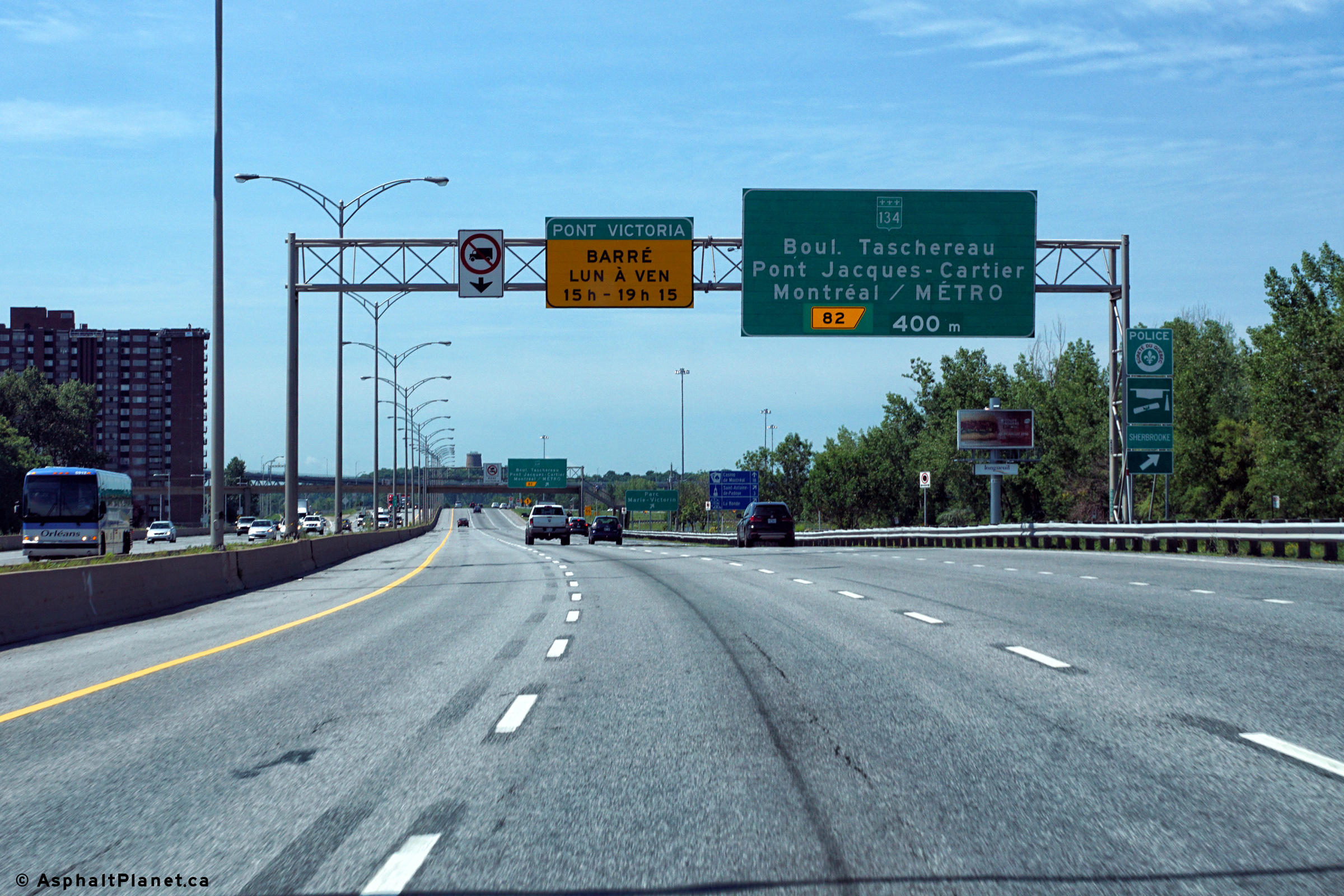
|
Agglomeration de Longueuil |
Westbound signage at the off-ramp to Route 134 and Pont Jacques-Cartier. |
 |
||
|
Date: 7/12/2016 |
High-res: (1440x960) (2400x1600) | |||
|
Agglomeration de Longueuil |
Westbound advanced signage for the Route 134 interchange. |
 |
||
|
Date: 7/12/2016 |
High-res: (1440x960) (2400x1600) | |||
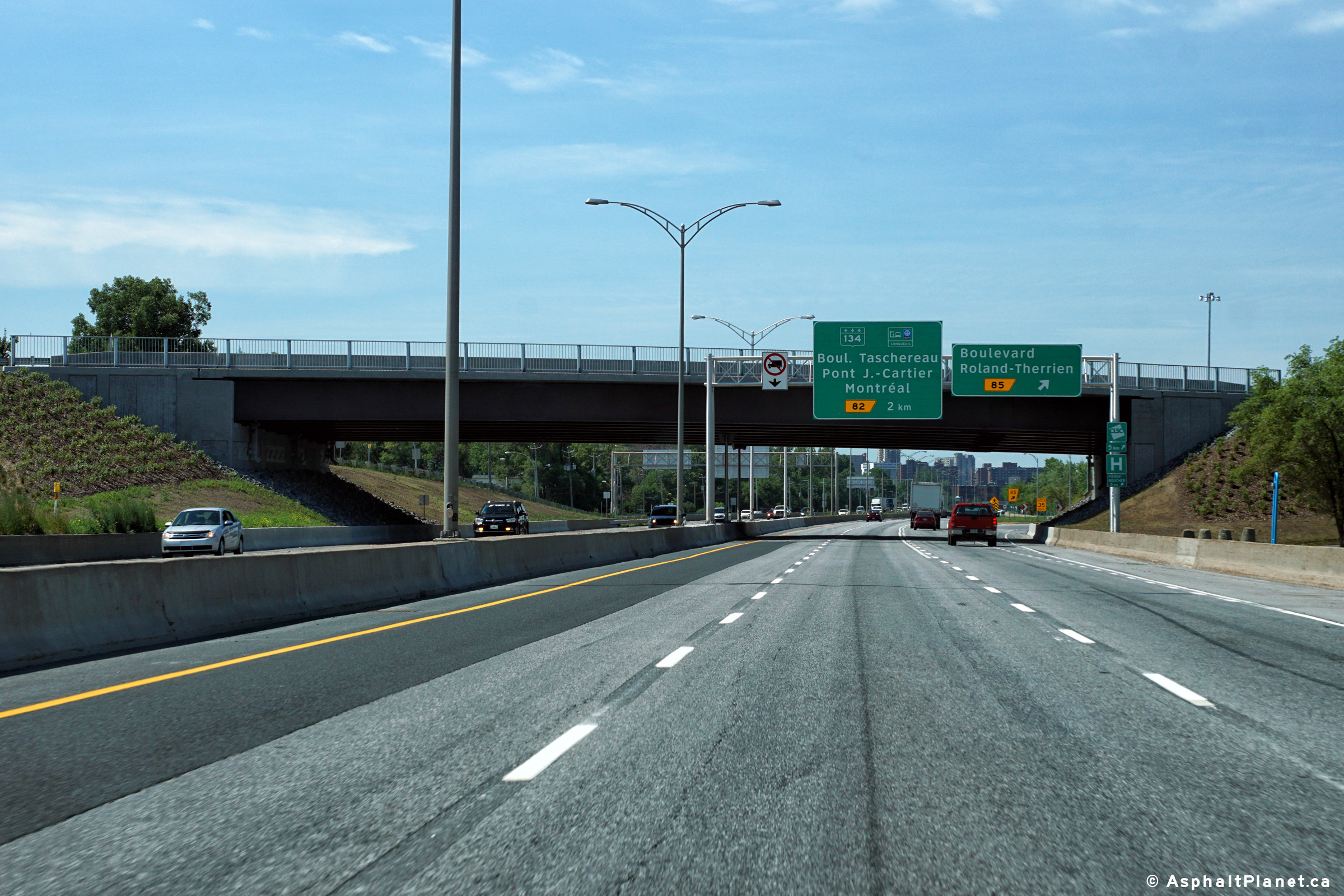
|
Agglomeration de Longueuil |
View looking westerly at the Roland-Therrien Boulevard interchange. The former single span rigid frame arch bridge that carried Roland-Therrien Boulevard overtop of Autoroute 20 was replaced with the current structure during the 2015 construction season. |
 |
||
|
Date: 7/12/2016 |
High-res: (1440x960) (2400x1600) | |||
|
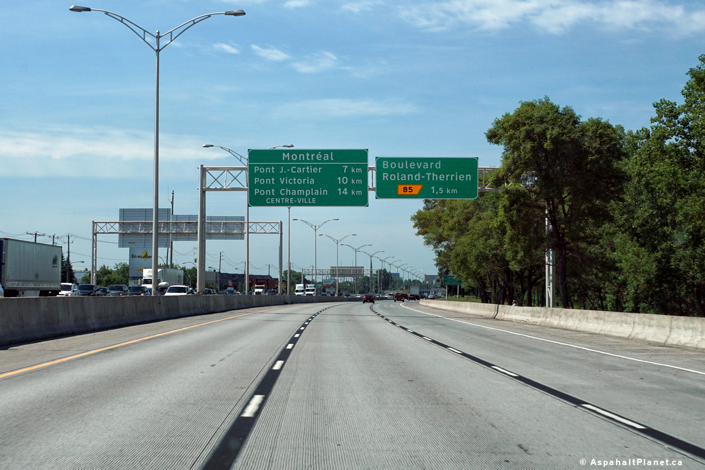
Agglomeration de Longueuil |
Westbound signage in advance of the Roland-Therrien Boulevard interchange. |
 |
||
|
Date: 7/12/2016 |
High-res: (1440x960) (2400x1600) | |||
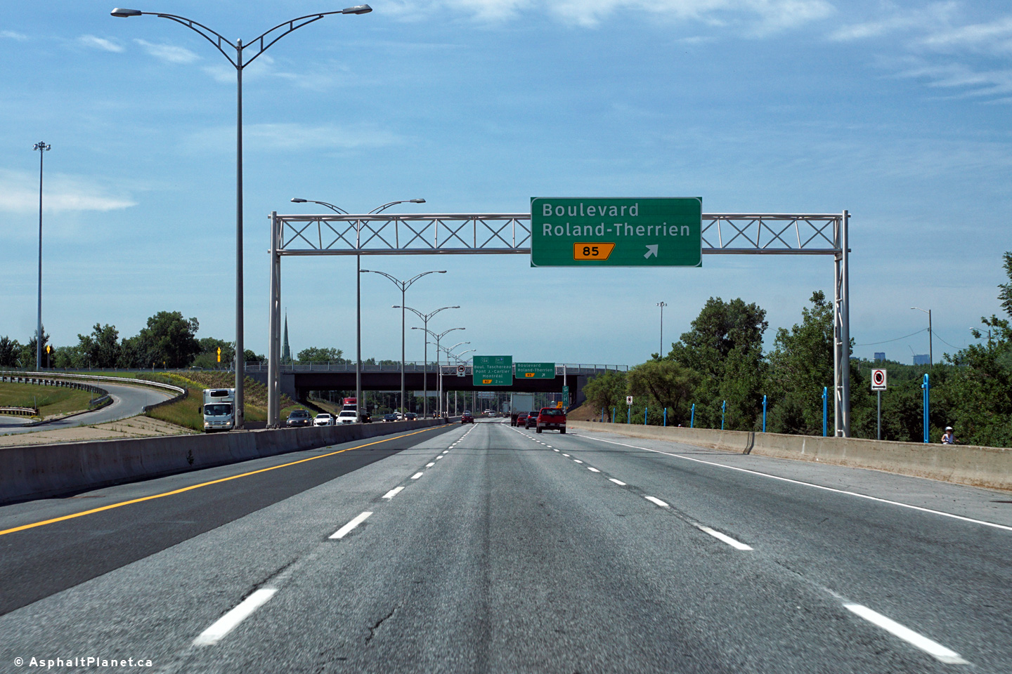
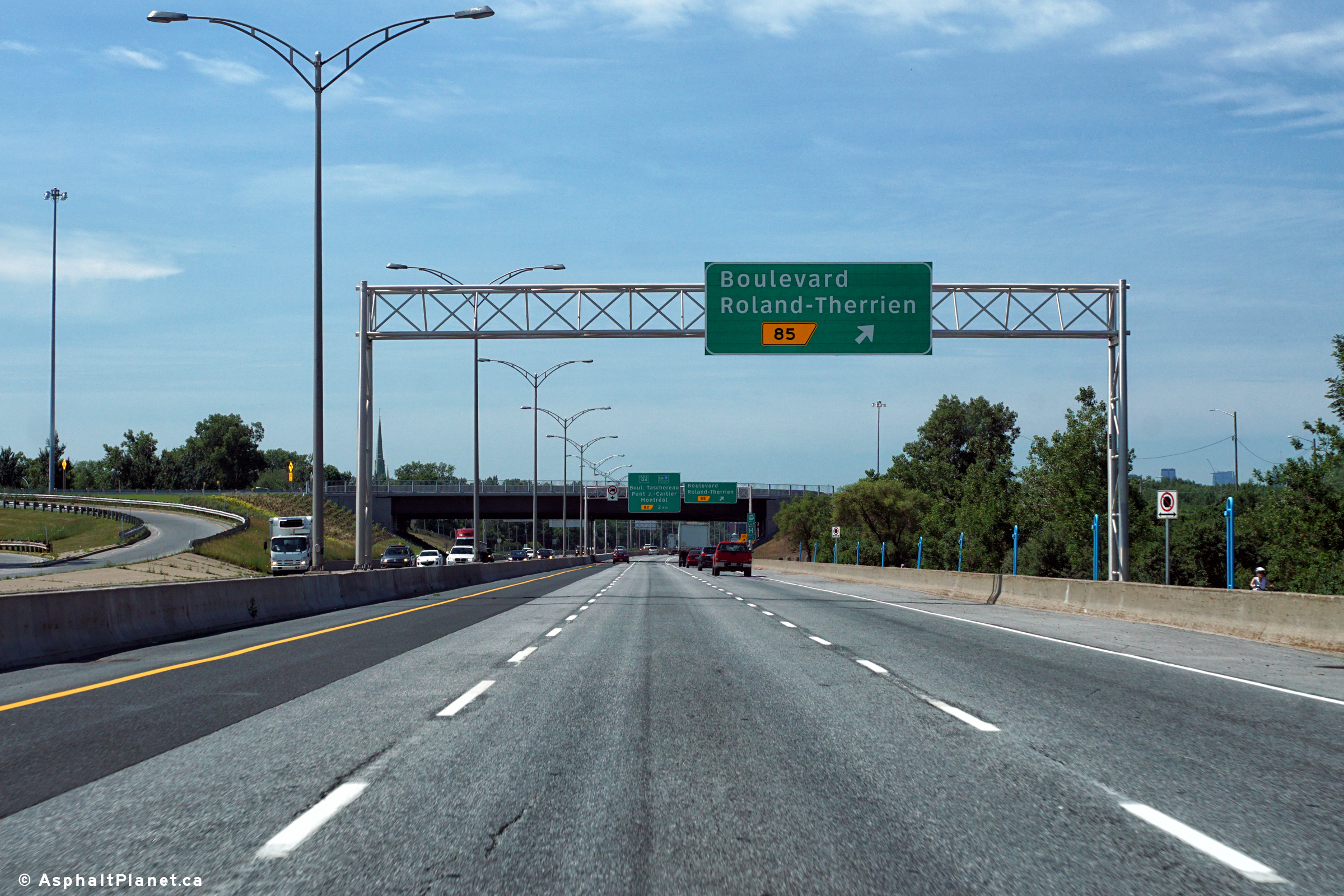
|
Agglomeration de Longueuil |
Advanced signage for the Roland-Therrien Boulevard interchange. |
 |
||
|
Date: 7/12/2016 |
High-res: (1440x960) (2400x1600) | |||
|
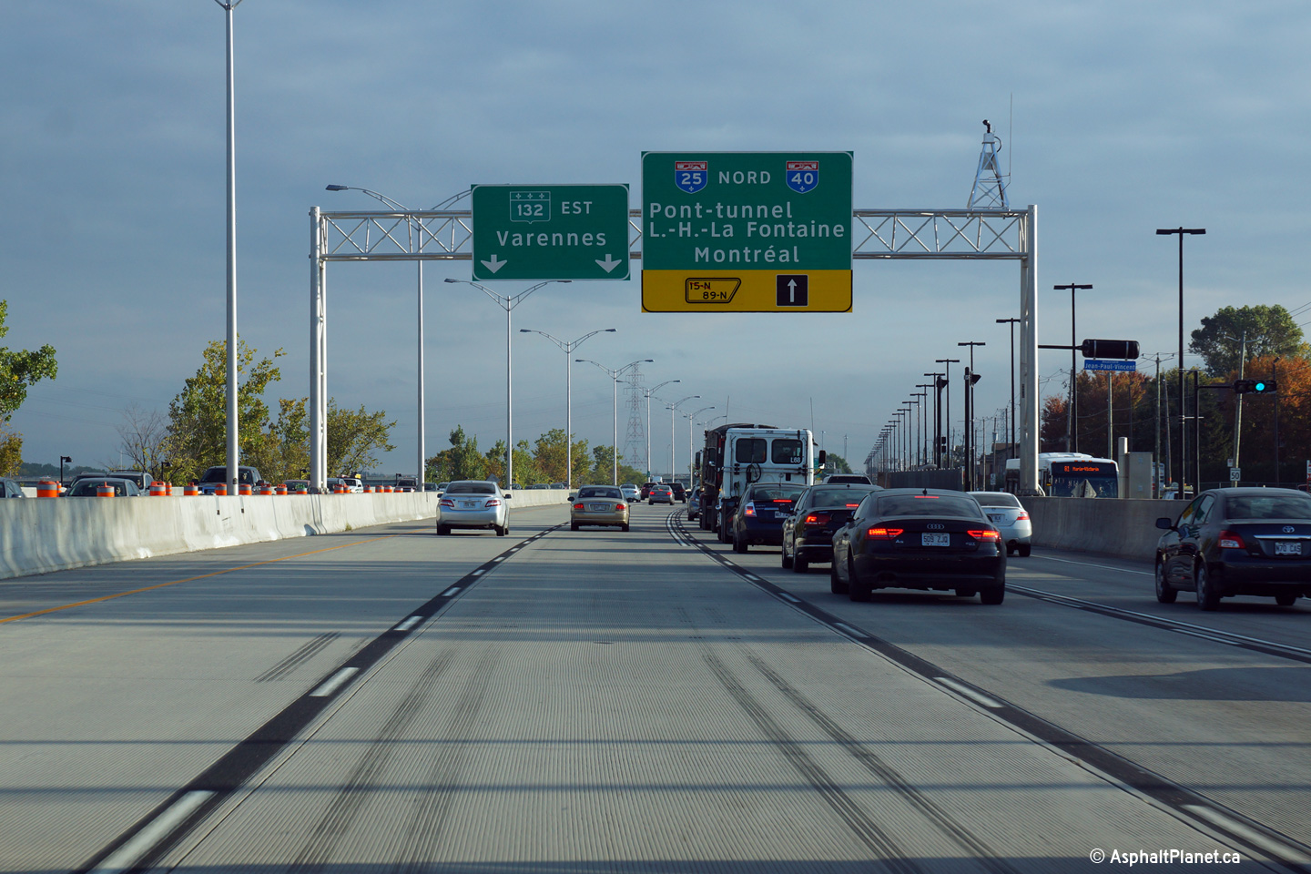
Agglomeration de Longueuil |
The first of a series of overhead signs in advance of the upcoming interchange with Autoroute 25. |
 |
||
|
Date: 10/02/2014 |
High-res: (1440x960) (2400x1600) | |||
|
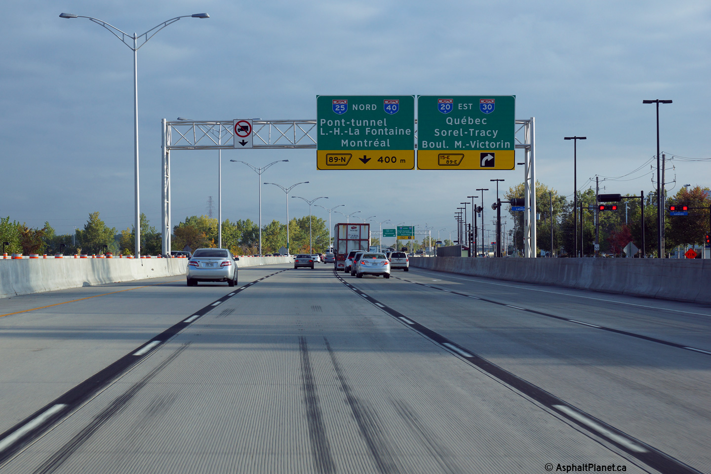
Agglomeration de Longueuil |
This is the second in a series of advanced signs for the A-25 interchange. Autoroute 20 exits the freeway mainline at this interchange via a single lane ramp at the right side of the freeway. |
 |
||
|
Date: 10/02/2014 |
High-res: (1440x960) (2400x1600) | |||
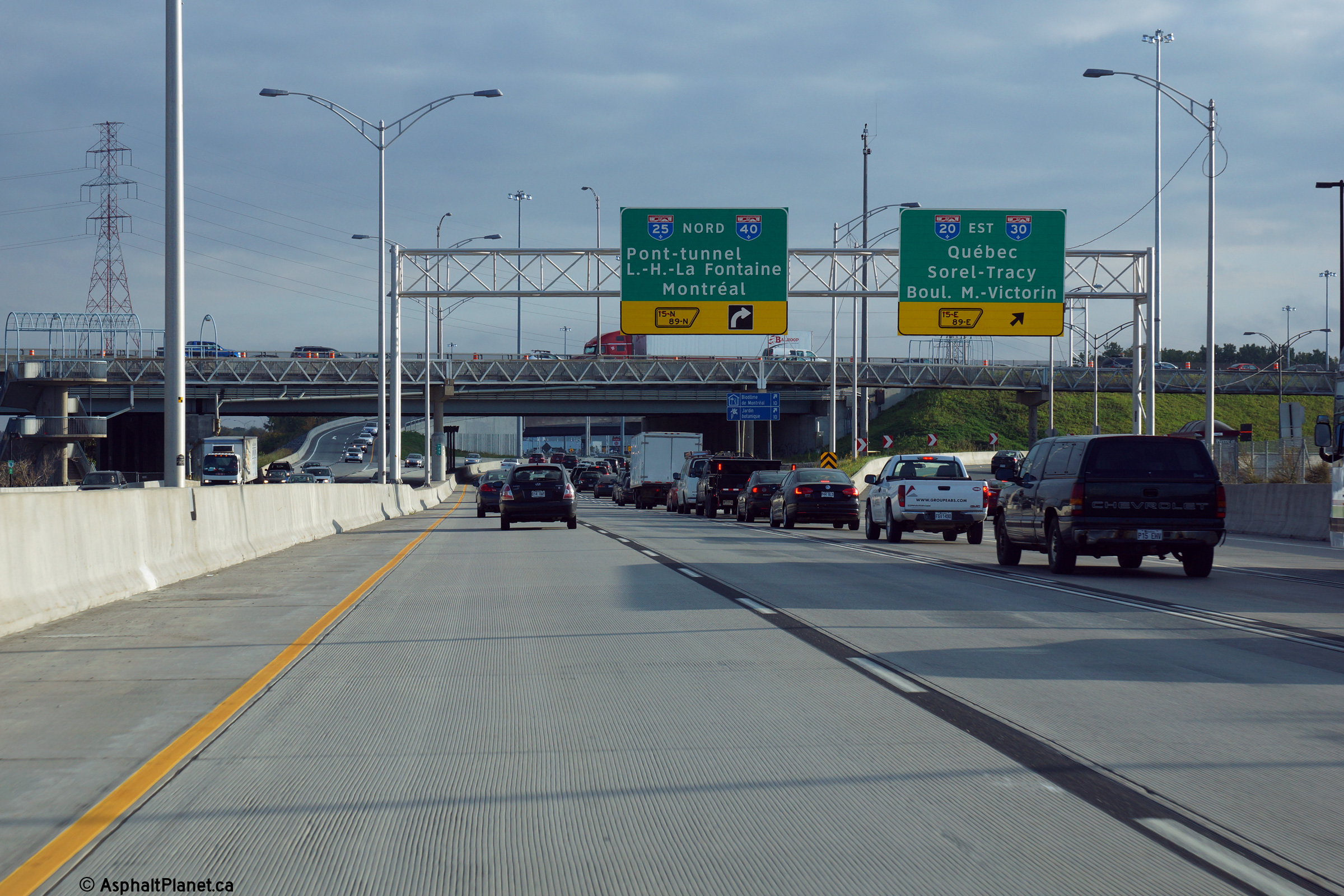
|
Agglomeration de Longueuil |
Third sign for the A-25 interchange. This photo was taken during the morning rush hour, as such there was a long queue of traffic for the ramp to Autoroute 25 North towards the Lafontaine Bridge-Tunnel that leads to Montreal Island. |
 |
||
|
Date: 10/02/2014 |
High-res: (1440x960) (2400x1600) | |||
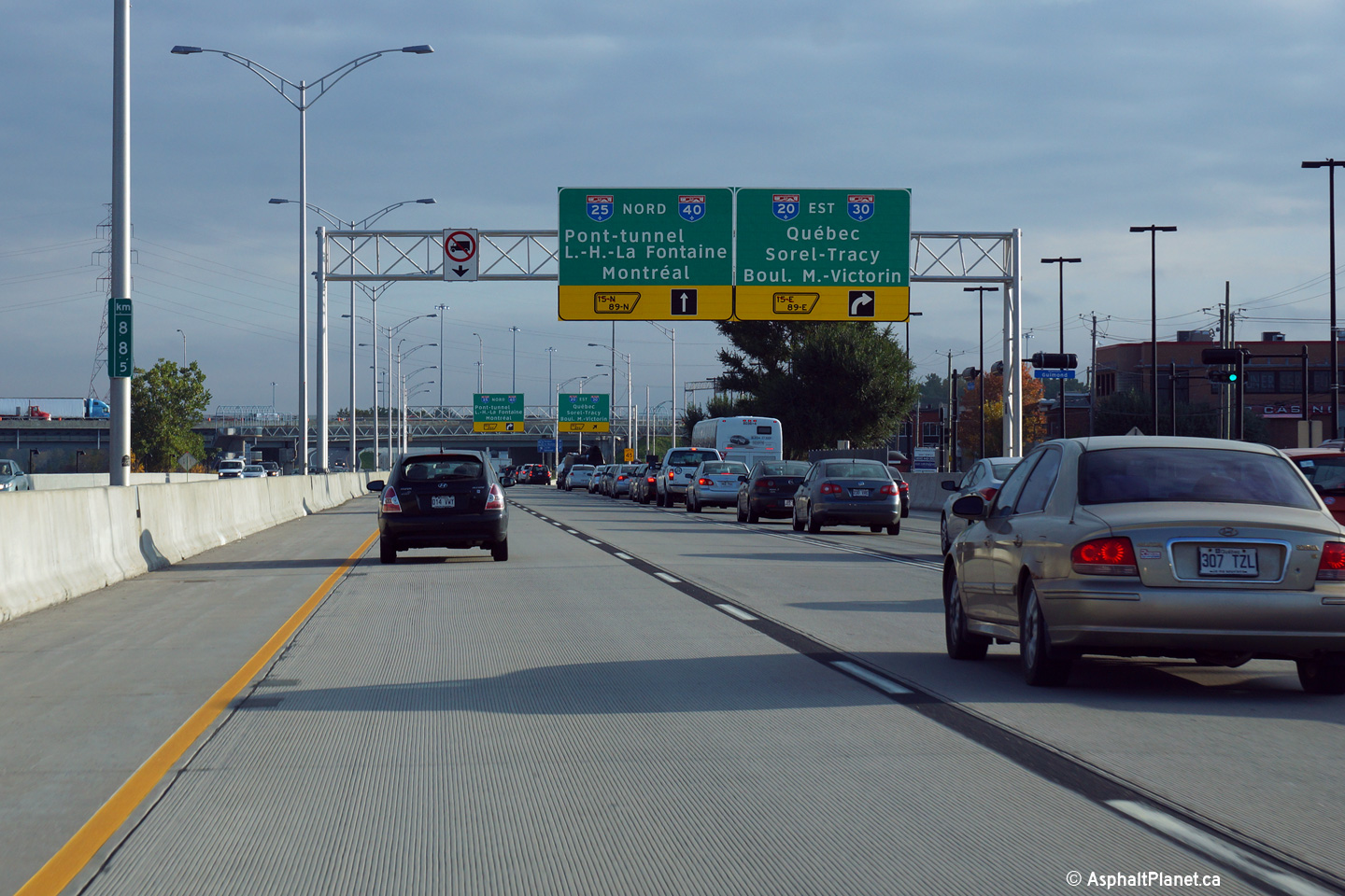
|
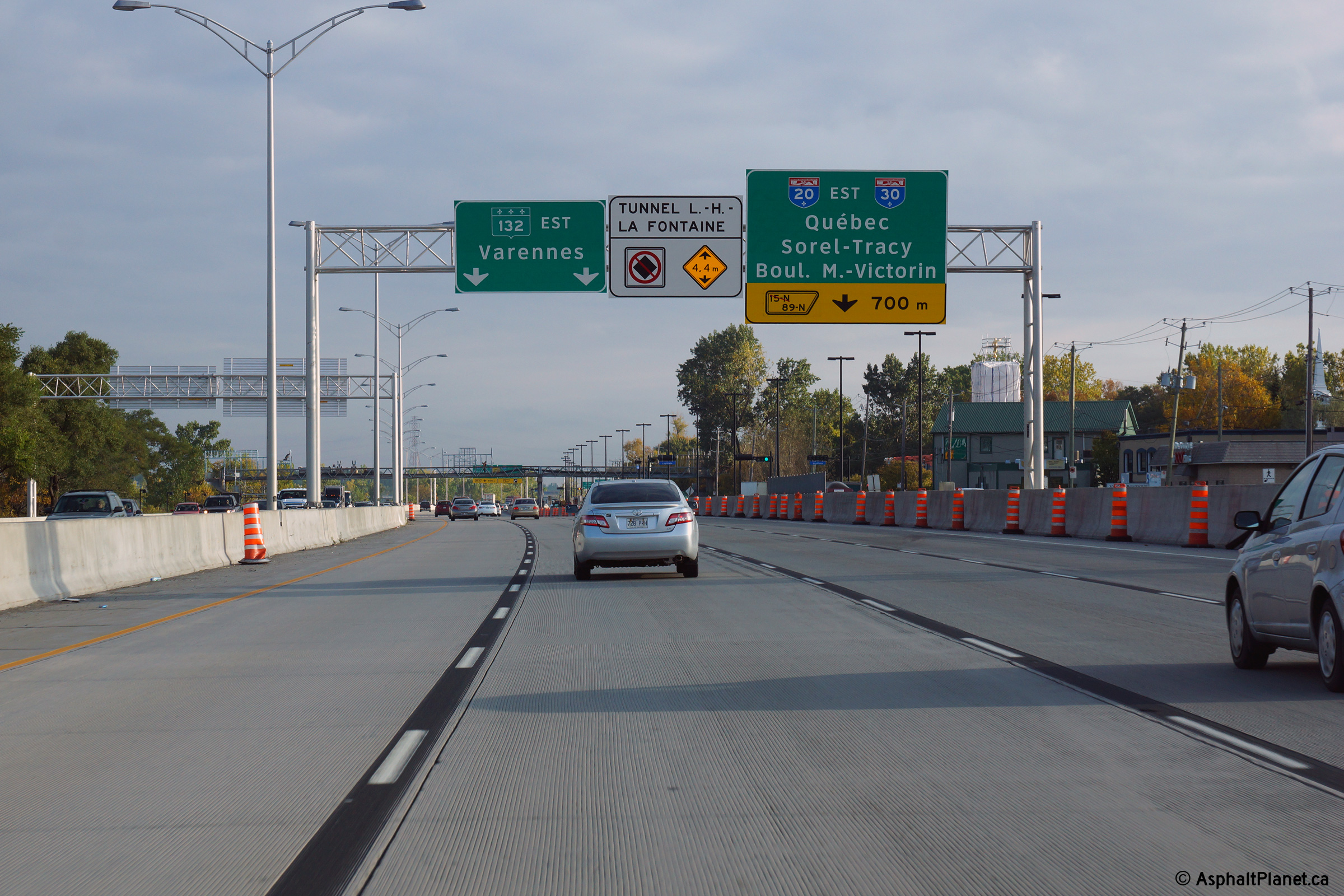
Agglomeration de Longueuil |
Must exit signage for both the ramps to A-20 East and A-25 North. Because of the large width of these signs, the MTQ cannot place a pull through sign overtop of all four lanes on the same gantry. |
 |
||
|
Date: 10/02/2014 |
High-res: (1440x960) (2400x1600) | |||
|
Agglomeration de Longueuil |
Signage as the single lane off-ramp to Autoroute 20 exits from the right side of the freeway. Beyond the Autoroute 25 interchange, R-132 continues as a freeway for several kilometres before narrowing to surface boulevard. |
 |
||
|
Date: 10/02/2014 |
High-res: (1440x960) (2400x1600) | |||
|
Agglomeration de Longueuil |
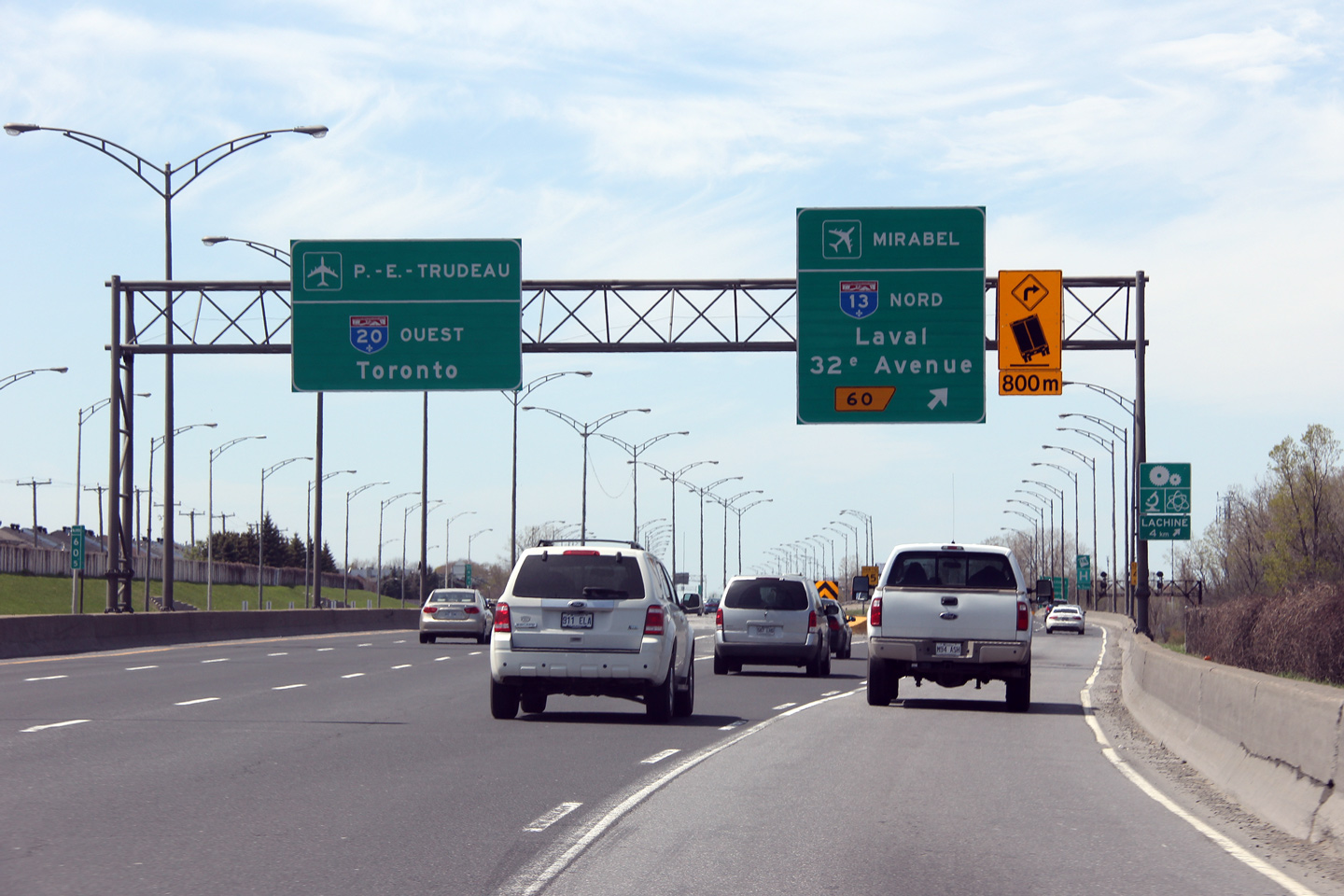
Westerly view overtop of A-20 from the pedestrian bridge immediately adjacent to the A-25 overpass. When this photo was taken, construction was just about finished on the project to rehabilitate the mainline lanes of A-20 west of the A-25 interchange. This work was completed during a series of contracts that saw the A-20/25 interchange completely reconstructed. |
 |
||
|
Date: 5/5/2012 |
High-res: (1440x960) (2400x1600) | |||
<- Page 1 Back to Autoroute 20 Index Page 3 ->
© 2007-17 AsphaltPlanet.ca.
AsphaltPlanet@asphaltplanet.ca
Page Created: December 13, 2008.
Last Updated: February 19, 2017.


