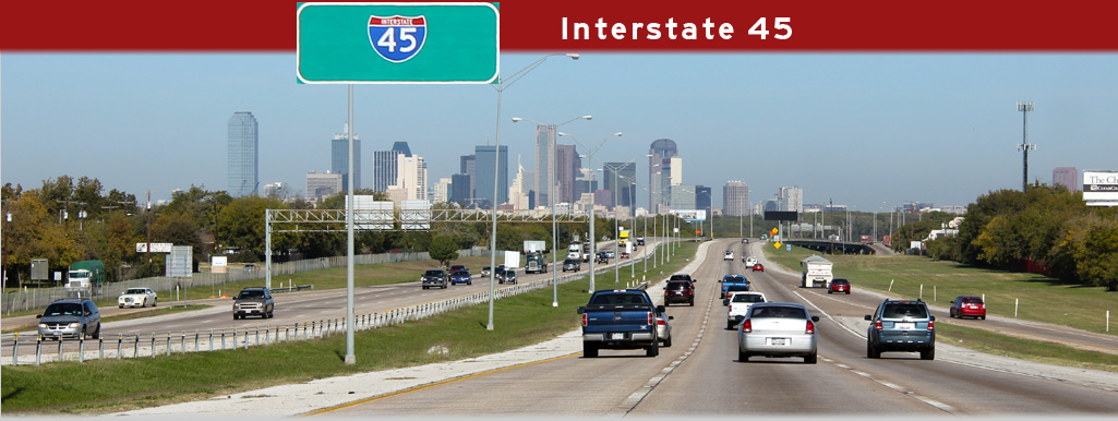
AsphaltPlanet.ca > Texas > Interstate 45
|
Southern Terminus: Texas Highway 87 in Galveston.
Northern Terminus: I-30/I-345/US-75 interchange in Downtown Dallas. Length in TX: 284.913 Miles (458.52km). Links:
|
Pictures on this page are arranged in order from south to north. I-45 North photos are left-aligned in the last column, while I-45 South photos are right-aligned. Center-line pictures are centered within the last column.
|
Location |
Description |
Photo |
||
|
North- |
South- |
|||
|
Tarrant County Fort Worth |
View looking southerly along the Gulf Freeway (I-45) at the flyover ramp to NASA 1 By-pass. NASA 1 By-pass was completed in 2008 and the interchange has been designed with an eight lane cross-section envisioned for the I-45 corridor. |
 |
||
|
Date: 11/1/2012 |
High-res: (1440x960) (2400x1600) | |||
|
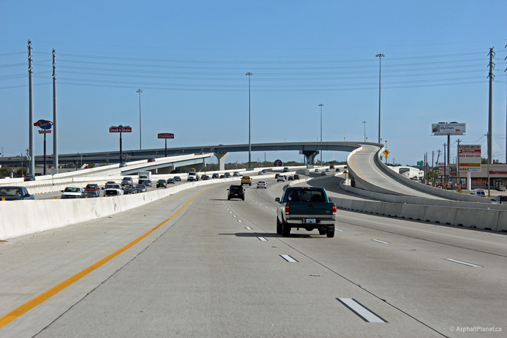
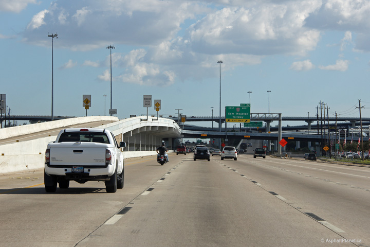
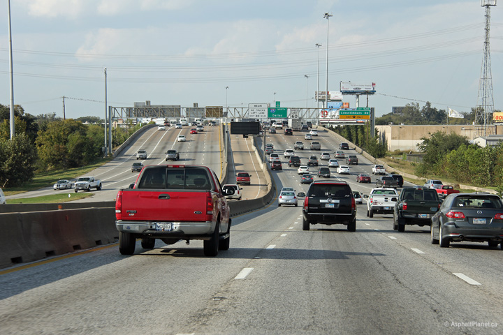
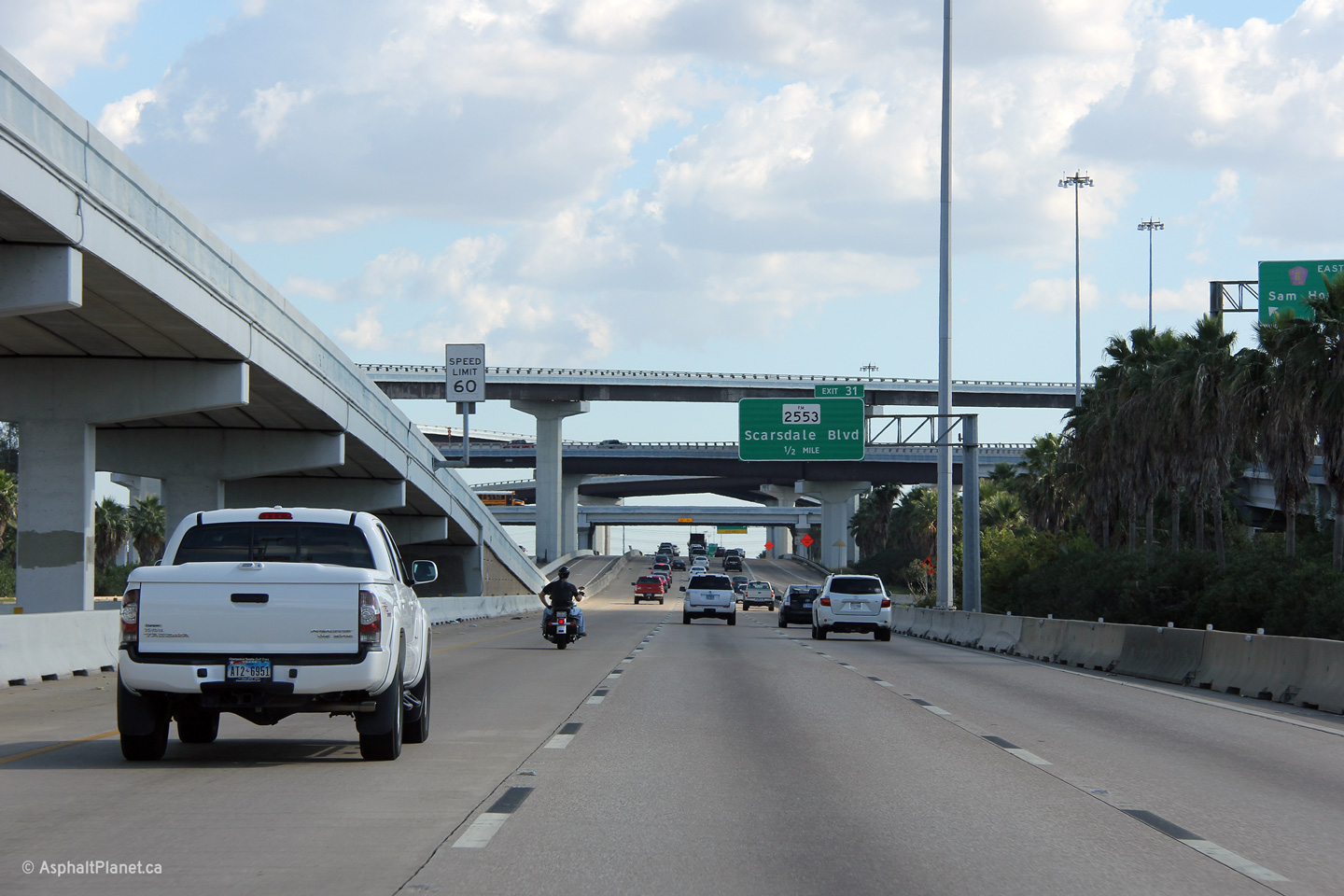
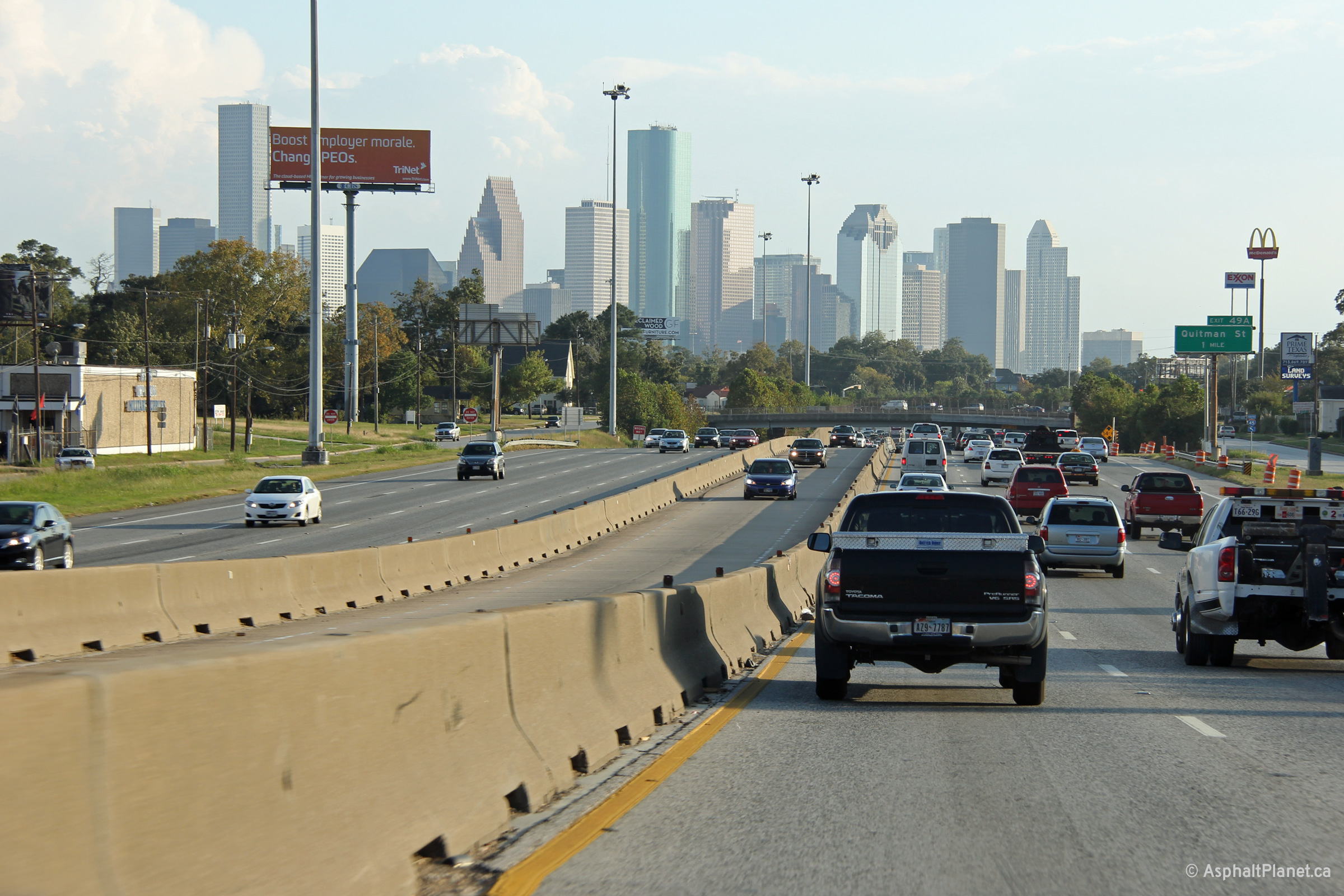
Harris County Houston |
View looking northerly along I-45 approaching the Sam Houston Tollway interchange. |
 |
||
|
Date: 11/1/2012 |
High-res: (1440x960) (2400x1600) | |||
|
Harris County Houston |
Southbound view at the Sam Houston Tollway interchange. |
 |
||
|
Date: 11/1/2012 |
High-res: (1440x960) (2400x1600) | |||
|
Harris County Houston |
View looking southerly underneath the flyover between the HOV lane and Fuqua Park and Ride towards the high level Sam Houston Tollway interchange. |
 |
||
|
Date: 11/1/2012 |
High-res: (1440x960) (2400x1600) | |||
|
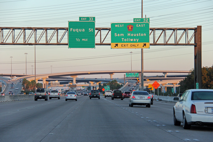
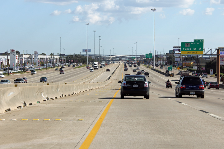
Harris County Houston |
Southbound signage at the exit to Beltway 8, the frontage road for the Sam Houston Tollway. |
 |
||
|
Date: 11/1/2012 |
High-res: (1440x960) (2400x1600) | |||
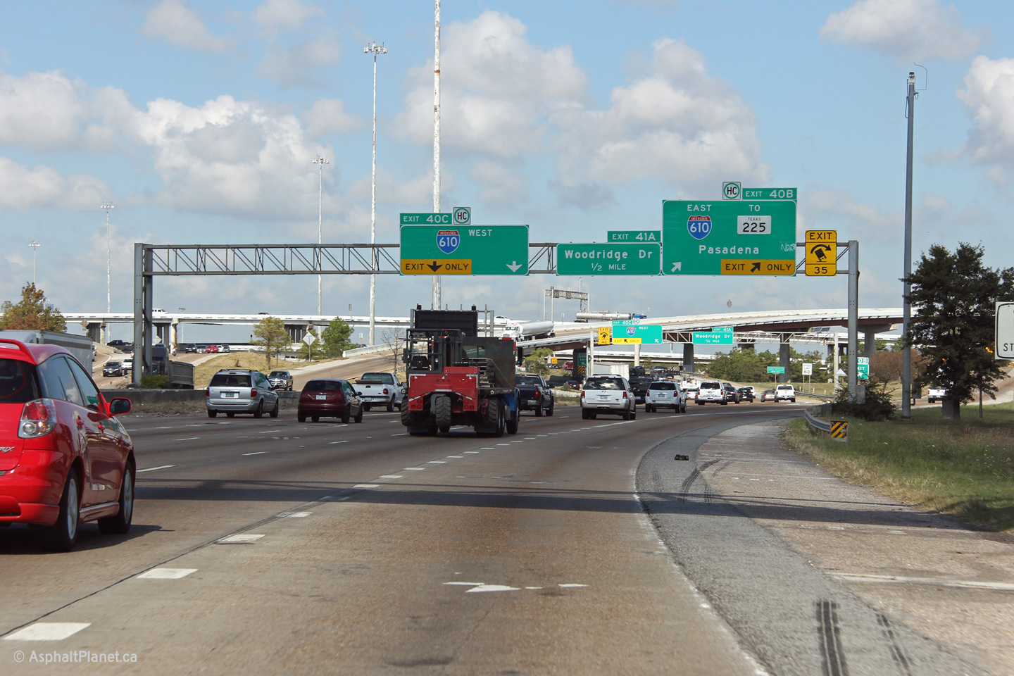
|
Harris County Houston |
Northerly view at the southern I-610 interchange south of Downtown. Hazardous cargo is prohibited along I-45 through Downtown Houston and is directed to exit the freeway at this interchange. |
 |
||
|
Date: 11/1/2012 |
High-res: (1440x960) (2400x1600) | |||
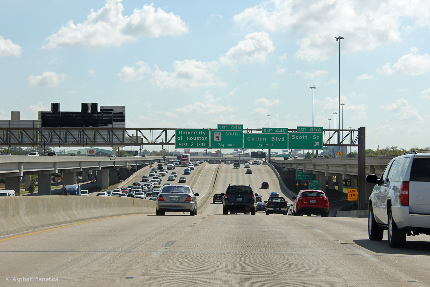
|
Harris County Houston |
The slip ramp to the frontage road at Exit 43A is quickly succeeded by a slip ramp from the frontage road back onto the freeway. |
 |
||
|
Date: 11/5/2012 |
High-res: (1440x960) (2400x1600) | |||
|
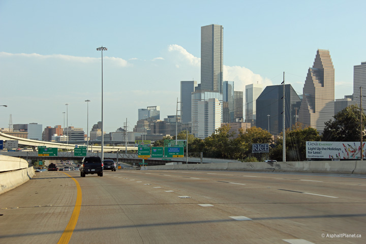
Harris County Houston |
View looking northerly approaching Downtown Houston at Exit 44A. |
 |
||
|
Date: 11/5/2012 |
High-res: (1440x960) (2400x1600) | |||
|
Harris County Houston |
Northerly view at the Scott Street on-ramp. |
 |
||
|
Date: 11/5/2012 |
High-res: (1440x960) (2400x1600) | |||
|
Harris County Houston |
View looking southbound at the ramp to Scott Street. Interstate 45 has the geometry of a rollercoaster south of Downtown Houston. |
 |
||
|
Date: 11/1/2012 |
High-res: (1440x960) (2400x1600) | |||
|
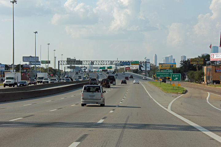
Harris County Houston |
Northbound view approaching the US-59 interchange southwest of Downtown Houston. |
 |
||
|
Date: 11/5/2012 |
High-res: (1440x960) (2400x1600) | |||
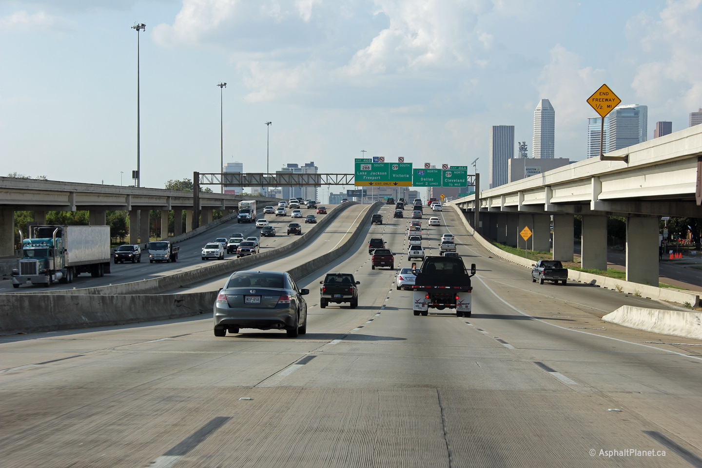
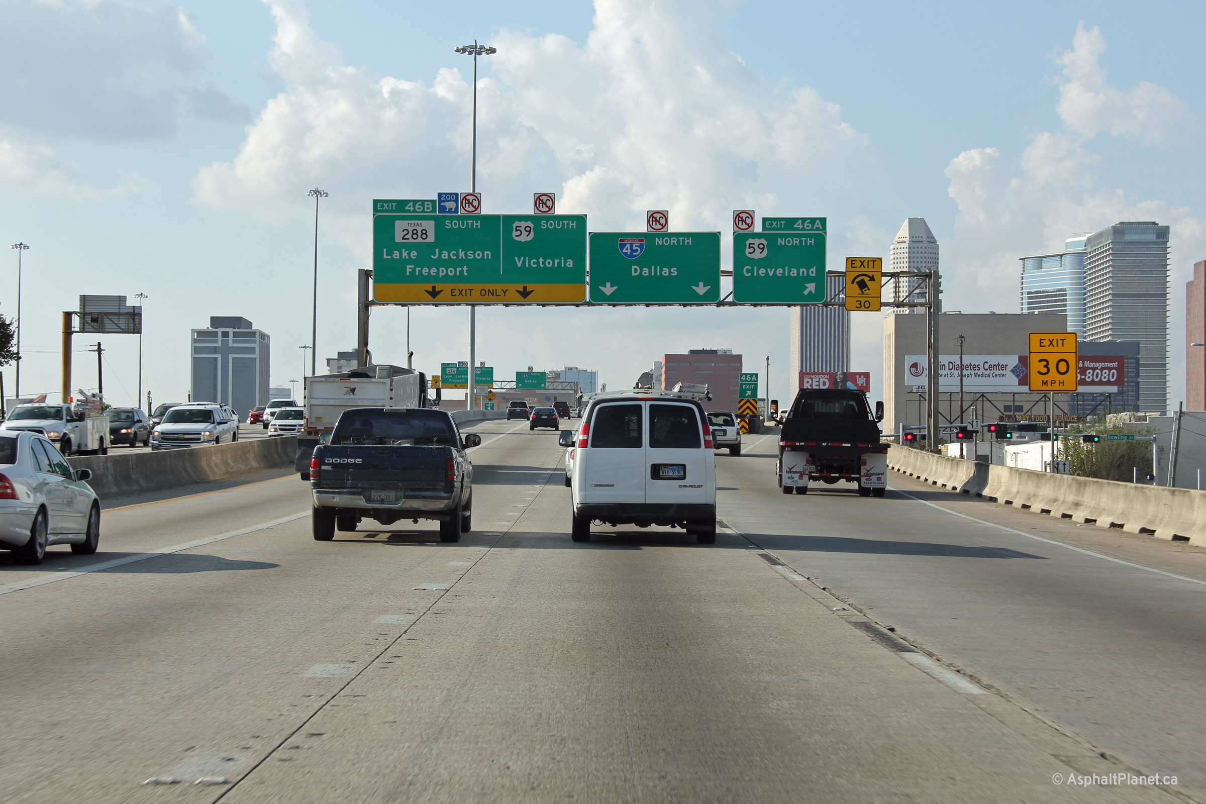
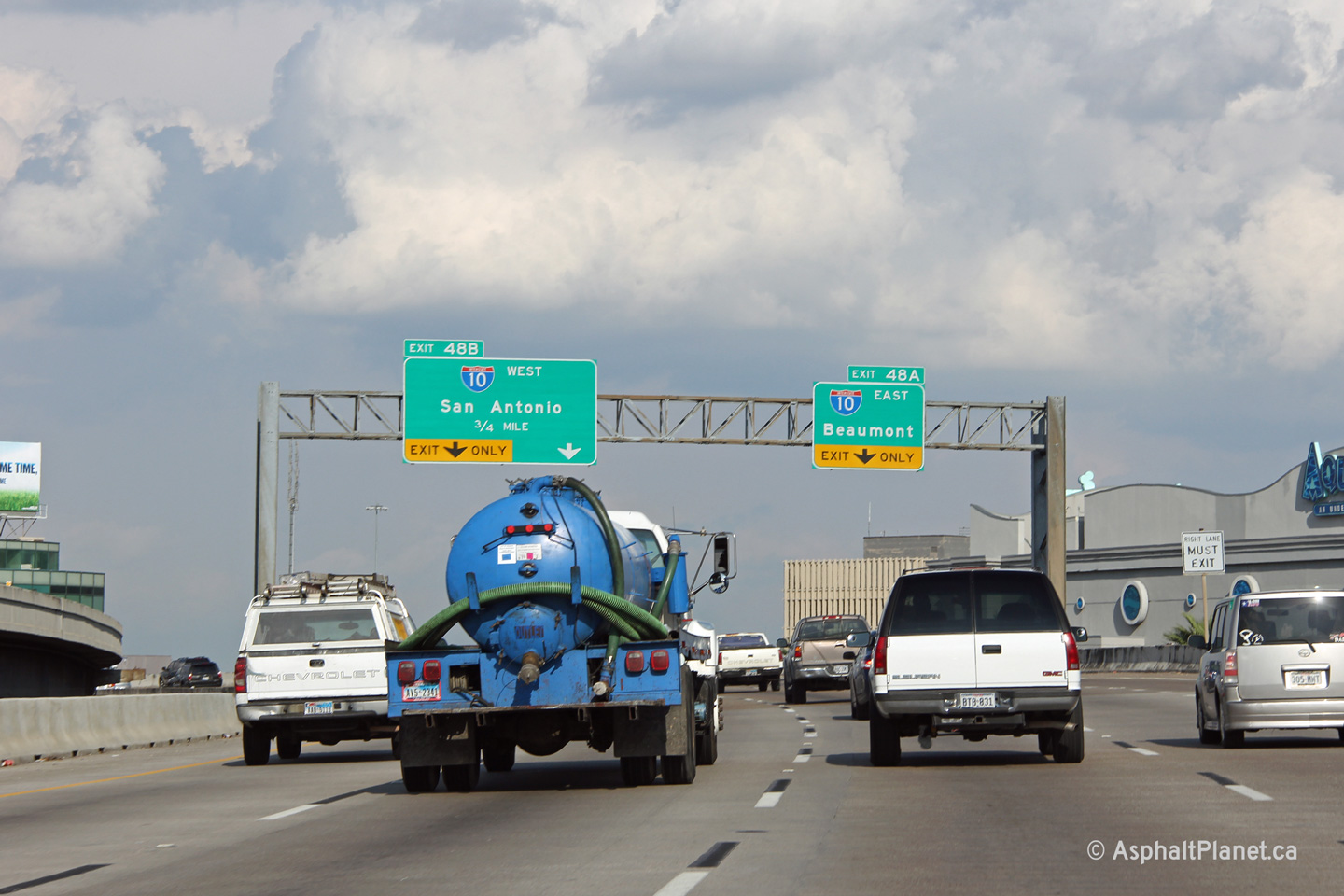
|
Harris County Houston |
View looking southerly at the interchange between US-59 and TX-288. The exit to the right leads to both US-59 and TX-288 South, while the exit to the right carries traffic towards the northern leg of US-59. |
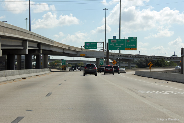 |
||
|
Date: 11/1/2012 |
High-res: (1440x960) | |||
|
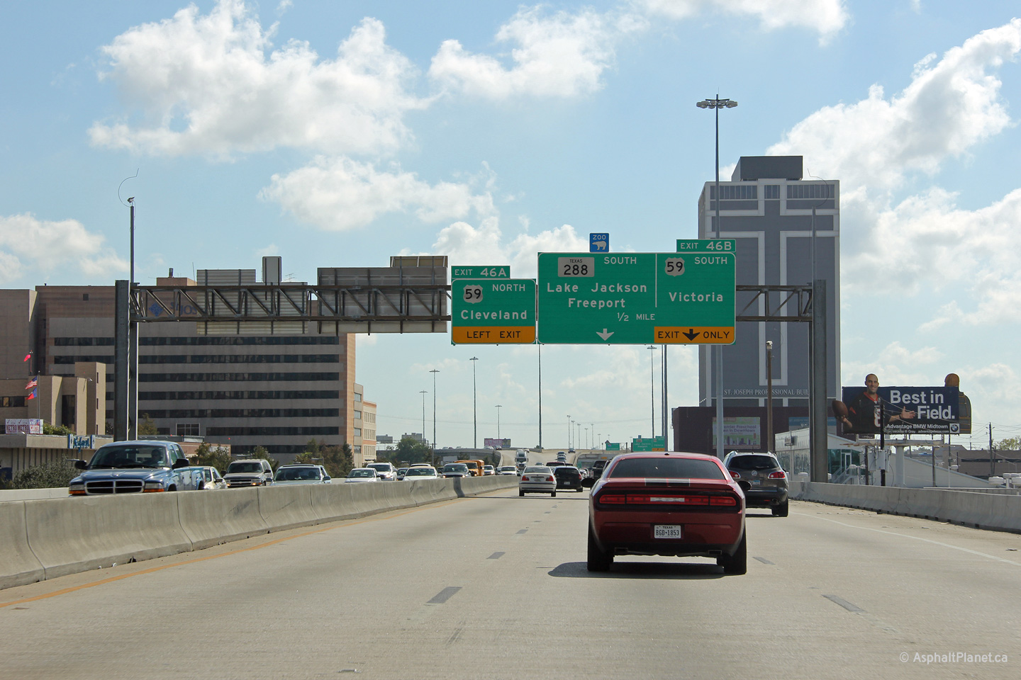
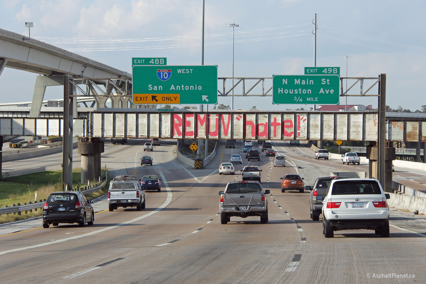
Harris County Houston |
Southbound view approaching the US-59 interchange. |
 |
||
|
Date: 11/1/2012 |
High-res: (1440x960) (2400x1600) | |||
|
Harris County Houston |
Interstate 45 runs descends from an elevated freeway to run underneath of Dallas Street. The frontage roads appear to have been added alongside the freeway several years after the freeway was initially constructed. |
 |
||
|
Date: 11/5/2012 |
High-res: (1440x960) (2400x1600) | |||
|
Harris County Houston |
The old design standards of I-45 through Central Houston are evidenced by the left hand exits and entrances along the freeway. |
 |
||
|
Date: 11/5/2012 |
High-res: (1440x960) | |||
|
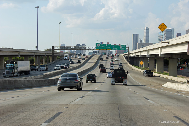
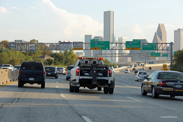
Harris County Houston |
View looking northerly approaching the I-10 interchange. |
 |
||
|
Date: 11/5/2012 |
High-res: (1440x960) | |||
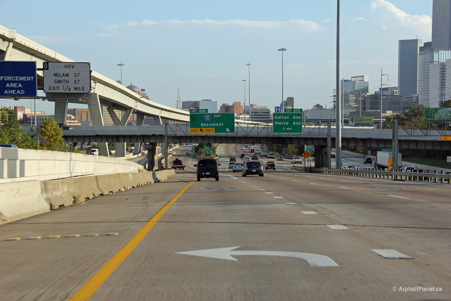
|
Harris County Houston |
This view looks northerly as the slip ramp to Interstate 10 West leaves I-45 North. |
 |
||
|
Date: 11/5/2012 |
High-res: (1440x960) (2400x1600) | |||
| Interstate 45 runs parallel to Interstate 10 for just under a mile north of Downtown Houston. Click here for Interstate 10 images. | ||||
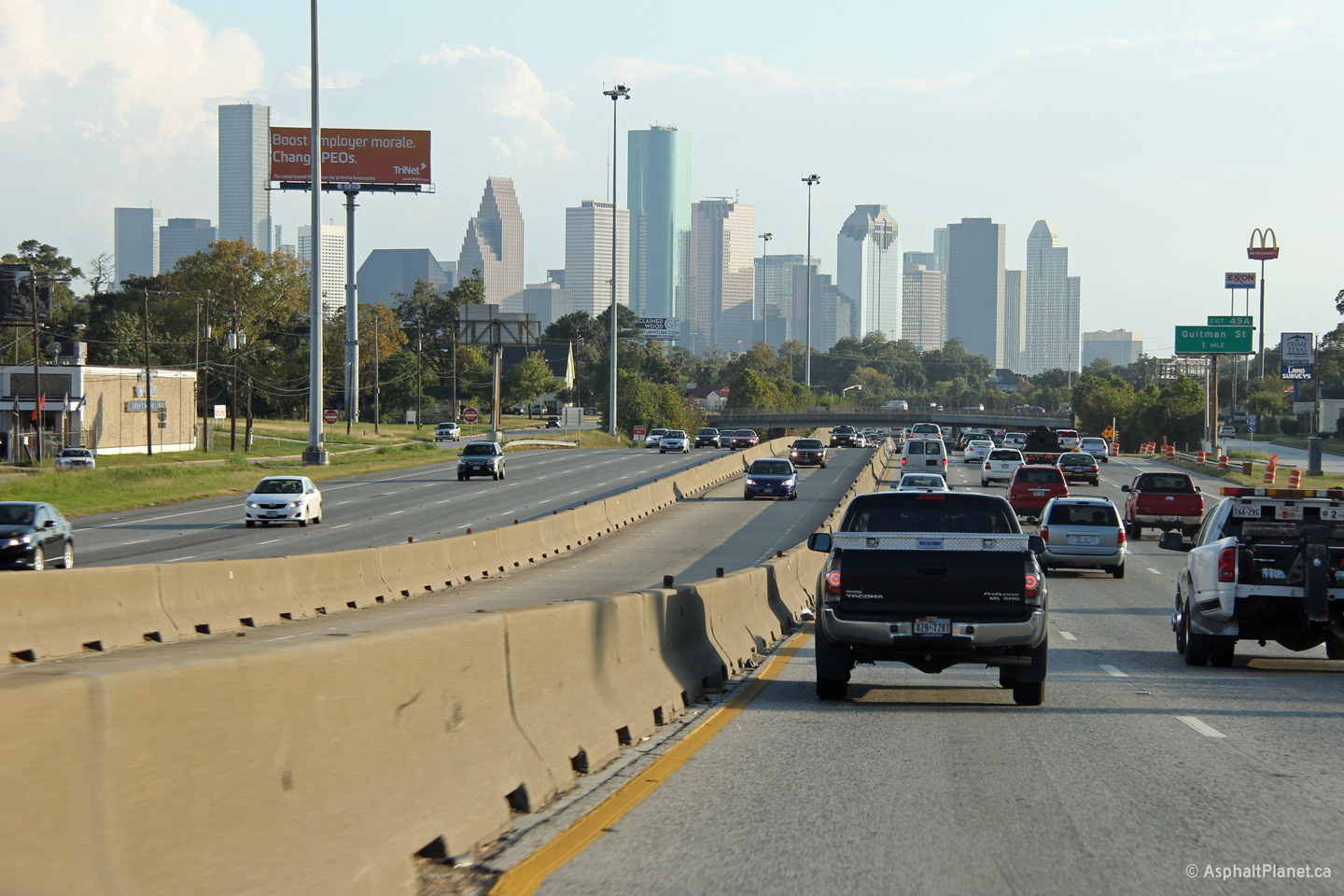
|
Harris County Houston |
Two views looking southerly along I-45 where it runs parallel to I-10. I-10 and I-45 run parallel to one another for just under a mile to the north of Downtown Houston. |
 |
||
| High-res: (1440x960) (2400x1600) | ||||
 |
||||
|
Date: 11/5/2012 |
High-res: (1440x960) (2400x1600) | |||
|
Harris County Houston |
Southbound view at the Quitman Road interchange. Quitman Road is located just north of the I-10 interchange. |
 |
||
|
Date: 11/5/2012 |
High-res: (1440x960) (2400x1600) | |||
|
Harris County Houston |
View looking southerly south of the Gardner Street underpass. |
 |
||
|
Date: 11/5/2012 |
High-res: (1440x960) (2400x1600) | |||
|
Harris County Houston |
View looking northerly along I-45 approaching the compact stack interchange with I-610. |
 |
||
|
Date: 11/5/2012 |
High-res: (1440x960) (2400x1600) | |||
|
Harris County Houston |
Northerly view along I-45 from the top of the I-610 interchange. |
 |
||
|
Date: 11/5/2012 |
High-res: (1440x960) (2400x1600) | |||
|
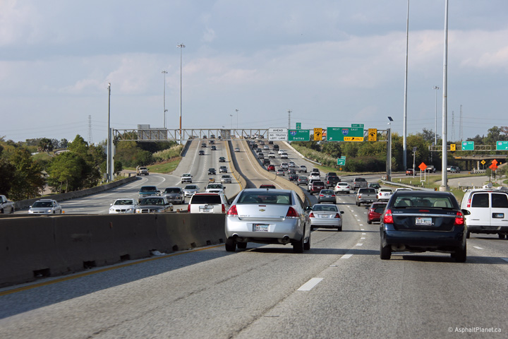
Harris County Houston |
This view looks northerly just south of the West Road interchange. |
 |
||
|
Date: 11/2/2012 |
High-res: (1440x960) (2400x1600) | |||
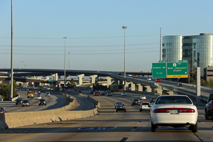
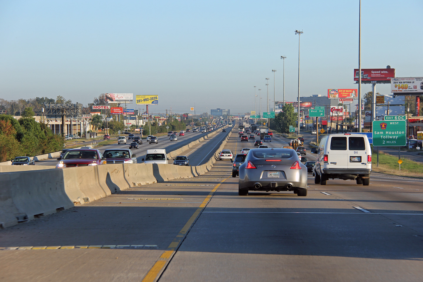
|
Harris County Houston |
Northerly view approaching the Sam Houston Tollway interchange. |
|
||
|
Date: 11/5/2012 |
High-res: (1440x960) (2400x1600) | |||
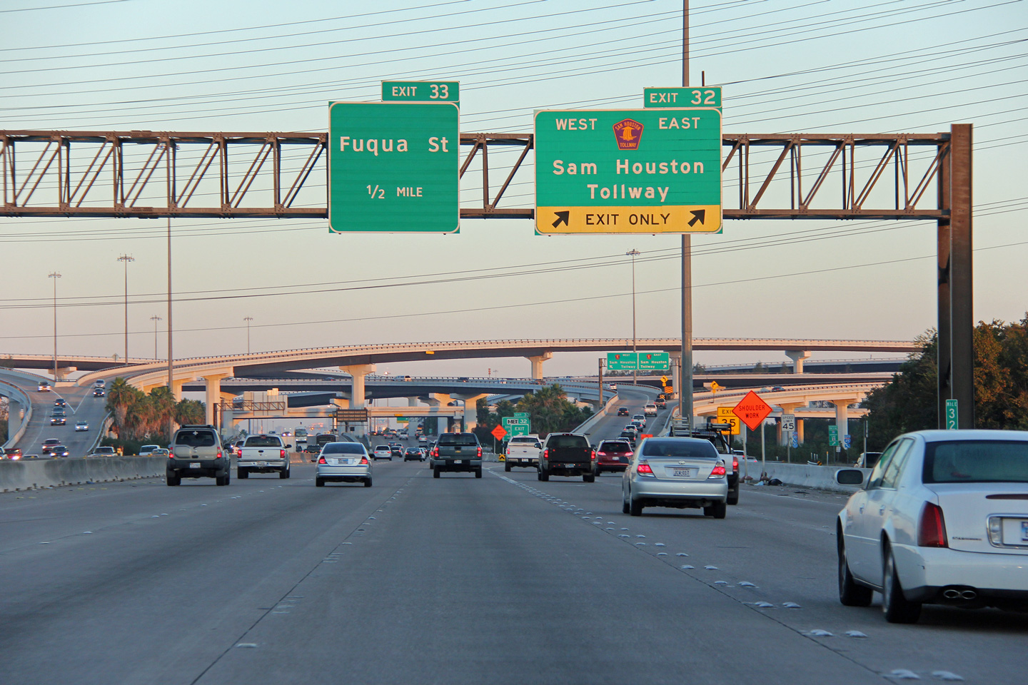
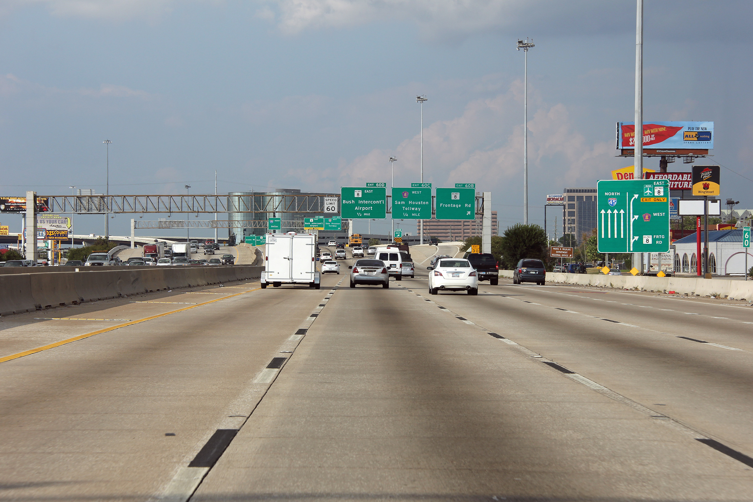
|
Harris County Houston |
Northerly view through the Sam Houston Tollway interchange. |
|
||
|
Date: 11/2/2012 |
High-res: (1440x960) (2400x1600) | |||
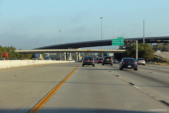
|
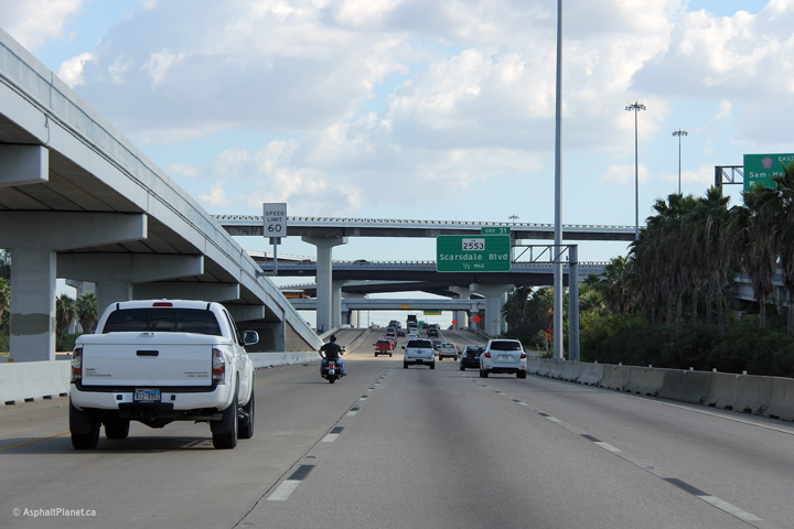
Harris County Spring |
Driving northerly through the Spring Crossing interchange. The Third level structure is the ramp from I-45 South to Hardy Toll Road. |
 |
||
|
Date: 11/2/2012 |
High-res: (1440x960) (2400x1600) | |||
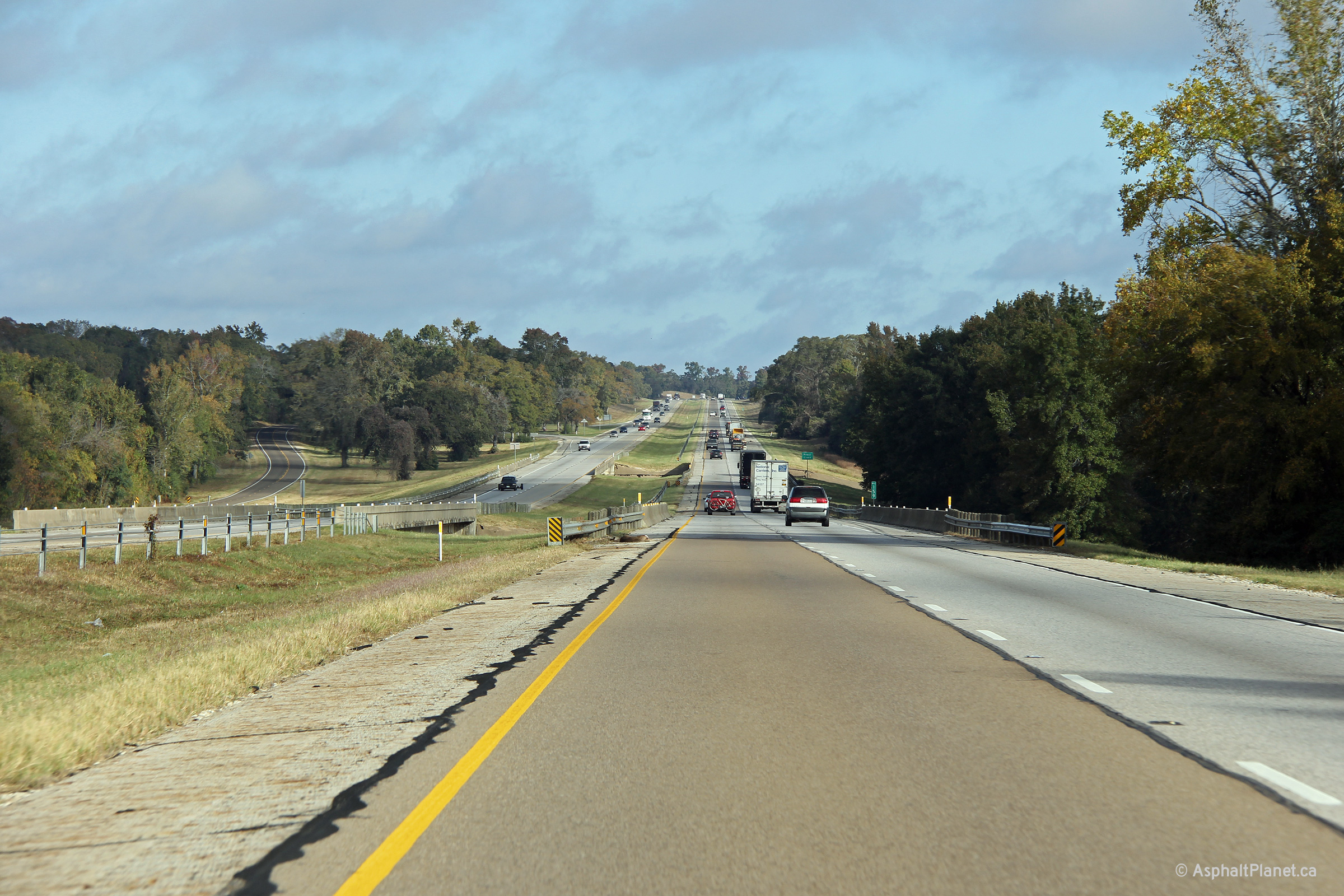
|
Leon County |
Northerly view along I-45 between Houston and Texas as the interstate crosses Boggy Creek. |
 |
||
|
Date: 11/2/2012 |
High-res: (1440x960) (2400x1600) | |||
| Interstate 45 ends just north of Interstate 30 at Downtown Dallas, continuing north of US-75. Click here for US-75 images. | ||||
<- I-44
TX
Highways I-69 ->
AsphaltPlanet.ca
© 2006-2013 AsphaltPlanet.ca.
AsphaltPlanet@asphaltplanet.ca
Page Created: April 20, 2013.
Last Updated: April 20, 2013.
