AsphaltPlanet.ca > Arizona > Interstate 10
|
Western Entrance: CA/AZ border just west of Ehrenberg, AZ.
Eastern Entrance: AZ/NM border east of Wilcox, AZ. Length in AZ: 391.99 Miles (630.85km). |
Pictures on this page are arranged in order from south to north. I-10 East photos are left-aligned in the last column, while I-10 West photos are right-aligned. Center-line pictures are centered within the last column.
|
Location |
Description |
Photo |
||
|
East- |
West- |
|||
|
Go West and find images of Interstate 10 in California. Click here for Interstate 10 - California images. |
||||
|
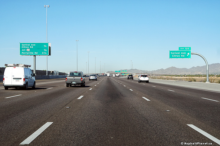
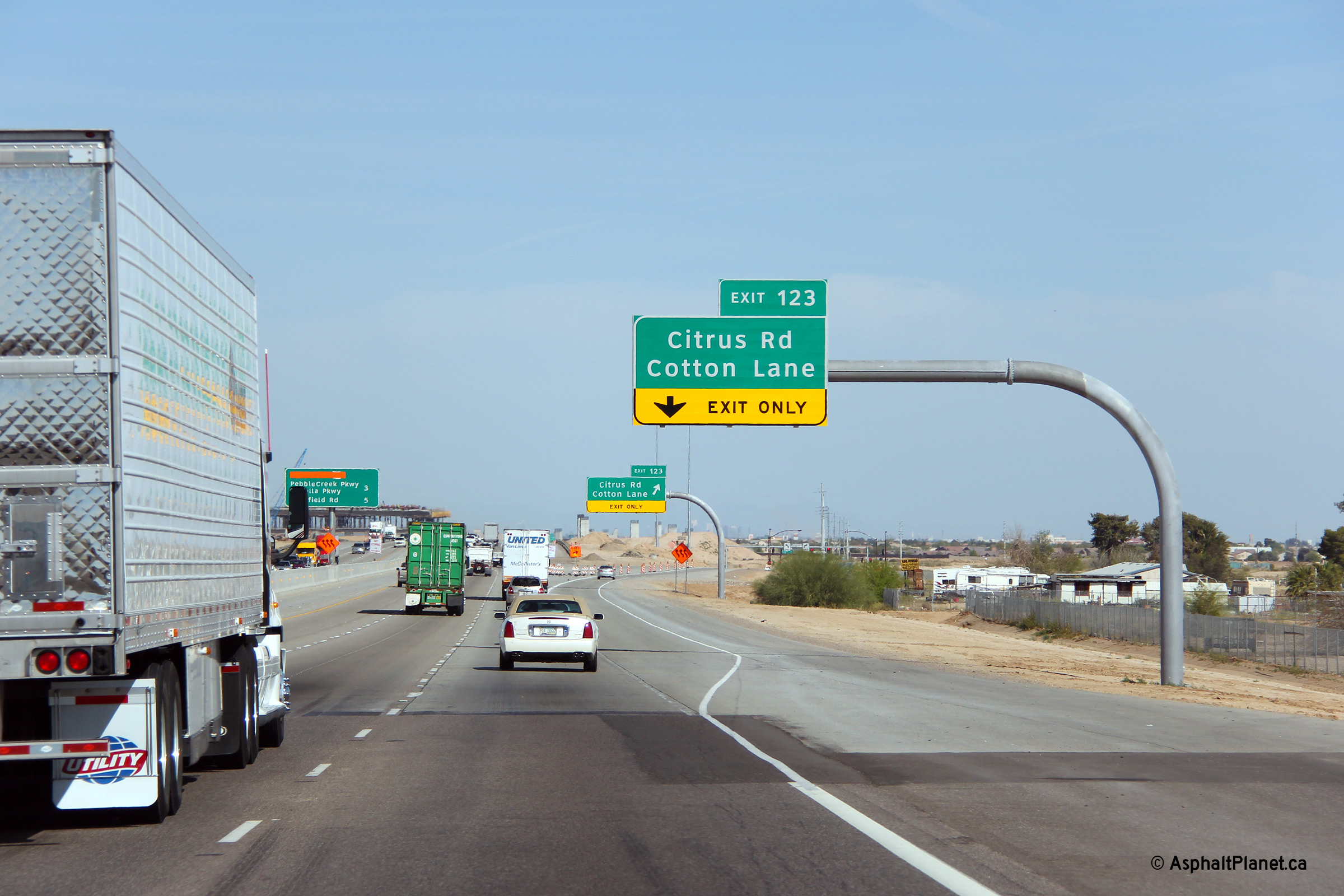
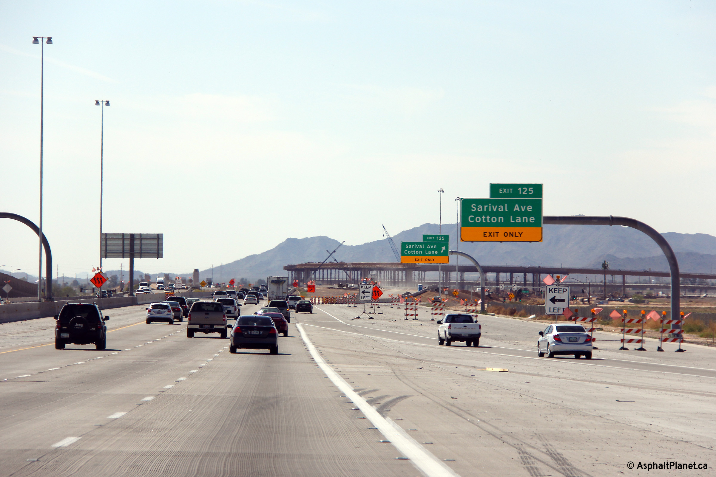
Maricopa County Goodyear |
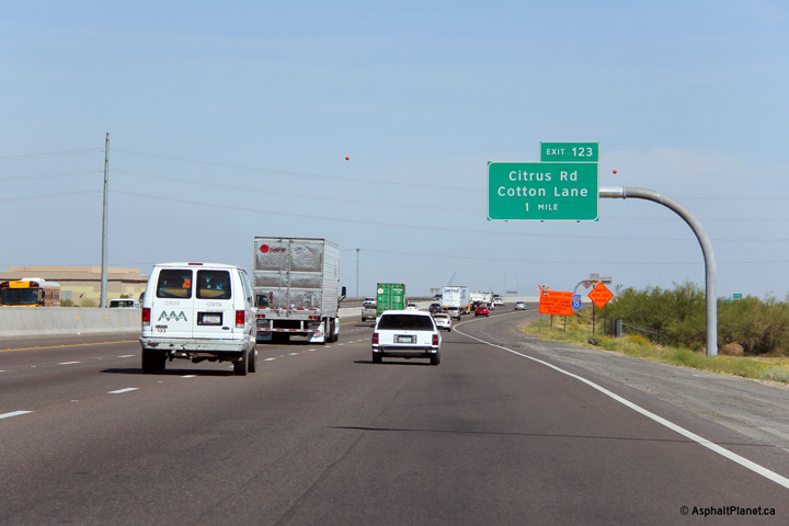
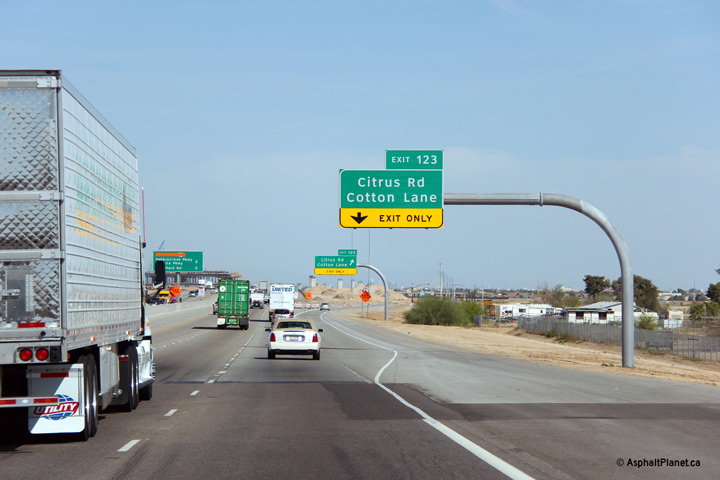
Eastbound advanced signage for the Citrus Road and Cotton Lane exit. |
 |
||
|
Date: 26/3/2013 |
High-res: (1440x960) (2400x1600) | |||
|
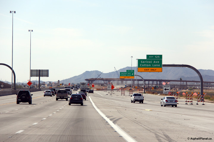
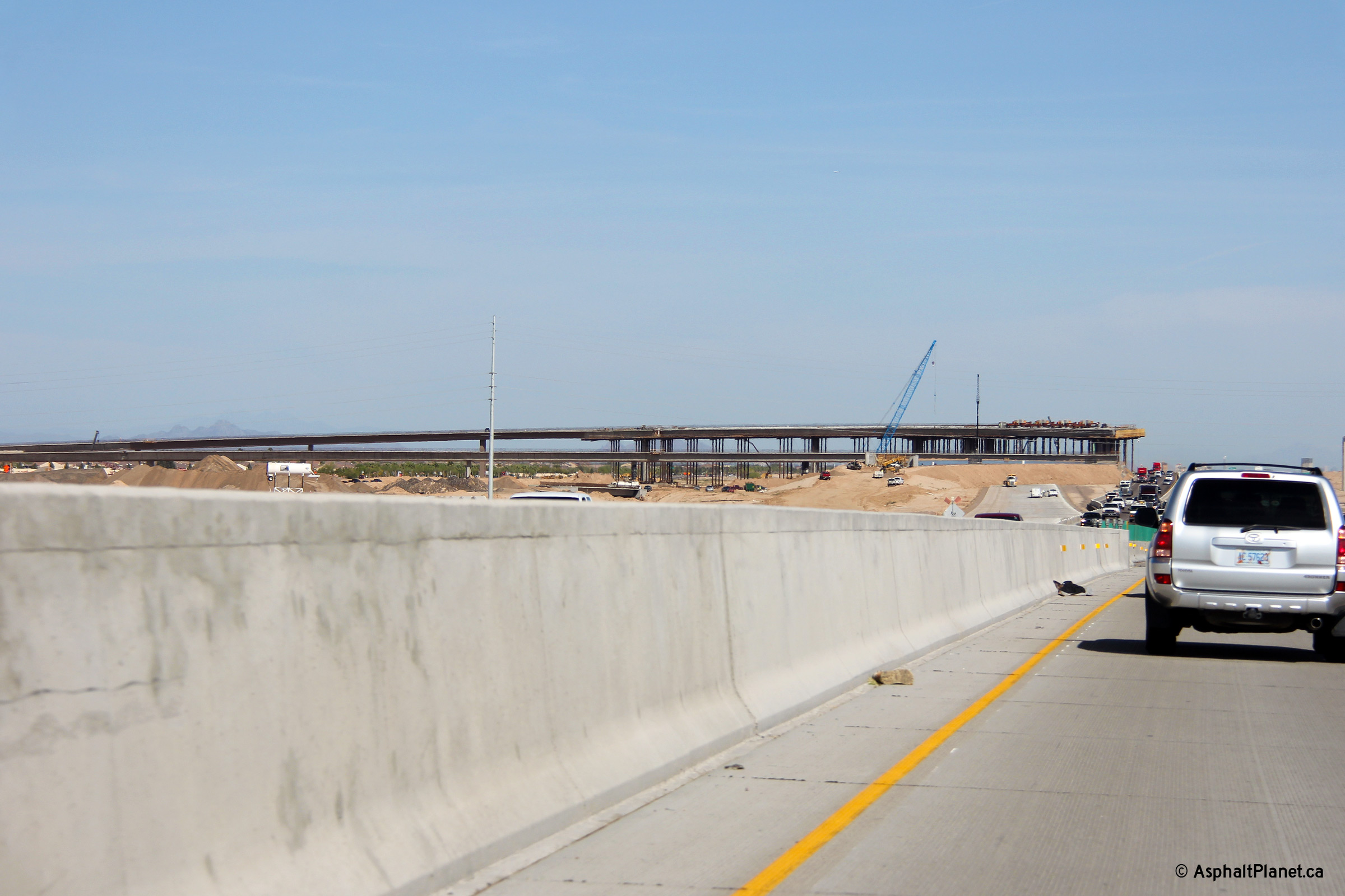
Maricopa County Goodyear |
Just before the eastbound off-ramp to Citrus Road and Cotton Lane, I-10 becomes surfaced in concrete. Presumably, once construction has been completed on the Loop 303 interchange and traffic has been moved to its final configuration the exposed concrete will be surfaced with rubberized asphalt. Rubberized asphalt is used extensively on Metro Phoenix's freeways and in my opinion provides one of the smoothest road surfaces in all of North America. |
 |
||
|
Date: 26/3/2013 |
High-res: (1440x960) (2400x1600) | |||
|
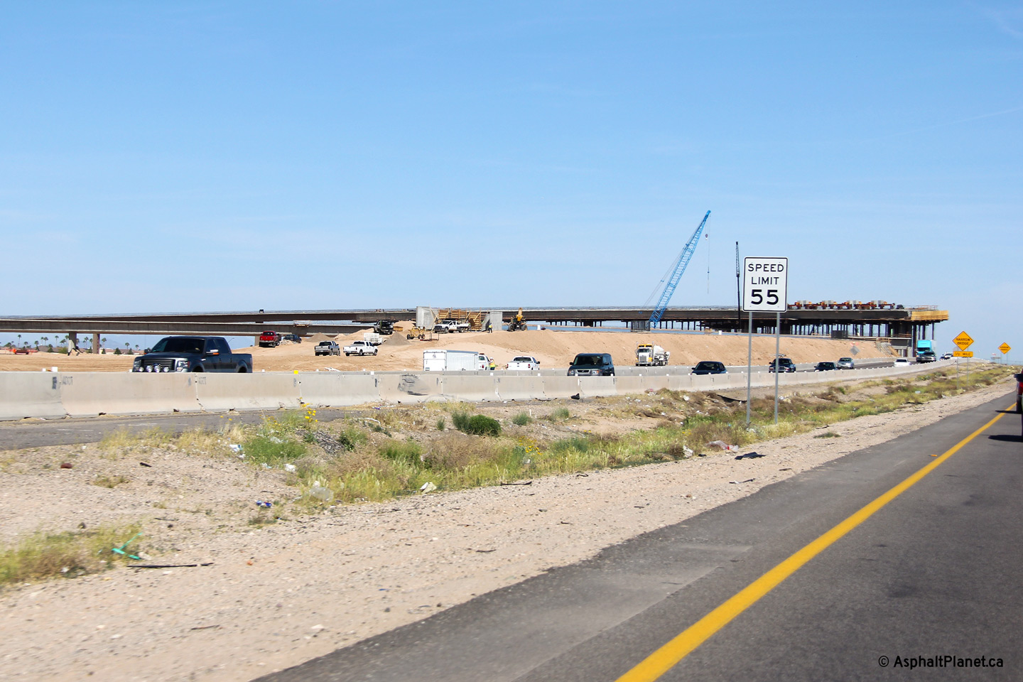
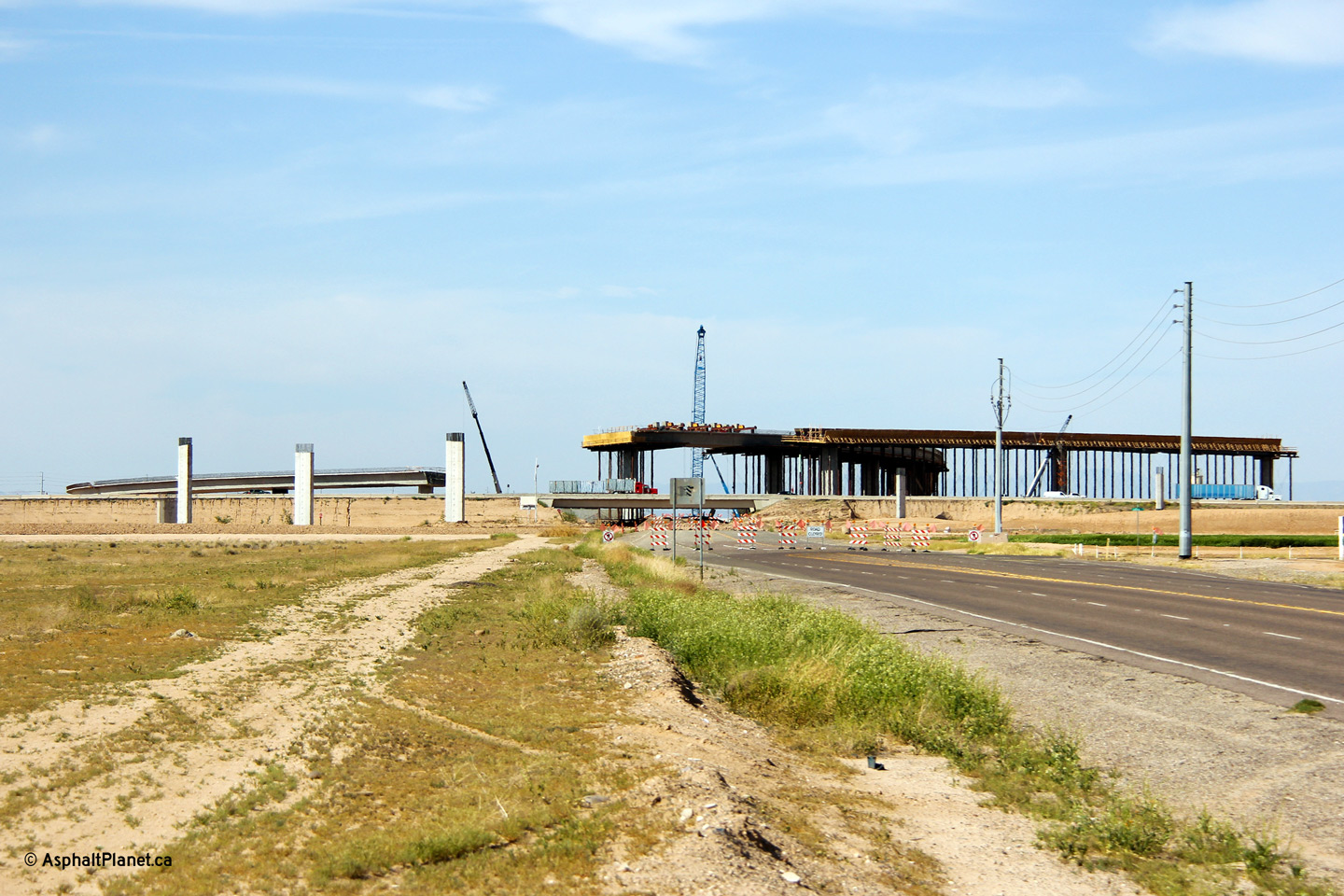
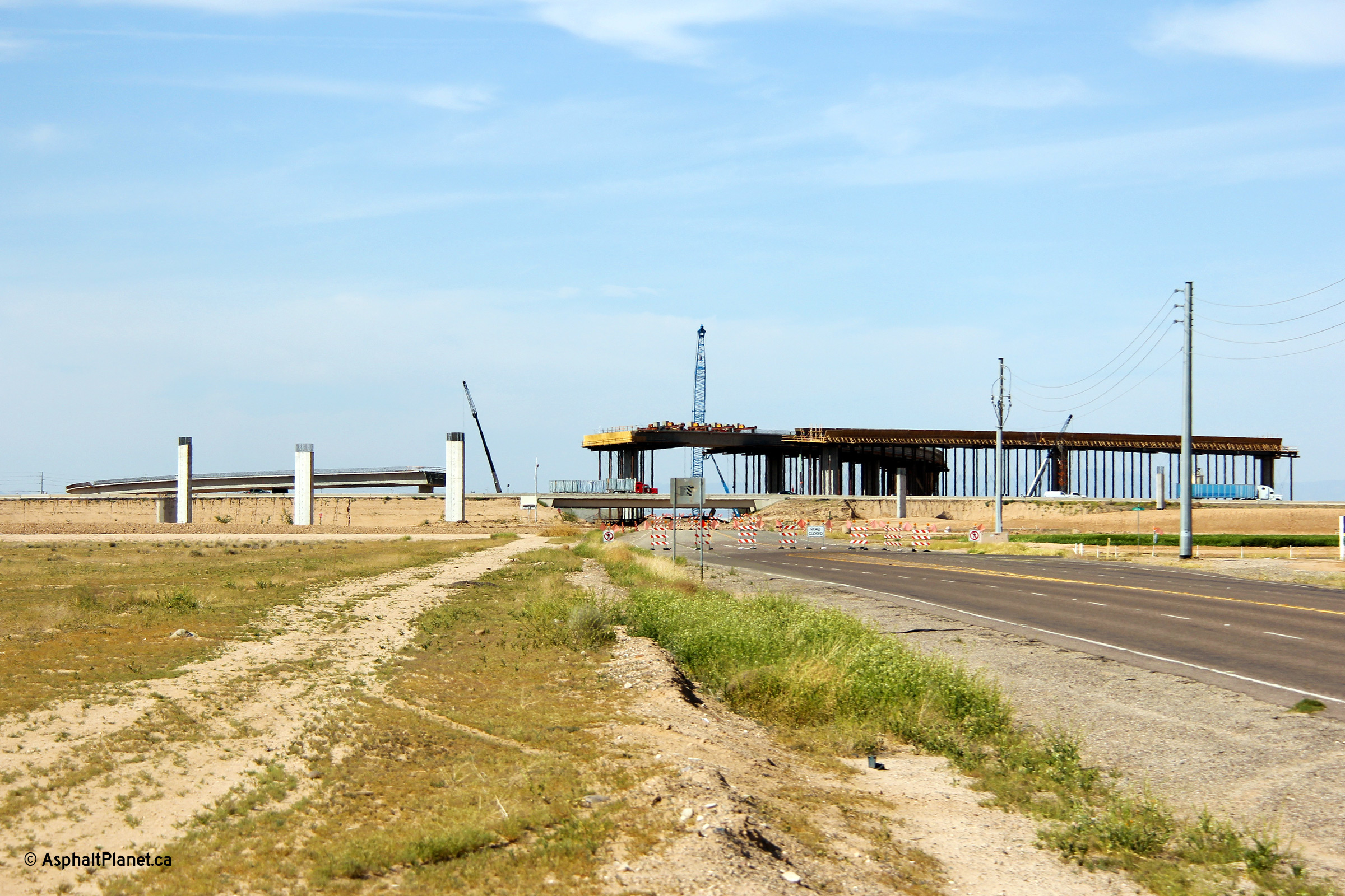
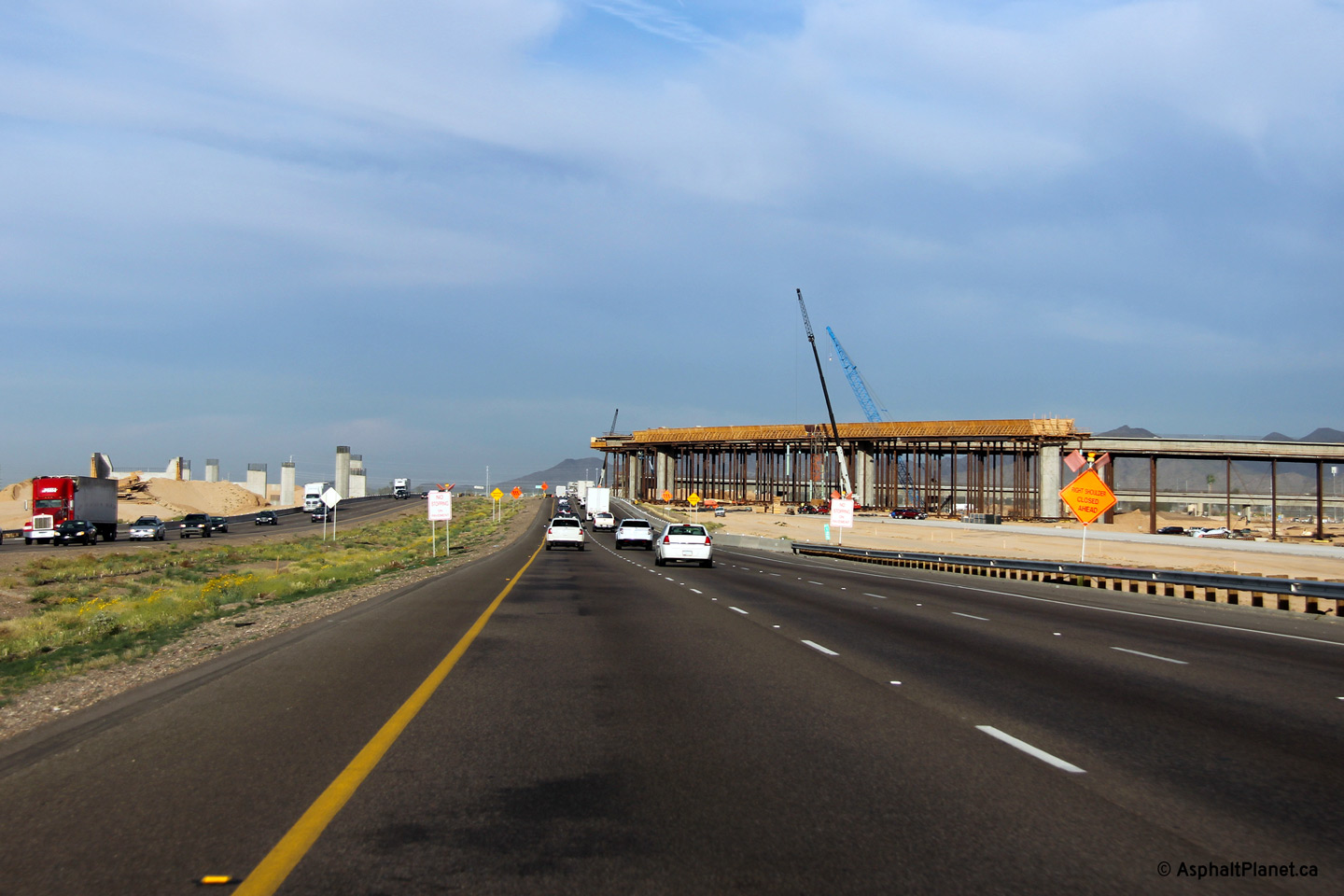
Maricopa County Goodyear |
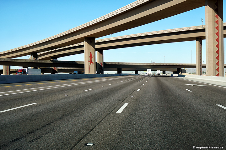
Two views looking easterly through the future Loop 303 interchange that was under construction at the time that the photos were taken. |
 |
||
| High-res: (1440x960) (2400x1600) | ||||
 |
||||
|
Date: 26/3/2013 |
High-res: (1440x960) (2400x1600) | |||
|
Maricopa County Goodyear |
This view looks northerly along Cotton Lane (which was closed to traffic when this photo was taken) towards the future stack interchange between I-10 and Loop 303. |
 |
||
|
Date: 26/3/2013 |
High-res: (1440x960) (2400x1600) | |||
|
Maricopa County Goodyear |
Two views looking westerly through the Loop 303 interchange.
Photo # 1 taken: 26/3/2013.
Photo # 2 and # 3 taken: 28/03/2018 |
 |
||
| High-res: (1440x960) (2400x1600) | ||||
 |
||||
| High-res: (1440x960) (2400x1600) | ||||
 |
||||
|
Date: as noted |
High-res: (1440x960) (2400x1600) | |||
|
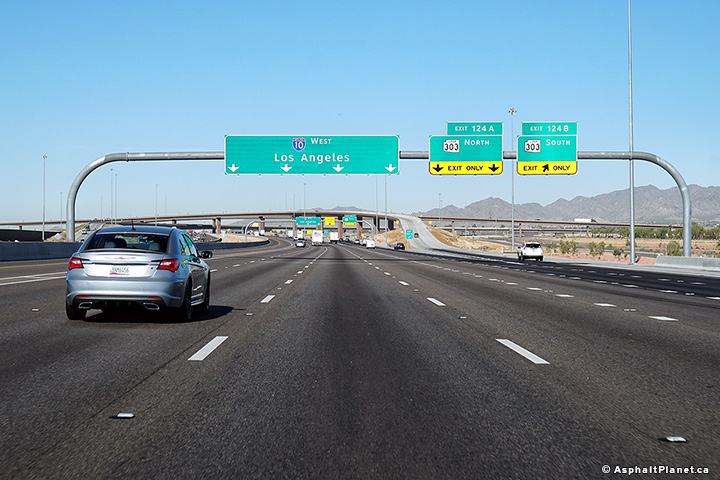
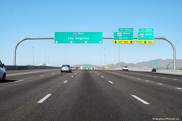
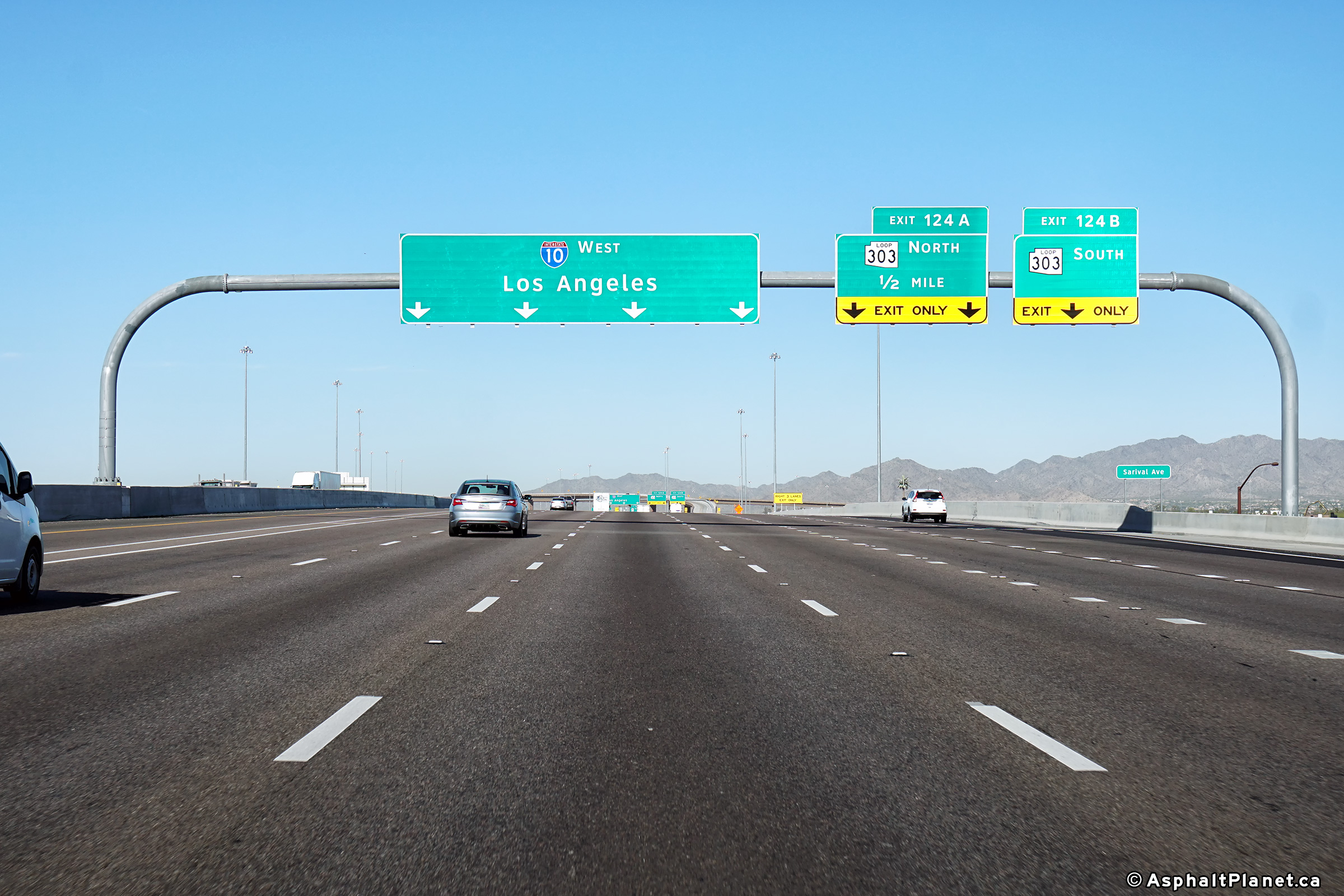
Maricopa County Goodyear |
Sigmage facing westbound motorists for the ramp to Loop 303 North. |
 |
||
|
Date: 28/3/2018 |
High-res: (1440x960) (2400x1600) | |||
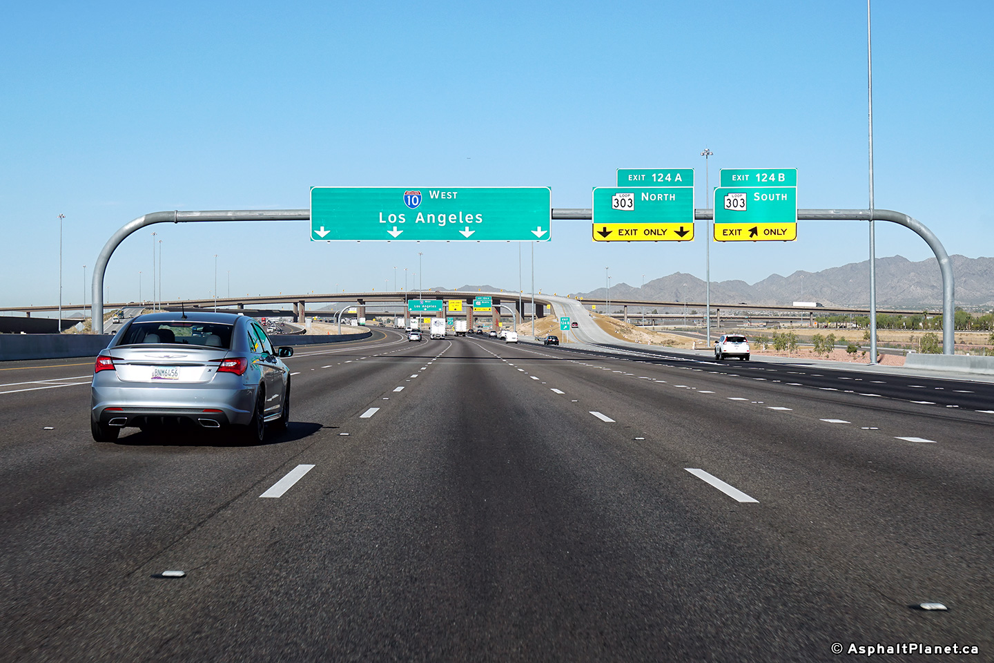
|
Maricopa County Goodyear |
View looking westerly as the ramp to Loop 303 South departs from the westbound lanes of the freeway. |
 |
||
|
Date: 28/3/2018 |
High-res: (1440x960) (2400x1600) | |||
|
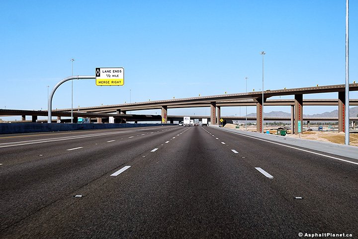
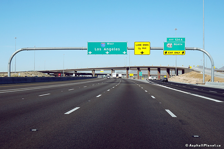
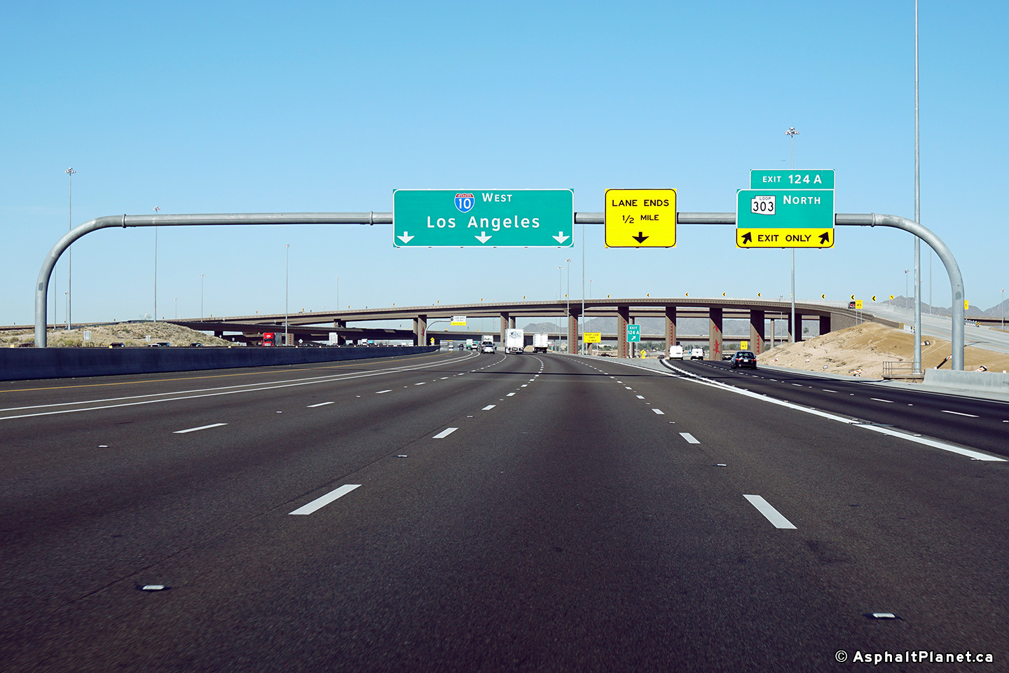
Maricopa County Goodyear |
Westbound signage in advance of the Loop 303 interchange. |
 |
||
|
Date: 28/3/2018 |
High-res: (1440x960) (2400x1600) | |||
|
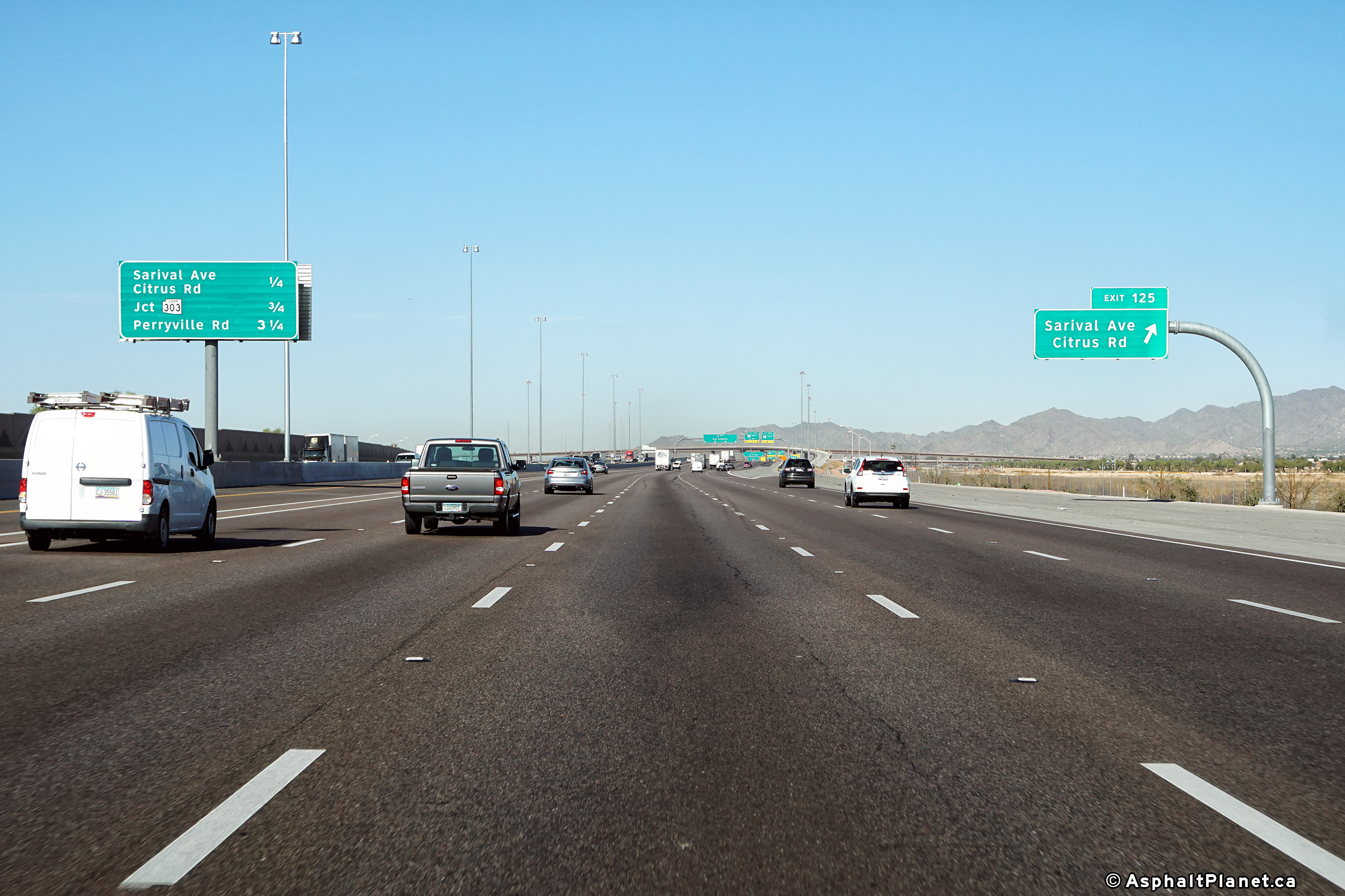
Maricopa County Goodyear |
View looking westerly approaching the off-ramp to Sarival Avenue and Cotton Lane. |
 |
||
|
Date: 28/3/2018 |
High-res: (1440x960) (2400x1600) | |||
|
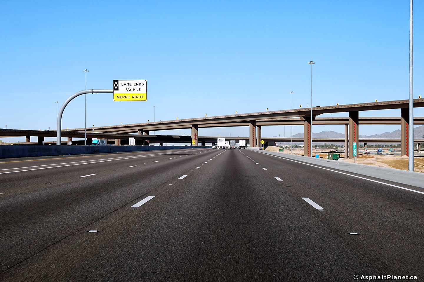
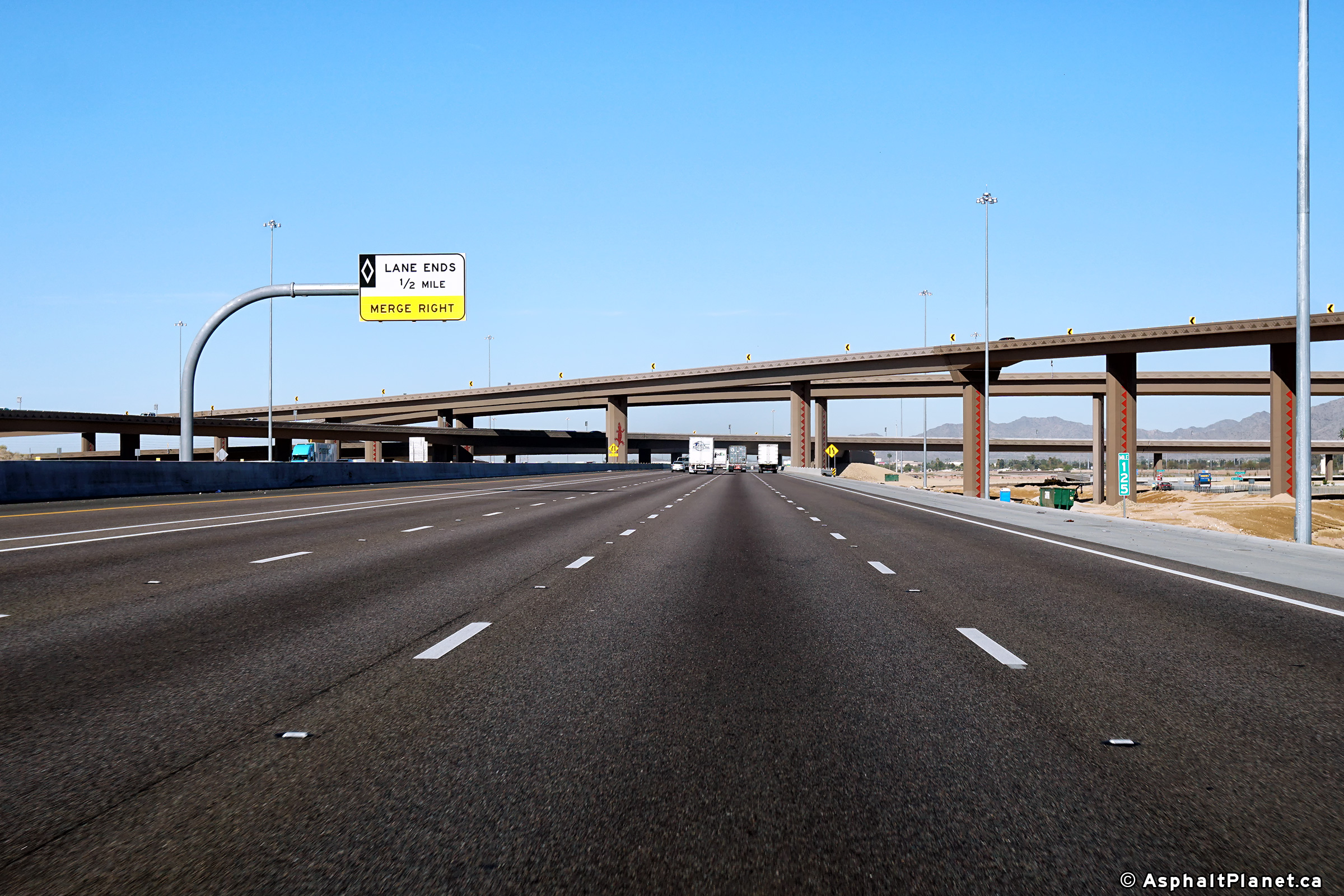
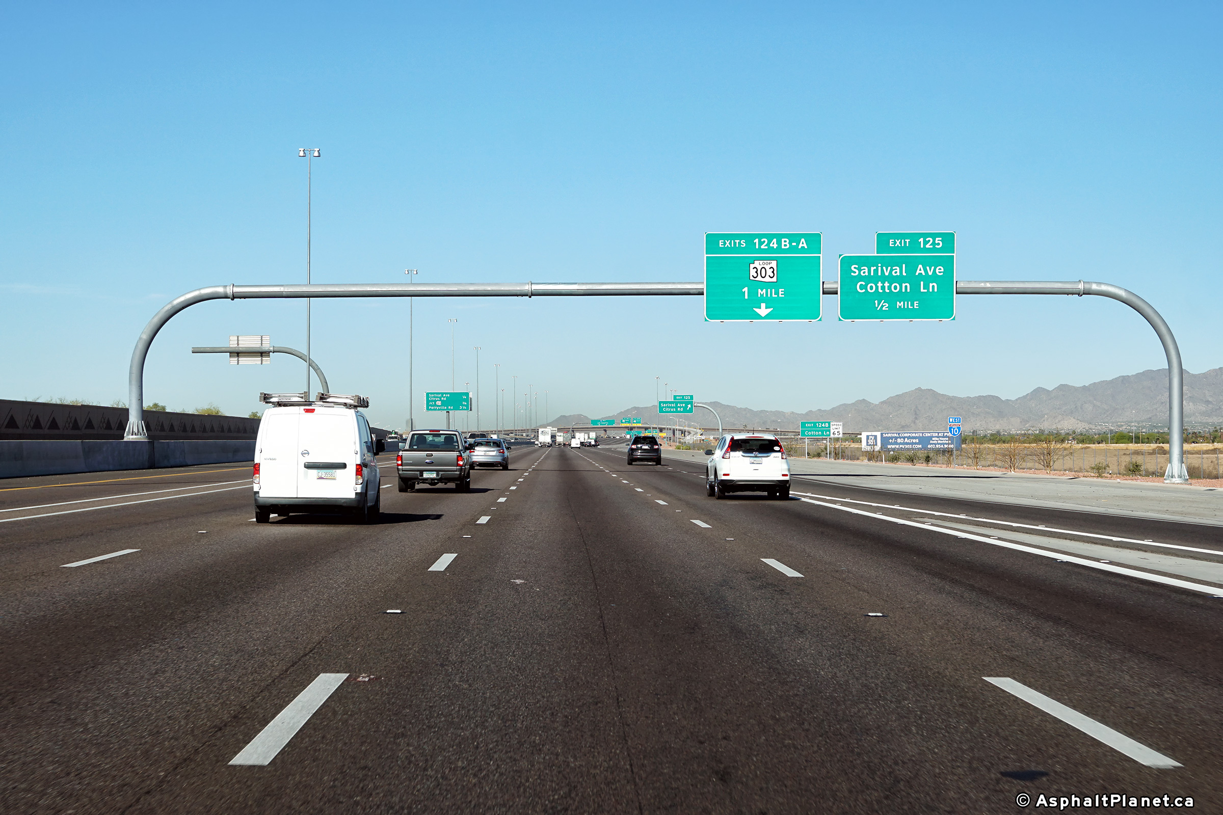
Maricopa County Goodyear |
Two views looking westerly approaching the off-ramp to Sarival Avenue and Cotton Lane.
Photo # 1 taken: 26/3/2013.
Photo # 2 taken: 28/03/2018 |
 |
||
| High-res: (1440x960) (2400x1600) | ||||
 |
||||
|
Date: 28/3/2018 |
High-res: (1440x960) (2400x1600) | |||
|
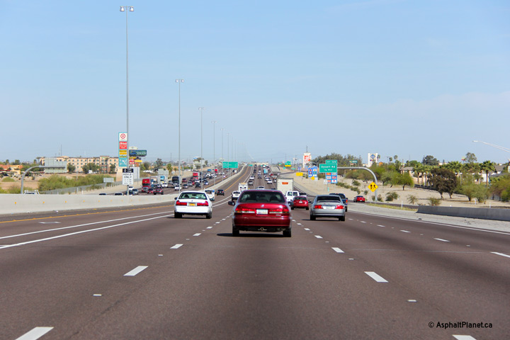
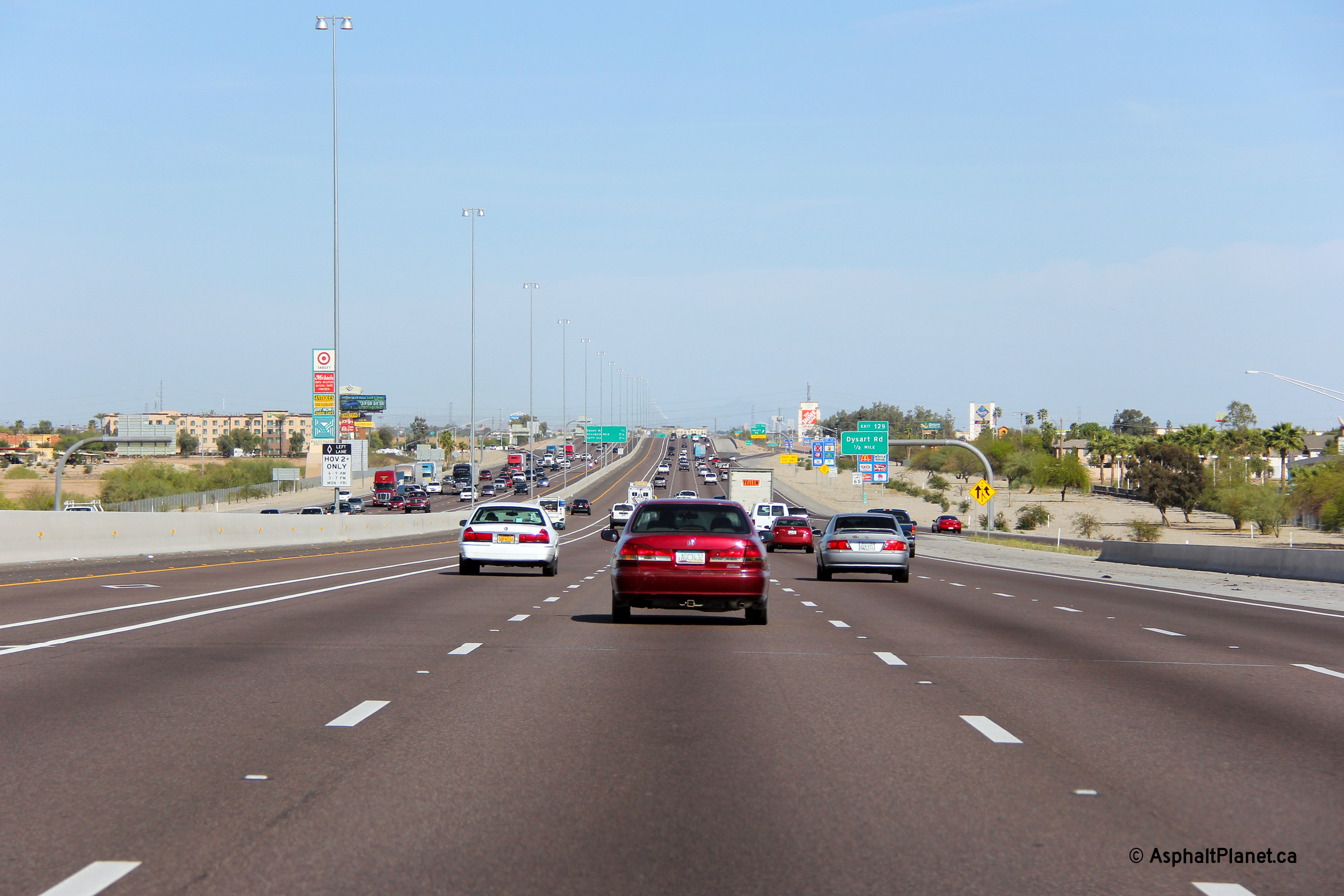
Maricopa County Avondale |
Easterly view approaching the Dysart Road interchange. |
 |
||
|
Date: 26/3/2013 |
High-res: (1440x960) (2400x1600) | |||
|
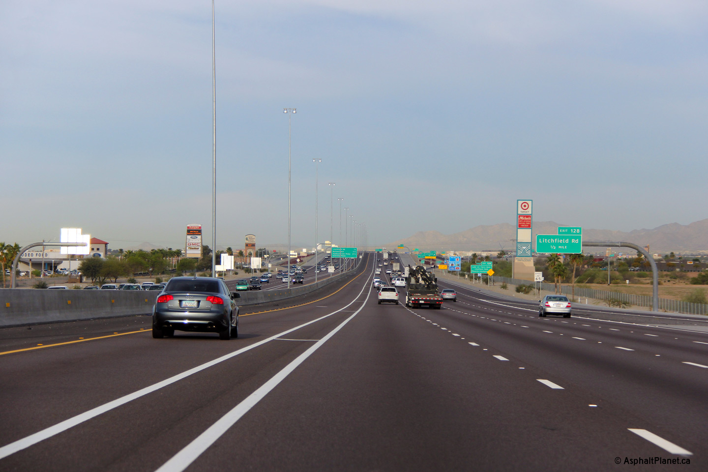
Maricopa County Avondale |
This view looks westerly towards the Litchfield Road interchange. |
 |
||
|
Date: 26/3/2013 |
High-res: (1440x960) (2400x1600) | |||
|
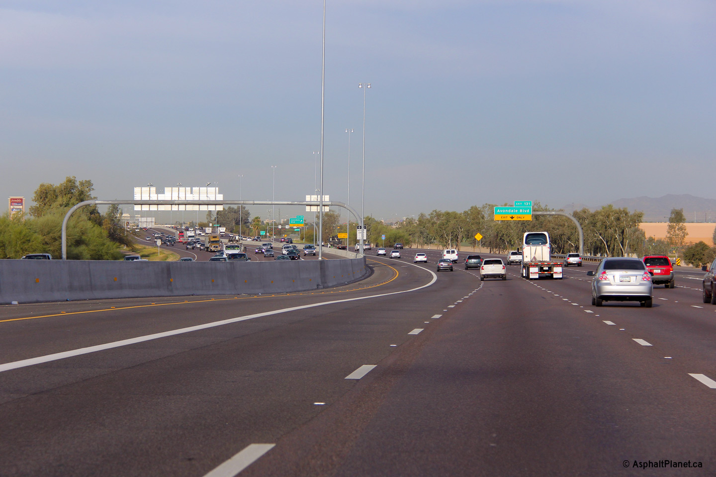
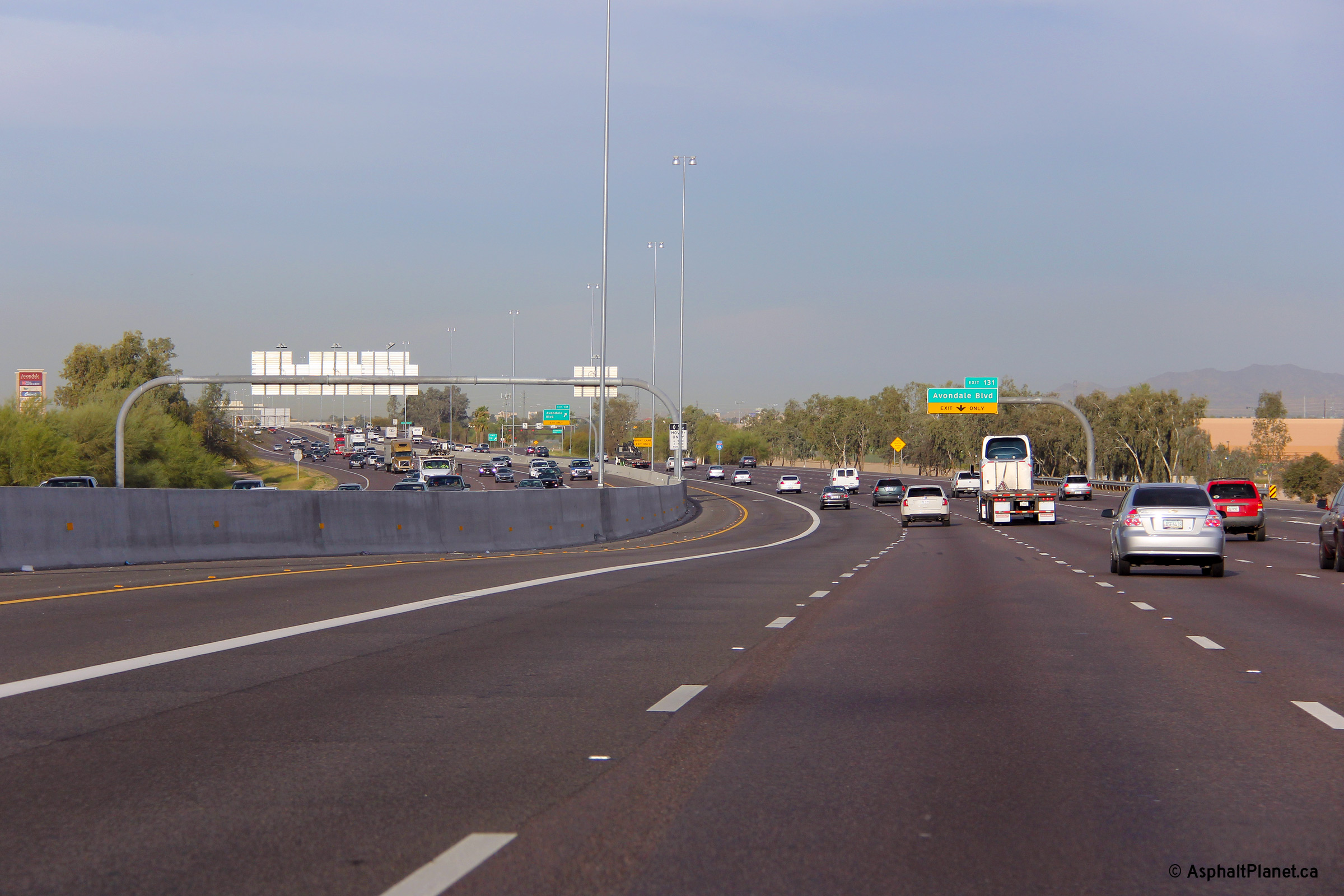
Maricopa County Avondale |
Westerly view as I-10 rounds a curve to the east of Avondale Boulevard. |
 |
||
|
Date: 26/3/2013 |
High-res: (1440x960) (2400x1600) | |||
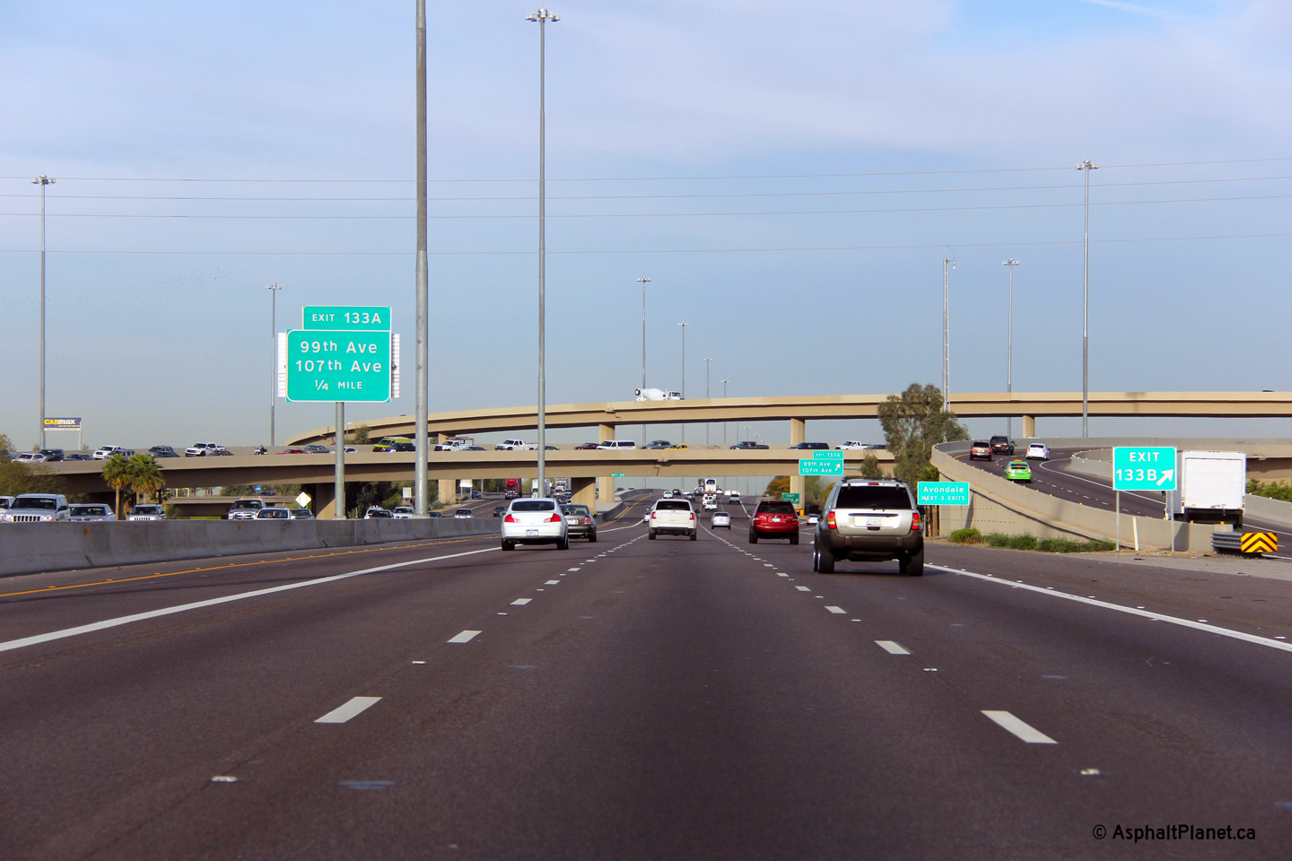
|
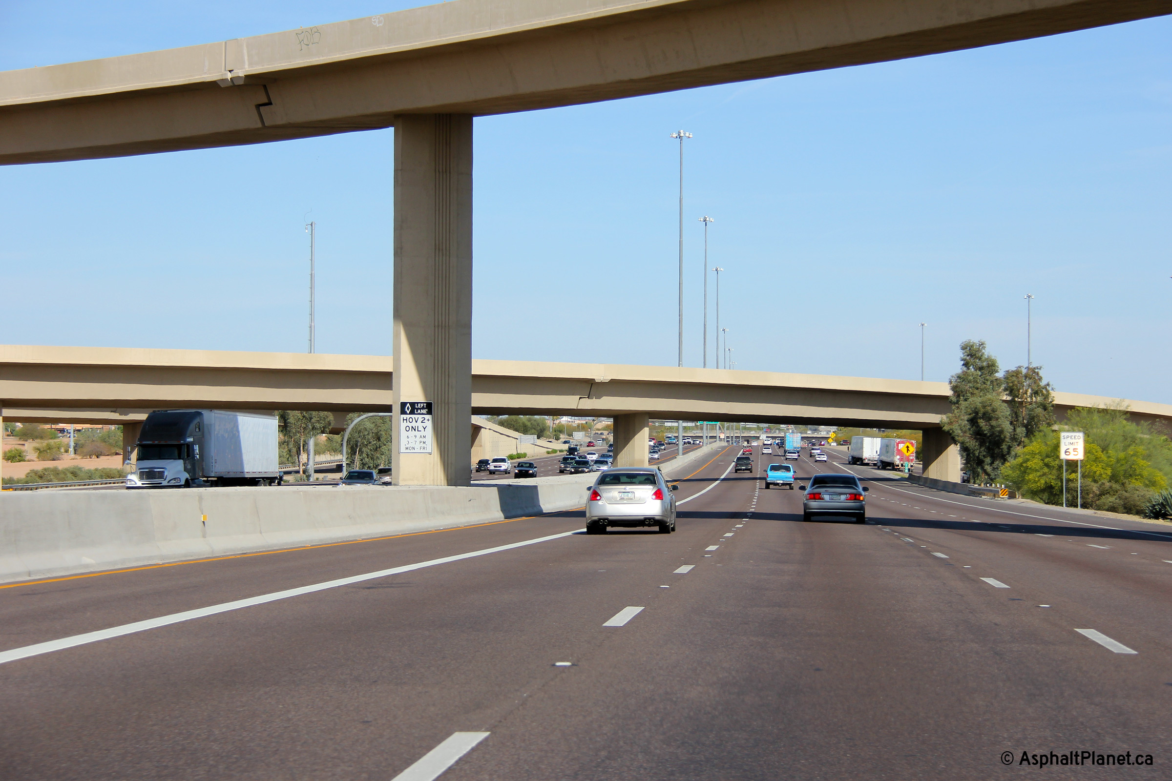
Maricopa County Avondale |
Easterly view at the off-ramp to 107th Avenue. |
 |
||
|
Date: 26/3/2013 |
High-res: (1440x960) (2400x1600) | |||
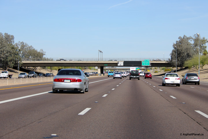
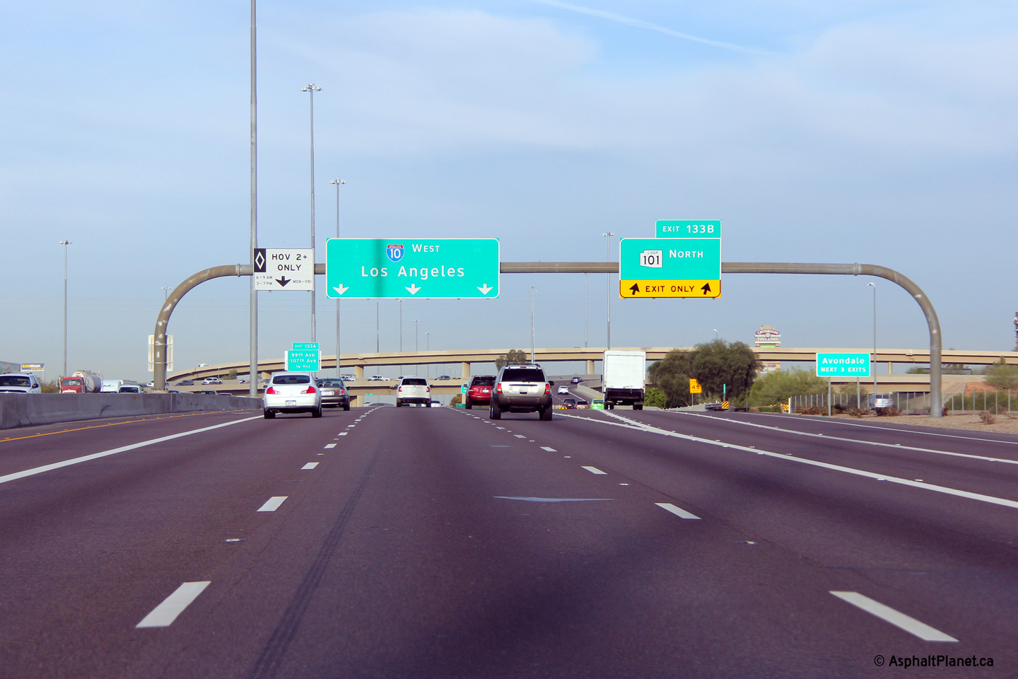
|
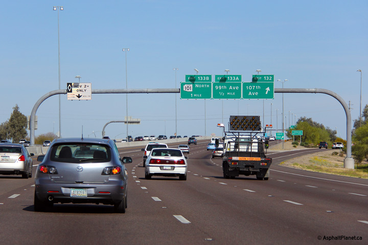
Maricopa County Tolleson |
Easterly view approaching the Loop 101 interchange along I-10. Loop 101 encircles the northern and eastern inner suburbs of Phoenix and was constructed in segments between the late 1990s and early 2000s. The interchange between I-10 and Loop 101 was completed during the early 2000s. |
 |
||
|
Date: 26/3/2013 |
High-res: (1440x960) (2400x1600) | |||
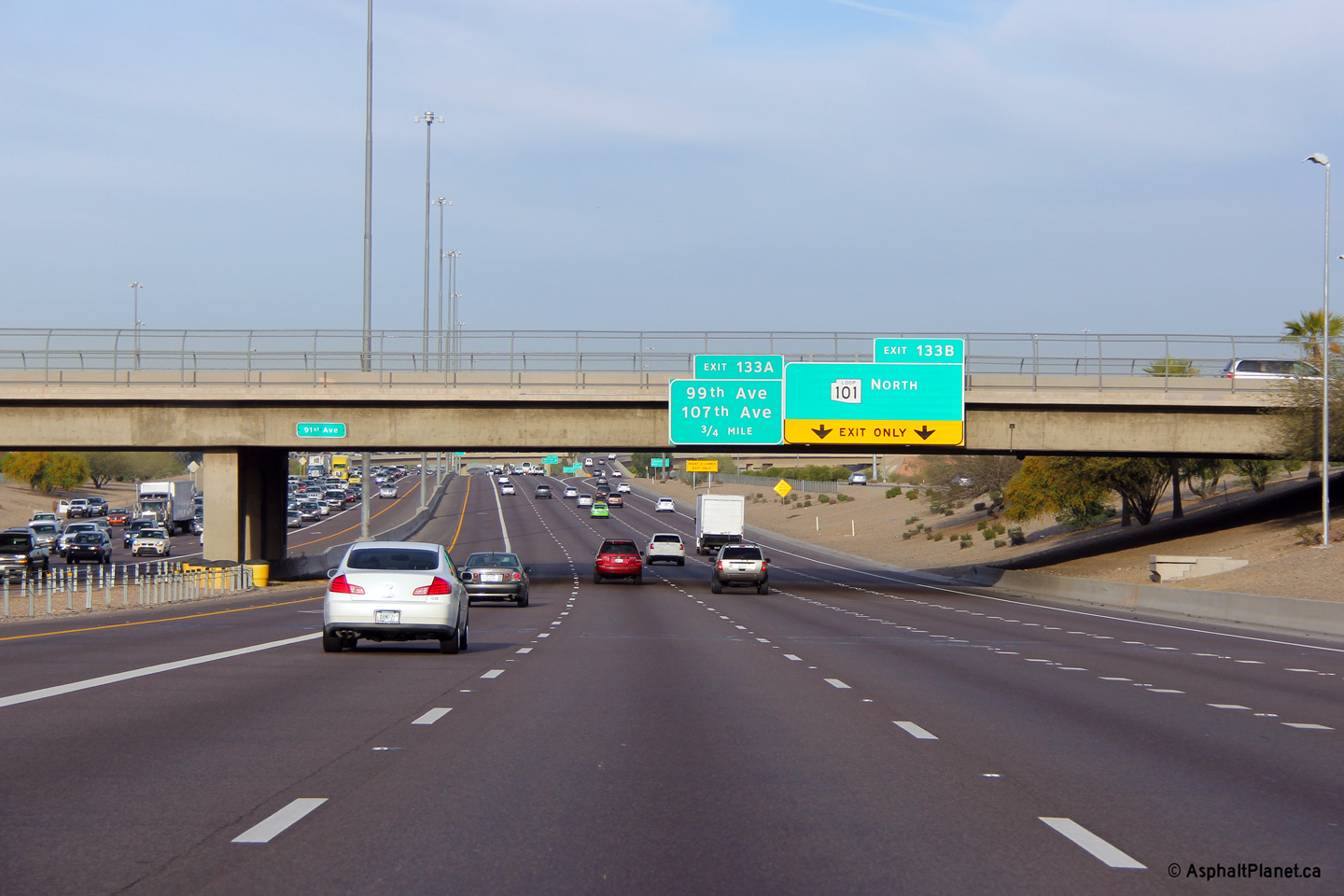
|
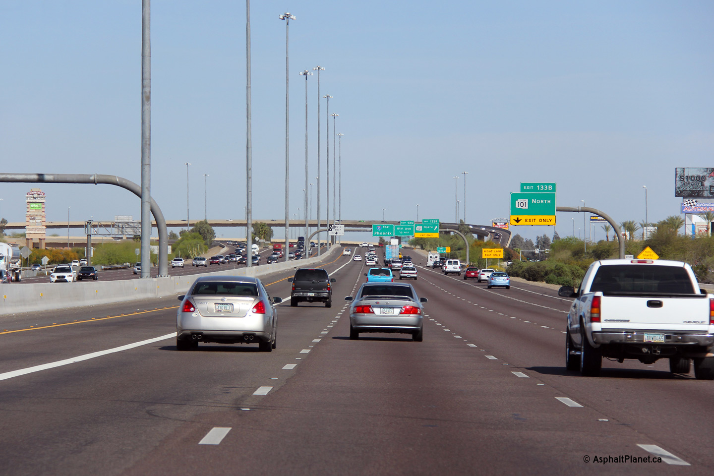
Maricopa County Tolleson |
Overhead signage for the eastbound off-ramp to Loop 101. Surprisingly, the eastbound off-ramp and associated fly-over linking I-10 to Loop 101 has only a single lane. |
 |
||
|
Date: 26/3/2013 |
High-res: (1440x960) (2400x1600) | |||
|
Maricopa County Tolleson |
The eastbound off-ramp to 91st Avenue is situated beneath the high-speed flyovers that link Loop 101 with I-10. |
 |
||
|
Date: 26/3/2013 |
High-res: (1440x960) (2400x1600) | |||
|
Maricopa County Tolleson |
View looking easterly through the flyover ramps that link Loop 101 and Interstate 10. The interchange between Loop 101 and I-10 is one of the Phoenix area's simplest freeway to freeway interchanges. Unlike most of Phoenix's other urban freeway interchanges, no space was reserved for direct ramps between the HOV lanes on the two freeways. |
 |
||
|
Date: 26/3/2013 |
High-res: (1440x960) (2400x1600) | |||
|
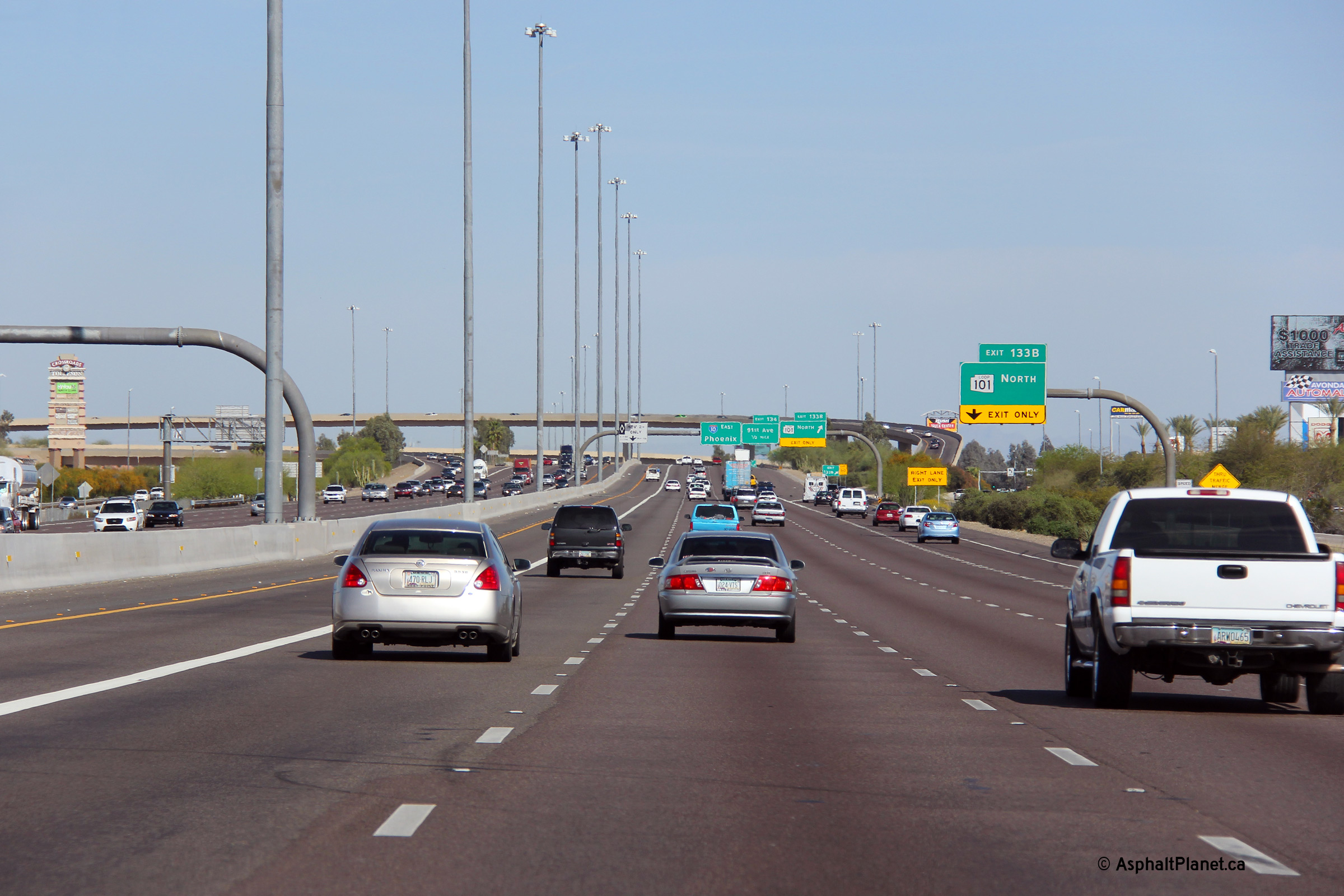
Maricopa County Tolleson |
View looking westerly through the Loop 101/I-10 interchange. Note the heavy eastbound traffic -- this photo was taken during a typical weekday morning rush hour. |
 |
||
|
Date: 26/3/2013 |
High-res: (1440x960) (2400x1600) | |||
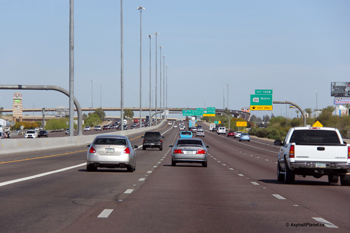
|
Maricopa County Tolleson |
Overhead signage for the westbound off-ramp to Loop 101. |
 |
||
|
Date: 26/3/2013 |
High-res: (1440x960) (2400x1600) | |||
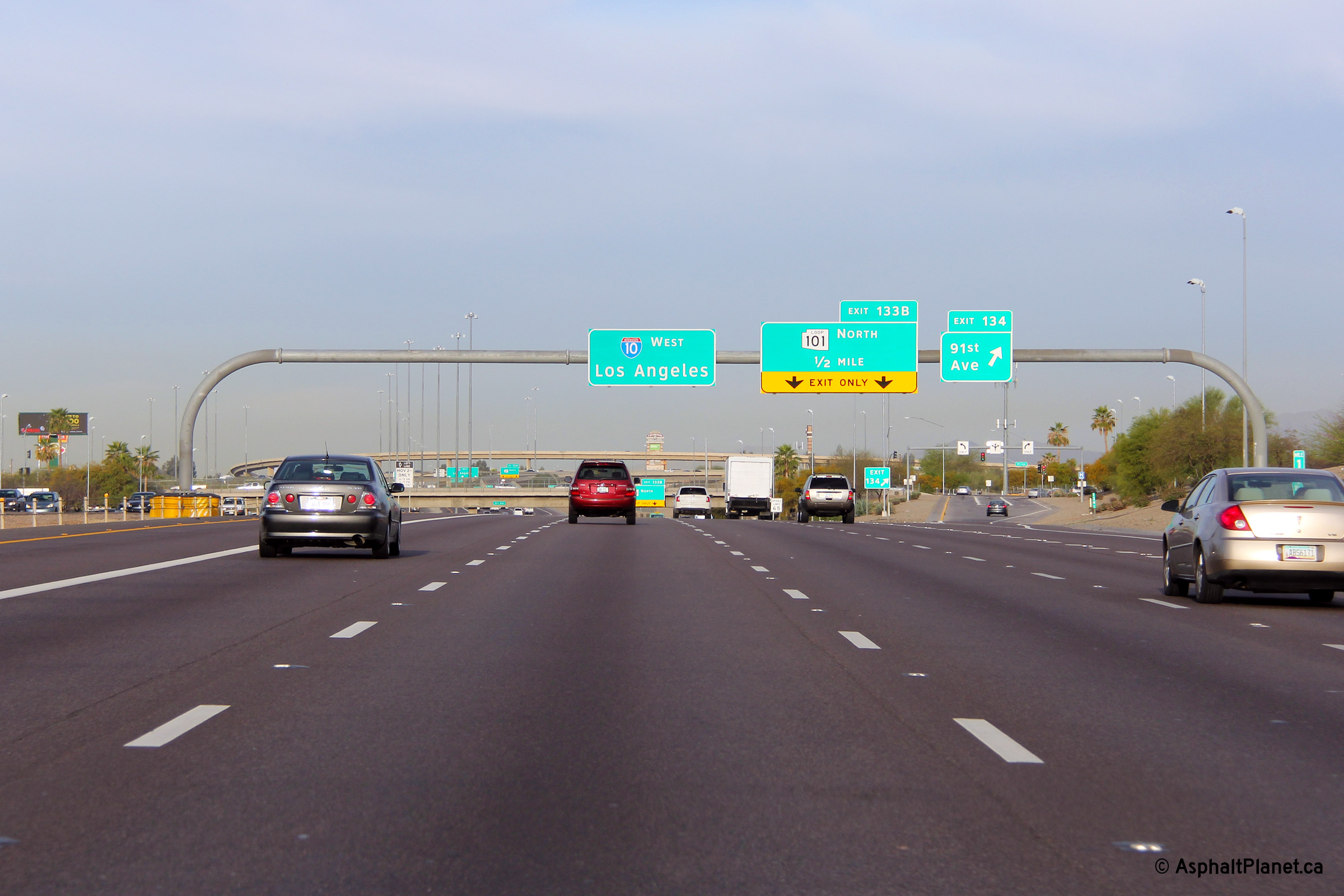
|
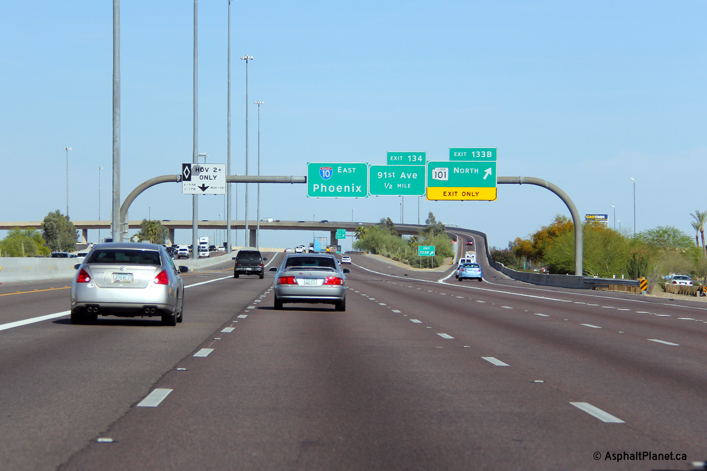
Maricopa County Tolleson |
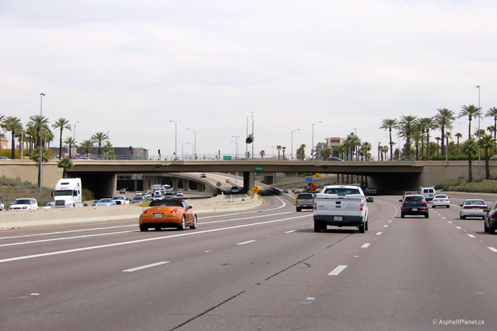
Two views at the 91st Avenue overpass looking west. Heading west, the wide depressed median that extends westerly from Central Phoenix along the Papago Freeway (I-10) narrows to a concrete wall at 91st Street. The depressed median along I-10 through Western Phoenix will eventually house a rapid transit line that is proposed. |
 |
||
| High-res: (1440x960) (2400x1600) | ||||
 |
||||
|
Date: 26/3/2013 |
High-res: (1440x960) (2400x1600) | |||
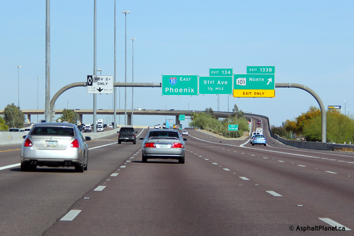
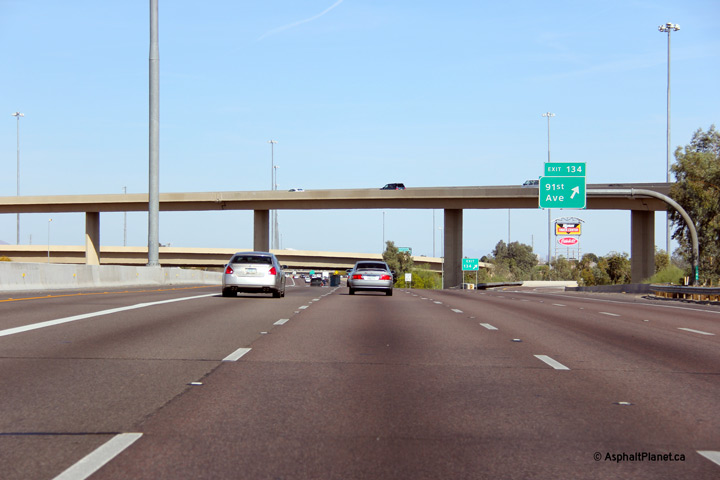
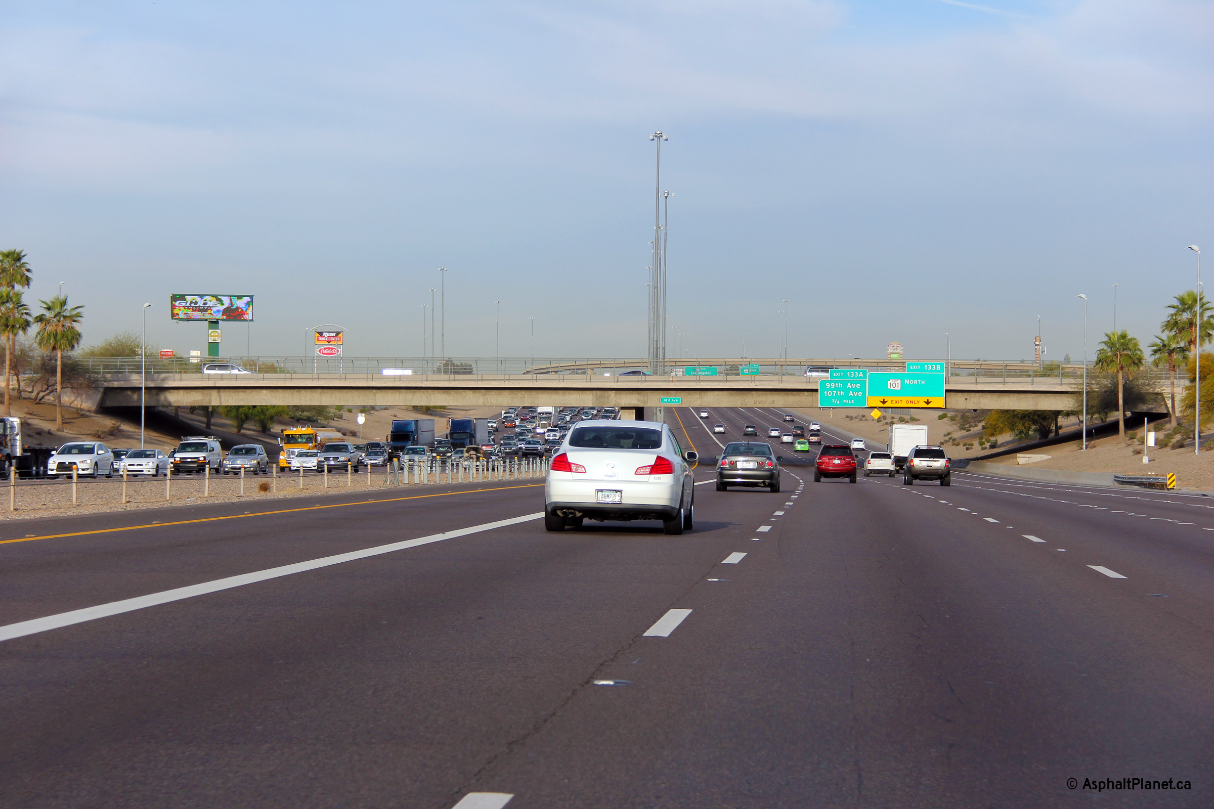
|
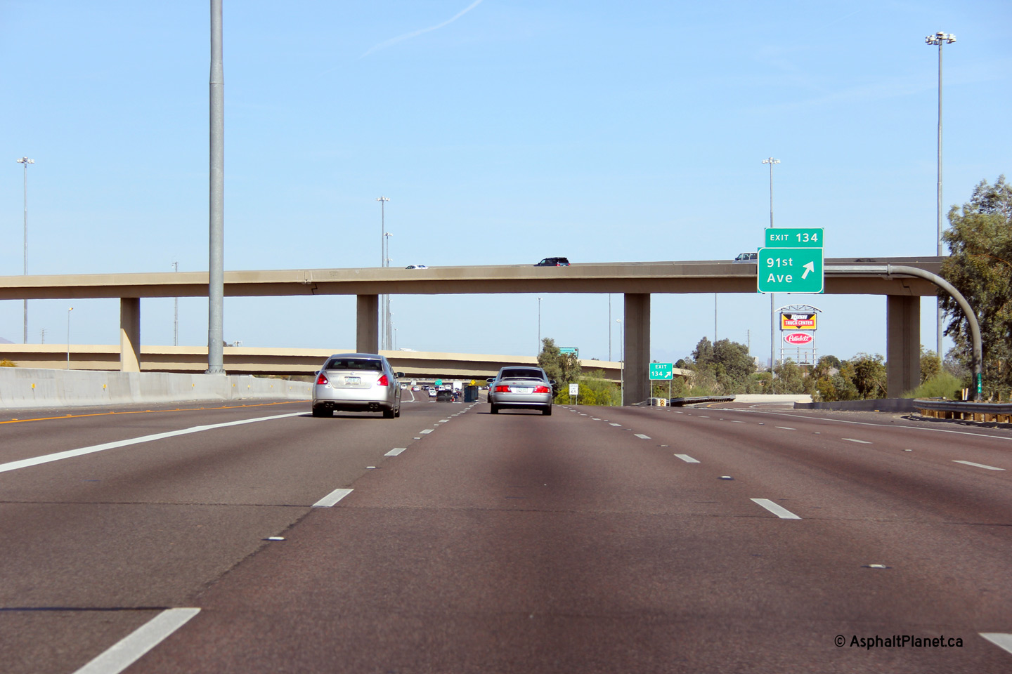
Maricopa County Tolleson |
Overhead signage at the off-ramp to 91st Avenue. The three level interchange with I-10 and Loop 101 can be seen in the distance. |
 |
||
|
Date: 26/3/2013 |
High-res: (1440x960) (2400x1600) | |||
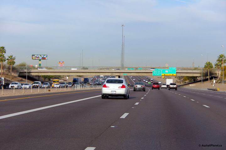
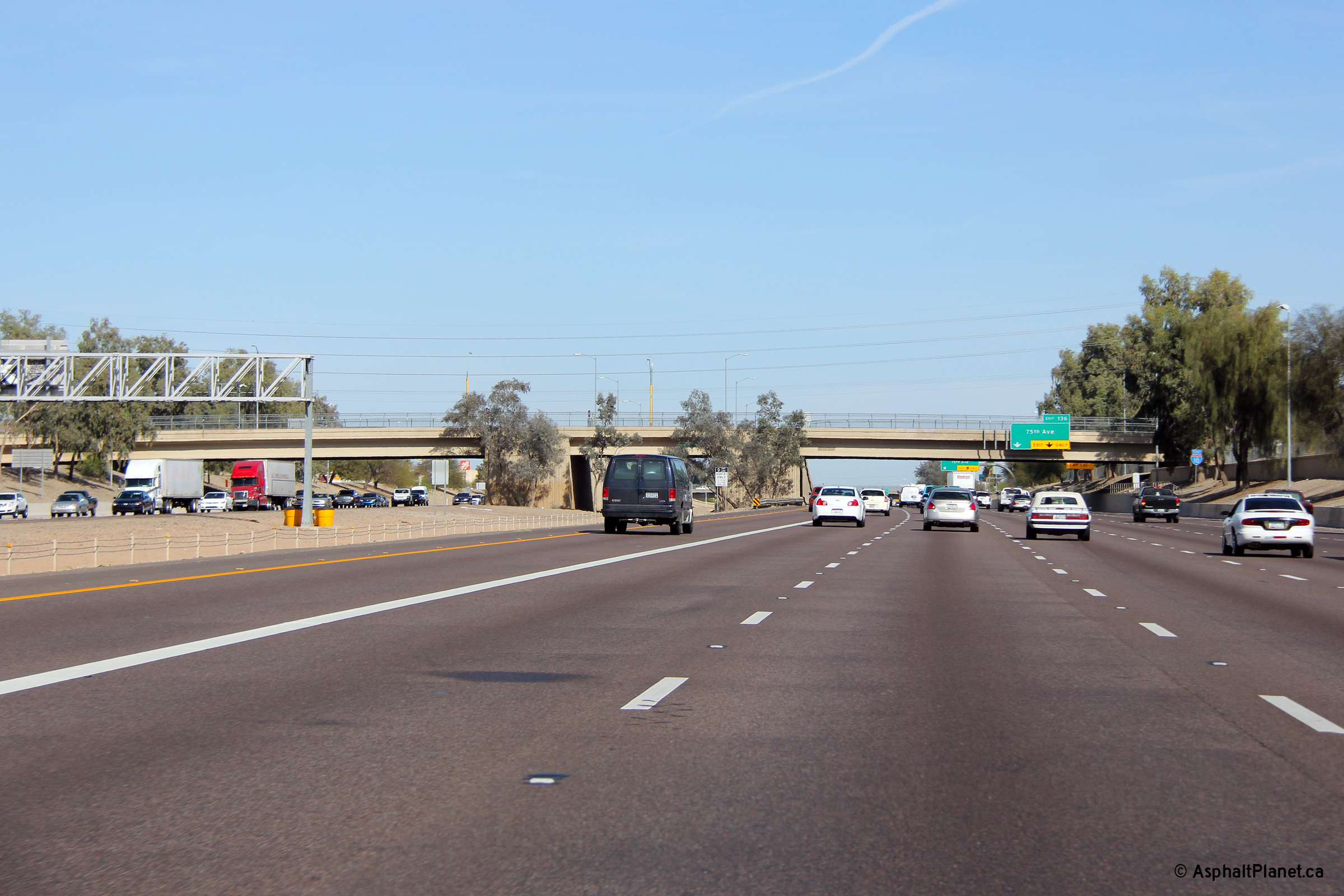
|
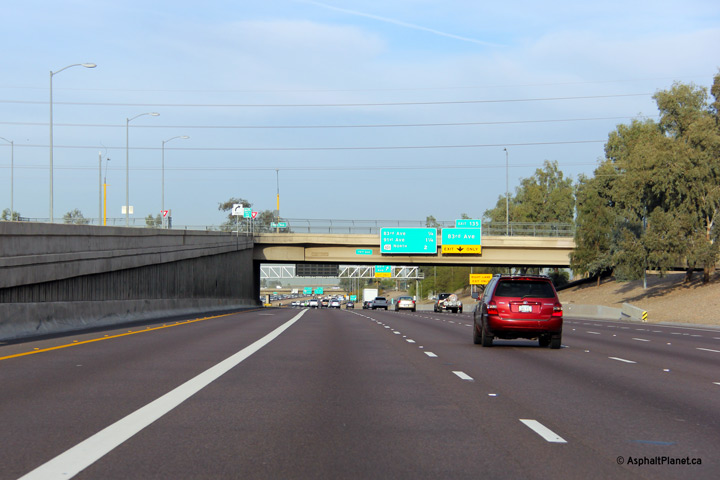
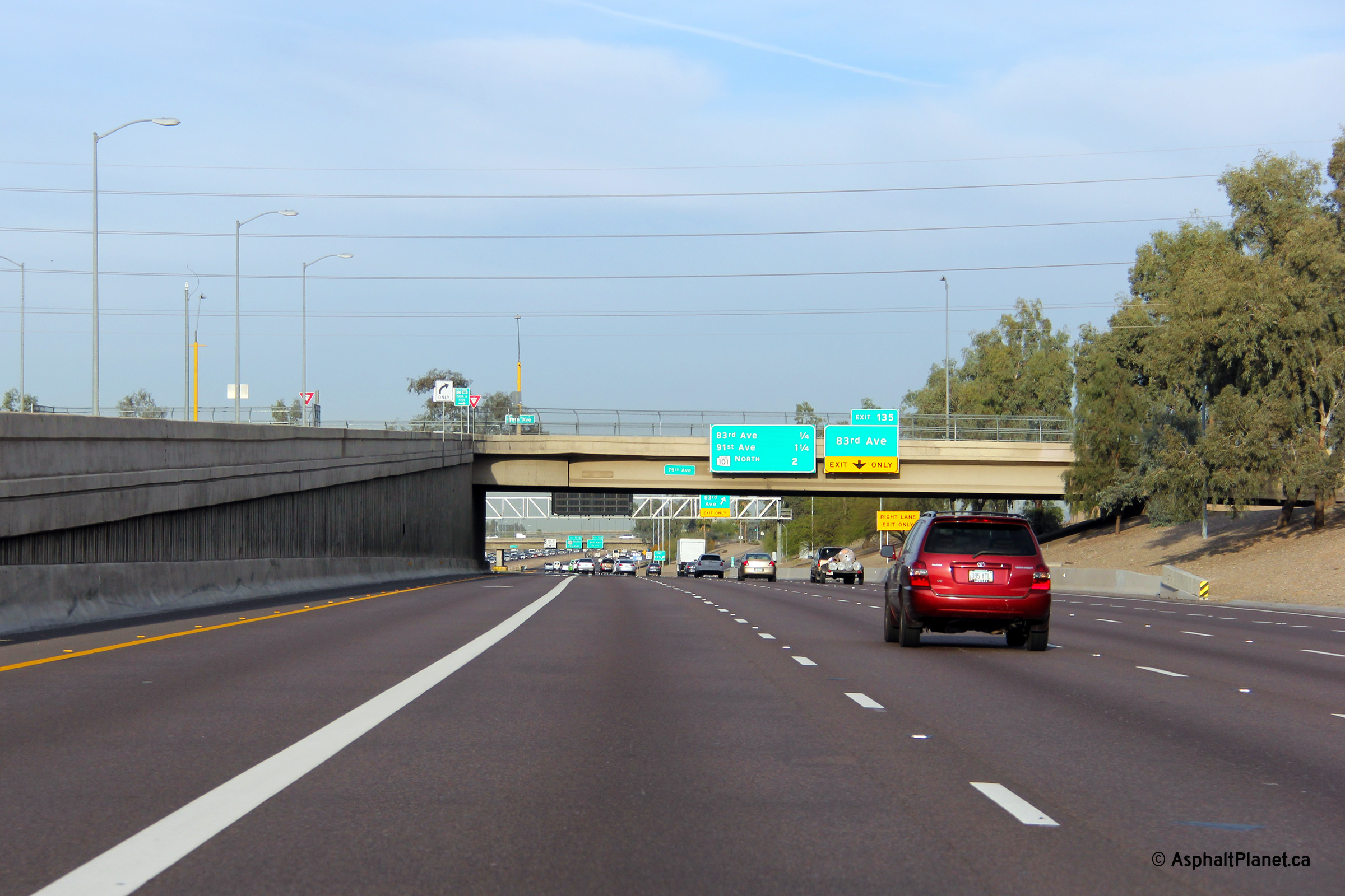
Maricopa County Phoenix |
Two views looking easterly through the 79th Avenue overpass. The unused central span between the HOV lane on and off-ramps will one day house a rapid transit line that will run through the median of I-10. |
 |
||
| High-res: (1440x960) (2400x1600) | ||||
 |
||||
|
Date: 26/3/2013 |
High-res: (1440x960) (2400x1600) | |||
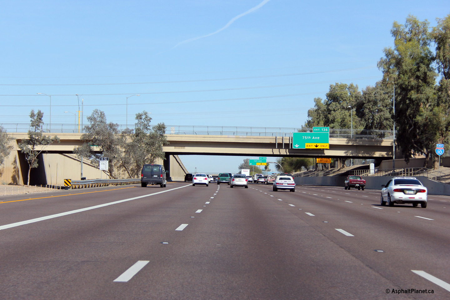
|
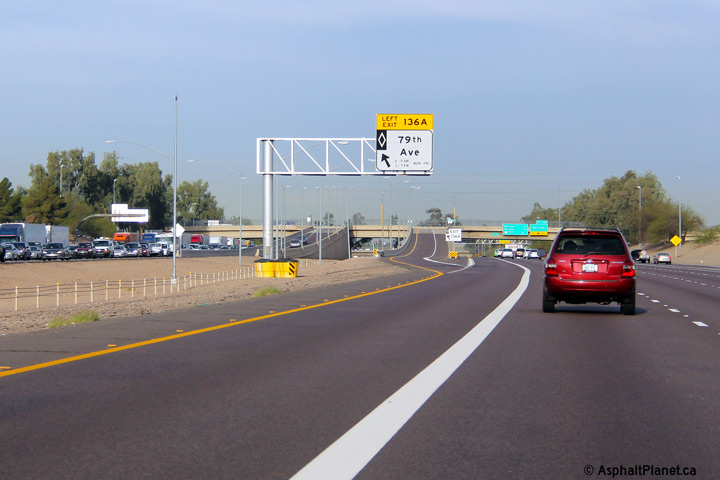
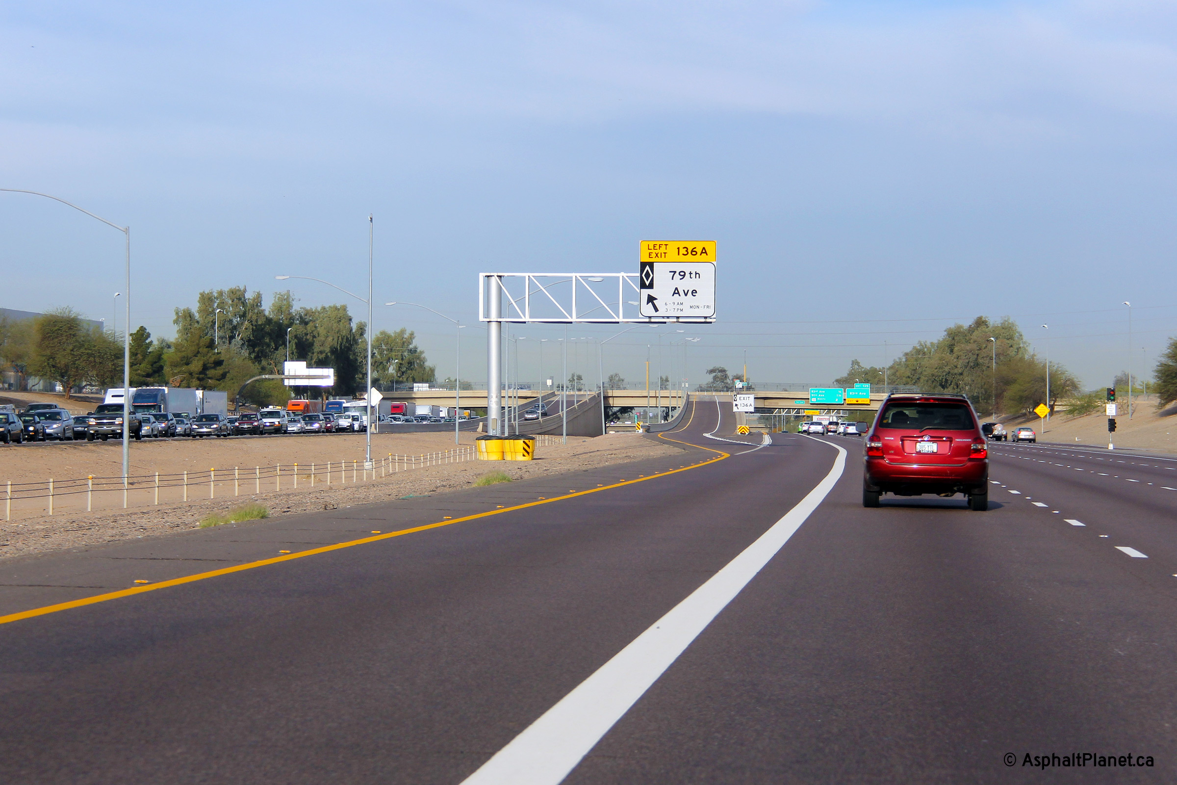
Maricopa County Phoenix |
View looking westerly approaching the 79th Avenue overpass. The exit lane from the HOV lane to 79th Avenue can be seen on the left. |
 |
||
|
Date: 26/3/2013 |
High-res: (1440x960) (2400x1600) | |||
|
Maricopa County Phoenix |
Signage for the HOV lane exit to 79th Avenue. |
 |
||
|
Date: 26/3/2013 |
High-res: (1440x960) (2400x1600) | |||
|
Maricopa County Phoenix |
Easterly view as I-10 passes beneath the 67th Avenue overpass. A changeable message sign has been affixed to the 67th Avenue overpass. |
 |
||
|
Date: 26/3/2013 |
High-res: (1440x960) (2400x1600) | |||
|
Maricopa County Phoenix |
Another easterly view, this time through the 63rd Avenue overpass. |
 |
||
|
Date: 26/3/2013 |
High-res: (1440x960) (2400x1600) | |||
|
Maricopa County Phoenix |
This view looks easterly through the 51st Avenue overpass. The taupe coloured sealant that has been applied to the structures along I-10 through Metro Phoenix greatly improves the highway's aesthetics. I-10 was not completed through western Phoenix until the mid 1980s. |
 |
||
|
Date: 26/3/2013 |
High-res: (1440x960) (2400x1600) | |||
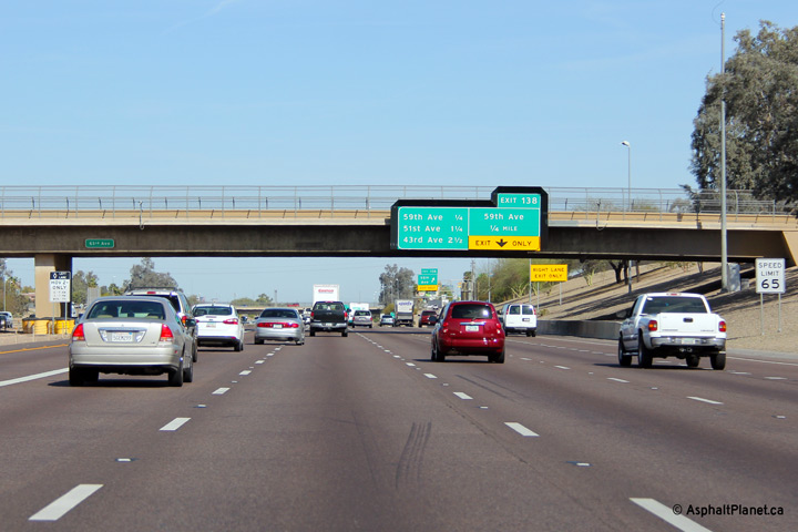
|
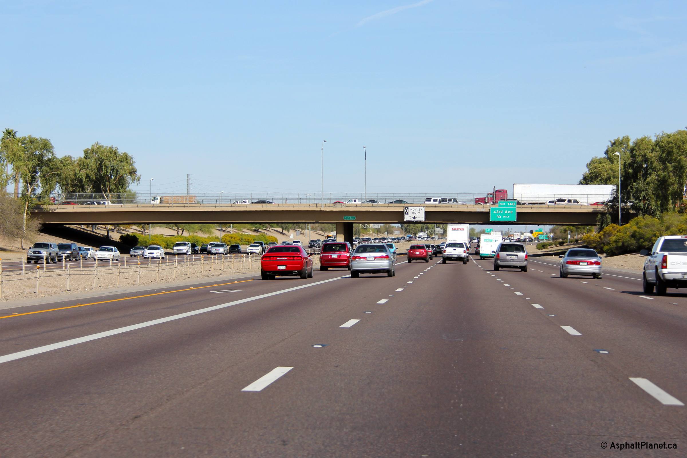
Maricopa County Phoenix |
View looking easterly at the 43rd Avenue overpass. |
 |
||
|
Date: 26/3/2013 |
High-res: (1440x960) (2400x1600) | |||
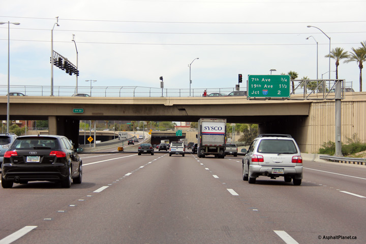
|
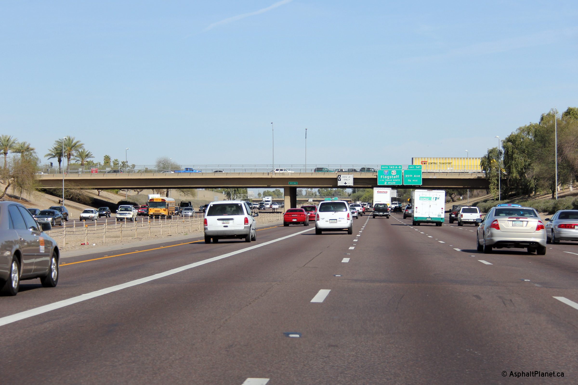
Maricopa County Phoenix |
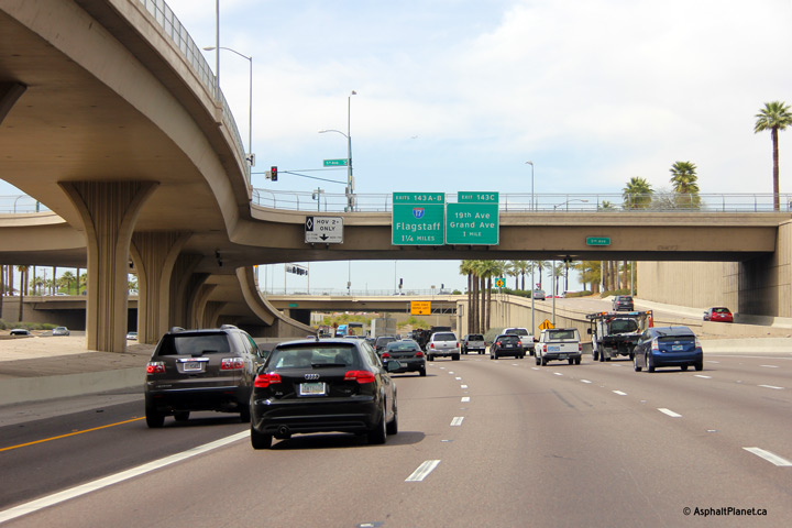
Eastbound signage in advance of the I-17 interchange. |
 |
||
|
Date: 26/3/2013 |
High-res: (1440x960) (2400x1600) | |||
|
Maricopa County Phoenix |
This eastbound view through the 31st Avenue overpass. I-10 has an impressive cross-section beneath the 31st Avenue overpass. |
 |
||
|
Date: 26/3/2013 |
High-res: (1440x960) (2400x1600) | |||
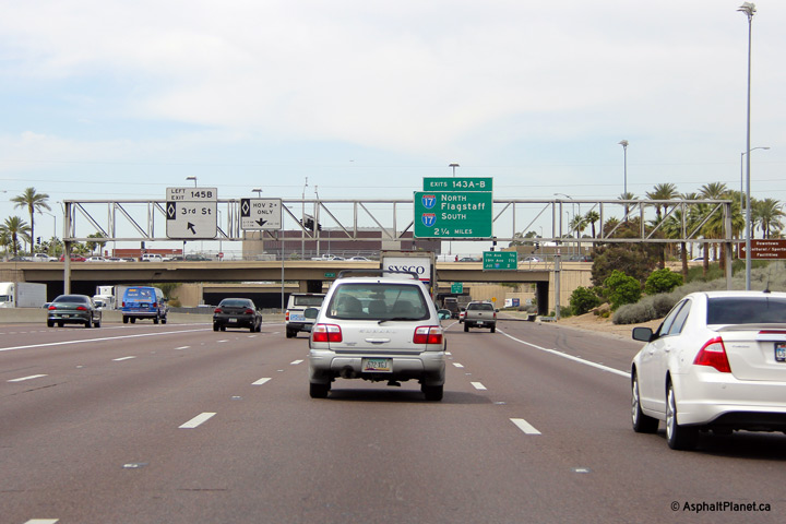
|
Maricopa County Phoenix |
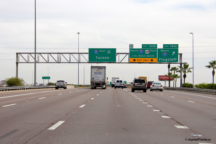
Eastbound view at the off-ramp to I-17 North from I-10. Surprisingly, the high-speed flyover that links I-10 East to I-17 North is only a single lane wide. The interchange between I-10 and I-17 is locally known as "the Stack". |
 |
||
|
Date: 26/3/2013 |
High-res: (1440x960) (2400x1600) | |||
|
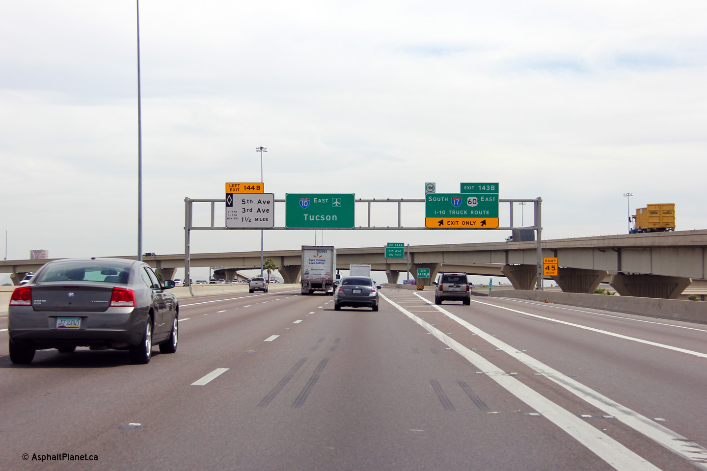
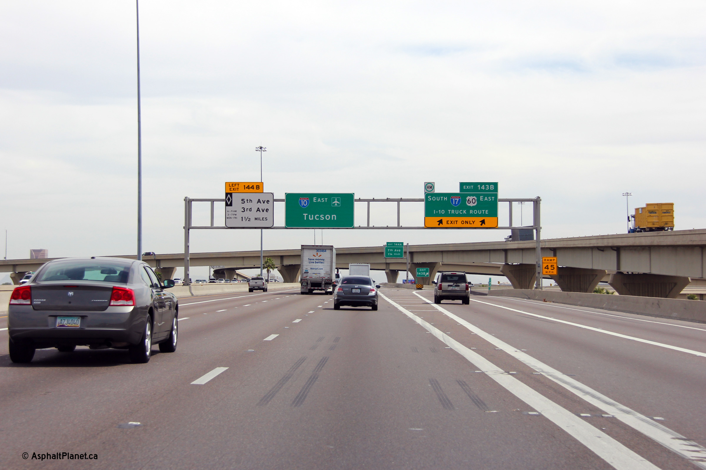
Maricopa County Phoenix |
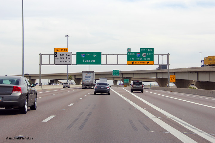
Overhead signage for the eastbound off-ramp to I-17 South. Vehicles carrying hazardous cargo are directed onto I-17 at this interchange. Signs direct vehicles carrying hazardous material away from the Papago Freeway Tunnel which carries I-10 beneath Margaret T. Hance Park in Central Phoenix. |
 |
||
|
Date: 26/3/2013 |
High-res: (1440x960) (2400x1600) | |||
| Interstate 17 is the main north-south freeway through the Phoenix Metro. It is known as the Black Canyon Freeway through the city. Click here for Interstate 17 images. | ||||
|
Maricopa County Phoenix |
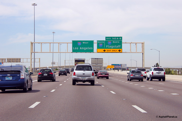
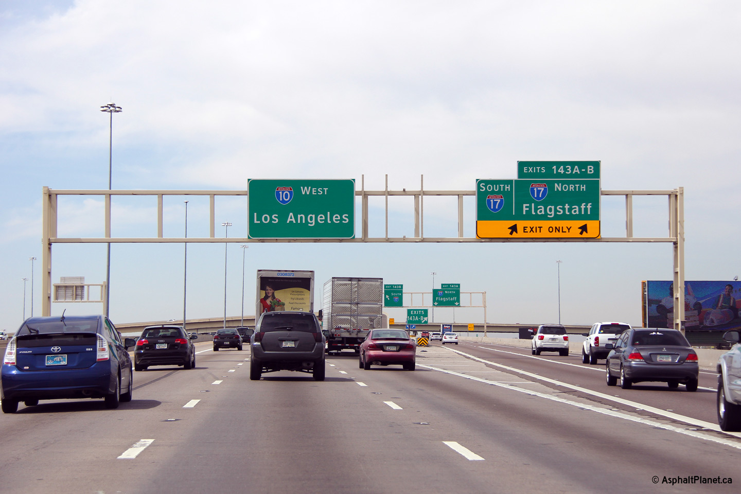
Westbound signage at the ramp to I-17 from I-10. |
 |
||
|
Date: 26/3/2013 |
High-res: (1440x960) (2400x1600) | |||
|
Maricopa County Phoenix |
Southbound turn-off signage at the ramp to US-60 West. US-60 East follows I-17 southerly through Central Phoenix, until I-10 where it later branches off on its own freeway alignment through Phoenix's eastern suburbs. |
 |
||
|
Date: 26/3/2013 |
High-res: (1440x960) (2400x1600) | |||
|
Maricopa County Phoenix |
Northbound view through the Grant Street overpass. One would think that that what appears to be white paint on the hazard makers of the bridge abutment and pier were originally painted yellow and have since faded.. |
 |
||
|
Date: 26/3/2013 |
High-res: (1440x960) (2400x1600) | |||
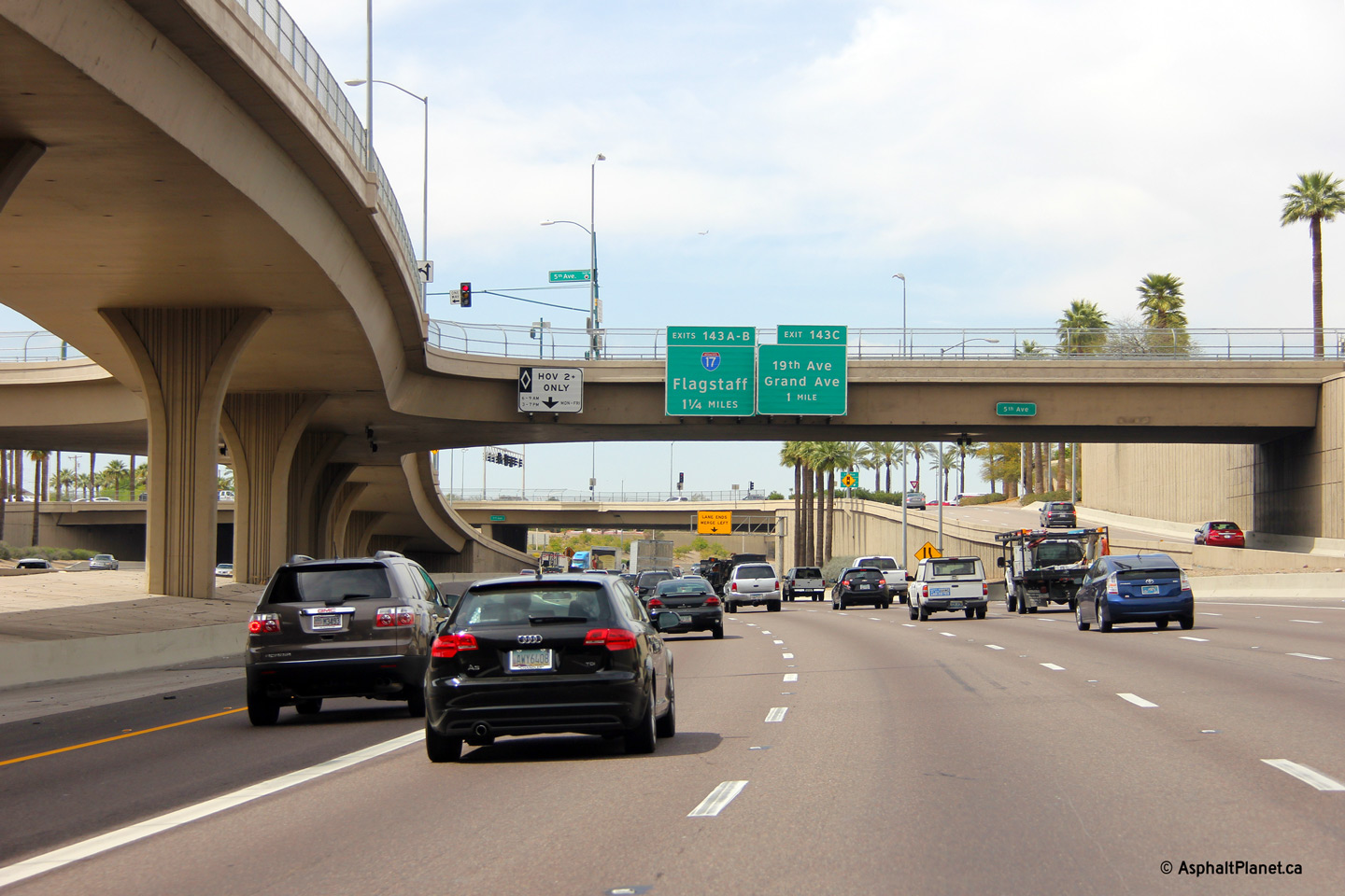
|
Maricopa County Phoenix |
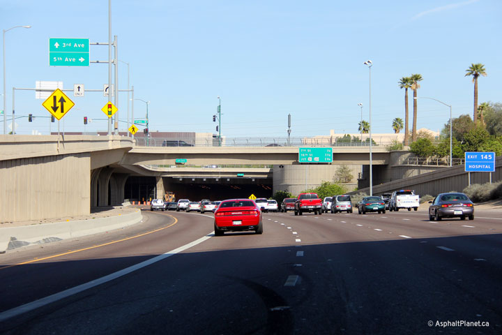
Easterly view approaching the Papago Freeway tunnel at the Fifth Avenue overpass. I-10 was completed through the Papago Tunnel in 1990. Engineers paid careful attention to the highways aesthetics when this section of roadway was complete. Structures were built with clean lines and decorative piers while vertical concrete walls were embossed with a decorative striped pattern throughout. |
 |
||
|
Date: 26/3/2013 |
High-res: (1440x960) (2400x1600) | |||
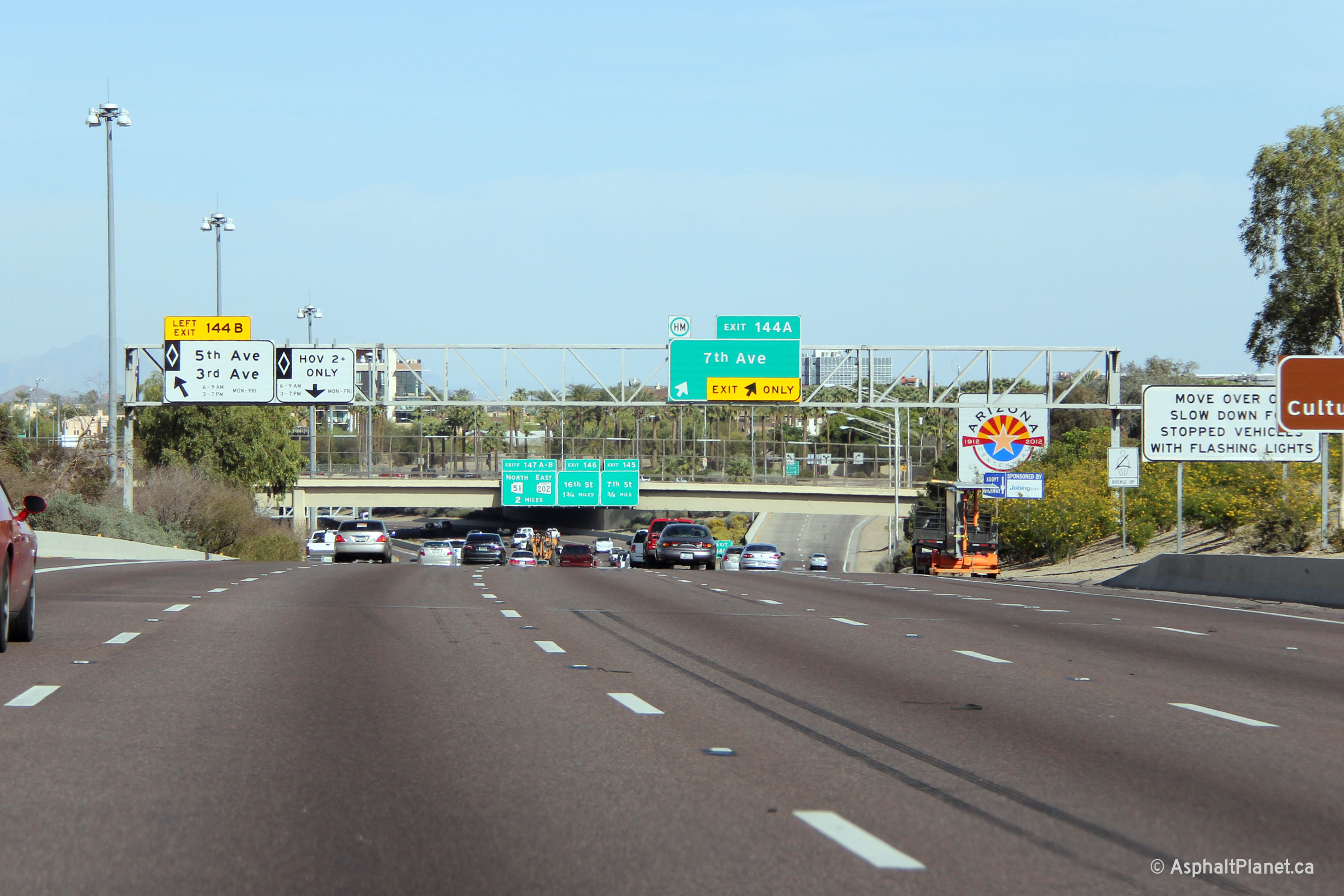
|
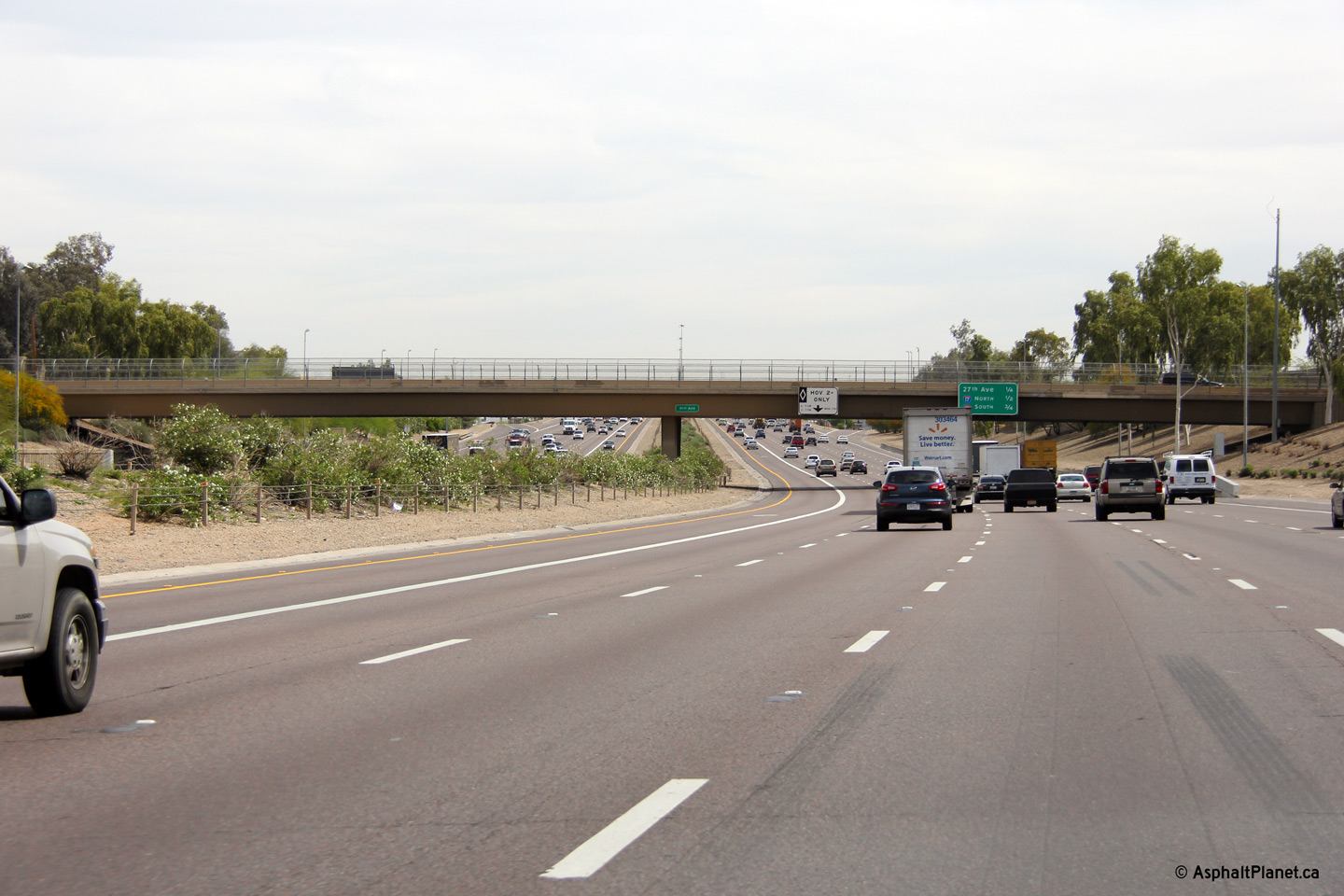
Maricopa County Phoenix |
Westbound view just beyond the Papago Freeway Tunnel along I-10. A direct connection to I-10's HOV lanes begins at Third Avenue (the western limits of Margarat T. Hance Park) and intersects with Fifth Avenue overtop of the freeway before merging with the HOV lanes beneath the Seventh Avenue overpass. |
 |
||
|
Date: 26/3/2013 |
High-res: (1440x960) (2400x1600) | |||
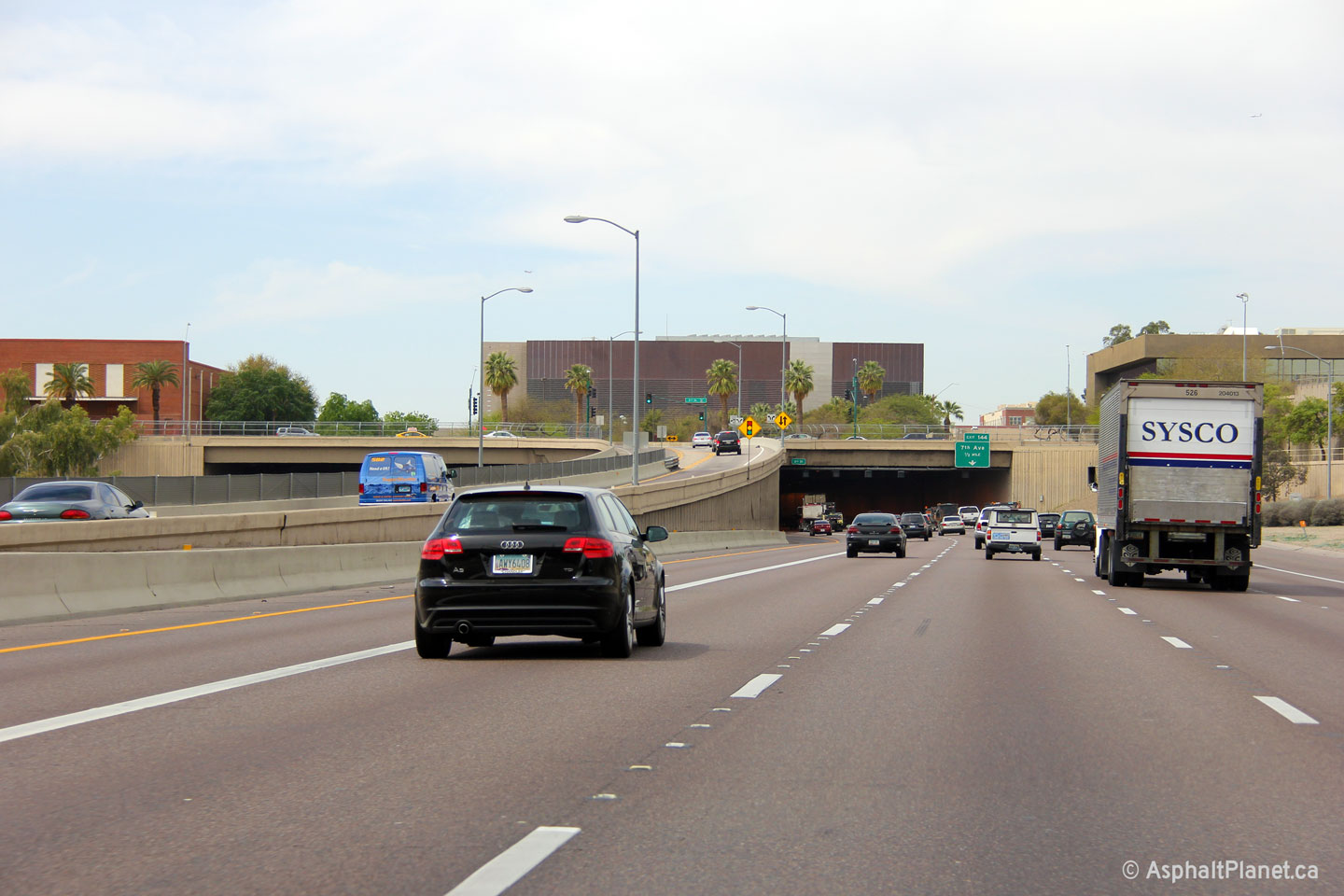
|
Maricopa County Phoenix |
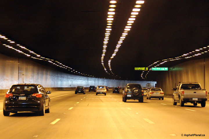
View looking westerly through the Papago Freeway Tunnel. The overhead signs are internally illuminated to stand out against the darkened tunnel. |
 |
||
|
Date: 26/3/2013 |
High-res: (1440x960) | |||
|
Maricopa County Phoenix |
Westerly view from the Papago Freeway Tunnel in Central Phoenix. |
 |
||
|
Date: 26/3/2013 |
High-res: (1440x960) (2400x1600) | |||
|
Maricopa County Phoenix |
Overhead guide signage at signage at eastbound the Seventh Street overpass. |
 |
||
|
Date: 26/3/2013 |
High-res: (1440x960) (2400x1600) | |||
|
Maricopa County Phoenix |
This view looks westerly through the Seventh Street overpass. |
 |
||
|
Date: 26/3/2013 |
High-res: (1440x960) (2400x1600) | |||
|
Maricopa County Phoenix |
Overhead guide signage at the HOV off-ramp to Third Avenue. |
 |
||
|
Date: 26/3/2013 |
High-res: (1440x960) (2400x1600) | |||
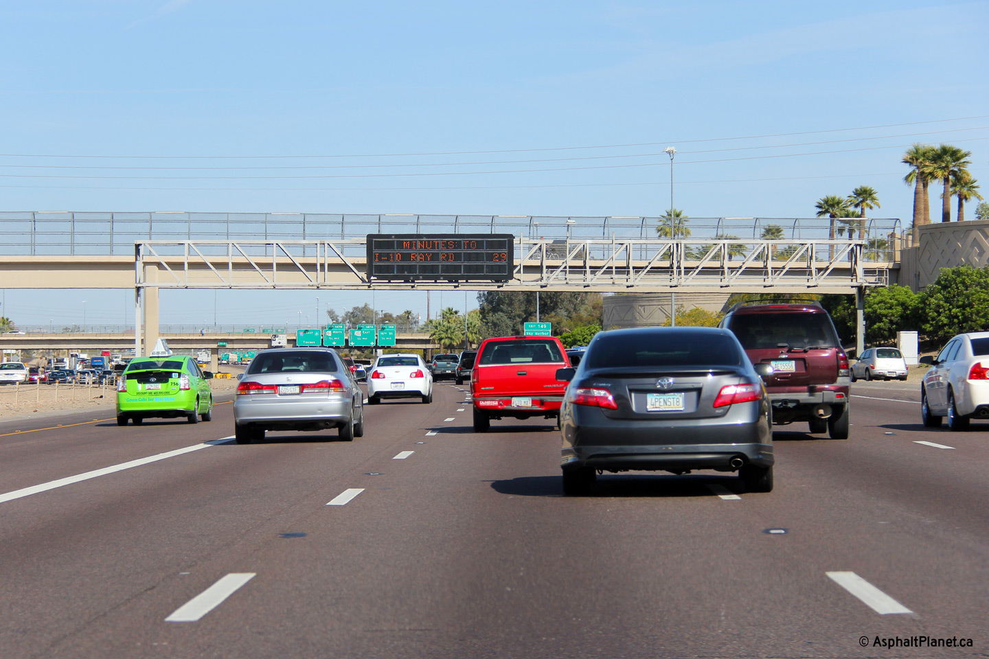
|
Maricopa County Phoenix |
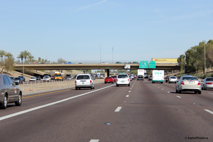
Eastbound view at the 10th Street Pedestrian Overpass. This photo was taken near the afternoon rush hour at a time when travel times are displayed on Phoenix's freeway network. When this photo was taken, I-10 was congested beyond the Mini Stack interchange. |
 |
||
|
Date: 26/3/2013 |
High-res: (1440x960) (2400x1600) | |||
|
Maricopa County Phoenix |
Advanced signage for the 16th Street and AZ-51/Loop 202 interchanges affixed to the 12th Street overpass. |
 |
||
|
Date: 26/3/2013 |
High-res: (1440x960) (2400x1600) | |||
|
Maricopa County Phoenix |
Signage at the eastbound off-ramp to 16th Street. |
 |
||
|
Date: 26/3/2013 |
High-res: (1440x960) (2400x1600) | |||
|
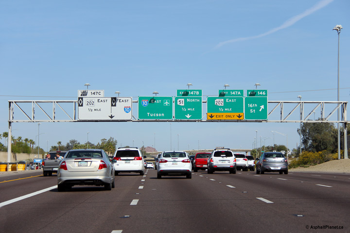
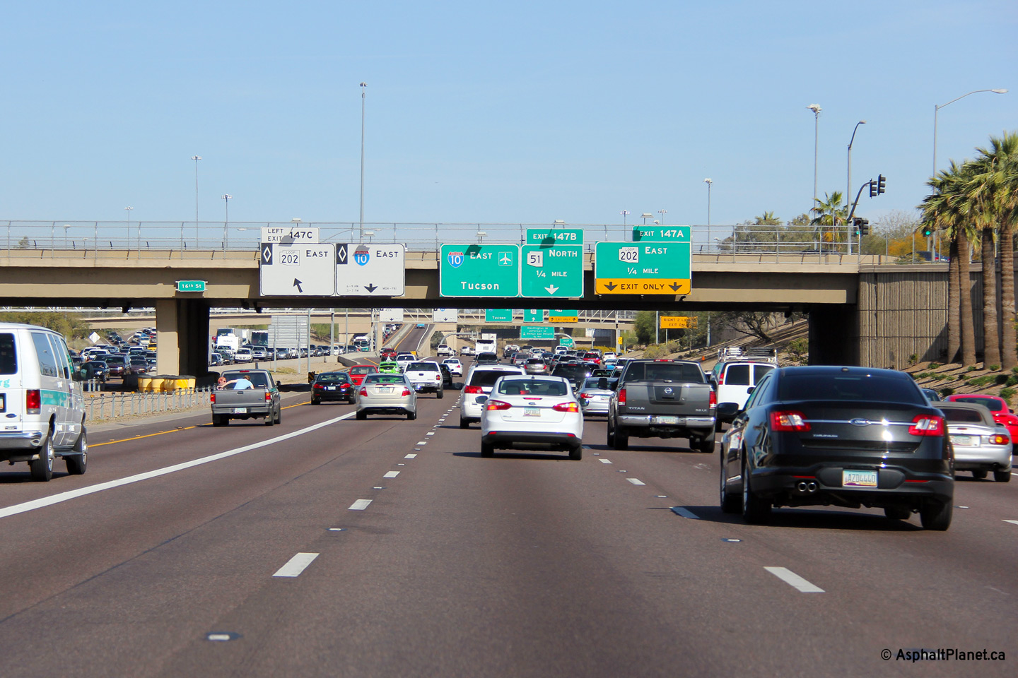
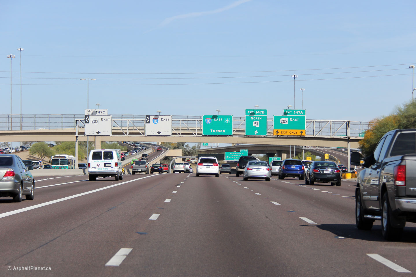
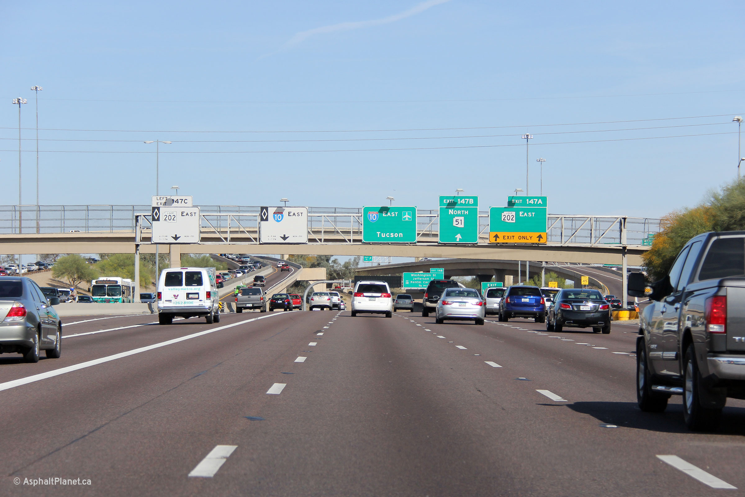
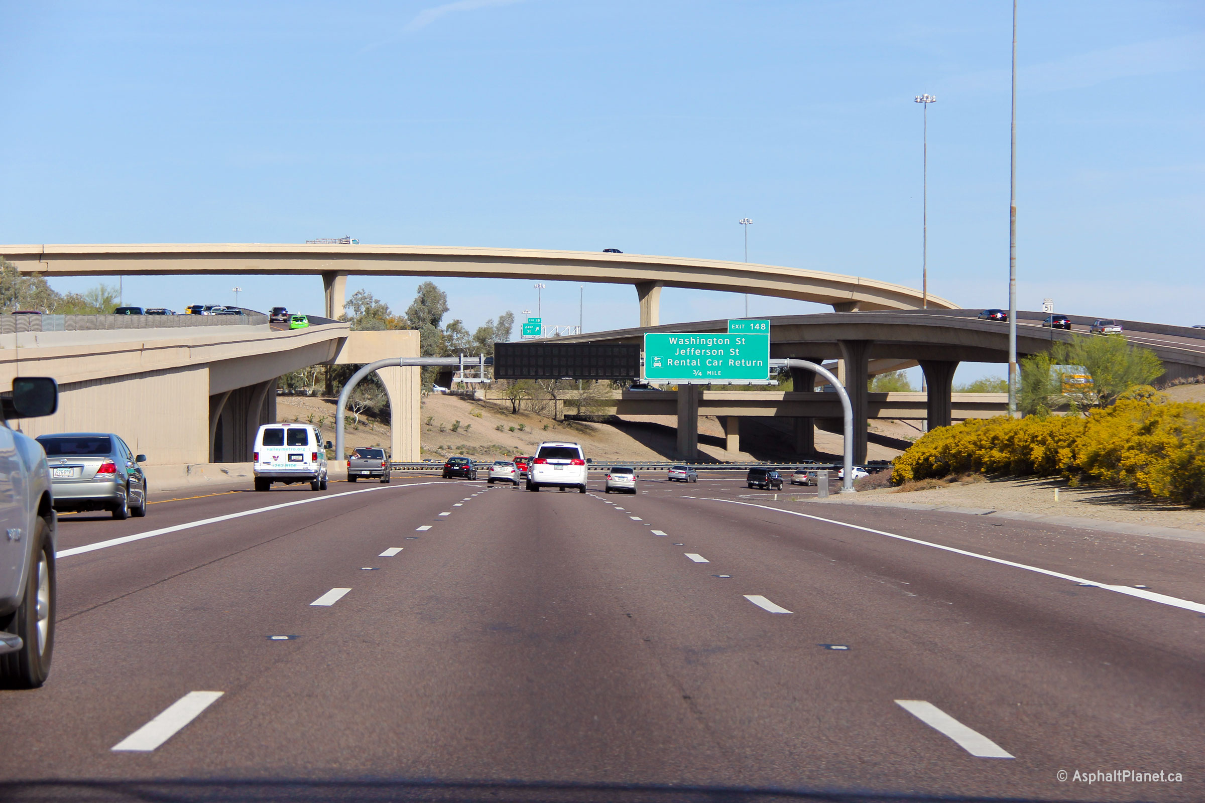
Maricopa County Phoenix |
Advanced signage for both AZ-51 and Loop 202. Both Highway 51 and Loop 202 opened as at-grade highways when they were first constructed. |
 |
||
|
Date: 26/3/2013 |
High-res: (1440x960) (2400x1600) | |||
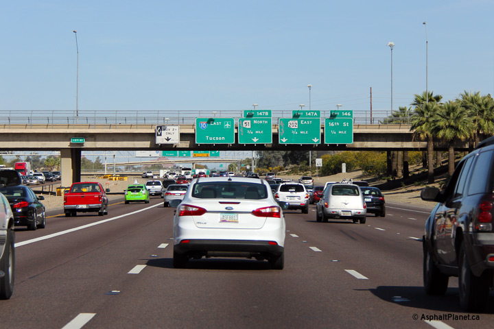
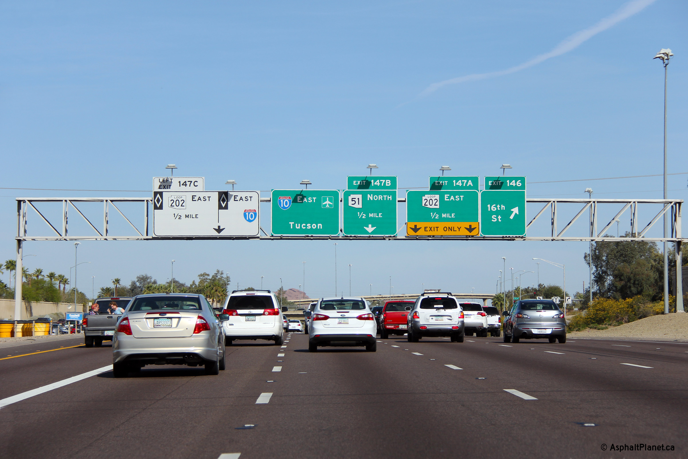
|
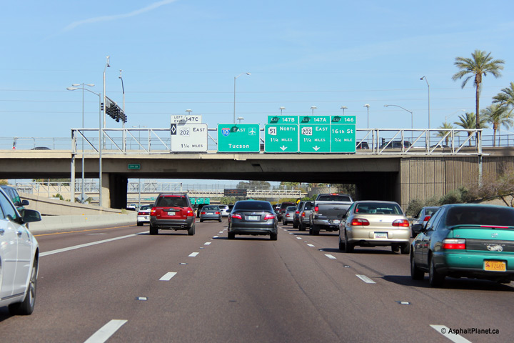
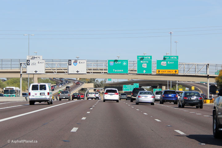
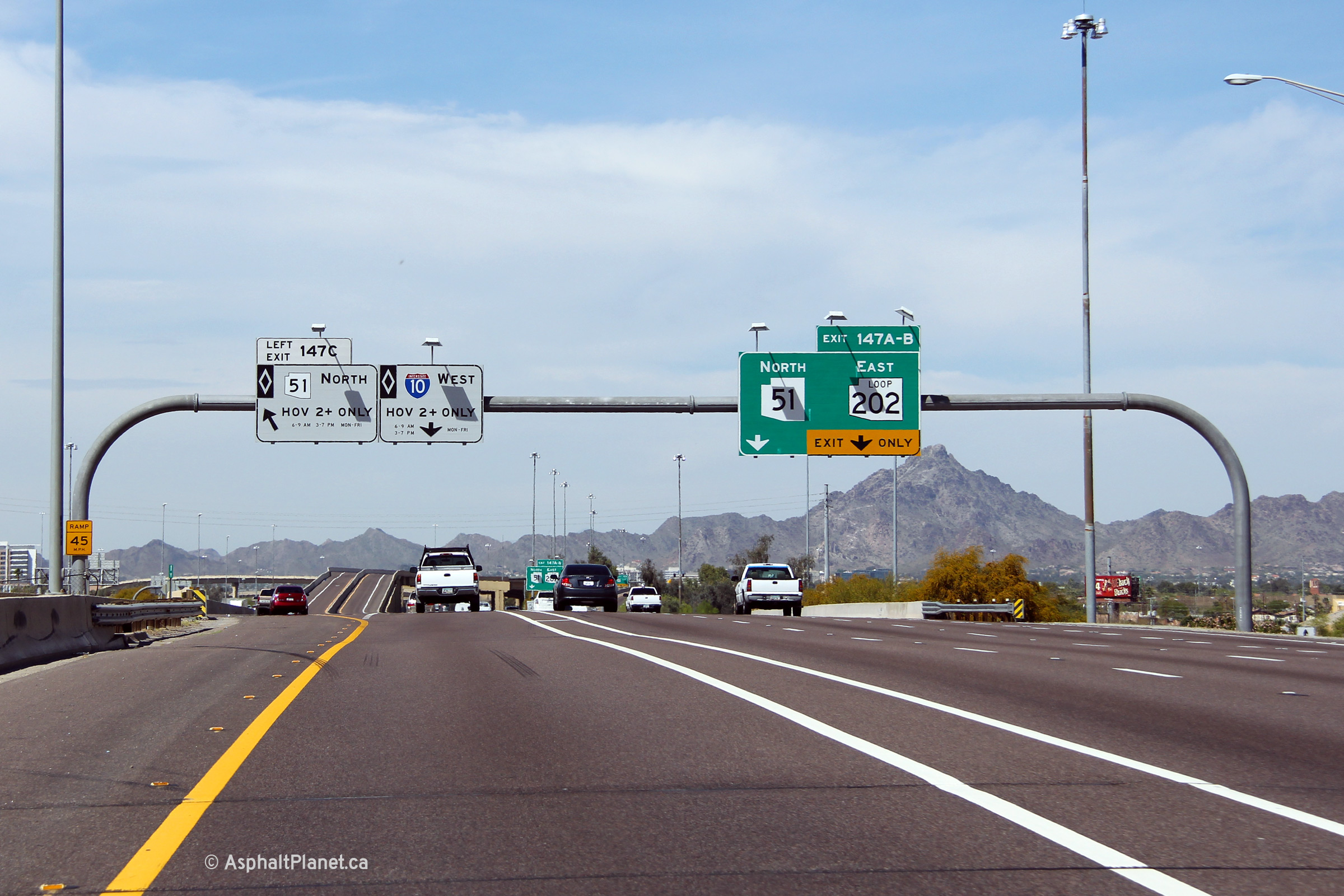
Maricopa County Phoenix |
Easterly view as the ramps to AZ-51 and Loop 202 depart from both the general purpose and HOV lanes. While, the I-10/AZ-51/Loop 202 interchange is locally known as the Mini-stack, it is by far the most complex freeway to freeway interchange in all of Arizona. |
 |
||
|
Date: 26/3/2013 |
High-res: (1440x960) (2400x1600) | |||
|
Maricopa County Phoenix |
View looking easterly through the large Highway 51/Loop 202 interchange. I-10 East turns 90 degrees to the south at this interchange. |
 |
||
|
Date: 26/3/2013 |
High-res: (1440x960) (2400x1600) | |||
| Interstate 10 intersects both AZ-51 and Loop 202 at the Mini-Stack interchange. Click here for AZ-51 images and here for Loop 202 images. | ||||
|
Maricopa County Phoenix |
This view looks southerly through the I-10 interchange along I-17. |
 |
||
|
Date: 26/3/2013 |
High-res: (1440x960) (2400x1600) | |||
|
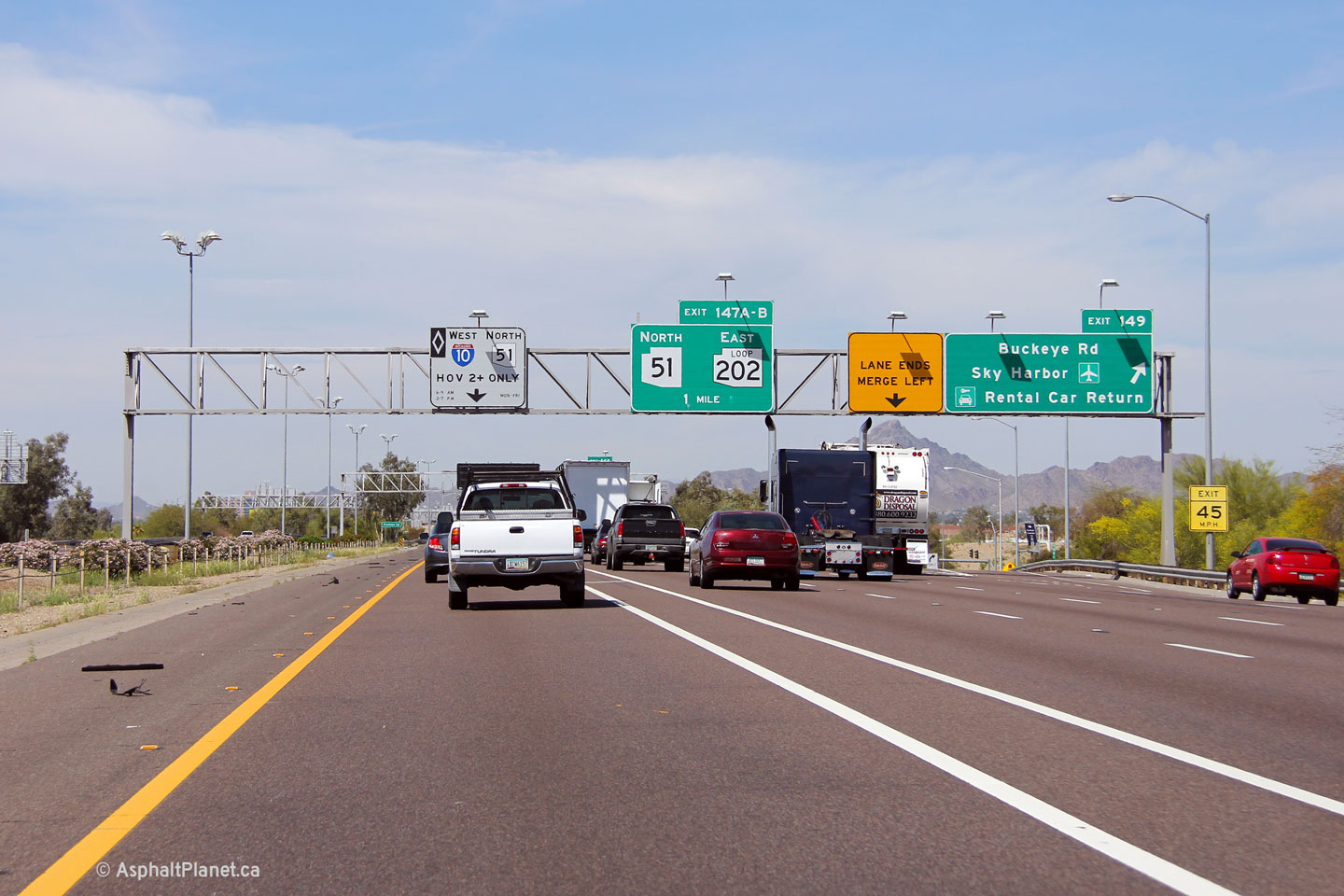
Maricopa County Phoenix |
Westerly view at the Buckeye Road off-ramp. |
 |
||
|
Date: 26/3/2013 |
High-res: (1440x960) (2400x1600) | |||
|
By-pass New Mexico and continue east along I-10 in Texas. Click here for Interstate 10 - Texas images. |
||||
<- I-8
AZ Highways
I-15 ->
AsphaltPlanet.ca
© 2006-2013 Scott Steeves.
Scott@asphaltplanet.ca
Page Created: July 2 2013.
Last Updated: July 2 2013.