King's Highway 402 - www.OntHighways.com

Highway 402 is the main route between London and Sarnia.  Though most of Highway 402 is a fairly recent addition to the provincial highway network, the 402 was actually the third 400-series highway to be designated in Ontario.  Originally Highway 402 ran only through Sarnia, and had numerous at-grade intersections (including an at-grade rail crossing).  It was not until 1982 that the 402 was completely grade separated through Sarnia.  Coincidentally, Highway 402 was also officially opened in 1982, when the last stretch of new expressway was completed between Delaware and Strathroy.


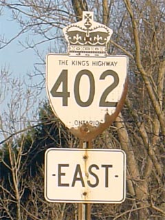
King's Highway 402 Shield

  Western Terminus:  At the Customs facility for the Bluewater Bridge in Sarnia.

Eastern Terminus:  At the Highway 401 interchange south of London.

Length:  102.5 km.

Multiplexes:  9.3 km with Highway 21 near Reece's Corners.  Despite being obsolete, and no longer signed, this co-designation still legally exits.

Freeway:  Entire Length.

AADT (2002):  Highest: 25,600, from Indian Road easterly to Highway 40 in Sarnia;

                             Lowest:  15,700, from the Bluewater Bridge to the Bridge Street/Marina Drive interchange.

Road Info:  Most of Highway 402 is now in excellent shape, with one notable exception between Mandaumin Road and Highway 21-North.  The 402 has yet to be rehabilitated through this area.  On this short section, pavement conditions are poor, and lane widths are narrower then current freeway standard.  Also, motorists should use caution upon entering Sarnia from the east.  Because of some isolated lengthy backups on the Bluewater Bridge, the westbound Highway 402 speed limit drops to 80km/h west of Airport Road.  Police have actively been patrolling this section of highway, due to the abnormally low speed limit.


Highway 402 information:


OntHighways.com  

Detailed Route information available below
Virtual Tour of Highway 402
Traffic Volumes and Mileage Log


TheKingsHighway.ca   History of Highway 402
Photographic History of Highway 402

Interchanges along Highway 402 from West to East:

Proper Municipality Name Exit # Interchange Name North / West Control City South / East Control City
Village of Point Edward --- Bridge Street & Marina Road Point Edward
Village of Point Edward                1                 Front Street (Formerly Highway 40B) Point Edward Sarnia Downtown
Point Edward - Sarnia Boundary 2 - WB Partial Interchange Christina Street City of Sarnia
Population 73,000
5-WB, 3-EB Interchanges

Sarnia Downtown via Front Street South

City of Sarnia 3 Indian Line (Lambton Road 29)
City of Sarnia 6 King's Highway 40 (Modeland Road)
City of Sarnia 9 Airport Road
Sarnia - Plympton- Wyoming Boundary 15 Mandaumin Road (Lambton Road 26)
Town of Plympton- Wyoming 25 Highway 21-South (Lambton Road 21) & Oil Heritage Line (Lambton Road 30) ----- Wyoming
Plympton- Wyoming - Warwick Boundary 34 King's Highway 21-North & Forest Road (Lambton Road 8) Forest, Grand Bend -----
Township of Warwick 44 Highway 79 (Nauvoo Road, Lambton Road 79) Arkona Watford
Township of Adelaide- Metcalfe 56 Kerwood Road (Middlesex Road 6) ----- Kerwood
Township of Adelaide- Metcalfe 65 Highway 81 (Centre Road, Middlesex Road 81) Parkhill Strathroy
Adelaide- Metcalfe - Strathroy- Caradoc Boundary 69 Hickory Road (Middlesex Road 39) Strathroy -----
Township of Strathroy- Caradoc 82 Glendon Road (Middlesex Road 14) Mount Bridges Komoka
Township of Strathroy- Caradoc 86 Highway 2 (Longwoods Road, Middlesex Road 2) Melbourne Deleware
City of London 98 King's Highway 4 (Colonel Talbot Road) London St. Thomas
City of London 100 Wonderland Road London: 5-Interchanges. Downtown via Wellington Road
City of London --- King's Highway 401 Eastbound   Toronto

Highway 402 ENDS


<- Highway 401         www.OntHighways.com - Home         Highway 403 ->


Copyright (c) 2004-2010, AsphaltPlanet.ca  AsphaltPlanet@asphaltplanet.ca

Page last updated:  June 16, 2008

Page created:  January 11th, 2004