King's Highway 406 - www.OntHighways.com
Highway 406 is a short commuter
highway that runs along the west side of the Welland Canal, through Downtown
St. Catharines, from Welland to the QEW. Of note, Highway 406 is one of the three
Ontario 400-series highways that is not fully a freeway -- the highway is
two-lanes undivided south of Port Robinson Road in Thorold.
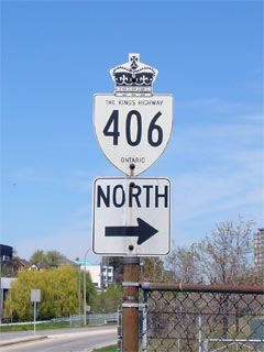
Old Style
King's Highway 406 Shield
|
|
Southern Terminus: At East Main
Street (Hwy 7146) in Welland.
Northern Terminus: At the QEW
interchange located in western St. Catharines.
Length: 25.0 km
Multiplexes: None
Freeway: From south of Beaverdams Road in
Thorold northerly.
AADT (2002):
Highest: 49,600 from Glendale Avenue northerly to Westchester Avenue;
Lowest: 12,700 from East Main Street northerly to the Welland River
Bridge.
Road Info: Highway 406 is
generally in good condition for its entire length. The southern
portion of highway is currently a limited access highway, that at times can
be quite congested. There is an ongoing construction project that will
see the freeway portion of the route extended southerly from Beaverdams Road
to Port Robinson Road. Through Downtown St. Catharines, because of
some rather sharp curves, the highway has a posted speed limit of only
80km/h as opposed to the standard 100km/h limit seen on most freeways.
The rest of the freeway stretches of Highway 406 are posted at 100km/h while
the two-lane portion is posted at 80km/h. |
Table
with 3 columns shows Highway 406 information when it is a conventional two-lane
highway. Table with 5 columns shows Highway 406 information when it is a
freeway. Information is arranged from South to North:
|
Proper Municipality Name |
Distance |
Intersecting Road |
|
Proper
Municipality Name |
Exit # |
Interchange
Name |
North / West Control City |
South / East Control City |
| City of Welland |
0km / 25.0km |
East Main Street (Niagara Road 27 &
Highway 7146) -- Interchange proposed |
| City of Welland |
2.7km / 22.3km |
Woodlawn Road (Highway 7236) --
Interchange proposed |
| City of Thorold |
4.8km / 20.2km |
Merrit Road (Highway 58-South,
Niagara Road 37) -- Interchange proposed |
| City of Thorold |
--- |
Port Robinson Road -- Access to be closed during future
construction project |
|
Between Port Robinson Road and
Highway 20, Highway 406 transitions from a two lane highway to a
four-lane freeway. |
| City of Thorold |
17 |
Highway 20 &
Highway 58-North (Niagara Road 20,
Canboro Road) |
Fonthill |
Niagara Falls |
| City of Thorold |
14 |
Beaverdams Road (Niagara Road 67) |
----- |
----- |
| Thorold - St. Catharines Boundary |
11 (A-B) |
King's Highway 58 & St. Davids Road
(Niagara Road 71) |
St. Catharines |
Thorold, Niagara Falls |
| City of St. Catharines |
9 |
Glendale Avenue (Niagara Road 89) |
St. Catharines
Population 130 000St. Catharines
Downtown Via Geneva Street North |
| City of St. Catharines |
6(A) |
Westchester Avenue |
| City of St. Catharines |
6B |
Geneva Street |
| City of St. Catharines |
4 |
Fourth Avenue (Niagara Road 77) |
| City of St. Catharines |
--- |
Queen Elizabeth Way |
Toronto |
Niagara |
|
Highway 406 ENDS |
<-
Highway 405
www.OntHighways.com -
Home
Highway 407 ETR ->
Copyright
(c) 2004-2007, AsphaltPlanet.ca
webmaster@onthighways.com
Page last updated: November 1st, 2006
Page created: January 4th, 2004