|
Proper Municipality Name |
Photo Description |
Photo |
|
Pictures taken
from driver's perspective appear offset from centre-line pictures: |
North-
Bound |
South-
Bound |
|
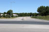
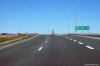
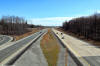
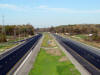
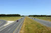
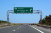
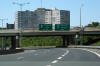
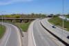
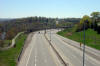
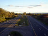
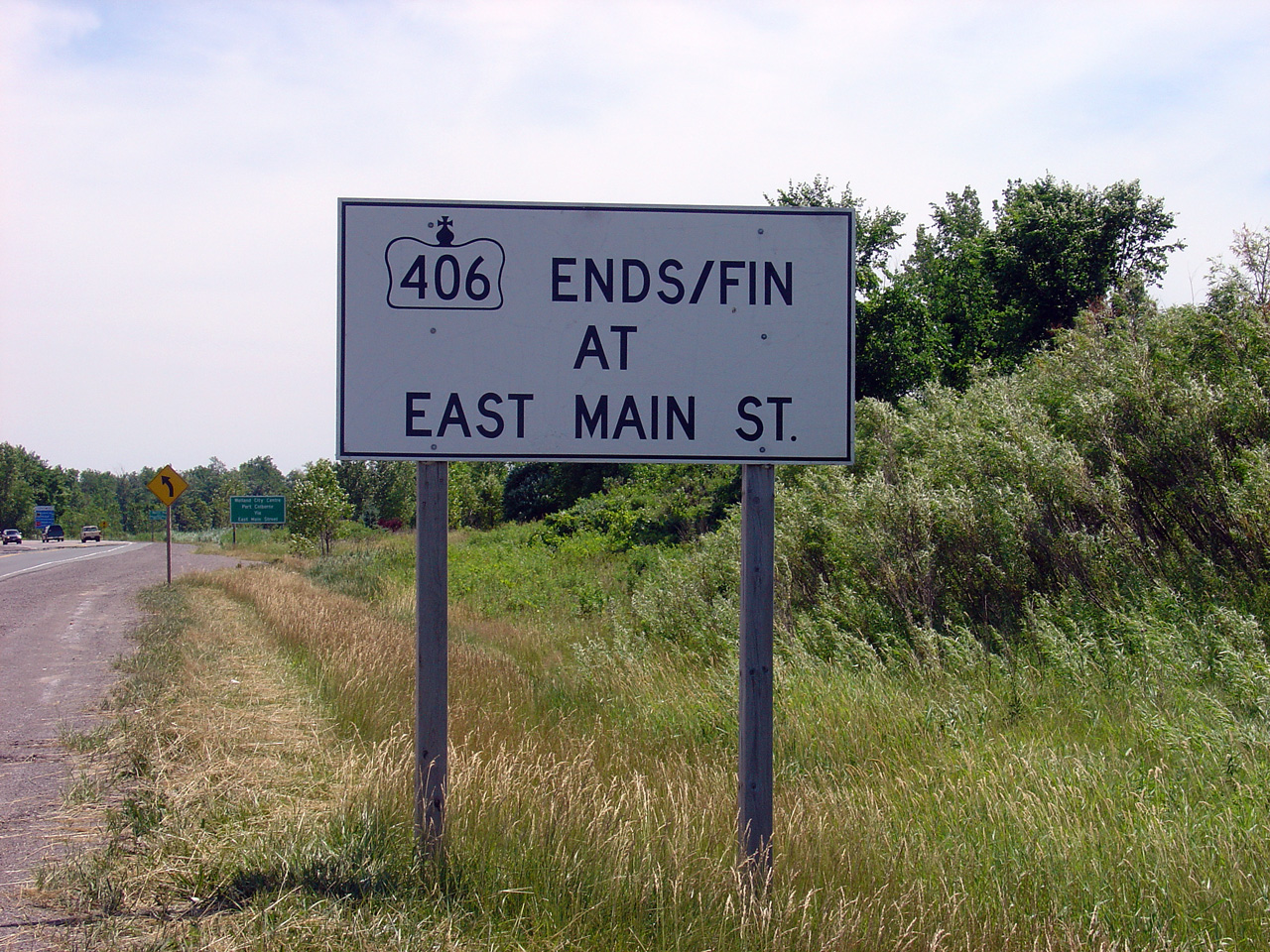
City of Welland Regional Municipality of Niagara |
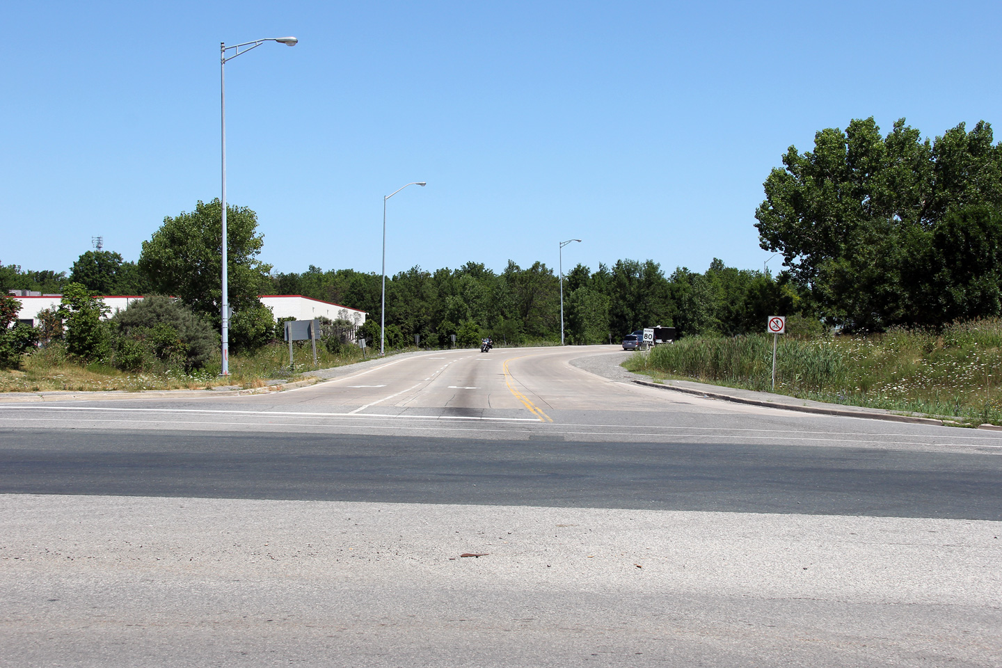
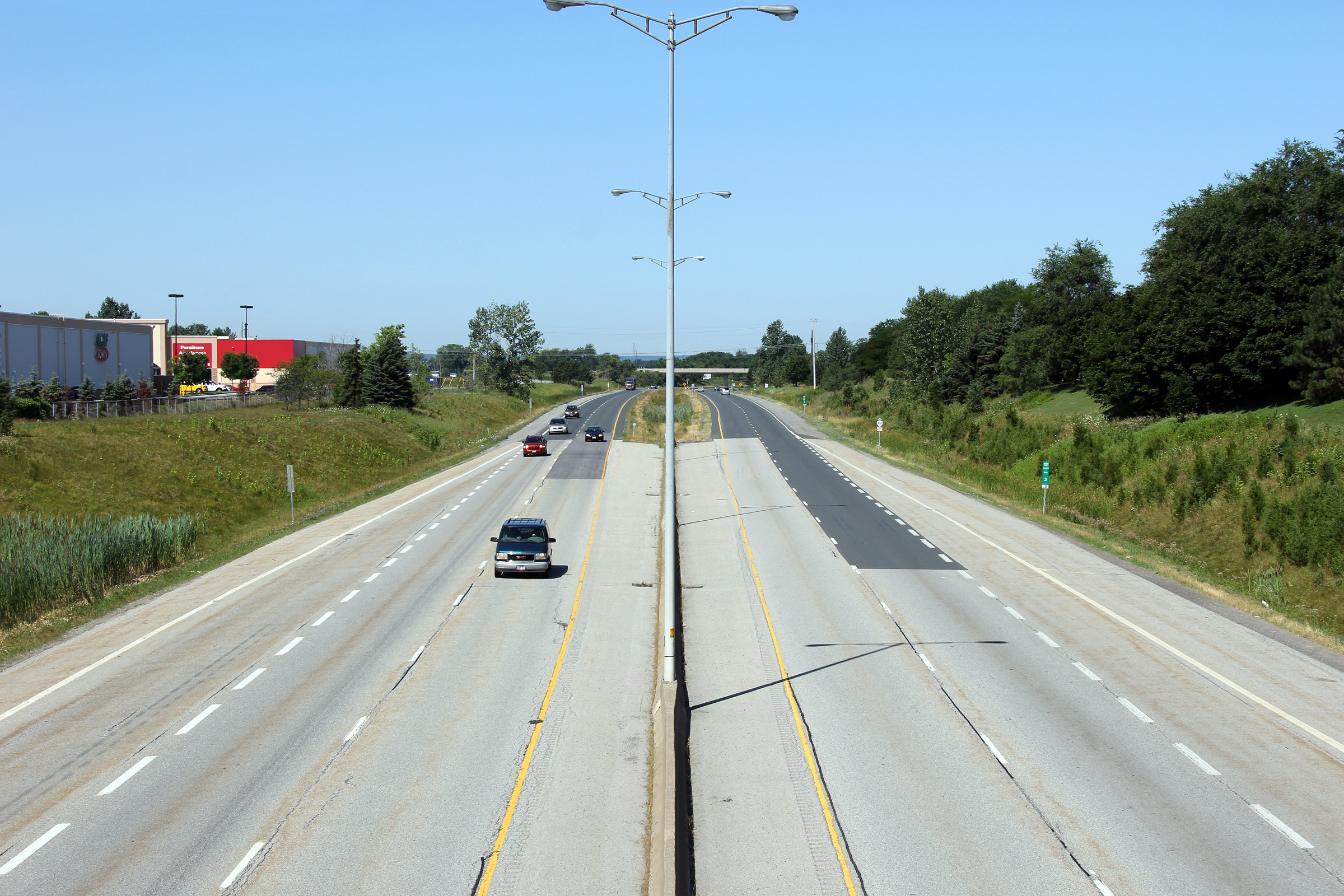
This view looks northerly from the southern terminus of Highway 406 at East
Main Street. The southern terminus of Highway 406 was first envisioned as
the southbound off-ramp of a partial cloverleaf interchange, with the
mainline of Highway 406 continuing southerly towards Highway 58A. A
further southerly extension of Highway 406 is today contingent upon the
final alignment of Niagara's Mid Peninsula Highway.
Photo taken: July 30th, 2011. |
(720x480)
(1440x960)
(2400x1600) |
|
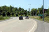
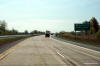
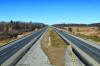
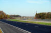
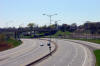
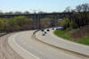
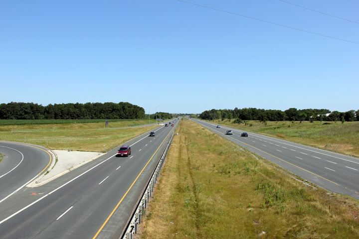
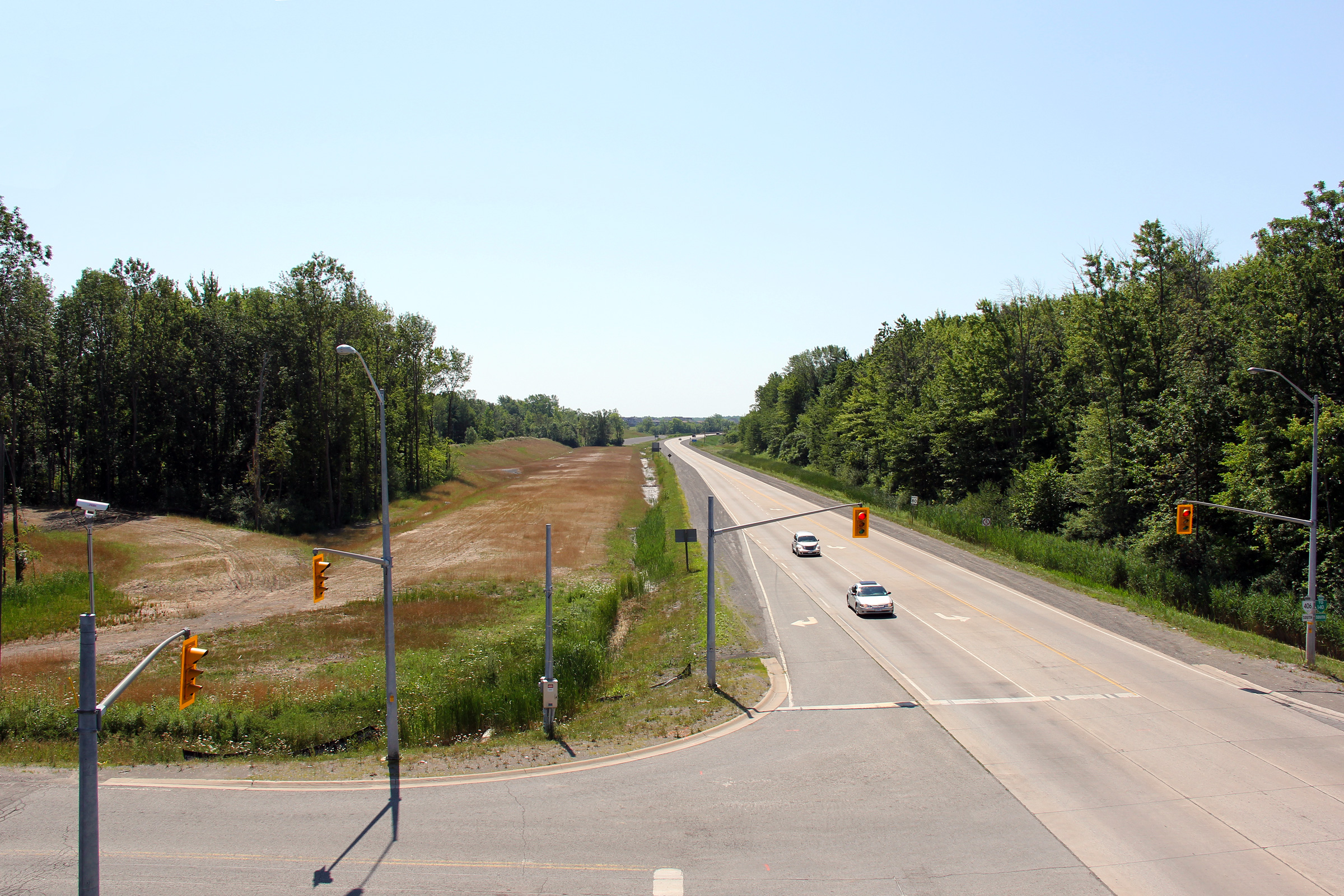
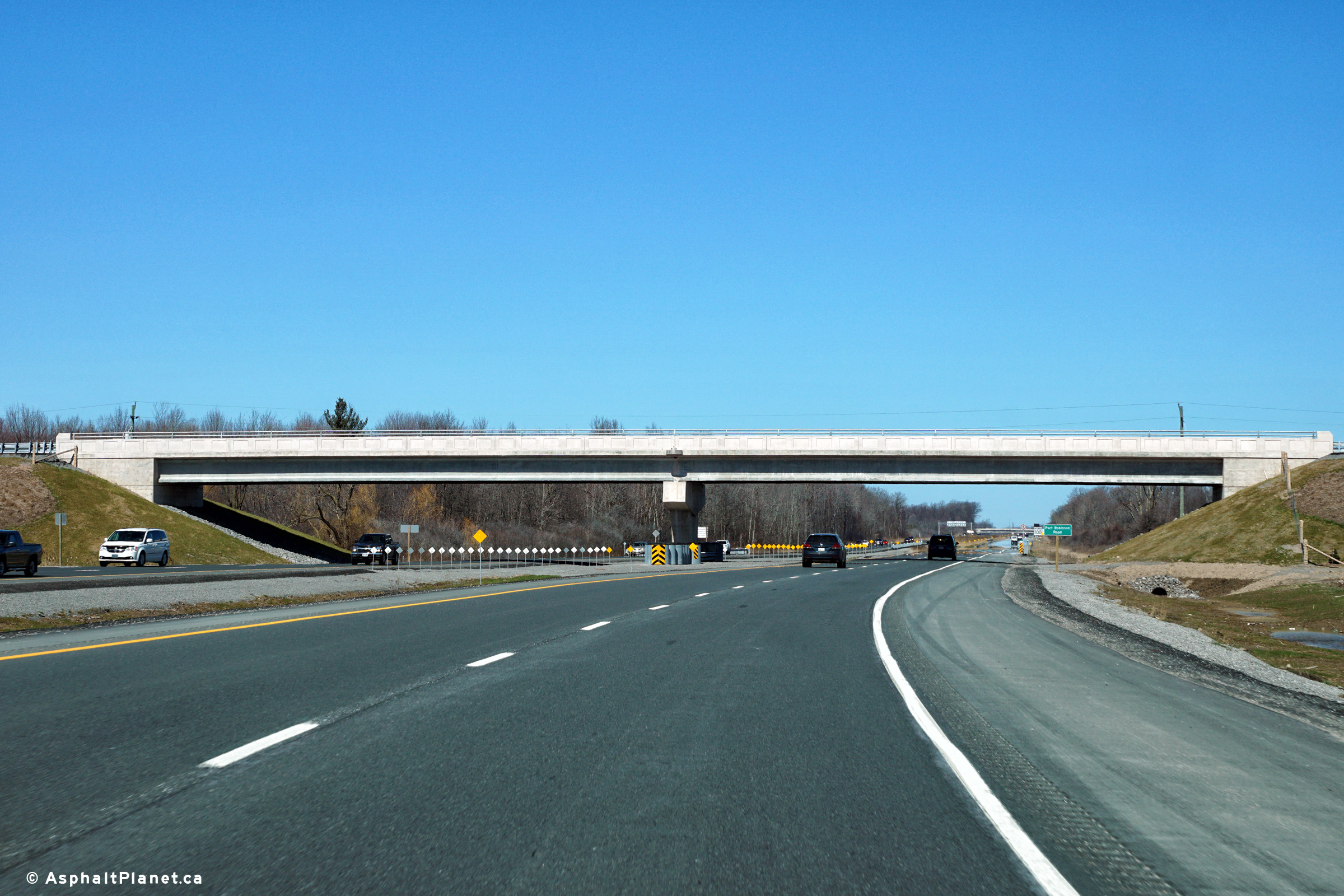
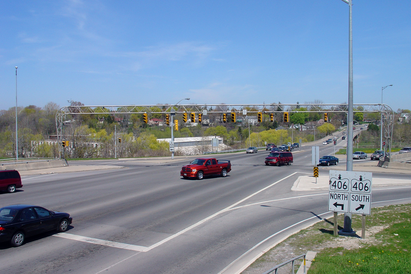
City of Welland Regional Municipality of Niagara |
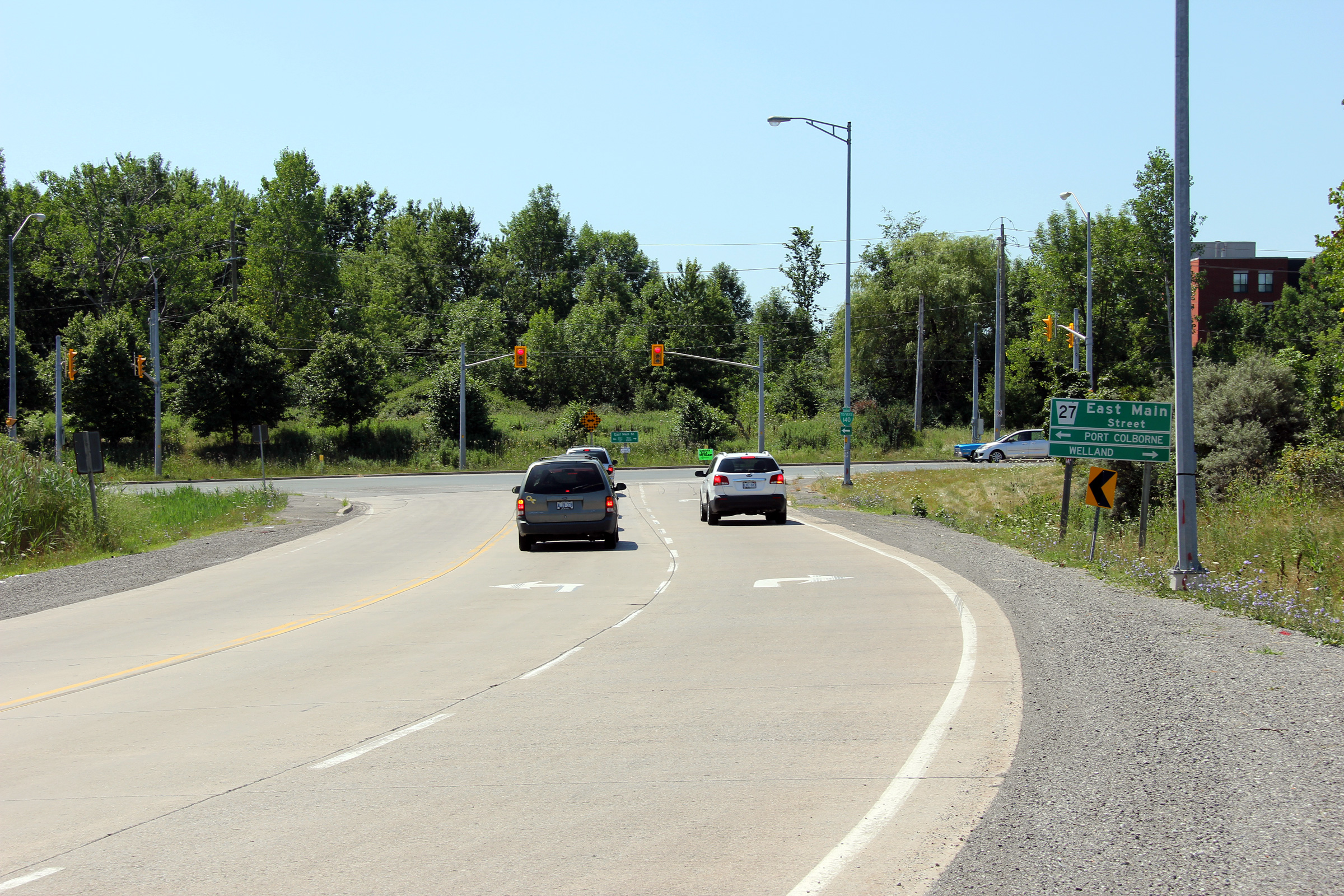
Southerly view towards the southern terminus of Highway 406 at East Main
Street. A multiyear construction project commencing in 2011 will see
this intersection replaced with a modern roundabout as part of the four-laning
and "freewayalization" of Highway 406 between East Main Street and Port
Robinson Road.
Photo taken: July 30th, 2011. |
(720x480)
(1440x960)
(2400x1600) |
|
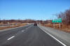
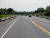
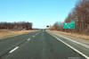
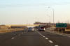
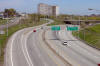
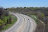
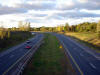
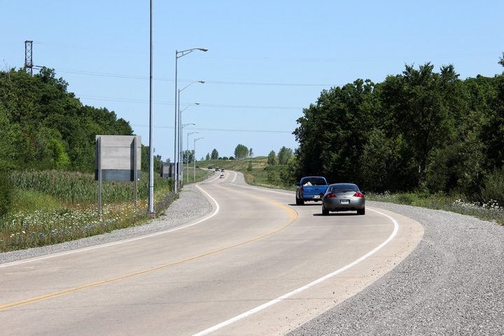
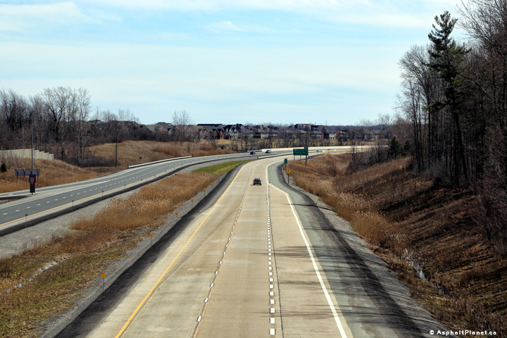
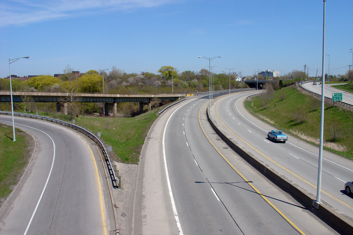
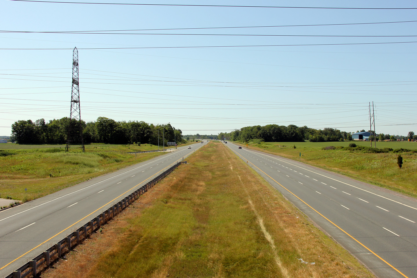
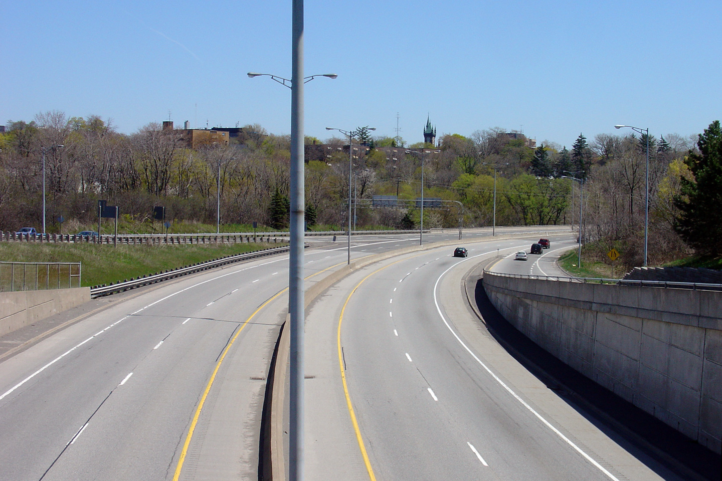
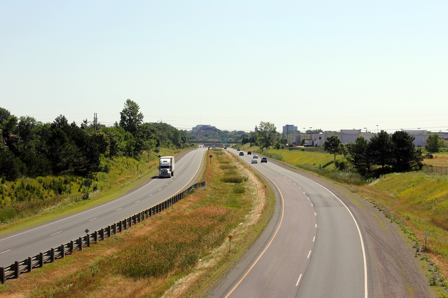
City of Welland Regional Municipality of Niagara |
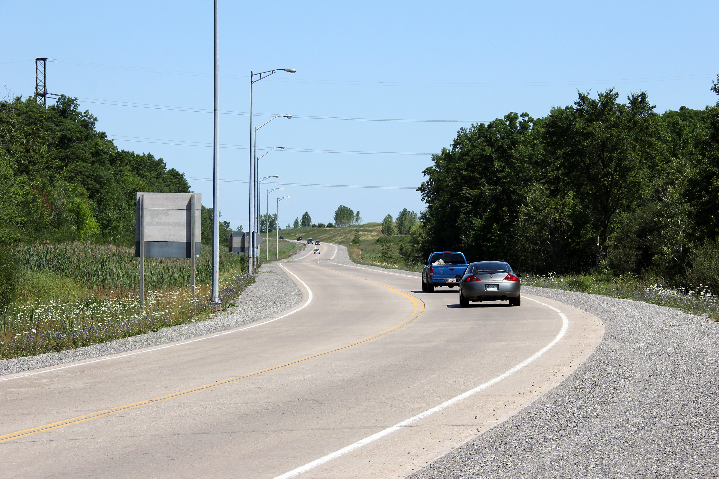
Northerly view of Highway 406 from a few hundred metres north of the East
Main Street intersection.
Photo taken: July 30th, 2011. |

(720x480)
(1440x960)
(2400x1600) |
|
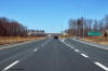
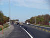
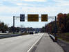
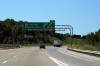
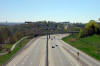
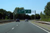
City of Welland Regional Municipality of Niagara |
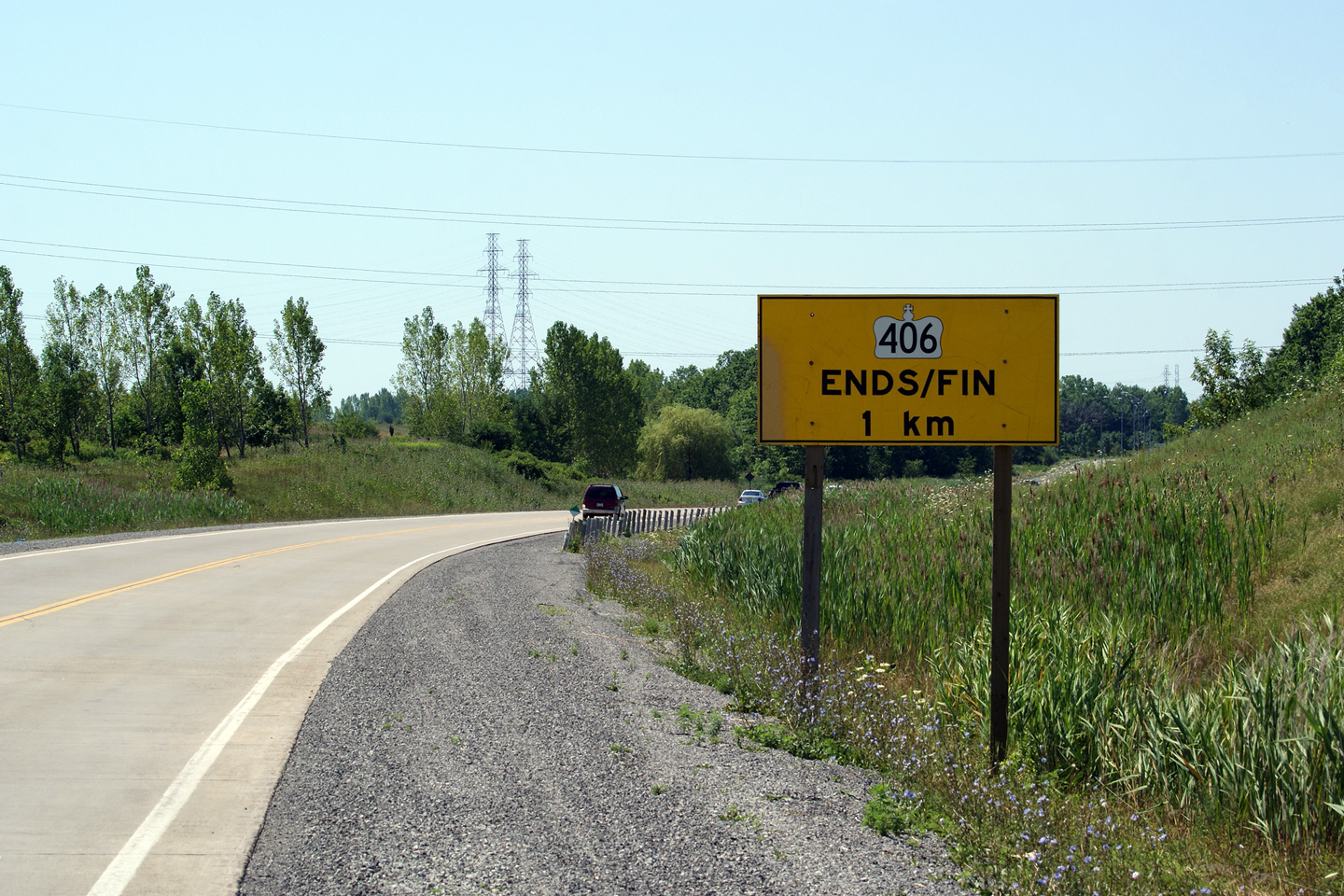
Southbound signage warning drivers of the impending southern terminus of
Highway 406 at East Main Street.
Photo taken: July 30th, 2011. |
 (720x480) (720x480)
(1440x960) |
|
|
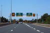
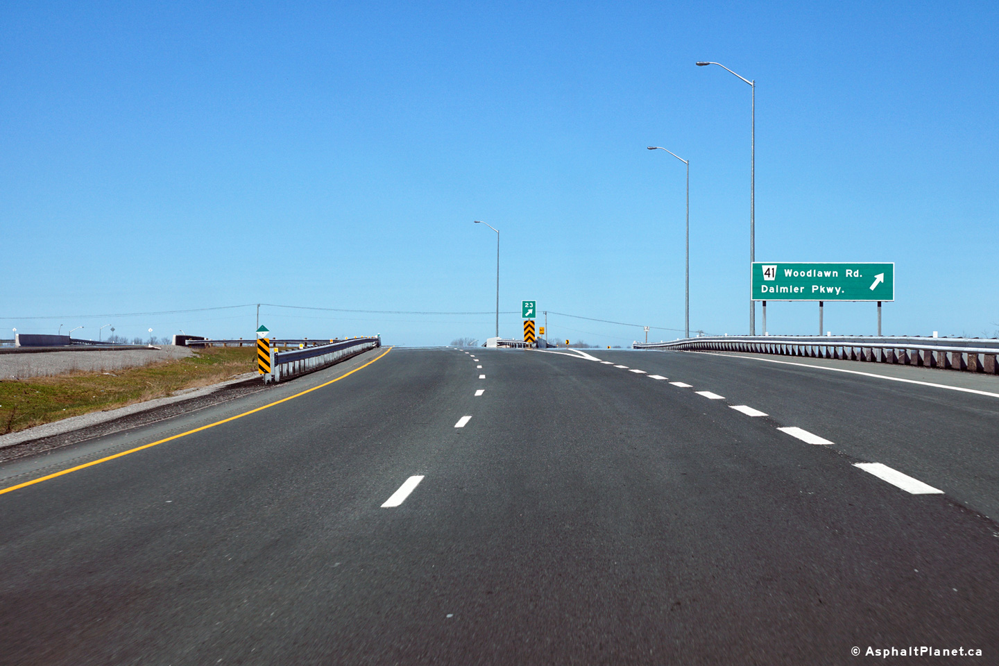
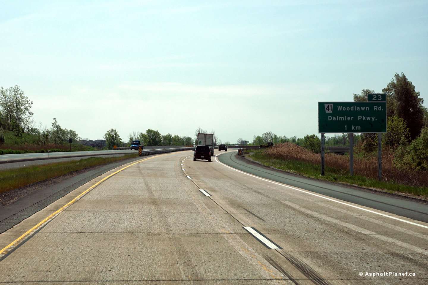
Northbound advanced signage for the Woodlawn Road interchange. |
 (720x480) (720x480)
(1440x960)
(2400x1600) |
|
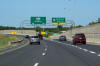
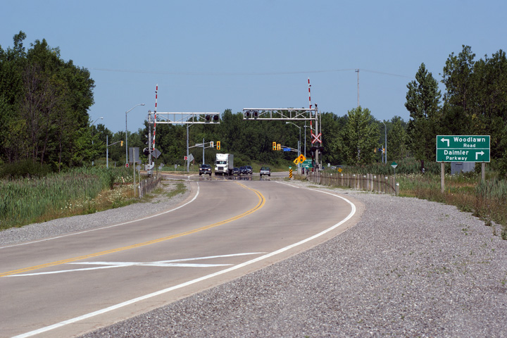
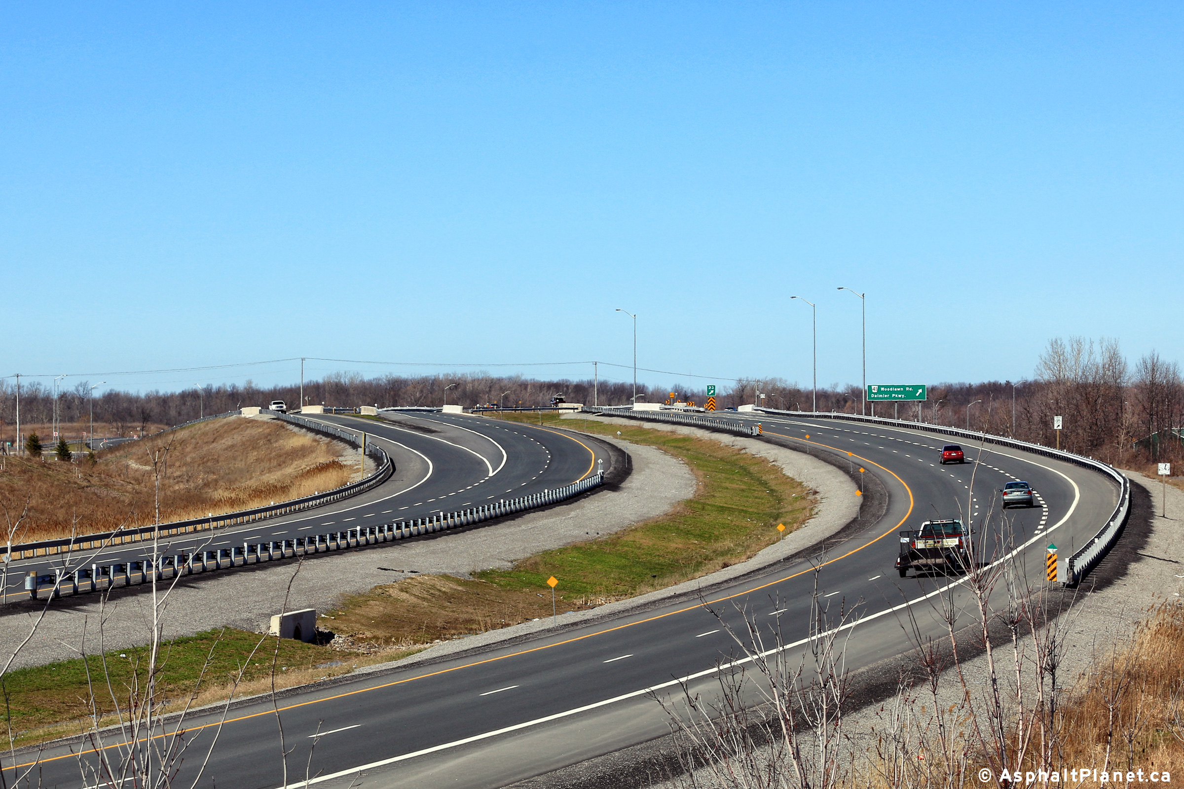
City of Welland Regional Municipality of Niagara |
Two northbound views along Highway 406 approaching the Woodlawn Road
intersection and the Port Colborne Harbour Railway (PCHR) at-grade railway crossing. Highway 406 is
the only 400-series highway in Ontario to cross a railway at-grade. A
widening contract that was called in 2011 will see Highway 406 four-laned
with all at-grade intersections grade-separated, including the elimination
of the pictured at-grade railway crossing.
Photos taken: July 30th, 2011. |

(720x480)
(1440x960)
(2400x1600)
|
|
|
Northbound signage at the off-ramp to Woodlawn Road. |
 (720x480) (720x480)
(1440x960)
(2400x1600) |
|
|
|
 (720x480) (720x480)
(1440x960)
(2400x1600) |
|
|
|
 (720x480) (720x480)
(1440x960)
(2400x1600) |
|
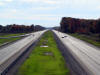
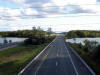
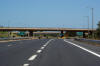
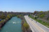
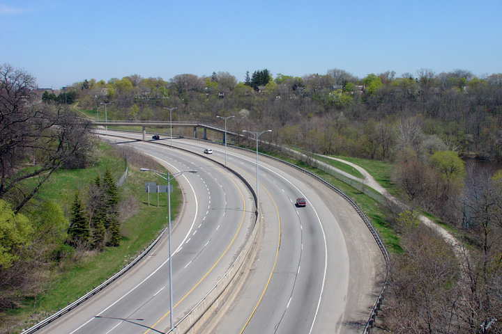
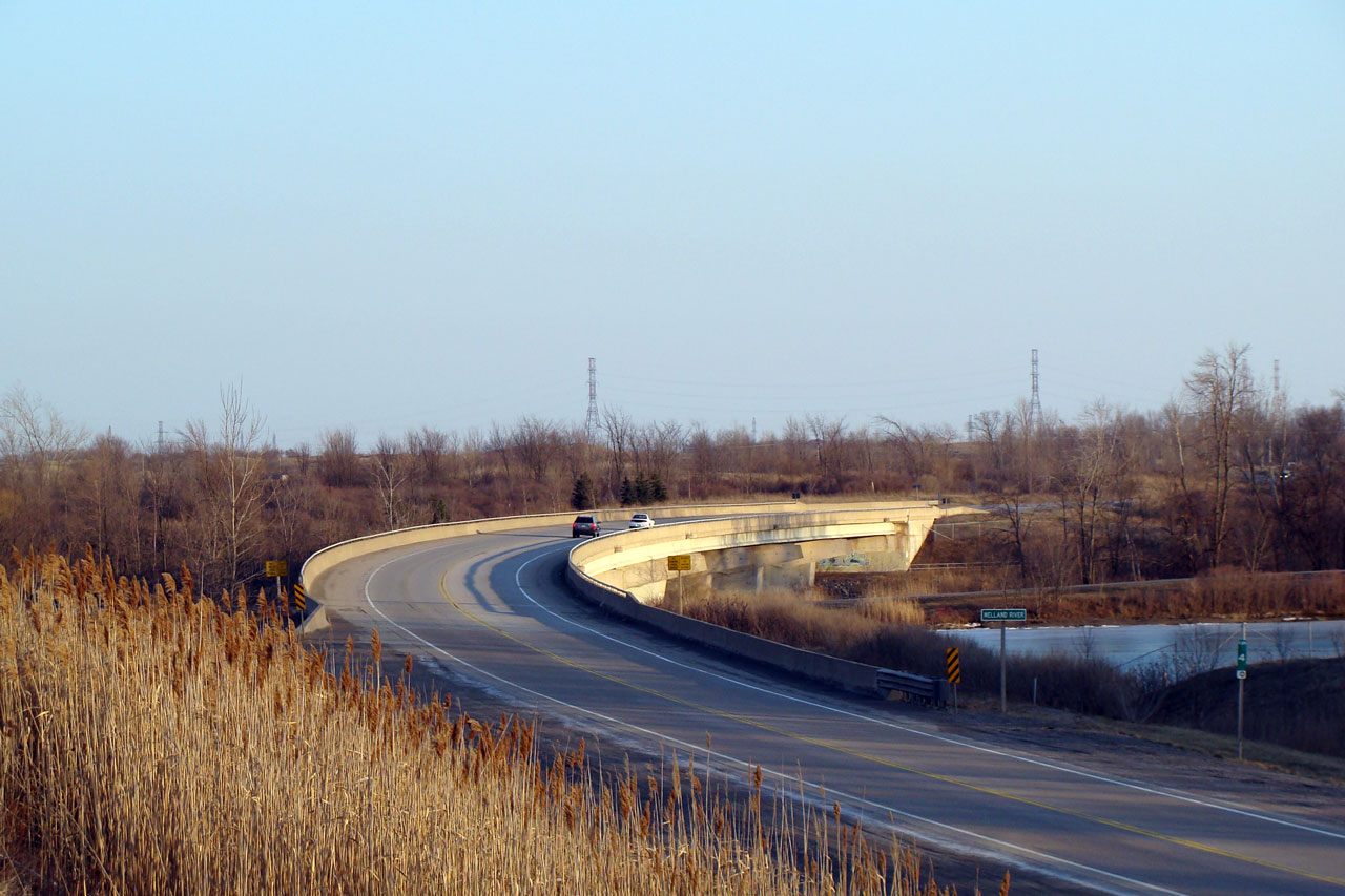
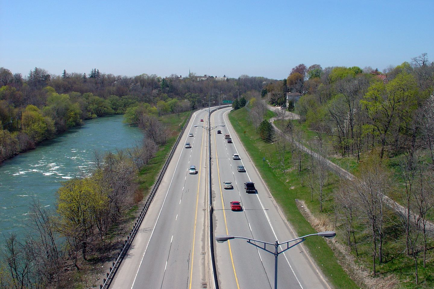
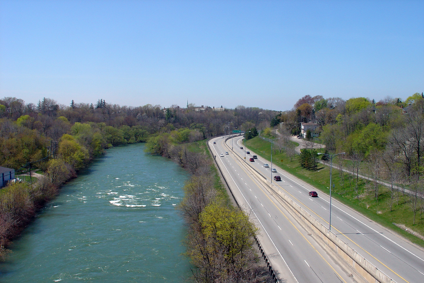
City of Welland Regional Municipality of Niagara |
View looking southerly as Highway 406 passes over the Welland River on a
long sweeping curve. Photo taken: April 2nd, 2008. |
|
|
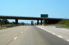
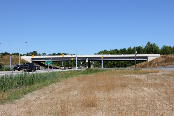
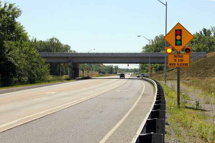
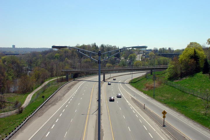
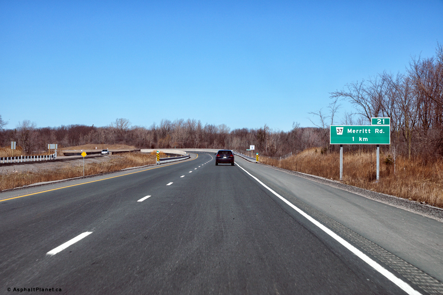
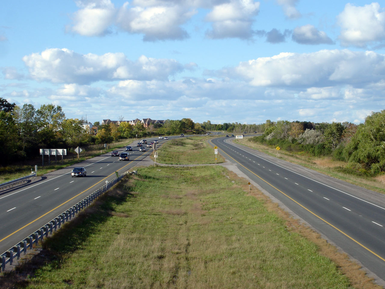
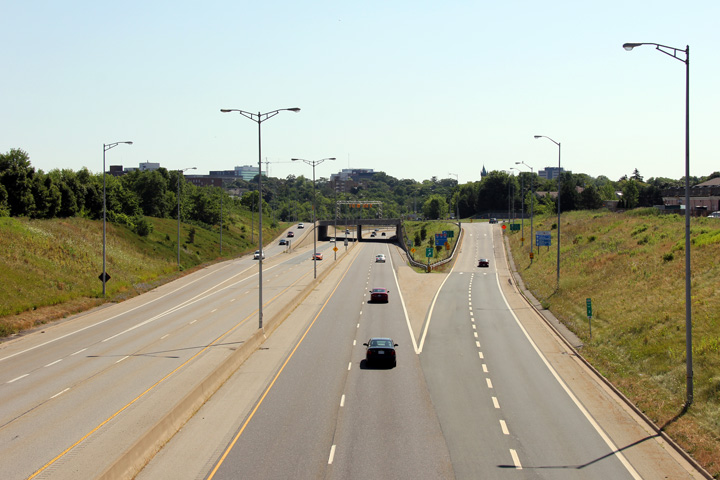
City of Welland Regional Municipality of Niagara |
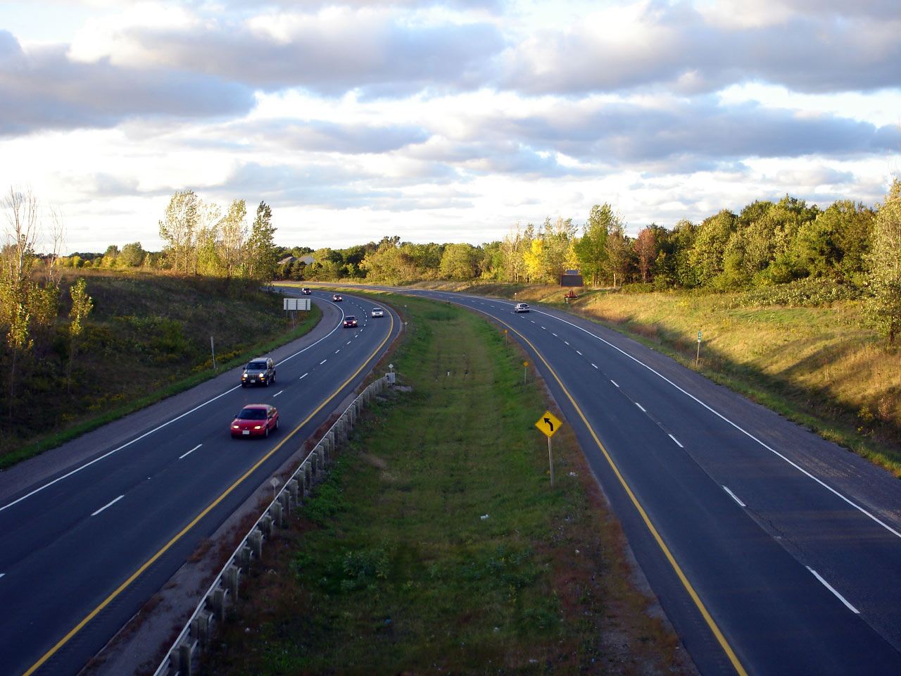
Two views looking northerly along the 406 towards the Merritt Road
intersection. Starting in 2011, Highway 406 will be twinned and this
signalized intersection will be replaced with a partial cloverleaf
interchange.
Upper photo taken: April 2nd, 2008.
Lower photo taken: July 30th, 2011. |

(720x480)
(1440x960)
(2400x1600) |
|
|
|
 (720x480) (720x480)
(1440x960)
(2400x1600) |
|
|
|
 (720x480) (720x480)
(1440x960)
(2400x1600) |
|
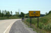
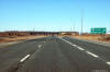
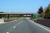
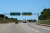
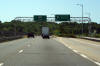
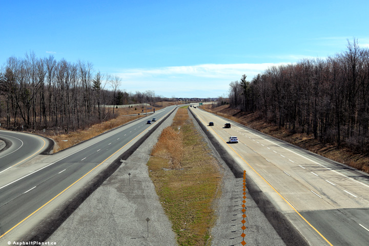
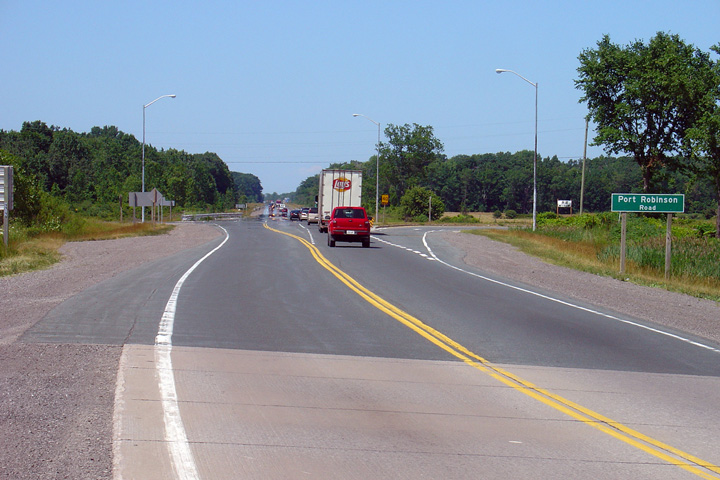
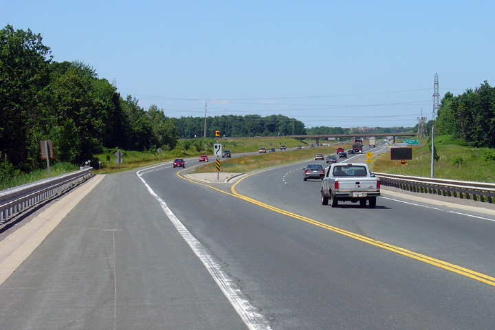
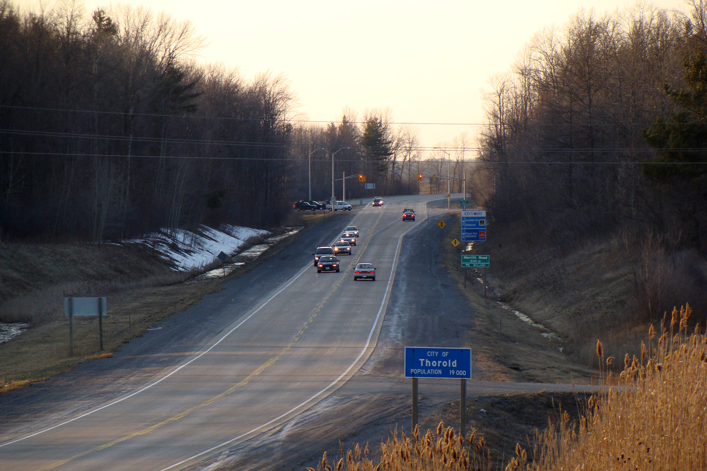
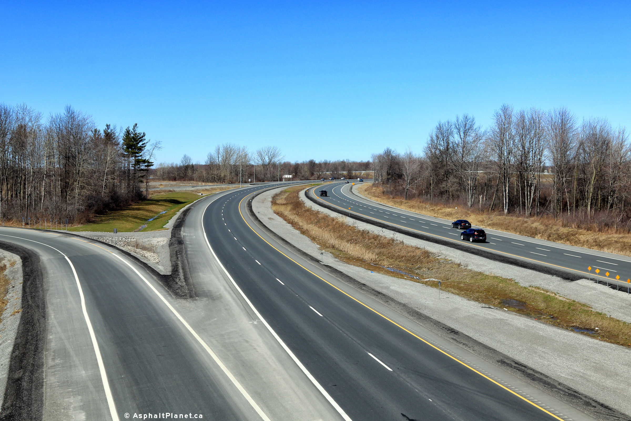
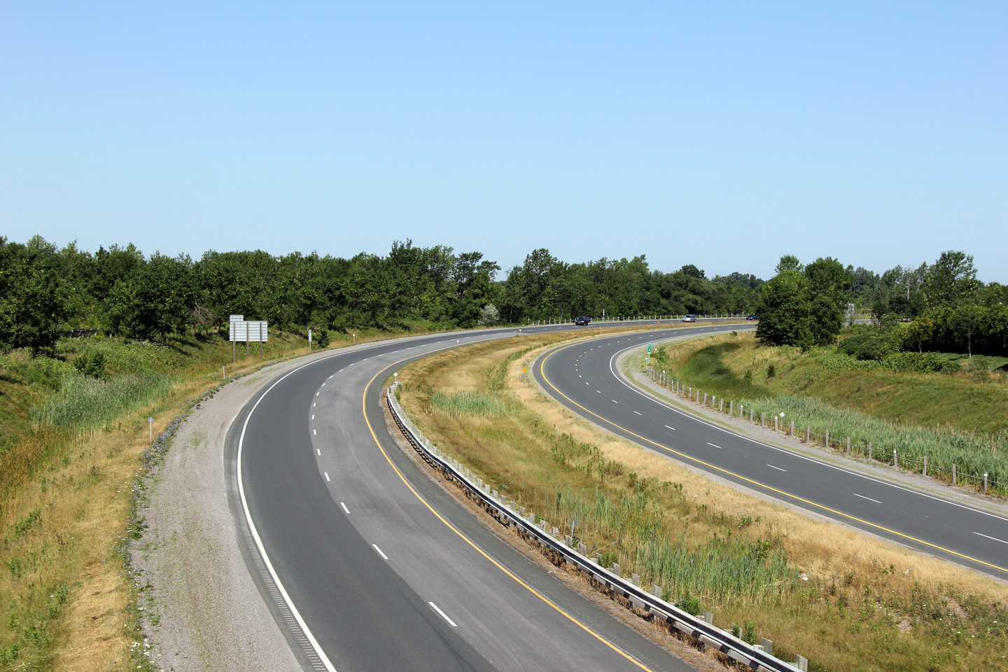
City of Thorold Regional Municipality of Niagara |
Southerly view along Highway 406 from the unopened Merritt Road overpass.
About 200m of advanced grading for the future northbound carriageway was
completed as part of the construction of the new Merritt Road overpass.
Interestingly, to the north of the Port Robinson Road the highway was
twinned to the west of the existing lanes -- through Merritt Road twinning
has taken place to the east of the existing carriageway.
Photo taken: July 30th, 2011. |
(720x480)
(1440x960)
(2400x1600)

(720x480)
(1440x960)
(2400x1600) |
|
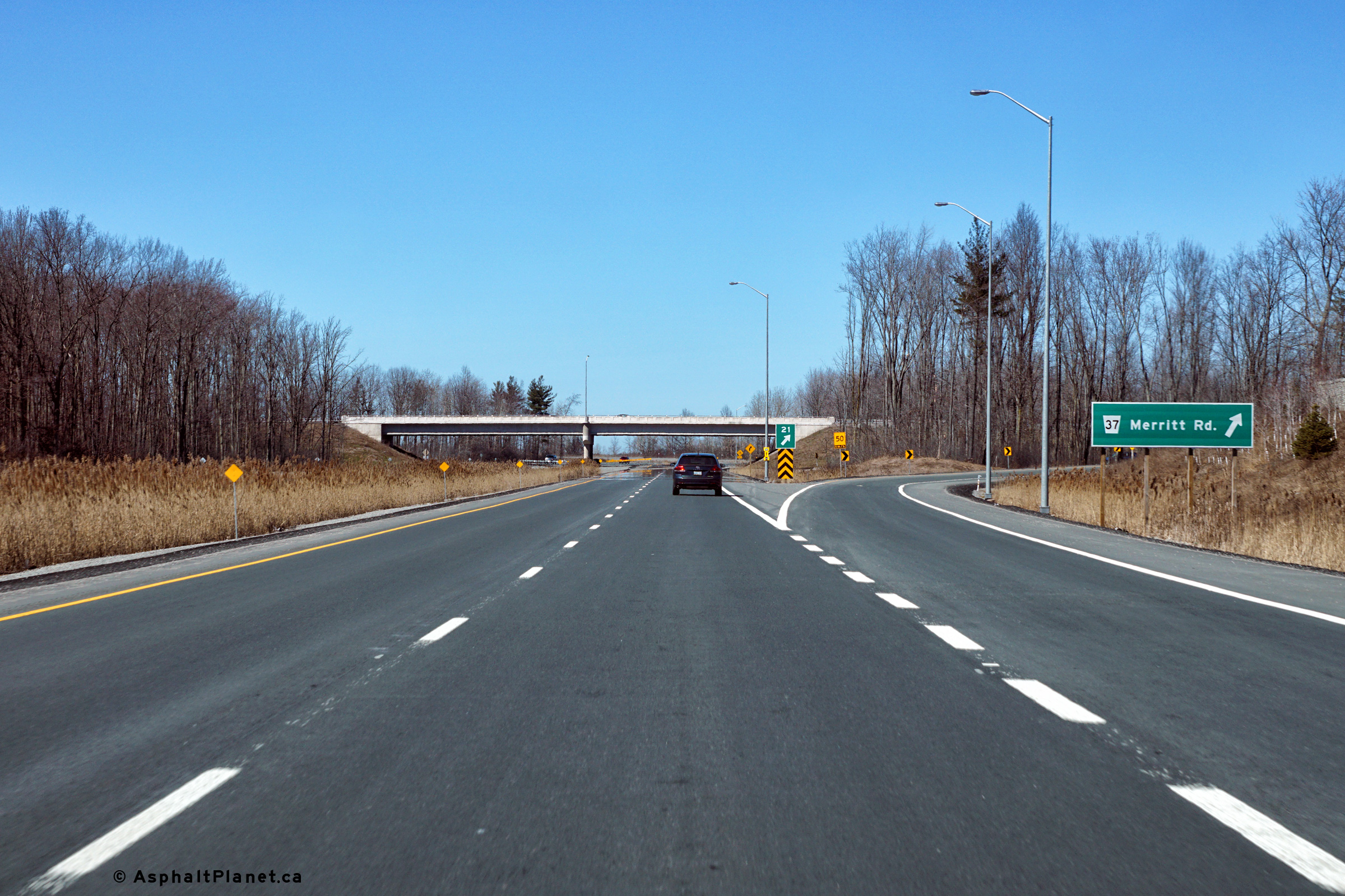
City of Thorold Regional Municipality of Niagara |
This view looks northerly from the future Merritt Road overpass towards the
still two-lane Highway 406.
Photo taken: July 30th, 2011. |

(720x480)
(1440x960)
(2400x1600)
|
|
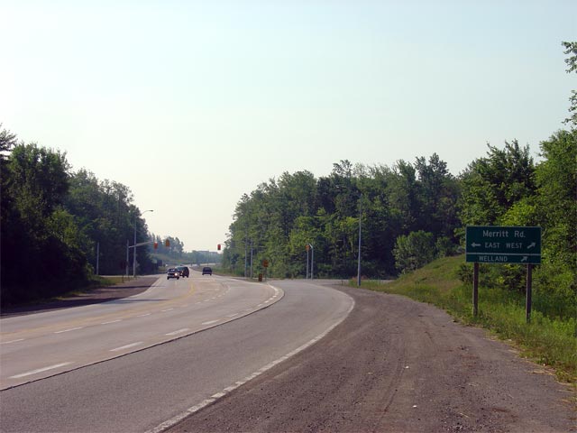
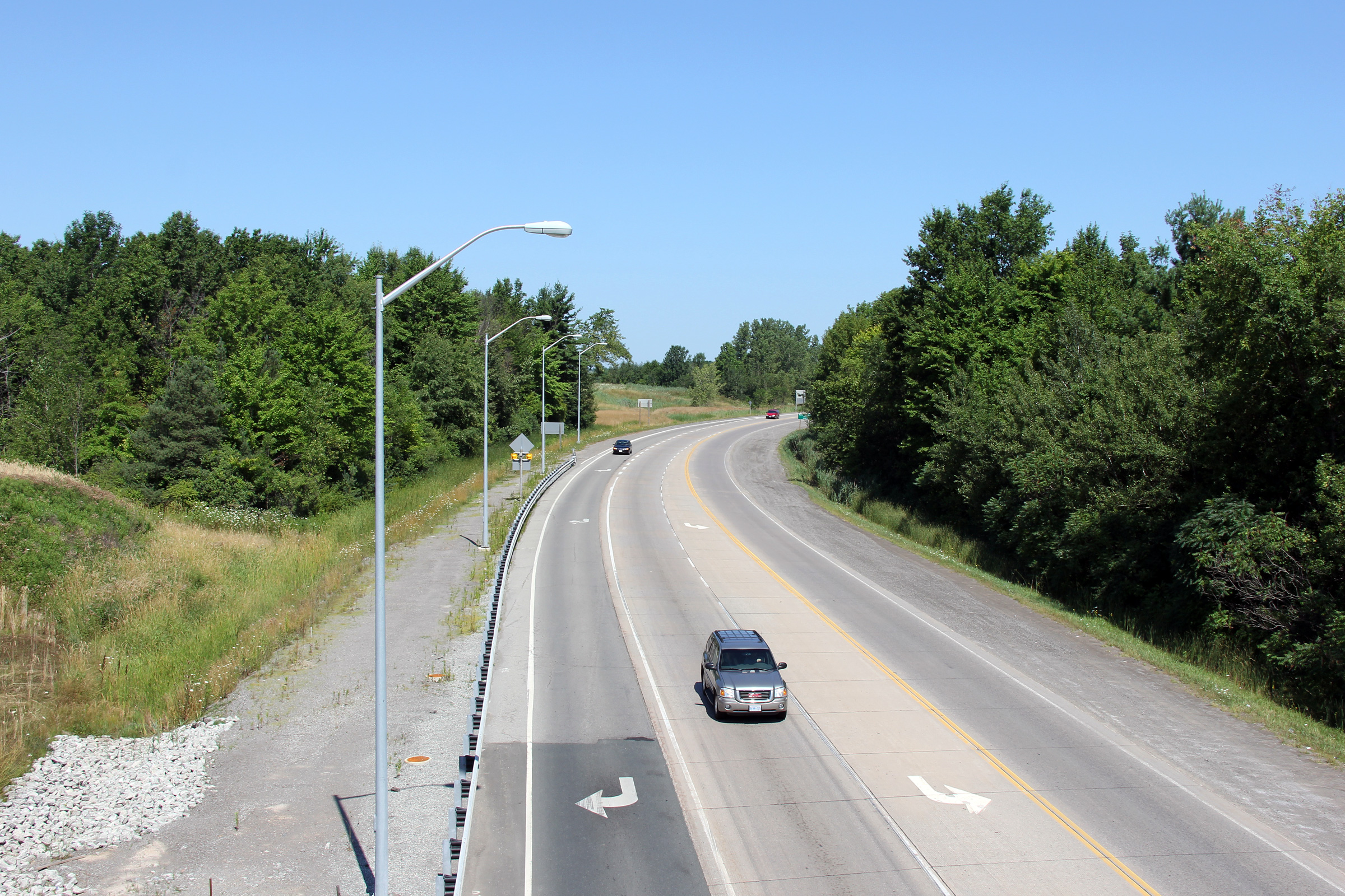
City of Thorold Regional Municipality of Niagara |
Two views looking southerly along Highway 406 as the highway approaches the
Merritt Road intersection. Old Highway 58 departed Highway 406 at this
junction leading through Downtown Welland. This is the first traffic
signal located on Highway 406 south of the freeway segment.
Upper photo taken: July 9th, 2007.
Lower photo taken: July 30th, 2011. |

(720x480)
(1440x960)
(2400x1600) |
|
City of Thorold Regional Municipality of Niagara |
Looking north along Highway 406 towards the Port Robinson Road at-grade
intersection. This at-grade intersection will be removed as part of
Highway 406's conversion to a freeway.
Photo taken: July 7th, 2005 |
|
|
|
|

(720x480)
(1440x960)
(2400x1600) |
|
|
|
(720x480)
(1440x960)
(2400x1600) |
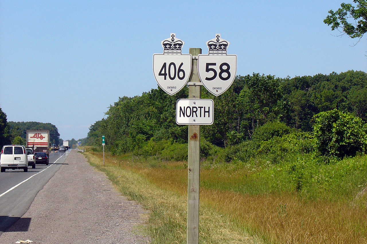
| City of Thorold Regional
Municipality of Niagara |
Northbound reassurance marker for Highway 406/58. As of the Summer of
2011, the Highway 58 reassurance marker has been replaced with a green
trailblazer.
Photo taken: July 7th, 2005. |
|
| City of Thorold Regional
Municipality of Niagara |
Basterdized bilingual signage way in advance of the southern terminus of
Highway 406 at East Main Street. This sign should have read "406
Ends/Fin At/À East Main Street". This sign no
longer stands.
Photo taken: July 7th, 2005 |
|
|
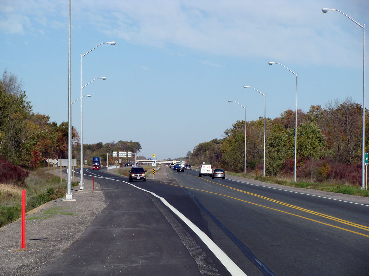
City of Thorold Regional Municipality of Niagara |
This picture shows Highway 406 looking south towards the Port Robinson Road
intersection. Picture taken: July 7th, 2005. |
 |
| City of Thorold Regional
Municipality of Niagara |
View looking northerly at the new southern end of the divided highway, just
to the north of the Port Robinson Road intersection. Photo taken: October
22nd, 2007. |
(720x480) (1440x960) |
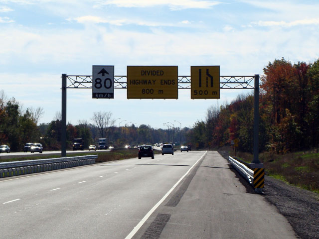
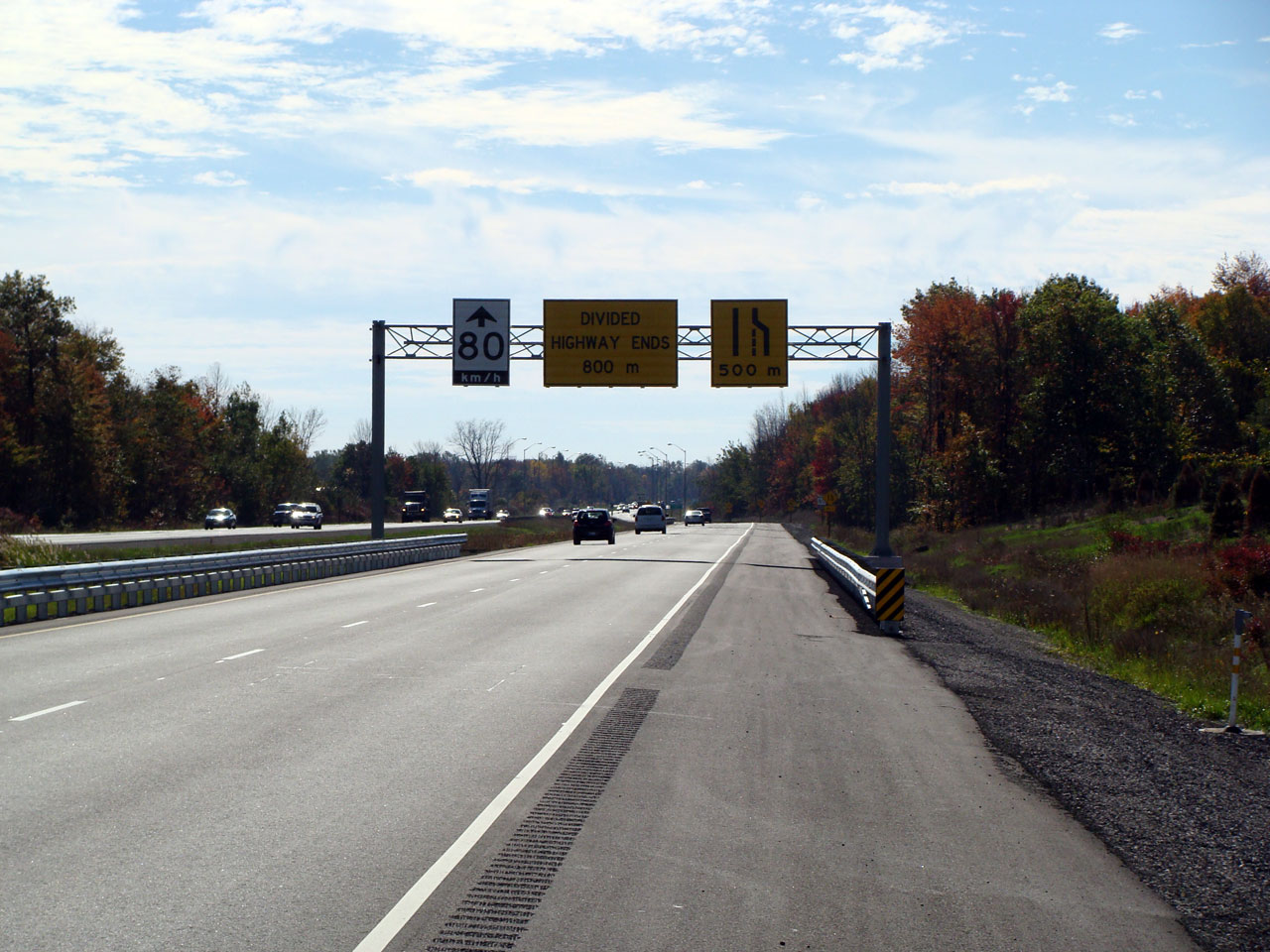
| City of Thorold Regional
Municipality of Niagara |
Southbound overhead gantry denoting the southern end of the divided freeway.
Notice the Divided Highway ends sign is written in text, rather then a
pictogram sign. Photo taken: October 22nd, 2007. |
(720x480)
(1440x960) |
| |
|
 (720x480) (720x480)
(1440x960)
(2400x1600) |
| |
|
 (720x480) (720x480)
(1440x960)
(2400x1600) |
| City of Thorold Regional
Municipality of Niagara |
Centre-line view of Highway 406 looking south from the
Highway 20
interchange. Highway 20 intersects Highway 406 via a parclo a-2
interchange. Photo taken: October 22nd, 2007. |
(720x480) (1440x960) |
|
Highway 20, now practically defunct, ran through
the centre of the Niagara Peninsula between Niagara Falls and Hamilton.
Click here for Highway 20 images. |
| City of Thorold Regional
Municipality of Niagara |
Northbound view of Highway 406 from the Highway 20 interchange.
Surprisingly, during the construction contract for the twinning between Port
Robinson and Beaverdams Road the northbound lanes of Highway 406 were only resurfaced in
the immediate vicinity of the former Highway 20 intersection.
Photo taken: October 22nd, 2007. |
(720x480) (1440x960) |
| City of Thorold Regional
Municipality of Niagara |
Drivers view of the new signage denoting the Highway 20 exit. Photo taken:
April 2nd, 2008. |
(720x480)
(1440x960) |
| City of Thorold Regional
Municipality of Niagara |
Two views looking northerly from the site of the former railway
overhead. For 36 years between the initial opening of Highway 406 in
1971 until the twinning south to Port Robinson Road opened in 2007, Highway
406 narrowed from a four-lane freeway to a two-lane single carriageway
at-grade highway at this location.
Upper photo taken: July 7th, 2005.
Lower photo taken: October 22nd, 2007.
|
(720x480) (1440x960) |
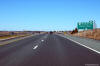
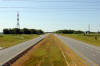
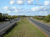
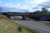
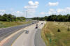
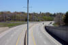
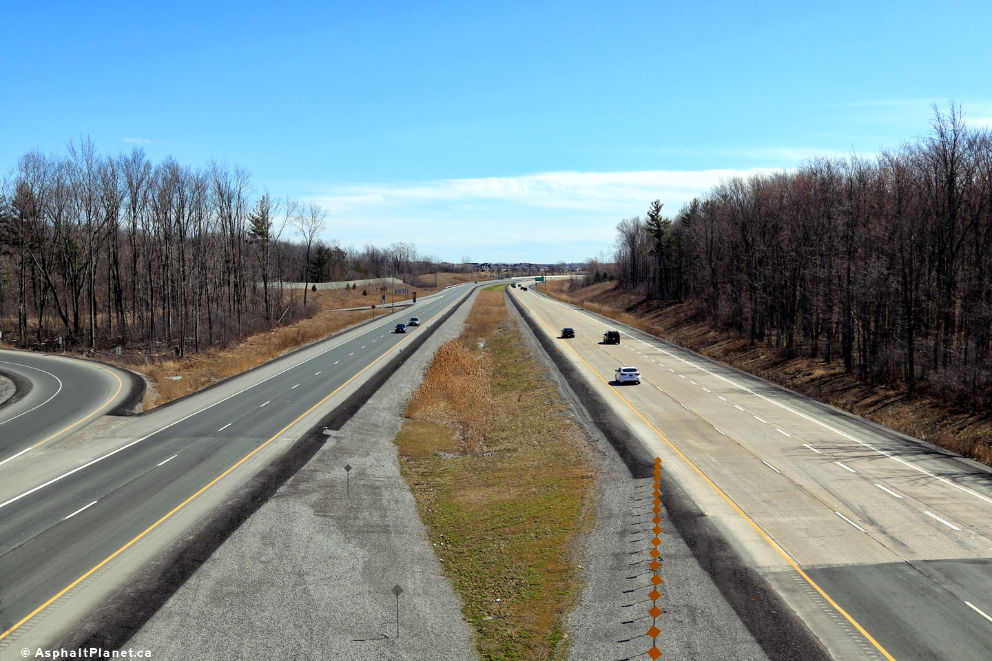
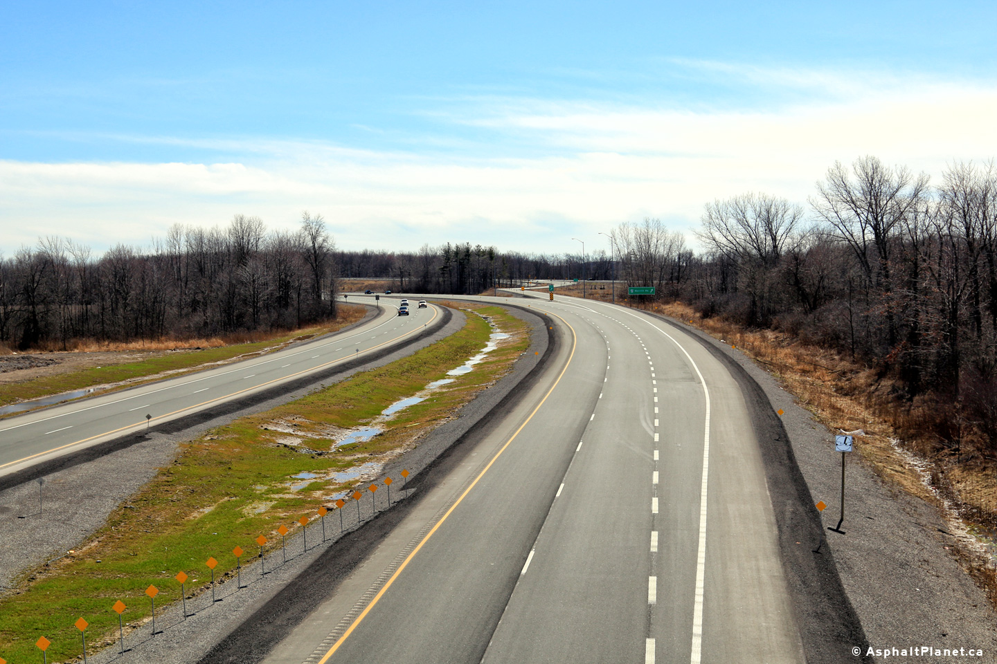
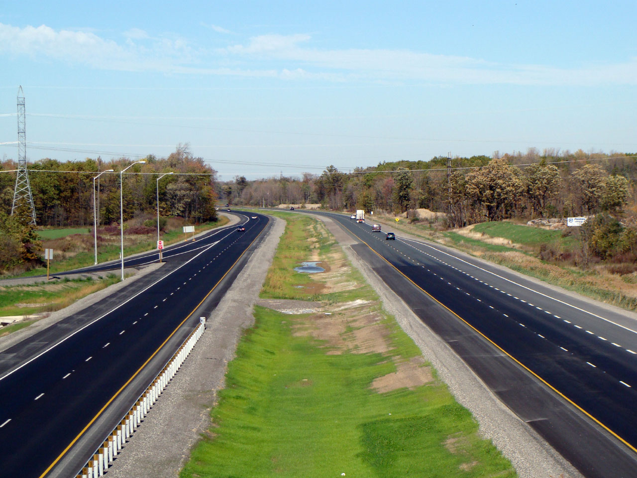
City of Thorold
Regional Municipality of Niagara |
Southerly view along Highway 406 from the Beaverdams Road interchange.
Prior to a 2006/07 twinning contract, Highway 406 narrowed to a single
two-lane carriageway south of Beaverdams Road.
Photo taken: July 30th, 2011. |
(720x480)
(1440x960)
(2400x1600) |
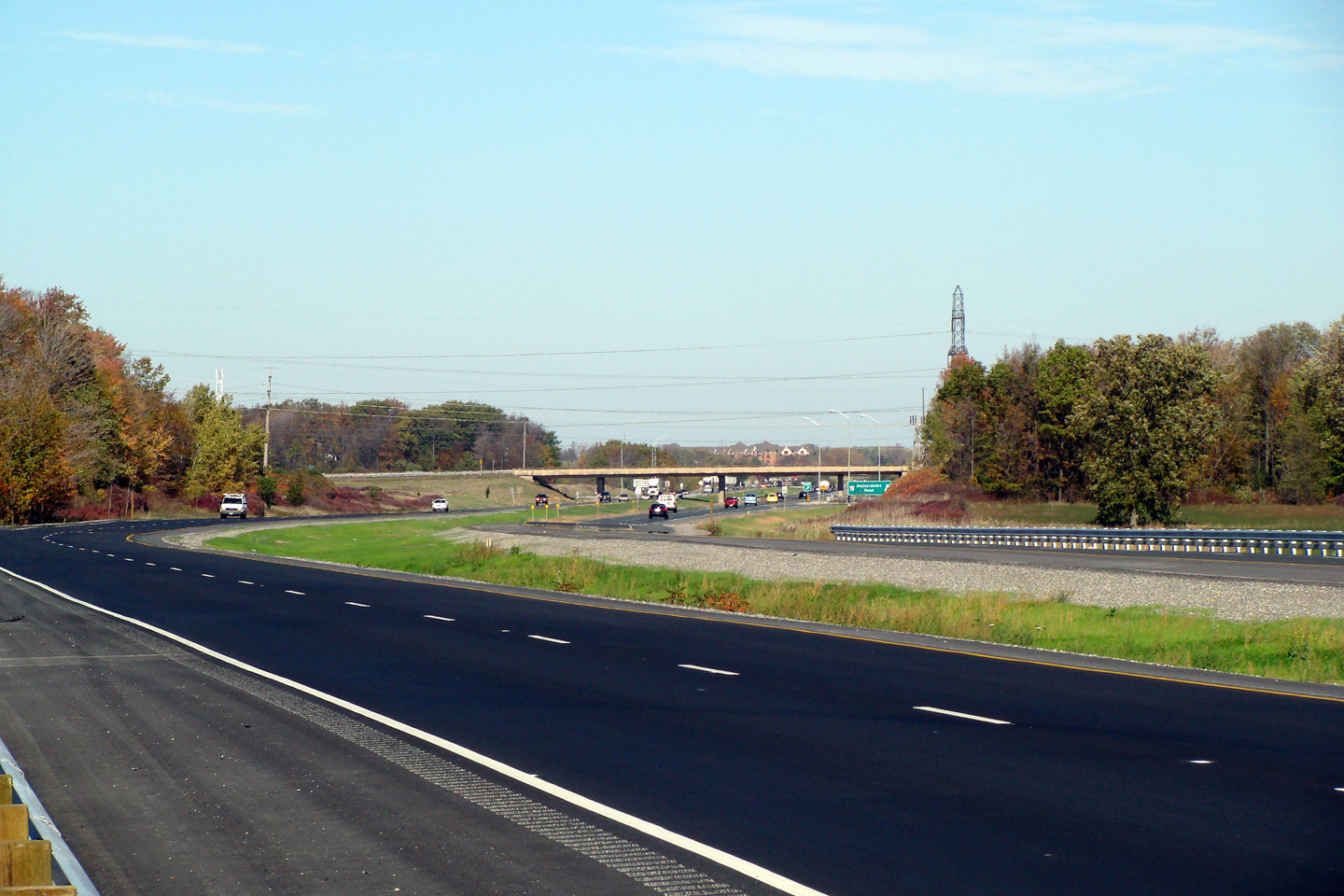
City of Thorold
Regional Municipality of Niagara |
This view looks northerly from the Beaverdams road overpass.
Photo taken: July 30th, 2011. |
(720x480)
(1440x960)
(2400x1600) |
City of Thorold
Regional Municipality of Niagara |
Signage for the northbound ramp to Highway 58 in advance to the Decew Road
overpass.
Photo taken: July 30th, 2011. |
 (720x480) (720x480)
(1440x960)
(2400x1600) |
|
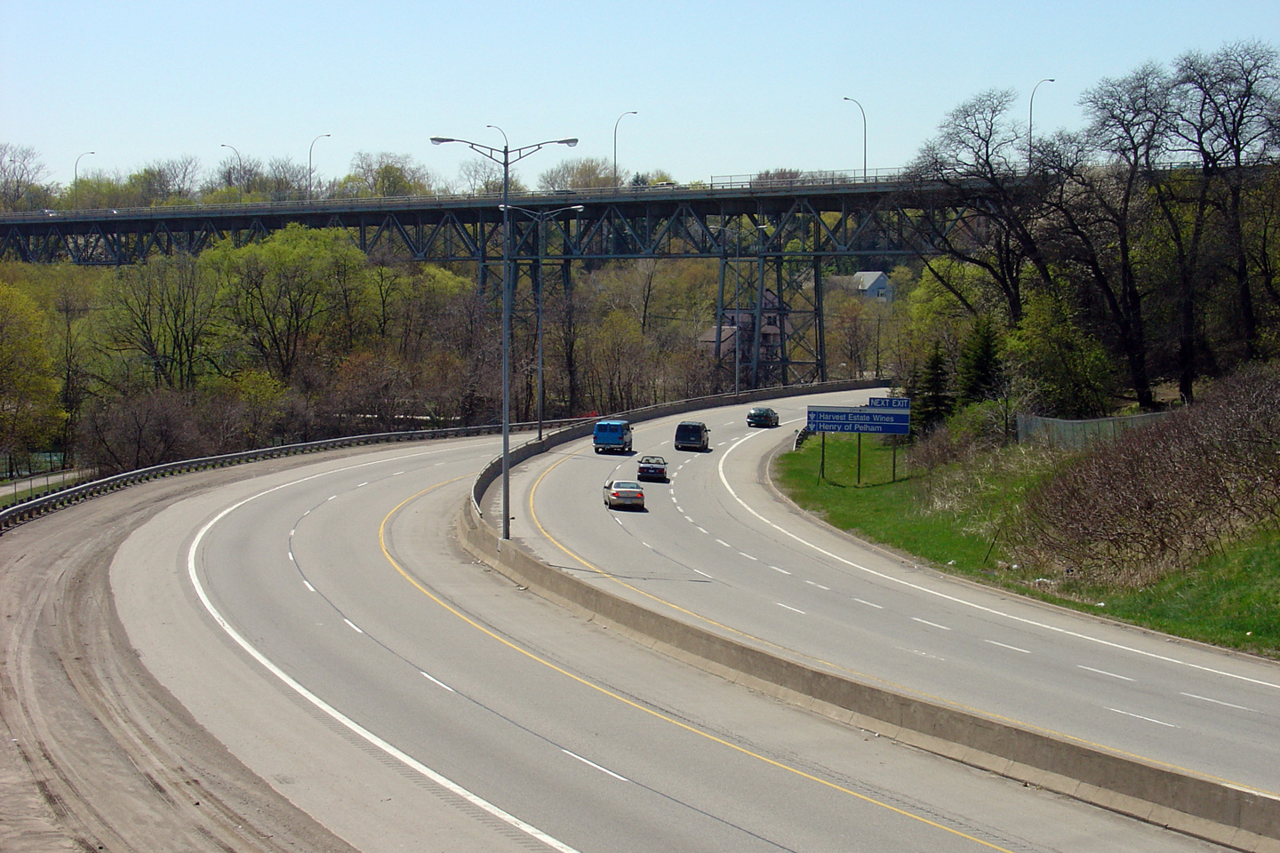
City of Thorold Regional Municipality of Niagara |
View looking southerly as the freeway crosses Lake Gibson from the Decew
Road overpass. Photo taken: September 20th, 2006. |
(720x480) (1440x960) |
|
City of Thorold Regional Municipality of Niagara |
This view looks northerly towards St. Catharines from he Decew Road
overpass. Photo taken: September 20th, 2006. |
(720x480) (1440x960) |
|
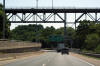
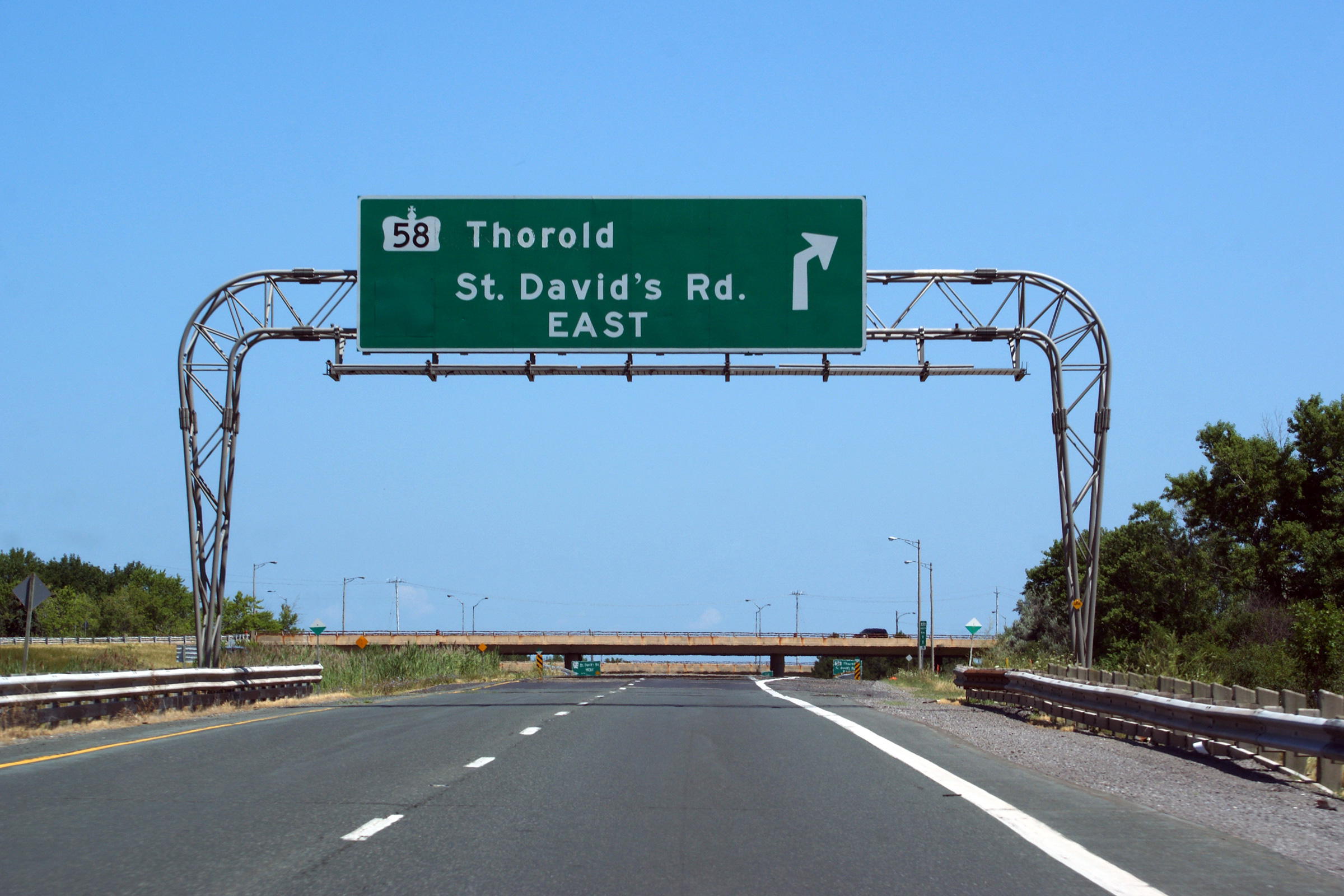
City of Thorold Regional Municipality of Niagara |
Overhead advanced sign for the upcoming and very large
Highway 58 interchange. Photo taken:
September 20th, 2006. |
 (720x480) (720x480)
(1440x960)
(2400x1600) |
|
City of Thorold Regional Municipality of Niagara |
View looking northerly at the signage for the Highway 58 interchange.
As is too often the case, the overhead sign that had previously existed at this
location was replaced with semi-permanently
mounted ground signage -- signage that is much too small for a large systems interchange.
At the time this photo was taken, new mounts had been installed for a new
tri-chord overhead sign to replace the much too small signage that has
existed here for many years too long. As is obvious in the photo
however, the new overhead signage had yet to be erected.
Photo taken: September 20th, 2006. |
 (720x480) (720x480)
(1440x960)
(2400x1600) |
|
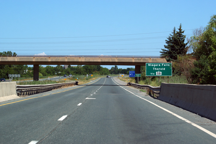
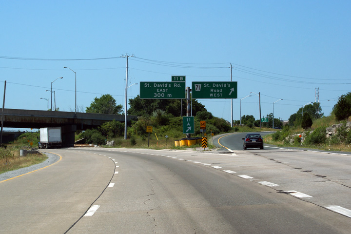
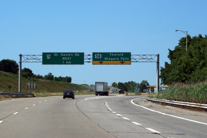
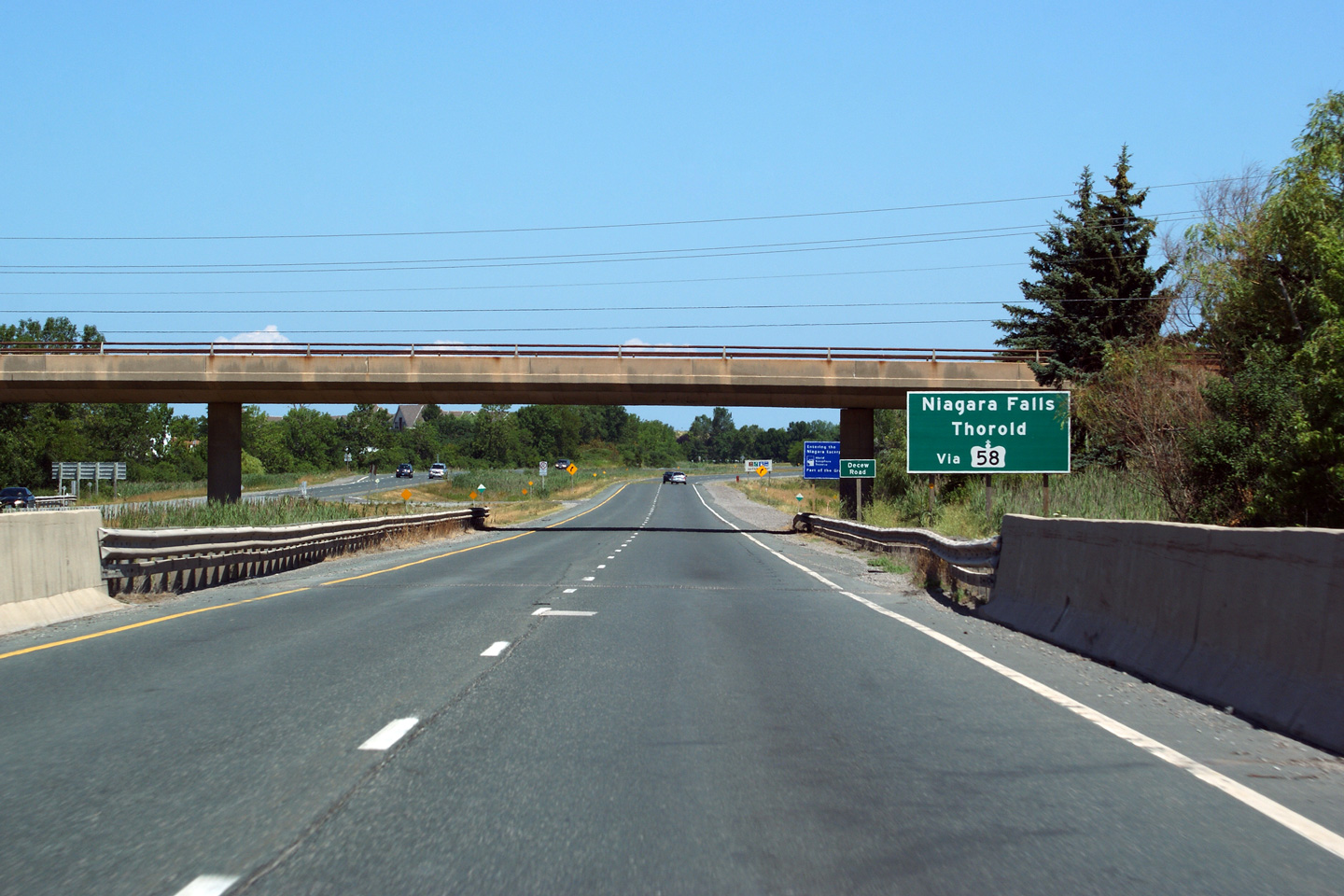
City of Thorold Regional Municipality of Niagara |
Signage for St. David's Road East from Highway 406-south. The
interchange between St. David's Road and Highway 406 is tightly intertwined
with the Highway 58/406 interchange. Photo taken: July 30th, 2011. |
 (720x480) (720x480)
(1440x960)
(2400x1600) |
|
City of St. Catharines Regional Municipality of Niagara |
Butterfly gantry for Highway 406 at the ramp to St. David's Road West.
St. David's Road meets Highway 406 at a parclo b4 interchange. There
are only a handful of interchanges with this design in the province.
Photo taken: July 30th, 2011. |
 (720x480) (720x480)
(1440x960)
(2400x1600) |
|
Highway 58 leads to the east side of the Welland
Canal before rejoining Highway 406 at the Highway 20 interchange a short
distance southerly.
Click here for Highway 58 images. |
|
City of St. Catharines Regional Municipality of Niagara |
Southbound signage at the high-speed off-ramp to Highway 58 East.
Photo taken: July 30th, 2011. |
 (720x480) (720x480)
(1440x960)
(2400x1600) |
|
City of St. Catharines Regional Municipality of Niagara |
Southbound advanced signage announcing the ramp to Highway 58.
Photo taken: July 30th, 2011. |
 (720x480) (720x480)
(1440x960)
(2400x1600) |
|
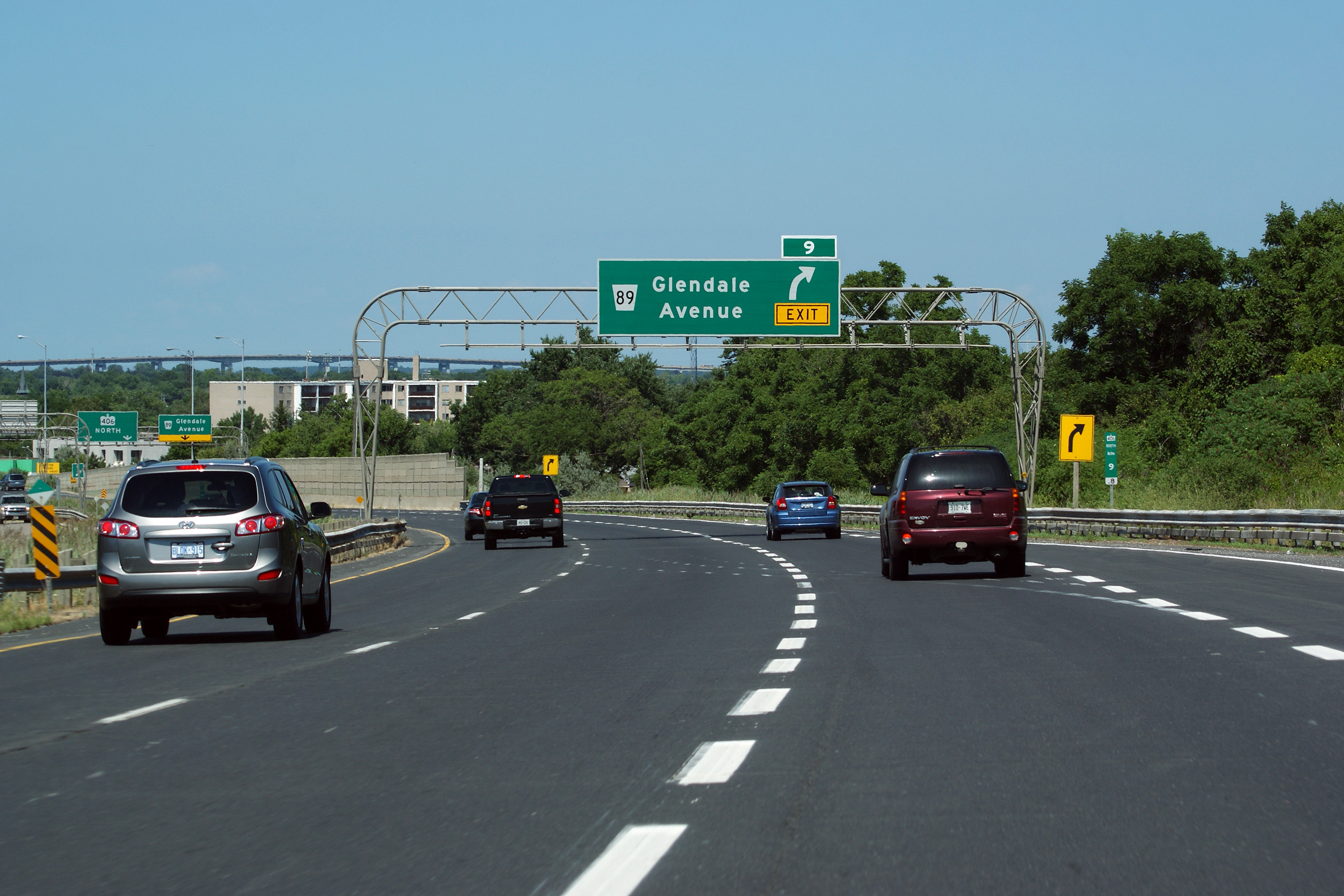
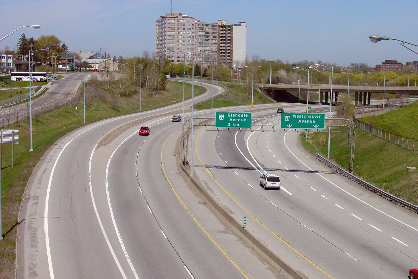
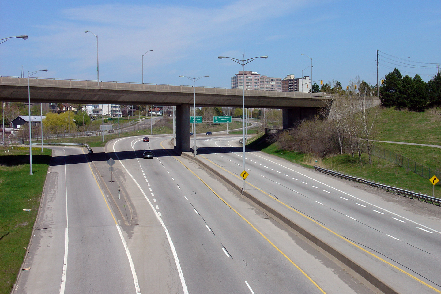
City of St. Catharines Regional Municipality of Niagara |
Northbound advanced signage for the off-ramp to Glendale Avenue. The
formidable Garden City Skyway dominates the St Catharines skyline from this
vantage point.
Photo taken: July 30th, 2011. |
 (720x480) (720x480)
(1440x960)
(2400x1600) |
|
City of St. Catharines Regional Municipality of Niagara |
Northbound view along Highway 406 as the auxiliary lane from the
Highway 58 interchange departs the freeway for Glendale Avenue.
Photo taken: July 30th, 2011. |
 (720x480) (720x480)
(1440x960)
(2400x1600) |
|
City of St. Catharines Regional Municipality of Niagara |
Southerly view as the ramp to Glendale Avenue departs from Highway 406
South.
Photo taken: July 30th, 2011. |
 (720x480) (720x480)
(1440x960)
(2400x1600) |
|
City of St. Catharines Regional Municipality of Niagara |
This view looks southerly towards the Glendale avenue interchange from the
CN Railway overhead.
Photo taken: September 20th, 2006. |

(720x480) (1440x960) |
|
City of St. Catharines Regional Municipality of Niagara |
View looking northerly CN Railway overhead towards Downtown St. Catharines.
Photo taken: September 20th, 2006. |

(720x480) (1440x960) |
|
City of St. Catharines Regional Municipality of Niagara |
A southerly view of the CNR overhead. Concrete rigid frame girder
structures is an uncommon design for a freeway constructed in the 1960s.
Rigid frames were most common along freeways constructed in the 1950s.
Photo taken: September 20th, 2006. |
(720x480) (1440x960) |
|
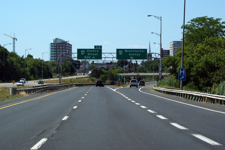
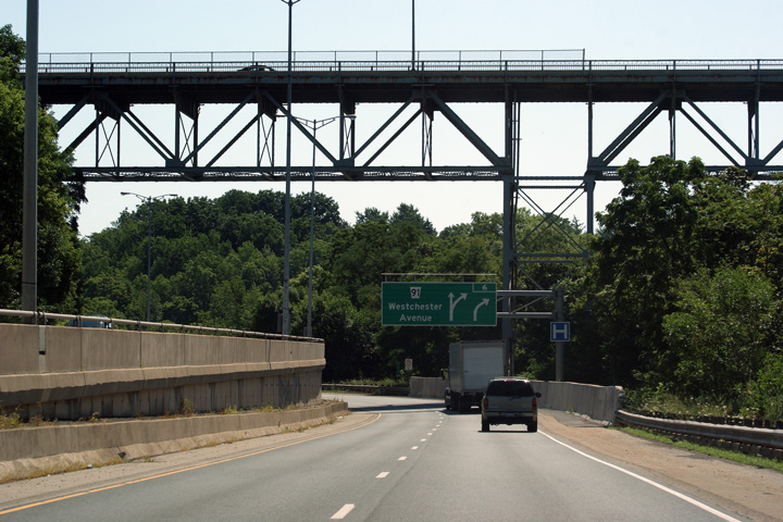
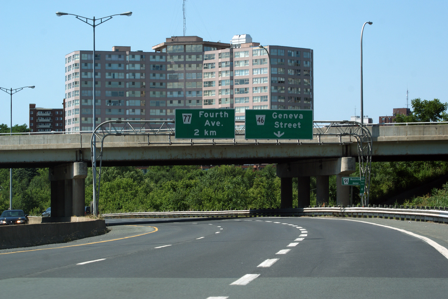
City of St. Catharines Regional Municipality of Niagara |
Northbound signage at the off-ramp to Westchester Road. Interestingly,
when the exit numbers were applied to Highway 406 early in 2011, the
designer elected to designate Westchester Road as exit 6A, and Geneva Street
as exit 6B, despite the fact that the mileage is progressing from north to
south. The designer was able to do this since there is only a single southbound
off-ramp to Westchester Road.
Photo taken: July 30th, 2011. |
 (720x480) (720x480)
(1440x960)
(2400x1600) |
City of St. Catharines
Regional Municipality of Niagara |
Northbound view along Highway 406 at the Geneva Street off-ramp. The
owner of Keefer Developments, the large apartment building that dominates
the photo, would have been well advised to have selected a different colour
for their apartment complex.
Photo taken: July 30th, 2011. |
 (720x480) (720x480)
(1440x960)
(2400x1600) |
|
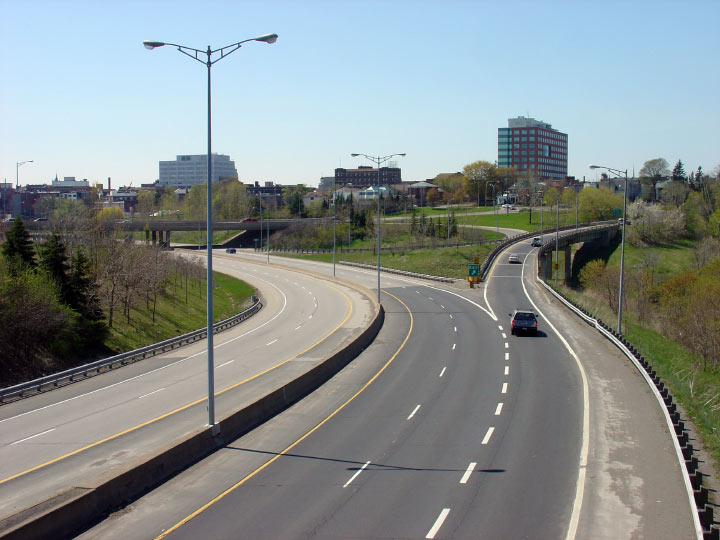
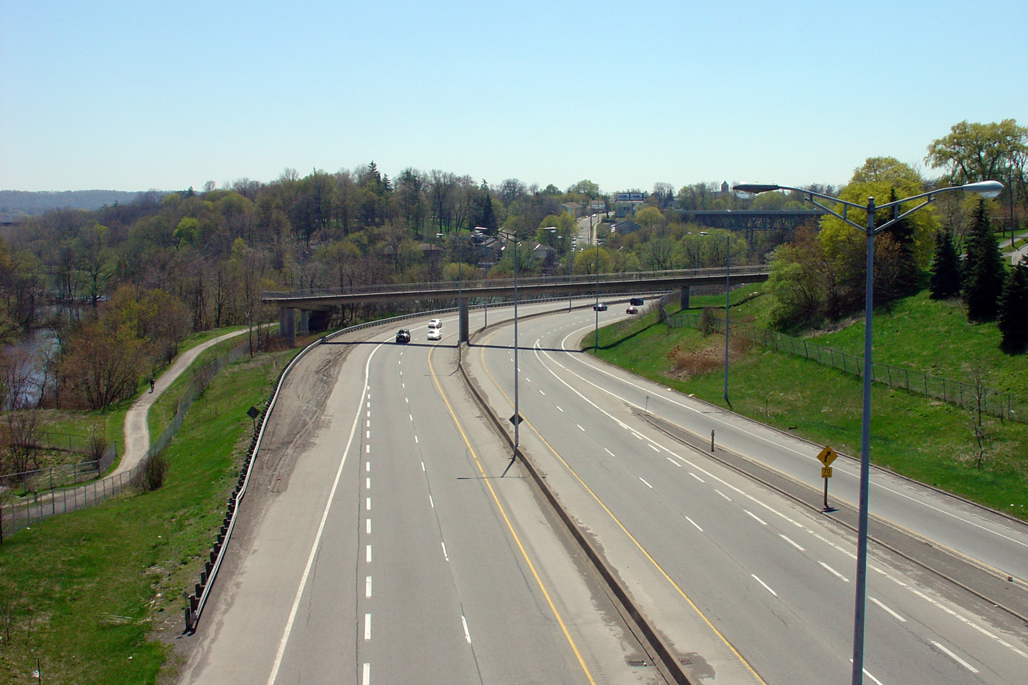
City of St. Catharines Regional Municipality of Niagara |
View looking southerly from the Westchester Drive overpass in St.
Catharines. Highway 406 has an 80km/h speed limit between Westchester
Drive and Fourth Avenue, due to some very sharp curves and overall tight
geometry.
Upper photo taken: July 30th, 2011.
Lower photo taken: April 2nd, 2008. |
(720x480)
(1440x960)
(2400x1600)
(720x480) (1440x960) |
|
City of St. Catharines Regional Municipality of Niagara |
Looking north along the 406 from Westchester Drive. Highway 406 skirts
the south side of Downtown St. Catharines. Until 1982, Highway 406
terminated at this interchange with its last long ramp reaching high over
the Old Welland Canal for
Geneva Street.
Upper photo taken: May 8th, 2005.
Lower photo taken: April 2nd, 2008. |

(720x480) (1440x960)
(720x480) (1440x960) |
|
City of St. Catharines Regional Municipality of Niagara |
This view looks southerly from the Geneva Street overpass along Highway
406. Running through the left of the photo is the off-ramp from Highway 406
to Geneva Street. You can see how industrial the structural steel looks
that is supporting the Geneva Street off-ramp. This structure was built in
the early 1960s, at a time when the Ontario economy was based far more on
heavy industry. An industrial looking highway was considered more
attractive at that time.
Photo taken: May 8th, 2005. |
(720x480) (1440x960) |
|
City of St. Catharines Regional Municipality of Niagara |
This view looks northerly along the 406 from the Geneva Street overpass.
Photo taken: May 8th, 2005. |
(720x480) (1440x960) |
|
City of St. Catharines Regional Municipality of Niagara |
Southerly view looking somewhat southerly along Highway 406 from the western
Westchester Road overpass. Through Central St. Catharines, Highway 406
was constructed overtop of an historic alignment of the Welland Canal.
Photo taken: May 8th, 2005. |
(720x480) (1440x960) |
|
City of St. Catharines Regional Municipality of Niagara |
Northbound view from the western Westchester Road overpass along
Highway 406. Highway 406 opened to traffic in 1982 between Downtown
St. Catharines (Geneva Street) and the Queen Elizabeth Way. Very few urban freeways
were constructed during the 1980's in Ontario, and Highway 406 has been
altered very little since it first opened to traffic. While the 406 is
generally similar to most modern 400-series highways, the use of truss
lighting, and low slung concrete jersey barriers to separate traffic are
not common to many freeways in the province.
Photo taken: May 8th, 2005. |
(720x480) (1440x960)
(720x480) (1440x960) |
|
City of St. Catharines Regional Municipality of Niagara |
This view looks again somewhat southerly (although slightly northerly) from
the St. Paul Crescent Pedestrian Bridge towards the western Westchester Road
overpass. Highway 406 passes underneath of Westchester Road, then
crosses underneath of Geneva Street before crossing back underneath of
Westchester Road in a convoluted routing through Downtown St. Catharines.
Photo taken: May 8th, 2005. |

(720x480) (1440x960) |
|
City of St. Catharines Regional Municipality of Niagara |
This view looks northbound along Highway 406 towards the massive Burgoyne
Bridge. The Burgoyne Bridge carries St. Paul Street over Highway 406
and Twelve Mile Creek. The Burgoyne Bridge pre-dates the completion of
Highway 406 by almost 7 decades.
The Burgoyne Bridge was built in 1915, and is facing Demolition by the
Region of Niagara.
Photo taken: May 8th, 2005. |
(720x480) (1440x960) |
|
City of St. Catharines Regional Municipality of Niagara |
Southerly view along Highway 406 from the St. Paul Street overpass.
The riverside pathway was constructed in the early 1980s as part of Highway
406's construction. Adding pedestrian facilities in proposed freeway
corridors often makes new freeway construction much more palatable to the
surrounding community. Most new urban freeways, particularly those
adjacent to waterways are met with at least some kind of local resistance
prior to construction.
Photo taken: May 8th, 2005. |
(720x480) (1440x960) |
|
City of St. Catharines Regional Municipality of Niagara |
Two northbound view along Highway 406 from the St. Paul Street overpass in
St. Catharines. Highway 406 follows Twelve mile Creek for just shy of
a kilometre in a rather substantial valley. Through Downtown St.
Catharines, the 406 is far more reminiscent of the Don Valley Parkway then
it is of a typical 400-series highway. Highway 406 is arguably one of
the best urban freeway drives in the province of Ontario. Twelve Mile
Creek is crossed by the Queen Elizabeth Way by means of the iconic
Henley Bridges.
Photos taken: May 8th, 2005. |

(720x480) (1440x960)
(720x480) (1440x960) |
|
City of St. Catharines Regional Municipality of Niagara |
Brand new partial overhead sign in advance of the Winchester Road overpass.
Notice the new and rather substantial barrier that has been installed to
protect the Burgoyne Bridge pier. Photo taken: July 30th, 2011. |
 (720x480) (720x480)
(1440x960)
(2400x1600) |
|
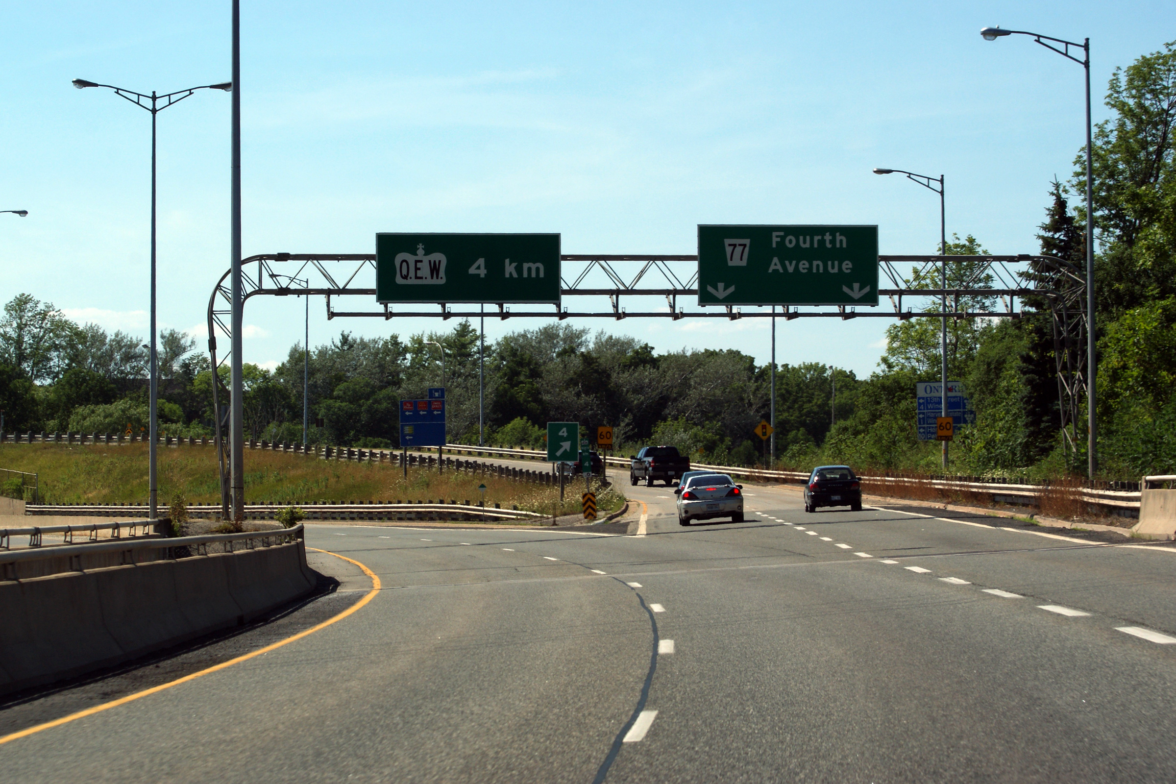
City of St. Catharines Regional Municipality of Niagara |
Northbound view at the off-ramp to the Fourth Avenue interchange.
Photo taken: July 30th, 2011. |
 (720x480) (720x480)
(1440x960)
(2400x1600) |
|
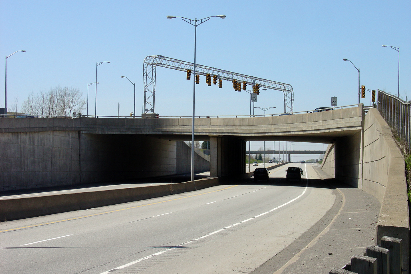
City of St. Catharines Regional Municipality of Niagara |
Northerly view along Highway 406 approaching the Fourth Avenue Single Point
Urban Interchange, or SPUI. Note the rather excessive traffic signal
setup towering over Fourth Avenue. At a SPUI, all interchange ramps
intersect at a single point, in this overtop of the freeway, hence the
interchange name.
Photo taken: May 8th, 2005. |

(720x480) (1440x960) |
|
City of St. Catharines Regional Municipality of Niagara |
This view looks southerly along Highway 406 from Fourth Avenue. This
is a not a very exciting vantage point.
Photo taken: May 8th, 2005. |
(720x480) (1440x960) |
|
City of St. Catharines Regional Municipality of Niagara |
Deck view of Fourth Avenue passing overtop of Highway 406. The SPUI is a
modern iteration of the classic diamond interchange. Because all of the
ramps converge at one point, there is no limiting issue with where to store
opposing left turning vehicles as their is with a diamond. This is
Ontario's only SPUI.
Photo taken: May 8th, 2005. |

(720x480) (1440x960) |
|
City of St. Catharines Regional Municipality of Niagara |
Northerly view from the Fourth Avenue interchange.
Photo taken: May 8th, 2005. |
(720x480) (1440x960) |
|
City of St. Catharines Regional Municipality of Niagara |
Southerly view from the Martindale Road overpass towards the Fourth Avenue
SPUI.
Photo taken: July 30th, 2011. |

(720x480)
(1440x960)
(2400x1600) |
|
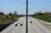
City of St. Catharines Regional Municipality of Niagara |
Northerly view from the Martindale Road overpass. Highway 406
widens out from its tight urban cross-section to a rural cross-section just
beyond Martindale Road.
Photo taken: July 30th, 2011. |

(720x480)
(1440x960)
(2400x1600) |
|
City of St. Catharines Regional Municipality of Niagara |
Southerly view from the First Street Louth Overpass. The St.
Catharines skyline is visible in the distance.
Photo taken: July 30th, 2011. |

(720x480)
(1440x960)
(2400x1600) |
|
City of St. Catharines Regional Municipality of Niagara |
Northerly view from First Street Louth. Highway 406 serves as the
western limit of St. Catharines urbanized area between this curve and the
QEW.
Photo taken: July 30th, 2011. |
(720x480)
(1440x960)
(2400x1600) |
|
City of St. Catharines Regional Municipality of Niagara |
View looking southerly from the Third Avenue overpass in the former township
of Louth. Photo taken: September 20th, 2006. |
(720x480) (1440x960) |
|
City of St. Catharines Regional Municipality of Niagara |
View looking northerly from the Third Avenue overpass towards the QEW
interchange. Photo taken: September 20th, 2006. |
(720x480) (1440x960) |
|
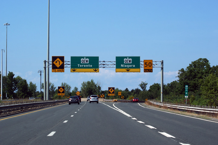
City of St. Catharines Regional Municipality of Niagara |
Northbound diagram sign for the upcoming Queen Elizabeth Way interchange.
This overhead sign was recently updated to more accurately reflect the
actual geometry of the interchange.
Photo taken: July 30th, 2011. |
 (720x480) (720x480)
(1440x960)
(2400x1600) |
|
City of St. Catharines Regional Municipality of Niagara |
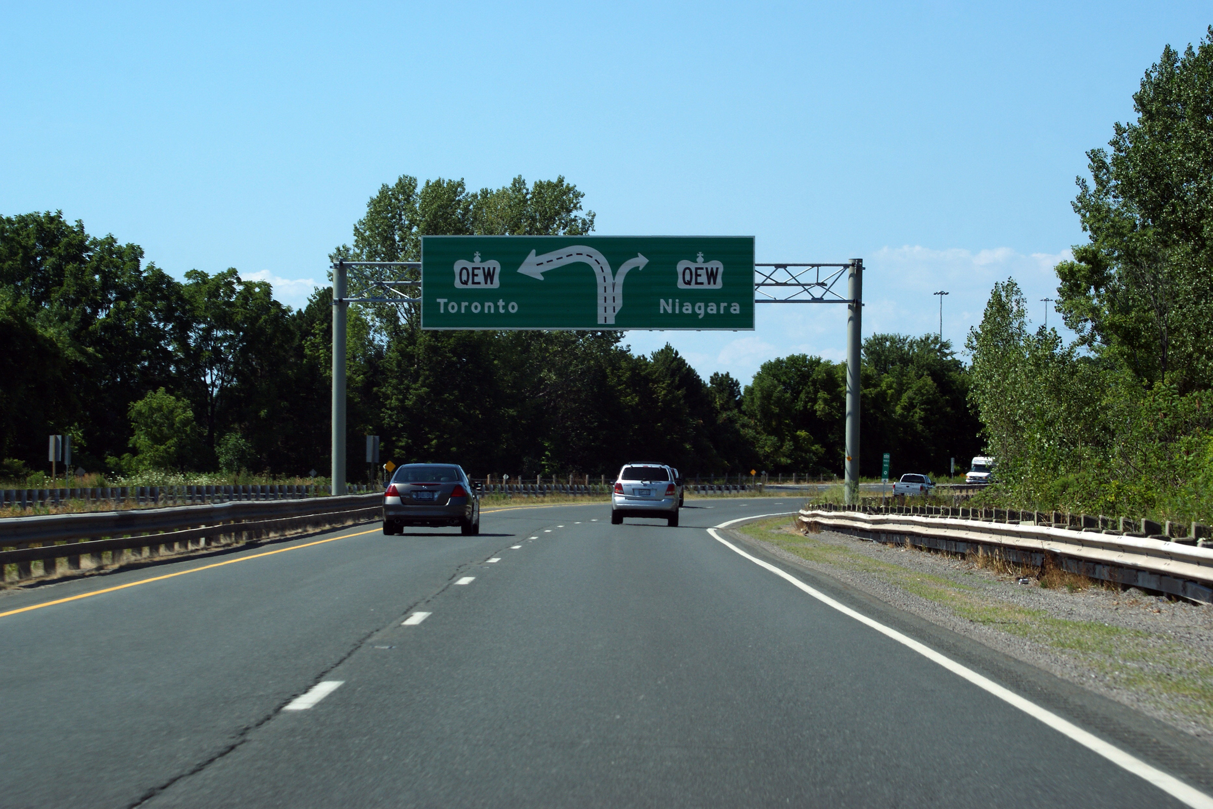
Signage at the gore to the dual off-ramps to the QEW. The vast array
of warning signs standing in advance of the ramp to the Toronto-bound QEW
seems to indicate a heightened collision rate along the ramp.
Motorists are advised to drive cautiously, and heed the warning sign's
advice.
Photo taken: July 30th, 2011. |
 (720x480) (720x480)
(1440x960)
(2400x1600) |
|
Highway 406 ends at a trumpet
interchange with the QEW in western St. Catharines.
Click
here for QEW images. |


 (720x480)
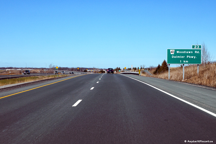 (720x480)
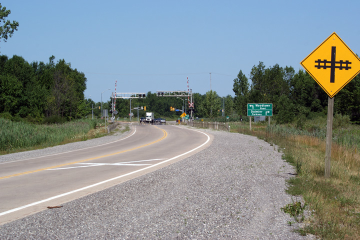

 (720x480)
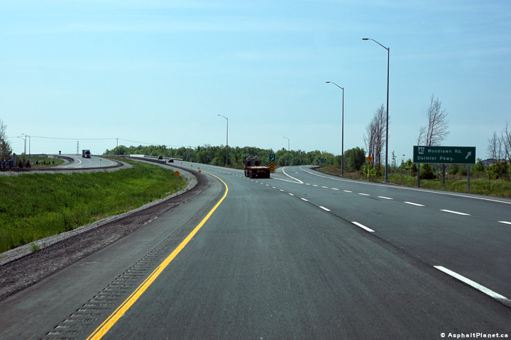 (720x480)
 (720x480)
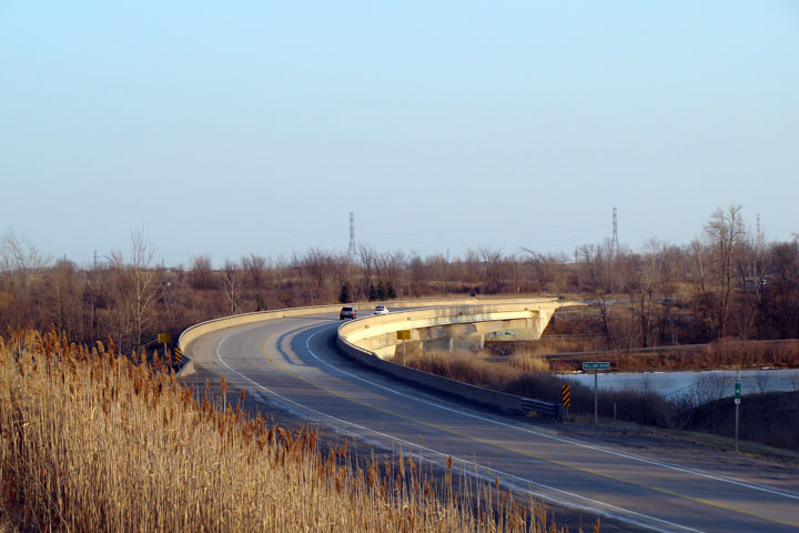

 (720x480)
 (720x480)


 (720x480)


 (720x480)
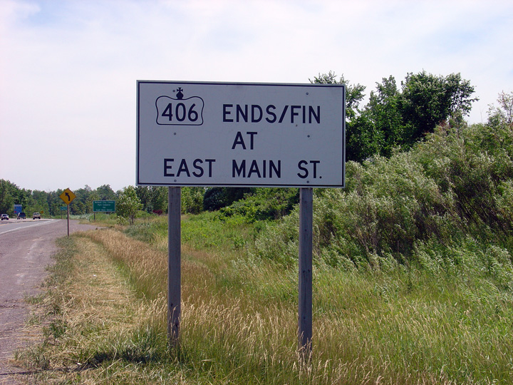 (720x480)

 (720x480)
 (720x480)


 (720x480)
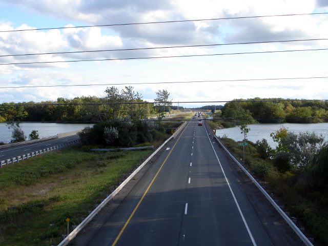

 (720x480)
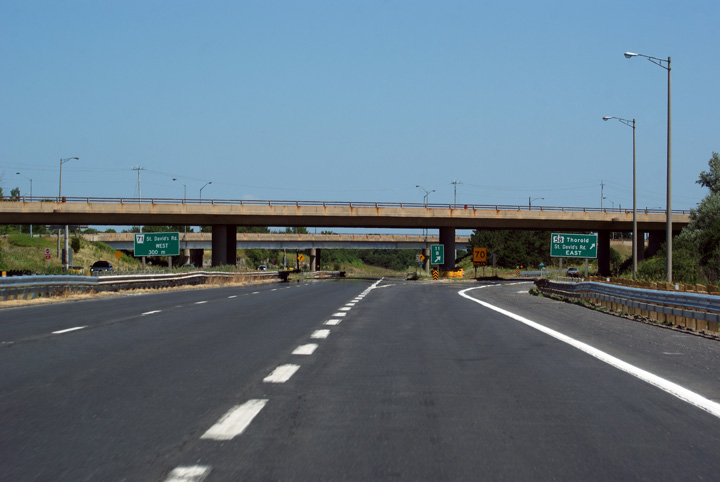 (720x480)
 (720x480)
 (720x480)
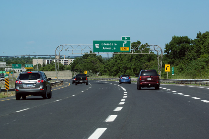 (720x480)
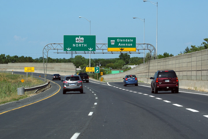 (720x480)
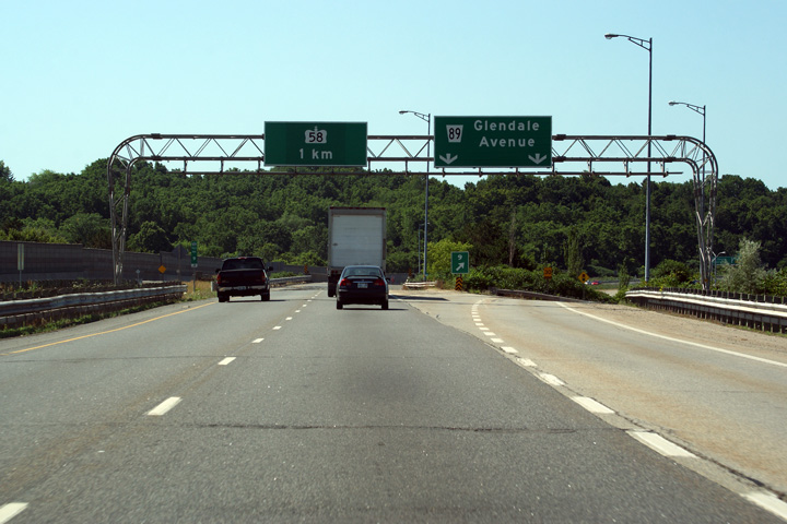 (720x480)
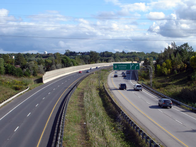


 (720x480)
 (720x480)


 (720x480)


 (720x480)
 (720x480)