King's Highway 58 - Images
Photos shown in this table are arranged from South to North:
| Proper Municipality Name | Photo Description | Photo | |
|
Photos taken from driver's perspective appear offset from centre-line Photos: |
North- Bound |
South- Bound |
|
| Highway 58 ends at a signalized intersection with Highway 3 to the west side of Port Colborne. Click here for Highway 3 images. | |||
| City of Port Colborne Regional Municipality of Niagara |
Southbound junction assembly for the Highway 3/Niagara Road 3 intersection
at the South end of Highway 58. Highway 3 is locally controlled
through the urban section of Port Colborne, and is as such inconsistently
signed as both Highway 3 and Regional Road 3. Photo taken: February 23rd, 2005. |
 |
|
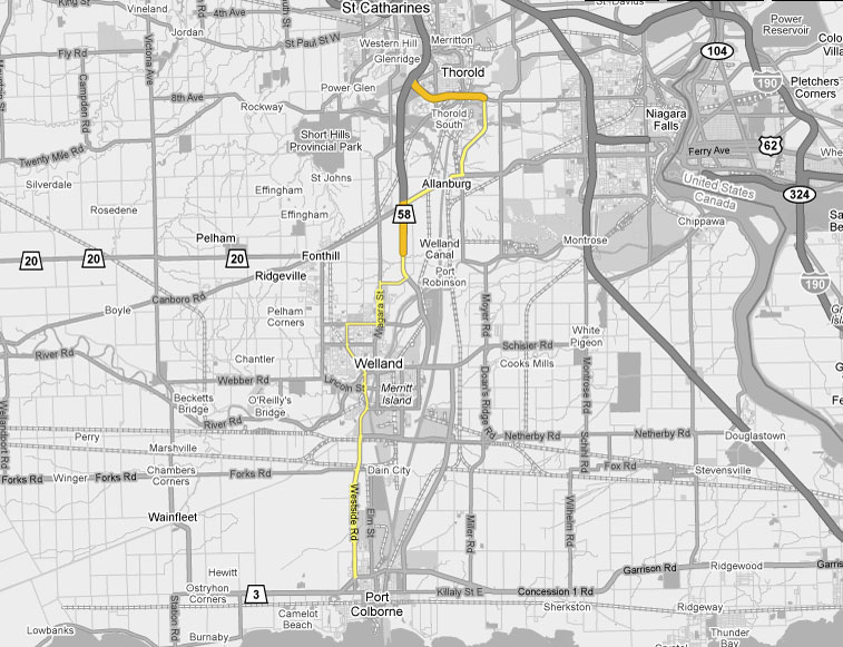
| City of Welland Regional Municipality of Niagara |
View looking northbound at the Forks Road intersection. Forks Road
meets at a rather odd looking stop-controlled parclo interchange, due to
some tight geometry between Highway 58, a railway line, and Forks Road
itself. Photo taken: May 8th, 2005. |
 |
|
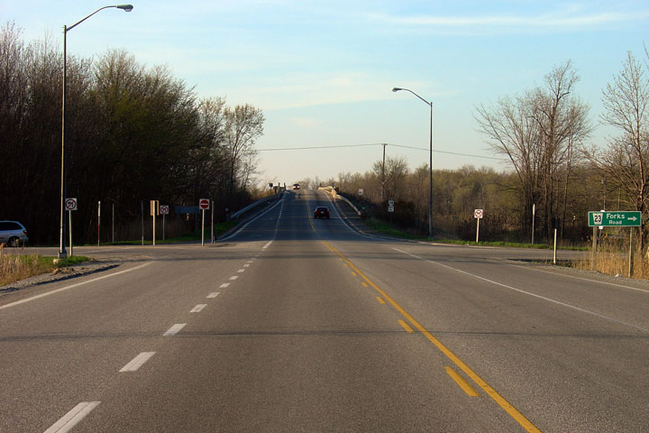
| City of Welland Regional Municipality of Niagara |
Reverse view of the Forks Road intersection -- looking south. Photo taken: May 8th, 2005. |
 |
|
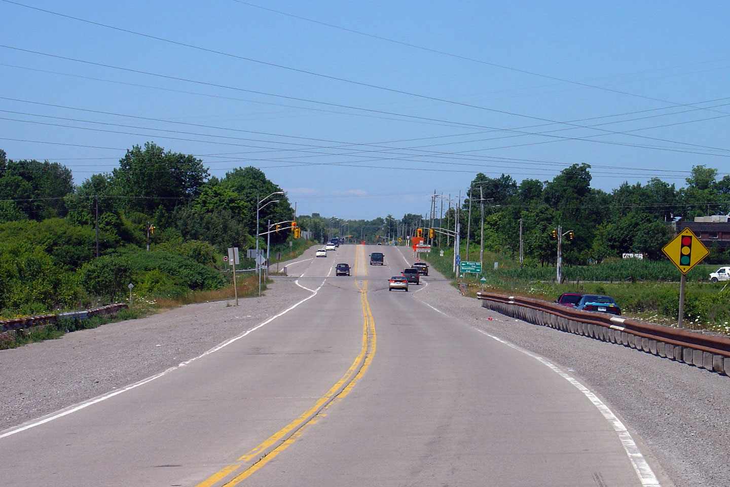
| City of Welland Regional Municipality of Niagara |
View looking northerly along Highway 58 nearing the Highway 58A
intersection. Photo taken: October 15th, 2006. |
 |
|
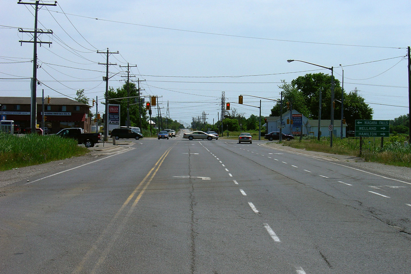
| City of Welland Regional Municipality of Niagara |
Newly erected green signs advising drivers of their choices as they approach
Welland. Highway 58 was downloaded through Welland and now carries
several different names as the highway twists and turns through Welland to
Highway 406. It is simply astounding that the southern tier of Highway
58 remains under provincial control. Photo taken: October 15th, 2006. |
 |
|
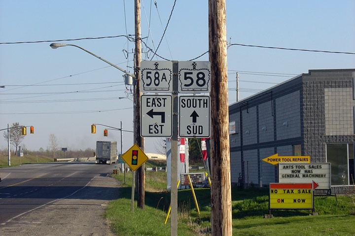
| The south segment of Highway 58 ends at the Highway 58A intersection, immediately south of Welland. Click here for Highway 58A images. | |||
| City of Welland Regional Municipality of Niagara |
Southerly view along Prince Charles Road towards the Highway 58A
intersection. Photo taken: May 8th, 2005. |
 |
|
| City of Welland Regional Municipality of Niagara |
Southbound junction assembly approaching the Highway 58A intersection. Photo taken: May 8th, 2005. |
 |
|
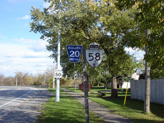
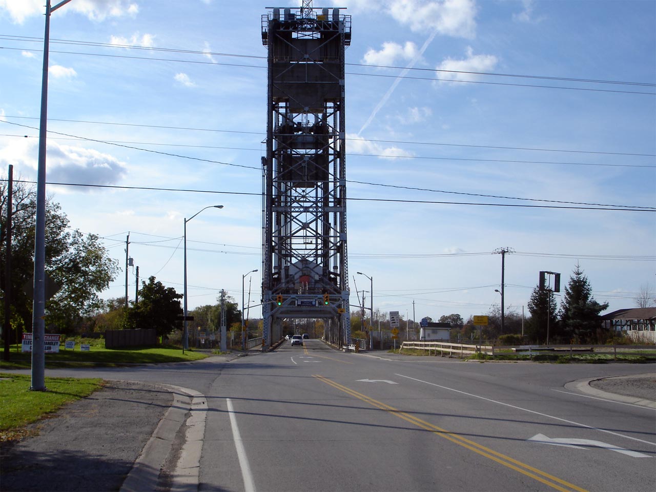
| City of Thorold Regional Municipality of Niagara |
View looking west across the Welland Canal Lift bridge along Highway 20/58.
For more information about this interesting lift bridge, please visit
Nathan
Holth's Historic Bridge website. Photo taken: October 15th, 2006. |
 |
|
| City of Thorold Regional Municipality of Niagara |
Shield assembly located just east of the Allenburg Bridge.
Surprisingly when Highway 20 was downloaded to the Region of Niagara in
1998, sporadic Highway 58 signage was left in place. Photo taken: October 15th, 2006. |
 |
|
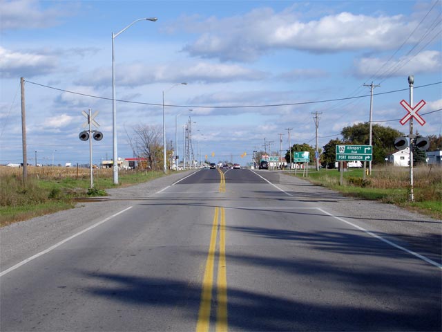
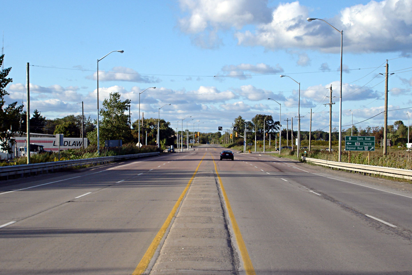
| City of Thorold Regional Municipality of Niagara |
View looking easterly towards the eastern Highway 58 junction south of
Allenburg. Photo taken: October 15th, 2006. |
 |
|
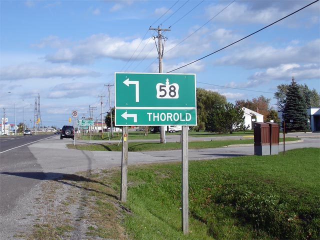
| City of Thorold Regional Municipality of Niagara |
Green advanced signage denoting the Highway 58 junction. Highway 58
departs Highway 20 here, heading north around Allenburg before crossing the
Welland Canal once again to meet Highway 406. Photo taken: October 15th, 2006. |
 |
|
| East of Highway 58, Highway 20 continues into Niagara Falls. Click here for Highway 20 images. | |||
| City of Thorold Regional Municipality of Niagara |
Highway 58 looking south approaching the eastern Highway 20 junction.
At this junction, (before downloading) southbound traffic must turn right
towards Highway 406 and Hamilton to stay on Highway 58. Currently,
this intersection marks the southern terminus of the northern section of
Highway 58. Photo taken: July 7th, 2005. |
 |
|
| City of Thorold Regional Municipality of Niagara |
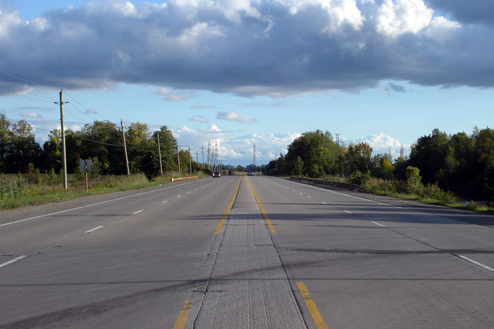
This Photo shows Highway 58 nearing the Beaverdams Road & Niagara Falls
Road intersection. Notice the concrete driving surface on Highway 58.
Concrete was extensively used as a driving surface on highways during the
mid-1960s. This section of Highway 58 (by-passing Thorold South) was
constructed in the mid-1960s as part of the Thorold Tunnel construction
project. Photo taken: July 7th, 2005. |
 |
|
| City of Thorold Regional Municipality of Niagara |
Southerly view of Highway 58 from just south of Thorold Stone Road.
This stretch of Highway 58 is no longer paved in concrete. This is a
neat cross-section however, its too bad the use of raised singing medians
has fallen out of favour. Photo taken: October 15th, 2006. |
 |
|
| City of Thorold Regional Municipality of Niagara |
View looking northerly along Highway 58 approaching the Thorold Stone Road
intersection. Photo taken: October 15th, 2006. |
 |
|
| City of Thorold Regional Municipality of Niagara |
Green signage approaching the Thorold Stone Road intersection. Photo taken: October 15th, 2006. |
 |
|
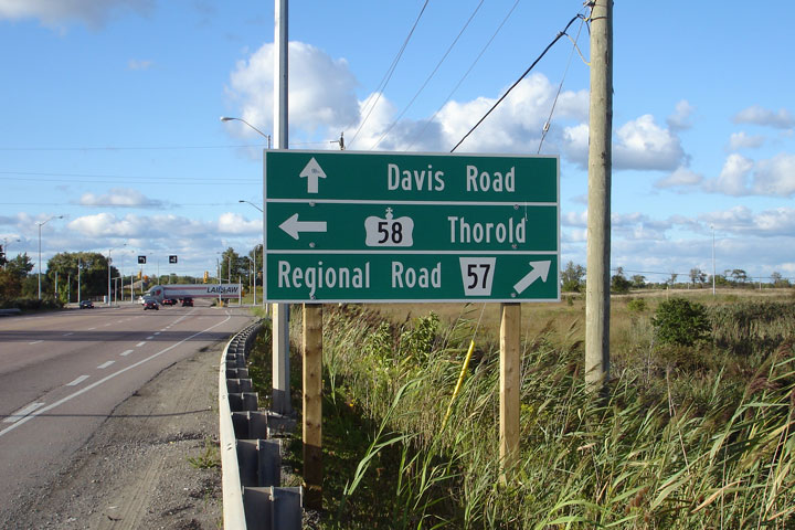
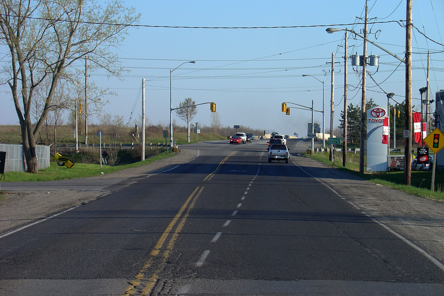
| City of Thorold Regional Municipality of Niagara |
Easterly view towards the Niagara Stone Road intersection. At this
junction, Highway 58 turns southerly and becomes a conventional at-grade
highway for its remaining trek to Port Colborne. Photo taken: October 15th, 2006. |
 |
|
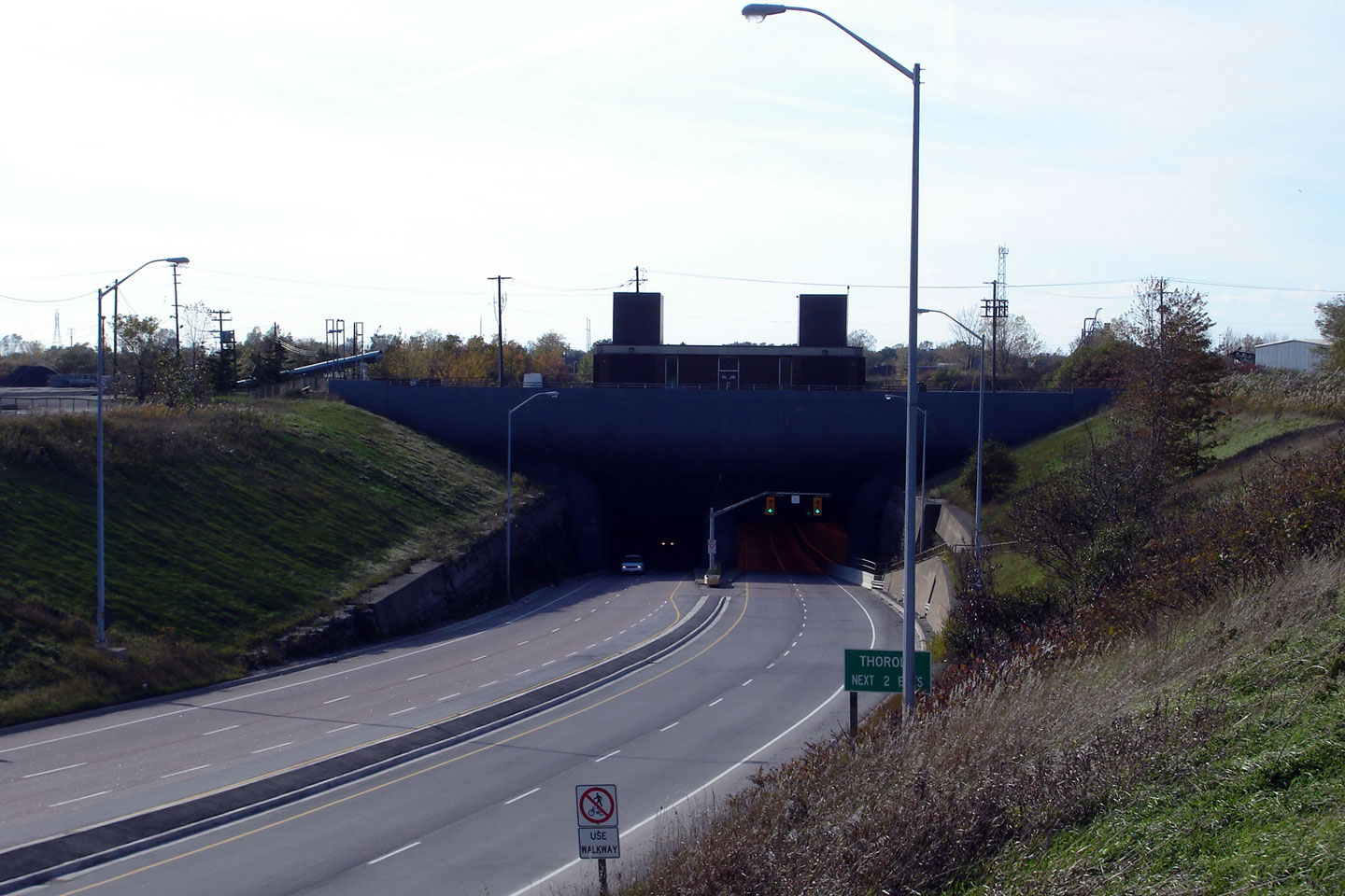
| City of Thorold Regional Municipality of Niagara |
View looking northerly as towards the eastern Thorold Tunnel Portal.
Highway 58 emerges from the other side the Welland Canal as a full-fledged
freeway. Photo taken: October 15th, 2006. |
 |
|
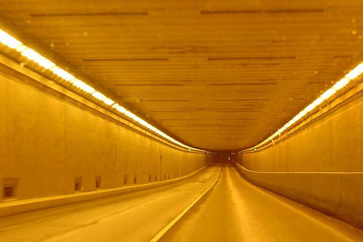
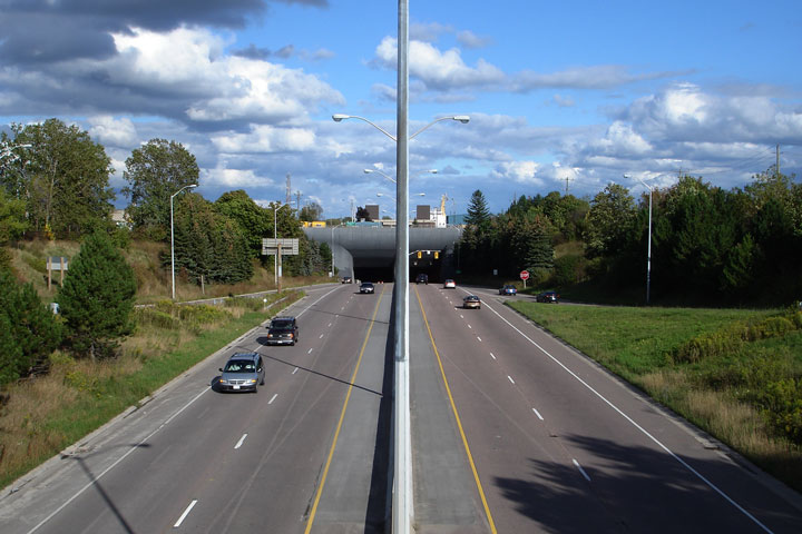
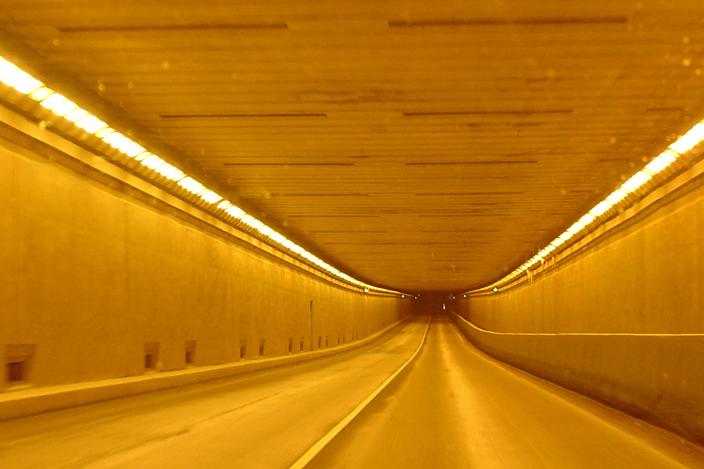
| City of Thorold Regional Municipality of Niagara |
View looking northerly as Highway 58 passes through the Thorold Tunnel that
runs underneath the Welland Shipping Canal. Photo taken: September 20th, 2006. |
 Low
Res Low
ResHigh Res |
|
| City of Thorold Regional Municipality of Niagara |
View looking northerly towards the Pine Street intersection from the top of
the Thorold Tunnel Portal. Photo taken: September 20th, 2006. |
 |
|
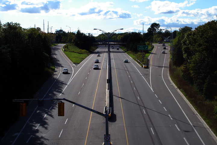
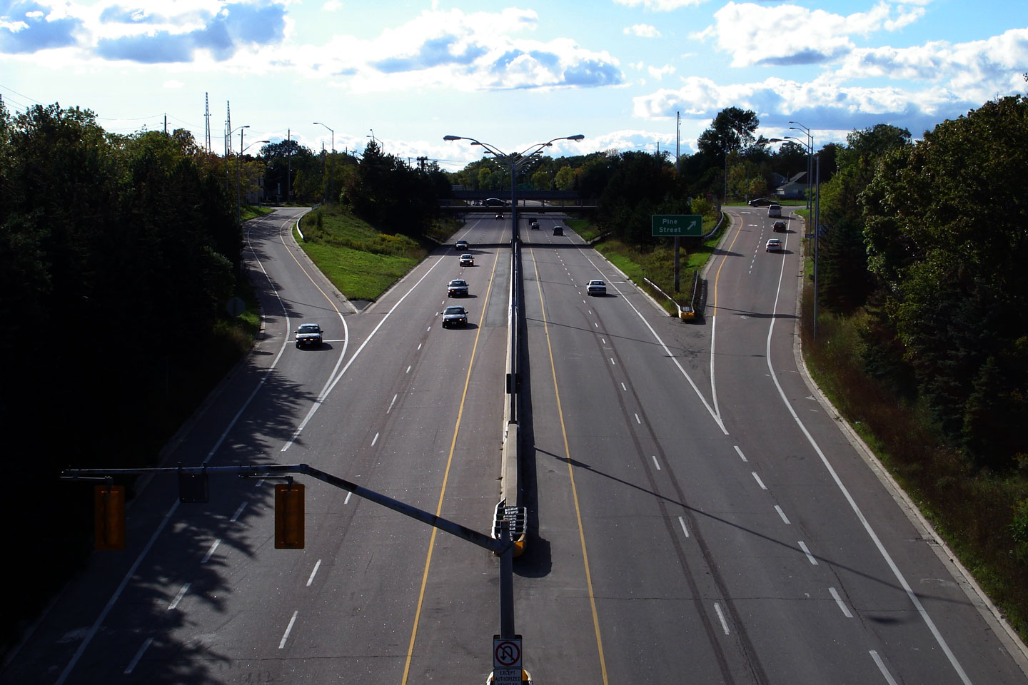
| City of Thorold Regional Municipality of Niagara |
Highway 58 looking south from the Pine Street overpass in Thorold.
This Photo shows the western (northern) Portal to the Thorold Tunnel.
Notice the onramp to Highway 58 from Pine Street meets Highway 58 at a stop
sign. Because of the close proximity with the Thorold Tunnel, there
was insufficient room to construct a proper merge lane at Pine Street. Photo taken: February 23rd, 2005. Size: 55kb. |
 |
|
| City of Thorold Regional Municipality of Niagara |
Northerly view towards from Pine Street towards Queen Street and the
Chemical Plant Railway spur. A considerable amount of Thorold was
removed for the construction of this highway. Photo taken: September 20th, 2006. |
 |
|
| City of Thorold Regional Municipality of Niagara |
Looking south on Highway 58 towards the Pine Street interchange from the
Queen Street overpass in Thorold. Photo taken: September 20th, 2006. |
 |
|
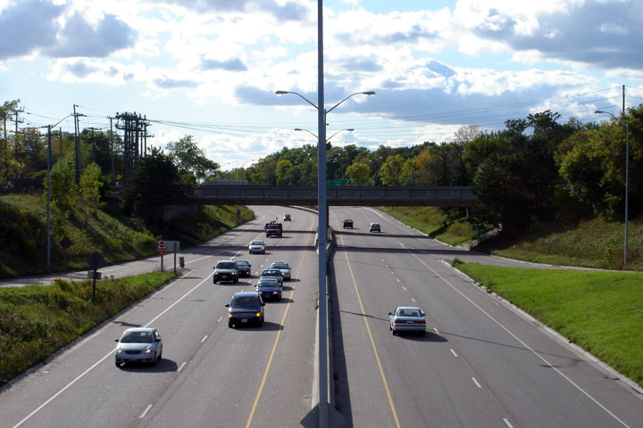
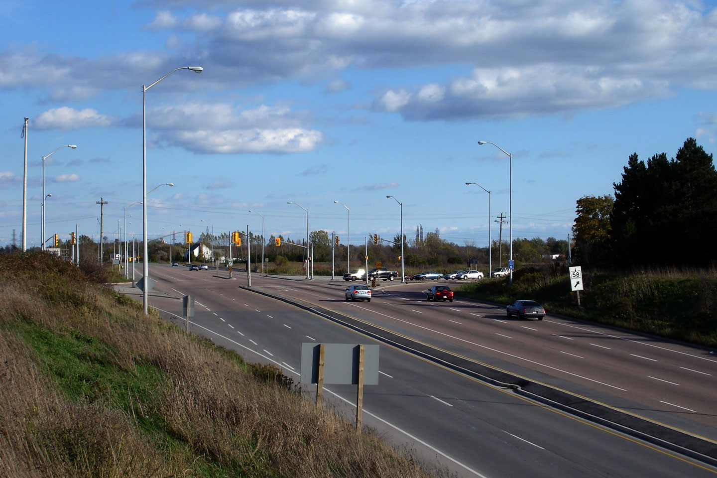
| City of Thorold Regional Municipality of Niagara |
View looking northerly along Highway 58 towards the Collier Street
interchange. Photo taken: September 20th, 2006. |
 |
|
| City of Thorold Regional Municipality of Niagara |
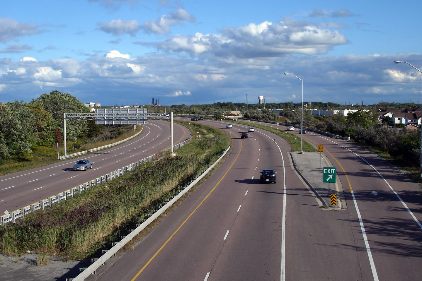
Northbound sign advising drivers that Highway 58 ends at the upcoming
Highway 406 interchange. Photo taken: October 15th, 2006. |
 |
|
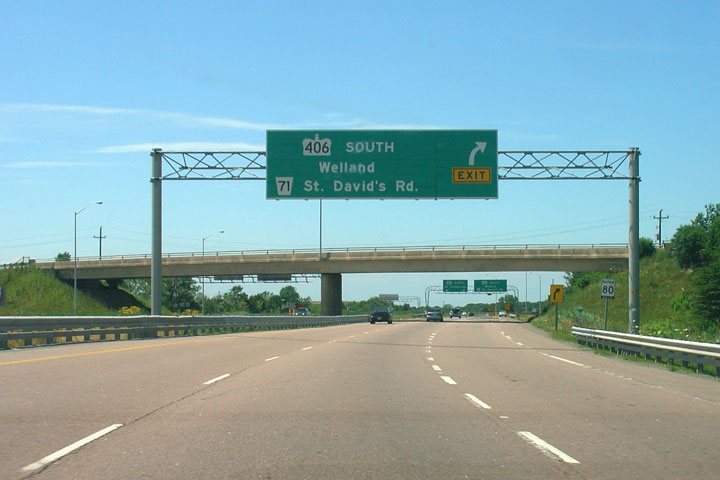
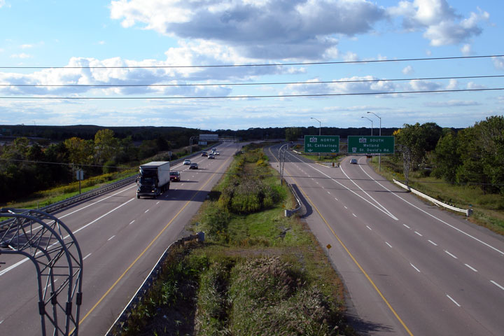
| City of Thorold Regional Municipality of Niagara |
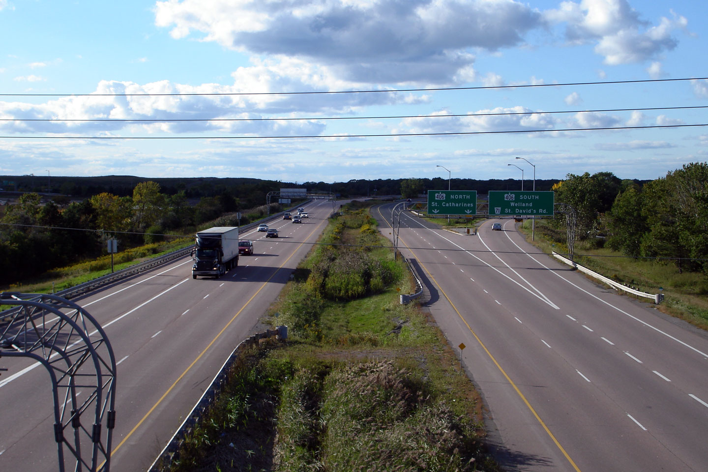
Advanced signage for the upcoming Highway 406 interchange along northbound
Highway 58. At the Highway 406 interchange, the mainline Highway 58
lanes simply default onto the northbound Highway 406. Southbound
Highway 406 is accessible via a long high-speed ramp that follows St.
David's Road. Photo taken: July 7th, 2005. |
 Low
Res Low
ResHigh Res |
|
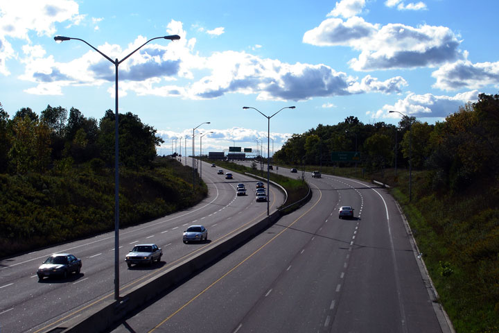
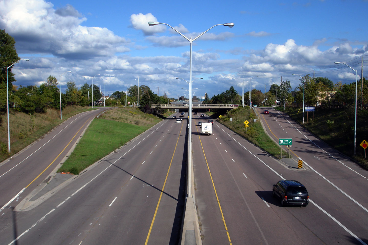
| City of Thorold Regional Municipality of Niagara |
Southerly view of Highway 58 from the Richmond Street overpass. Short
little freeway segments of highway is not typical of highways in Ontario. Photo taken: September 20th, 2006. |
 |
|
| City of Thorold Regional Municipality of Niagara |
Northerly view from the Richmond Street overpass, towards the rather
grandiose Highway 406 interchange. Photo taken: September 20th, 2006. |
 |
|
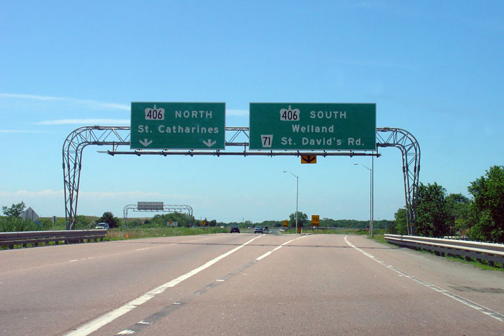
| City of Thorold Regional Municipality of Niagara |
Signage along northbound Highway 58 at the Highway 406 interchange.
Click
here to see an aerial view of this very large interchange (provided
courtesy of Google Maps). Photo taken: July 7th, 2005. |
 Low
Res Low
ResHigh Res |
|
| Highway 58 ends at a large interchange with Highway 406 in Thorold. Click here for Highway 406 images. |
<-
Highway 56 Images
Back to Highway
58
Highway 58A Images ->
Images Index
Copyright (c) 2004-2010, Scott Steeves (Webmaster) scott@asphaltplanet.ca