King's Highway 66 - www.OntHighways.com

Highway 66 is an east-west highway that runs from the Montreal River bridge in Matachewan to the Quebec Boundary east of Virginiatown.  East of Highway 11, Highway 66 is part of the Trans-Canada Highway.  While it has been indicated as the Kirkland Lake Route of the Trans-Canada Highway for many years on Ontario Road maps, it wasn't until May of 2004 that signs were erected along the route, marking it as part of the Trans-Canada Highway.


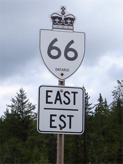
New Style King's Highway 66 marker

  Western Terminus:  Highway 566 at the Montreal River bridge in Matachewan

Eastern Terminus:  Quebec Route 117 at the Ontario/Quebec Boundary

Length:  103.5km

Multiplexes:  None

Freeway:  No

Trans-Canada Highway: Highway 66 is part of the Trans-Canada Highway between Highway 11 and the Quebec Boundary.  It is signed as a spur of the Northern Ontario route, but has been indicated on maps as the Kirkland Lake Route in the past.

AADT (2002):  Highest:  5,700, from Highway 112 to Kirkland Lake;

                             Lowest:  380, from Matachewan to Highway 65.

Road info:  East of Highway 11, Highway 66 is a fairly modern, well traveled highway, and is part of the Trans-Canada Highway as the Kirkland Lake Route.  West of Highway 11, while Highway 66 is generally well surfaced, the road design is often sub-par and makes for a very interesting drive.  Rural speed limits along Highway 66 are posted at 80km/h.


Highway 66 information:


OntHighways.com  

Detailed Route information available below
Virtual Tour of Highway 66 (Coming Soon!)


TheKingsHighway.ca   History of Highway 66
Photographic History of Highway 66

Communities and Major Intersections located along Highway 66 from West to East:

Proper Municipality Name Community Name Distance Intersecting Road
Township of Matachewan Matachewan 0km / 103.5km Secondary Highway 566
Township of Matachewan ----- 4.6km / 98.9km King's Highway 65
District of Timiskaming ----- 44.8km / 58.7km King's Highway 11
District of Timiskaming Kirkland Lake West Limits 50.4km / 53.1km -----
Town of Kirkland Lake Swastika --- -----
Town of Kirkland Lake ----- 54.0km / 49.5km King's Highway 112
Town of Kirkland Lake Chaput Heights --- -----
Town of Kirkland Lake Kirkland Lake --- Main Street
Town of Kirkland Lake Kirkland Lake --- Duncan Street
Kirkland Lake Boundary Kirkland Lake East Limits 61.0km / 42.5km -----
District of Timiskaming King Kirkland --- -----
Township of Gauthier ----- 74.6km / 29.9km Secondary Highway 672
Township of Larder Lake Larder Lake 86.4km / 17.1km Secondary Highway 624
Township of McGarry Virginatown --- -----
Township of McGarry Kearns --- -----
Ontario - Quebec Boundary ----- 103.5km / 0km PQ Route 117
Highway 66 ENDS

<-Highway 65          www.OntHighways.com - Home          Highway 67->


Copyright (c) 2004-2010, AsphaltPlanet.ca  AsphaltPlanet@asphaltplanet.ca

Page last updated:  February 25th, 2007

Page created:  February 25th, 2007