|
Proper Municipality Name |
Photo Description |
Photo |
|
Pictures taken
from driver's perspective appear offset from centre-line pictures: |
East-
bound |
West-
bound |
|
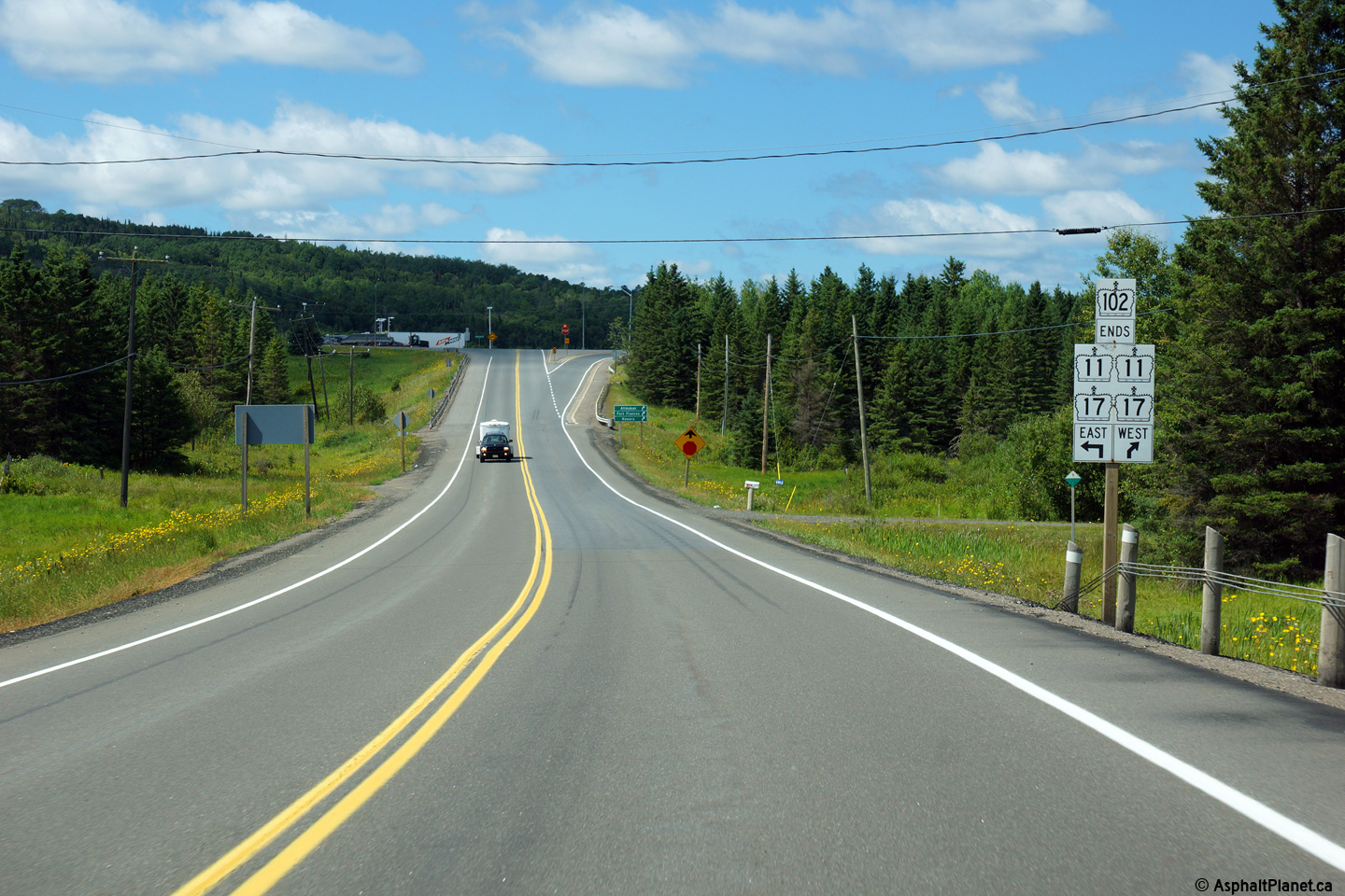
Highway 102, ends at Highway 11/17 at
Sistonen's Corners. Click
here for Highway 11
Images and here for Highway 17 images. |
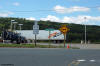
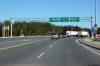
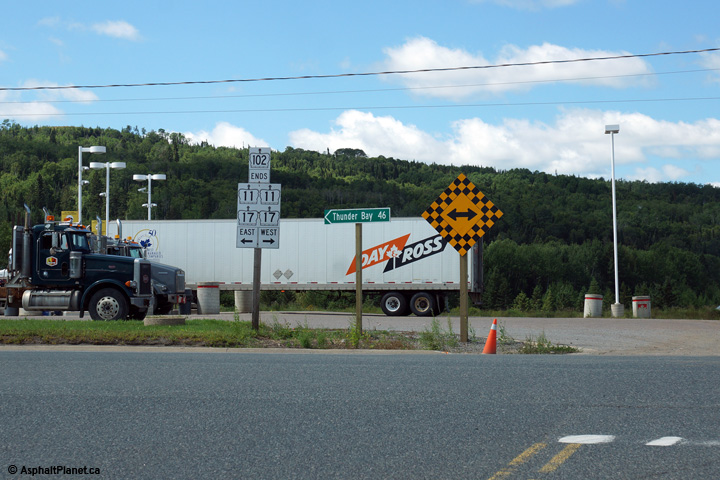
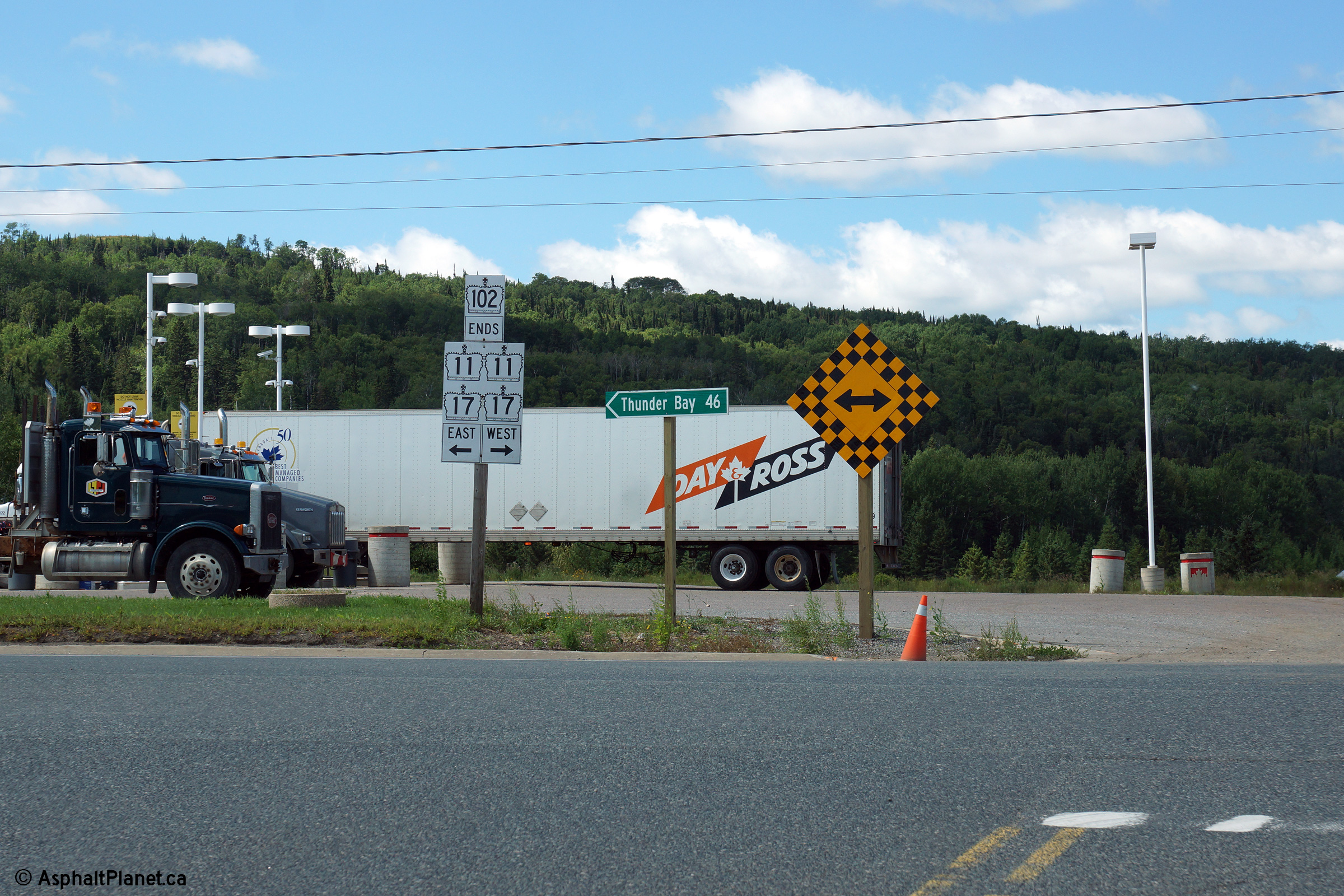
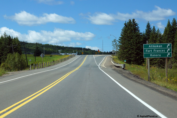
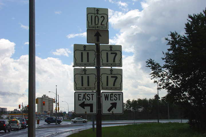
| District of Thunder Bay |
Junction signage denoting the western end of Highway 102
at the Highway 11/17 junction in Sistonen's Corners. Photo taken: August
13th, 2014. |
 (720x480) (720x480)
(1440x960)
(2400x1600)
|
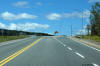
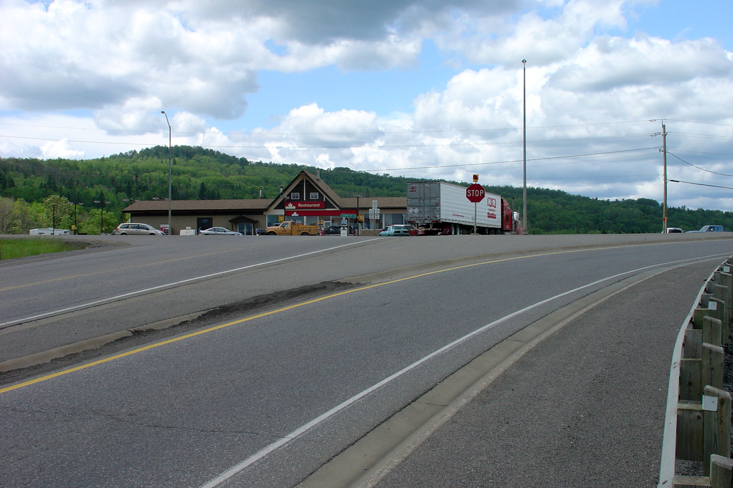
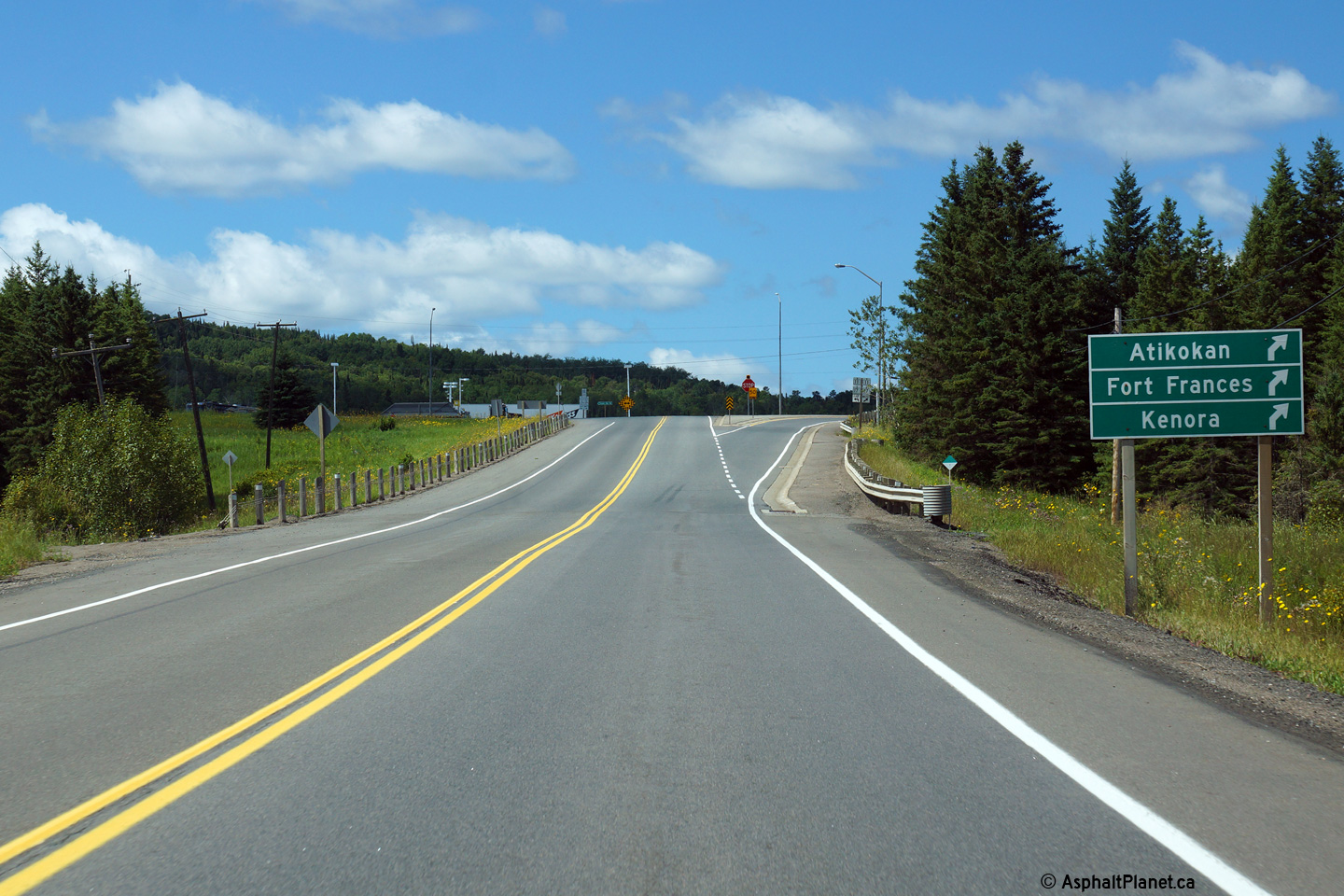
| District of Thunder Bay |
Signage approaching the western terminus of Highway 102. Click
here for an additional view of
the western terminus of Highway 102, taken in July, 2004. Photo taken:
August 13th, 2014. |
(720x480)
(1440x960)
(2400x1600)
(720x480)
(1440x960)
(2400x1600) |
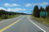
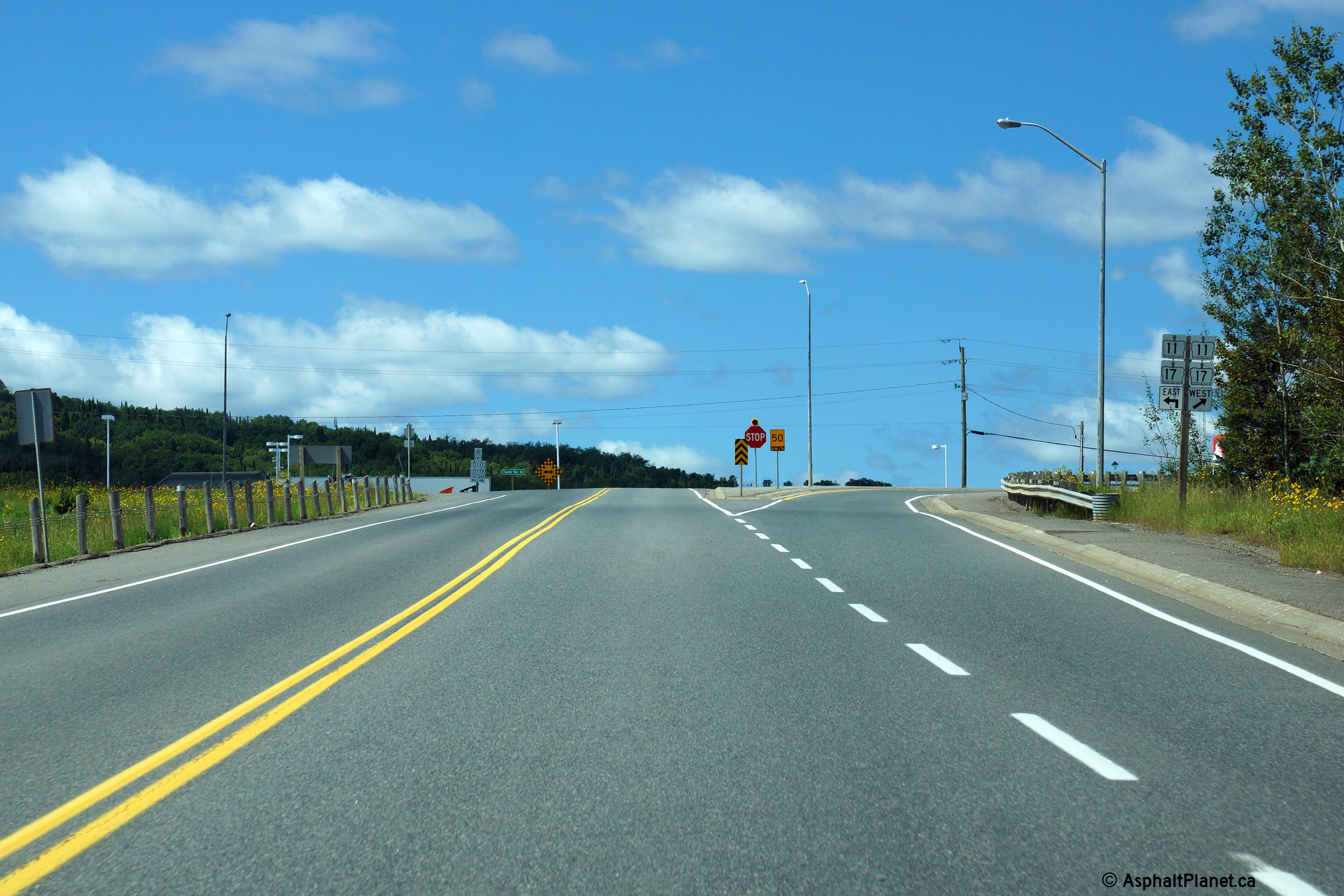
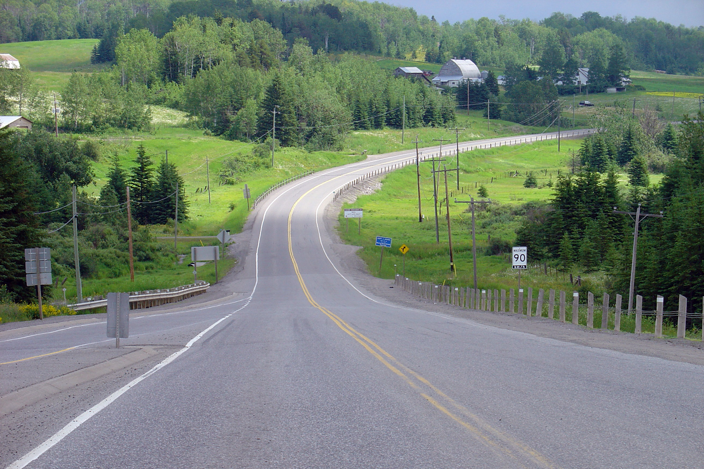
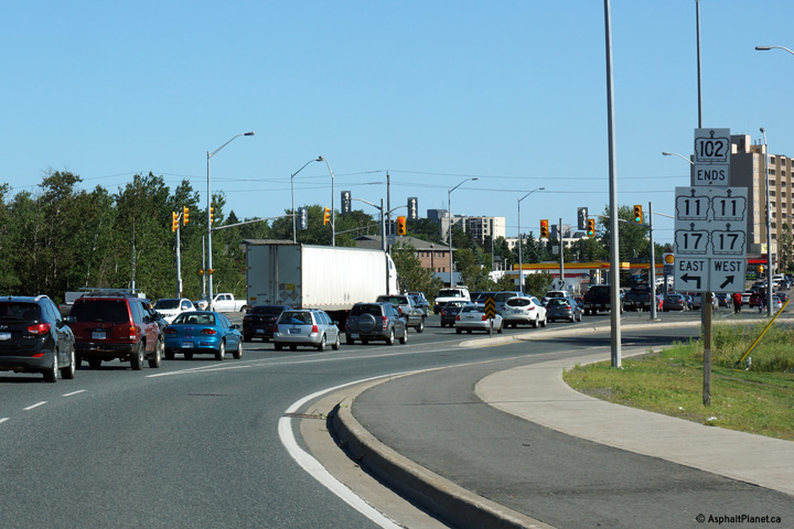
| District of Thunder Bay |
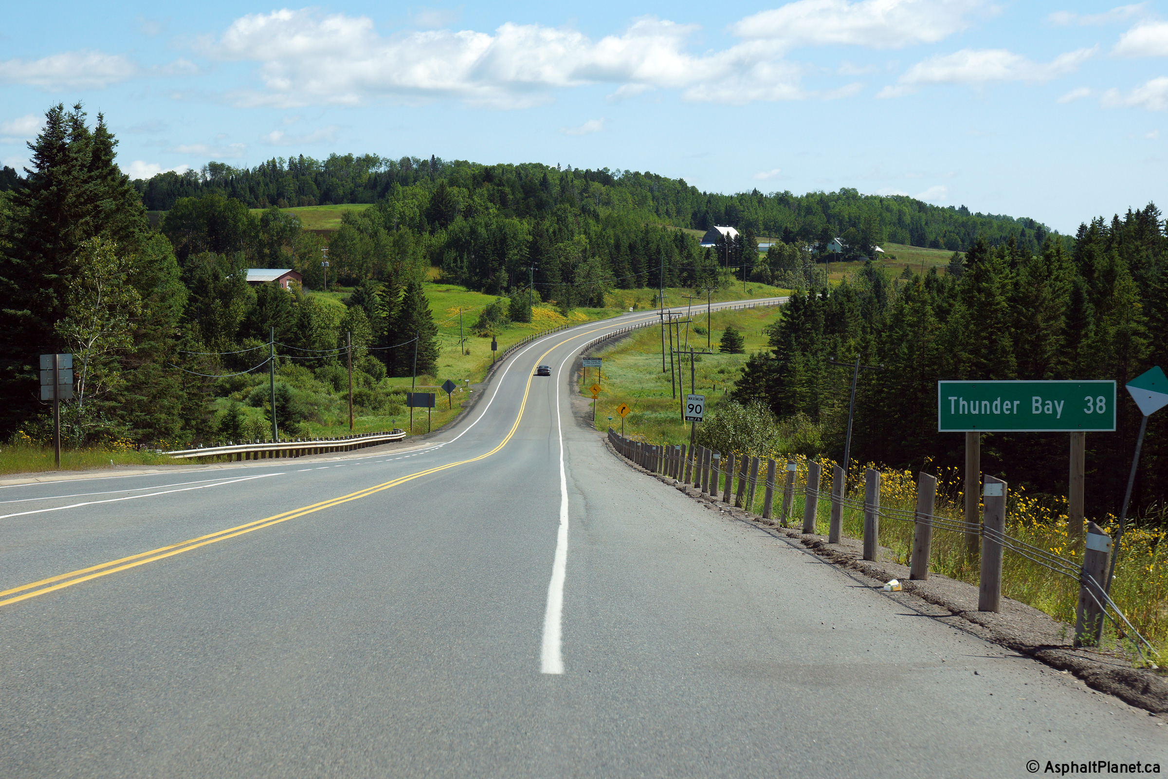
View looking east from the western Highway 11/17
junction towards Thunder Bay. Highway 102 is a useful short-cut route
that saves 17.4km versus the routing of Highway
11/17. Click here for an
additional photo from this vantage point, taken in July, 2004. Photo taken: August 13th, 2014. |
(720x480)
(1440x960)
(2400x1600) |
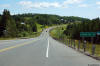
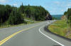
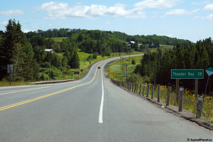
| District of Thunder Bay |
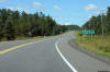
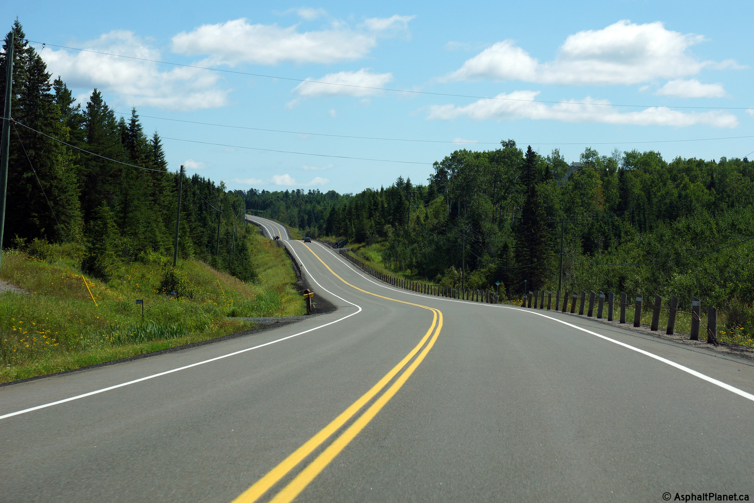
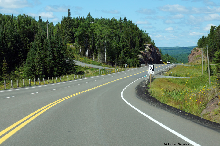
View looking easterly approaching Sistonen's Corners.
Photo taken: August 13th, 2014. |

(720x480)
(1440x960)
(2400x1600) |
| District of Thunder Bay |
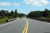
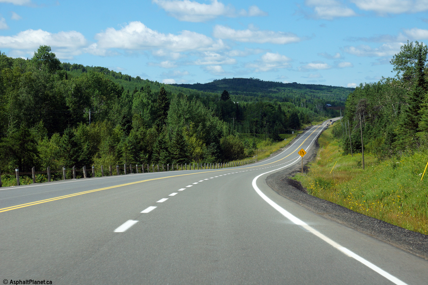
Easterly view of Highway 102 taken from about 1km east of the Highway 11/17
junction at Sistonen's Corners.
Photo taken: August 13th, 2014. |

(720x480)
(1440x960)
(2400x1600) |
| District of Thunder Bay |
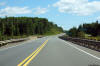
Westerly view from about 500m west of the CNR underpass.
Photo taken: August 13th, 2014. |

(720x480)
(1440x960)
(2400x1600) |
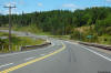
| District of Thunder Bay |
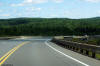
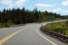
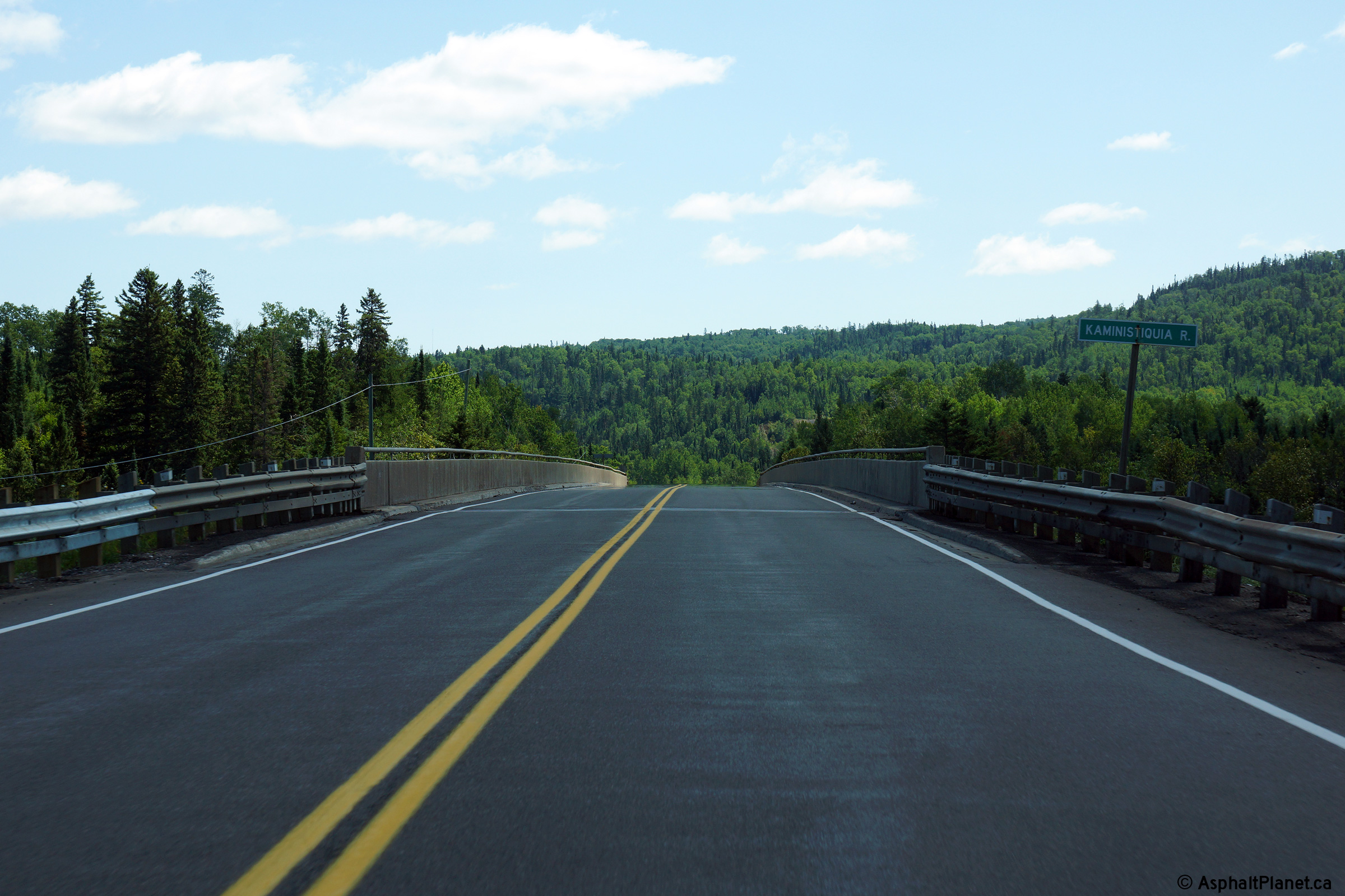
Easterly view as Highway 102 descends into the Kaministiquia River Valley.
On its descent to the river, Highway 102 passes over CN's mainline between
Rainy River and Thunder Bay, as well as the long abandoned, Grand Trunk
Railway that ran between Superior Junction (Sioux Lookout) and Thunder Bay.
Photo taken: August 13th, 2014. |
(720x480)
(1440x960)
(2400x1600) |
| District of Thunder Bay |
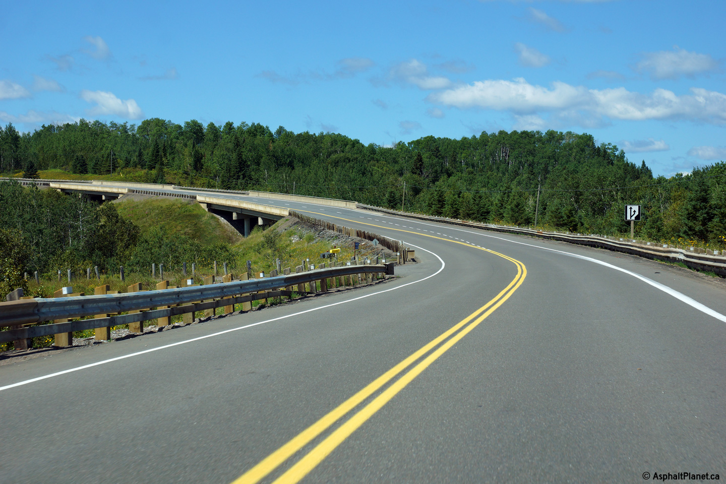
Westerly view along Highway 102 from west of the Kaministiquia River as the
highway ascends out of the valley.
Photo taken: August 13th, 2014. |
(720x480)
(1440x960)
(2400x1600) |
| District of Thunder Bay |
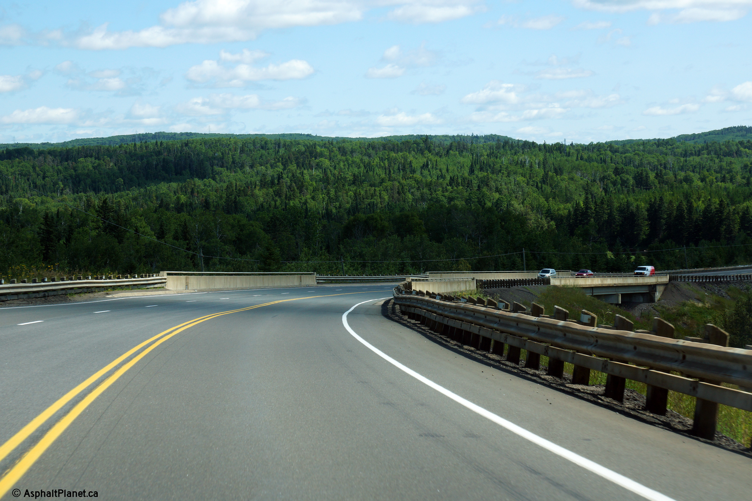
Easterly deck view as Highway 102 crosses the Kaministiquia River bridge.
Photo taken: August 13th, 2014. |

(720x480)
(1440x960)
(2400x1600) |
| District of Thunder Bay |
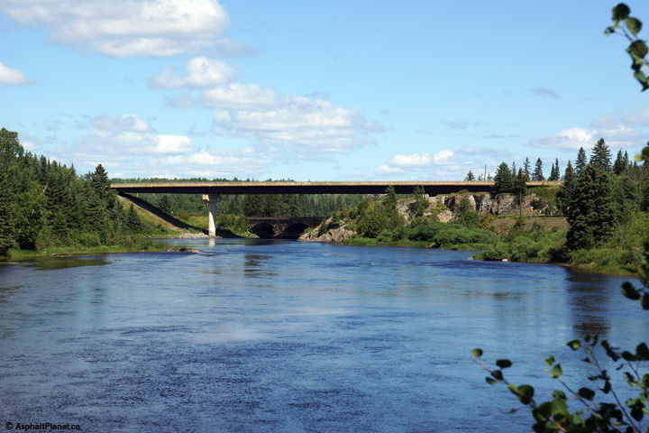
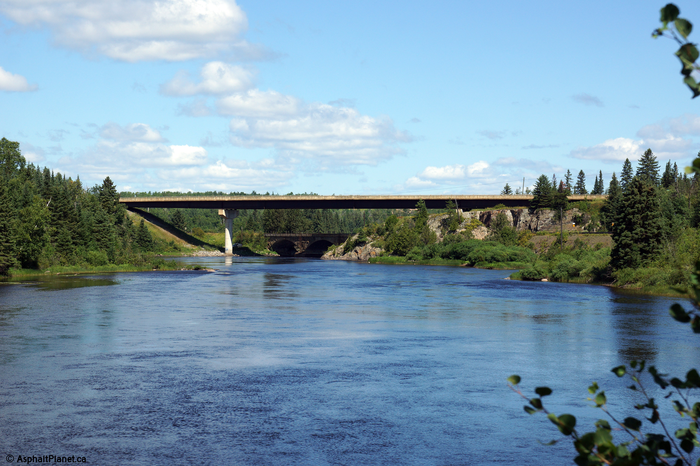
This view looks northerly along the Kaministiquia River towards the
Highway 102 structure. In addition to crossing the river, the structure
crosses over the CP Railway as well.
Photo taken: August 13th, 2014. |

(720x480)
(1440x960)
(2400x1600) |
| District of Thunder Bay |
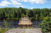
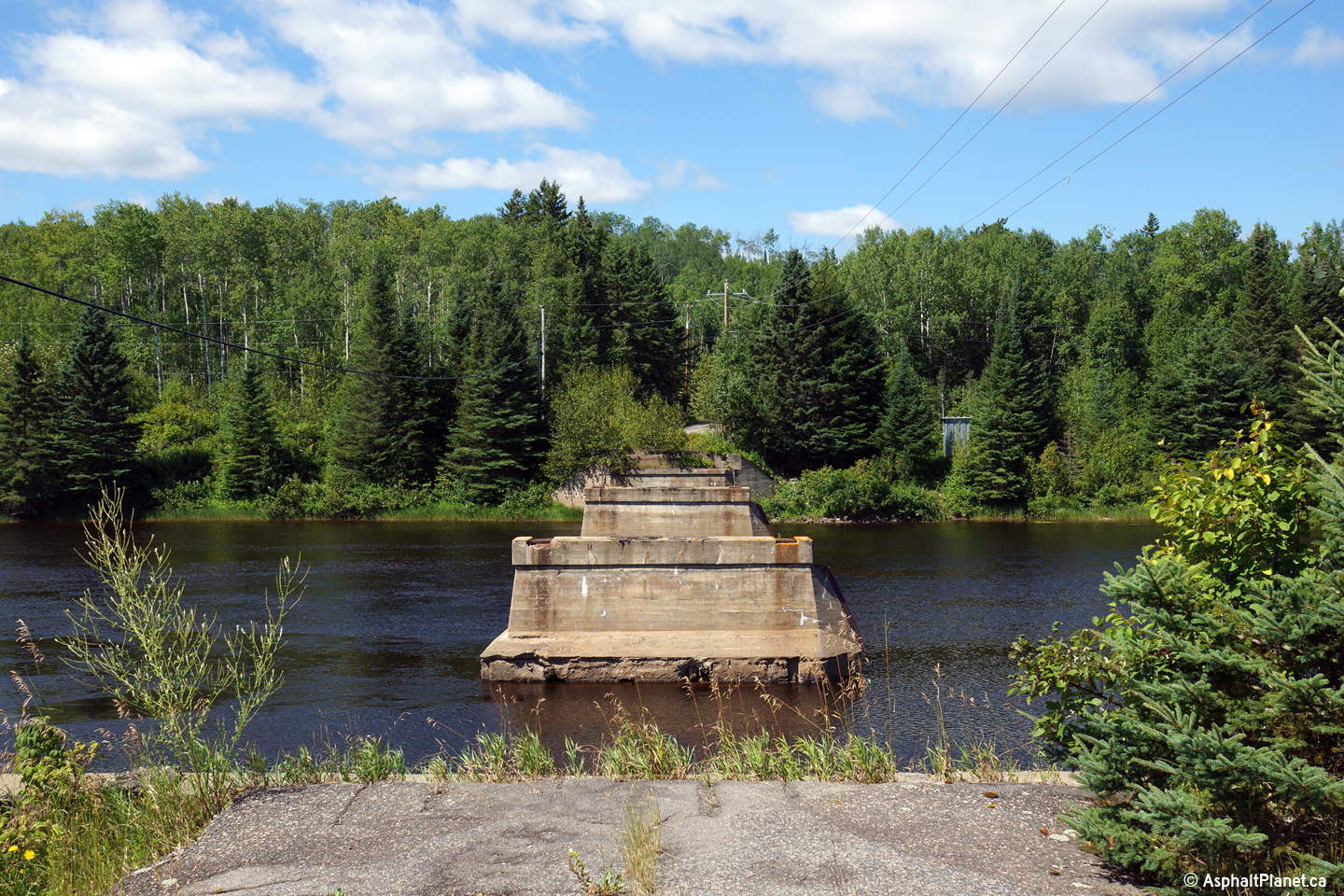
Westerly view across the former site of the Kaministiquia River bridge.
Only the piers of the former bridge remain.
Photo taken: August 13th, 2014. |
(720x480)
(1440x960)
(2400x1600) |
| District of Thunder Bay |
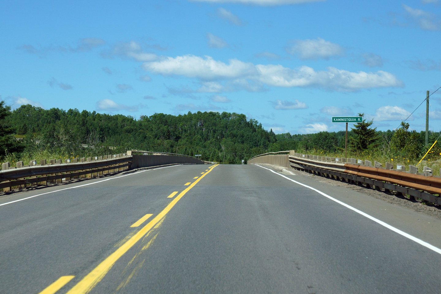
Westerly view overtop of the Kaministiquia River Bridge.
Photo taken: August 13th, 2014. |

(720x480)
(1440x960)
(2400x1600) |
| District of Thunder Bay |
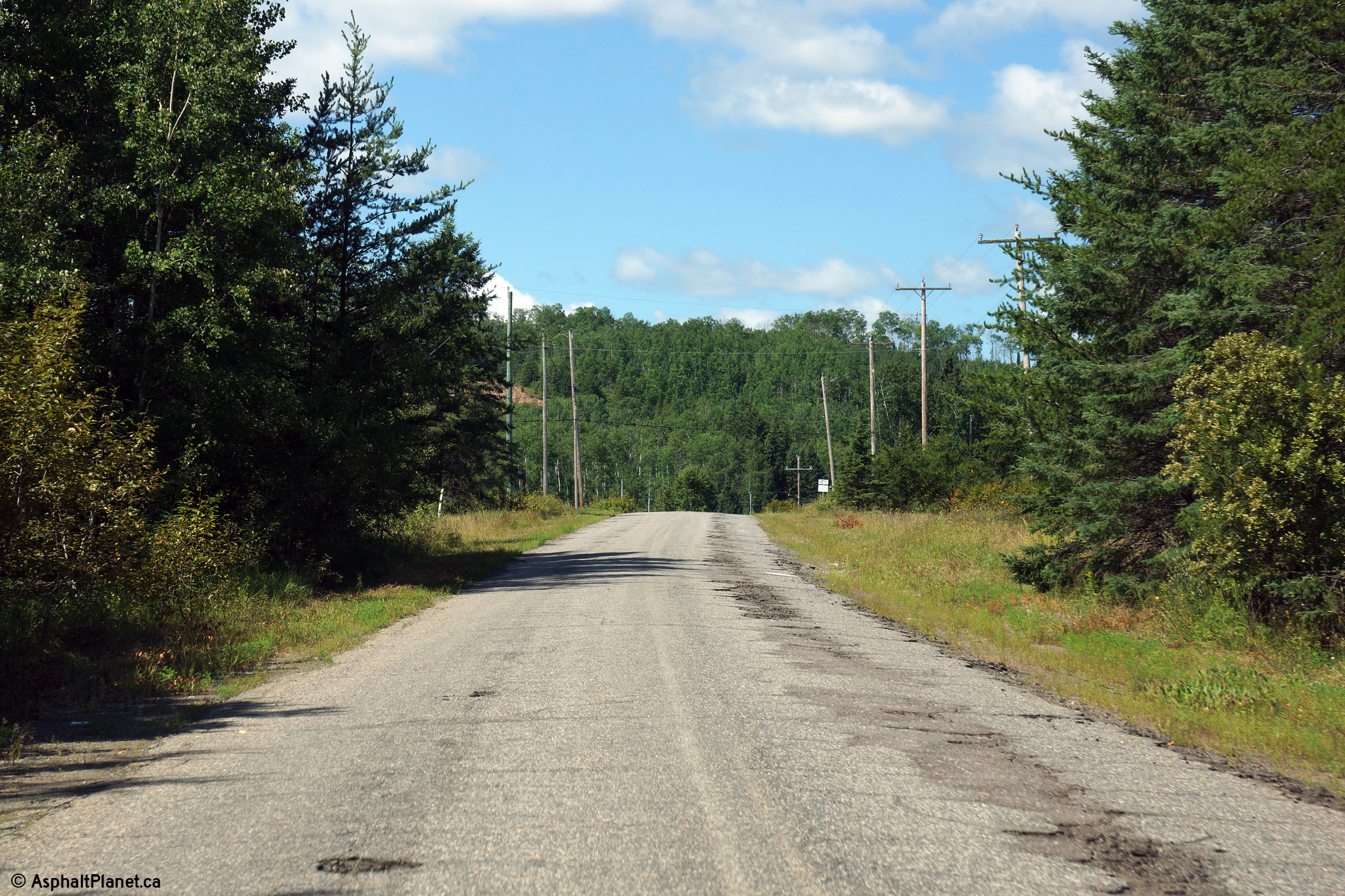
View looking westerly along the abandoned alignment of Highway 102 leading
to the former, and long demolished, Kaministiquia River bridge.
Additional photos of this abandoned section of Highway 102 can be found
here.
Photo taken: August 13th, 2014. |
(720x480)
(1440x960)
(2400x1600) |
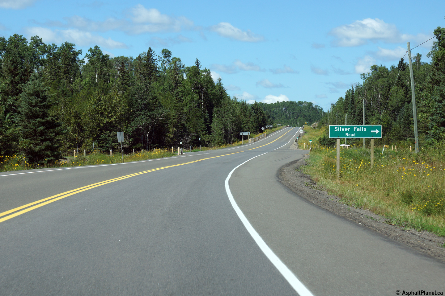
| District of Thunder Bay |
View looking westerly approaching the Silver Falls Road. The former
alignment of Highway 102 leading to the original, long demolished Kaministiquia
River bridge is accessible by turning south at this intersection.
Photo taken: August 13th, 2014. |
(720x480)
(1440x960)
(2400x1600) |
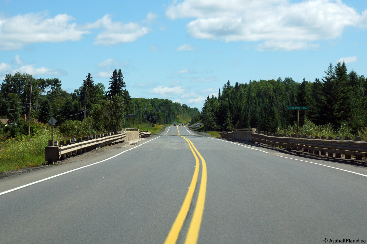
| District of Thunder Bay |
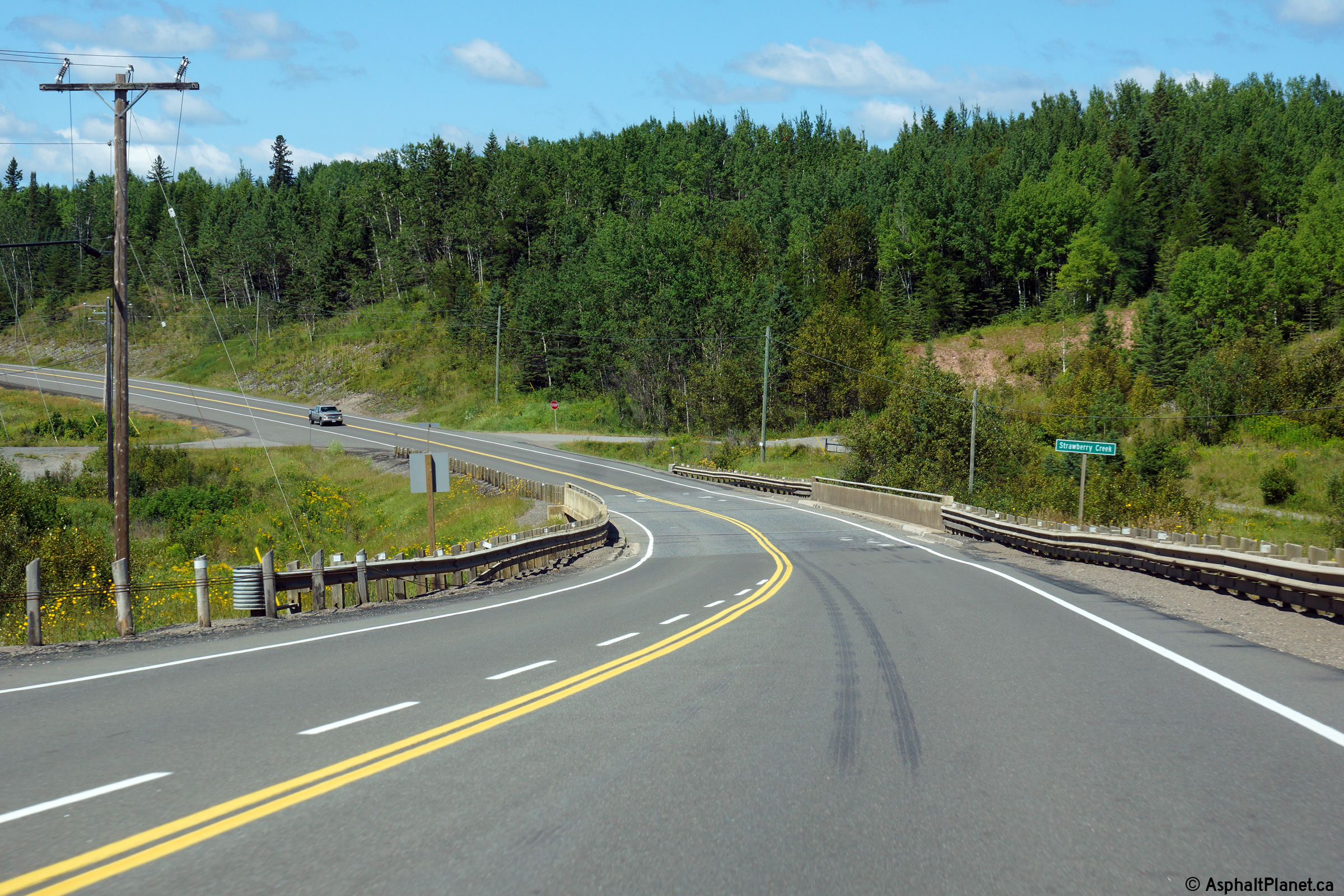
View looking easterly approaching the first of three crossings of Strawberry
Creek. Highway 102 follows Strawberry Creek for about 2km before
climbing out of the Kaministiquia River Valley.
Photo taken: August 13th, 2014. |
(720x480)
(1440x960)
(2400x1600) |
| District of Thunder Bay |
Easterly view at the second of three Strawberry Creek crossings.
Photo taken: August 13th, 2014. |
(720x480)
(1440x960)
(2400x1600) |
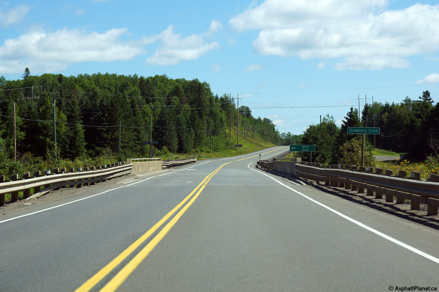
| District of Thunder Bay |
Easterly view at the eastern-most Strawberry Creek bridge.
Photo taken: August 13th, 2014. |
(720x480)
(1440x960)
(2400x1600) |
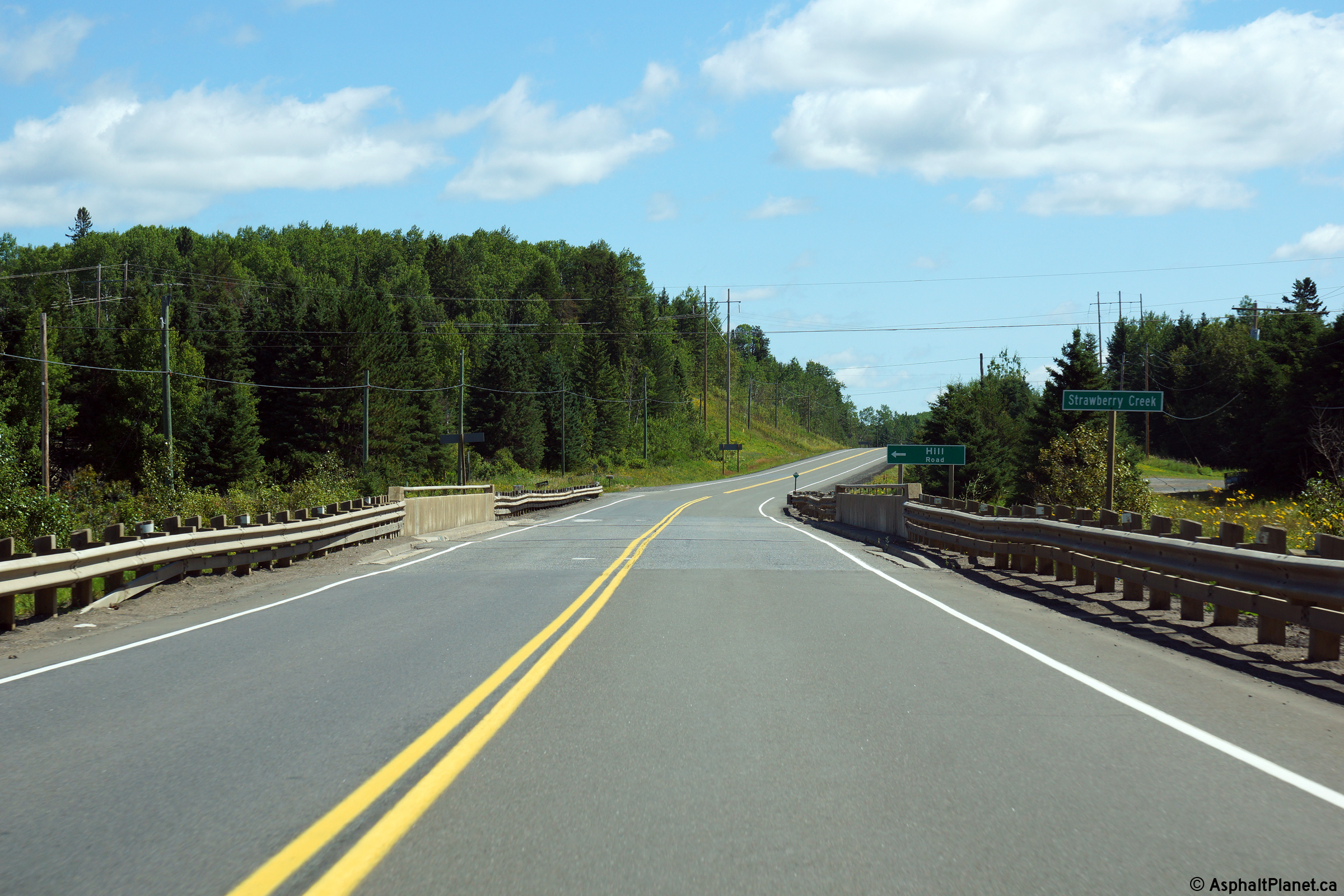
| District of Thunder Bay |
View looking westerly as Highway 102 crosses the Strawberry Creek bridge.
Photo taken: August 13th, 2014. |
(720x480)
(1440x960)
(2400x1600) |
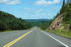
| District of Thunder Bay |
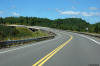
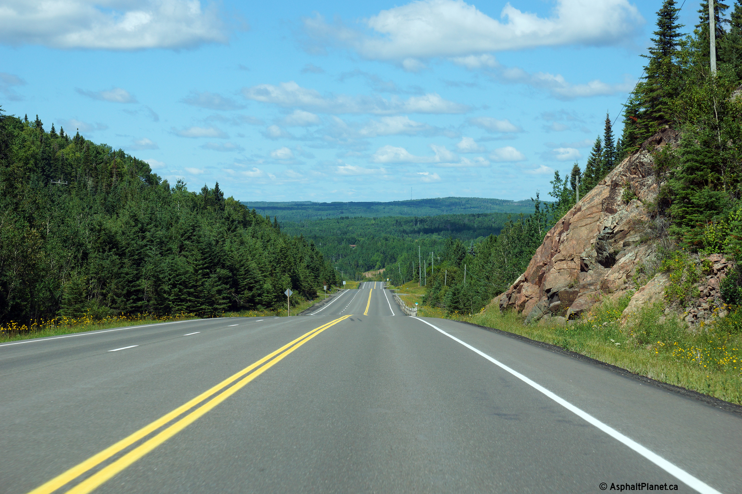
Westerly view as Highway 102 continues its descent into the Kaministiquia
River Valley.
Photo taken: August 13th, 2014. |
(720x480)
(1440x960)
(2400x1600) |
| District of Thunder Bay |
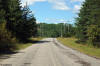
Westerly view about 5km east of the Kaministiquia River bridge.
Photo taken: August 13th, 2014. |
(720x480)
(1440x960)
(2400x1600) |
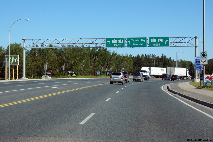
| City of Thunder Bay |
Overhead signage facing eastbound motorists in advance of the Thunder Bay
Expressway (Highway 11/17) intersection.
Photo taken: August 13th, 2014. |
 (720x480) (720x480)
(1440x960)
(2400x1600) |
| City of Thunder Bay |
Two versions of the signage at the Highway 11/17 intersection in Thunder
Bay. The upper photo shows the signage assembly as it stood in 2004,
and still indicated Highway 102 as heading east of the Thunder Bay
Expressway into Downtown Thunder Bay. The lower photo shows the modern
signage and indicates that the Thunder Bay Expressway is the eastern
terminus of Highway 102.
Upper photo taken: July 13th, 2004.
Lower photo taken: August 13th, 2014. |
 (720x480) (720x480)
(1440x960) |
|
Highway 11/17 follow the Thunder Bay Expressway along the
western edge of the city. Click
here for Highway 11
Images and here for Highway 17 images. |
 (720x480)


 (720x480)
 (720x480)
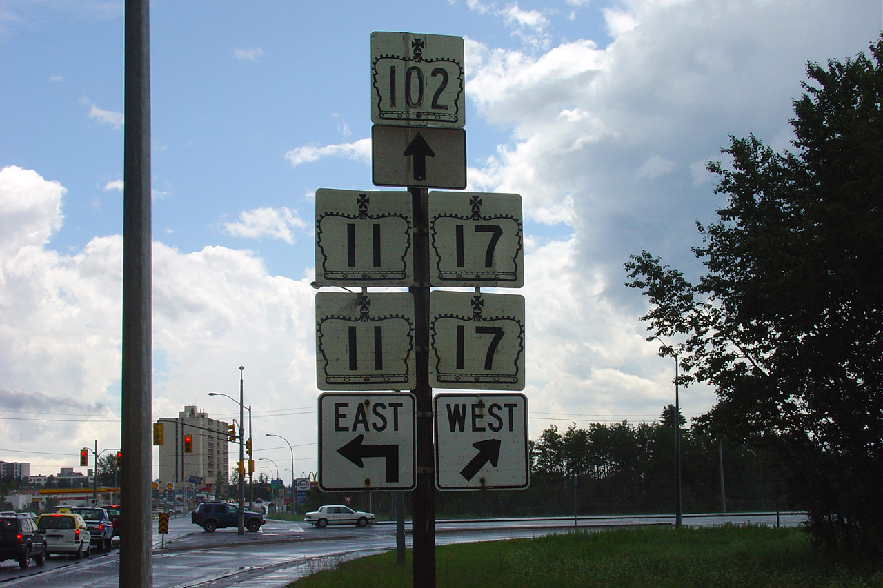
 (720x480)