
AsphaltPlanet.ca >
OntHighways > Highway 17 >
Images > Page 2E
< Hwy 16
Hwy 17A >
King's Highway 17 - Images
<- Page 2D Page 2E - Marathon to White River Page 2F->
Photos shown in this table are arranged from North to South:
| Proper Municipality Name | Photo Description |
Photo |
|
|
Pictures taken from driver's perspective appear offset from centre-line pictures: |
South- Bound |
North- bound |
|
| Continued from Schreiber to Marathon Images | |||
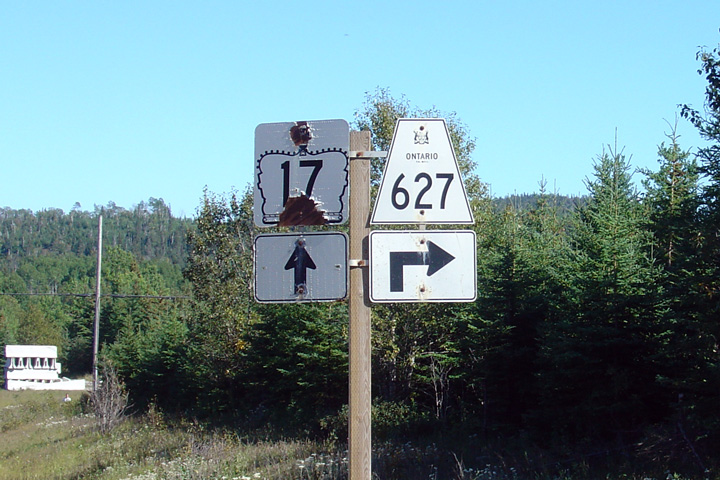
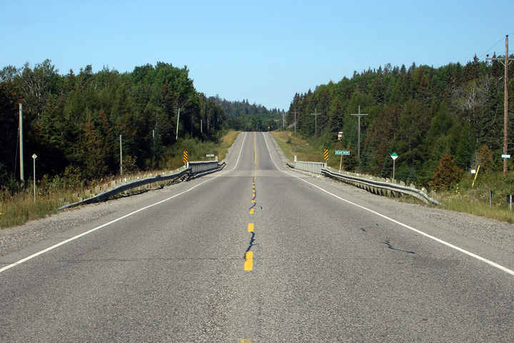
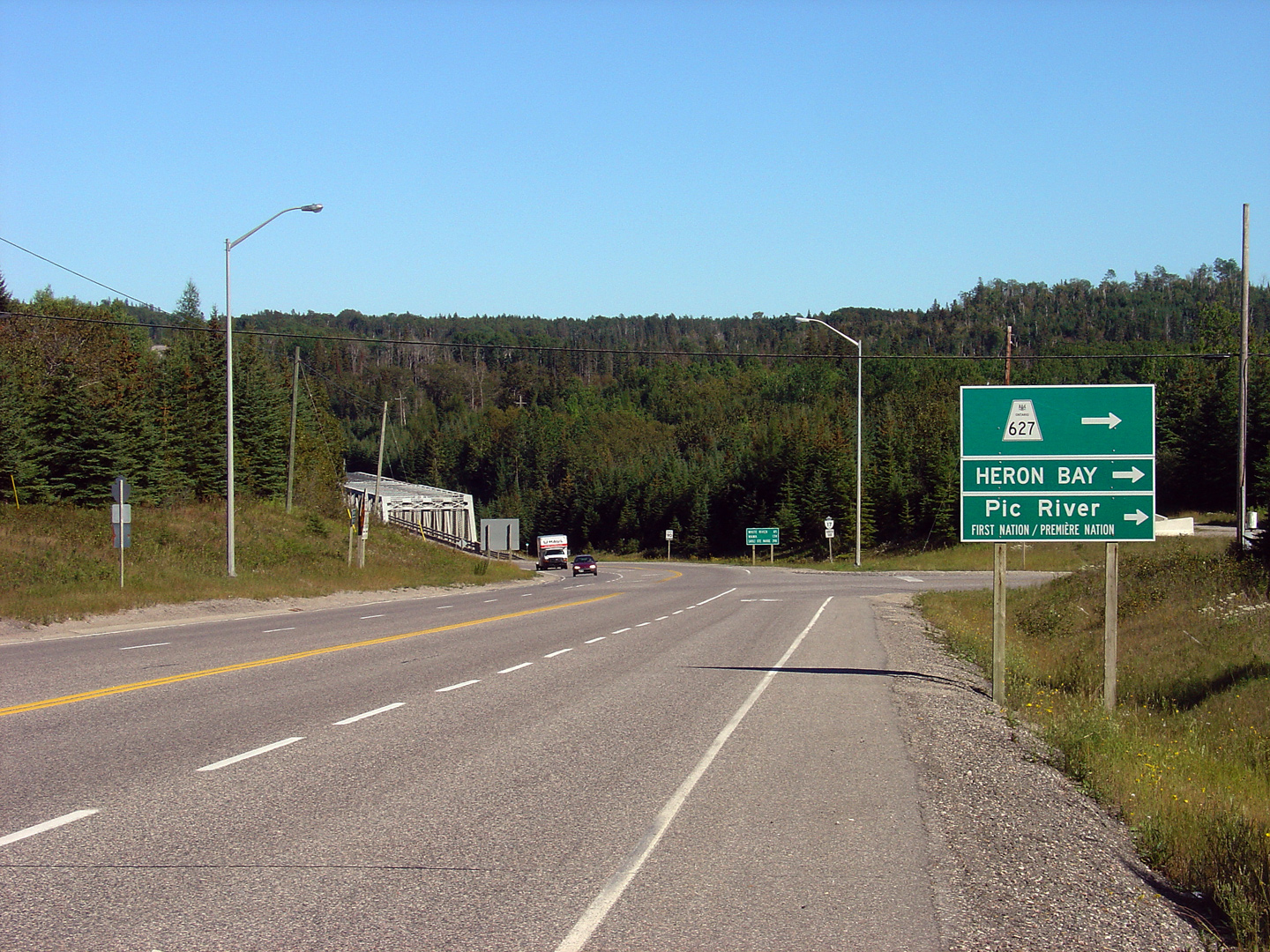
| Town of Marathon District of Thunder Bay |
Junction signage for the Highway 627, traveling
south along Highway 17. Photo taken: August 29th, 2006. |
 |
|
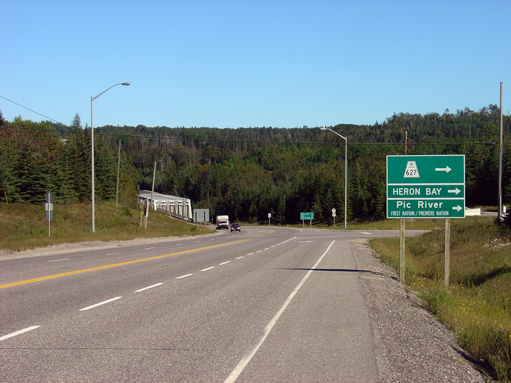
| Town of Marathon District of Thunder Bay |
View looking southerly at the Highway 627 junction as the Pic River Truss
Bridge comes into view. Photo taken: August 29th, 2006. |
 Low-res High-res |
|
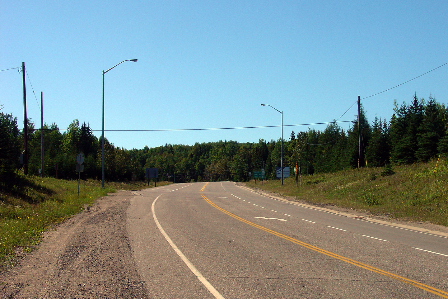
| Town of Marathon District of Thunder Bay |
Opposing view (looking northerly) towards the Highway 627 intersection. Photo taken: August 29th, 2006. |
 Low-res High-res |
|
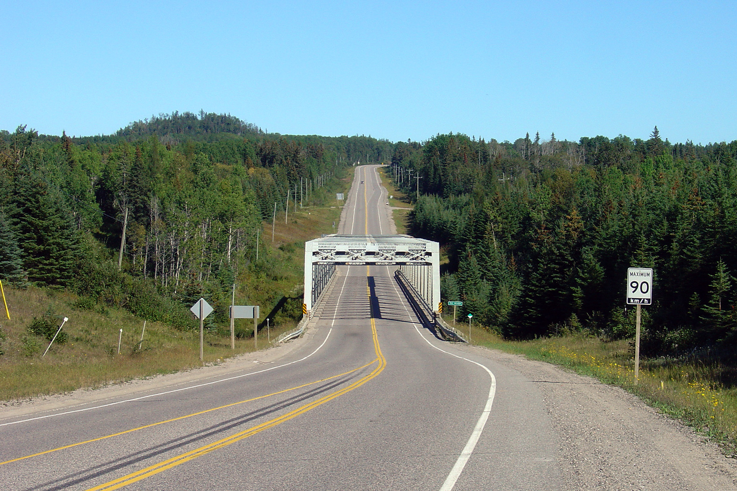
| Town of Marathon District of Thunder Bay |
Looking south across the Pic River truss bridge from the Highway 627
intersection. Photo taken: August 29th, 2006. |
 Low-res High-res |
|
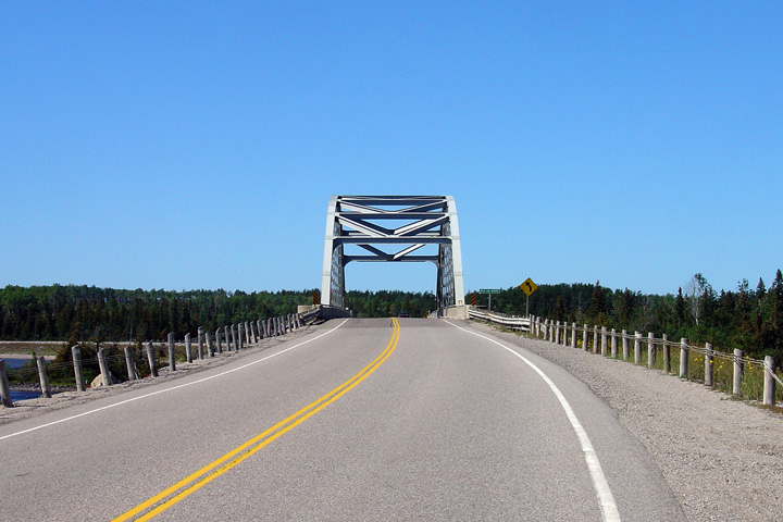
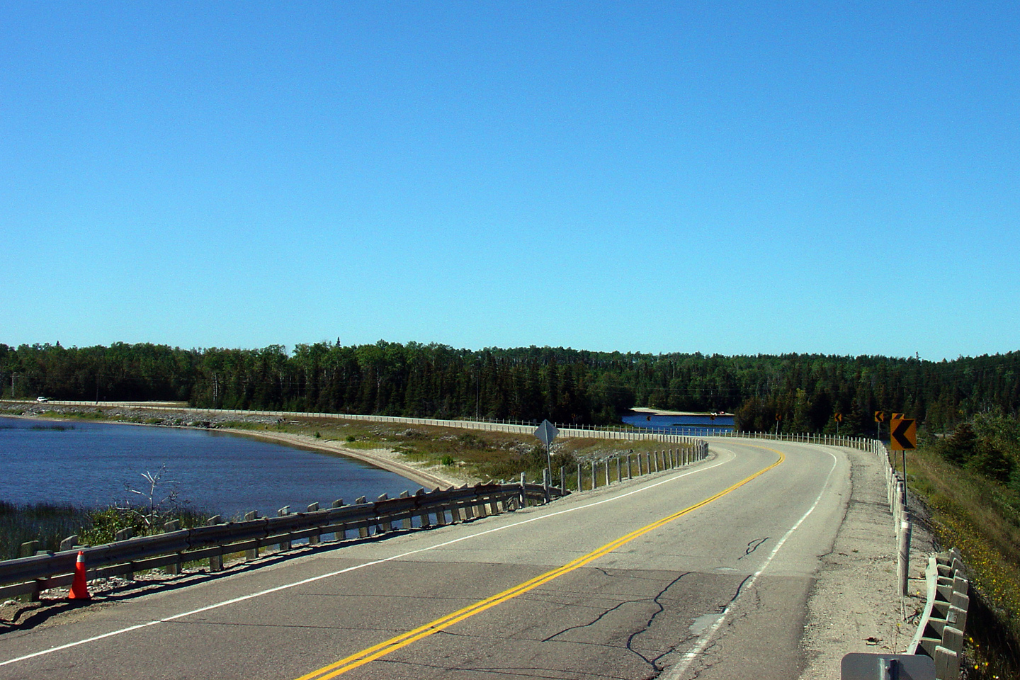
| Town of Marathon District of Thunder Bay |
View looking northerly across the Pic River
bridge. Just days after this photo was taken, jersey barriers were
erected along side the existing steel railings to protect the intricate
truss members. Photo taken: August 29th, 2006. |
 Low-res High-res |
|
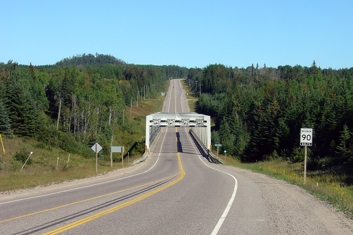
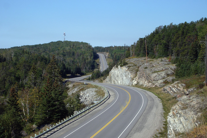
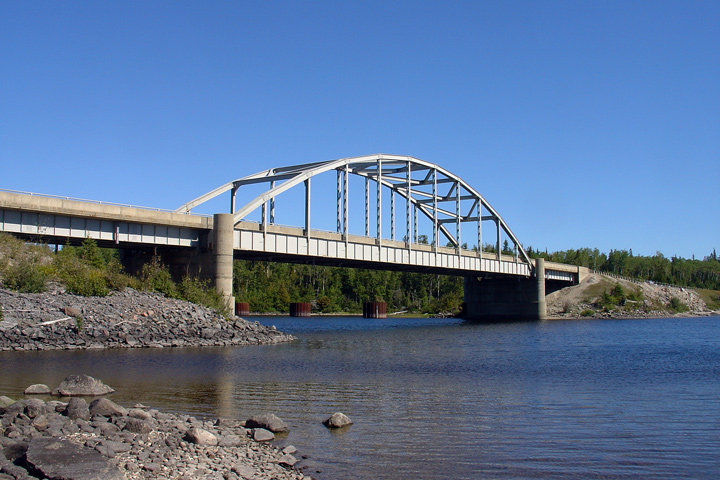
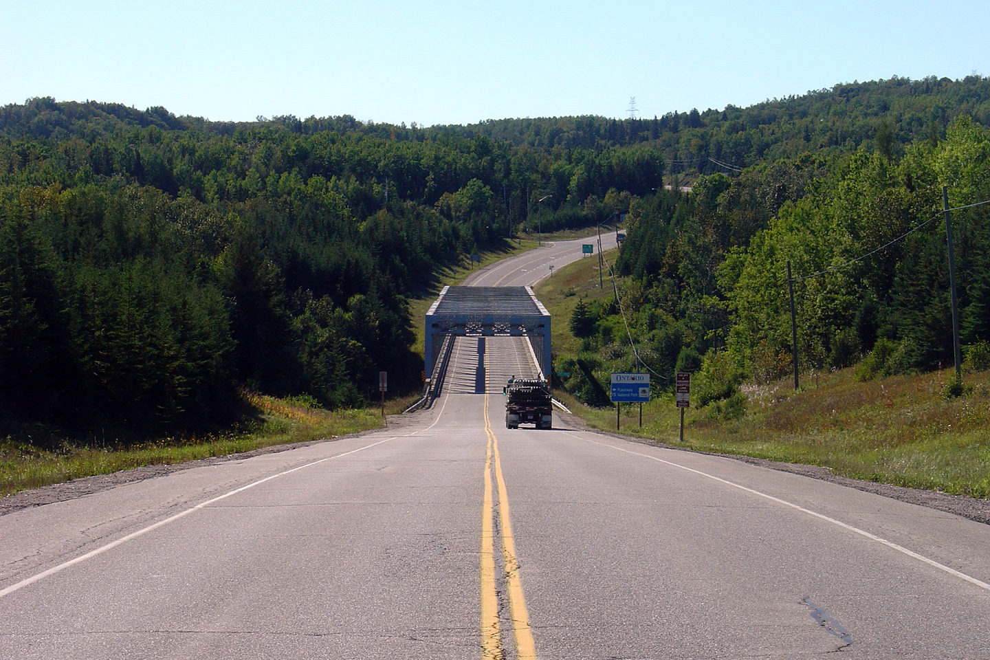
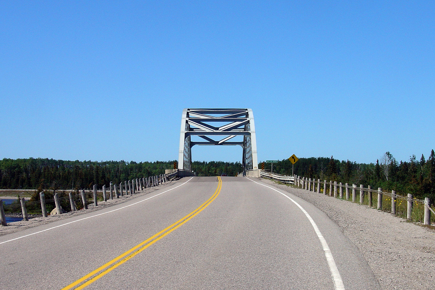
| District of Thunder Bay | View looking northerly from further up the Pic
River Valley. The Pic River bridge is of a modified Warren truss
design that is unlike any other highway bridge in Ontario. Photo taken: August 29th, 2006. |
 Low-res High-res |
|
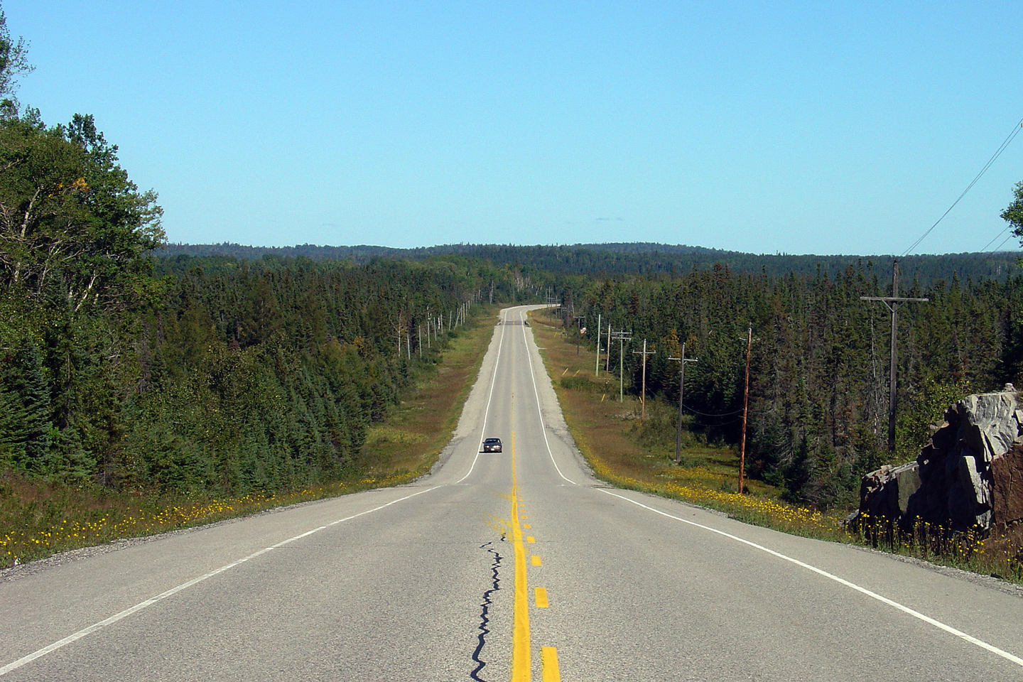
| District of Thunder Bay | View looking northerly along Highway 17 as it
passes overtop of Black Creek. Photo taken: September 5th, 2006. |
 Low-res High-res |
|
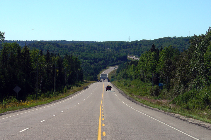
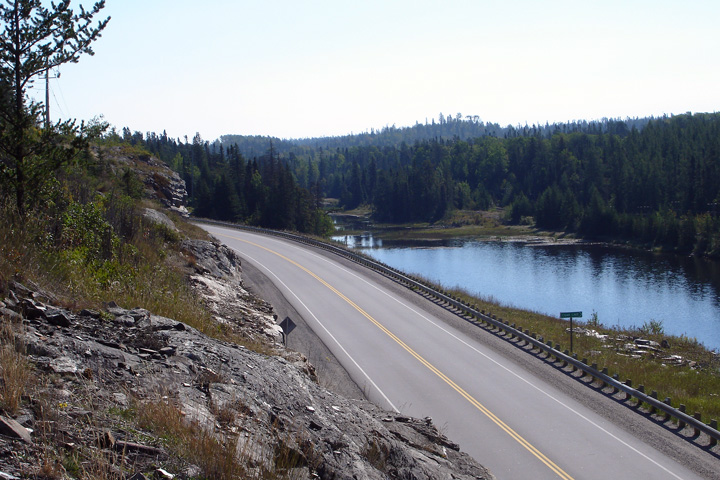
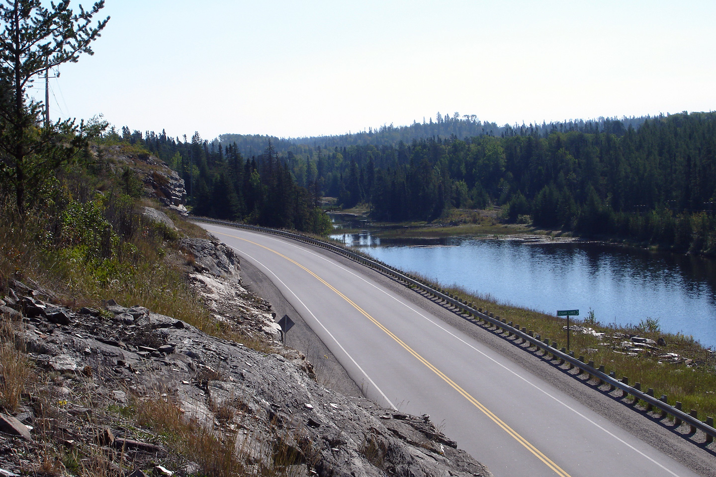
| District of Thunder Bay | View looking northerly as Highway 17 passes
Cigar Lake, just west of the Hemlo Gold Mine. Photo taken: September 5th, 2006. |
 Low-res High-res |
|
| District of Thunder Bay | View looking southerly as Highway 17 rounds the
curve away from Cigar Lake towards the Hemlo Gold Mine. Photo taken: September 5th, 2006. |
 Low-res High-res |
|
District of Thunder Bay |
Looking southerly through Terrace Bay.
Terrace Bay's commercial district is found just to the left of the highway
in this photo. Photo taken: August 29th, 2006. |
 Low-res High-res |
|
District of Thunder Bay |
View looking northerly from the north end of the
White Lake Narrows bridge as Highway 17 rounds the bend to follow the White
Lake shoreline. Photo taken: August 29th, 2006. |
 Low-res High-res |
|
District of Thunder Bay |
Southerly view approaching the White Lake Narrows bridge. The White
Lake Narrows bridge is a bowstring arch truss bridge. Photo taken: August 29th, 2006. |
 Low-res High-res |
|
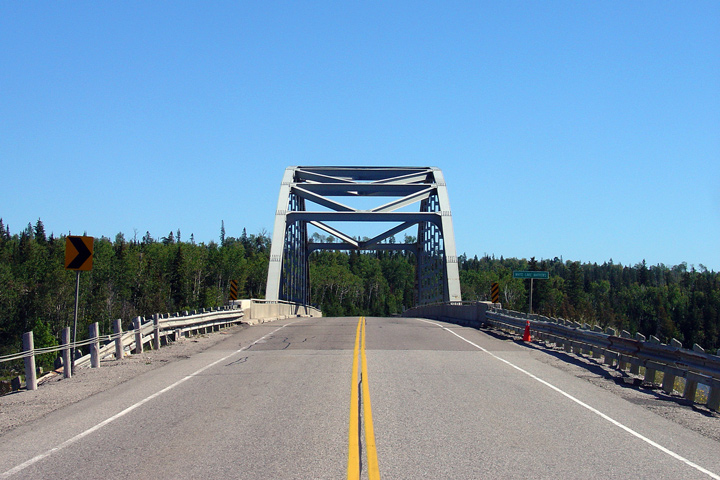
| District of Thunder Bay | Side view of the White Lake Narrows Truss
Bridge. This bridge is reminiscent of the new Bluewater Bridge span
that links Highway 402 in Sarnia to Interstate 69/94 in Port Huron Michigan. Photo taken: August 29th, 2006. |
 Low-res High-res |
|
District of Thunder Bay |
The White Lake Narrows Bridge, looking north. Photo taken: August 29th, 2006. |
 Low-res High-res |
|
District of Thunder Bay |
A southbound passing lane begins immediately
north of the White Lake Narrows Bridge. Photo taken: August 29th, 2006. |
 Low-res High-res |
|
District of Thunder Bay |
View looking south as the southbound White Lake
passing lane ends. A northbound passing lane also ends in this photo,
passing lanes are very frequent along Highway 17 between Sault Ste. Marie
and Thunder Bay.. Photo taken: August 29th, 2006. |
 Low-res High-res |
|
Township of White River District of Algoma |
View looking northerly at the north end of White
River. White River is a small town of roughly 850 people. Photo taken: August 29th, 2006. |
 Low-res High-res |
|
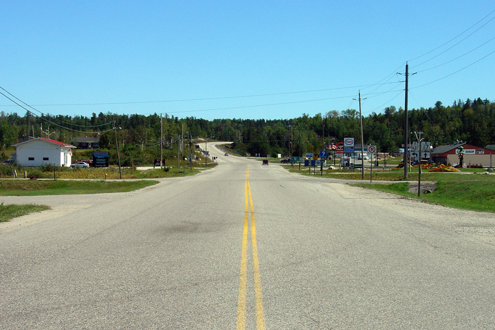
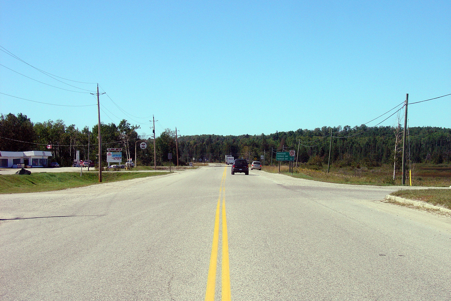
Township of White River District of Algoma |
Southerly view through White River towards the
Highway 631 junction. White River is a notable stop along Highway 17
-- it features both an A&W and Robins Donut location. Photo taken: August 29th, 2006. |
 Low-res High-res |
|
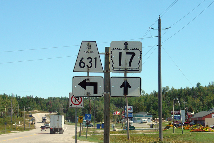
Township of White River District of Algoma |
Southbound junction assembly for the Highway 631
intersection. Highway 631 is a long secondary highway that links
Highway 17 to Highway 11 via Hornepayne. Photo taken: August 29th, 2006. |
 |
|
| Highway 631 leads north from White River to Hornepayne and Highway 11. Click here for Highway 631 images. | |||
| Continues on White River to Wawa Images | |||
<-
Page 2D Images
Highway
17 Images Index
Page
2F Images ->
Back to Highway 17 - Page 2
<- Highway 16 Images Images Index Highway 17A Images ->
Copyright (c) 2004-2010, Scott Steeves (Webmaster) scott@asphaltplanet.ca