King's Highway 17 - www.OntHighways.com

 Page 2   -   Thunder Bay To Sault Ste Marie

This section of Highway 17 is one of Ontario's most desolate highways, and is a likely candidate for the most desolate stretch of the mainline Trans-Canada Highway through mainland Canada.  Motorists should be advised to watch their fuel while traveling along this portion of highway, as road side services are virtually non-existent outside of the larger communities.  Despite this, this portion of Highway 17 is quite scenic and is certainly worth the drive.  Much of the highway passes very close to Lake Superior's often rugged shoreline, which provides drivers with numerous panoramic vistas.


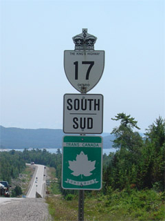
Old style King's Highway 17 marker and Trans-Canada Highway shield


Highway 17 information that pertains to the Thunder Bay to Sault Ste. Marie Section:

Multiplexes:  180.1 km with Highway 11 from Shabaqua Corners through Thunder Bay to just east of Nipigon

Freeway:  None.  Highway 11/17 is an at-grade urban expressway from Arthur Street (and Highway 61) to just east of Hodder Street in the northeast end of Thunder Bay.

Trans-Canada Highway: Entire Length, as the Lake Superior Route

AADT (2002):  Highest: 20,900, from Highway 61 to the Harbour Expressway in Thunder Bay;

                               Lowest: 1,700, from Old Woman River bridge to Michipicoten River Harbour.

Road Info:  Highway 17 is in good shape for this entire section.  The Thunder Bay expressway is an undivided (for the most part) at grade urban expressway, with moderate traffic volumes.  Traffic volumes drop rapidly east of Hodder Street in Thunder Bay, however Highway 11/17 is a very well maintained and high standard road with ample passing lanes east to Nipigon.  From Nipigon to Marathon, Highway 17 is still a very well maintained high standard road, but passing lanes are far less frequent.  East of Marathon, passing lanes are once again quite regular.  Highway 17 features a rural speed limit of 90km/h


Communities and Major Intersections along this section of Highway 17 from West (North) to East (South):

Proper Municipality Name Community Name Distance Intersecting Road

At Highway 61:  EB: Continued from Page 1.  WB: Take the ramp to the right towards Shabaqua, and click here

City of Thunder Bay (Thunder Bay By-pass) (536.2km) / (1,593.5km) King's Highway 61 & Highway 11B/17B (Arthur Street)
City of Thunder Bay (Thunder Bay By-pass) (539.2km) / (1,590.5km) Harbour Expressway
City of Thunder Bay (Thunder Bay By-pass) (540.8km) / (1,488.9km) Oliver Road
City of Thunder Bay (Thunder Bay By-pass) --- John Street
City of Thunder Bay (Thunder Bay By-pass) (545.3km) / (1,584.4km) Highway 102 (Red River Road)
City of Thunder Bay (Thunder Bay By-pass) --- Balsam Street
City of Thunder Bay (Thunder Bay By-pass) (551.7km) / (1,578.0km) Highway 11B/17B (Hodder Avenue)
Thunder Bay - Shuniah Boundary Thunder Bay East Limits (554.2km) / (1,575.5km) -----
Township of Shuniah ----- (555.6km) / (1,574.1km) Secondary Highway 527
Township of Shuniah ----- (570.5km) / (1,559.2km) Lakeshore Drive
Township of Shuniah ----- (585.6km) / (1,544.1km) Secondary Highway 587
Township of Dorion Dorion --- -----
District of Thunder Bay ----- (621.9km) / (1,507.8km) Secondary Highway 582 (South Jct)
District of Thunder Bay ----- (626.2km) / (1,503.5km) Secondary Highway 582 (North Jct)
Township of Red Rock ----- (641.5km) / (1,488.1km) Secondary Highway 628
Township of Nipigon ----- (650.1km) / (1,479.6km) Secondary Highway 585
Township of Nipigon Nipigon --- -----

At Highway 11 East Highway 17 switches cardinal directions.  Eastbound becomes southbound, and Northbound becomes westbound.

Township of Nipigon ----- (654.1km) / (1,475.6km) King's Highway 11-East
District of Thunder Bay Cavers ----- -----
Pays Plat IR 51 Pays Plat (716.3km) / (1,413.4km) -----
District of Thunder Bay Schreiber (743.9km) / (1,385.8km) Quebec Street
Township of Terrace Bay Terrace Bay (758.5km) / (1,371.2km) -----
District of Thunder Bay Neys ----- -----
District of  Thunder Bay Coldwell (816.1km) / (1,313.6km) -----
Town of Marathon ----- (834.9km) / (1,294.8km) Highway 626 (Peninsula Drive)
Town of Marathon ----- (841.6km) / (1,288.1km) Secondary Highway 627
District of Thunder Bay Hemlo (865.3km / 1,264.4km) ----
District of Thunder Bay ----- (874.8km) / (1,254.9km) Secondary Highway 614
Thunder Bay - Algoma District Boundary ----- (919.5km) / (1,210.2km) -----
Township of White River White River (925.6km) / (1,204.1km) Secondary Highway 631
District of Algoma ----- (976.6km) / (1,153.1km) Secondary Highway 519
Township of Michipicoten ----- (1,015.4km) / (1,114.3km) King's Highway 101
Township of Michipicoten Michipicoten River (1,021.7km) / (1,108.0km) -----
District of Algoma Agawa Bay (1,099.7km) / (1,030.0km) -----
District of Algoma Montreal River (1,121.1km) / (1,008.6km) -----
District of Algoma Batchawana (1,171.8km) / (957.9km) Secondary Highway 563
District of Algoma Karalash Corners --- -----
District of Algoma ----- (1,211.2km) / (918.5km) Secondary Highway 552
District of Algoma ----- (1,223.4km) / (906.3km) Secondary Highway 556
Sault Ste. Marie Boundary Sault Ste Marie North Limits (1,227.5km) / (902.8km) ------
City of Sault Ste. Marie Sault Ste. Marie (1,236.7km) / (893.0km) King's Highway 17B & Secondary Highway 550

EB: To Continue Eastwards Along Highway 17 click here.  NB: Continued from Page 3

Highway 17 (Page 2) - Images

Page 1 (Manitoba to Thunder Bay)     Page 3 (Marathon to Sault Ste. Marie)

Highway 17 Home

www.OntHighways.com - Home


Copyright (c) 2004,2005 Scott Steeves (Webmaster)  webmaster@onthighways.com

Page last updated:  August 1st, 2006

Page created:  August 1st, 2006