|
Proper Municipality Name |
Photo Description |
Photo |
|
Pictures taken
from driver's perspective appear offset from centre-line pictures: |
East-
bound |
West-
bound |
|
Pictures continue westward on the
North Bay to Mattawa section |
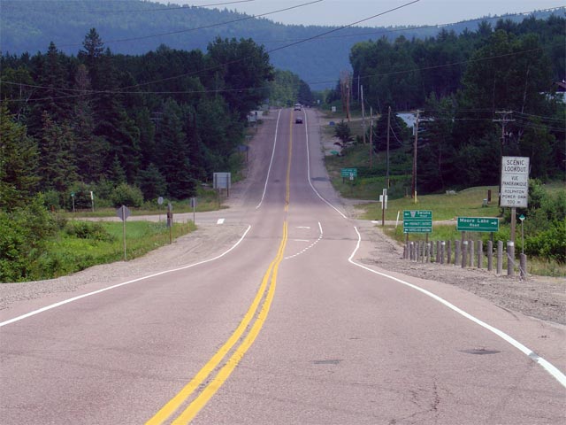
| Town of Mattawa District of
Nipissing |
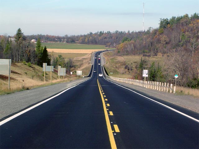
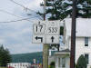
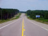
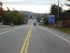
Junction assembly heading westbound along Highway 17 for the upcoming
Highway 533
junction. Picture size: 50kb. |
 |
|
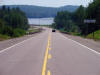
Town of Mattawa District of Nipissing |
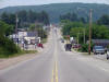
Looking west through the town of Mattawa. Though not totally evident
in the pictures, Highway 17 actually skirts around the heart of Mattawa.
Mattawa's historic downtown is located a short distance north of Highway 17
along Highway 533.
Picture taken: July 4th, 2005. Size: 65kb. |
 |
|
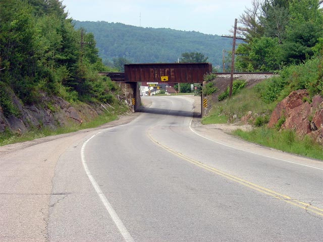
Town of Mattawa District of Nipissing |
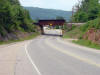
Looking west through the narrow OVR overhead. This old and narrow
structure is located just east of Mattawa. Picture taken: July 4th, 2005.
Size: 65kb. |
 |
|
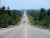
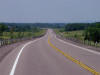
Township of Papineau-Cameron District of Nipissing |
Looking east along Highway 17 from just east of the eastern limits of the
Town of Mattawa. As evident in the photo, Highway 17 features a long
passing lane for eastbound traffic just east of Mattawa. Picture taken:
July 4th, 2005. Size: 50kb. |
 |
|
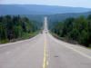
Township of Papineau-Cameron District of Nipissing |
Looking west towards Mattawa along Highway 17. This picture was taken
roughly 12km east of Mattawa. Picture taken: July 4th, 2005. Size:
60kb. |
 |
|
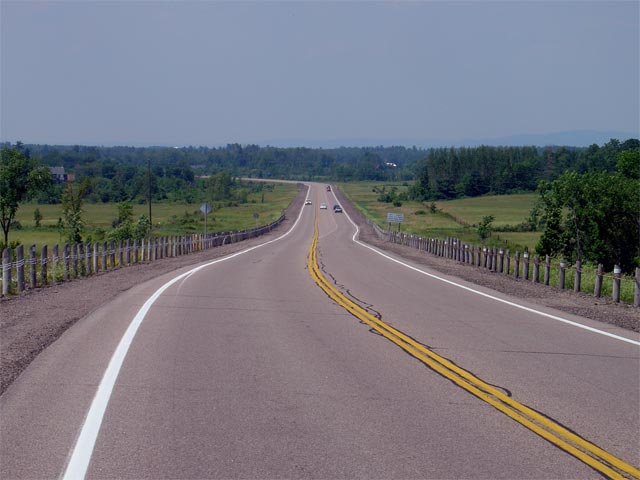
Township of Head, Clara and Maria County of Renfrew |
Looking east along Highway 17 in the vicinity of Bissett Creek.
Highway 17 was extensively rehabilitated between Deux Rivieres and Bissett
Creek in 2002. This construction included the addition of two
eastbound and westbound passing lanes to the highway.
Picture taken: July 4th, 2005. Size: 50kb. |
 |
|
Township of Head, Clara and Maria County of Renfrew |
Looking west towards Mattawa from roughly 23km west of Rolphton. Picture
taken: July 4th, 2005. Size: 60kb. |
 |
|
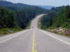
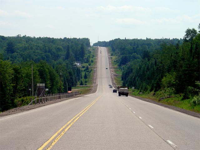
Township of Head, Clara and Maria County of Renfrew |
Looking east along Highway 17 through the Grants Creek Valley. As
evident from the photos, the upper Ottawa Valley is quite rugged, passing
through several of these large valleys between Mattawa and Rolphton.
Picture taken: July 4th, 2005. Size: 65kb. |
 |
|
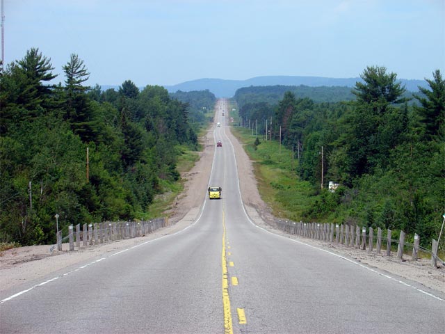
Township of Head, Clara and Maria County of Renfrew |
Looking west towards the main entrance to Driftwood Provincial Park.
Driftwood Provincial Park is located roughly 13km west of Rolphton.
Picture taken: July 4th, 2004. Size: 45kb. |
 |
|
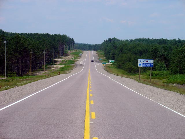
Township of Head, Clara and Maria County of Renfrew |
Looking east along Highway 17 towards Mackey. Mackey is located
roughly 10km west of the Highway 635 junction at Rolphton. Picture taken:
July 4th, 2005. Size: 55kb. |
 |
|
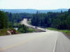
Town of Laurentian Hills County of Renfrew |
Looking east through Rolphton towards the junction with Highway 635 (now
Renfrew Road 635). Highway 635 is a short highway that runs northerly
from Highway 17 crossing into Quebec via the Swisha Bridge.
Picture taken: July 4th, 2005. Size: 60kb. |
 |
|
Township of Laurentian Valley County of Renfrew |
Looking west along the Pembroke Bypass from roughly 1km west of the Highway
62/148
junction. The Pembroke and Petawawa Bypass was built as a staged
freeway that will one day be incorporated into a westerly
Highway 417 extension.
Picture taken: July 4th, 2005. Size: 50kb. |
 |
|
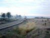
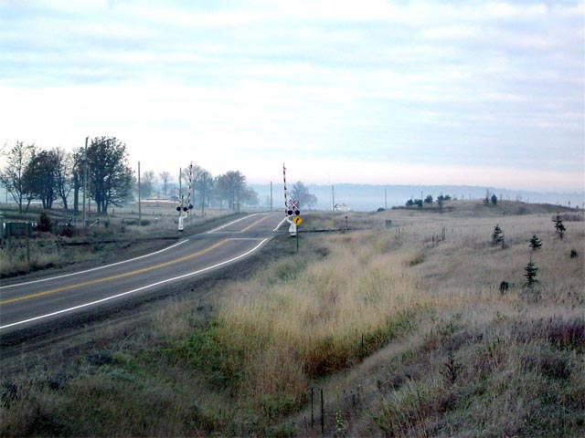
Township of Whitewater Region County or Renfrew |
Looking west along Highway 17 at Shields Crossing. Notice the grading
to the right of the highway at the railway crossing. This land was
graded as the former Cobden Overhead sat on this ground. The Overhead
was demolished because of its poor condition and never replaced because the
MTO is planning to by-pass this portion of Highway 17.
Picture taken: October 23rd, 2004. Size: 50kb. |
 |
|
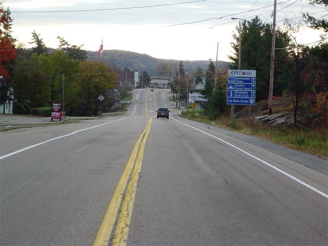
Township of Whitewater Region County of Renfrew |
Looking east through the small community of Cobden along Highway 17.
Cobden is the only notable community not yet bypassed along the Trans-Canada
Highway between Chalk River and Ottawa. A new alignment has been
developed to bypass Cobden (bypassing roughly 30km of Highway 17), but is
likely decades away from construction.
Picture taken: October 23rd, 2004. Size: 50kb. |
 |
|
Highway 653 leads travelers
easterly from the Trans-Canada Highway into the Province of Quebec.
Click here for Highway 653 images |
|
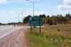
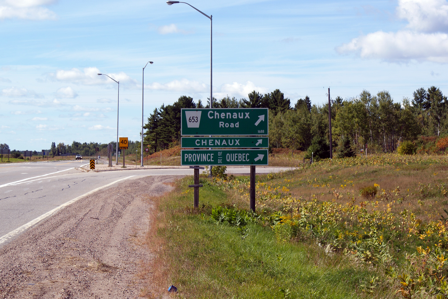
Township of Whitewater Region County of Renfrew |
Green signage for Highway 653 along Highway 17 West.
Photo taken: September 12th, 2009. |
(720x480)
(1440x960) |
|
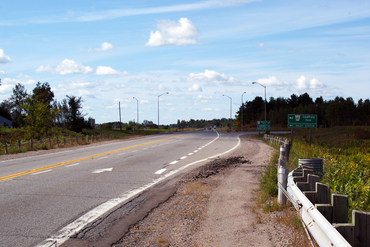
Township of Whitewater Region County of Renfrew |
This photo looks westerly approaching the Highway 653 junction. During
the 2011 construction season, this section of Highway 17 is slated to be
resurfaced.
Photo taken: September 12th, 2009. |
(720x480)
(1440x960) |
|
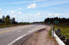
Horton - Renfrew Boundary County of Renfrew |
Looking west along Highway 17 from just west of the
Highway 60 junction. Highway 17 was
resurfaced in the vicinity of Highway 60 in
conjunction with intersection improvements that saw traffic signals
installed at the junction. This work was carried out in the fall of
2004.
Picture taken: October 23rd, 2004. Size: 50kb. |
 |
|
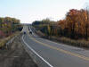
Town of Arnprior County of Renfrew |
Highway 17 looking east across the Madawaska River bridge on the Arnprior
By-pass. Baskin Drive is located approximately 1km west of this point.
Highway 17 ends at the top of this hill, where it transitions from two- to
four-lanes at the beginning of Highway 417.
Click here for Highway 417
images.
Picture taken: October 23rd, 2004. Size: 55kb. |
 |
|
Click here to continue easterly via
Highway 417 Images |


