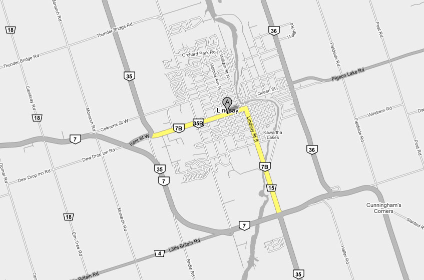
King's Highway 35B - Images
Photos shown in this table are arranged from West to East:
| Proper Municipality Name | Photo Description | Photo | |
|
Pictures taken from driver's perspective appear offset from centre-line pictures: |
East- Bound |
West- Bound |
|
| Highway 35B ends at the Highway 35-North junction. North of Lindsay, Highway 35 is bound for Fenelon Falls. Click here for Highway 35 images. | |||
| City of Kawartha Lakes | View looking easterly along Highway 7B/35B from
the Highway 35 junction. The odd Highway 35B crown pictured beside the
7B shield was added long after the highway was transferred.. Photo taken: April 10th, 2009. |
 Low-res High-res |
|
| City of Kawartha Lakes | Kent Street in all of its glory. A lot of
small towns in Ontario have a main commercial strip such as this just
outside of the historic City core. Photo taken: April 10th, 2009. |
 Low-res High-res |
|
| City of Kawartha Lakes | Easterly view from Cambridge Street. I
find these old historic Downtown's more and more interesting the more I see
of them. Remember until the 1960s Kent Street was both the main route
for Highway 7 and Highway 35. Photo taken: April 10th, 2009. |
 Low-res High-res |
|
| City of Kawartha Lakes | View looking westerly towards the Second Street
intersection. Photo taken: April 10th, 2009. |
 Low-res High-res |
|
| City of Kawartha Lakes | Junction assembly for the Highway 36B
intersection. This is the only Highway 36B shield still remaining. Photo taken: April 10th, 2009. |
 |
|
| City of Kawartha Lakes | Northbound junction assembly for the Highway 36B
junction at the intersection of Lindsay and Kent Street's. This is the
main intersection in Lindsay. Photo taken: April 10th, 2009. |
 |
|
| Highway 36B was a short locally signed highway leading from Lindsay to Highway 36 at Pigeon Lake Road. Click here for Highway 36B images. | |||
| City of Kawartha Lakes | View looking northerly approaching the Kent
Street intersection along Lindsay Street. Photo taken: April 10th, 2009. |
 Low-res High-res |
|
| City of Kawartha Lakes | Looking southerly along Lindsay Street away from
the Downtown Core. There is far less commercial development along
Lindsay Street compared to Kent Street. Photo taken: April 10th, 2009. |
 Low-res High-res |
|
| City of Kawartha Lakes | Easterly view across the Scugog River Bridge.
The Scugog River bridge was completed in 1970 and was constructed wide
enough to support a four-lane roadway. Half of this structure's service
life has passed by awaiting for a four lane widening of Lindsay Street that
has yet to come to fruition. Photo taken: August 23rd, 2013. |
 (720x480) (1440x960) (2400x1600) |
|
| City of Kawartha Lakes | Side view (looking easterly) towards the Scugog
River Bridge. Photo taken: August 23rd, 2013. |
 (720x480) (1440x960) (2400x1600) |
|
| City of Kawartha Lakes | Westerly view overtop of the Scugog River Bridge
entering Lindsay. Photo taken: August 23rd, 2013. |
 (720x480) (1440x960) (2400x1600) |
|
| City of Kawartha Lakes | Advanced signage for the Highway 7 and 35
interchange. Photo taken: August 23rd, 2013. |
 (720x480) (1440x960) (2400x1600) |
|
| City of Kawartha Lakes | Green directional sign directing traffic towards
the various major centres accessible from this highway junction. Photo taken: August 23rd, 2013. |
 (720x480) (1440x960) (2400x1600) |
|
| City of Kawartha Lakes | View looking easterly towards the eastern
junction of Highway 7 and 35. Photo taken: August 23rd, 2013. |
 (720x480) (1440x960) (2400x1600) |
|
| South of Downtown Lindsay, Highway 7B/35B once again intersects with Highways 7 and 35. Click here for Highway 7 Images and here for Highway 35 Images. | |||
<- Highway 35 Images Back to Highway 35B Highway 36 Images ->
Copyright (c) 2004-2014 Scott Steeves (Webmaster) scott@asphaltplanet.ca