AsphaltPlanet.ca > OntHighways >
Highway 401 > Images
> Page 1
King's Highway 401 - Images
Page 1 - Windsor to Highway 77 Page 2 ->
Photos shown in this table are arranged from West to East:
| Proper Municipality Name | Photo Description | Photo | |||||
|
Photos taken from driver's perspective appear offset from centre-line Photos: |
East- bound |
West- bound |
|||||
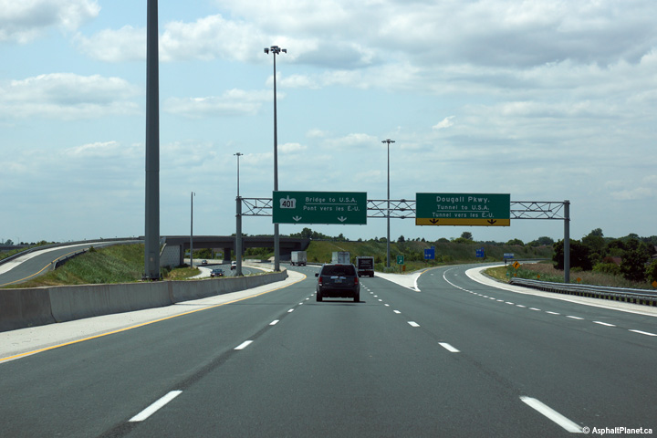
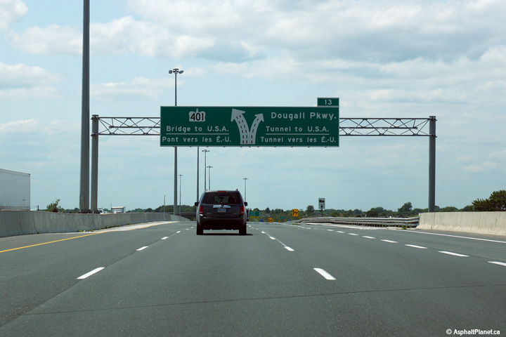
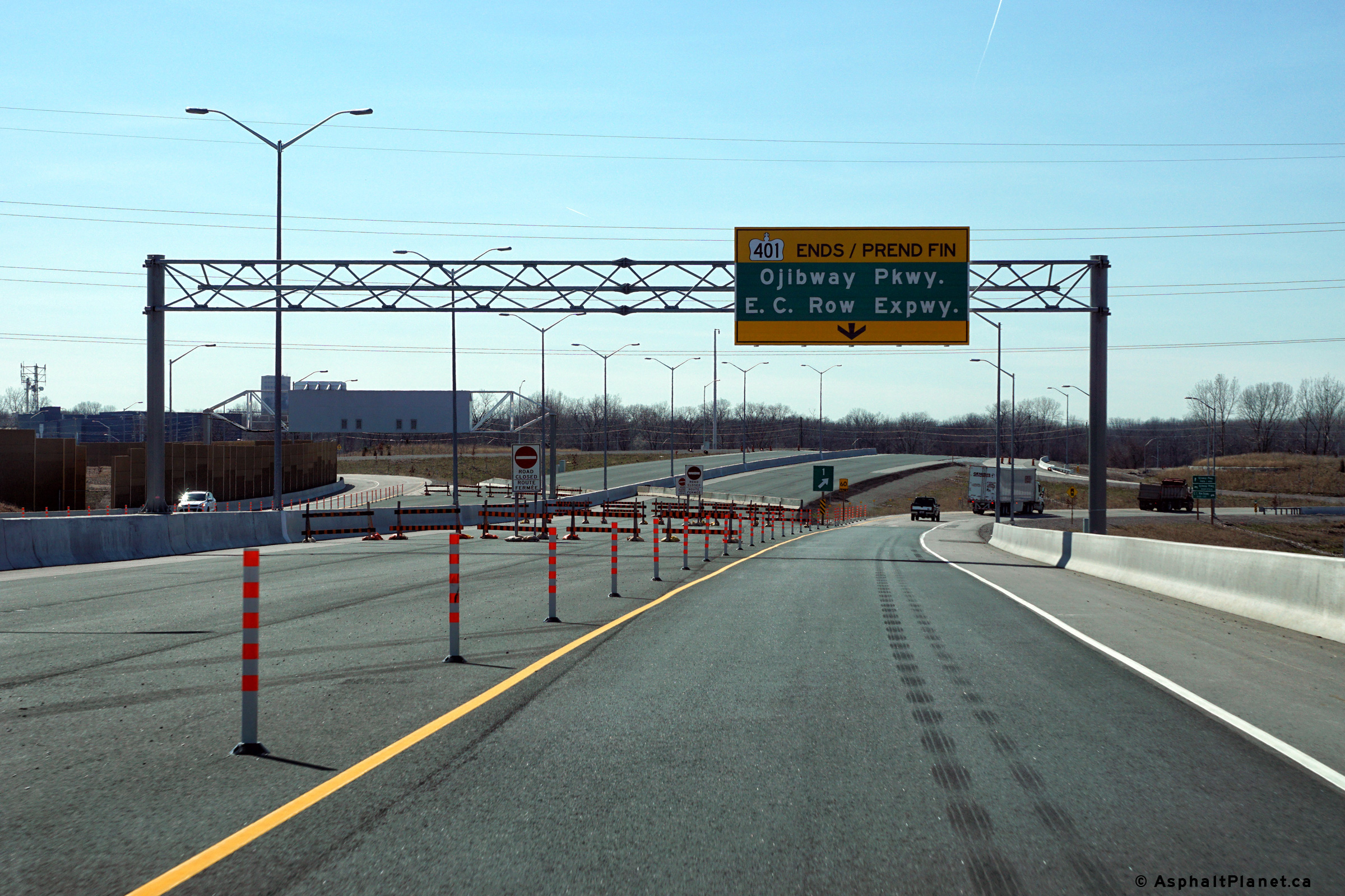
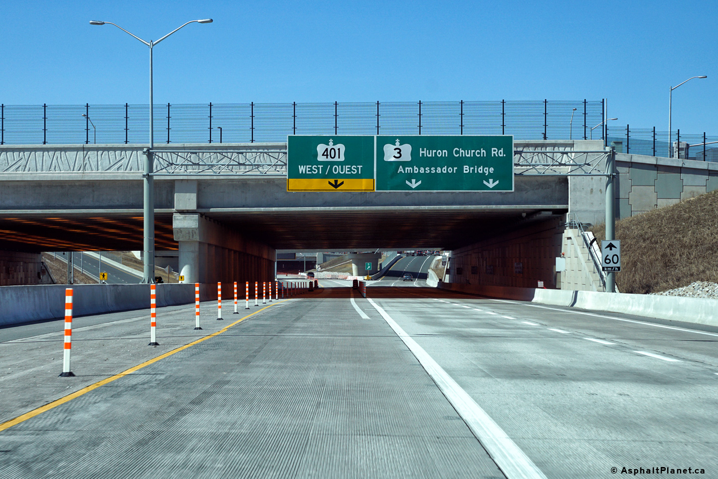
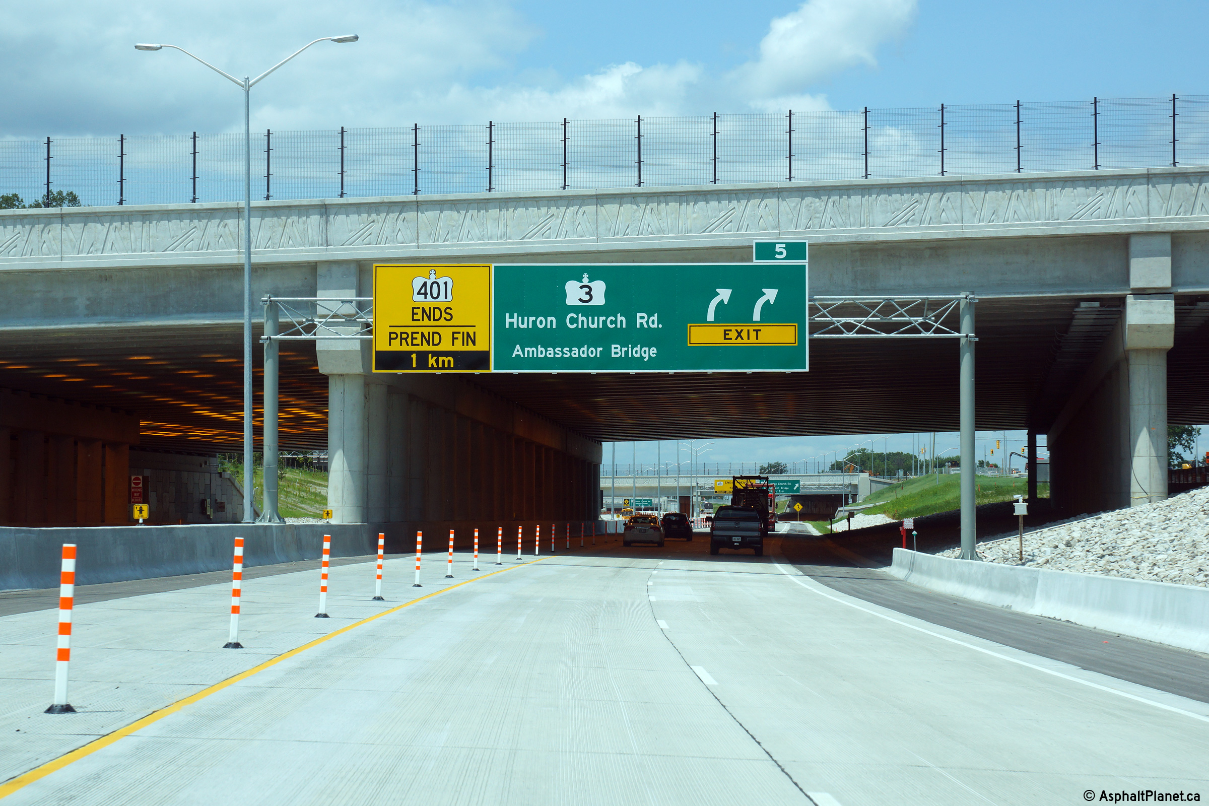
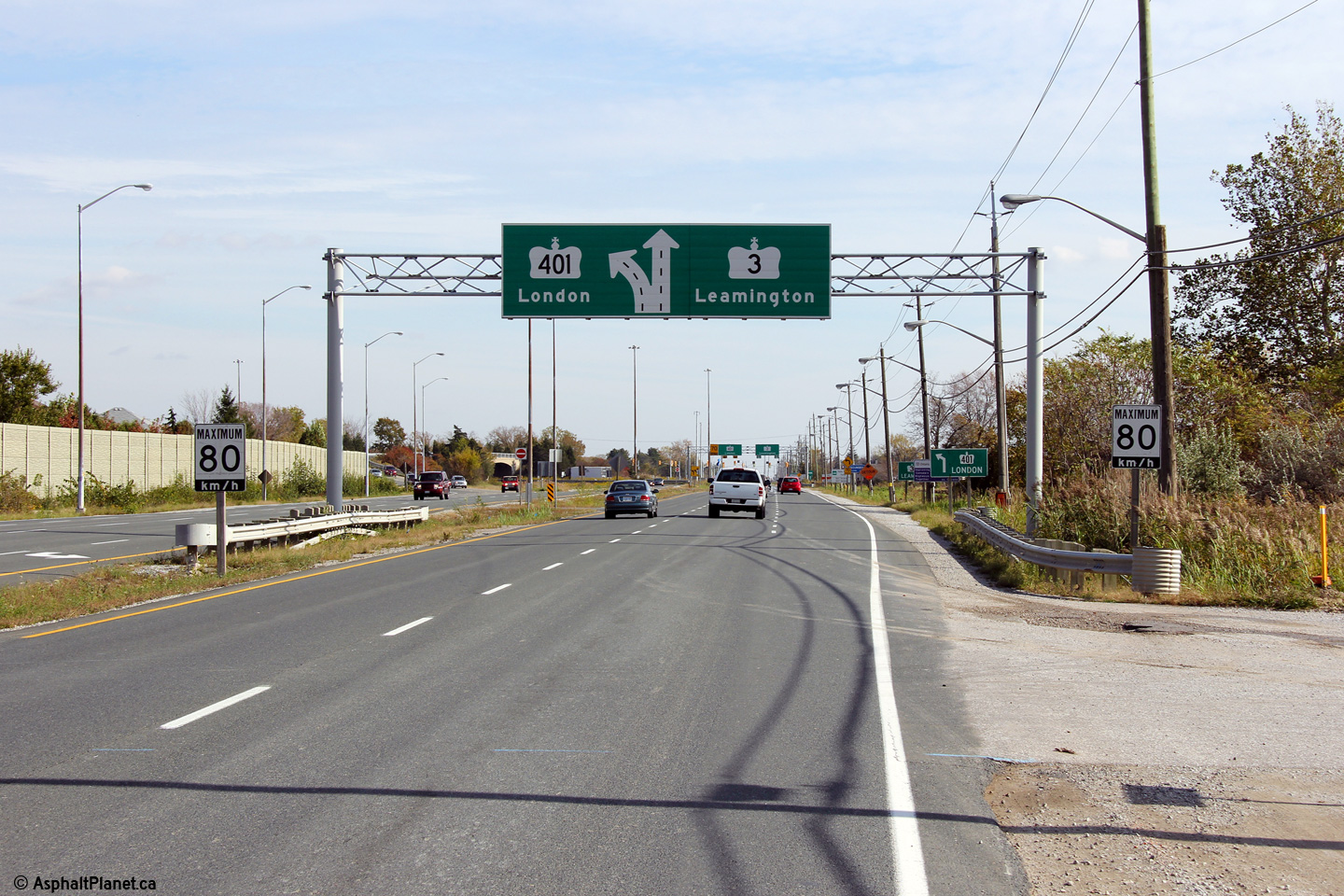
| City of Windsor |
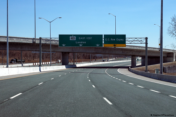
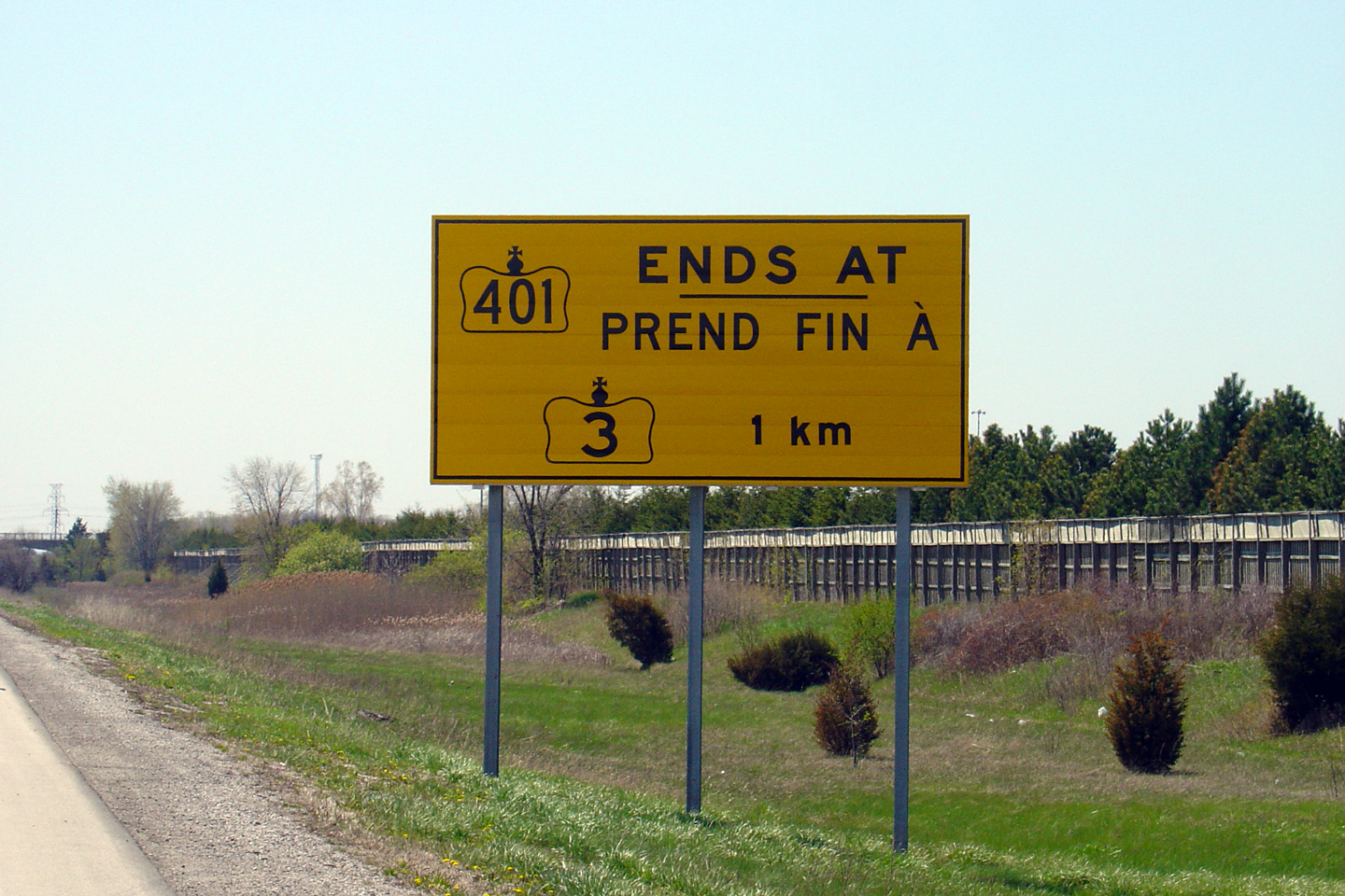
Overhead signage notifying westbound motorists that they will be forced off
the highway ahead. Photo taken: March, 2016. |
 (720x480) (720x480)(1440x960) (2400x1600) |
|||||
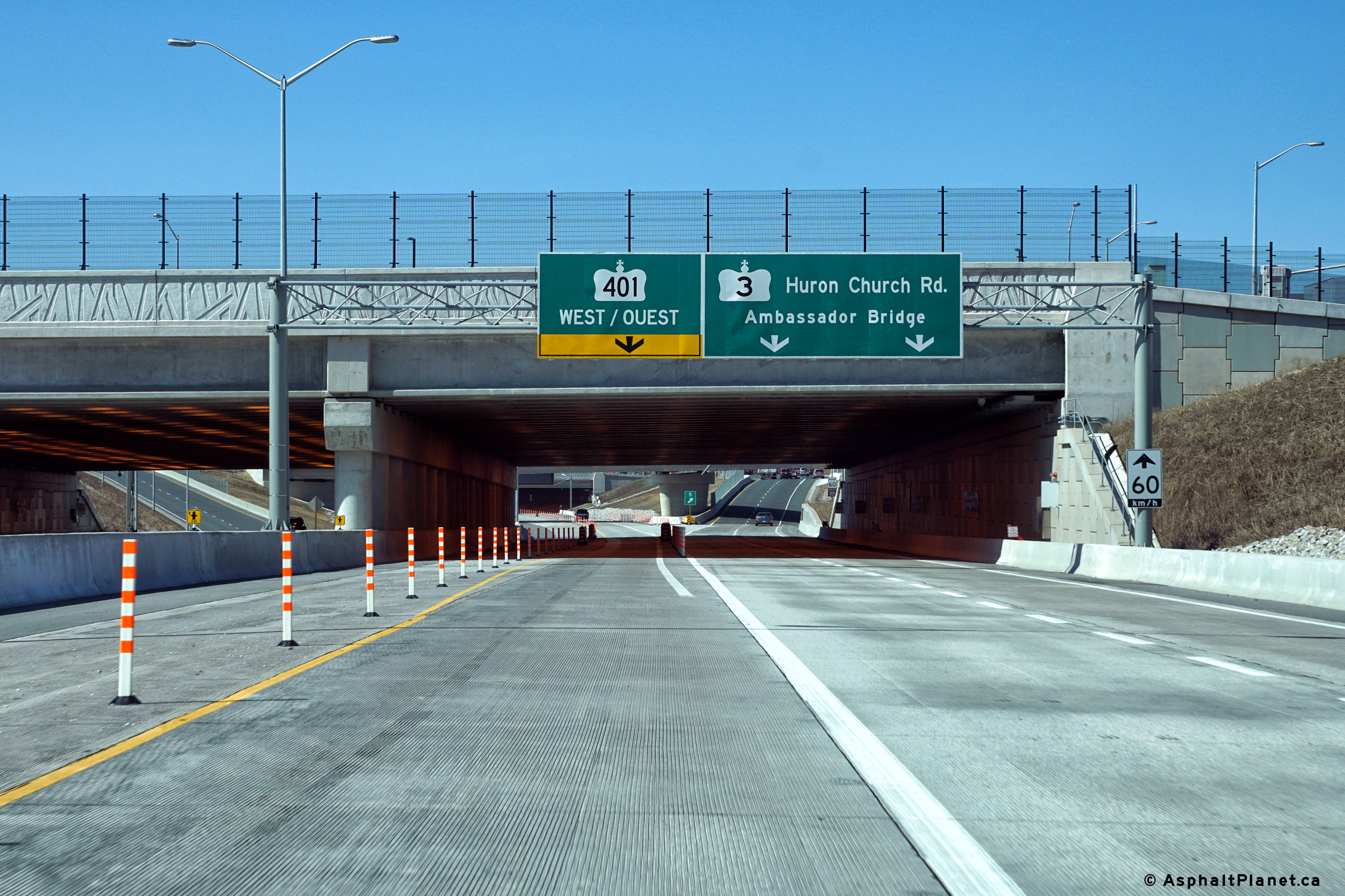
| City of Windsor |
Overhead signage notifying westbound motorists that they will be forced off
the highway ahead. Photo taken: March, 2016. |
 (720x480) (720x480)(1440x960) (2400x1600) |
|||||
| City of Windsor |
Overhead signage notifying westbound motorists that they will be forced off
the highway ahead. Photo taken: March, 2016. |
 (720x480) (720x480)(1440x960) (2400x1600) |
|||||
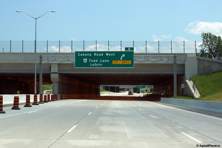
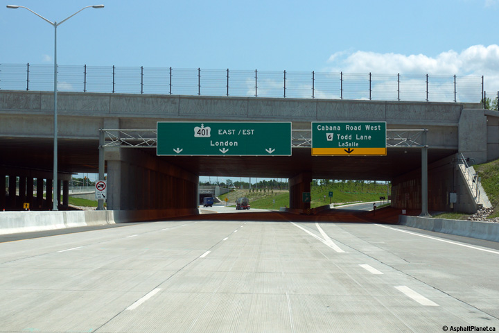
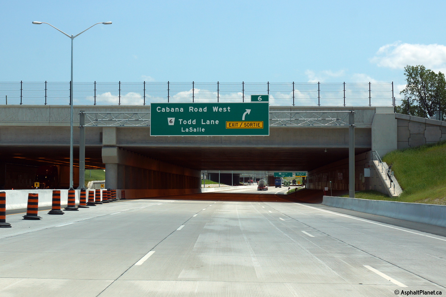
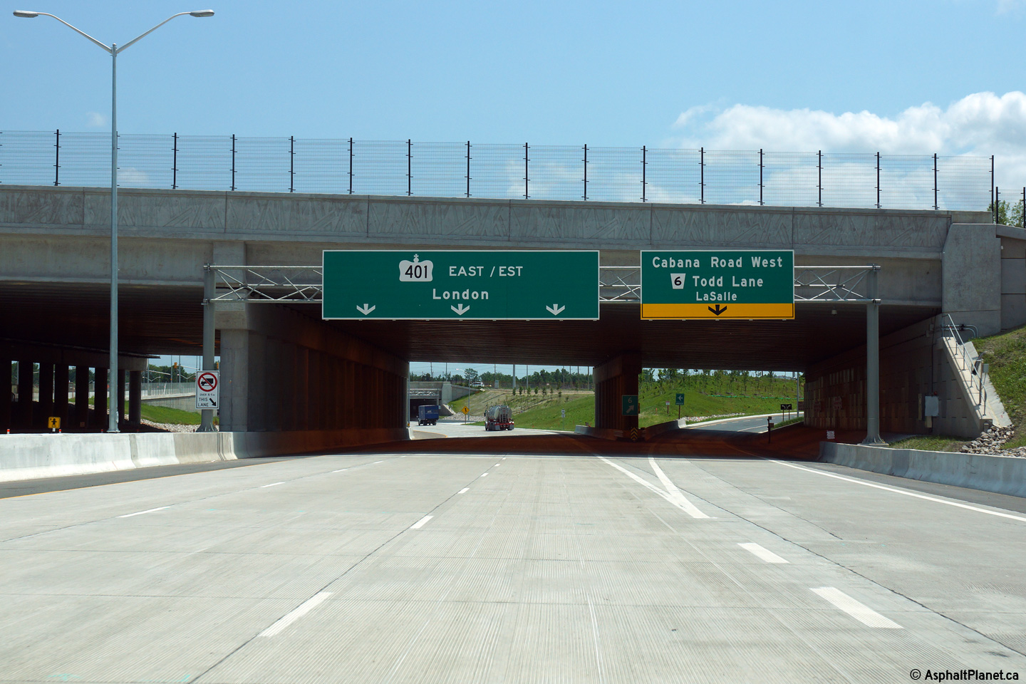
| City of Windsor |
Eastbound signage at the off-ramp to Cabana Road and Todd Lane. Photo taken: March, 2016. |
 (720x480) (720x480)(1440x960) (2400x1600) |
|||||
| City of Windsor |
Overhead signage notifying westbound motorists that they will be forced off
the highway ahead. Photo taken: March, 2016. |
 (720x480) (720x480)(1440x960) (2400x1600) |
|||||
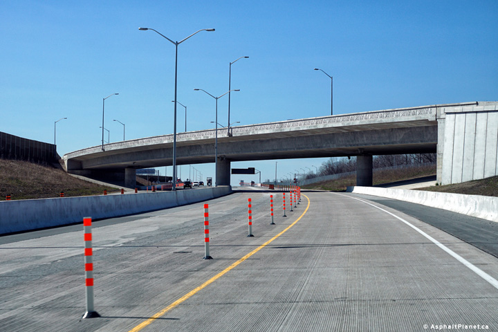
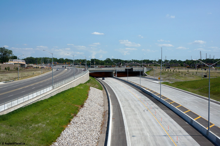
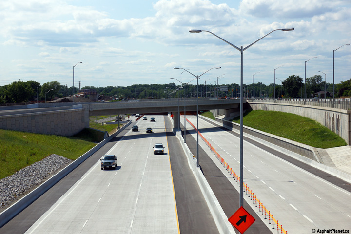
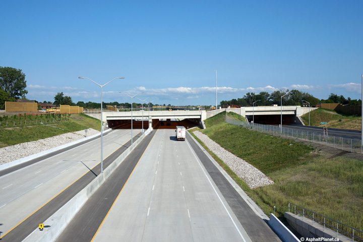
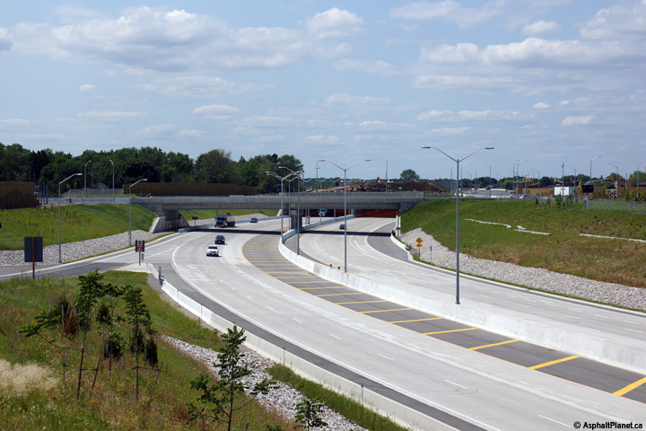
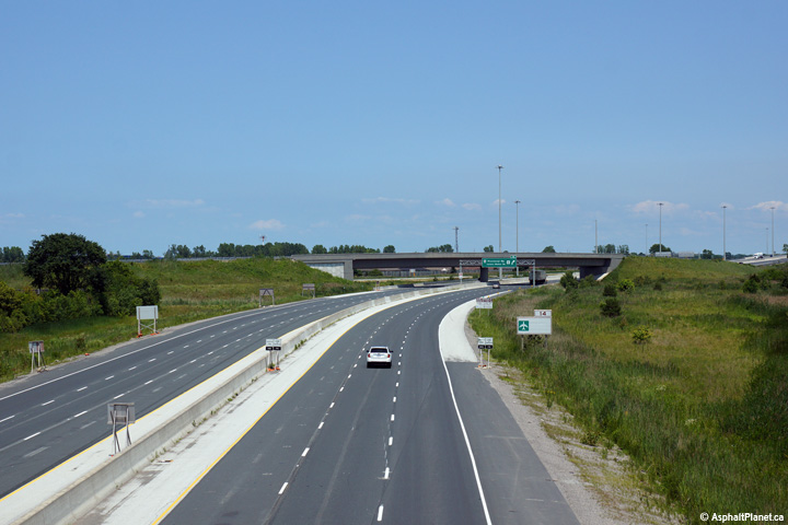
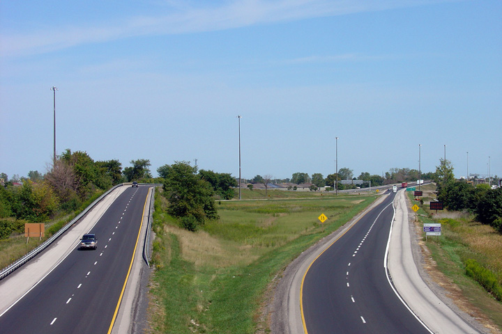
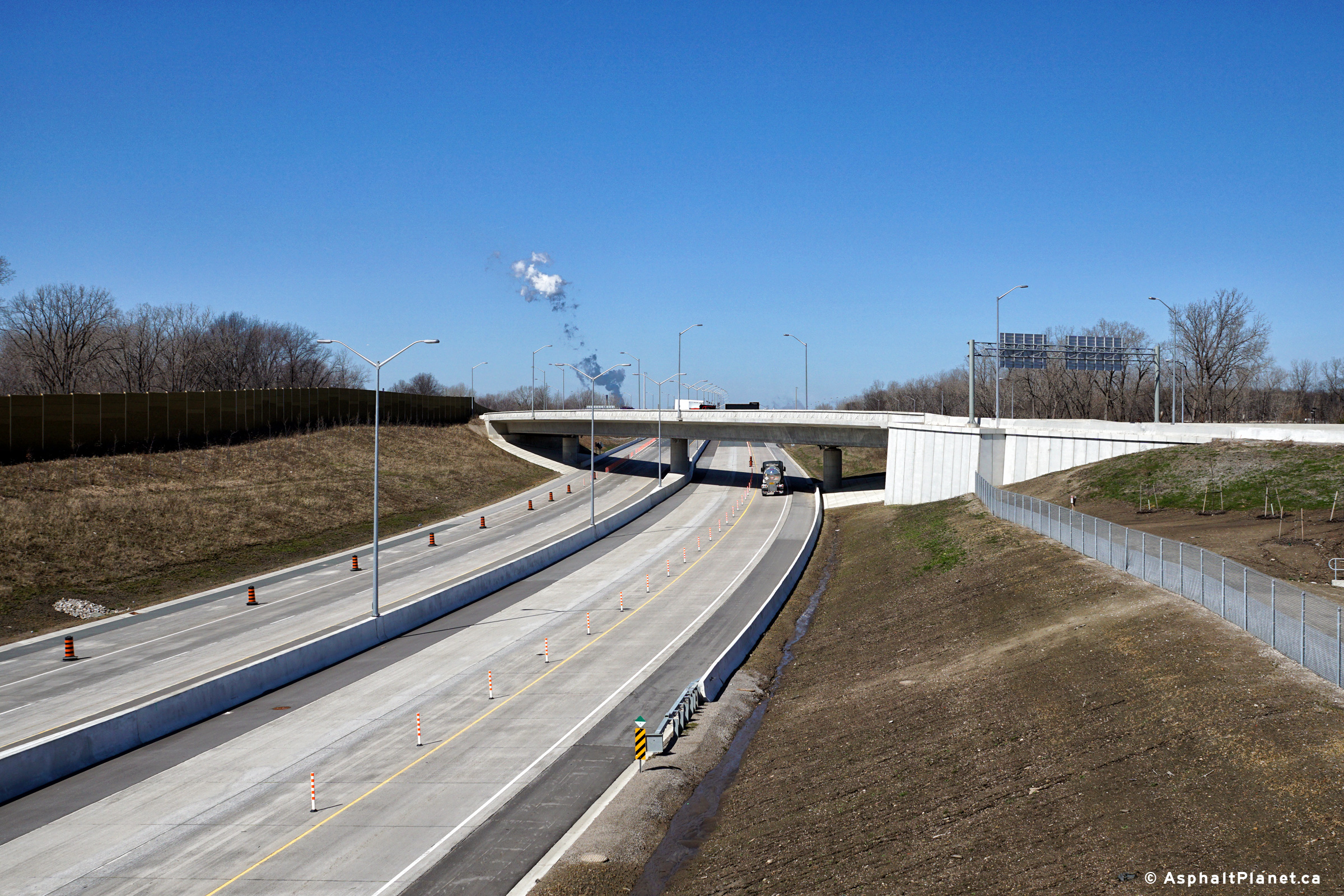
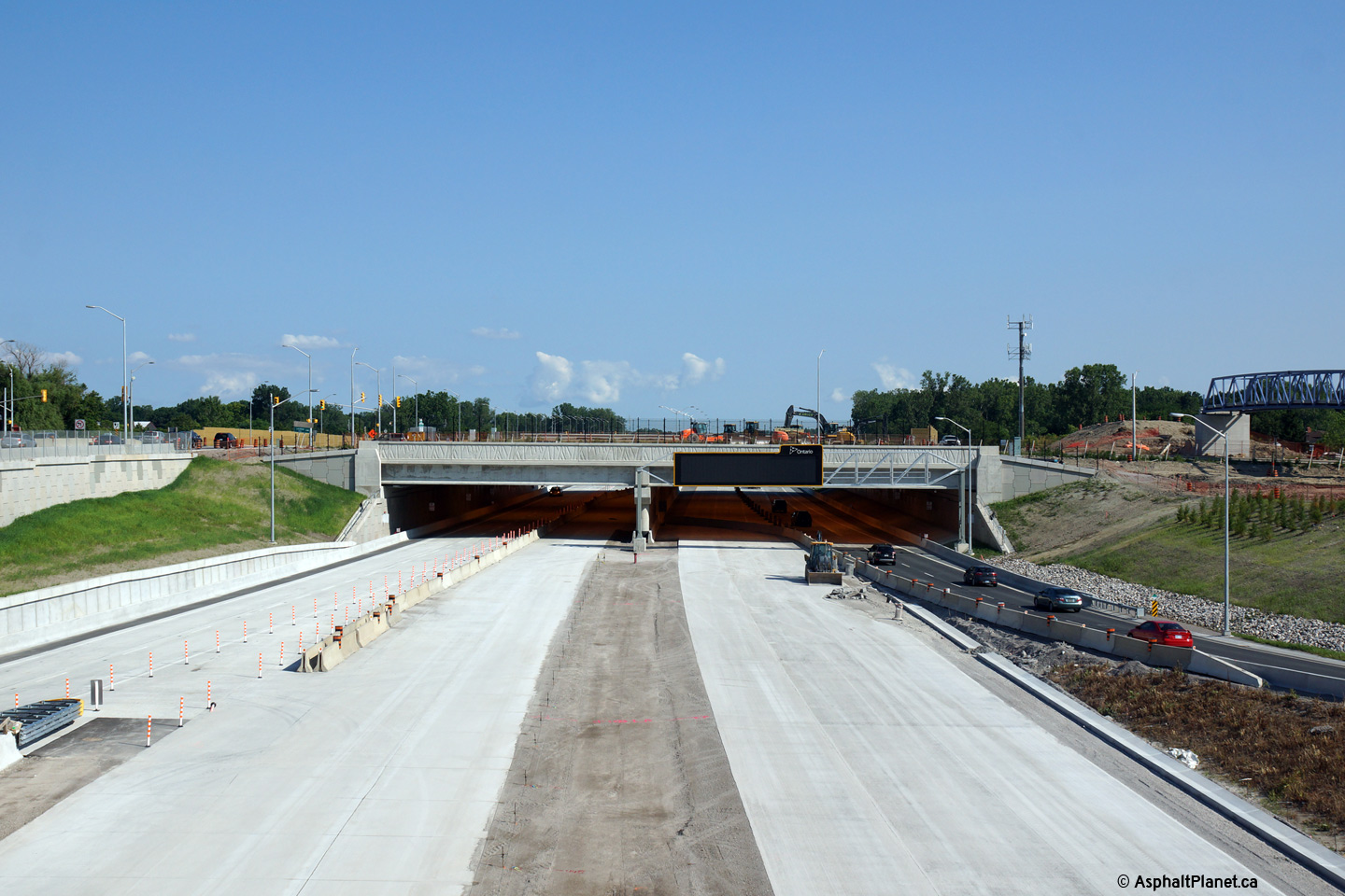
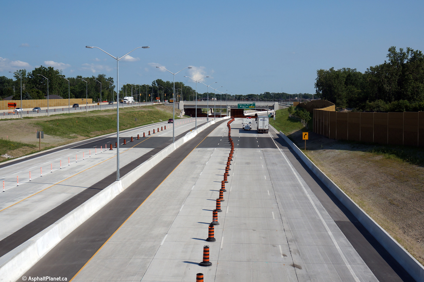
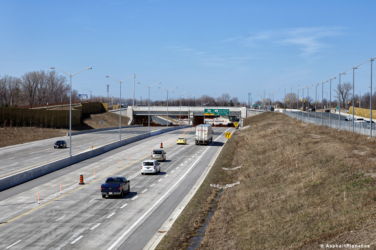
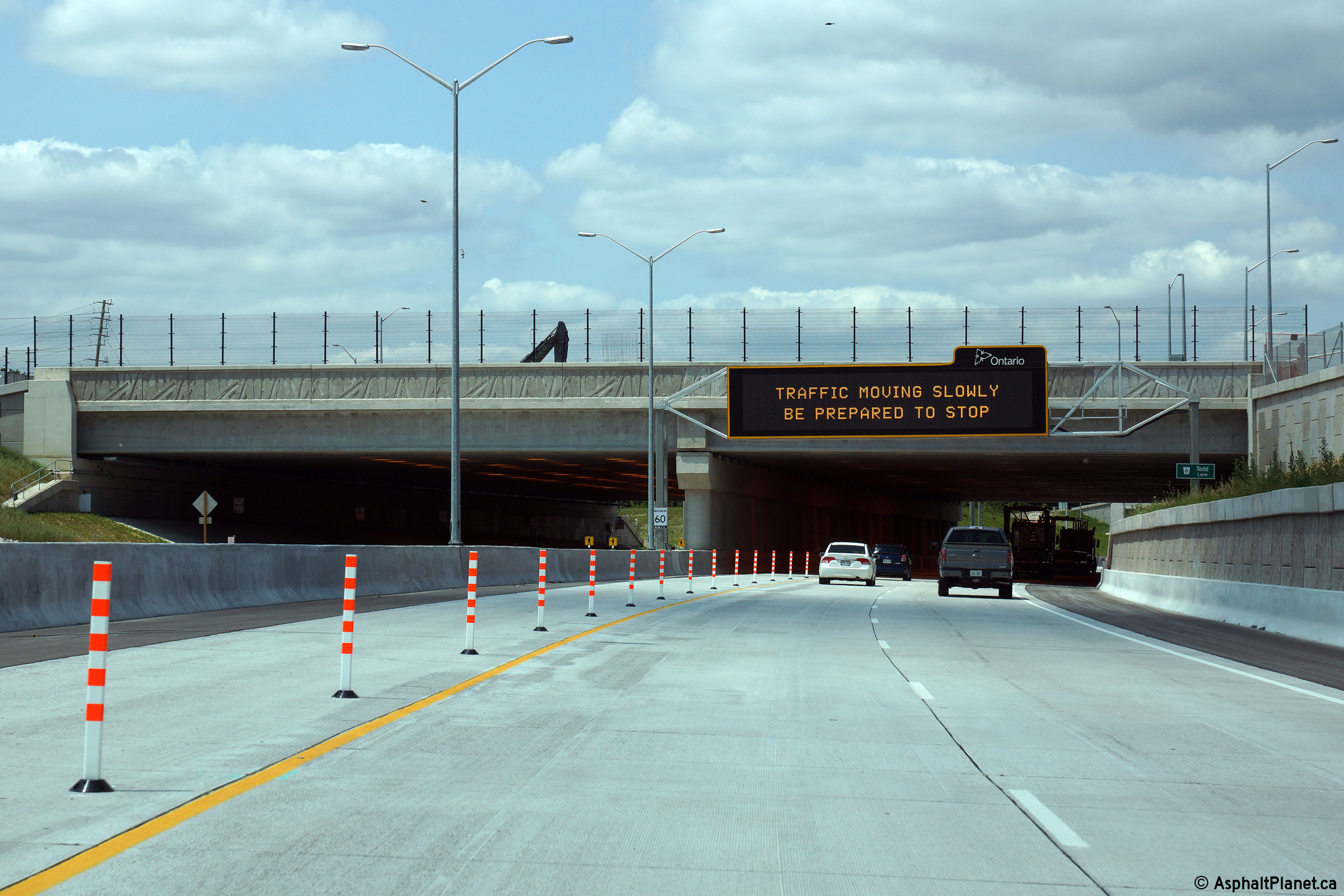
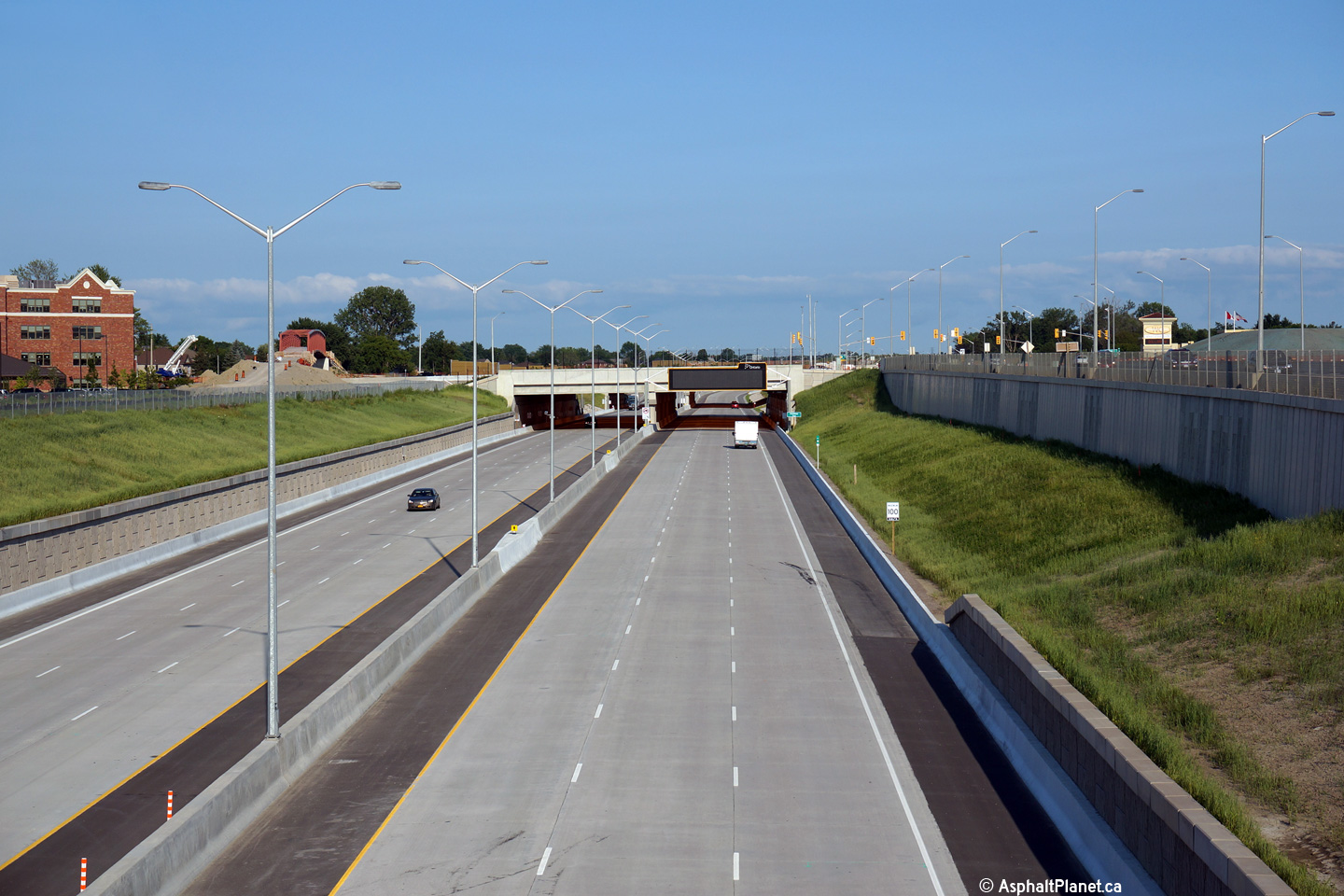
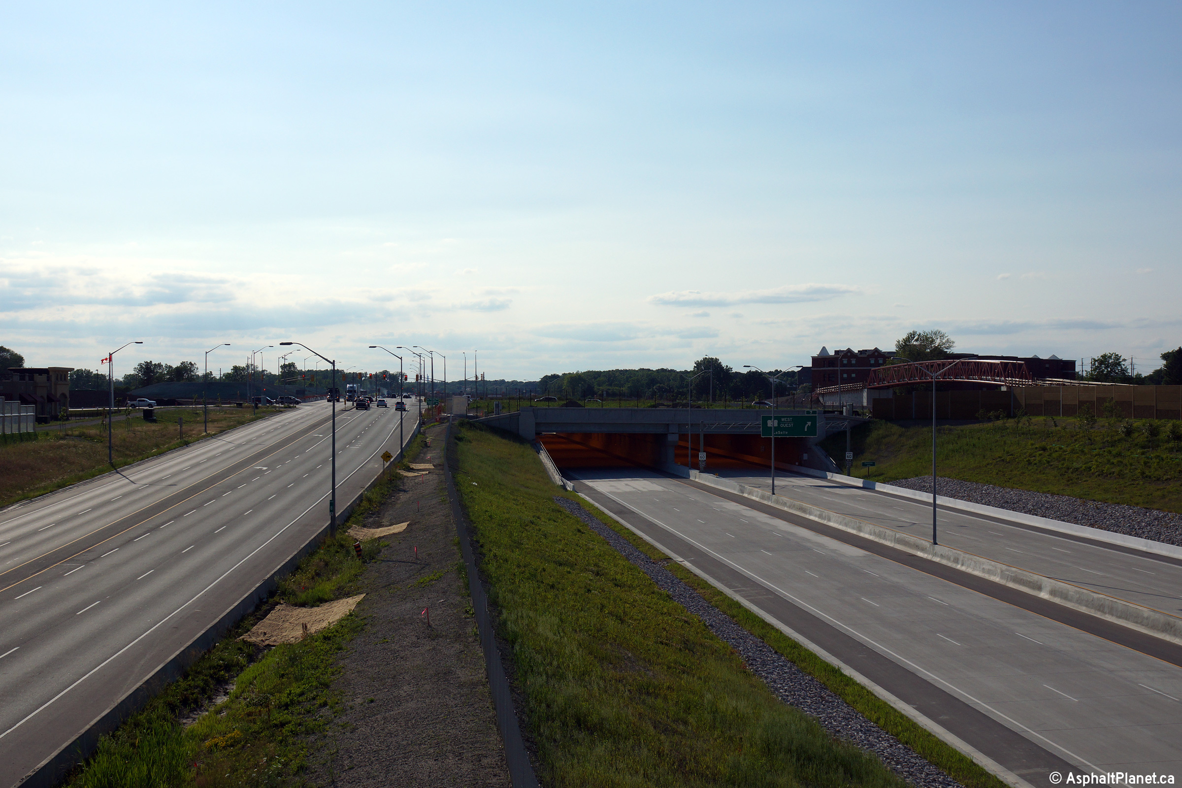
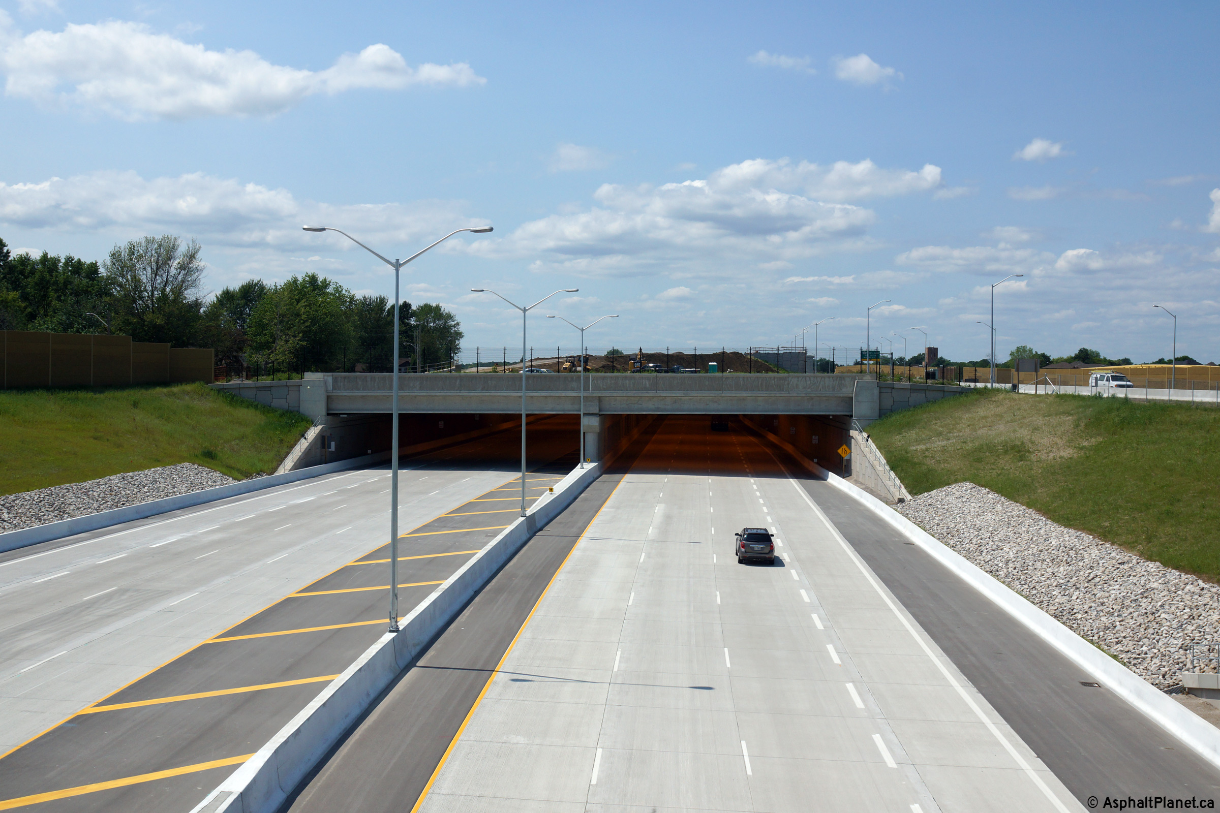
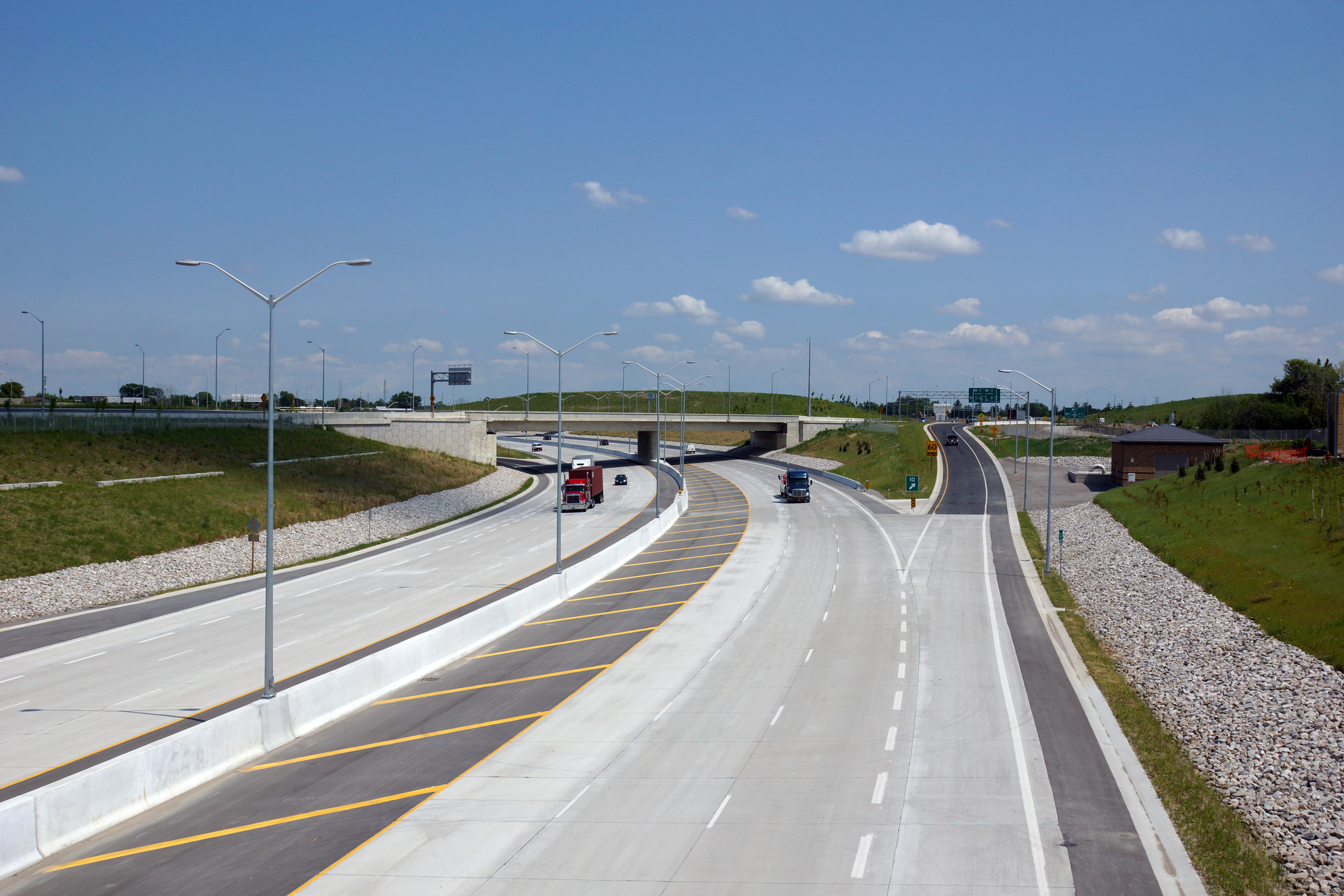
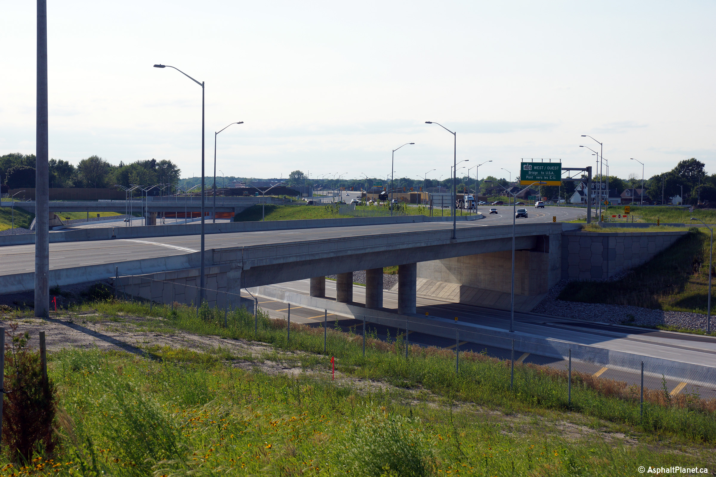
| City of Windsor |
View looking westerly along Highway 401 from the Spring Garden Tunnel (T-1). Photo taken: March, 2016. |
 (720x480) (1440x960) (2400x1600) |
|||||
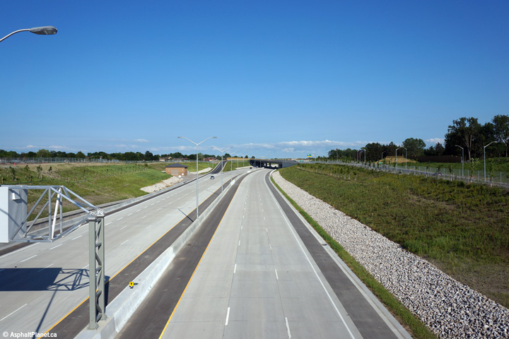
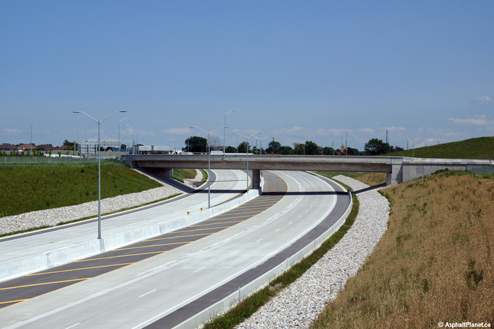
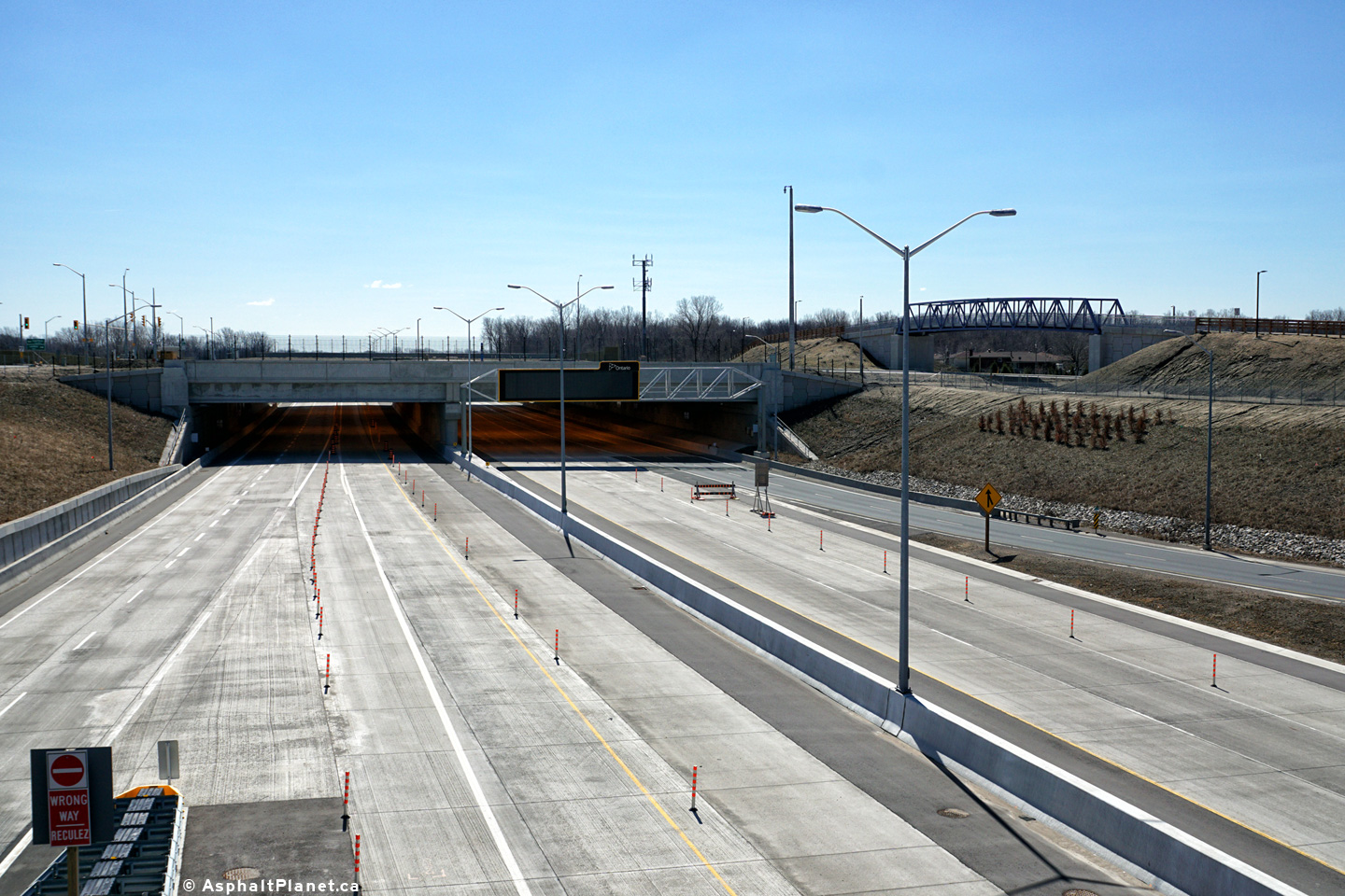
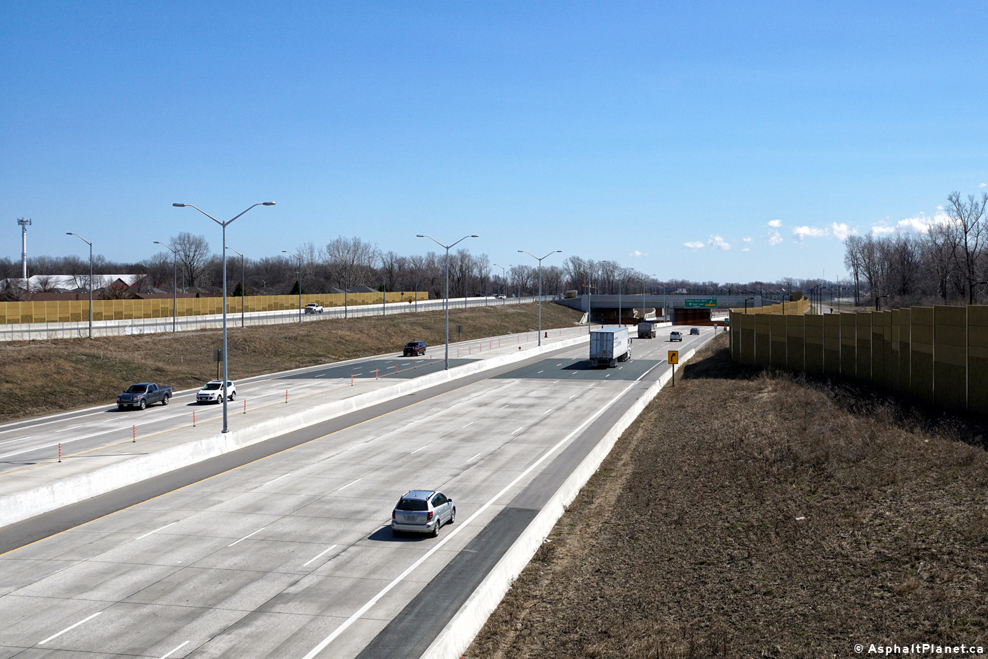
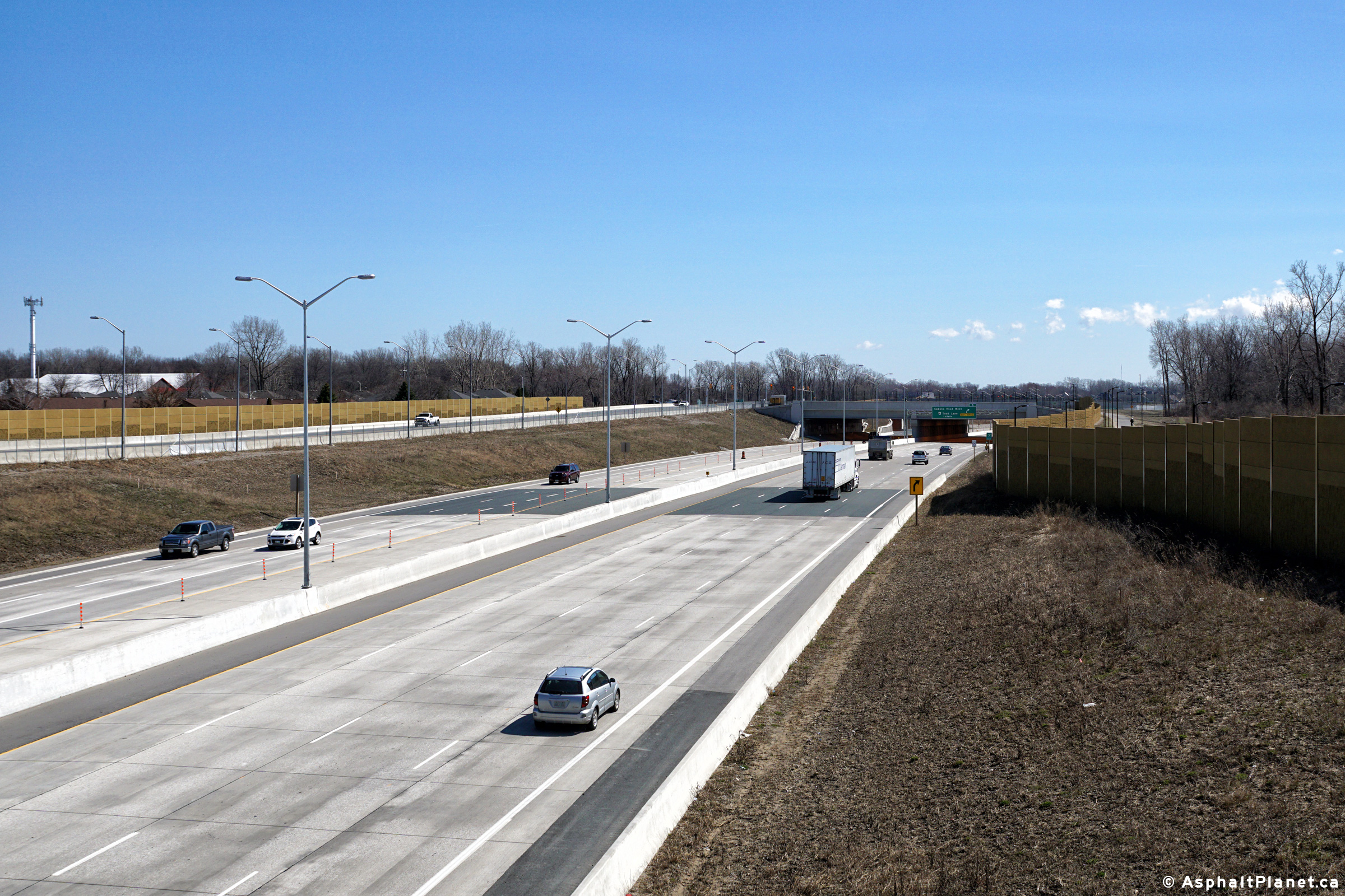
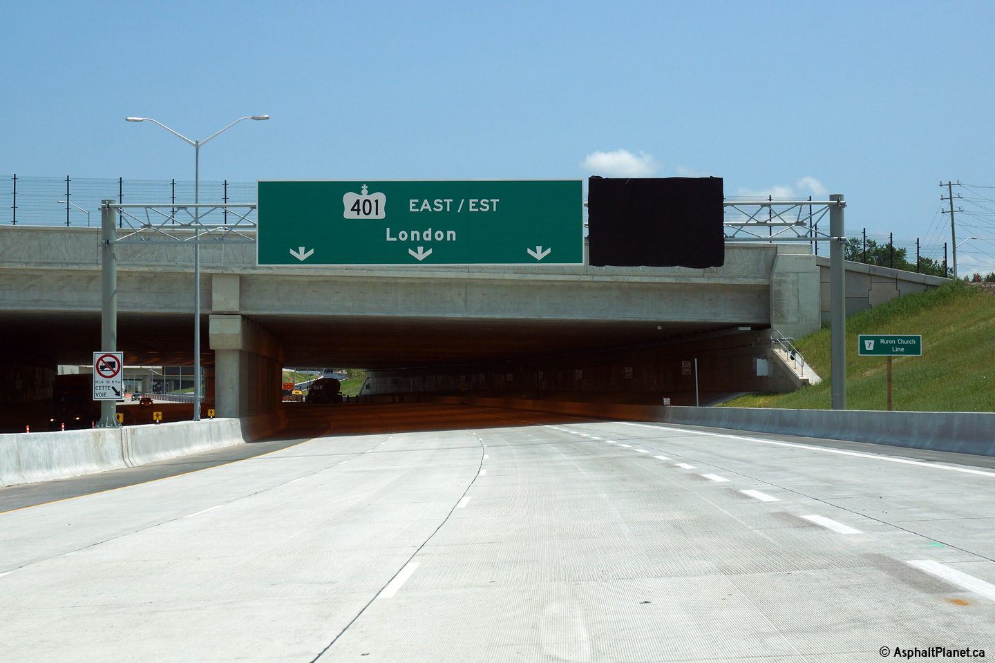
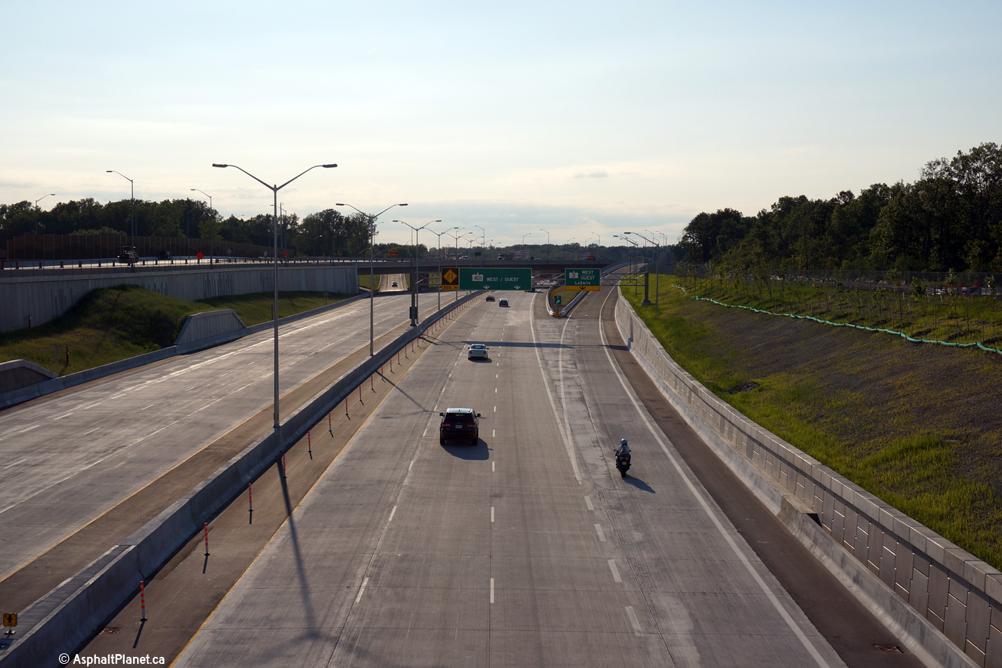
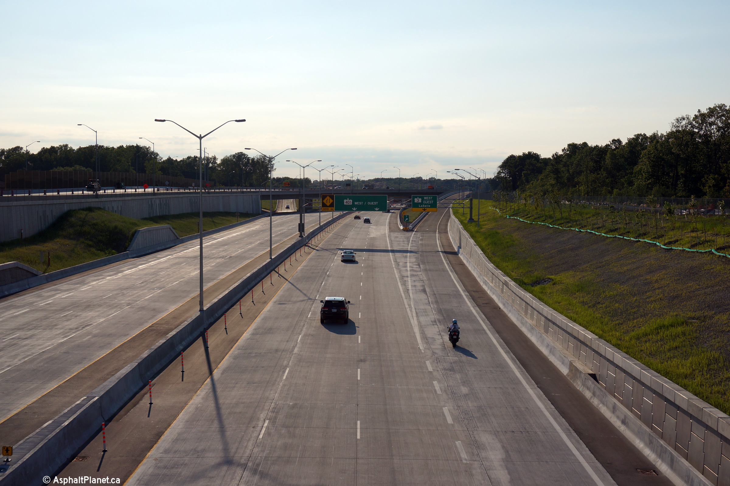
| City of Windsor |
Easterly view along Highway 401 towards the Labelle Tunnel (T-2) from the
Spring Garden Tunnel. Photo taken: March, 2016. |
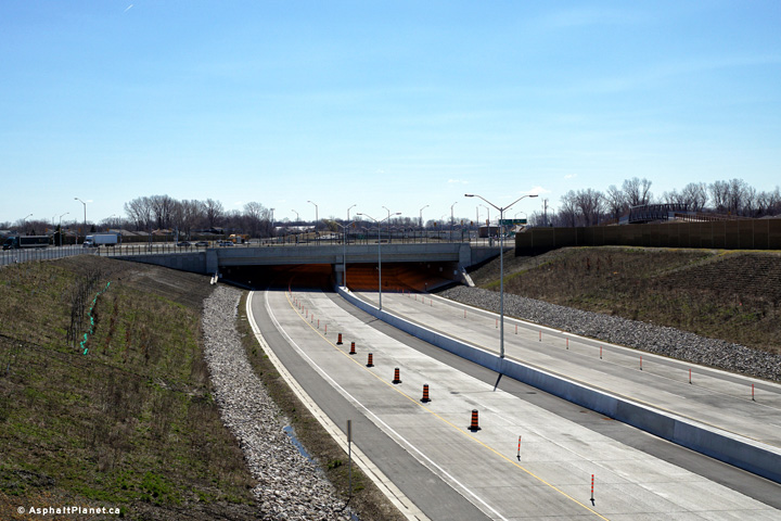 (720x480) (1440x960) (2400x1600) |
|||||
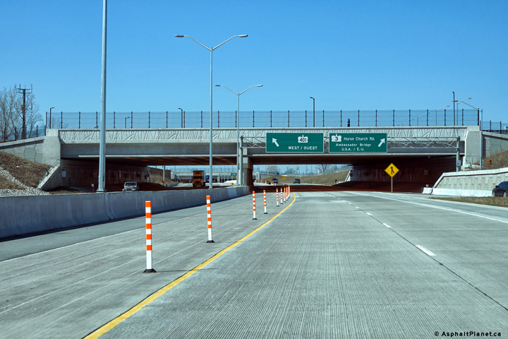
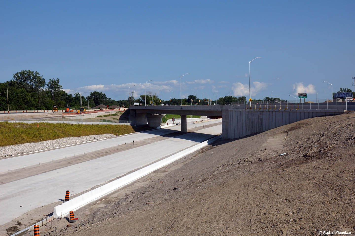
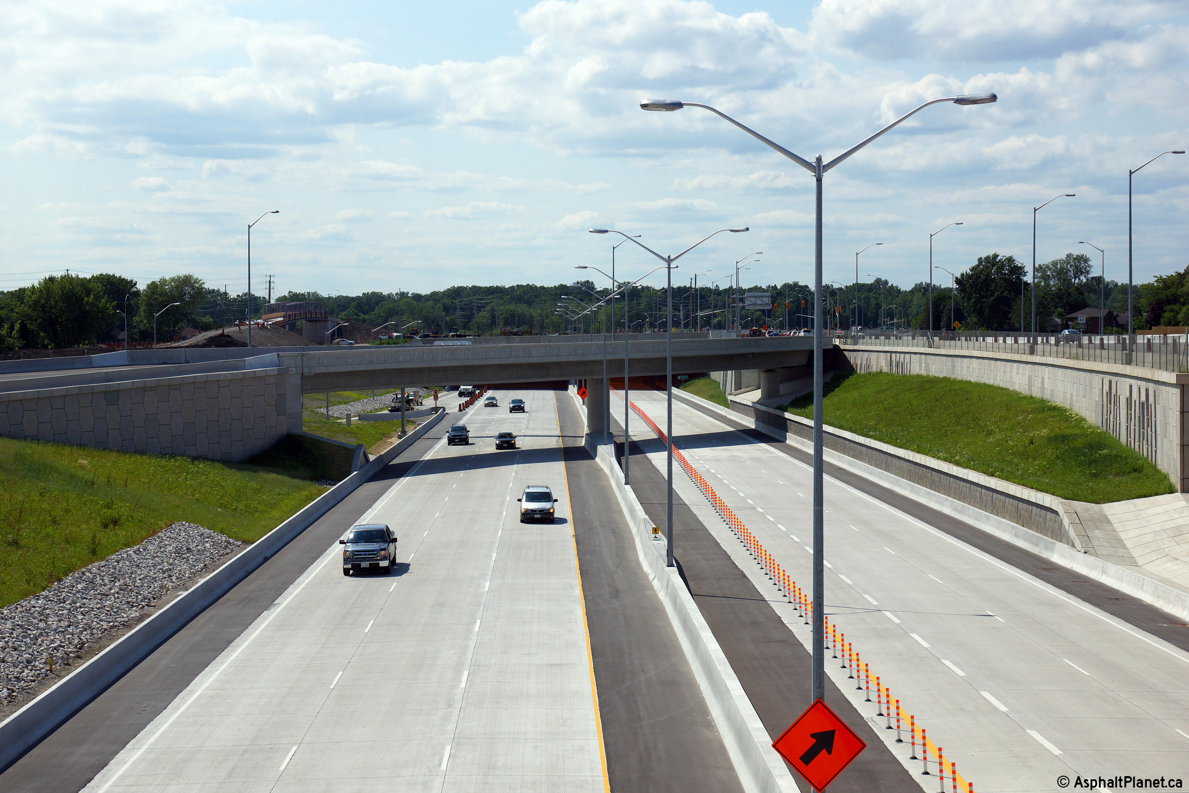
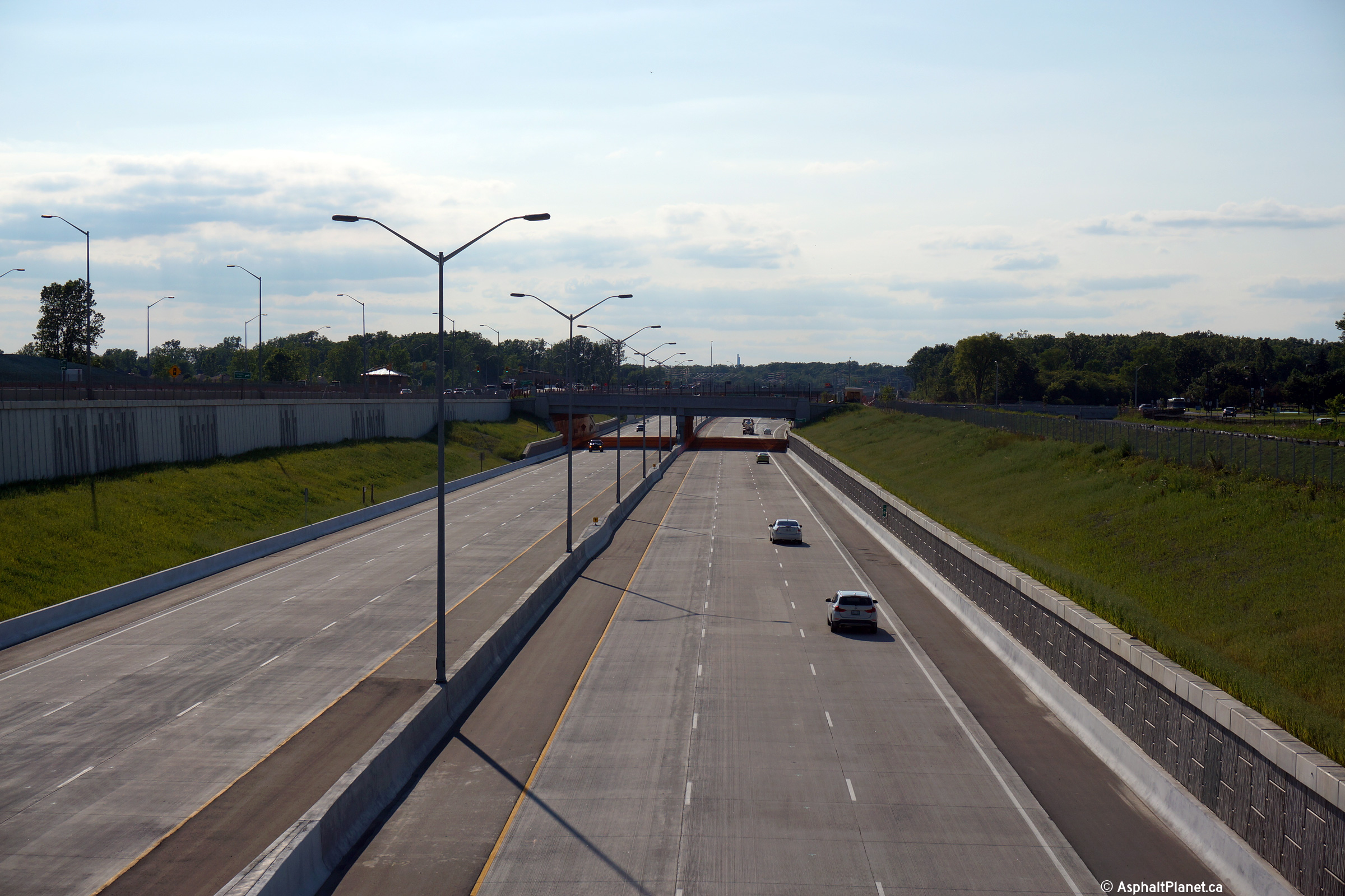
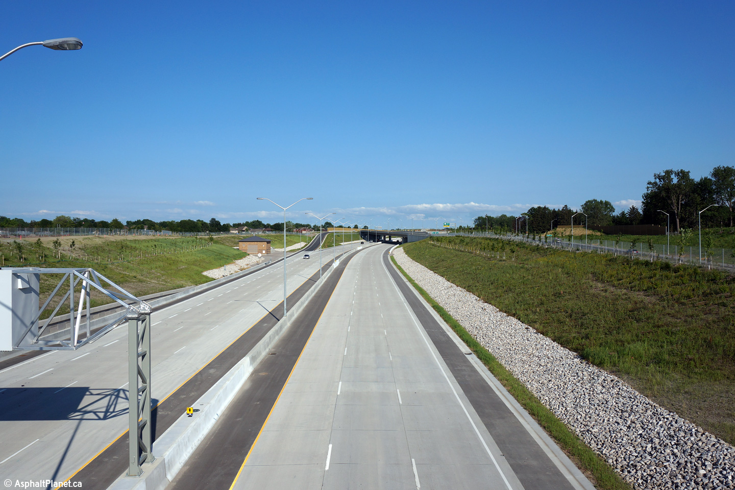
| City of Windsor |
Easterly view along the unopened alignment of Highway 401 from the Labelle
Tunnel (T-2). Photo taken: July 2nd, 2015. |
 (720x480) (1440x960) (2400x1600) |
|||||
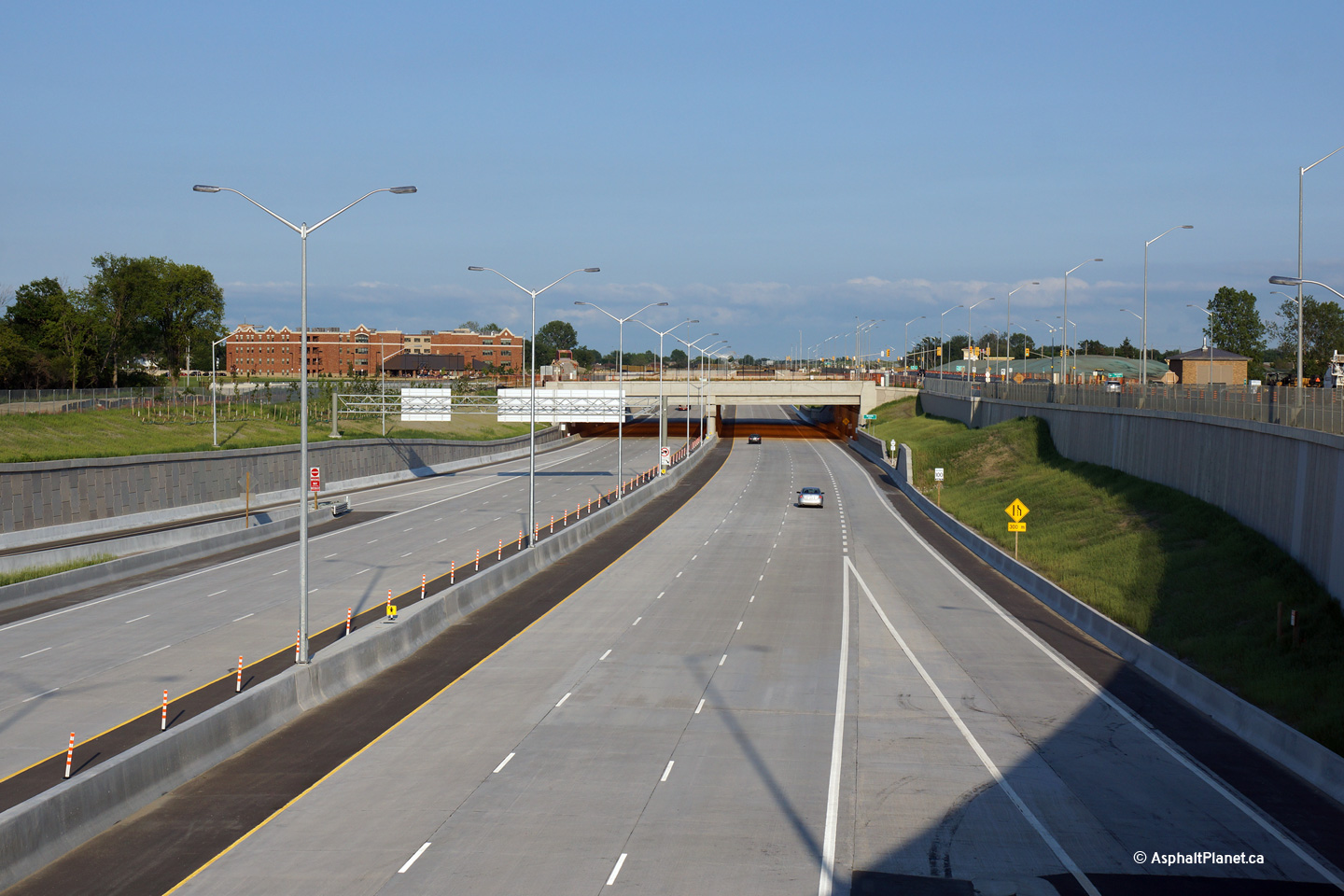
| City of Windsor |
View looking westerly along the unopened alignment of Highway 401 towards
the Labelle Tunnel (T-2) from the structure that carries the eastbound lanes
of Highway 3 overtop of the new highway. Upper photo taken: July 2nd, 2015. Lower photo taken: March, 2016. |
 (720x480) (1440x960) (2400x1600) |
|||||
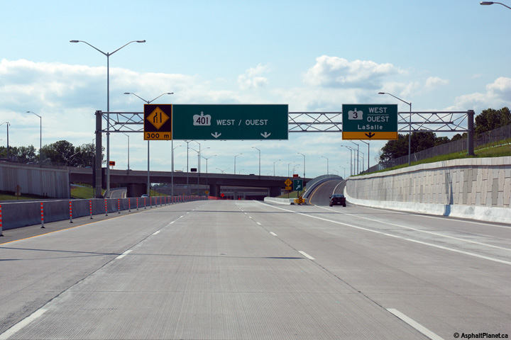
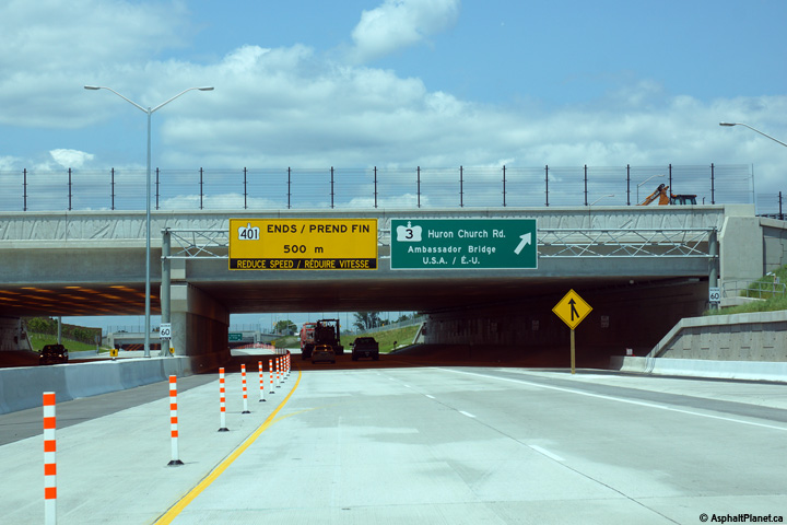
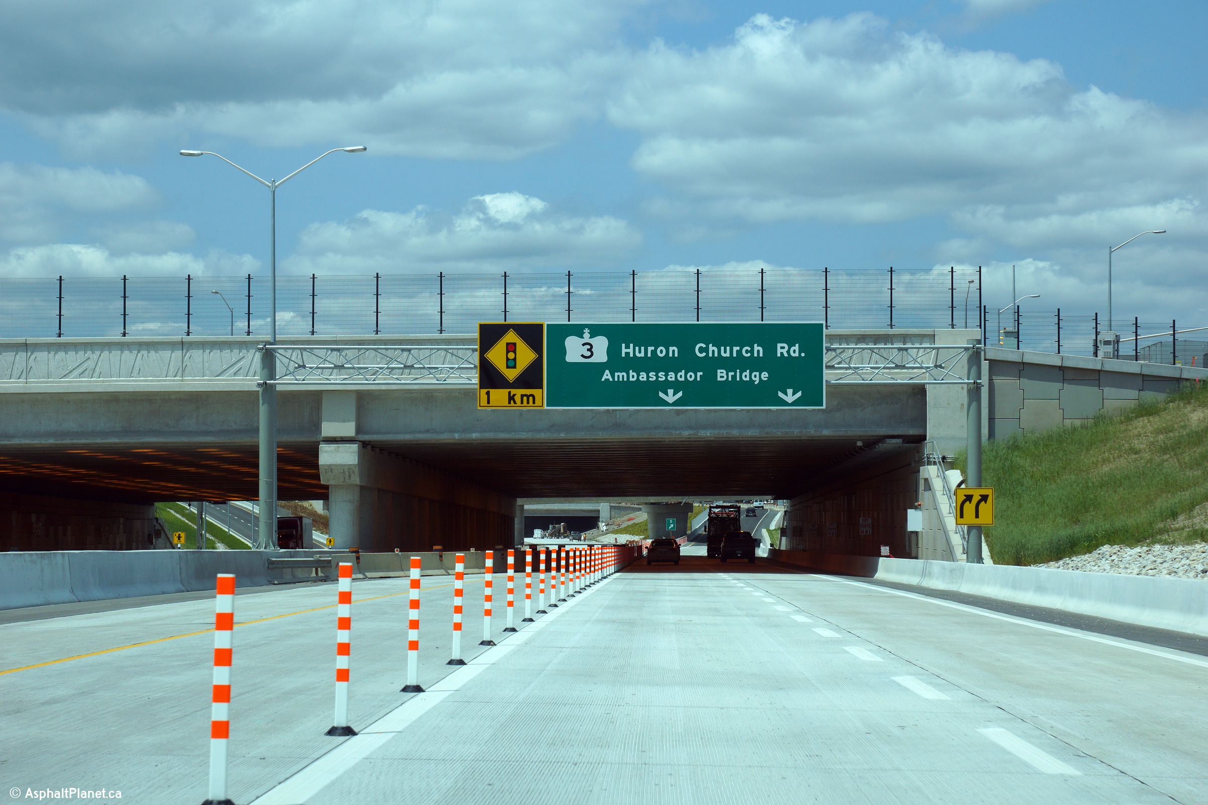
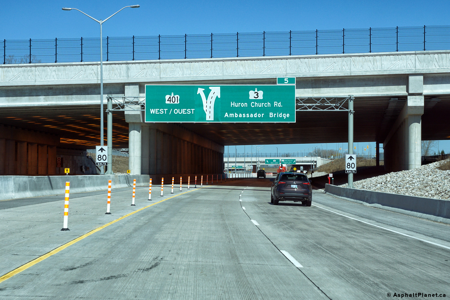
| Highway 401 ends at Highway 3. Traffic bound for the Ambassador Bridge must follow Highway 3-West. Click here for Highway 3 Images | |||||||
| Click here for a high-speed video of both directions of the Herb Gray Parkway filmed days after the highway opened to traffic. | |||||||
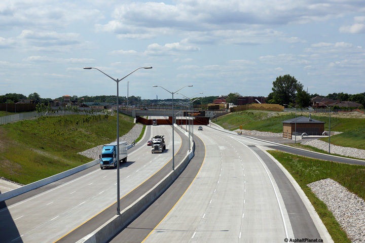
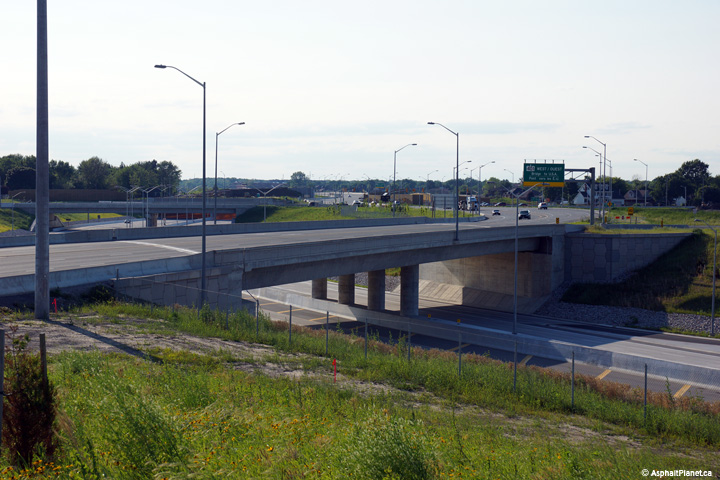
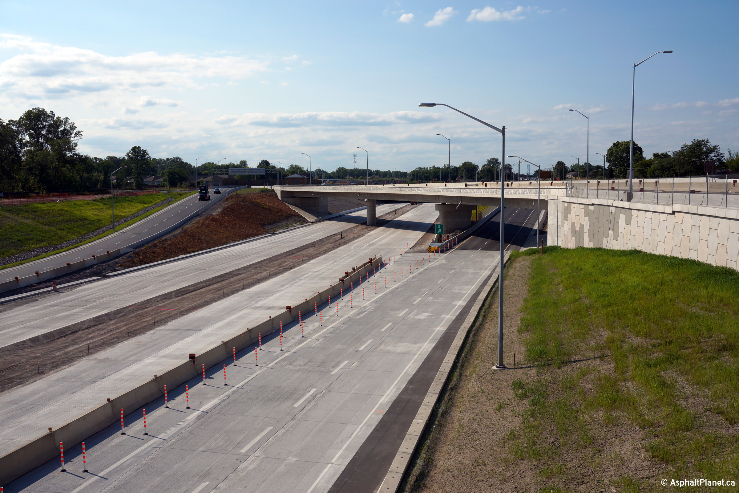
| City of Windsor |
View looking easterly from the eastbound lanes of Highway 3 towards the
current eastbound start of Highway 401 and the Herb Gray Parkway. From
this point easterly, Highway 401 opened to traffic on June 29th, 2015. Upper photo taken: July 2nd, 2015. Lower photo taken: March, 2016. |
 (720x480) (1440x960) (2400x1600) |
|||||
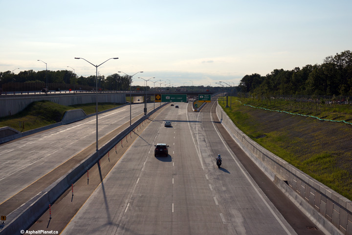
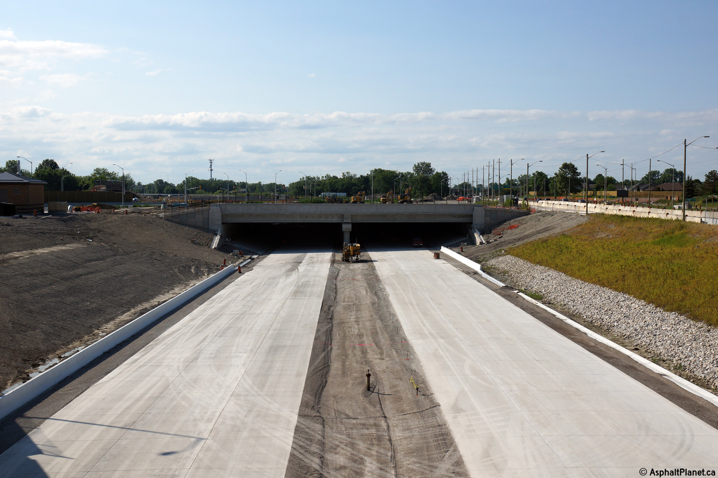
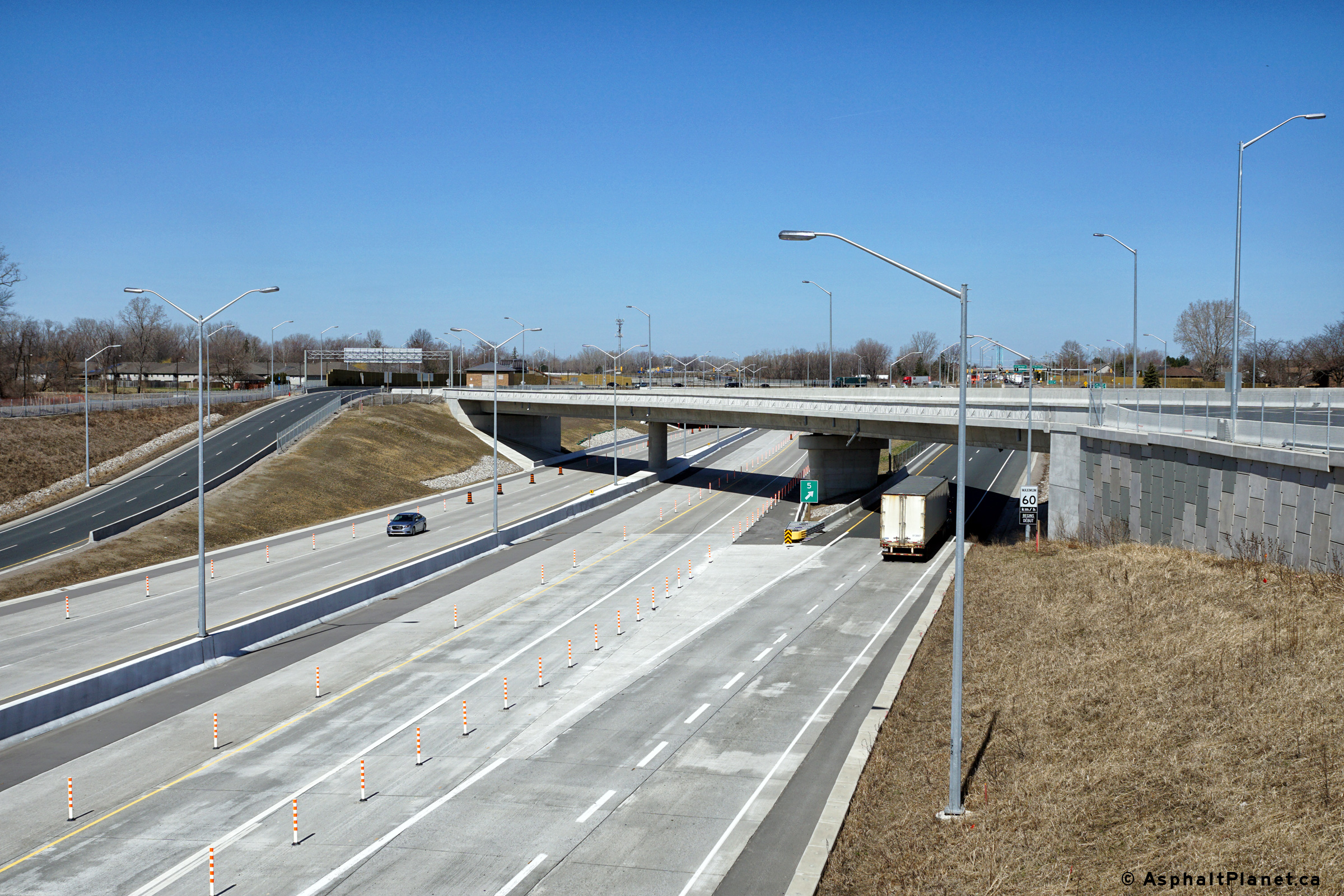
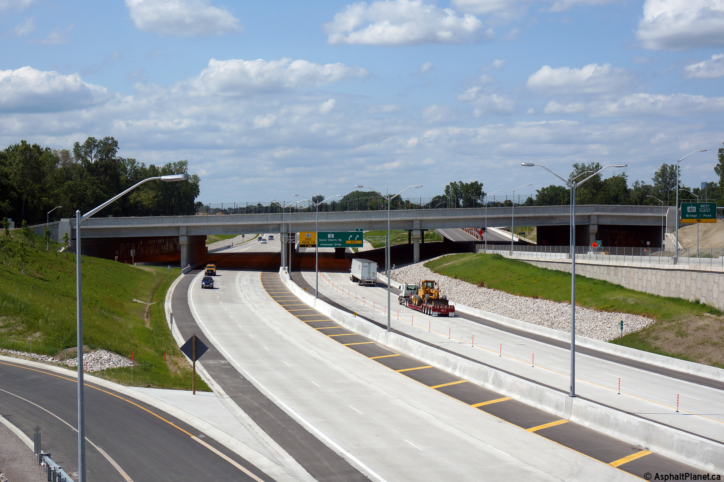
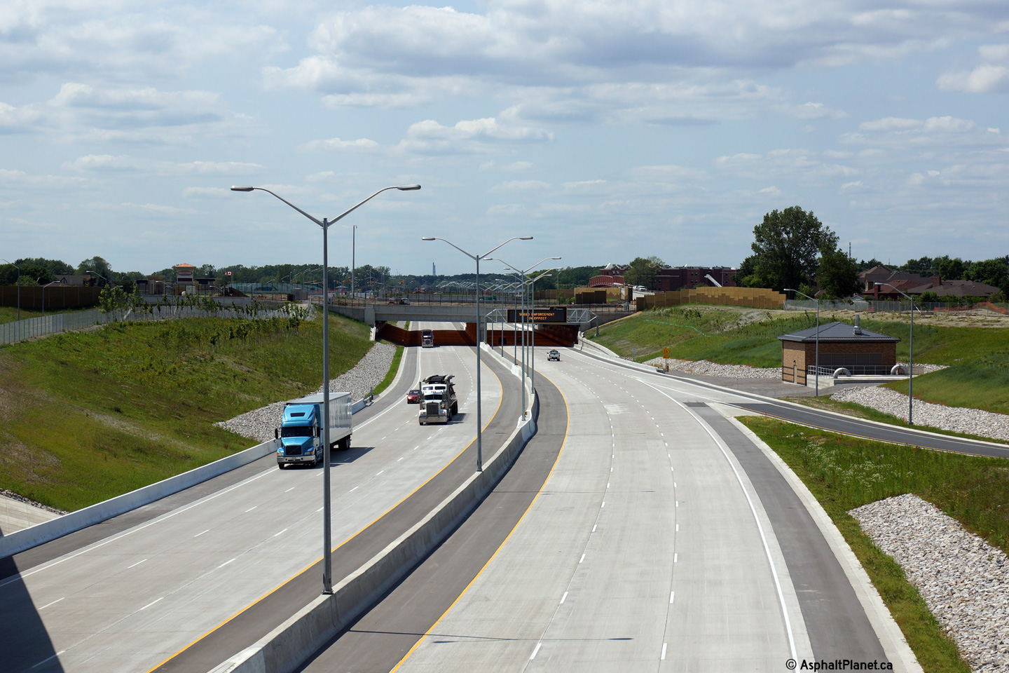
| City of Windsor |
View looking westerly from the Grand Marais Tunnel (T-3) towards the current
western terminus of Highway 401. All traffic is currently forced to
exit the highway at this location. Upper photo taken: July 2nd, 2015. Lower photo taken: March, 2016. |
 (720x480) (1440x960) (2400x1600) 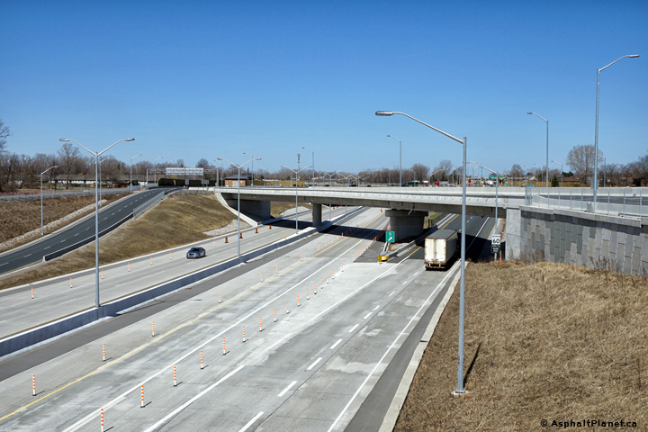 (720x480) (1440x960) (2400x1600) |
|||||
| City of Windsor |
Easterly view along Highway 401 from the Grand Marais Tunnel. Upper photo taken: July 2nd, 2015. Lower photo taken: March, 2016. |
 (720x480) (1440x960) (2400x1600) |
|||||
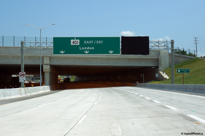
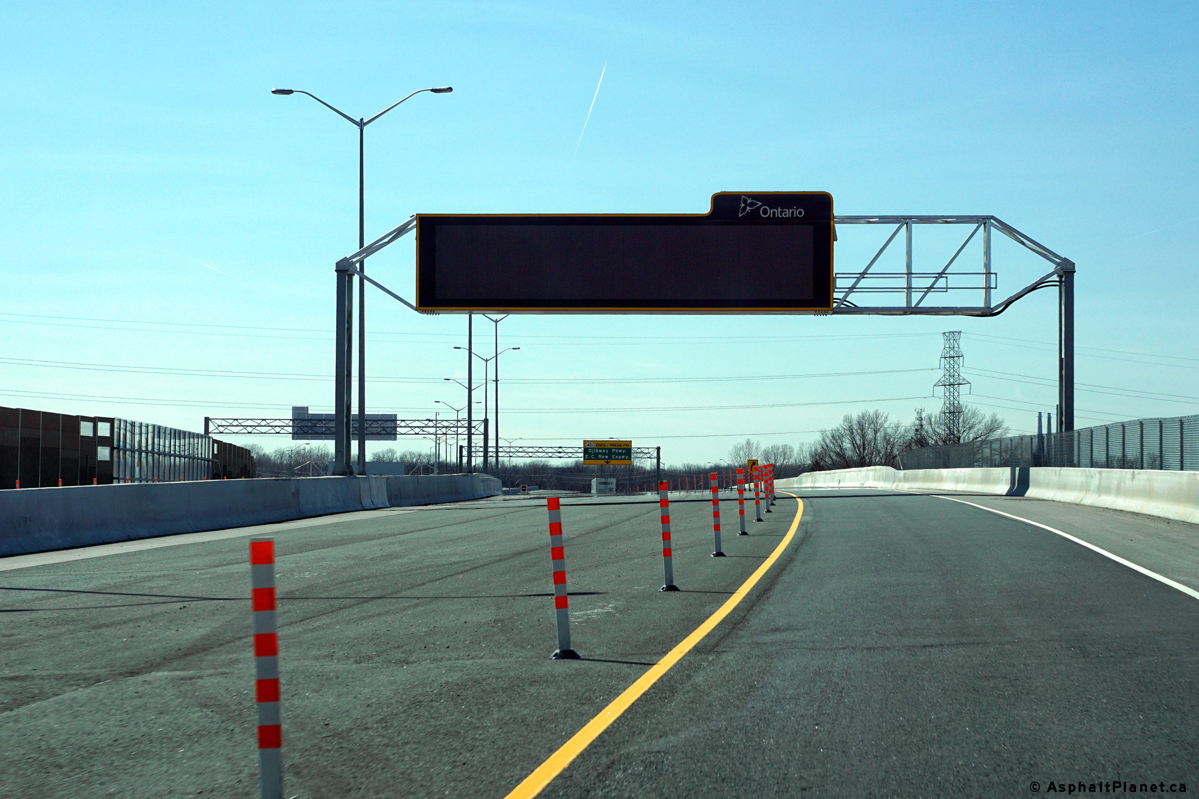
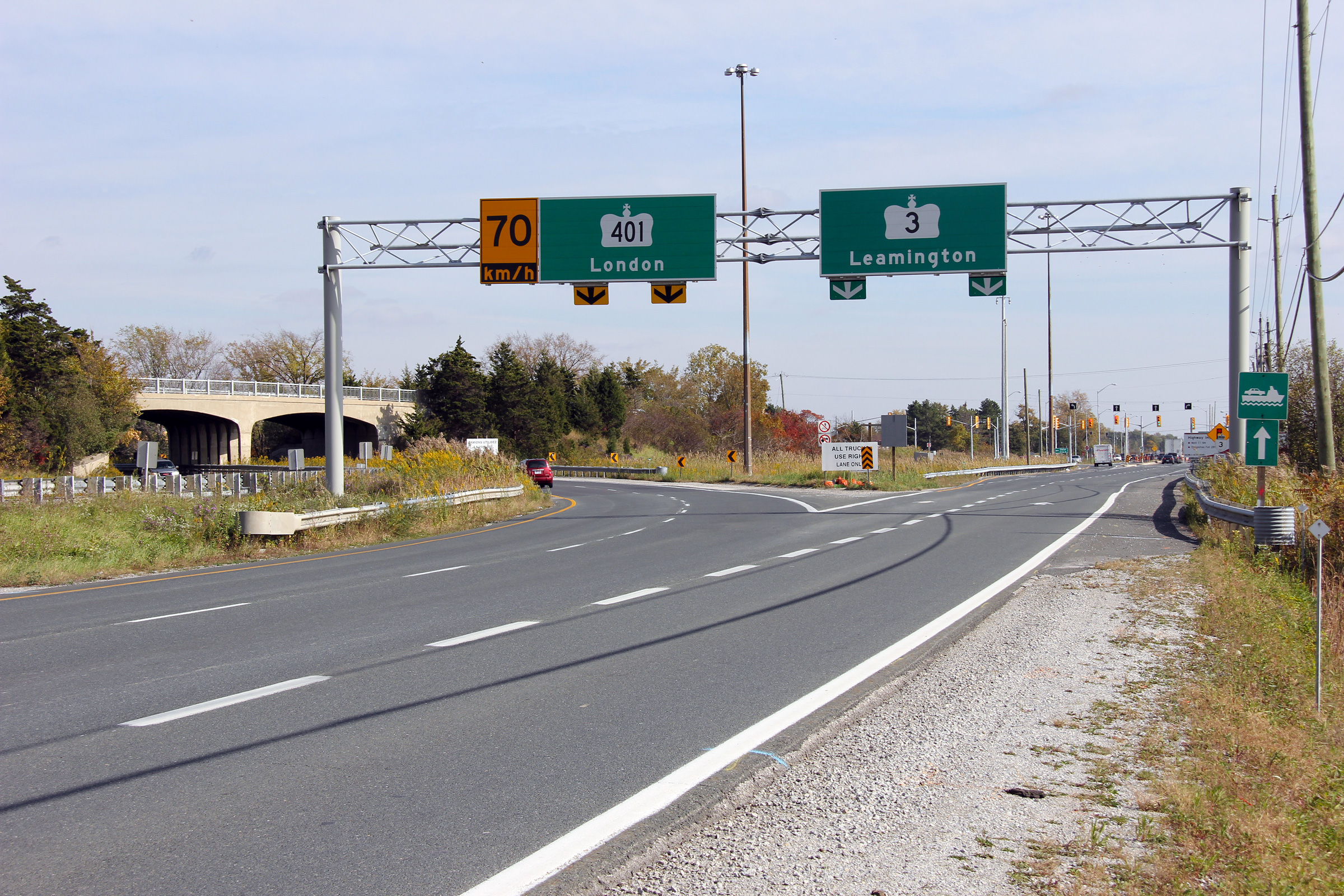
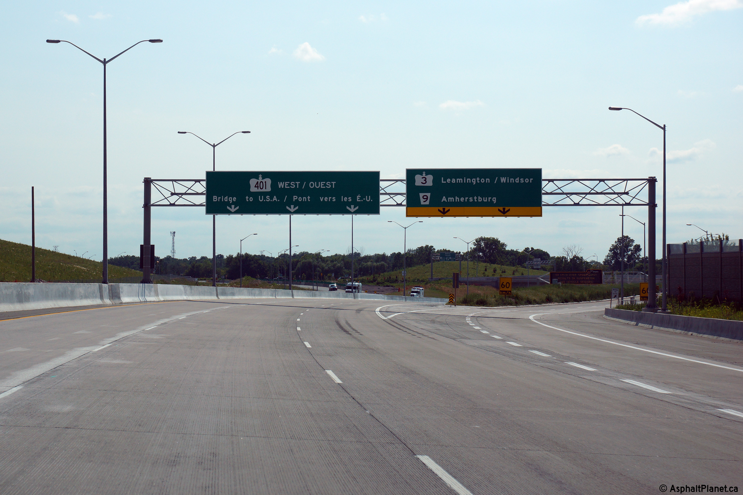
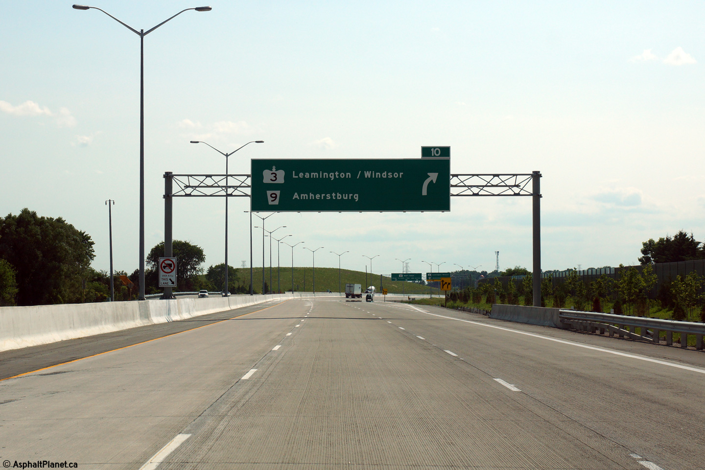
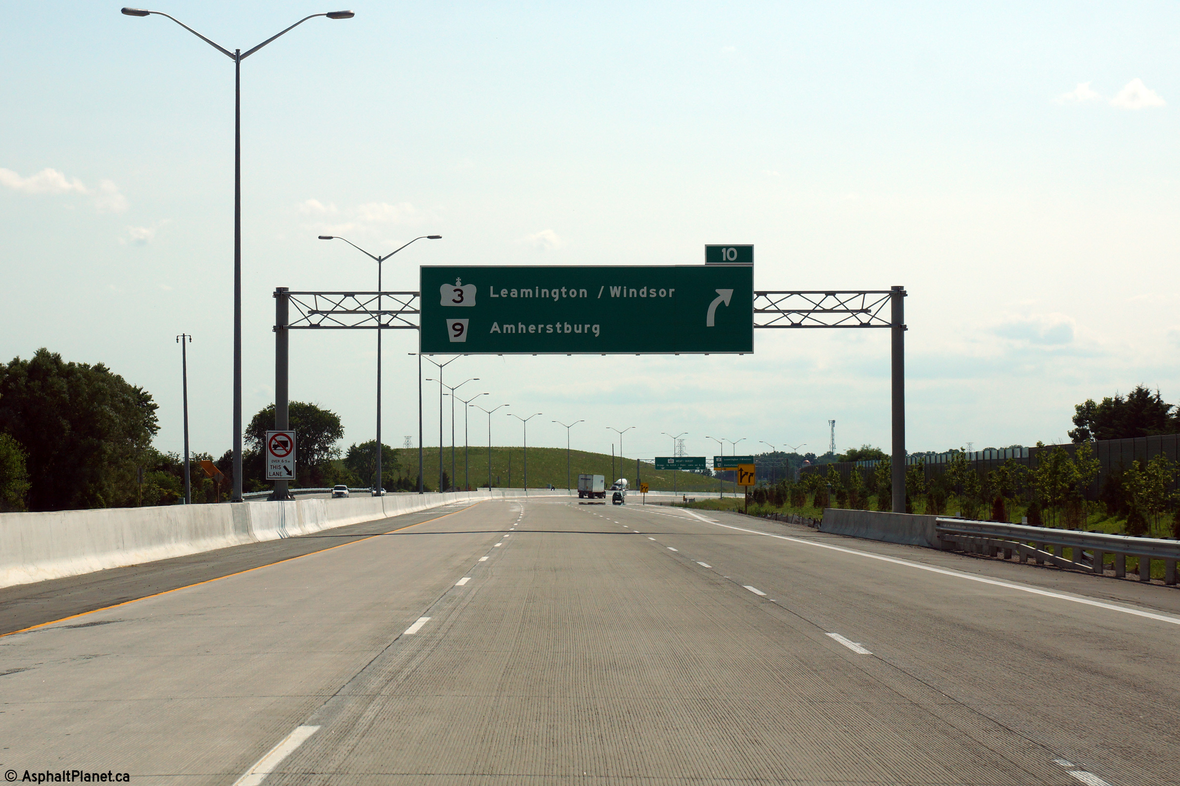
| City of Windsor |
Overhead signage notifying westbound motorists that they will be forced off
the highway ahead. Photo taken: July 2nd, 2015. |
 (720x480) (720x480)(1440x960) (2400x1600) |
|||||
| City of Windsor |
Eastbound advanced signage for the off-ramp to Cabana Road and Todd Lane. Photo taken: July 2nd, 2015. |
 (720x480) (720x480)(1440x960) (2400x1600) |
|||||
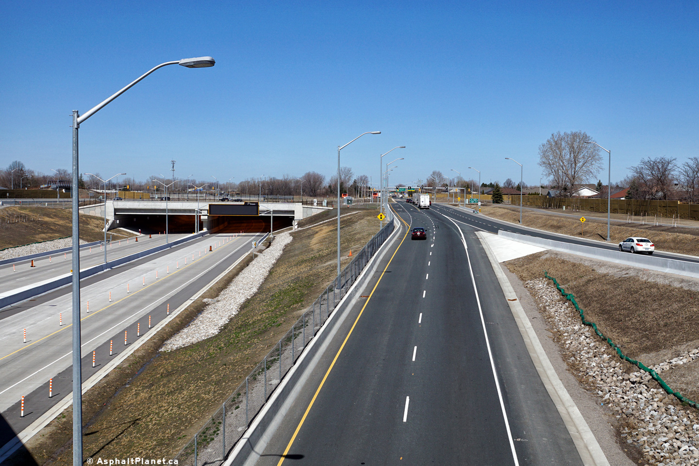
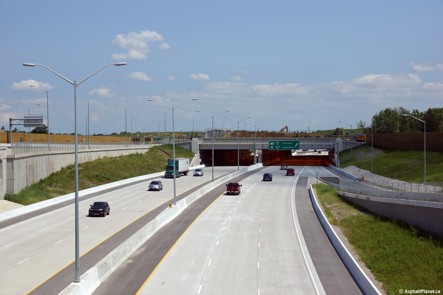
| City of Windsor |
Westerly view from the Pulford Tunnel (T-4) along Highway 401. Upper photo taken: July 2nd, 2015. Lower photo taken: March, 2016. |
 (720x480) (1440x960) (2400x1600) |
|||||
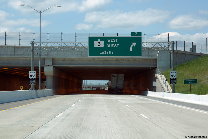
| City of Windsor |
Easterly view from the Pulford Tunnel along Highway 401. Observe the
incoming on-ramp to the westbound lanes of Highway 401 from the westbound
lanes of Highway 3. Photos taken: July 2nd, 2015. |
 (720x480) (1440x960) (2400x1600)  (720x480) (1440x960) (2400x1600) |
|||||
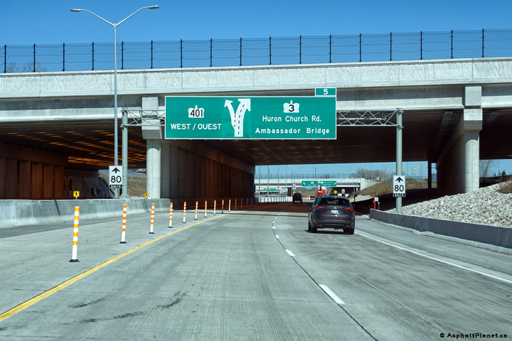
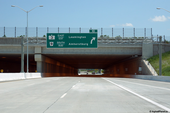
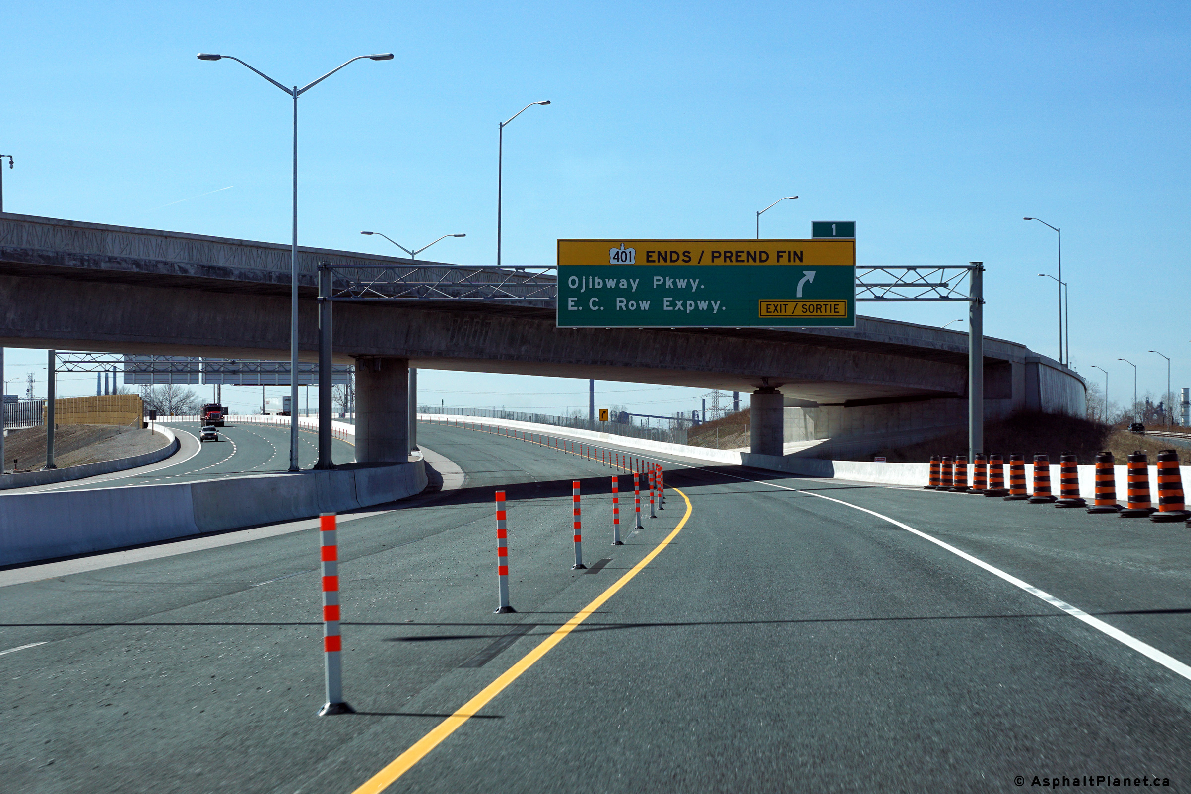
| City of Windsor |
This advanced signage approaching the end of Highway 401 at Highway 3 is
situated immediately in front of the Pulford Tunnel (T-4). Photo taken: July 2nd, 2015. |
 (720x480) (720x480)(1440x960) (2400x1600) |
|||||
| City of Windsor |
Eastbound signage at the off-ramp to Cabana Road and Todd Lane. Photo taken: July 2nd, 2015. |
 (720x480) (720x480)(1440x960) (2400x1600) |
|||||
| City of Windsor |
View looking westerly from the Oakwood Tunnel (T-5) towards the Pulford
Tunnel (T-4). Photo taken: July 2nd, 2015. |
 (720x480) (1440x960) (2400x1600) |
|||||
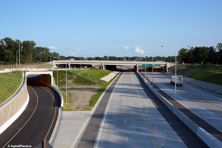
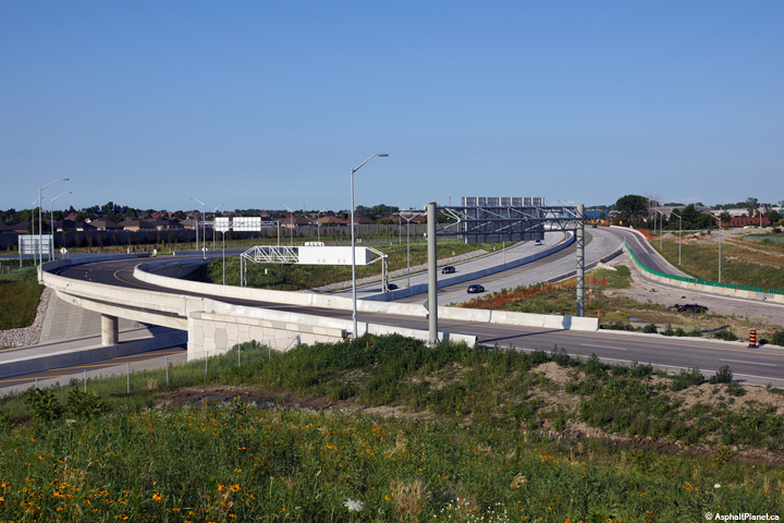
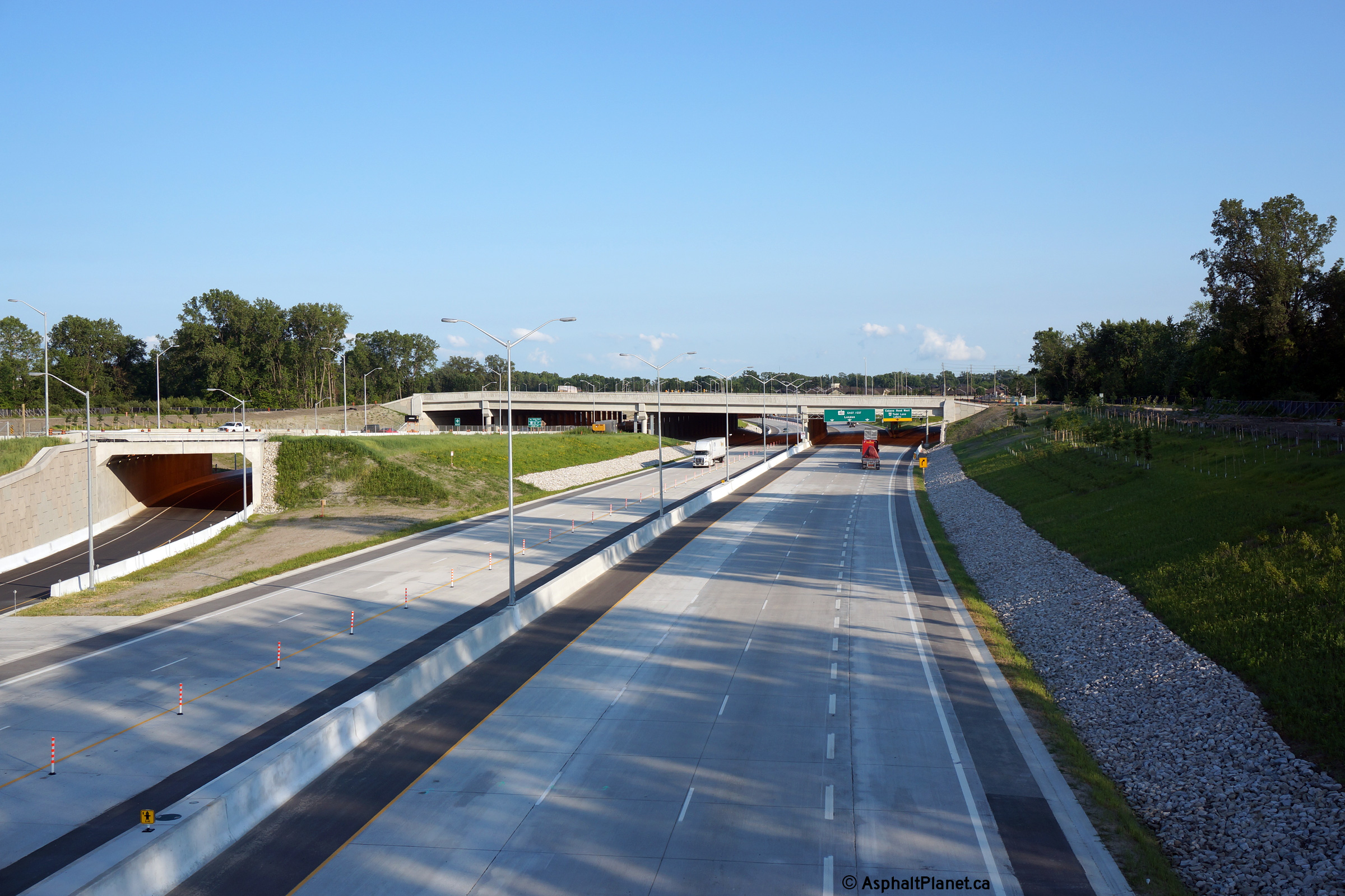
| City of Windsor. |
Two views looking easterly towards the Todd/Cabana Tunnel (T-6) and
associated interchange from the Oakwood Tunnel (T-5). Photos taken: July 2nd, 2015. |
 (720x480) (1440x960) (2400x1600)  (720x480) (1440x960) (2400x1600) |
|||||
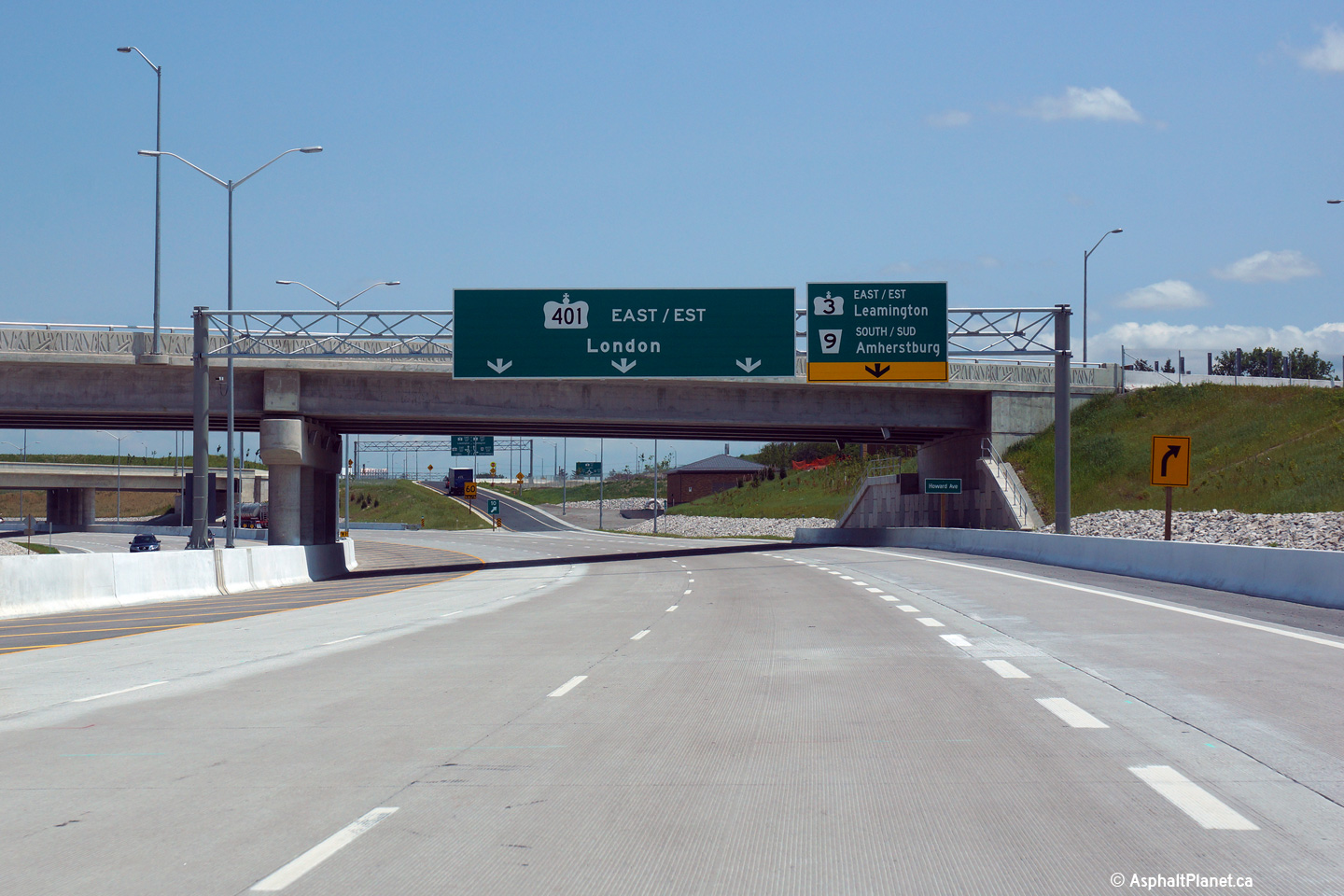
| City of Windsor |
This overhead signage in advance of the western terminus of Highway 401 at
Highway 3 is located just before westbound traffic passes beneath the
Oakwood Tunnel. Upper photo taken: July 2nd, 2015. Lower photo taken: March, 2016. |
 (720x480) (720x480)(1440x960) (2400x1600) |
|||||
| Windsor / LaSalle Boundary County of Essex |
The ramp to Highway 3 just east of Huron Church Line was not opened to
traffic when Highway 401 was opened in June, 2015. When this photo was
taken paving operations were still ongoing on this ramp. Photo taken: July 2nd, 2015. |
 (720x480) (720x480)(1440x960) (2400x1600) |
|||||
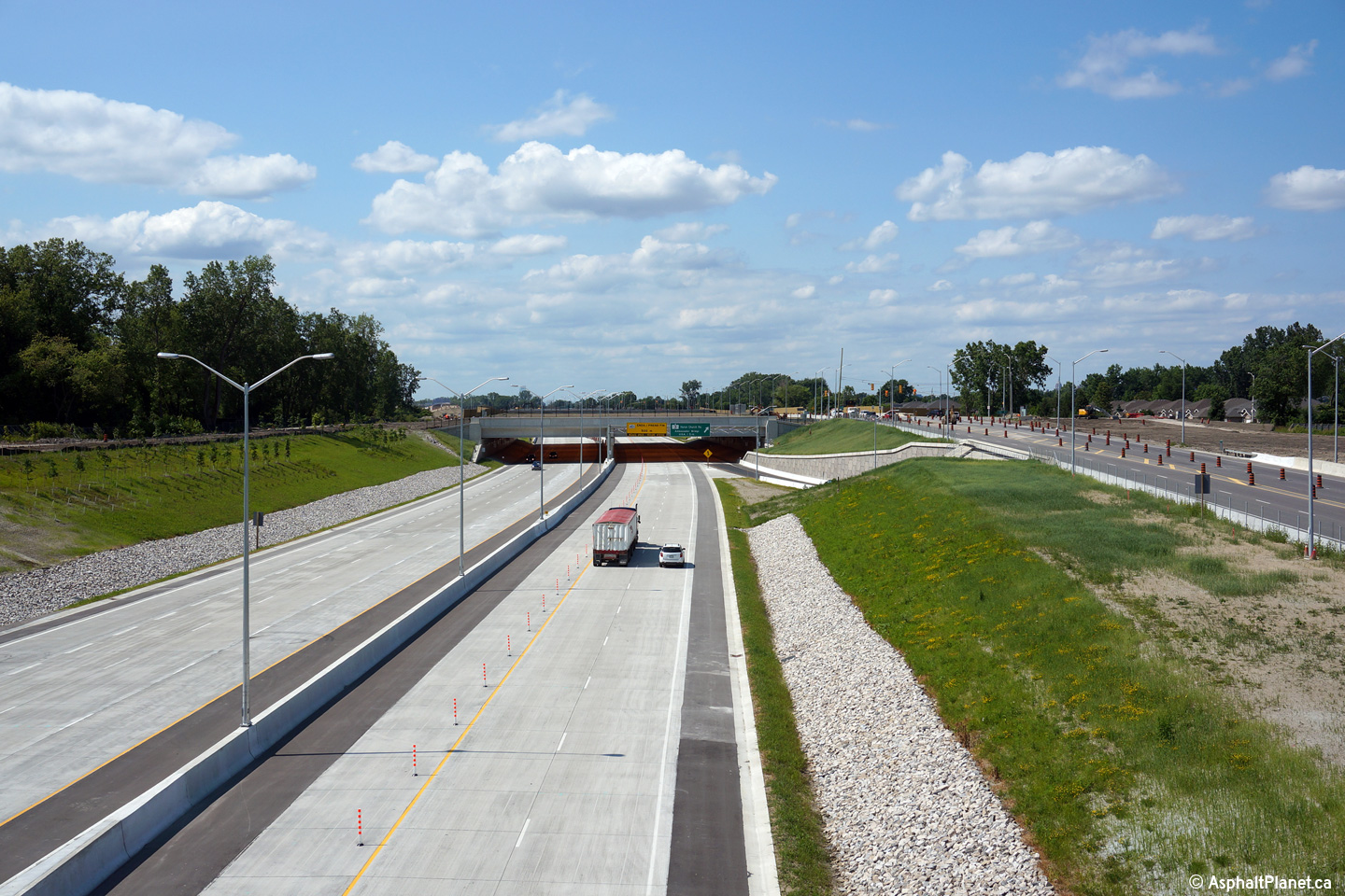
| Windsor / LaSalle Boundary County of Essex |
View looking westerly from the Todd/Cabana Tunnel (T-6) towards Highway 401. Photo taken: July 2nd, 2015. |
 (720x480) (1440x960) (2400x1600) |
|||||
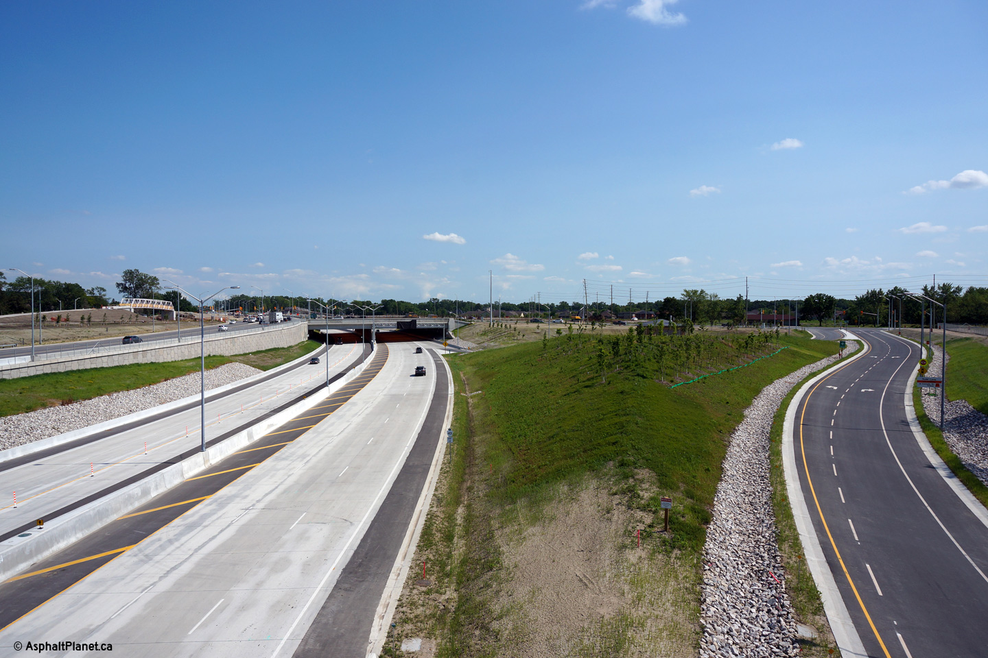
| Windsor / LaSalle Boundary County of Essex |
View looking westerly as Highway 401 passes beneath the Todd/Cabana Tunnel.
When these photos were taken, MTO had taken considerable effort to ensure
traffic transitioned from freeway driving speeds to urban driving speeds in
advance of the western terminus of Highway 401 at Labelle Street. Photo taken: July 2nd, 2015. |
 (720x480) (720x480)(1440x960) (2400x1600) |
|||||
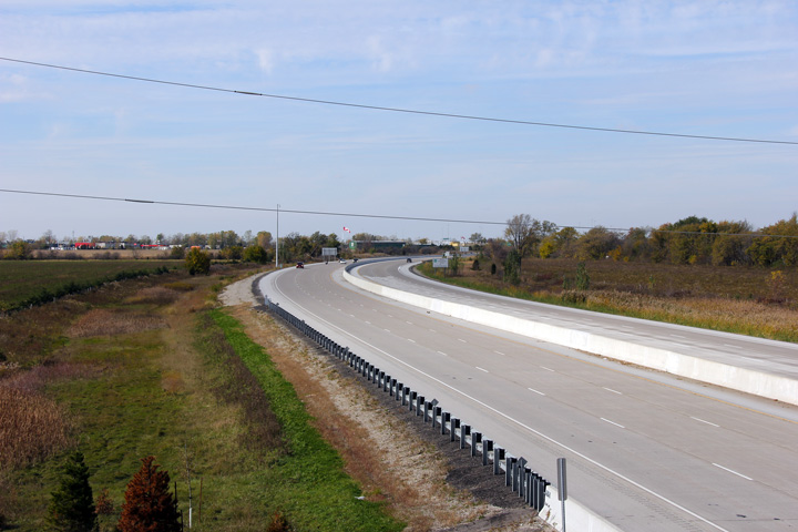
| Windsor / LaSalle Boundary County of Essex |
Easterly view in advance of the then unopened ramp to Highway 3 east of
Huron Church Line. The Huron Church Line Tunnel is visible behind the
sign. Photo taken: July 2nd, 2015. |
 (720x480) (720x480)(1440x960) (2400x1600) |
|||||
| Windsor / LaSalle Boundary County of Essex |
Westerly view along Highway 401 from Highway 3 east of Huron Church Line.
The structure in the foreground carries a ramp from Highway 3 east to the
eastbound lanes of the 401. Photo taken: July 2nd, 2015. |
 (720x480) (1440x960) (2400x1600) |
|||||
| Windsor / LaSalle Boundary County of Essex |
Easterly view along Highway 401 from Highway 3 east of Huron Church Line.
St. Clair College is visible to the north of the highway. Photo taken: July 2nd, 2015. |
 (720x480) (1440x960) (2400x1600) |
|||||
| Windsor / LaSalle Boundary County of Essex |
Westbound signage for Highway 3 at the LaSalle interchange. Photo taken: July 2nd, 2015. |
 (720x480) (720x480)(1440x960) (2400x1600) |
|||||
| Windsor / LaSalle Boundary County of Essex |
Westerly view along Highway 401 from the Geraedts Tunnel (T-8). Photo taken: July 2nd, 2015. |
 (720x480) (1440x960) (2400x1600) |
|||||
| Windsor / LaSalle Boundary County of Essex |
Easterly view along Highway 401 from the Geraedts Tunnel. Photo taken: July 2nd, 2015. |
 (720x480) (1440x960) (2400x1600) |
|||||
| Windsor / LaSalle Boundary County of Essex |
Advanced signage for the westbound off-ramp to Highway 3 bound for LaSalle. Photo taken: July 2nd, 2015. |
 (720x480) (720x480)(1440x960) (2400x1600) |
|||||
| Windsor / LaSalle Boundary County of Essex |
Westerly view from the Cousineau Tunnel (T-9) Photo taken: July 2nd, 2015. |
 (720x480) (1440x960) (2400x1600) |
|||||
| Windsor / LaSalle Boundary County of Essex |
Easterly view from the Cousineau Tunnel towards the Hearthwood (T-10)
Tunnel. Photo taken: July 2nd, 2015. |
 (720x480) (1440x960) (2400x1600) |
|||||
| Windsor / LaSalle Boundary County of Essex |
This view looks westerly towards the Cousineau Tunnel from the Hearthwood
Tunnel. Photo taken: July 2nd, 2015. |
 (720x480) (1440x960) (2400x1600) |
|||||
| Windsor / LaSalle Boundary County of Essex |
Easterly view towards London from atop to Hearthwood Tunnel. Photo taken: July 2nd, 2015. |
 (720x480) (1440x960) (2400x1600) |
|||||
| Windsor / LaSalle Boundary County of Essex |
Westerly view from the Highway 3 overpass west of Howard Avenue. Photo taken: July 2nd, 2015. |
 (720x480) (1440x960) (2400x1600) |
|||||
| Windsor / LaSalle Boundary County of Essex |
This view looks westerly from the Highway 3 overpass west of Howard Avenue
towards the Oliver Estates Tunnel (T-11). Photo taken: July 2nd, 2015. |
 (720x480) (1440x960) (2400x1600) |
|||||
| Windsor / LaSalle Boundary County of Essex |
Advanced signage for the ramp to Highway 3 and Howard Avenue. It is
interested to compare the current signage to the previous signage that stood
at this location before Highway 401 was extended through Windsor. Upper photo taken: October 22nd, 2011. Lower photo taken: July 2nd, 2015. |
 (720x480) (720x480)(1440x960) (2400x1600) |
|||||
| Windsor / LaSalle Boundary County of Essex |
Two incarnations of the overhead signage that has stood at the Highway 401/3
interchange in Tecumseh. Upper photo taken: October 22nd, 2011. Lower photo taken: July 2nd, 2015. |
 (720x480) (720x480)(1440x960) (2400x1600) |
|||||
| Windsor / LaSalle Boundary County of Essex |
Westerly view from Howard Avenue towards the Oliver Estates Tunnel. Photo taken: July 2nd, 2015. |
 (720x480) (1440x960) (2400x1600) |
|||||
| Windsor / Tecumseh Boundary County of Essex |
Easterly view from Howard Avenue towards the eastern Highway 3 interchange. Photo taken: July 2nd, 2015. |
 (720x480) (1440x960) (2400x1600) |
|||||
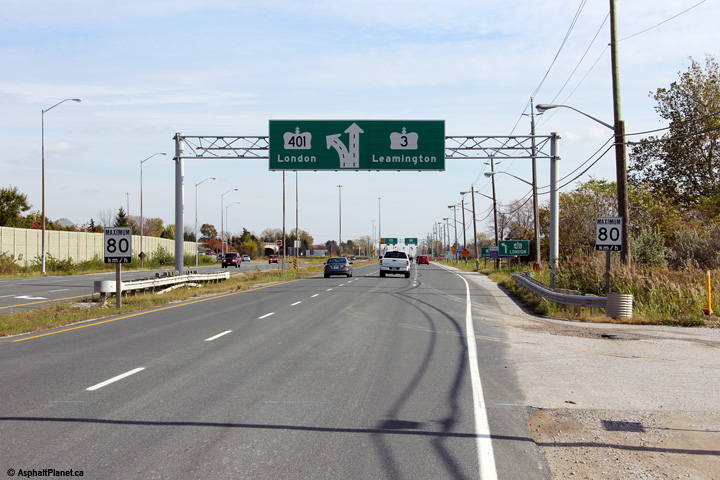
| Windsor / Tecumseh Boundary County of Essex |
Highway 3 and 401 looking west from the westbound Highway 3 overpass in
Windsor. At the time the upper photos were taken, Highway 401 ended at
Highway 3 at this interchange. Today, Highway 401 has been extended
beyond the Highway 3 interchange on a new alignment. Upper photos taken: December 5th, 2004. Lower photos taken: July 2nd, 2015. |
 (720x480) (1440x960) (2400x1600) |
|||||
| Highway 3 continues east of Highway 401 bound for Leamington. Click here for Highway 3 Images | |||||||
| Highway 401 was extended west of Tecumseh during a multiyear project that commenced in 2011. Click here for Herb Gray Parkway Construction Information. | |||||||
| Windsor / Tecumseh Boundary County of Essex |
Two views looking easterly from the Highway 3 overpass. Upper photo taken: December 5th, 2004. Lower photo taken: July 2nd, 2015. |
 (720x480) (1440x960) (2400x1600) |
|||||
| Windsor / Tecumseh Boundary County of Essex |
Westerly view towards the Highway 3 overpass crossing Highway 401. Photo taken: July 2nd, 2015. |
 (720x480) (1440x960) (2400x1600) |
|||||
| Windsor / Tecumseh Boundary County of Essex |
Easterly view towards Highway 401. In the foreground is the structure
that carries the westbound off-ramp from Highway 401 towards the Howard
Avenue Roundabout. Photo taken: July 2nd, 2015. |
 (720x480) (1440x960) (2400x1600) |
|||||
| Windsor / Tecumseh Boundary County of Essex |
Westbound signage approaching the Highway 3 interchange at Tecumseh. Photo taken: July 2nd, 2015. |
 (720x480) (720x480)(1440x960) (2400x1600) |
|||||
| Windsor / Tecumseh Boundary County of Essex |
Advanced signage for the Highway 3 interchange at Tecumseh. An
incorrect advanced arrow configuration was used on this signage.
Construction was still underway when this photo was taken, so this sign may
be updated to show a proper configuration before construction is completed. Photo taken: July 2nd, 2015. |
 (720x480) (720x480)(1440x960) (2400x1600) |
|||||
| Windsor / Tecumseh Boundary County of Essex |
Easterly view passing beneath the North Talbot Road overpass. In a
perfect world, a supplementary distance sign would provide the distance from
Windsor to Toronto and beyond, in addition to the distances to both Chatham
and London. Photo taken: July 2nd, 2015.S |
 (720x480) (720x480)(1440x960) (2400x1600) |
|||||
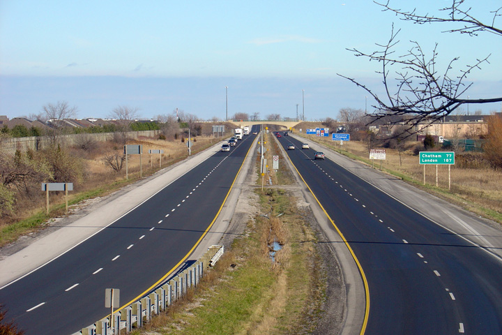
| Windsor / Tecumseh Boundary County of Essex |
Highway 401 looking west from the North Talbot Road overpass in Windsor.
In the upper photo, Highway 401 ended just west of the North Talbot Road
overpass. The lower photo was taken four days after the Herb Gray
Parkway extension was opened through Windsor. Upper photo taken: December 5th, 2004. Lower photo taken: July 2nd, 2015. |
 (720x480) (1440x960) (2400x1600) |
|||||
| Windsor / Tecumseh Boundary County of Essex |
Two views along Highway 401 looking east from the North Talbot Road overpass in Windsor. Both show different incarnations of how the Dougall Parkway interchanged with Highway 401. As part of the reconstruction project that saw Highway 401 six-laned between Windsor and Tilbury, the Dougall Parkway interchange was considerably improved and modernized.
Upper photo taken: September 10th, 2005.
Middle photo taken: January 24th, 2009.
Lower photo taken: July 2nd, 2015. |
 (720x480) (1440x960) (2400x1600) |
|||||
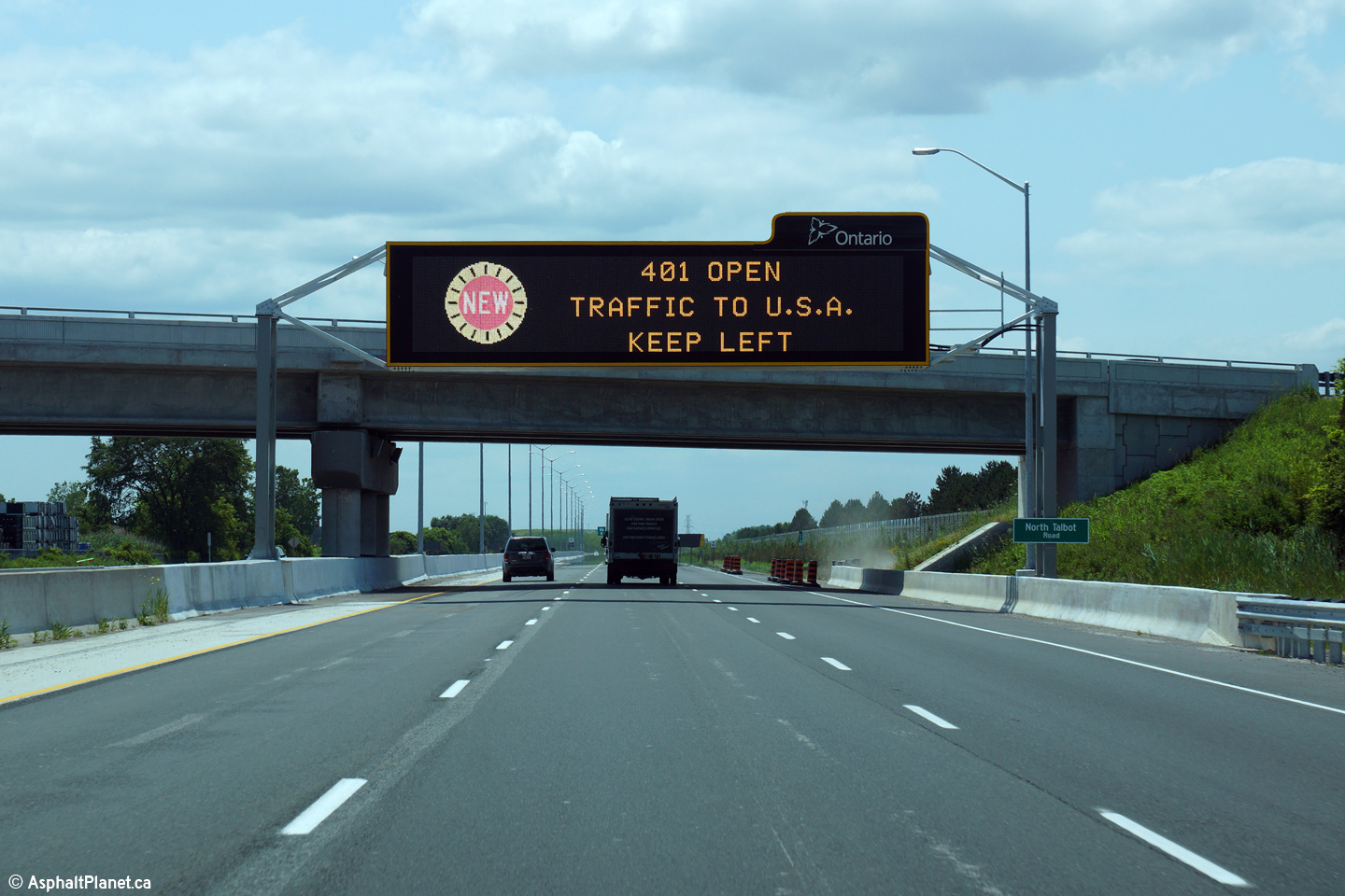
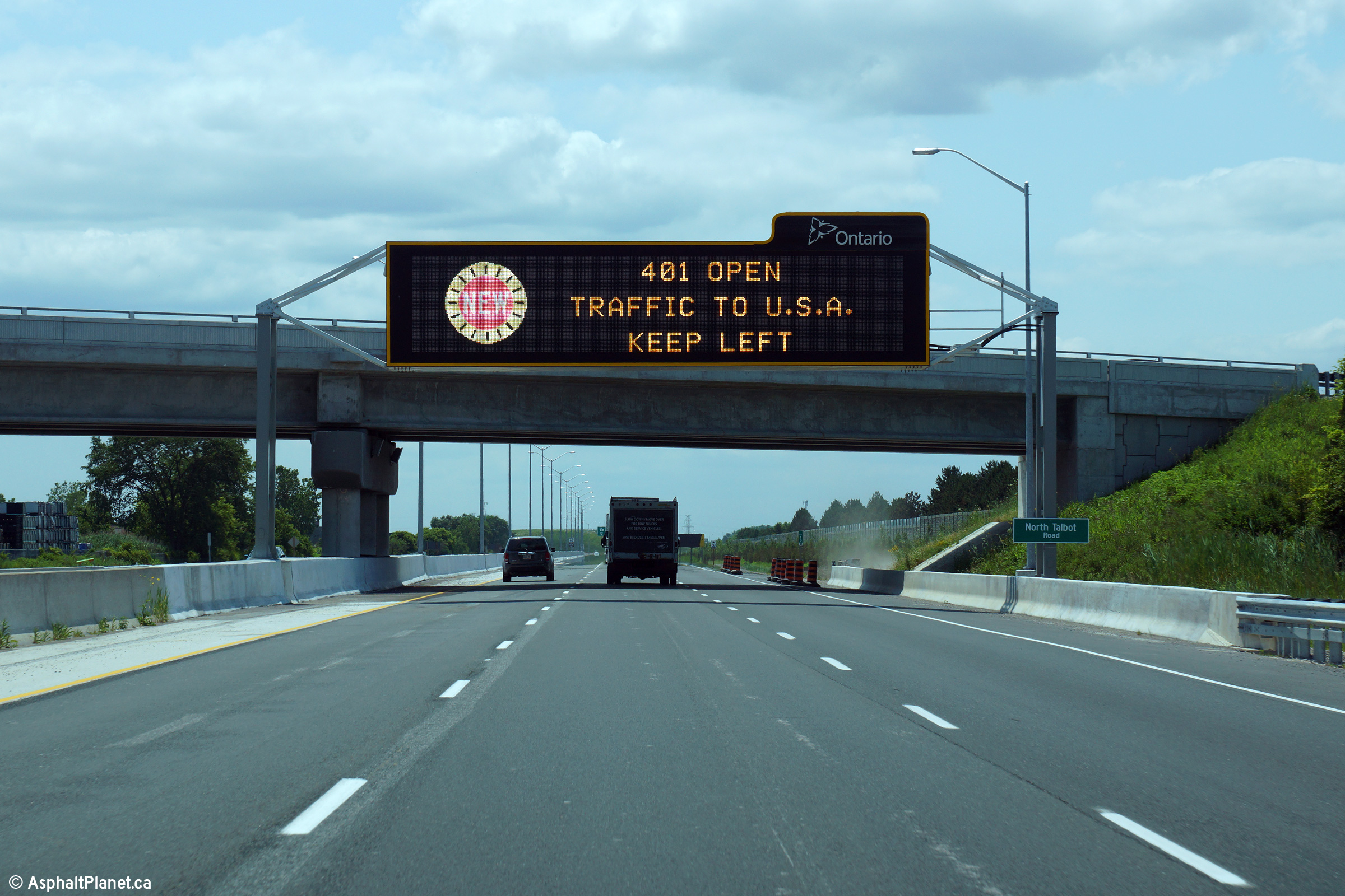
| Windsor / Tecumseh Boundary County of Essex |
Because this photo was taken only a few days after the Herb Gray Parkway had
opened to traffic, this overhead changeable message sign was notifying
traffic of the completion of Highway 401 through Windsor. Contrast
this to the former sign that
stood in the vicinity of this location. Photo taken: July 2nd, 2015. |
 (720x480) (720x480)(1440x960) (2400x1600) |
|||||
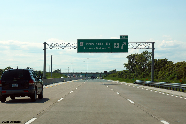
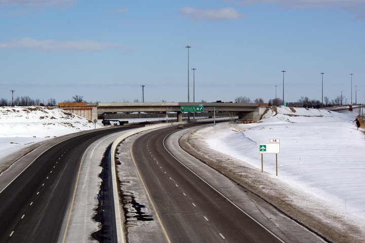
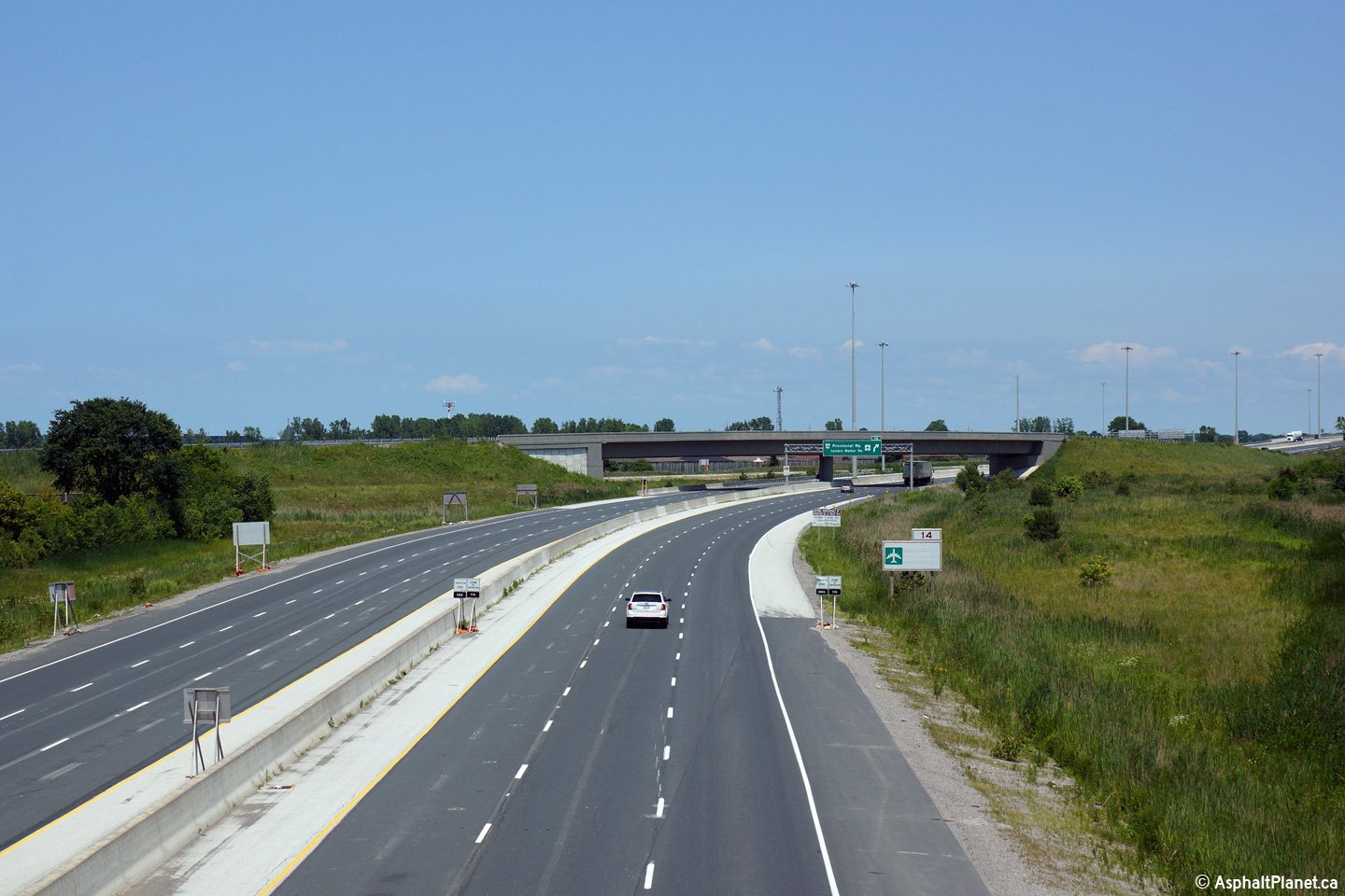
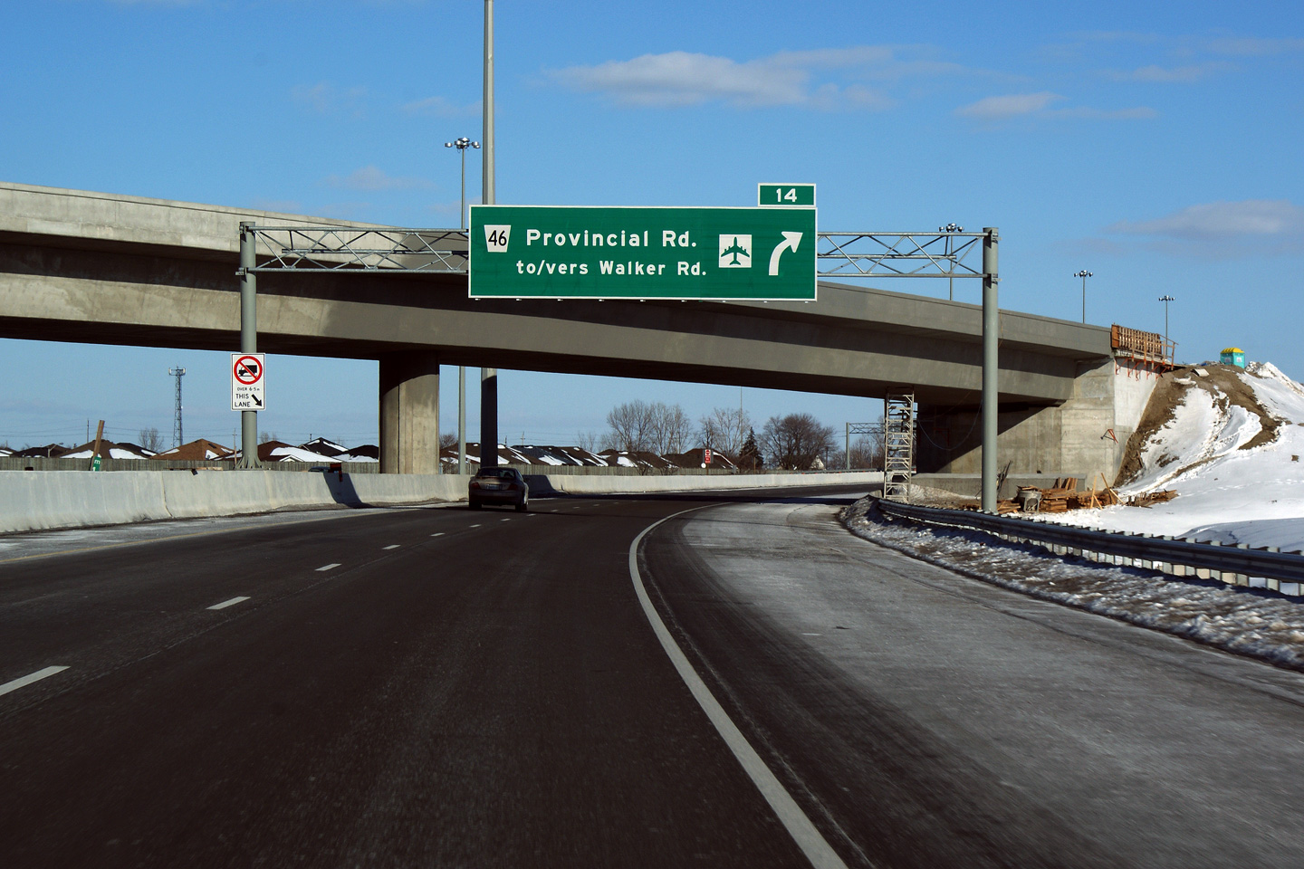
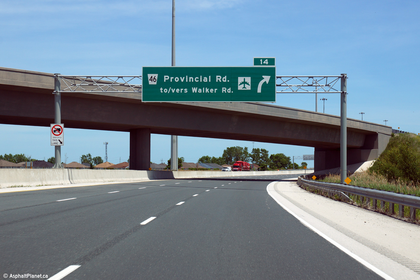
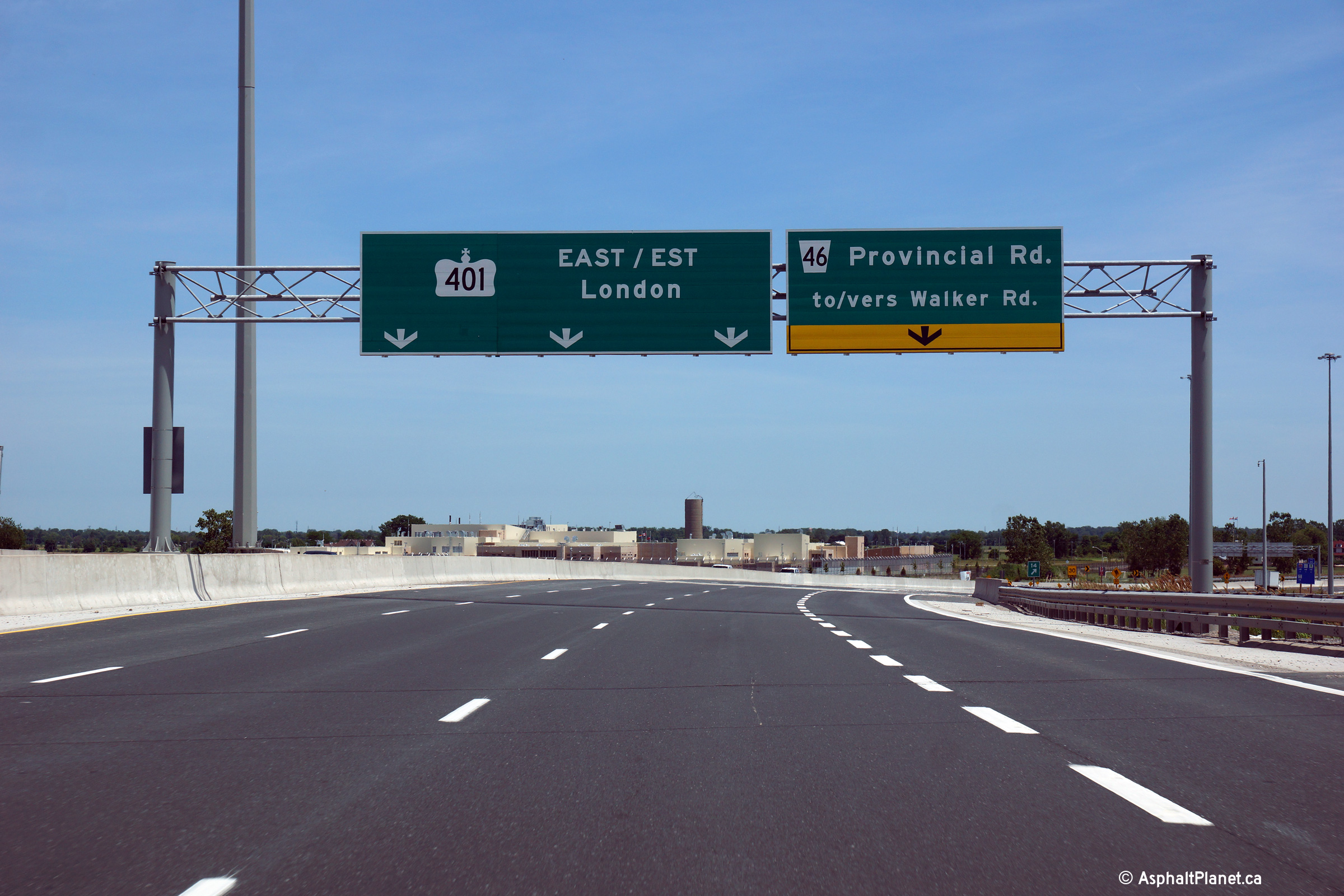
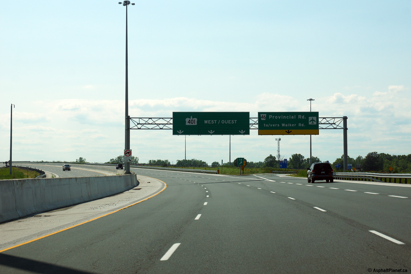
| Windsor / Tecumseh Boundary County of Essex |
Overhead advanced sign for the Provincial Road interchange. Click
here for an earlier photo of this
signage taken in January, 2009. before construction to widen Highway 401 to
six lanes had been completed. Photo taken: June 15th, 2014. |
 (720x480) (720x480)(1440x960) (2400x1600) |
|||||
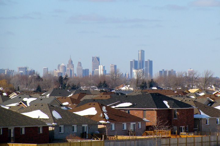
| Windsor / Tecumseh Boundary County of Essex |
View
looking towards the Detroit skyline from the uncompleted flyover ramp from
the Dougall Parkway to Highway 401 in Windsor. Detroit has a very
impressive skyline. Be sure to visit the Michigan Highway section of
AsphaltPlanet.ca Photo taken: January 24th, 2009. |
 (720x480) (1440x960) |
|||||
| Windsor / Tecumseh Boundary County of Essex |
This view looks easterly from the then unfinished Highway 3B flyover.
The highway was still very much under construction when this photo was
taken. Photo taken: January 24th, 2009. |
|
|||||
| Highway 3B is the now defunct highway that led traffic from Highway 401 into Downtown Windsor, and the Detroit-Windsor Tunnel. Click here for Highway 3B images. | |||||||
| Windsor / Tecumseh Boundary County of Essex |
Highway 401 driving west through the Highway 3B (now Dougall Avenue)
interchange. Highway 3B (Dougall Avenue) is a freeway for a short
distance west of Highway 401 until just beyond the Howard Avenue interchange. Photo taken: July 2nd, 2015. |
 (720x480) (720x480)(1440x960) (2400x1600) |
|||||
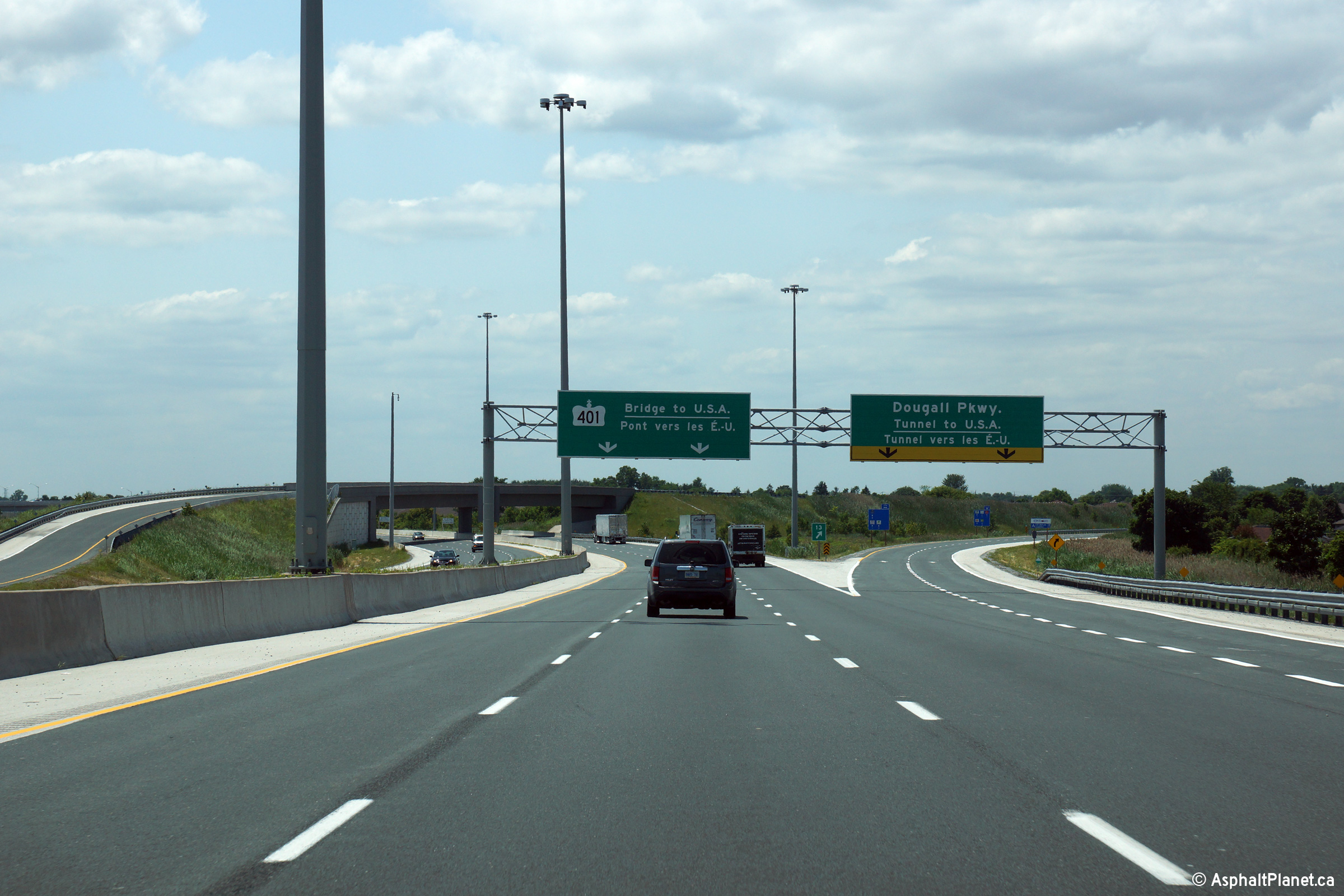
| Windsor / Tecumseh Boundary County of Essex |
Overhead diagram signage for the upcoming Highway 401/3B interchange.
Traffic bound for the Detroit/Windsor Tunnel is directed to follow Dougall
Avenue. Click here for a
photo of this signage taken in December, 2004, before the 401 was widened to
six lanes. Photo taken: July 2nd, 2015. |
 (720x480) (720x480)(1440x960) (2400x1600) |
|||||
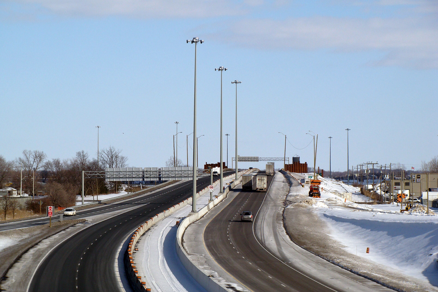
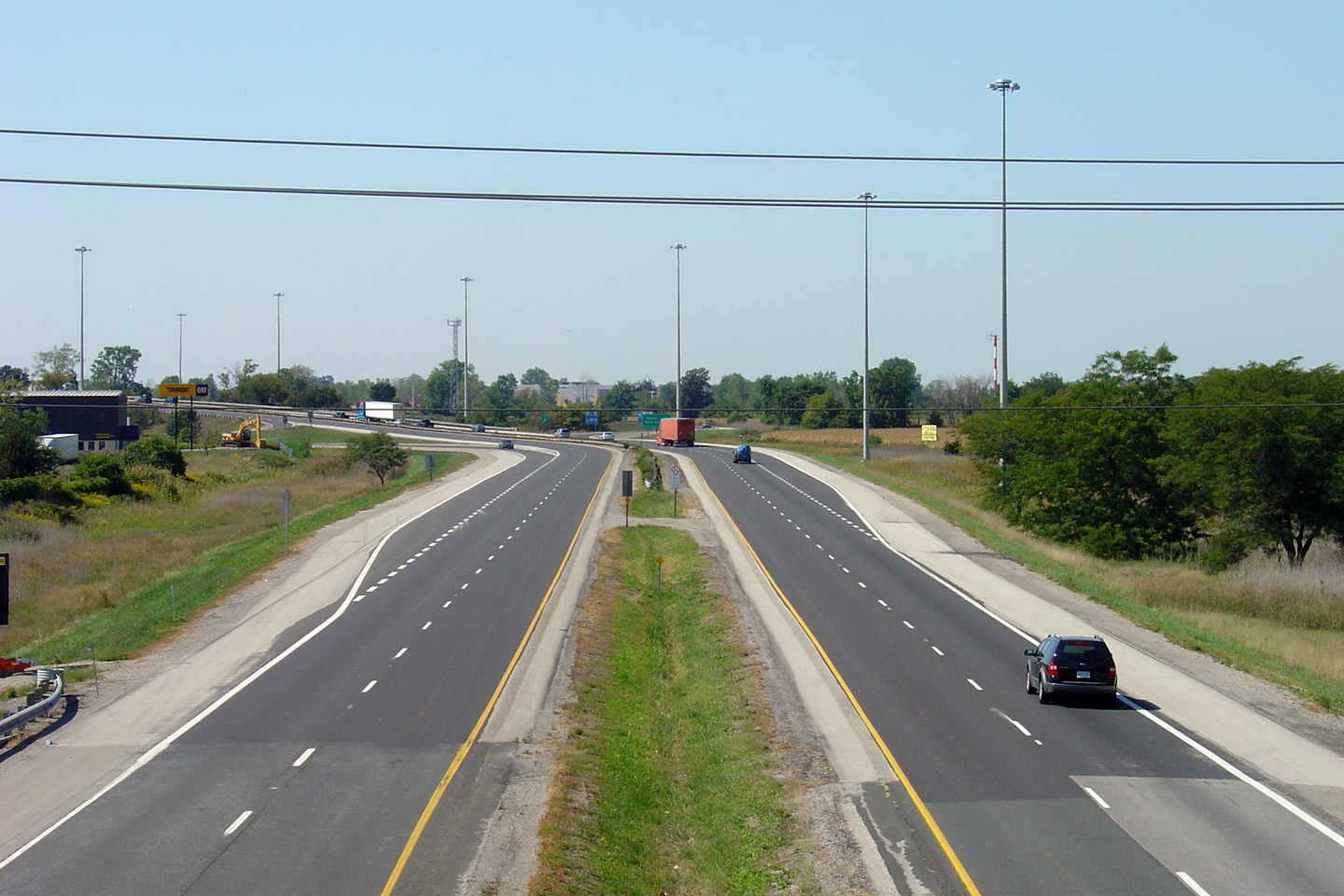
| Windsor / Tecumseh Boundary County of Essex |
A series of views of signage approaching the Essex Road 46 interchange.
In the old view, notice the slotted concrete barrier that is used along the outside of the
highway overtop of Provincial Road. Such barrier design dates back to
the 401's original 1950s construction and is substandard to today's design practices. Upper photo taken: January 24th, 2009. Lower photo taken: June 15th, 2014. |
 (720x480) (720x480)(1440x960) (2400x1600) |
|||||
| indsor / Tecumseh Boundary County of Essex |
Westerly view at the off-ramp to Provincial Road in eastern Windsor. Photo taken: July 2nd, 2015. |
 (720x480) (720x480)(1440x960) (2400x1600) |
|||||
| Windsor / Tecumseh Boundary County of Essex |
Westbound advanced signage for the ramp to Provincial Road. Photo taken: July 2nd, 2015. |
 (720x480) (720x480)(1440x960) (2400x1600) |
|||||
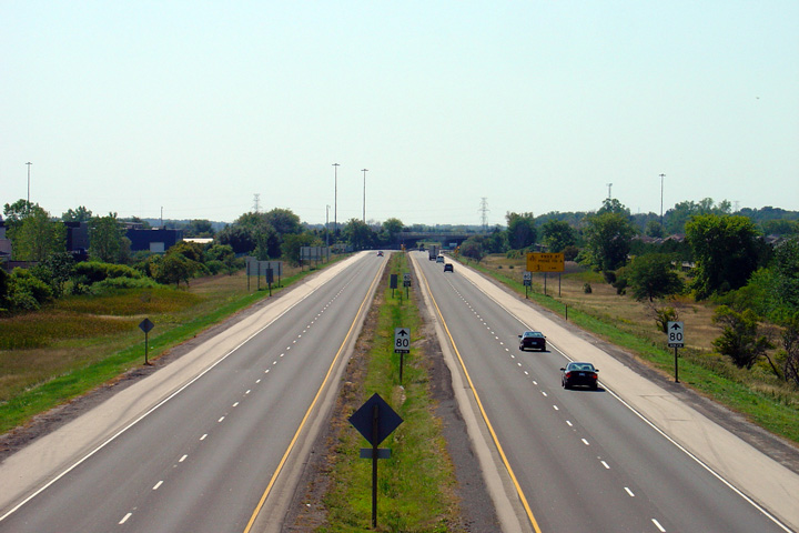
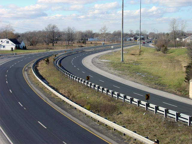
| Windsor / Tecumseh Boundary County of Essex |
Highway 401 looking west from the 8th Concession Road overpass. Highway 401
begins to skirt alongside Windsor's urban area to the west of this overpass. Upper photo taken: September 10th, 2005. Lower photo taken: October 22nd, 2011. |
 (720x480) (1440x960) (2400x1600) |
|||||
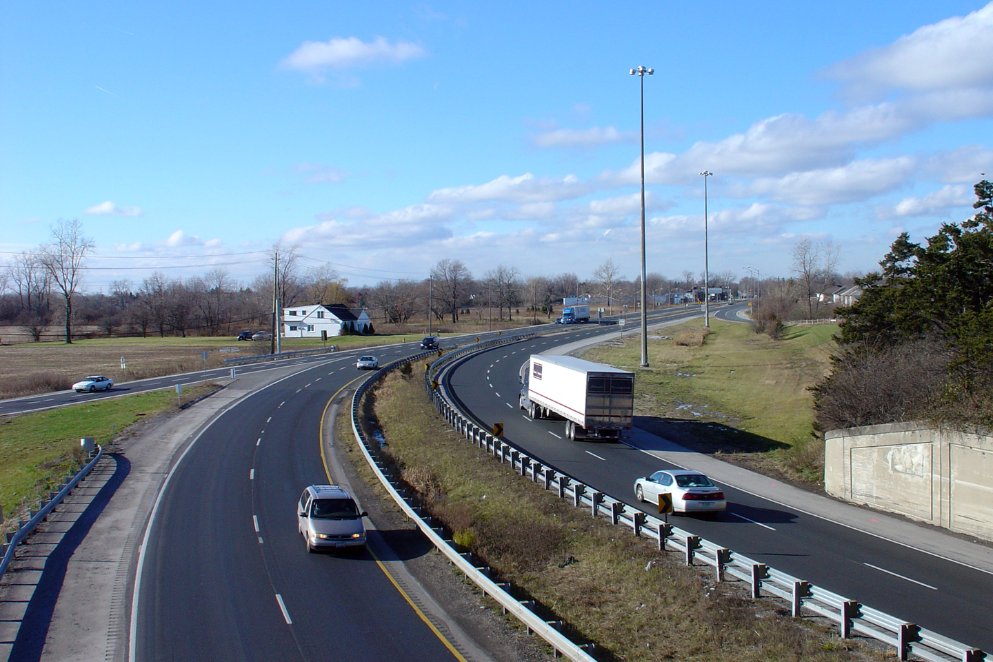
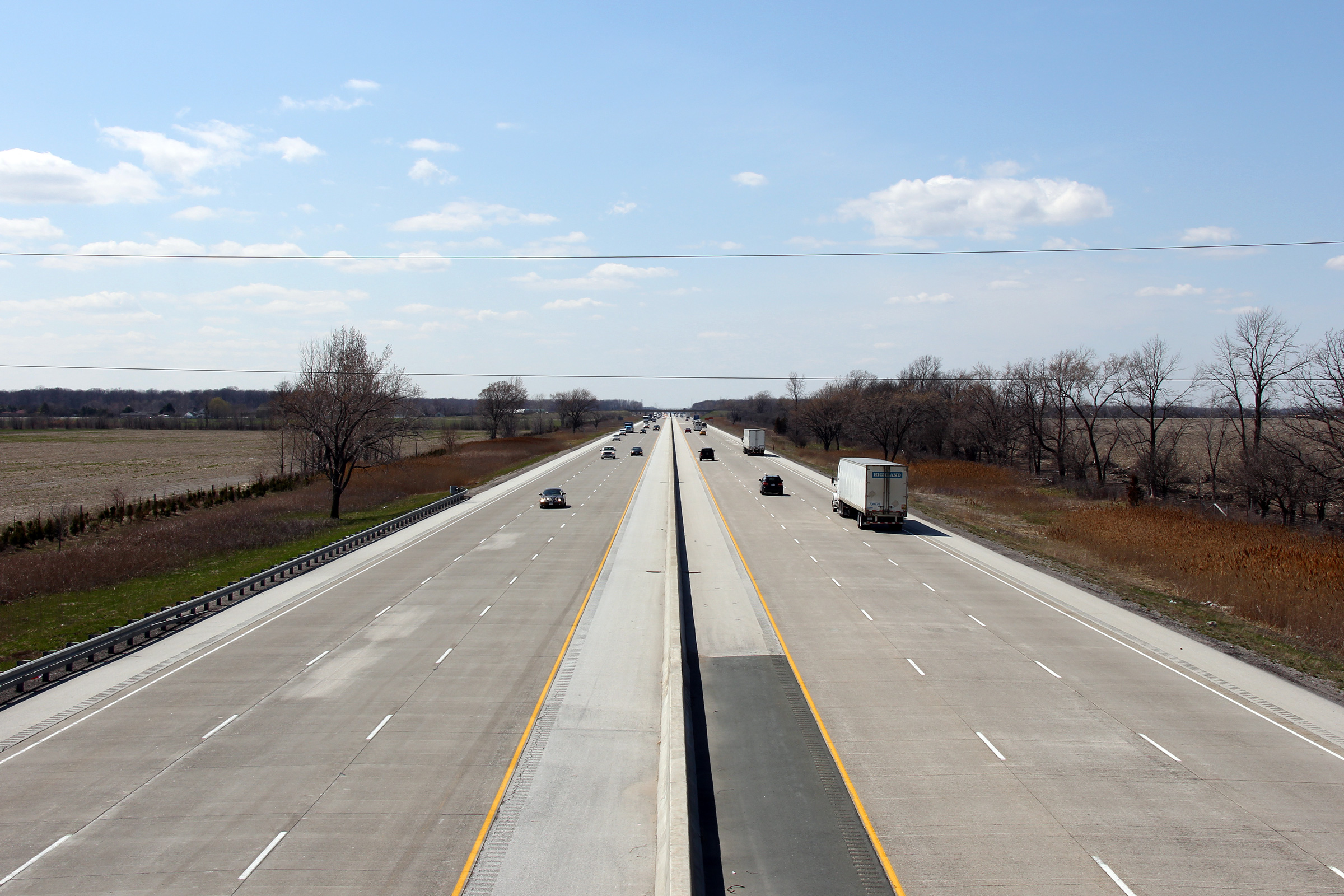
| Windsor / Tecumseh Boundary County of Essex |
Looking east from the 8th Concession Road overpass. Note the
transition from asphalt to concrete in this photo. Highway 401 is
surfaced in concrete east from Windsor to Tilbury. Photo taken: October 22nd, 2011. |
 (720x480) (1440x960) (2400x1600) |
|||||
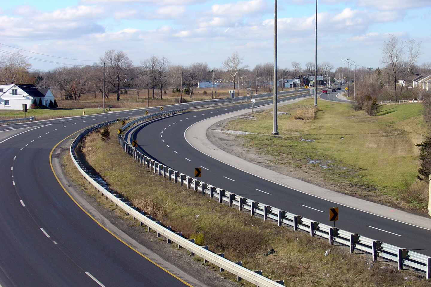
| Windsor / Tecumseh Boundary County of Essex |
Westerly view towards the Tecumseh 8th Concession Road overpass.
Virtually all grade separations along the Windsor to Tilbury section of
Highway 401 were constructed over a decade after the 401 was
opened to traffic. The 8th Concession Road, as pictured, met Highway
401 at grade until the late 1960s. Photo taken: October 22nd, 2011. |
 (720x480) (1440x960) (2400x1600) |
|||||
| Windsor / Tecumseh Boundary County of Essex |
Westerly view towards Windsor from the Tecumseh 9th Concession Road
overpass. Photo taken: October 22nd, 2011. |
 (720x480) (1440x960) (2400x1600) |
|||||
| Windsor / Tecumseh Boundary County of Essex |
Easterly view from the 9th Concession Road overpass along Highway 401. Photo taken: October 22nd, 2011. |
 (720x480) (1440x960) (2400x1600) |
|||||
| Windsor / Tecumseh Boundary County of Essex |
Westerly view towards Windsor from the 10th Concession Road overpass. Photo taken: October 22nd, 2011. |
 (720x480) (1440x960) (2400x1600) |
|||||
| Windsor / Tecumseh Boundary County of Essex |
Reverse view (looking easterly) from the 10th Concession Road overpass. Photo taken: October 22nd, 2011. |
 (720x480) (1440x960) (2400x1600) |
|||||
| Town of Tecumseh County of Essex |
Looking west from the 11th Concession Road overpass. 11th Concession Road is located at roughly
kilometre marker 19. Photo taken: October 22nd, 2011 |
 (720x480) (1440x960) (2400x1600) |
|||||
| Town of Tecumseh County of Essex |
Looking east from the 11th Concession Road overpass. Photo taken: October 22nd, 2011. |
 (720x480) (1440x960) (2400x1600) |
|||||
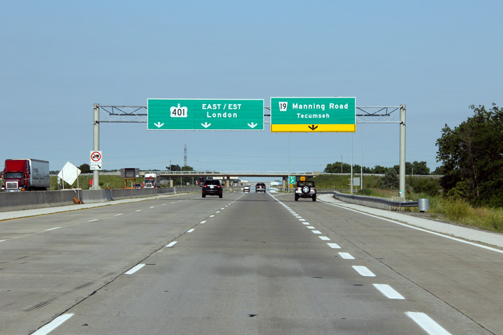
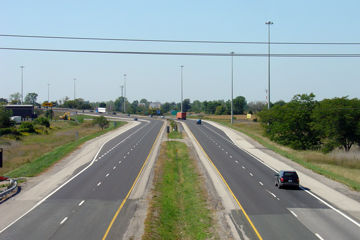
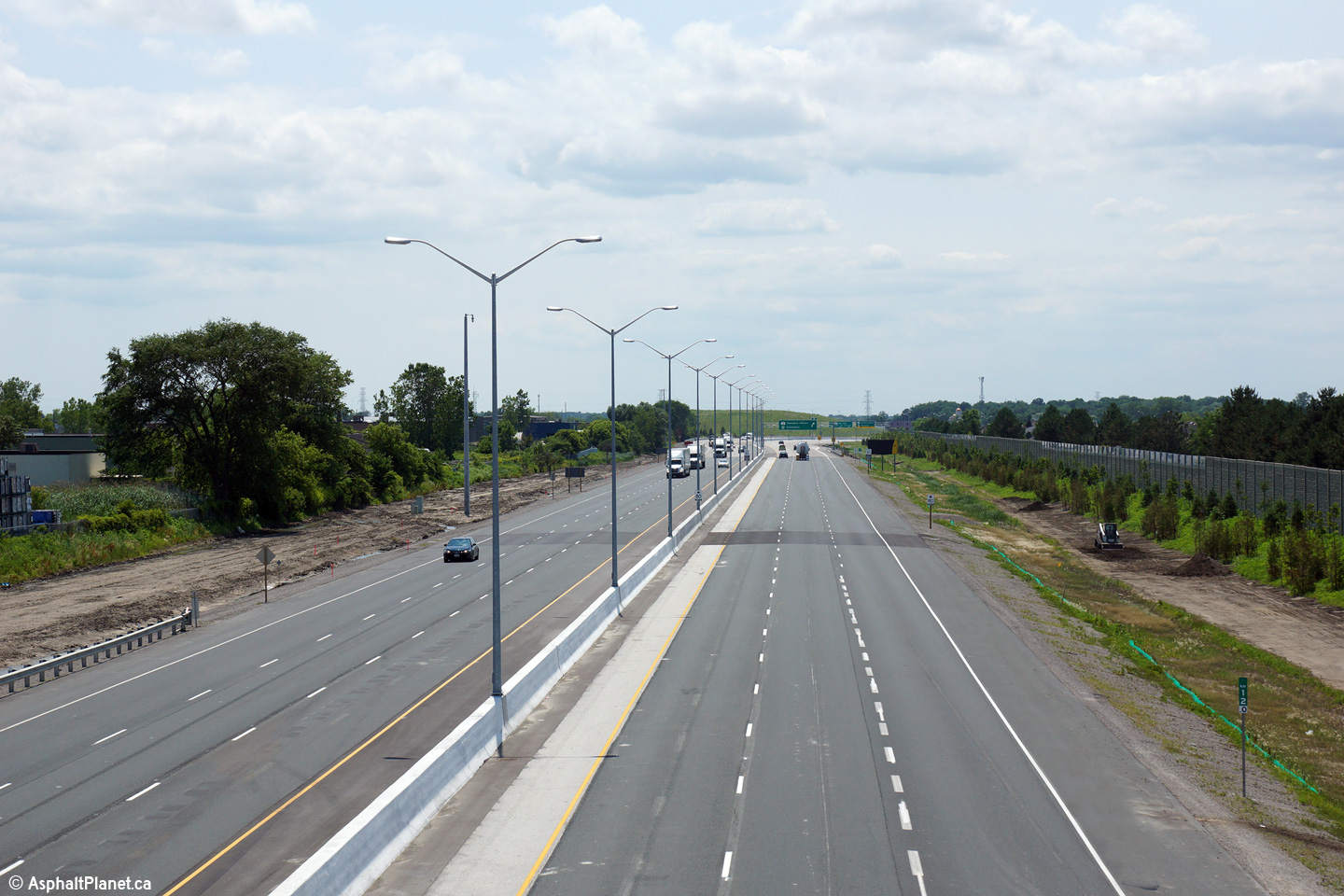
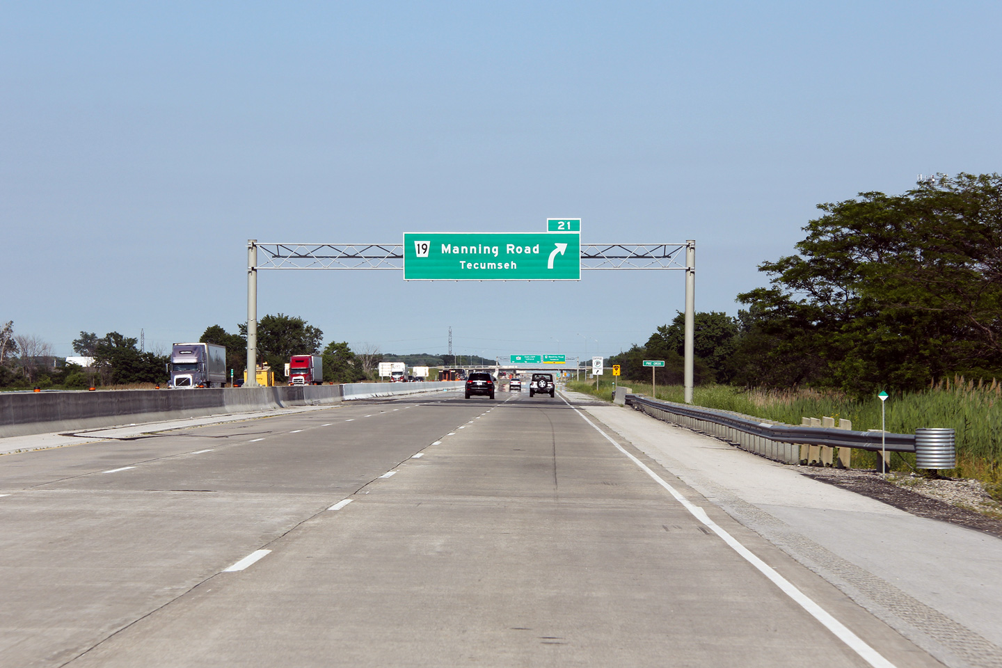
| Town of Tecumseh County of Essex |
Advanced signage for the ramp to Manning Road from Highway 401 East. All
newly constructed or reconstructed sections of six lane or wider highways in
Ontario are to be fully signed with overhead signs. Photo taken: June 26th, 2011. |
 (720x480) (720x480)(1440x960) (2400x1600) |
|||||
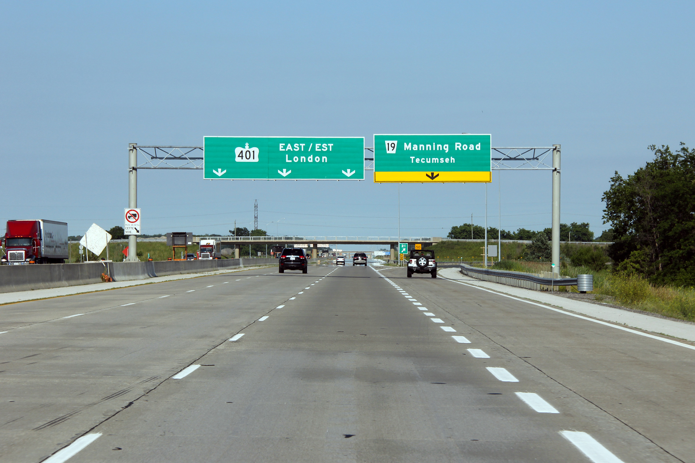
| Town of Tecumseh County of Essex |
Eastbound signage for the Manning Road interchange. Manning Road is an
important county road that links the eastern Windsor suburb of Tecumseh to
Highway 401. Photo taken: June 26th, 2011. |
 (720x480) (720x480)(1440x960) (2400x1600) |
|||||
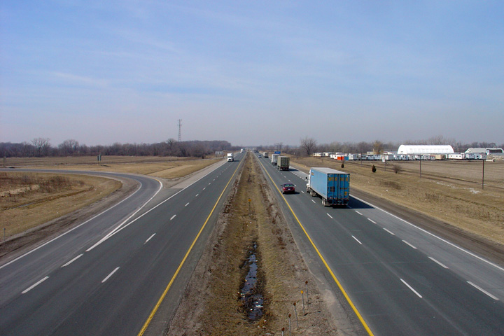
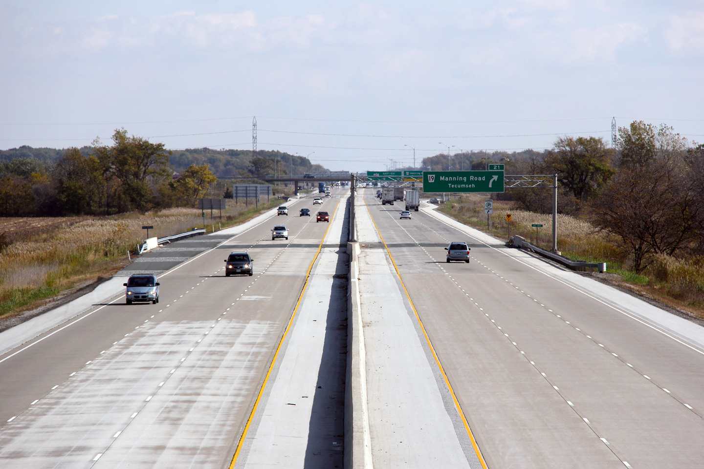
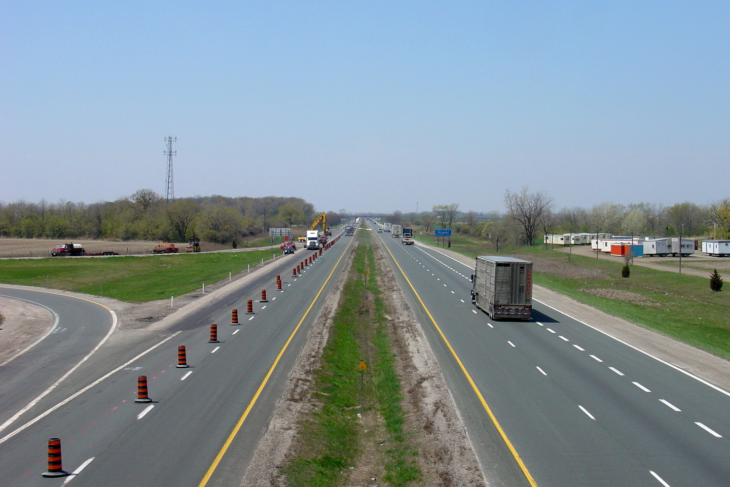
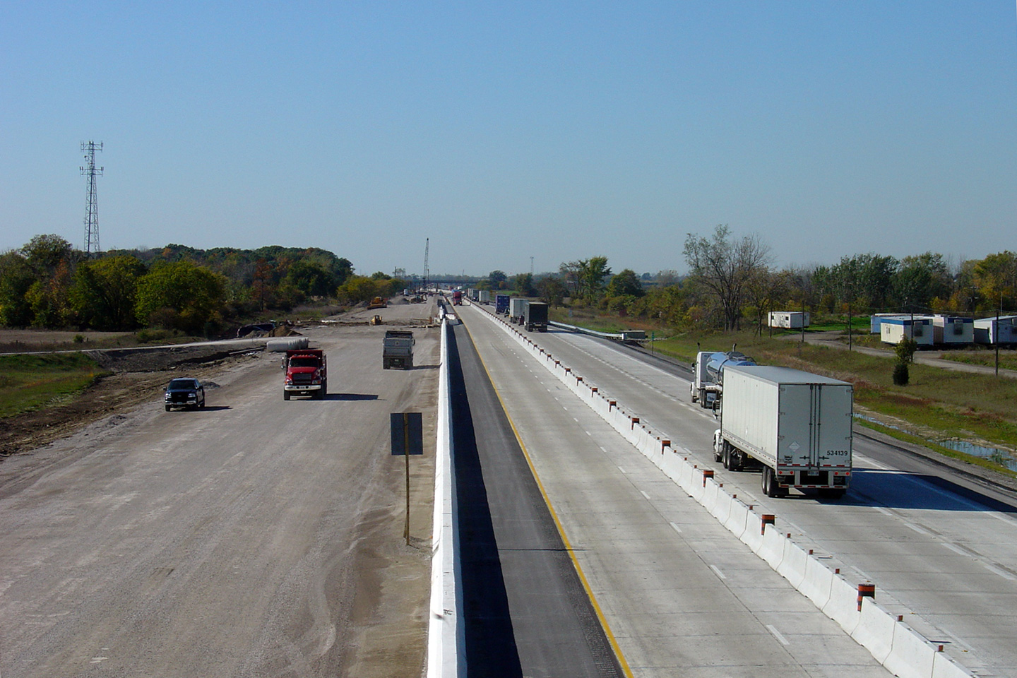
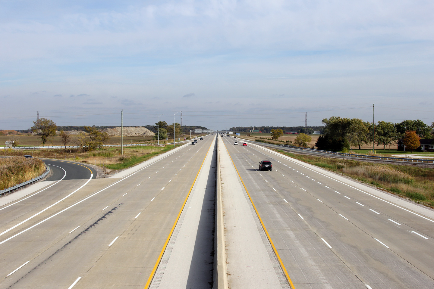
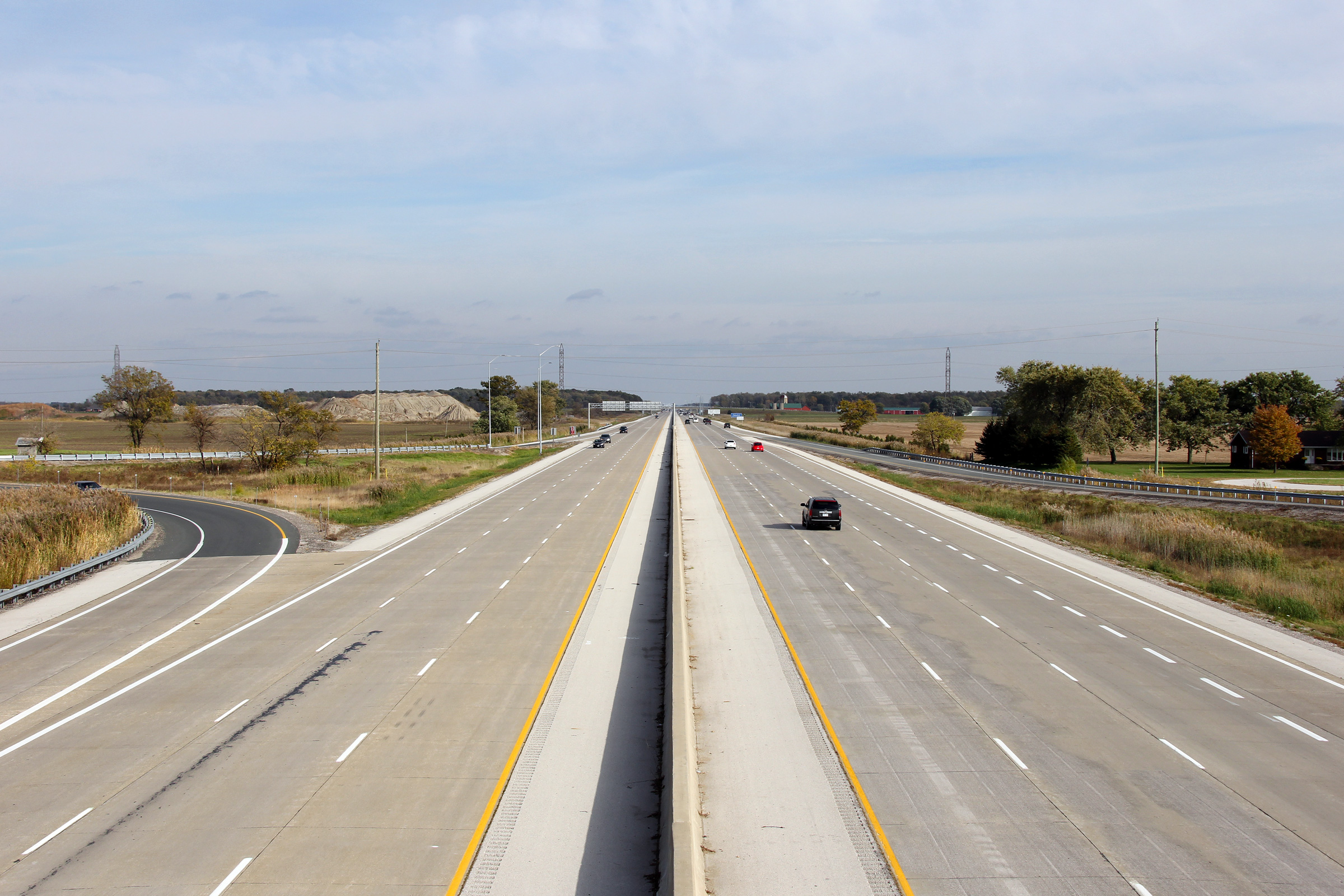
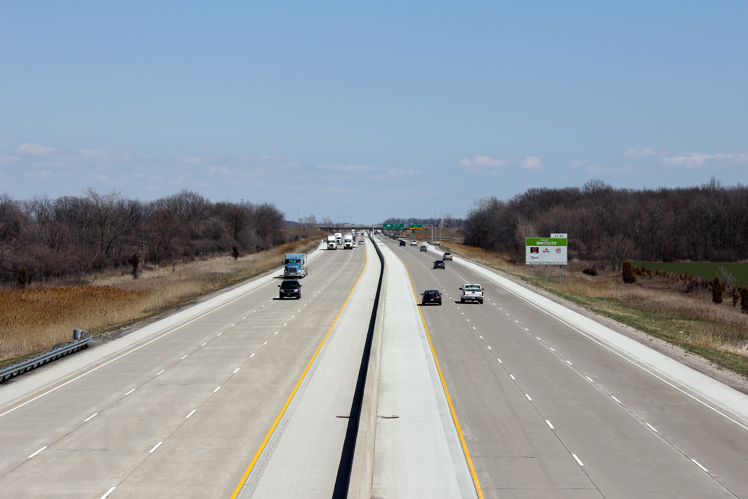
| Tecumseh - Lakeshore Boundary County of Essex |
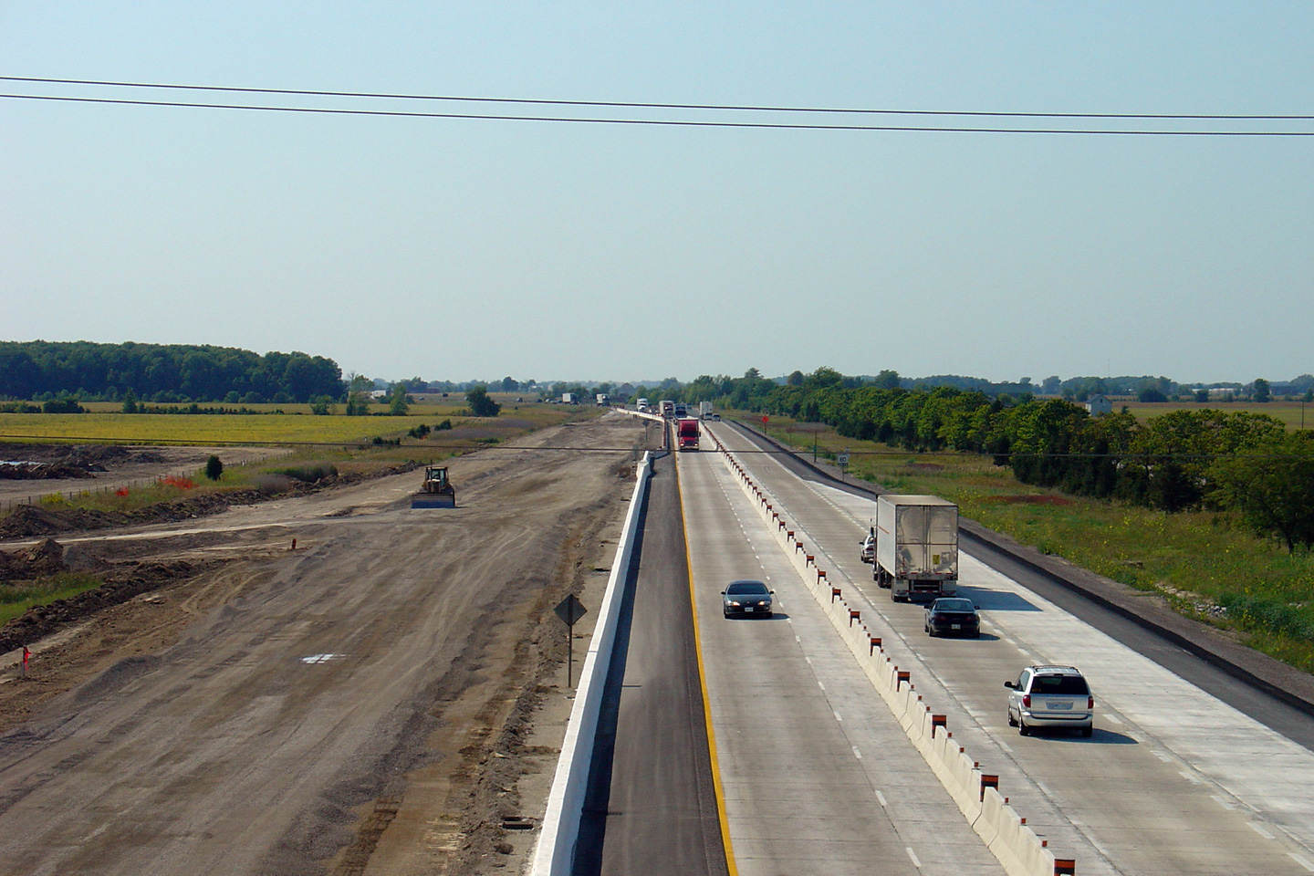
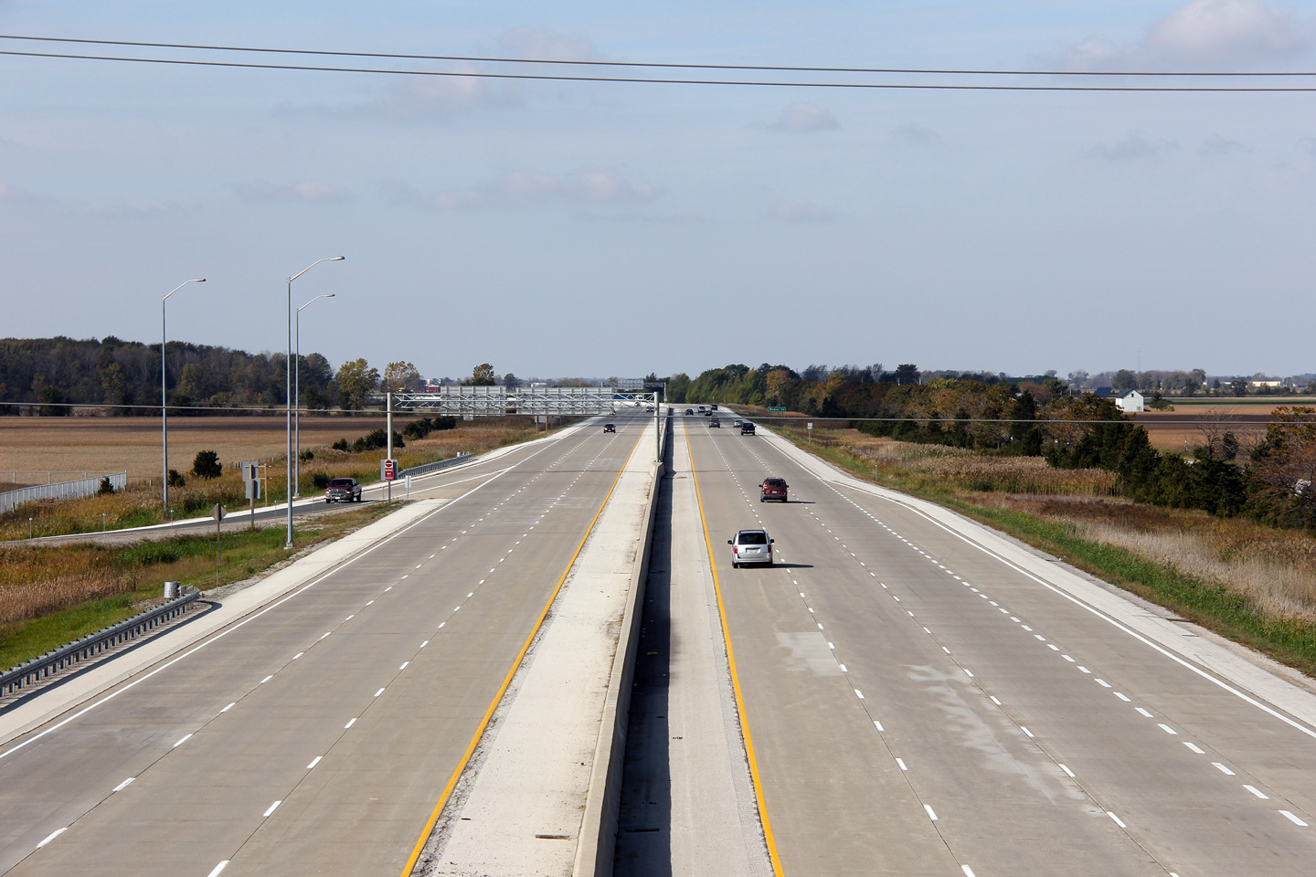
A series of views looking westerly from the Manning Road overpass.
Photo #1 highlights the 401 before any construction activity had taken place
through Manning Road. The second photo, taken two months after the
upper photo shows the eastbound carriageway reduced to a single lane with
construction crews setting up the traffic staging that will allow the
eastbound carriageway to carry the two way traffic. Once two way
traffic was placed on the eastbound carriageway, the westbound lanes were
completely reconstructed. The third photo in the series, jumps ahead
six months in the construction phase, and shows two way traffic on the
reconstructed eastbound carriageway. With all traffic now using the
widened eastbound lanes, crews turned their attention to the westbound
lanes, widening them to match the eastbound carriageway. The fourth
photo, shows the highway after substantial construction had finished.
The eastbound passing lane was closed for most of 2006 in order to minimize
the amount of lane drops for eastbound traffic going into the next phase of
the construction project, at Puce Road. The final photo, shows a
completed six-lane Highway 401 at Manning Road. Photo #1 taken: March 29th, 2005. Photo #2 taken: May 5th, 2005. Photo #3 taken: October 17th, 2005. Photo #4 taken: March 17th, 2006. Photo #5 taken: October 22nd, 2011. |
 (720x480) (1440x960) (2400x1600) |
|||||
| Highway 401 was extensively upgraded and widened through Essex County. Click here for more information and photos. | |||||||
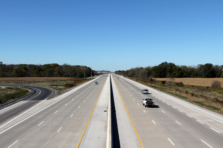
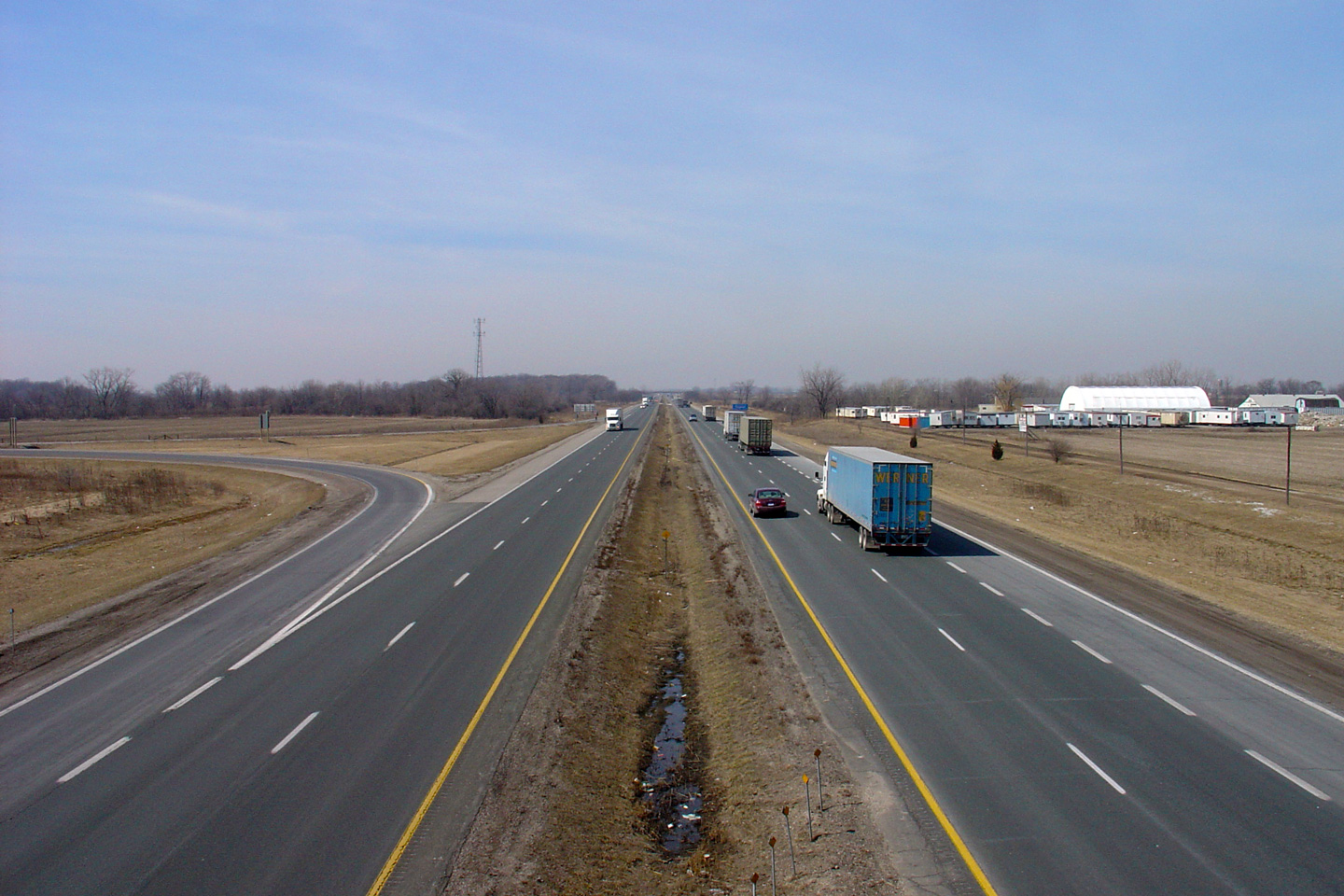
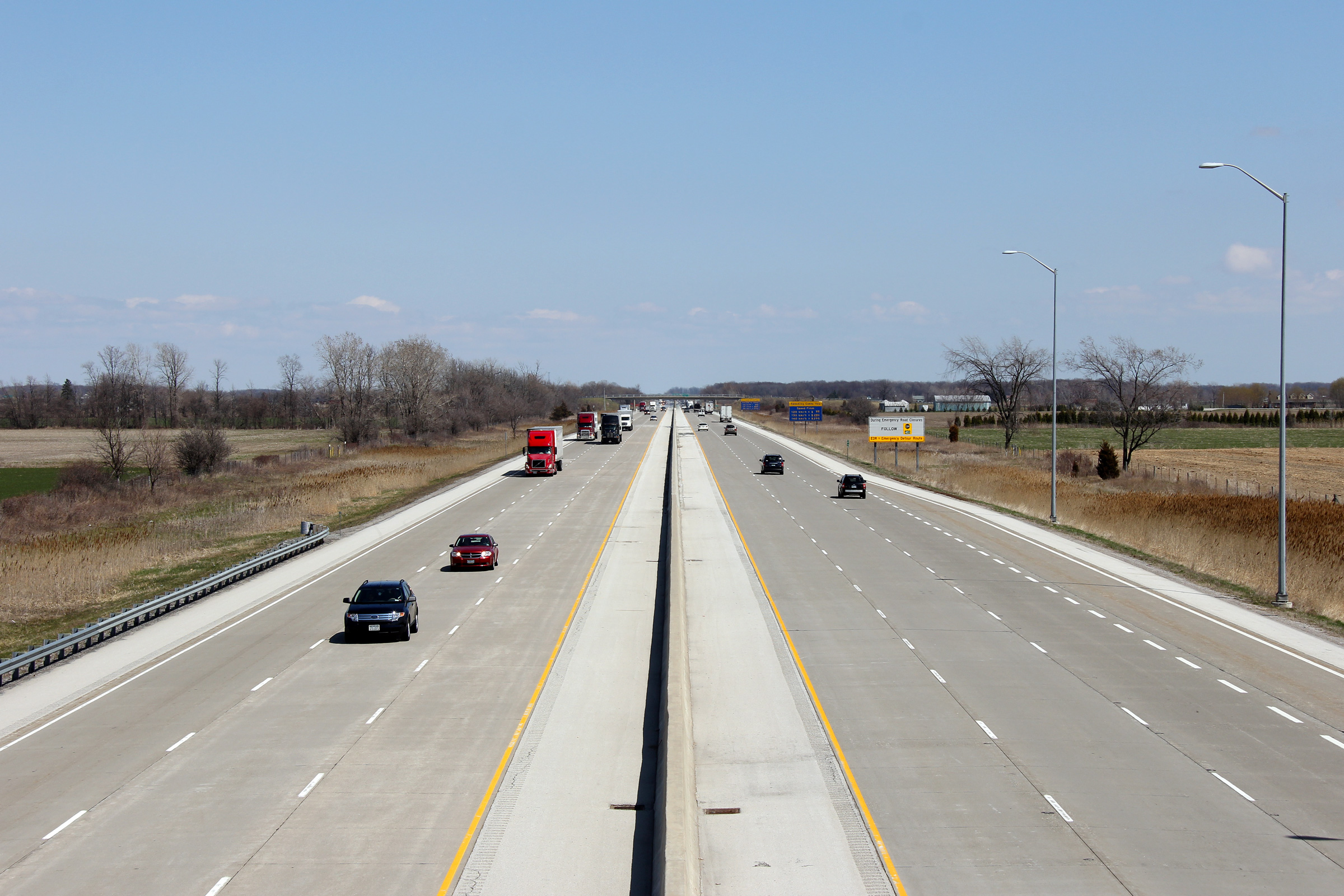
| Tecumseh - Lakeshore Boundary County of Essex |
Looking east from the Manning Road overpass. The directional ramp
carrying traffic from Manning Road northbound to Highway 401 eastbound was
added in 2005 as part of the highway reconstruction. Photo taken: October 22nd, 2011. |
 (720x480) (1440x960) (2400x1600) |
|||||
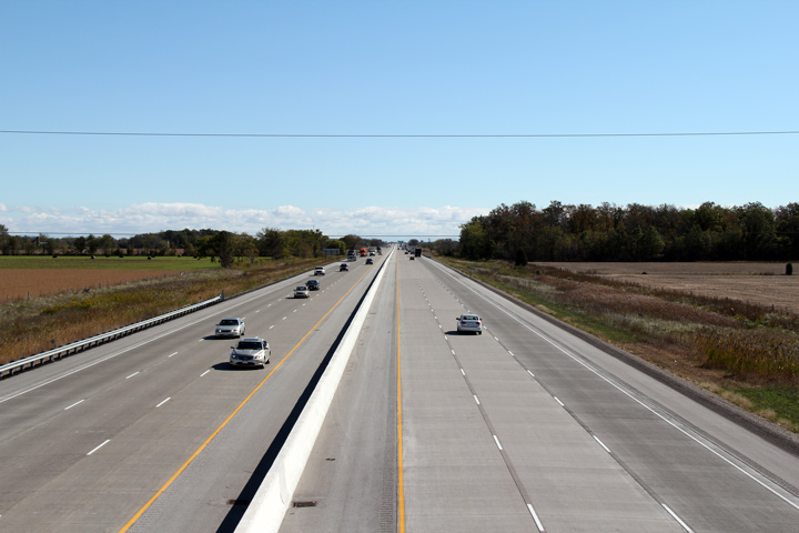
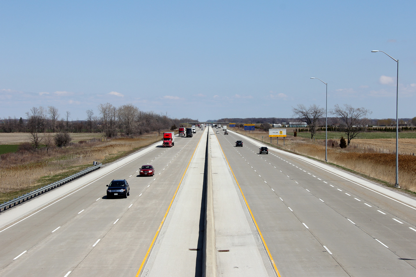
| Town of Lakeshore County of Essex |
Looking west towards Manning Road from the Lakeshore Road 101 overpass.
The Lakeshore Road 101 overpass is located roughly at kilometre marker 23. Photo taken: April 21st, 2011. |
 (720x480) (1440x960) (2400x1600) |
|||||
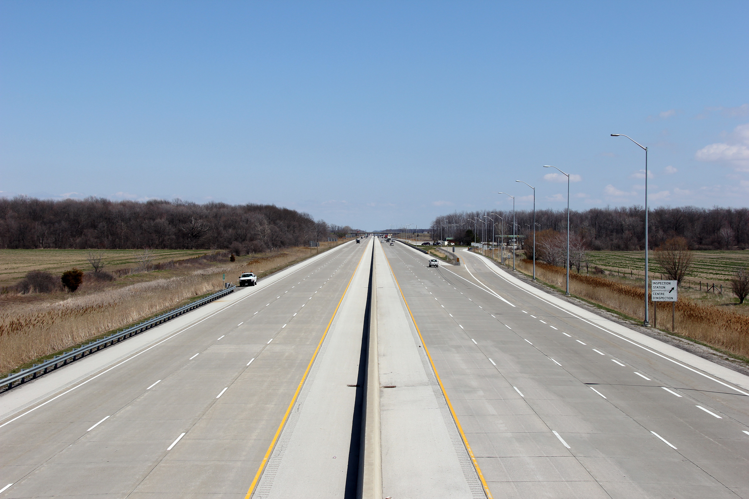
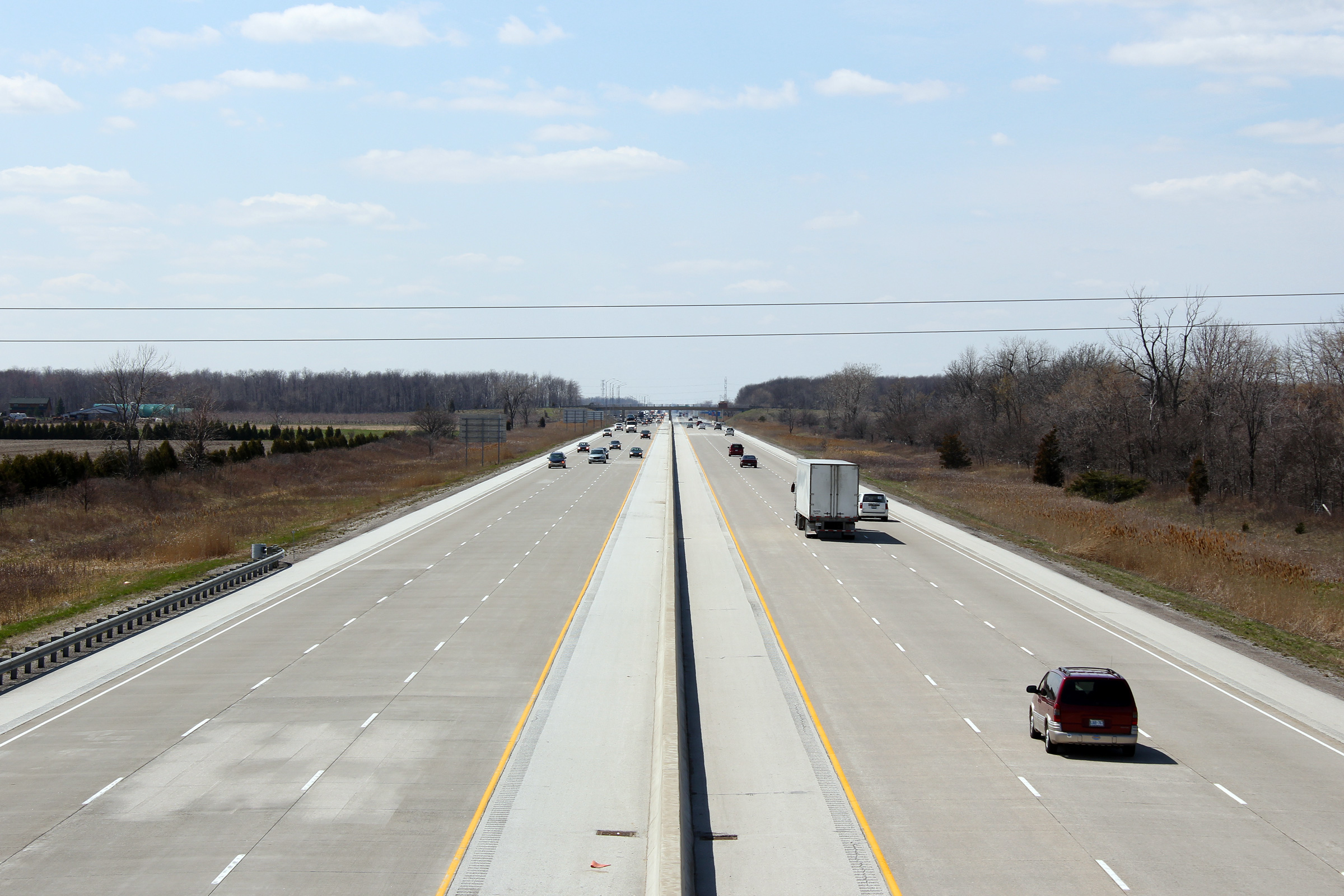
| Town of Lakeshore County of Essex |
Looking east from the Lakeshore Road 101 overpass. The truck
inspection facility that is pictured along the eastbound lanes was
considerably enlarged and improved during the highway reconstruction. Photo taken: April 21st, 2011. |
 (720x480) (1440x960) (2400x1600) |
|||||
| Town of Lakeshore County of Essex |
Looking west from the Lakeshore Road 103 overpass. Photo taken: April 21st, 2011. |
 (720x480) (1440x960) (2400x1600) |
|||||
| Town of Lakeshore County of Essex |
Looking east from the Lakeshore Road 103 overpass. This overpass is
located roughly at kilometre marker 24. Photo taken: April 21st, 2011. |
 (720x480) (1440x960) (2400x1600) |
|||||
| Town of Lakeshore County of Essex |
View
looking westerly along the 401 from the Lakeshore Road 105 overpass. Photo taken: April 21st, 2011. |
||||||
| Town of Lakeshore County of Essex |
View
looking easterly from the Lakeshore Road 105 overpass. Photo taken: April 21st, 2011. |
 (720x480) (1440x960) (2400x1600) |
|||||
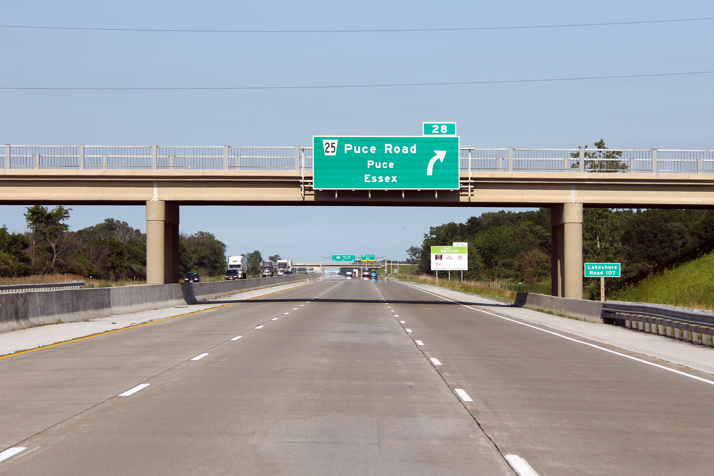
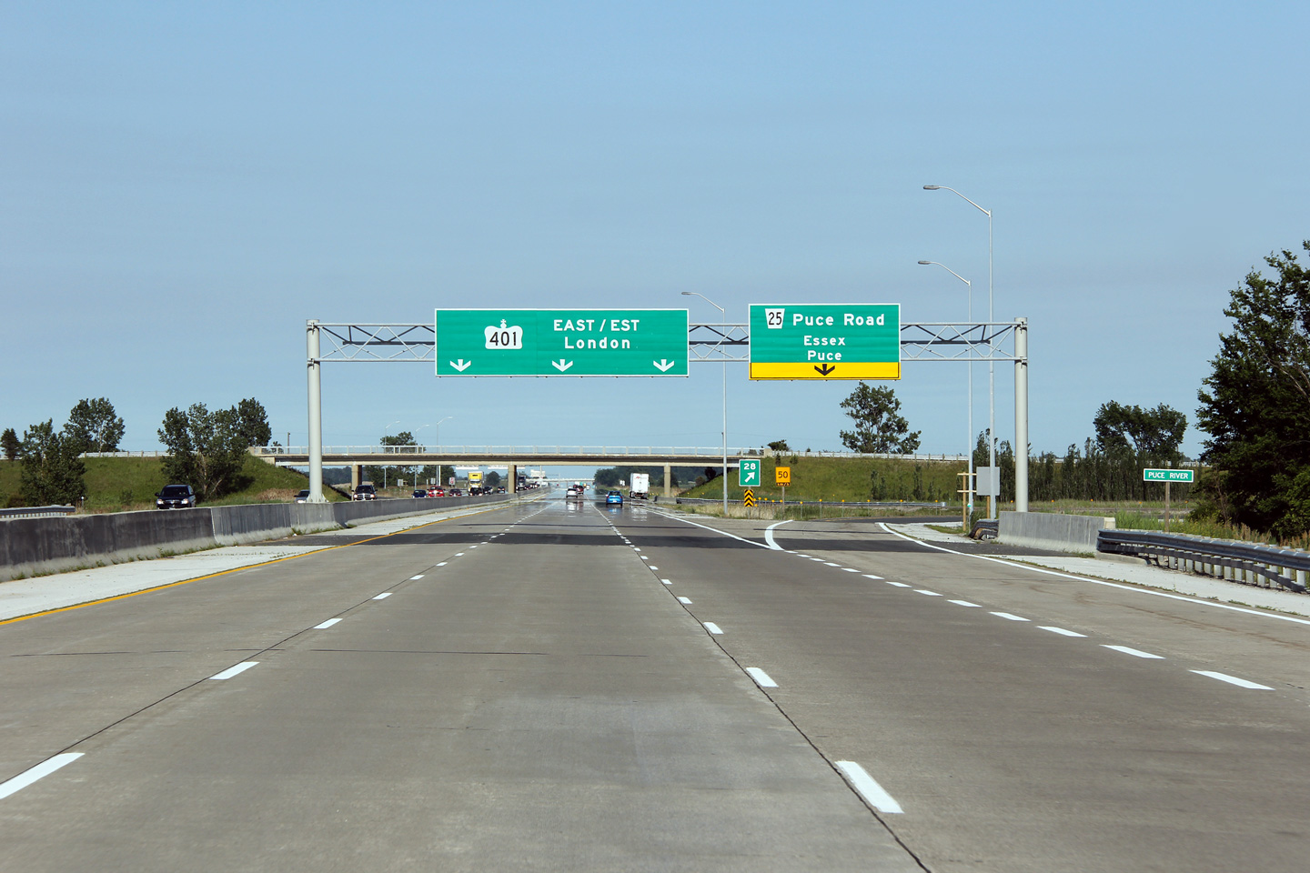
| Town of Lakeshore County of Essex |
Easterly view through the Lakeshore Road 107 overpass in advance of the
Puce Road interchange. Photo taken: June 26th, 2011. |
 (720x480) (720x480)(1440x960) (2400x1600) |
|||||
| Town of Lakeshore County of Essex |
Looking west from the
Lakeshore Road 107 overpass along Highway 401. Photo taken: January 24th, 2009. |
 |
|||||
| Town of Lakeshore County of Essex |
Easterly
view from the Lakeshore Road 107 overpass towards Puce Road. Photo taken: January 24th, 2009. |
 (720x480) (1440x960) (2400x1600) |
|||||
| Town of Lakeshore County of Essex |
Easterly view as the highway crosses the Puce River at the off-ramp to Puce
Road. Photo taken: June 26th, 2011. |
 (720x480) (720x480)(1440x960) (2400x1600) |
|||||
| Town of Lakeshore County of Essex |
Westerly view from the Puce Road overpass. Photo taken: October 1st, 2010. |
 (720x480) (1440x960) (2400x1600) |
|||||
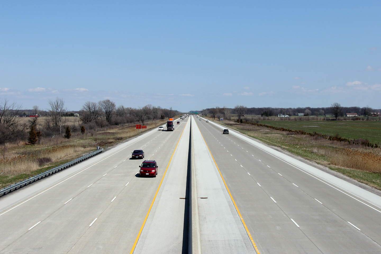
| Town of Lakeshore County of Essex |
View of Highway 401 looking east from Puce Road, near Windsor.
Photo taken: October 1st, 2010. |
|
|||||
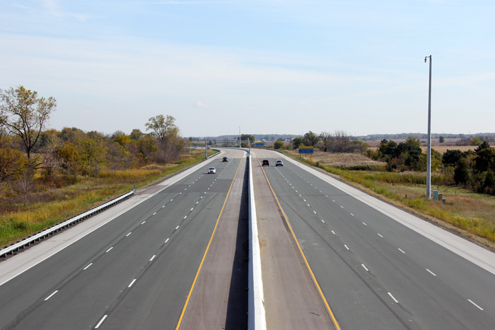
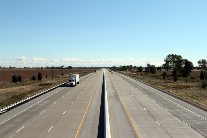
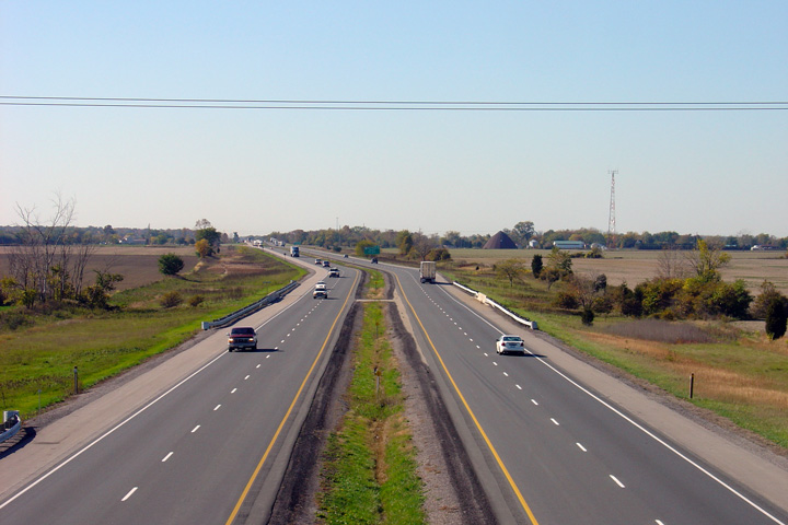
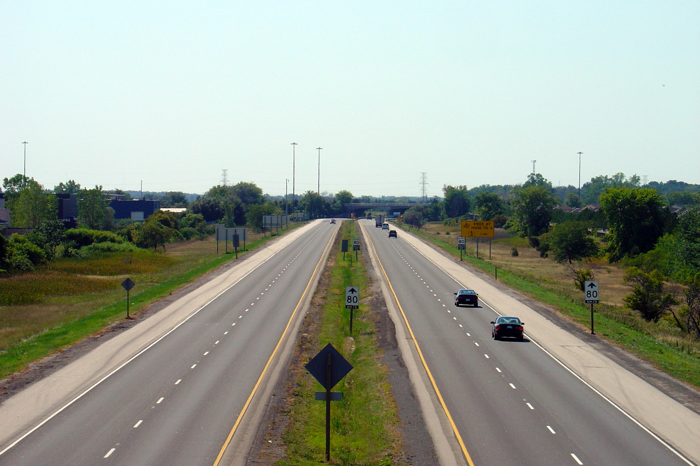
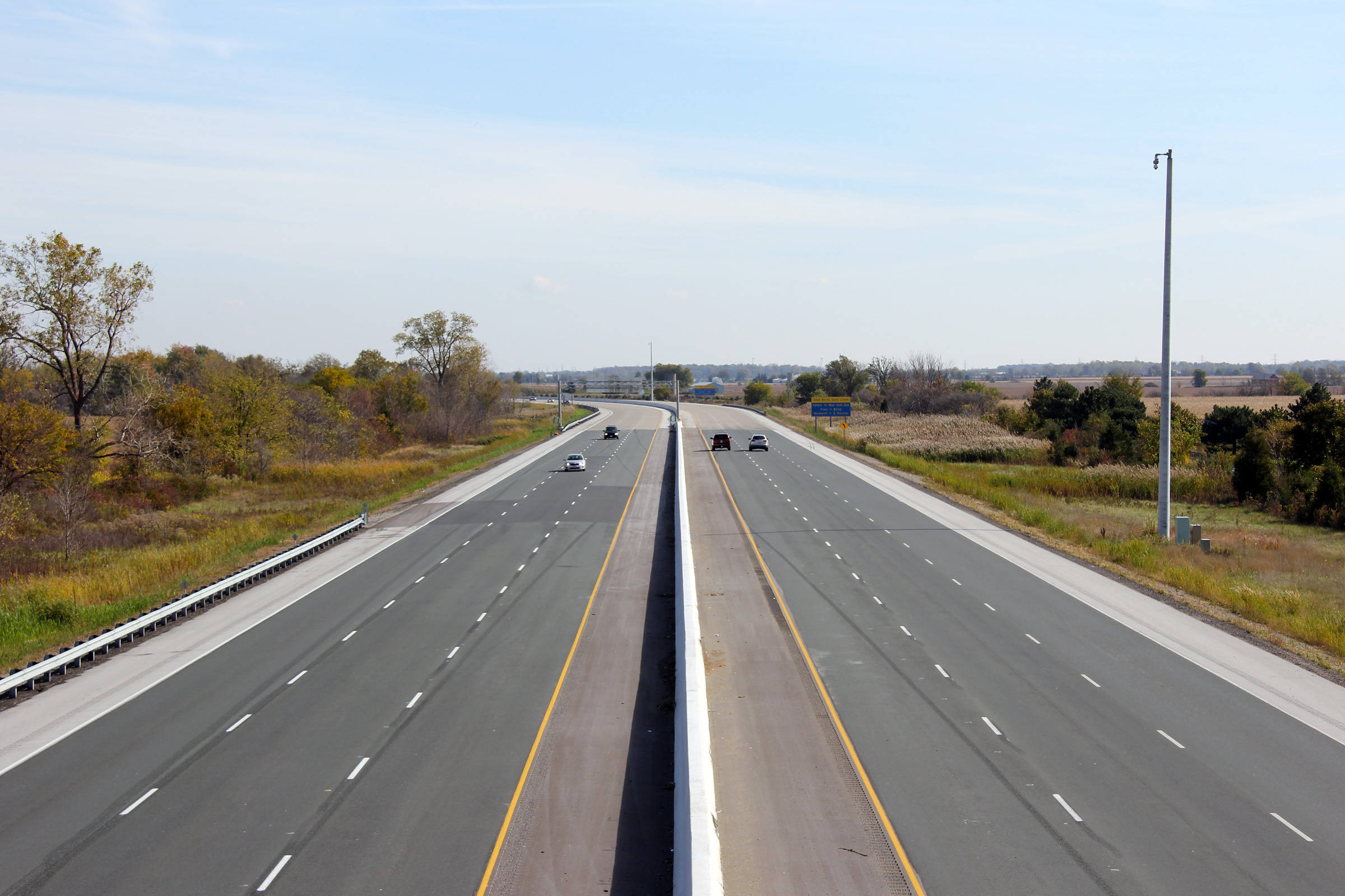
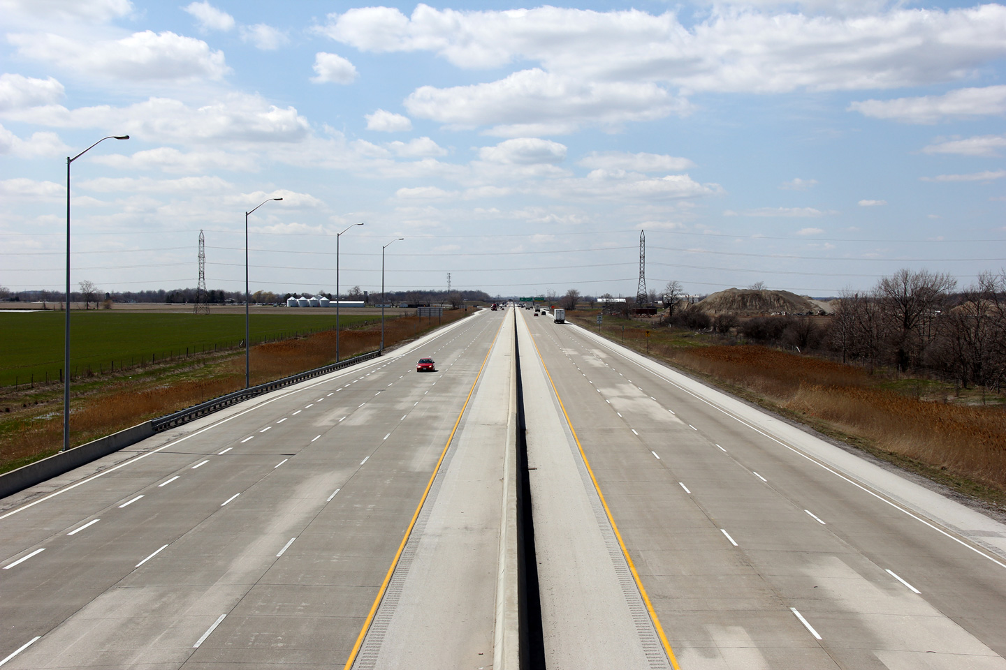
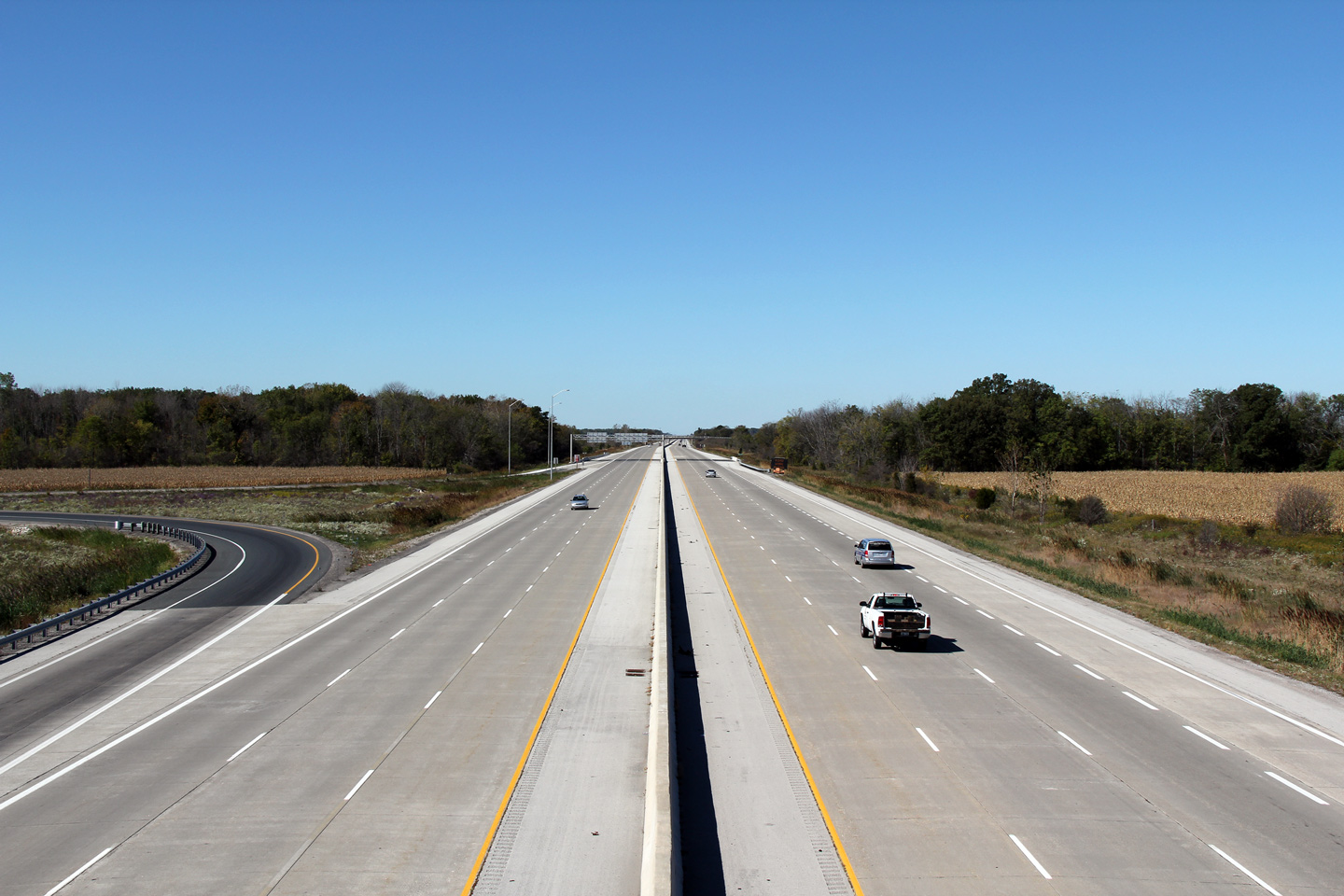
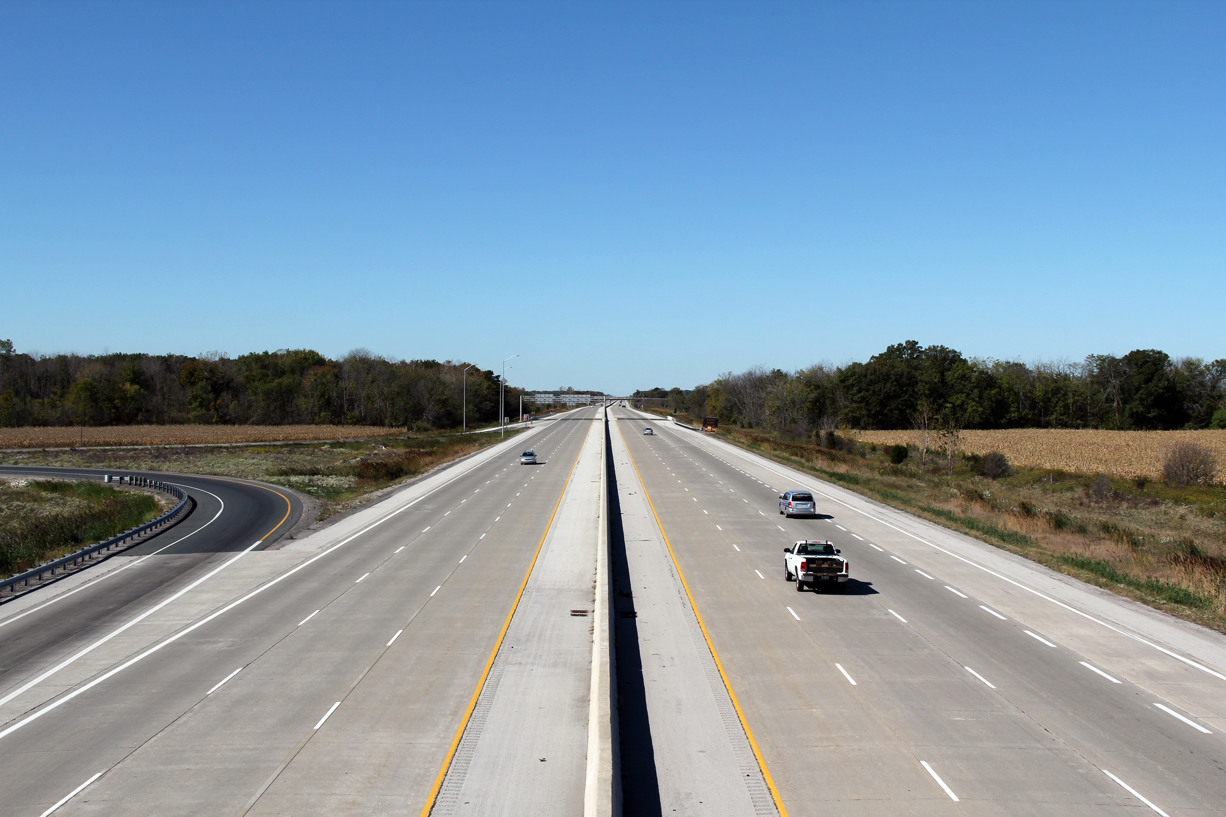
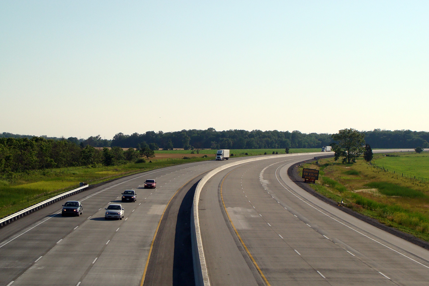
| Town of Lakeshore County of Essex |
This view looks westerly from the Lakeshore Road 113 overpass. Highway
401 is very straight and flat through the Essex Plain. The recently
widened stretch of highway does a lot to break up the monotony of the drive. Photo taken: October 1st, 2010. |
 (720x480) (1440x960) (2400x1600) |
|||||
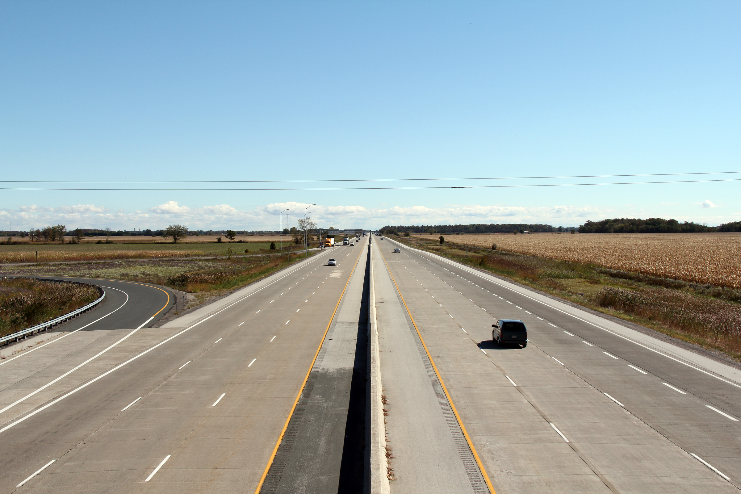
| Town of Lakeshore County of Essex |
Easterly view from the Lakeshore Road 113 overpass. Photo taken: October 1st, 2010. |
 (720x480) (1440x960) (2400x1600) |
|||||
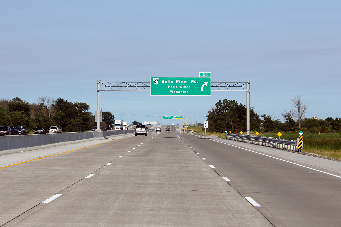
| Town of Lakeshore County of Essex |
Advanced signage for the Belle River Road exit. Photo taken: June 26th, 2011. |
 (720x480) (720x480)(1440x960) (2400x1600) |
|||||
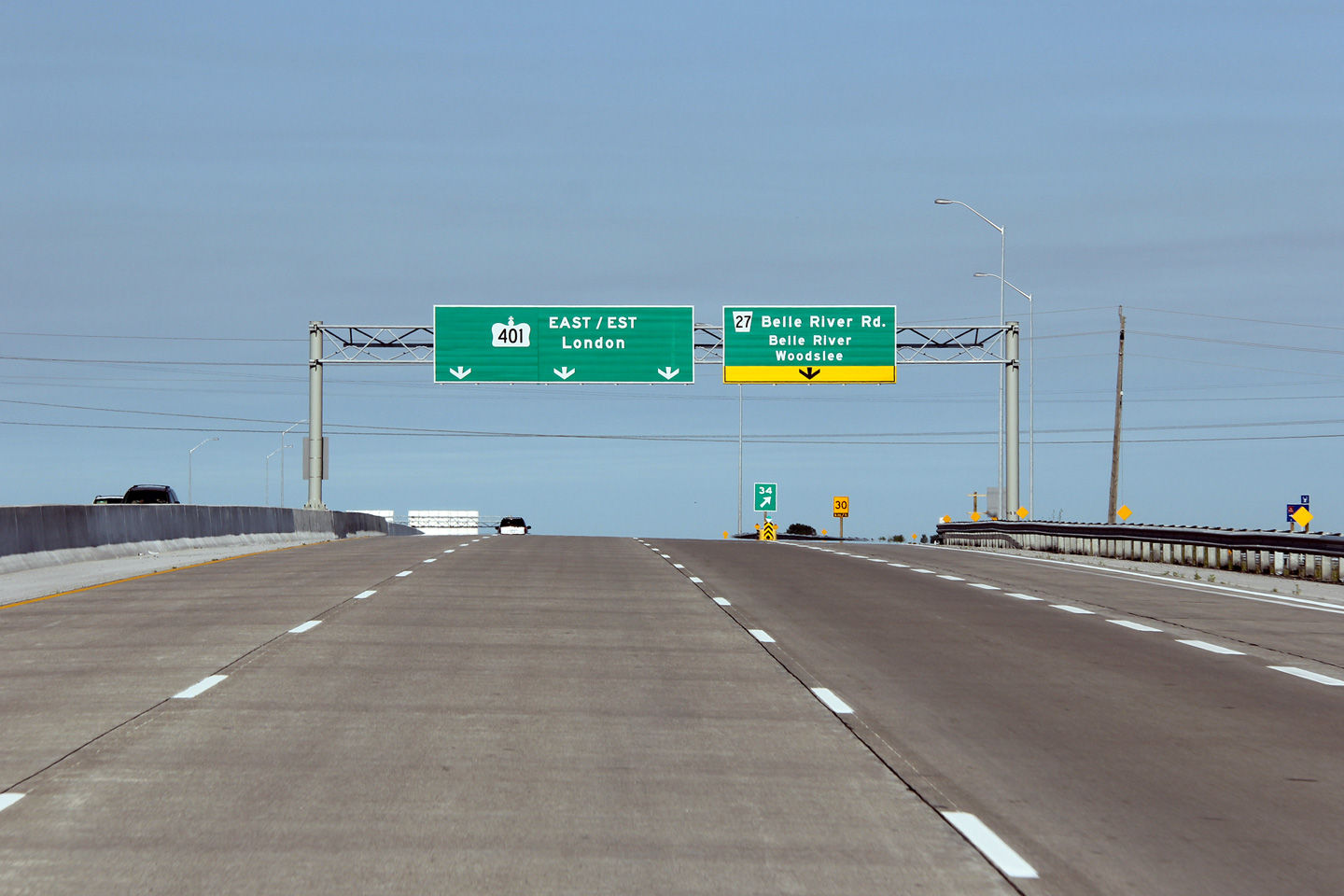
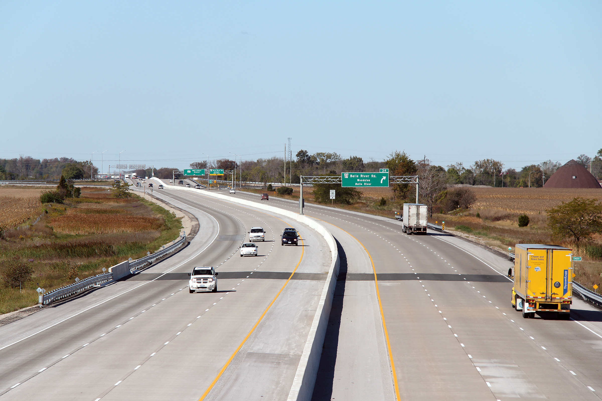
| Town of Lakeshore County of Essex |
Signage for the Belle River Road interchange. Due to the proximity of
the Belle River, Highway 401 meets Belle River Road at a parclo AB2
interchange with all
ramps to the east of Belle River Road. Photo taken: June 26th, 2011. |
 (720x480) (720x480)(1440x960) (2400x1600) |
|||||
| Town of Lakeshore County of Essex |
Three westerly views from the Myers Road overpass towards the Belle River
Road interchange. Note from the series of views how sharp the kink in the
highway was before the highway was upgraded and widened to six lanes. More construction information and photos
can be found here. Photo #1 taken: September 10th, 2005. Photo #2 taken: July 6th, 2008. Photo #3 taken: October 1st, 2010. |
 (720x480) (1440x960) (2400x1600) |
|||||
| Town of Lakeshore County of Essex |
This view looks easterly from the Myers Road overpass. . Photo taken: October 1st, 2010. |
 (720x480) (1440x960) (2400x1600) |
|||||
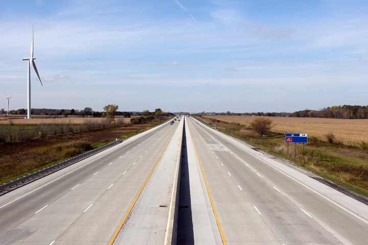
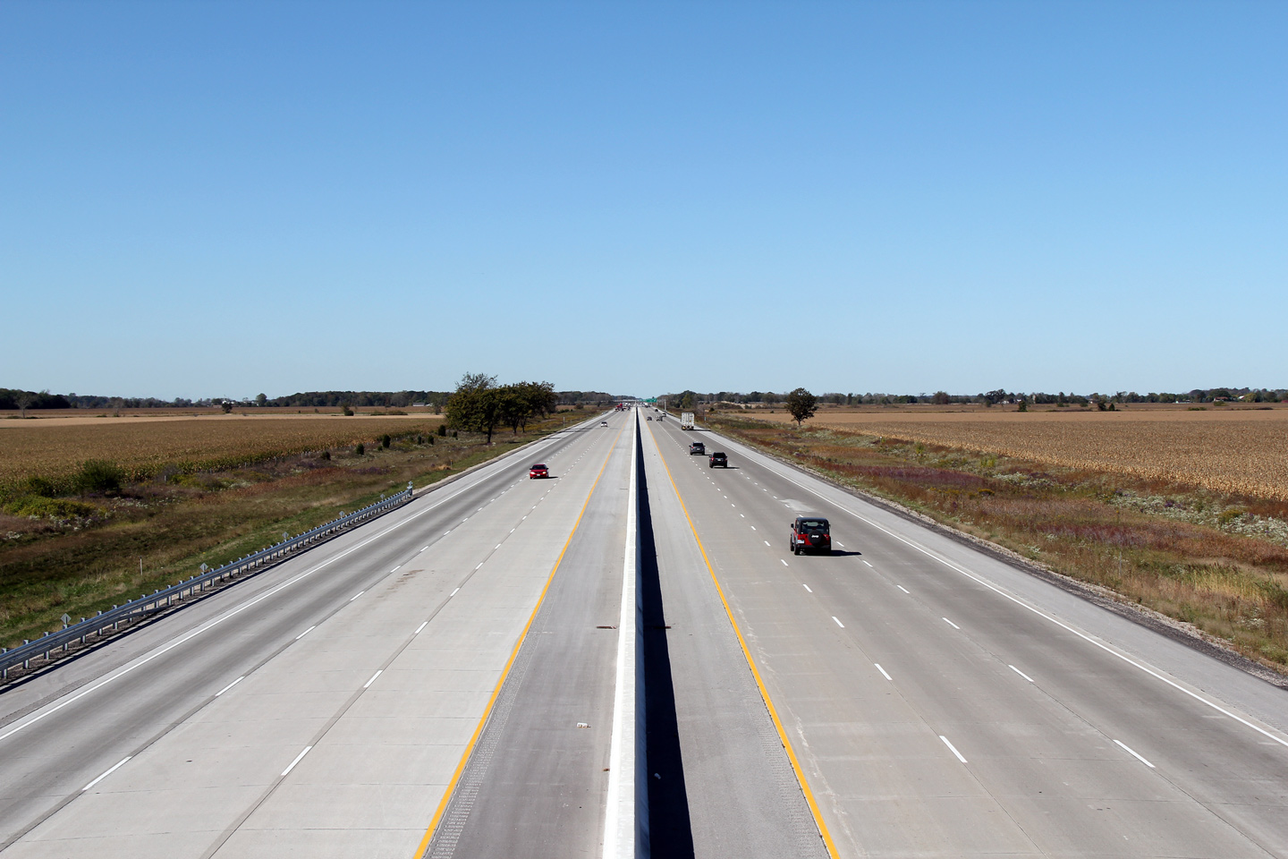
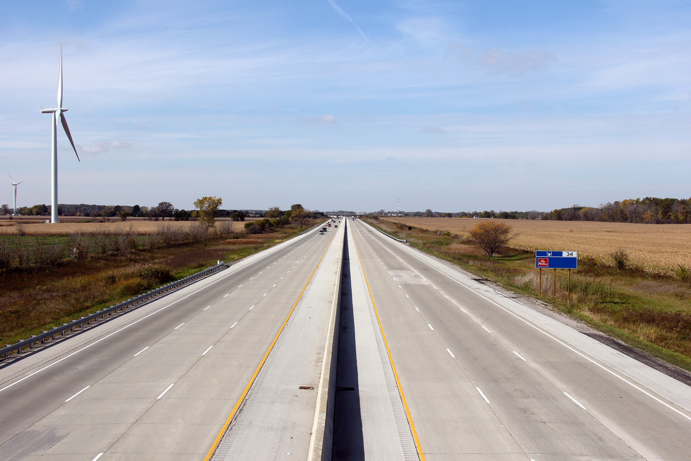
| Town of Lakeshore County of Essex |
This view looks westerly from the Lakeshore Road 123 overpass. Note
the Gosfield wind turbine to the south of the freeway. Several large
wind farms have been developed within Essex-and Chatham-Kent Counties. Photo taken: October 22nd, 2011. |
 (720x480) (1440x960) (2400x1600) |
|||||
| Town of Lakeshore County of Essex |
Easterly view from the Lakeshore Road 123 overpass towards the French Line
Road interchange. Photo taken: October 22nd, 2011. |
 (720x480) (1440x960) (2400x1600) |
|||||
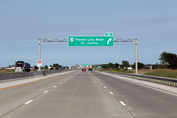
| Town of Lakeshore County of Essex |
Overhead advanced signage for the French Line Road interchange. Photo taken: June 26th, 2011. |
 (720x480) (720x480)(1440x960) (2400x1600) |
|||||
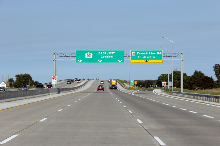
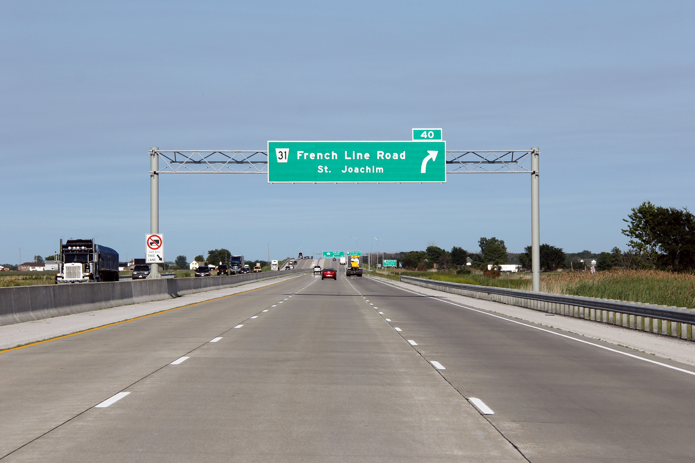
| Town of Lakeshore County of Essex |
Easterly view as the ramp to French Line Road departs the freeway mainline.
Highway 401 meets French Line Road at a diamond interchange -- the only
diamond interchange west of London along Highway 401. Photo taken: June 26th, 2011. |
 (720x480) (720x480)(1440x960) (2400x1600) |
|||||
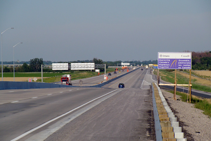
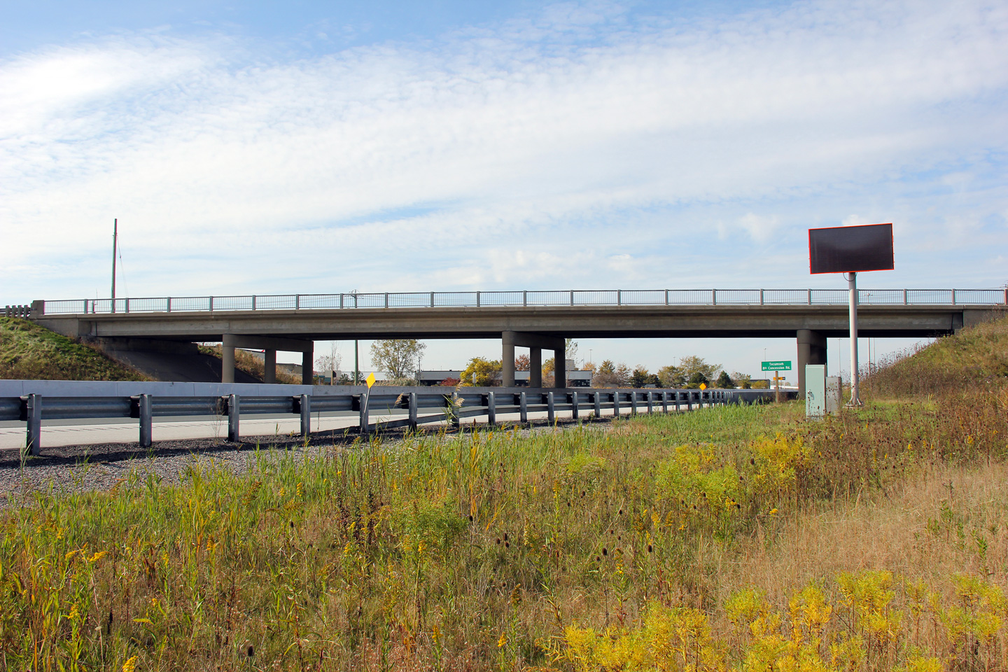
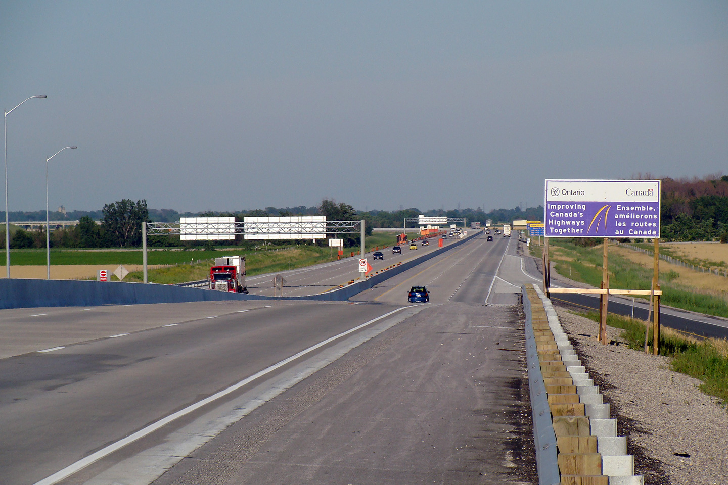
| Town of Lakeshore County of Essex |
View looking easterly along Highway 401 from the French
Line Road underpass. Note the cost-sharing signage left over from the
recently completed construction. Photo taken: July 6th, 2008 |
 |
|||||
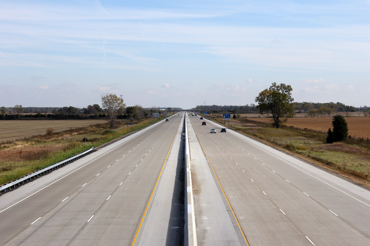
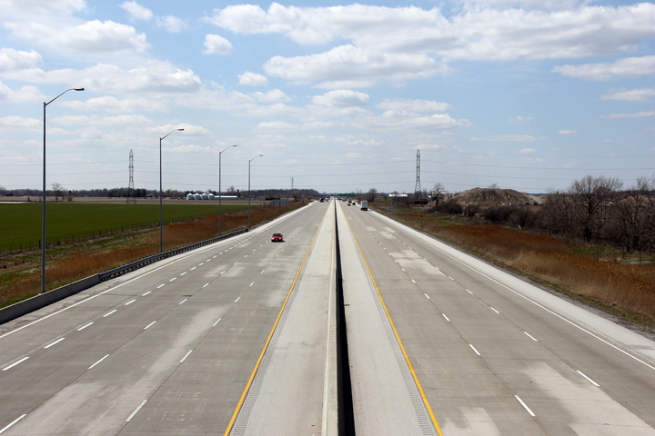
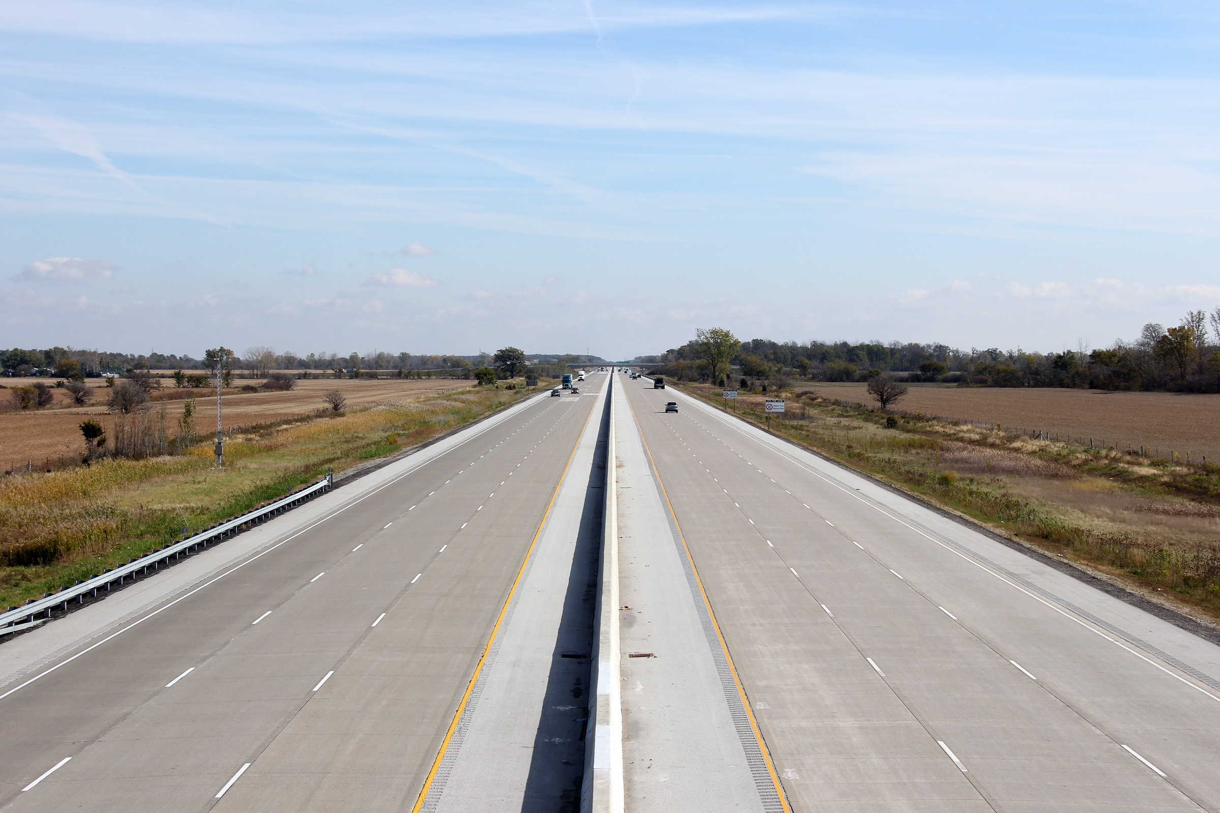
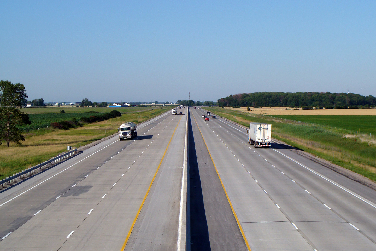
| Town of Lakeshore County of Essex |
Highway 401 looking west from the Rochester Townline Road overpass. This overpass is located roughly at kilometre marker 44. Once around this gentle curve, Highway 401 heads due west, and is virtually dead-straight for the next 30 kilometres. Photo taken: July 6th, 2008. |
 |
|||||
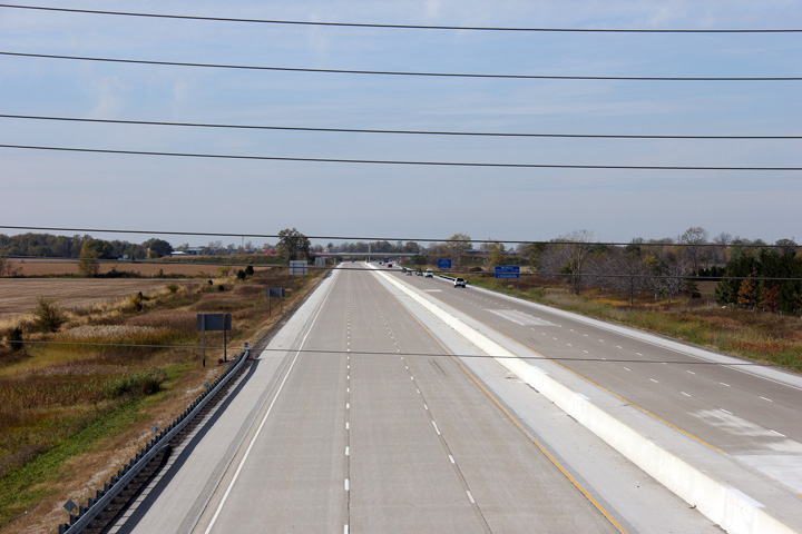
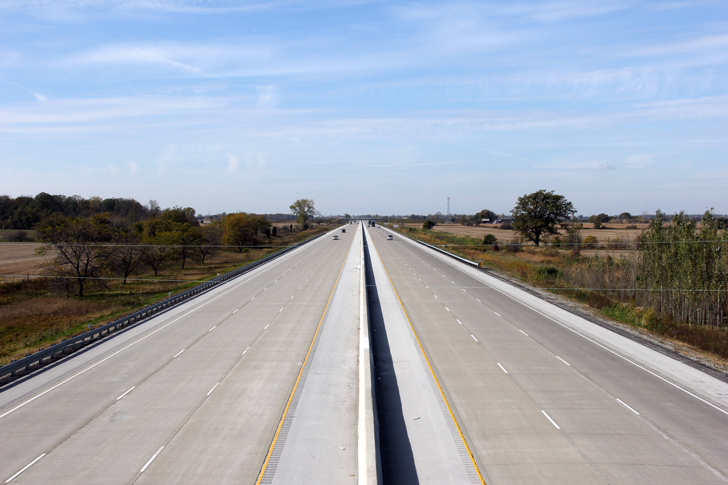
| Town of Lakeshore County of Essex |
Highway 401 looking east from the Rochester Townline Road overpass.
Photo taken: July 6th, 2008. |
 |
|||||
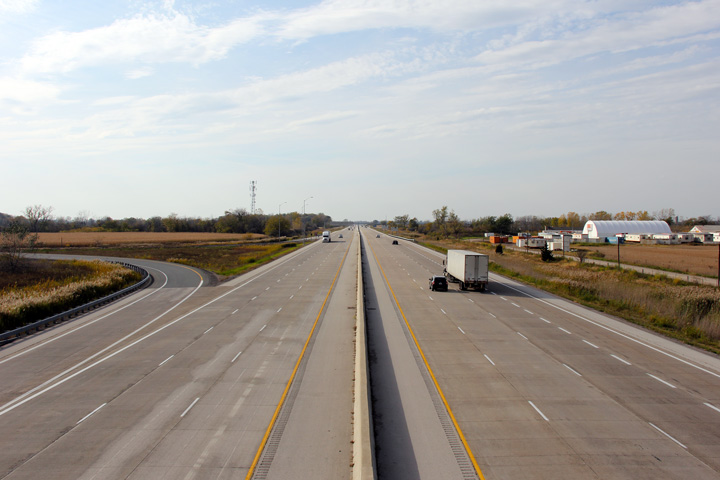
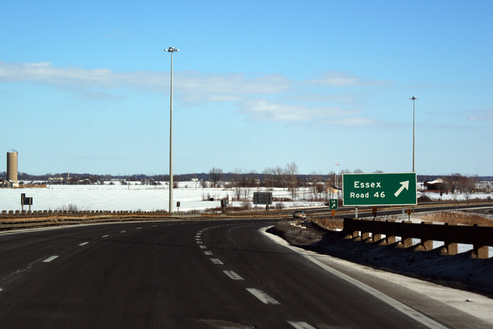
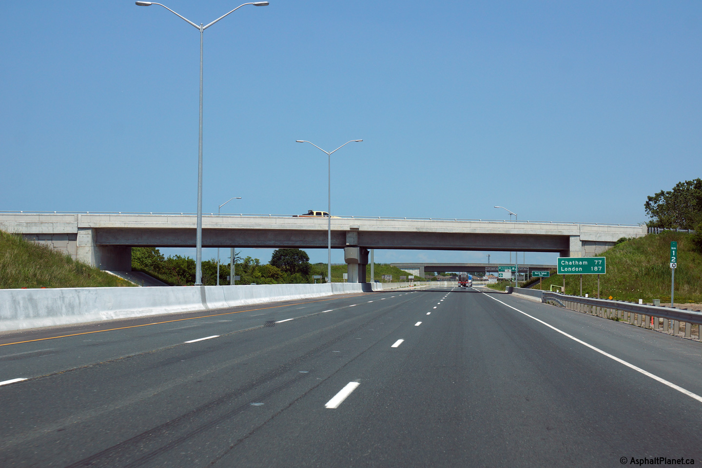
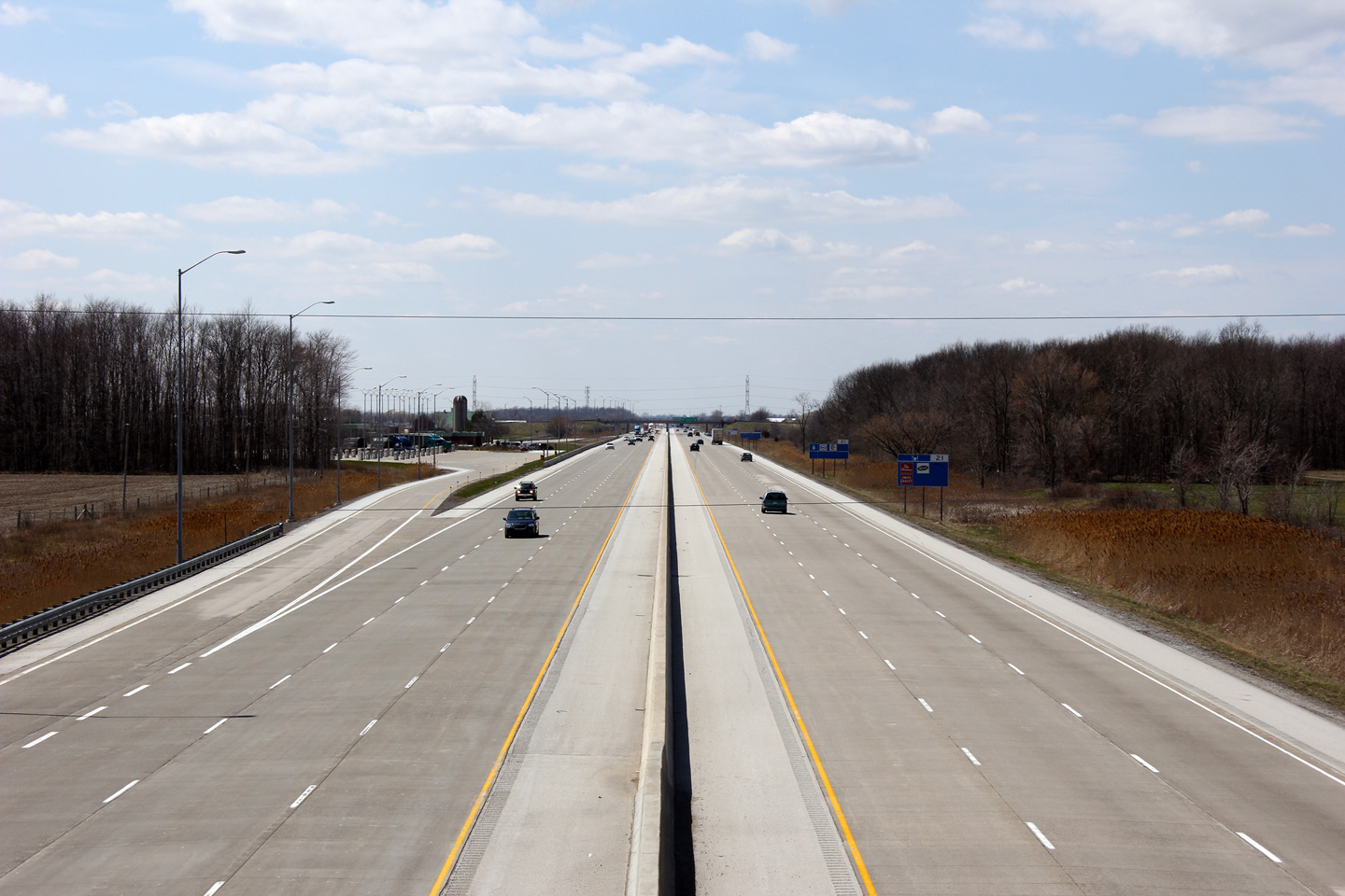
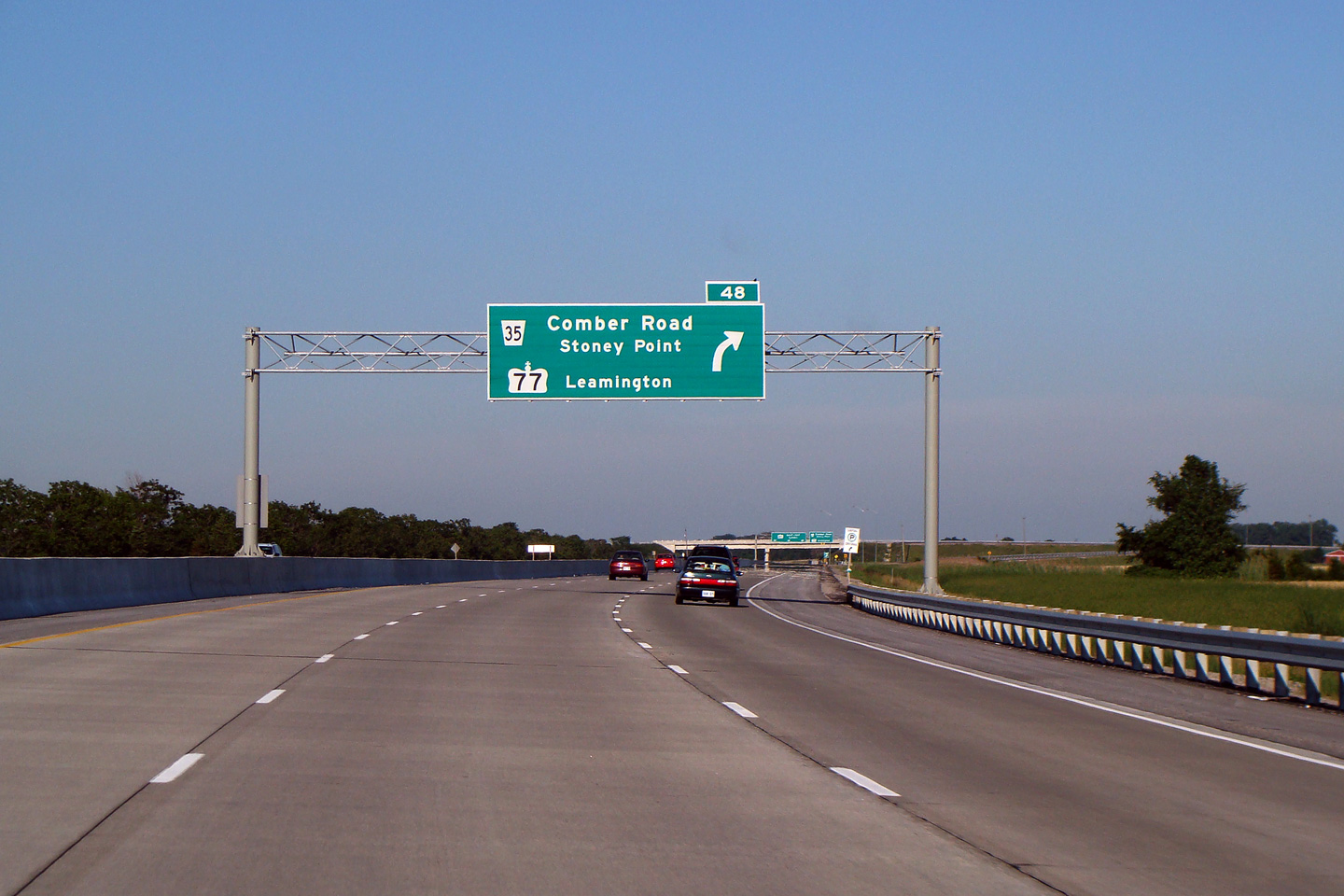
| Town of Lakeshore County of Essex |
Overhead guide signage for Highway 77 from the eastbound
lanes of Highway 401. Photograph taken: July 6th, 2008 |
 |
|||||
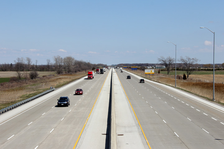
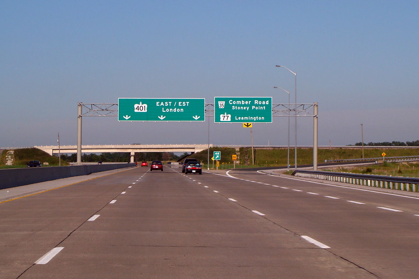
| Town of Lakeshore County of Essex |
During the 2005 reconstruction, the Highway 77/401
interchange was extensively reconstructed. This new modern interchange
replaced a very poor parclo b2 design. Photograph taken: July 6th, 2008 |
 (720x480) (720x480)(1440x960) |
|||||
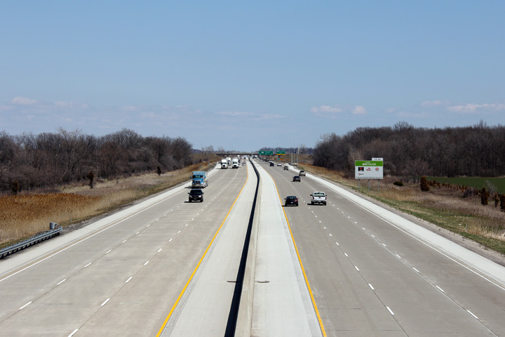
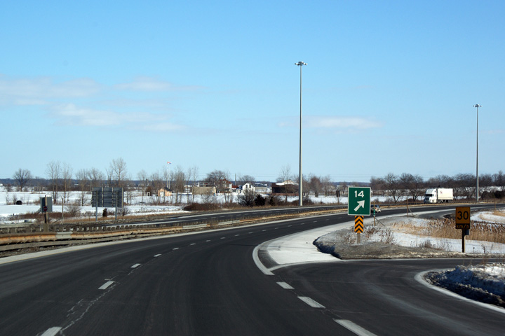
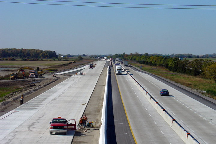
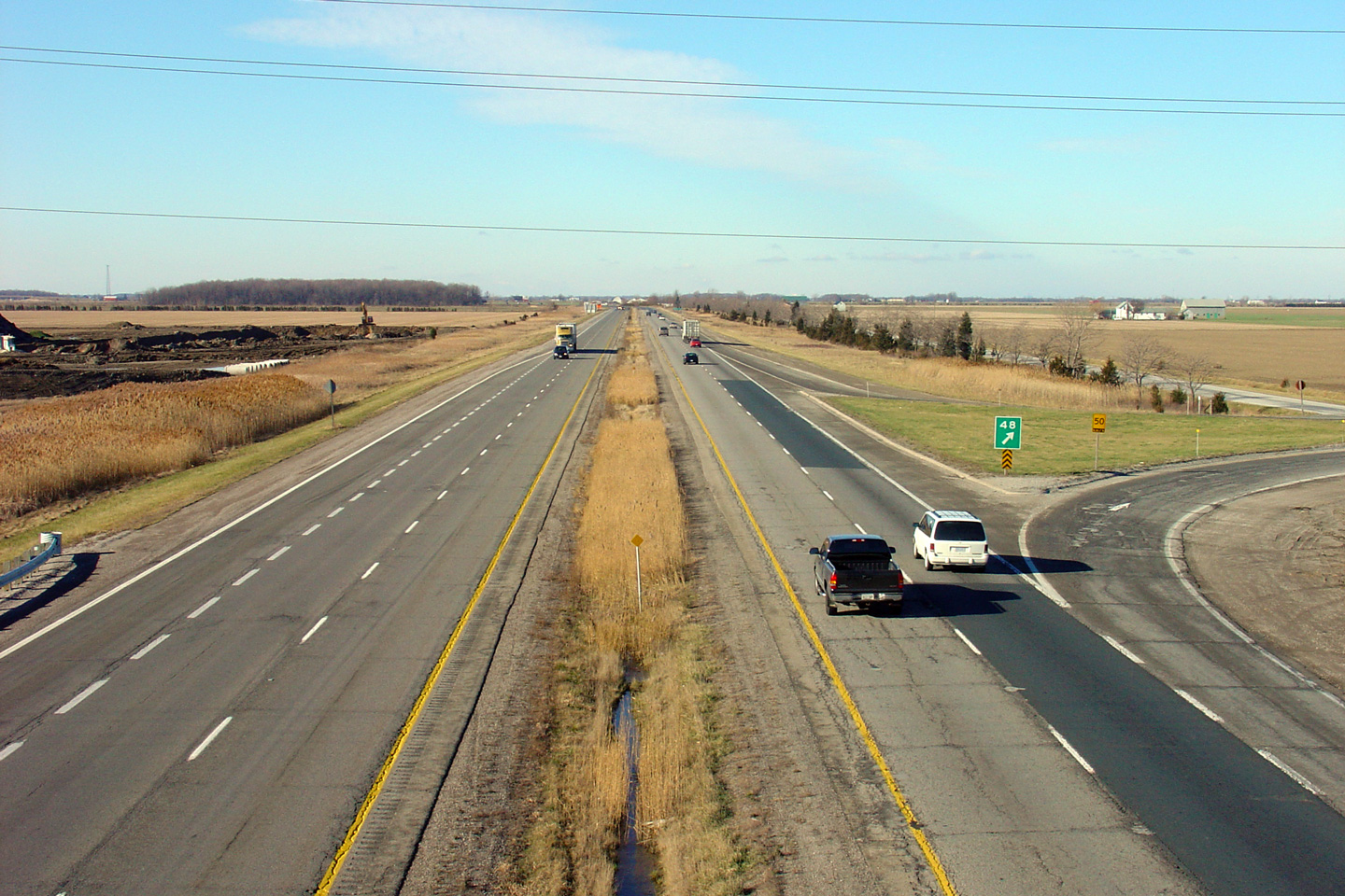
| Town of Lakeshore County of Essex |
A series of views looking westerly along Highway 401 from the Highway 77 overpass. This series of views shows the sequence of events that saw Highway 401 upgraded to a six-lane cross-section between Windsor and Tilbury. The first contract that saw Highway 401 six laned between Windsor and Tilbury took place from this interchange easterly to just east of Highway 2 in Tibury. Construction on this segment commenced in the spring of 2004 and was substantially completed late in 2005. More construction information and photos can be found here.
Photo #1 taken: December 5th, 2004.
Photo #2 taken: September 10th, 2005.
Photo #3 taken: October 17th, 2005.
Photo #4 taken: October 22nd, 2011. |
 |
|||||
| Highway 77 runs south of Highway 401 to Highway 3 at Leamington. Click here for Highway 77 images. | |||||||
| Click here for Highway 77 to Chatham Photos | |||||||
Highway 401 Images Index Page 2 Images ->
<- Highway 400 Images Back to Highway 401 Highway 402 Images ->
Copyright (c) 2004-2015, AsphaltPlanet.ca AsphaltPlanet@asphaltplanet.ca


