AsphaltPlanet.ca > OntHighways >
Highway 403 > Images
> Page 5
King's Highway 403 - Images
<- Page 4 Page 5 - Burlington to Mississauga Other->
Photos shown in this table are arranged from West to East:
| Proper Municipality Name | Photo Description | Photo | |
|
Photos taken from driver's perspective appear offset from centre-line Photos: |
East- bound |
West- bound |
|
| Continued from Burlington to Oakville Images | |||
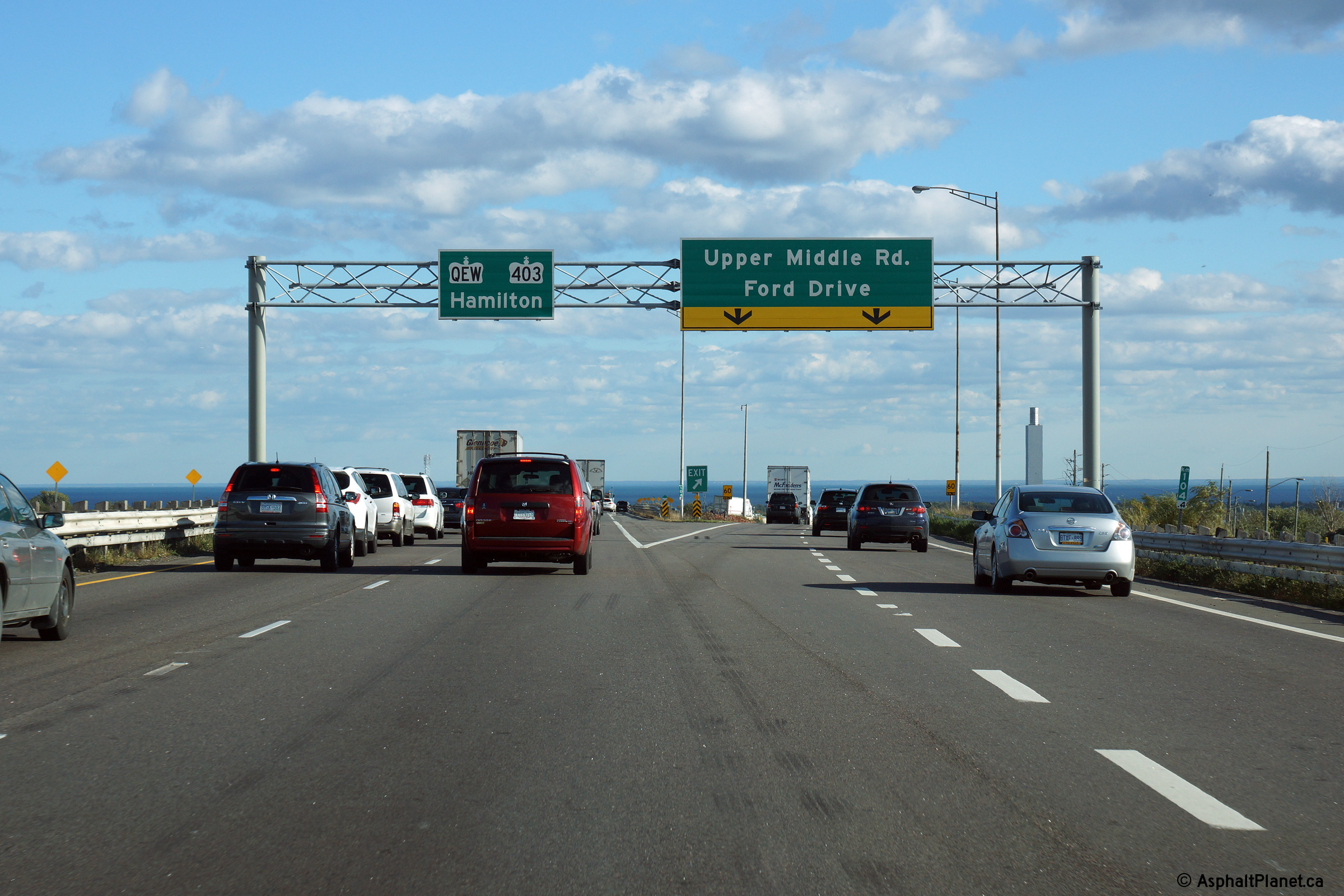
| Town of Oakville Regional Municipality of Halton |
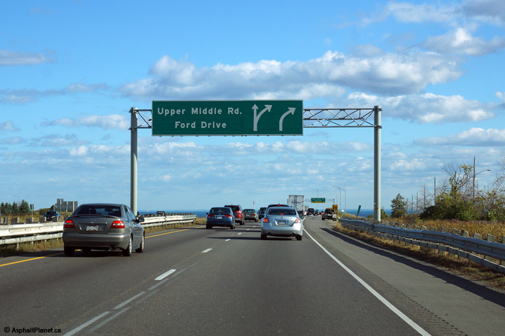
Exit signage at the ramp to Upper Middle Road. Beyond this exit, the
westbound lanes of the 403 merge with the Hamilton-bound lanes of the Queen
Elizabeth Way. The QEW and 403 run concurrently between this
interchange in Oakville and the Freeman interchange in Burlington. Photo taken: October 9th, 2014. |
 (720x480) (720x480)(1440x960) (2400x1600) |
|
| Town of Oakville Regional Municipality of Halton |
Westbound view approaching the Upper Middle Road interchange. The exit
number for the Upper Middle Road interchange (104) has been omitted from
this signage. Photo taken: October 9th, 2014. |
 (720x480) (720x480)(1440x960) (2400x1600) |
|
| Town of Oakville Regional Municipality of Halton |
Advanced overhead signage for Dundas Street (Formerly Highway 5).
Click here for signage affixed to the former rounded
"type 1" style gantry
that was taken in June, 2007. Photo taken: October 9th, 2014. |
||
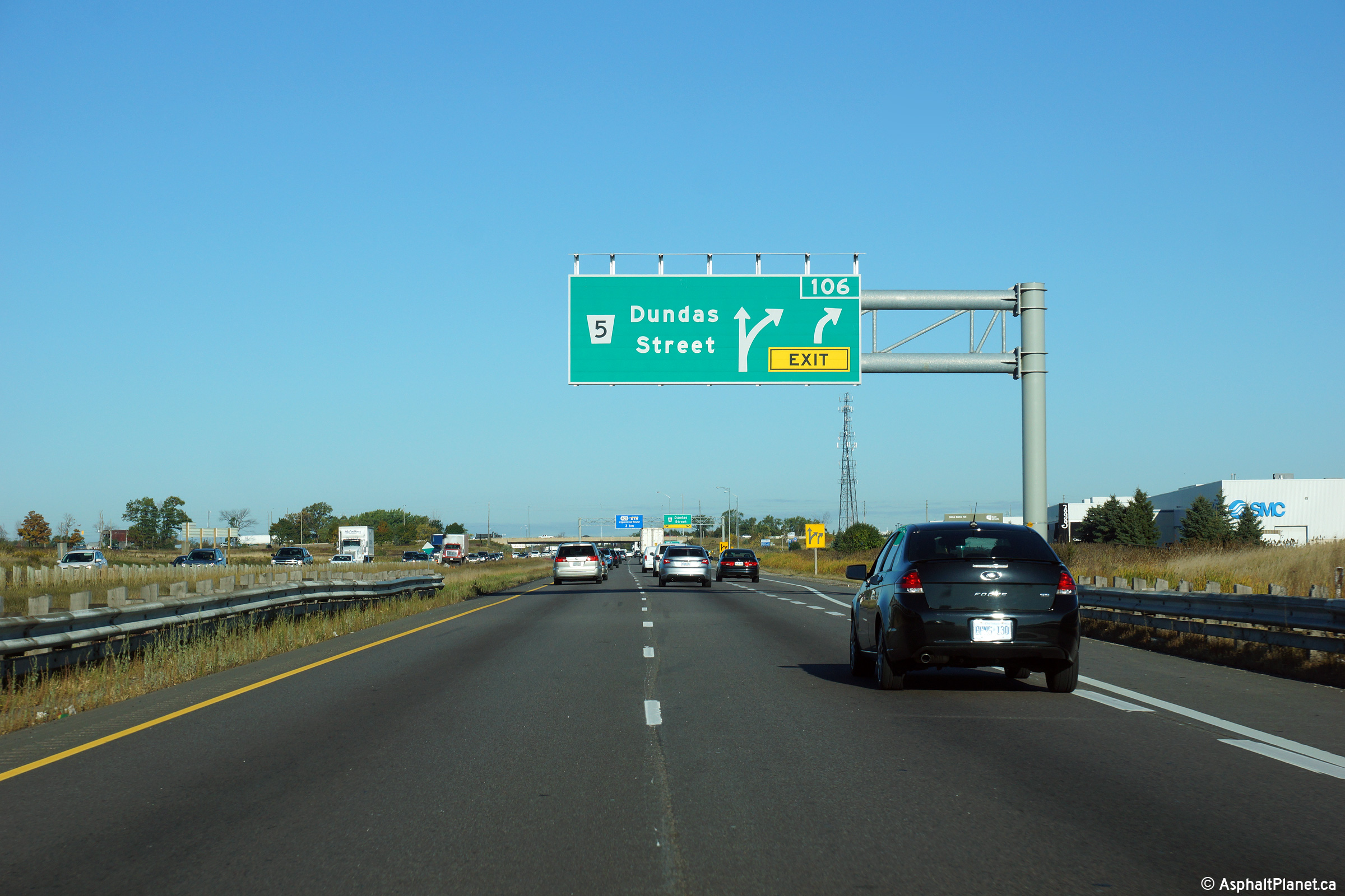
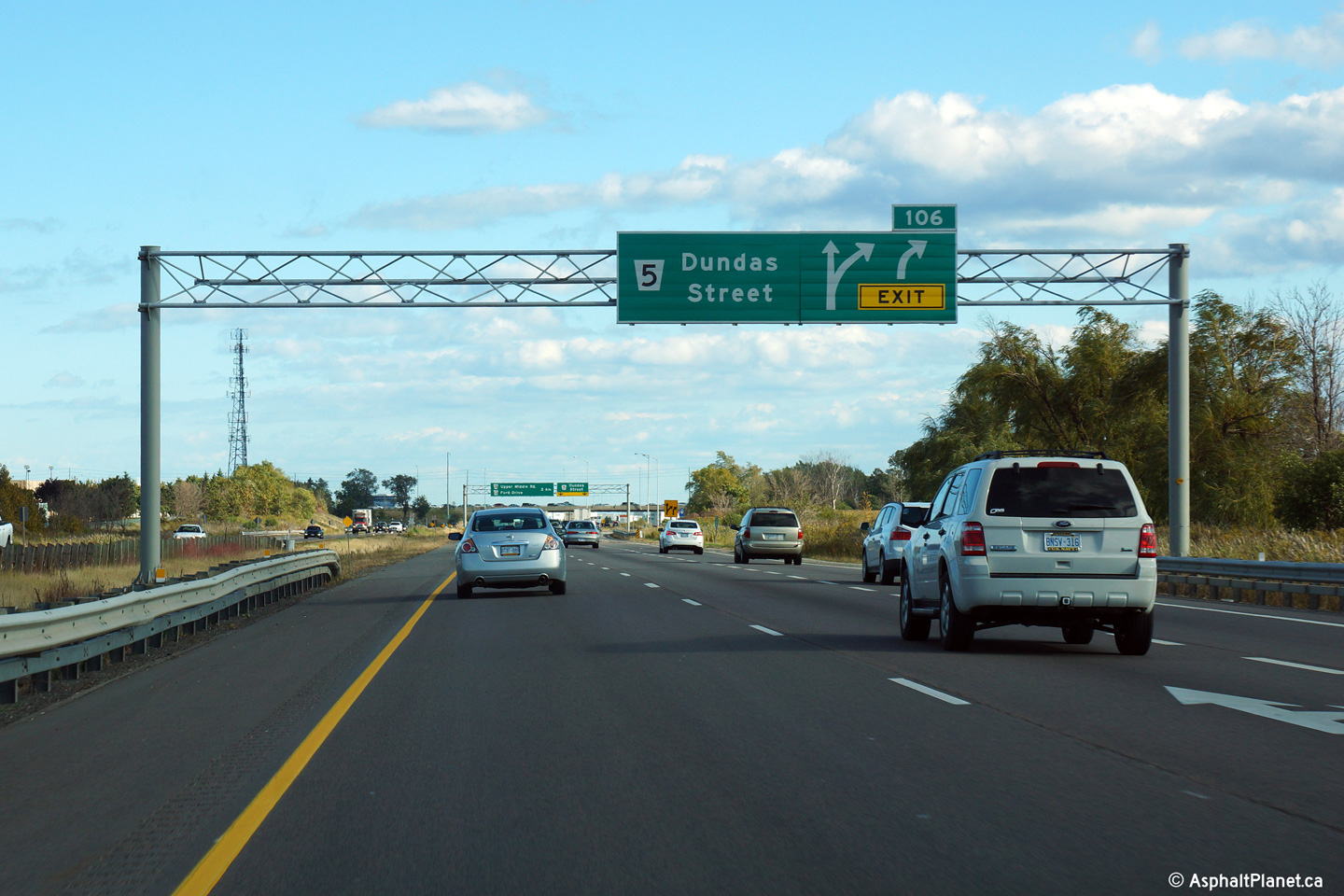
| Town of Oakville Regional Municipality of Halton |
Overhead exit signage for the Dundas Street interchange. Click
here for signage affixed to the former rounded
"type 1" style gantry
that was taken in June, 2007. Photo taken: October 9th, 2014. |
||
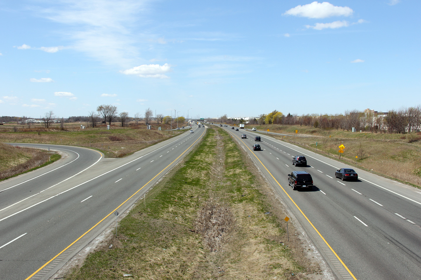
| Town of Oakville Regional Municipality of Halton |
Westerly view from the Dundas Street overpass. Photo taken: April 9th, 2012. |
 |
|
| Highway 5 leads from Paris to Scarborough north of Highway 2. Click here for Highway 5 images. | |||
| City of Mississauga Regional Municipality of Peel |
Easterly view from the Dundas Street overpass. Photo taken: April 9th, 2012. |
 |
|
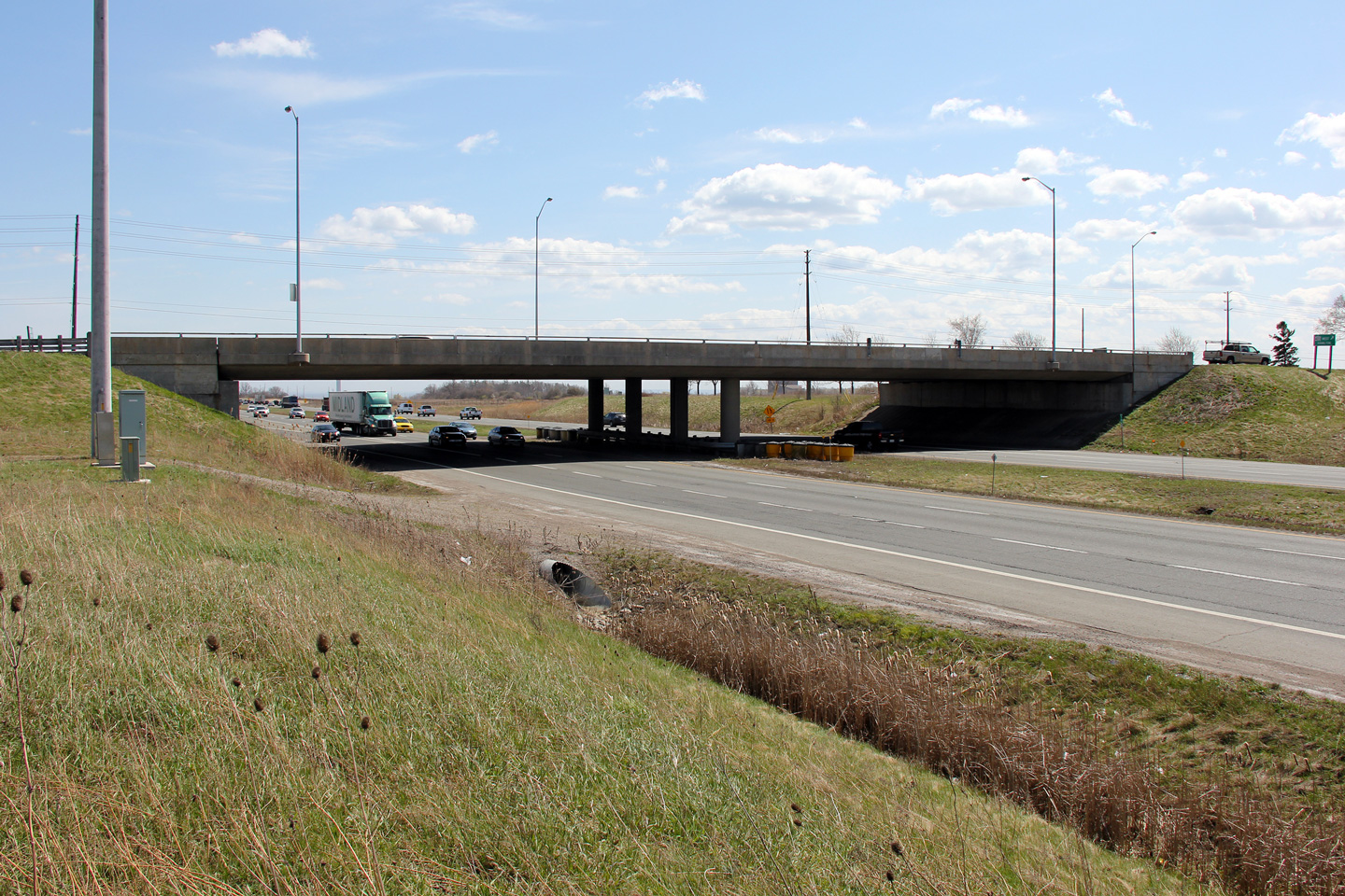
| City of Mississauga Regional Municipality of Peel |
View of the eastern side of the Dundas Street overpass. This structure
was completed in 1980 while the freeway underneath was opened a year later
in 1981. Photo taken: April 9th, 2012. |
 |
|
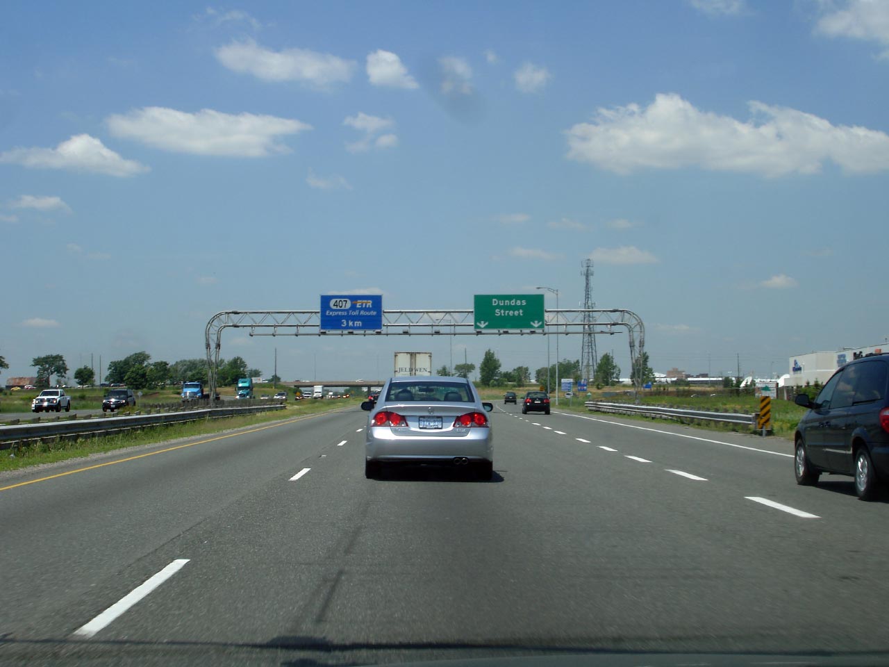
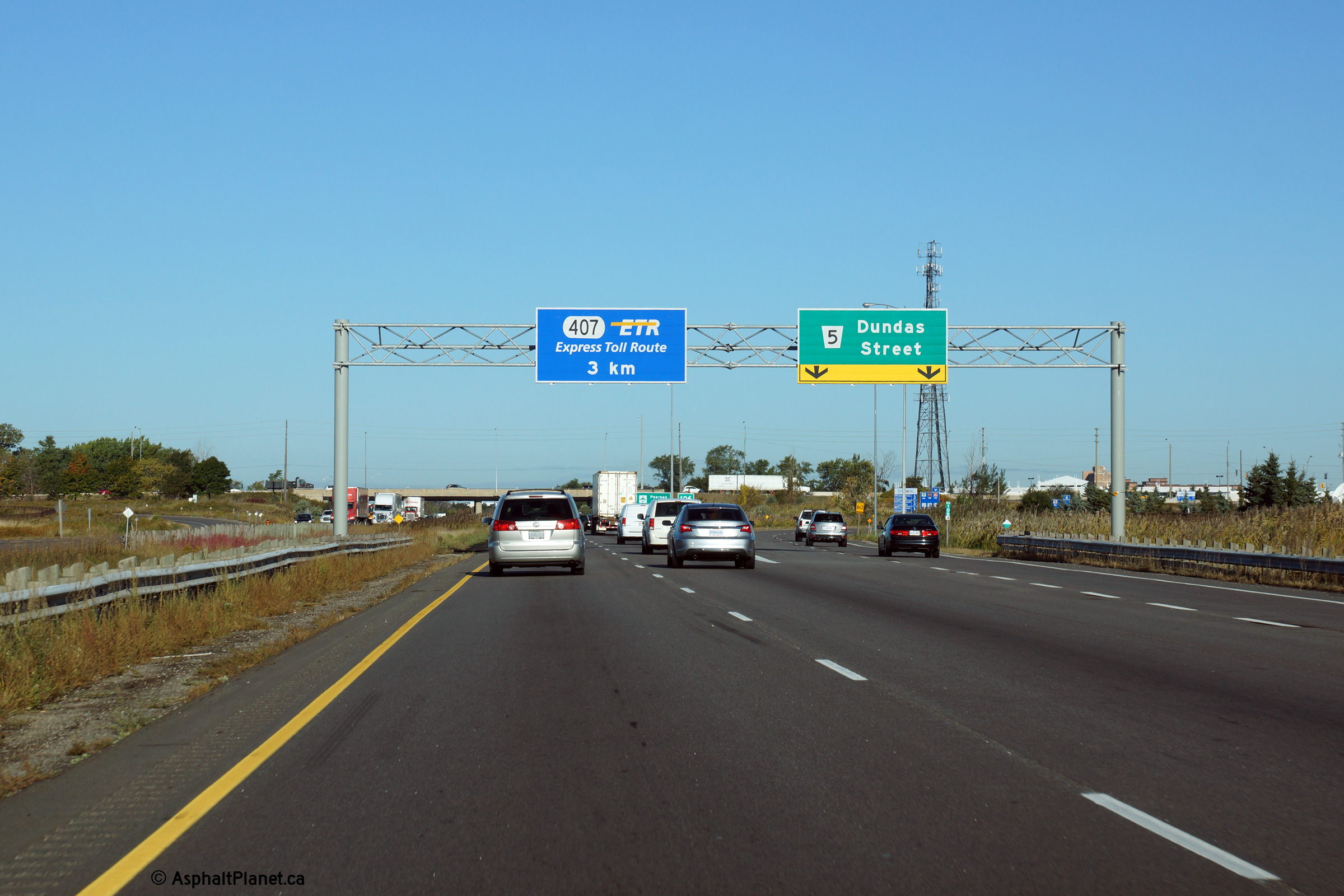
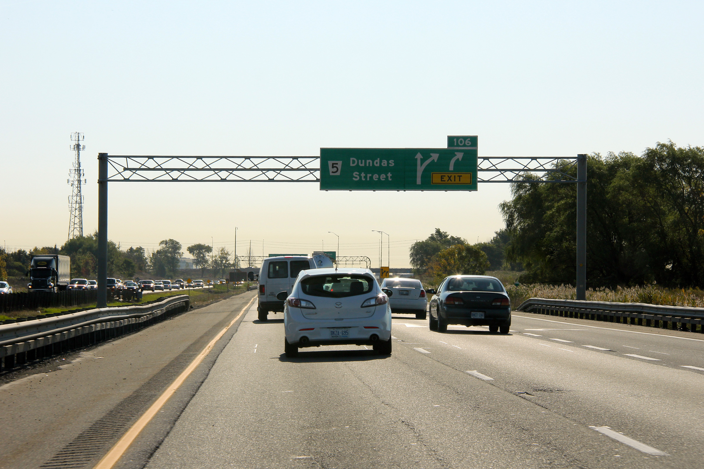
| City of Mississauga Regional Municipality of Peel |
Overhead signage at the westbound exit to Dundas Street. Click
here for signage affixed to the former rounded
"type 1" style gantry that was taken in October, 2011. Photo taken: October 9th, 2014. |
 (720x480) (720x480)(1440x960) (2400x1600) |
|
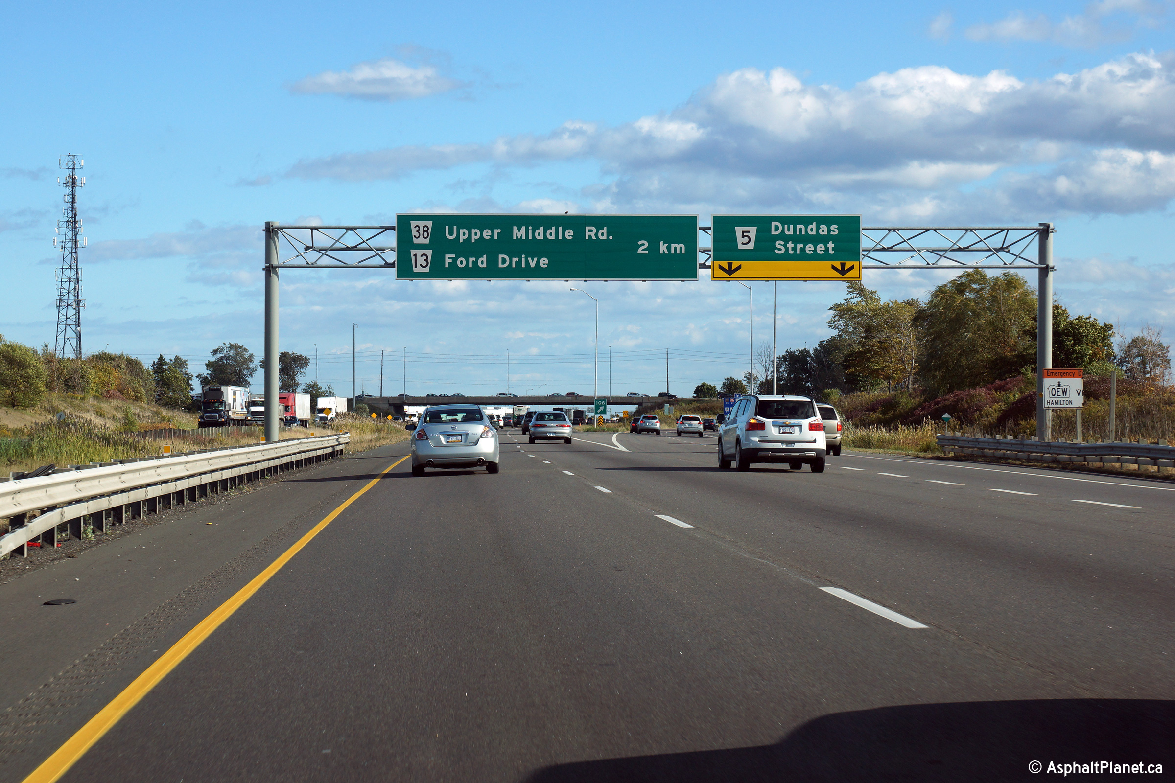
| City of Mississauga Regional Municipality of Peel |
Westbound advanced signage for the exit to Dundas Street. Click
here for an alternate photo of
this sign, taken in October, 2011. Photo taken: October 9th, 2014. |
 (720x480) (720x480)(1440x960) (2400x1600) |
|
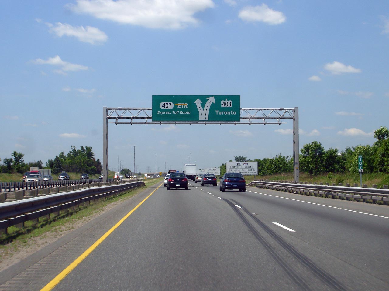
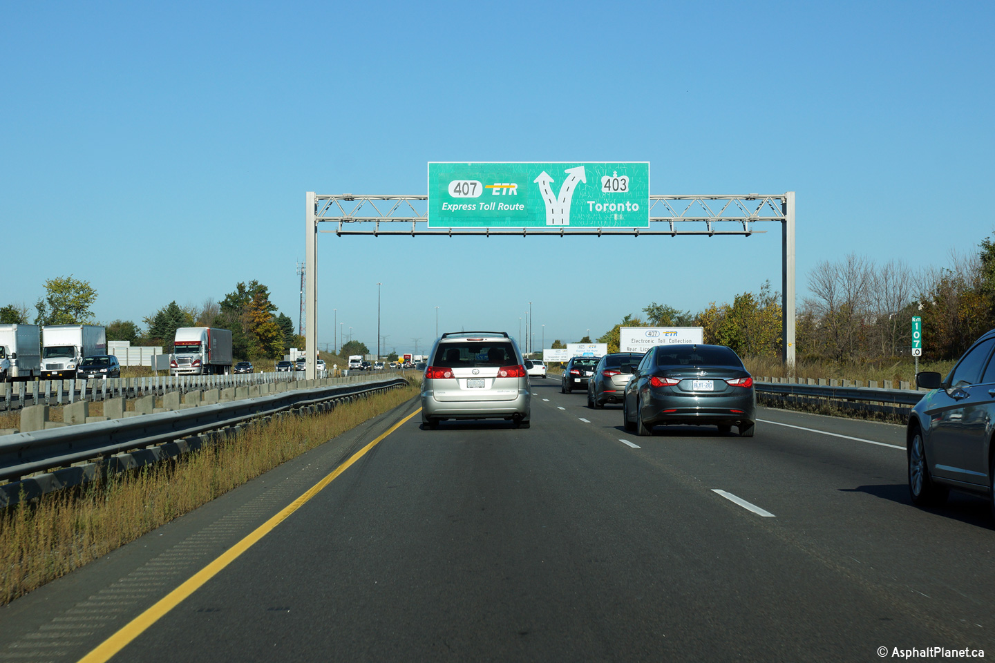
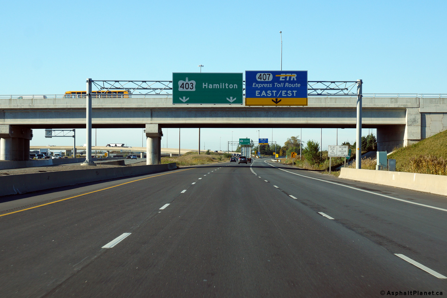
| City of Mississauga Regional Municipality of Peel |
Diagram sigh for the upcoming
Highway 407 interchange. Both
the eastbound and westbound ramps to Highway 407 exit from the left-side of
Highway 403 at this interchange. Click
here for an alternate photo of this
sign, taken in June, 2007. Photo taken: October 9th, 2014. |
||
| City of Mississauga Regional Municipality of Peel |
Advanced signage for the
Highway 407 interchange. In the
background of this photo the Burnhamthorpe Road overpass is visible.
Click here for signage affixed to the former rounded
"type 1" style gantry
that was taken in June, 2007. Photo taken: October 9th, 2014. |
||
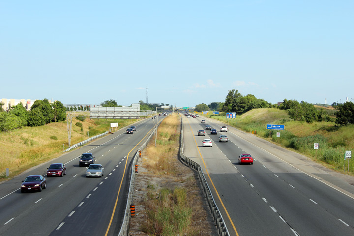
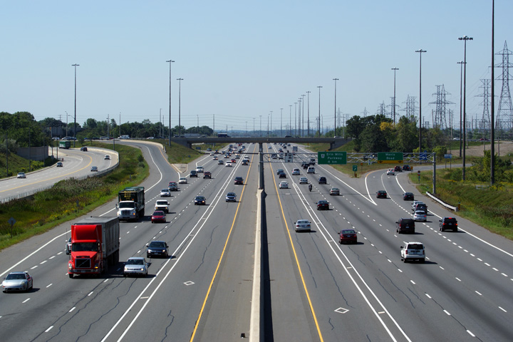
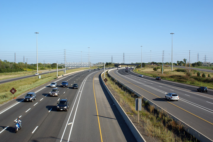
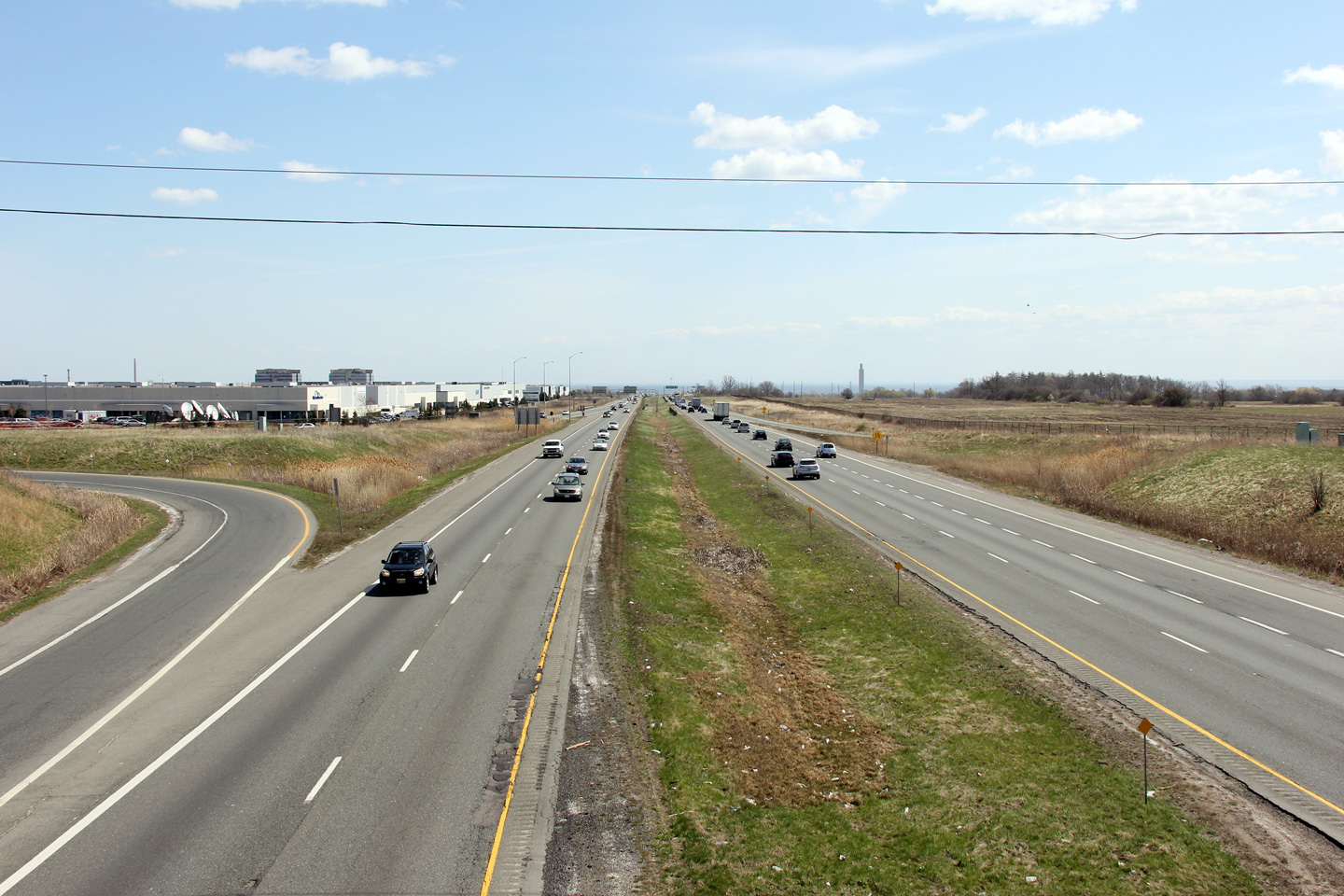
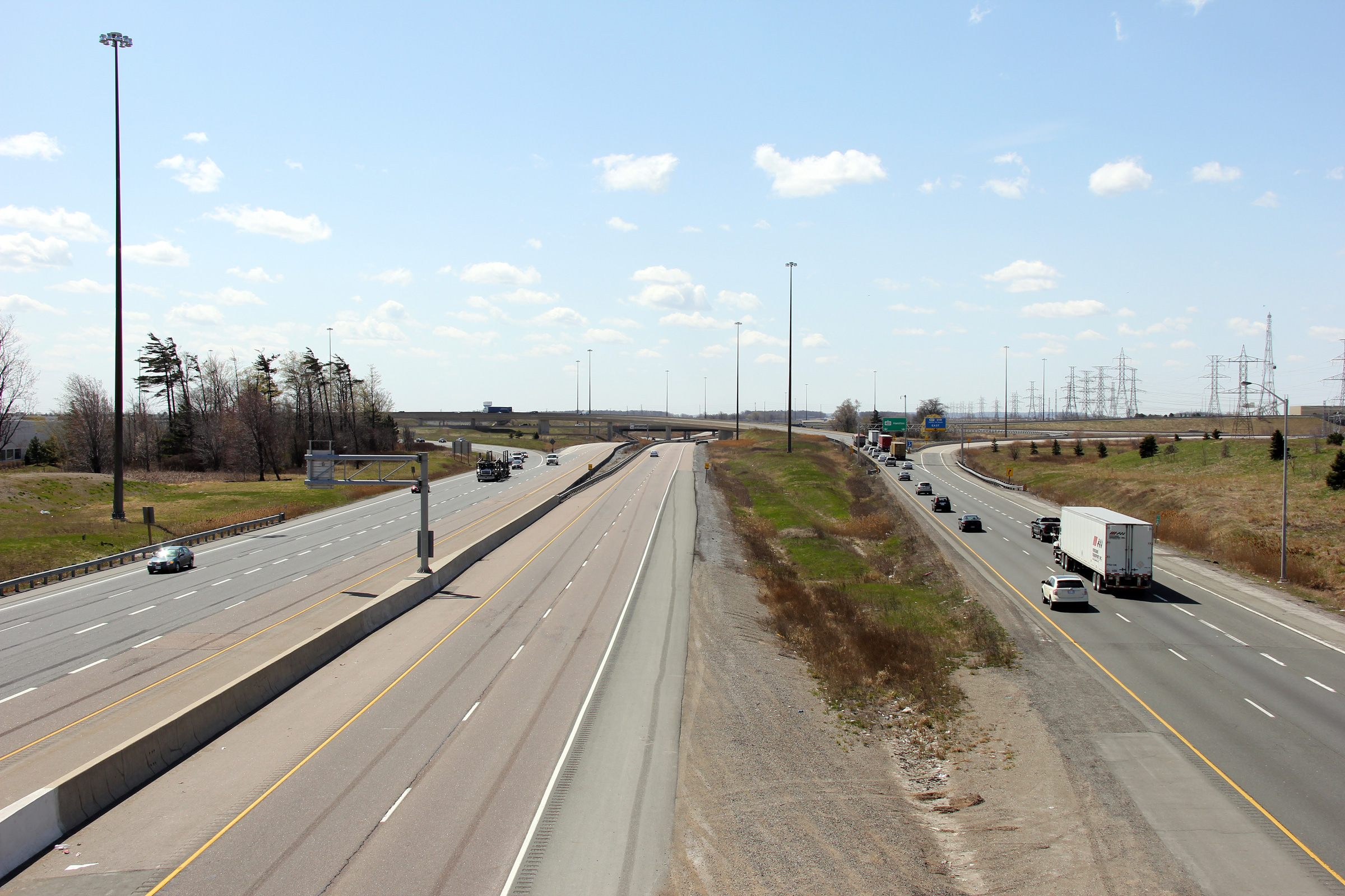
| City of Mississauga Regional Municipality of Peel |
Looking westerly from the Burnhamthorpe Road overpass. From Highway 407 southerly to the
QEW, Highway 403 has a 4 through-lane
cross-section. Photo taken: July 30th, 2011. |
 |
|
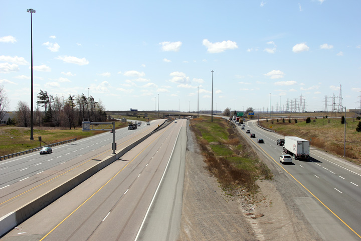
| City of Mississauga Regional Municipality of Peel |
Looking easterly from the Burnhamthorpe Road overpass
towards the Highway 407 interchange. The first stage
of the Highway 403/407 interchange was constructed in the early 1990s and at
the time provided a link between Highway 403 and Trafalgar Road. Photo taken: July 30th, 2011. |
 |
|
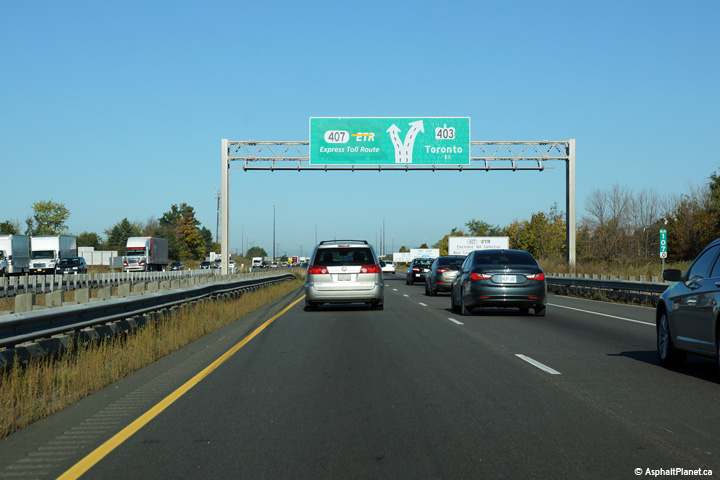
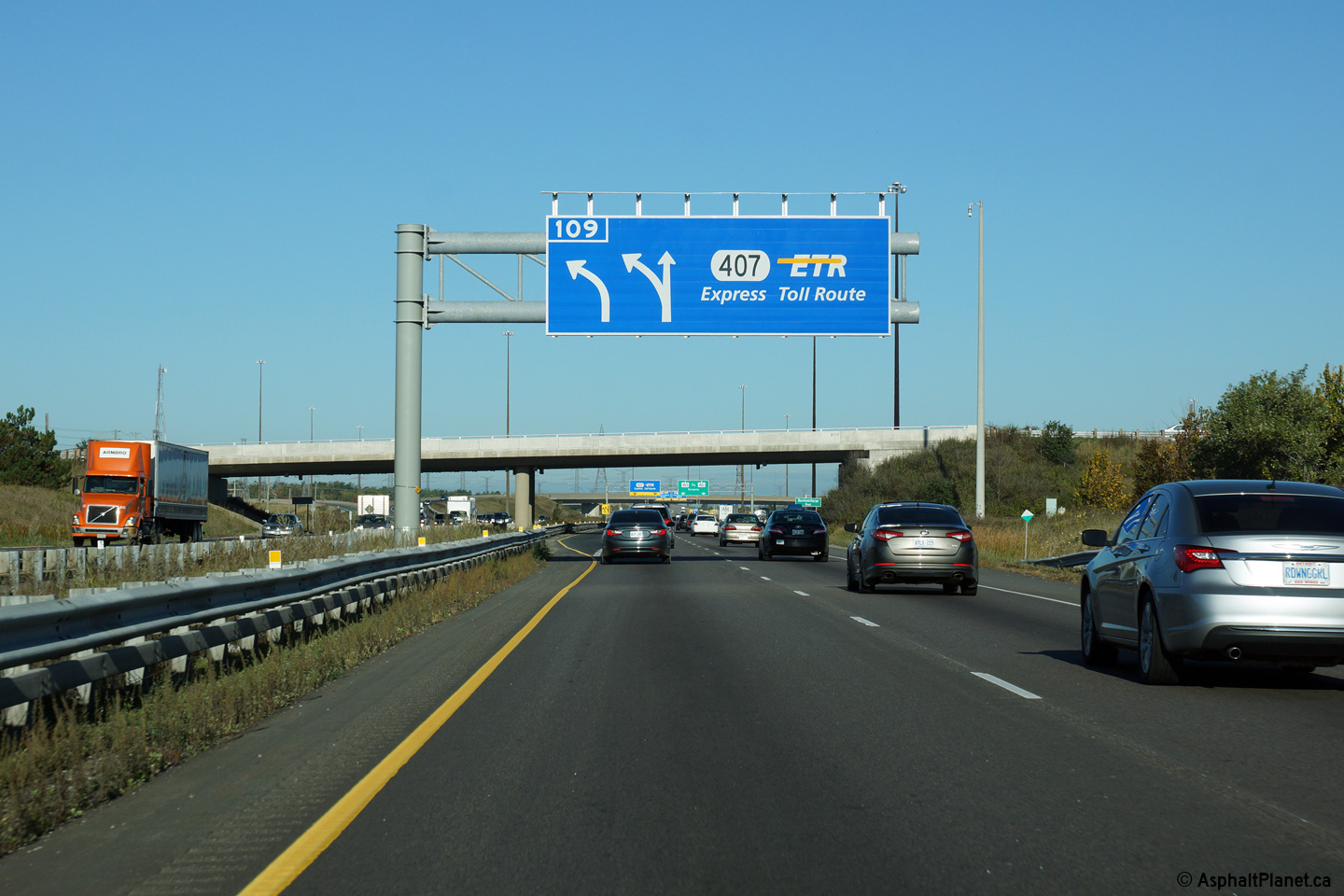
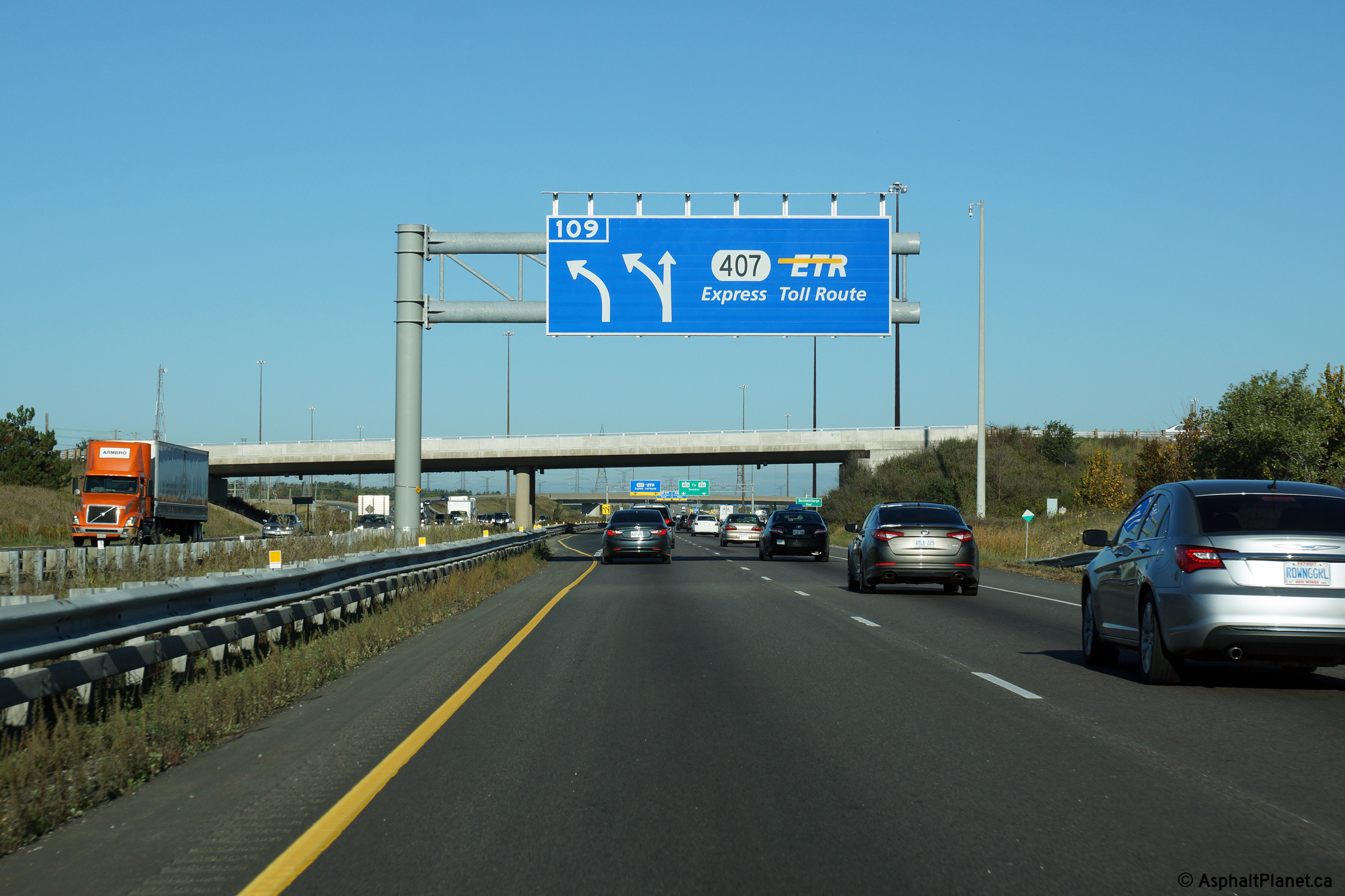
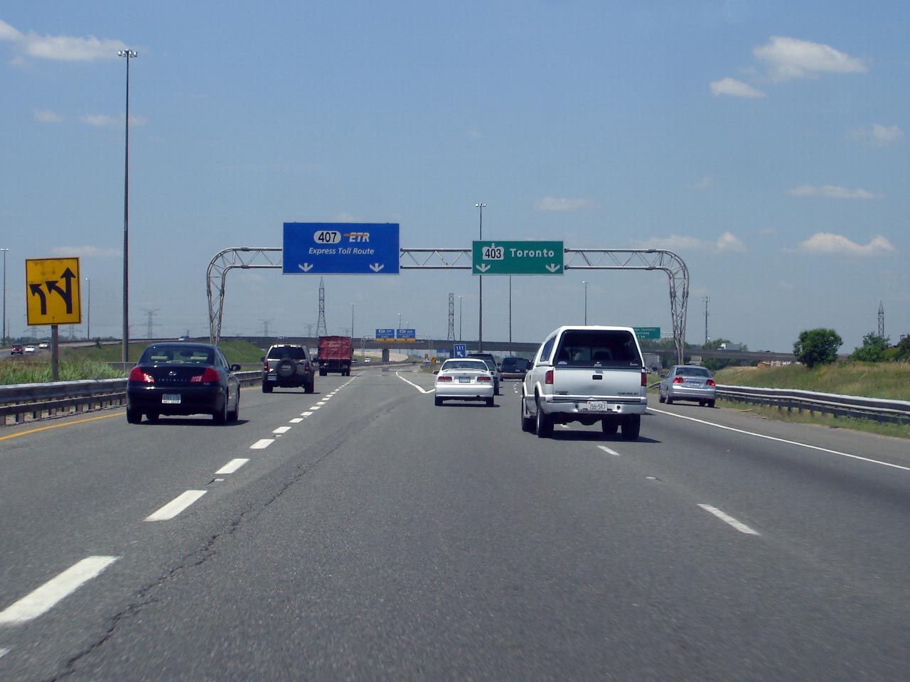
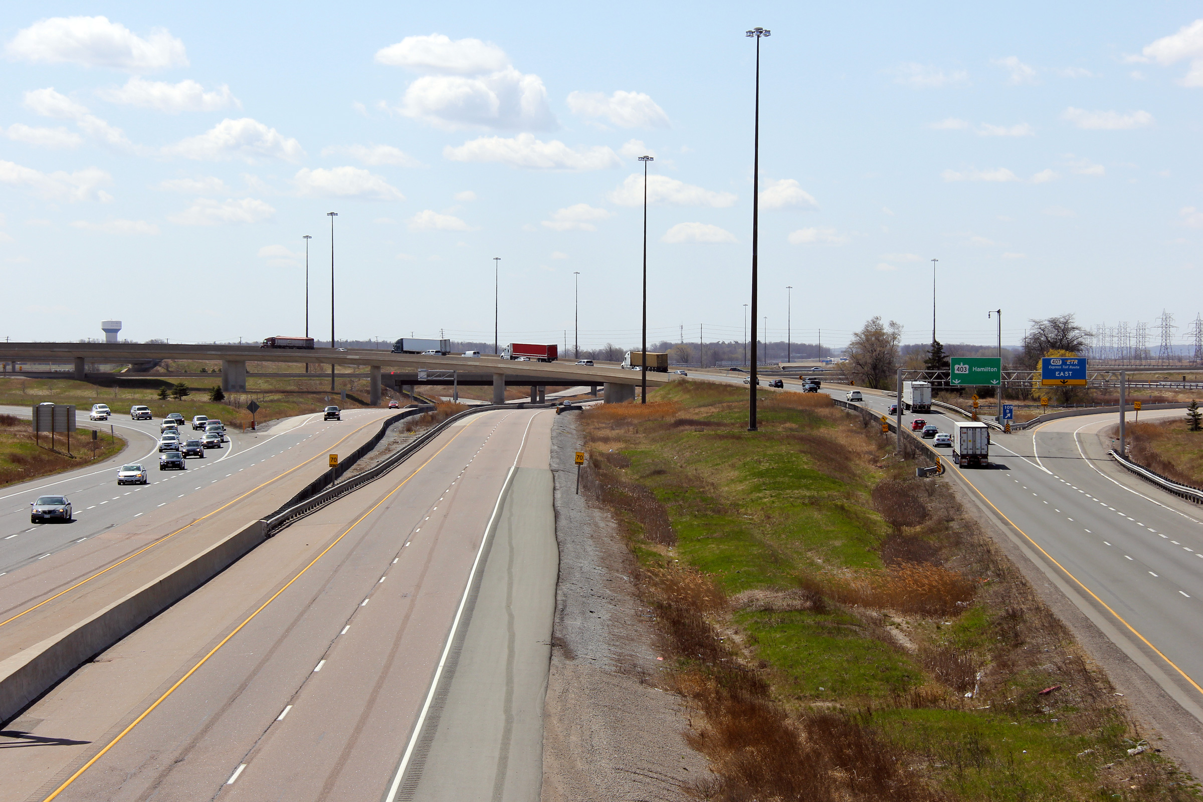
| City of Mississauga Regional Municipality of Peel |
Signage for the eastbound Highway 403/407
split. The 403 abruptly curves 90 degrees to the right at this
interchange, turning northeast through the city of Mississauga. Click
here for signage affixed to the former rounded
"type 1" style gantry
that was taken in June, 2007. Photo taken: October 9th, 2014. |
||
| Highway 407 meets Highway 403 in Western Mississauga on its journey across the western part of the GTA. Click here for Highway 407 images. | |||
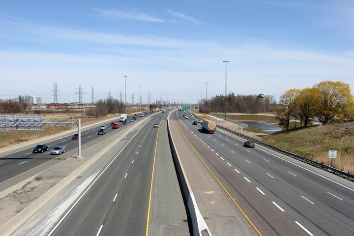
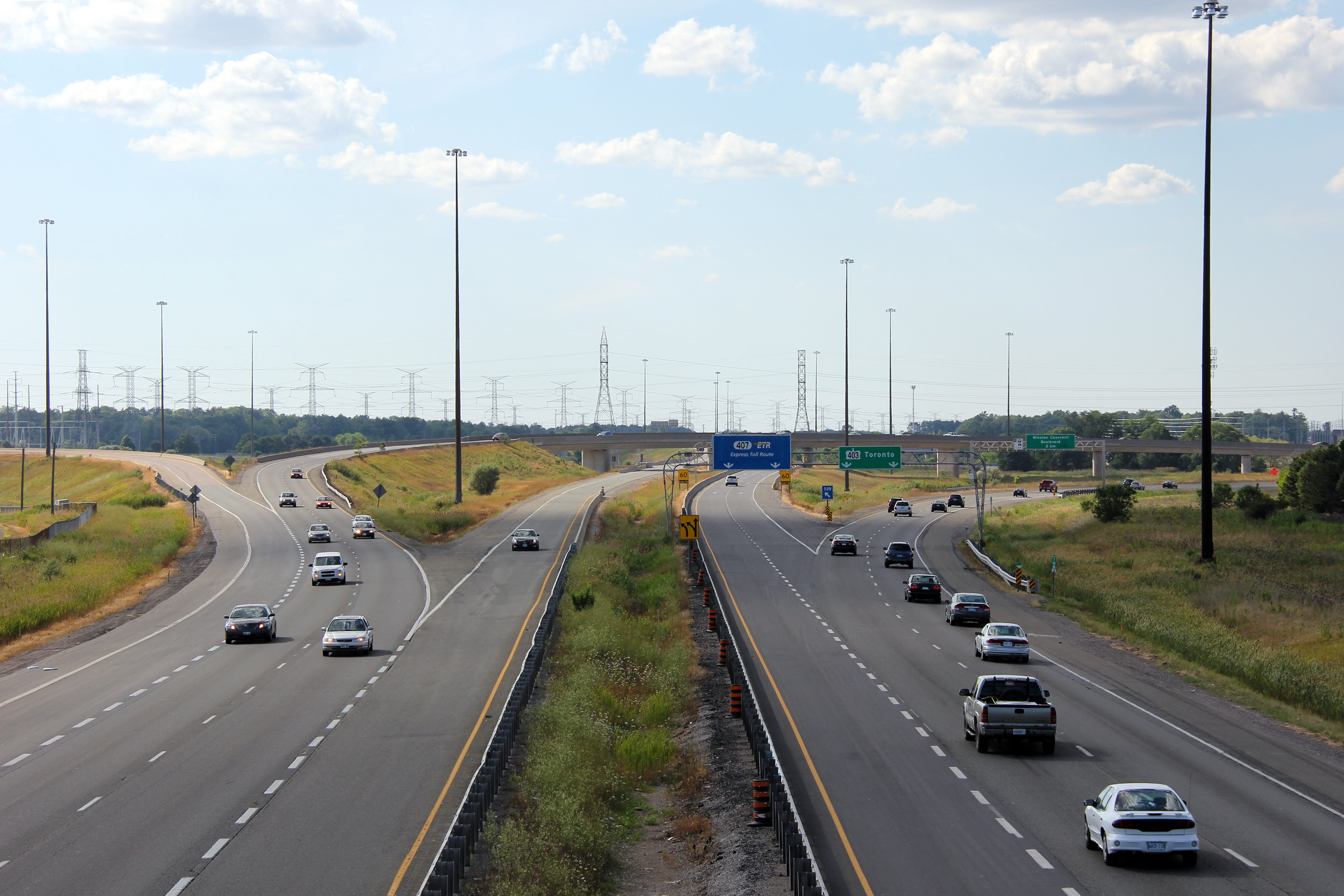
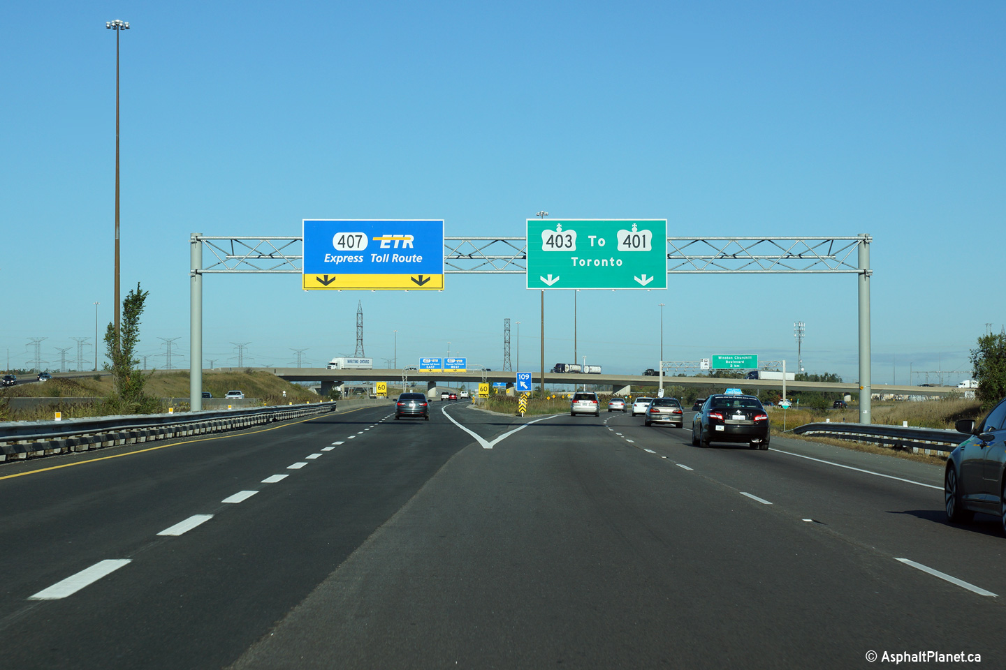
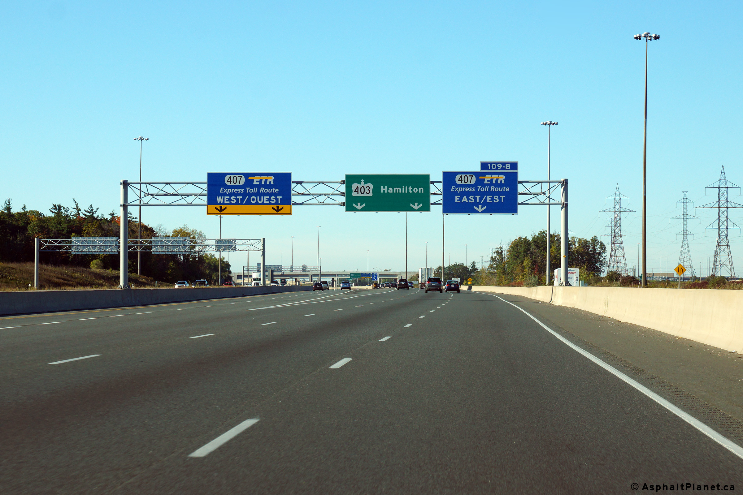
| City of Mississauga Regional Municipality of Peel |
Signage at the westbound split of the Highway 407-East off-ramp. Beyond the ramp to Highway 407-East, the westbound carriageway narrows to two lanes turning south as it follows a long high-speed flyover overtop of the ramps to and from Highway 407. Photo taken: October 9th, 2014. |
||
| City of Mississauga Regional Municipality of Peel |
Two views looking westerly from the Ridgeview Drive overpass towards the
sprawling Highway 407 interchange. Photos taken: April 9th, 2012. |
 (720x480) (1440x960) (2400x1600)  (720x480) (1440x960) (2400x1600) |
|
| City of Mississauga Regional Municipality of Peel |
Easterly view from the Ridgeview Drive overpass along Highway 403. Photo taken: April 9th, 2012. |
 (720x480) (1440x960) (2400x1600) |
|
| City of Mississauga Regional Municipality of Peel |
Advanced signage for the ramp to Highway 407-East. Wisely the MTO chose pull-through lane signs in advance of the exit rather than an advanced arrow sign. A new overpass for Ridgeview Drive was constructed immediately behind this overhead signage during the 2010 construction season. Photo taken: October 9th, 2014. |
||
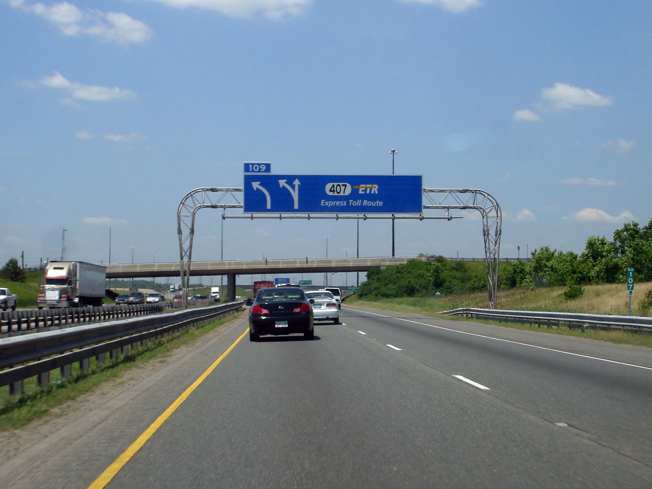
| City of Mississauga Regional Municipality of Peel |
Signage outlining the lane configurations as Highway 403 meets Highway 407.
|
||
| City of Mississauga Regional Municipality of Peel |
Eastbound advanced signage for the off-ramp to Winston Churchill Boulevard. Photo taken: May 11th, 2014. |
 (720x480) (720x480)(1440x960) (2400x1600) |
|
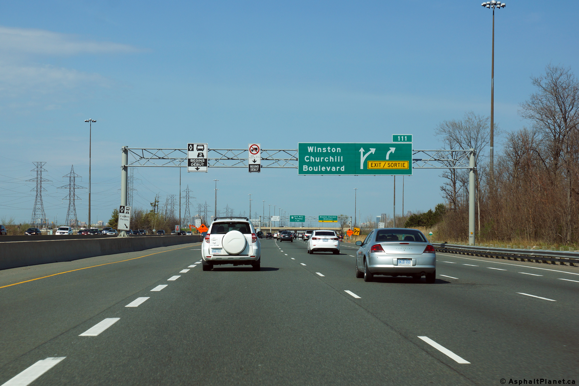
| City of Mississauga Regional Municipality of Peel |
Easterly view at the off-ramp to Winston Churchill Boulevard. Photo taken: May 11th, 2014. |
 (720x480) (720x480)(1440x960) (2400x1600) |
|
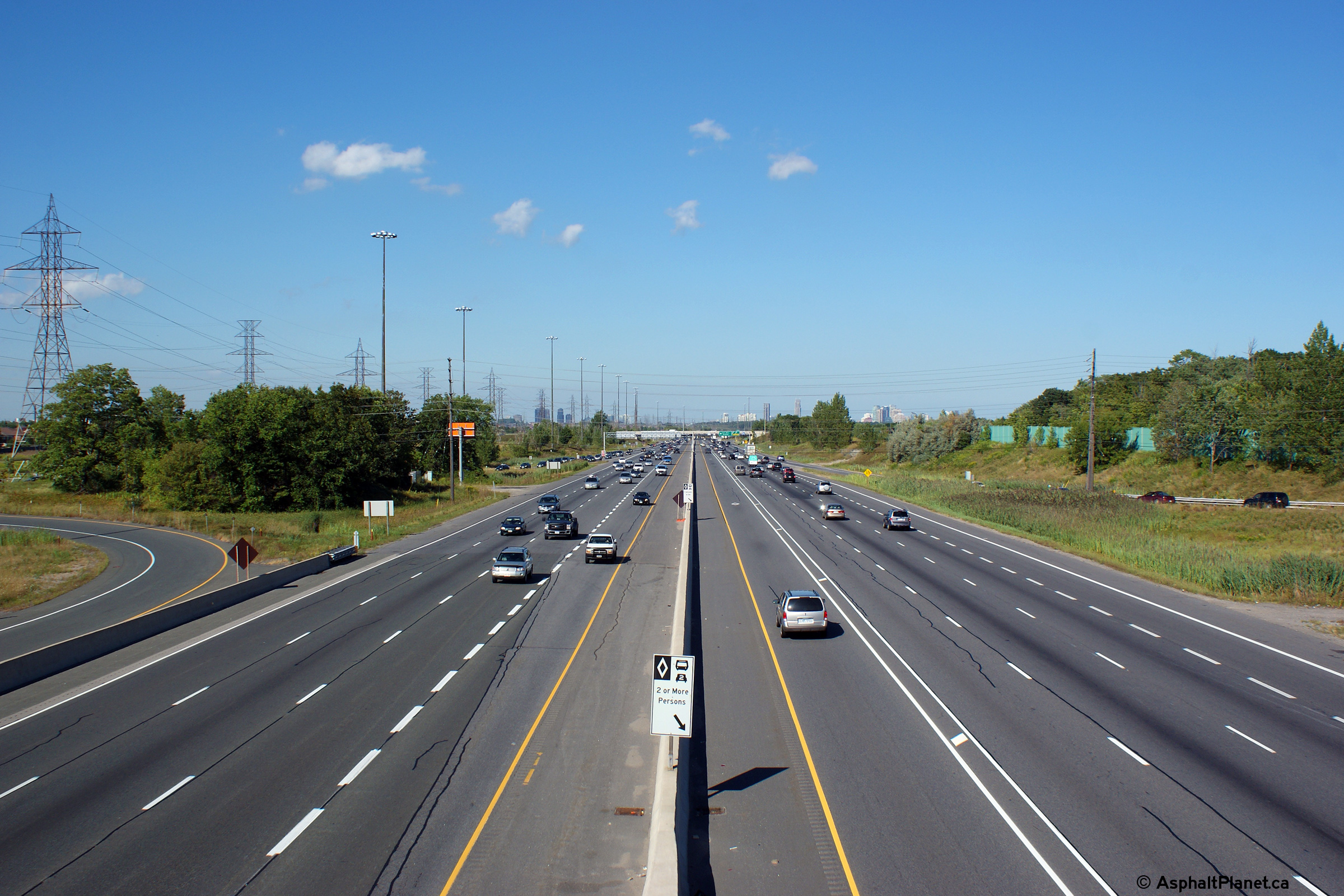
| City of Mississauga Regional Municipality of Peel |
Two views looking west form the Winston Churchill overpass. Notice the
collector ramp that separates the westbound onramps from Winston Churchill
Boulevard
from the westbound ramp to Highway 407 west. Click
here for a photo from this
vantage point before the HOV lanes were constructed along the 403, taken in
April, 2005. Daytime photo taken: August 18th, 2010. Night-time photo taken: July 20th, 2007. |
 (720x480) (1440x960) (2400x1600)  (720x480) (1440x960) |
|
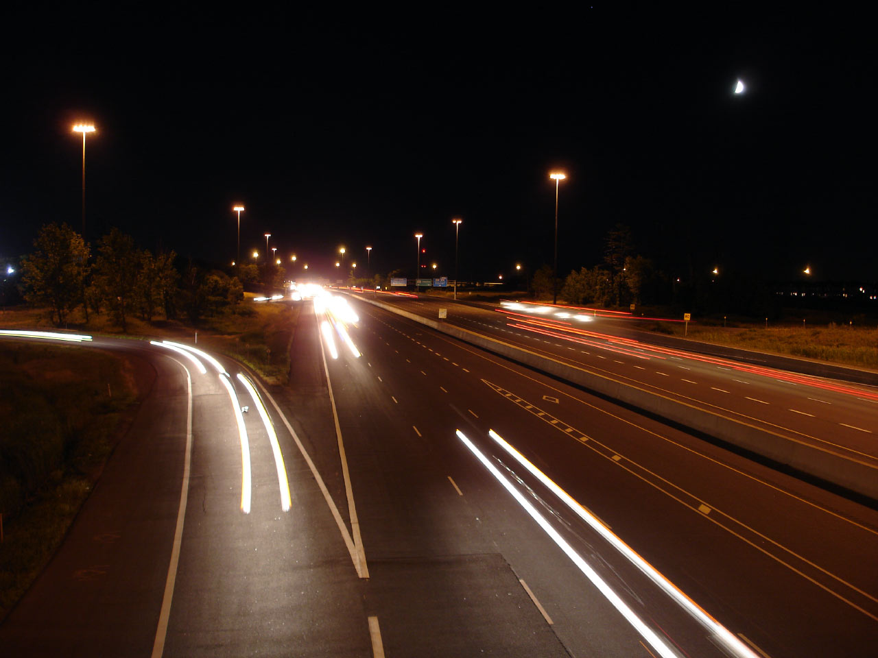
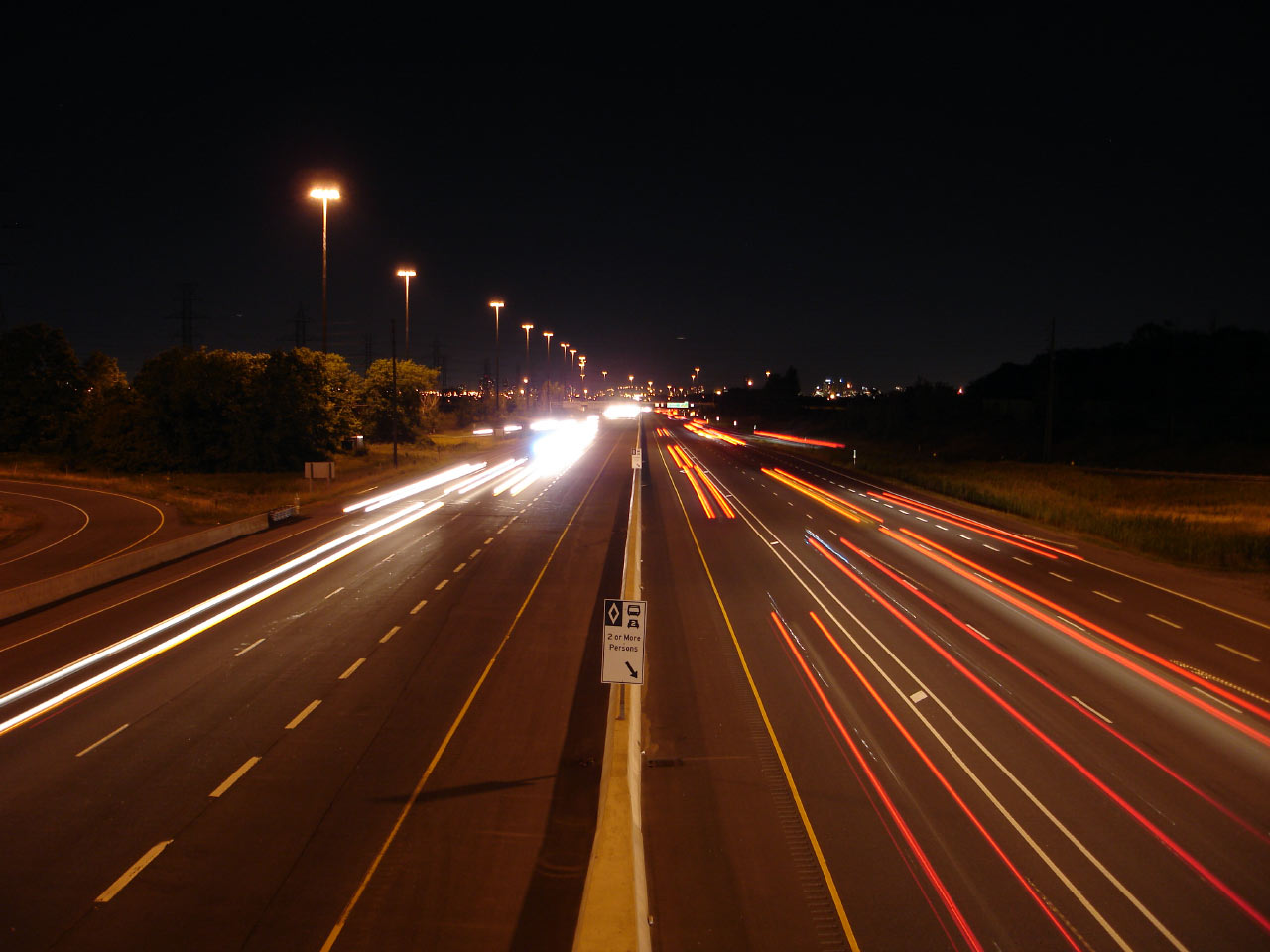
| City of Mississauga Regional Municipality of Peel |
Once again a daytime and night-time view of Highway 403, this time looking
from the eastern side of the Winston Churchill Road overpass. Notice
that unlike other GTA highways, the continuous high mast lighting has been
installed along the outside of the roadway. Click
here for a photo from this
vantage point before the HOV lanes were constructed along the 403, taken in
April, 2005. Daytime photo taken: August 18th, 2010. Night-time photo taken: July 20th, 2007. |
 (720x480) (1440x960) (2400x1600)  (720x480) (1440x960) |
|
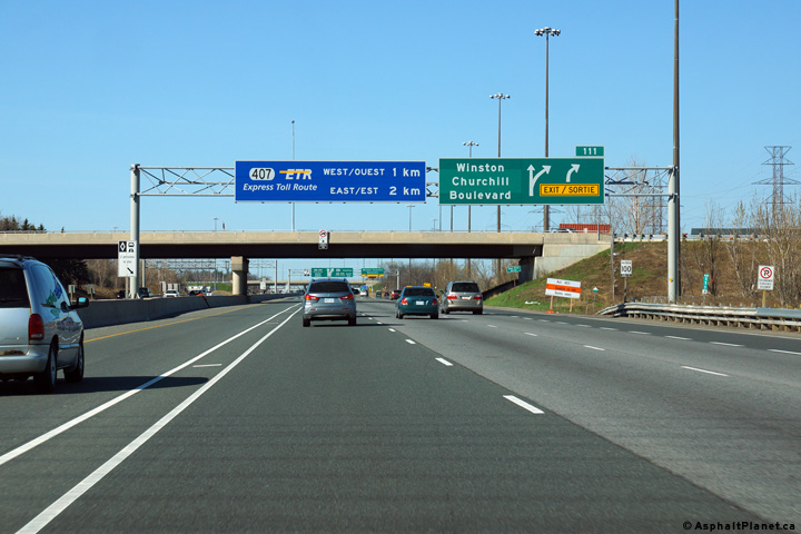
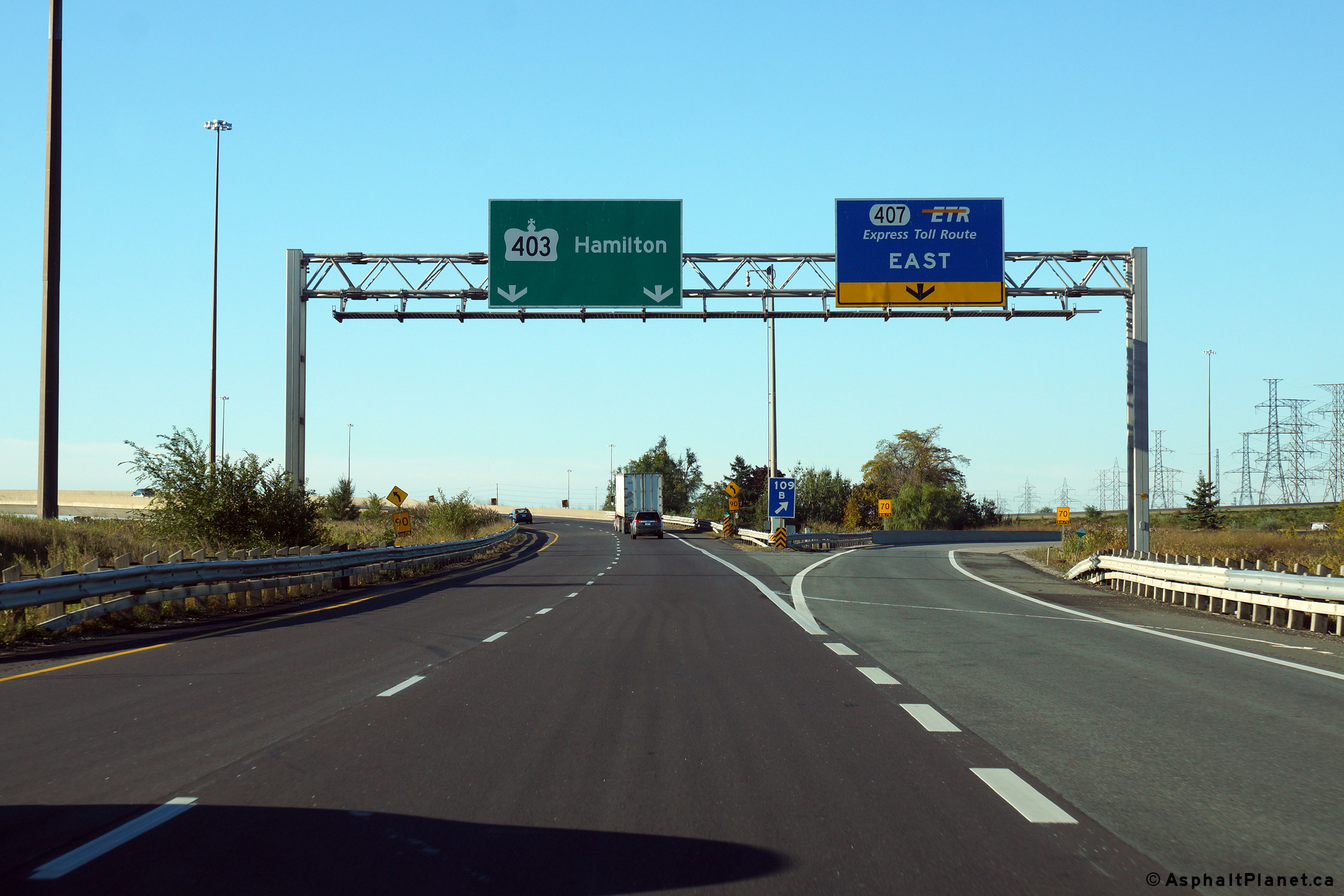
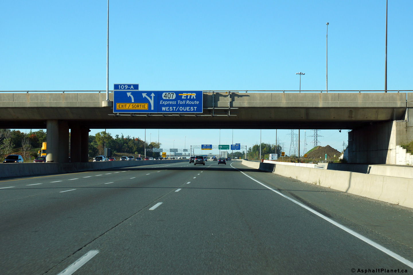
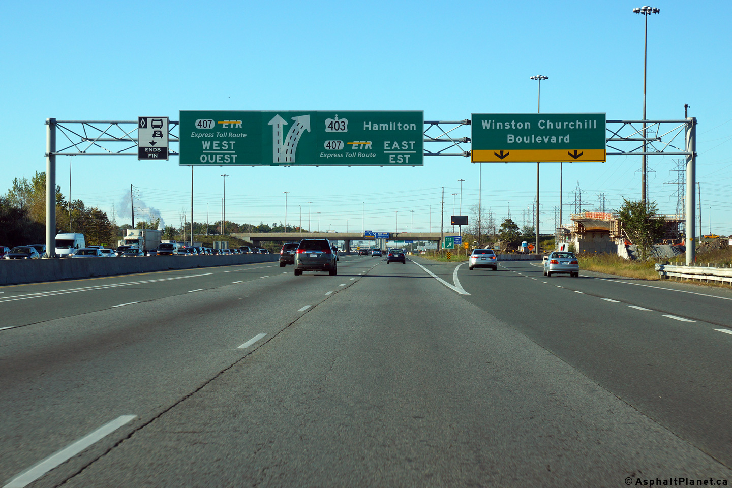
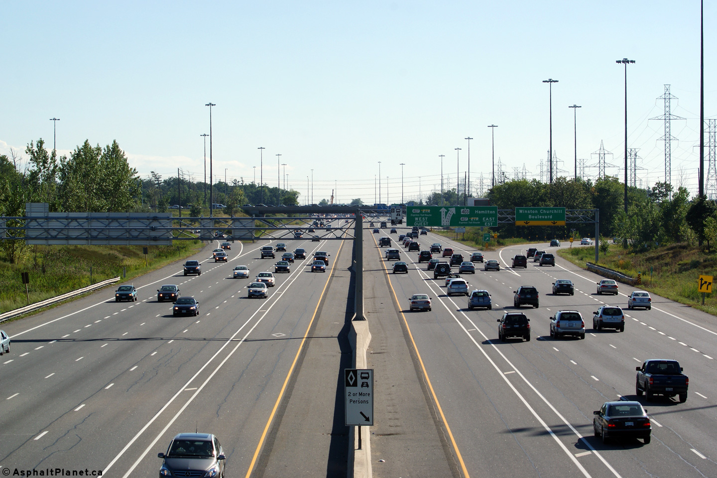
| City of Mississauga Regional Municipality of Peel |
Advanced signage for the Highway 407-West interchange. When the first phase
of the Highway 403/407 interchange was constructed, it was anticipated that
Highway 403 would continue straight ahead through the interchange, rather
than the sharp curve to the south that it takes now. Because the
interchange was designed this way, the ramp to Highway 407-West exits from
the left of Highway 403. Photo taken: October 9th, 2014. |
||
| City of Mississauga Regional Municipality of Peel |
Overhead signage appearing westbound along the 403 at the Winston Churchill off-ramp. The HOV lane ends at this location to depart the 403 for Highway 407 west roughly 600m upstream.
Photo taken: October 9th, 2014. |
||
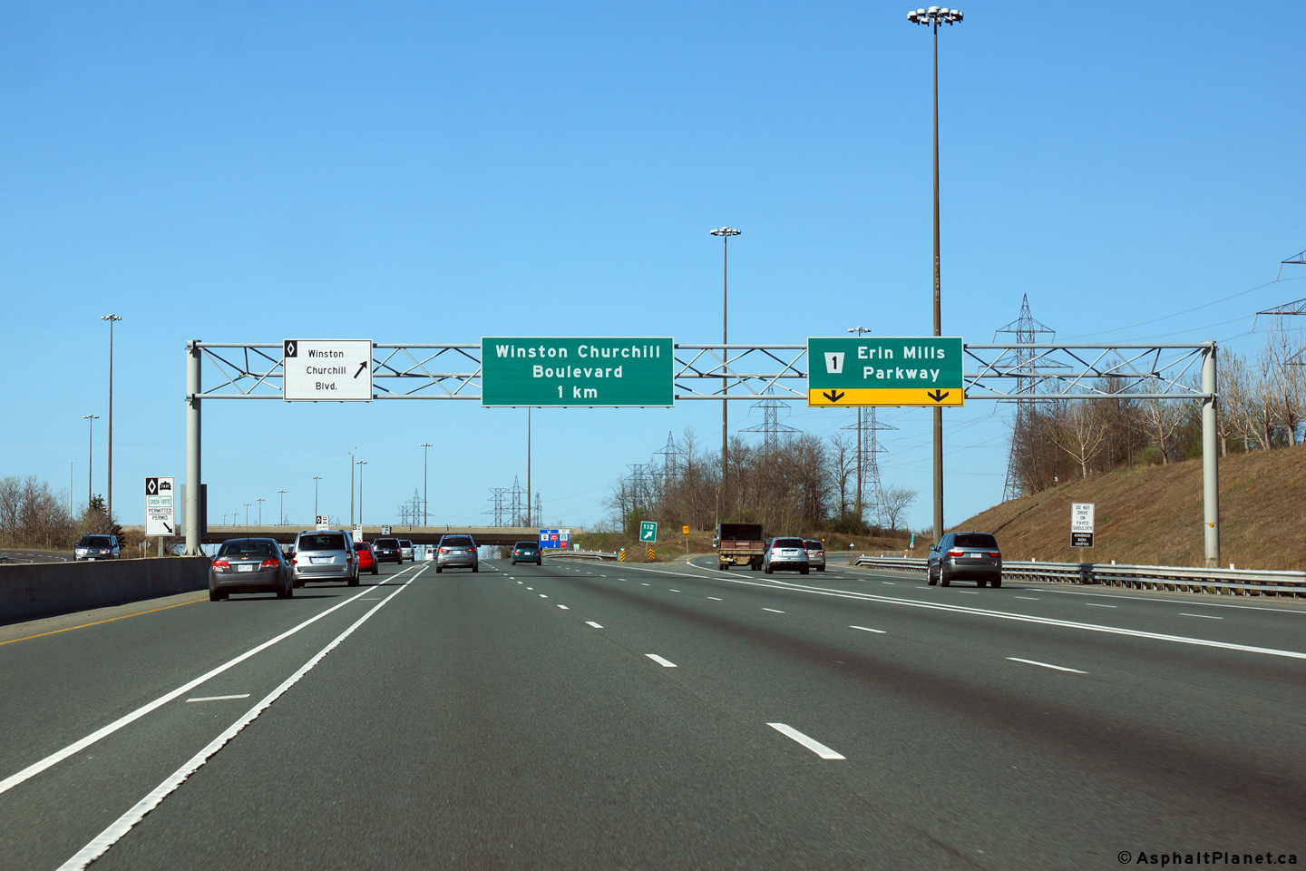
| City of Mississauga Regional Municipality of Peel |
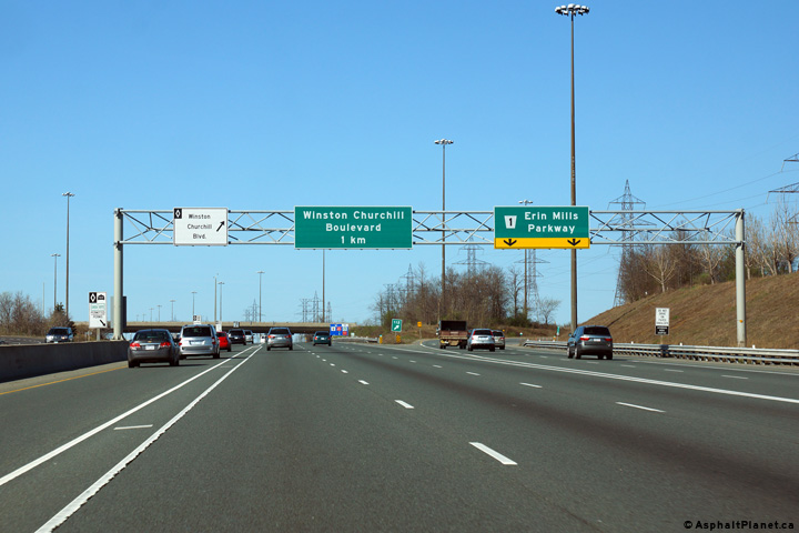
Advanced signage for both the Winston Churchill and Highway 407 exits.
Photo taken: May 11th, 2014. |
||
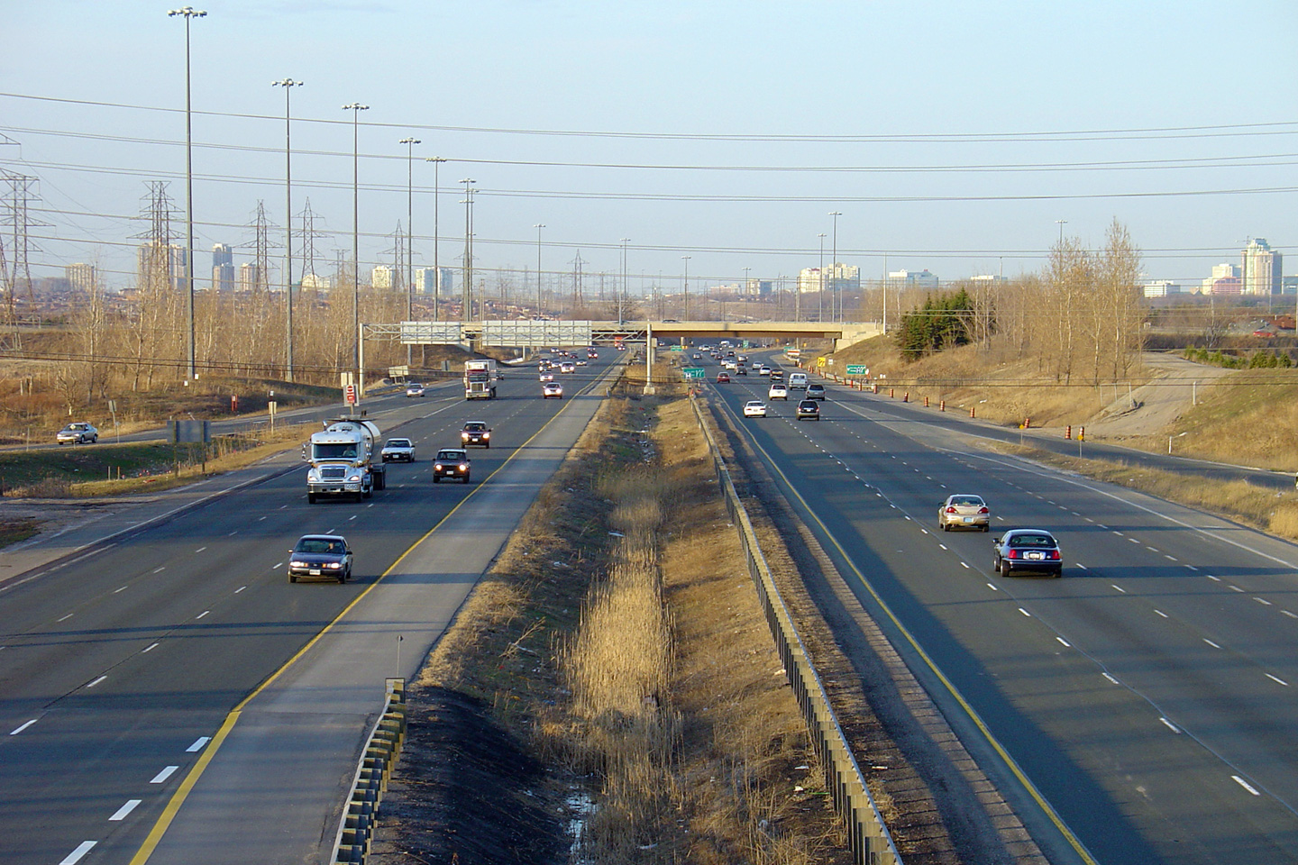
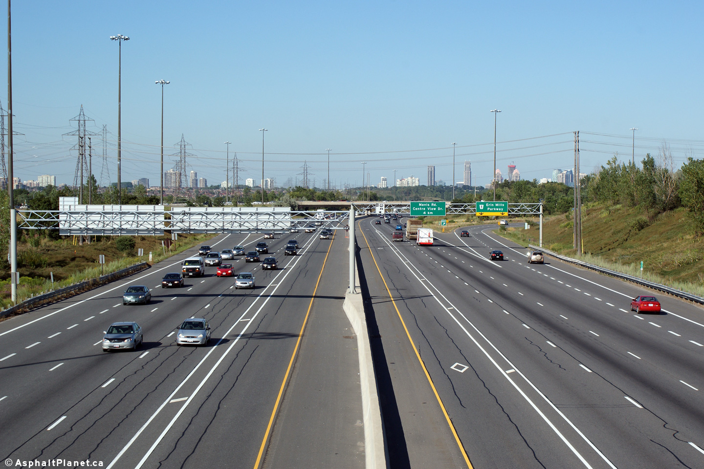
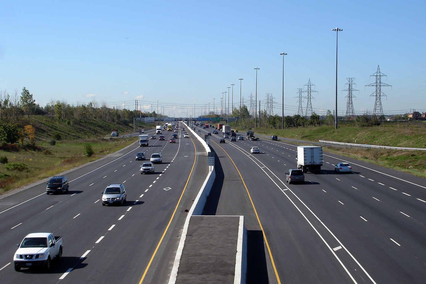
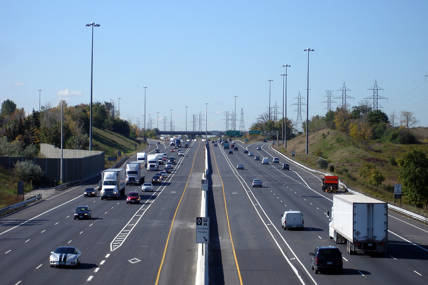
| City of Mississauga Regional Municipality of Peel |
View looking westerly from the Glen Erin Road overpass. Glen Erin Road
is sandwiched between the Winston Churchill and Erin Mills Parkway
interchanges. Photo taken: August 18th, 2010. |
||
| City of Mississauga Regional Municipality of Peel |
This view looks easterly from the Glen Erin Road overpass towards the
interchange with Erin Mills Parkway. Photo taken: August 18th, 2010. |
 (720x480) (1440x960) (2400x1600) |
|
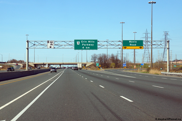
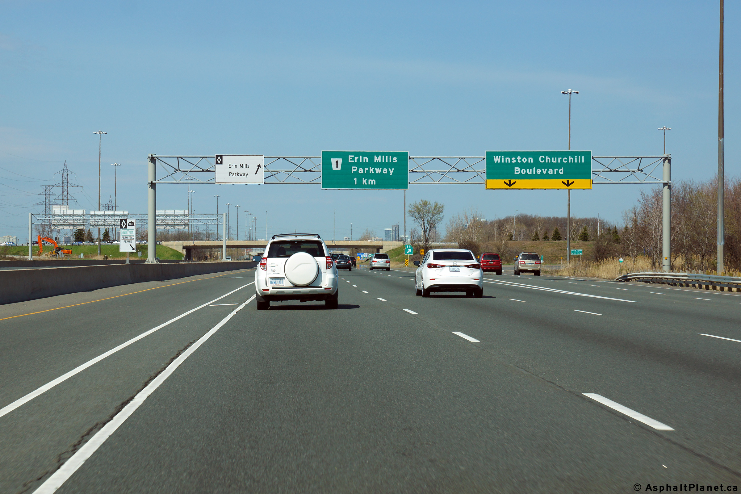
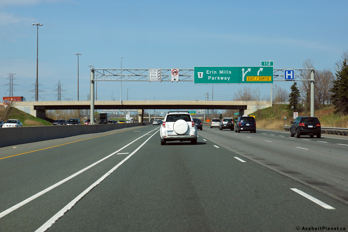
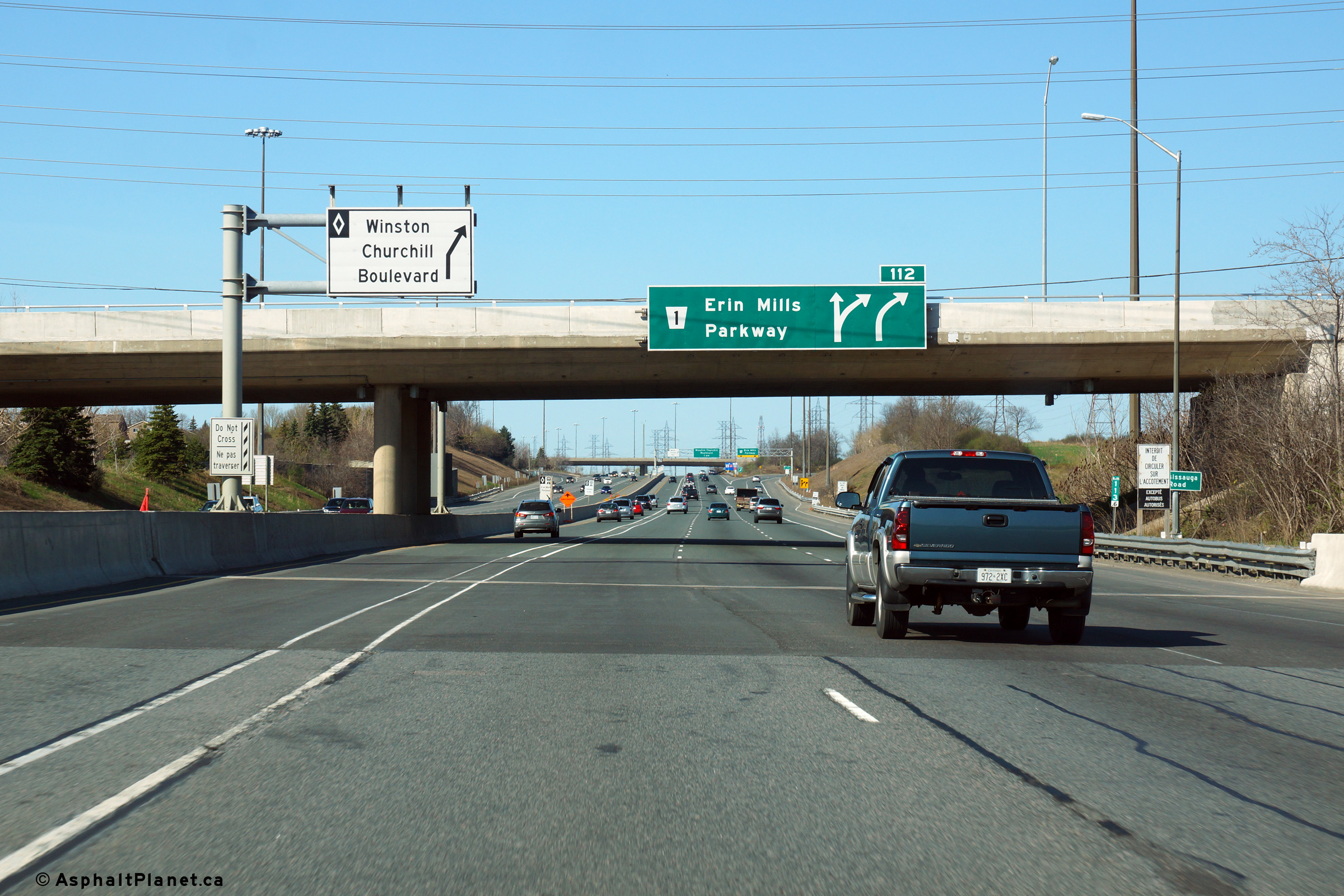
| City of Mississauga Regional Municipality of Peel |
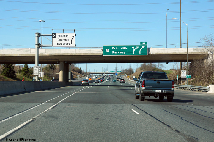
Eastbound advanced signage for the Erin Mills Parkway interchange. The
Glen Erin Road overpass is visible beyond the overhead signage. Photo taken: May 11th, 2014. |
 (720x480) (720x480)(1440x960) (2400x1600) |
|
| City of Mississauga Regional Municipality of Peel |
View at the eastbound off-ramp to Erin Mills Parkway. Photo taken: May 11th, 2014. |
 (720x480) (720x480)(1440x960) (2400x1600) |
|
| City of Mississauga Regional Municipality of Peel |
Westerly view from the top of the Erin Mills Parkway overpass. Note
the "enforcement pocket" that has been constructed in the median.
Enforcement pockets were constructed at the request of the OPP during the construction of the
HOV lanes. They allow OPP cruisers safe refuge to enforce the
restricted use of the HOV lanes. Photo taken: October 6th, 2006. |
|
|
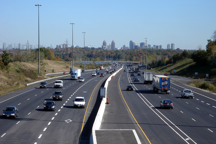
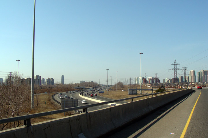
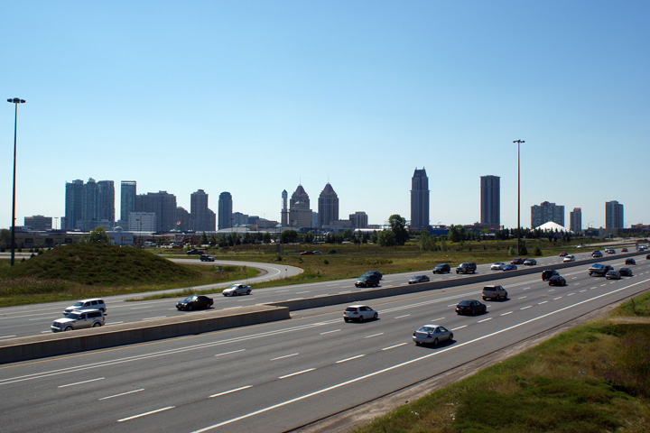
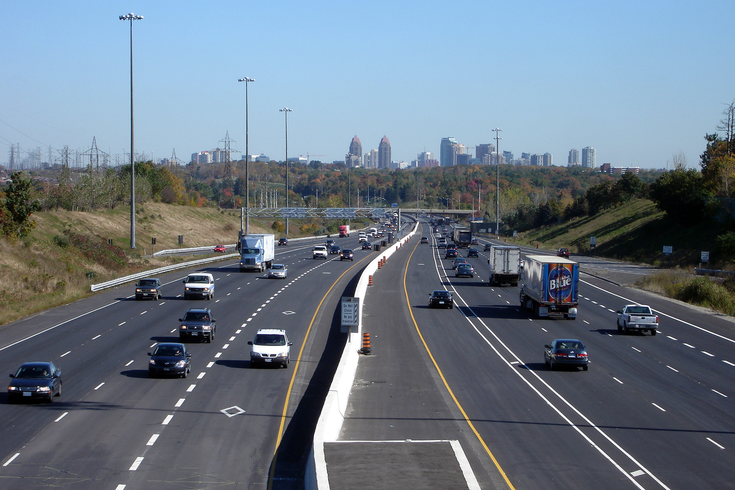
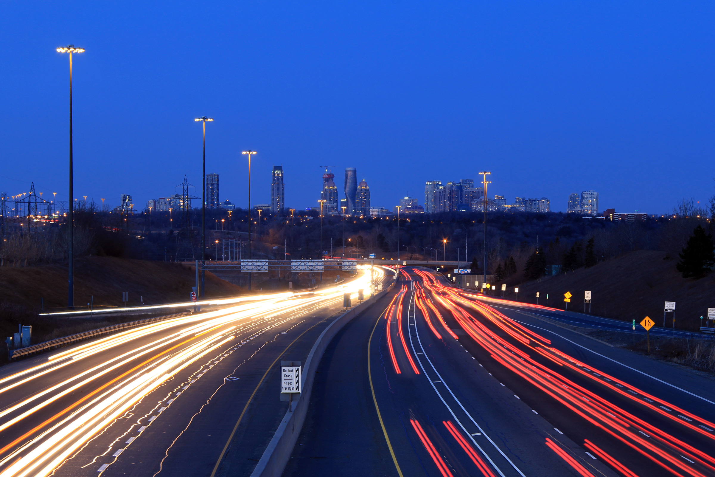
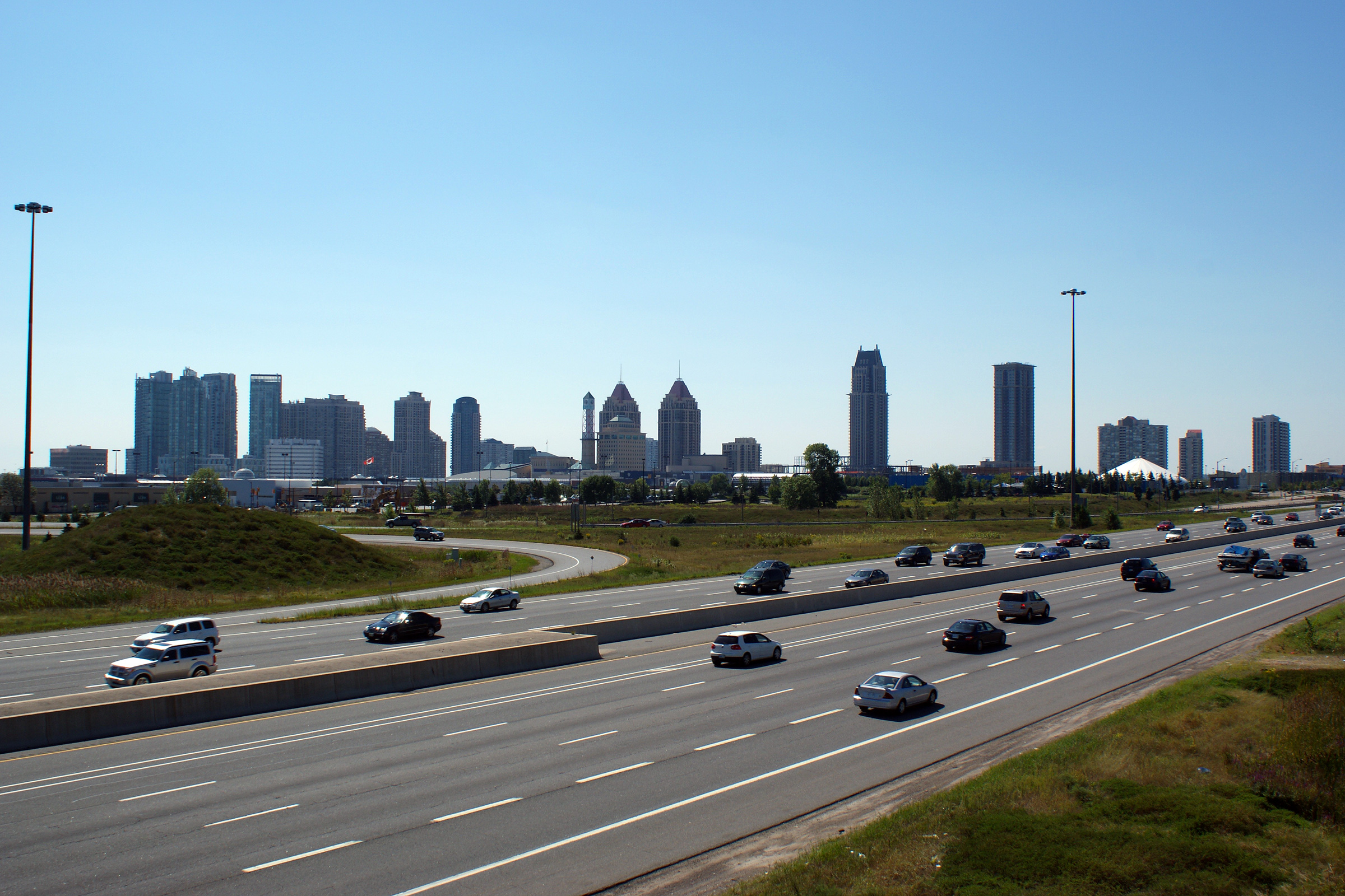
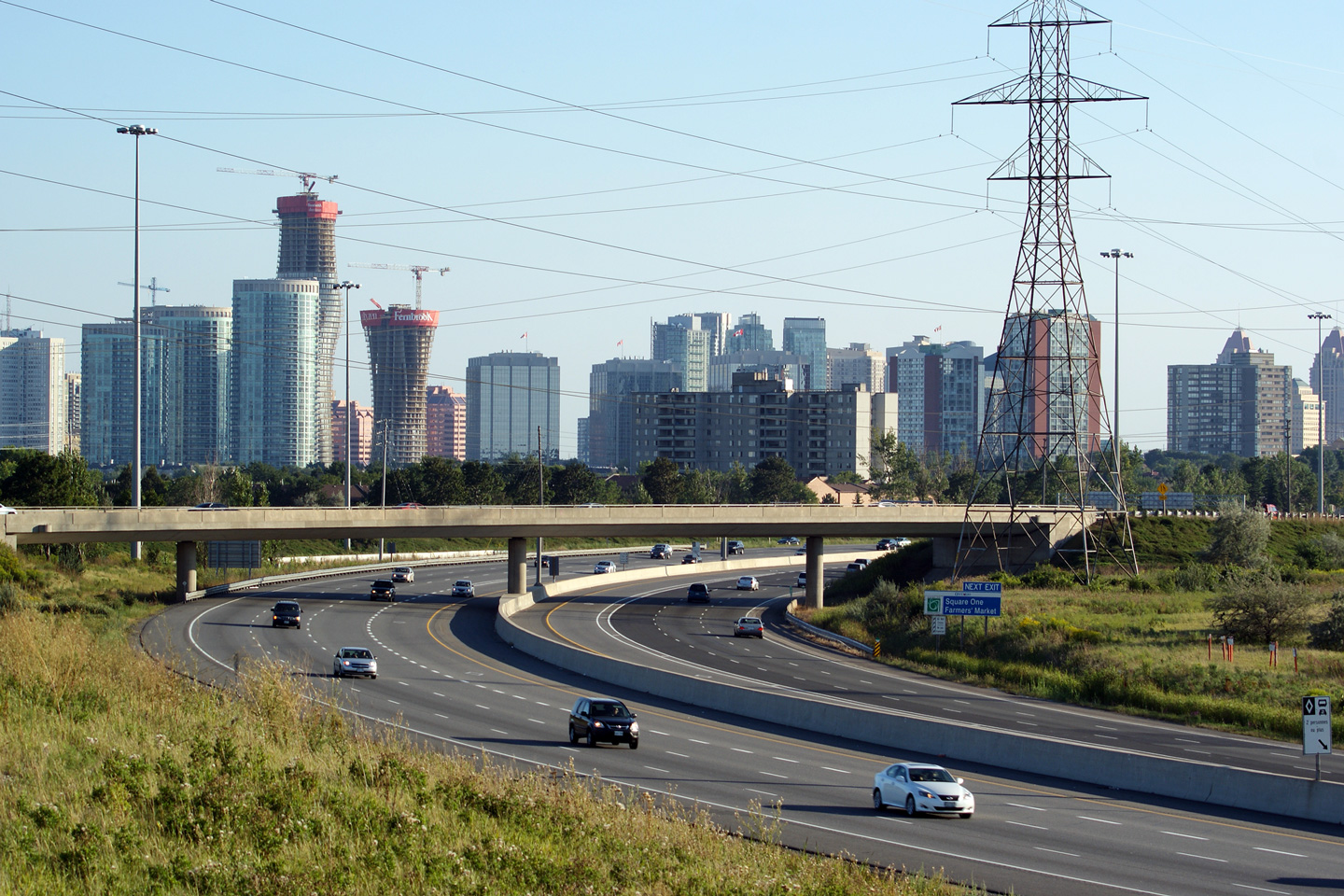
| City of Mississauga Regional Municipality of Peel |
Several views looking easterly from Erin Mills Parkway. The Mississauga City
Centre Skyline dominates the horizon. Mississauga has a very impressive
cityscape for a city of its size -- especially since Mississauga is but a
large suburb of Toronto. Take notice of how many additional tall buildings
there are that dot the the City of Mississauga's skyline in 2011 compared to 2006.
Mississauga's Growth continues to be impressive. Upper photo taken: October 6th, 2006. Lower two photos taken: March 19th, 2011. |
 (720x480) (1440x960)  (720x480) (1440x960) (2400x1600) 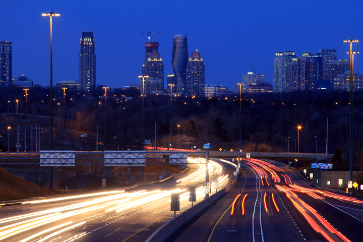 (720x480) (1440x960) (2400x1600) |
|
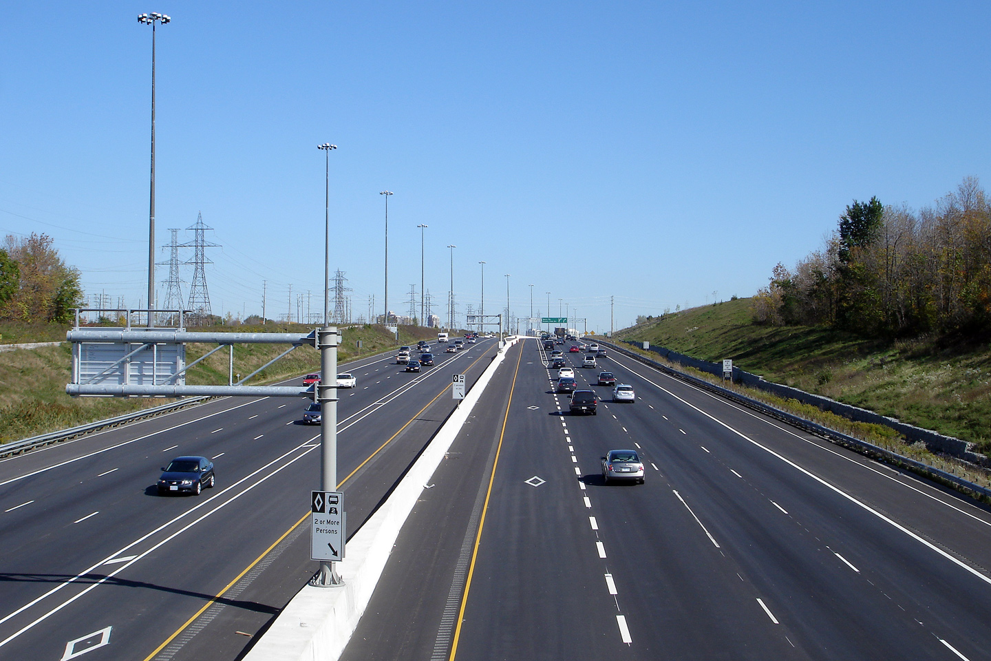
| City of Mississauga Regional Municipality of Peel |
Westbound view at the off-ramp to Erin Mills Parkway. Photo taken: May 11th, 2014. |
 (720x480) (720x480)(1440x960) (2400x1600) |
|
| City of Mississauga Regional Municipality of Peel |
The westbound advanced signage for the ramp to Erin Mills Parkway is affixed
to the Mississauga Road overpass. Photo taken: May 11th, 2014. |
 (720x480) (720x480)(1440x960) (2400x1600) |
|
| City of Mississauga Regional Municipality of Peel |
View looking westerly from the Mississauga Road overpass towards the Erin
Mills Parkway interchange. Photo taken: October 6th, 2006. |
|
|
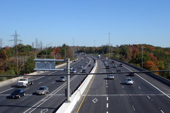
| City of Mississauga Regional Municipality of Peel |
Easterly view from Mississauga Road over the Credit River Bridge. In
addition to the six general purpose lanes and two HOV lanes, two transit
lanes adorn the outside shoulders of the 403 overtop of the Credit River.
Mississauga Transit runs an express bus service along Highway 403 between
Western Mississauga and Square One that utilizes the freeway. Photo taken: October 6th, 2006. |
|
|
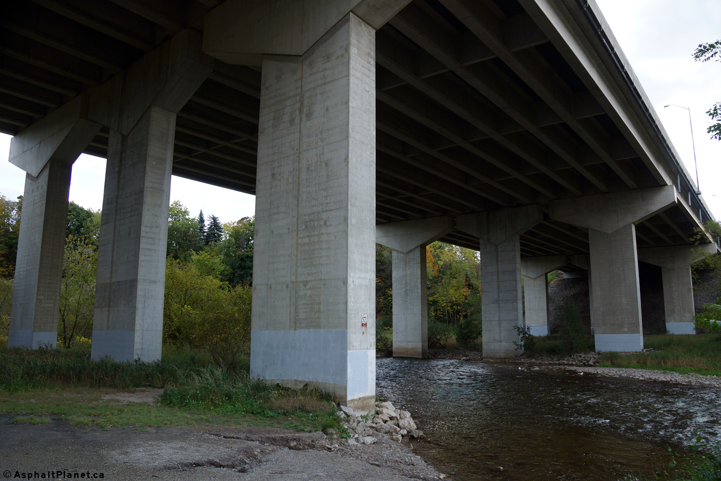
| City of Mississauga Regional Municipality of Peel |
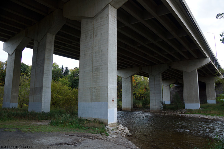
View looking southwesterly underneath the Credit River Bridge. Photo taken: October 9th, 2014. |
 (720x480) (1440x960) (2400x1600) |
|
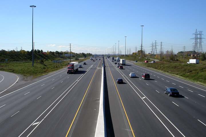
| City of Mississauga Regional Municipality of Peel |
Looking west from Creditview Road. Note CP's Galt subdivision which crosses
the 403 in the photo. CP's Galt railway line carries GO Trains (among other
freight traffic) between Toronto's Union Station and Milton. There is talk
of extending passenger service westerly along this line -- once again only
time will tell if this plan ever comes to fruition. The extension of
passenger rail along the Galt Subdivision is complicated by the fact
that the Galt Subdivision is CP's mainline through Southwestern Ontario. Photo taken: October 6th, 2006. |
|
|
| City of Mississauga Regional Municipality of Peel |
View looking easterly from the Creditview Road overpass. Photo taken: October 6th, 2006. |
|
|
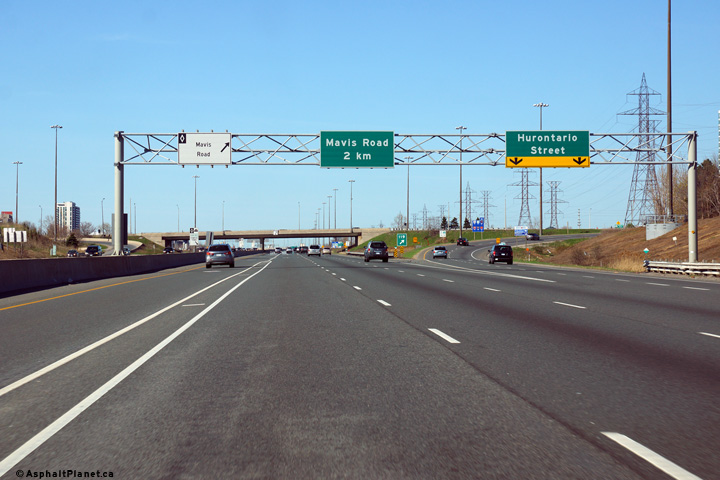
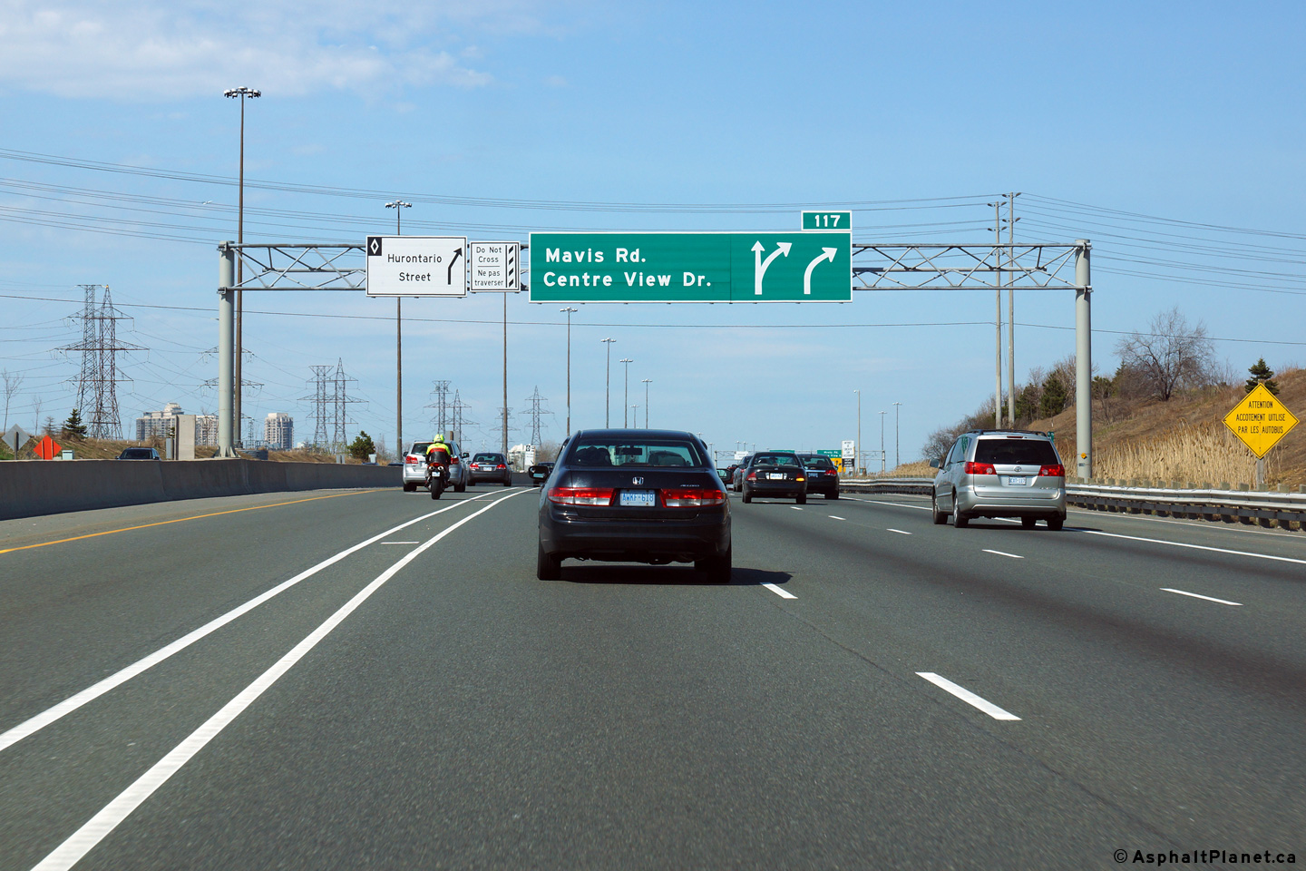
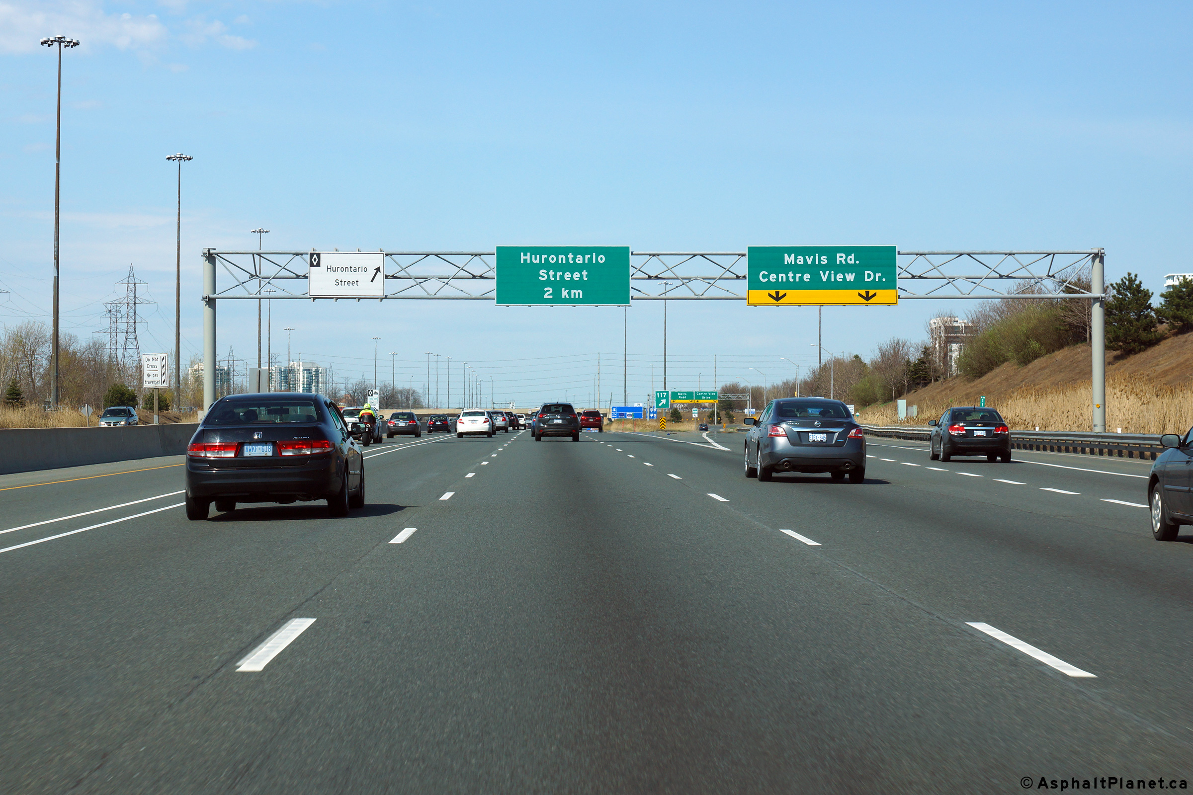
| City of Mississauga Regional Municipality of Peel |
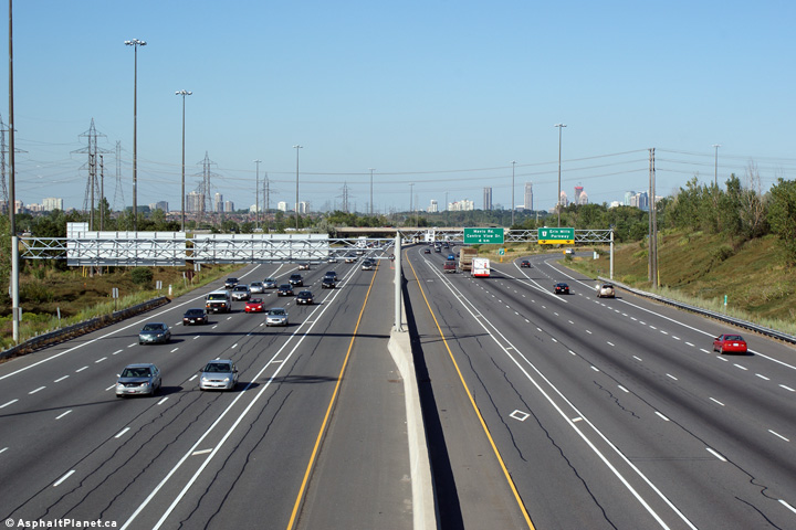
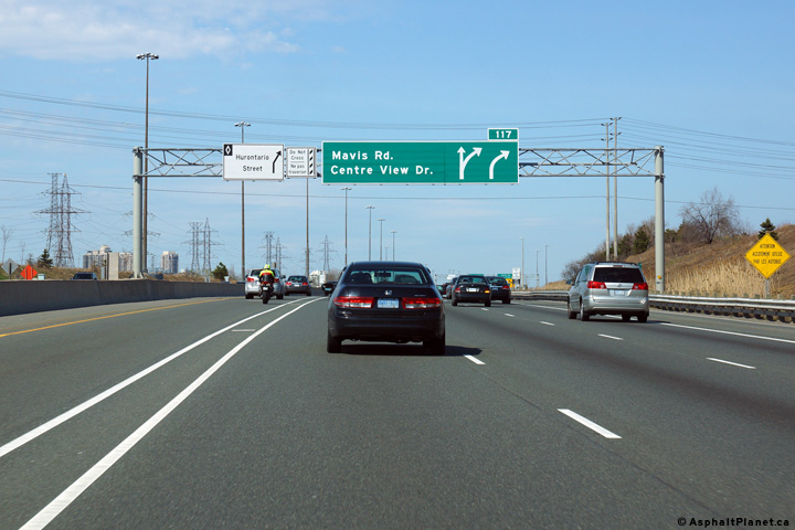
Easterly view in advance of the ramp to both Mavis Road and Centre View
Drive. Photo taken: May 11th, 2014. |
 (720x480) (720x480)(1440x960) (2400x1600) |
|
| City of Mississauga Regional Municipality of Peel |
Eastbound view at the off-ramp to Mavis Road. Click
here for a photo of the signage
that stood in this location prior to completion of HOV lanes through
Mississauga, taken in August, 2004. Photo taken: May 11th, 2014. |
 (720x480) (720x480)(1440x960) (2400x1600) |
|
| City of Mississauga Regional Municipality of Peel |
Westerly view from Mavis Road. Photo taken: October 6th, 2006. |
|
|
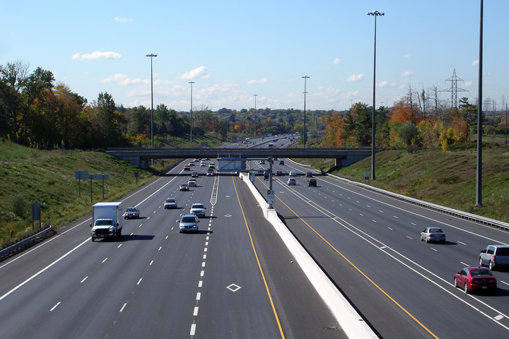
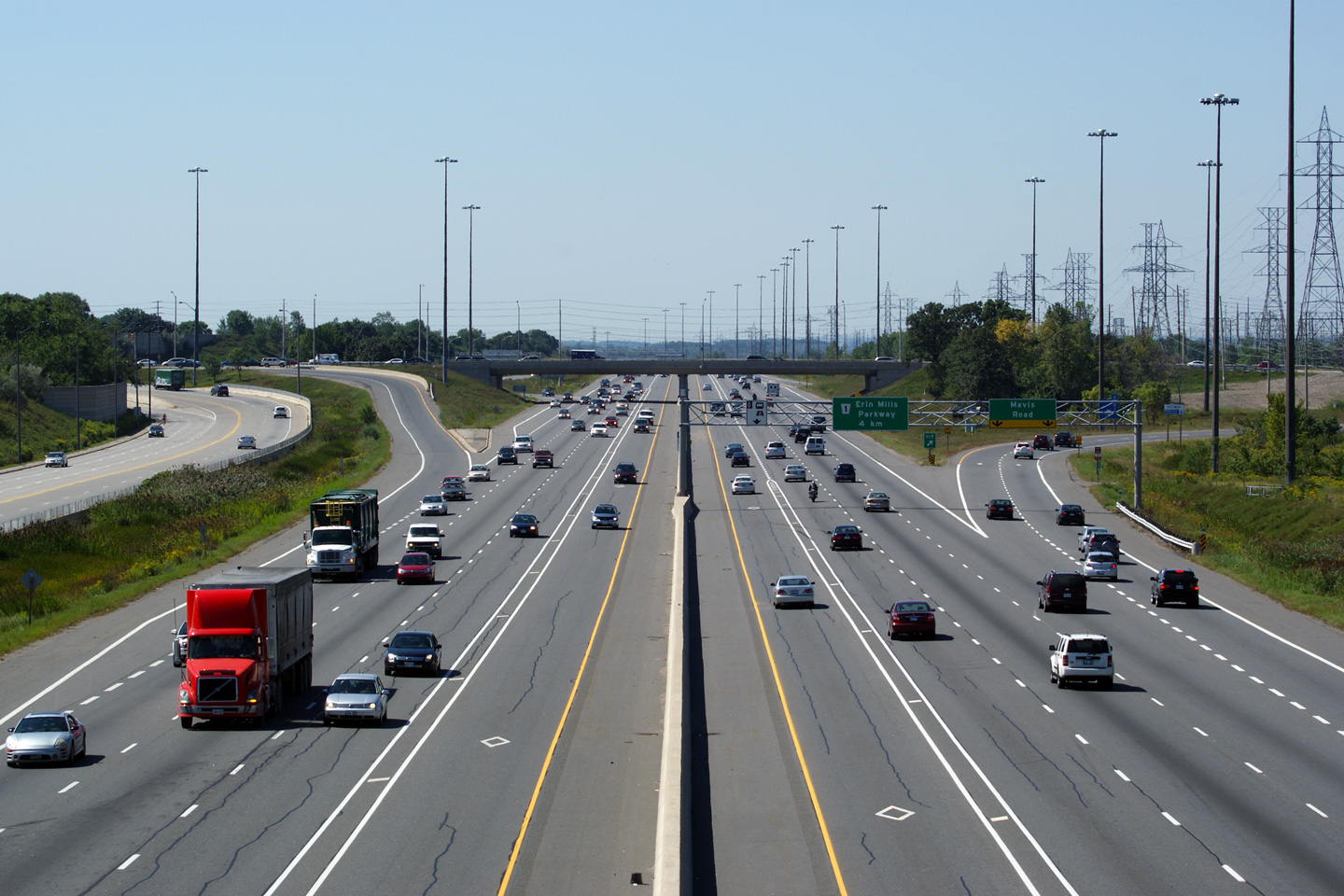
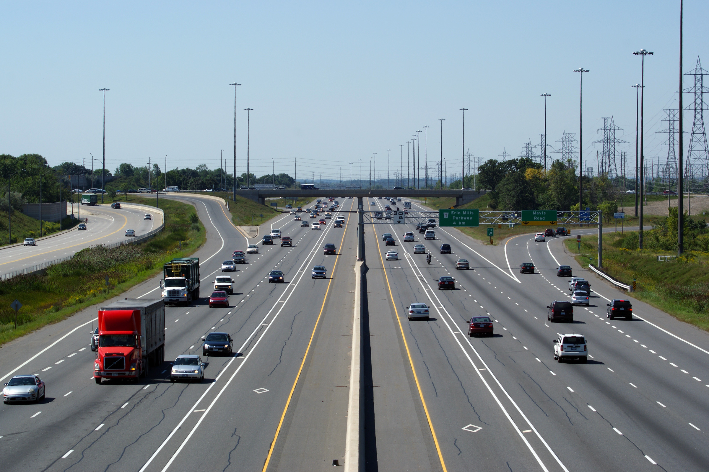
| City of Mississauga Regional Municipality of Peel |
Easterly view from the Mavis Road overpass. This photo was taken before the
Confederation Parkway overpass was completed. Photo taken: October 6th, 2006. |
|
|
| City of Mississauga Regional Municipality of Peel |
Westerly view at the off-ramp to Mavis Road. Photo taken: May 11th, 2014. |
 (720x480) (720x480)(1440x960) (2400x1600) |
|
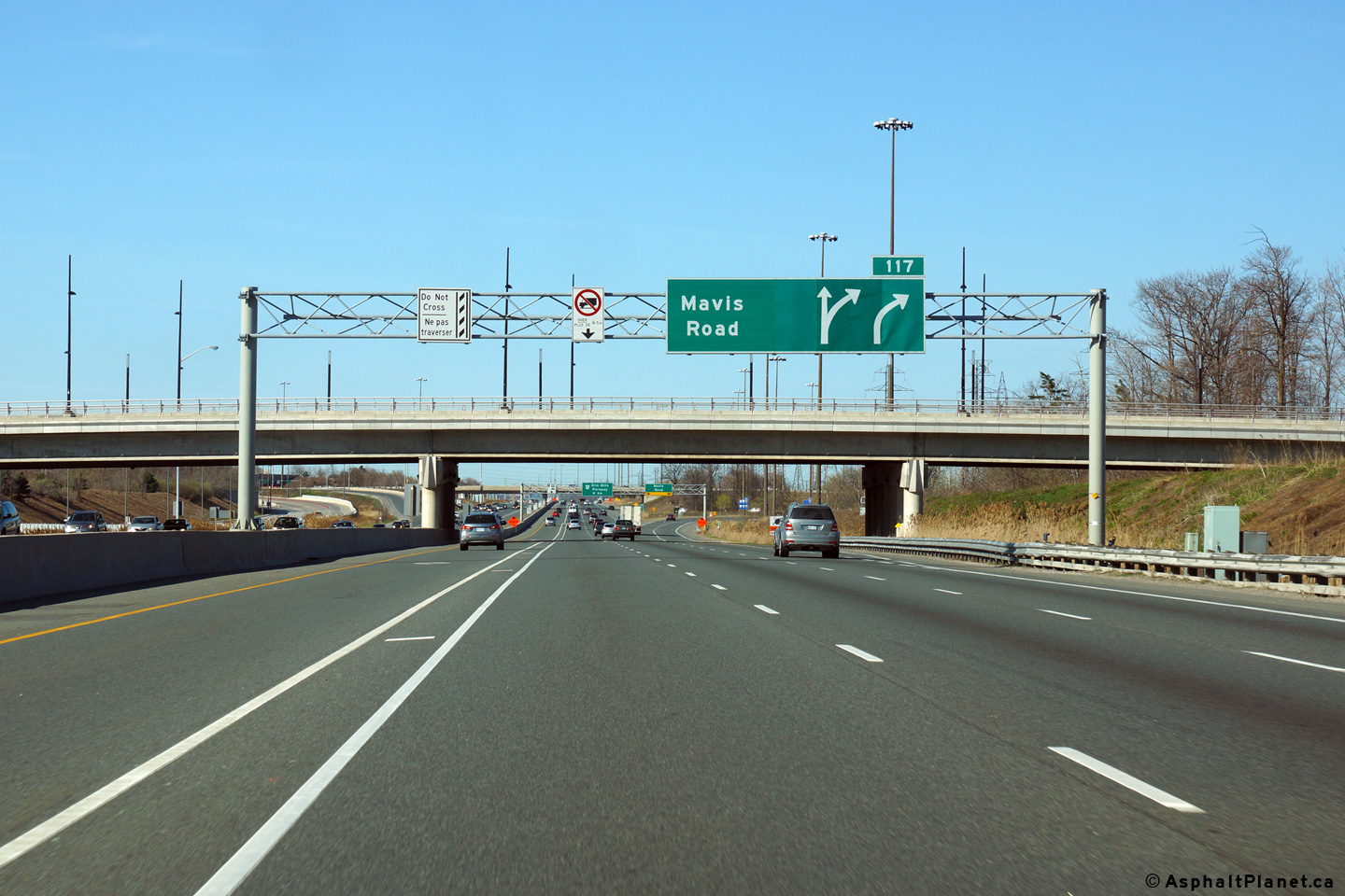
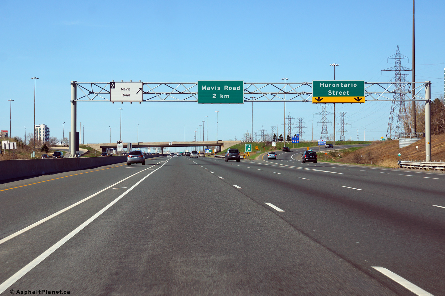
| City of Mississauga Regional Municipality of Peel |
Westbound advanced signage for the Mavis Road interchange. The
Confederation Parkway overpass is visible in the distance. Photo taken: May 11th, 2014. |
 (720x480) (720x480)(1440x960) (2400x1600) |
|
| City of Mississauga Regional Municipality of Peel |
Westerly view from Confederation Parkway towards the Mavis Road
interchange. Confederation Parkway is a new overpass, constructed in 2008
designed to relieve congestion on Hurontario Street. Photo taken: August 28th, 2010. |
|
|
| City of Mississauga Regional Municipality of Peel |
Eastbound view from the Confederation Parkway. Photo taken: August 28th, 2010. |
||
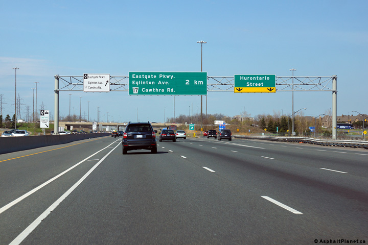
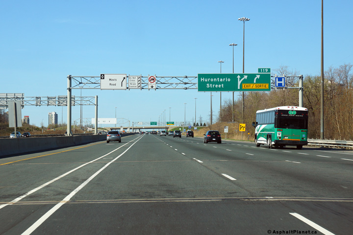
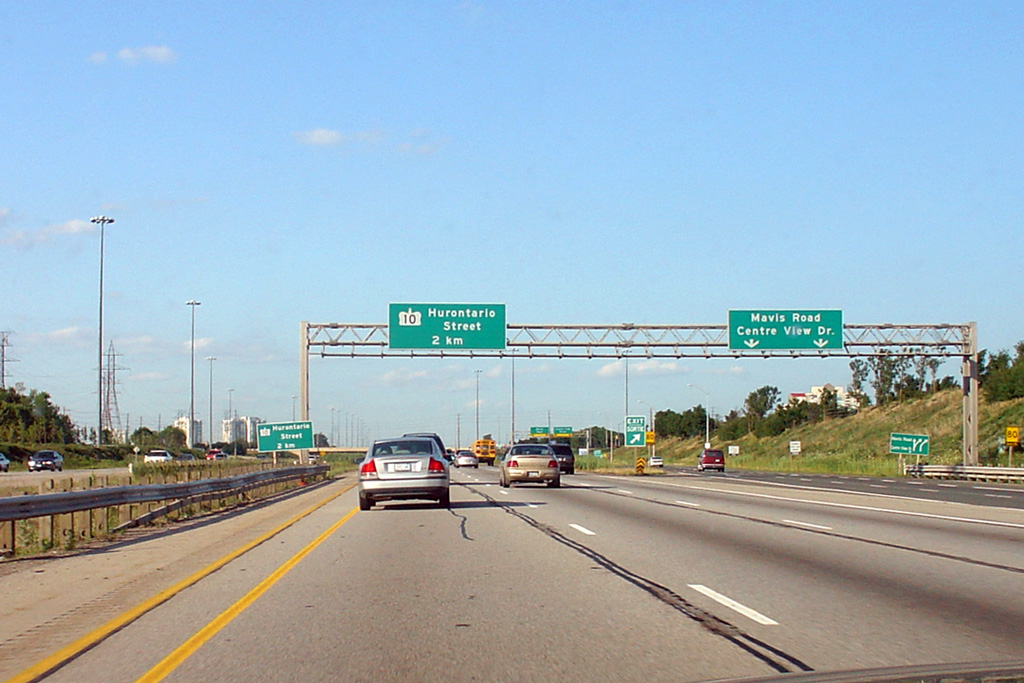
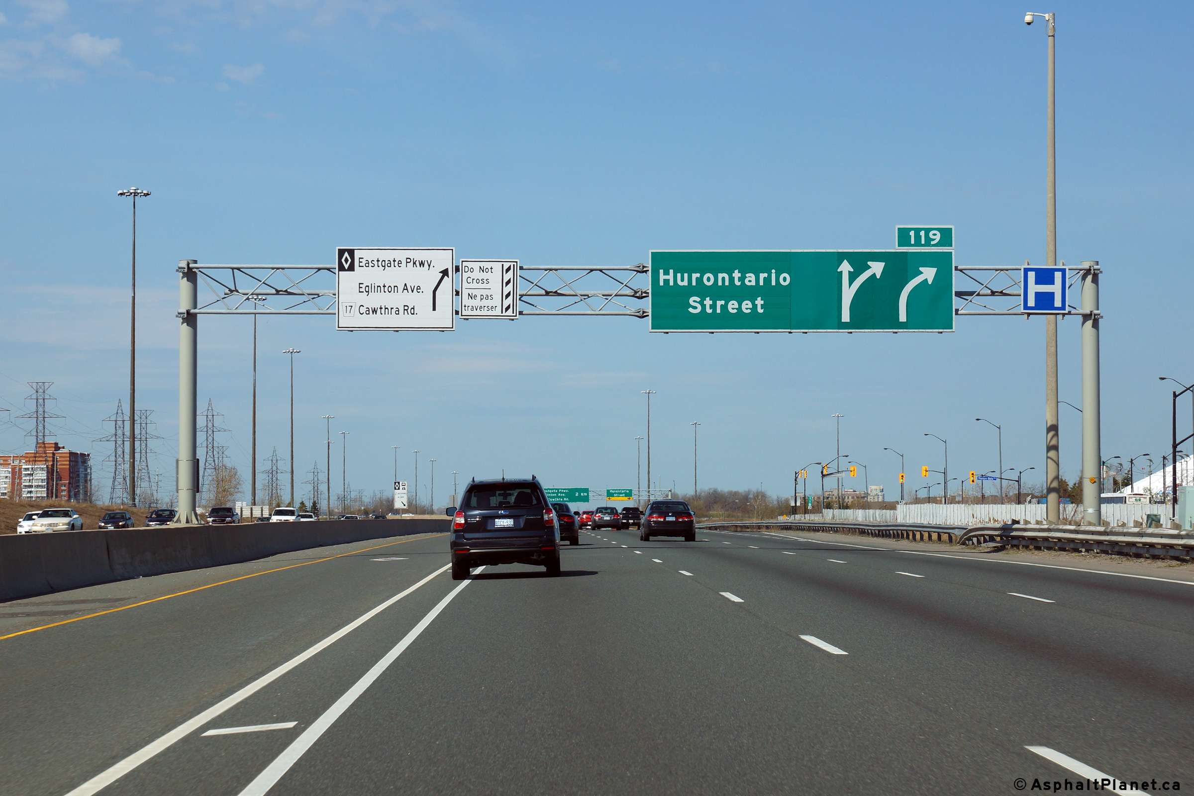
| City of Mississauga Regional Municipality of Peel |
Eastbound advanced signage for the ramp to Hurontario Street. Photo taken: May 11th, 2014. |
 (720x480) (720x480)(1440x960) (2400x1600) |
|
| City of Mississauga Regional Municipality of Peel |
View as the off-ramp to Hurontario Street departs from the eastbound lanes
of the expressway. Photo taken: May 11th, 2014. |
 (720x480) (720x480)(1440x960) (2400x1600) |
|
| City of Mississauga Regional Municipality of Peel |
Looking west from the Hurontario Street overpass towards Highway 403 as it
passes to the north of Mississauga's City Centre. Photo taken: August 28th, 2010. |
|
|
| Hurontario Street through Mississauga and Brampton was part of Highway 10 before 1998. Click here for Highway 10 images. | |||
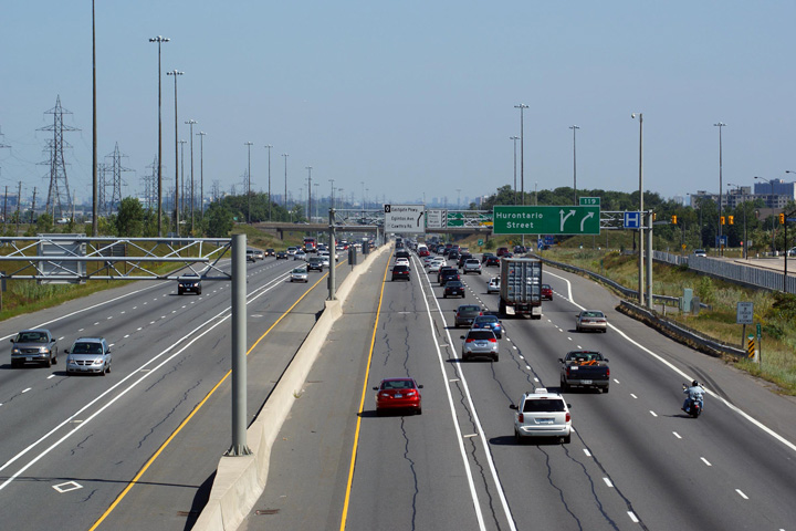
| City of Mississauga Regional Municipality of Peel |
Two views looking east from the Hurontario Street (Highway
10) overpass. Notice the contrasting treatments of the HOV lanes in the
opposing carriageways. The upper photo showcases both the stripped
buffer zone separating the HOV lane from the mainline lanes, as well as a
designated entry and exit point. The lower photo is focused on a
COMPASS CMS board in advance of the Highway 401/410 interchange. Photo taken: August 28th, 2010. |
|
|
| City of Mississauga Regional Municipality of Peel |
Signage denoting the westbound off-ramp to Hurontario Street. Photo taken: May 11th, 2014. |
||
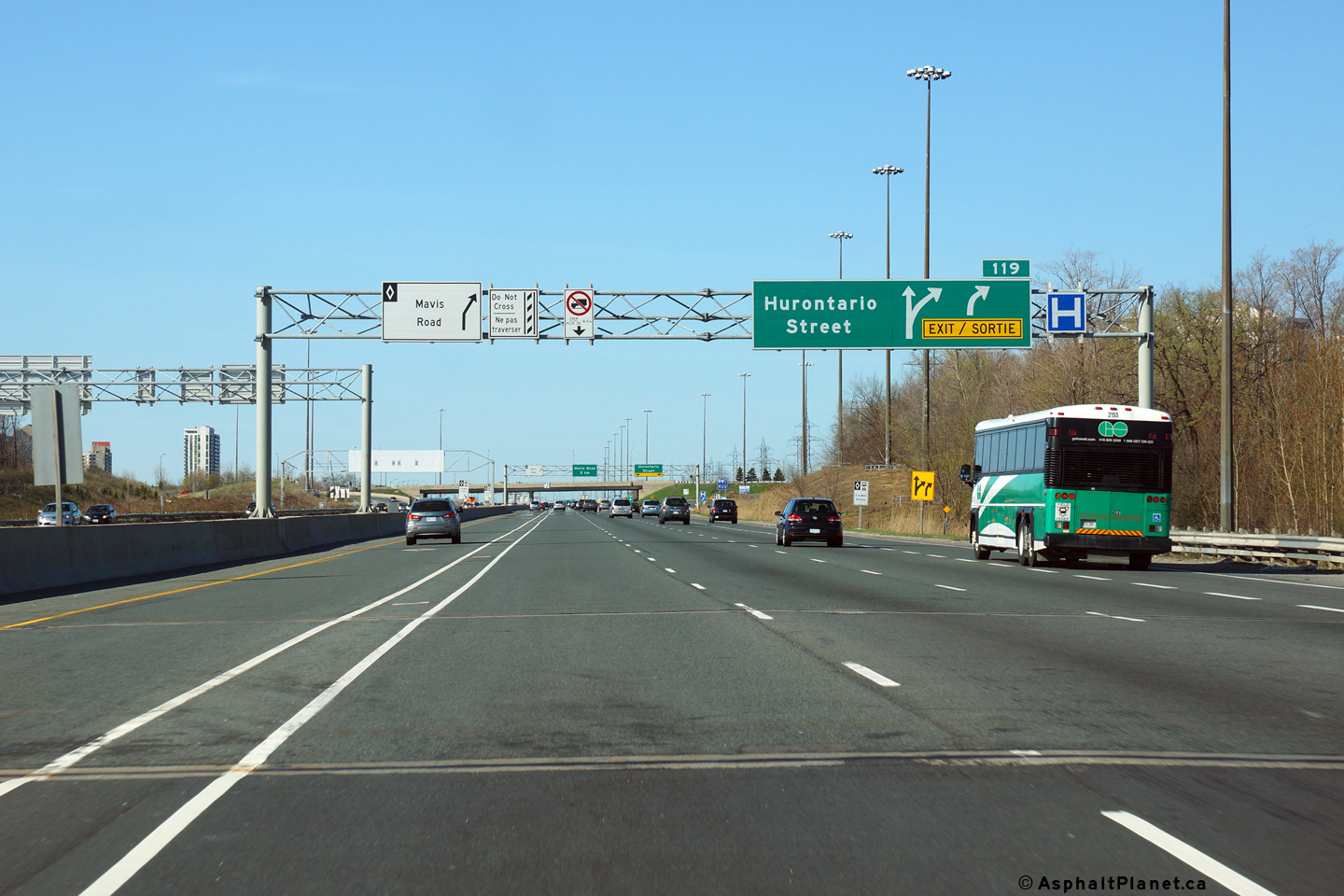
| City of Mississauga Regional Municipality of Peel |
Overhead advanced sign for the Hurontario Street interchange. Notice
the black on white HOV signage also on the overhead. Photo taken: May 11th, 2014. |
||
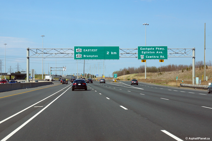
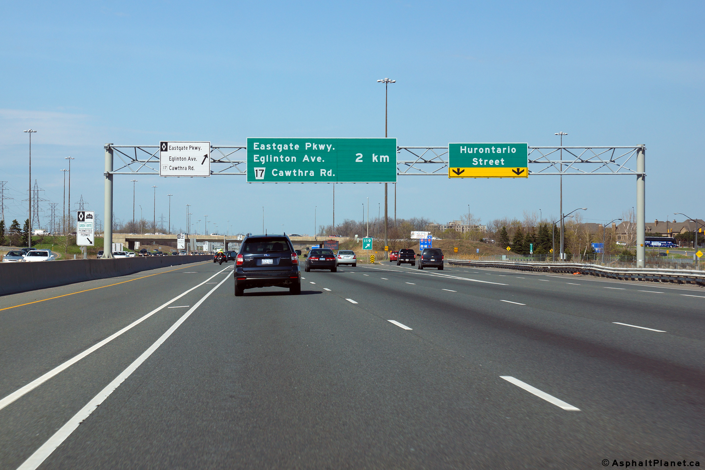
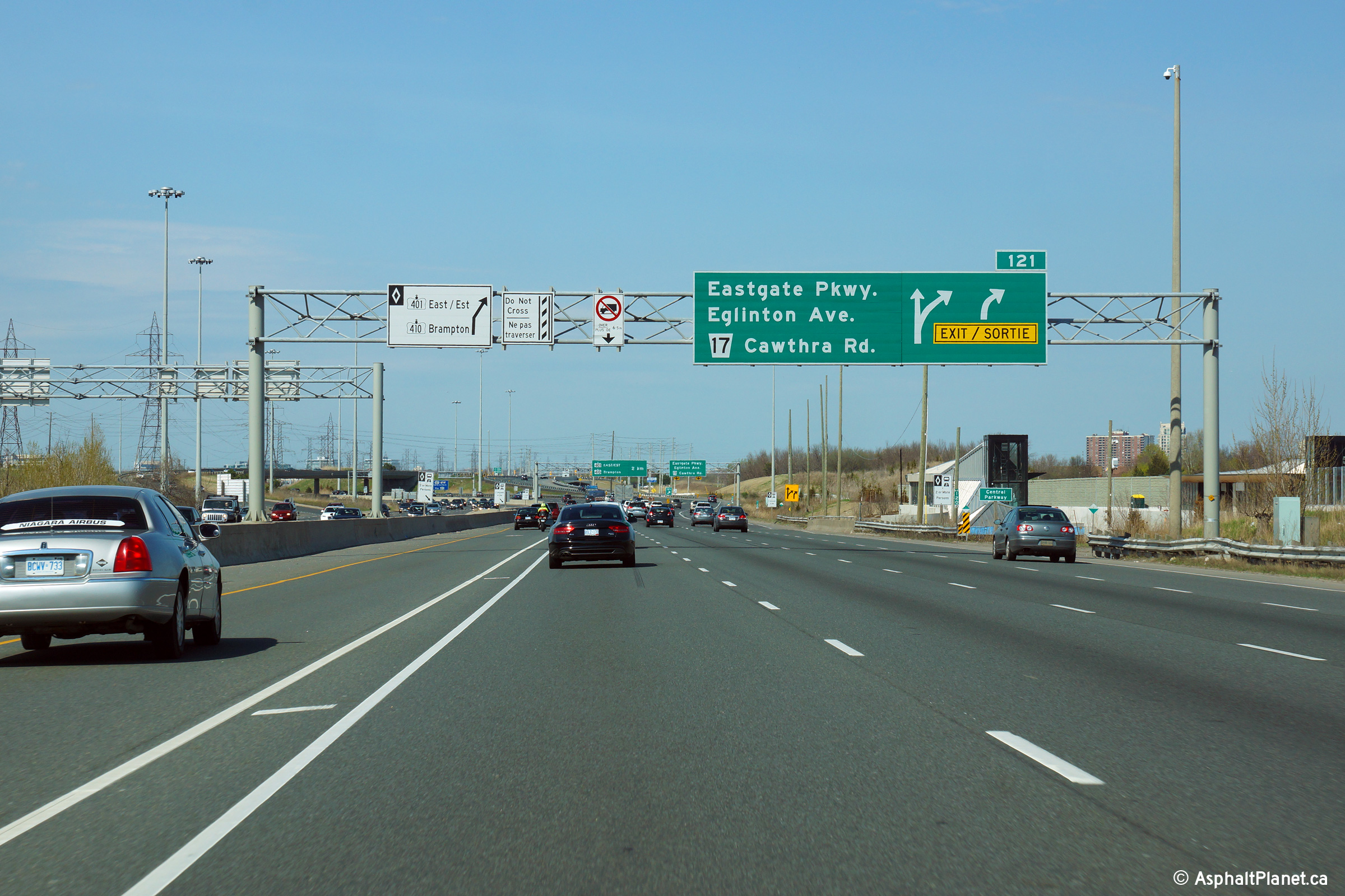
| City of Mississauga Regional Municipality of Peel |
Advanced signage for the ramp to Cawthra Road,
Eastgate Parkway and Eglinton Avenue interchange. Note the
advanced sign overtop of the HOV lane directing traffic to the Highway 410
'exit'. Photo taken: May 11th, 2014. |
 (720x480) (720x480)(1440x960) (2400x1600) |
|
| City of Mississauga Regional Municipality of Peel |
Signage at the ramp to Cawthra Road, Eastgate Parkway and Eglinton Avenue.
Eastgate Parkway was first conceived as a freeway that was to link Highway
403 directly to the Highway 401/427 interchange in Etobicoke. While it
was obviously not constructed as a freeway, it is an fairly efficient
at-grade divided highway. Photo taken: May 11th, 2014. |
 (720x480) (720x480)(1440x960) (2400x1600) |
|
| City of Mississauga Regional Municipality of Peel |
Partial overhead sign denoting the transfer from the HOV lanes to the
Highway 410 and 401 East Collectors. This sign is somewhat misleading
as both the through HOV-lane movement and the "exit" are both bound for
Highway 401 East. Photo taken: May 11th, 2014. |
 (720x480) (720x480)(1440x960) (2400x1600) |
|
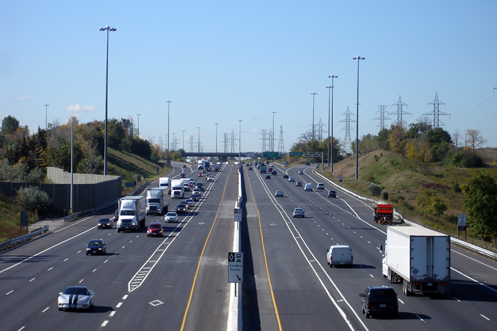
| City of Mississauga Regional Municipality of Peel |
View looking westerly from the on-ramp from Eastgate Parkway to Highway 403.
Note just how wide the highway and associated hydro right-of-way is within Mississauga.
Mississauga Transit is constructing a dedicated bus-rapid-transit
line within the ample right-of-way. Photo taken: March 16th, 2009. |
 |
|
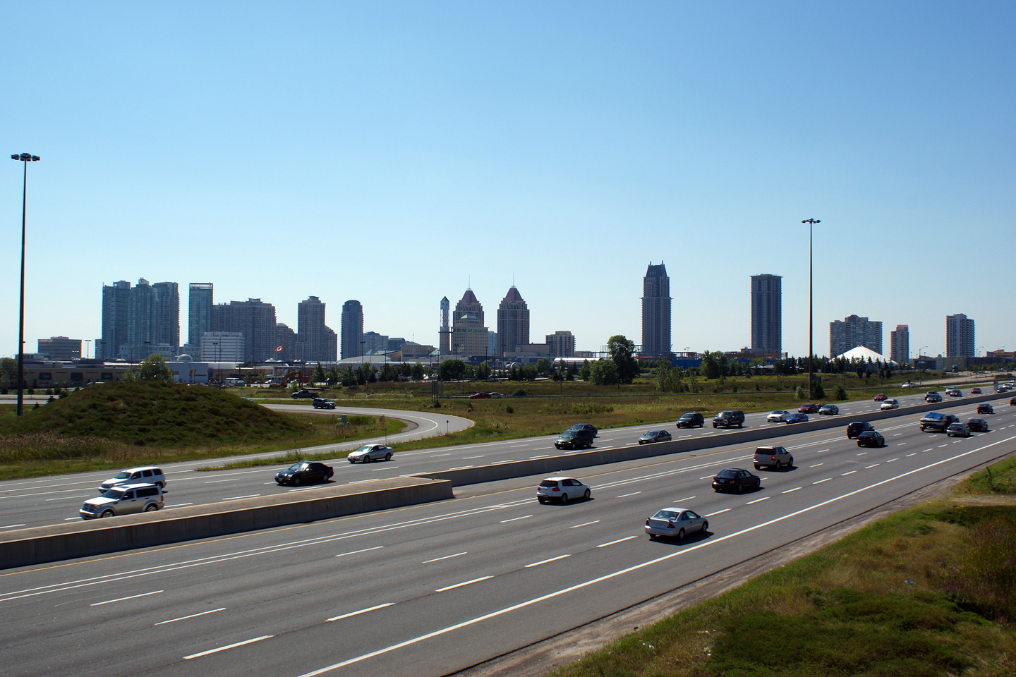
| City of Mississauga Regional Municipality of Peel |
This view looks westerly between the off-and on-ramp to and from Eastgate
Parkway. Note the Mississauga cityscape, very impressive considering it is
a suburb of Toronto. Photo taken: August 28th, 2010. |
||
| City of Mississauga Regional Municipality of Peel |
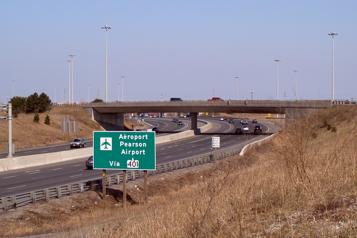
View looking easterly towards the Eglinton Avenue interchange. Note
the bilingual signage directing traffic towards the 401 for the airport. Photo taken: March 16th, 2009. |
 |
|
| City of Mississauga Regional Municipality of Peel |
Advanced diagramical signage for the Highway
401/410
split. Interestingly, though probably not surprising, that no effort was
made to differentiate the HOV lanes from the general purpose lanes on the
diagram signage. Photo taken: May 11th, 2014. |
 (720x480) (720x480)(1440x960) (2400x1600) |
|
| City of Mississauga Regional Municipality of Peel |
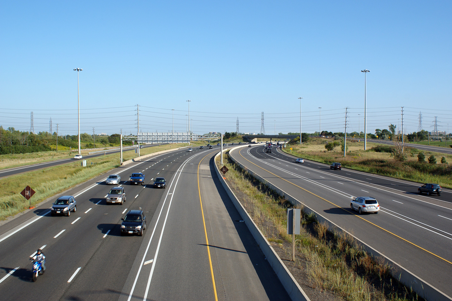
A centralized view of Highway 403 from the Eglinton Avenue overpass in
Mississauga. At Eglinton Avenue, westbound traffic turns 90degrees and
heads southwest. Interestingly, the southern Eglinton Avenue ramps do not
directly access the 403, instead they lead to the Cawthra Road
interchange, where a turn is required to access the freeway. Photo taken: August 28th, 2010. |
||
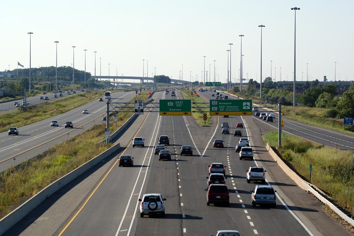
| City of Mississauga Regional Municipality of Peel |
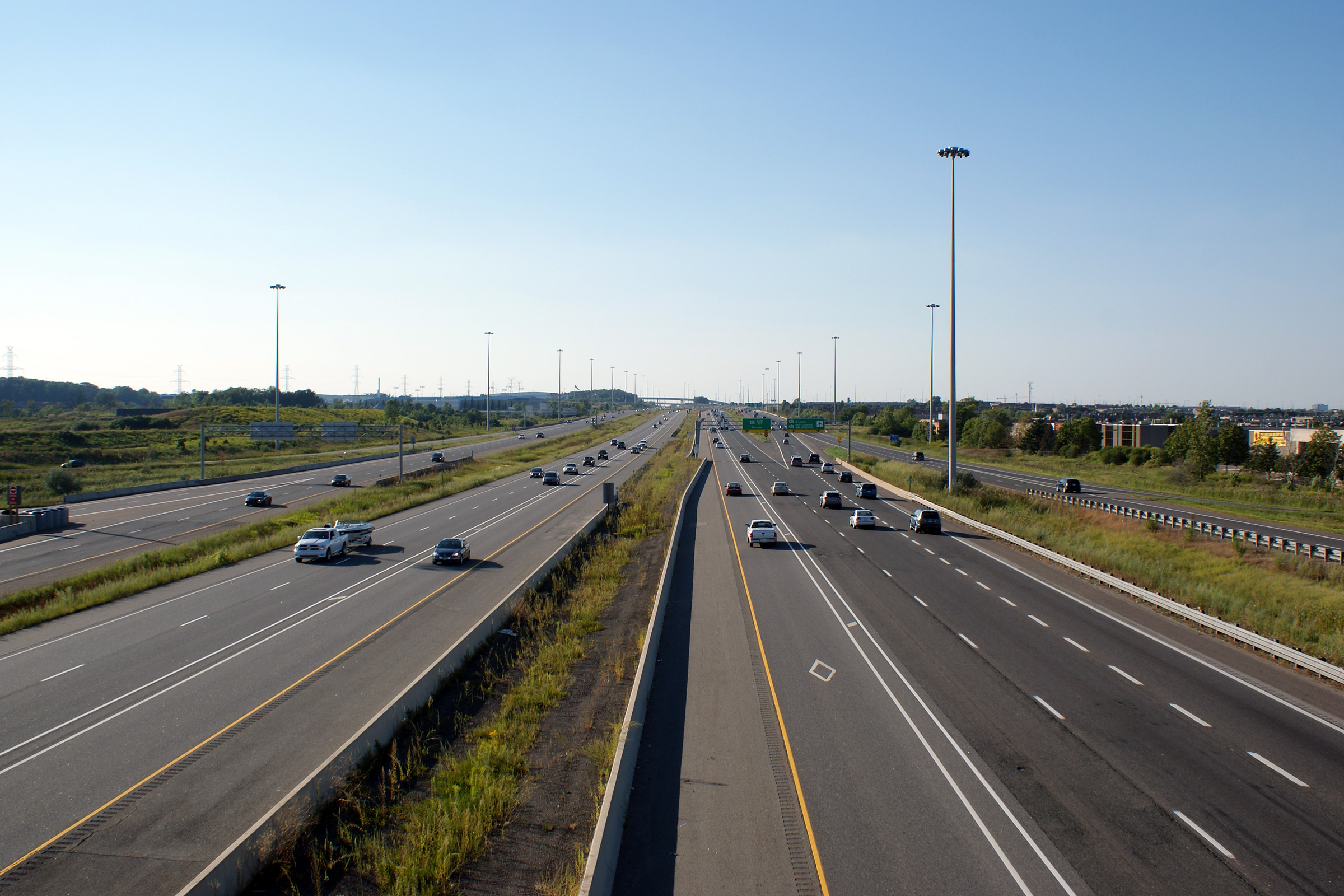
Highway 403 looking east (north) from the Eglinton Avenue overpass in
Mississauga. As shown in the photo, Highway 403 has a short
core-distributor system from Eglinton Avenue northerly to
Highway 401.
Also visible in this photo, is the large Highway
401/403/410 interchange
which is located about 3km to the north. Photos taken: August 28th, 2010. |
||
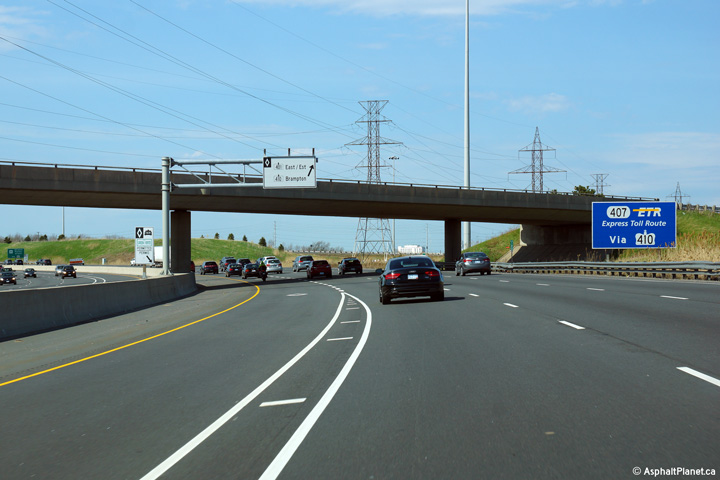
| City of Mississauga Regional Municipality of Peel |
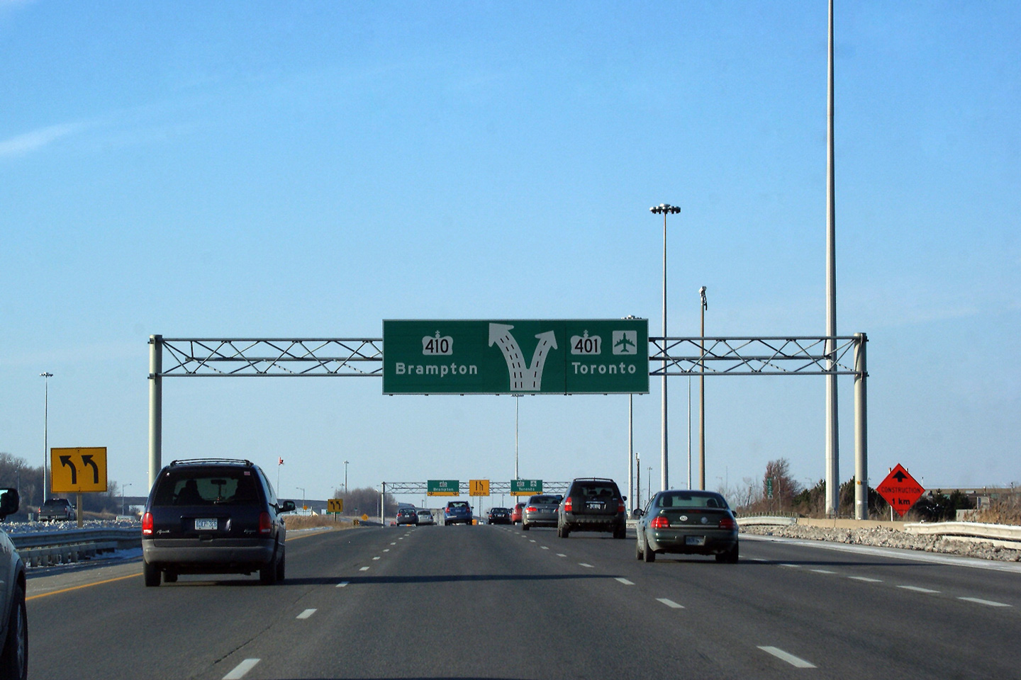
Driving eastbound approaching the Highway Highway
401/403/410
interchange. The mainline 403 lanes default for the eastbound express
lanes of Highway 401. Highway 410
is only accessed from the 403's short collector lanes. Photo taken: August 28th, 2010. |
 (720x480) (720x480)(1440x960) (2400x1600) |
|
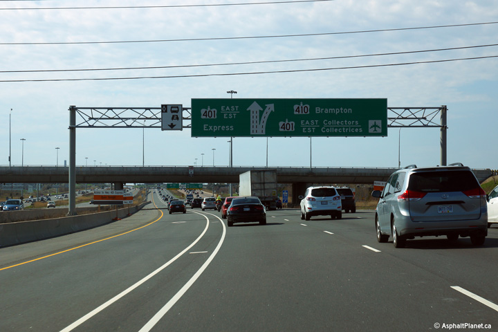
| City of Mississauga Regional Municipality of Peel |
In the collectors, there is another diagram sign advises drivers of the
upcoming split between Highway 401 and 410. Note that the yellow
roadside mounted lane diagram signs show Highway 410 as the exit, not
Highway 401. Inconsequential, but interesting nonetheless. Photo taken: December 12th, 2009. |
 (720x480) (720x480)(1440x960) |
|
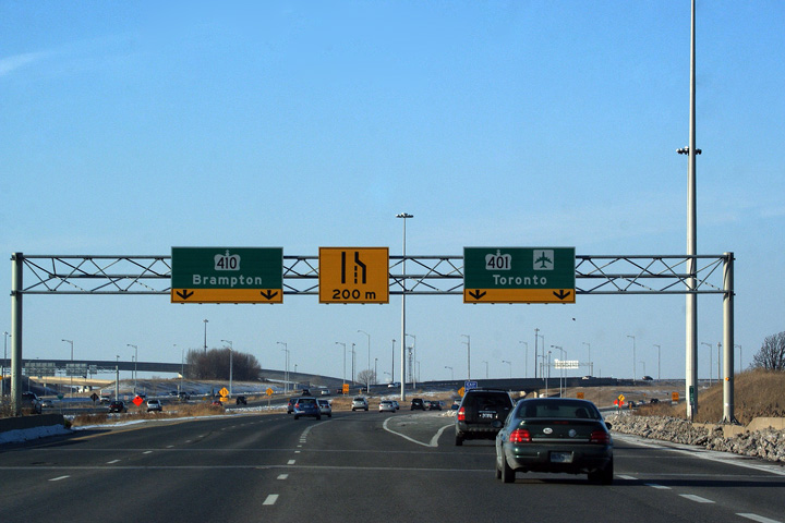
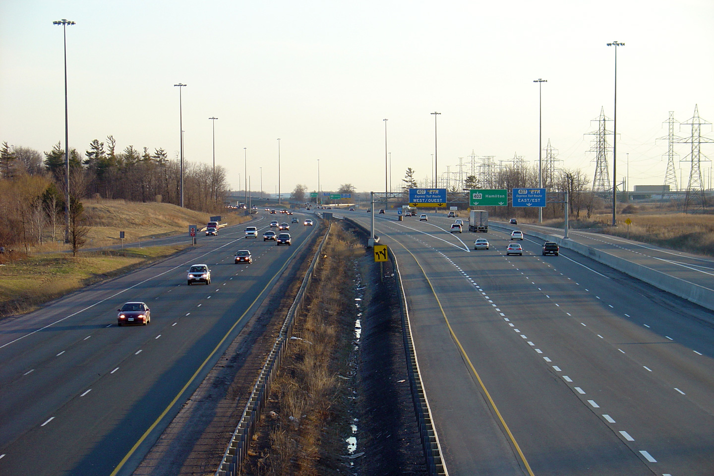
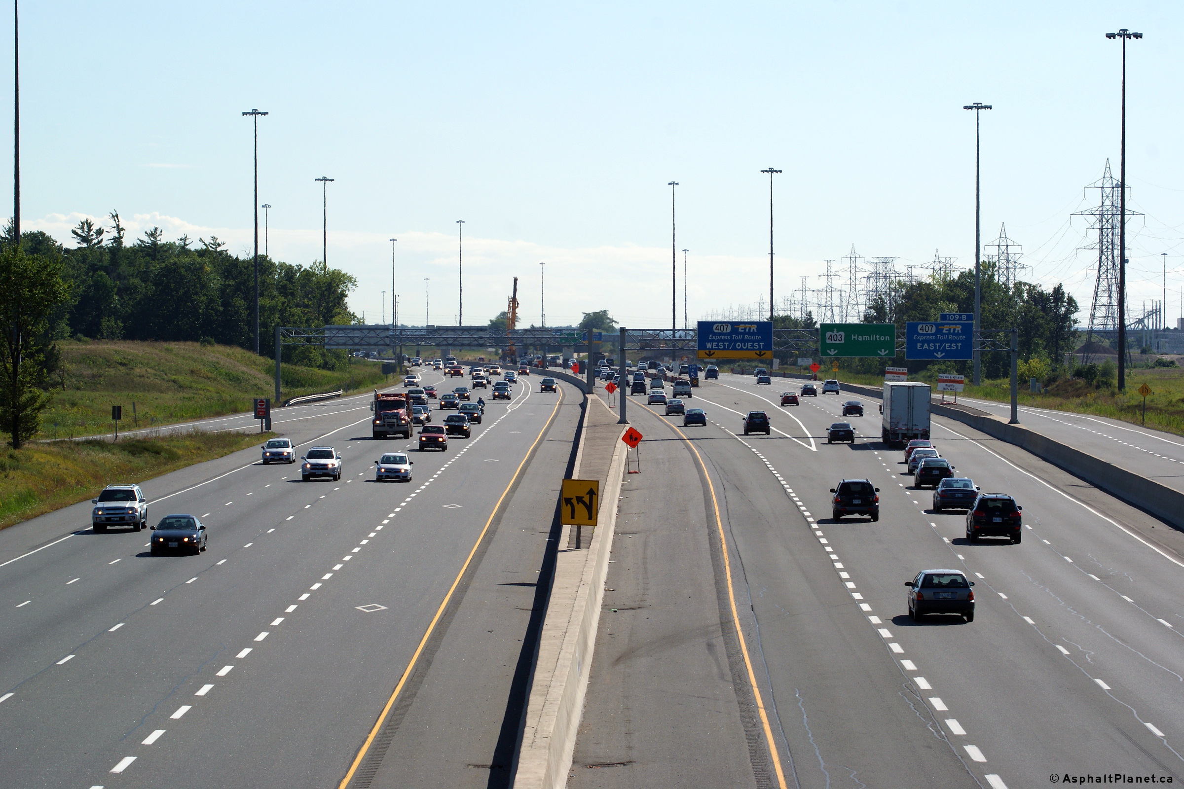
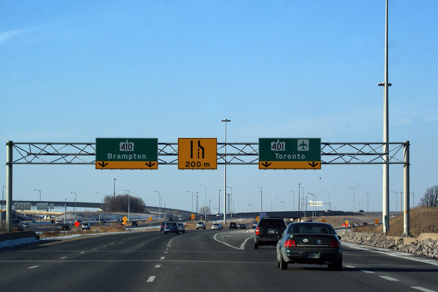
| City of Mississauga Regional Municipality of Peel |
Signage at the split to the 401-East Collectors and Highway 410. This
is the eastern terminus of Highway 403. Photo taken: December 12th, 2009. |
 (720x480) (720x480)(1440x960) |
|
|
Highway 403 ends at a large interchange with
Highway 401 and Highway 410. Click here for Highway 401 images and here for Highway 410 images. |
|||
<- Page 4 Images Highway 403 Images Index Other Images ->
<- Highway 402 Images Back to Highway 403 Highway 404 Images ->
Copyright (c) 2004-2015, Scott Steeves (Webmaster) scott@asphaltplanet.ca


