AsphaltPlanet.ca > OntHighways >
Highway 407 > Images
> Page 2
Highway 407 ETR - Images
<- Page 1 Page 2 - Mississauga to Vaughan Page 3 - >
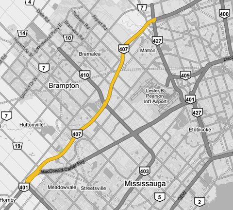
Photos shown in this table are arranged from West to East:
| Proper Municipality Name | Photo Description | Photo | |||
|
Photos taken from driver's perspective appear offset from centre-line Photos: |
East- Bound |
West- Bound |
|||
| Continued from Page 1 images | |||||
| Highway 407 meets Highway 401 in Western Mississauga. Click here for Highway 401 images. | |||||
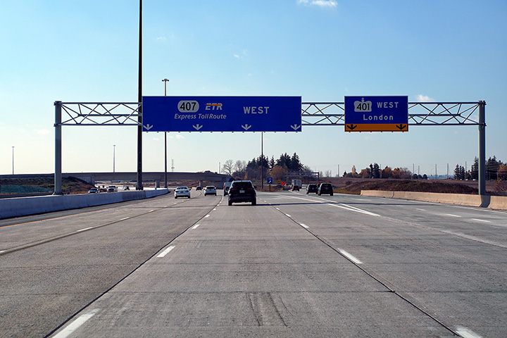
| Town of Halton
Hills Regional Municipality of Halton |
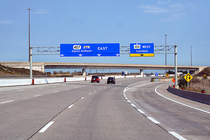
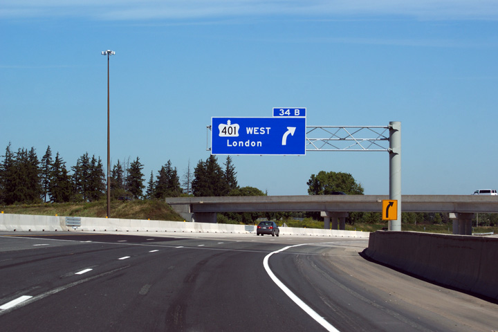
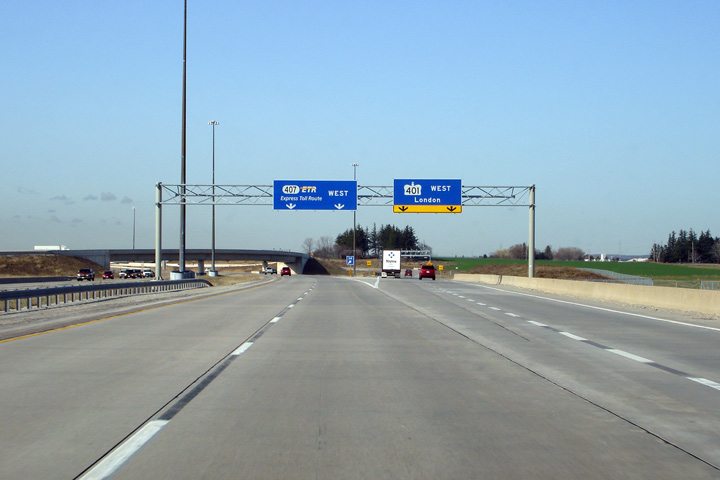
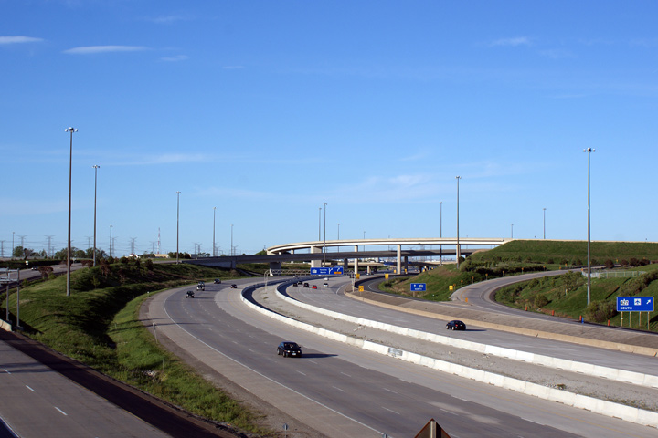
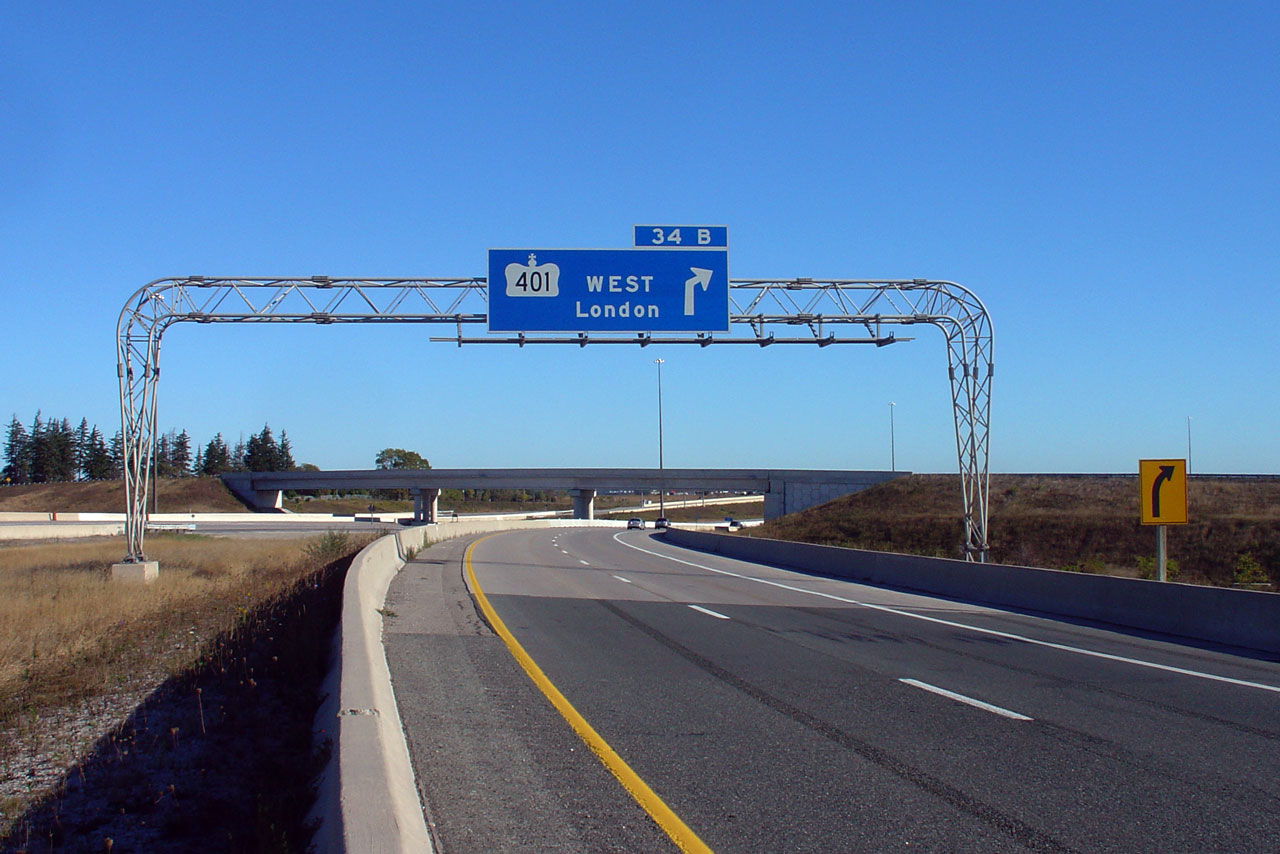
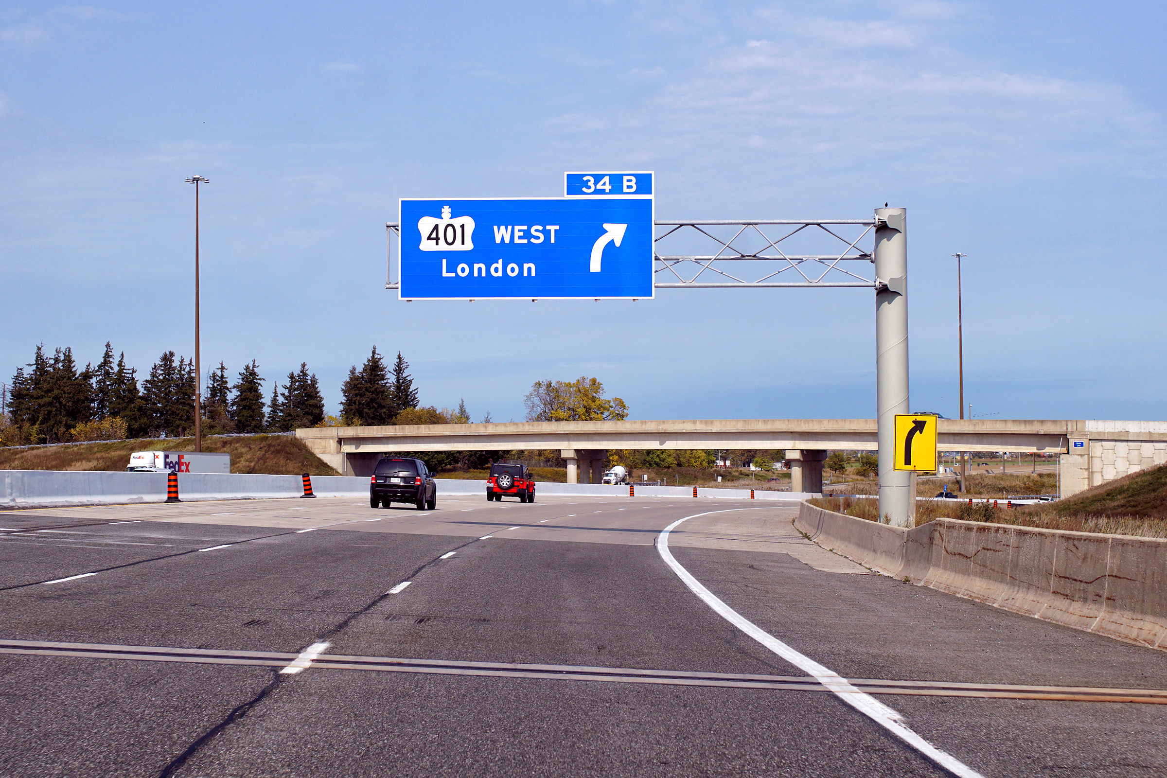
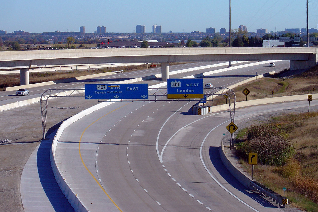
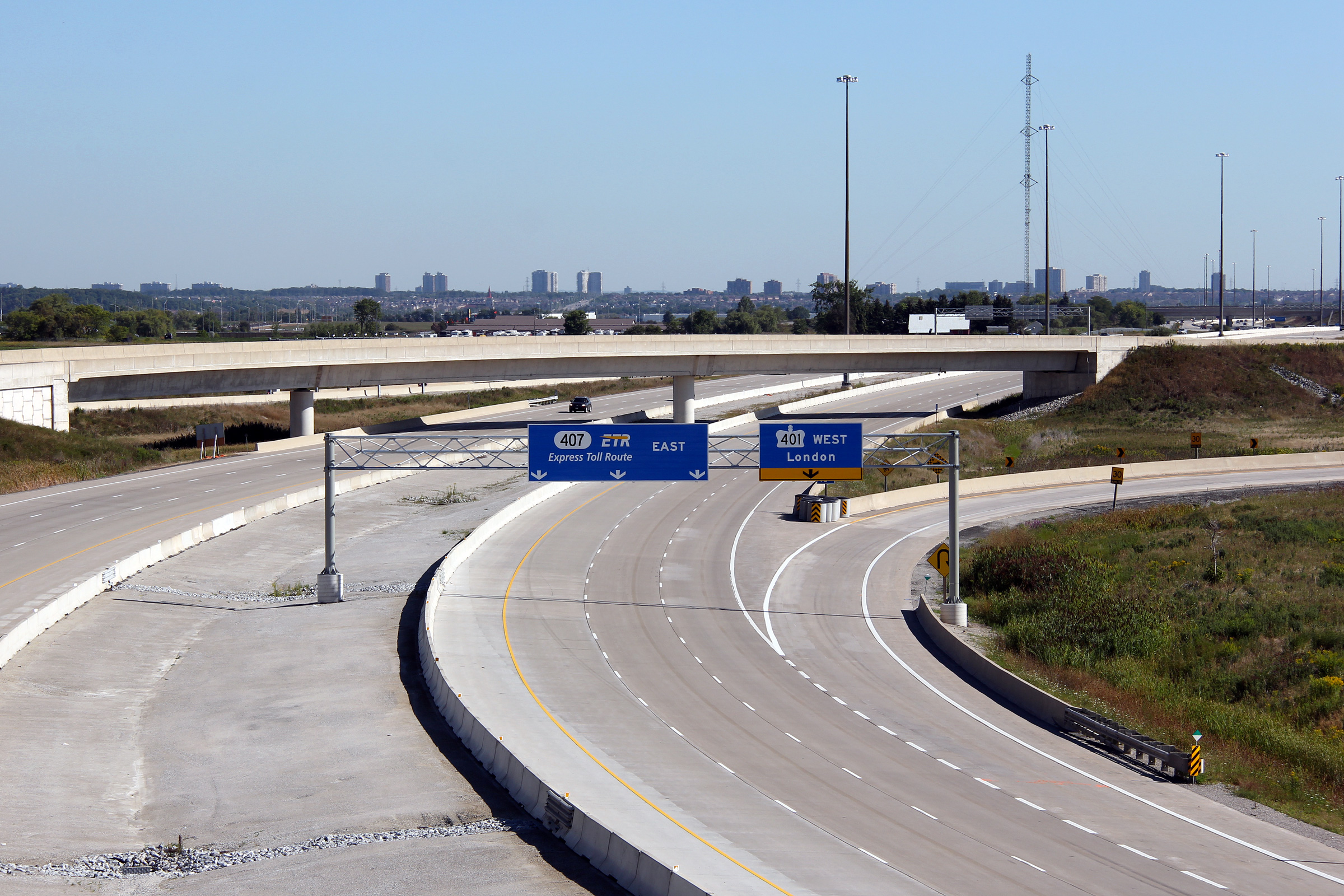
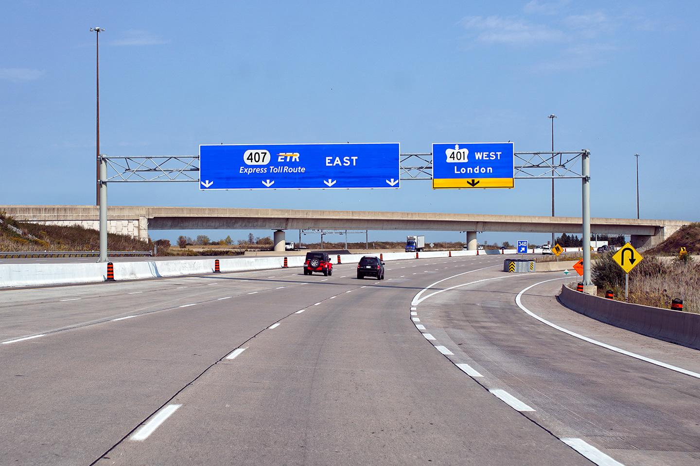
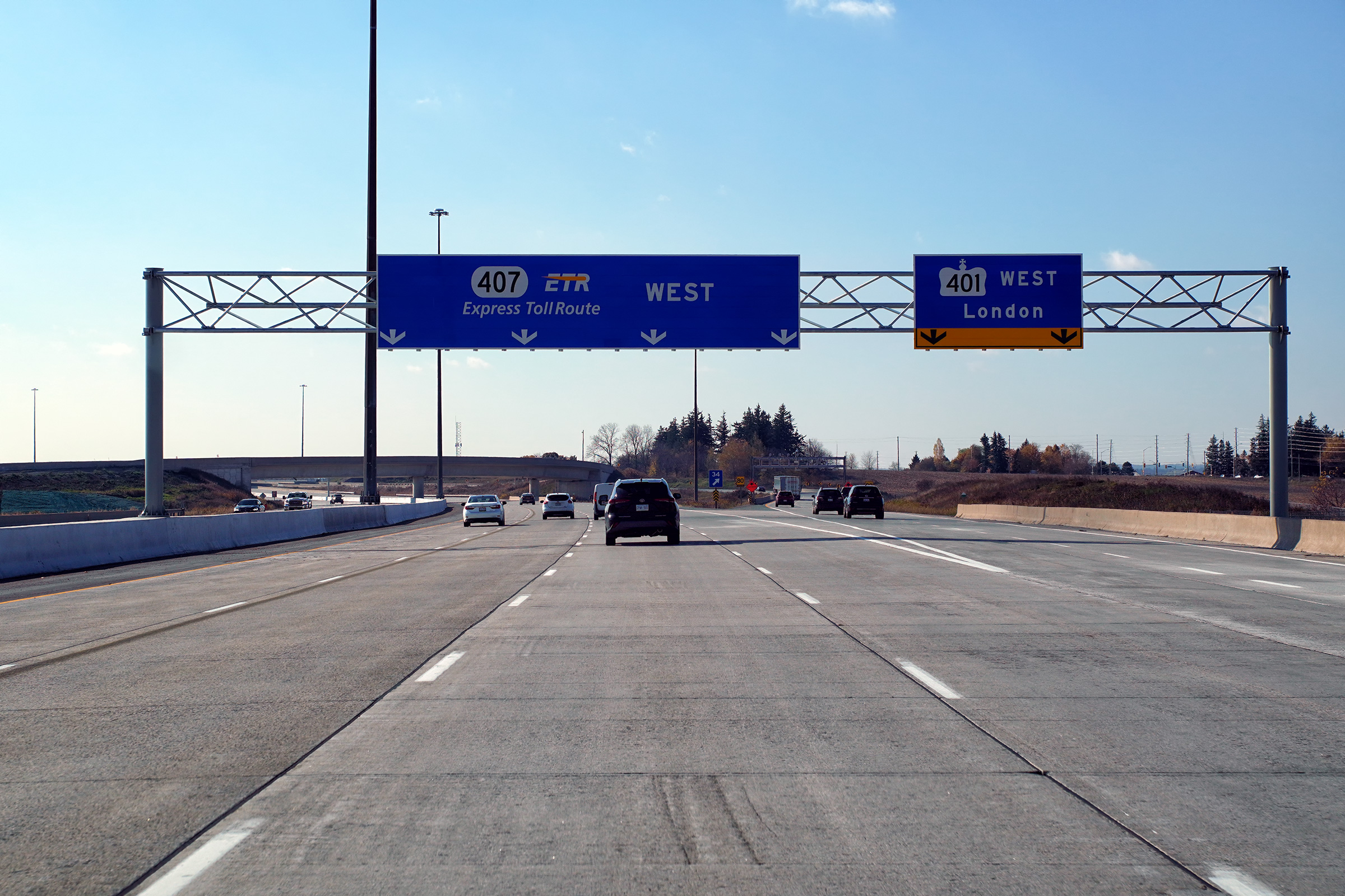
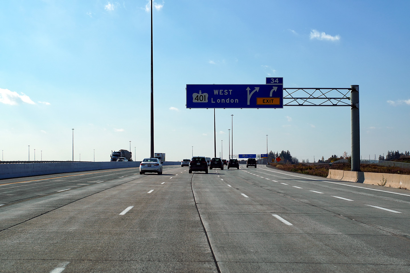
Advanced signage for the ramp from Highway 407 West to
Highway 401 East. Photo #1 taken: September 23rd, 2007 Photo #2 taken: September 9th, 2011. Photo #3 taken: October 28th, 2020. |
 (720x480) (720x480)(1440x960) (2400x1600) |
|||
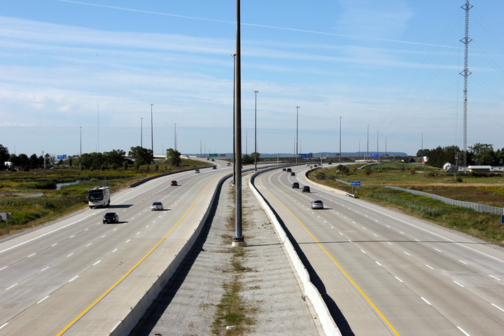
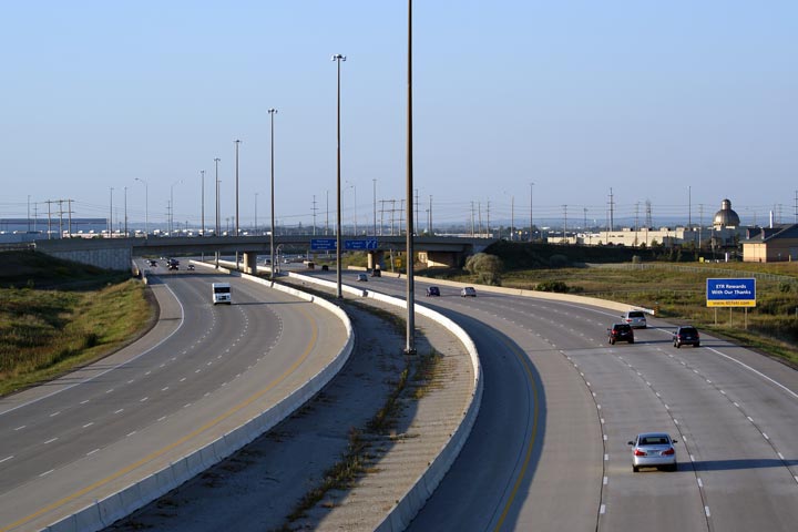
| Town of Halton
Hills Regional Municipality of Halton |
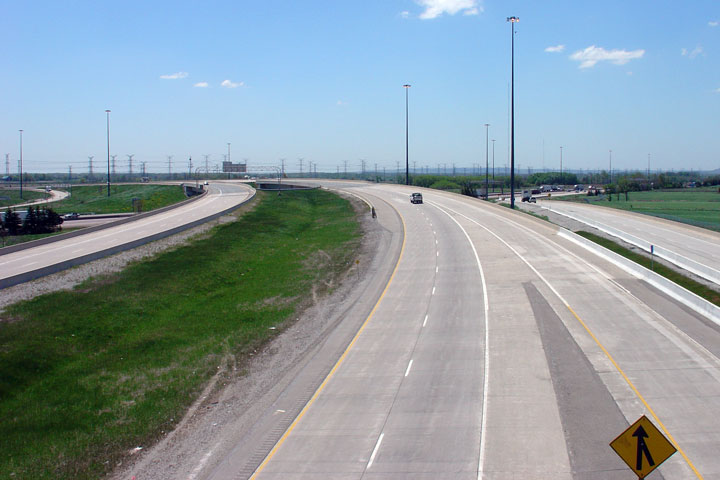
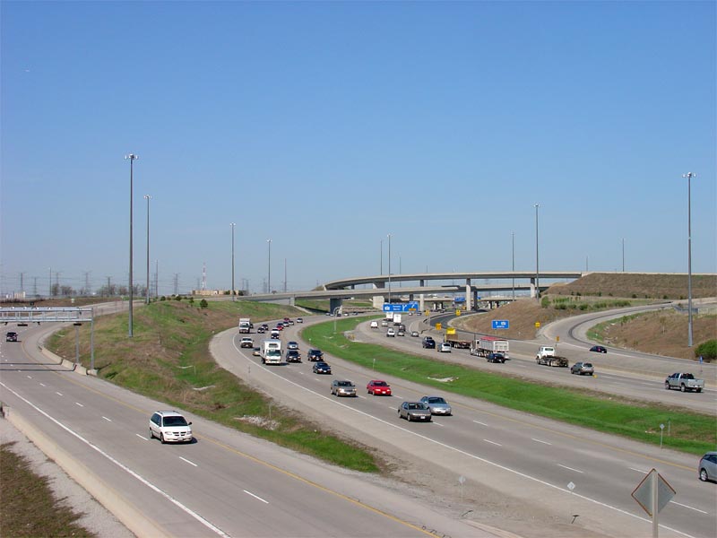
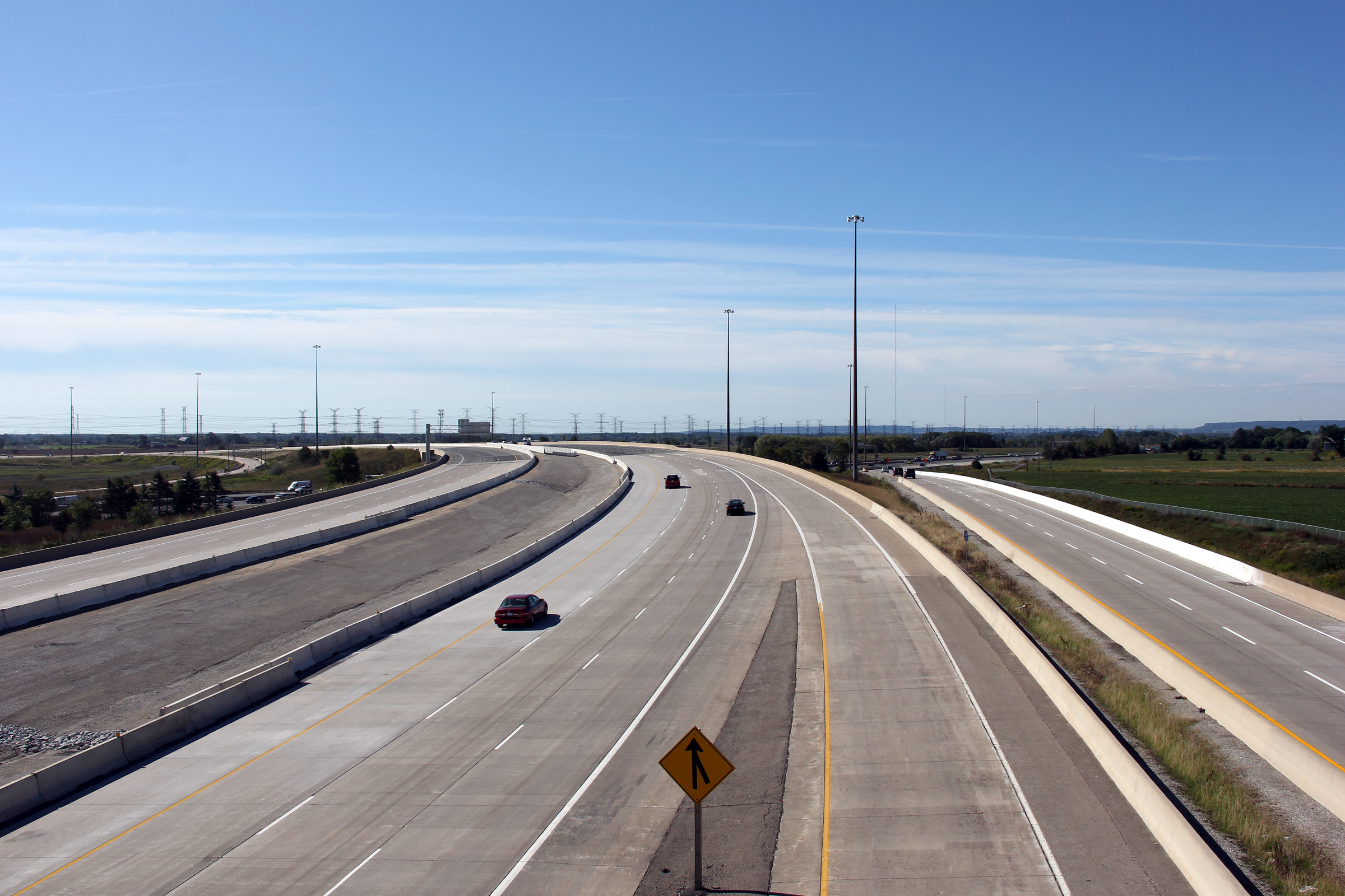
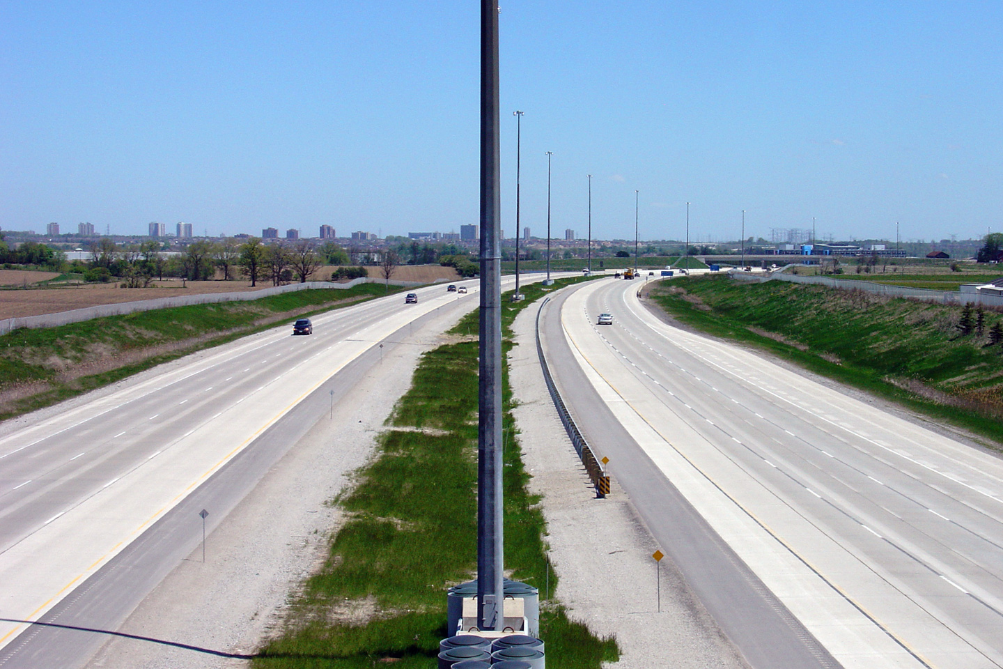
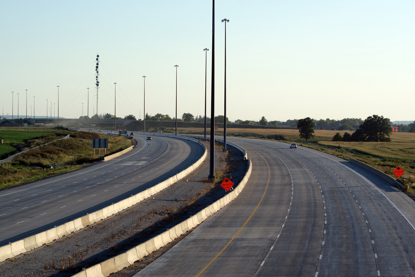
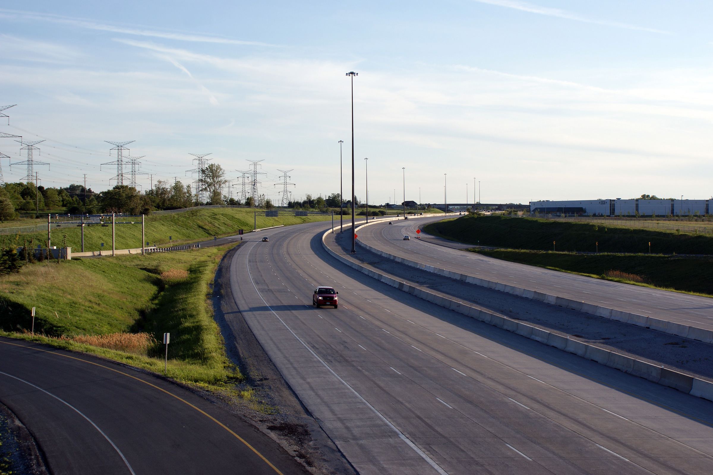
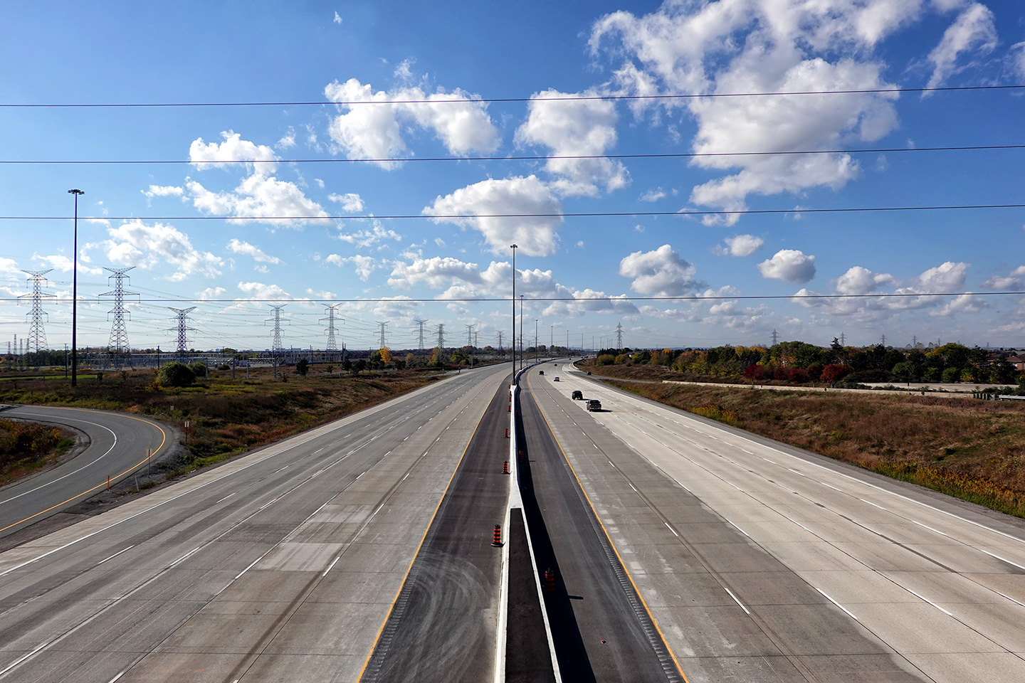
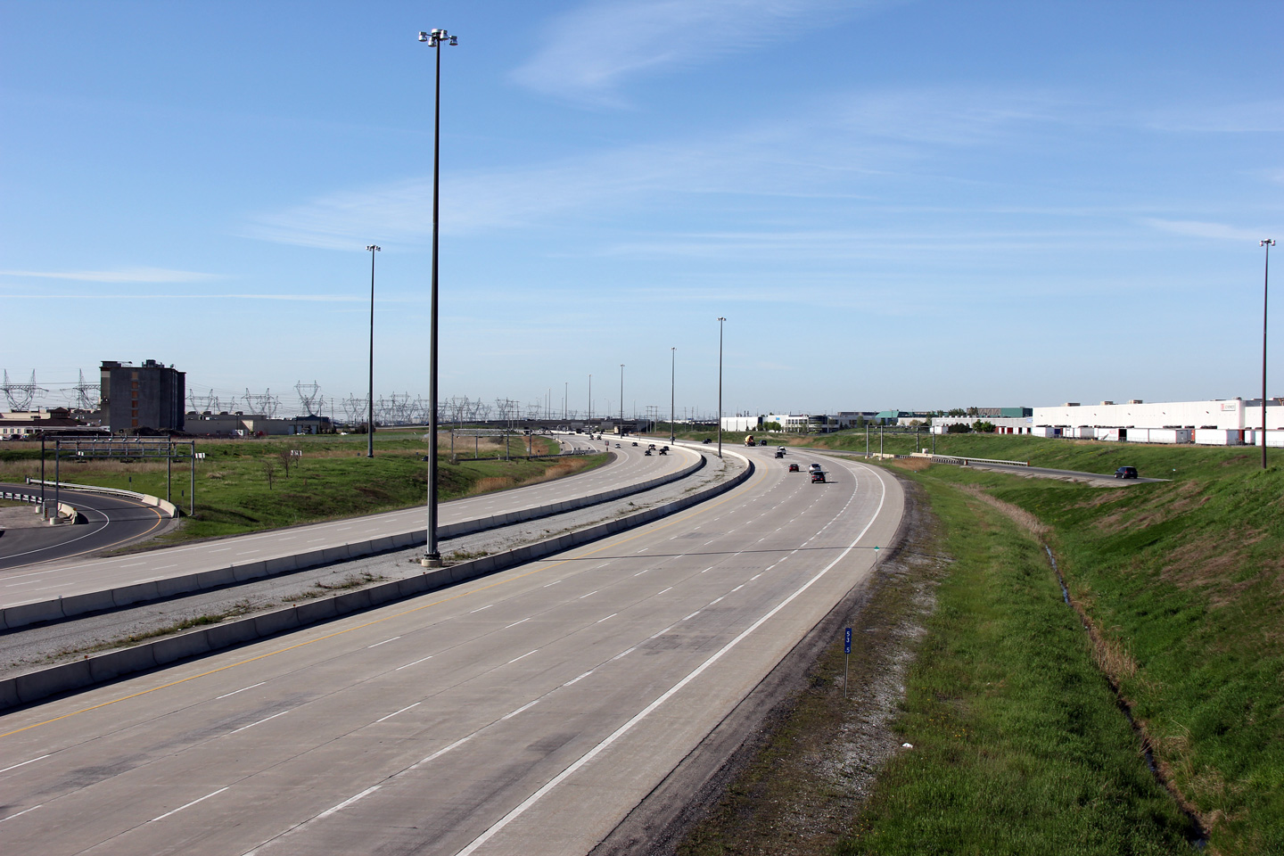
Highway 407 very abruptly curves in a southerly direction
at Highway 401. The 407 is part of the northwestern leg of
Mississauga's ring road. Upper photo taken: May 25th, 2005. Lower photo taken: September 9th, 2011. |
 (720x480) (1440x960) (2400x1600) |
|||
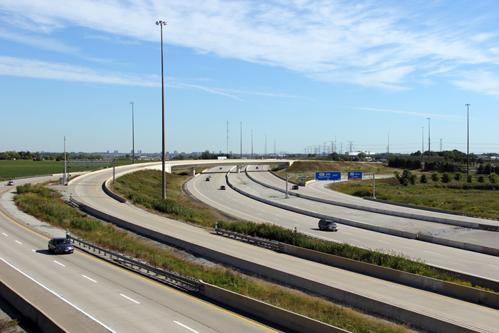
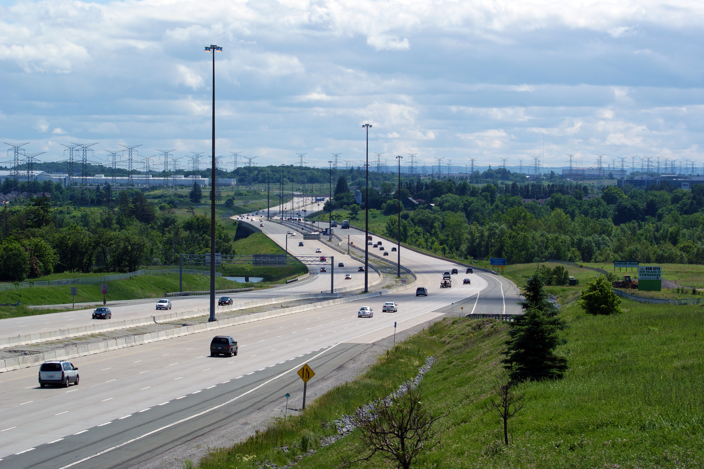
| Town of Halton Hills Regional Municipality of Halton |
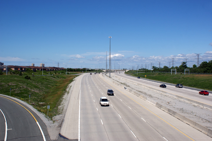
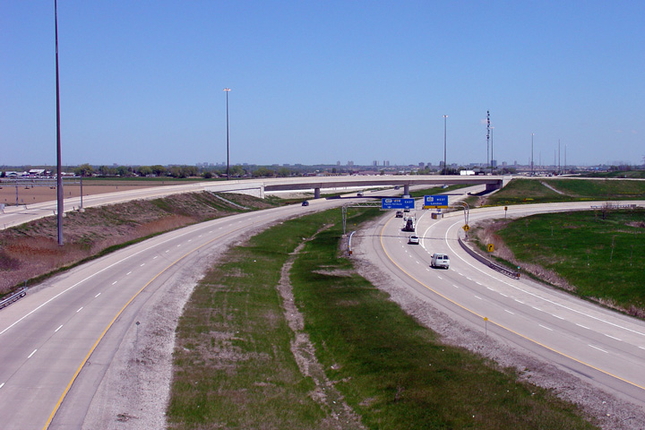
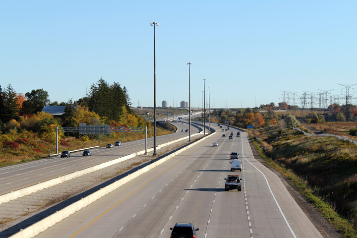
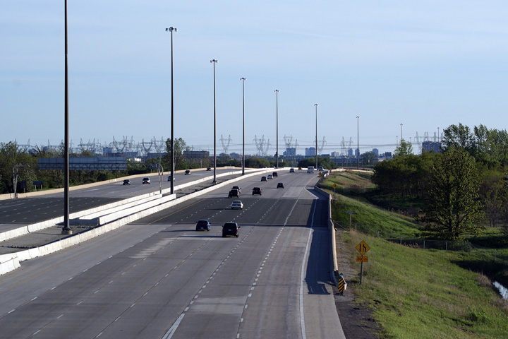
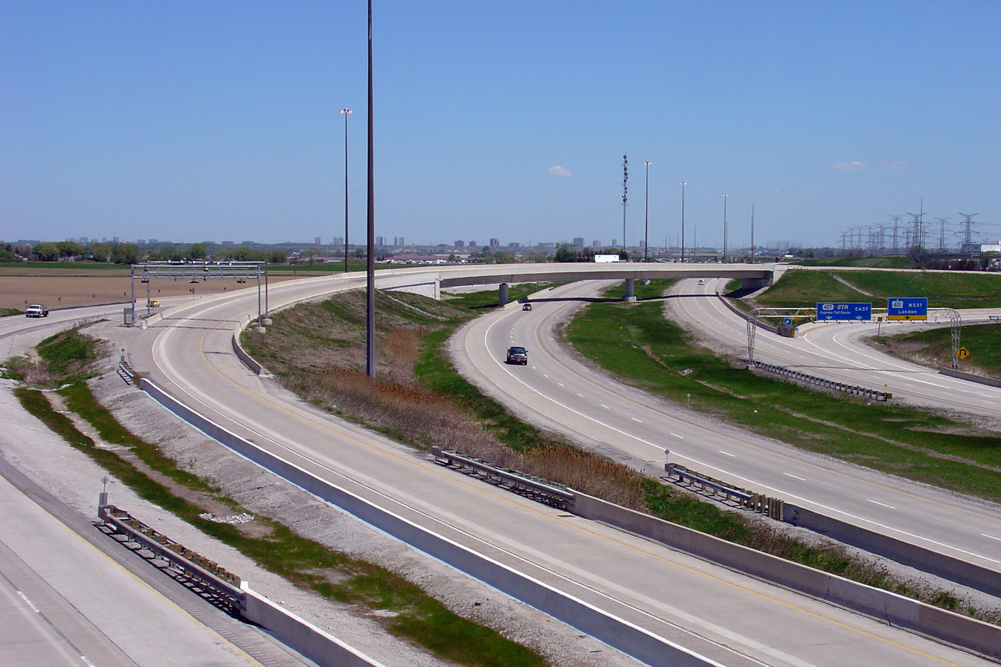
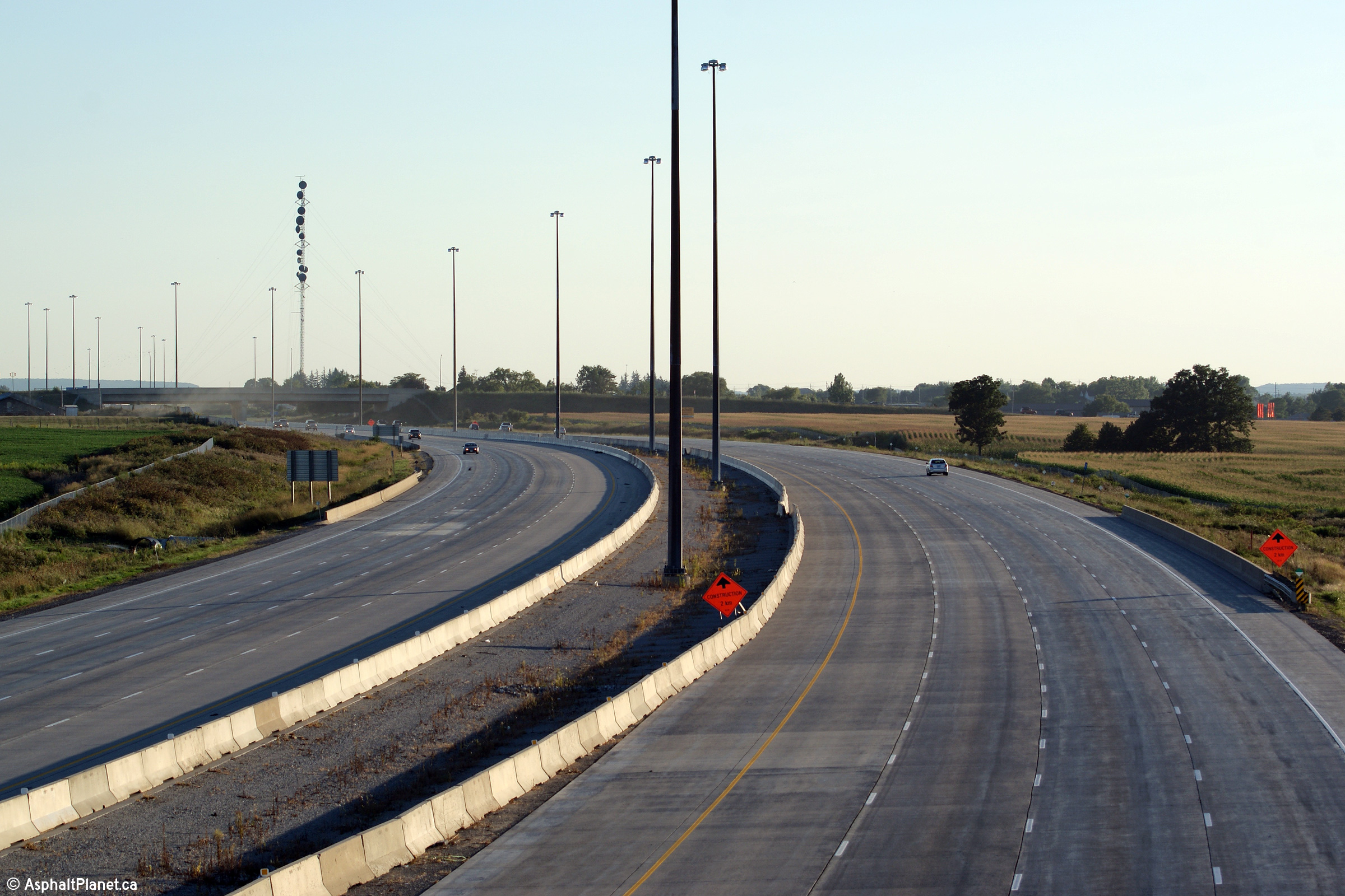
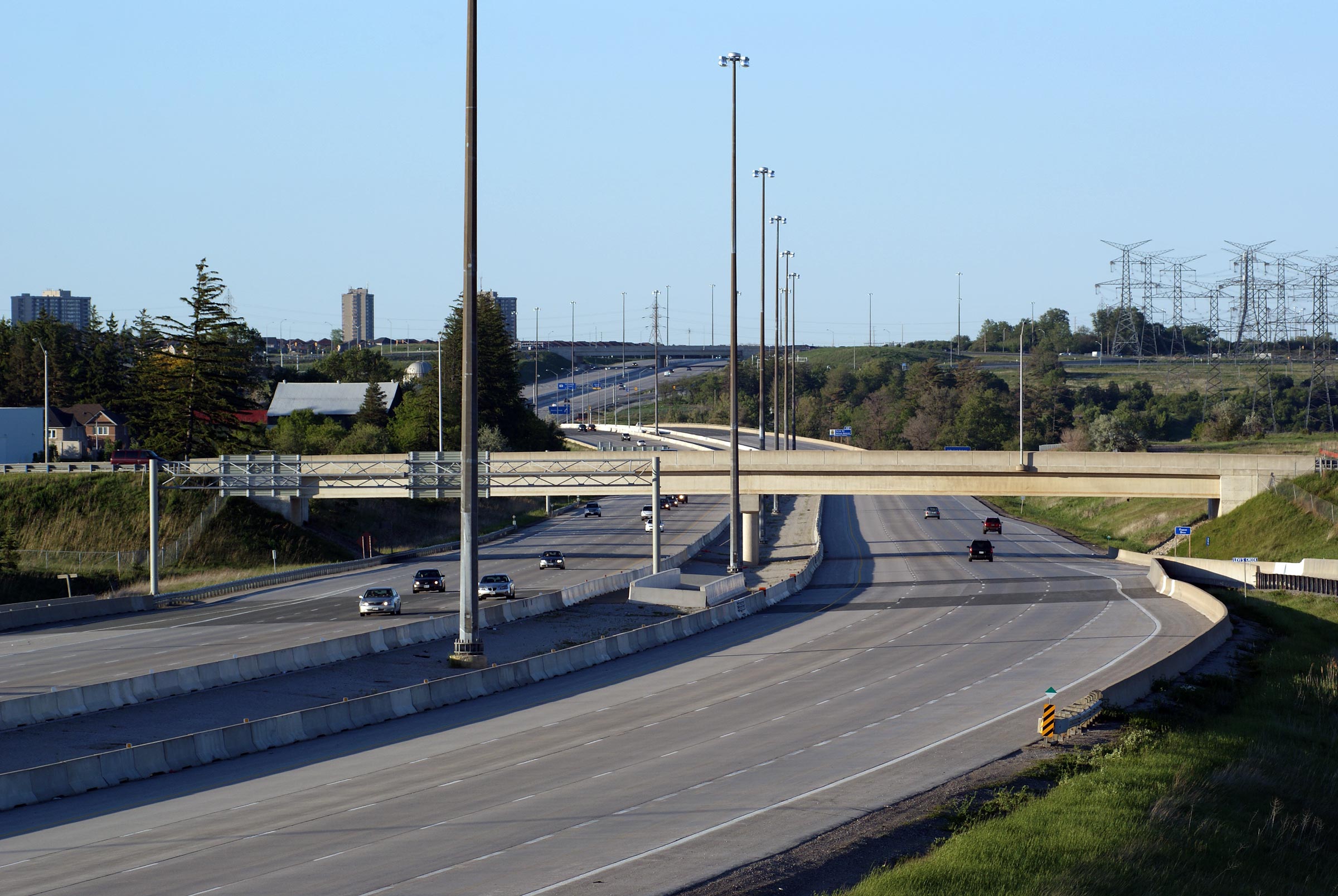
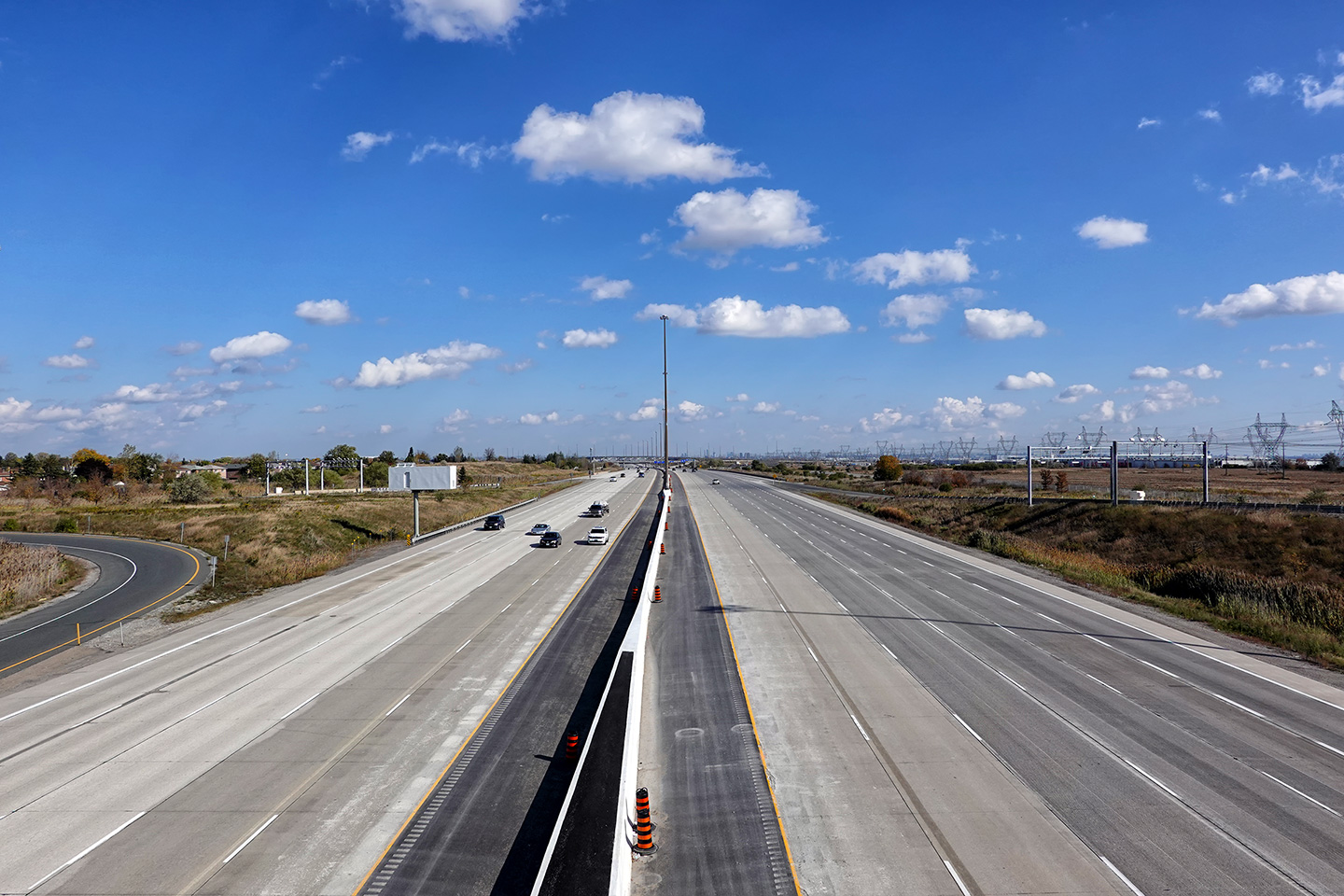
Highway 407 looking east from the Ninth Line Road overpass near
Mississauga. These photos show a good portion of the large Highway
401/407 interchange. Upper photo taken: May 25th, 2005. Lower photo taken: September 23rd, 2007. |
 (720x480) (1440x960) (2400x1600) |
|||
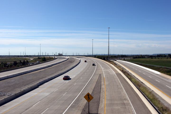
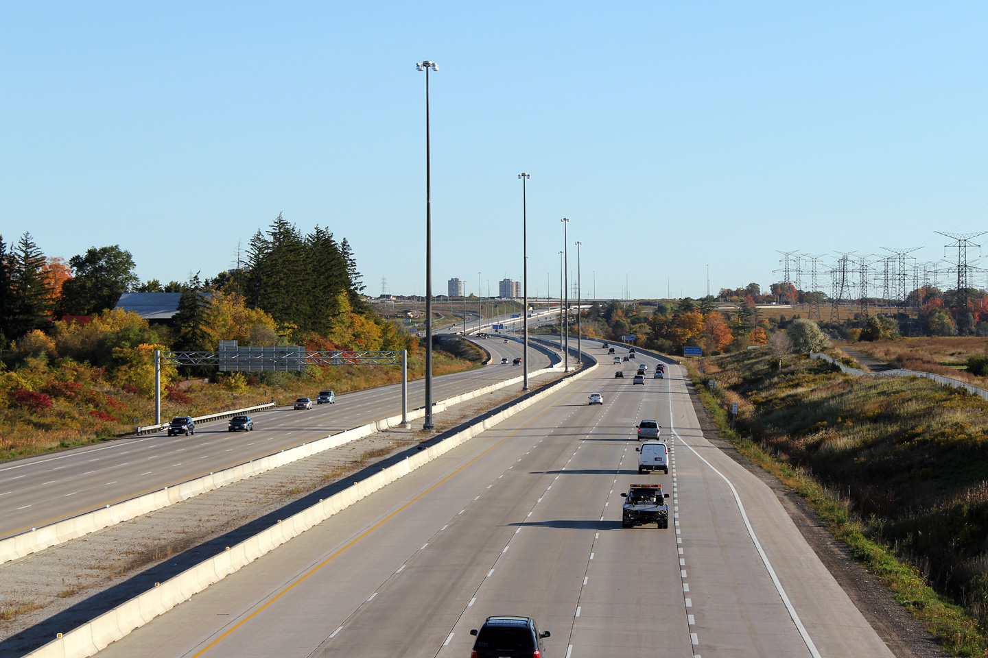
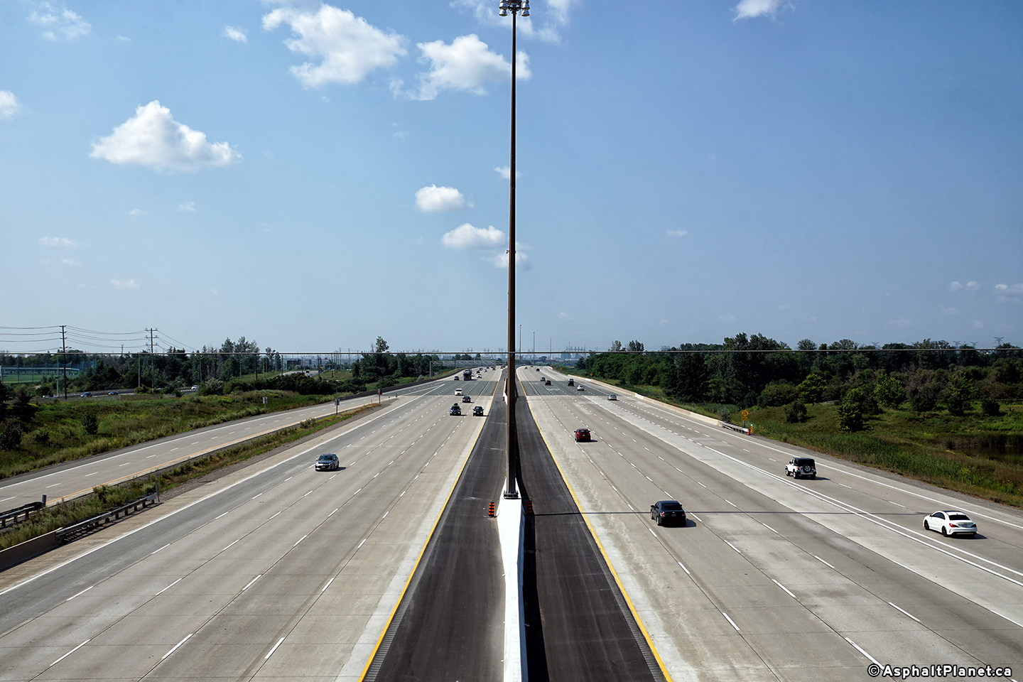
| Town of Halton Hills Regional Municipality of Halton |
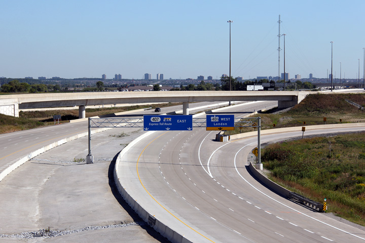
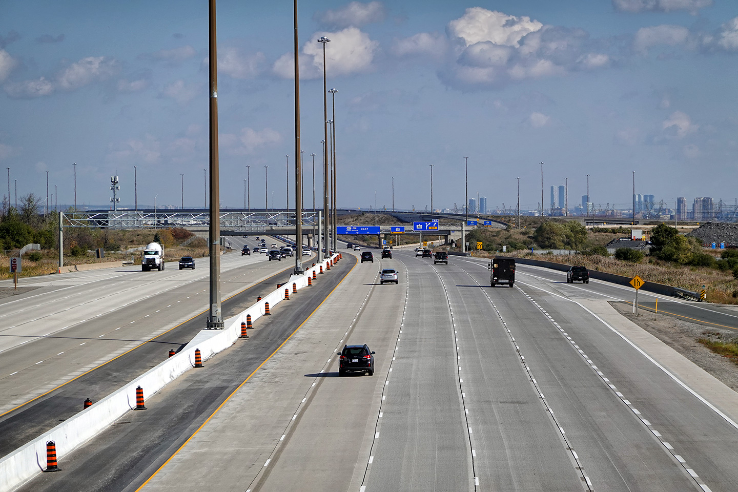
Overhead signage at the loop ramp to Highway 401 East.
Highway 407 has been widened several times through Mississauga since its
initial opening in 1998. When first constructed, Highway 407 was
opened with only four lanes between Highway 403 in Mississauga and Highway
410. Later, in 2004, Highway 407 was widened to six lanes between this
interchange and Highway 410. In 2007 the tollway was widened again,
this time to eight lanes easterly from this interchange. Finally, in
2011, Highway 407 was widened to six lanes between Highway 403 in
Mississauga and this interchange. Photo #1 taken: September 23rd, 2007. Photo #2 taken: September 9th, 2011. Photo #3 taken: October 28th, 2020. |
 (720x480) (720x480)(1440x960) (2400x1600) |
|||
| Town of Halton Hills Regional Municipality of Halton |
Overhead signage along westbound 407 denoting the
Highway 401 interchange. Only the westbound 401 is accessible from the
westbound 407 -- there are no ramps linking the westbound 407 with the
eastbound 401. Upper photo taken: April 17th, 2006. Lower photo taken: October 7th, 2011. |
 (720x480) (720x480)(1440x960) (2400x1600) |
|||
| Town of Halton Hills Regional Municipality of Halton |
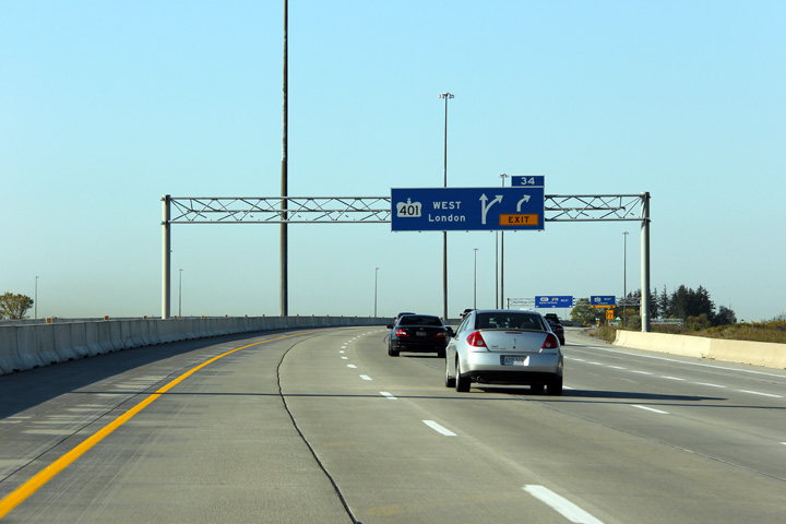
Overhead advanced signage for the Highway 401
interchange. The 401 ramp was widened from one to two lanes as part of
the 407 widening that saw the highway widened to 6-lanes westerly from
Hurontario Street to Highway 401 in 2004.
The right-most 407 lane now defaults off at the 401 interchange. Photo taken: October 7th, 2011. |
 (720x480) (720x480)(1440x960) (2400x1600) |
|||
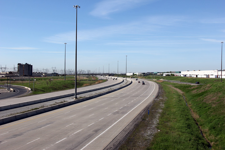
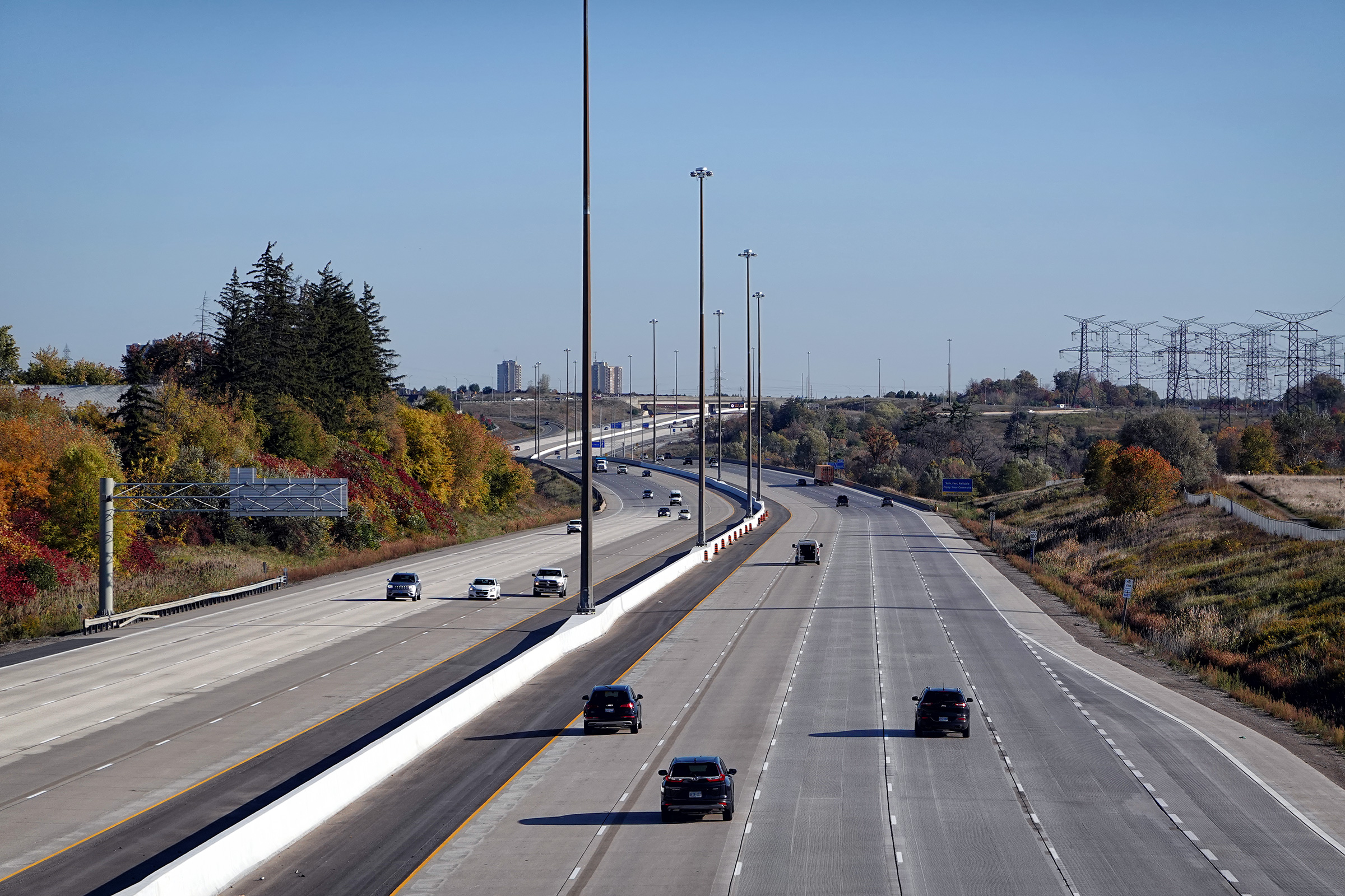
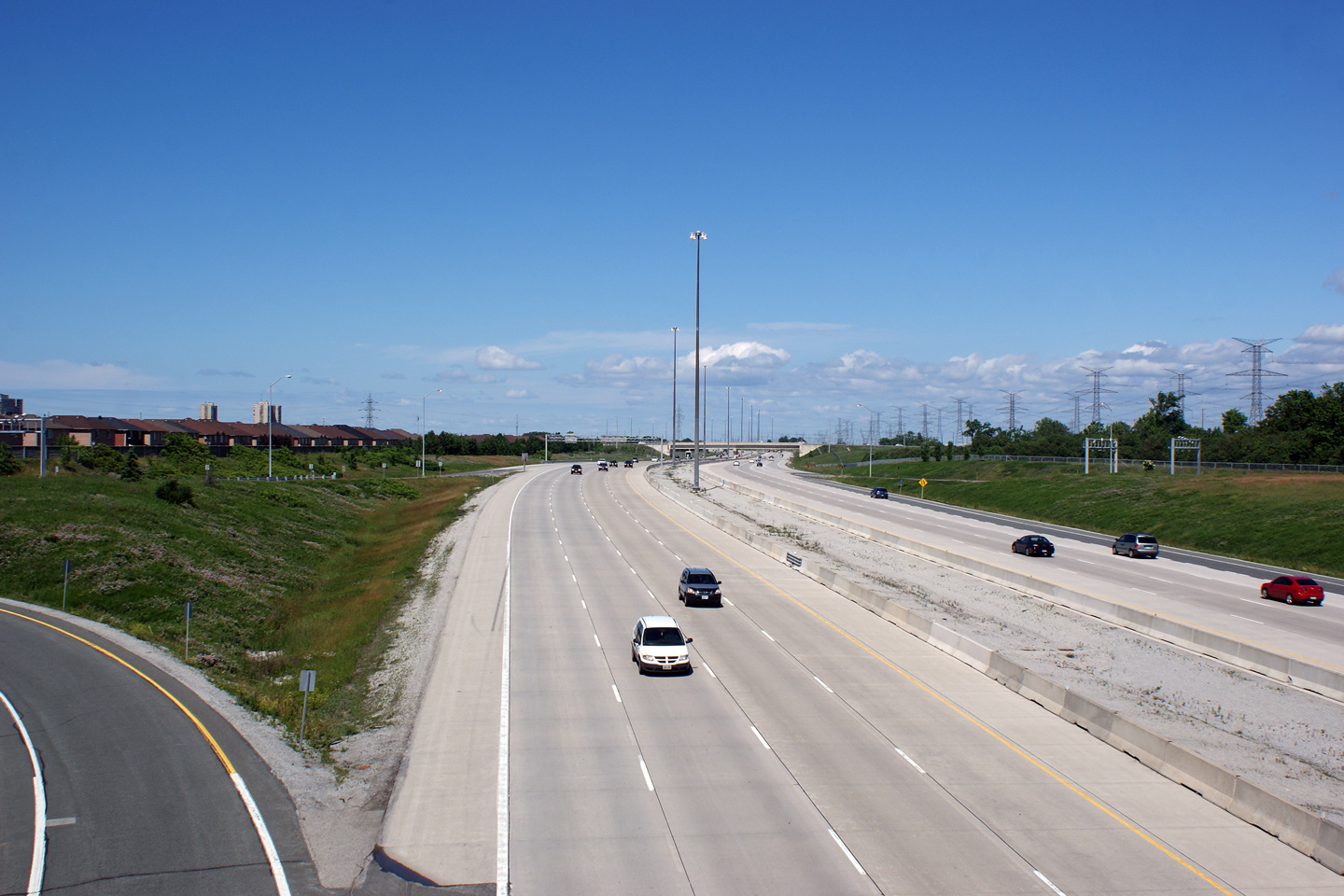
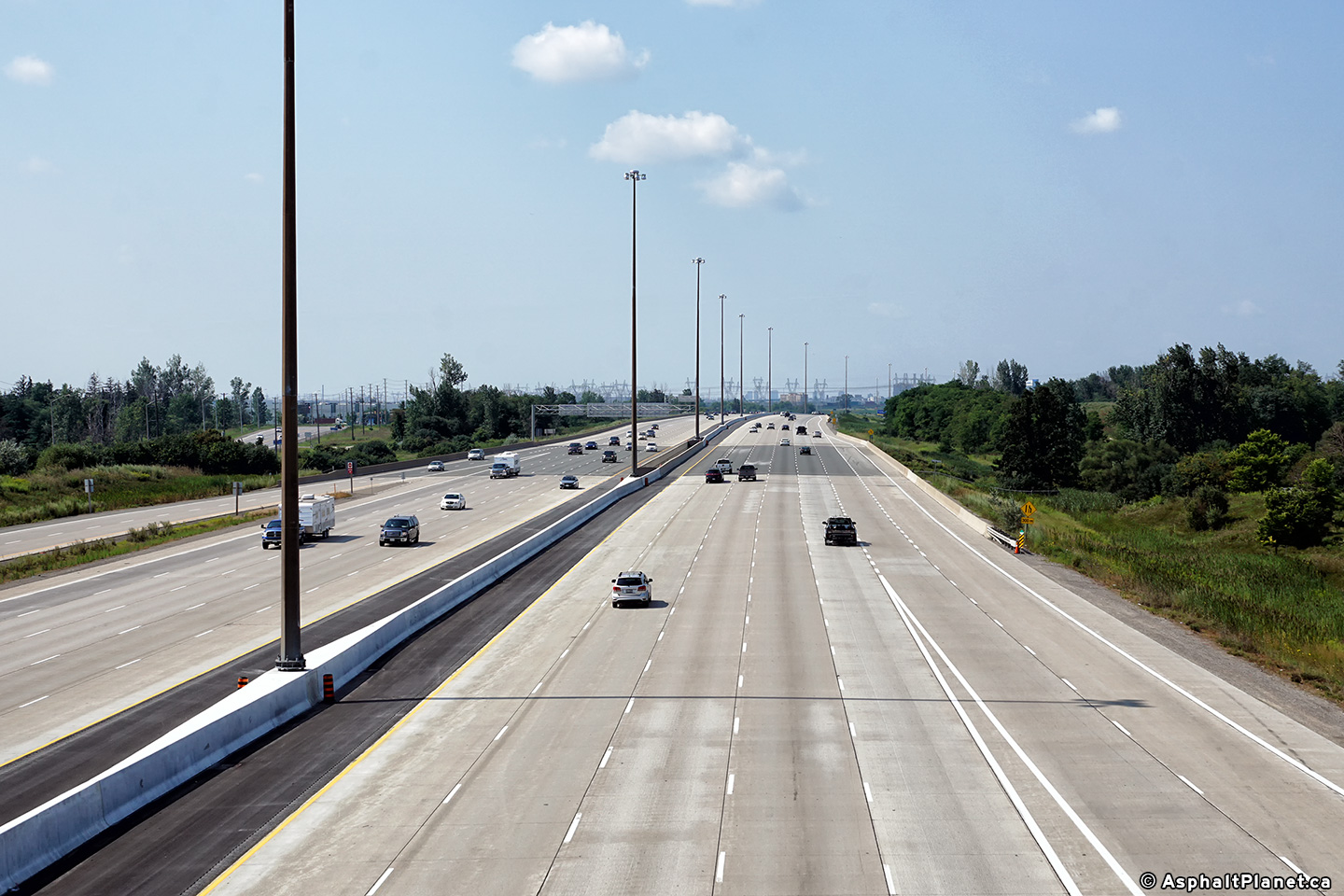
| Town of Halton Hills Regional Municipality of Halton |
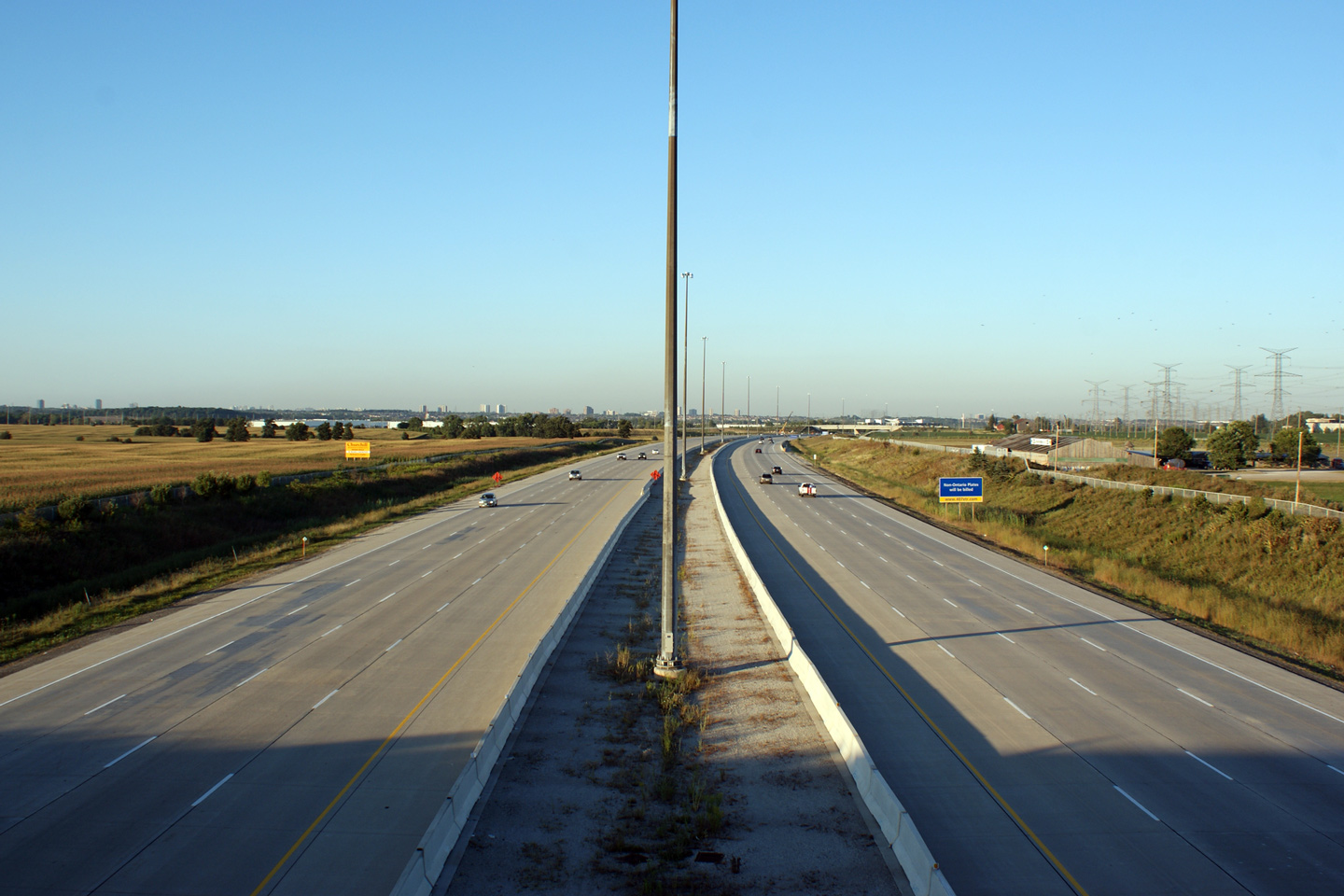
Highway 407 looking west from the Winston Churchill Road overpass in
Mississauga. Winston Churchill Road is located roughly at kilometre
marker 36. Between 2004, and 2007, the upper photo highlights where the
407 transitioned
from four- to six-lanes. This section of freeway
was widened to eight lanes in 2007. Upper photo taken: May 25th, 2005. Lower photo taken: September 9th, 2011. |
 (720x480) (1440x960) (2400x1600) |
|||
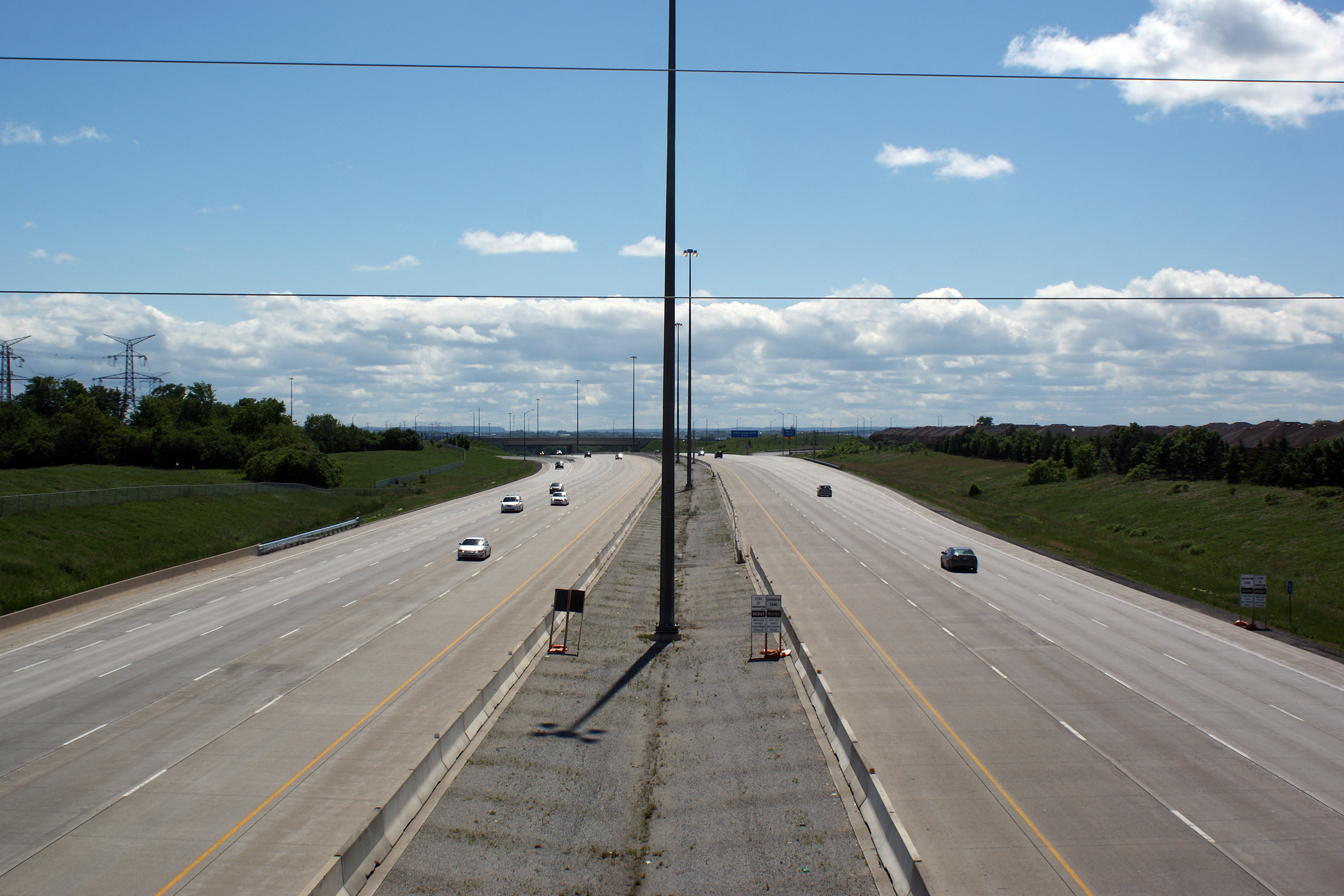
| Town of Halton Hills Regional Municipality of Halton |
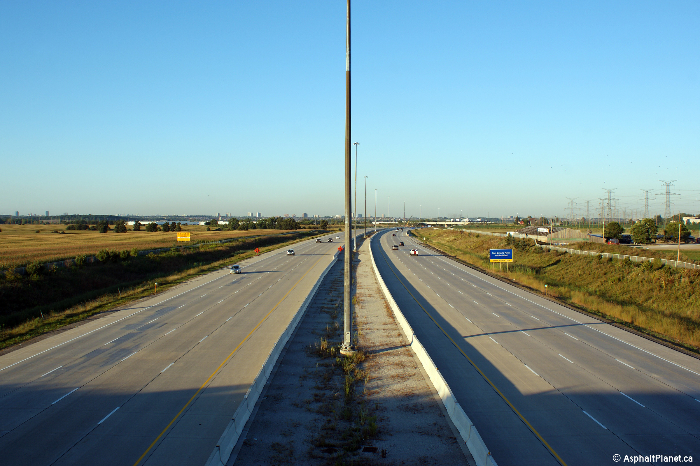
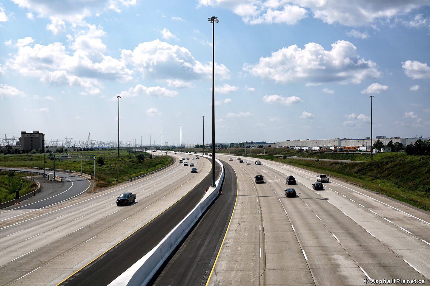
Highway 407 looking east from the Winston Churchill Road overpass in western
Mississauga. These photos show the progress of two widening projects
that took place during the 2000s. During the 2004 construction season,
Highway 410 was widened from four to six lanes (three per direction) between
Highway 401 and Hurontario Street. Later, in 2007, Highway 407 was
widened again, this time from six lanes to eight lanes (four per direction)
between Highway 401 and Highway 427. Upper photo taken: May 25th, 2005. Lower photo taken: August 18th, 2010. |
 (720x480) (1440x960) (2400x1600) |
|||
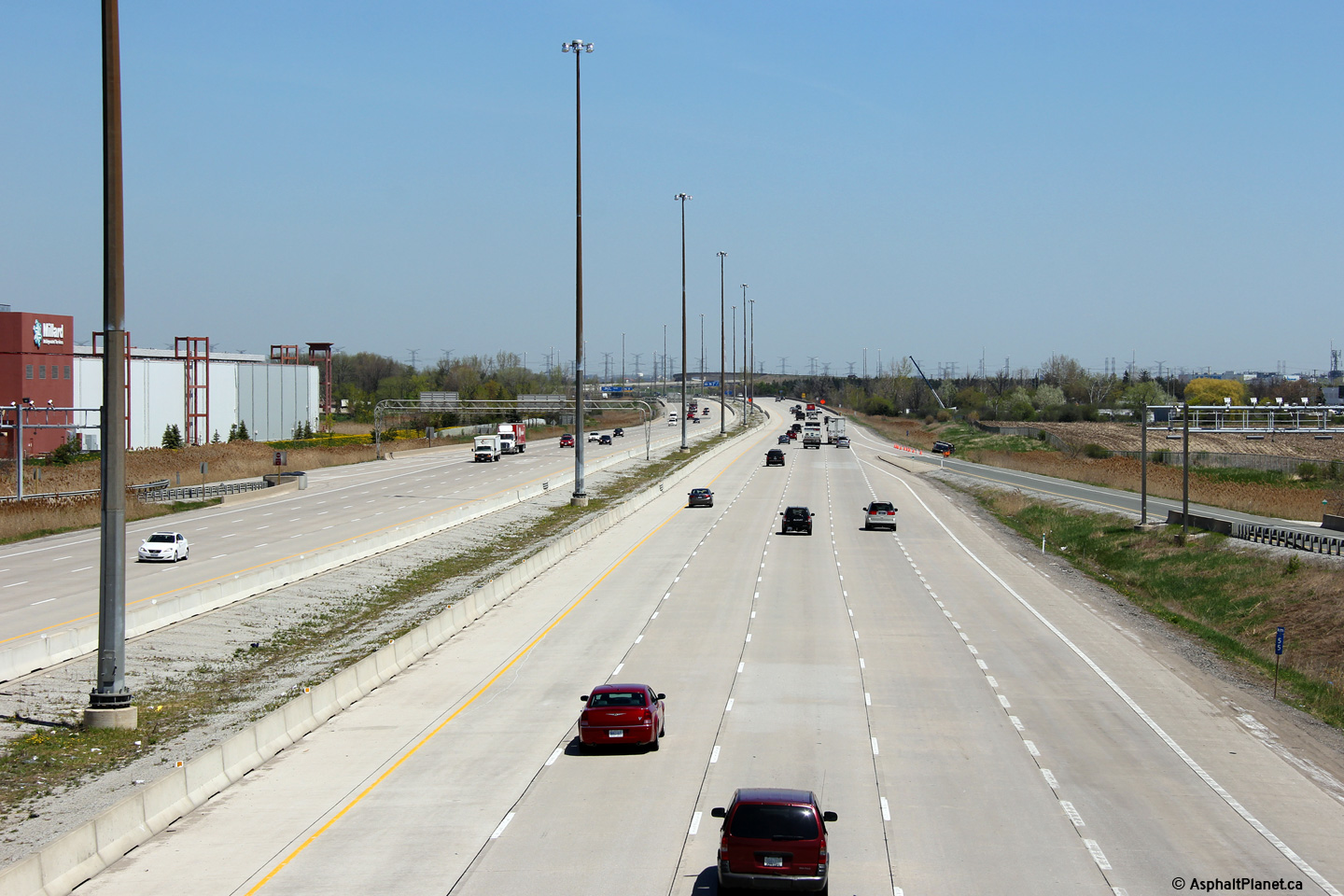
| City of Brampton Regional Municipality of Peel |
This view looks west as dusk begins to settle in over Western Mississauga
from the Heritage Drive overpass. Photo taken: August 18th, 2010. |
 (720x480) (1440x960) (2400x1600) |
|||
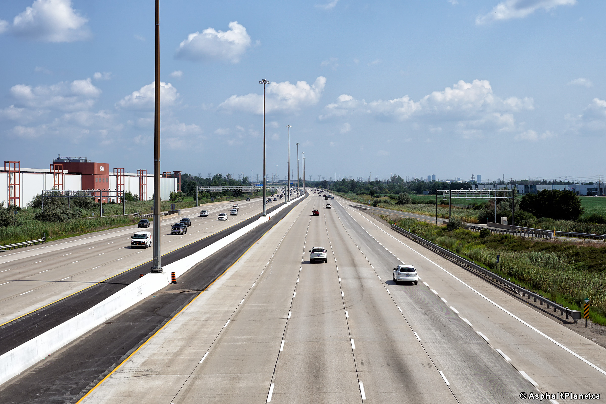
| City of Brampton Regional Municipality of Peel |
Easterly view from Heritage Drive along Highway 407. The rate at which
western Brampton has developed around Highway 407 is astounding.
Numerous prominent employers have located in Northwestern Mississauga, and
Southwestern Brampton adjacent to both Highway's 401 and 407 in recent
years. Photo taken: August 18th, 2010. |
 (720x480) (1440x960) (2400x1600) |
|||
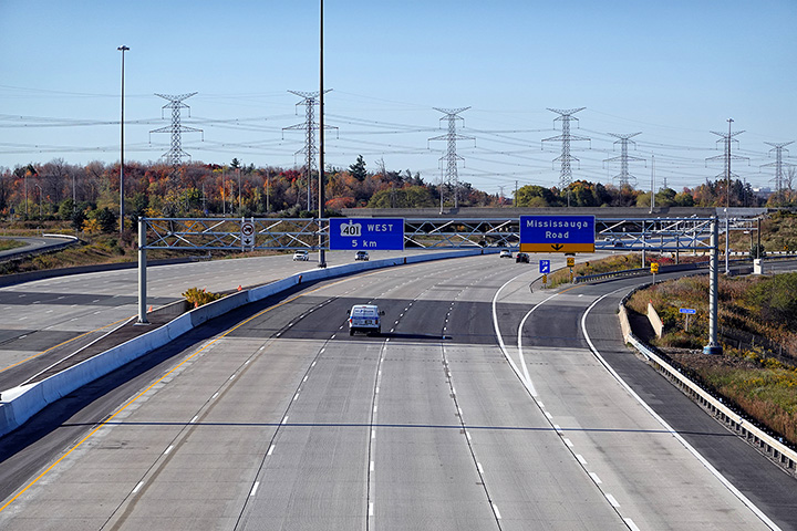
| City of Brampton Regional Municipality of Peel |
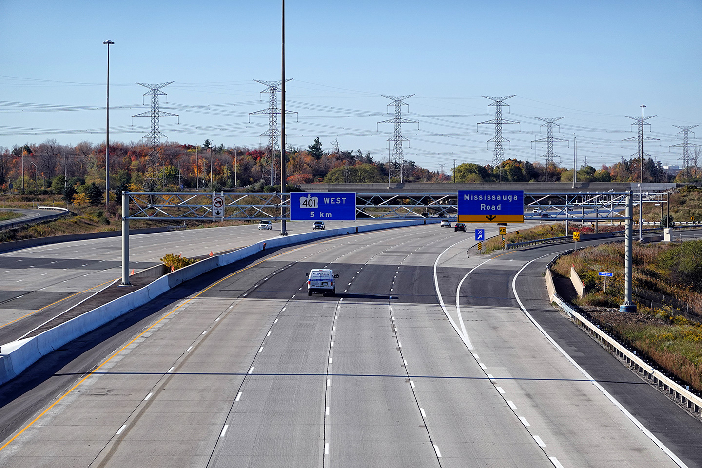
Westerly view into the evening sunset from the Mississauga Road overpass.
The Mississauga Road corridor is home to numerous top-end employers
including several high-level Canadian financial institutions and high-tech
offices. Photo taken: May 29th, 2009. |
 (720x480) (1440x960) (2400x1600) |
|||
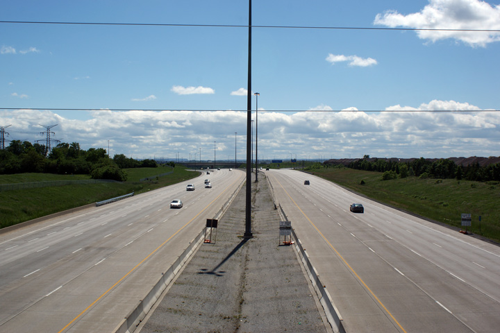
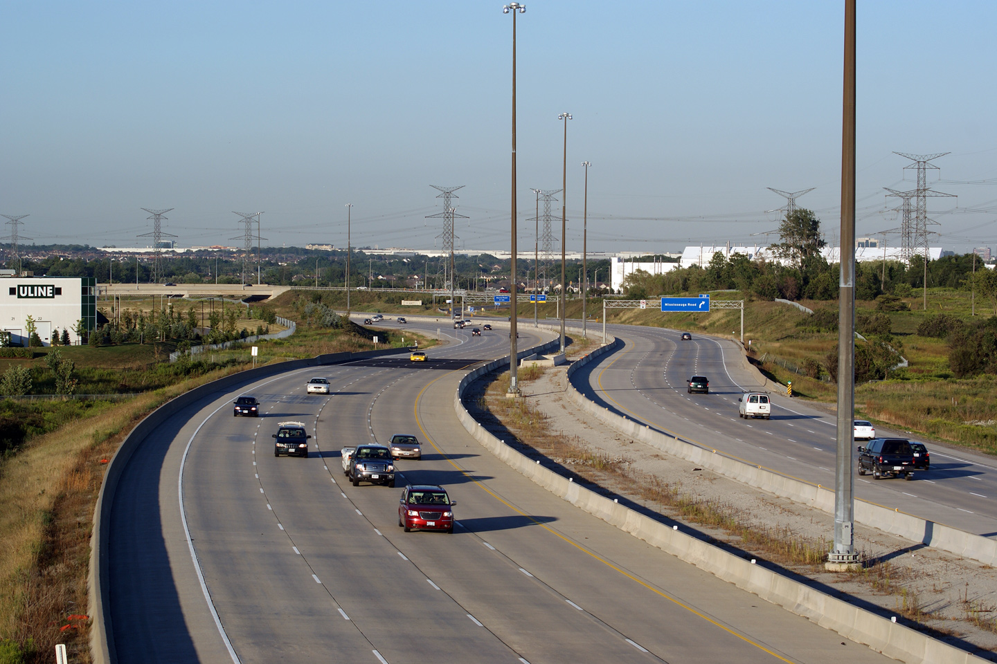
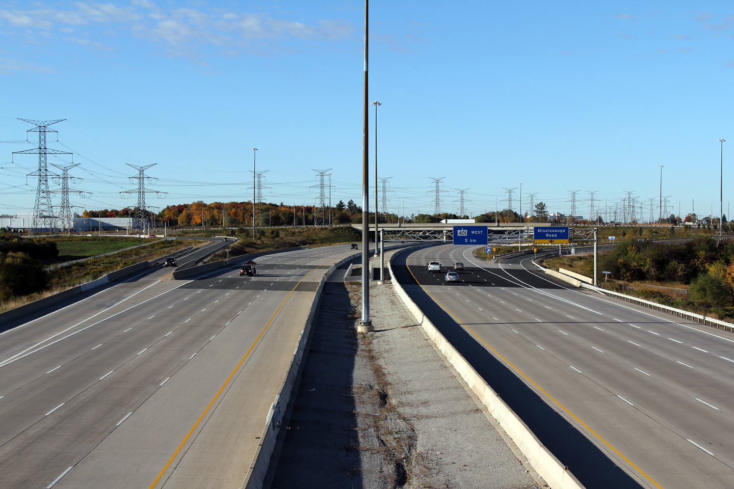
| City of Brampton Regional Municipality of Peel |
Easterly view from the Mississauga Road overpass towards Financial Drive and
Mavis Road. Often times my photos of the 407 show deceivingly low
traffic volumes along the tollway. Off-peak traffic on the 407 is
typically light, (why pay for a toll road when the 401 isn't congested?).
At peak times, however, while the tollway is seldom congested, it is very
well utilized. Photo taken: May 29th, 2009. |
 (720x480) (1440x960) (2400x1600) |
|||
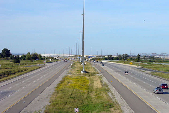
| City of Brampton Regional Municipality of Peel |
View
looking westerly from the Financial Drive overpass towards the Mississauga
Road overpass. Photo taken: March 28th, 2009. |
 (720x480) (1440x960) (2400x1600) |
|||
| City of Brampton Regional Municipality of Peel |
Looking
easterly towards the Credit River Valley from the Financial Drive overpass. Photo taken: March 28th, 2009. |
 (720x480) (1440x960) (2400x1600) |
|||
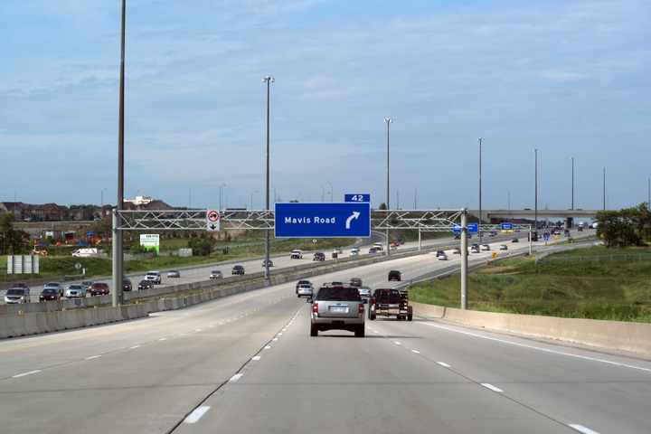
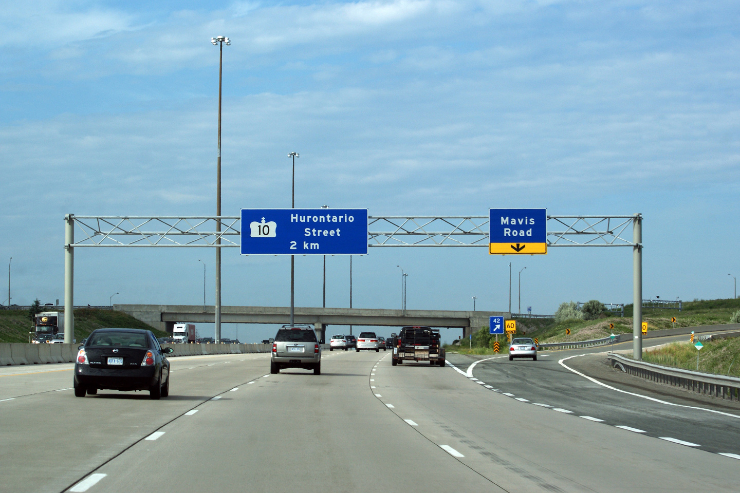
| City of Brampton Regional Municipality of Peel |
Advanced signage for Mavis Road. This signage was made for Highway 407
by a private sign shop, not MTO's signage department. Though the
quality of the sign is quite good, notice that 'Mavis Road' is written only
on a single line. MTO standard signage would have written 'Mavis Road'
on two lines. Photo taken: October 10th, 2009. |
 (720x480) (720x480)(1440x960) |
|||
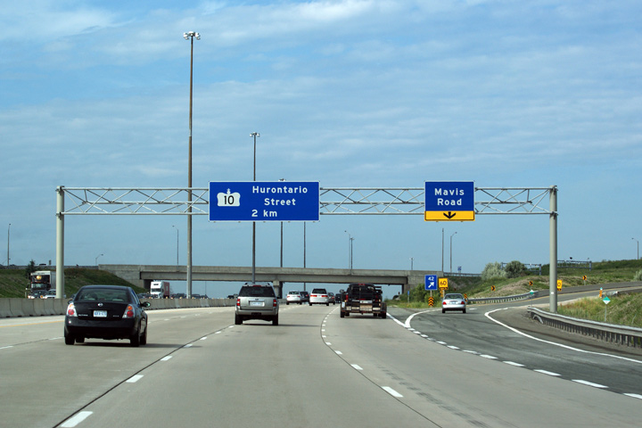
| City of Brampton Regional Municipality of Peel |
Signage at the ramp to Mavis Road. Notice that Highway 10 is still
signed along Hurontario Street. Interesting since this sign was
manufactured and installed late in 2004, almost 7 years after Highway 10 was
decommissioned through Brampton and Mississauga. Photo taken: October 10th, 2009. |
 (720x480) (720x480)(1440x960) |
|||
| City of Brampton Regional Municipality of Peel |
Westerly view towards the Credit River from the Mavis Road overpass. I like
these photo, the highway designer had keen attention to fit the highway into
the surrounding topography when this was
designed. Photo taken: March 28th, 2009. |
 (720x480) (1440x960) (2400x1600) 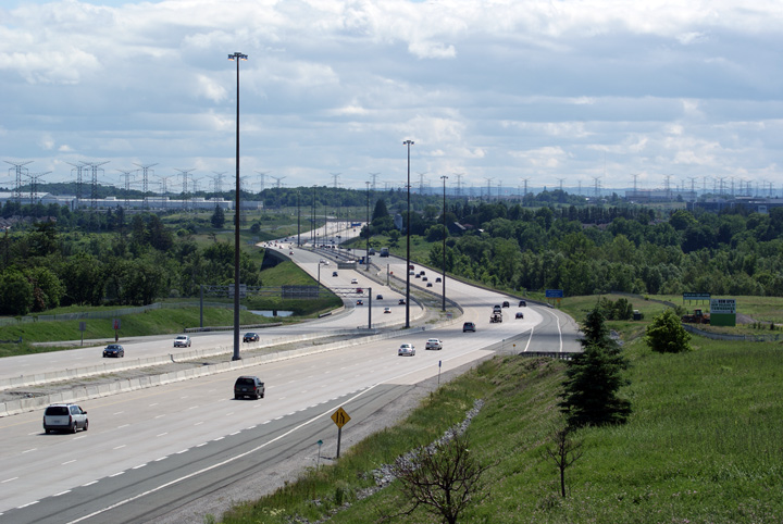 (720x480) (1440x960) (2400x1600) |
|||
| City of Brampton Regional Municipality of Peel |
Easterly
view along Highway 407 from the Mavis Road overpass. Photo taken: June 6th, 2010. |
 (720x480) (1440x960) (2400x1600) |
|||
| City of Brampton Regional Municipality of Peel |
This view looks westerly from the McLaughlin Road overpass. The
McLaughlin Road overpass was being widened at the time this photo was taken,
hence the construction zone sings in both this photo and the photo from the
opposing view. Photo taken: June 6th, 2010. |
 (720x480) (1440x960) (2400x1600) |
|||
| City of Brampton Regional Municipality of Peel |
Easterly view from the top of the McLaughlin Road overpass. Photo taken: June 6th, 2010. |
 (720x480) (1440x960) (2400x1600) |
|||
| City of Brampton Regional Municipality of Peel |
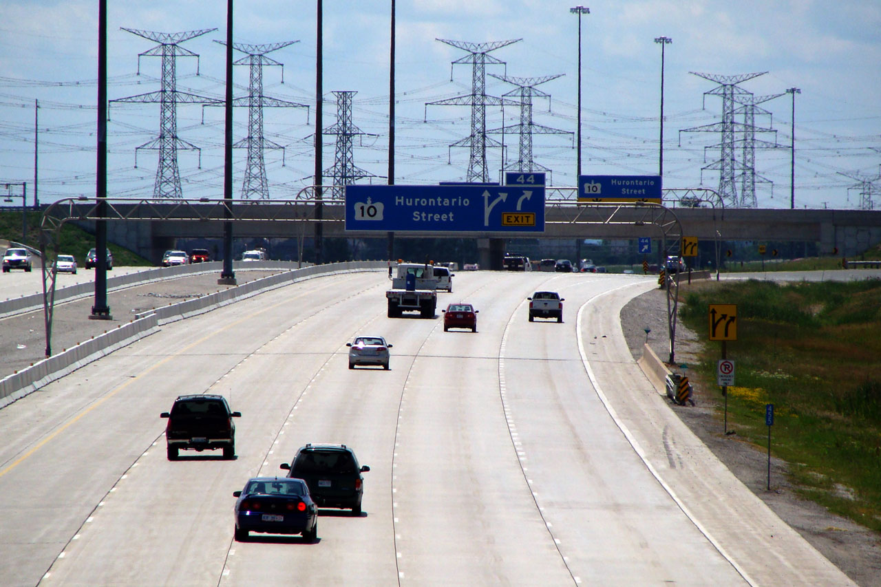
Overhead sign for in advance of Hurontario Street. Much like the
advanced sign posted at Mavis Road, this sign indicating Hurontario Street
as Highway 10 was erected long after the connecting link through Mississauga
and Brampton was repealed. Despite the fact that the Highway 10
reference is indeed an error, for historical reasons I hope that this sign
is never replaced. Photo taken: October 10th, 2009. |
 (720x480) (720x480)(1440x960) (2400x1600) |
|||
| City of Brampton Regional Municipality of Peel |
Eastbound exit sign for Highway 10 and eastbound advanced sign for Highway
410. Photo taken: October 10th, 2009. |
 (720x480) (720x480)(1440x960) |
|||
| City of Brampton Regional Municipality of Peel |
Two view looking west from the Hurontario Street overpass, the upper photo
before Highway 407 was widened to eight lanes, and the lower photo after the
highway was widened to eight lanes. Upper photo taken: August 13th, 2006. Lower photo taken: June 6th, 2010. |
|
|||
| Hurontario Street is the common name for Highway 10 through Mississauga and Brampton. Click here for Highway 10 images. | |||||
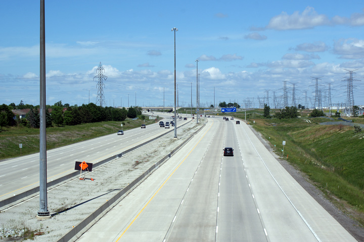
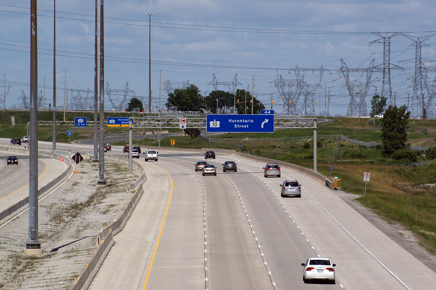
| City of Brampton Regional Municipality of Peel |
Easterly view from Hurontario Street. Before 2004, Highway 407 narrowed to
4-lanes west of this interchange -- since 2004, Highway 407 through
Mississauga has been widened twice, first to six lanes in 2004, and then to
eight lanes in 2007. Upper photo taken: August 13th, 2006. Lower photo taken: June 6th, 2010. |
 (720x480) (1440x960) (2400x1600)  (720x480) (1440x960) (2400x1600) |
|||
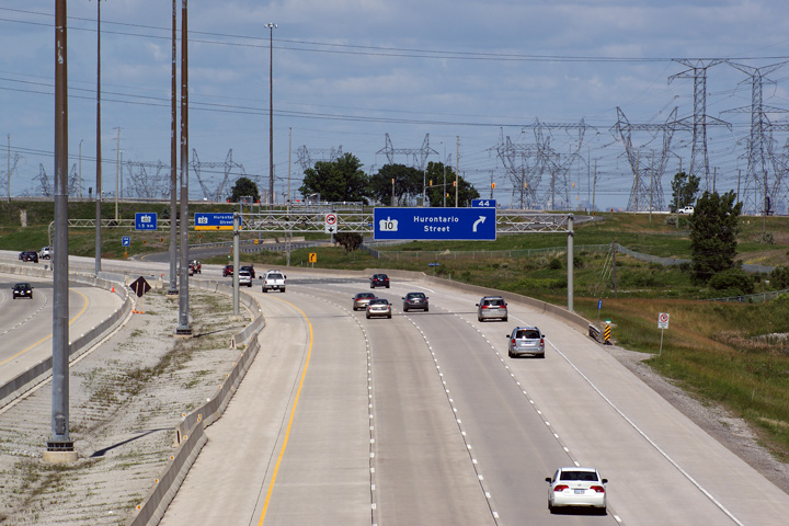
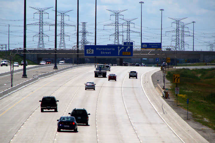
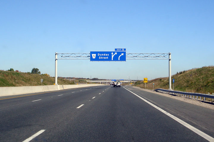
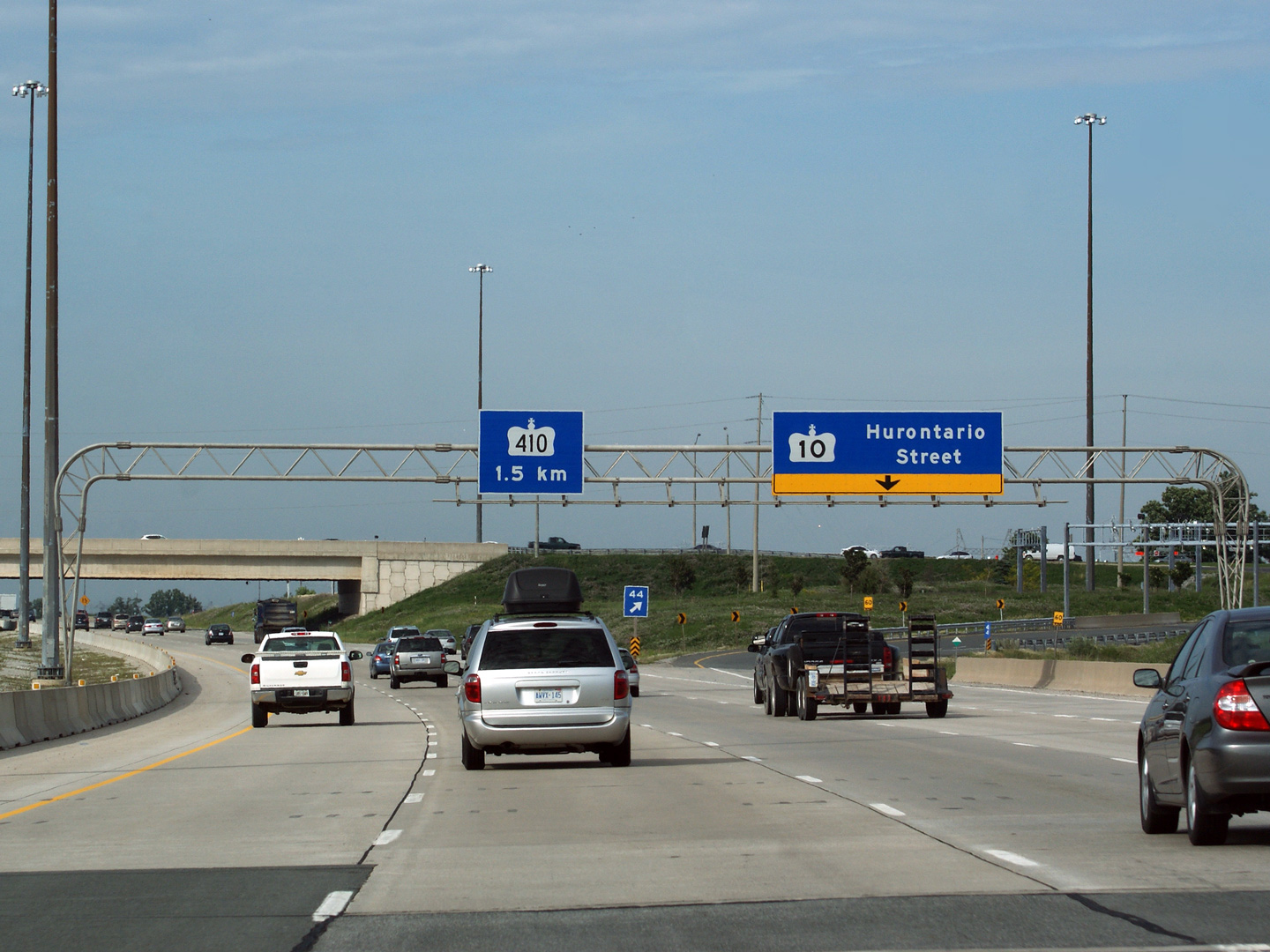
| City of Brampton Regional Municipality of Peel |
Blue overhead advanced sign for Hurontario Street (still
signed as Highway 10) as seen from the Kennedy Road overpass. It is a
shame that Highway 10 couldn't retain its highway designation for historical
reasons through Mississauga and Brampton. Photo taken: June 24th, 2008. |
 (720x480) (720x480)(1440x960) |
|||
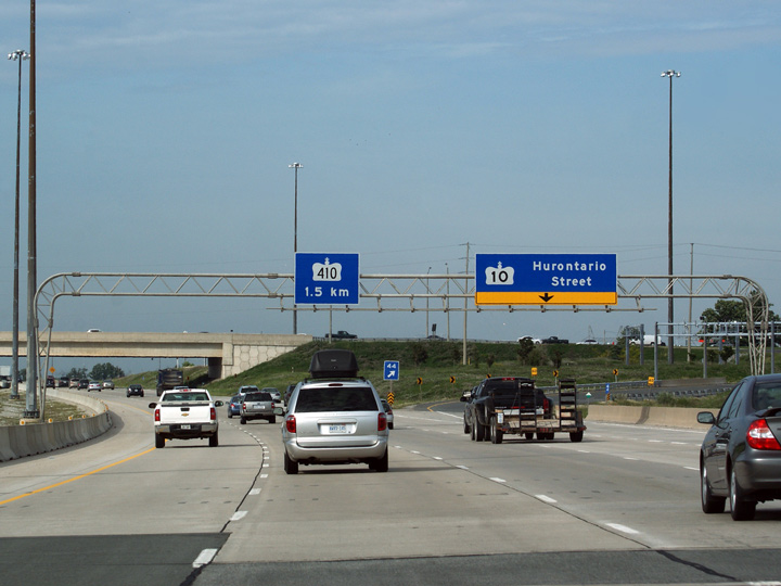
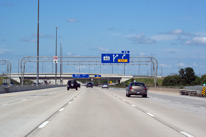
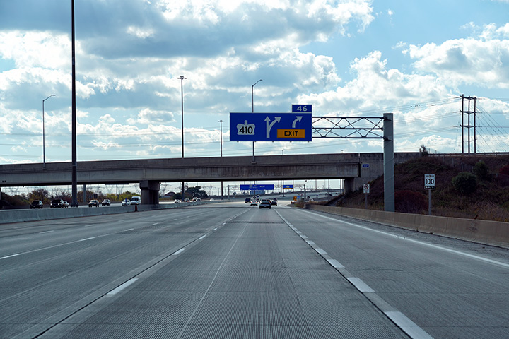
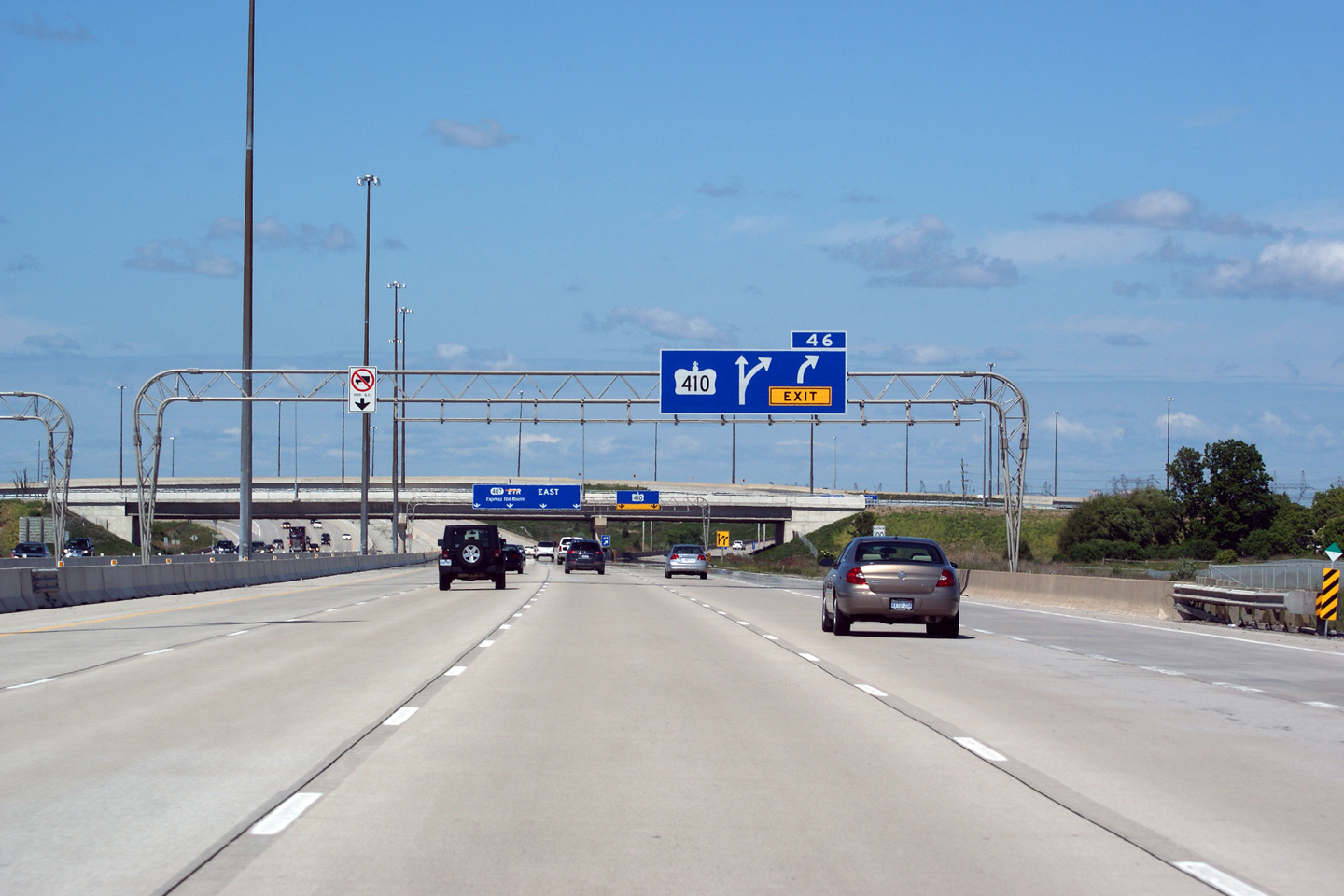
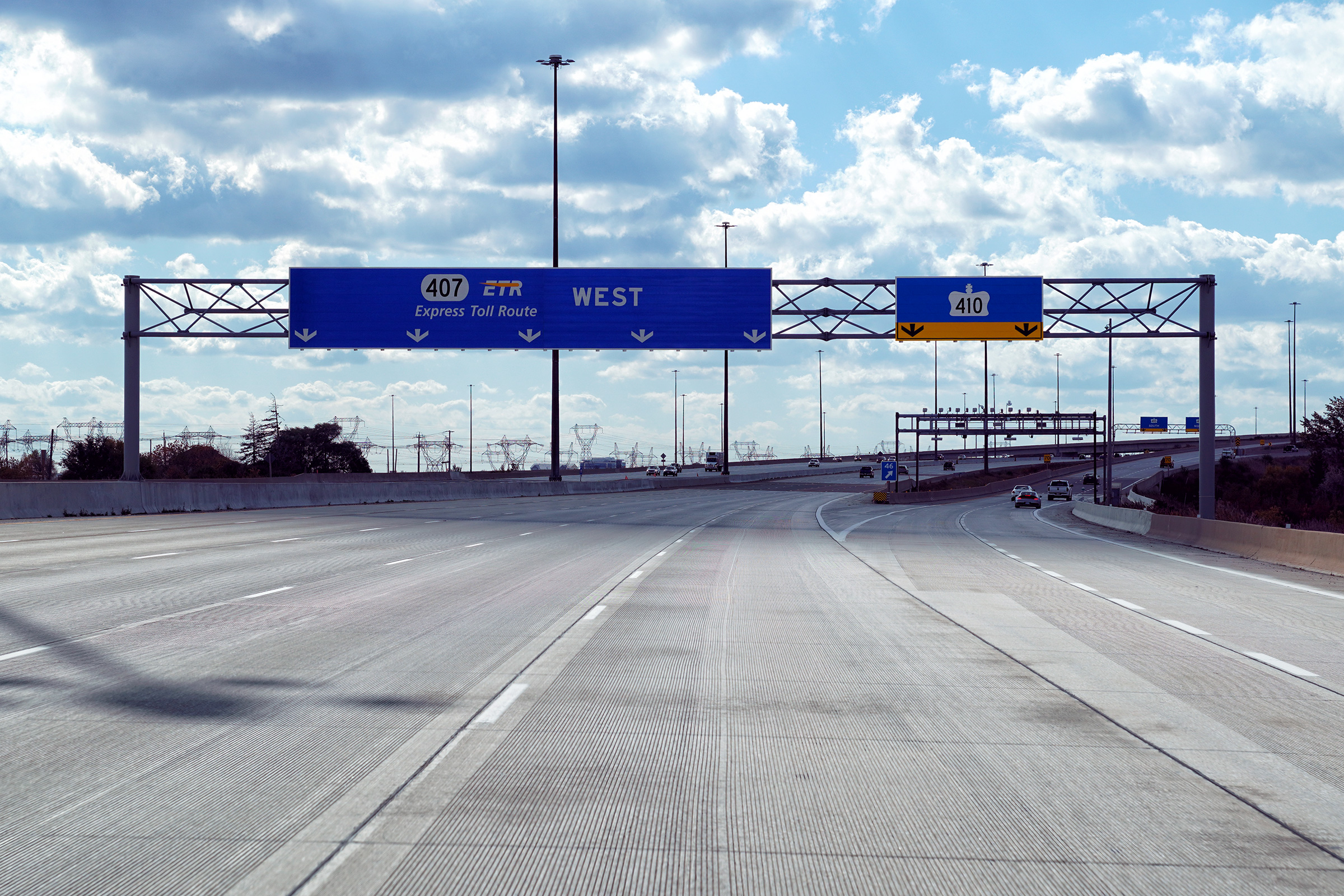
| City of Brampton Regional Municipality of Peel |
Advanced sign for Highway 410. Highway 410 has no control city from
the 407 as the 410 extends only a short distance either to the north or to
the south of Brampton. Photo taken: October 10th, 2009. |
 (720x480) (720x480)(1440x960) (2400x1600) |
|||
| City of Brampton Regional Municipality of Peel |
Overhead signage at the eastbound ramp to Highway 410. Take a look at how
big the pull-through signage is for Highway 407. All the new signs that
went up when the highway was widened to eight lanes are this massive. It's
a nicely designed sign, but I question if the size was necessary. Photo taken: October 10th, 2009. |
 (720x480) (720x480)(1440x960) (2400x1600) |
|||
| City of Brampton Regional Municipality of Peel |
View of the bullnose for the eastbound Highway 410 ramp
from the Kennedy Road overpass. Photo taken: June 24th, 2008. |
 |
|||
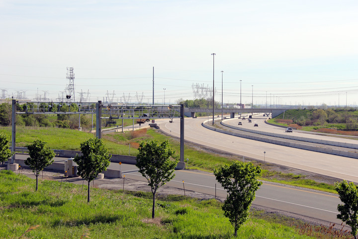
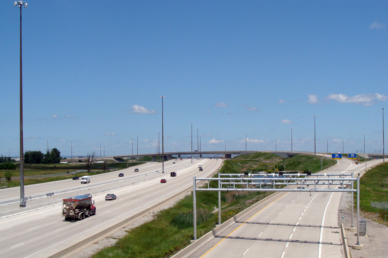
| City of Brampton Regional Municipality of Peel |
Easterly view from the Kennedy Road overpass of the
highspeed Highway 410 flyovers, and of the ominous electronic toll gantry. Photo taken: June 24th, 2008. |
 (720x480) (1440x960) |
|||
| Highway 410 is a short commuter highway that connects Brampton to the 401 and 403 in Mississauga. Click here for Highway 410 images | |||||
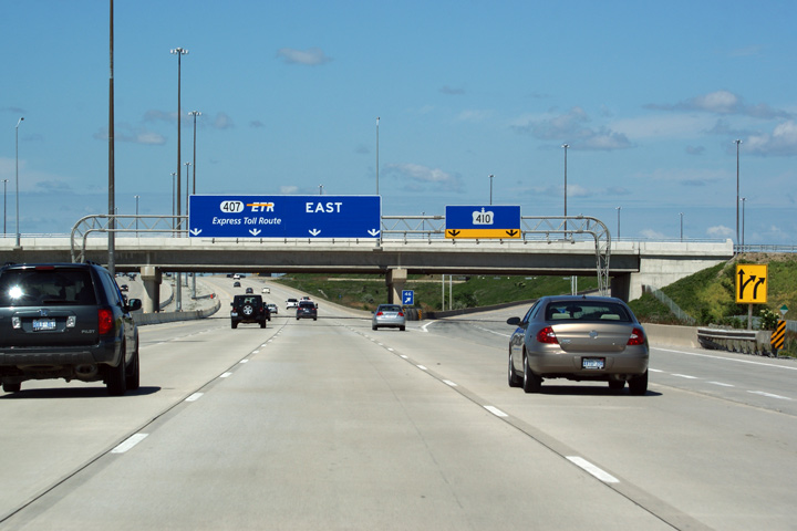
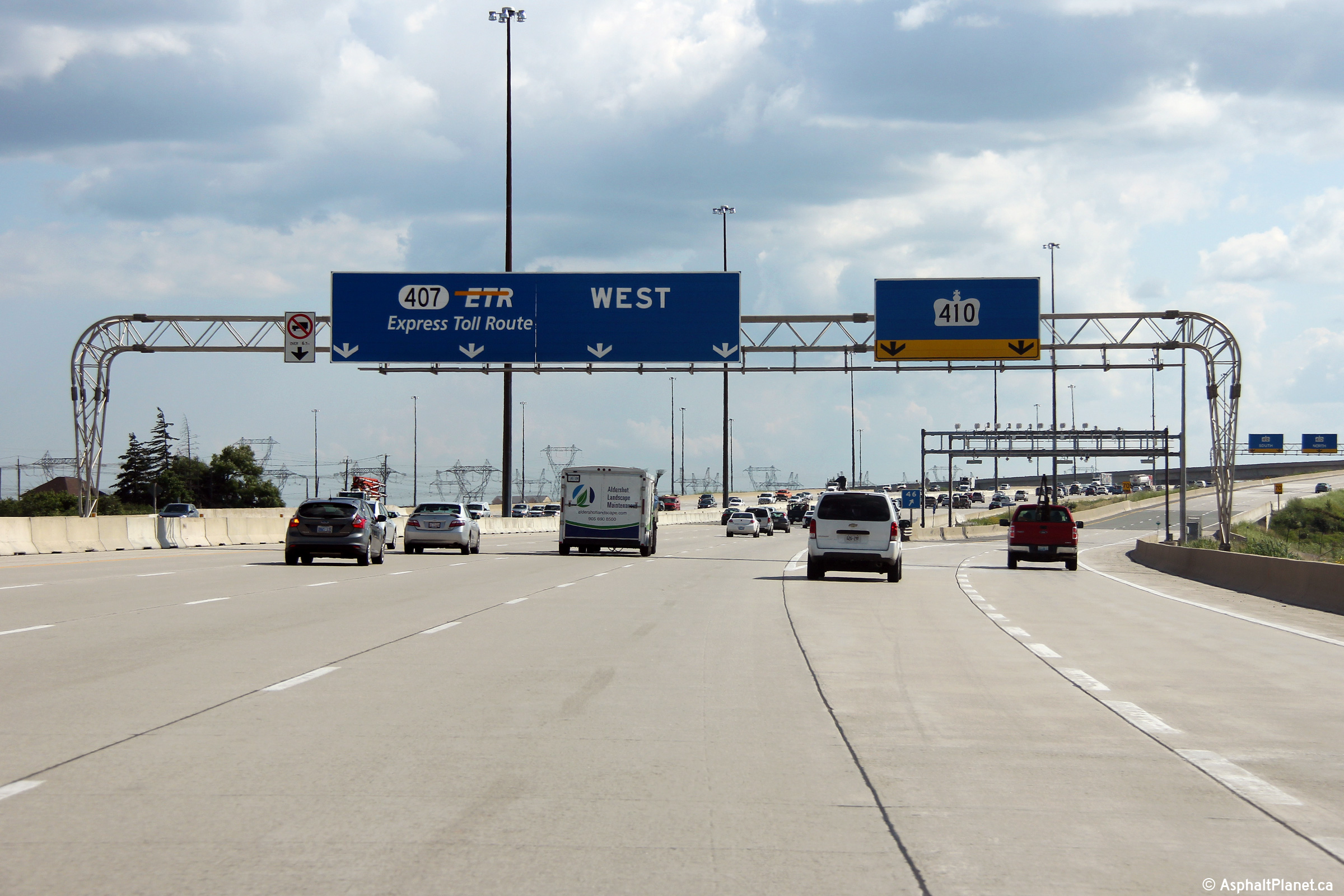
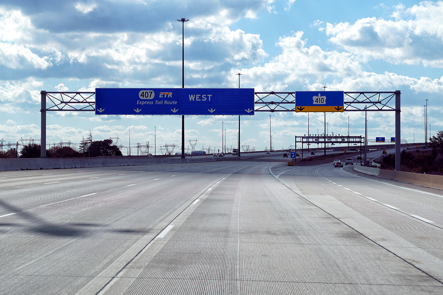
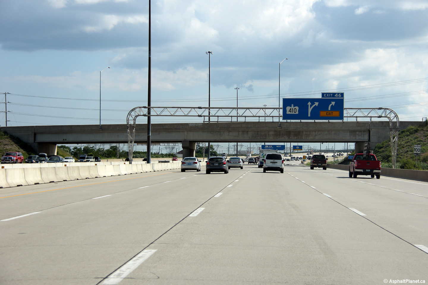
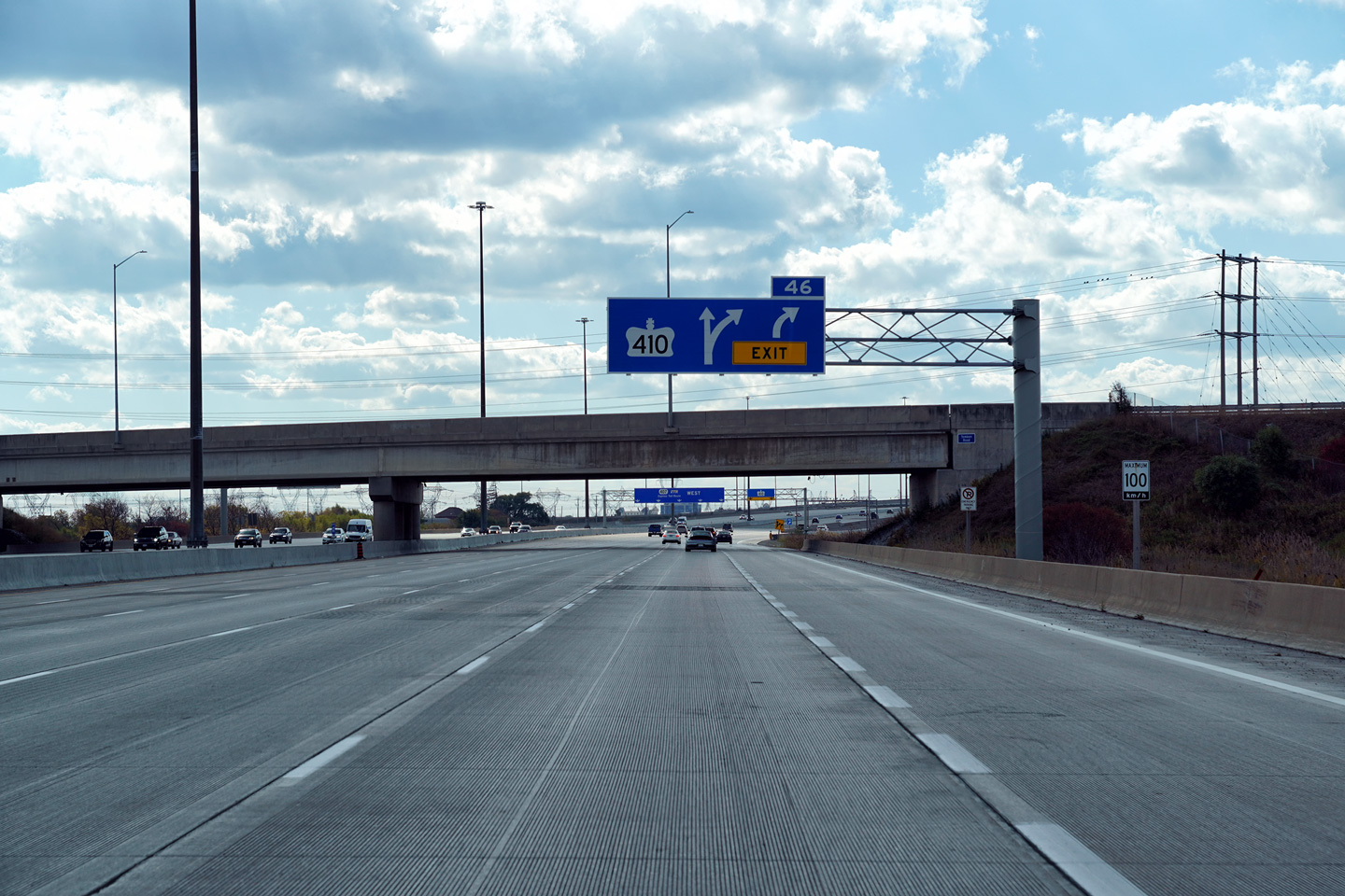
| City of Brampton Regional Municipality of Peel |
Westbound signage at the off-ramp to Highway 410. Upper photo taken: July 11th, 2013. Lower photo taken: October 17th, 2020. |
 (720x480) (720x480)(1440x960) (2400x1600) |
|||
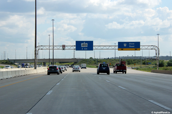
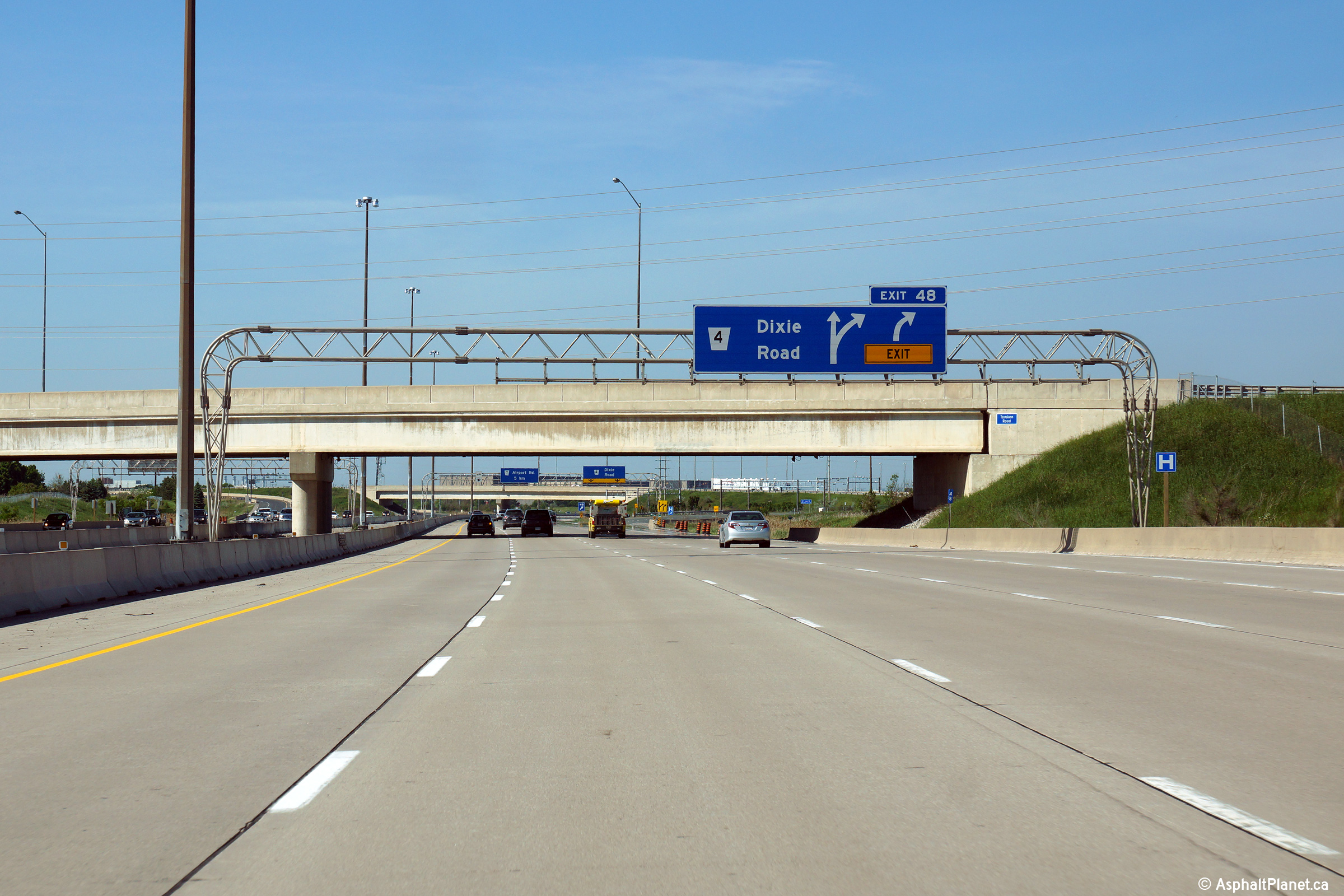
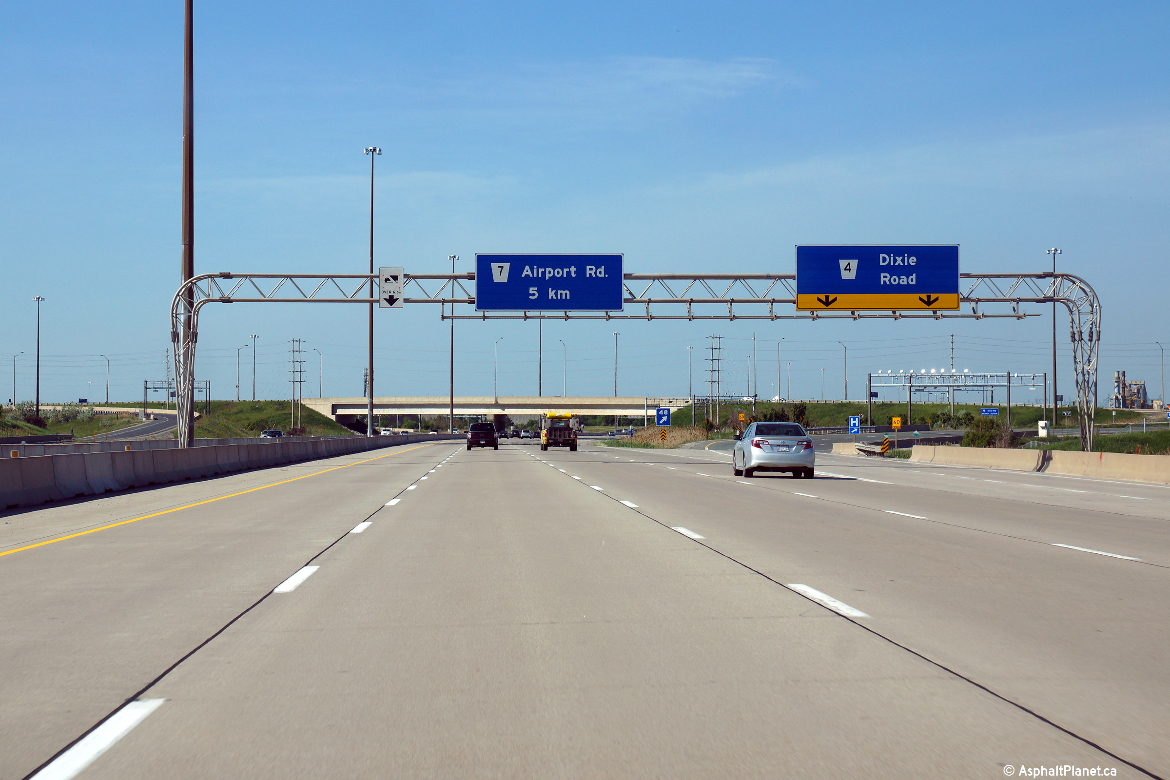
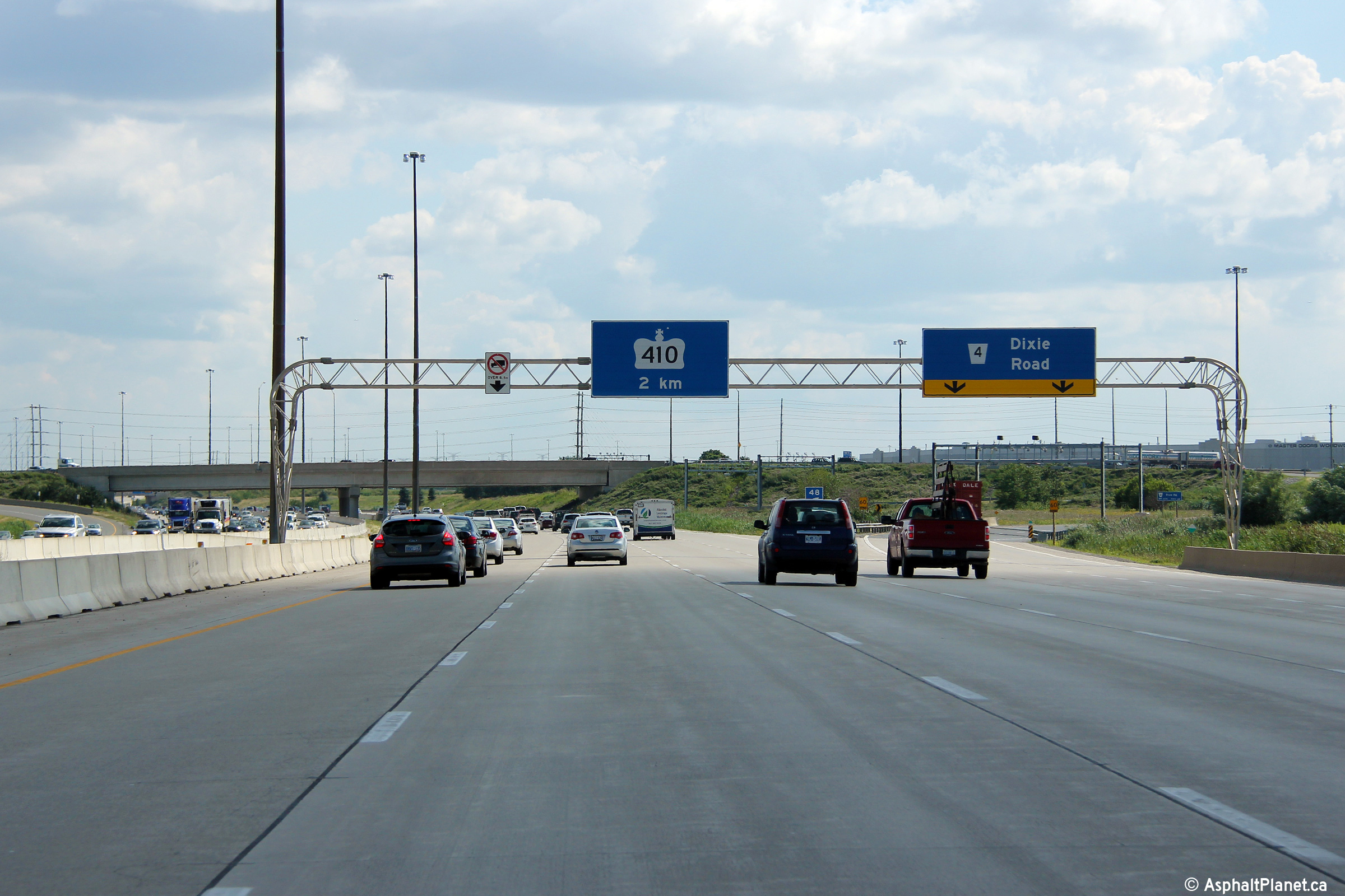
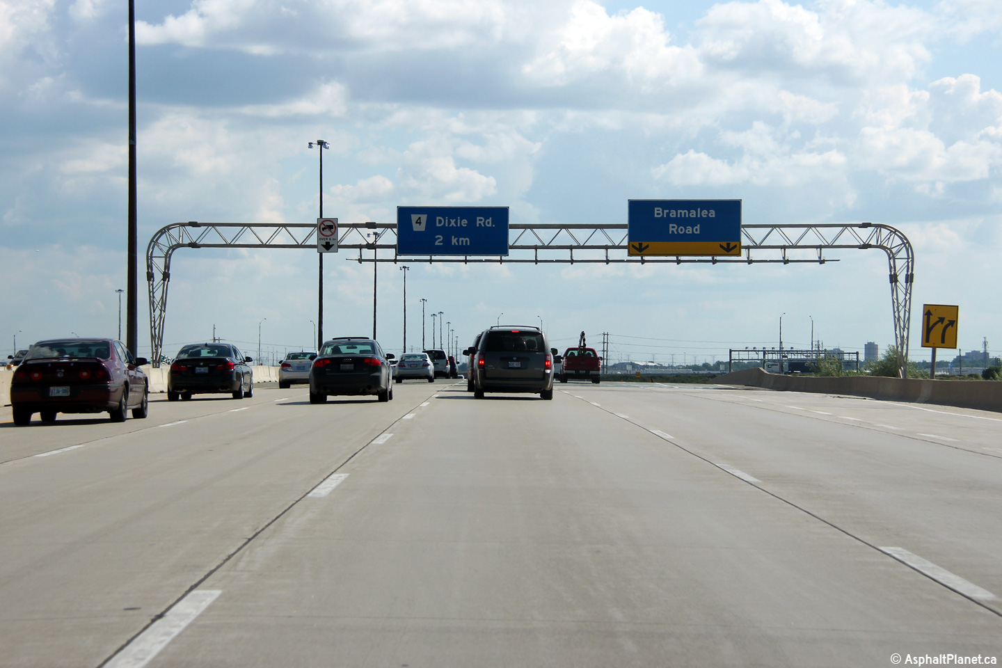
| City of Brampton Regional Municipality of Peel |
Eastbound advanced signage for the the Dixie Road interchange. Photo taken: June 7th, 2014. |
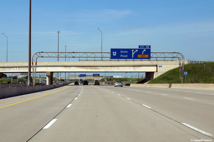 (720x480) (720x480)(1440x960) (2400x1600) |
|||
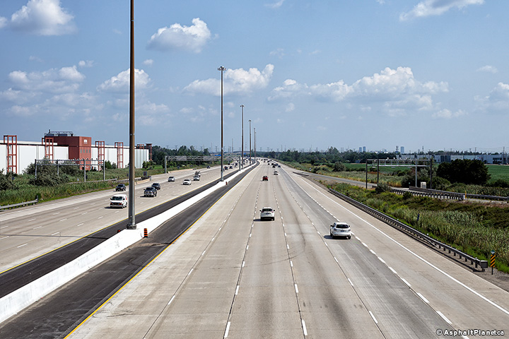
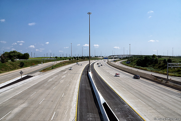
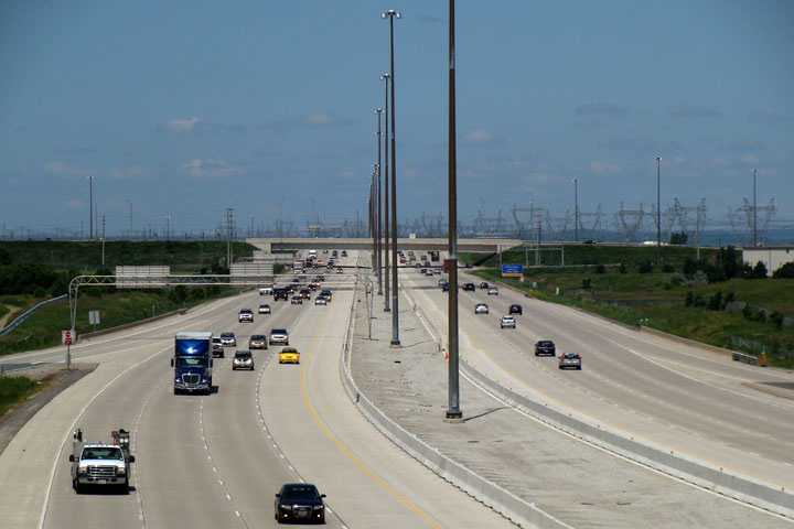
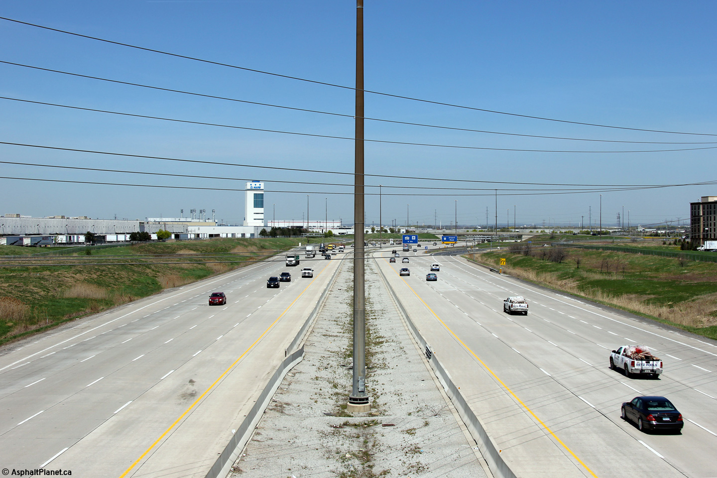
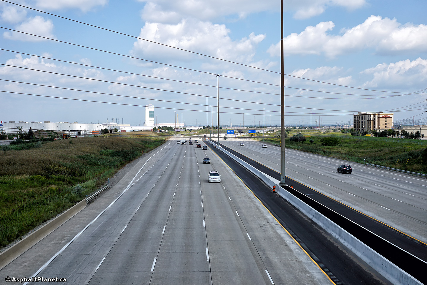
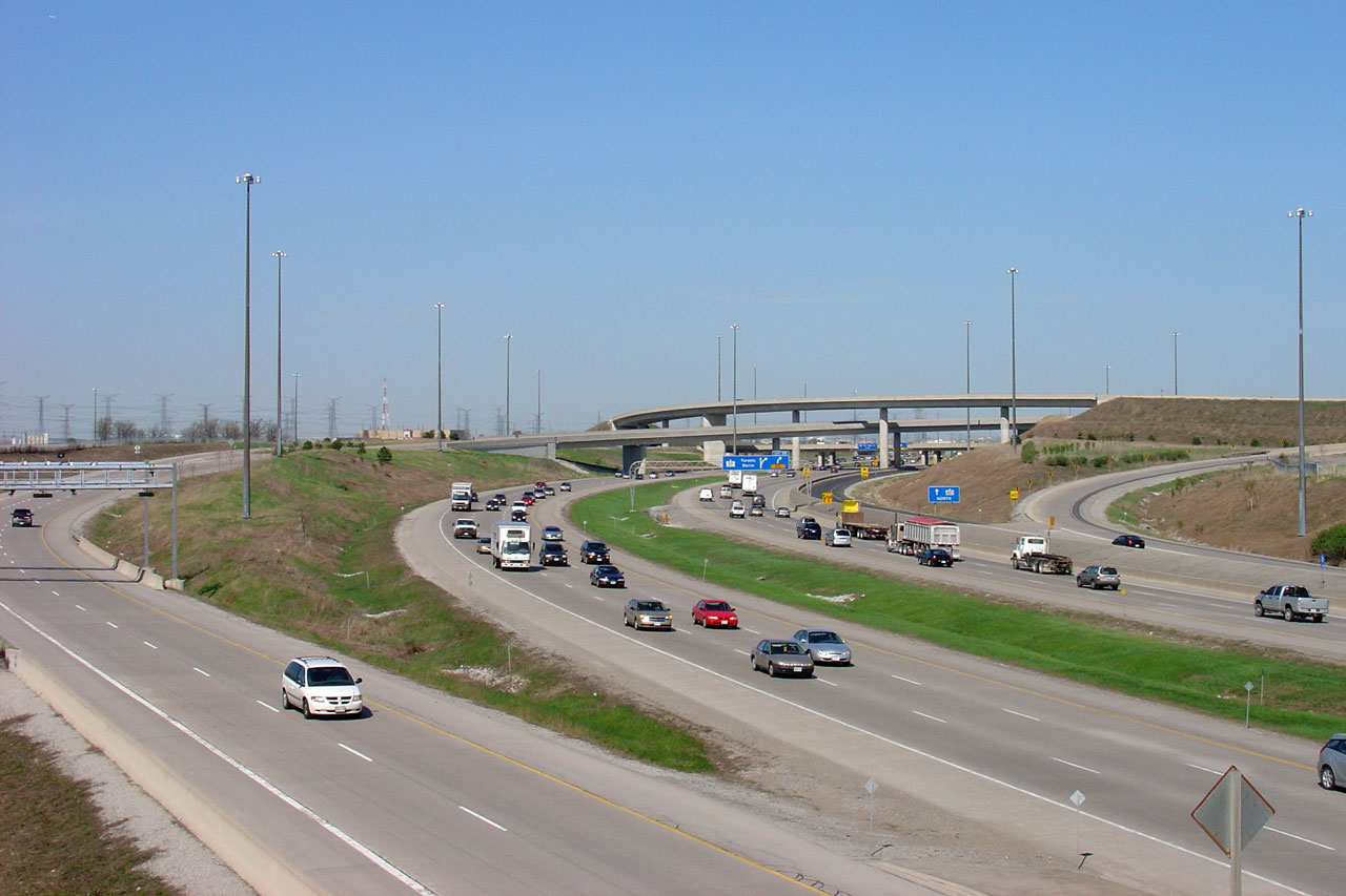
| City of Brampton Regional Municipality of Peel |
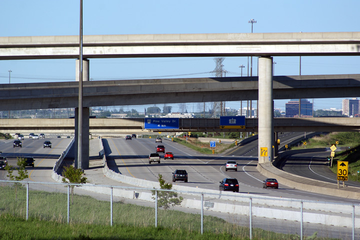
Looking west towards the Highway 410 interchange from the Tomken Road
overpass in Brampton. Highway 407 meets the 410 at a three-level
clover-stack interchange. Highway 410 marked the original western
terminus of the 407 when it was originally opened on June 7th, 1997. Photo #1 taken: June 24th, 2008. Photo #2 taken: August 20, 2017. |
 (720x480) (1440x960) (2400x1600) |
|||
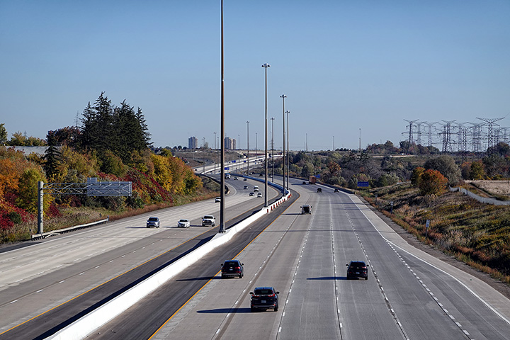
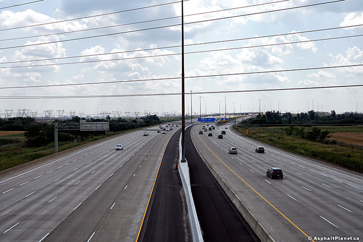
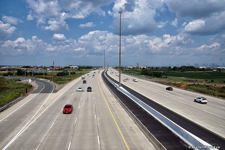
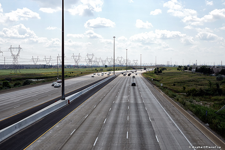
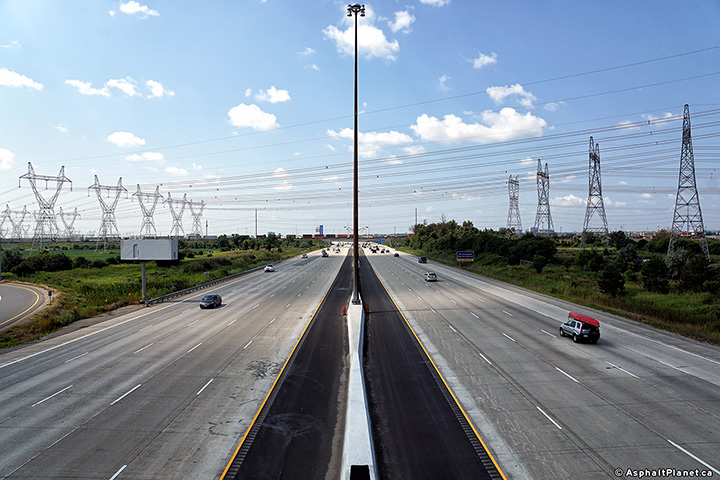
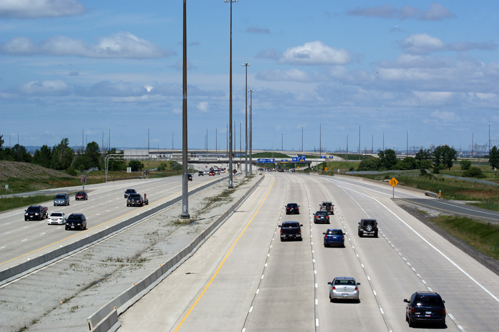
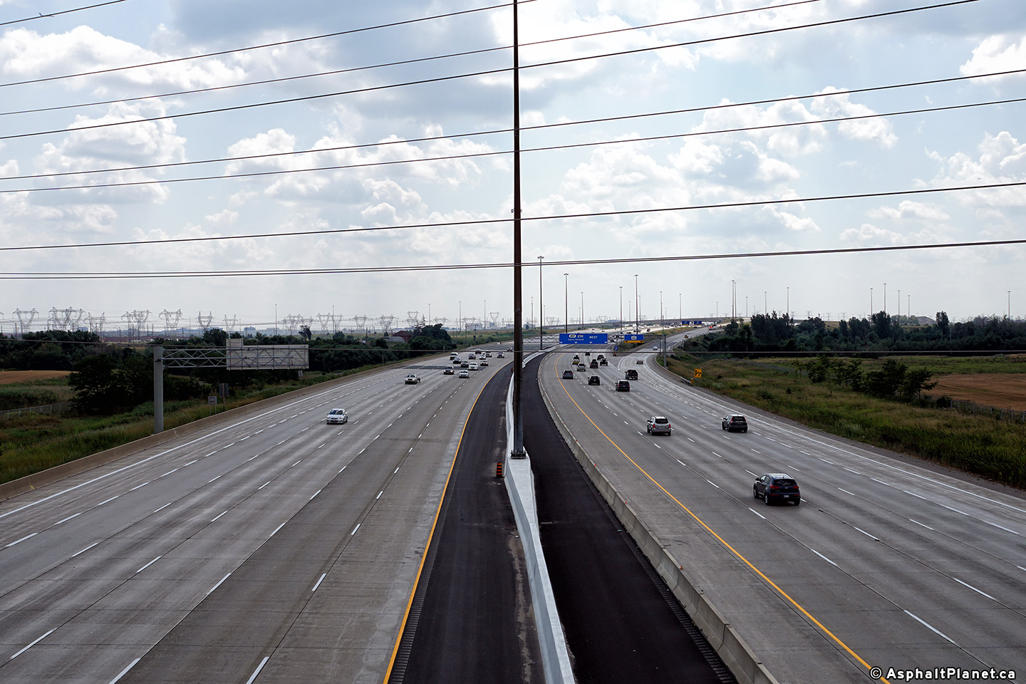
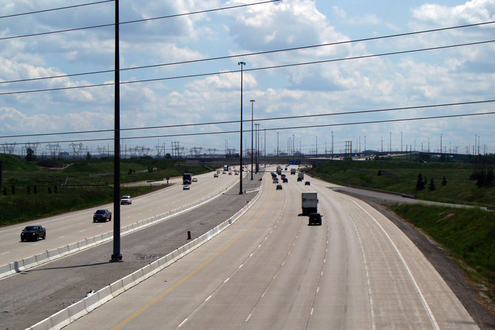
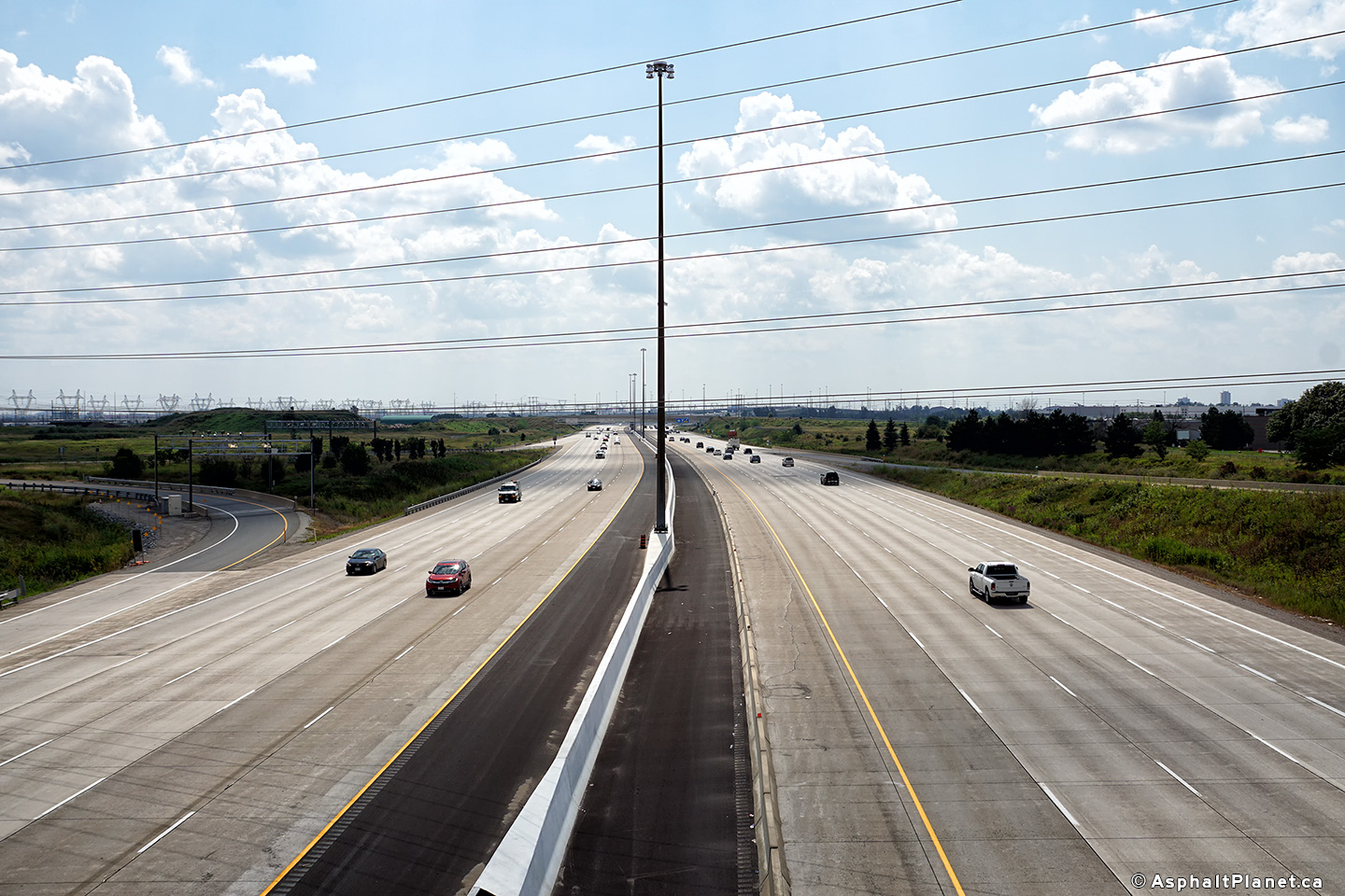
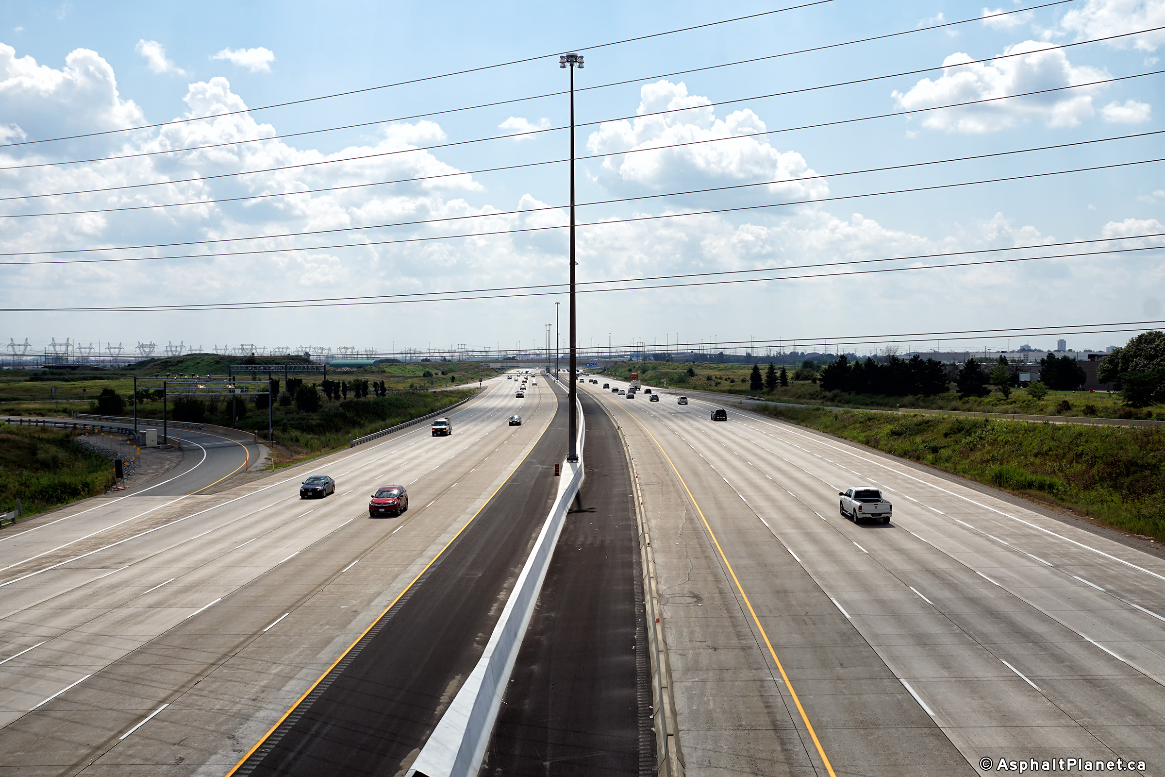
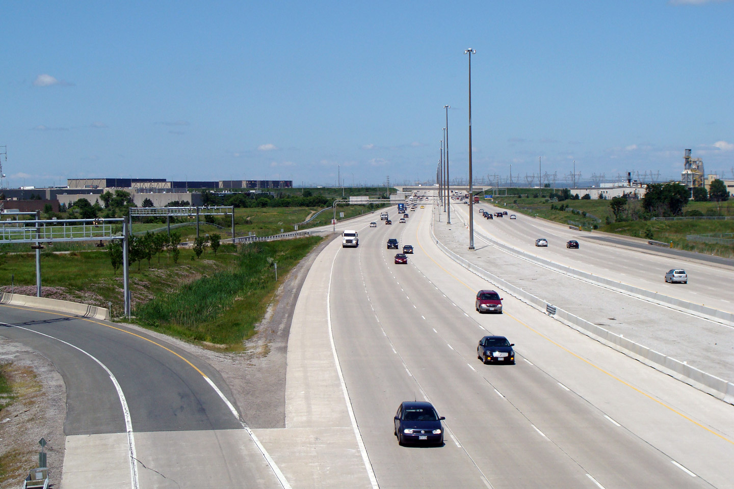
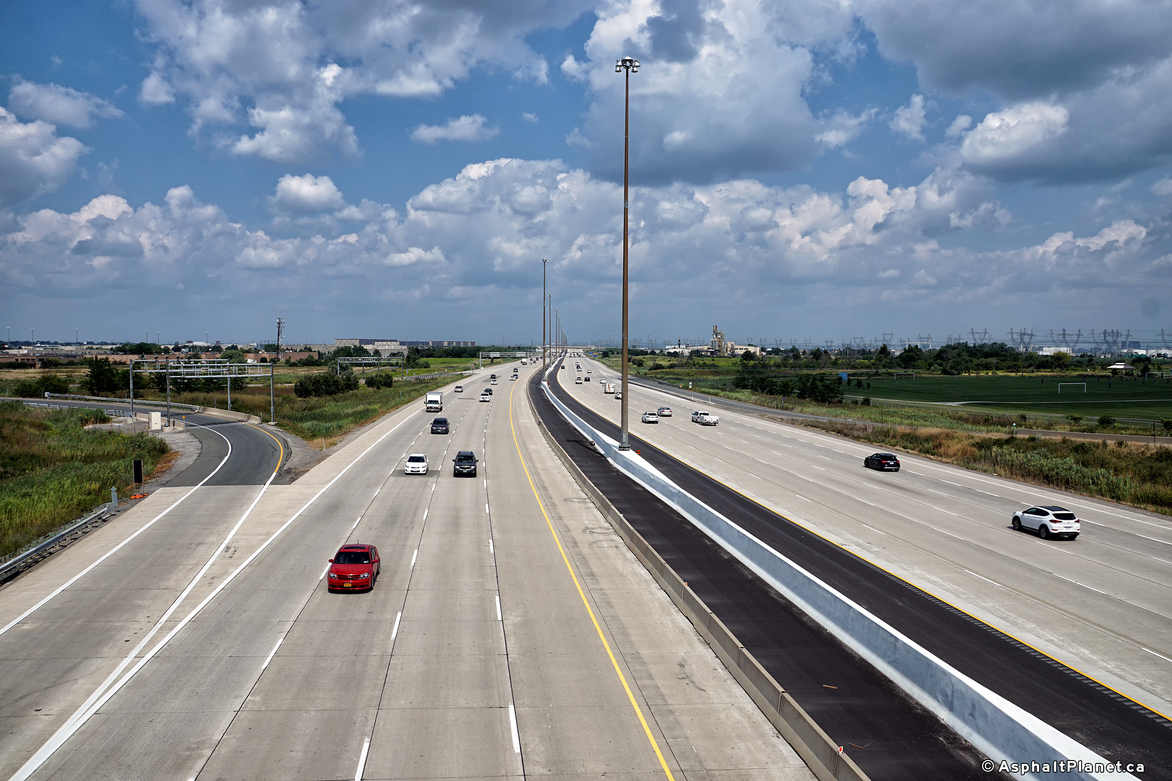
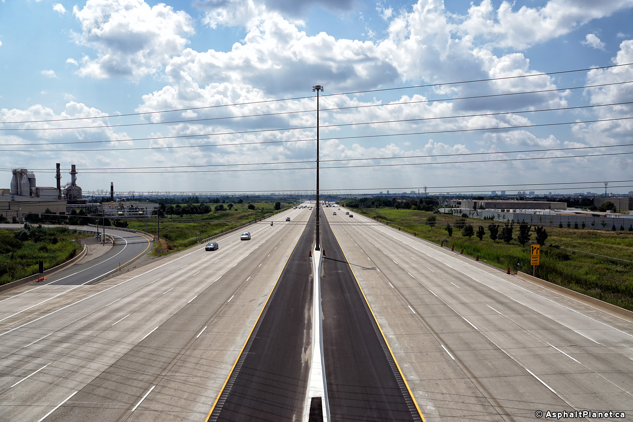
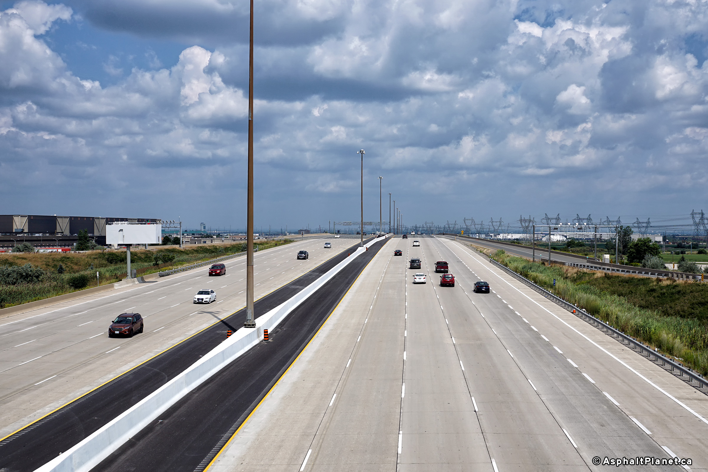
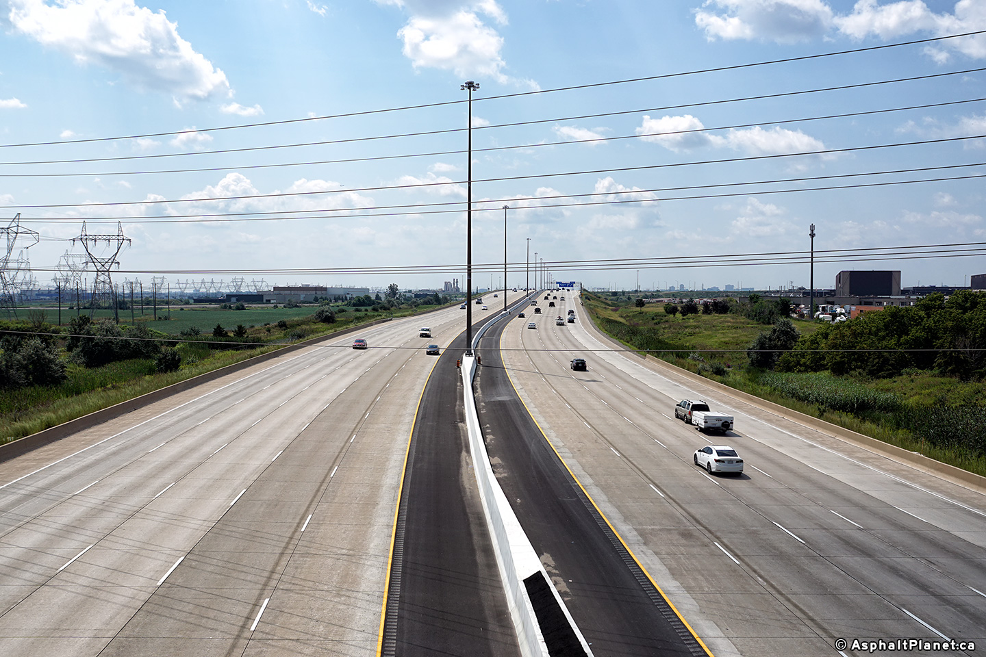
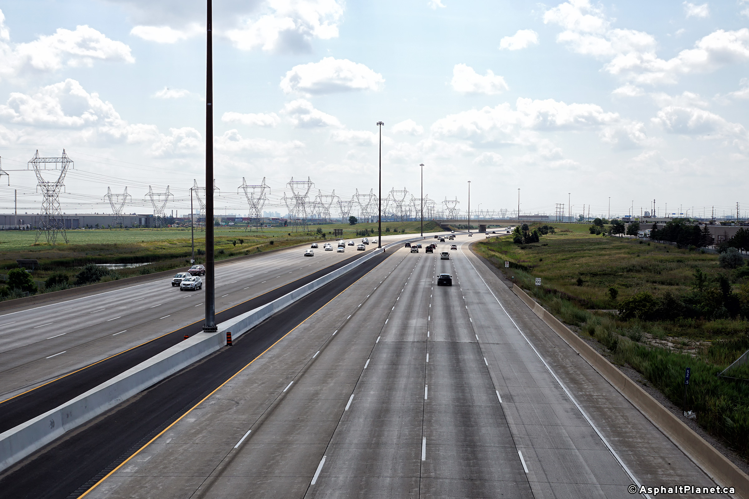
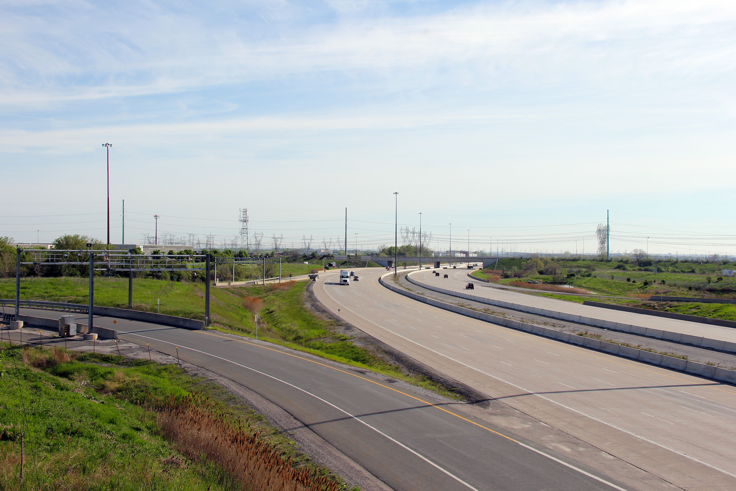
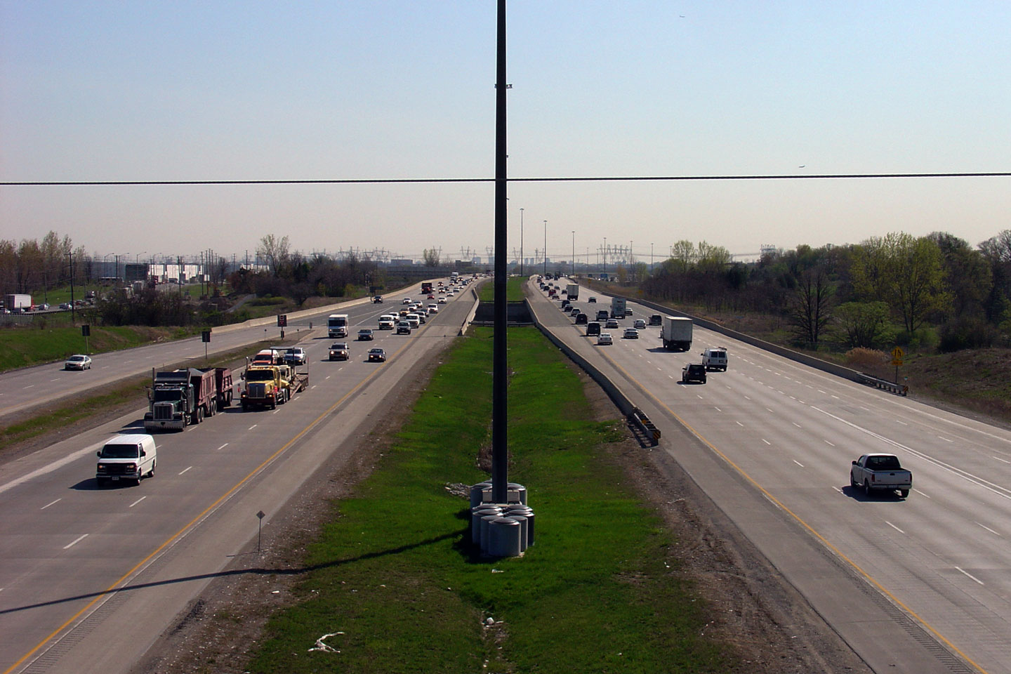
| City of Brampton Regional Municipality of Peel |
Three views looking east along Highway 407 from the Tomken Road overpass.
The six-lane cross-section, eight-lane cross-section and the ten-lane
cross-section are visible in the photo montage. The operator of the 407 has been very aggressively widening
the tollway over the past few years. Photo #1 taken: August 28th, 2005. Photo #2 taken: June 24th, 2008. Photo #3 taken: August 20th, 2017. |
 (720x480) (1440x960) (2400x1600) |
|||
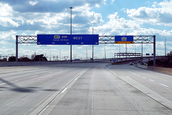
| City of Brampton Regional Municipality of Peel |
Westbound advanced signage for the upcoming Highway 410 interchange.
The Tomken Road overpass is visible beyond the signage. Upper photo taken: July 11th, 2013. Lower photo taken: October 17th, 2020. |
 (720x480) (720x480)(1440x960) (2400x1600) |
|||
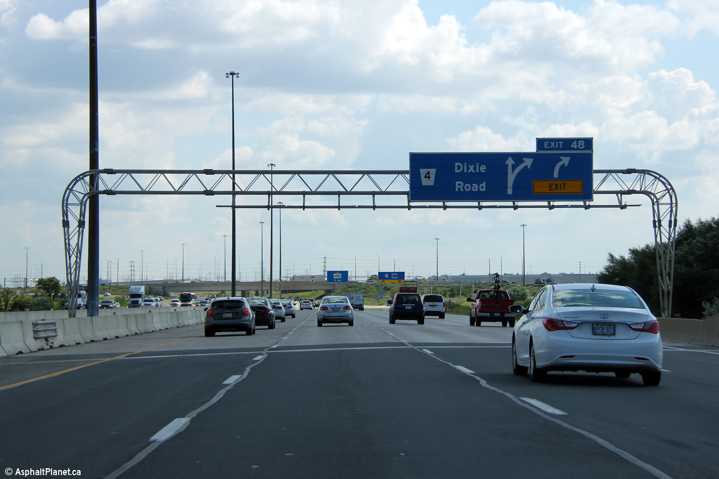
| City of Brampton Regional Municipality of Peel |
Easterly view at the off-ramp to Dixie Road. Photo taken: June 7th, 2014. |
 (720x480) (720x480)(1440x960) (2400x1600) |
|||
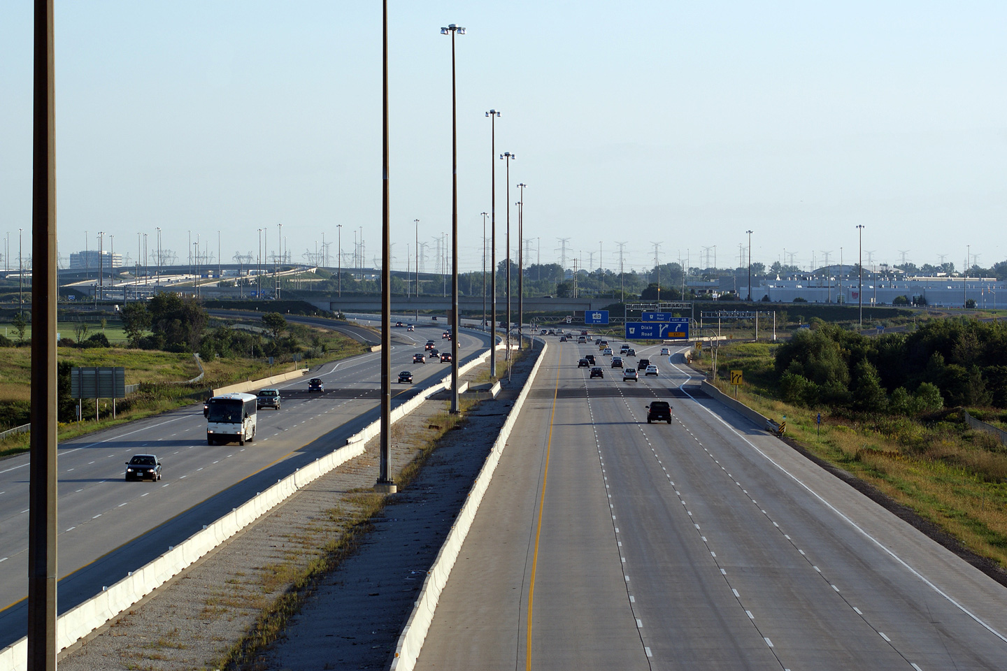
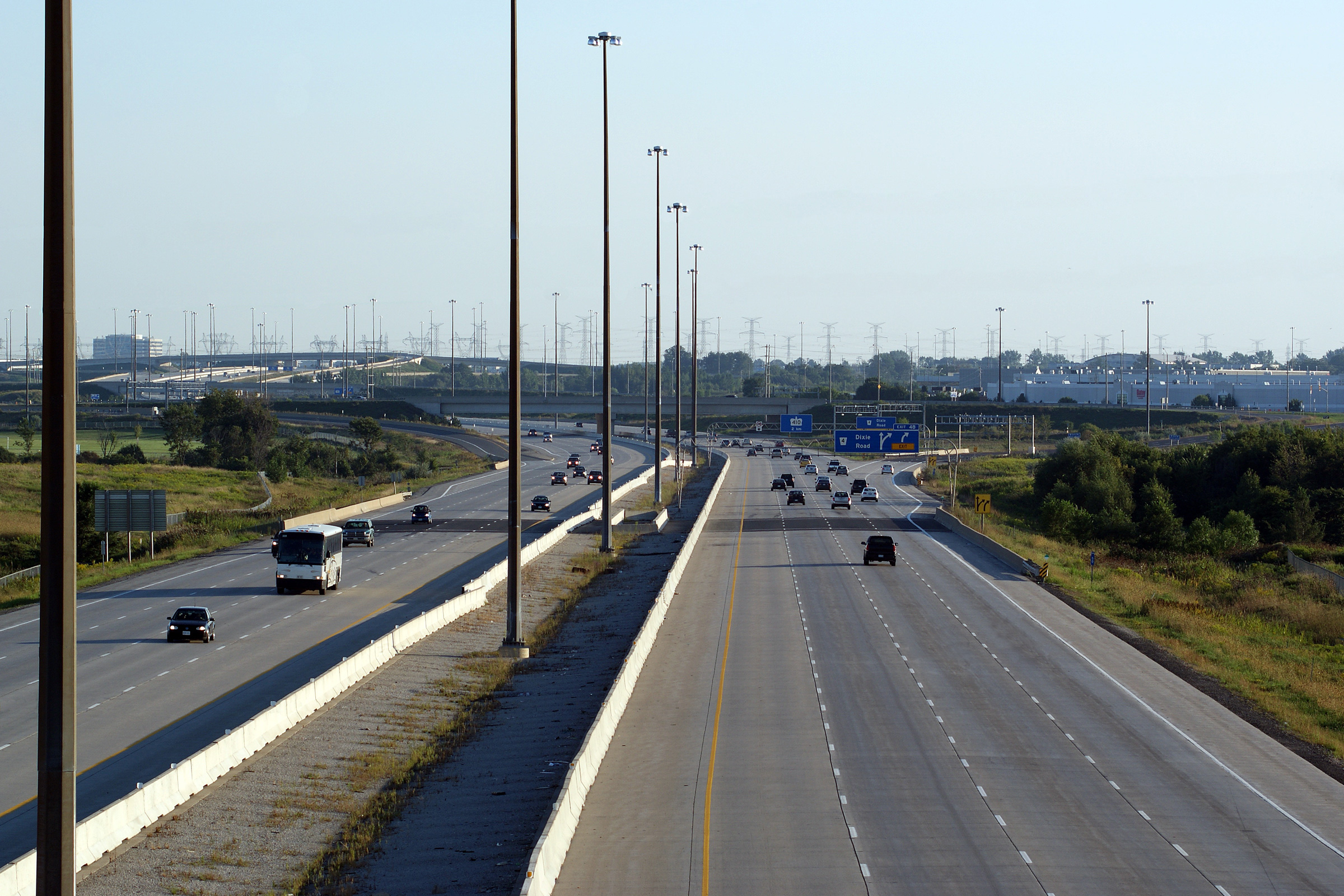
| City of Brampton Regional Municipality of Peel |
Westerly views from the Dixie Road overpass. Photo #1 taken: June 24th, 2008. Photo #2 taken: August 20th, 2017. |
 (720x480) (1440x960) (2400x1600) |
|||
| City of Brampton Regional Municipality of Peel |
These views look easterly from Dixie Road along the 407. Photo #1 taken: June 24th, 2008. Photo #2 taken: August 20th, 2017. |
 (720x480) (1440x960) (2400x1600) |
|||
| City of Brampton Regional Municipality of Peel |
View looking westerly at the off-ramp to Dixie Road. Photo taken: July 11th, 2013. |
 (720x480) (720x480)(1440x960) (2400x1600) |
|||
| City of Brampton Regional Municipality of Peel |
Westbound advanced signage approaching the Dixie Road interchange. Photo taken: July 11th, 2013. |
 (720x480) (720x480)(1440x960) (2400x1600) |
|||
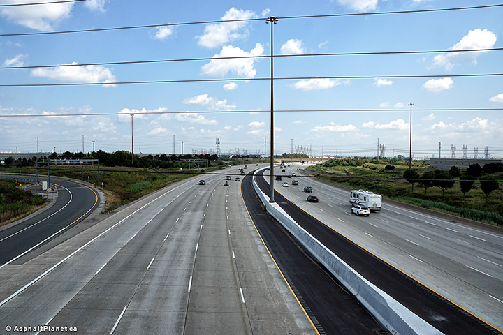
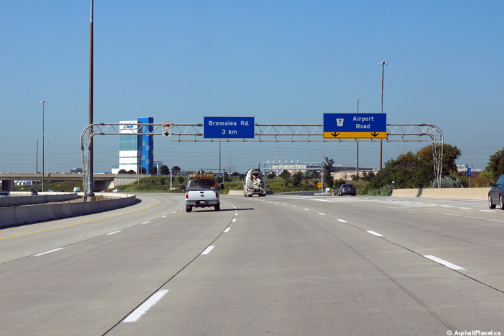
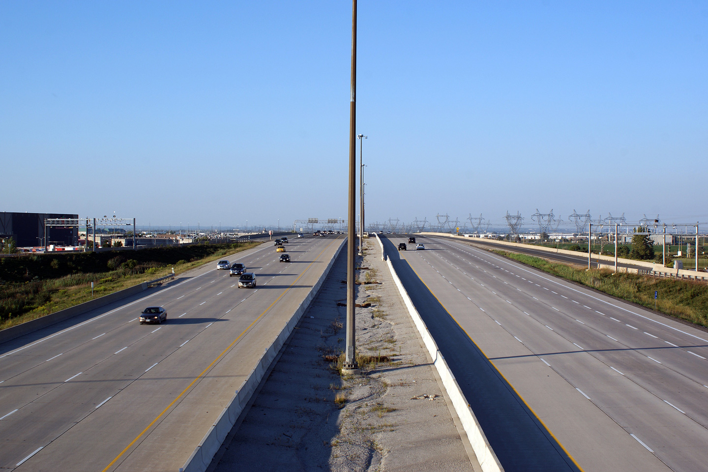
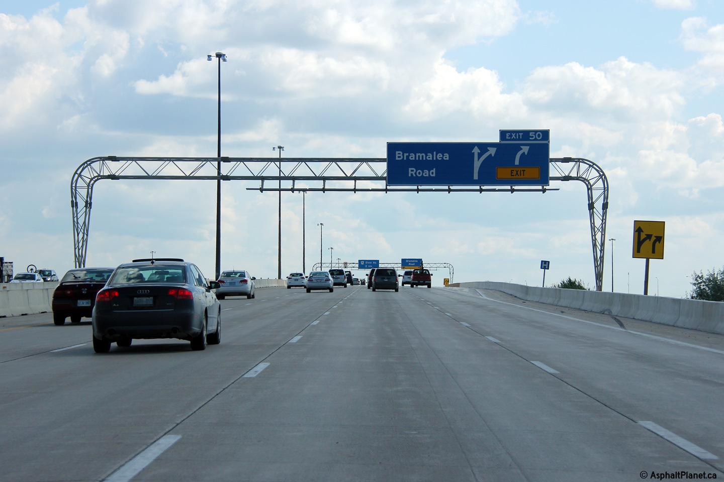
| City of Brampton Regional Municipality of Peel |
These views look westerly from the Bramalea Road overpass towards the Dixie
Road interchange. Photo #1 taken: August 28th, 2010. Photo #2 taken: August 20th, 2017. |
 (720x480) (1440x960) (2400x1600) |
|||
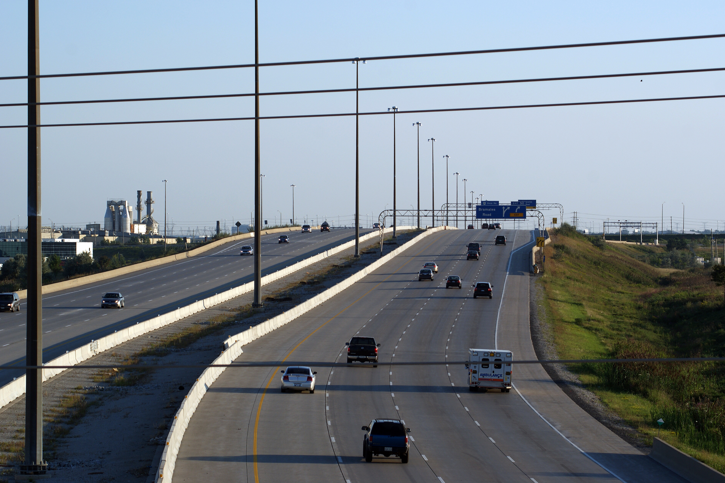
| City of Brampton Regional Municipality of Peel |
Easterly views from Bramalea Road overpass. Bramalea Road has a partial
interchange with Highway 407 that favours movements to the eastbound side. Photo #1 taken: August 28th, 2010. Photo #2 taken: August 20th, 2017. |
 (720x480) (1440x960) (2400x1600) |
|||
| City of Brampton Regional Municipality of Peel |
View as the westbound off-ramp to Bramalea Road departs from the mainline
lanes of Highway 407. Photo taken: July 11th, 2013. |
 (720x480) (720x480)(1440x960) (2400x1600) |
|||
| City of Brampton Regional Municipality of Peel |
Westbound advanced signage for the off-ramp to the Bramalea Road
interchange. Photo taken: July 11th, 2013. |
 (720x480) (720x480)(1440x960) (2400x1600) |
|||
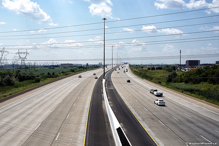
| City of Brampton Regional Municipality of Peel |
View looking west from the Torbram Road overpass.
The 407 crosses overtop of the Kitchener GO line between Torbram and
Bramalea Roads. Photo #1 taken: August 28th, 2010. Photo #2 taken: August 20th, 2017. |
 (720x480) (1440x960) (2400x1600) |
|||
| City of Brampton Regional Municipality of Peel |
Two views looking east towards Steeles Avenue from the Torbram
Road overpass. Photo #1 taken: May 27th, 2006. Photo #2 taken: August 28th, 2010. Photo #3 taken: August 20th, 2017. |
 (720x480) (1440x960) (2400x1600) |
|||
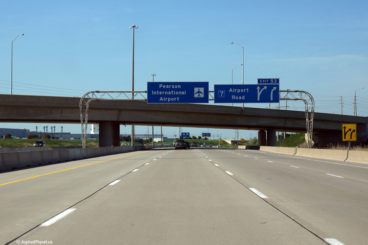
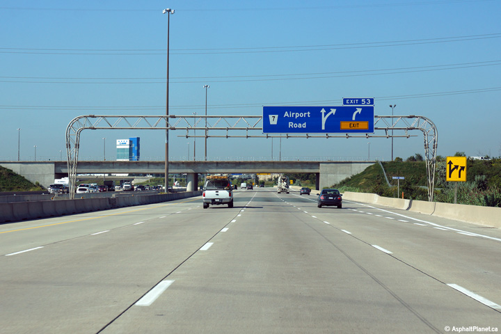
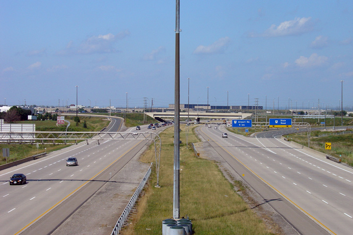
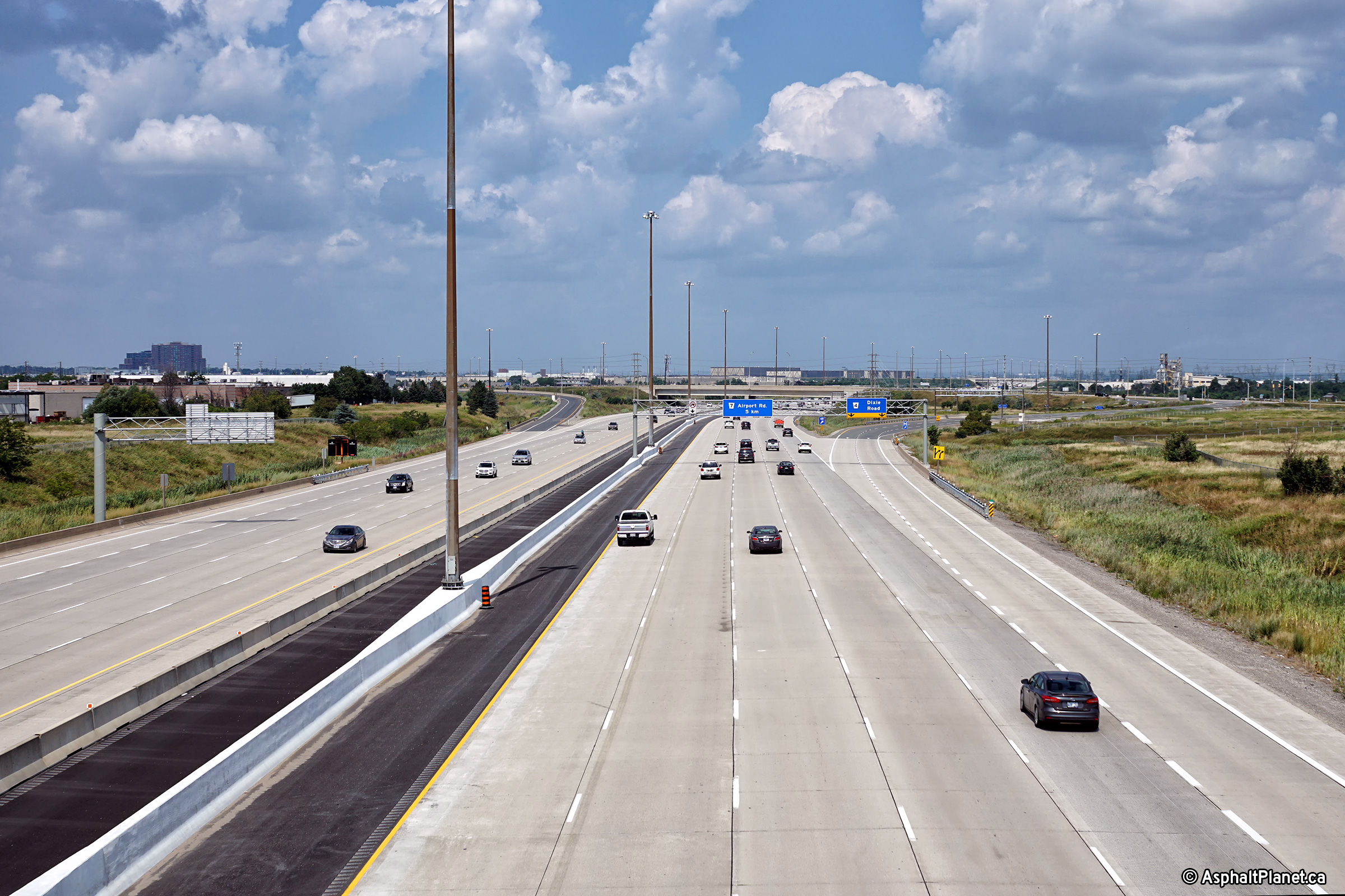
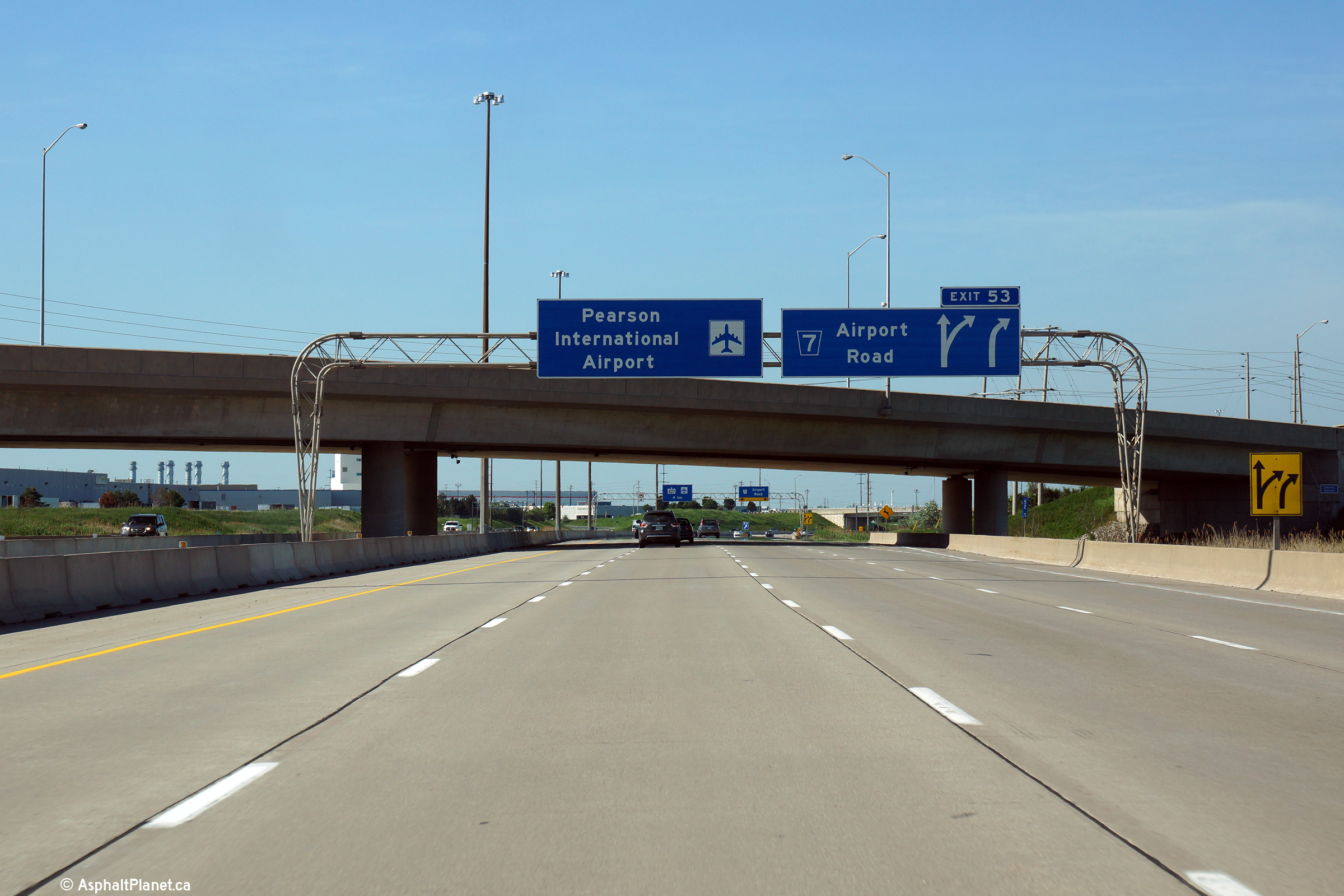
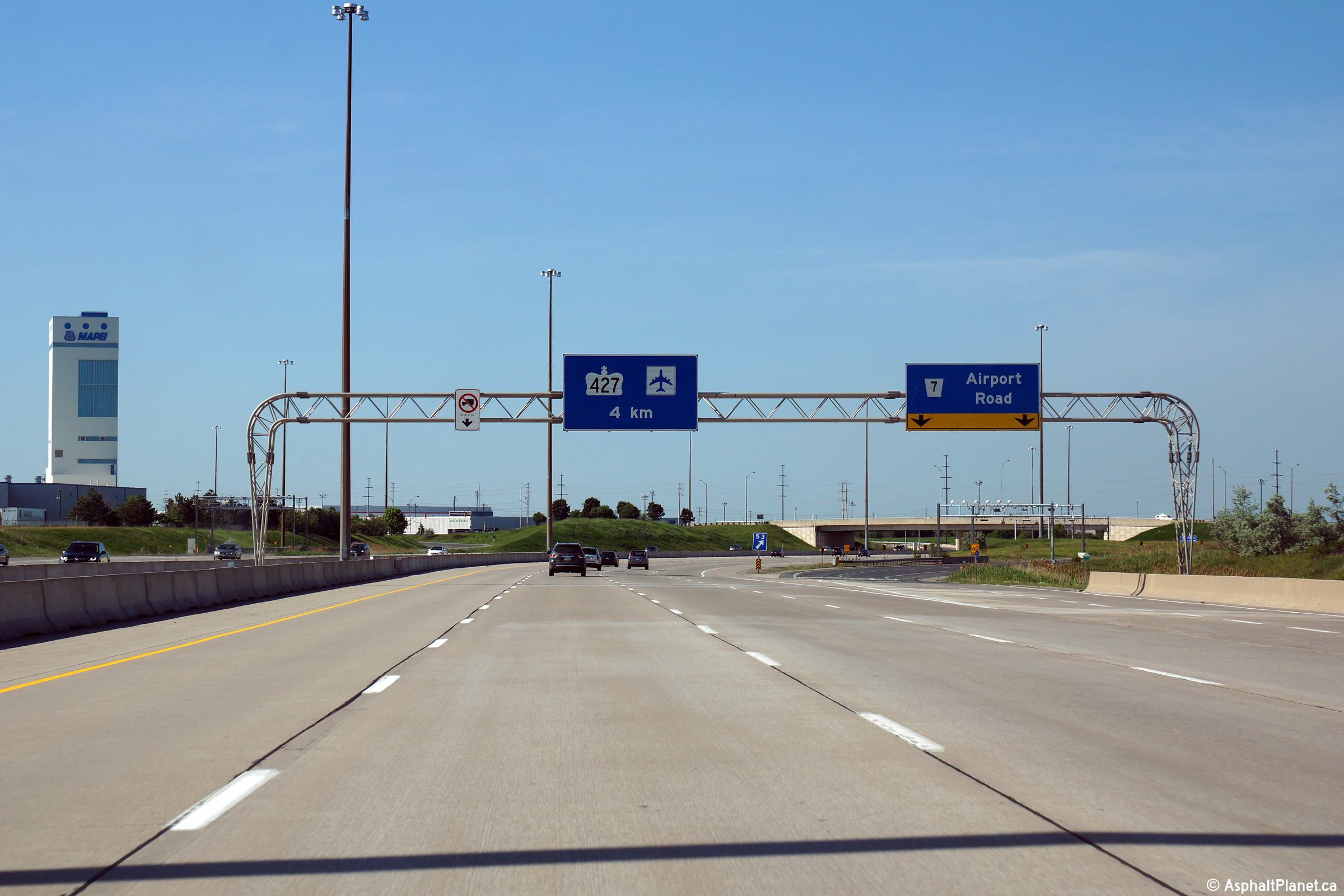
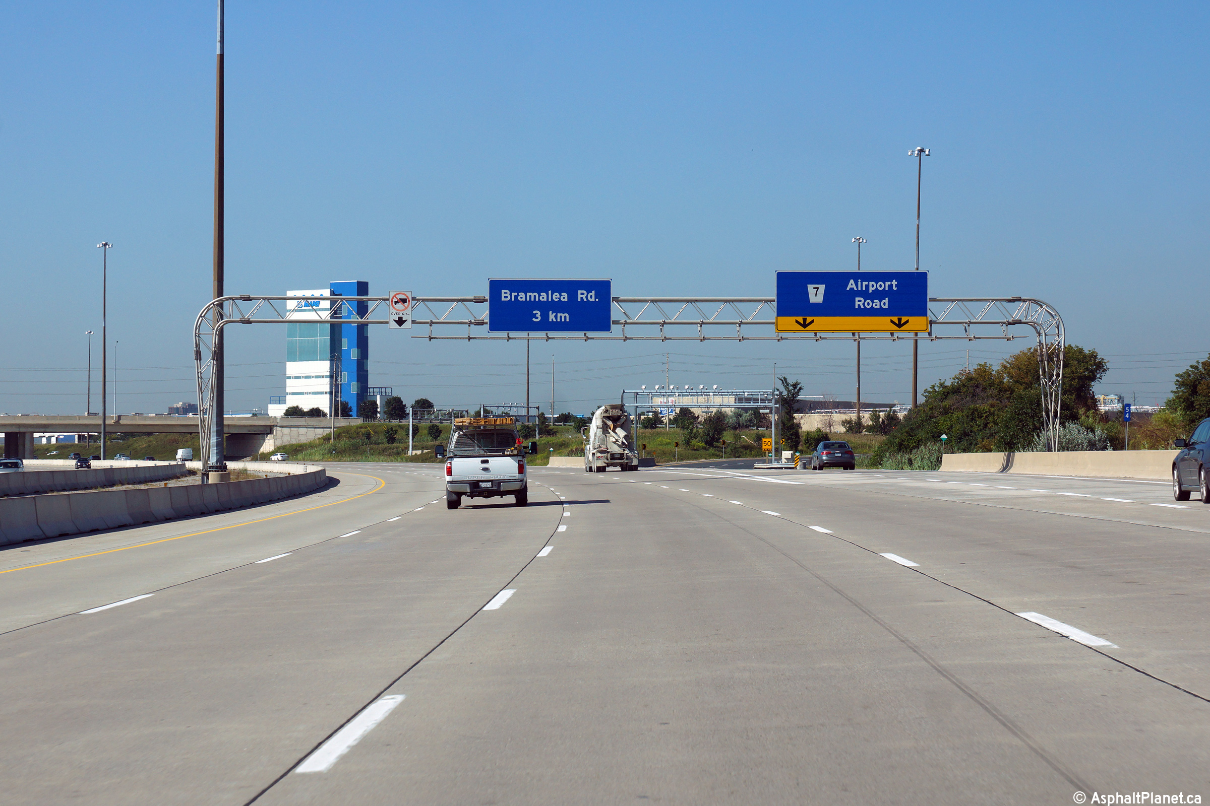
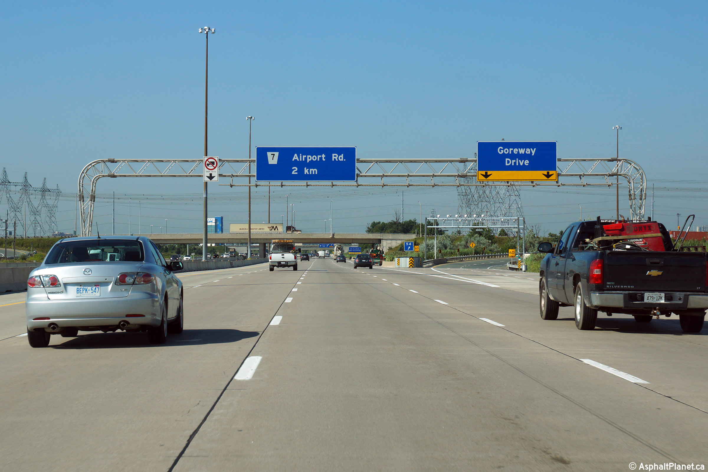
| City of Brampton Regional Municipality of Peel |
Overhead signage in advance of the Airport Road interchange. Note the
oddly coloured county route shield on the signage. Photo taken: June 7th, 2014. |
 (720x480) (720x480)(1440x960) (2400x1600) |
|||
| City of Brampton Regional Municipality of Peel |
The back side of an elegant rounded truss gantry as
seen from the western side of the Steeles Avenue overpass. Photo #1 taken: May 6th, 2012. Photo #2 taken: August 20th, 2017. |
 (720x480) (1440x960) (2400x1600) |
|||
| City of Brampton Regional Municipality of Peel |
Two view looking easterly from Steeles Avenue. Photo #1 taken: May 6th, 2012. Photo #2 taken: August 20th, 2017. |
 (720x480) (1440x960) (2400x1600)  (720x480) (1440x960) (2400x1600) |
|||
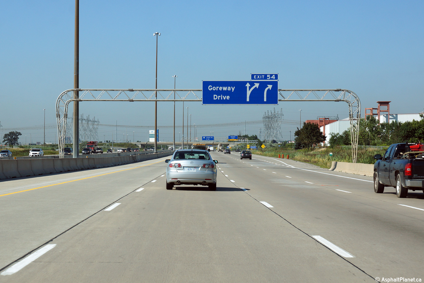
| City of Brampton Regional Municipality of Peel |
Eastbound signage at the off-ramp to Airport Road. Photo taken: June 7th, 2014. |
 (720x480) (720x480)(1440x960) (2400x1600) |
|||
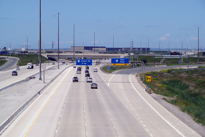
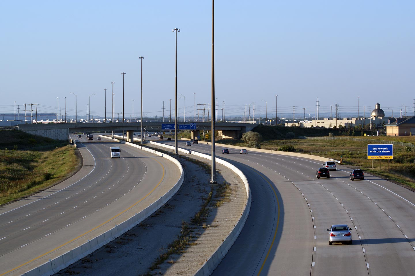
| City of Brampton Regional Municipality of Peel |
Westerly view from Airport Road. Photo #1 taken: May 21st, 2011. Photo #2 taken: August 20th, 2017. |
 (720x480) (1440x960) (2400x1600) |
|||
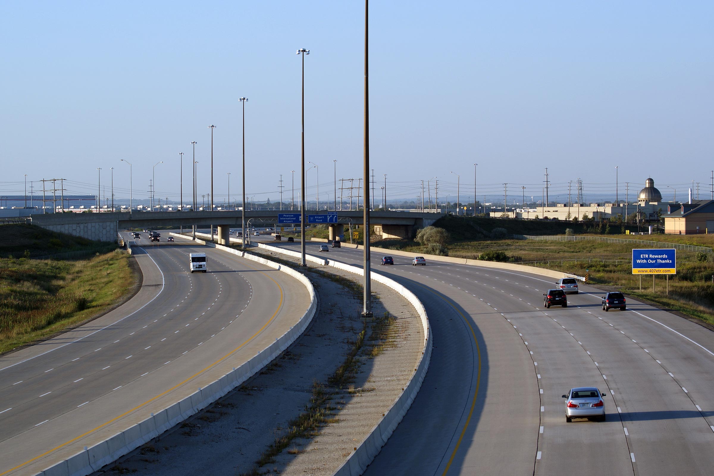
| City of Brampton Regional Municipality of Peel |
Two views looking east along the 407 from the Airport Road
overpass. Photo #1 and #2 taken: May 21st, 2011. Photo #3 taken: August 20th, 2017. |
 (720x480) (1440x960) (2400x1600) |
|||
| City of Brampton Regional Municipality of Peel |
Westbound signage as the off-ramp to Airport Road departs from the mainline
lanes of Highway 407. Photo taken: August 19th, 2014. |
 (720x480) (720x480)(1440x960) (2400x1600) |
|||
| City of Brampton Regional Municipality of Peel |
Westbound advanced signage for the upcoming Airport Road interchange. Photo taken: August 19th, 2014. |
 (720x480) (720x480)(1440x960) (2400x1600) |
|||
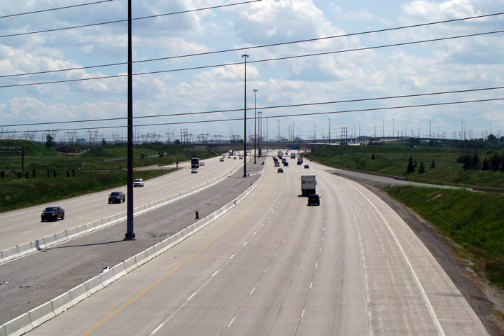
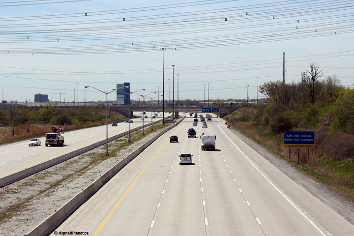
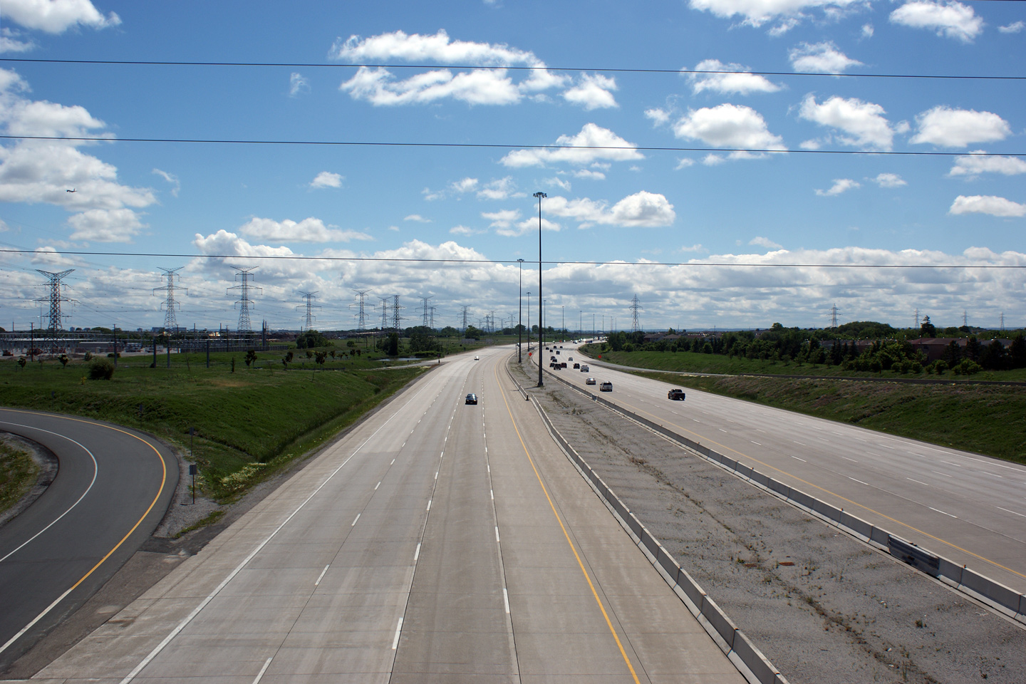
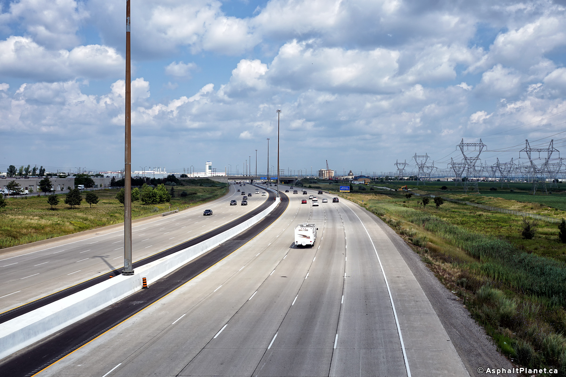
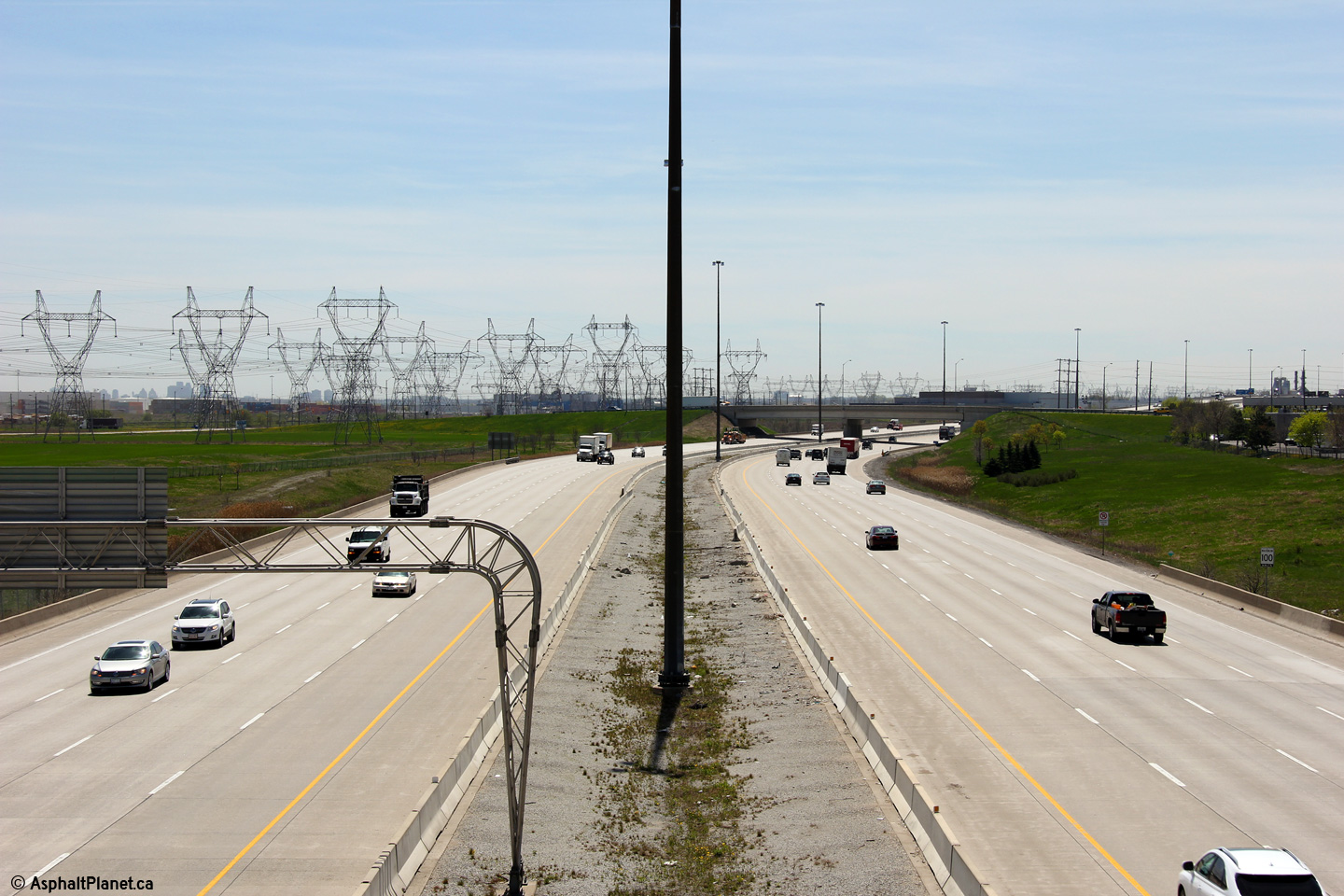
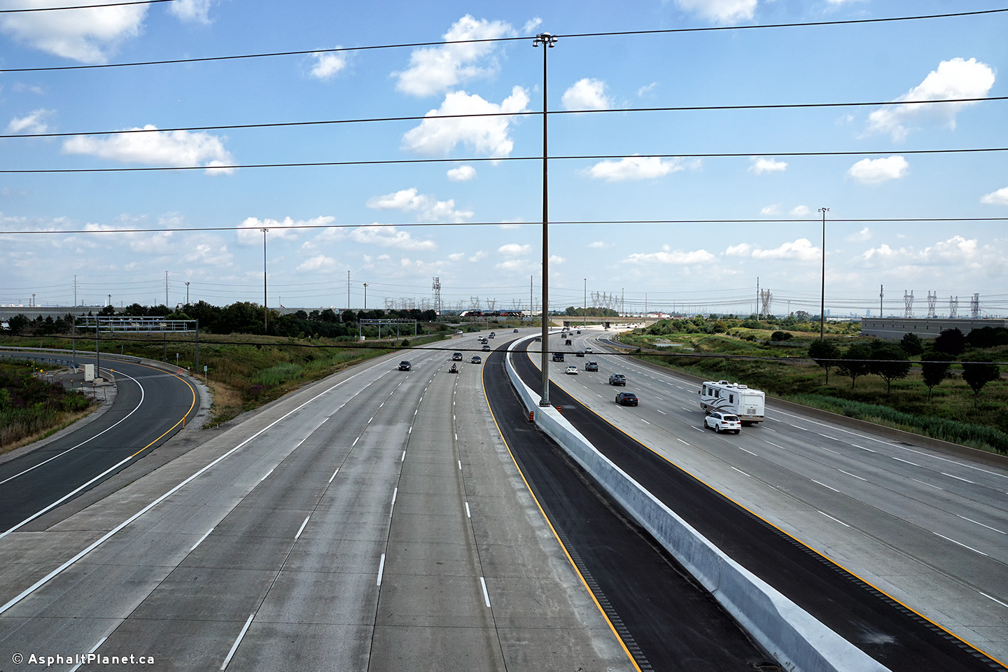
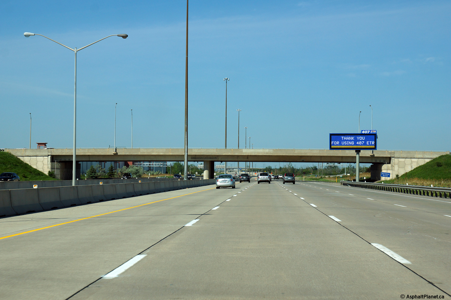
| City of Brampton Regional Municipality of Peel |
This view looks easterly approaching the Goreway Drive overpass.
Highway 407 is the only highway in all of Canada that thanks motorists for
using it. Photo taken: June 7th, 2014. |
 (720x480) (720x480)(1440x960) (2400x1600) |
|||
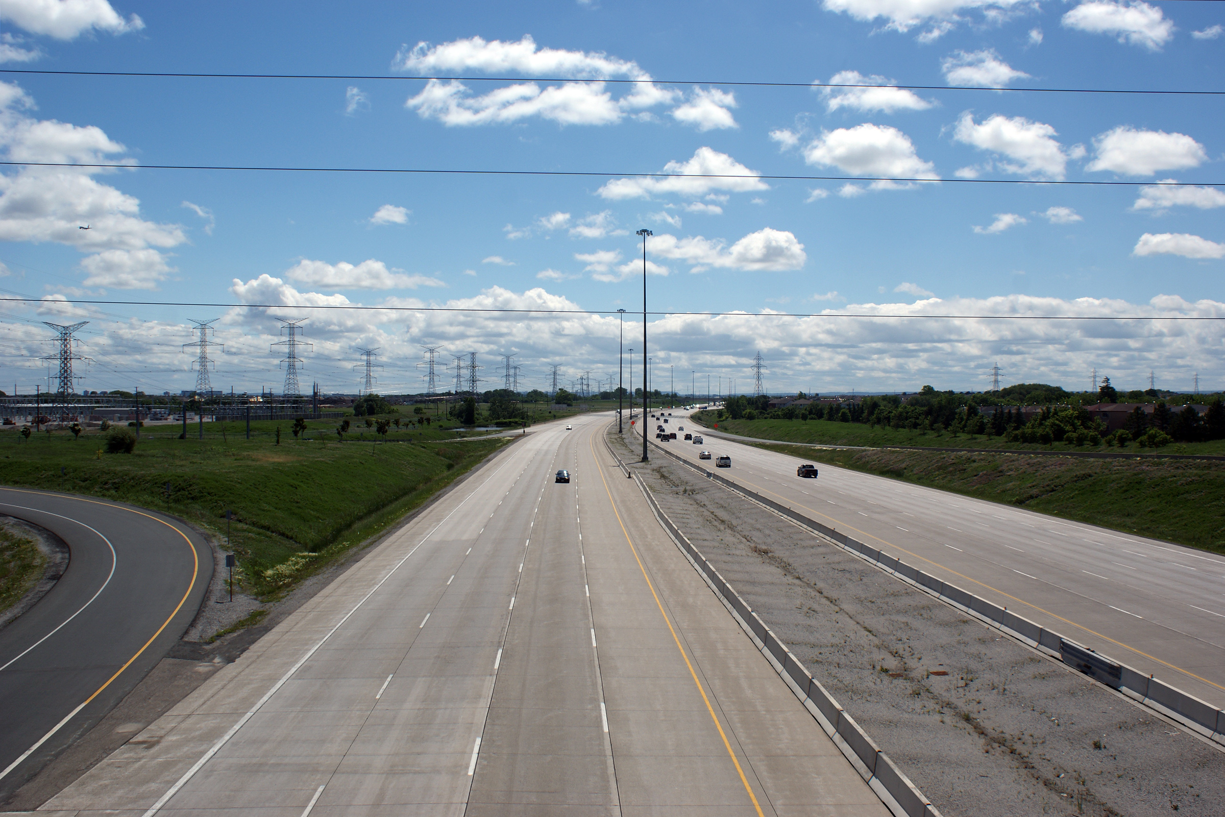
| City of Brampton Regional Municipality of Peel |
This photo was taken from the Goreway Drive overpass in Brampton. Photo #1 taken: May 6th, 2012. Photo #2 taken: August 20th, 2017. |
 (720x480) (1440x960) (2400x1600) |
|||
| City of Brampton Regional Municipality of Peel |
Two views looking easterly from the Goreway Drive overpass. In this
photo, both the on-and off-ramp toll collection gantries are visible.
The toll collection gantries work by first sending a radio transmission to
detect traffic. This radio transmission detects if a transponder is
present, and signals a series of laser beams to sweep the road and identify
the type of vehicle passing through the sensor. Dependant upon if a
transponder has been detected or not, a series of digital cameras then take
overlapping photos of the roadway to identify vehicle license plates.
Most license plates are recognized by computer software, however errant
plates still require human eyes to identify the plate number. Photos #1 and #2 taken: May 6th, 2012. Photo #3 taken: August 20th, 2017. |
 (720x480) (1440x960) (2400x1600) |
|||
| City of Brampton Regional Municipality of Peel |
Westerly view at the turn-off signage for the ramp to Goreway Drive. Photo taken: August 19th, 2014. |
 (720x480) (720x480)(1440x960) (2400x1600) |
|||
| City of Brampton Regional Municipality of Peel |
Westbound advanced signage for the off-ramp to Goreway Drive. Photo taken: August 19th, 2014. |
 (720x480) (720x480)(1440x960) (2400x1600) |
|||
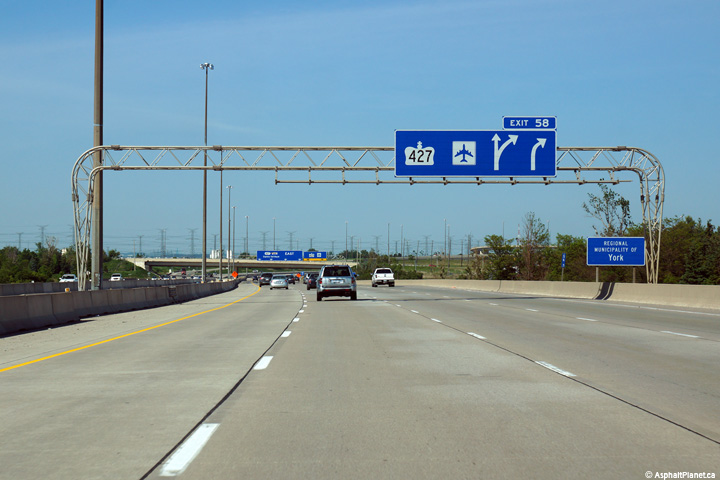
| City of Brampton Regional Municipality of Peel |
Advanced overhead signage for Highway 427. Photo taken: June 7th, 2014. |
 (720x480) (720x480)(1440x960) (2400x1600) |
|||
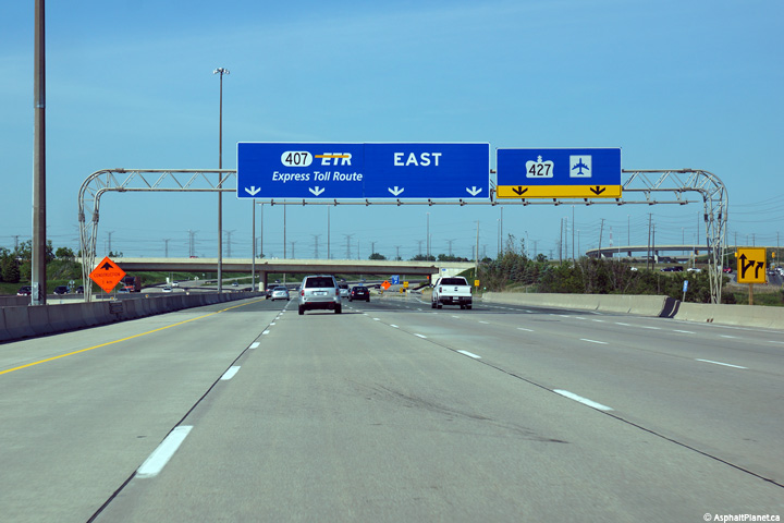
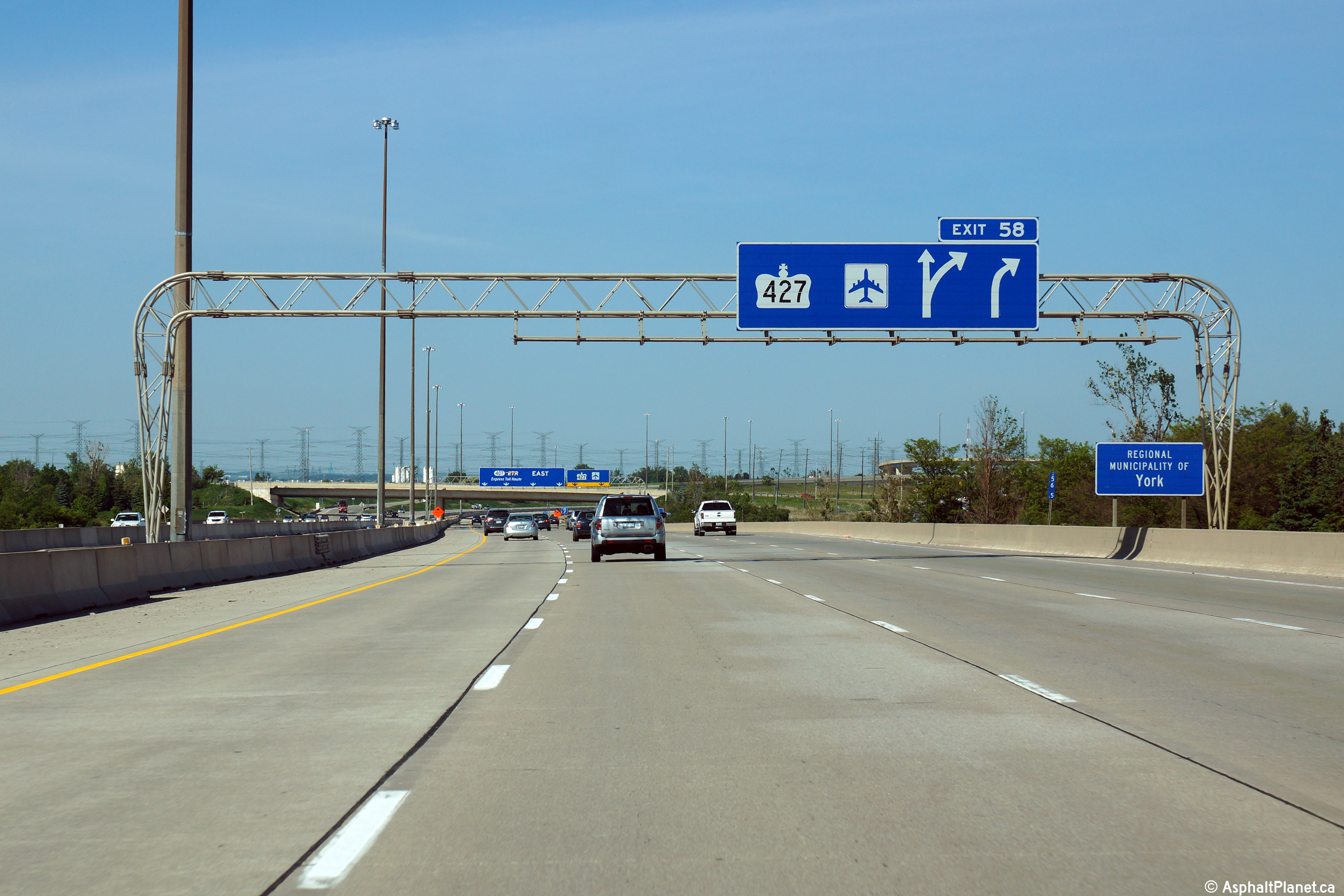
| City of Brampton Regional Municipality of Peel |
Overhead signage for the ramp to Highway 427 from the Highway 407 East. Photo taken: June 7th, 2014. |
 (720x480) (720x480)(1440x960) (2400x1600) |
|||
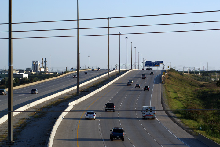
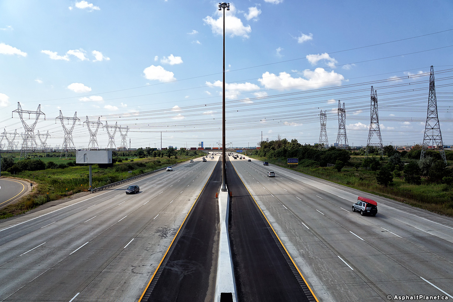
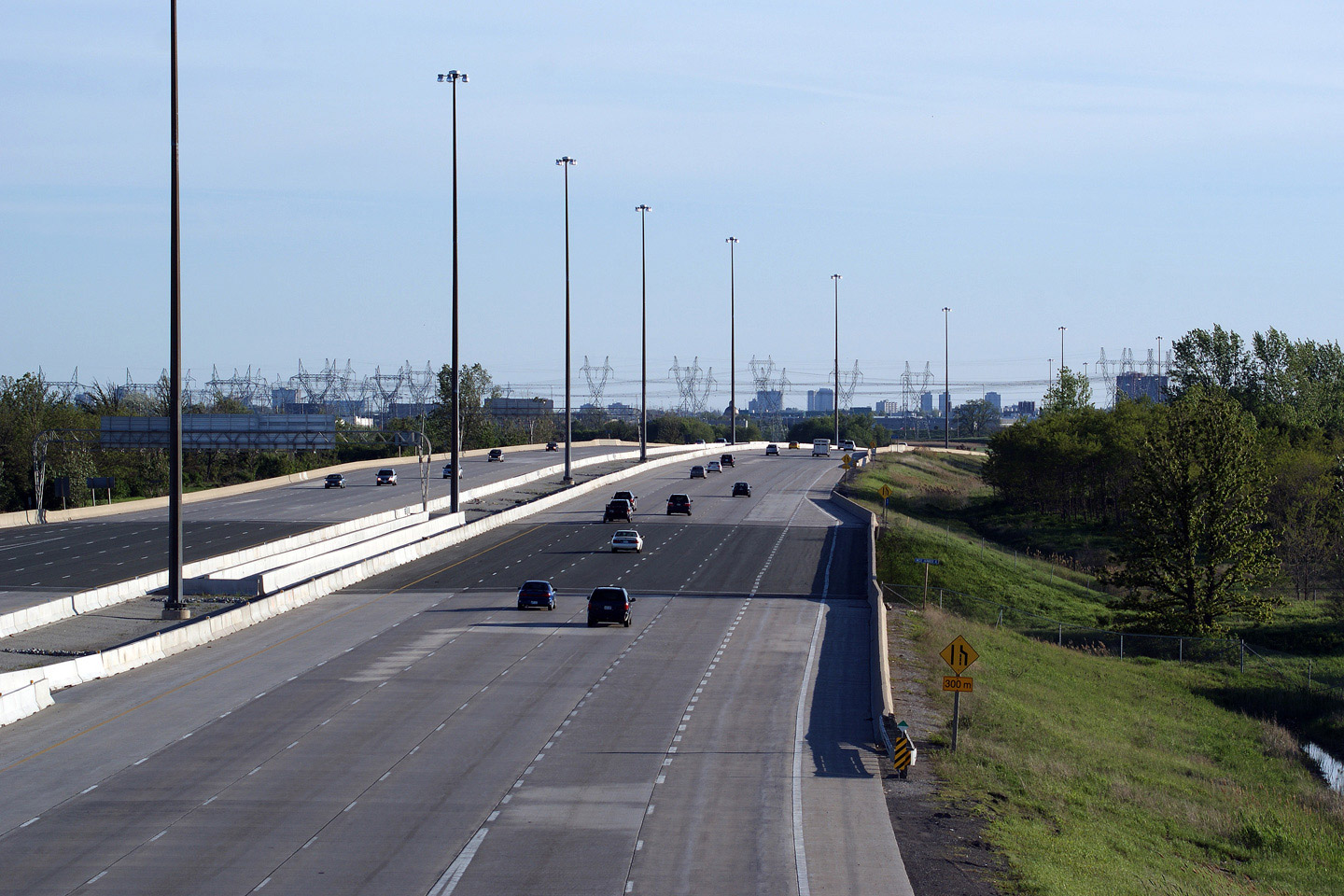
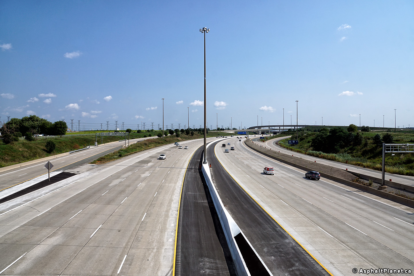
| City of Brampton Regional Municipality of Peel |
Two views looking westerly from the Highway 50 overpass. While I
certainly don't at all fault the 407 Consortium for being as aggressive to
widen the highway to keep up with demand as they have; it is a shame that it
cost the grassed median that the freeway was constructed with. I have
always preferred driving beside well manicured grass rather than a concrete wall. Photo #1 taken: May 12th, 2005. Photo #2 taken: May 31st, 2009. Photos #3 and #4 taken: August 20th, 2017. |
 (720x480) (1440x960) (2400x1600) 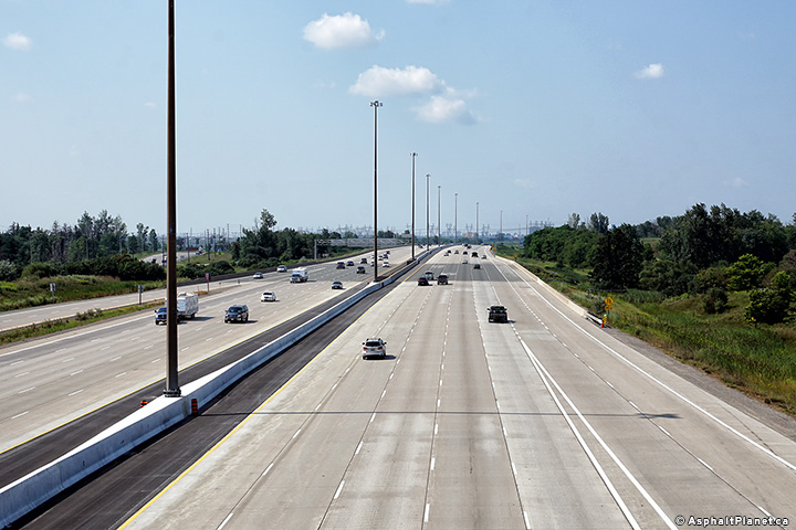 (720x480) (1440x960) (2400x1600) |
|||
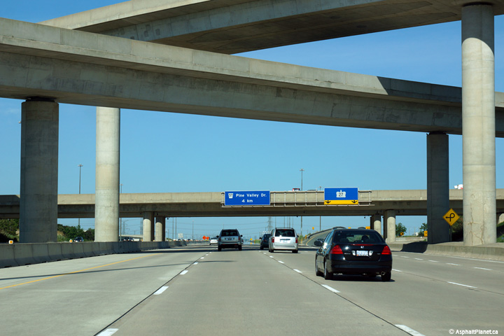
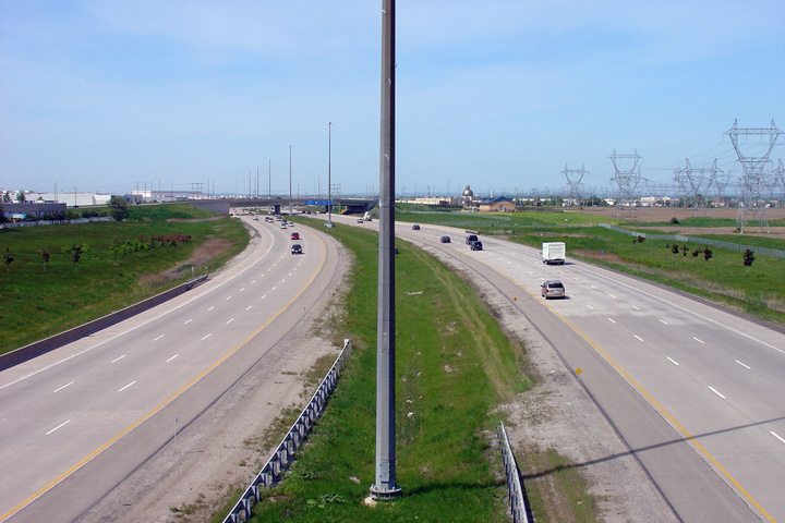
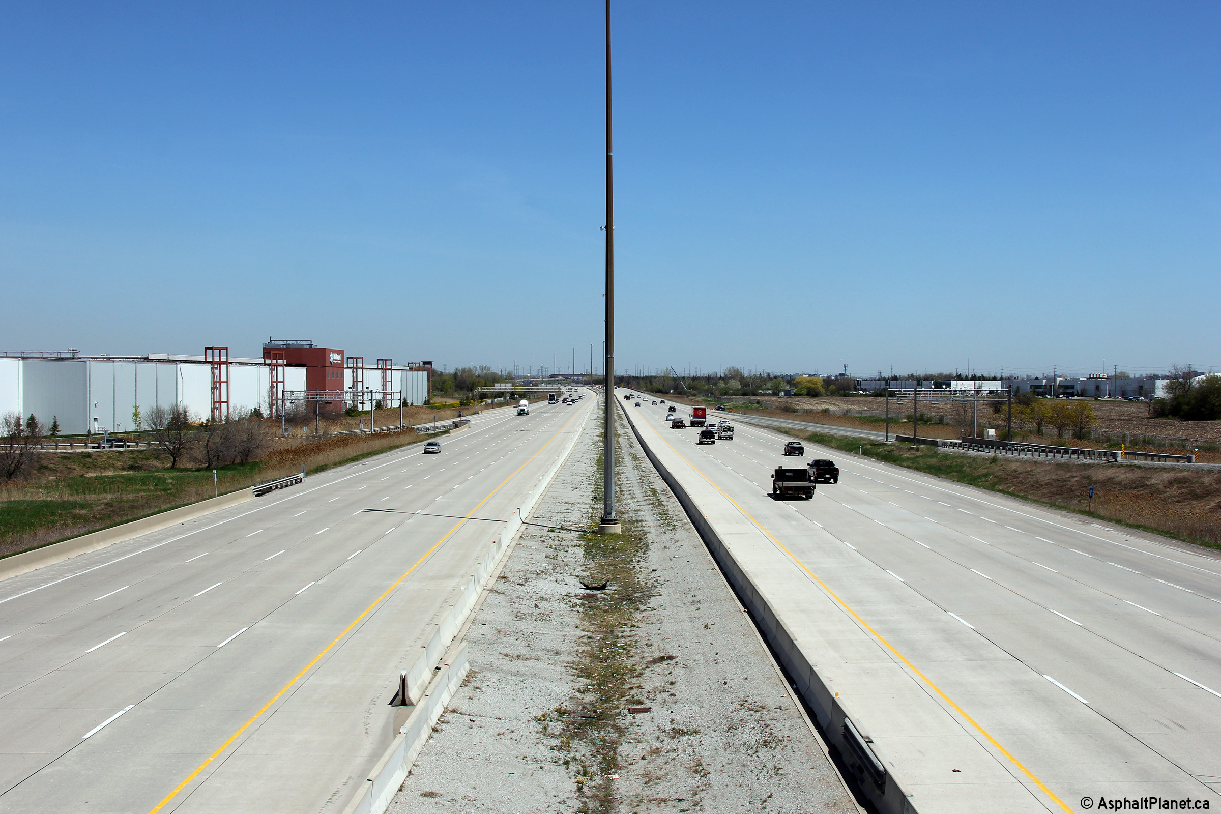
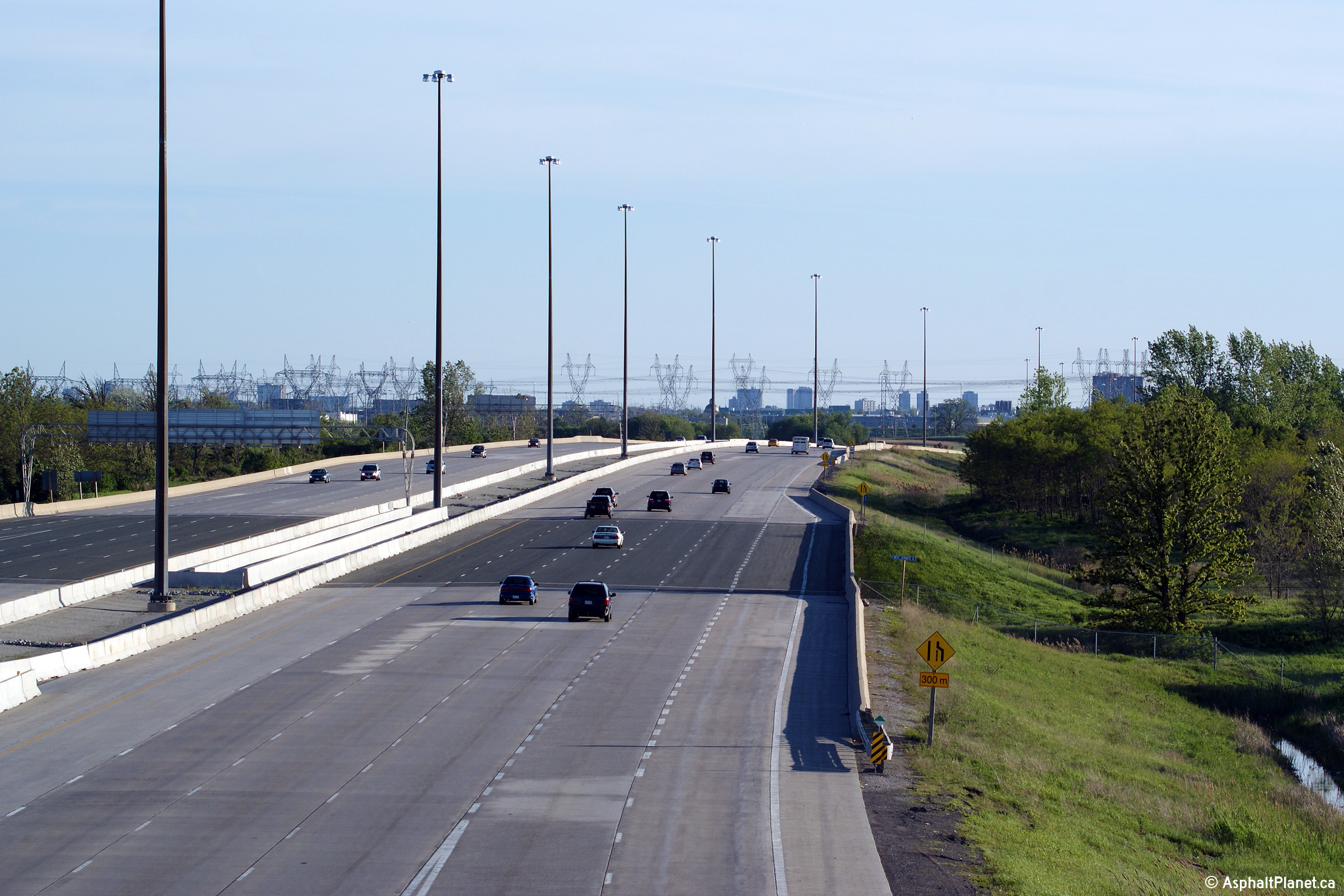
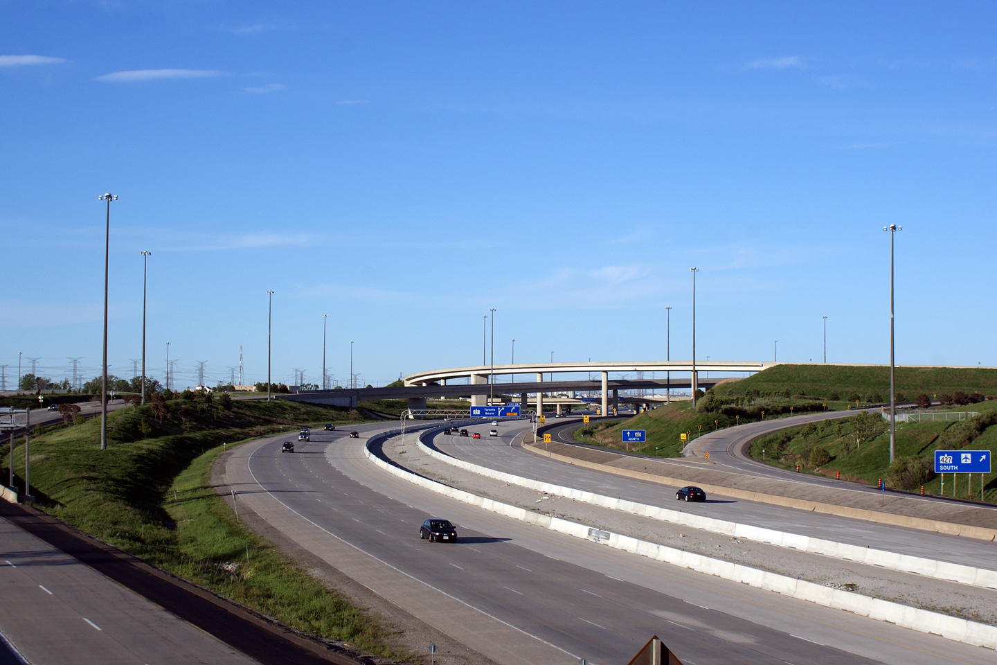
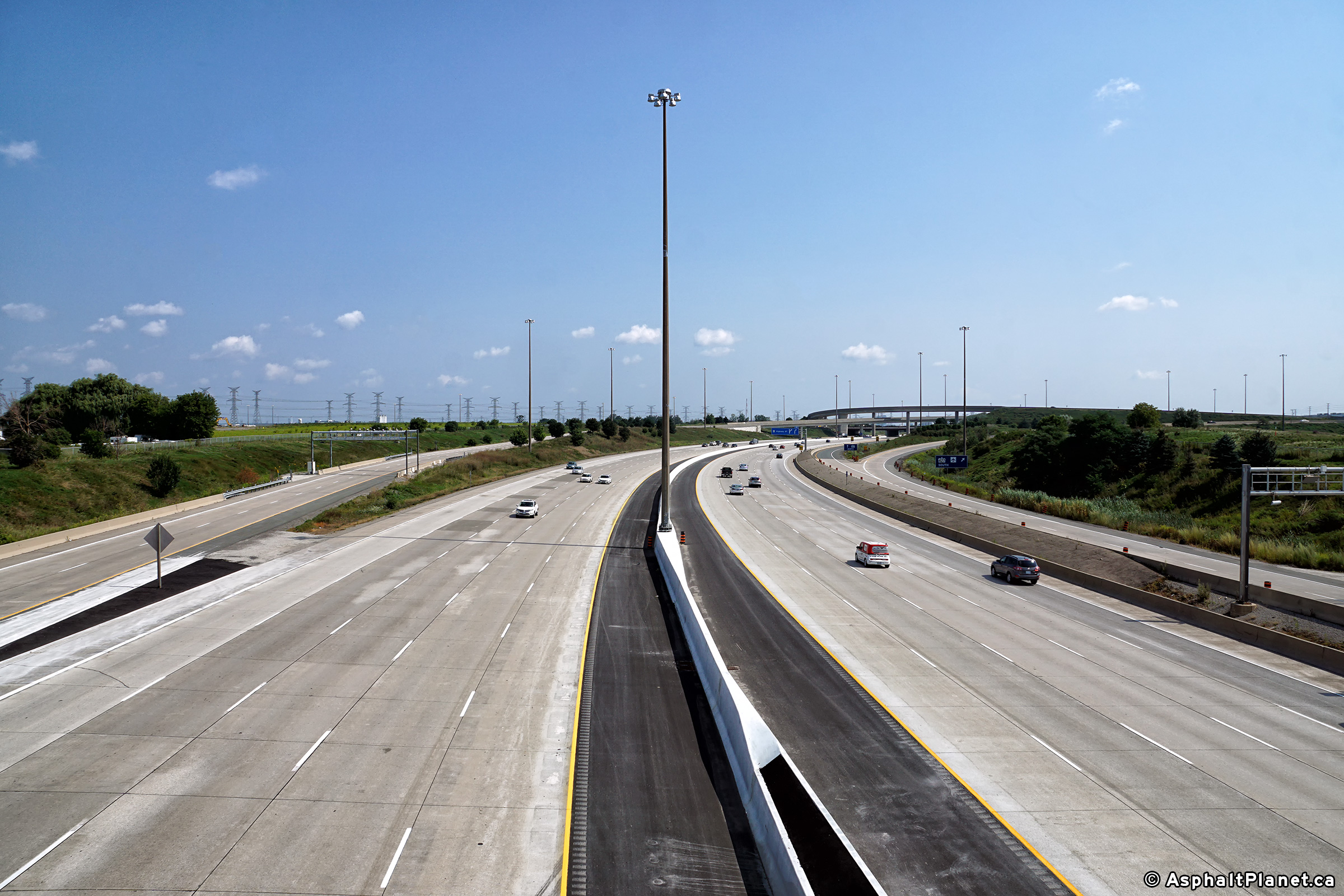
| City of Vaughan Regional Municipality of York |
Looking east from the Highway 50 overpass
towards the Highway 407/427 interchange.
This interchange is a large 4-level interchange with high-speed flyovers
favouring movements for travelers bound to and from Toronto. Photo #1 taken: May 12th, 2005. Photo #2 and #3 taken: May 31st, 2009. Photo #4 taken: August 20th, 2017. |
 (720x480) (1440x960) (2400x1600) |
|||
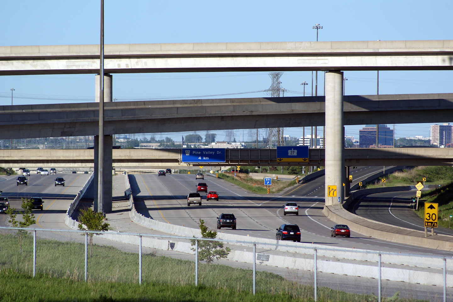
| City of Brampton Regional Municipality of Peel |
Advanced overhead signage for the Highway 27 interchange. Photo taken: June 7th, 2014. |
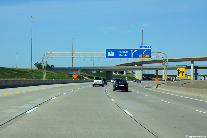 (720x480) (720x480)(1440x960) (2400x1600) |
|||
| City of Brampton Regional Municipality of Peel |
The overhead signage at the turn-off to Highway 27 is affixed to the
structure that carries the southbound lanes of Highway 427 overtop of
Highway 407. Photo taken: June 7th, 2014. |
 (720x480) (720x480)(1440x960) (2400x1600) |
|||
| Highway 427 is a short commuter highway that links Highway 7 to the QEW -- it serves as one of the primary highways to Toronto's Pearson Airport. Click here for Highway 427 images | |||||
| Click here for more Highway 407 images | |||||
<- Page 1 Images Highway 407 Images Index Page 3 Images ->
<- Highway 406 Images Back to Highway 407 Highway 409 Images ->
Copyright (c) 2004-2019, Scott Steeves (Webmaster) AsphaltPlanet@asphaltplanet.ca


 (720x480)
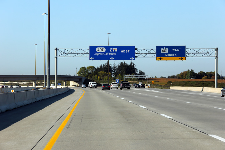


 (720x480)
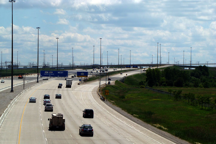


