AsphaltPlanet.ca > OntHighways >
Highway 401 > Images
> Page 8
King's Highway 401 - Images
<- Page 7 Page 8 - Milton to Mississauga Page 9->
Photos shown in this table are arranged from West to East:
| Proper Municipality Name | Photo Description | Photo | ||||
|
Photos taken from driver's perspective appear offset from centre-line photos: |
East- bound |
West- bound |
||||
| Continued from Cambridge to Milton Images | ||||||
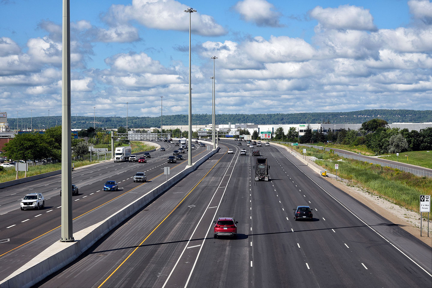
| Highway 25 is the main street through Milton, and prior to being downloaded in 1998 stretched from the QEW in Oakville to Highway 89 west of Shelburne. Click here for Highway 25 images. | ||||||
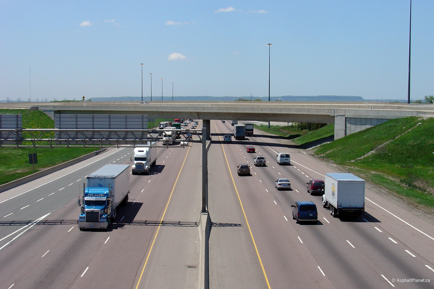
| Town of Halton Hills Regional Municipality of Halton |
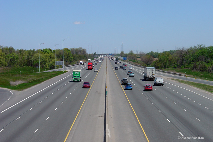
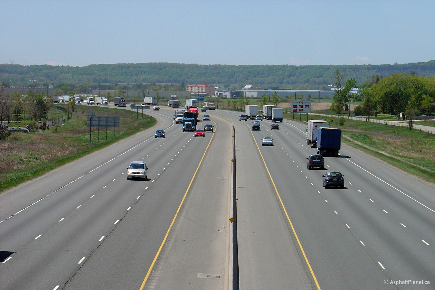
Highway 401 looking east from the
Highway 25
overpass in Milton. Highway 25 is located at kilometre marker 320.
Click here to jump to the view looking
west from the Highway 25 overpass. Upper photo taken: October 10th, 2009. Lower photos taken: August 27th, 2023. |
(1440x960) (2400x1600) (4200x2400)
|
||||
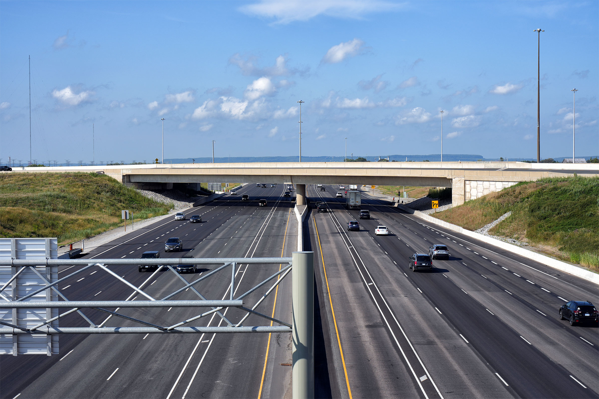
| Town of Halton Hills Regional Municipality of Halton |
Looking westerly from the Steeles Avenue overpass in Milton. Steeles
Avenue is located roughly at kilometre marker 322. Upper photo taken: May 25th, 2005. Lower photos taken: August 27th, 2023. |
|
||||
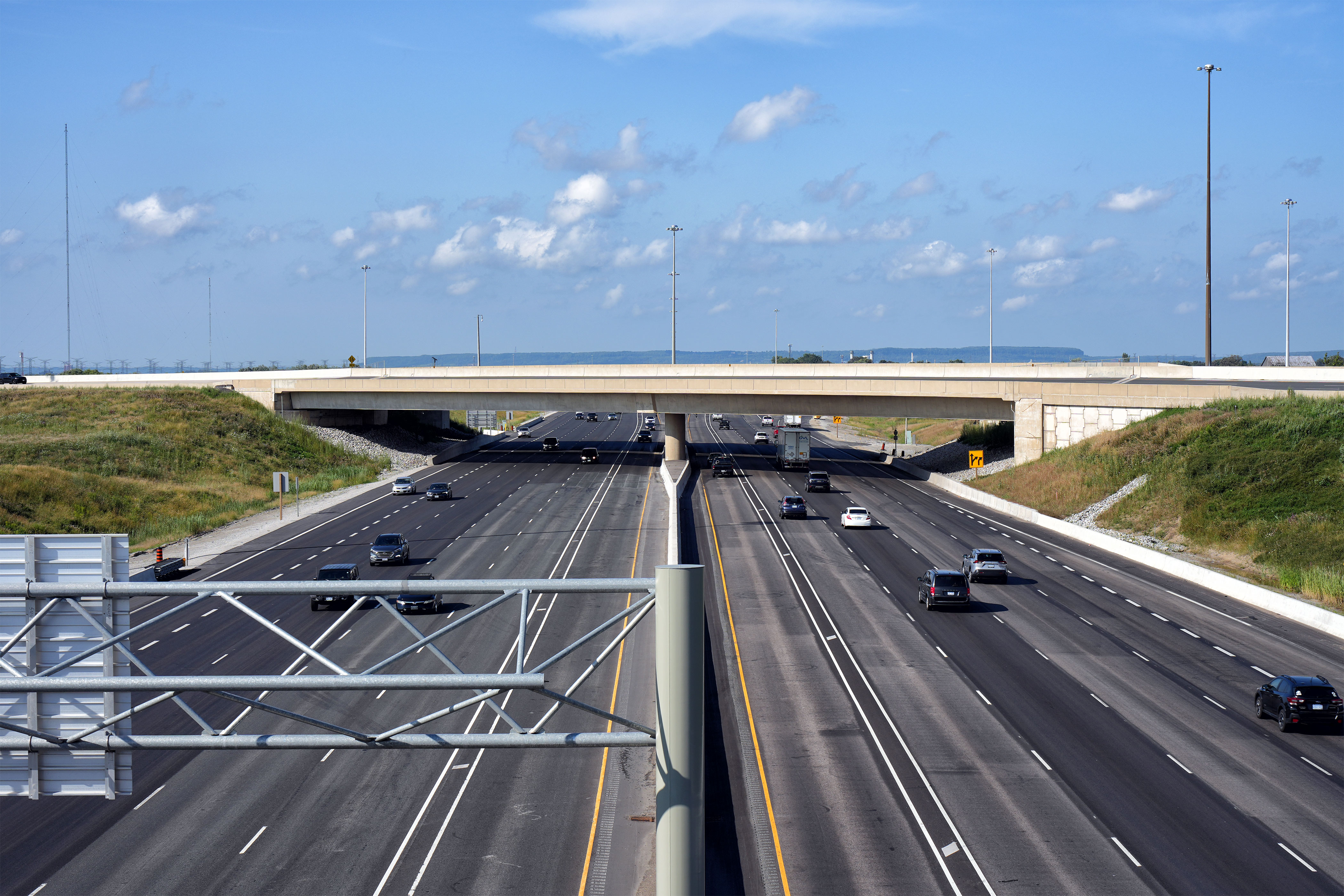
| Town of Halton Hills Regional Municipality of Halton |
Looking east towards Toronto from the Steeles Avenue overpass. Upper photo taken: May 25th, 2005. Lower photos taken: August 27th, 2023. |
 (1440x960) (2400x1600) (4200x2800)
|
||||
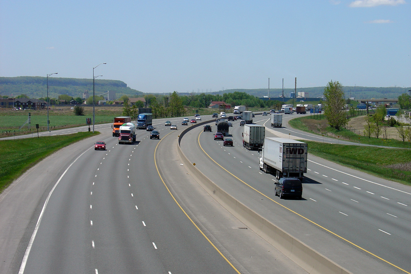
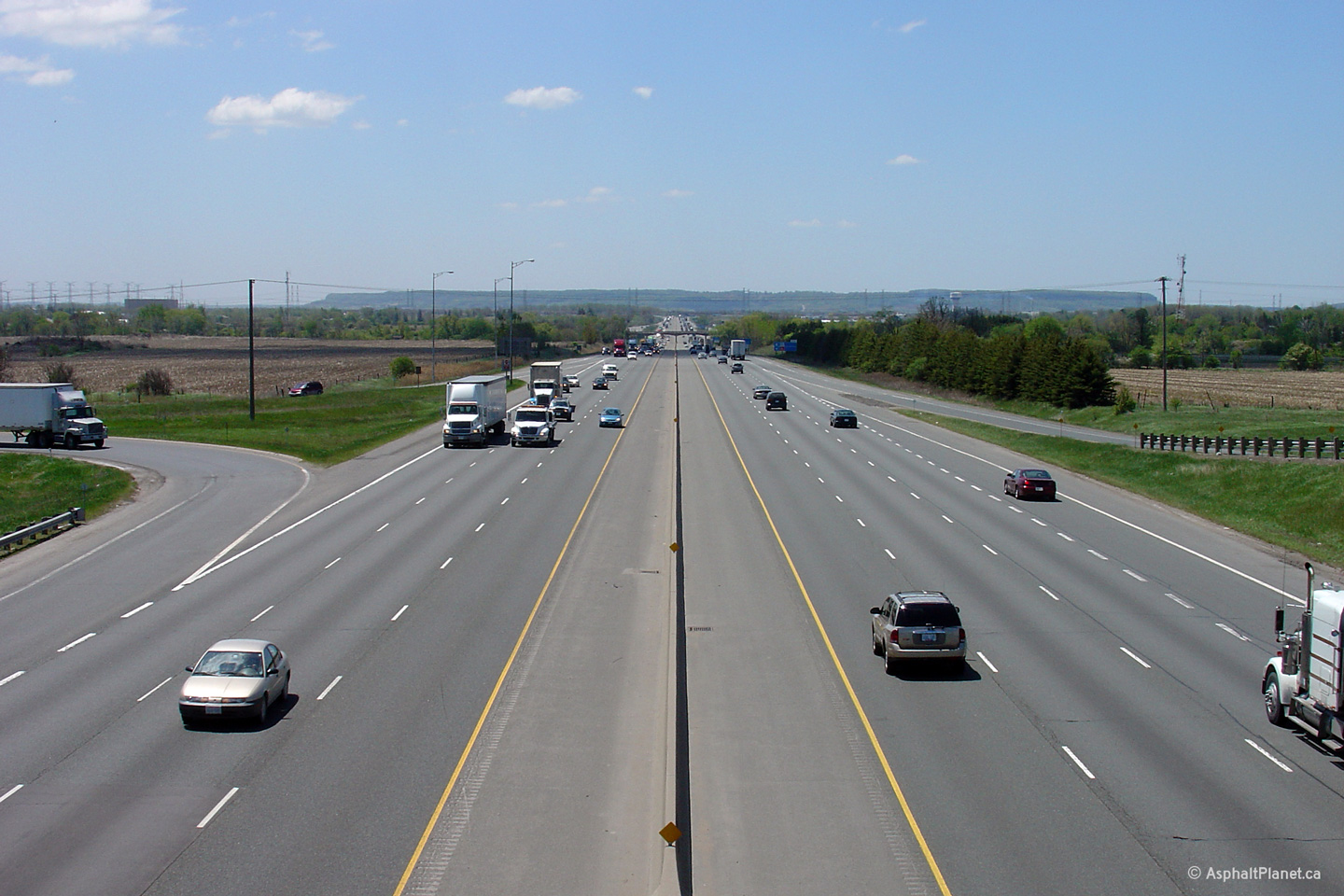
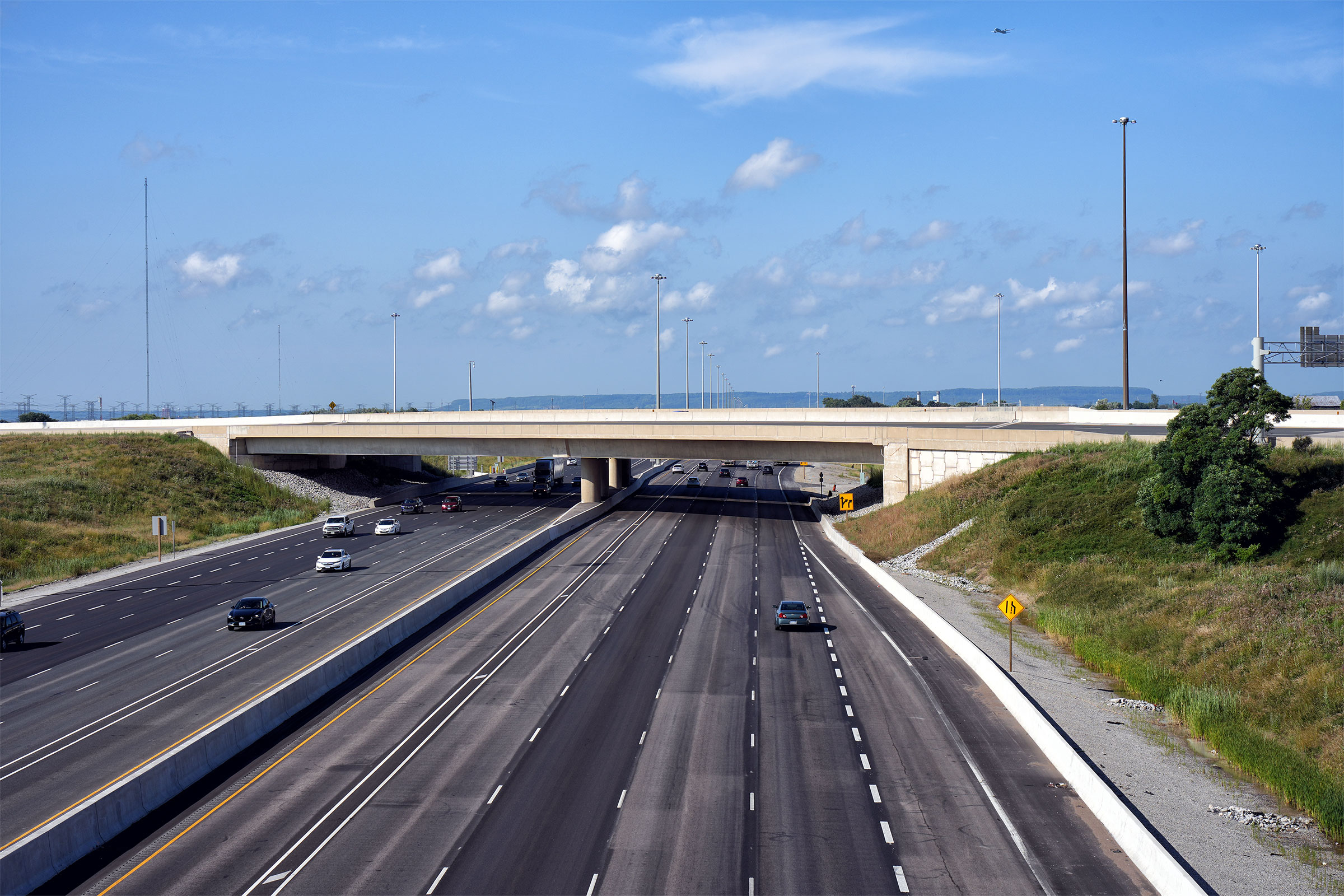
| Town of Halton Hills Regional Municipality of Halton |
Looking west from the James Snow Parkway interchange. James Snow was
Ontario's minister of Transportation and Communications between 1975 and
1985 during Bill Davis' tenure as premier of Ontario. Photo taken: May 25th, 2005. |
 |
||||
| Town of Halton Hills Regional Municipality of Halton |
Looking east from the James Snow Parkway interchange in Milton. James Snow
Parkway is located roughly at kilometre marker 324. Photo taken: May 25th, 2005. |
 |
||||
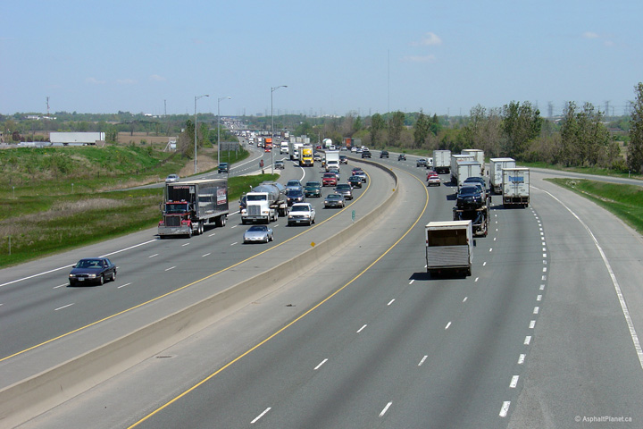
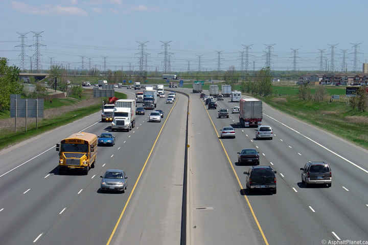
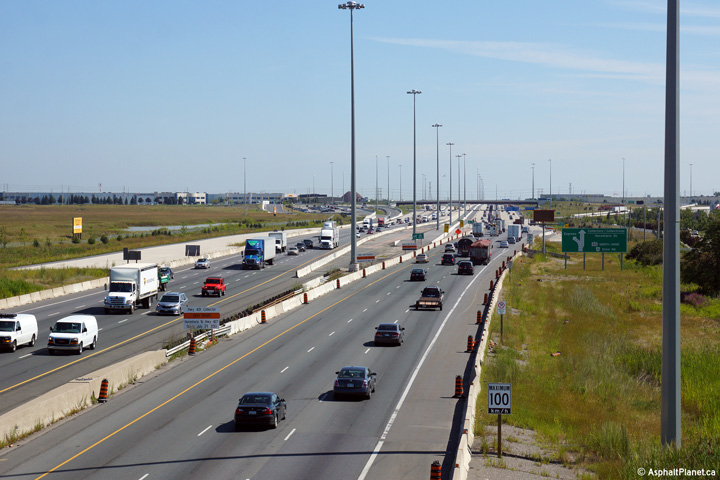
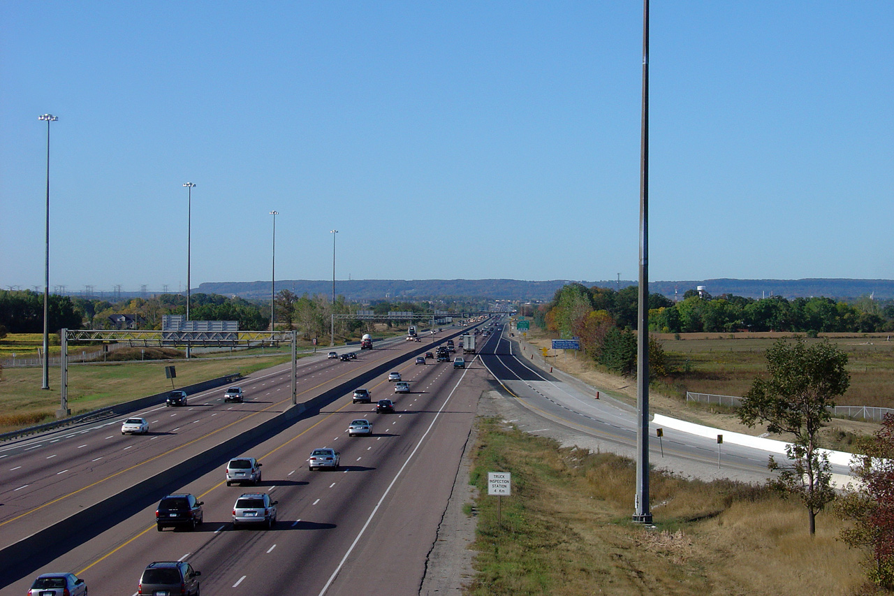
| Town of Halton Hills Regional Municipality of Halton |
Looking west towards Milton from the Sixth Line Road overpass. This
photo highlights the truck inspection stations that are located between
Mississauga and Milton. Photo taken: May 25th, 2005. |
 |
||||
| Town of Halton Hills Regional Municipality of Halton |
Looking east towards Toronto from the Sixth Line Road overpass. The
401 crosses Middle Sixteen Mile Creek in this photo. Notice that the 1950s vintage railings have been blocked off with jersey barrier. Photo taken: May 25th, 2005. |
 |
||||
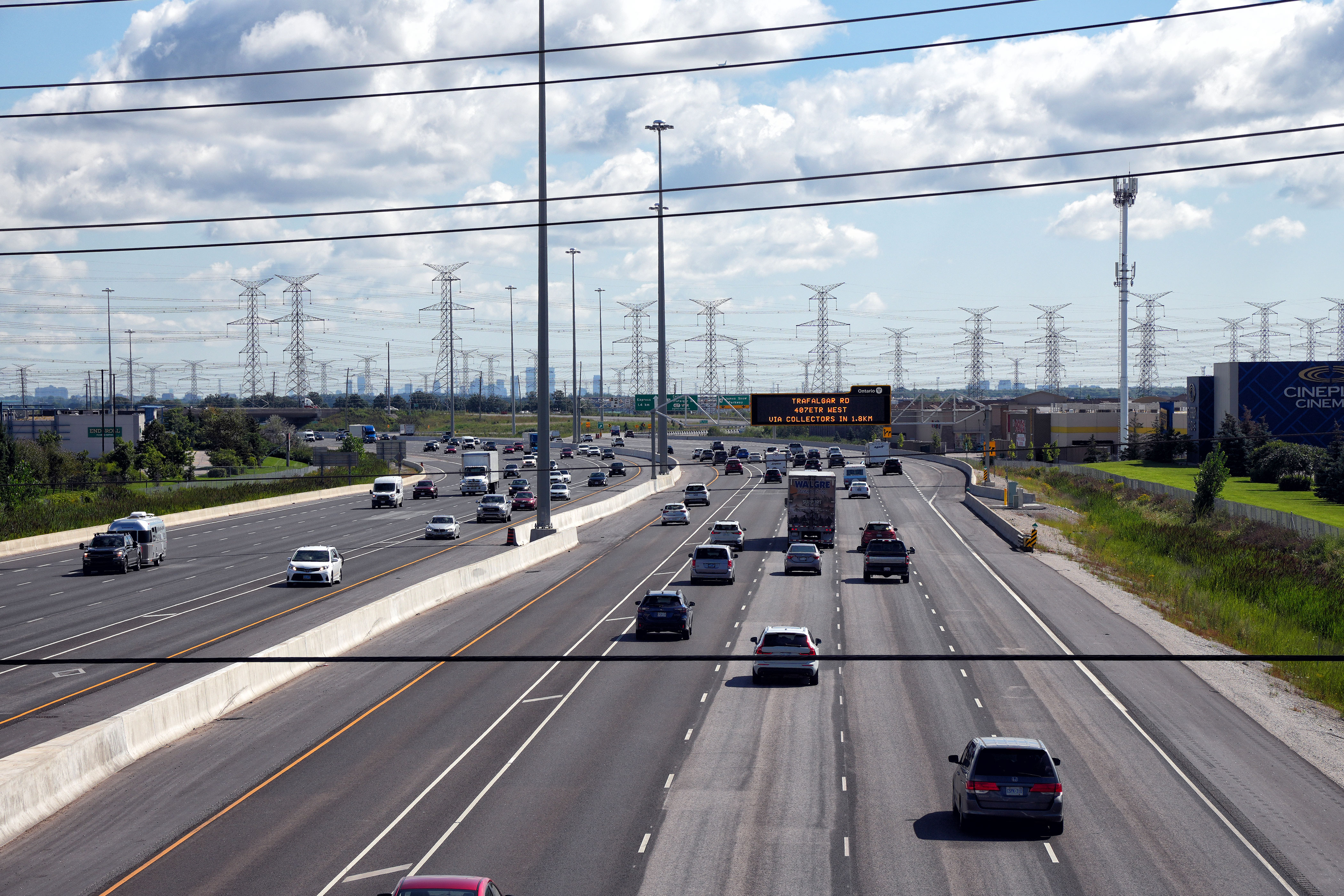
| Town of Halton Hills Regional Municipality of Halton |
Looking westerly from the Trafalgar Road overpass along Highway 401.
The Niagara Escarpment looms in the background of this photo, just beyond
Milton. Photo taken: May 25th, 2005. |
 |
||||
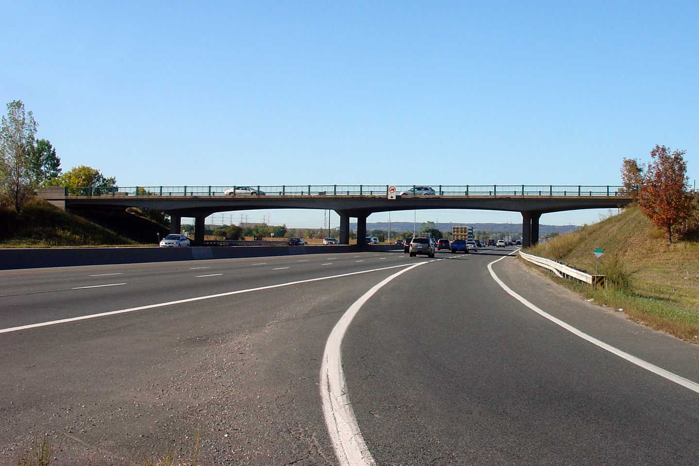
| Town of Halton Hills Regional Municipality of Halton |
Looking east towards Toronto from the Trafalgar
Road overpass. Trafalgar Road is located at exit number 328. Photo taken: May 25th, 2005. |
 |
||||
| Town of Halton Hills Regional Municipality of Halton |
Eastern side of the Trafalgar Road overpass. This overpass was
rehabilitated during the 2011 construction season. Photo taken: September 23rd, 2007. |
 |
||||
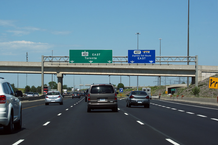
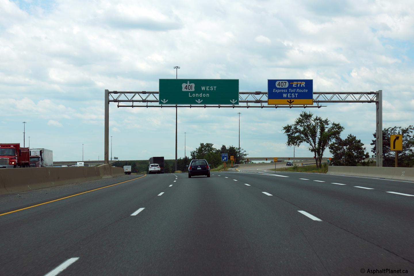
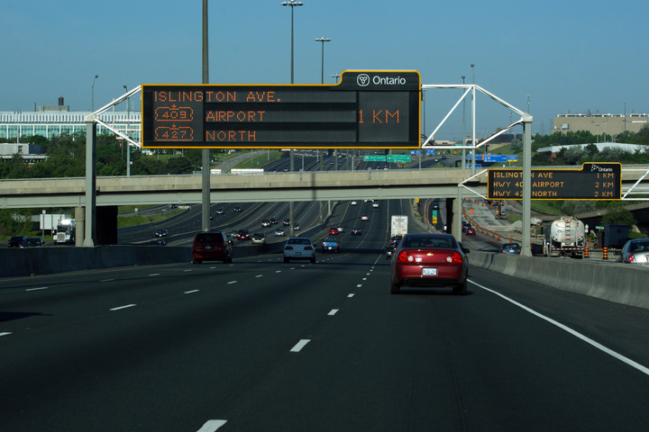
| Town of Halton Hills Regional Municipality of Halton |
Ground mounted signage in advance of the Highway 407
interchange. Photo taken: July 2nd, 2010. |
 (960x480) (960x480)(1440x960) |
||||
| Town of Halton Hills Regional Municipality of Halton |
Advanced signage for the ramp from the eastbound 401 to westbound Highway
407. Interestingly, this overhead sign uses an older (now obsolete) style of arrow
despite being a fairly recently manufactured sign. Photo taken: July 2nd, 2010 |
 (960x480) (960x480)(1440x960) |
||||
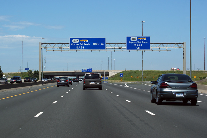
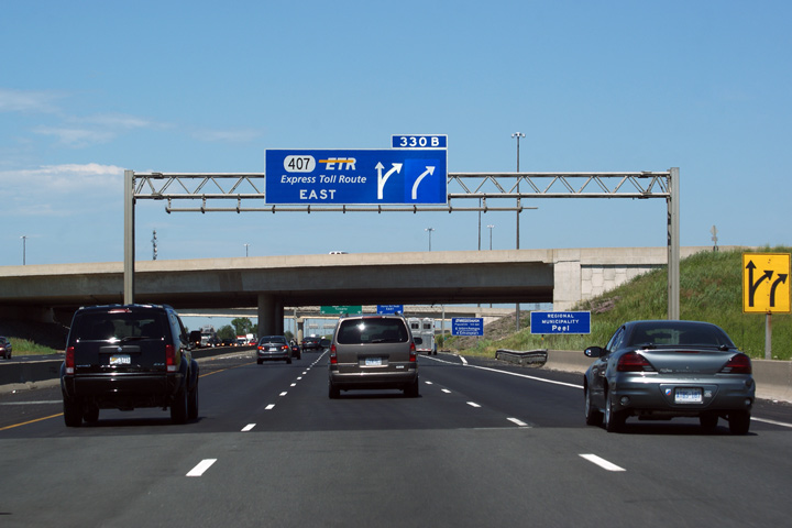
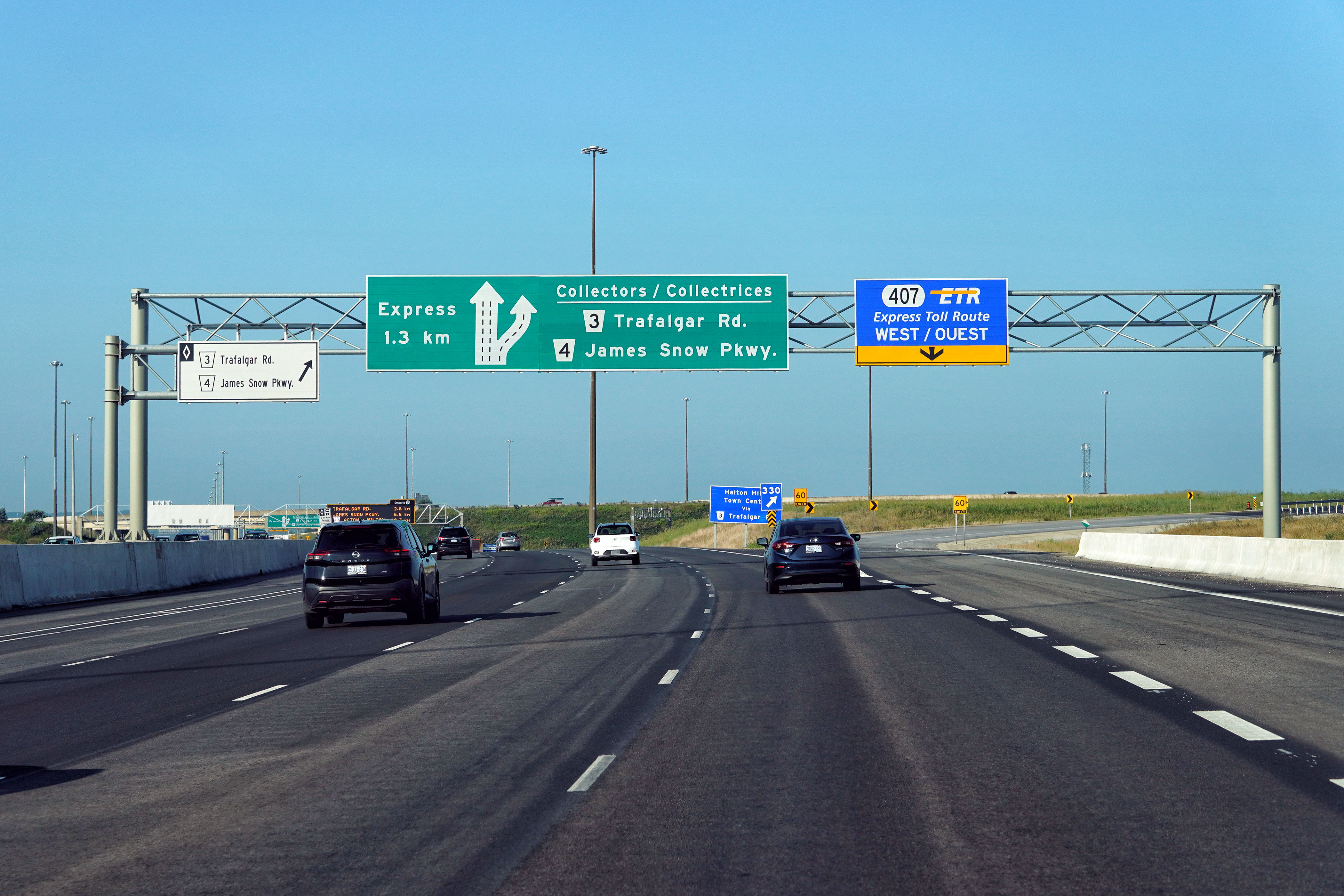
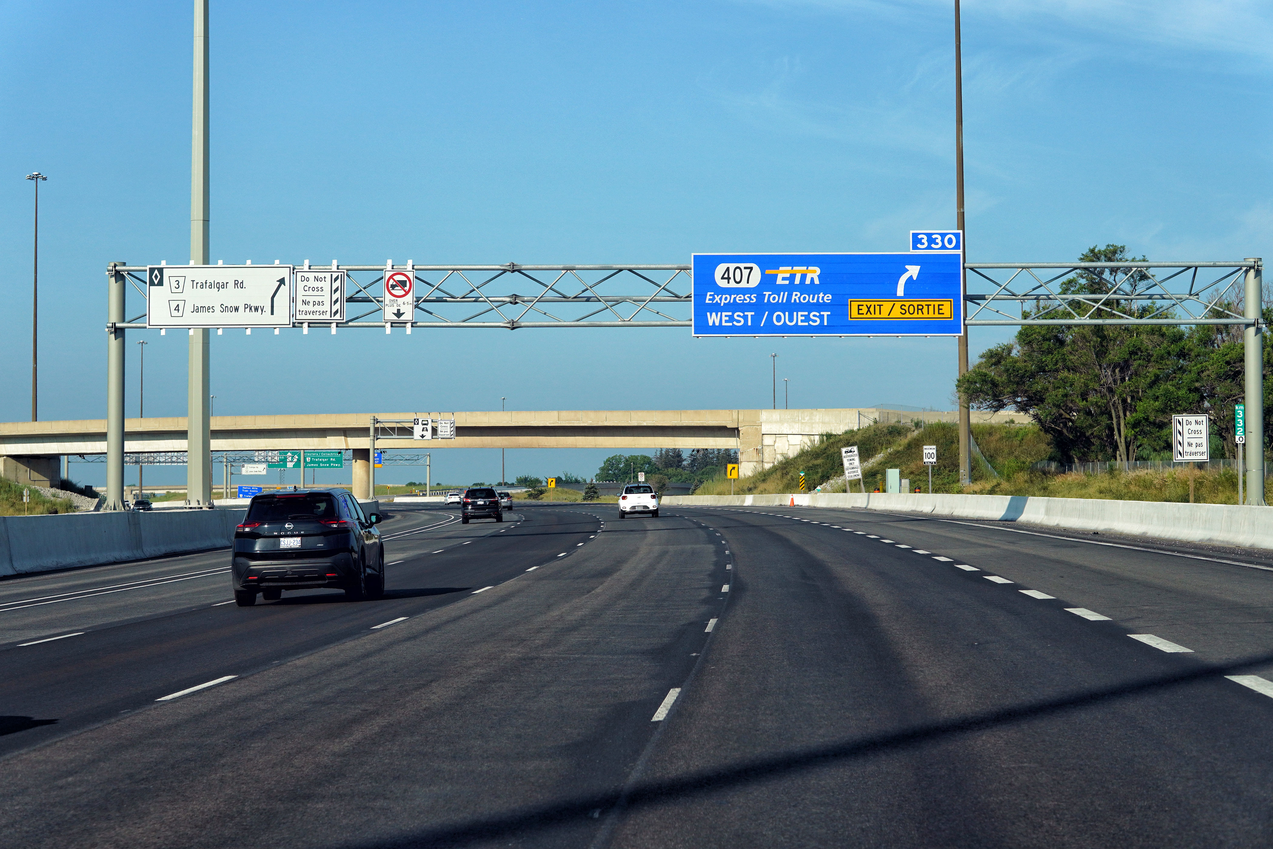
| Town of Halton Hills Regional Municipality of Halton |
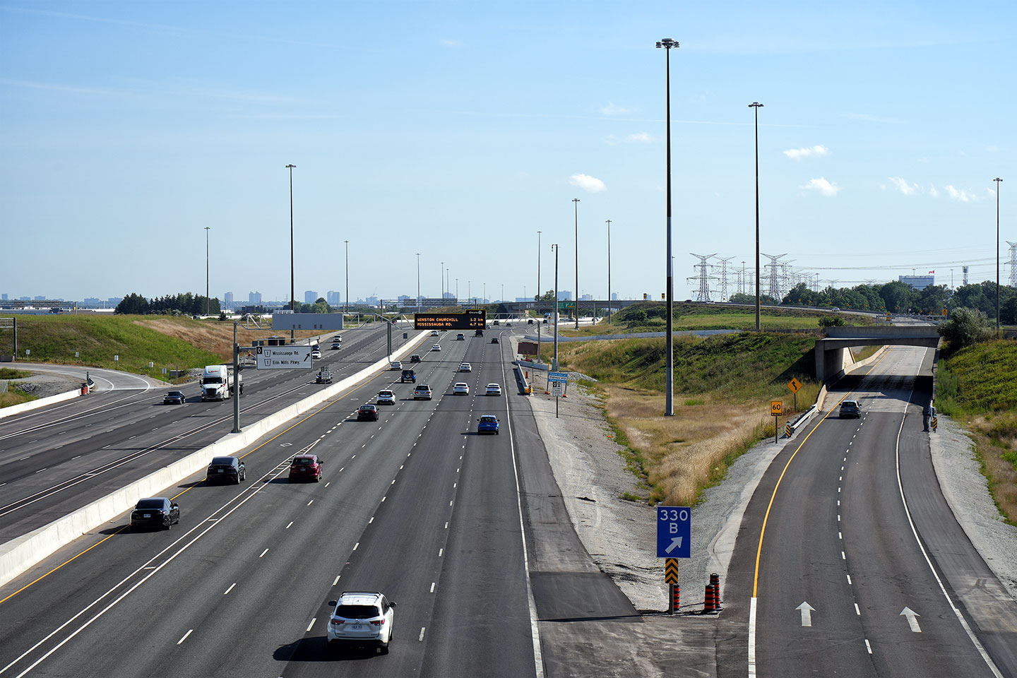
Overhead gantry for the westbound Highway 407 from eastbound Highway 401.
The eastbound Highway 407 exit is 800m ahead. The Highway 407 exit, is
located at kilometre marker 330, and is forms the western ring road for the
City of
Mississauga. Photo taken: July 2nd, 2010. |
 (960x480) (960x480)(1440x960) |
||||
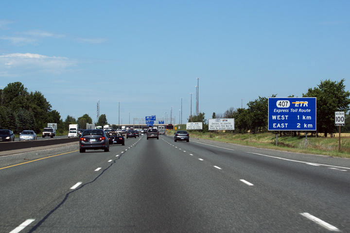
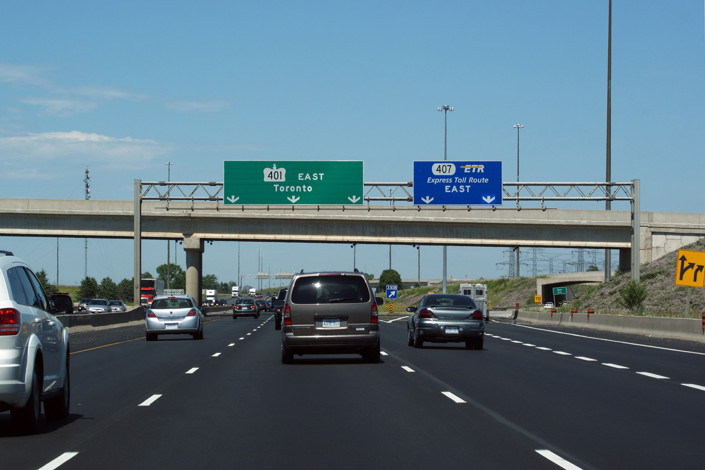
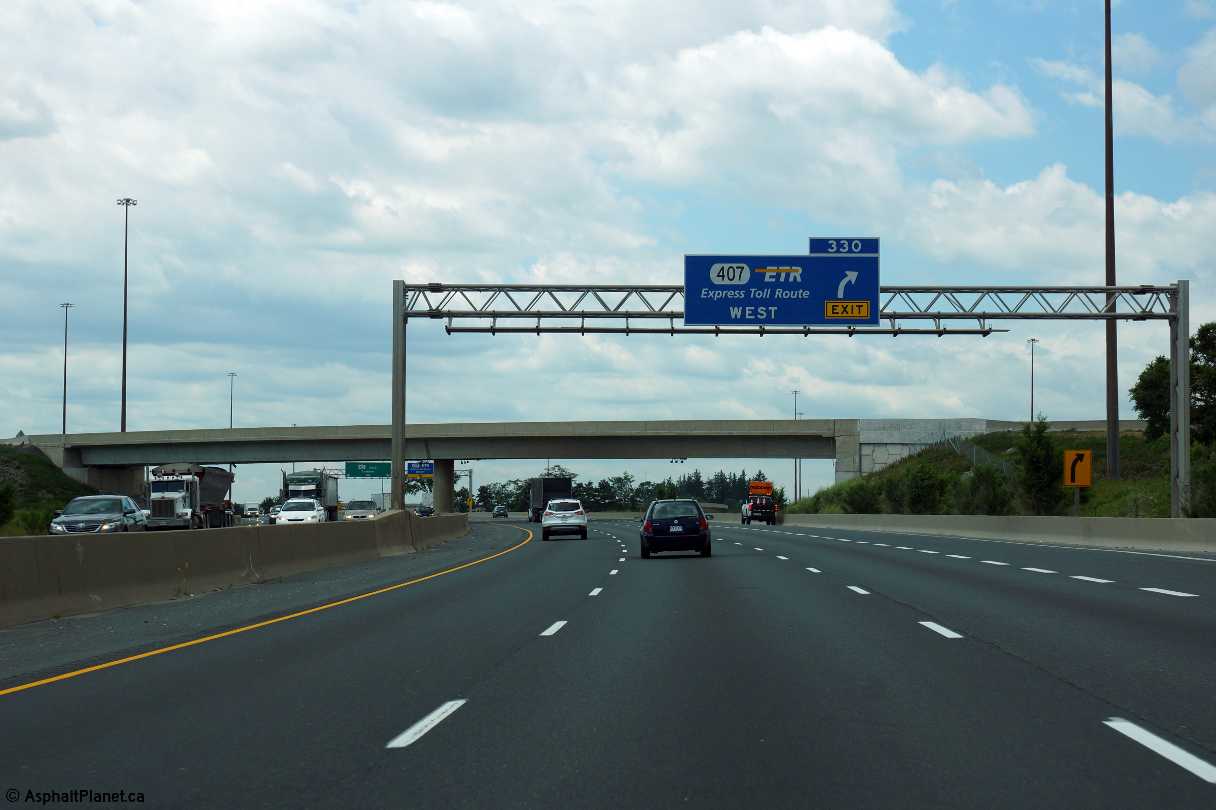
| Town of Halton Hills Regional Municipality of Halton |
Advanced signage for the ramp to Highway 407-East. This is a very
heavily used off-ramp. Despite the high cost of using Highway 407, the
highway is extremely well utilized, particularly during peak periods. Photo taken: July 2nd, 2010. |
 (960x480) (960x480)(1440x960) |
||||
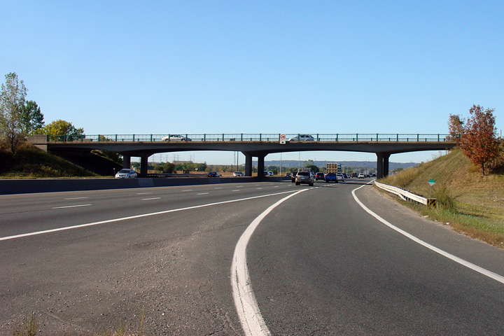
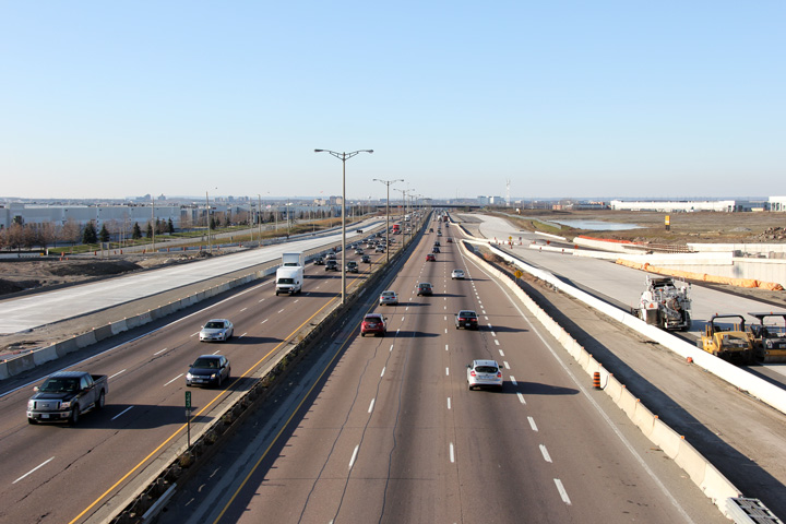
| Town of Halton Hills Regional Municipality of Halton |
View looking westerly along Highway 401 from the Highway 407 overpass.
Note the extra westbound lane built in 2007 between Highway 407 and
Trafalgar Road. Photo taken: September 23rd, 2007. |
 |
||||
| Highway 407 is a tolled by-pass of the Greater Toronto Area. Click here for Highway 407-West images and here for Highway 407-East images. | ||||||
| City of Mississauga Regional Municipality of Peel |
Signage fore the high-speed flyover from the eastbound 401 to eastbound Highway 407. Photo taken: July 2nd, 2010. |
|||||
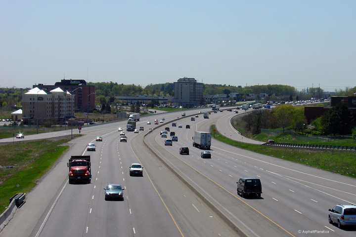
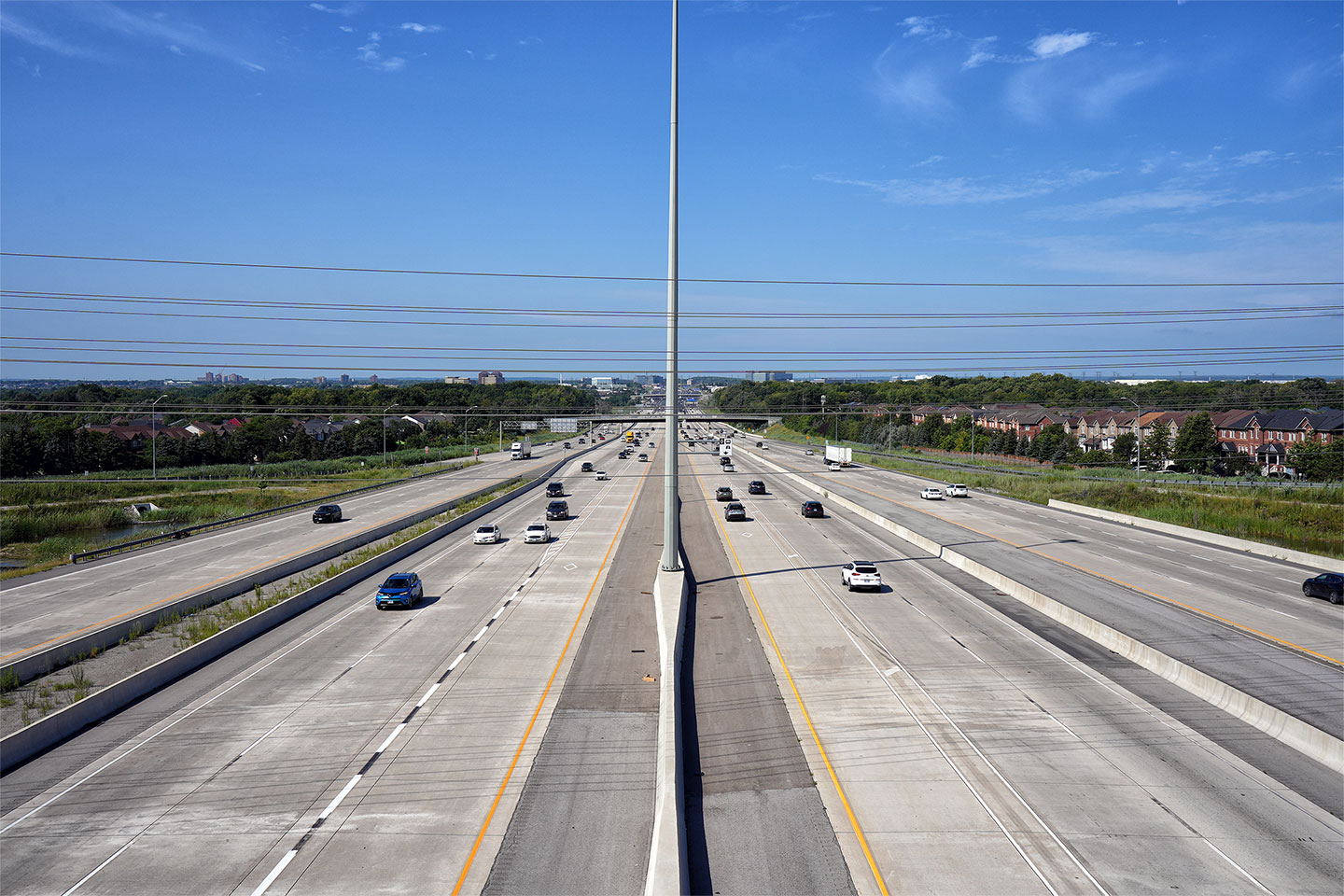
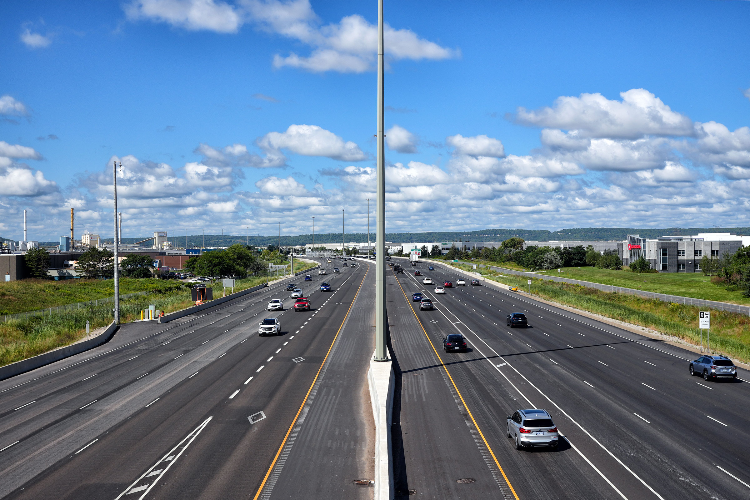
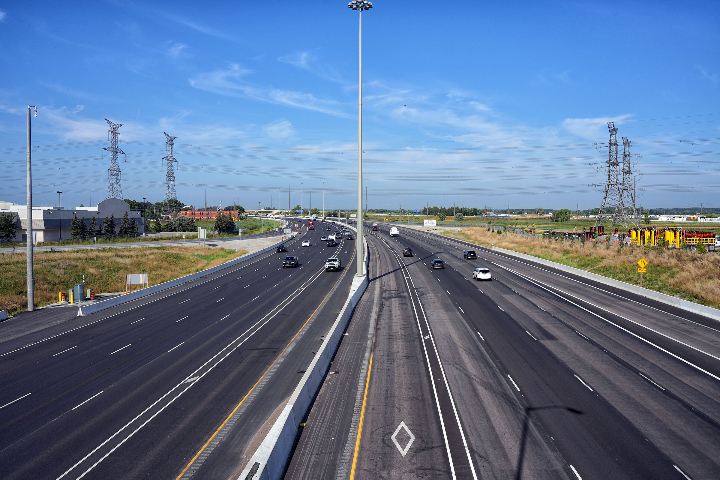
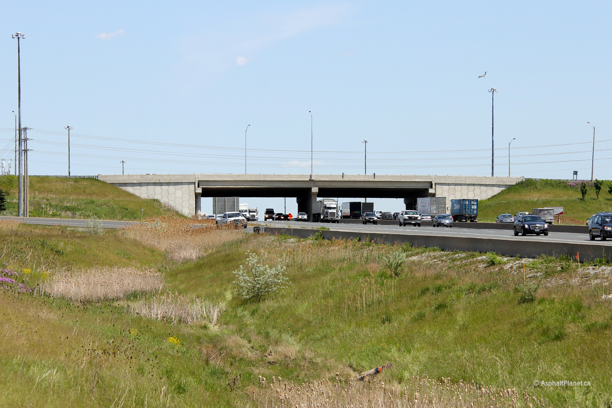
| Town of Halton Hills Regional Municipality of Halton |
Looking west from the Ninth Line overpass in western Mississauga. Just
west of Ninth Line, the mainline Highway 407
lanes cross overtop of the 401. Considering the complexity of the
401/407 interchange, it is quite
surprising that is has but a two-levels. Upper photo taken: May 25th, 2005. Lower photos taken: August 6th, 2023. |
 (1440x960) (2400x1600) (4200x2800) 
|
||||
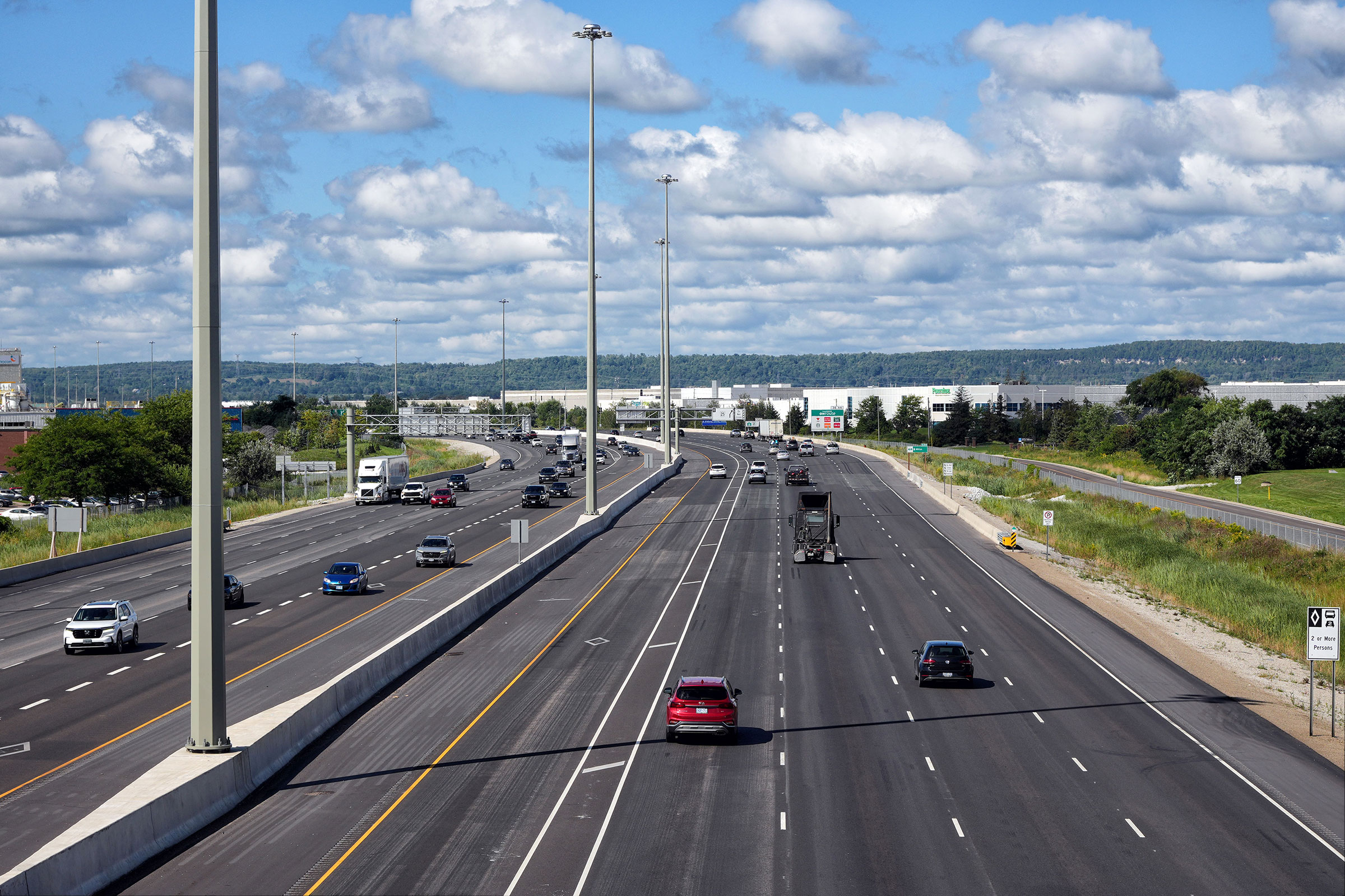
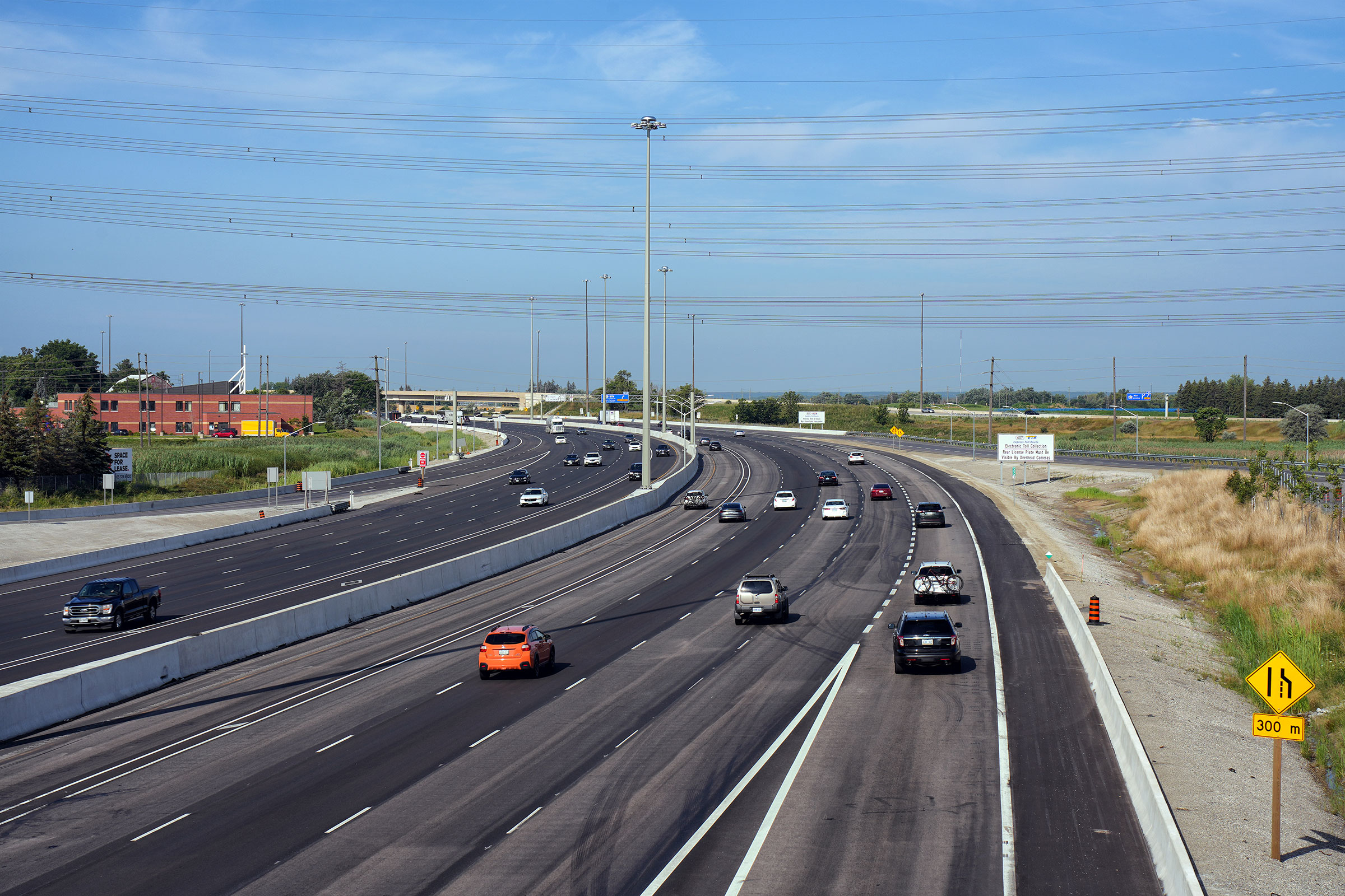
| Halton Hills - Mississauga
Boundary Halton - Peel Boundary |
This photo showcases the Highway 401 east from the Ninth Line. Ninth Line crosses over the 401 in the middle of the 401/407 interchange. This photo highlights the high-speed flyover ramp that leads eastbound 401 travelers to the eastbound 407. Also, notice the tight loop ramp located in the left-hand portion of the picture.
Upper photo taken: May 25th, 2005.
Lower photos taken: August 6th, 2023. |
(1440x960) (2400x1600) (4200x2800)
|
||||
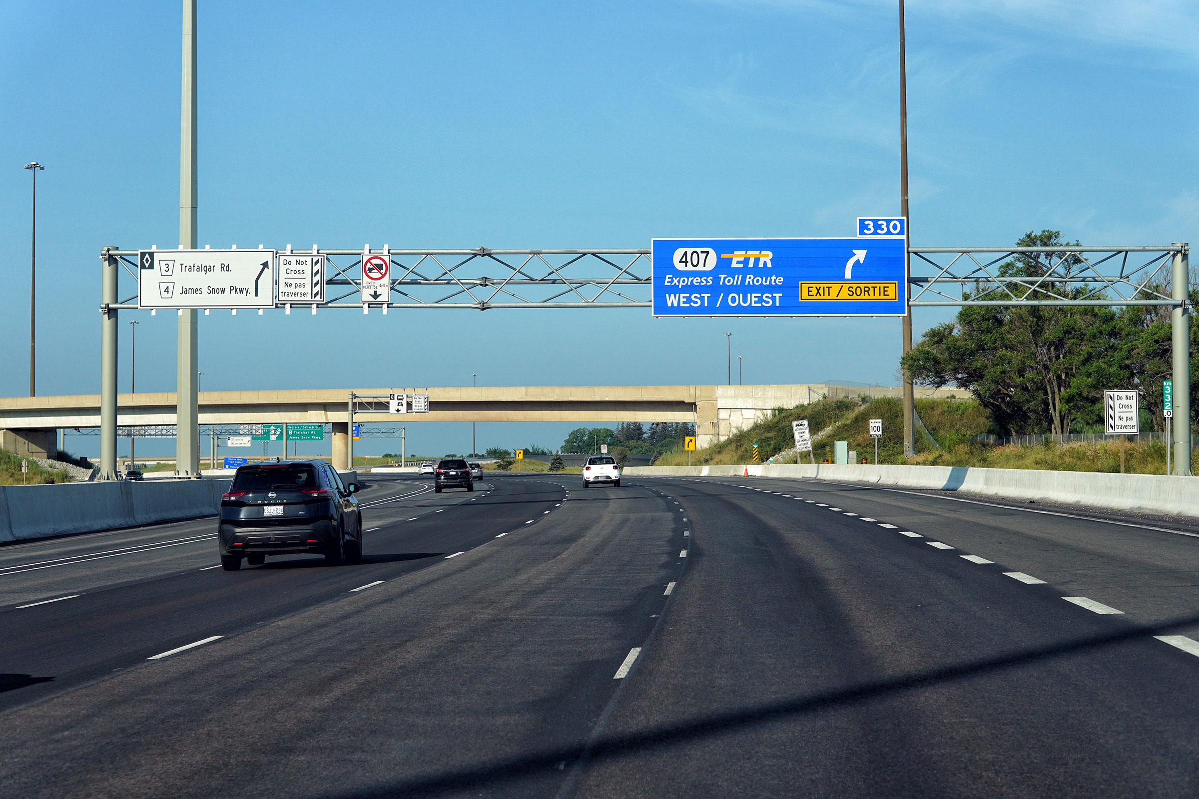
| Halton Hills - Mississauga
Boundary Halton - Peel Boundary |
Exit signage at the westbound ramp to Highway 407. Upper photo taken: July 10th, 2014. Lower photo taken: August 6th, 2023. |
 (1440x960) (1440x960)(2400x1600) (4200x2800) |
||||
| Halton Hills - Mississauga
Boundary Halton - Peel Boundary |
Advanced signage denoting the exit to Highway 407
from the westbound 401. Only the westbound
407 is accessible from the westbound 401. Upper photo taken: July 10th, 2014. Lower photo taken: August 6th, 2023. |
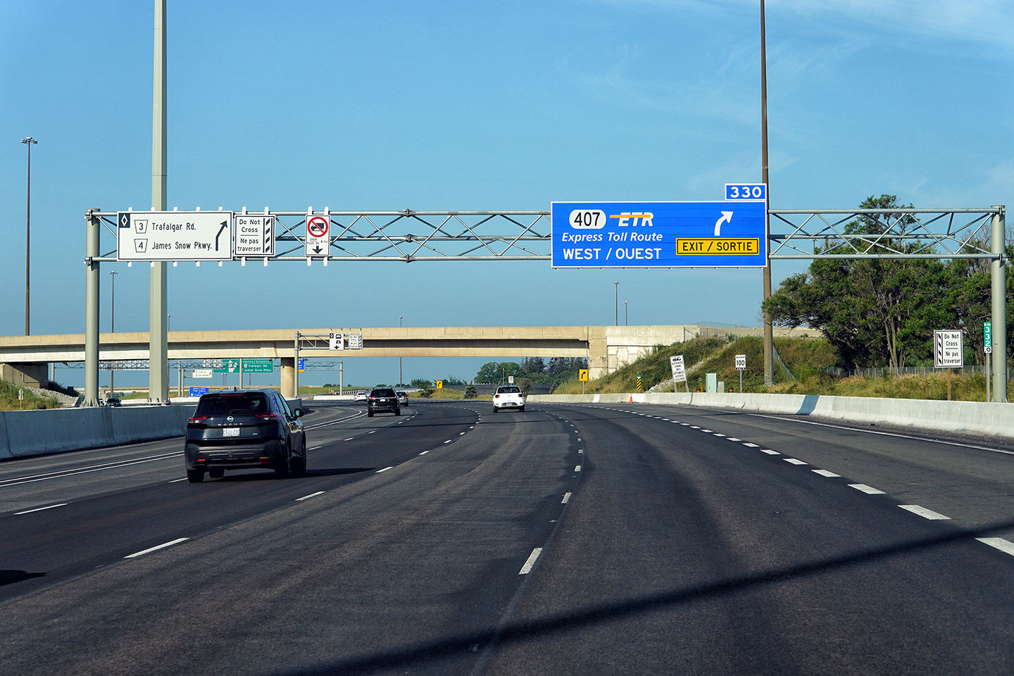 (1440x960) (1440x960)(2400x1600) (4200x2800) |
||||
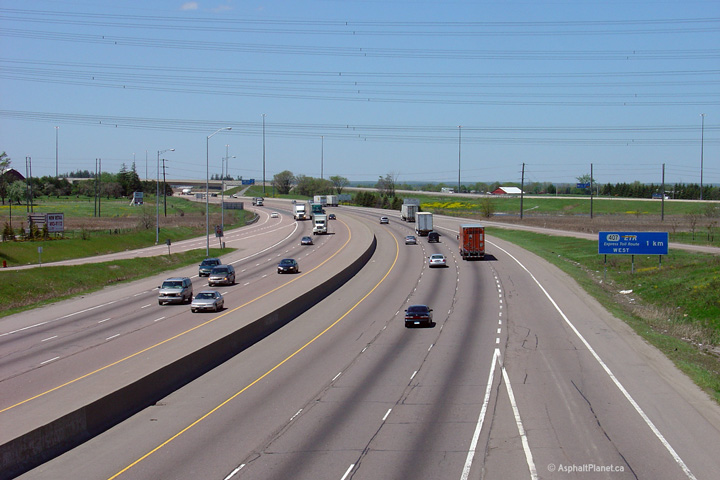
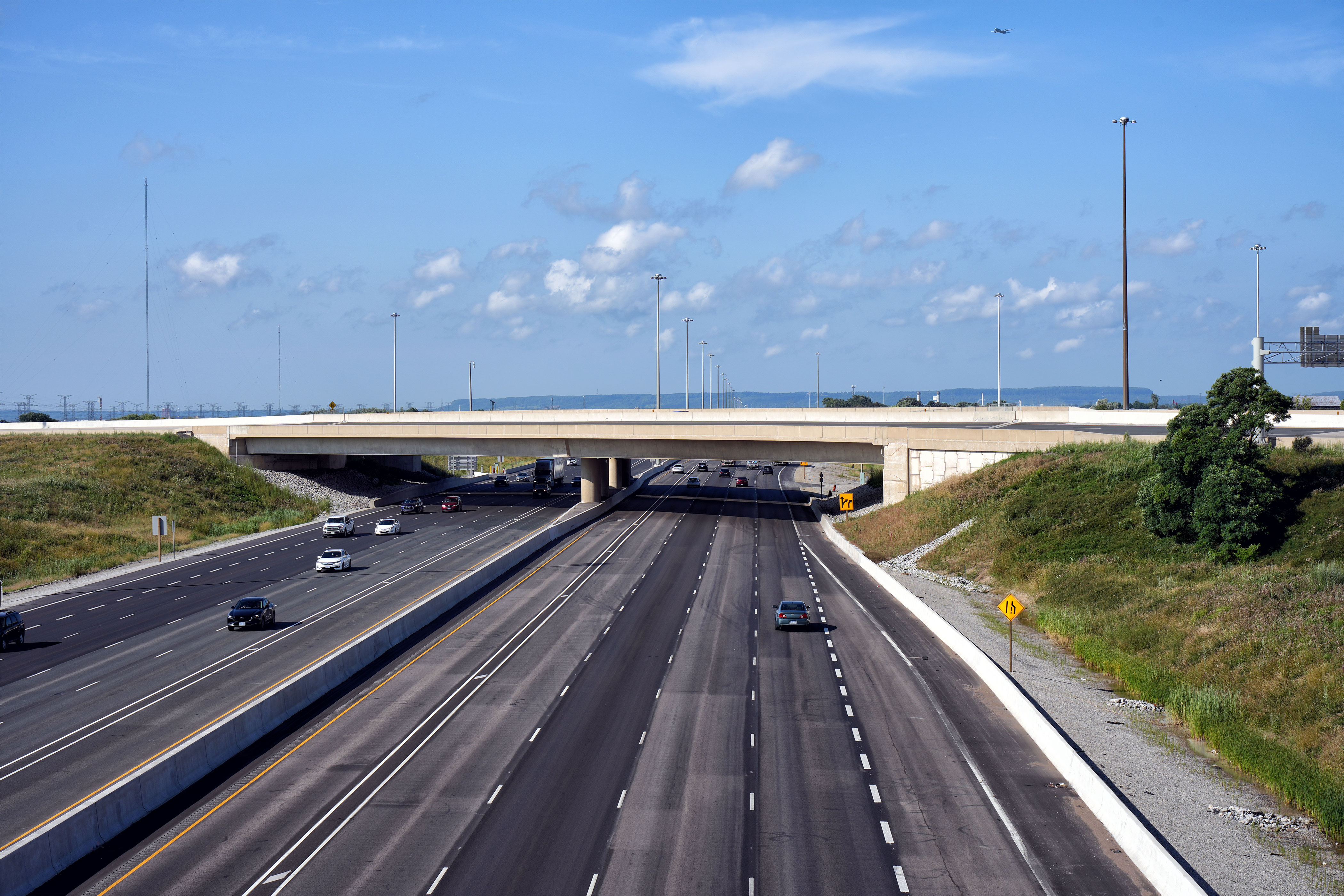
| City of Mississauga Regional Municipality of Peel |
Looking west from the Winston Churchill Boulevard overpass towards the
Highway 407
interchange. Notice Highway 407
running roughly parallel to Highway 401 through the right side of the photo. Photo taken: May 25th, 2005. |
|
||||
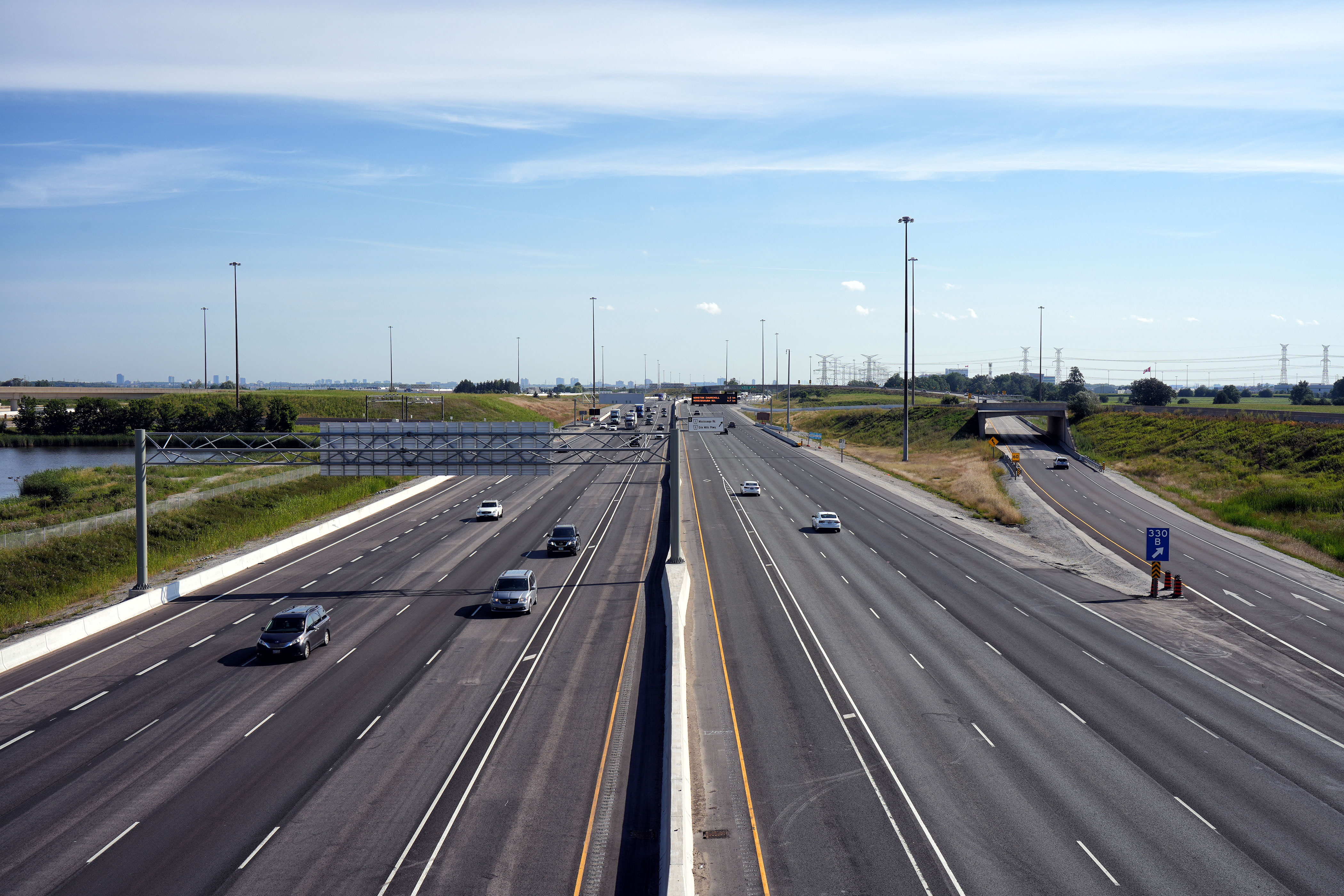
| City of Mississauga Regional Municipality of Peel |
Looking easterly from the Winston Churchill Boulevard overpass. East of Winston
Churchill Boulevard, the land surrounding Highway 401 is consistently
urbanized for the next 70km. Photo taken: May 25th, 2005. |
|
||||
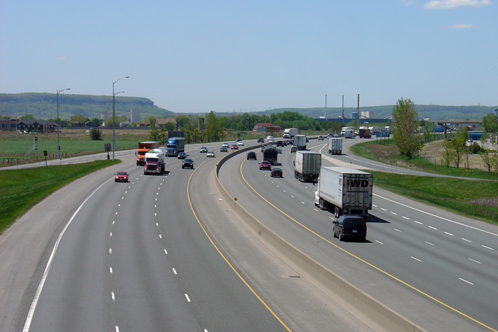
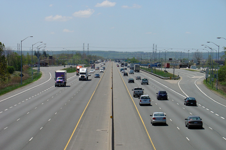
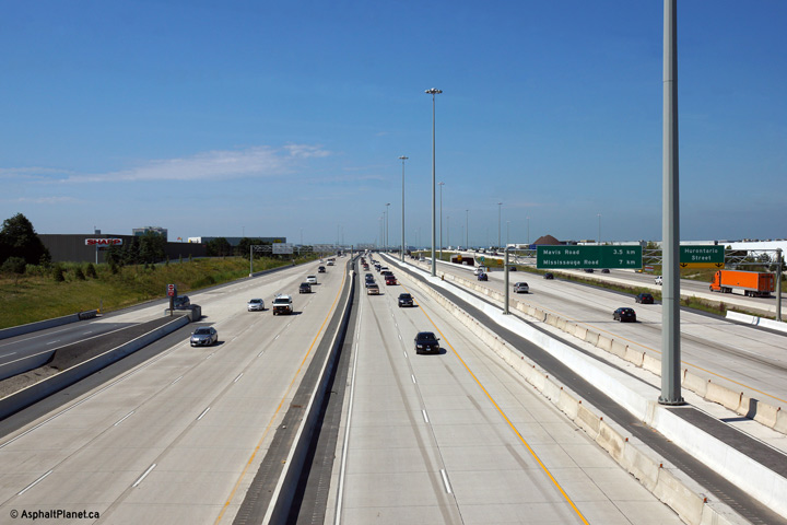
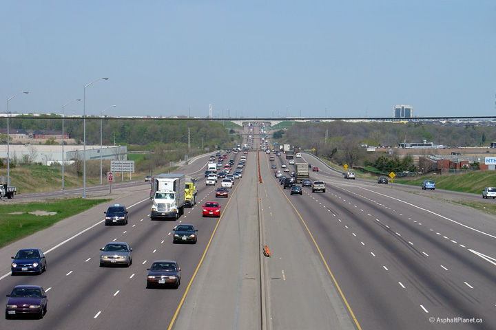
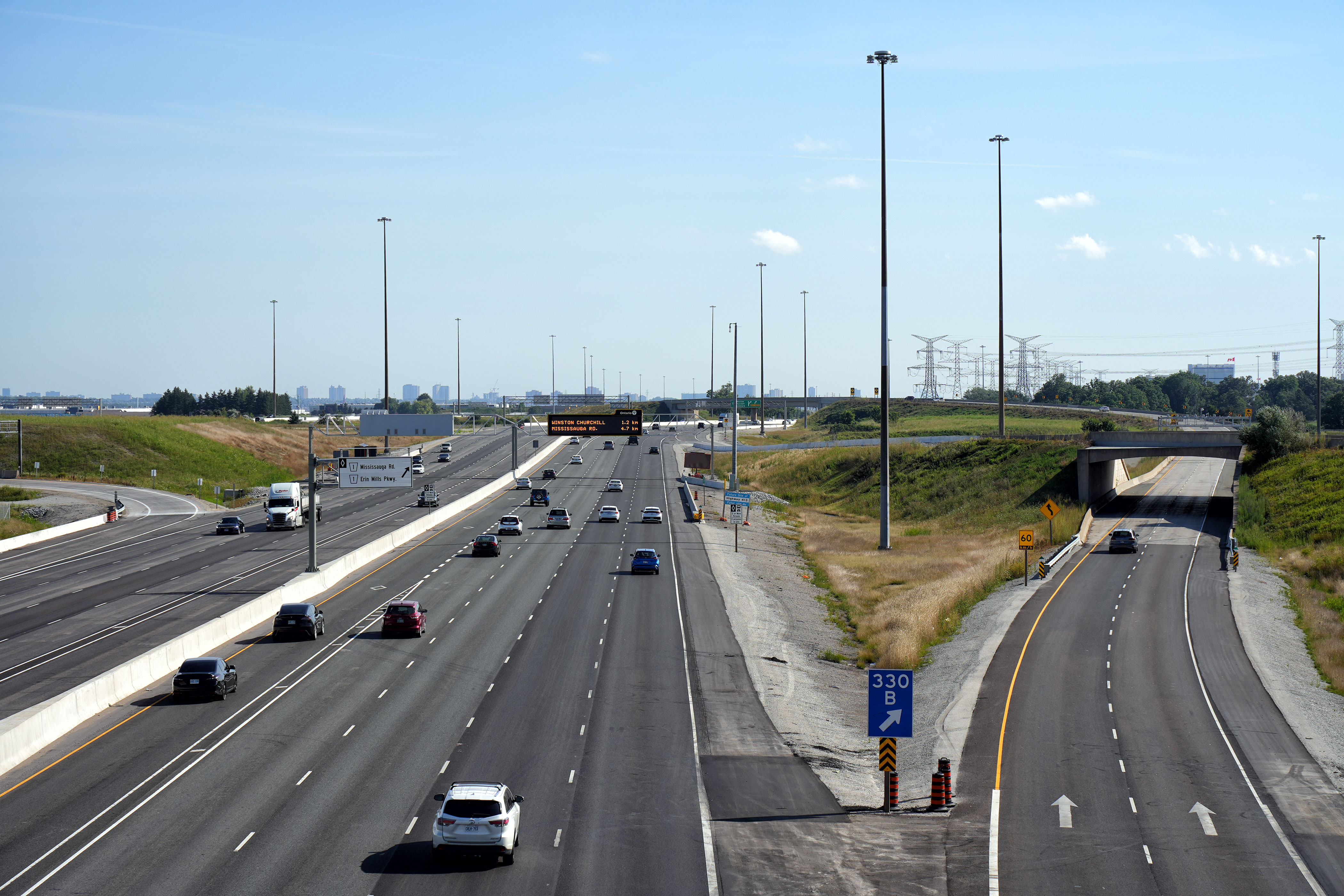
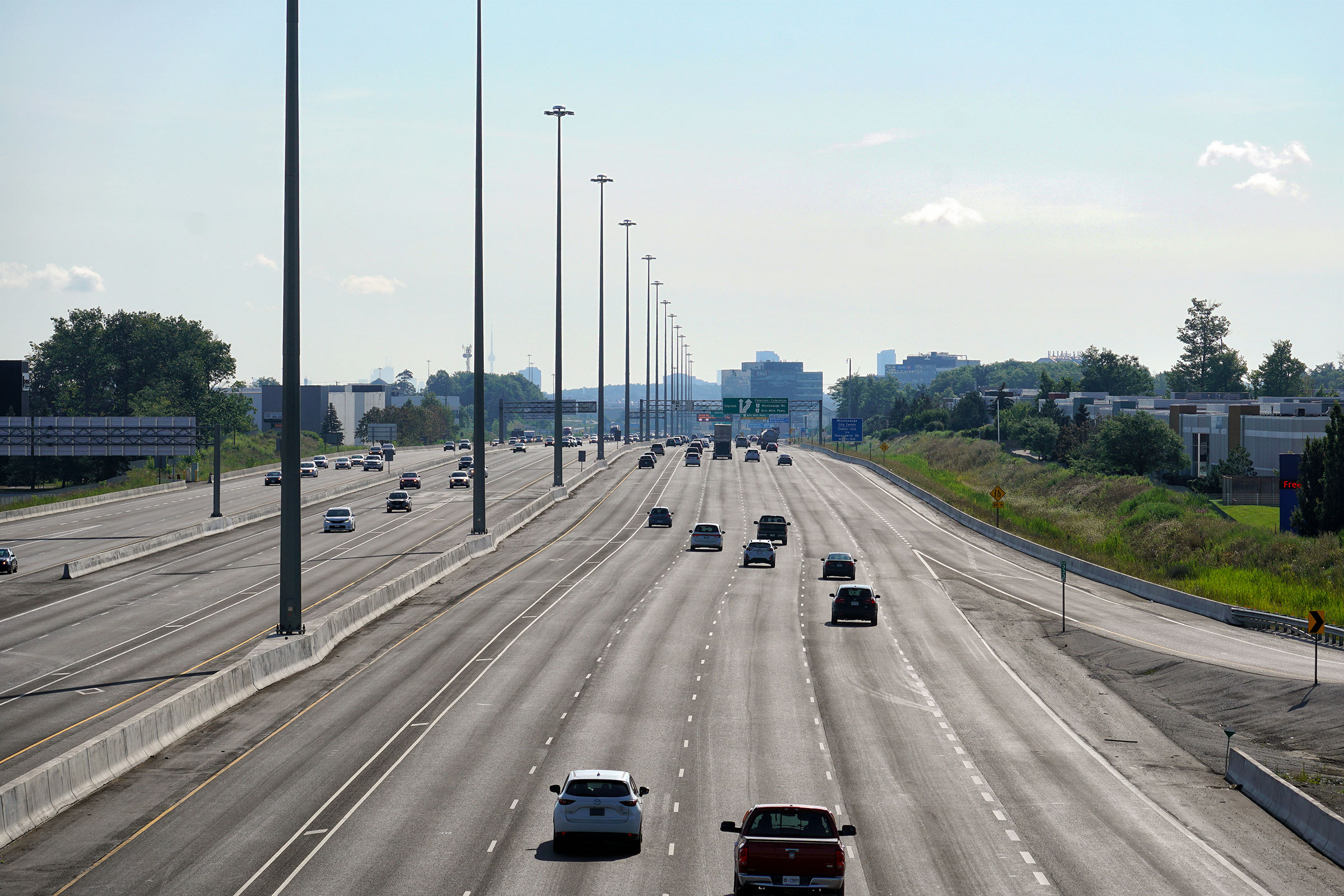
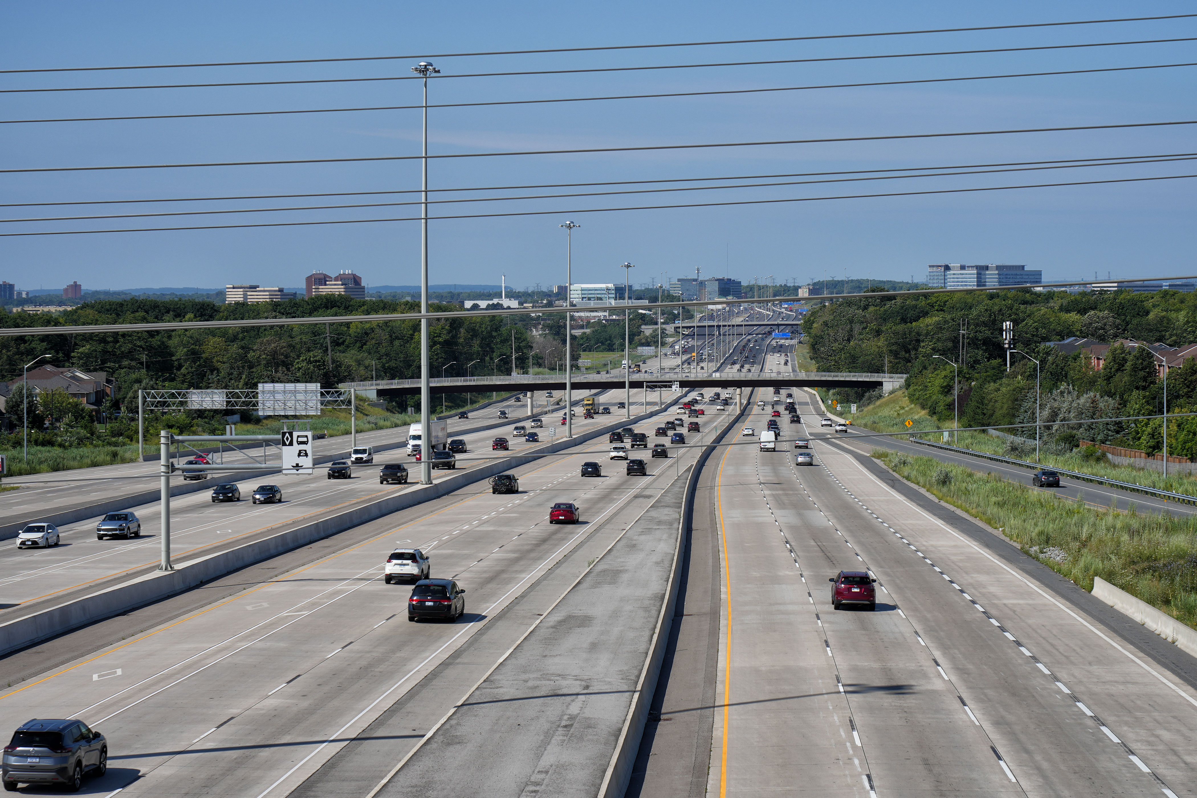
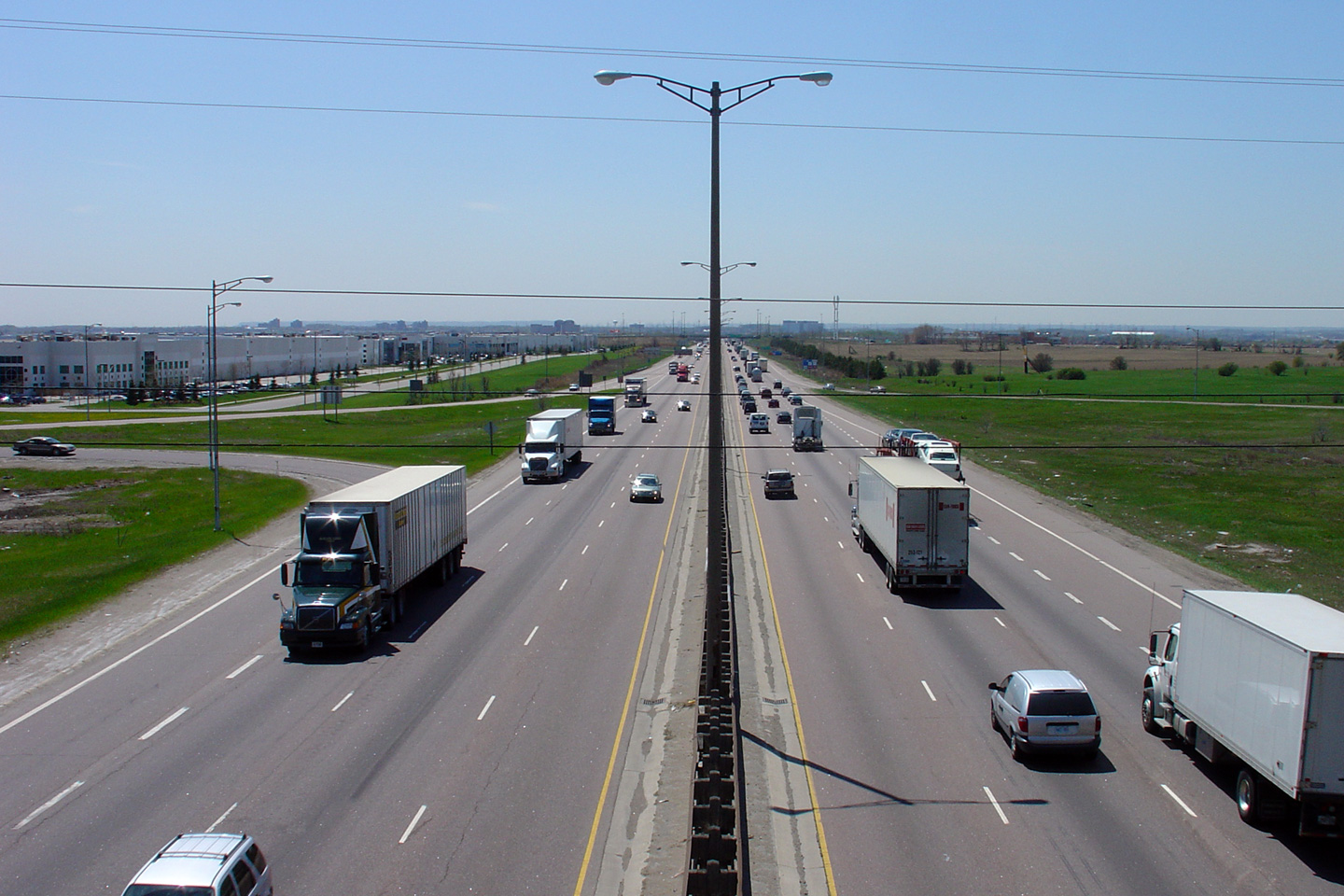
| City of Mississauga Regional Municipality of Peel |
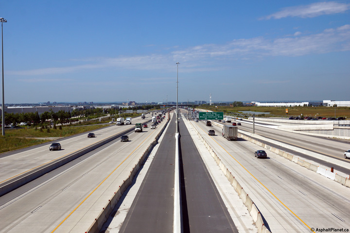
Highway 401 looking west from the Mississauga Road overpass.
Mississauga Road is located at kilometre marker 336. The Mississauga
Road overpass and interchange were reconstructed in the early 2000s in advance of
the extension of the core-distributor
system extension west of Highway 410.
The upper photos show Highway 401 prior to the extension of the collector
lanes through western Mississauga, while the lower two photos highlight the
widened segment of highway. Upper photo taken: May 12th, 2005. Lower photos taken: August 6th, 2023. |
 (1440x960) (2400x1600) (4200x2800) 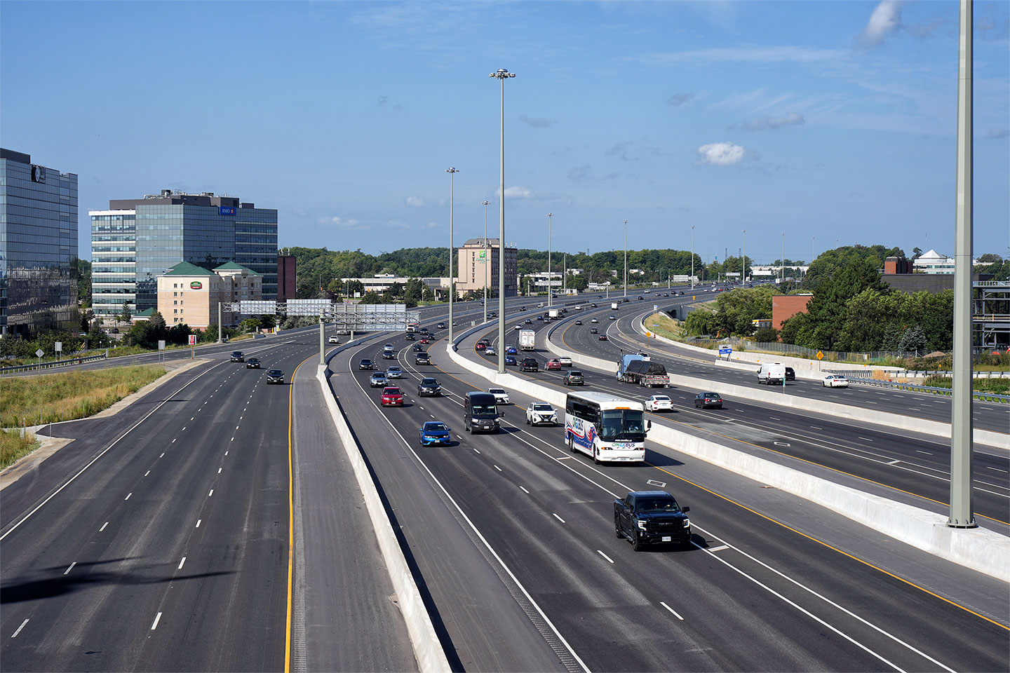
|
||||
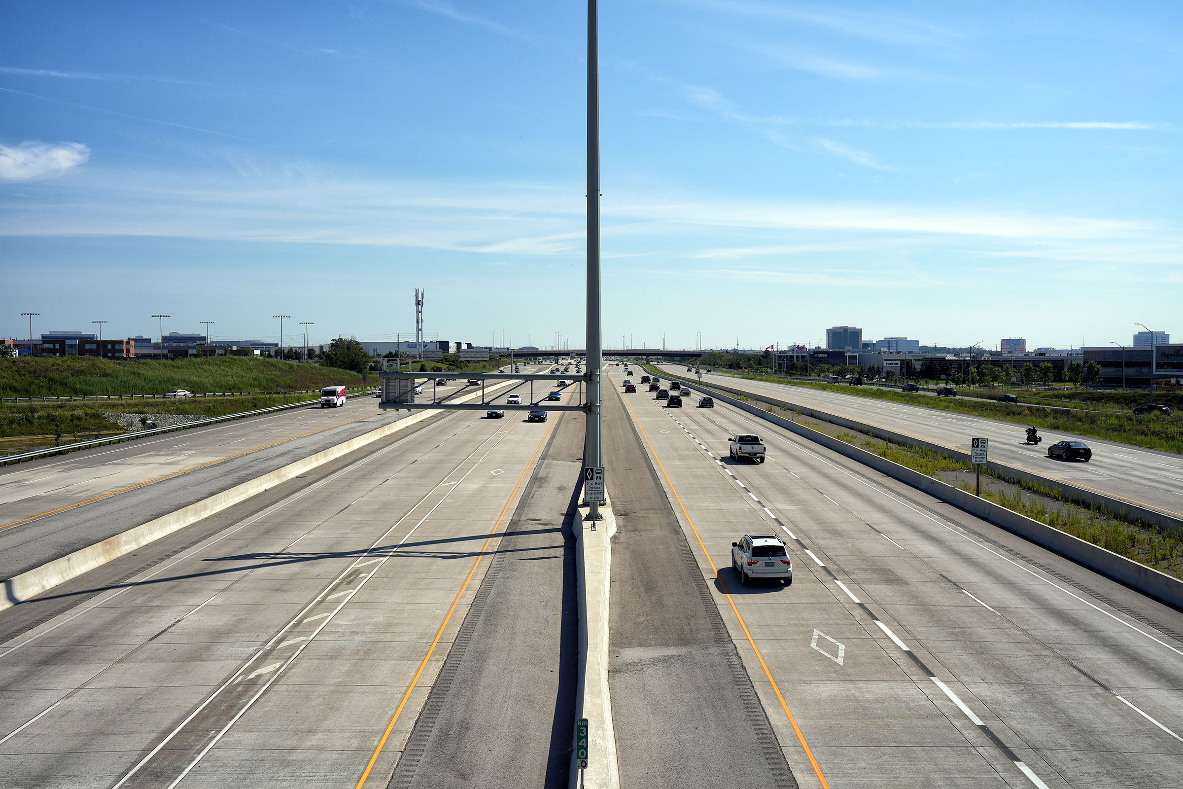
| City of Mississauga Regional Municipality of Peel |
Looking east along Highway 401 from the Mississauga Road overpass. Upper photo taken: May 12th, 2005. Lower photo taken: August 60th, 2023. |

|
||||
| City of Mississauga Regional Municipality of Peel |
Looking west towards the Mississauga Road interchange and the Mississauga
CPR overhead from the Creditview Road overpass. Photo taken: May 12th, 2005. |
|
||||
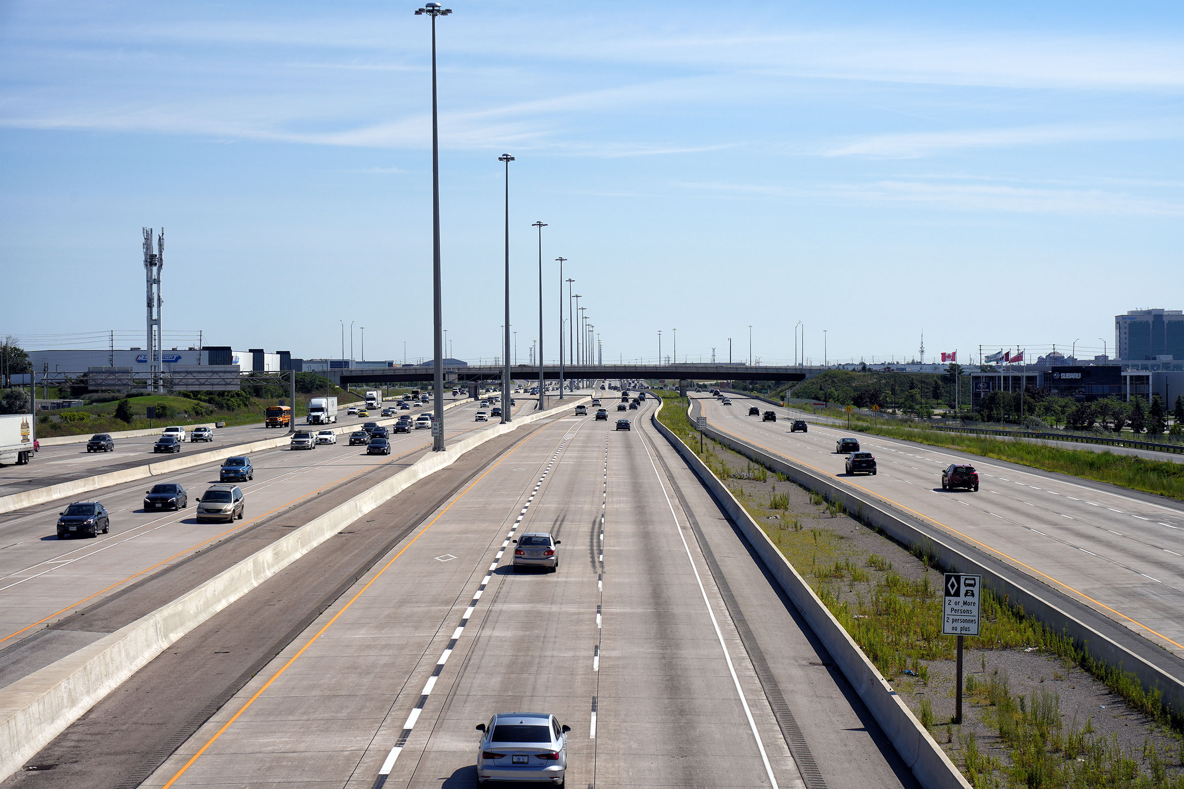
| City of Mississauga Regional Municipality of Peel |
Highway 401 looking east from the Creditview Road overpass. Creditview
Road is located roughly at kilometre marker 337. This picture
showcases where highway 401 crosses the Credit River Valley. The
Credit River Valley is fairly subdued through Northern Mississauga, unlike
the deep valley that the QEW passes over. Photo taken: May 12th, 2005. |
|
||||
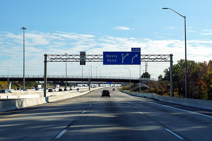
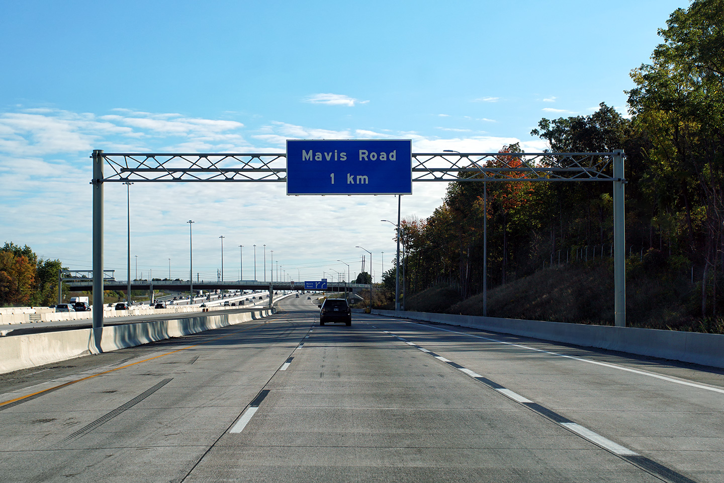
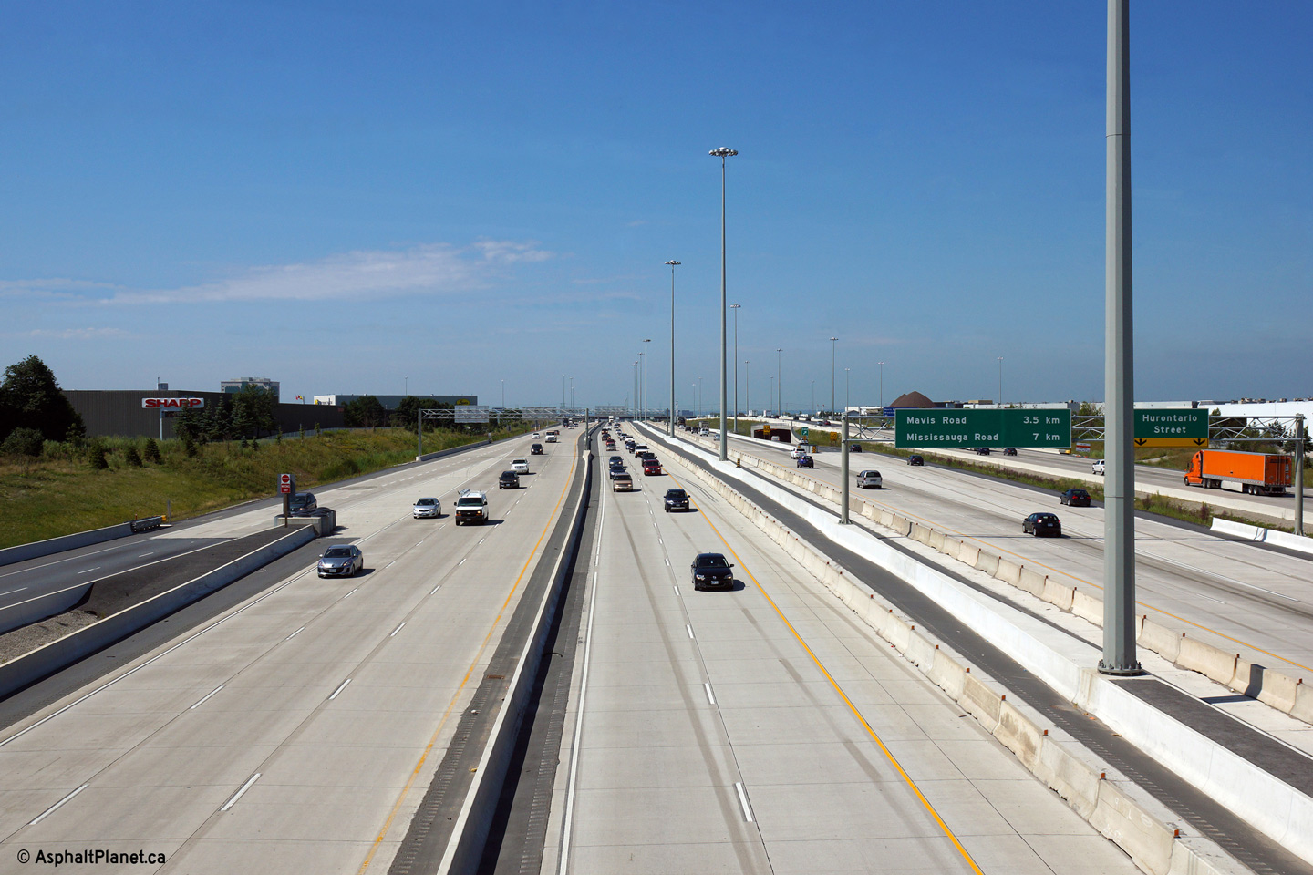
| City of Mississauga Regional Municipality of Peel |
Eastbound advanced signage for the collector lane exit to Mavis Road. Photo taken: September 20, 2020. |
 (720x480) (720x480)(1440x960) (2400x1600) |
||||
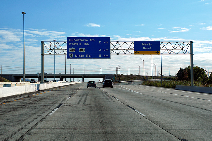
| City of Mississauga Regional Municipality of Peel |
There is a second eastbound advanced sign for the Mavis Road interchange.
The left-lane truck restriction sign has been removed, and is a holdover
from when the collector lanes began at MacLaughlan Road. Photo taken: September 20, 2020. |
 (720x480) (720x480)(1440x960) (2400x1600) |
||||
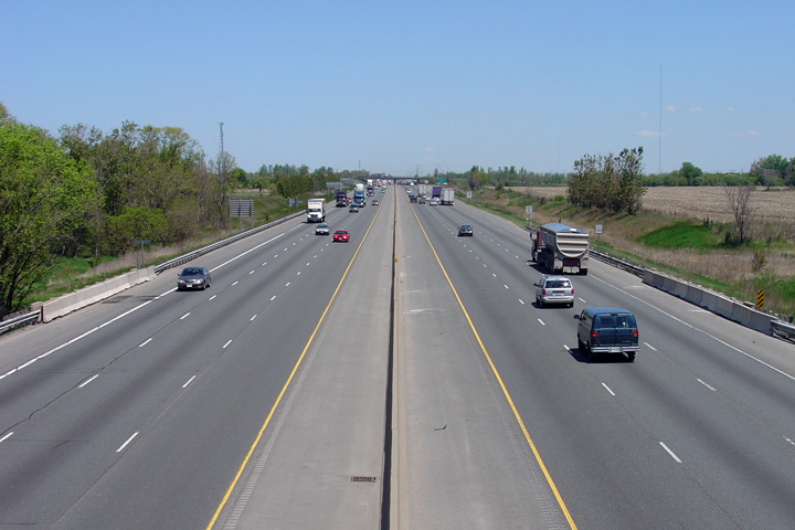
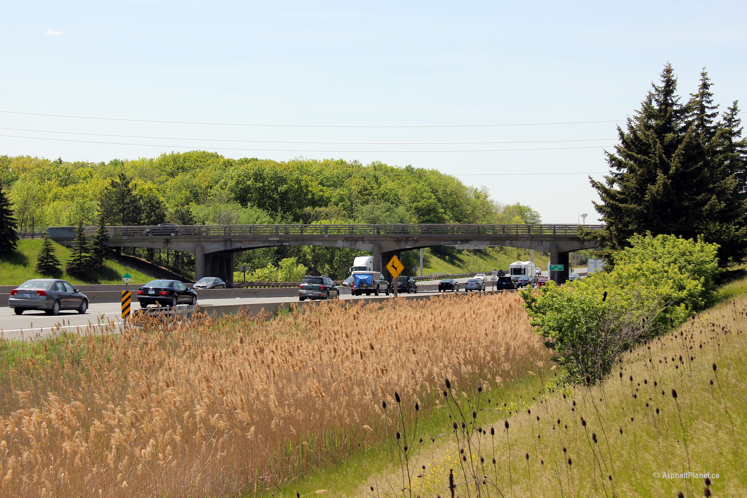
| City of Mississauga Regional Municipality of Peel |
Looking west along Highway 401 across the Credit River valley from the Second
Line West overpass. Second Line Road is located at roughly kilometre
marker 339. Photo taken: May 12th, 2005. Size: 40kb. |
 |
||||
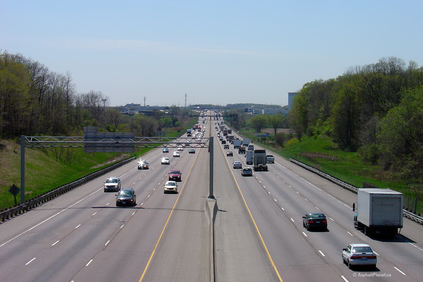
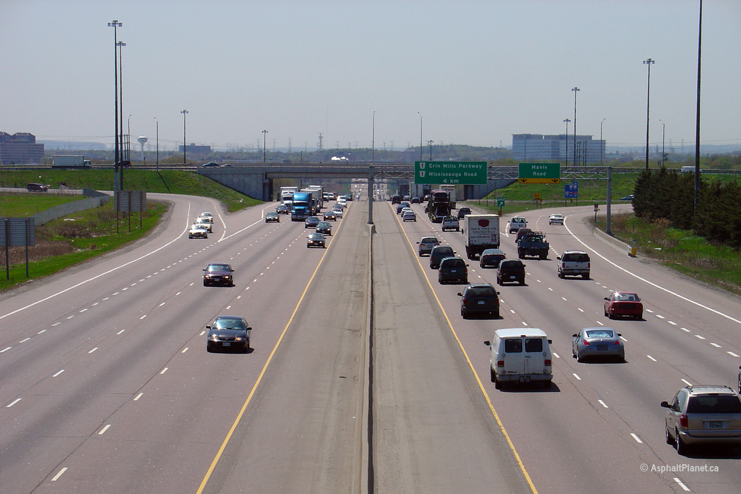
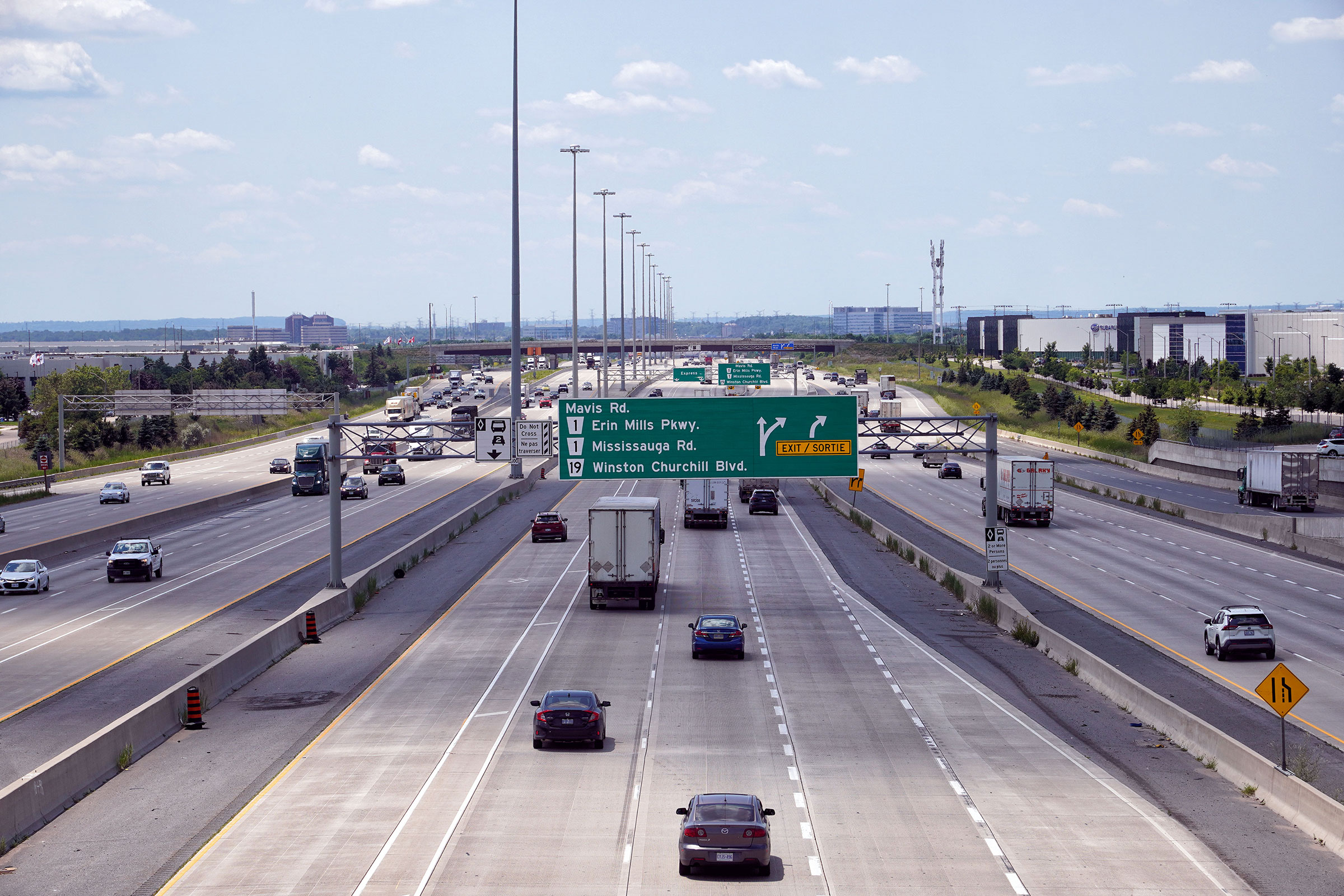
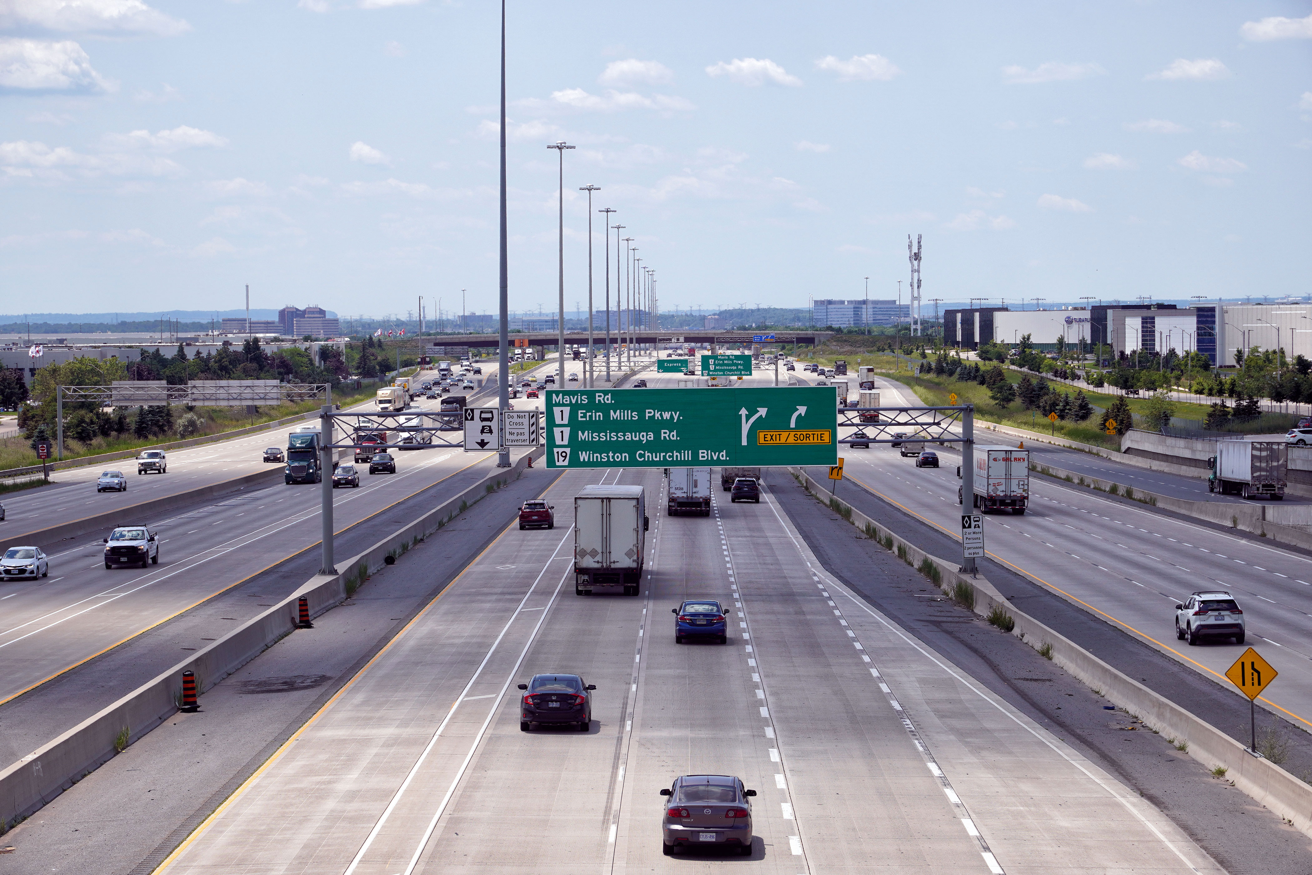
| City of Mississauga Regional Municipality of Peel |
Highway 401 looking east from the Second Line West overpass towards the Mavis
Road interchange. The Mavis Road interchange was completed in late 1999.
The Mavis Road overpass was designed so that the abutments can be removed,
allowing the structure to be elongated to support a C/D underneath the
overpass. Photo taken: May 12th, 2005. Size: 45kb. |
 |
||||
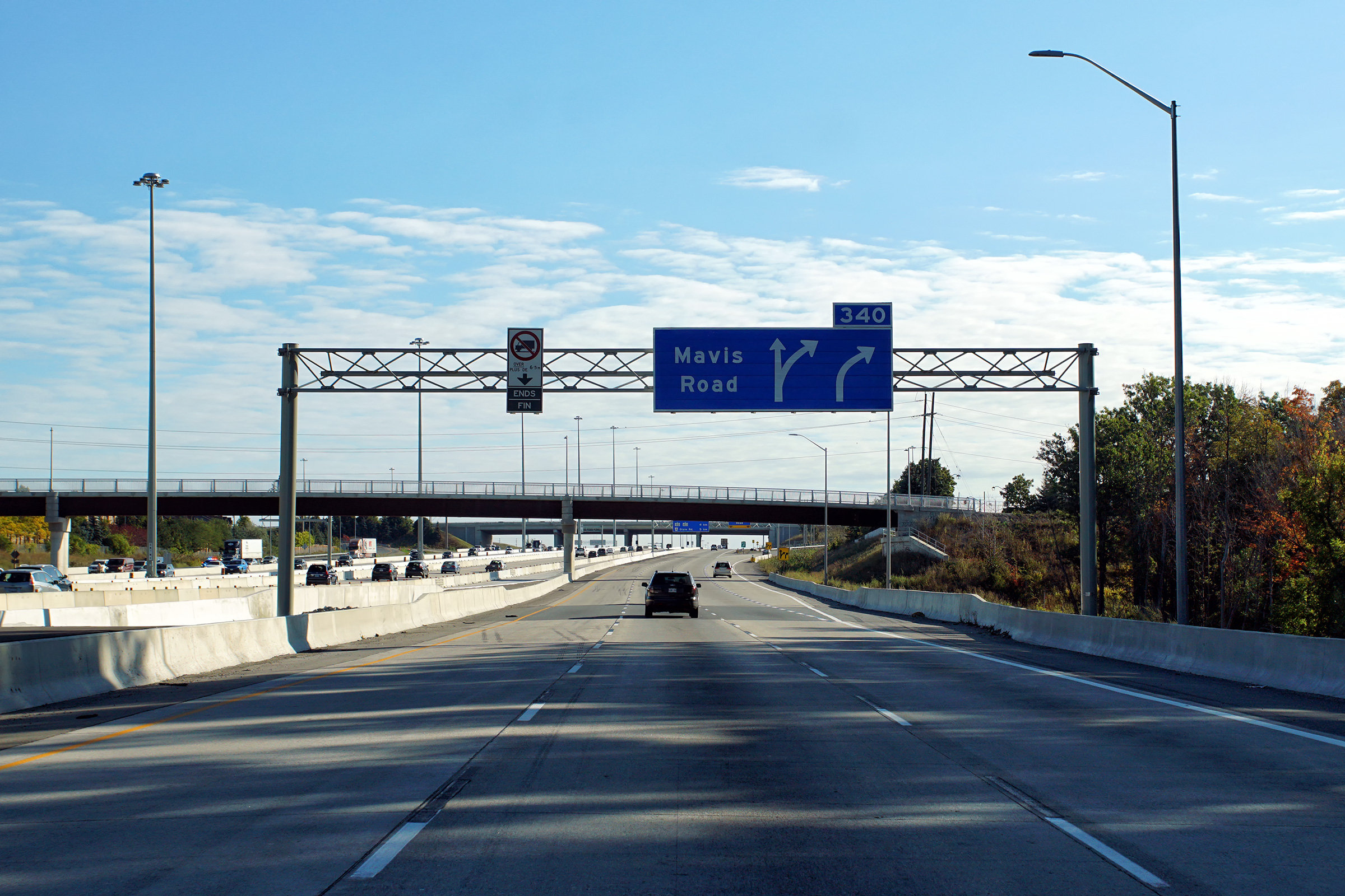
| City of Mississauga Regional Municipality of Peel |
Eastbound sgiange for the off-ramp to Mavis Road. Photo taken: September 20, 2020. |
 (720x480) (720x480)(1440x960) (2400x1600) |
||||
| City of Mississauga Regional Municipality of Peel |
This view looks westerly towards the Second Line overpass. The Second Line
overpass will be demolished in coming years to make way for a highway
widening project. This four span arch bridge looks to be in ailing
condition as crews have completed various concrete patches to repair spalling concrete in lieu of a full scale rehabilitation. Photo taken: May 17th, 2012. |
|
||||
| City of Mississauga Regional Municipality of Peel |
Close-up view of the Mavis Road overpass. Photo taken: May 17th, 2012 |
 |
||||
| City of Mississauga Regional Municipality of Peel |
Looking westerly from the Mavis Road overpass towards the Second Line West
overpass and the Credit River Valley. Notice the rather odd railing design
on the Second Line West overpass. Railings like this were used extensively on
the stretch of the 401 between Milton and Mississauga that opened in 1959. Photo taken: May 12th, 2005. |
|
||||
| City of Mississauga Regional Municipality of Peel |
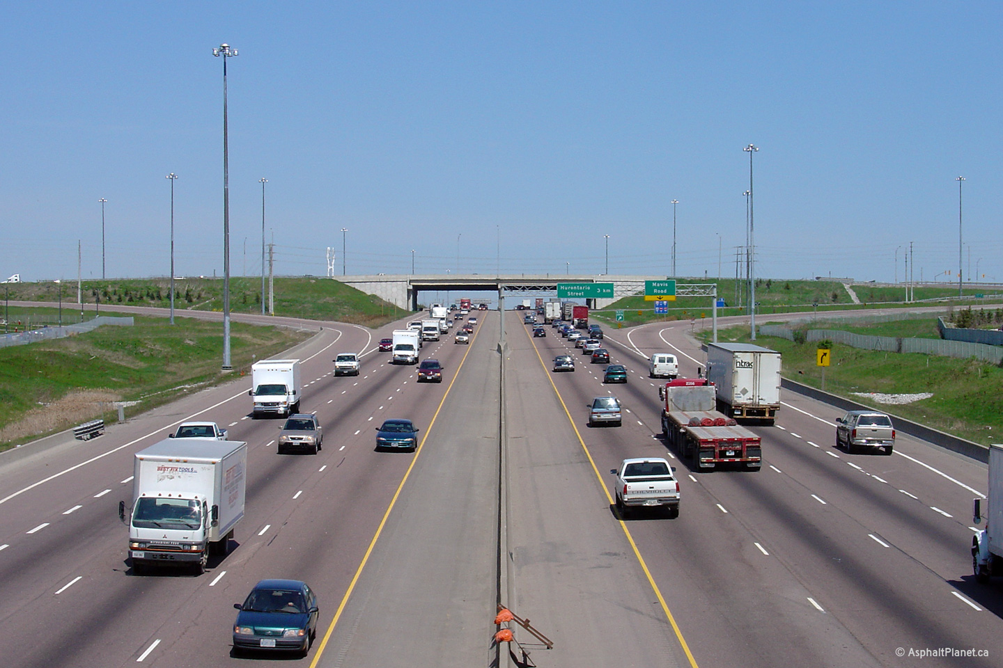
Looking east towards the McLaughlin Road overpass from Mavis Road. The
median splits at McLauglin Road for never constructed HOV ramps between the
median HOV lanes and McLaughlin Road. Upper photo taken: May 12th, 2005. Lower photos taken: August 6th, 2023. |
 (1440x960) (2400x1600) (4200x2800)  (1440x960) (2400x1600) (4200x2800) |
||||
| City of Mississauga Regional Municipality of Peel |
Looking westerly towards the Mavis Road interchange from the McLaughlin Road
overpass. The McLaughlin Road overpass will be replaced during the
2007 construction season, as a precursor to a series of projects that will
see Highway 401 widened through Mississauga. The lower photo shows
construction underway to elongate the Mavis Road overpass which is a
precursor to a larger contract to extend the collector lanes westerly from
Hurontario Street to the Credit River bridge. Upper photo taken: May 12th, 2005. Lower photo taken: August 19th, 2014. |

|
||||
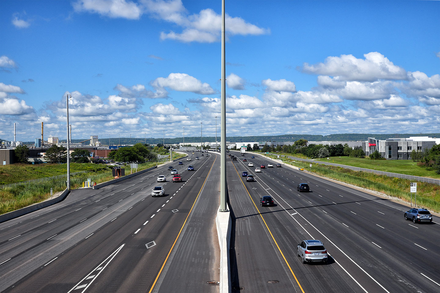
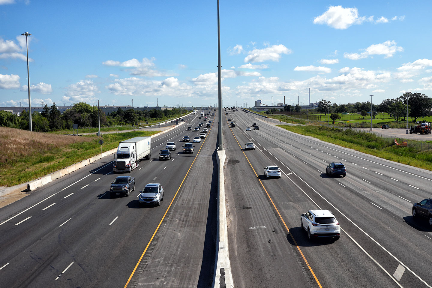
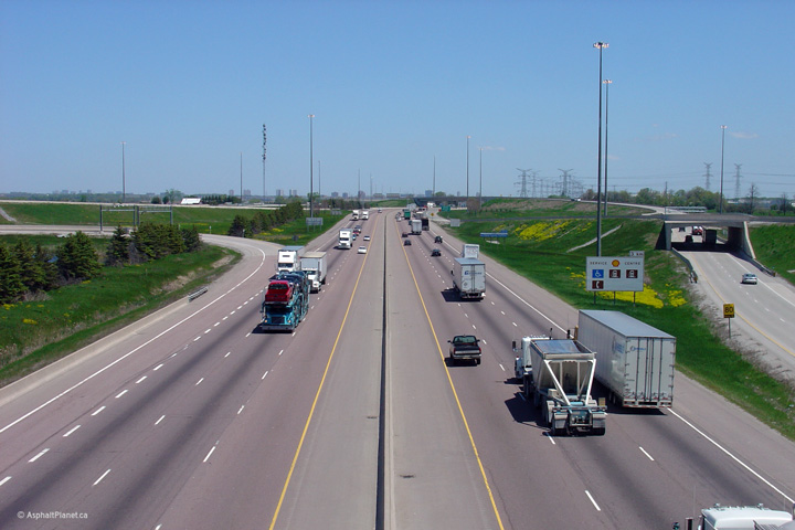
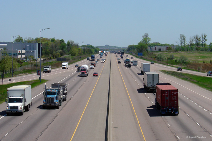
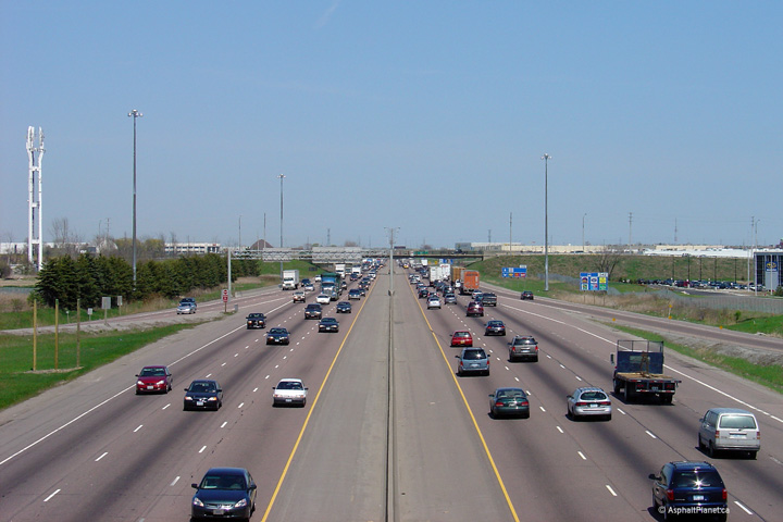
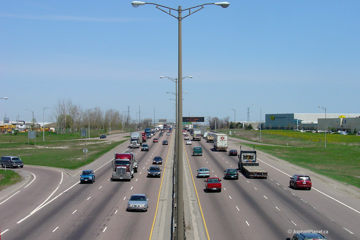
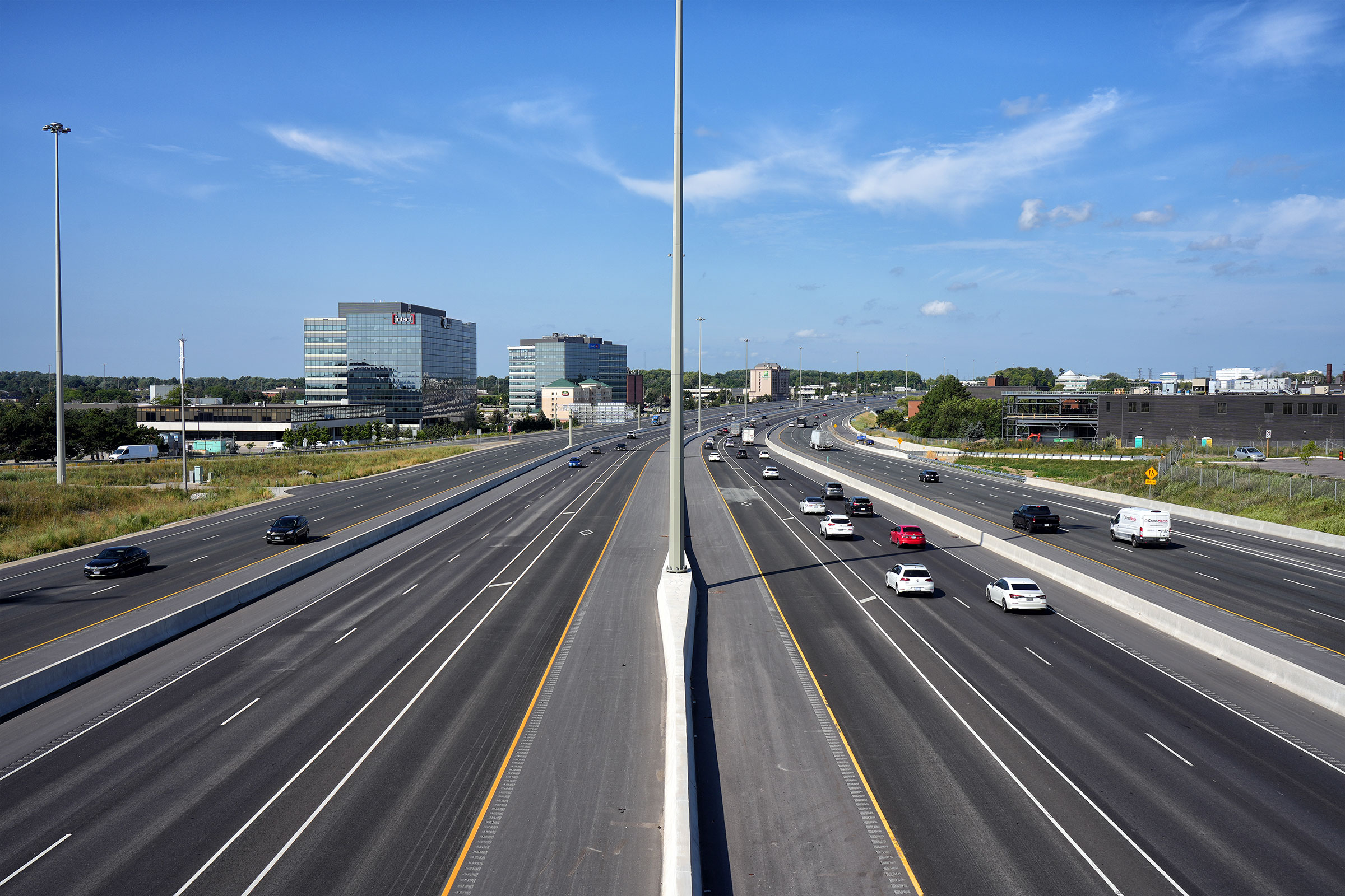
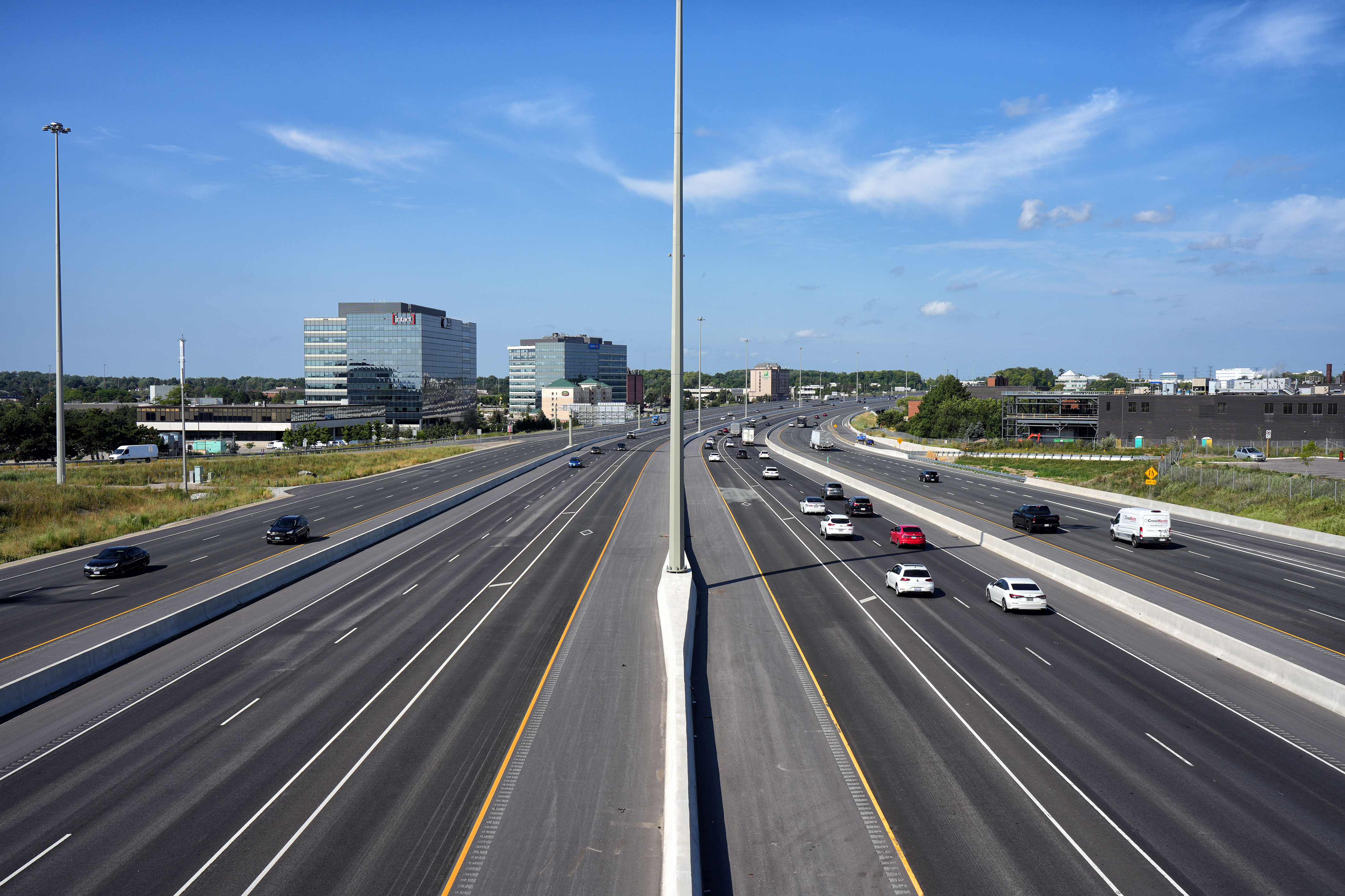
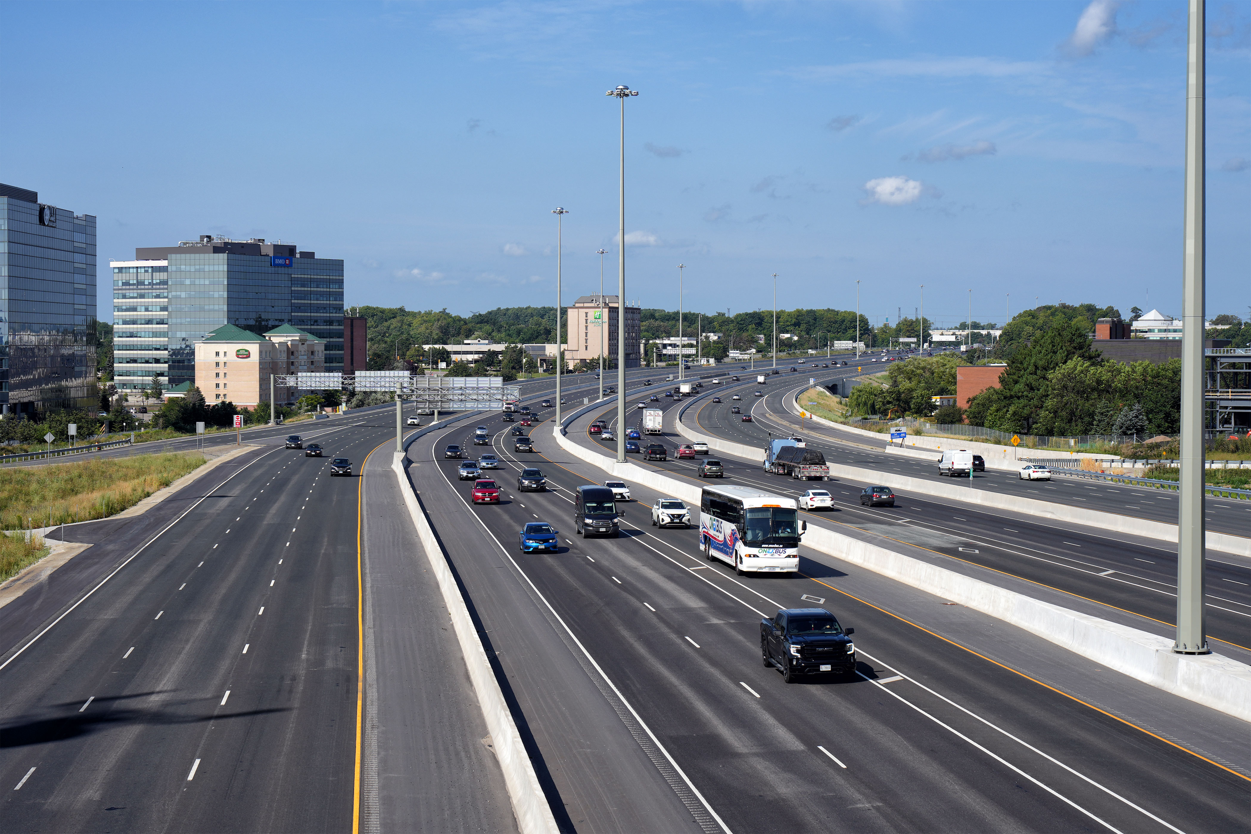
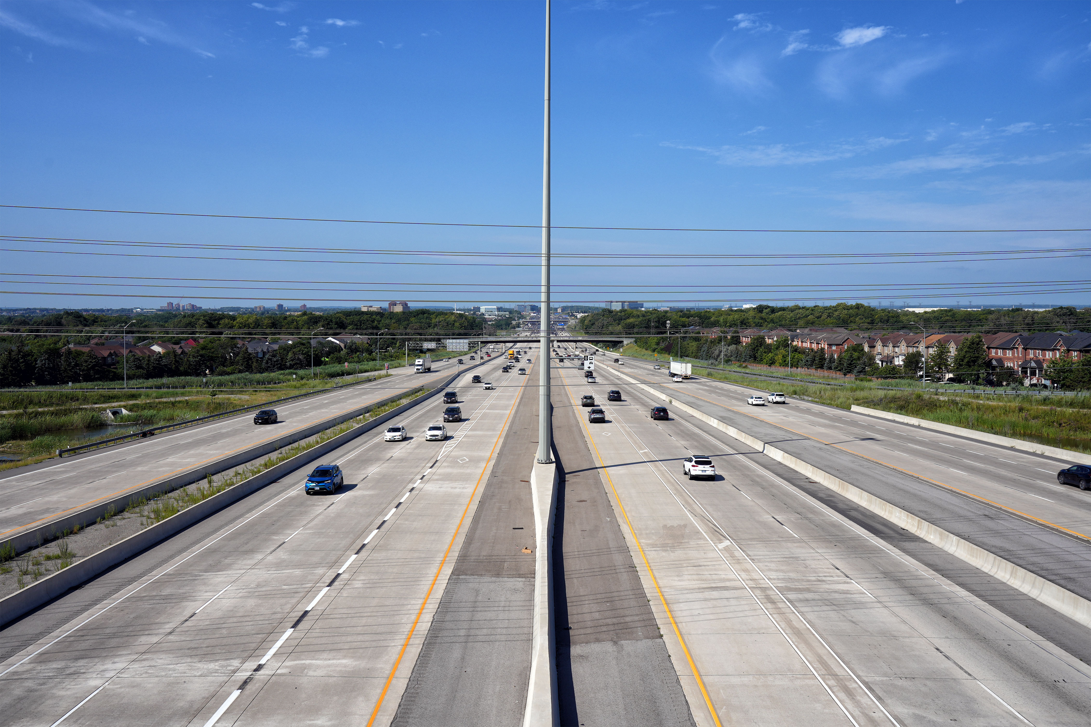
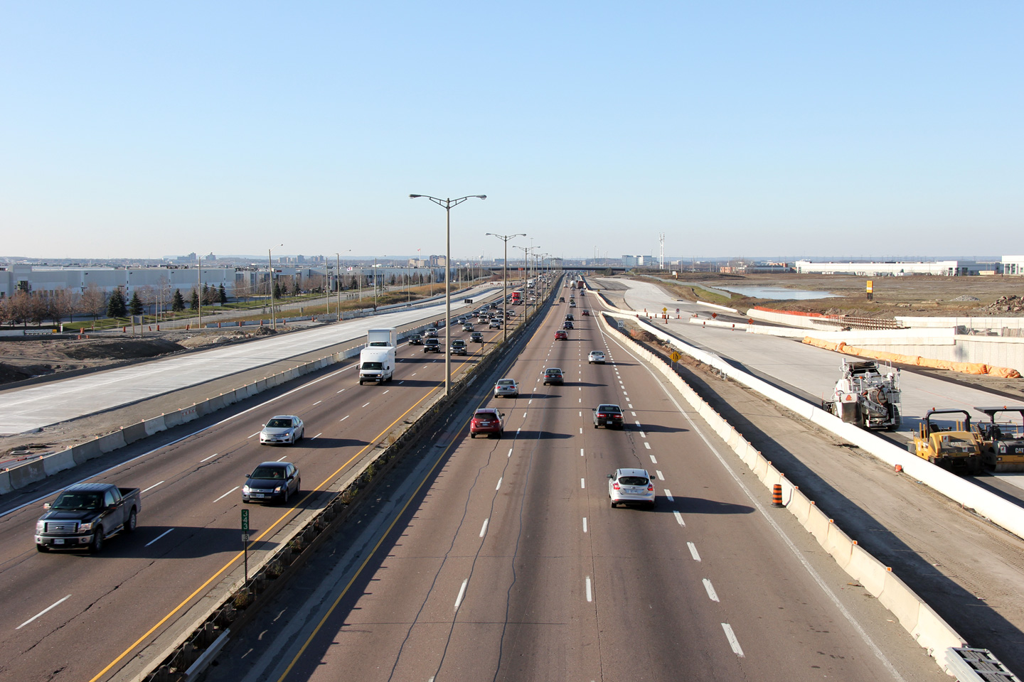
| City of Mississauga Regional Municipality of Peel |
View looking easterly from the McLaughlin Road overpass towards Hurontario
Street. The upper two photos show Highway 401 with a 1970s era
cross-section that was typical of virtually all freeways in Ontario
constructed or widened during the 1960s and 1970s.
Virtually all urban freeways in Ontario used to look like this before they
were retrofitted with tall-wall barrier and high-mast lighting. While high
mast lighting and tall-wall barrier are an improved design from an
operational standpoint, it is unfortunate that Ontario's freeways are losing
their past character as they are reconstructed. It is also unfortunate that
truss lighting is not being used in new applications not suitable for
high-mast lighting. The lower photo shows the cross-section of Highway
401 after the highway was widened to twelve lanes through the Hurontario
Street interchange. Upper photos taken: May 12th, 2005. Lower photo taken: August 19th, 2014. |
|
||||
| City of Mississauga Regional Municipality of Peel |
Eastbound advanced signage for the Mavis Road off-ramp. Photo taken: November 4, 2020. |
 (720x480) (720x480)(1440x960) (2400x1600) |
||||
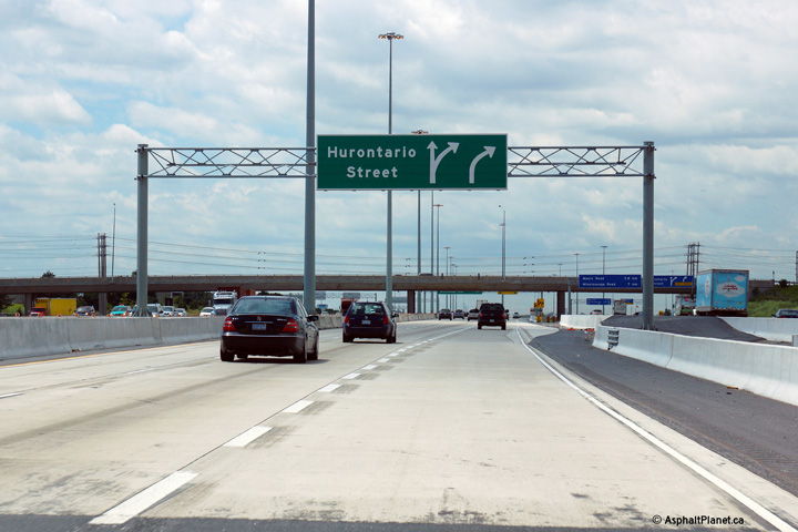
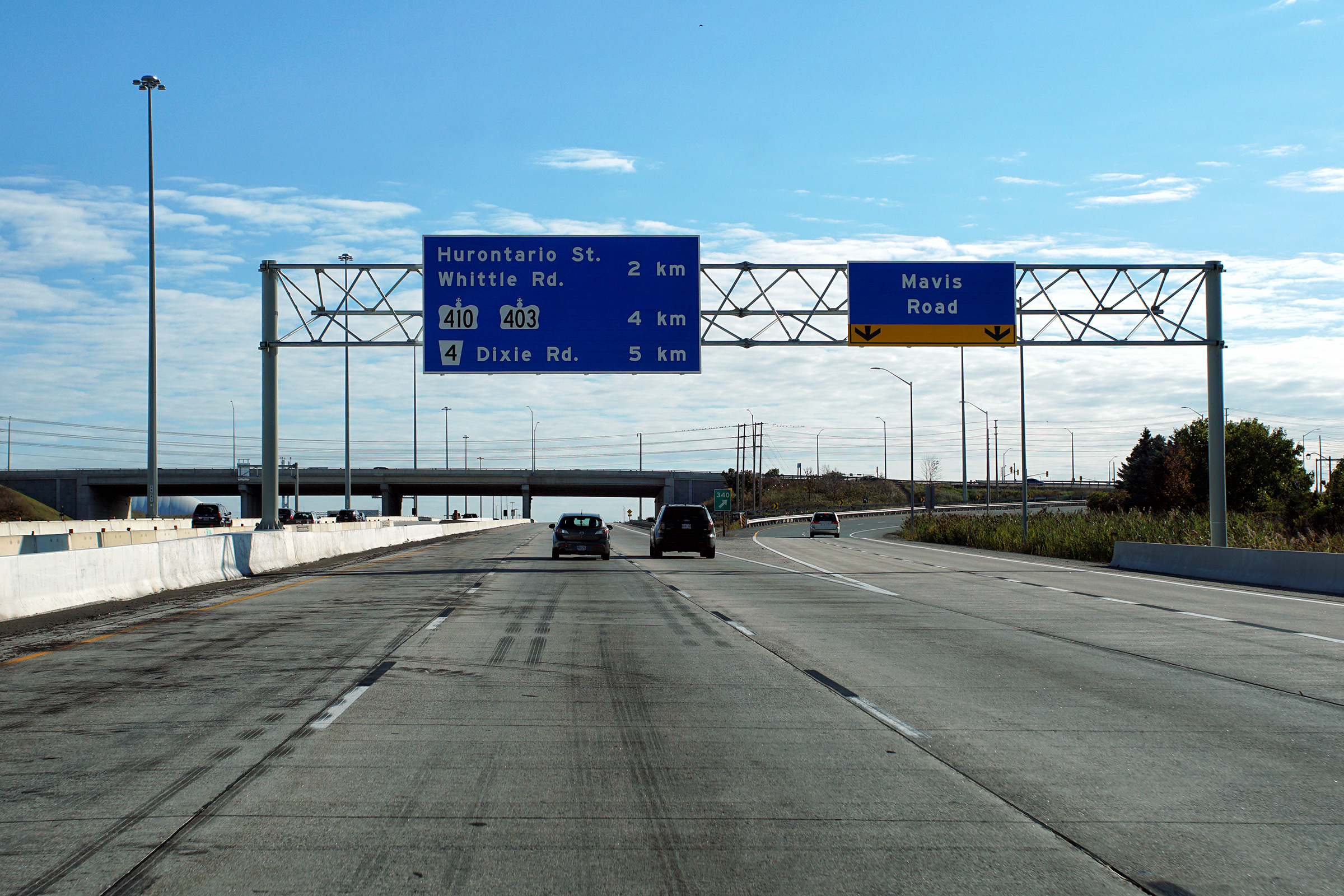
| City of Mississauga Regional Municipality of Peel |
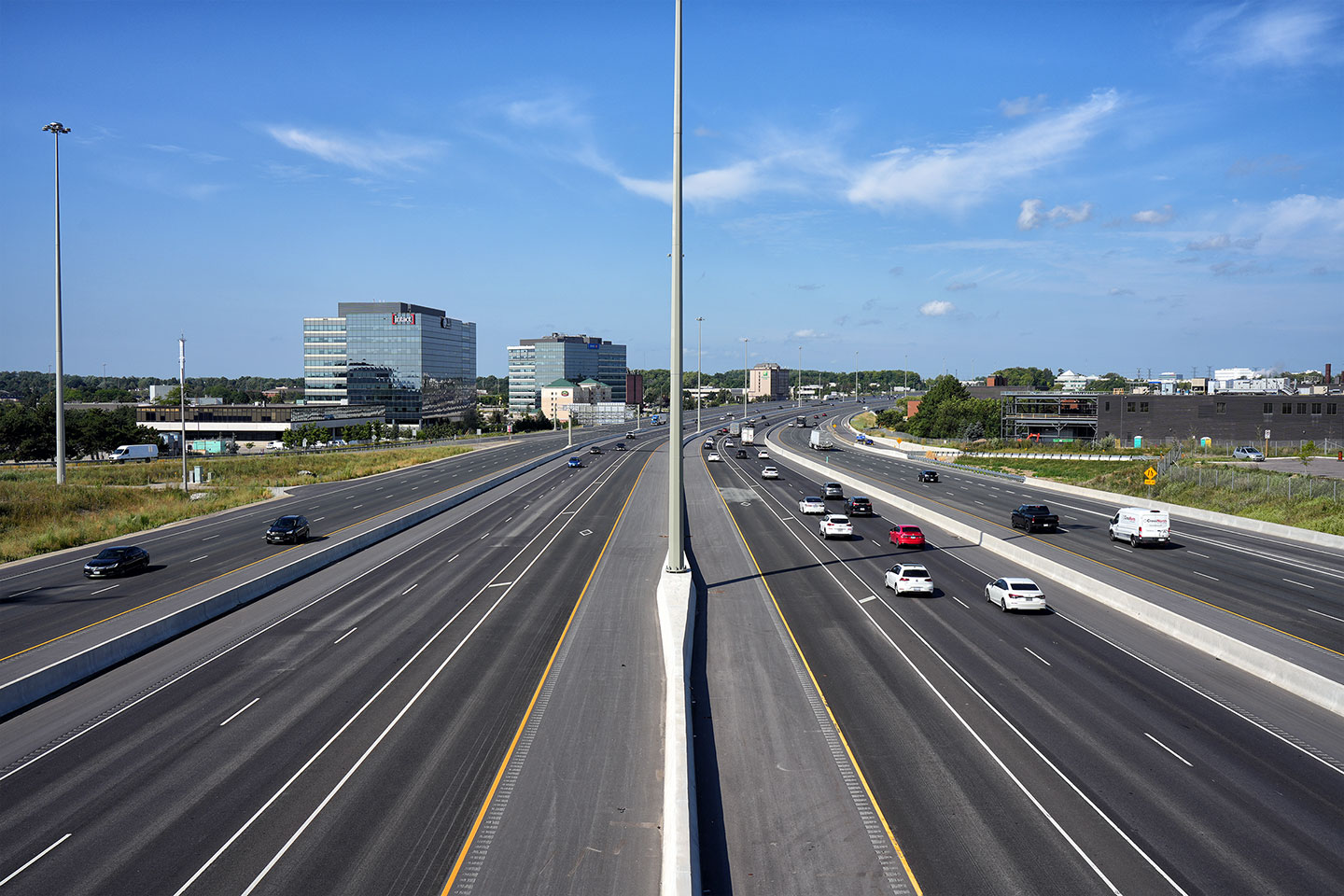
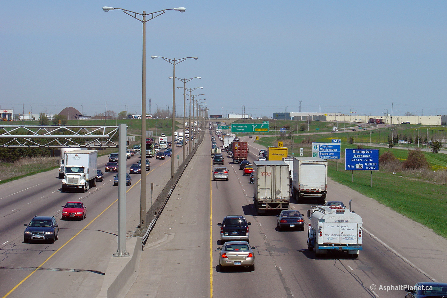
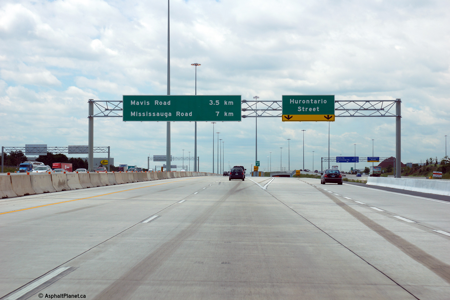
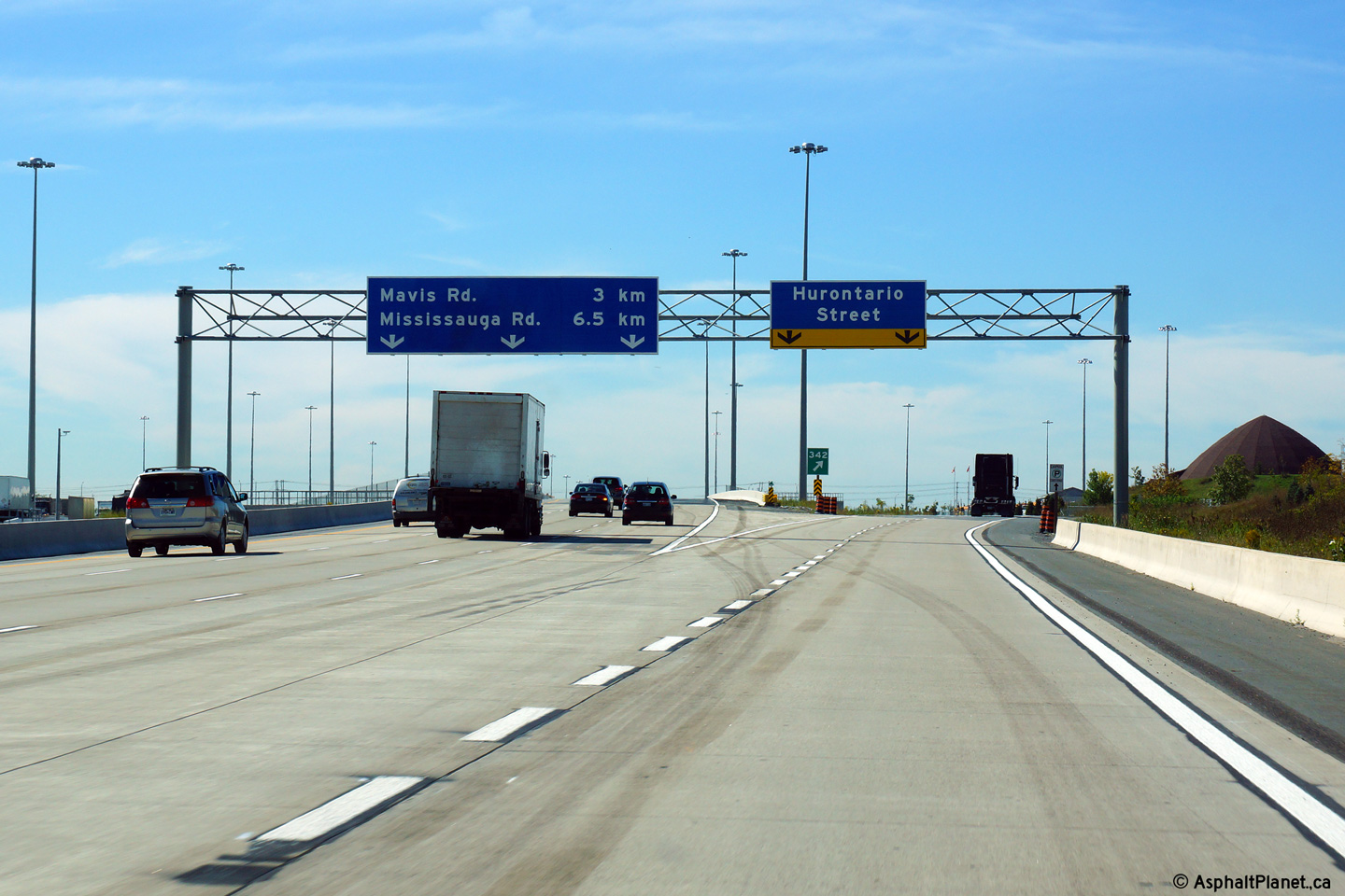
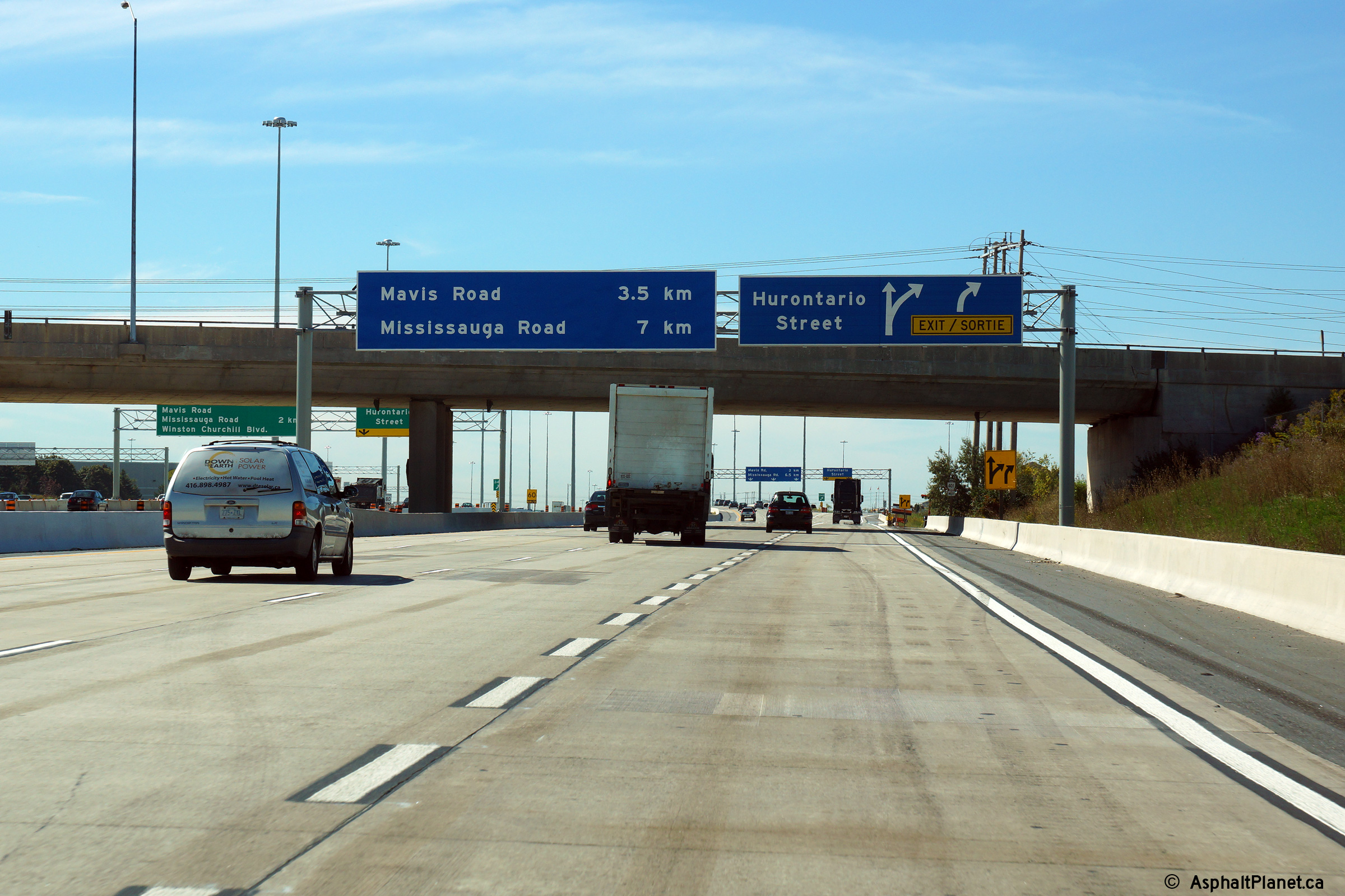
Eastbound signage approaching the Hurontario Street interchange. The
upper photo shows the signage as it existed before the collector lanes were
extended through Hurontario Street, while the lower photo shows the current
collector lanes giange. Highway 10
followed Hurontario Street until it was downloaded in 1998. Upper photo taken: March 27th, 2006. Lower photo taken: November 4, 2020. |
|
||||
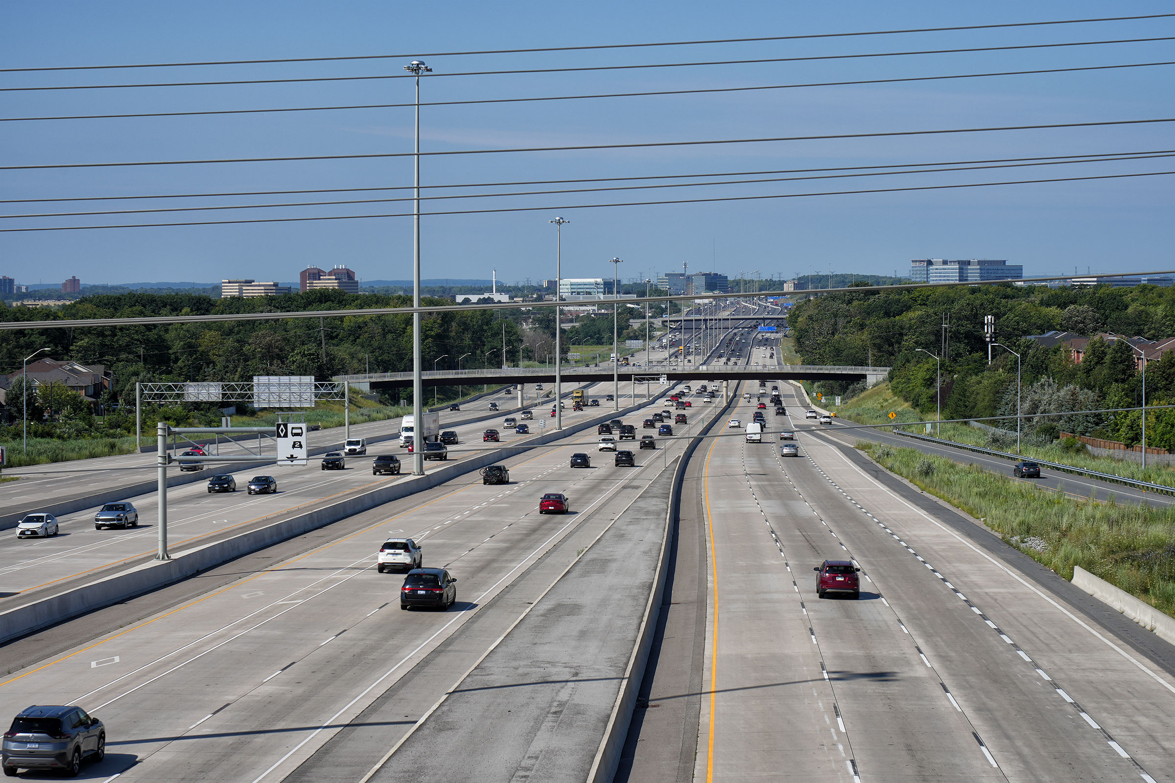
| City of Mississauga Regional Municipality of Peel |
Looking westerly from the Hurontario Street (Highway 10)
overpass in Mississauga. In the upper, pre-widening photo, notice the
somewhat elongated configuration
of this interchange. The elongated shape is due to the interchange
ramps not being realigned when this interchange was converted from a
cloverleaf design into a parclo
A-4 type. The middle photo shows the highway during the construction
project that saw collector lanes pushed through the Hurontario Street
interchange. Additional photos taken during this construction project
are available on the construction
focus page. Finally, the lower photos show Highway 401 after the
construction to add collector lanes through the Hurontario Street
interchange had been completed. The first completed photo shows the
interim configuration where the inner HOV lane remained closed, while the
final two photos were taken after the collector lanes had been extended to
beyond Mavis Road. Photo # 1 taken: May 12th, 2005. Photo # 2 taken: December 10th, 2011. Photo # 3 taken: August 19th, 2014. Photos # 4 and # 5 taken: July 10th, 2023. |
 (1440x960) (2400x1600) (4200x2800) 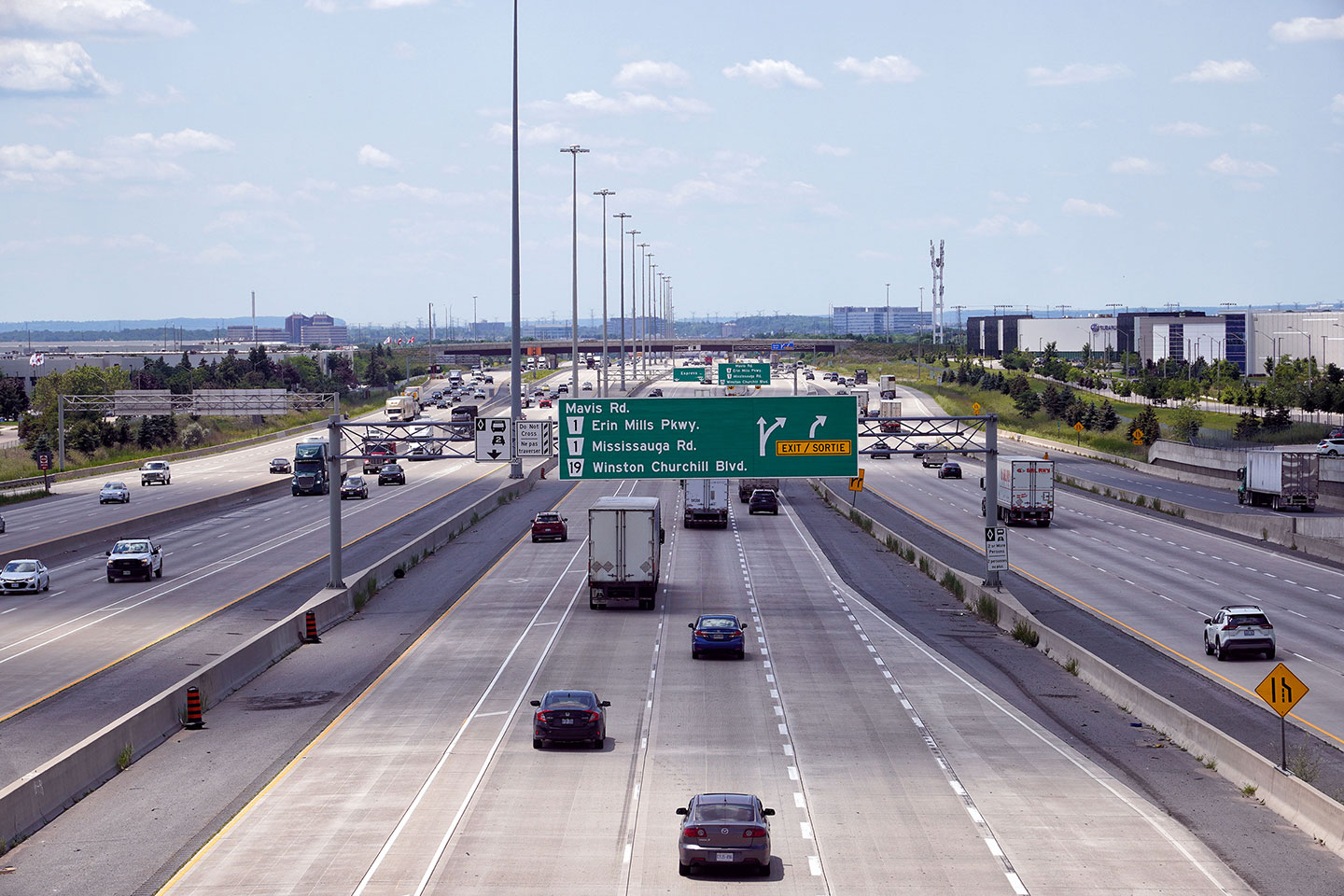 (1440x960) (2400x1600) (4200x2800) |
||||
| Hurontario Street carried the Highway 10 designation until it 1998 when all urban sections of the Highway were transferred to local municipalities. Click here for Highway 10 images. | ||||||
| Highway 401 is being widened from six to twelve lanes between 2009 and 2013 through Hurontario Street. Click here for more information and photos. | ||||||
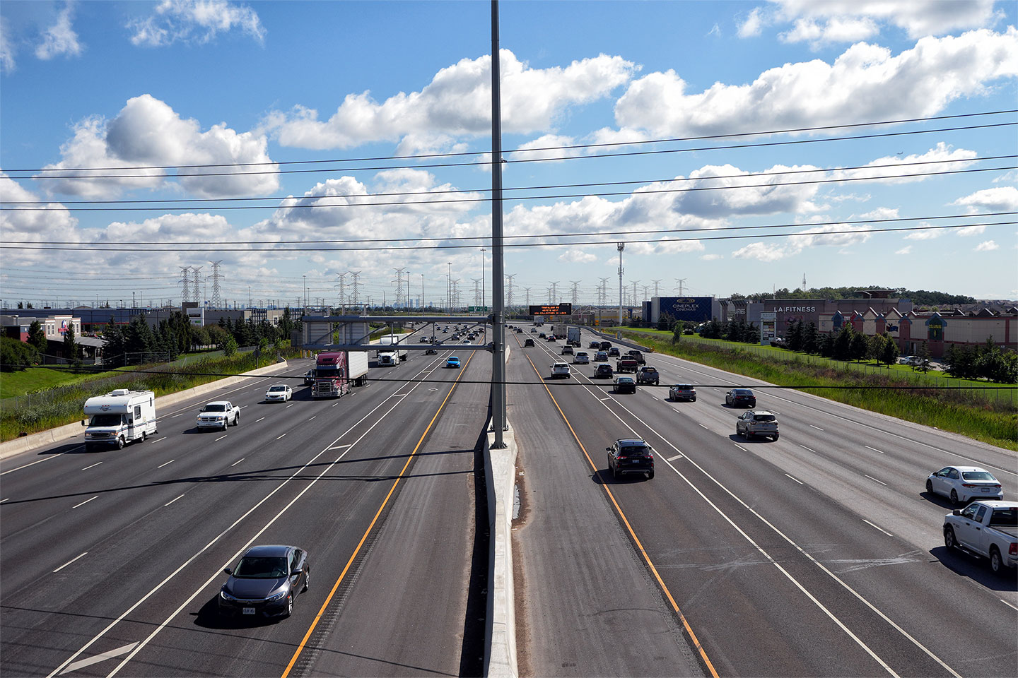
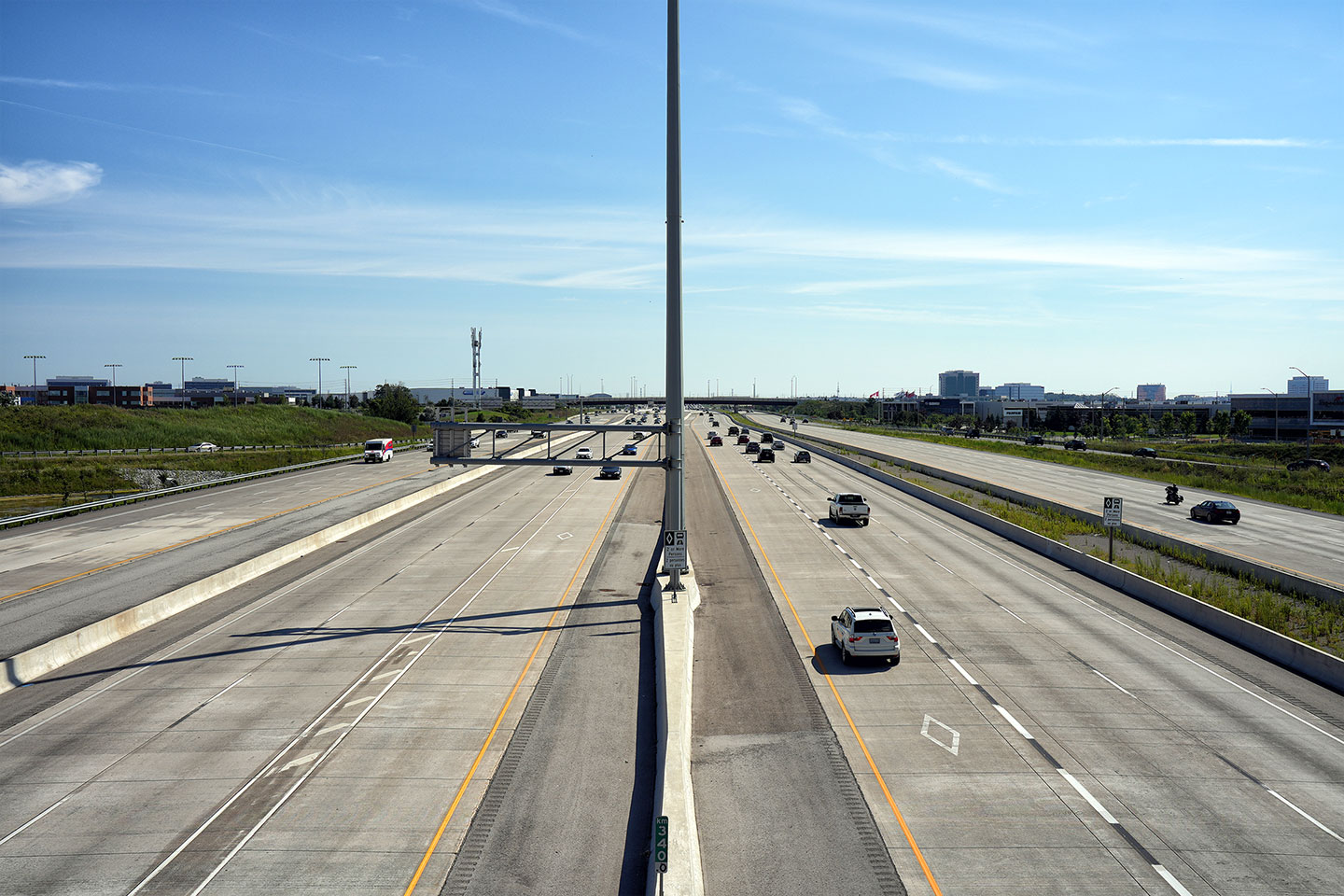
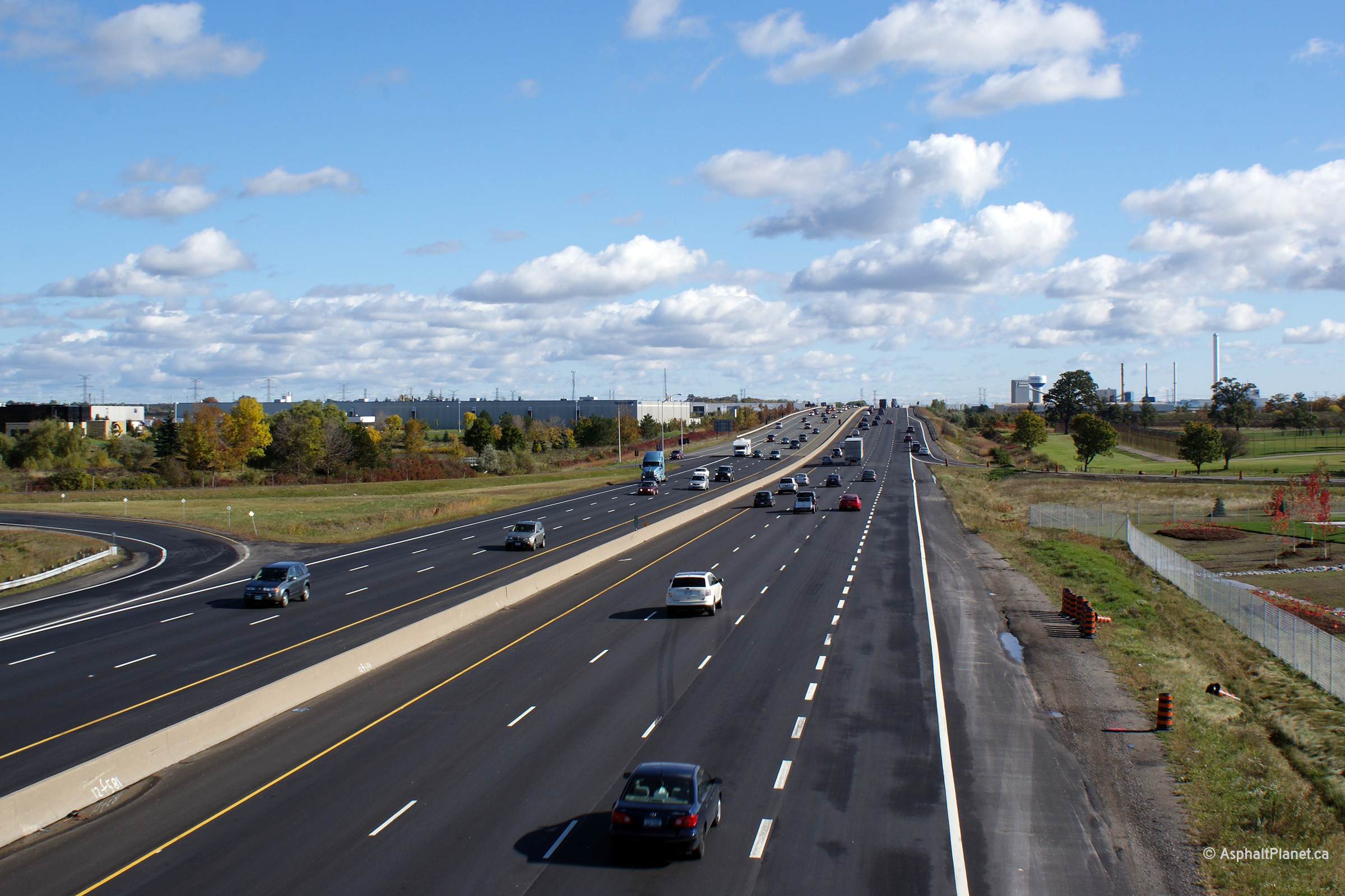
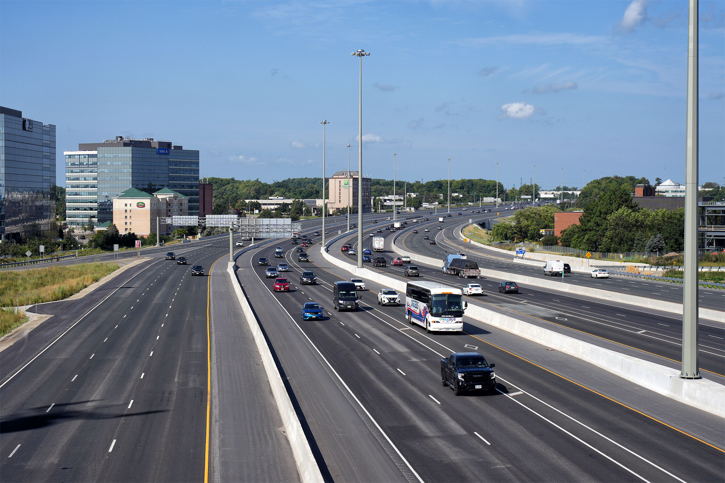
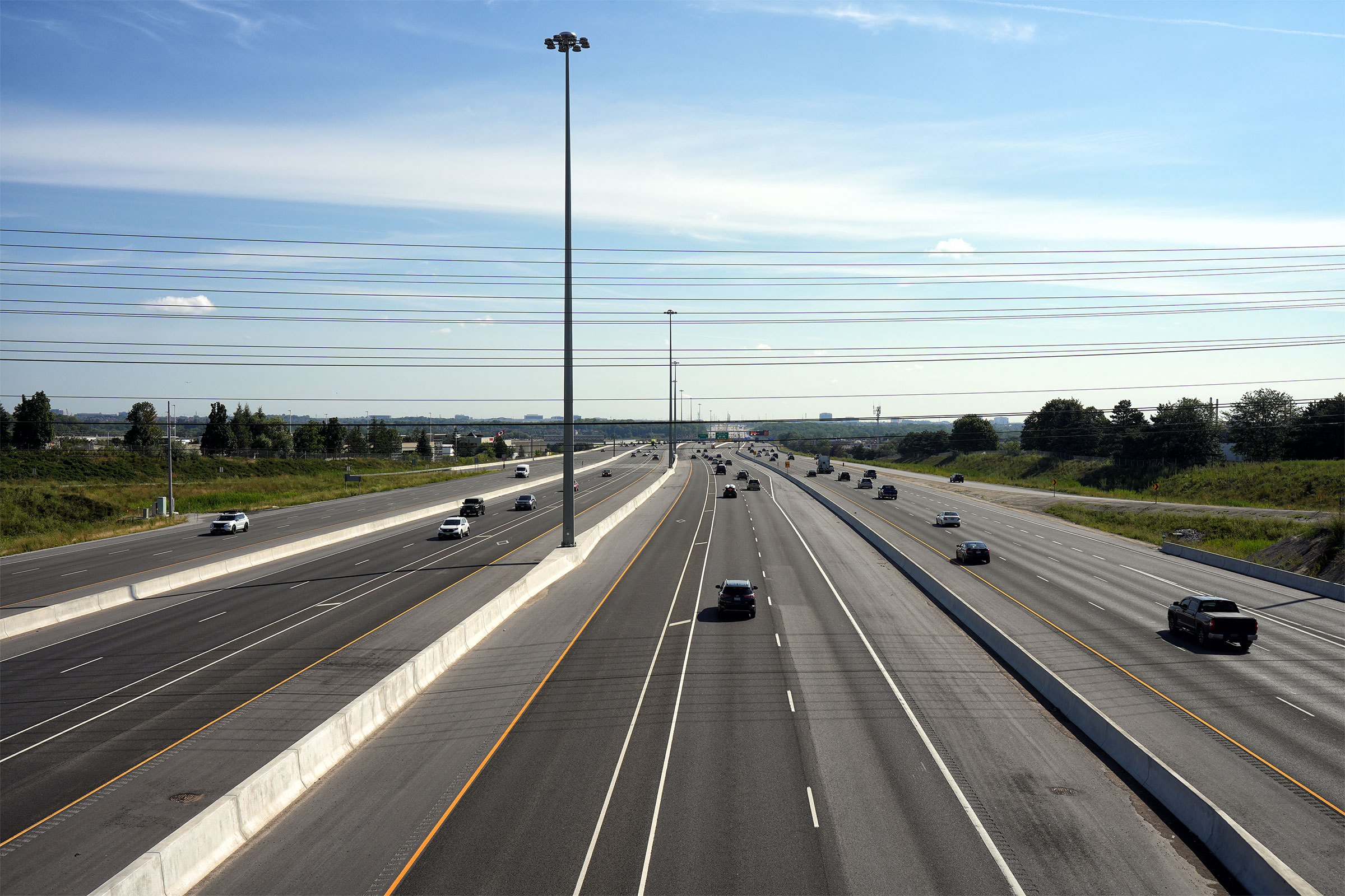
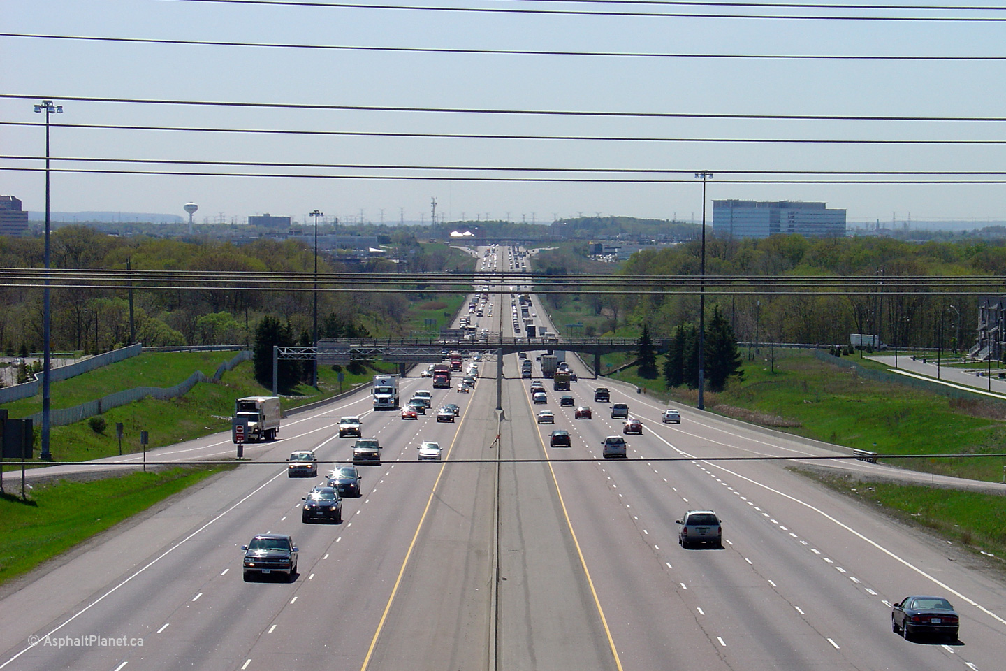
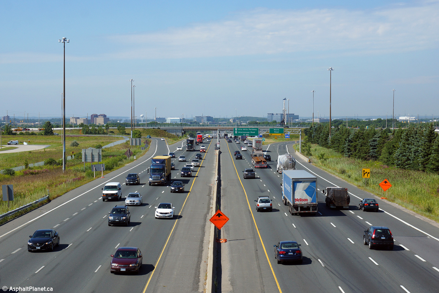
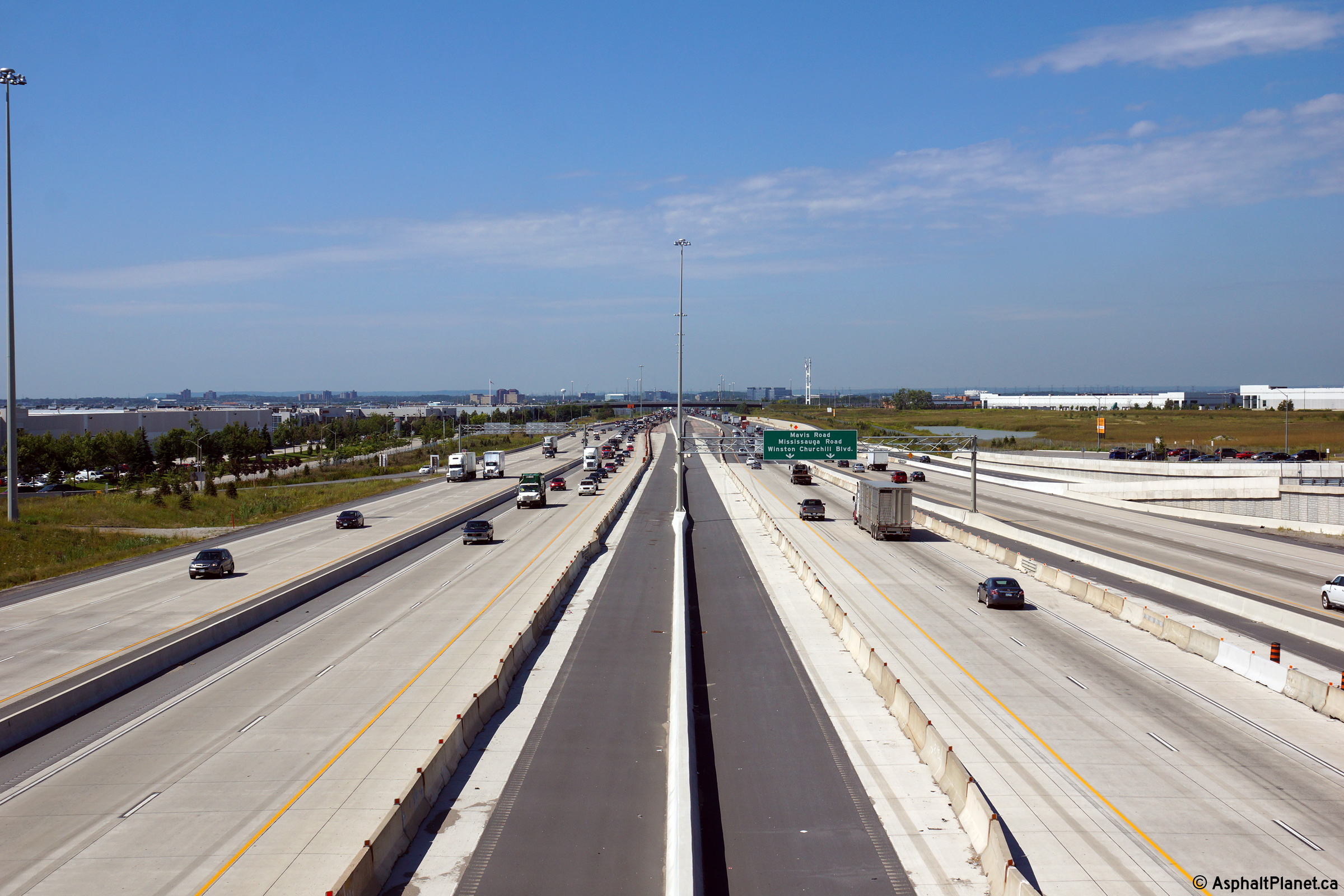
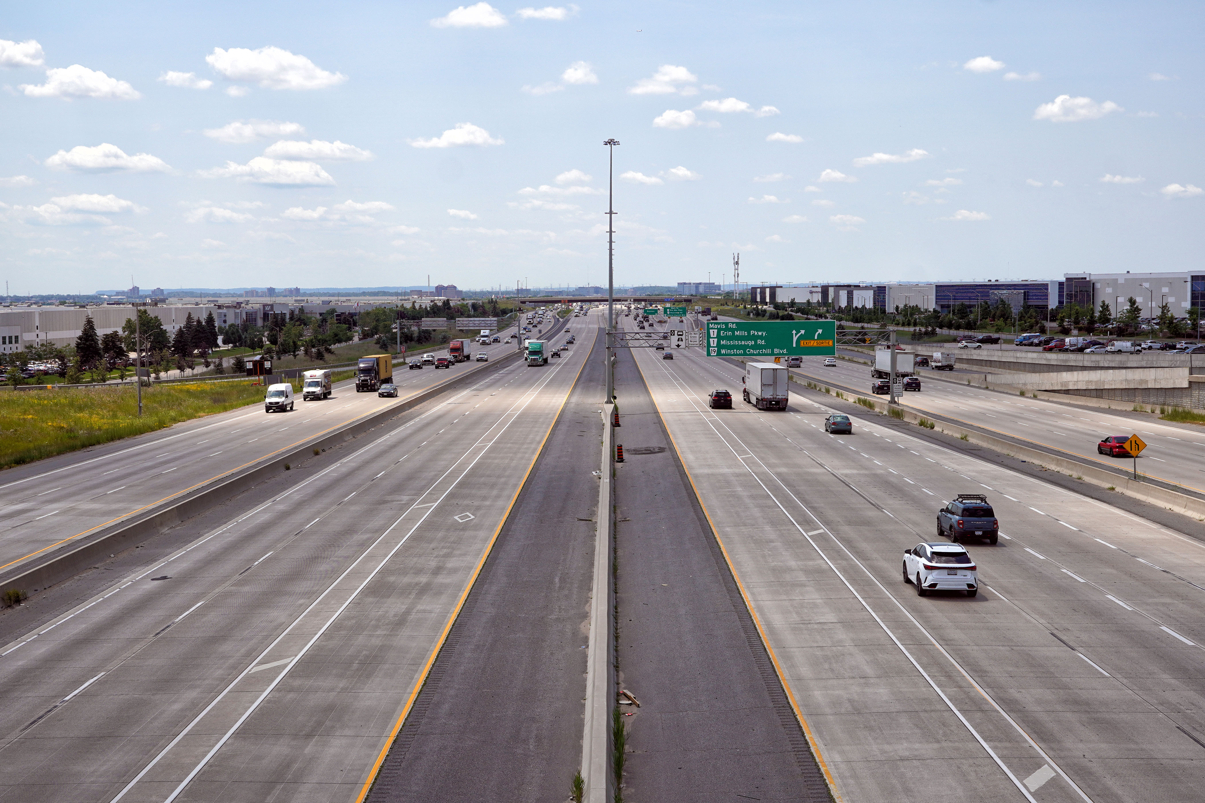
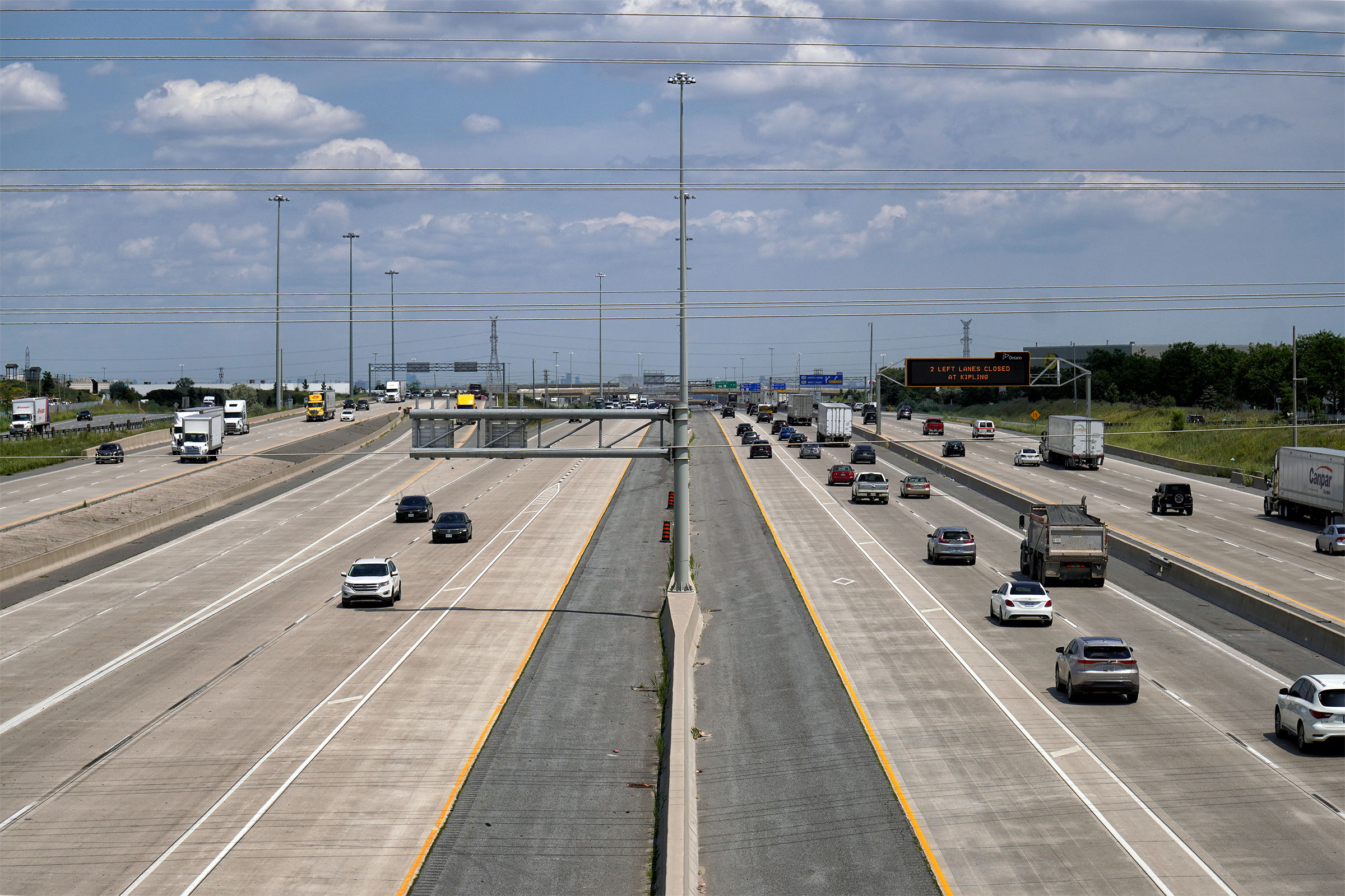
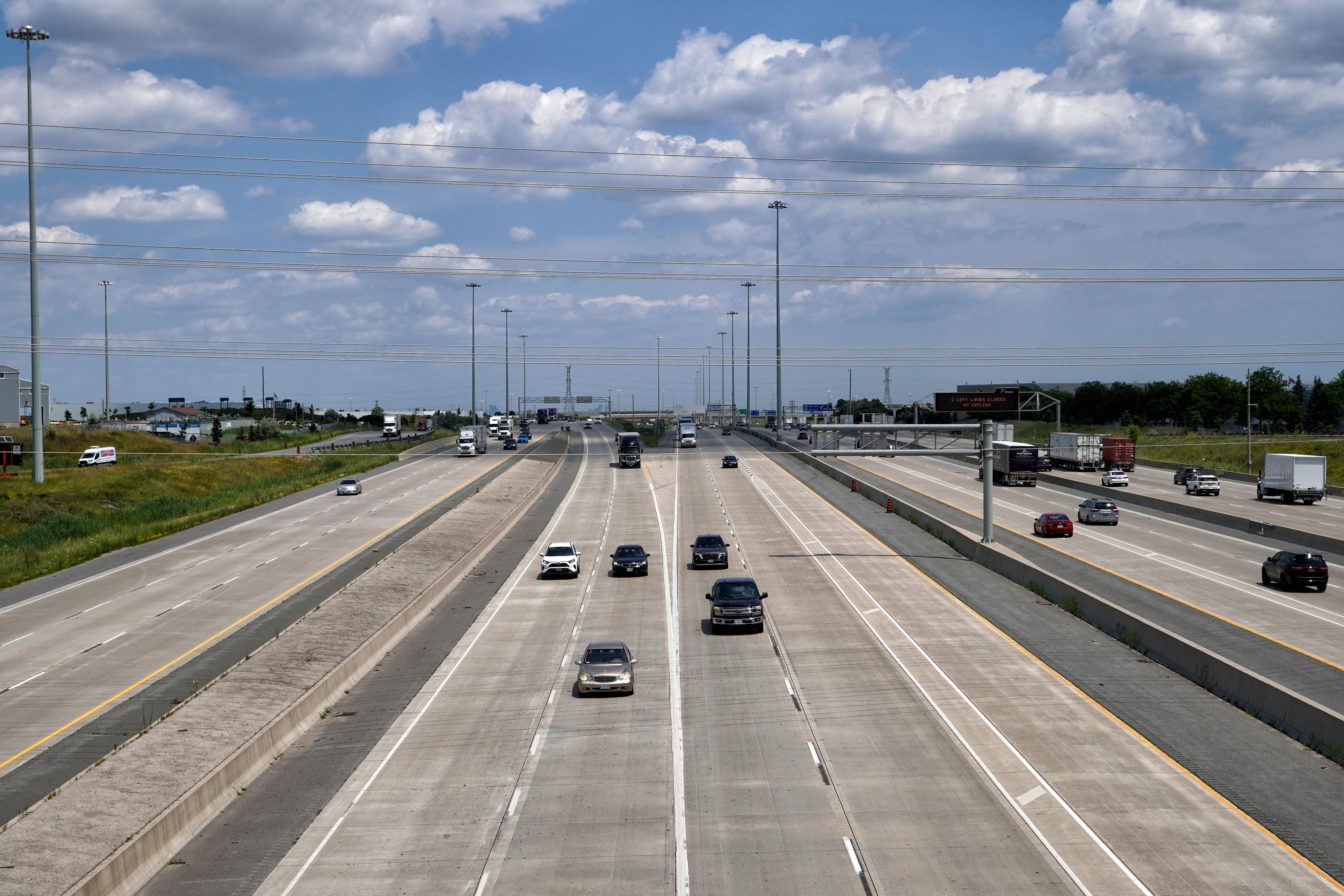
| City of Mississauga Regional Municipality of Peel |
Looking east along Highway 401 from the Highway
10 overpass. Highway 10 is located at roughly kilometre marker
342. Now that the highway has been widened to twelve lanes, the
cross-section that is pictured in the upper photo, before the widening
project started is almost unrecognizable compared to the lower photo. Photo # 1 taken: May 12th, 2005. Photo # 2 taken: August 19th, 2014. Photos # 3 and # 4 taken: July 10th, 2023. |
 (1440x960) (2400x1600) (4200x2800) 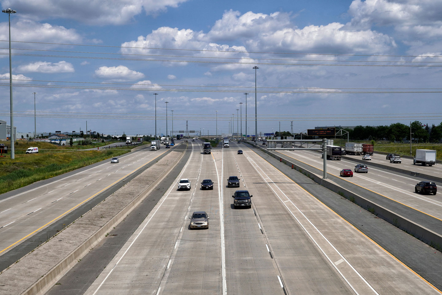 (1440x960) (2400x1600) (4200x2800) |
||||
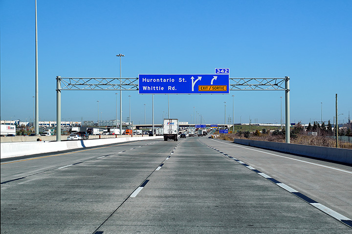
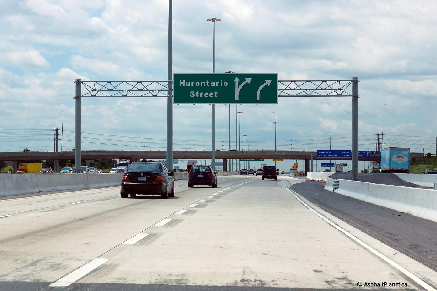
| City of Mississauga Regional Municipality of Peel |
Westbound signage approaching both the express and collector lane off-ramps
to Hurontario Street. Upper (Express Lanes) photo taken: July 10th, 2014. Lower (Collector Lanes) photo taken: September 10th, 2011. |
|
||||
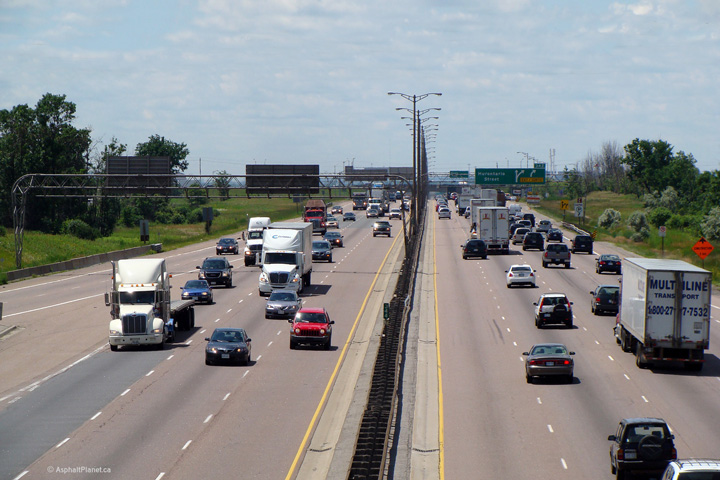
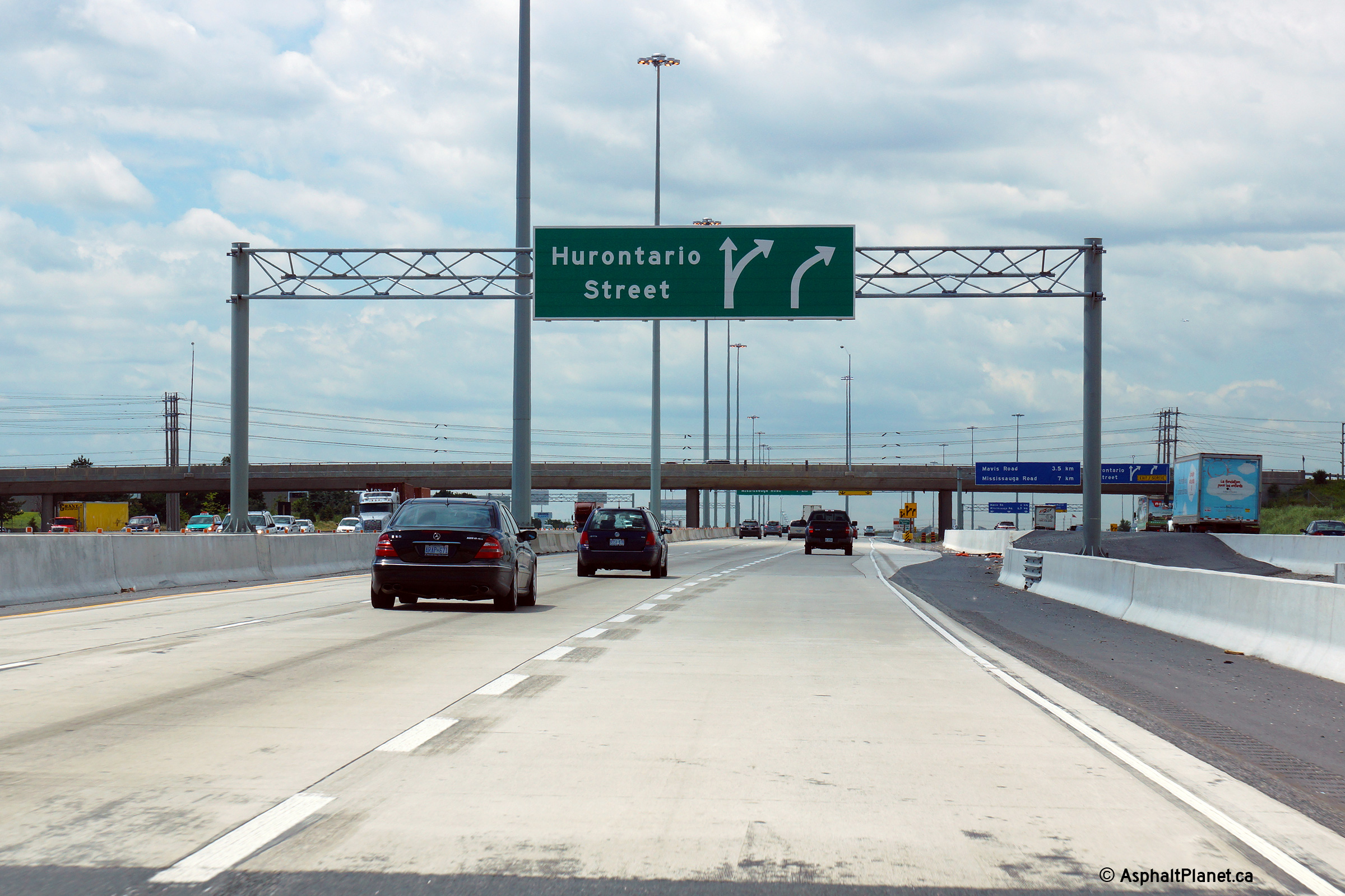
| City of Mississauga Regional Municipality of Peel |
Westbound views in both the express and collector lanes approaching the
Hurontario Street overpass. The third westbound express lanes exits at
the Hurontario Street interchange. In the future, when the collector
lanes are extended further west through the Mavis Road interchange, an HOV
lane will begin in the express lanes at this off-ramp. The HOV lane is
envisioned as far west as the Highway 24 interchange in Cambridge. Upper (Express Lanes) photo taken: July 10th, 2014. Lower (Collector Lanes) photo taken: September 10th, 2011. |
|
||||
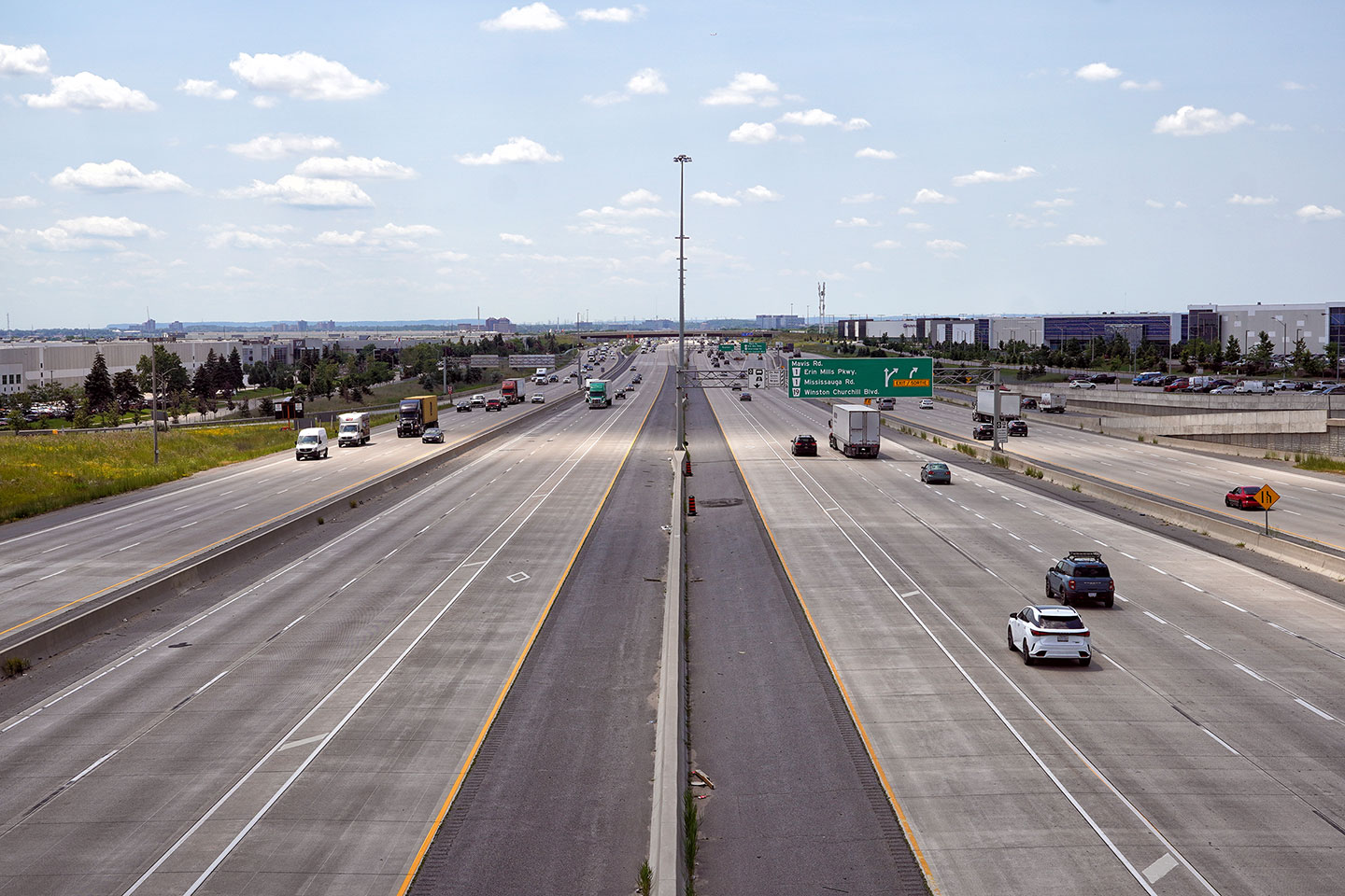
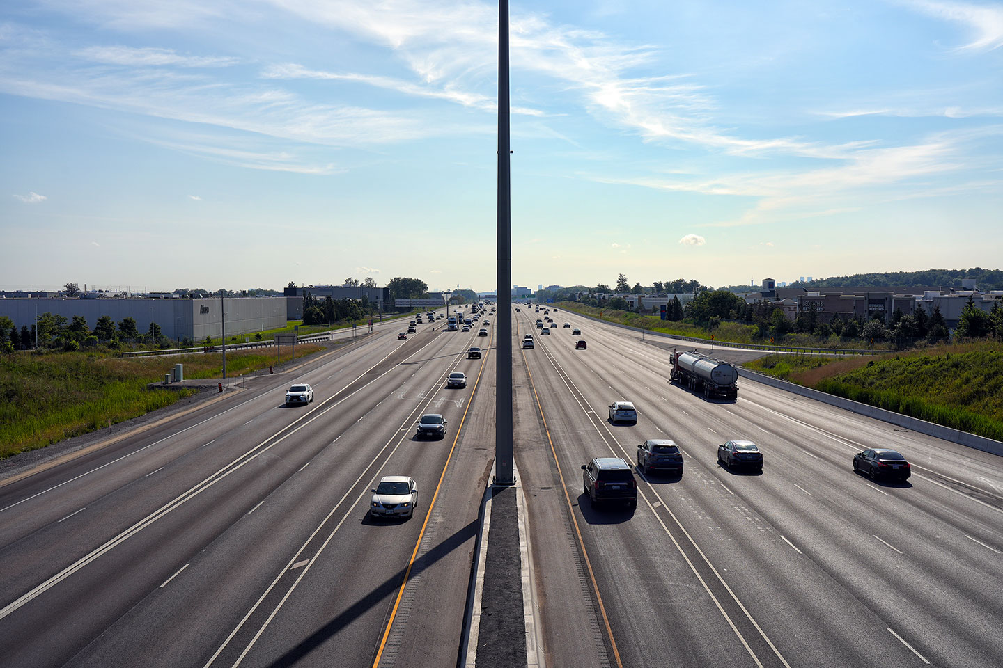
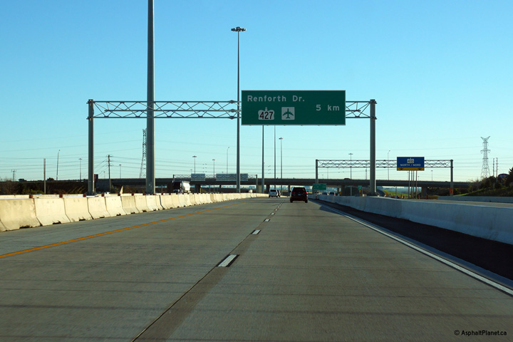
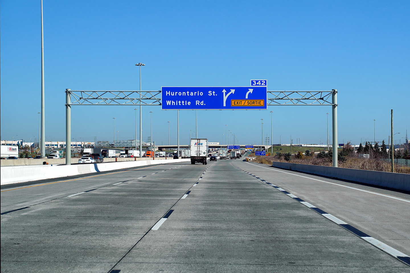
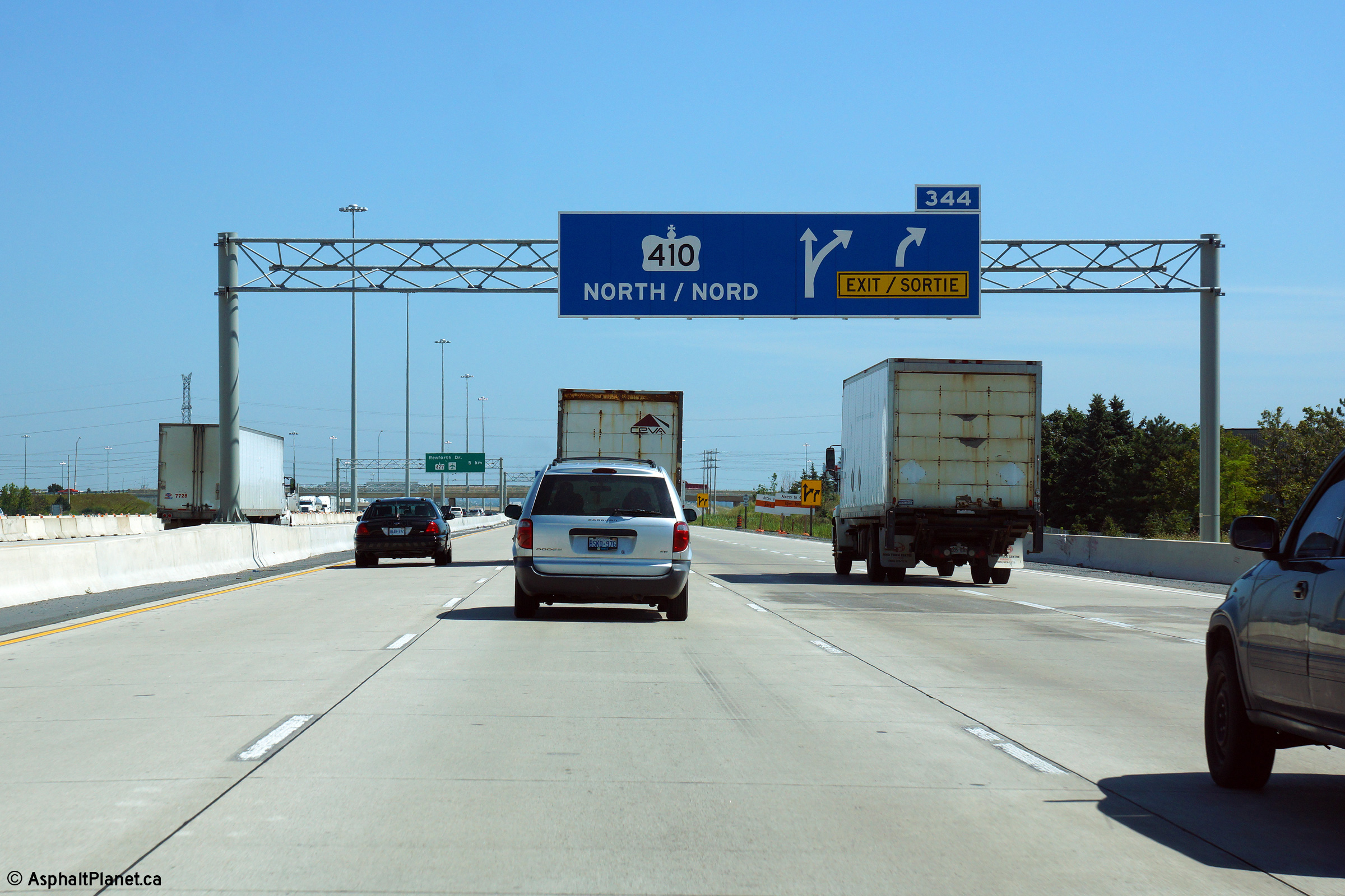
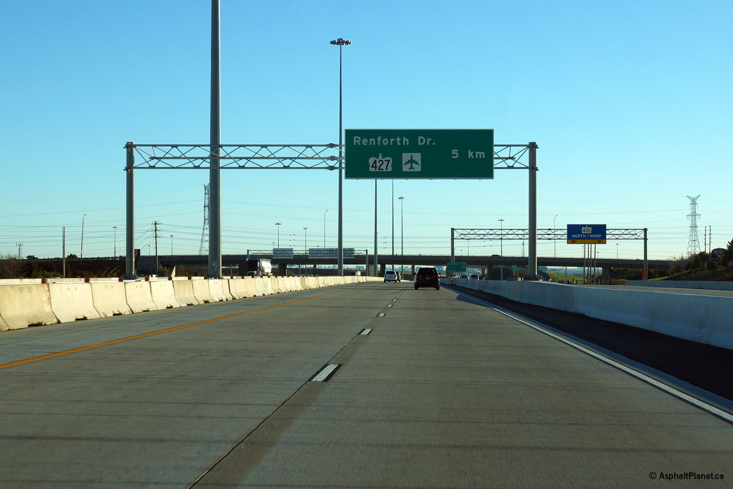
| City of Mississauga Regional Municipality of Peel |
Signage in the eastbound collector lanes for the ramp to
Highway 410. Click here
for a photo of the advanced signage before the ramp to Highway 410 taken in
March, 2006, before Highway 401 was widened to twelve lanes. Photo taken: August 19th, 2014. |
 (720x480) (720x480)(1440x960) (2400x1600) |
||||
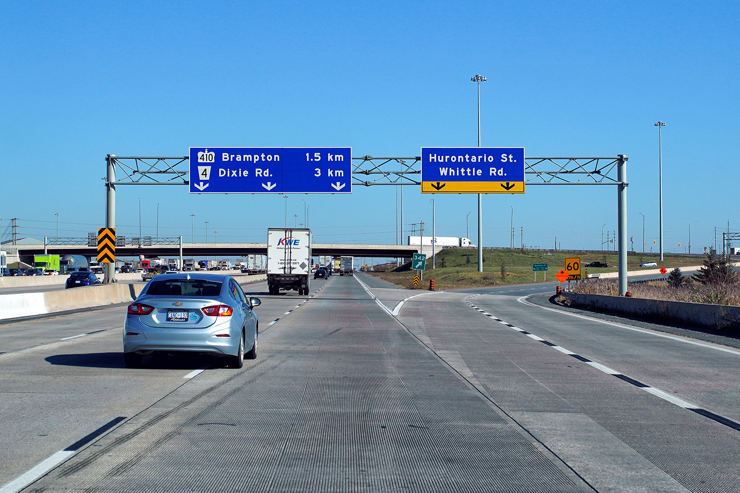
| City of Mississauga Regional Municipality of Peel |
Signs in both the express and collector lanes approaching the Highway 410
interchange. There is no direct ramp from the eastbound express lanes
to Highway 410, so the express lanes are only signed with a pre-advanced for
the upcoming Airport basketweave. Click
here for a photo of the sign at
the ramp to Highway 410 taken in March, 2006, before Highway 401 was widened
to twelve lanes. Upper photo taken: October 14th, 2013. Lower photo taken: August 19th, 2014. |
|
||||
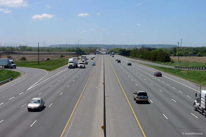
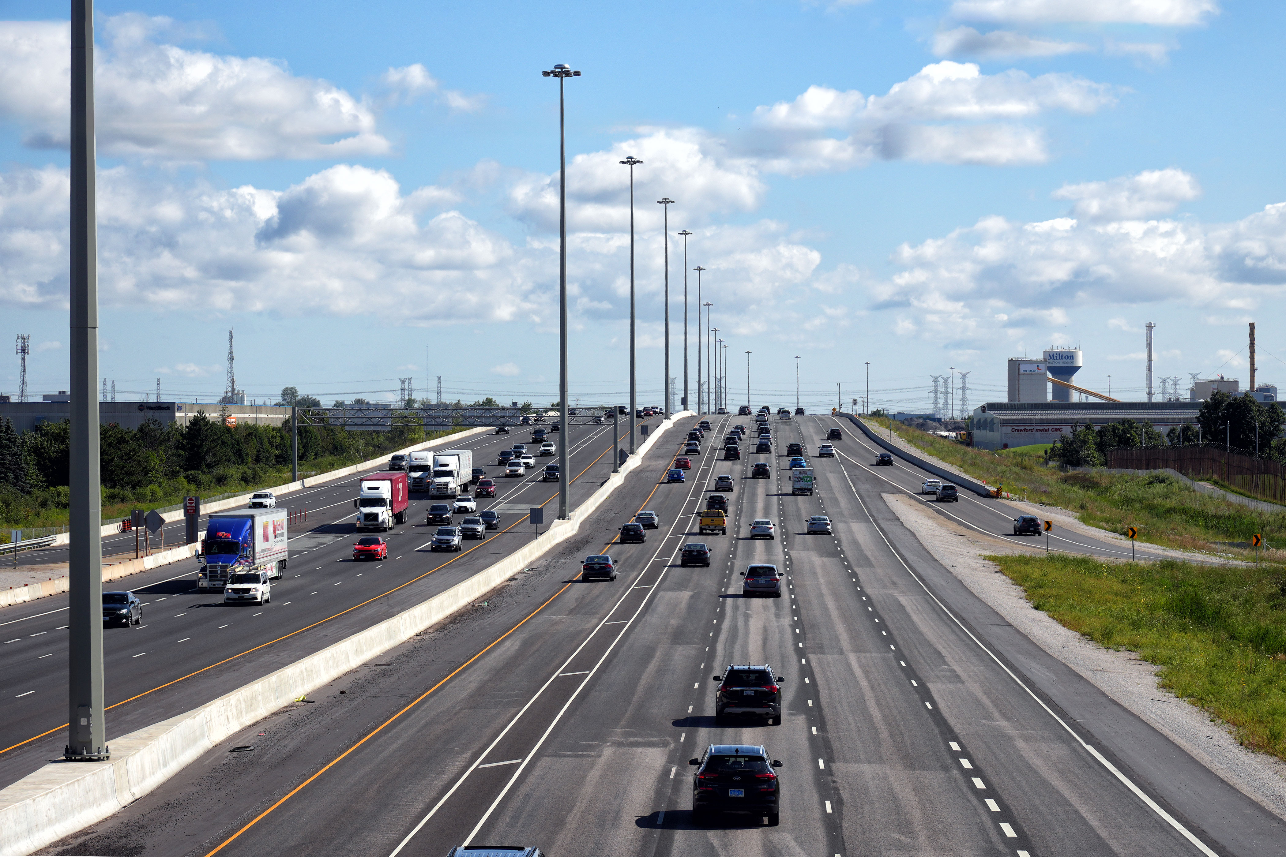
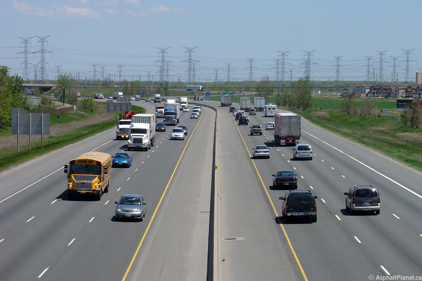
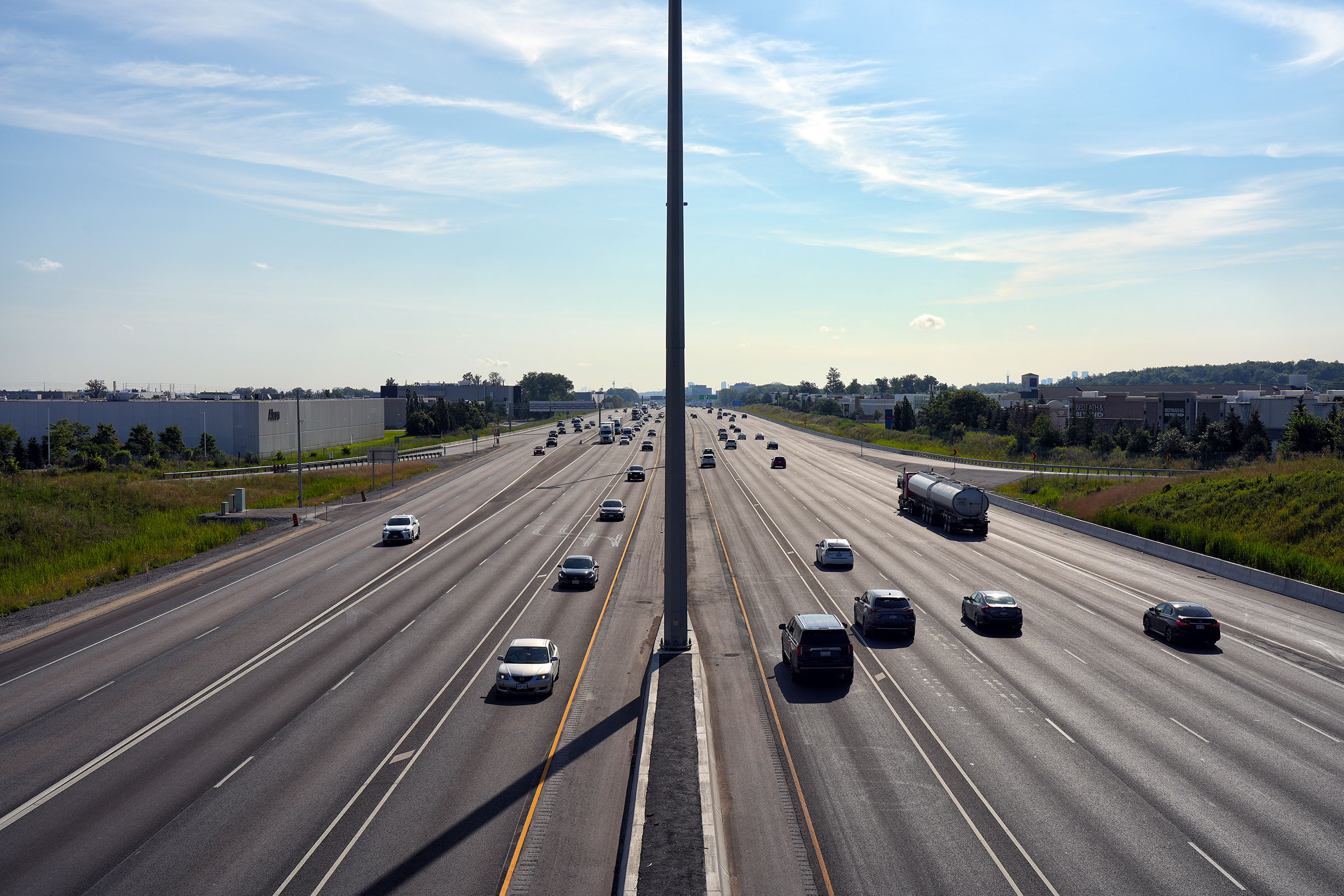
| City of Mississauga Regional Municipality of Peel |
Highway 401 looking west from the Kennedy Road overpass in Mississauga.
Kennedy Road is located roughly at kilometer marker 343, just to the west of
the Highway 401/403/410 mega-interchange.
Click here to jump to the view looking
east from the Kennedy Road overpass. Upper photo taken: June 24th, 2008. Lower photo taken: August 19th, 2014. |
 (720x480) (1440x960) (2400x1600) |
||||
| Click here for Mississauga to North York Images | ||||||
<- Page 7 Images Highway 401 Images Index Page 9 Images ->
<- Highway 400 Images Back to Highway 401 Highway 402 Images ->
Copyright (c) 2004-2024, AsphaltPlanet.ca AsphaltPlanet@asphaltplanet.ca


 (720x480)
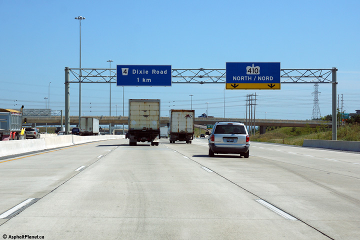