King's Highway 10 - Images
<- Page 1 Page 2 - Brampton to Shelburne Page 3 ->
Photos shown in this table are arranged from South to North:
| Proper Municipality Name | Photo Description | Photo | ||
|
Photos taken from driver's perspective appear offset from centre-line Photos: |
North- Bound |
South- Bound |
||
| South of the Hurontario Street interchange, Highway 410 takes through traffic southerly towards Mississauga and Highways 401 and 403. Click here for Highway 410 images. | ||||
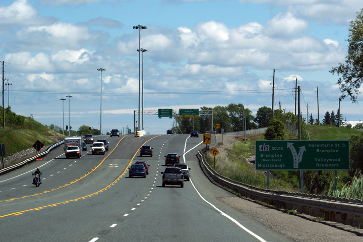
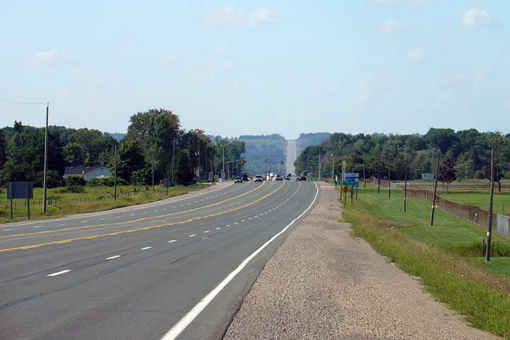
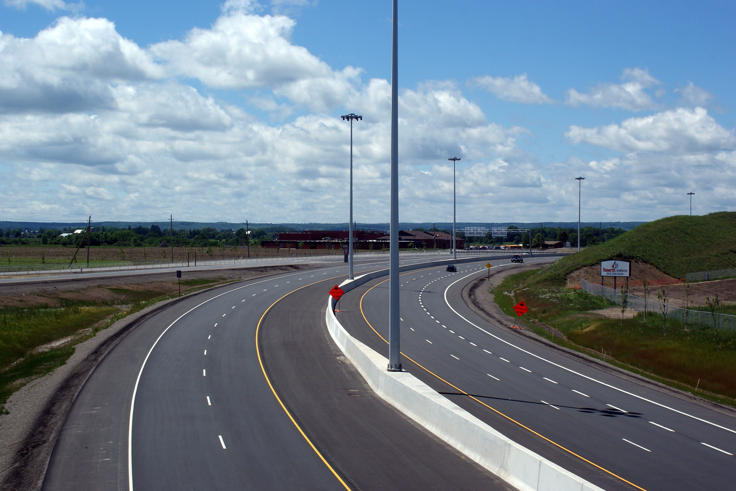
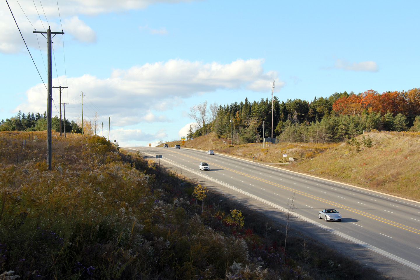
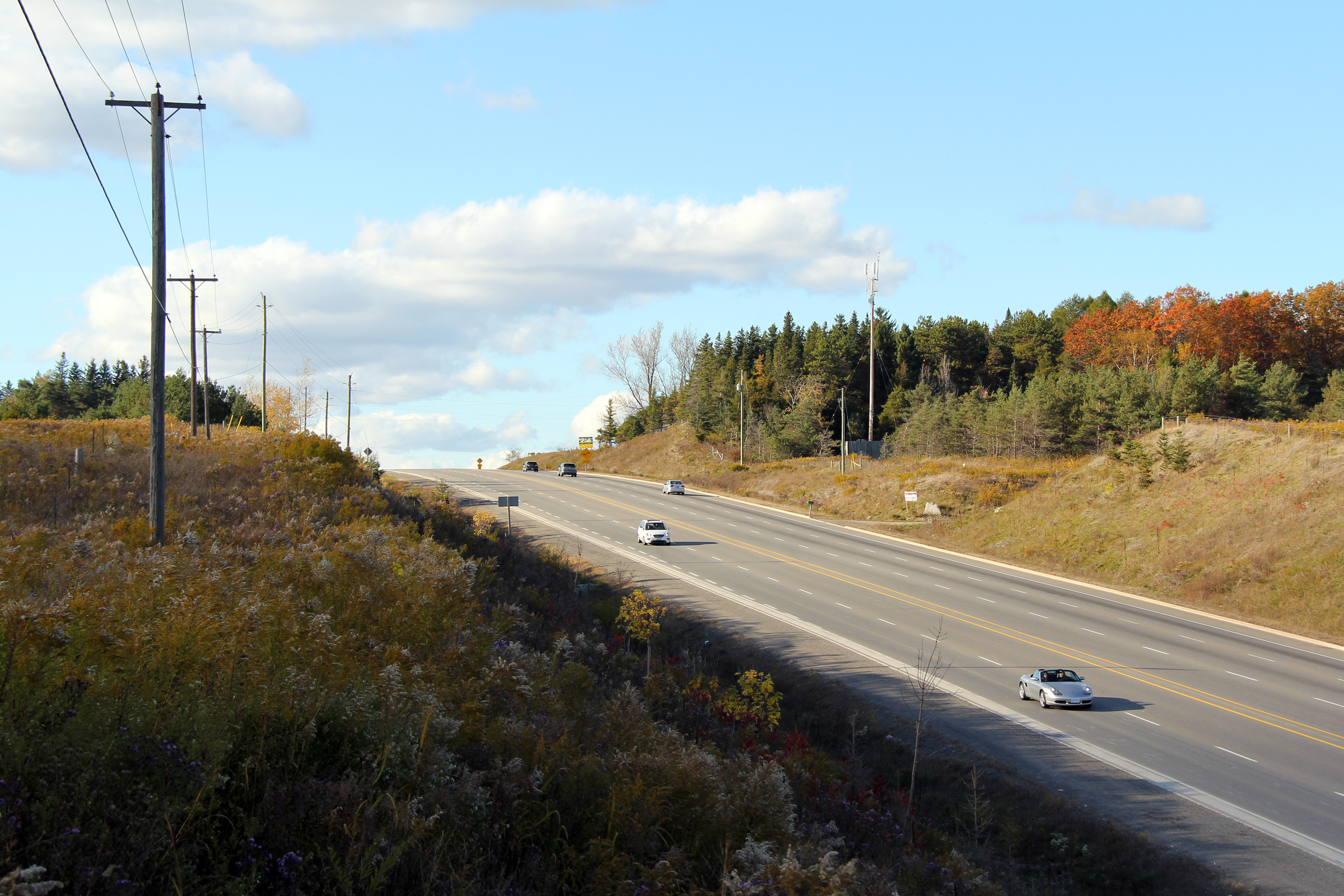
Town of Caledon Regional Municipality of Peel |
These views look northerly from Valleywood Boulevard.
The divided highway ends around the pictured curve. At the end
of the divided highway, Highway 410 ends, becoming Highway 10, which is a
four-lane undivided rural highway for a considerable distance northerly. Photos taken: June 6th, 2010. |
(720x480) (1440x960) (2400x1600)
|
||
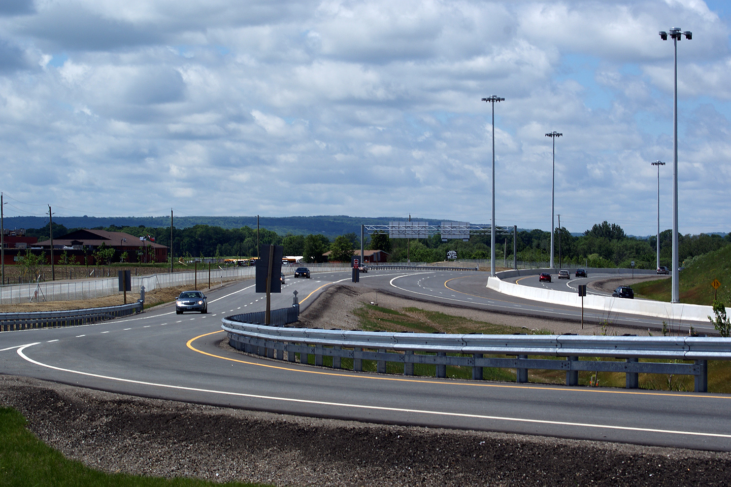
Town of Caledon Regional Municipality of Peel |
Southbound signage on approach to Highway 410.
Today's highway 10 ends at this interchange; the Highway 10 of
yesterday continued southerly along Hurontario Street until meeting the Lakeshore
Road (yesterday's Highway 2) in Port Credit. Photo taken: June 6th, 2010. |
 (720x480) (720x480)(1440x960) (2400x1600) |
||
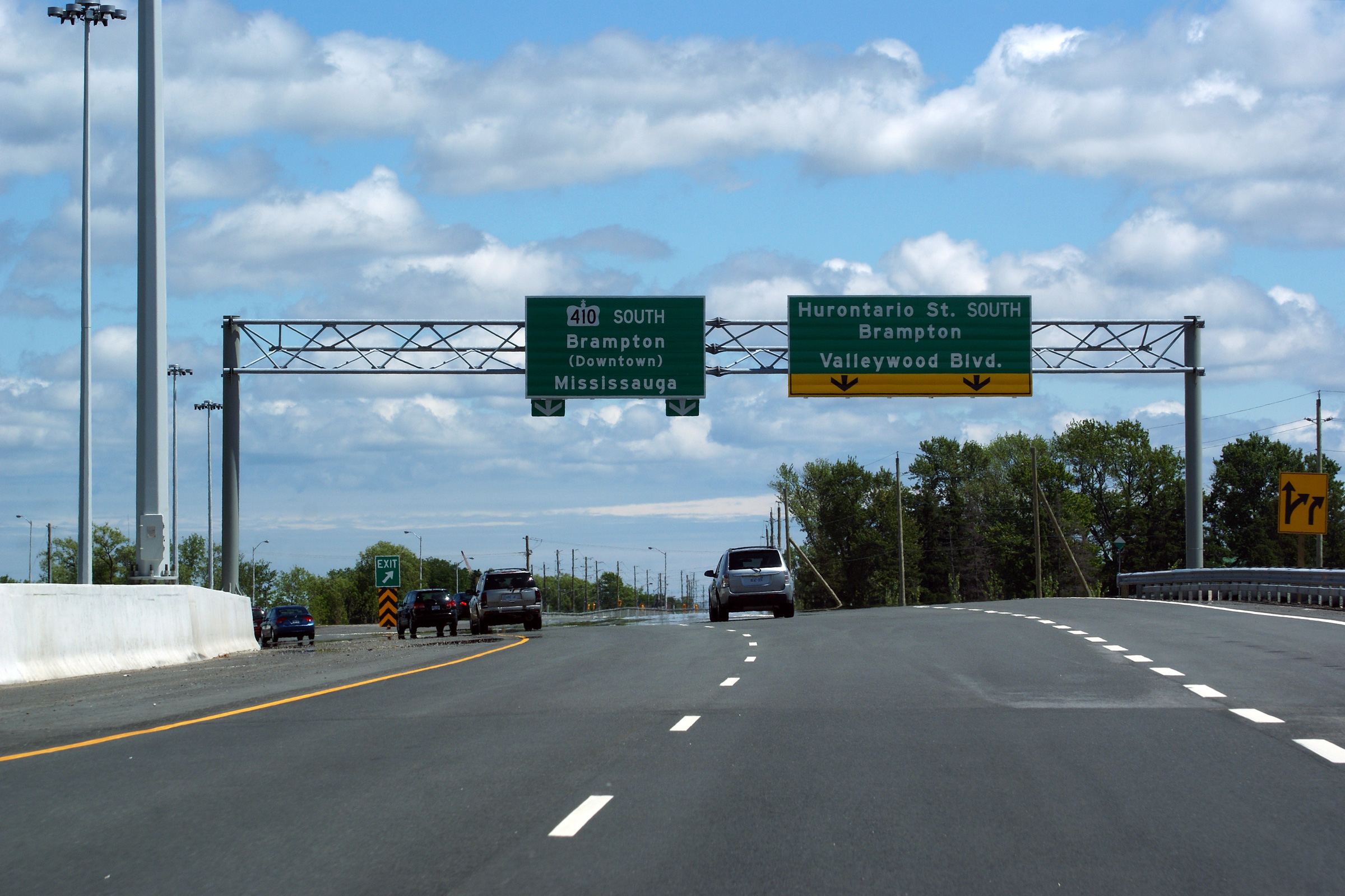
Town of Caledon Regional Municipality of Peel |
Advanced diagram sign for the Highway
410/Hurontario Street split. Photo taken: June 6th, 2010. |
 (720x480) (720x480)(1440x960) (2400x1600) |
||
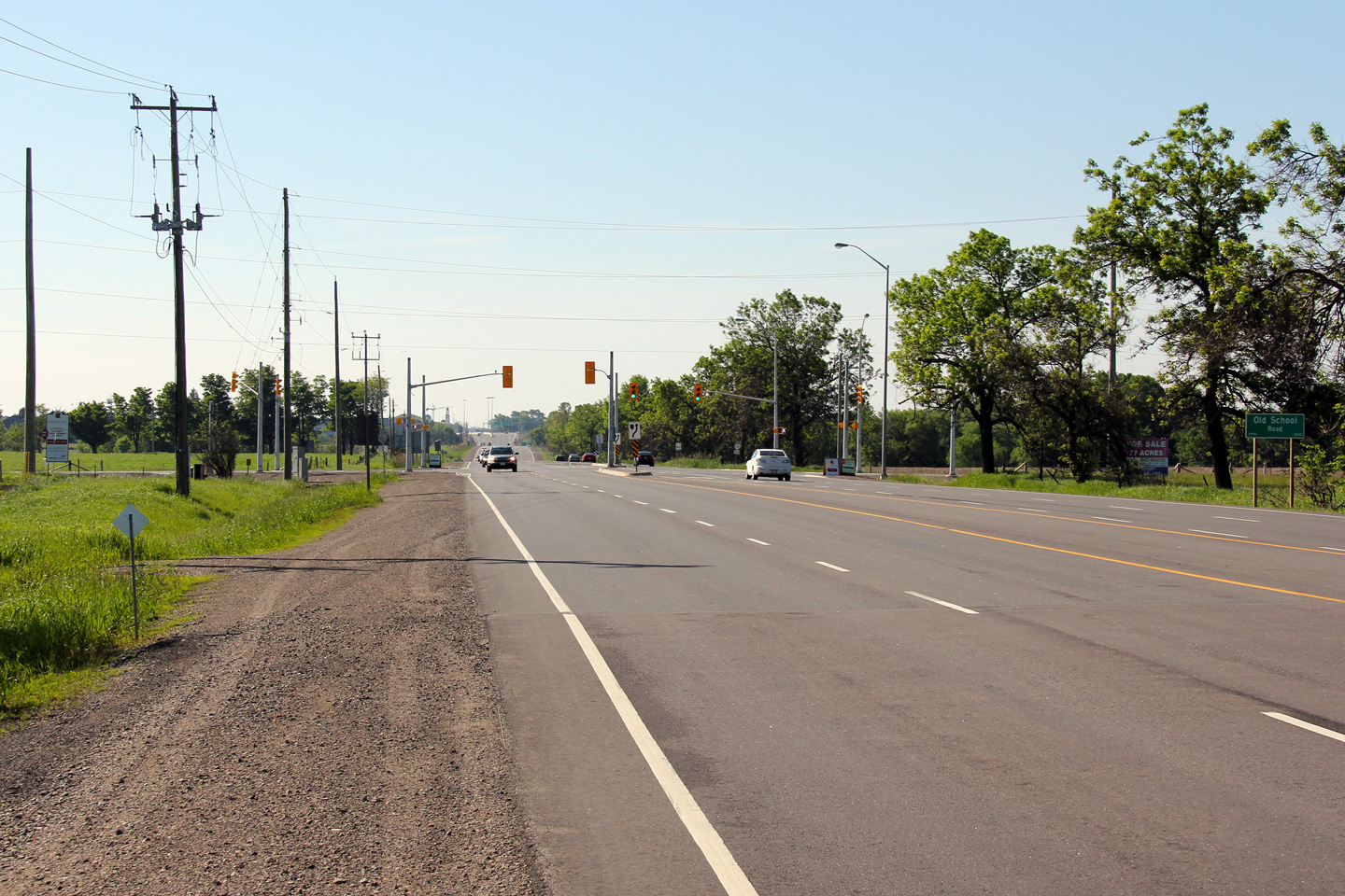
Town of Caledon Regional Municipality of Peel |
Looking southerly at the signalized intersection
with Old School Road. Old School Road is the first signalized
intersection that drivers encounter after the northbound terminus of Highway
410. Photo taken: June 5th, 2011. |
 |
||
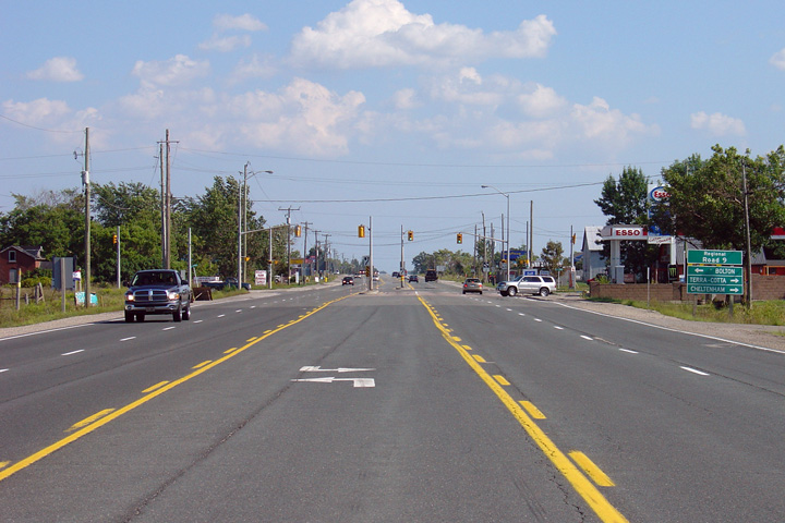
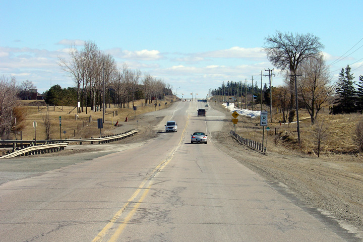
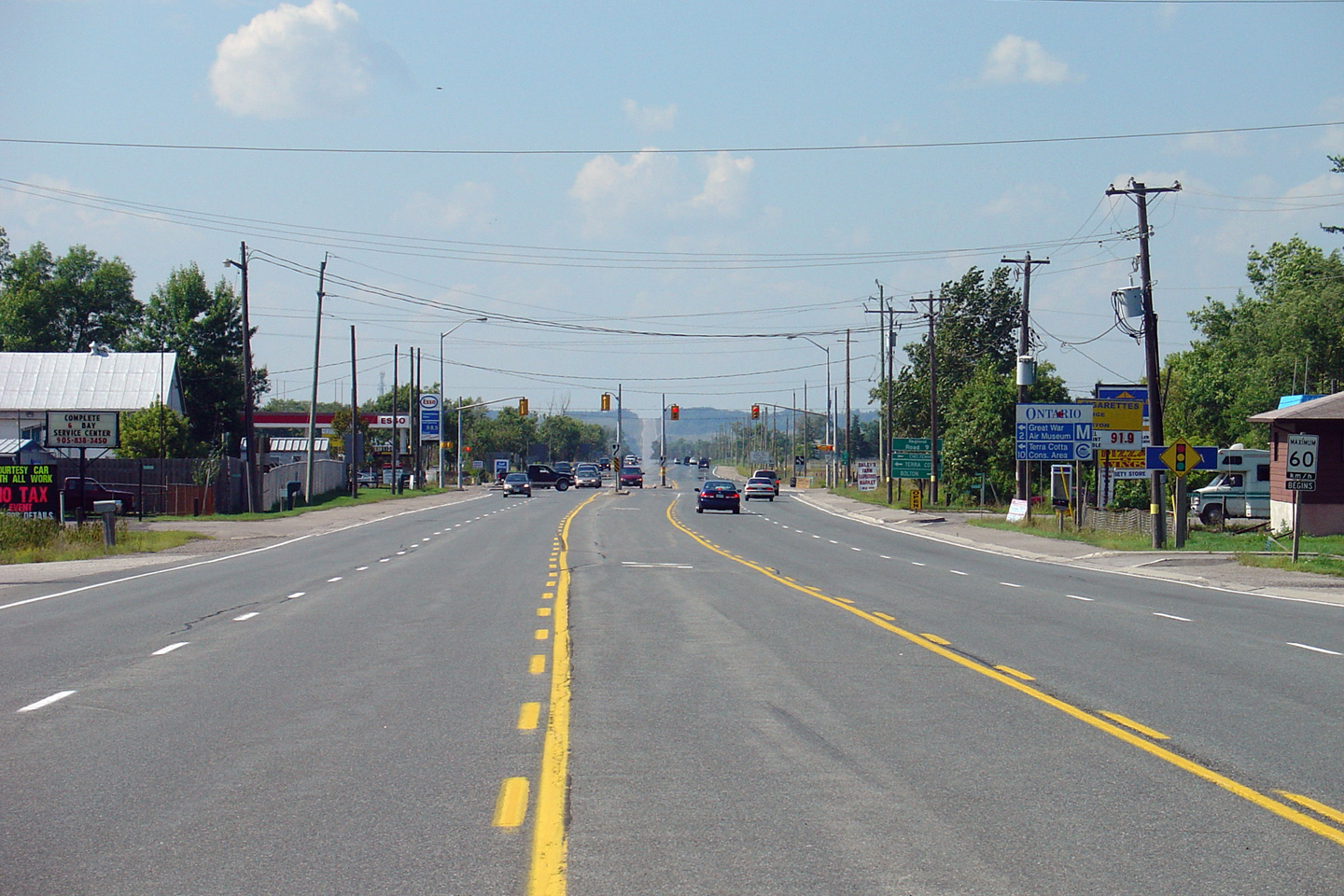
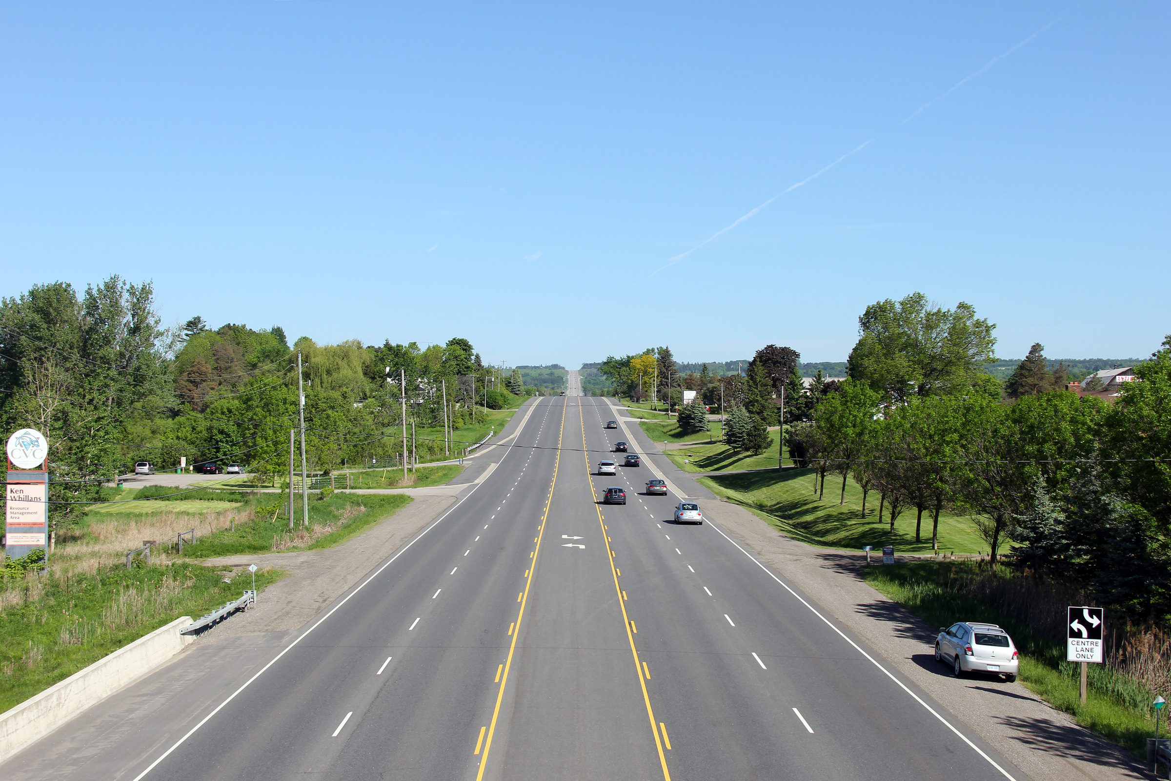
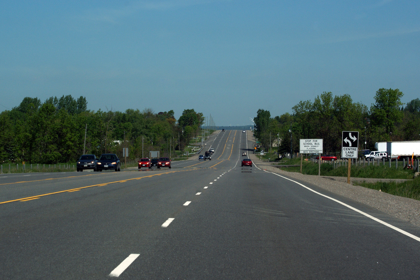
Town of Caledon Regional Municipality of Peel |
This view looks northerly along Highway 10
approaching the Peel Road 9 intersection. Photo taken: August 28th, 2005. |
 (720x480) (1440x960) |
||
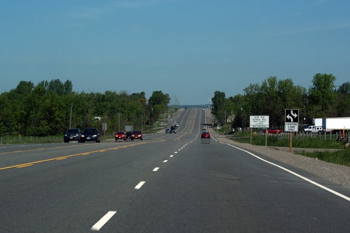
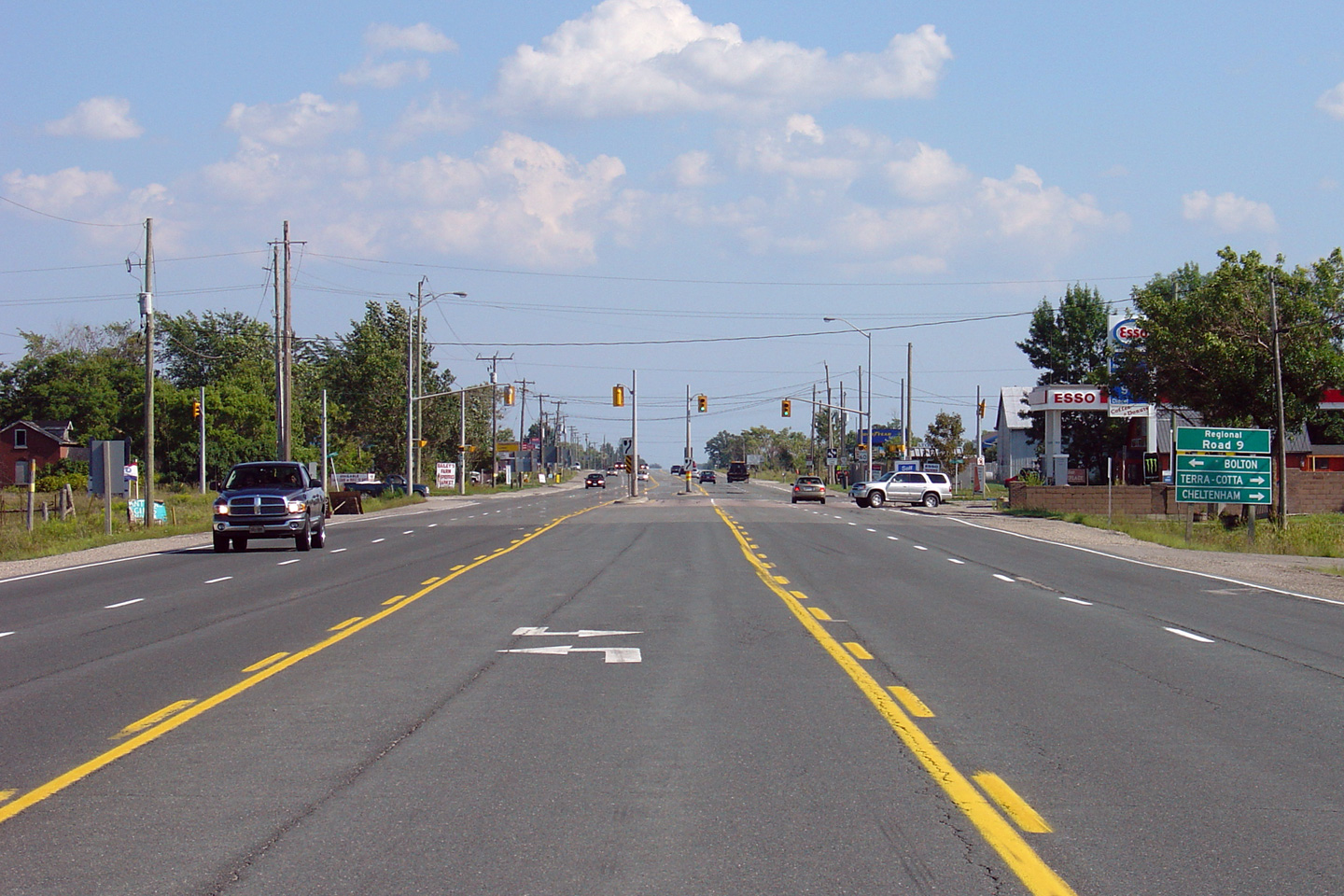
Town of Caledon Regional Municipality of Peel |
Southerly view approaching the Peel Road 9
intersection. Photo taken: August 28th, 2005. |
 (720x480) (1440x960) |
||
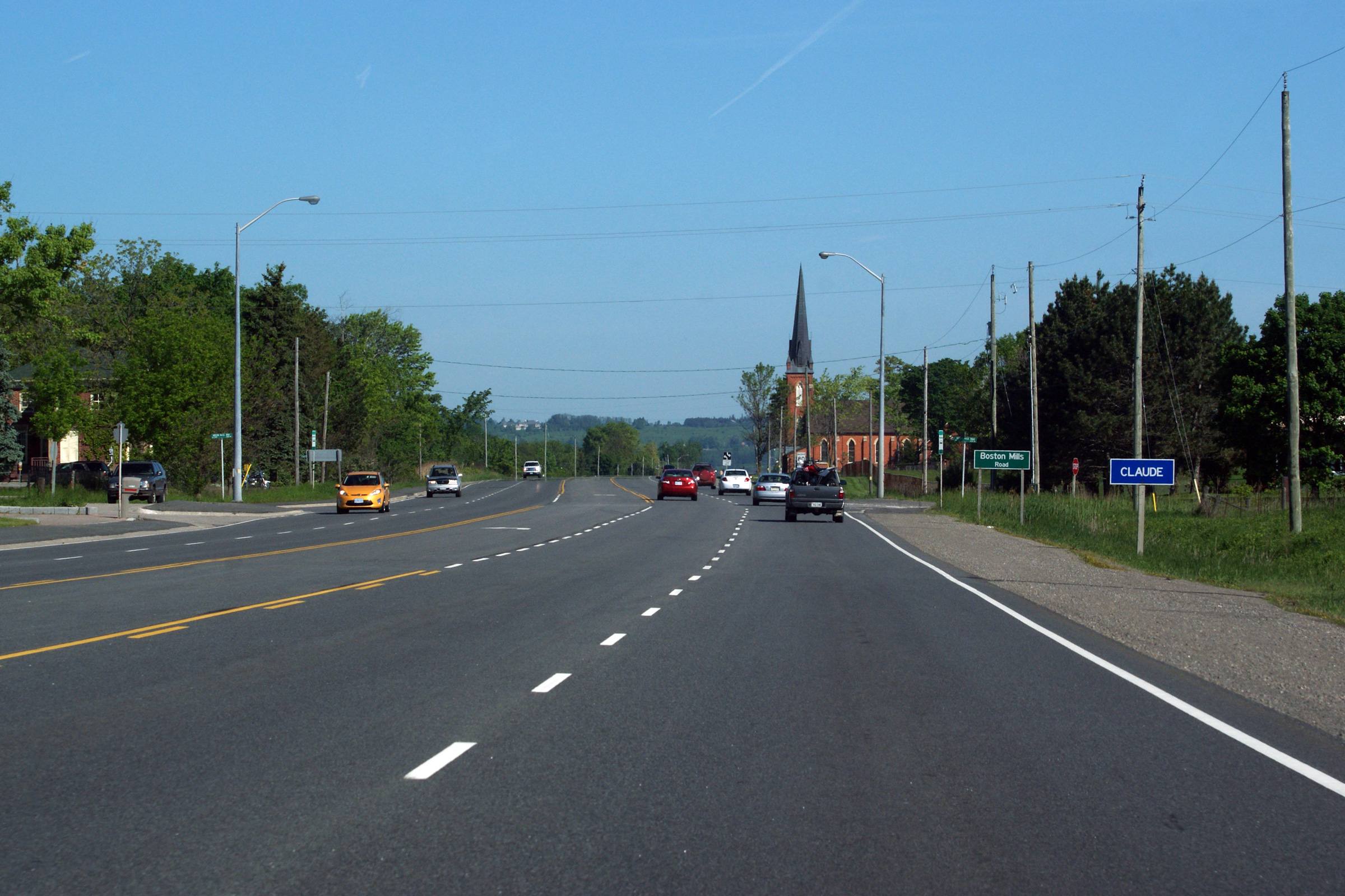
| Town of Caledon Regional Municipality of Peel |
Looking northerly as Highway 10 passes through
Claude. A slight kink in Highway 10`s otherwise straight alignment is
visible in this photo. The centre-line of Highway 10 was shifted
westerly by a few metres when Highway 10 was widened to four lanes in order
to provide suitable frontage to the pictured roadside church. Photo taken: June 5th, 2011. |
 |
||
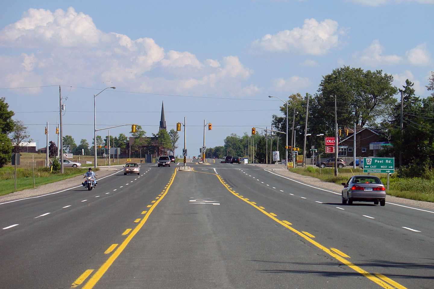
Town of Caledon Regional Municipality of Peel |
Northerly view approaching the Peel Road 12
intersection. Sligo Hill (the Niagara Escarpment) dominates the horizon. Photo taken: August 28th, 2005. |
 (720x480) (1440x960) |
||
Town of Caledon Regional Municipality of Peel |
Southerly view along Highway 10 approaching the
Peel Road 12 intersection. Notice how Peel Road 12 is indicated on the
guide signage. Unlike the signage seems to indicate, Peel Road 12 is not
known as Peel Road. In the author's opinion this is an awkward way to
sign an unnamed regional road. Photo taken: June 5th, 2011. |
 (720x480) (1440x960) |
||
| Town of Caledon Regional Municipality of Peel |
This unique and surprisingly long overpass was completed
to minimize the barrier effect large highways have on recreational
facilities. This view looks northerly, at the Trans-Canada Trail
crossing north of Claude. Photo taken: June 5th, 2011. |
 |
||
| Town of Caledon Regional Municipality of Peel |
View looking southerly from the Trans-Canada Trail
overpass. Photo taken: June 5th, 2011. |
 |
||
| Town of Caledon Regional Municipality of Peel |
Northerly view towards Sligo Hill from the Trans-Canada Trail. Photo taken: June 5th, 2011. |
 |
||
| Town of Caledon Regional Municipality of Peel |
Northerly view along Highway 10 approaching Sligo Hill. Photo taken June 5th, 2011. |
 |
||
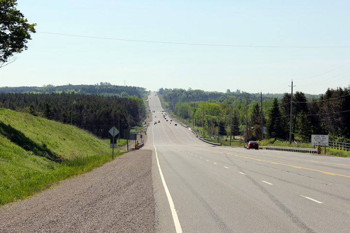
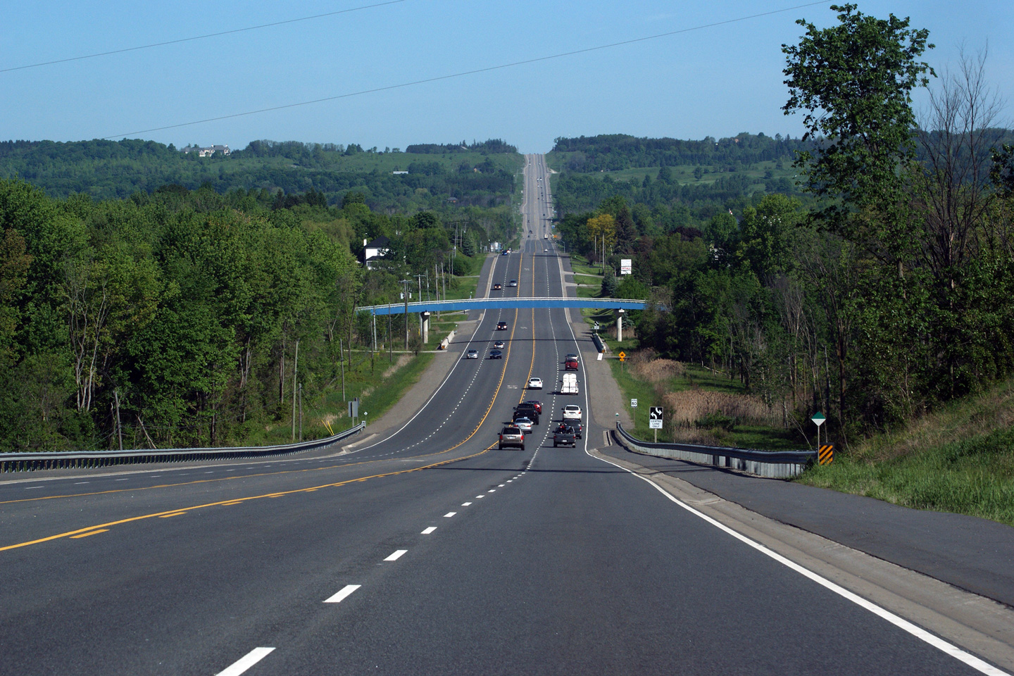
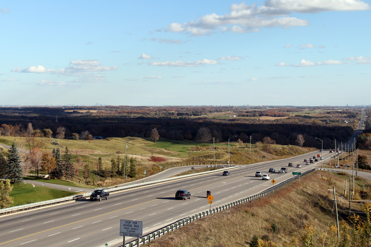
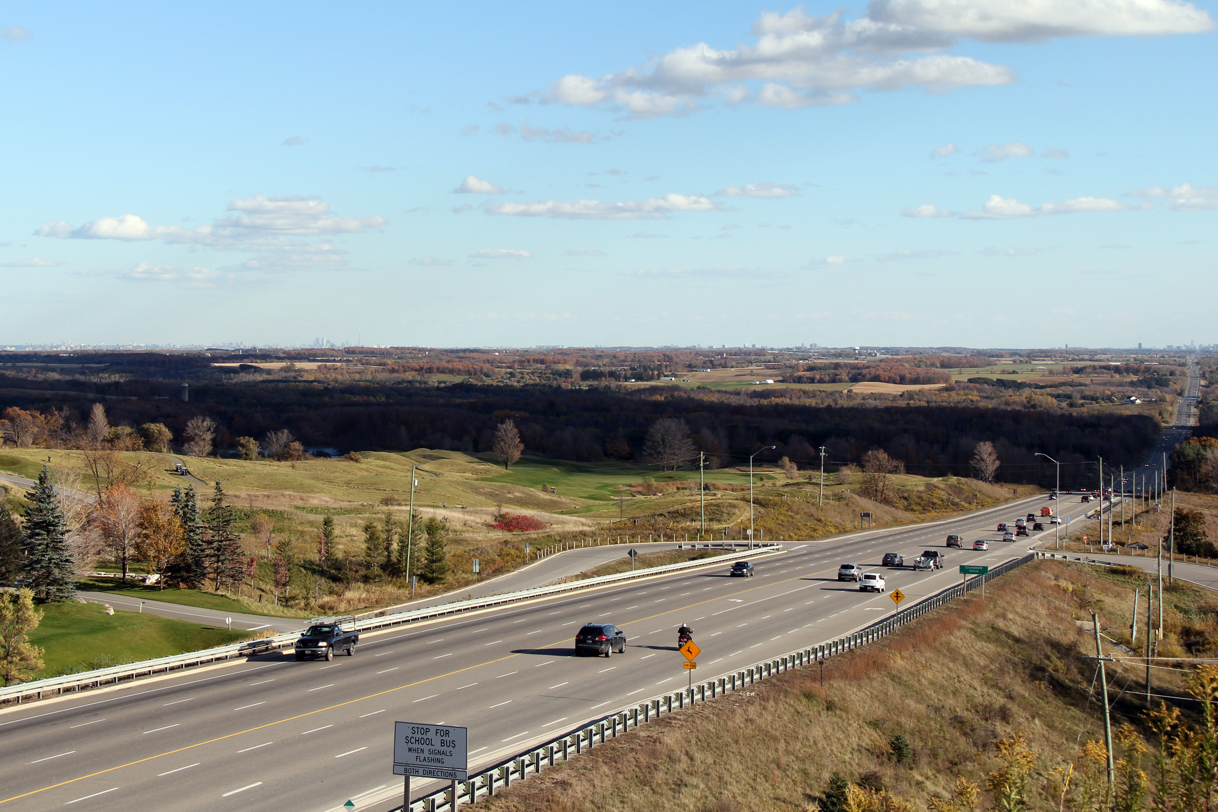
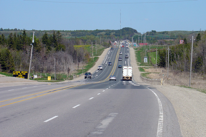
| Town of Caledon Regional Municipality of Peel |
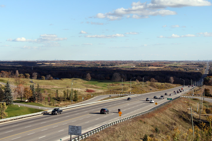
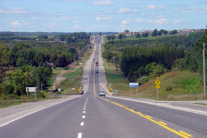
Two views looking southerly from Sligo Hill.
These photos were taken on a clear day; in the upper photo, the Toronto skyline can be seen
clearly some 50km away. Photos taken: October 17th, 2010. |
 (720x480) (1440x960) (2400x1600)
|
||
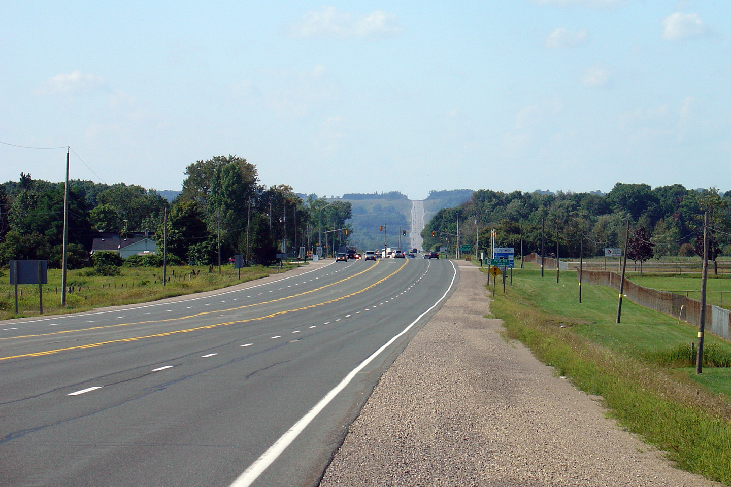
| Town of Caledon Regional Municipality of Peel |
This view looks northerly along Highway 10 as
the southbound truck climbing lane ends past the crest of Sligo Hill. Photo taken: October 17th, 2010. |
 |
||
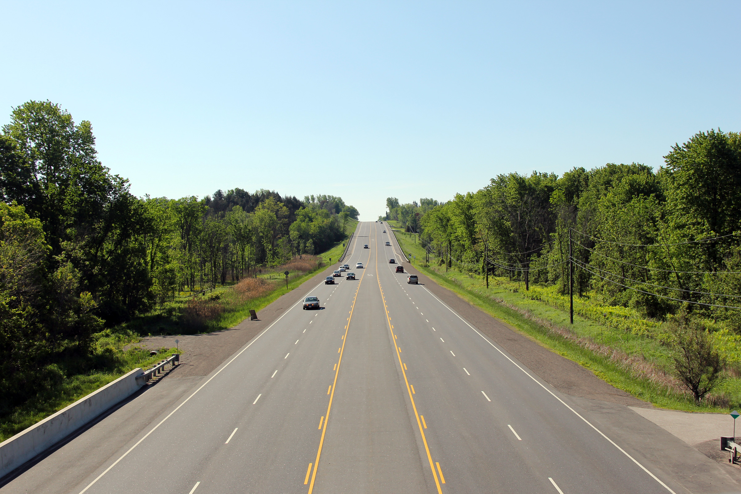
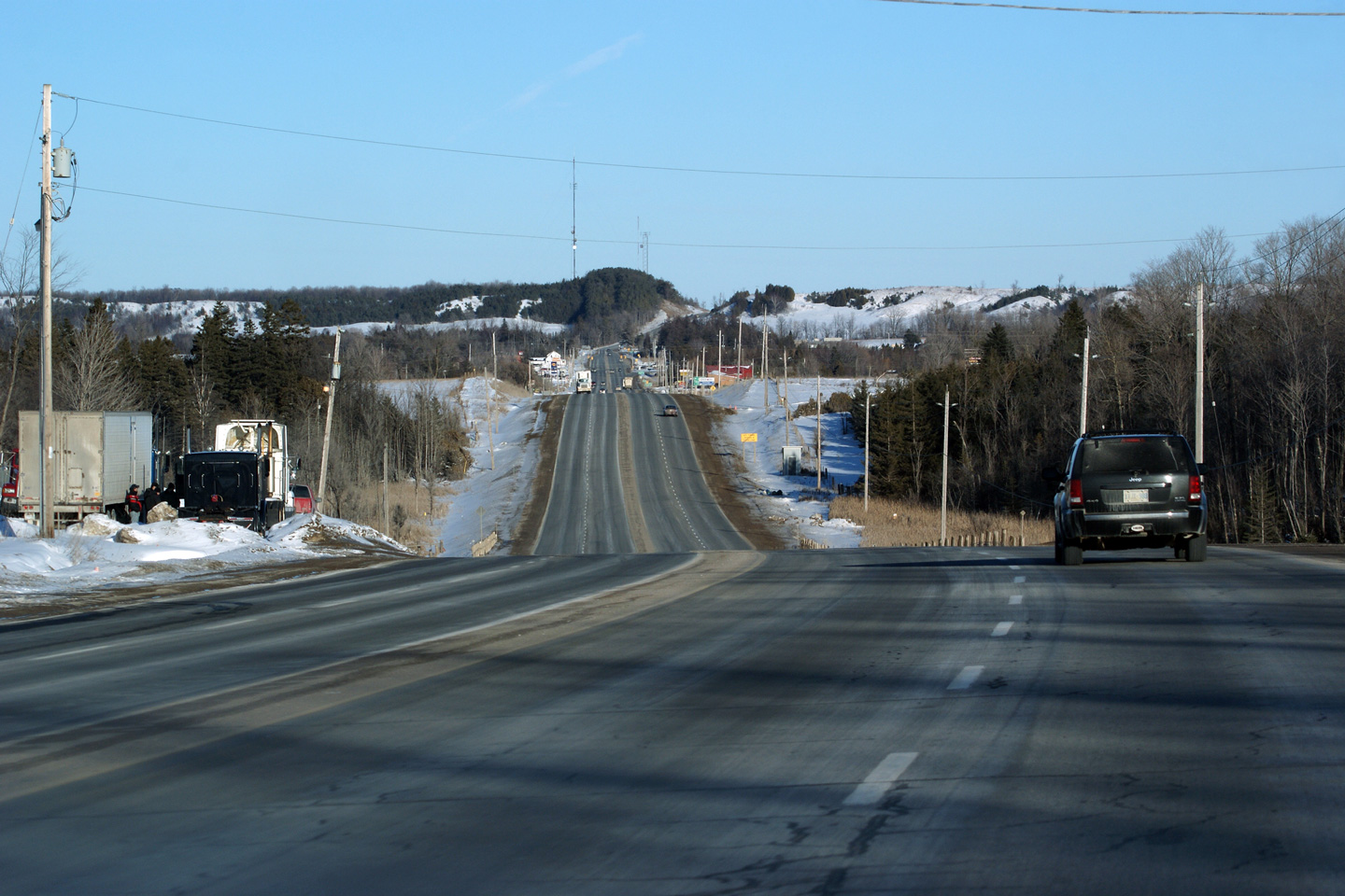
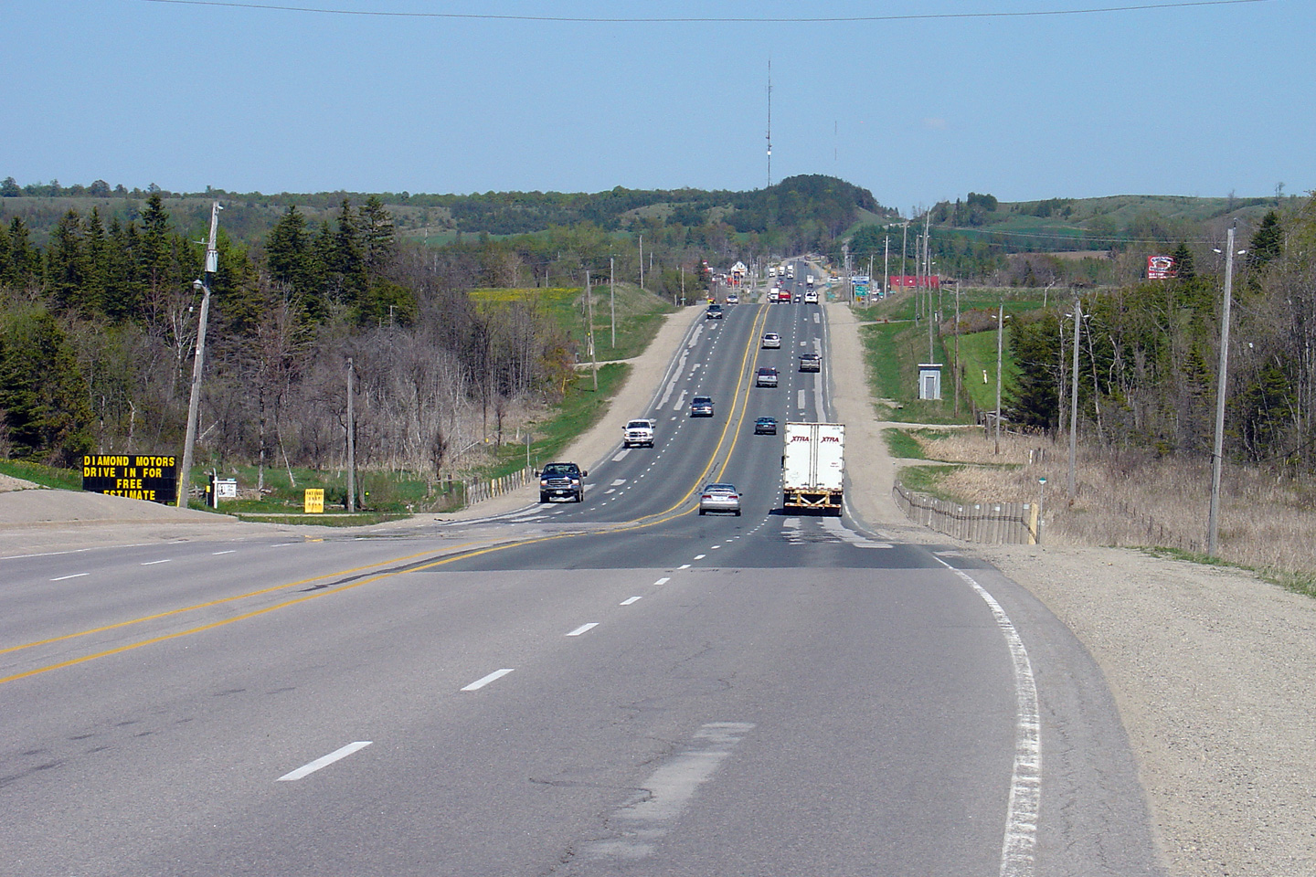
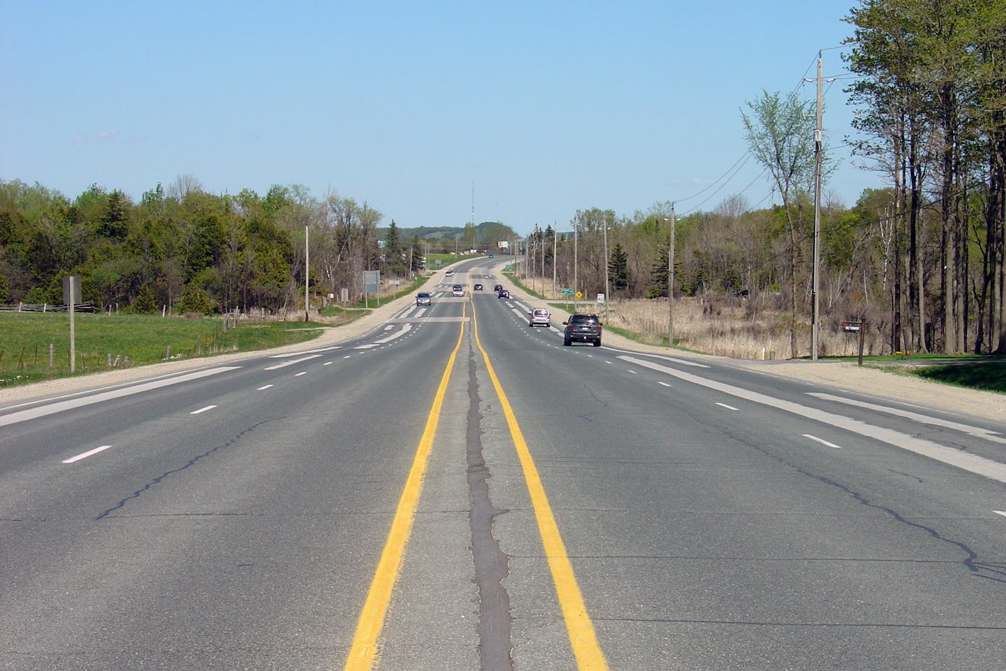
| Town of Caledon Regional Municipality of Peel |
View looking north along Highway 10 towards the
Caledon village. Two large rock quarries exist at the top of Sligo
Hill. Traffic signals were installed at their entrance in 2003 as part
of the Sligo Hill highway widening project. Photo taken: March 26th, 2006. |
 |
||
| Town of Caledon Regional Municipality of Peel |
Two views looking south from the village of
Caledon. Note the rather abrupt end to the four-lane highway
illustrated by the upper photo. Upper photo taken: March 26th, 2006. Lower photo taken: June 5th, 2011. |
 |
||
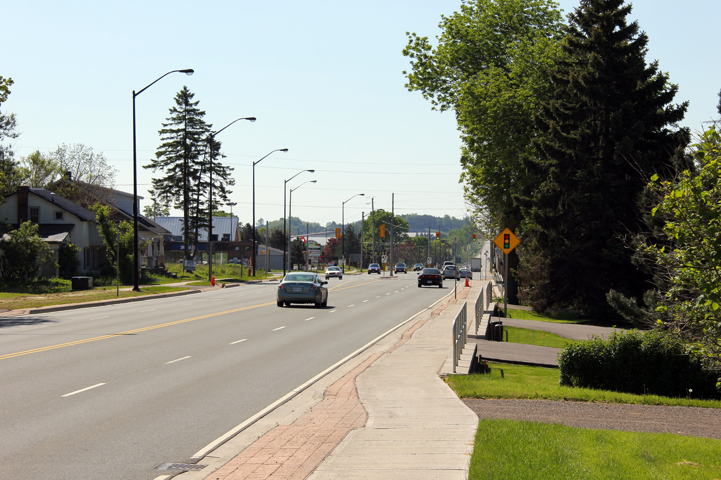
| Town of Caledon Regional Municipality of Peel |
A series of views looking northerly through the
village of Caledon. Prior to 2009 and the start of construction that
saw Highway 10 widened through the village of Caledon, Highway 10 was in
strikingly poor condition. Upper photo taken: March 26th, 2006. Lower photo taken: June 5th, 2011. |
 |
||
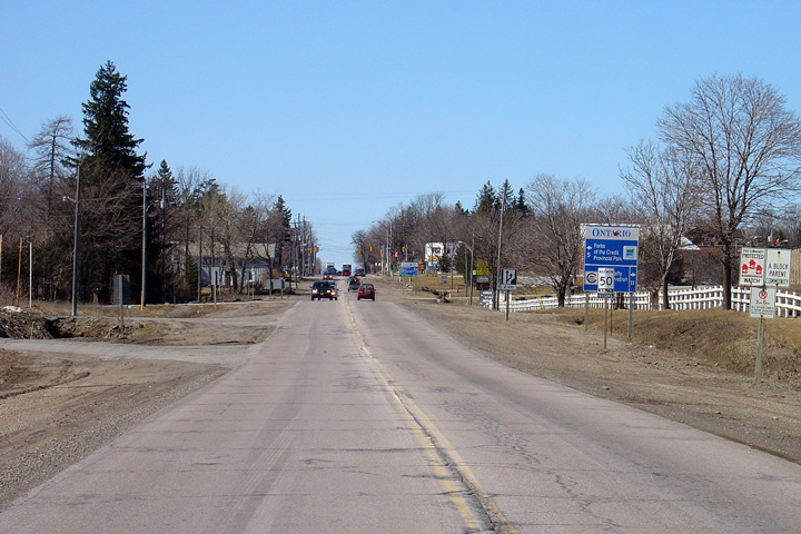
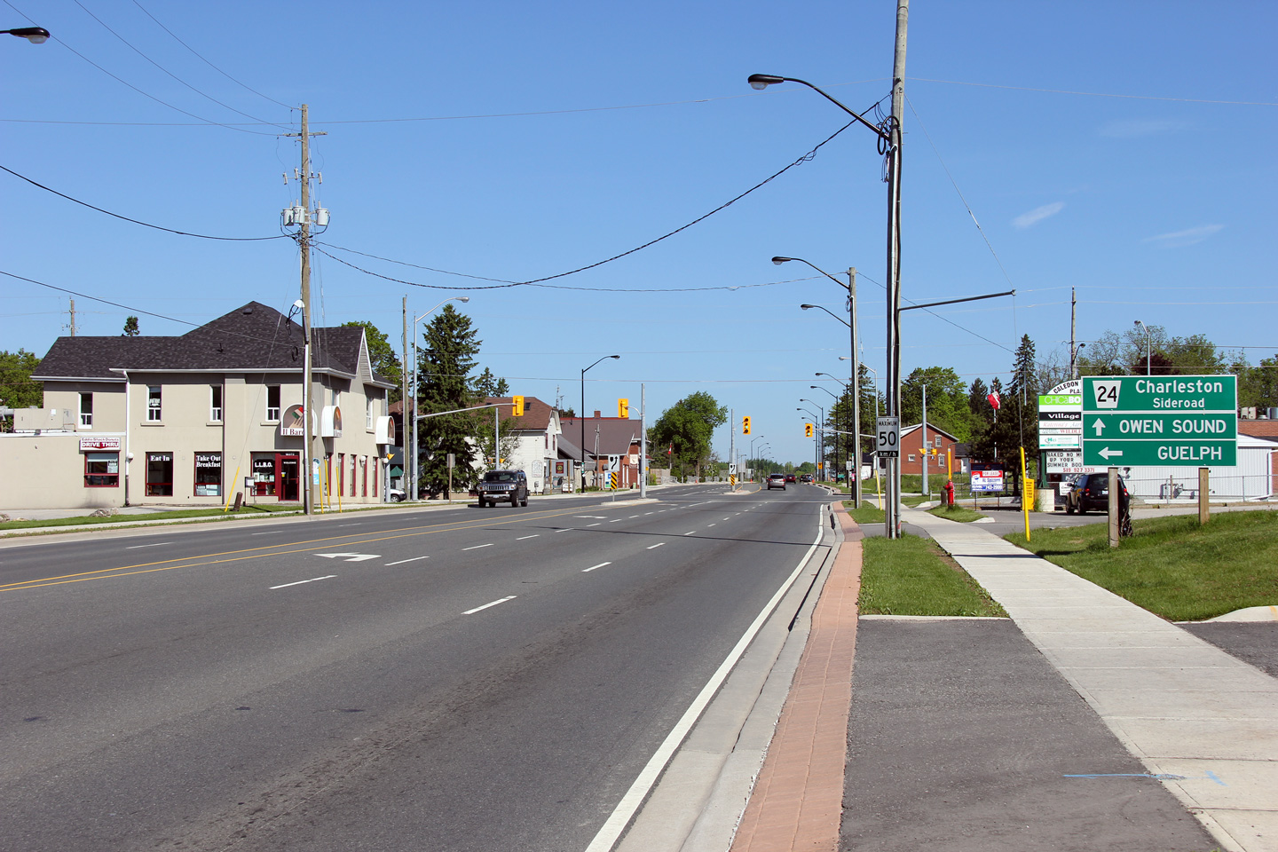
| Town of Caledon Regional Municipality of Peel |
Old erroneous signage indicating Charleston
Sideroad as Highway 24. This erroneous signage has been removed and
replaced with correct signage. Photo taken: February 26th, 2004. |
|
||
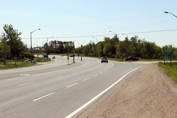
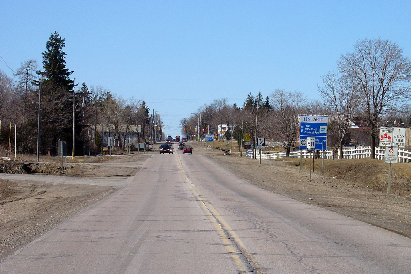
| Town of Caledon Regional Municipality of Peel |
Northerly view towards the old Highway 24
intersection. Prior to 1998, Highway 24 continued northerly from
Guelph to this intersection then piggybacked along Highway 10 to Shelburne
before heading on its own alignment bound for Collingwood. Photo taken: June 5th, 2011. |
 |
||
| South of Highway 10, the former Highway 24 heads to Guelph, Cambridge and Brantford. Click here for Highway 24-South images. | ||||
| Town of Caledon Regional Municipality of Peel |
Two views illustrating the highway widening that
took place through the village of Caledon, looking southerly towards the old
Highway 24 intersection. Upper photo taken: August 28th, 2005. Lower photo taken: June 5th, 2011. |
 |
||
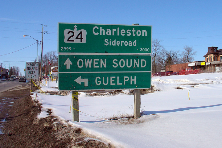
| Town of Caledon Regional Municipality of Peel |
Old erroneous signage indicating Charleston
Sideroad as County Road 124. This erroneous signage has been removed
and replaced with correct signage. Photo taken: March 26th, 2006. |
|
||
| Town of Caledon Regional Municipality of Peel |
This view looks southerly towards the Highway 24
junction in Caledon. Note the short retaining walls along the edge of the
MTO's property. Matching driveway alignment and grades can prove to be one
of the more challenging aspects of highway widening through an
urbanized area. Photo taken: June 5th, 2011. |
 |
||
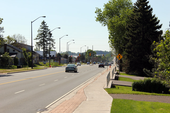
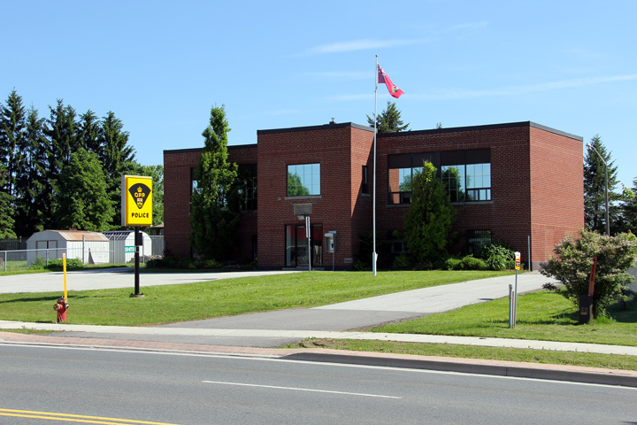
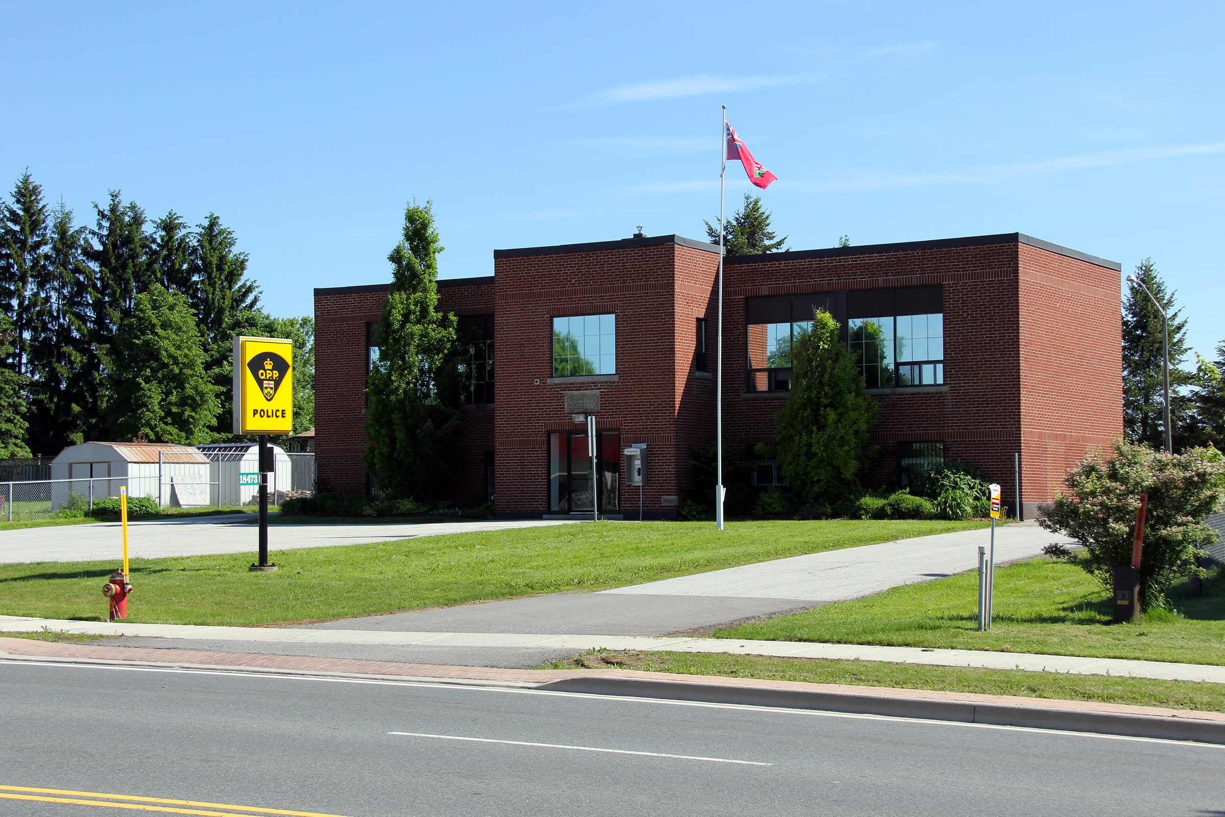
| Town of Caledon Regional Municipality of Peel |
Caledon's OPP station is a
converted historic school house. The OPP station is located on the east side
of Highway 10 just north of the Highway 24 junction. Photo taken: June 5th, 2011. |
 |
||
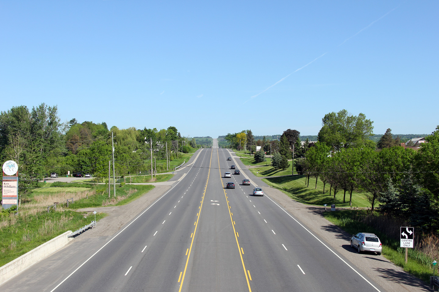
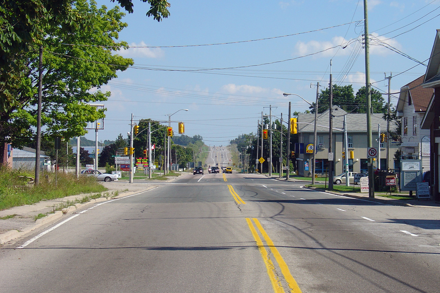
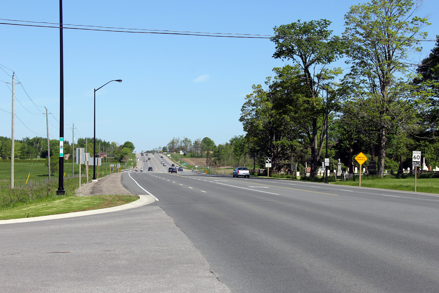
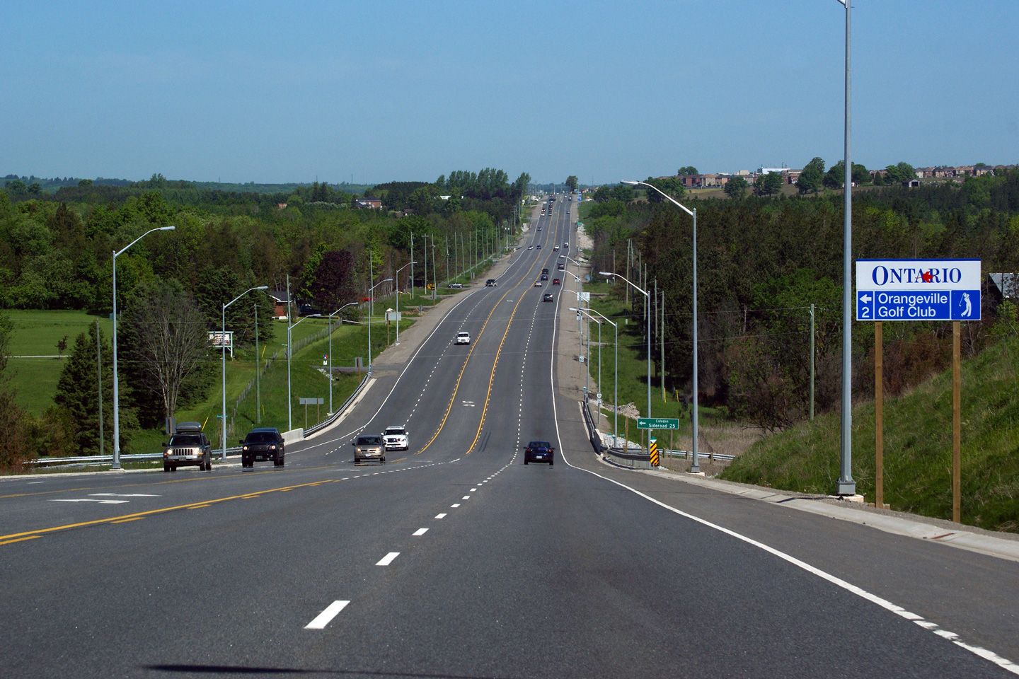
| Town of Caledon Regional Municipality of Peel |
Two views looking northerly towards Orangeville
from Caledon. Highway 10 was widened between Caledon and Orangeville
in three phases. The first phase, completed in 2008, saw Highway 10
widened between the north village limits of Caledon and the Beech Grove
Sideroad. Subsequent contracts that took place in 2009 and carrying over
into 2010 saw the remainder of the highway widened. Upper photo taken: August 28th, 2005. Lower photo taken: June 5th, 2011. |
 |
||
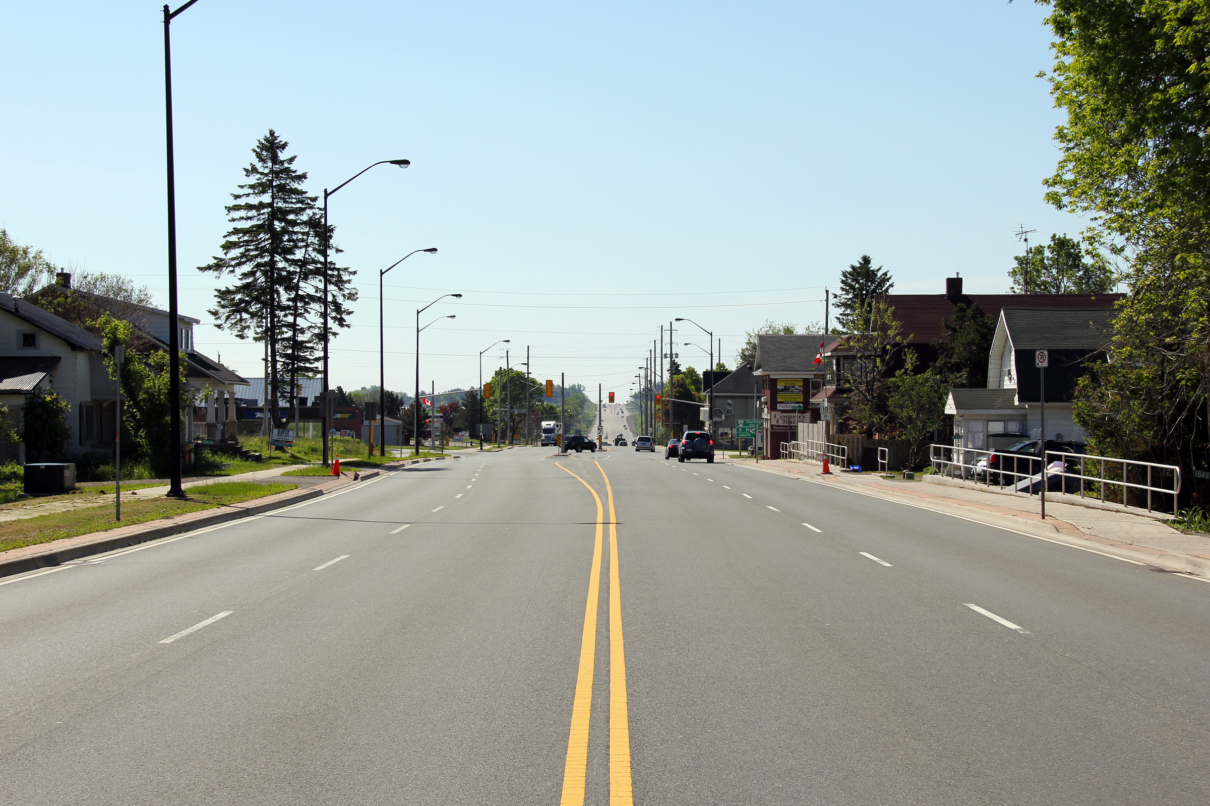
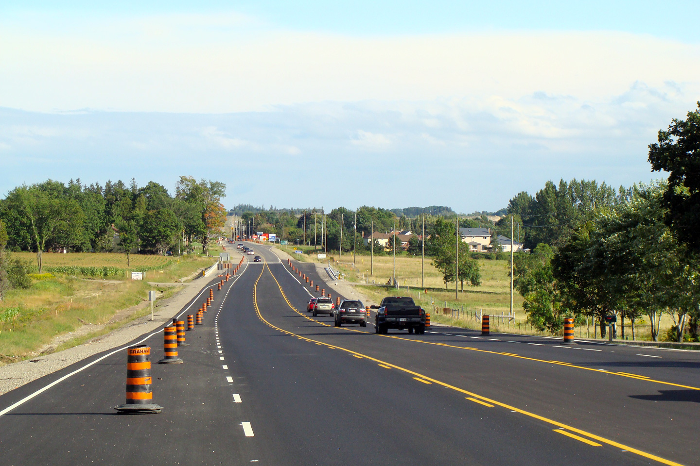
| Town of Caledon Regional Municipality of Peel |
View looking southerly towards Caledon village
along Highway 10. When this photo was taken, construction on the first
phase of highway widening between the north limits of Caledon Village and
Beech Grove Sideroad was nearing completion. Photo taken: September 6th, 2008. |
|
||
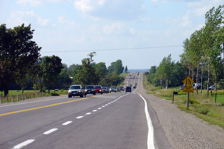
| Town of Caledon Regional Municipality of Peel |
Two northerly views along Highway 10 from just
north of the Beech Grove Sideroad intersection. Observe in the upper
photo how quickly traffic has begun to bunch up behind the lead vehicle in
the southbound lane. Considering the close proximity of the close
of the southbound
passing lane, the upper photo shows in obvious detail the congestion problem
that existed along Highway 10 before the highway was widened. Upper photo taken: August 28th, 2005. Lower photo taken: June 5th, 2011. |
 |
||
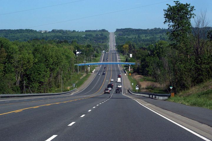
| Town of Caledon Regional Municipality of Peel |
Two views looking northerly into Orangeville
from the Highpoint Road intersection. Upper photo taken: August 28th, 2005. Lower photo taken: June 5th, 2011. |
 |
||
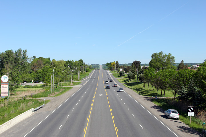
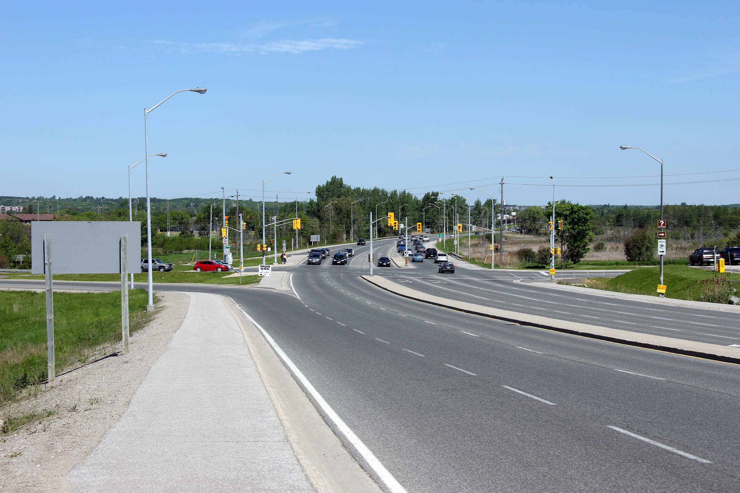
| Town of Caledon Regional Municipality of Peel |
Looking south from just past the Orangeville
By-pass intersection. This stretch of Highway 10 was widened to a five-lane
cross-section in 2008-2009. Upper photo taken: September 9th, 2005. Lower photo taken: June 5th, 2011. |
 |
||
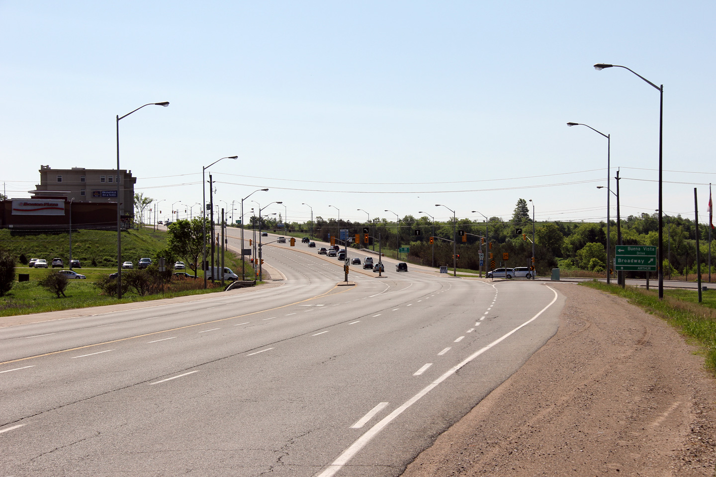
| Town of Caledon Regional Municipality of Peel |
Looking north towards the intersection with the
Orangeville By-pass. The Orangeville By-pass opened to traffic on August
4th, 2005. It serves as a by-pass to Broadway in Orangeville, Orangeville's busy main
street. Photo taken: September 9th, 2005. |
 (720x480) (1440x960) |
||
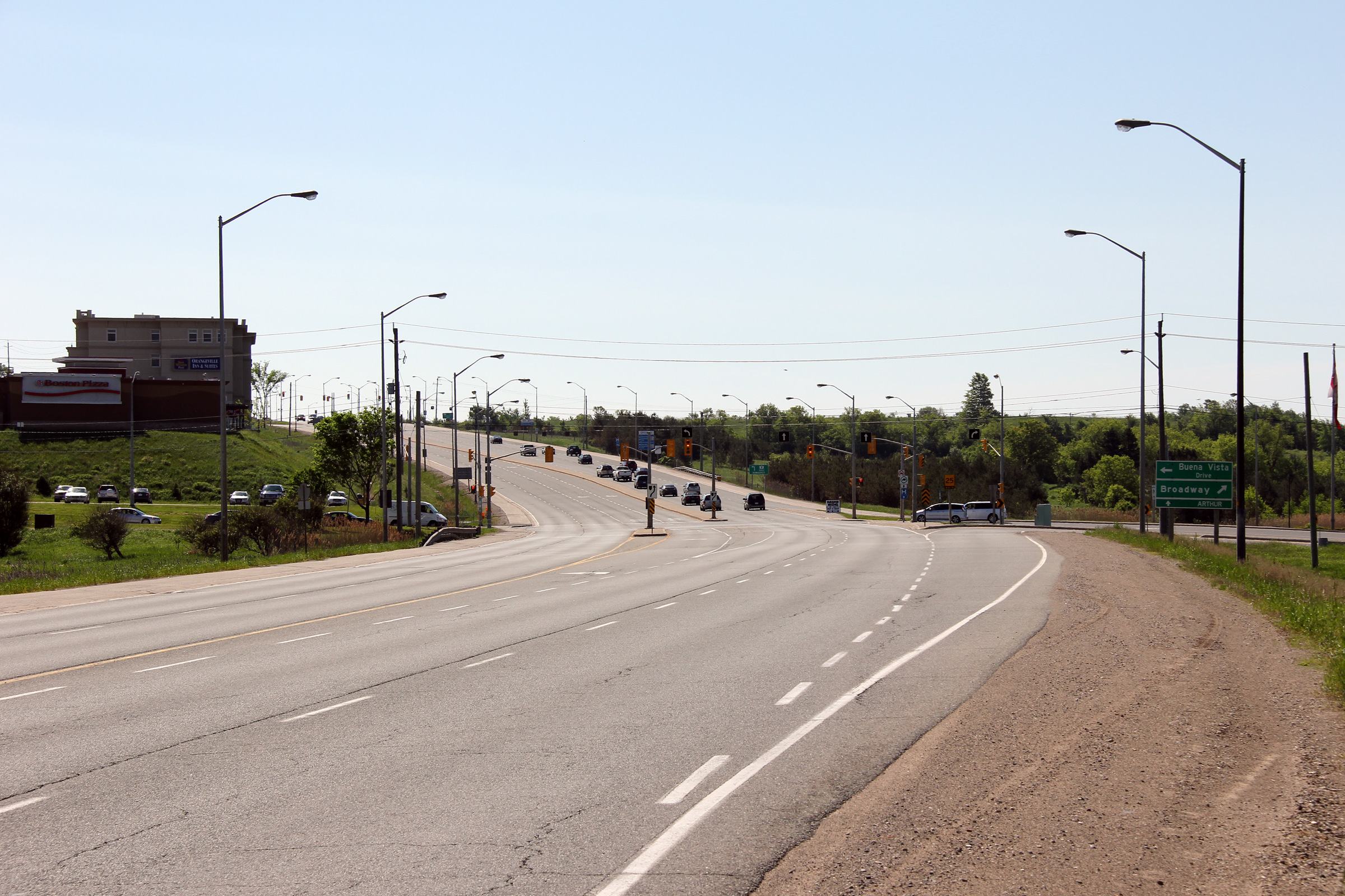
| Town of Orangeville | Looking south towards the intersection with the
Orangeville By-pass. The Orangeville By-pass has been designated as
part of Dufferin Road 109, matching the designation Dufferin has given its
assumed sections of the former Highway 9.
Interestingly, all of the new by-pass is being maintained by the county of
Dufferin, despite the fact that much of the new road actually lies within the
Region of Peel. Photo taken: September 9th, 2005. |
 (720x480) (1440x960) |
||
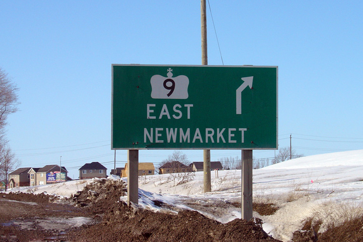
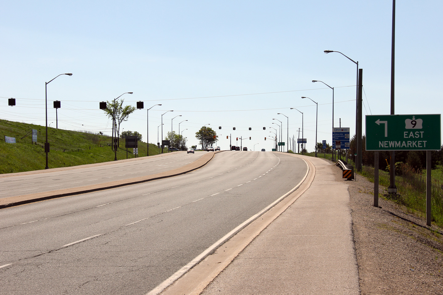
| Town of Orangeville | Directional signage for Highway 9 towards
Newmarket. Photo taken: February 26th, 2004. |
|||
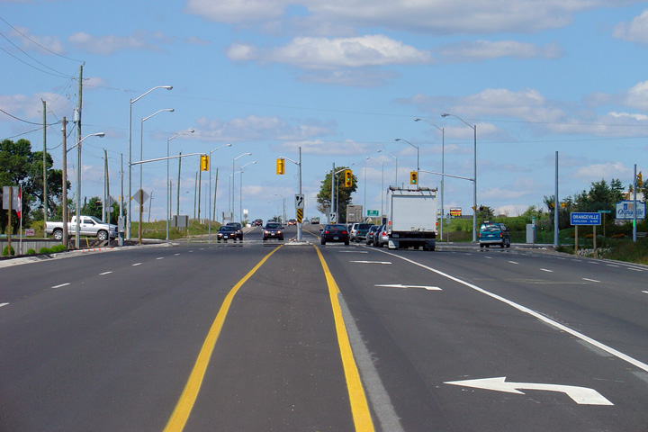
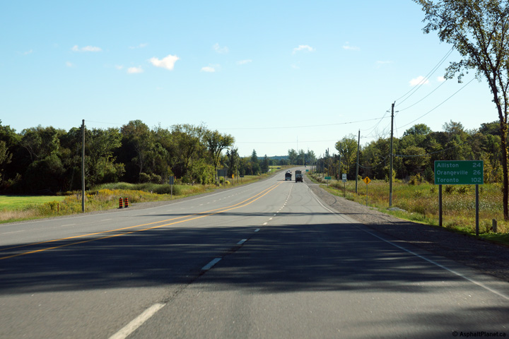
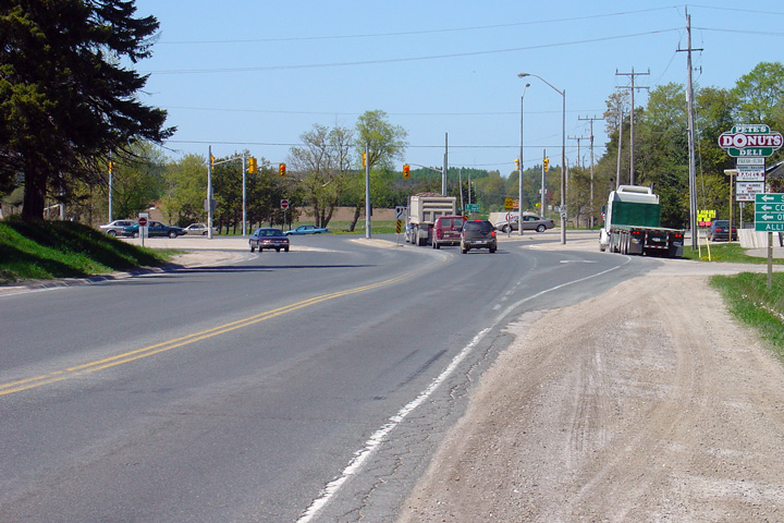
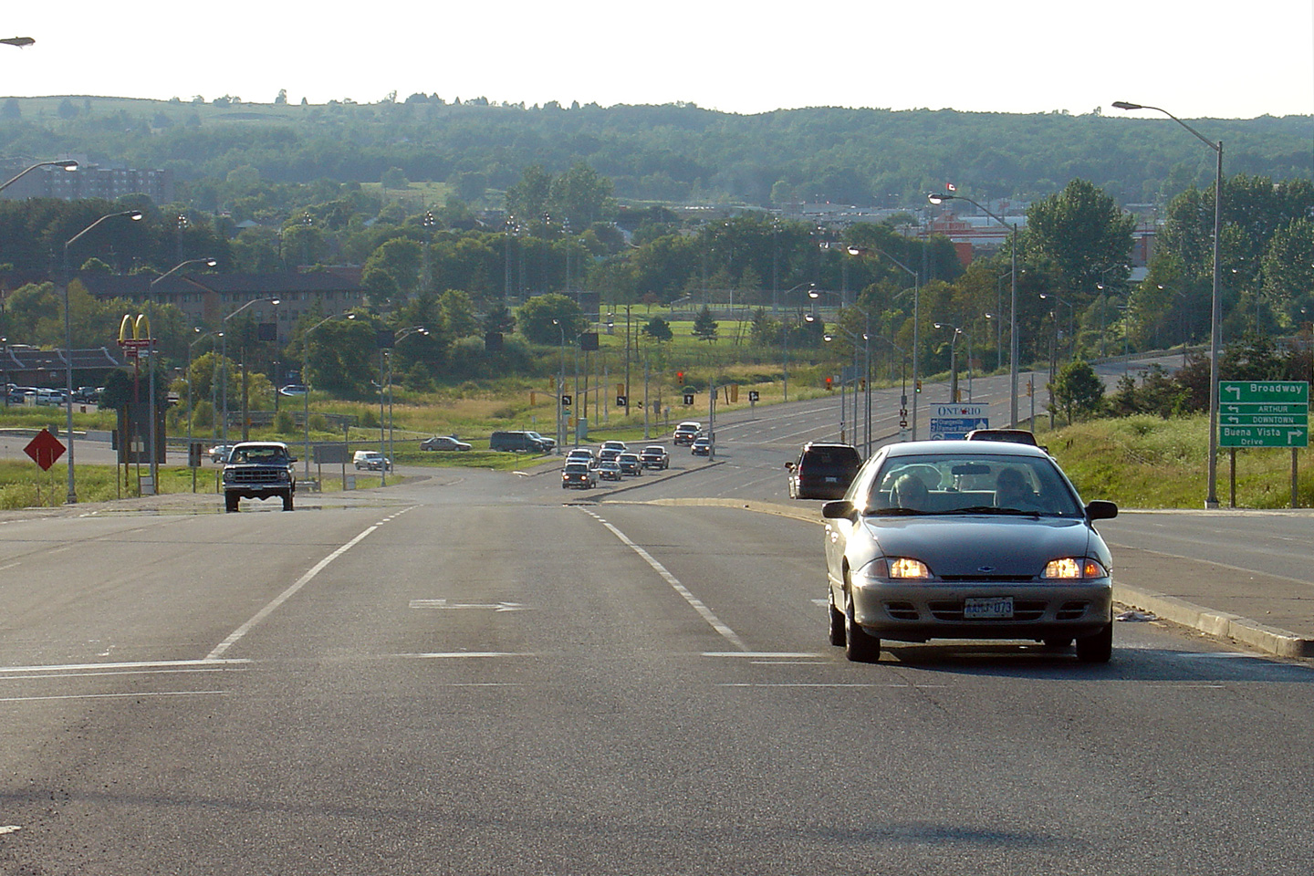
| Town of Orangeville | Highway 10/24 looking north from the southern
intersection of Highway 9.
Highway 9 was multiplexed with Highway 10
prior to downloading for roughly 500 meters. An enormous amount of
traffic from Highway 9 enters and departs Highway 10 within a very short
distance. The section in this photo represents the busiest
non-downloaded section of Highway 10. Photo taken: August 1st, 2004. |
|||
| Highway 9 leads east from Orangeville to Newmarket. Click here for Highway 9 images. | ||||
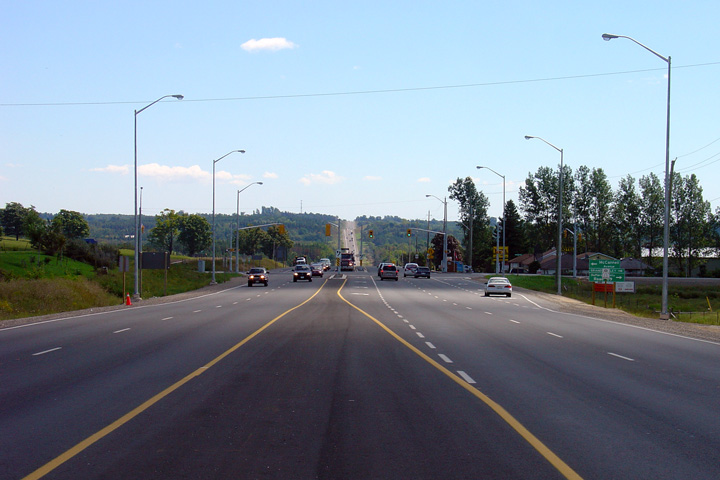
| Town of Orangeville | View looking southerly
towards the Highway 9 intersection. Highway 10 has an impressive
cross-section immediately south of Orangeville. Photo taken: June 5th, 2011. |
 |
||
| Town of Orangeville | Northerly view towards
Broadway. Broadway was designated as Highway 9 before the mass-highway
download. Photo taken: June 5th, 2011. |
 |
||
| Town of Orangeville | Broadway would have been an
excellent candidate for a Highway 9B designation had Highway 9 remained a
provincial highway between Harriston and Orangeville. Photo taken: June 5th, 2011. |
 |
||
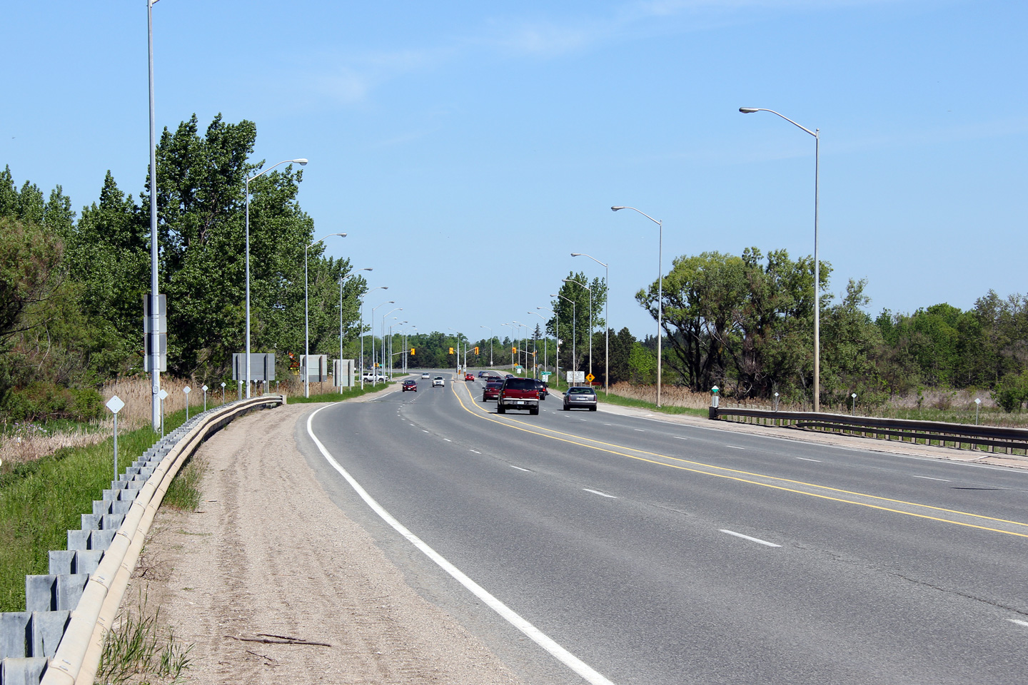
| Town of Orangeville | This is the first of several
traffic lights as the highway skirts along the southwestern shore of Island
Lake. Photo taken: June 5th, 2011. |
 |
||
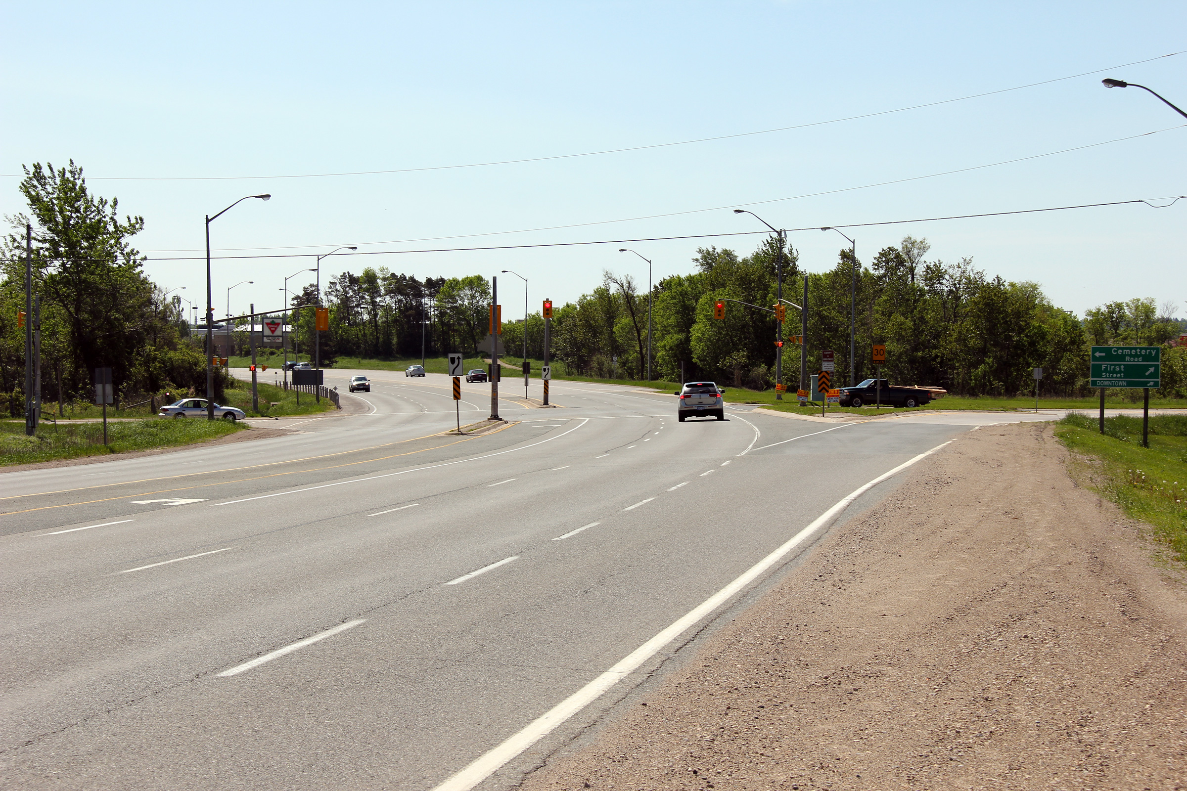
| Town of Orangeville | View looking northerly along Highway 10
approaching the First Street intersection. Photo taken: June 5th, 2011. |
 |
||
| Town of Orangeville | Southerly view looking towards the First Street
intersection. Prior to the completion of the Orangeville By-pass (the
section of Highway 10 running along the southwestern shore of Island Lake),
Highway 10 entered Downtown Orangeville following First Street and
Broadway. Photo taken: June 5th, 2011. |
 |
||
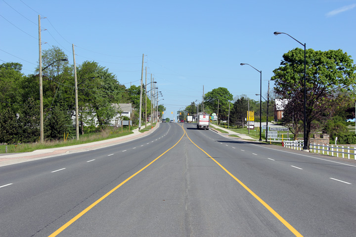
| Town of Mono County of Dufferin |
This view looks northerly from north of the
First Street intersection at the North-end of Orangeville. Photo taken: June 5th, 2011. |
 |
||
| Town of Mono County of Dufferin |
Looking southerly towards Orangeville from just
south of Mono 10th Sideroad. Photo taken: August 28th, 2005. |
 (720x480) (1440x960) |
||
| Town of Mono County of Dufferin |
Highway 10 looking north from just north of
Dufferin Road 8 at Camilla. As is evident from the photo, Highway 10
narrows from a 4.5-lane highway back to a 2-lane highway just north of
Camilla. Camilla is located roughly 8km north of Highway 9 in
Orangeville. Photo taken: August 28th, 2005. |
 (720x480) (1440x960) |
||
| Town of Mono County of Dufferin |
Highway 10 looking north towards the
intersection with Mono 25th Sideroad at Eba. At Eba, a short 1.5km
multilane section of Highway 10 commences once again. These dual passing
lanes appear to have been designed to be incorporated into a future
extension the 4.5 lane highway. Photo taken: August 28th, 2005. |
 (720x480) (1440x960) |
||
| Town of Mono County of Dufferin |
Looking south towards the same intersection as
the previous photo. This shows the southern end of the short
multilane section at Eba. Photo taken: August 28th, 2005. |
 (720x480) (1440x960) |
||
| Town of Mono County of Dufferin |
Looking south along Highway 10 towards Eba.
This photo shows the northern beginning of the southbound passing lane at Eba. The southbound passing lane is about 500m longer then its
northbound counterpart. Photo taken: August 28th, 2005. |
 (720x480) (1440x960) |
||
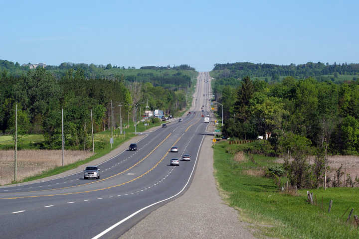
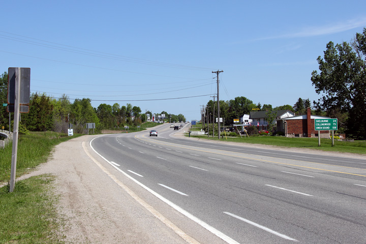
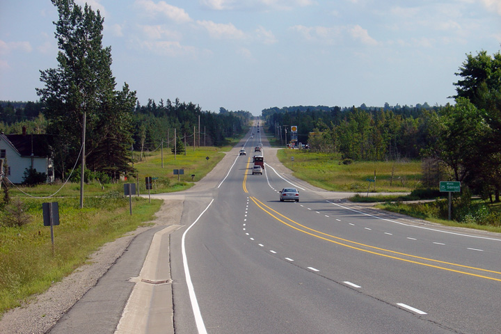
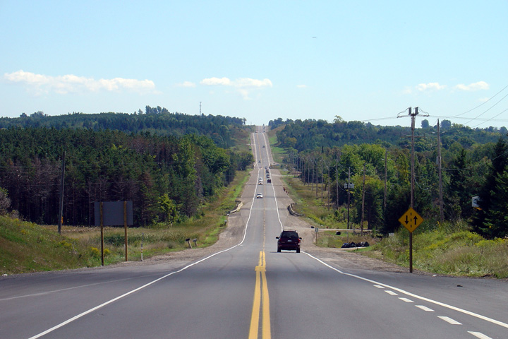
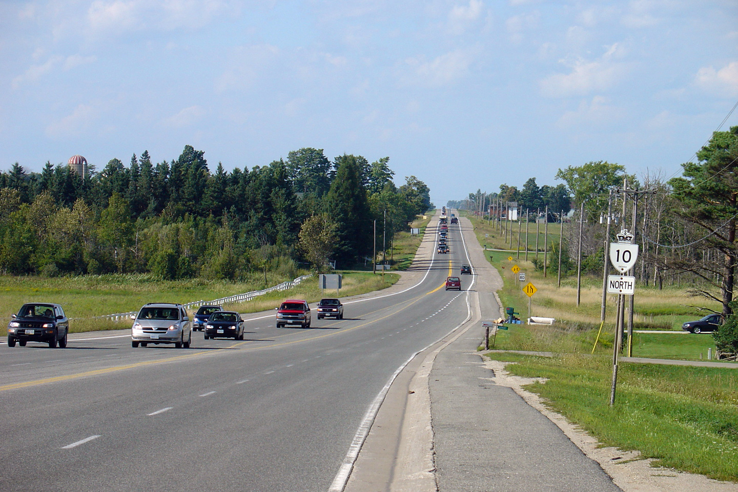
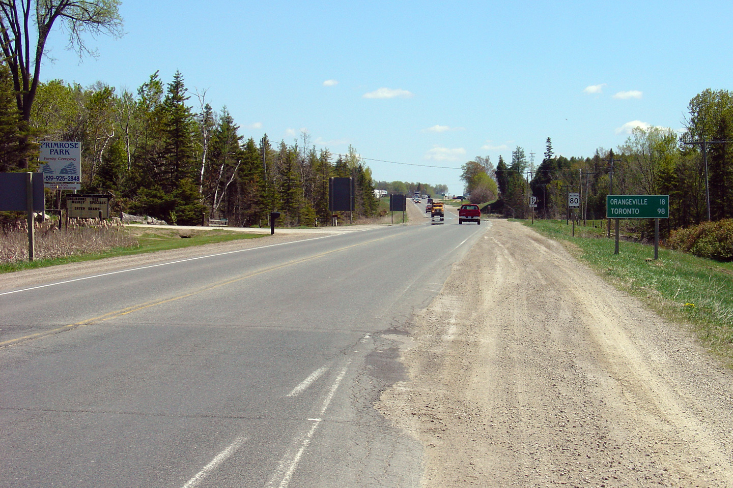
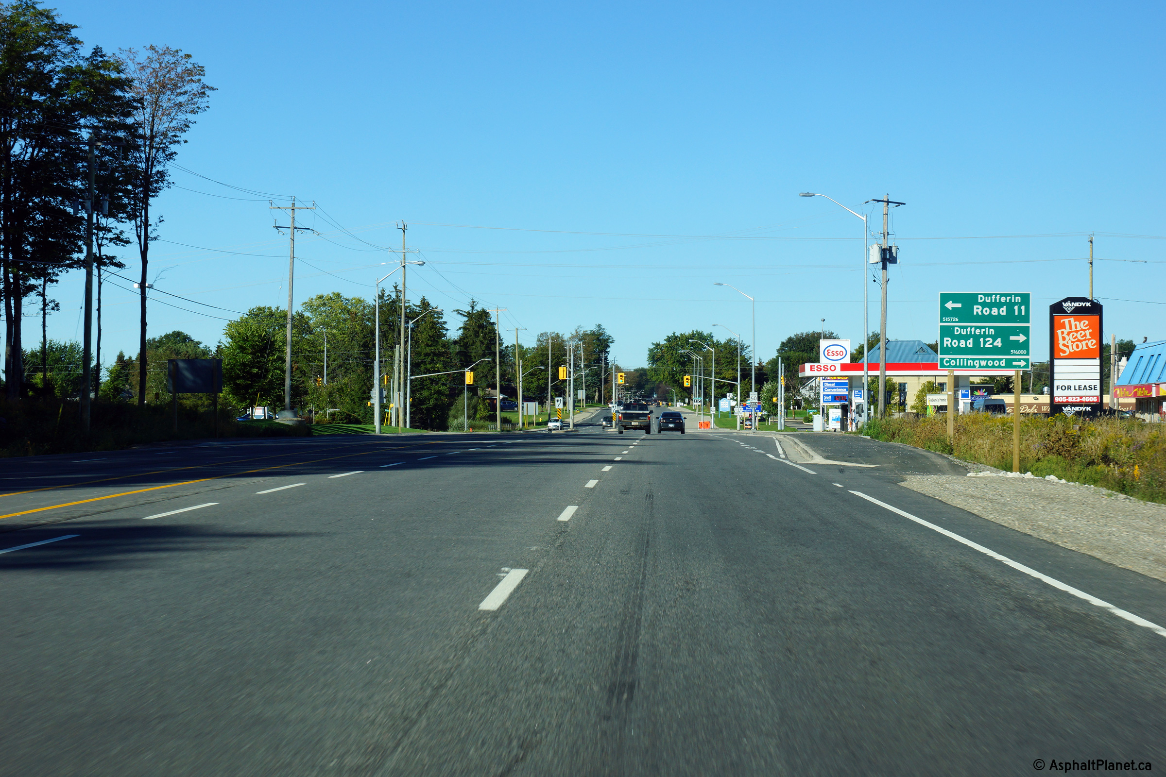
| Town of Mono County of Dufferin |
Highway 10 looking south towards Orangeville
from the Highway 89 junction. Aside from the short multilane section
at Eba, this is a very typical looking view of Highway 10 between Primrose
and Camilla. Upper photo taken: May 25th, 2005. Lower photo taken: August 24th, 2013. |
 (720x480) (1440x960) (2400x1600) |
||
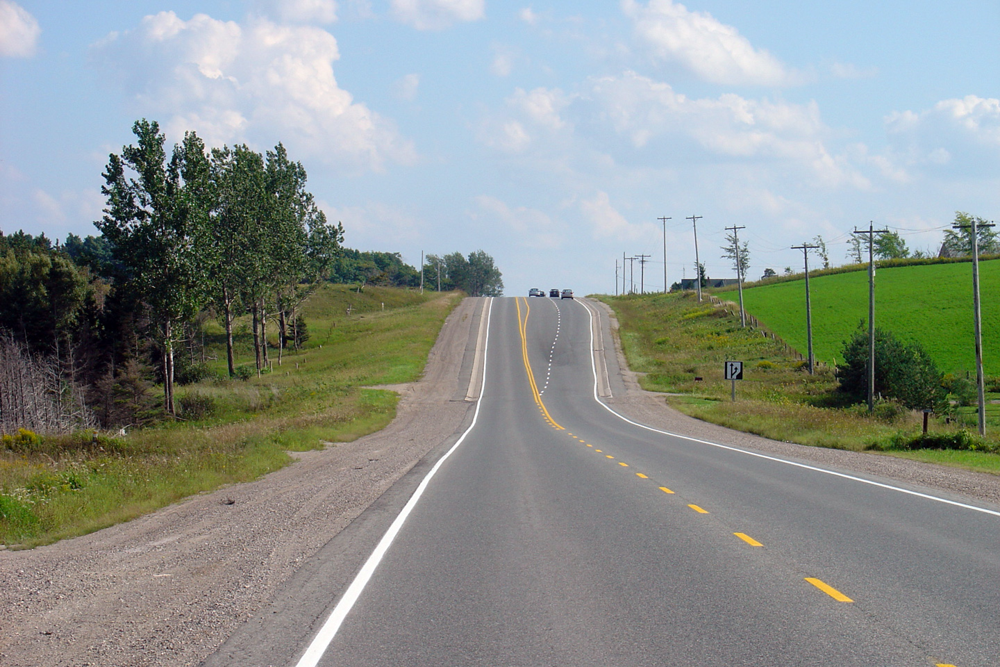
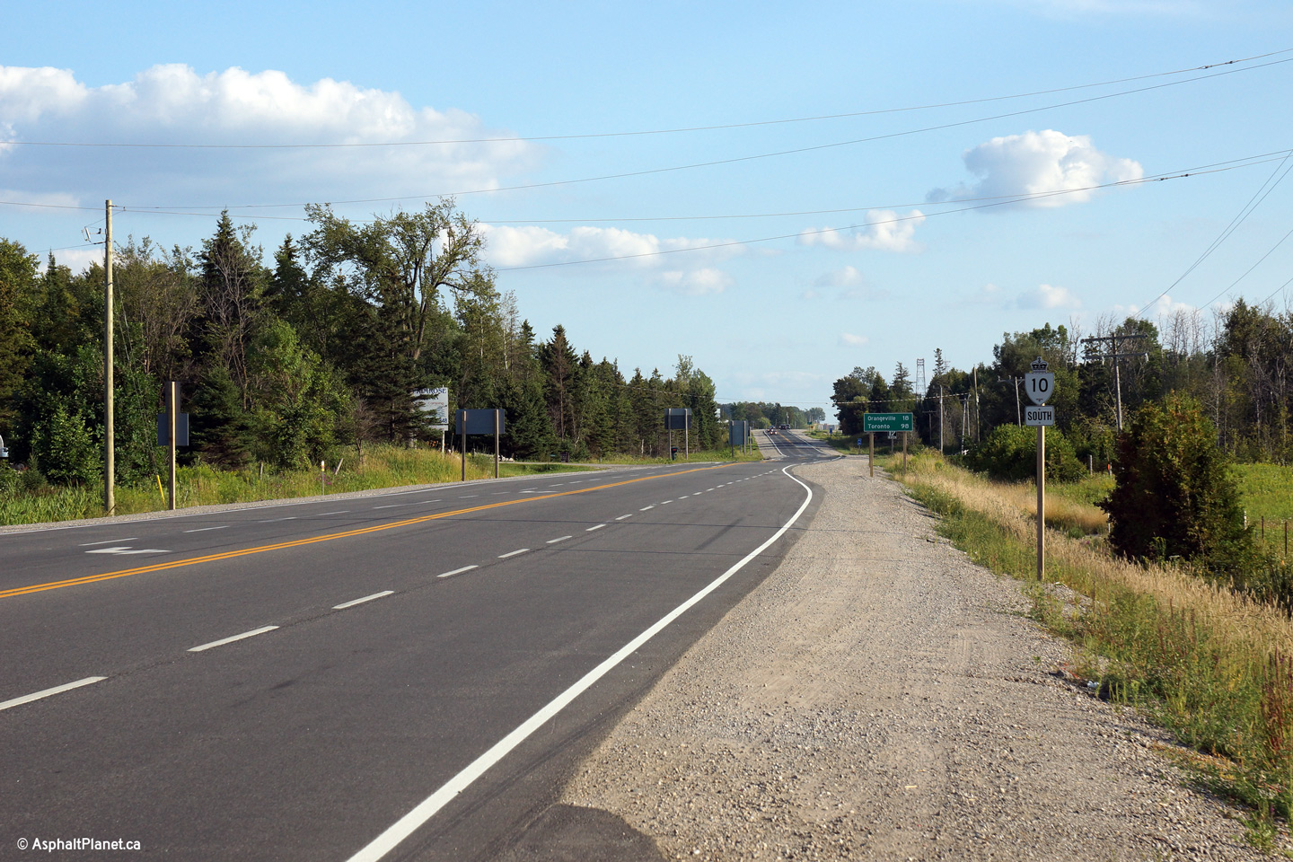
| Mono - Mulmer Boundary County of Dufferin |
Highway 10 at the eastern
Highway 89 junction.
Before downloading in 1998, this intersection marked the start of one of Ontario's few three-plexes.
Highway 10/24/89
went from Primrose a few kilometers westerly to Shelburne. Photo taken: February 26th, 2004. |
|||
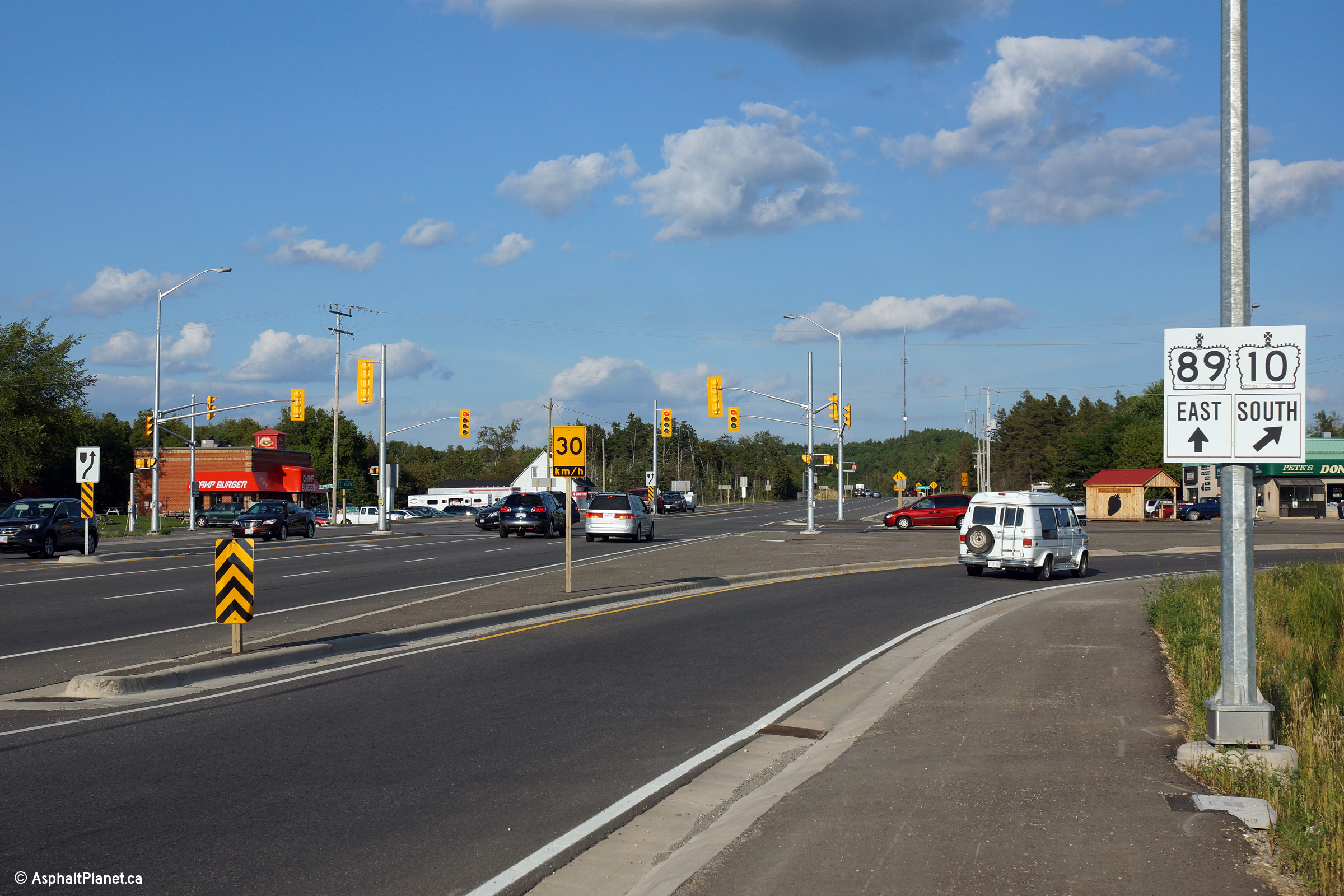
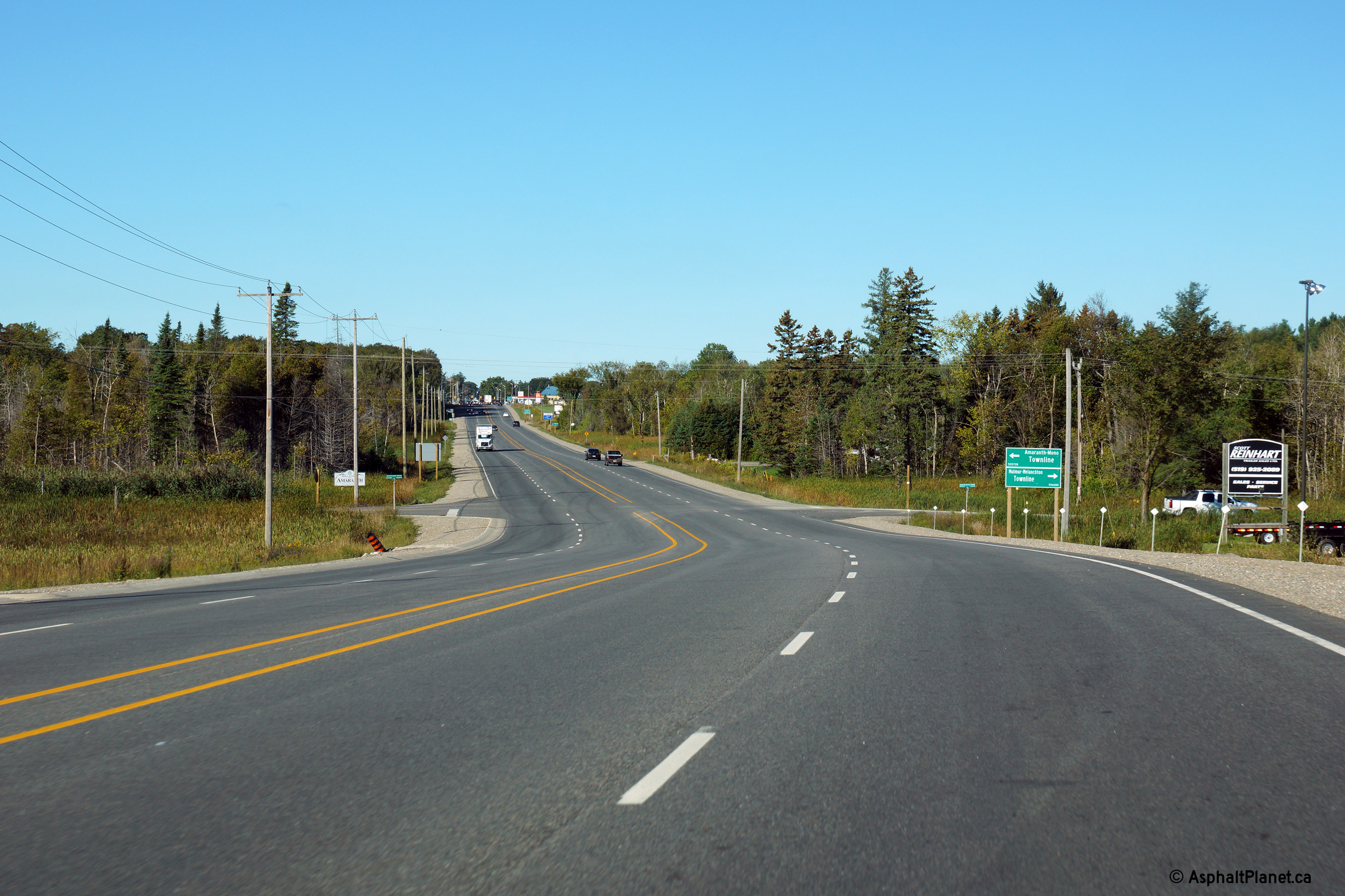
| Mono - Mulmer Boundary County of Dufferin |
Highway 10 approaching the eastern Highway 89
junction at Primrose. At this junction, traffic following Highway 10
to the north must turn left. Upper photo taken: May 25th, 2005. Lower photos taken: August 24th, 2013. |
 (720x480) (1440x960) (2400x1600) 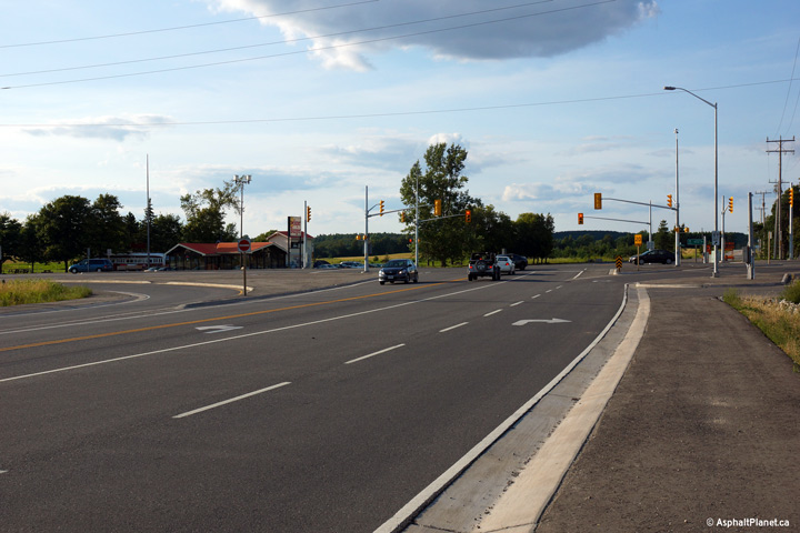 (720x480) (1440x960) (2400x1600) |
||
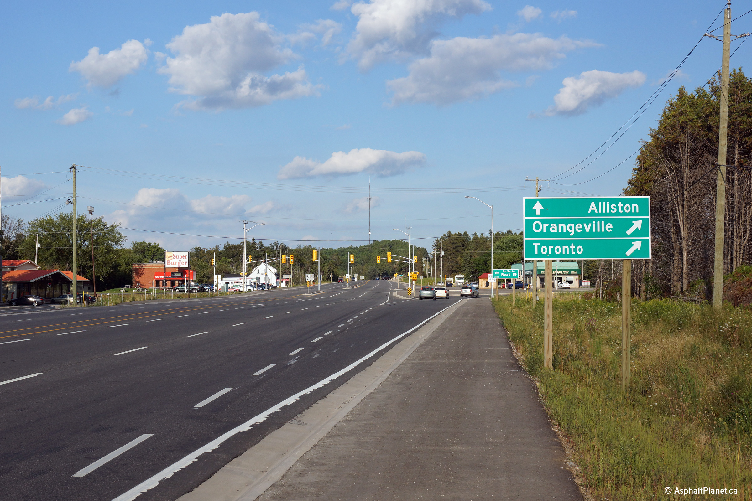
| East of Highway 10, Highway 89 is bound towards Alliston and Cookstown en route to Highways 400 and 11. Click here for Highway 89-East images. | ||||
|
Mulmur - Mono Boundary County of Dufferin |
Two photos looking easterly at Primrose Junction. The upper photo
shows the destination signage at the junction, while the second sign shows
the junction assembly. At this intersection, Highway 10 (and the
former Highway 24) veer to the right at this ramp while Highway 89
continues ahead. Click
here
for an additional view from this vantage point, taken February, 2010. Photos taken: August 24th, 2013. |
 (720x480) (1440x960) (2400x1600)  (720x480) (1440x960) (2400x1600) |
||
|
Mulmur - Mono Boundary County of Dufferin |
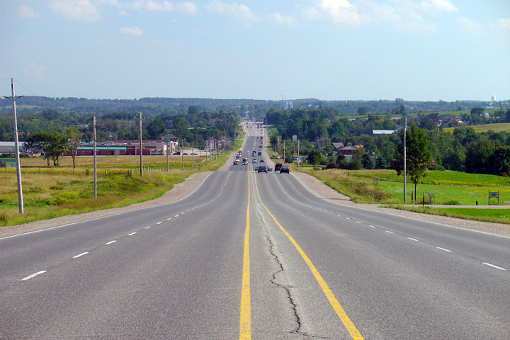
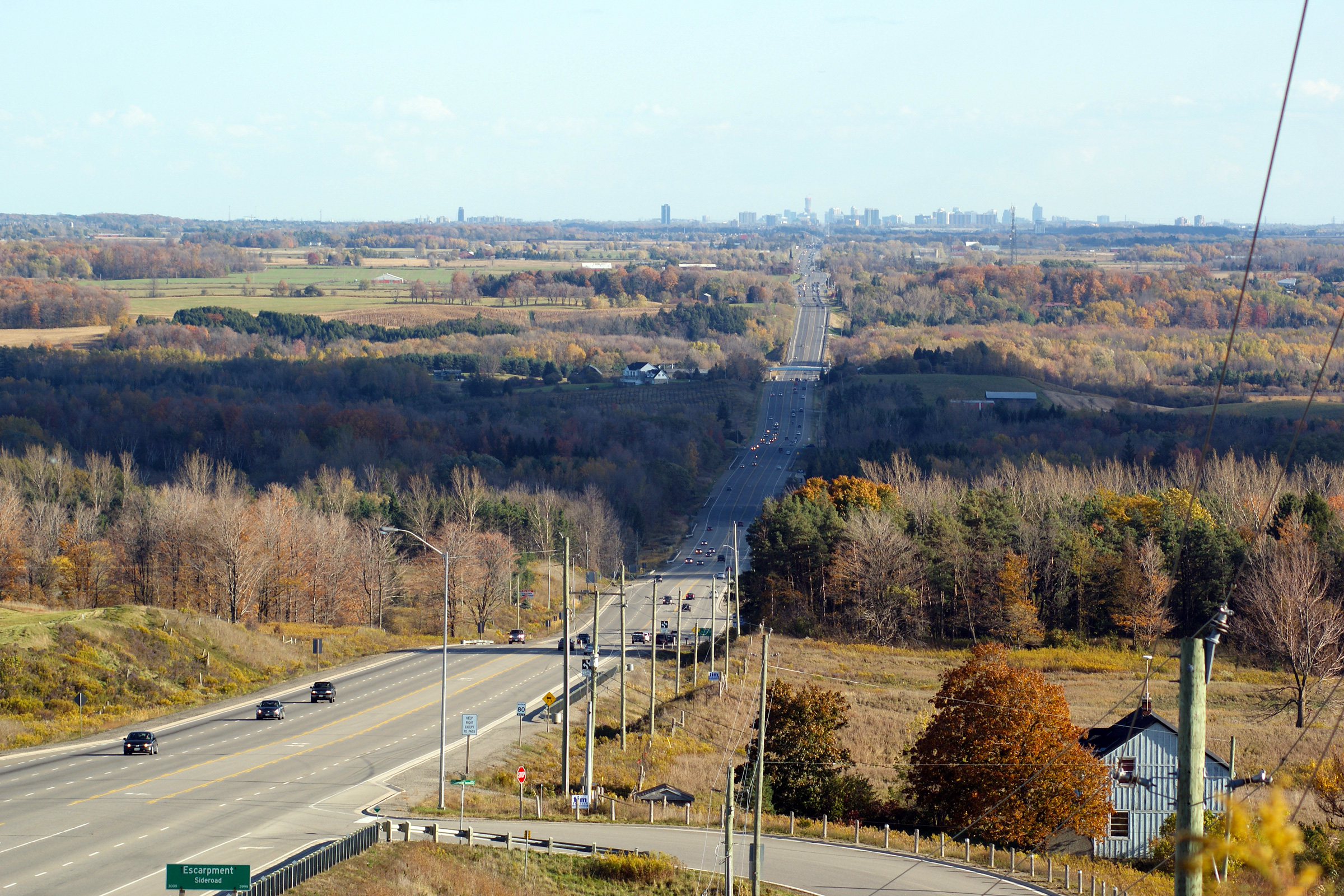
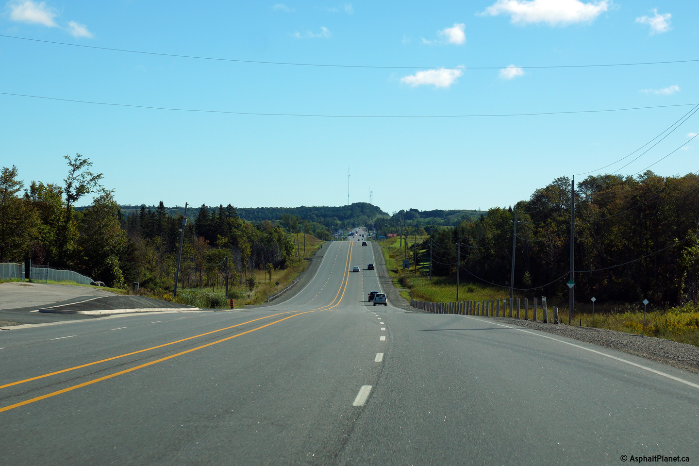
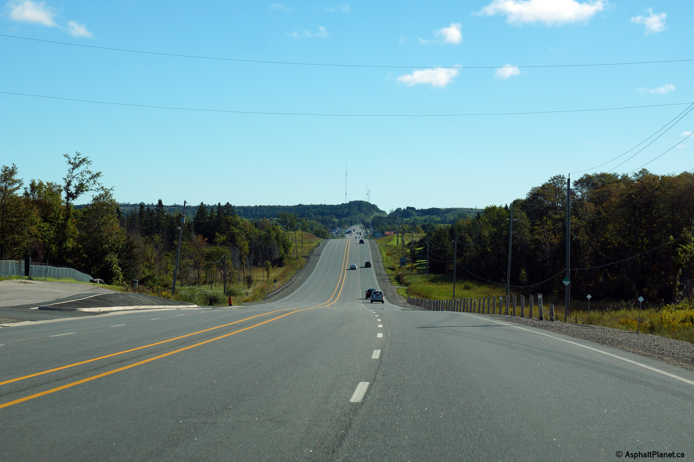
Two views looking east on Highway 10/24/89
from about halfway between Shelburne and Primrose. In the distance,
the eastern Highway 10/24/89
junction is visible. Click
here
for an additional view from this vantage point, taken February, 2010. Upper photo taken: May 25th, 2005. Lower photo taken: September 17th, 2013. |
 (720x480) (1440x960) (2400x1600) |
||
|
Mulmur - Mono Boundary County of Dufferin |
This view looks westerly as Highway 10/24/89 rounds the curve at the
Melancthon-Mulmure / Mon-Amarath Townline Road intersection. Photo taken: September 17th, 2013. |
 (720x480) (1440x960) (2400x1600) |
||
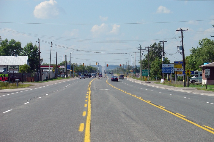
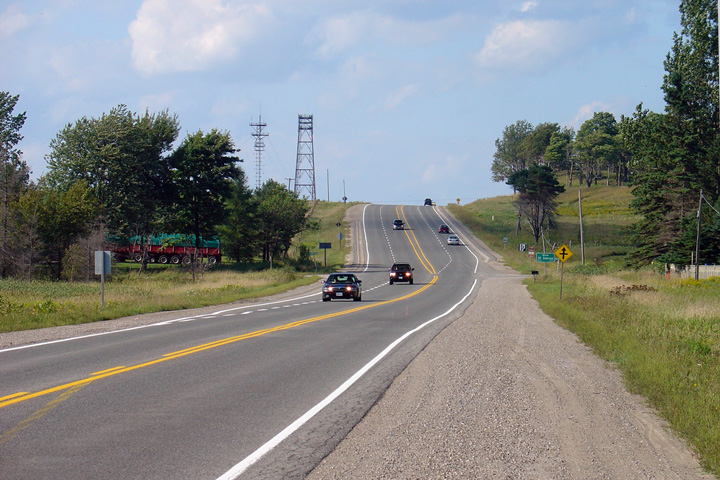
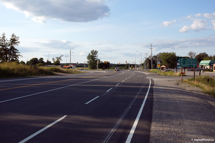
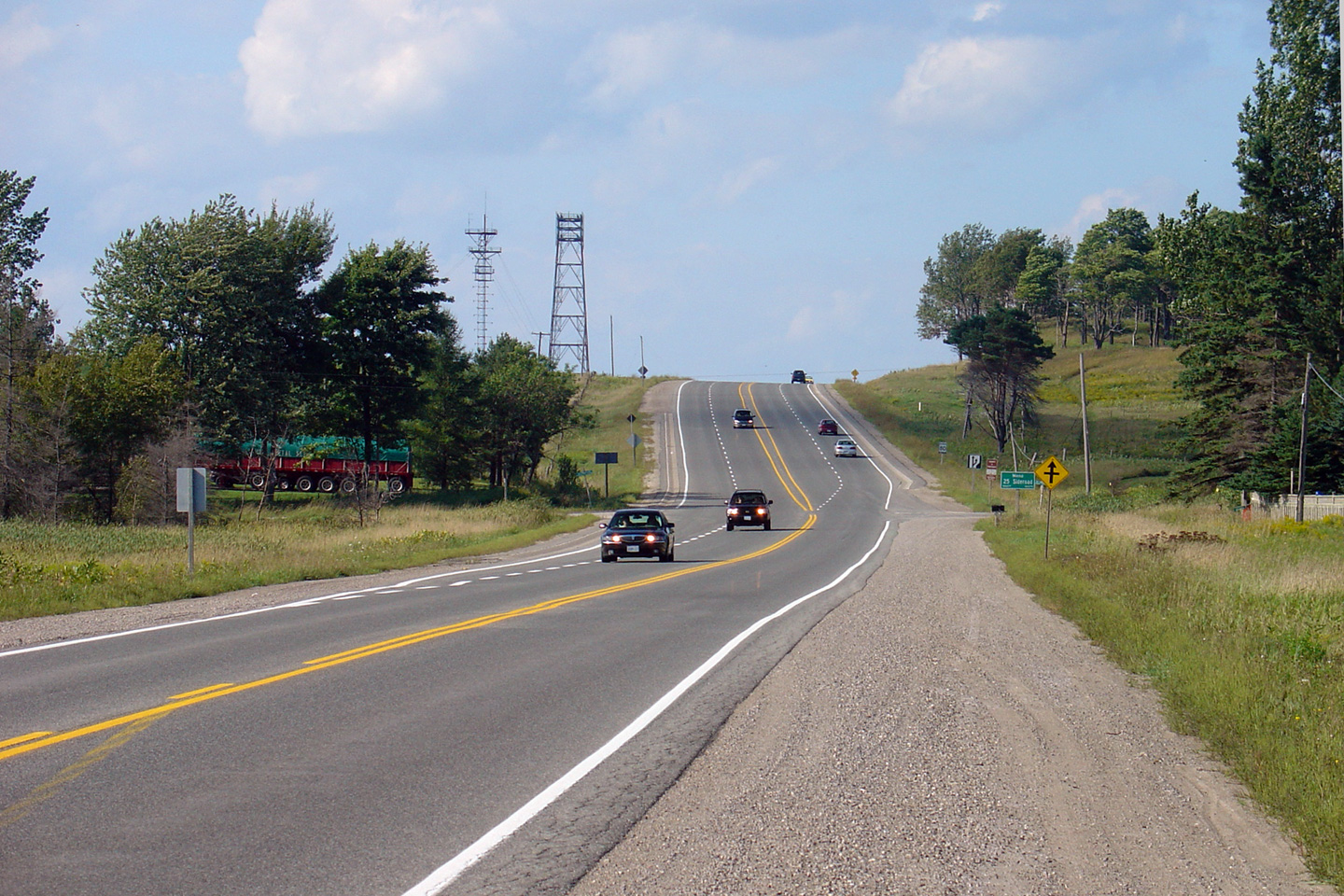
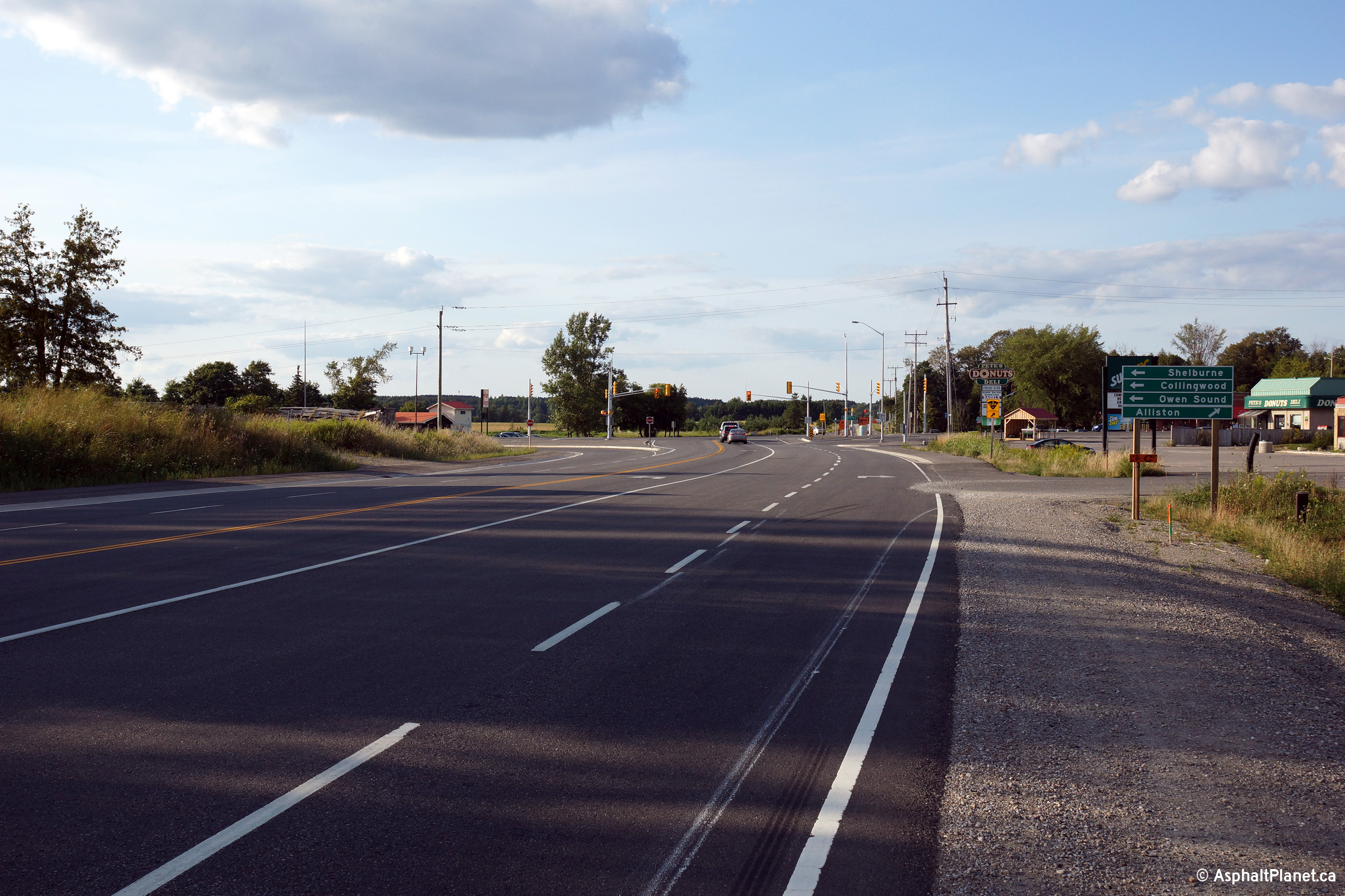
| Melancthon - Amaranth Boundary County of Dufferin |
Highway 89 looking east from just east of the Highway 24 (now County
Road 124) junction at Shelburne. Highway 89 is of the pictured 4.5
lane configuration for roughly 4km between Shelburne and Primrose. Upper photo taken: May 25th, 2005. Lower photo taken: September 17th, 2013. |
 (720x480) (1440x960) (2400x1600) |
||
| Melancthon - Amaranth Boundary County of Dufferin |
Westerly view approaching the former Highway 24-North junction. Since being
transferred to the County, the former Highway 24 has been known as County
Road 124. Photo taken: September 17th, 2013. |
 (720x480) (1440x960) (2400x1600) |
||
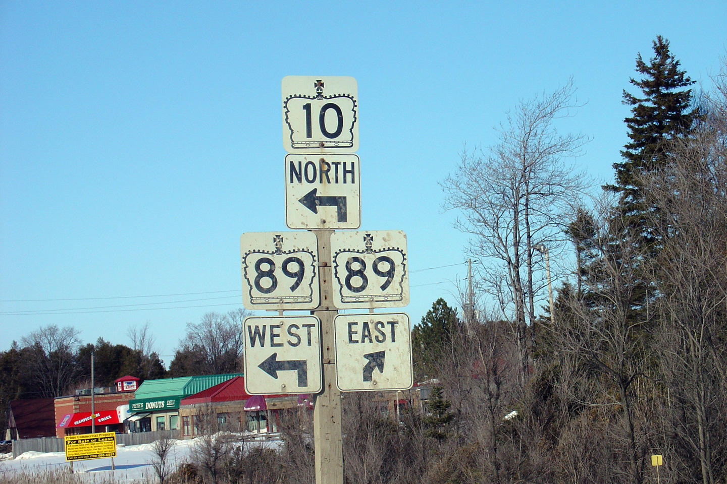
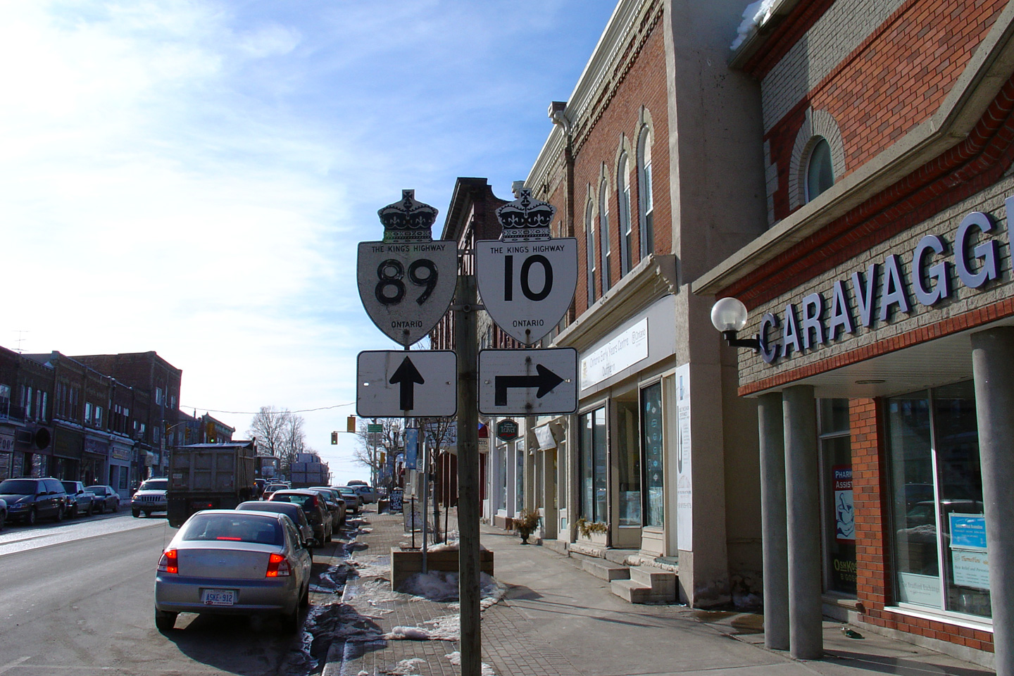
| Town of Shelburne |
Northbound advanced junction assembly for the western Highway 10/89
split in Downtown Shelburne. Photo taken: February 26th, 2004. |

|
||
| Continue north on Highway 10 via Shelburne to Owen Sound Images | ||||
<- Page 1 Images Highway 10 Images Index Page 3 Images ->
<- Highway 9 Images Back to Highway 10 Highway 11 Images ->
Copyright (c) 2004-2012, AsphaltPlanet.ca AsphaltPlanet@asphaltplanet.ca


