AsphaltPlanet.ca > OntHighways >
Highway 11 > Images
> Page 2D
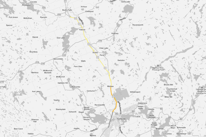
King's Highway 11 - Images
<- Page 2C Page 2D - Huntsville to Burk's Falls Page 2E ->
Photos shown in this table are arranged from South to North:
| Proper Municipality Name | Photo Description | Photo | |||
|
Pictures taken from driver's perspective appear offset from centre-line pictures: |
North- bound |
South- bound |
|||
| Continued from Gravenhurst to Huntsville Images. | |||||
| Highway 60 leads easterly from Highway 11 at Huntsville through Algonquin Park bound for Renfrew. Click here for Highway 60 images. | |||||
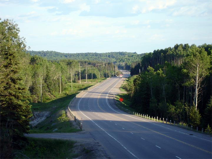
| Town of Huntsville District Municipality of Muskoka |
Northerly view along Highway 11 from the Highway 60 overpass. Photo taken: August 7th, 2004. |
 (720x480) (1440x960) |
|||
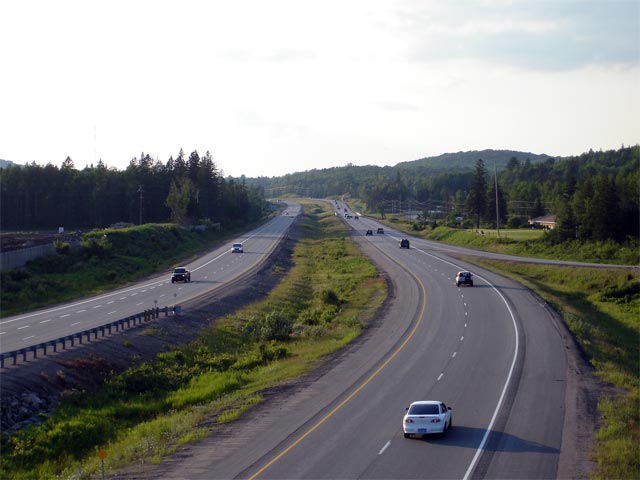
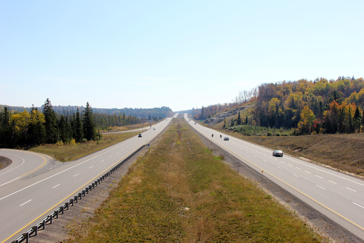
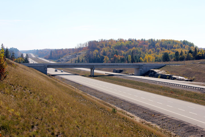
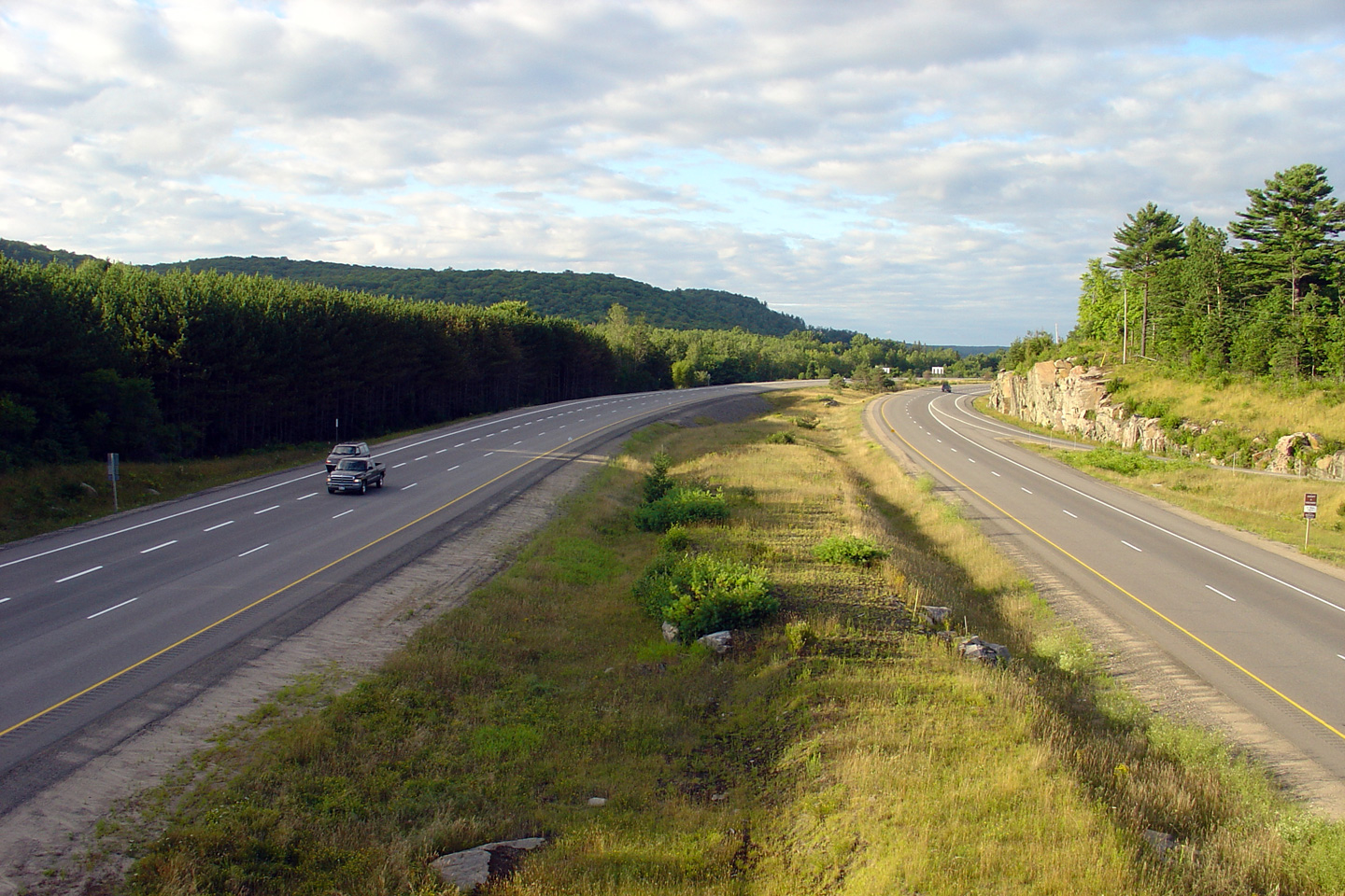
| Town of Huntsville District Municipality of Muskoka |
View looking southerly towards Huntsville from the Muskoka Road 3 overpass.
Until 2001 the divided highway ended at Muskoka Road 3. Since then
several multiyear projects have extended the divided highway northerly to
(as of 2011) Burk's Falls. Construction is currently underway to
four-lane the remaining two lane sections of Highway 11 between Huntsville
and North Bay 11, with work scheduled to be completed by the end of 2012. Photo taken: June 30th, 2006. |
 |
|||
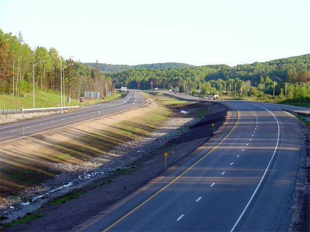
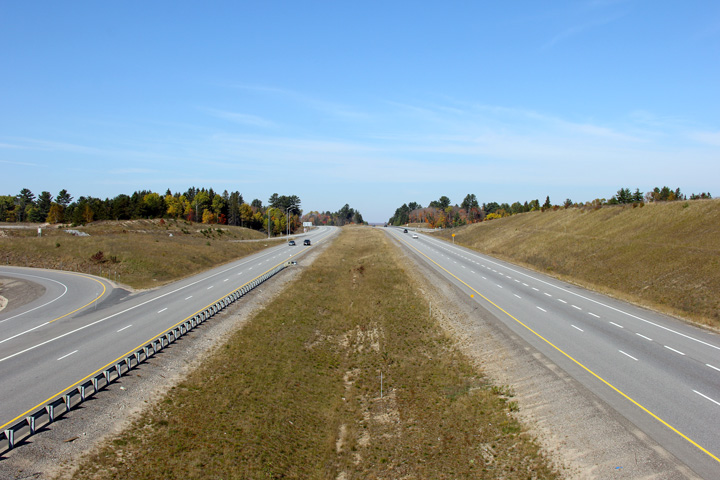
| Town of Huntsville District Municipality of Muskoka |
View looking northerly towards Mellissa from the Muskoka Road 3 overpass. Photo taken: June 30th, 2006. |
 |
|||
| Town of Huntsville District Municipality of Muskoka |
View looking southerly from the East Waseosa Lake Road overpass in Mellissa. Much of Mellissa's Main Street was obliterated when
Highway 11 was twinned through the area. Photo taken: May 29th, 2004. |
 |
|||
| Town of Huntsville District Municipality of Muskoka |
Opposing view from the East Waseosa Lake Road overpass in Mellissa.
Highway 11 was routed straight through Melissa due to the close proximity of the CN Railway and environmentally sensitive lands surrounding the Little East
River. Photo taken: May 29th, 2004. |
 |
|||
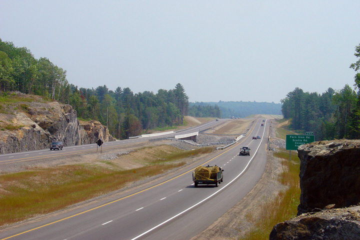
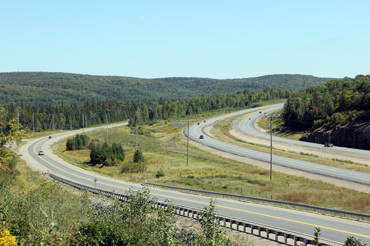
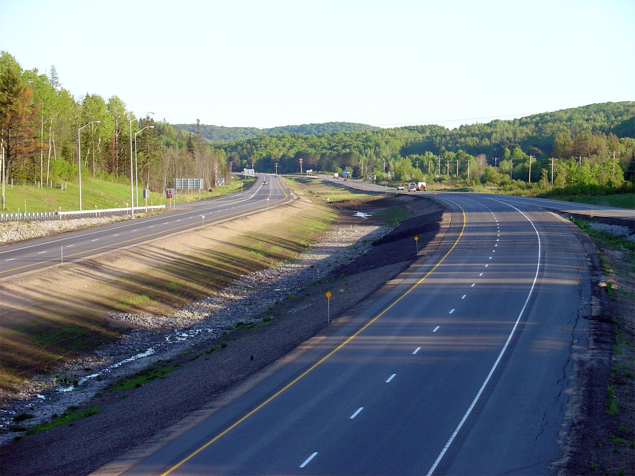
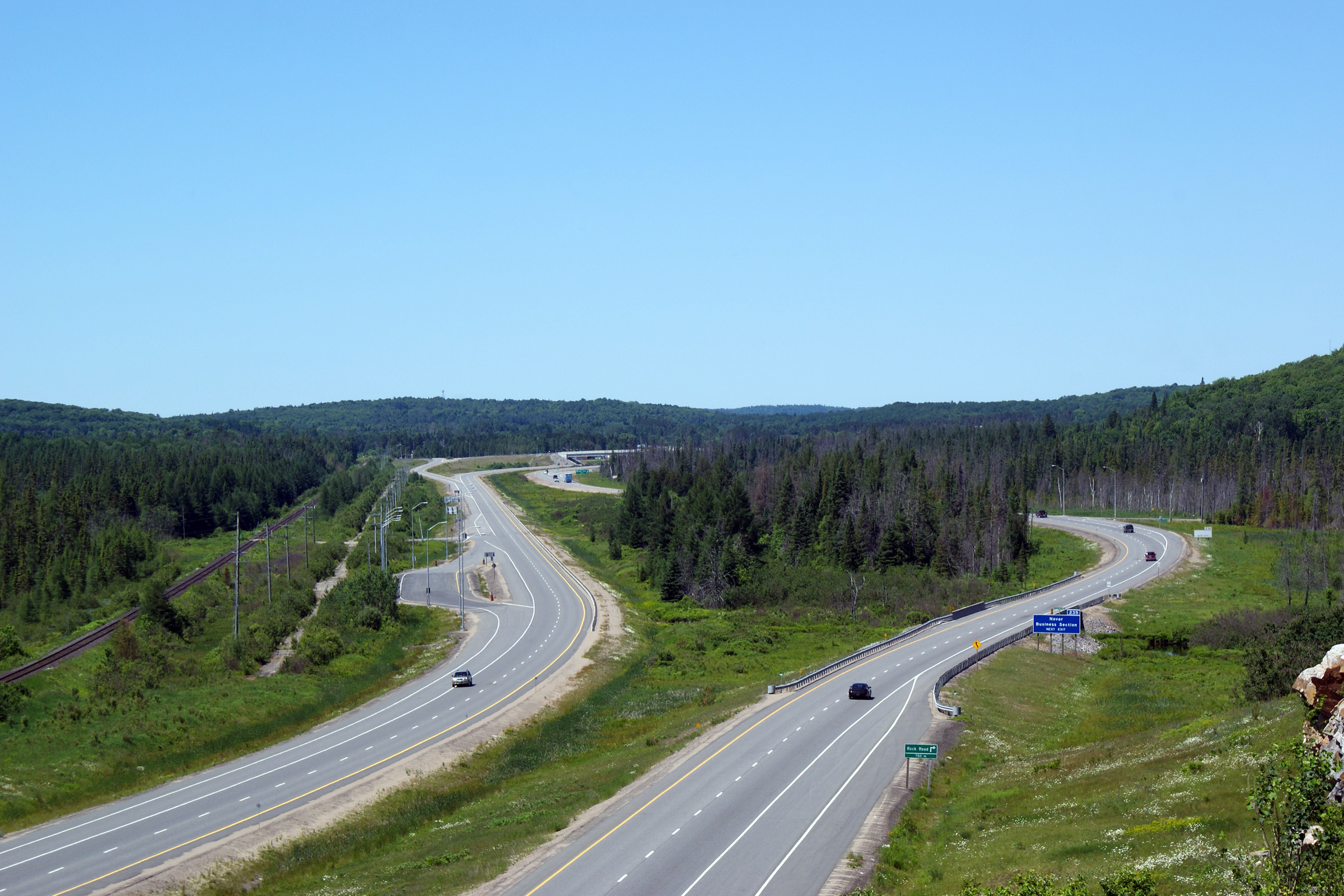
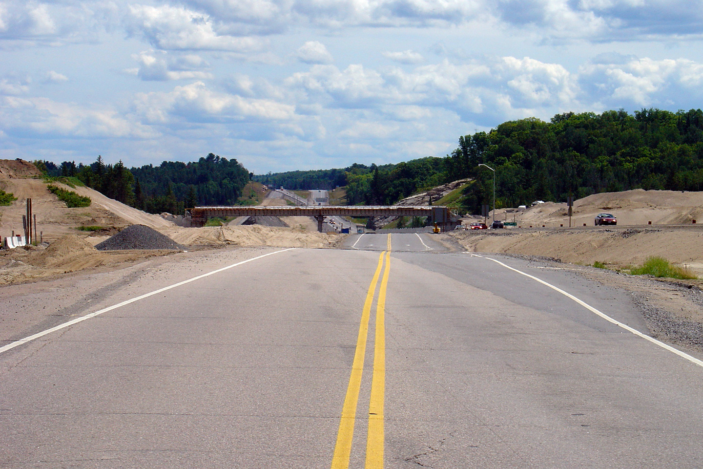
| Town of Huntsville District Municipality of Muskoka |
This view looks southerly towards the Mellissa interchange from a large rock
outcropping just north of the town. Photo taken: June 27th, 2009. |
|
|||
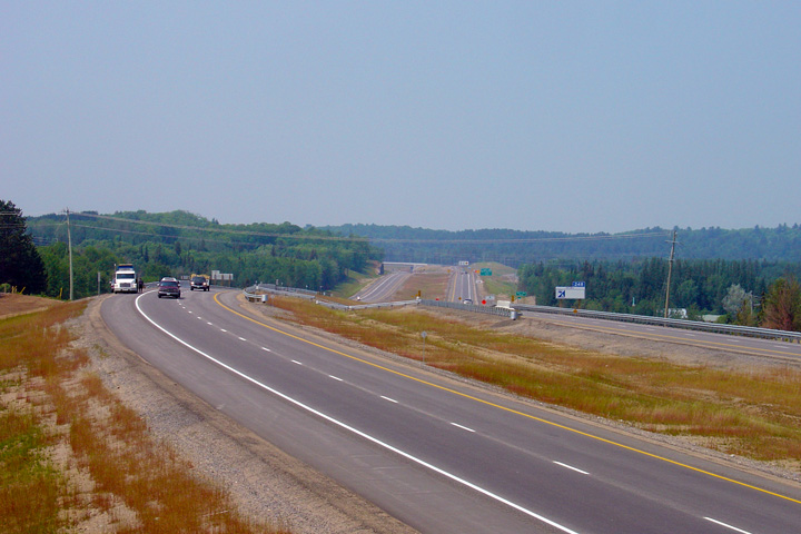
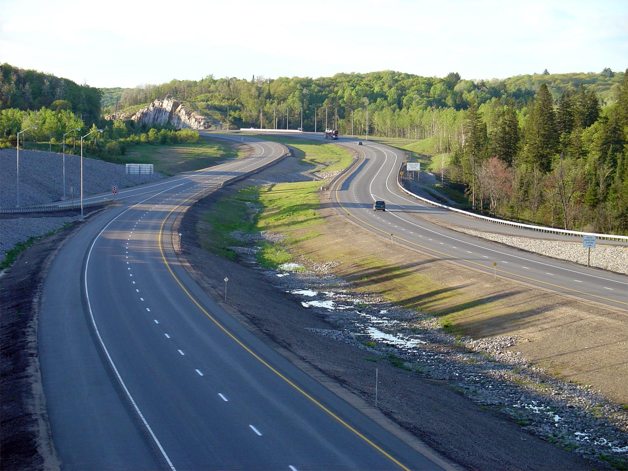
| Town of Huntsville District Municipality of Muskoka |
This view looks northerly from the same rock outcrop as the previous
photo. Notice the northbound (and newer) carriageway swings around
an environmentally sensitive tract of land where the highway crosses the Little East
River. Photo taken: June 27th, 2009. |
|
|||
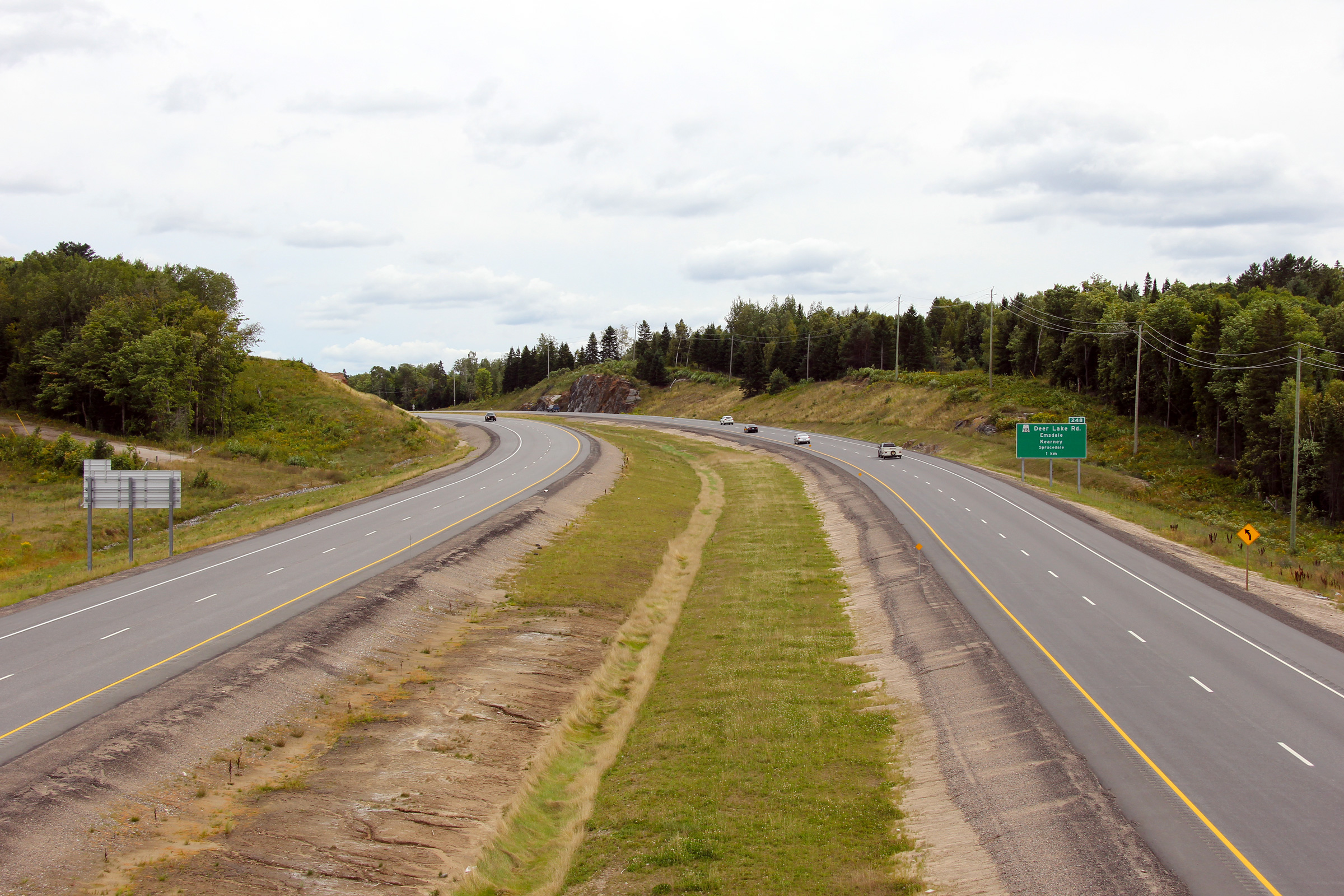
| Town of Huntsville District Municipality of Muskoka |
Northbound advanced signage for Highway 592 along Highway 11. Photo taken: October 5th, 2011. |
 (720x480) (720x480)(1440x960) (2400x1600) |
|||
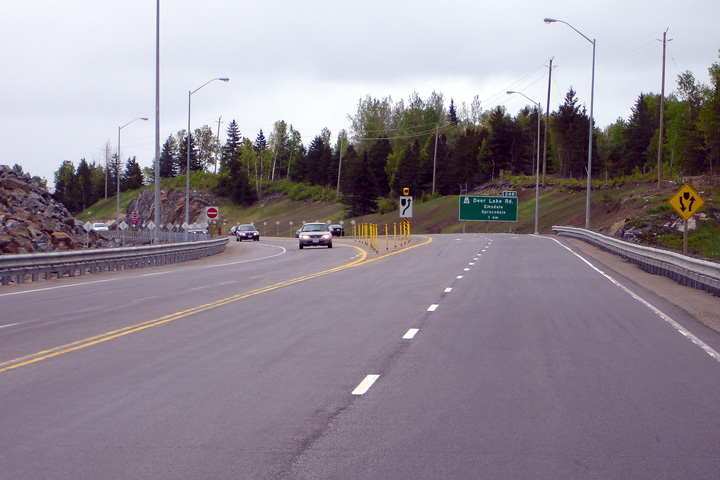
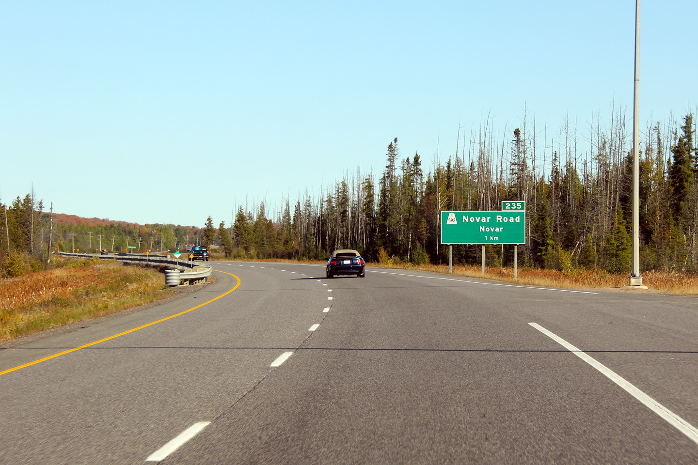
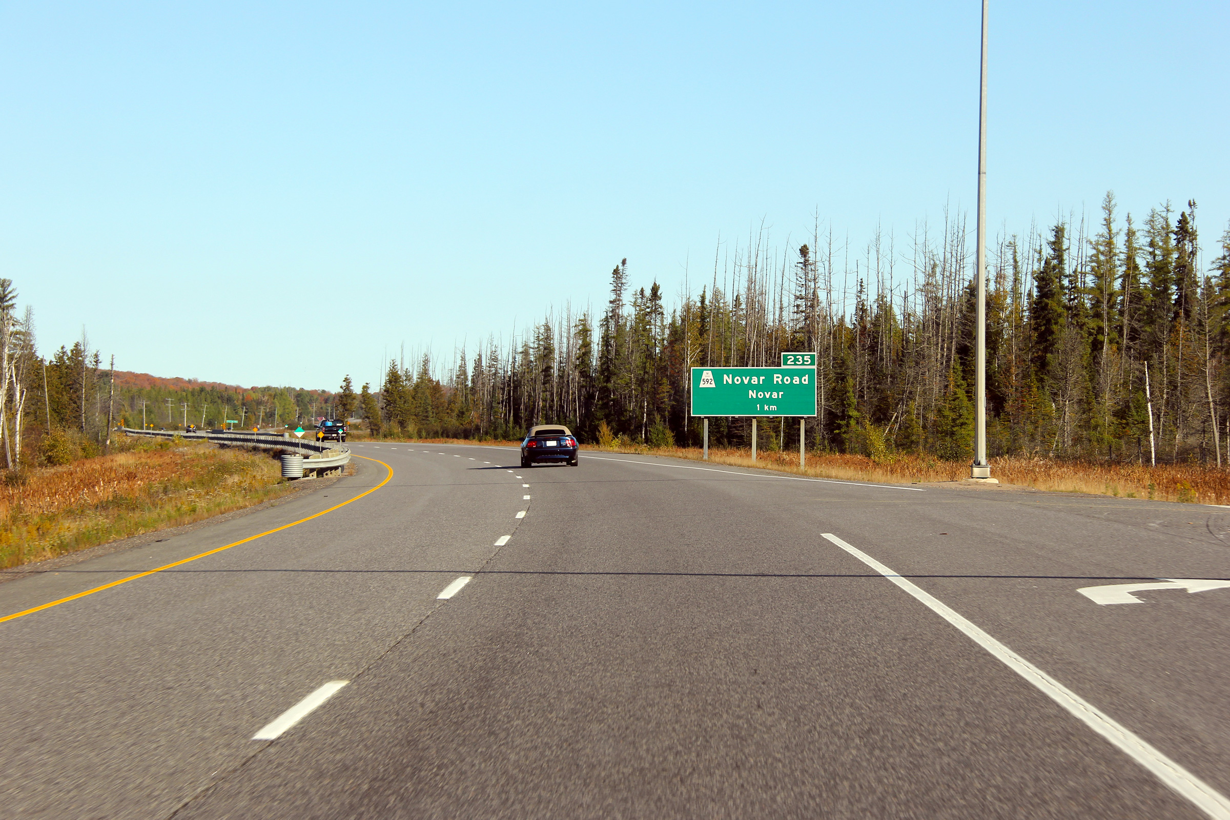
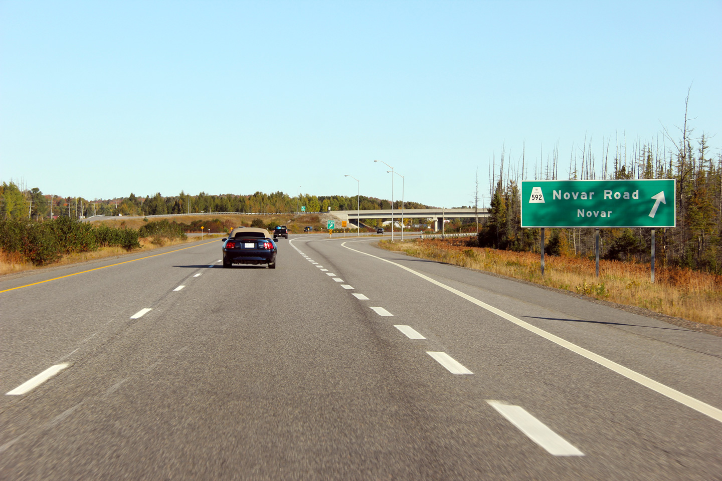
| Town of Huntsville District Municipality of Muskoka |
Northbound signage for Highway 592. Highway 592 is a former alignment
of Highway 11, by-passed in the 1950s. Highway 592 begins northerly from the Novar Road interchange
only to rejoin the Highway 11 alignment between Emsdale and Katrine. Photo taken: October 5th, 2011. |
 (720x480) (720x480)(1440x960) (2400x1600) |
|||
| Town of Huntsville District of Parry Sound |
View looking southerly into the October sun from the Novar Road overpass. Photo taken: October 8th, 2011. |
 |
|||
| Highway 592 follows a former (pre-1950s) alignment of Highway 11 through Scotia and Emsdale. Click here for Highway 592 images. | |||||
| Town of Huntsville District of Parry Sound |
This view of Highway 11 looks northerly from the Novar Road overpass.
The Novar Road interchange is situated just inside the northern limits of
the Muskoka District. Highway 592 actually enters the Muskoka District
for a distance of about 500m; this makes Highway 592 the only secondary highway
to exist in an organized upper-tier municipality in the province. Photo taken: October 8th, 2011. |
 |
|||
| Township of Perry District of Parry Sound |
Northerly view along Highway 11 taken from the drivers seat north of
the Rockcliffe Lane intersection. There are several low-volume
at-grade intersections and wilderness accesses along Highway 11 between
Novar and Scotia. Photo taken: October 5th, 2011. |
 |
|||
| Township of Perry District of Parry Sound |
Northbound signage for the Scotia Road interchange. Photo taken: October 5th, 2011. |
 (720x480) (720x480)(1440x960) (2400x1600) |
|||
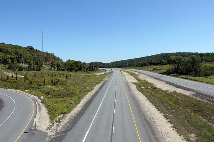
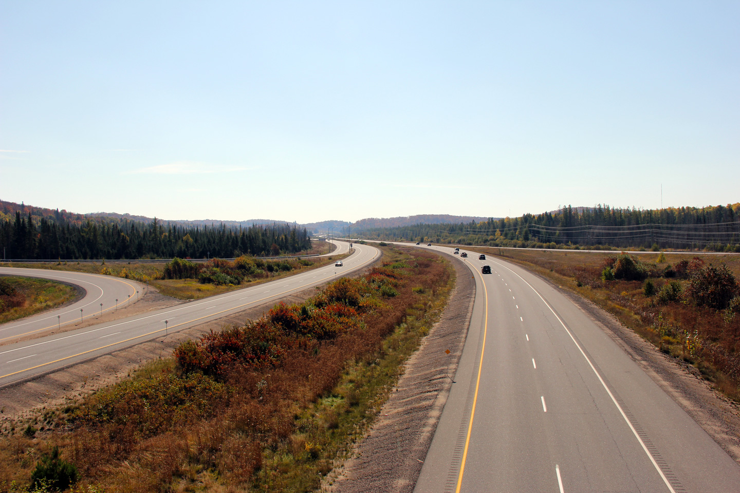
| Township of Perry District of Parry Sound |
View looking southerly along Highway 11 from the Scotia Road overpass.
The divided highway ended just south of this overpass until 2005. Photo taken: October 8th, 2011. |
 |
|||
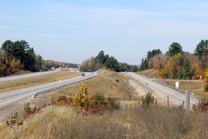
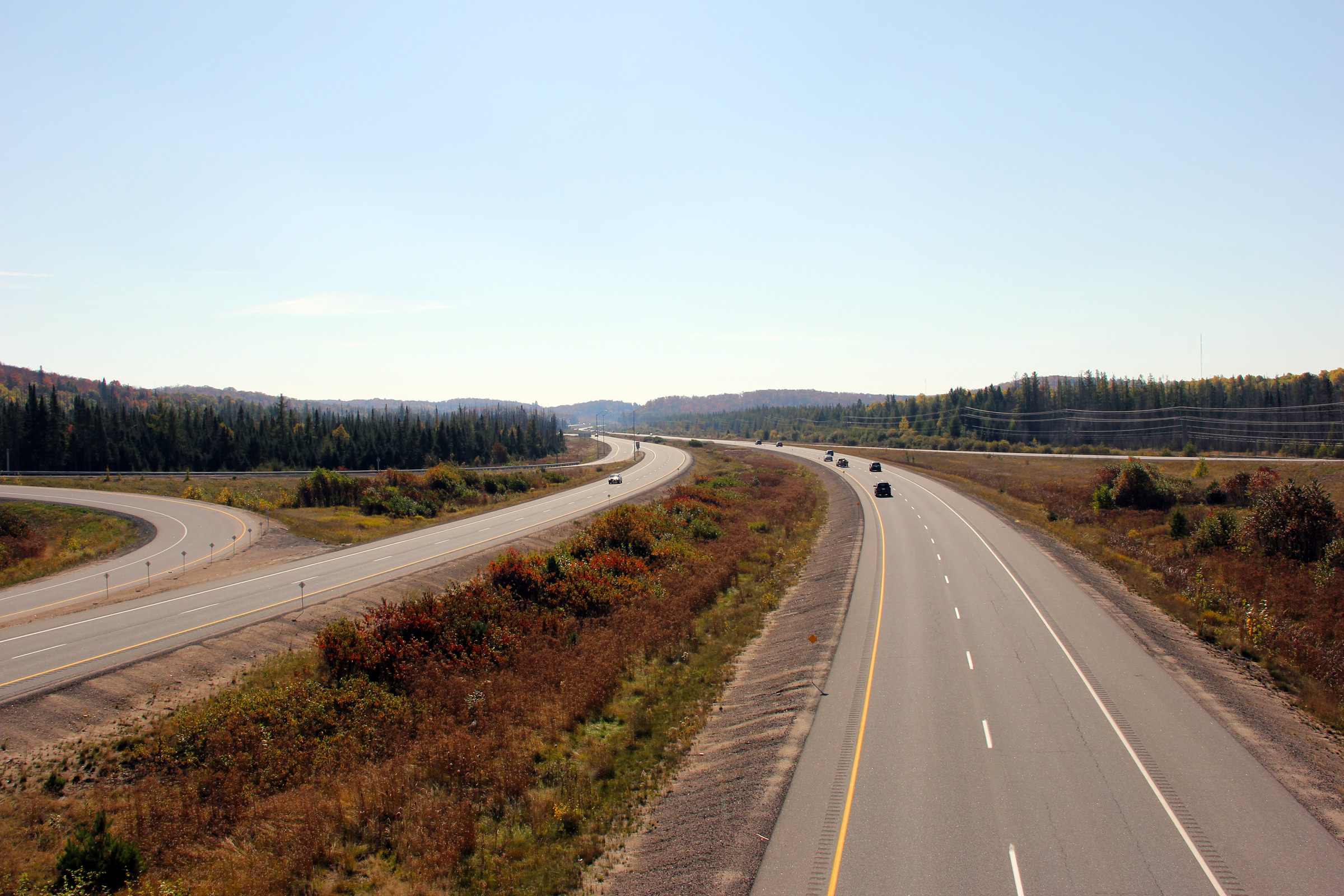
| Township of Perry District of Parry Sound |
Looking north from the Scotia Road overpass. Highway 11 curves west
around Emsdale at this point. Notice the clearing in the trees
straight ahead of the northbound carriageway. The former two-lane Highway
11 alignment passed through this clearing en route through Emsdale. Photo taken: October 8th, 2011. |
 |
|||
|
Township of Perry District of Parry Sound |
A series of views looking northerly towards the Scotia Road interchange.
The upper (2005) photo shows Highway 11 very much under construction.
In this photo, I am standing on the recently closed pre-2005 alignment of
Highway 11. When the upper photo was taken, two-way traffic had been
temporarily diverted onto the future southbound lanes of the Emsdale by-pass
so that the future northbound lanes could be completed. In modern
(2011) photos, notice the large retaining wall that has been constructed to
separate the southbound off-ramp from an adjacent residential property that
is located immediately east of the interchange along Fern Glen Road. MTO's
commitment to building rural parclo interchanges is astounding. Upper photo taken: August 14th, 2005. Middle and lower photo taken: October 8th, 2011. |
 |
|||
|
Township of Perry District of Parry Sound |
Northerly view from just north of the Scotia Road interchange. Emsdale
Road, the two lane road pictured on the right-side of the photo is the former (pre-2005)
alignment of Highway 11 through Emsdale. Today, Highway 11 skirts along the
west side of Emsdale. The former alignment of Highway 11 through Emsdale
rejoins the divided highway at the Highway 518 interchange,
some four kilometres ahead. Photo taken: October 8th, 2011. |
 |
|||
|
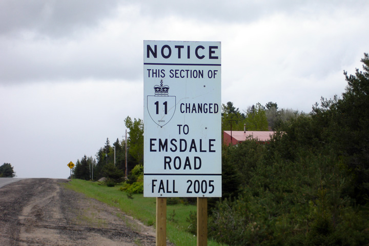
Township of Perry District of Parry Sound |
This sign stands on Emsdale Road to notify travelers that what was once
Highway 11 is now Emsdale Road. Photo taken: May 22nd, 2006. |
 (720x480) (1440x960) |
|||
|
Township of Perry District of Parry Sound |
View looking southerly along along the Emsdale By-pass. Note the twin
high-level watercourse structures in the photo. The old alignment of
Highway 11 (now Emsdale Road) crosses this same watercourse atop but a
narrow, low-level concrete culvert. Photo taken: June 17th, 2006. |
 (720x480) (1440x960) |
|||
|
Township of Perry District of Parry Sound |
This view looks northerly along the Emsdale By-pass as Highway 11 crosses
Star Lake Road. The Emsdale By-pass sits high atop the village on a
hill that is immediately west of the old Highway 11 alignment. Photo taken: June 17th, 2006. |
 (720x480) (1440x960) |
|||
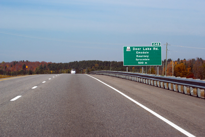
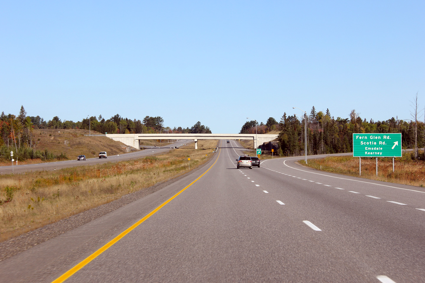
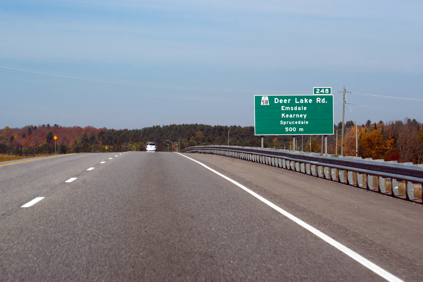
|
Township of Perry District of Parry Sound |
Advanced signage for the Highway 518 interchange. Surprisingly, the
northbound advanced signage for Highway 518 has only been placed 500m
upstream of the interchange. Photo taken: October 8th, 2011. |
 (720x480) (720x480)(1440x960) (2400x1600) |
|||
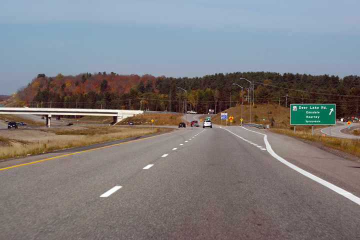
|
Township of Perry District of Parry Sound |
Northbound view approaching the Highway 518 interchange. Photo taken: October 8th, 2011. |
 (720x480) (720x480)(1440x960) (2400x1600) |
|||
|
Township of Perry District of Parry Sound |
Two views looking southerly along Highway 11 from the Highway 518 overpass.
The upper (2005) photo was taken shortly after traffic was moved from
today's Emsdale Road (the former alignment of Highway 11), to the future
southbound lanes of the four-lane highway. With two-way traffic
diverted onto the southbound lanes work was then focused on completing the
transitions where the bypass met the former two lane highway alignment.
The lower photo was taken several years after construction had been
completed. Upper photo taken: August 14th, 2005. Lower photo taken: October 8th, 2011. |
 |
|||
| Highway 518 is a long east-west highway that runs through Parry Sound District from Highway 400 to Sand Lake. Click here for Highway 518 images. | |||||
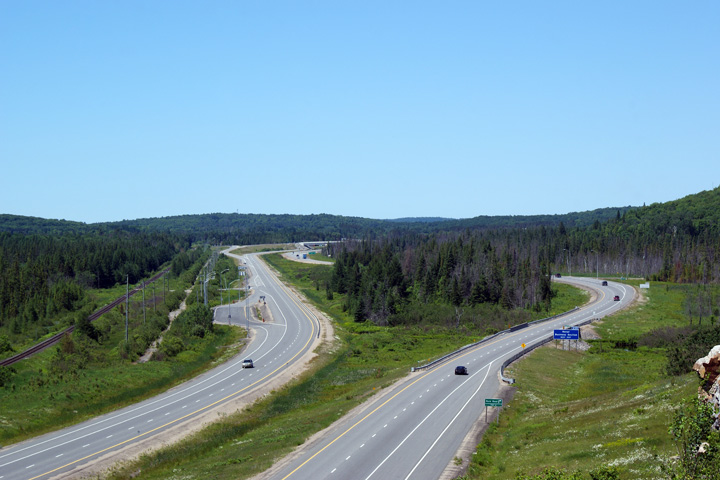
|
Township of Perry District of Parry Sound |
Northerly view along Highway 11 from the Highway 518 overpass. Highway
11 meets Highway 518 at a diamond interchange. Photo taken: October 8th, 2011. |
 |
|||
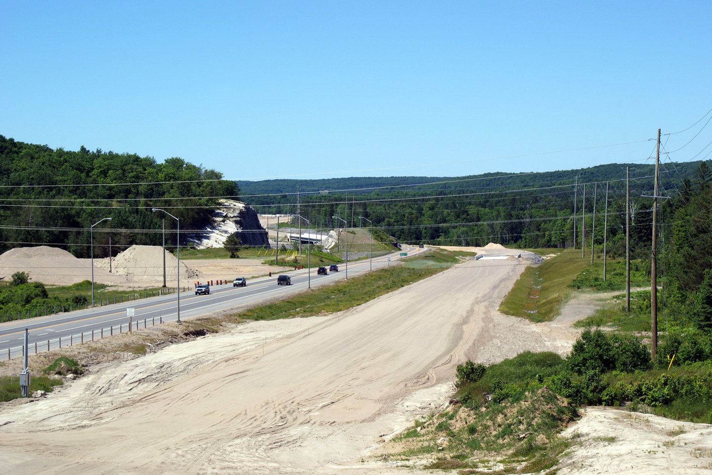
|
Township of Perry District of Parry Sound |
This 2006 photo shows the former end of the divided highway between Emsdale
and Katrine. The divided highway ended here for a period of five years
between 2005 and 2010. Photo taken: May 22nd, 2006. |
|
|||
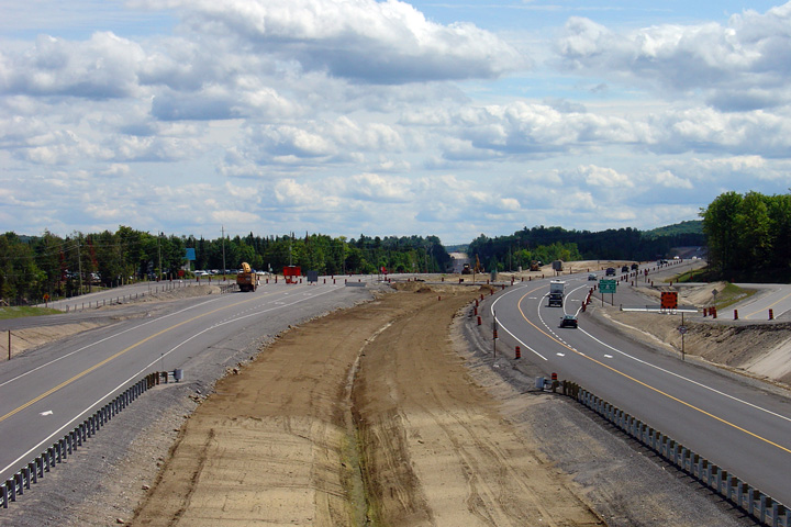
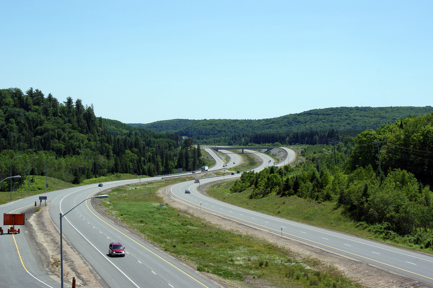
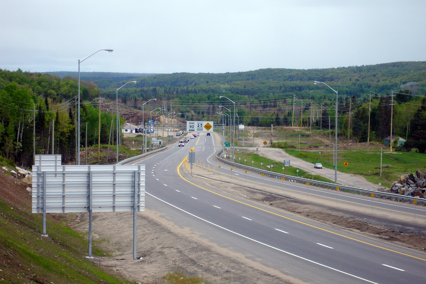
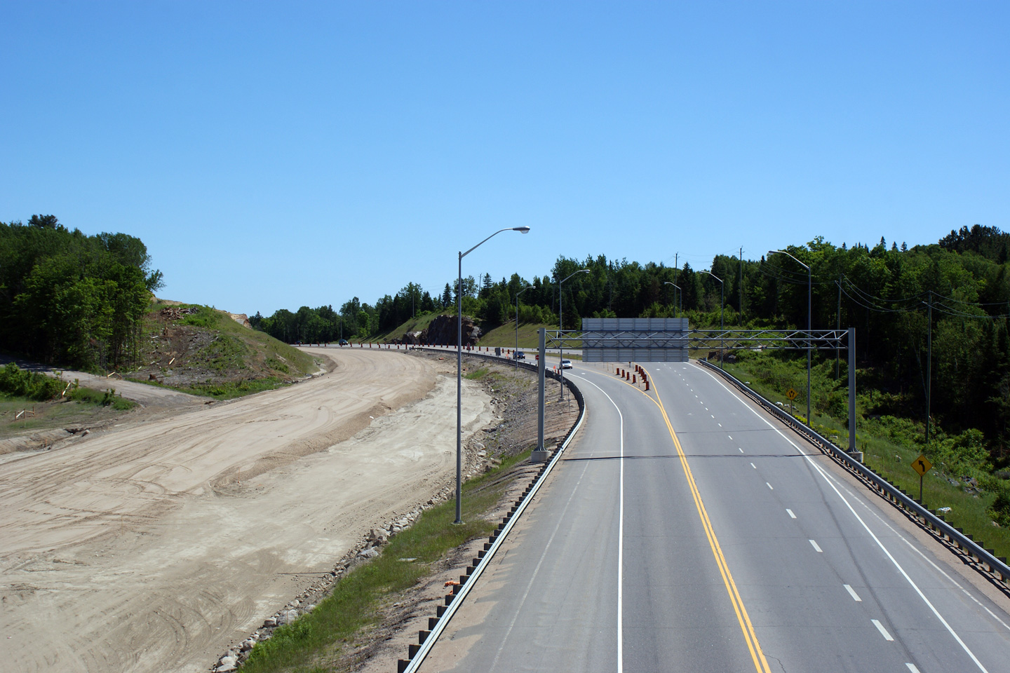
| Township of Perry District of Parry Sound |
Three views looking northerly from both the proposed location of the Highway
592 overpass, from ground level, and the constructed Highway 592 overpass.
The upper (2006) photo was taken shortly after the divided highway was
extended through Katrine to this location. The middle (2009) photo was
taken from the completed overpass and shows the graded southbound lanes
awaiting pavement. The 2011 photo shows the completed four-lane
highway open to traffic after construction had been completed. Upper photo taken: May 22nd, 2006. Middle photo taken: June 27th, 2009. Lower photo taken: August 28th, 2011. |
|
|||
| Township of Perry District of Parry Sound |
Two views attempting to show how the northern terminus of Highway 592 was
disconnected from Highway 11.
The upper photo shows the former directional signage for the Highway 592 intersection
prior to the completion of the divided highway. The lower photo shows
how Highway 592 was grade separated from
Highway 11, no interchange was constructed at this location.
Instead traffic bound to and from Highway 592 must use either the Highway
518 or the Three Mile Lake Road interchanges. Upper photo taken: May 22nd, 2006. Lower photo taken: October 8th, 2011. |
|
|||
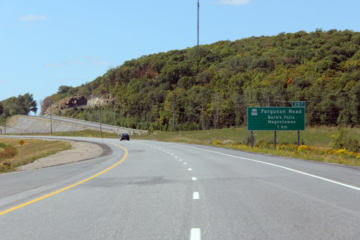
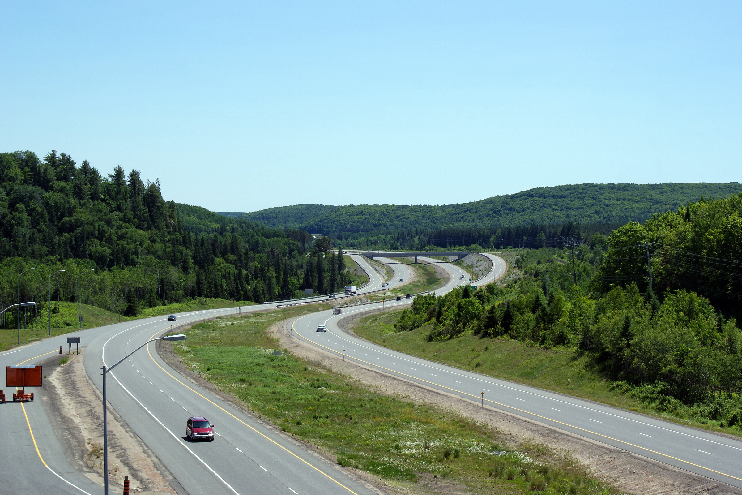
| Township of Armour District of Parry Sound |
Two views looking northerly along Highway 11 from the Highway 592 overpass. Upper photo taken: June 27th, 2009. Lower photo taken: August 28th, 2011. |
 |
|||
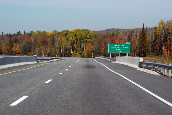
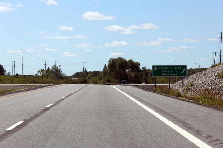
| Township of Armour District of Parry Sound |
Northbound advanced signage for the Three Mile Lake Road interchange.
Three Mile Lake Road passes underneath of Highway 11, and the interchange is
very intertwined with the nearby meandering Magnetawan River. Photo taken: October 8th, 2011. |
 (720x480) (720x480)(1440x960) (2400x1600) |
|||
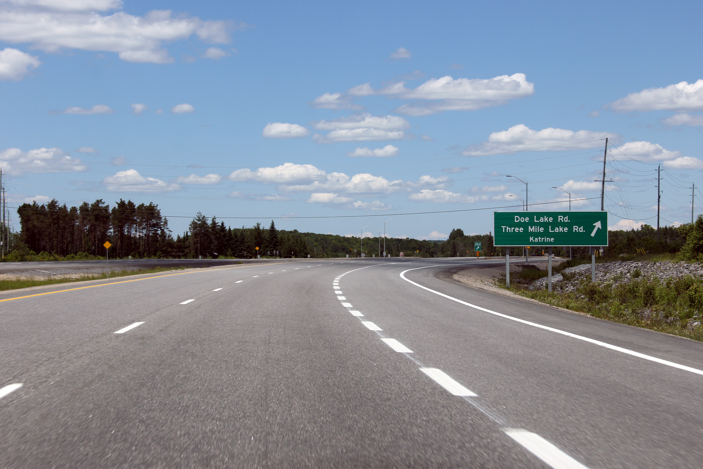
| Township of Armour District of Parry Sound |
Northbound signage at the Three Mile Lake Road interchange. Photo taken: June 23rd, 2012. |
 (720x480) (720x480)(1440x960) (2400x1600) |
|||
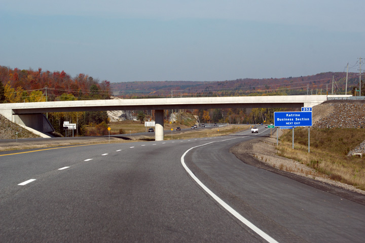
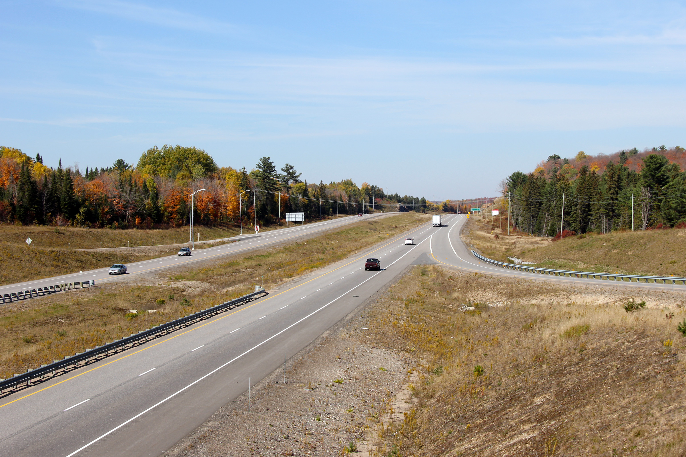
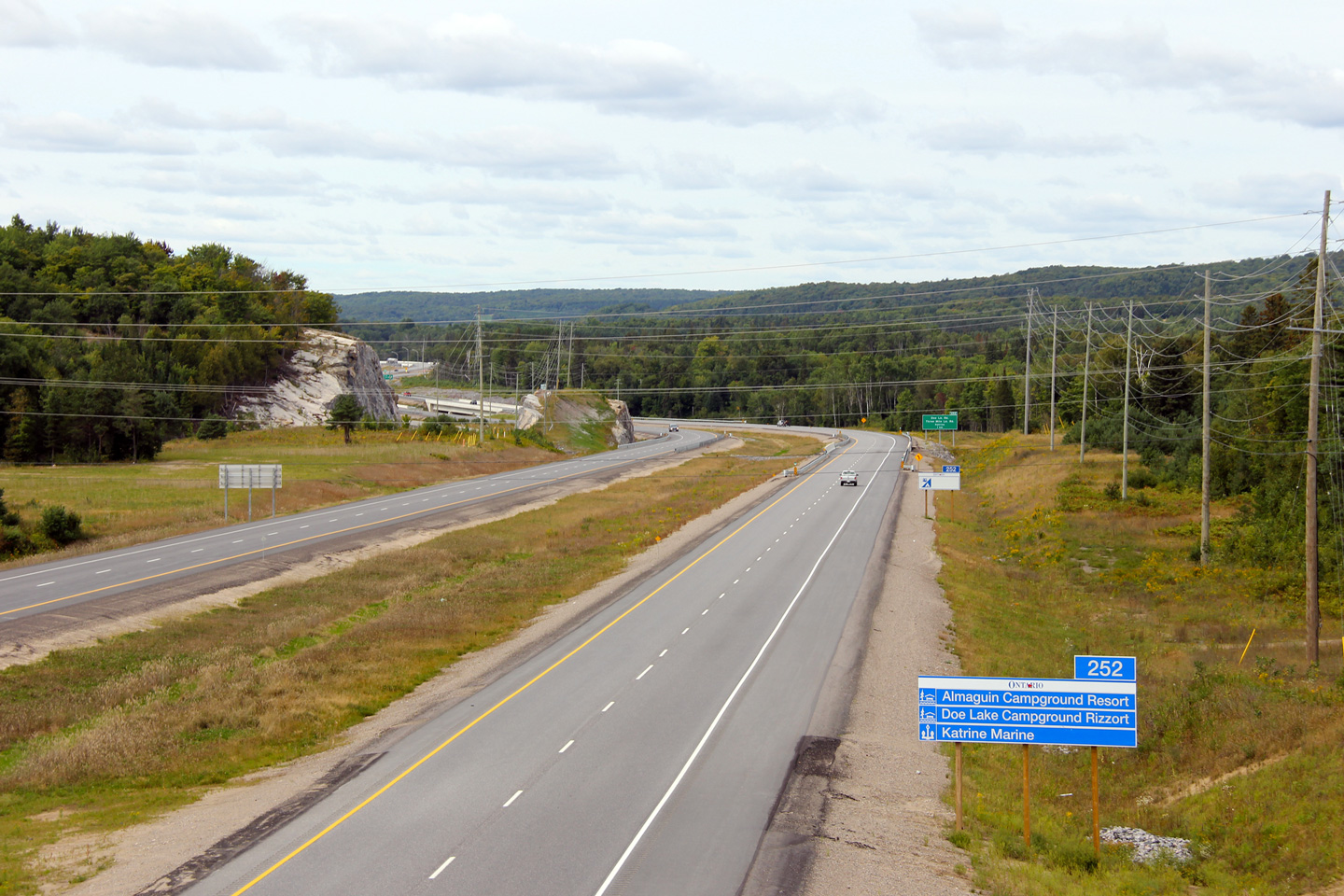
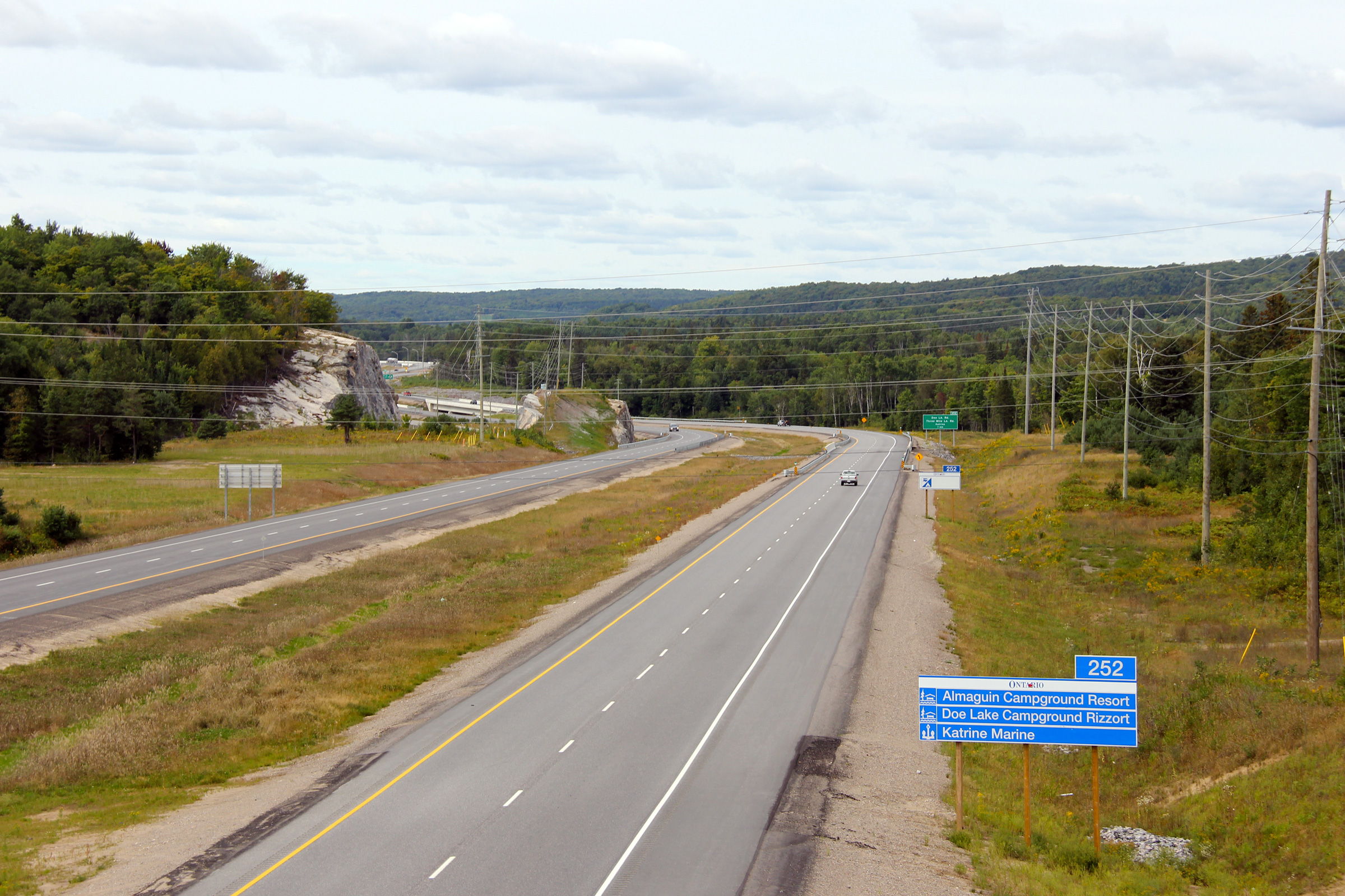
| Township of Armour District of Parry Sound |
Southerly view from the Katrine Road overpass along Highway 11, in the
direction of the Three Mile Lake Road interchange. Photo taken: October 8th, 2011. |
 |
|||
| Township of Armour District of Parry Sound |
Northerly view of the Highway 11from the Katrine Road overpass as the
divided highway climbs
partially out of the Magnetawan River Valley. Photo taken: October 8th, 2011. |
 |
|||
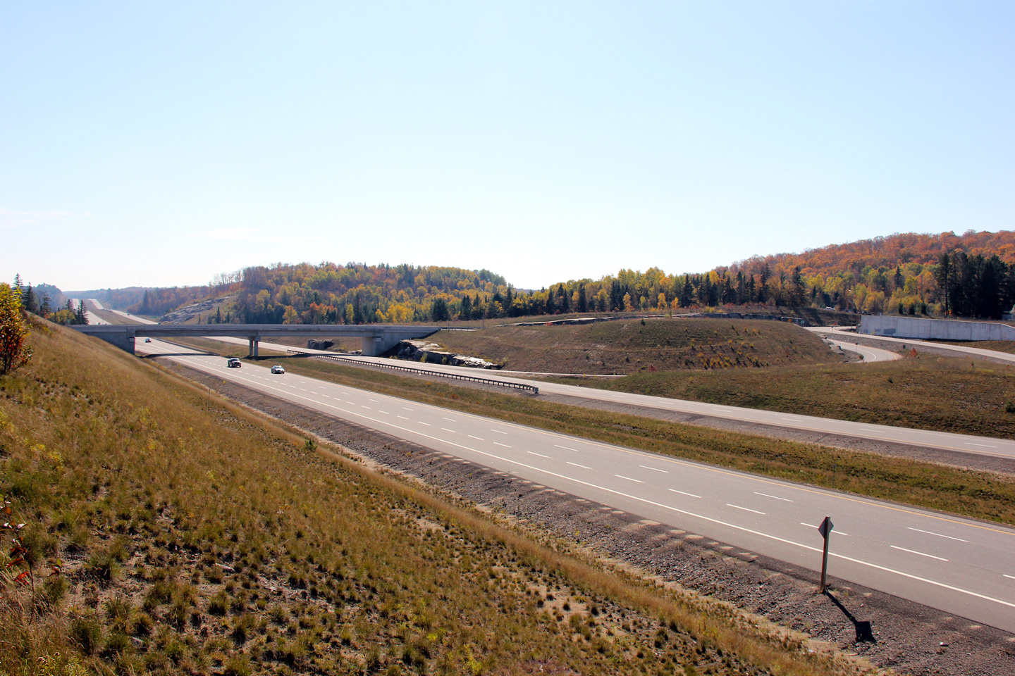
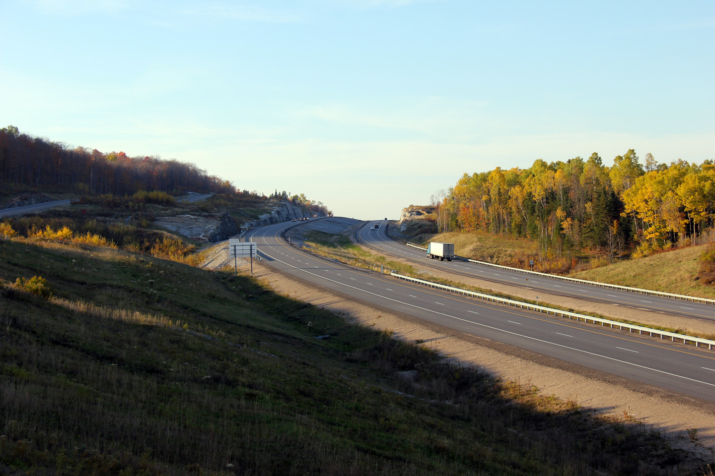
| Township of Armour District of Parry Sound |
This photo comparison may be slightly misleading as the older photo covers a
section of Highway 11 that was not directly twinned. North of Katrine
-- which is the area on display in both photos -- the divided highway was
constructed along a
new alignment, generally immediately to the west of the old road. The
former alignment of Highway 11 still exists, relatively unaltered as today's Katrine Road.
Both photos look southerly into Katrine. Upper photo taken: May 22nd, 2011. Lower photo taken: October 11th, 2011. |
 |
|||
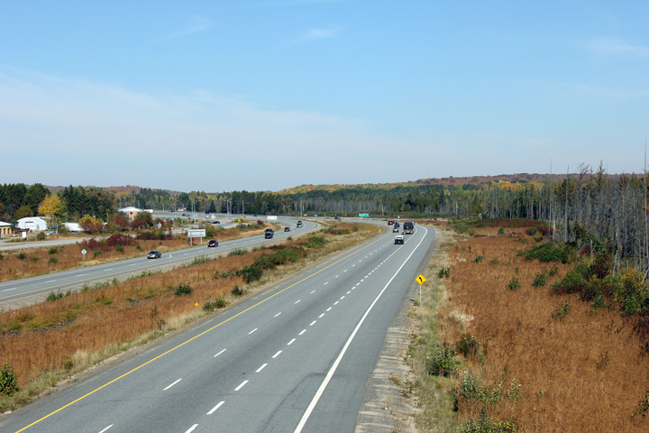
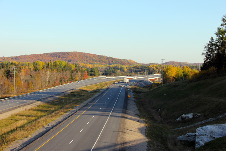
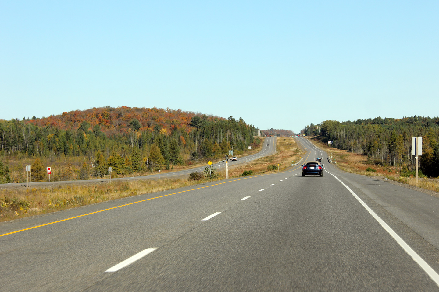
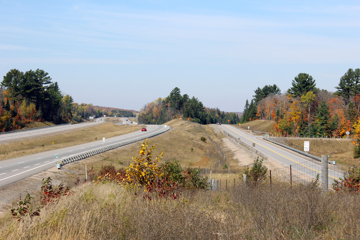
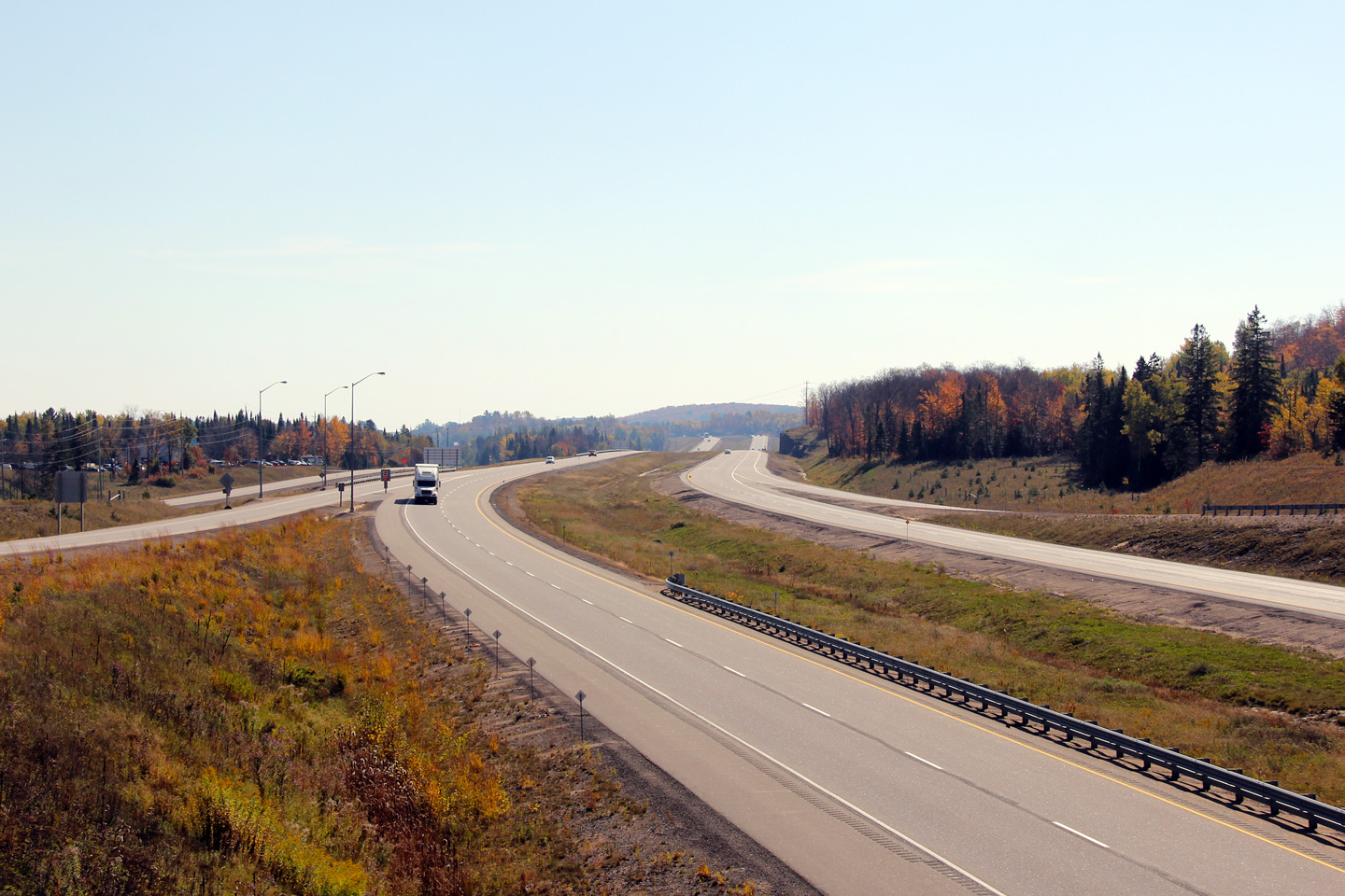
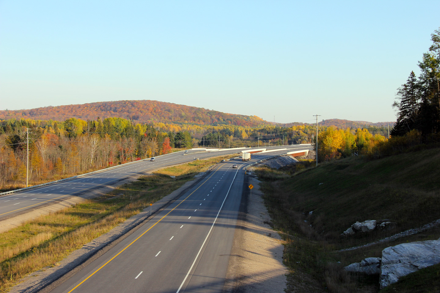
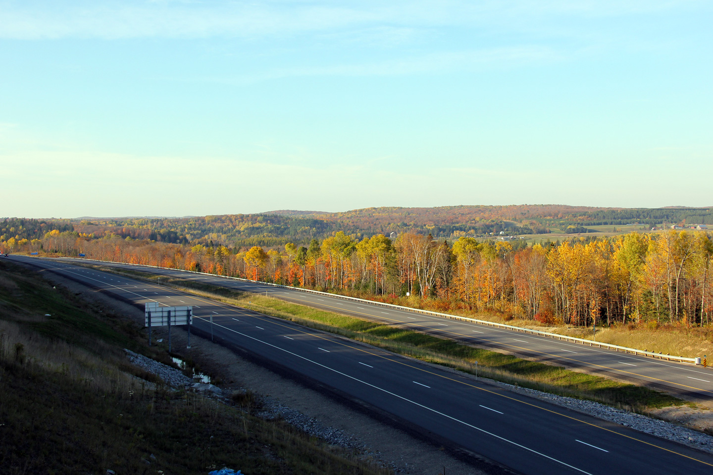
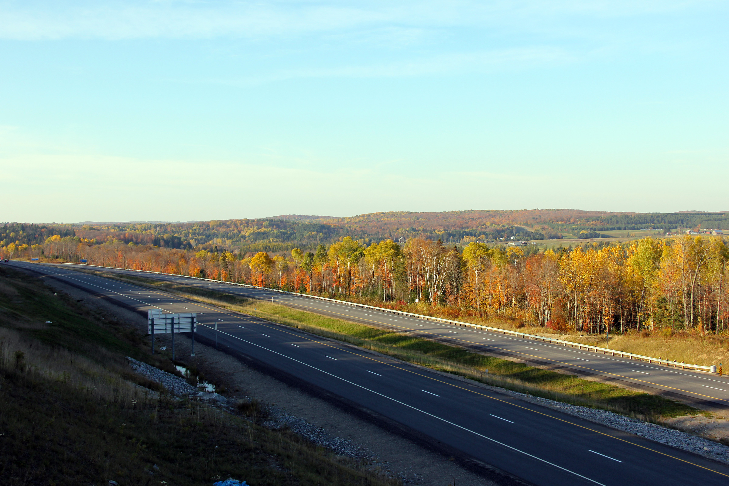
| Township of Armour District of Parry Sound |
This view looks northerly towards Burk's Falls along Highway 11. The fall
colours were near peak in the picturesque Magnetawan River Valley when this
photo was taken. Photo taken: October 8th, 2011. |
 |
|||
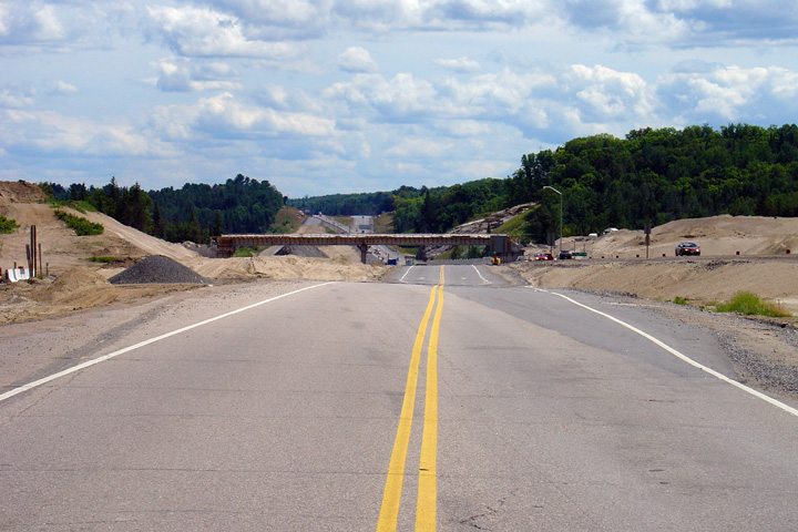
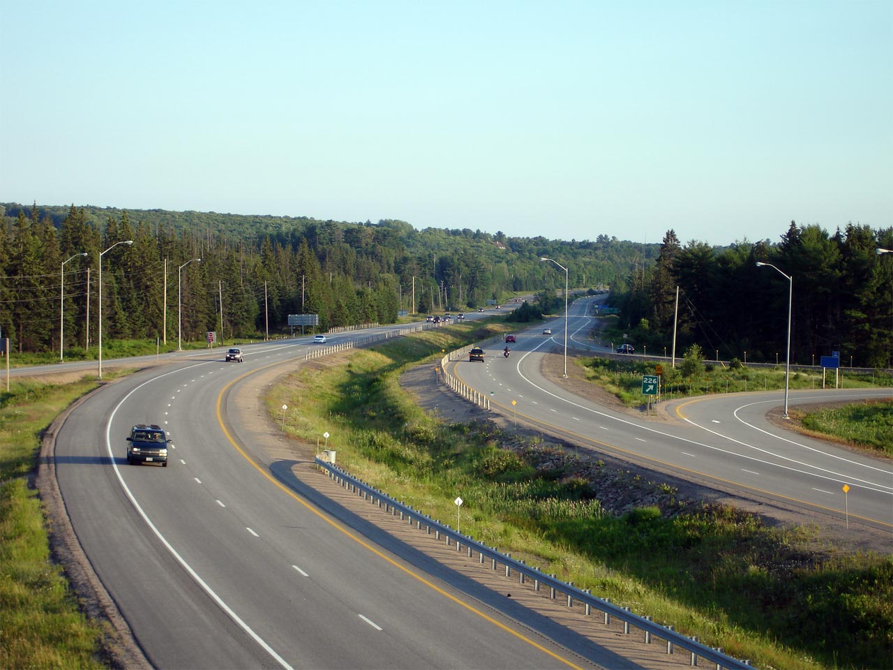
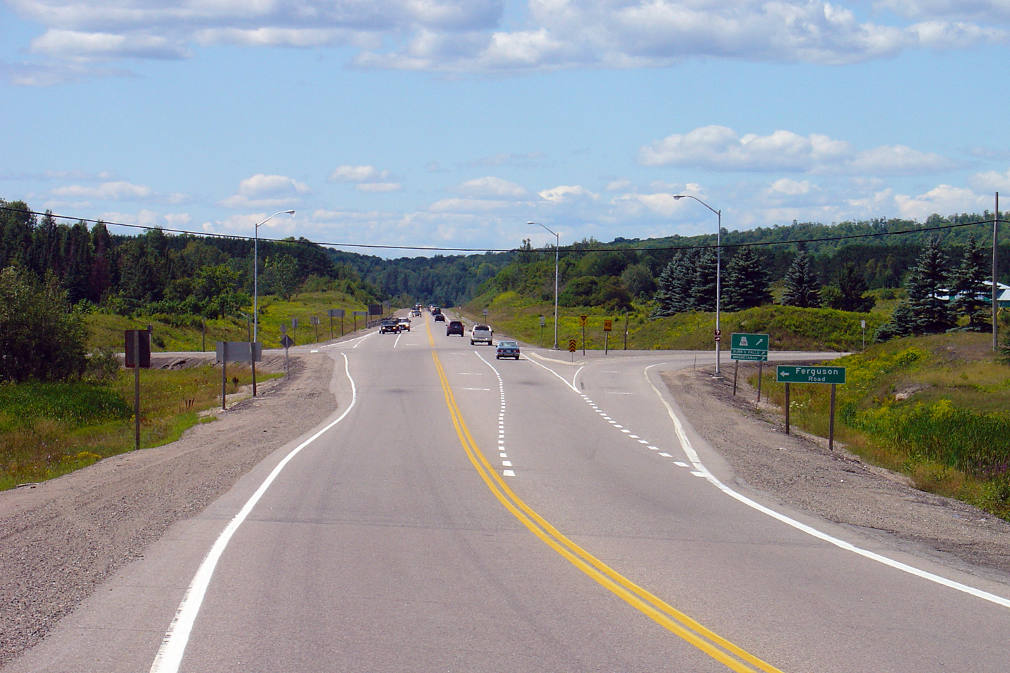
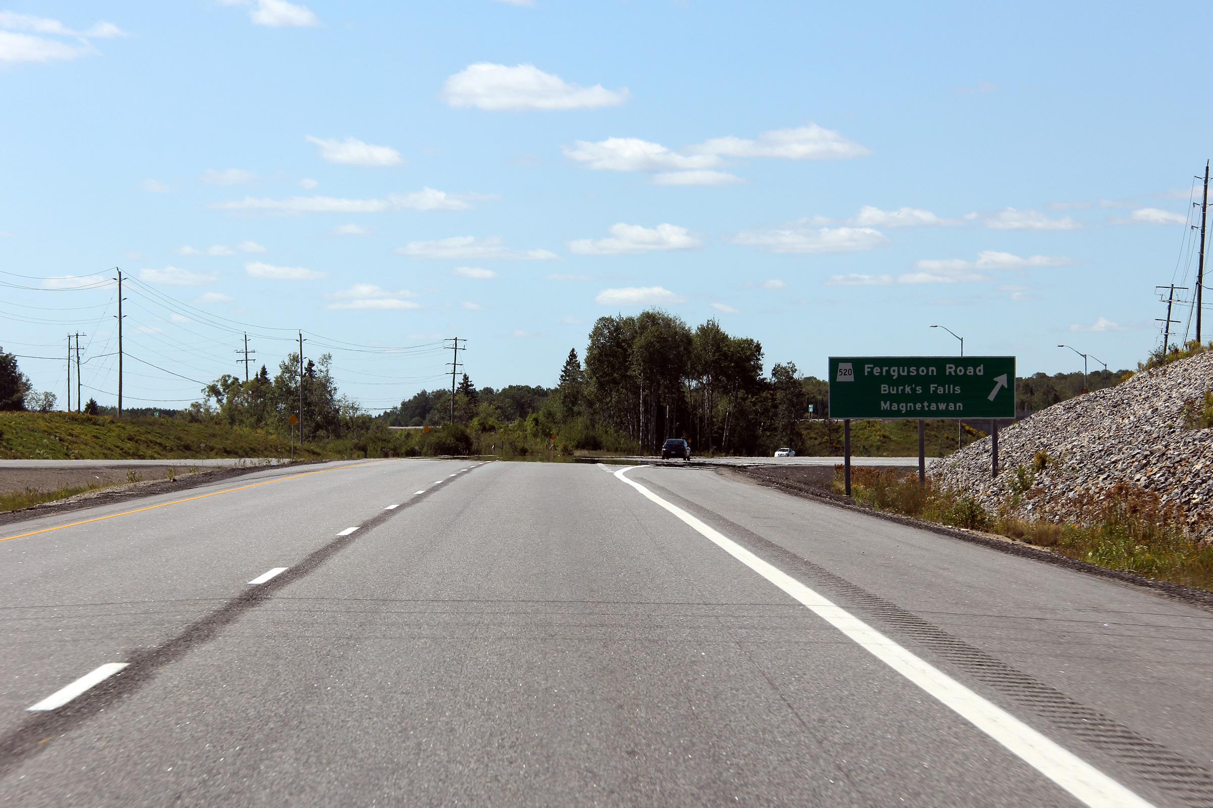
| Township of Armour District of Parry Sound |
Advanced signage for the Highway 520 interchange, taken before Highway 11
had opened as a divided highway between Emsdale and Burk's Falls. Photo taken: August 29th, 2012. |
 (720x480) (720x480)(1440x960) (2400x1600) |
|||
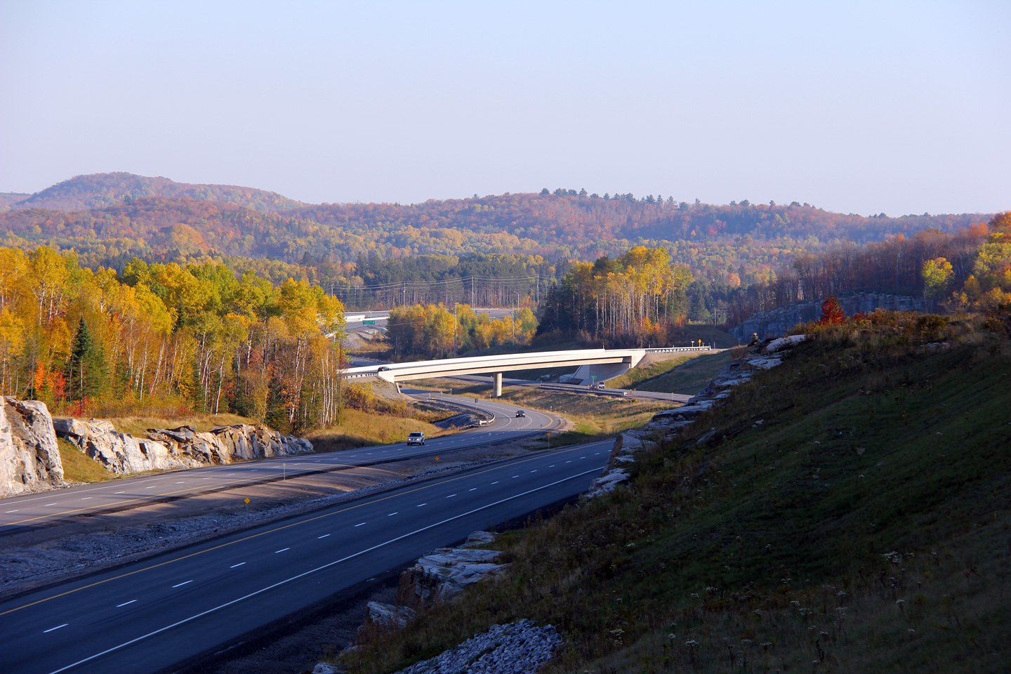
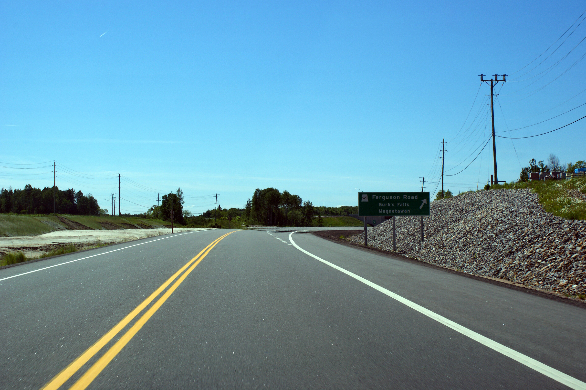
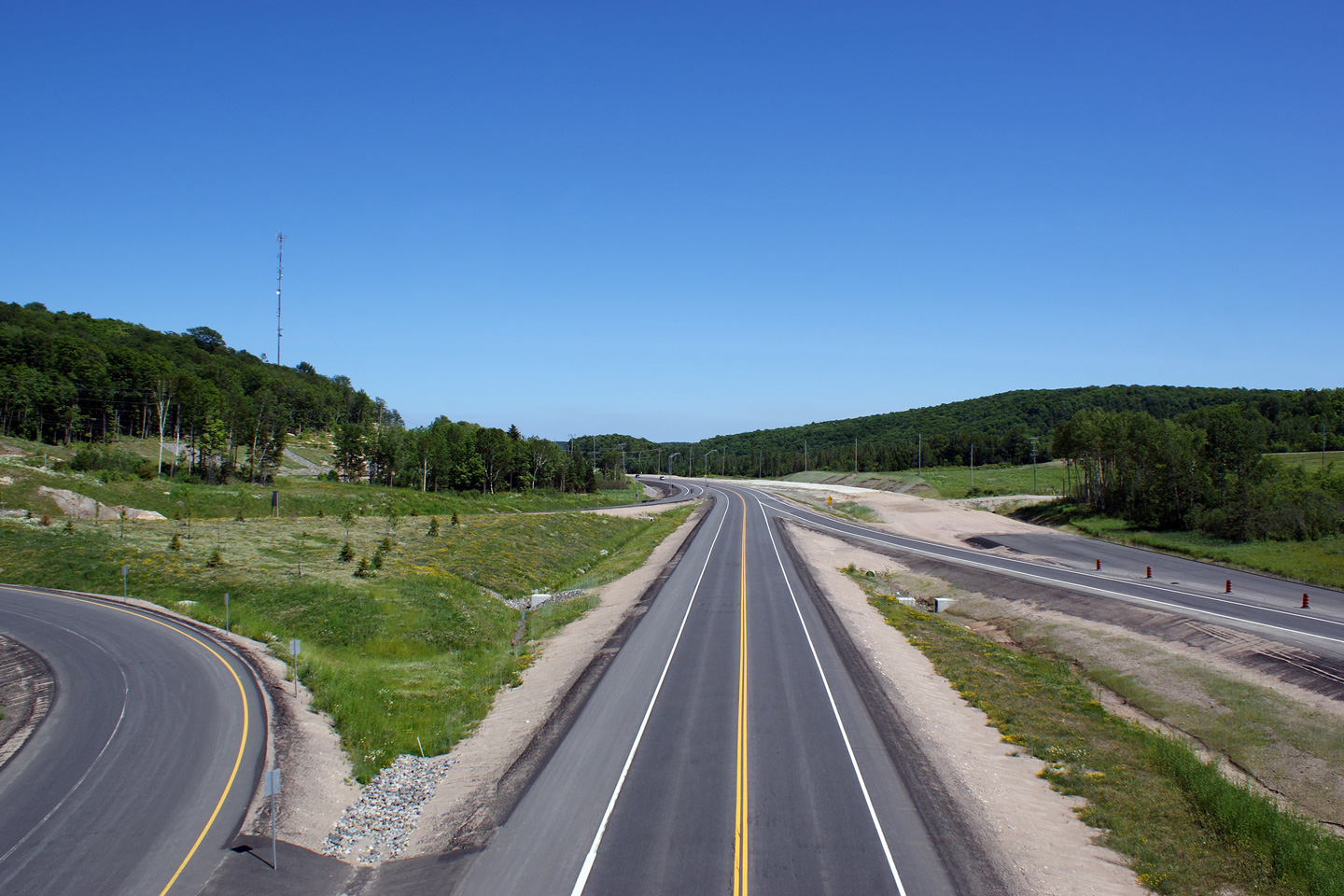
| Township of Armour District of Parry Sound |
A series of views on the northbound approach to the Highway 520 intersection
and interchange. The vantage points along Highway 11 are not identical,
however the intentions of all of the photos are the same. The
upper photo shows the Highway 520 intersection and was taken over a year prior to the
start of the construction that saw the highway twinned. The middle shows the
approach to the Highway 520 interchange while Highway 11 was still operating
as a super-2 freeway. The lower photo shows the permanent lane
configuration with Highway 11 converted to a four lane divided highway. Upper photo taken: August 14th, 2005. Middle photo taken: June 27th, 2009. Lower photo taken: August 29th, 2012. |
|
|||
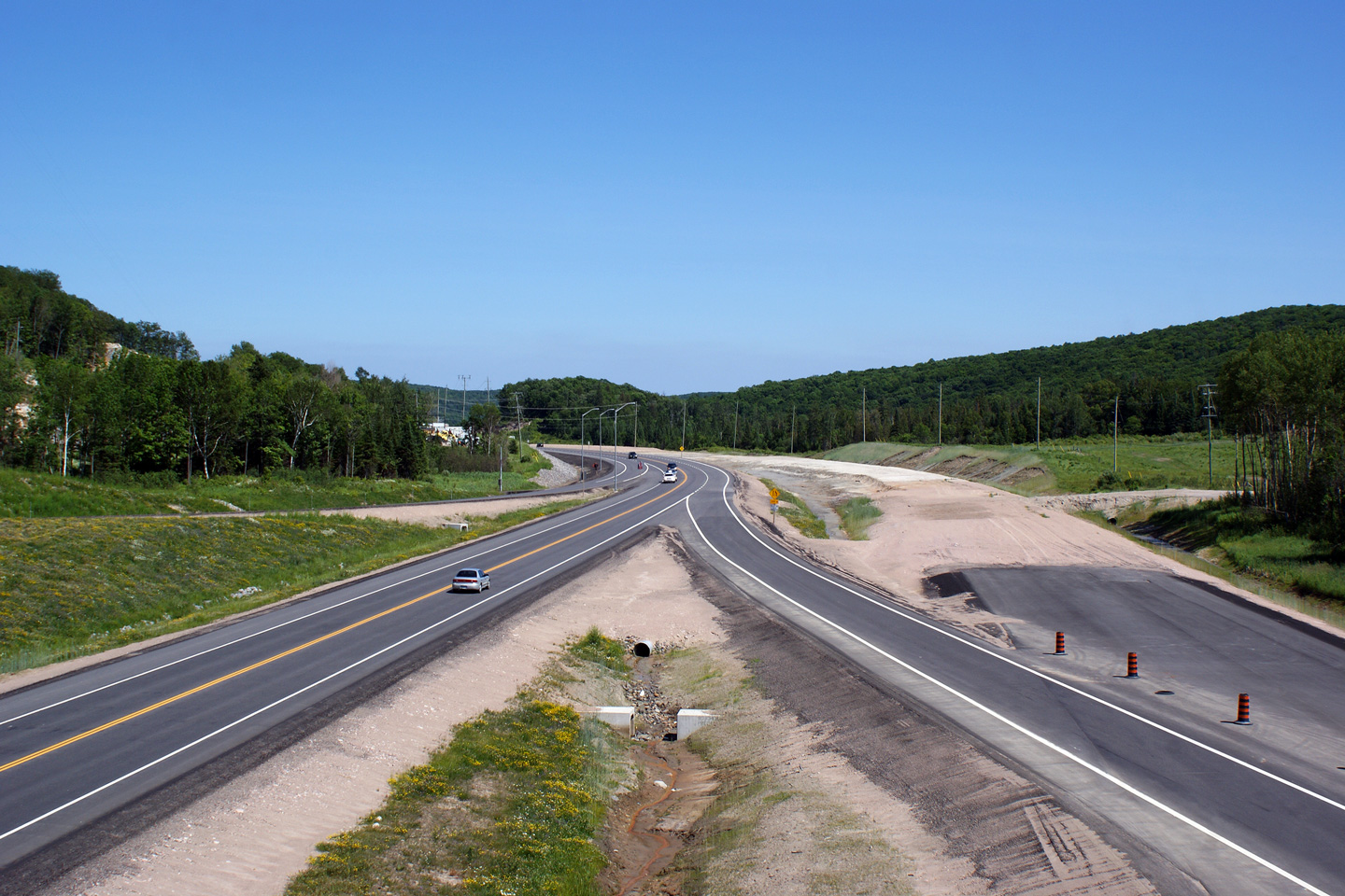
| Township of Armour District of Parry Sound |
View looking southerly along Highway 11 rounding the curve south of Burk's
Falls towards Katrine. The two lane service road to the left of the
divided highway is Katrine Road, the former alignment of Highway 11. Photo taken: August 29th, 2012. |
 (720x480) (1440x960) (2400x1600) |
|||
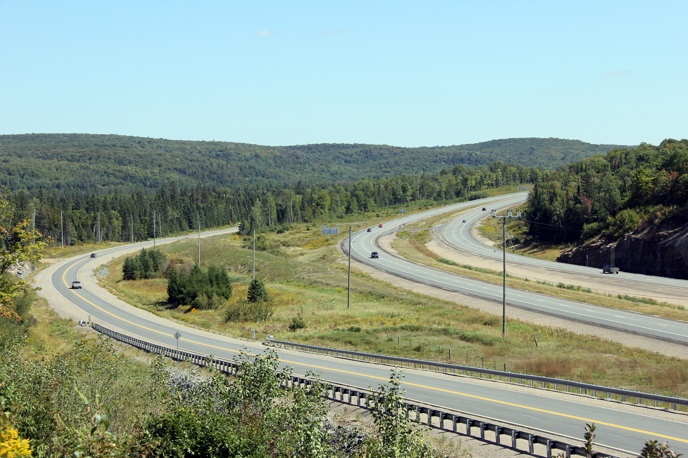
| Township of Armour District of Parry Sound |
Views looking southerly along Highway 11 from the Highway 520 overpass. The
pictured Highway 520 interchange was opened to traffic late in 2008, while
Highway 11 was still a two-lane highway. Late in 2010, the southbound
carriageway was opened to traffic, completing Highway 11 as a four-lane
highway as far north as Burk's Falls. Upper photos taken: June 27th, 2009. Lower photo taken: August 29th, 2012. |
 |
|||
| Highway 520 runs north-westerly from Highway 11 at Burks Falls towards the tiny community of Ardbeg. Click here for Highway 520 images. | |||||
| Continue north on Highway 11 via Burks Falls to Trout Creek Images | |||||
<- Page 2C Images Highway 11 Images Index Page 2E Images ->
<- Highway 10 Images Back to Highway 11 Highway 11A Images ->
Copyright (c) 2004-2013, AsphaltPlanet.ca AsphaltPlanet@asphaltplanet.ca


 (720x480)

