|
Proper Municipality Name |
Photo Description |
Photo |
|
Pictures taken
from driver's perspective appear offset from centre-line pictures: |
East-
Bound |
West-
Bound |
|
Click here for
Windsor to London Images. |
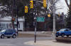
City of Woodstock
County of Oxford |
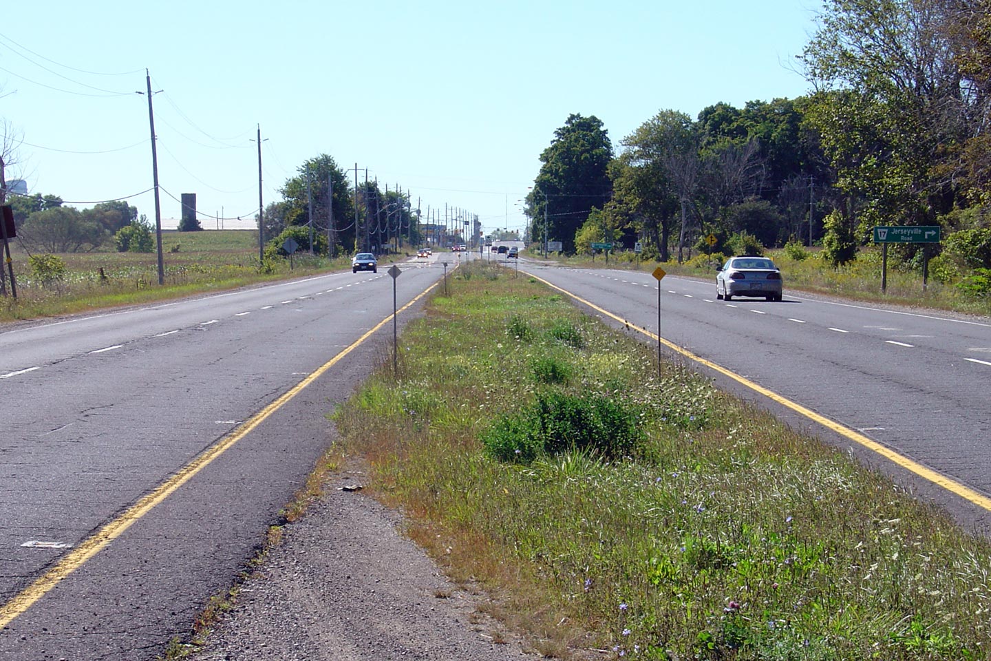
View
looking easterly towards the northern Highway 59 junction. I wish
these signs were provincial highway crowns rather than county road
flowerpots.
Photo taken: May 12th, 2009. |

(720x480)
(1440x960) |
|
Highway 59 leads both north and
south of Highway 2 in Downtown Woodstock.
Click here for Highway 59
images. |
City of Woodstock
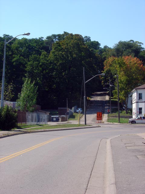
County of Oxford |
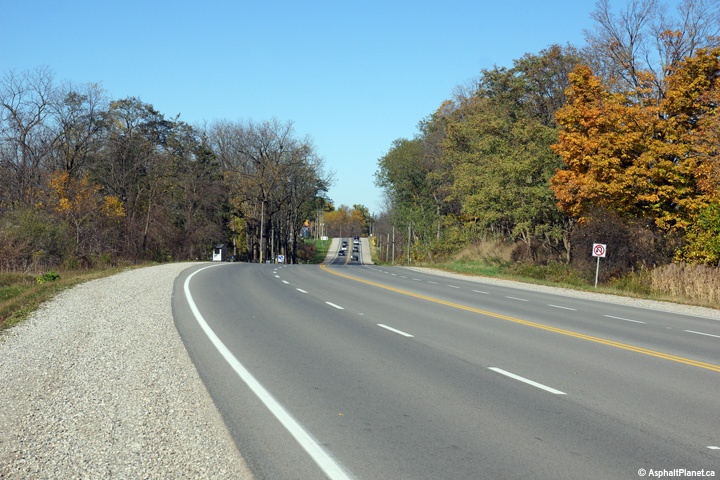
View
looking easterly from the former Town Limits of Woodstock. Highway 2
between Woodstock and Eastwood is one of few remaining examples of 1930's
divided highway remaining in the province.
Photo taken: May 12th, 2009. |

(720x480)
(1440x960) |
City of Woodstock
County of Oxford |
View
looking easterly along Highway 2 towards the Oxford Road 2 intersection.
Light standards were recently added to this section of highway as part of
the suburbanization of Highway 2 east of Woodstock for the new Toyota plant
and new industrial lands.
Photo taken: May 12th, 2009. |

(720x480)
(1440x960) |
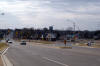
City of Woodstock
County of Oxford |
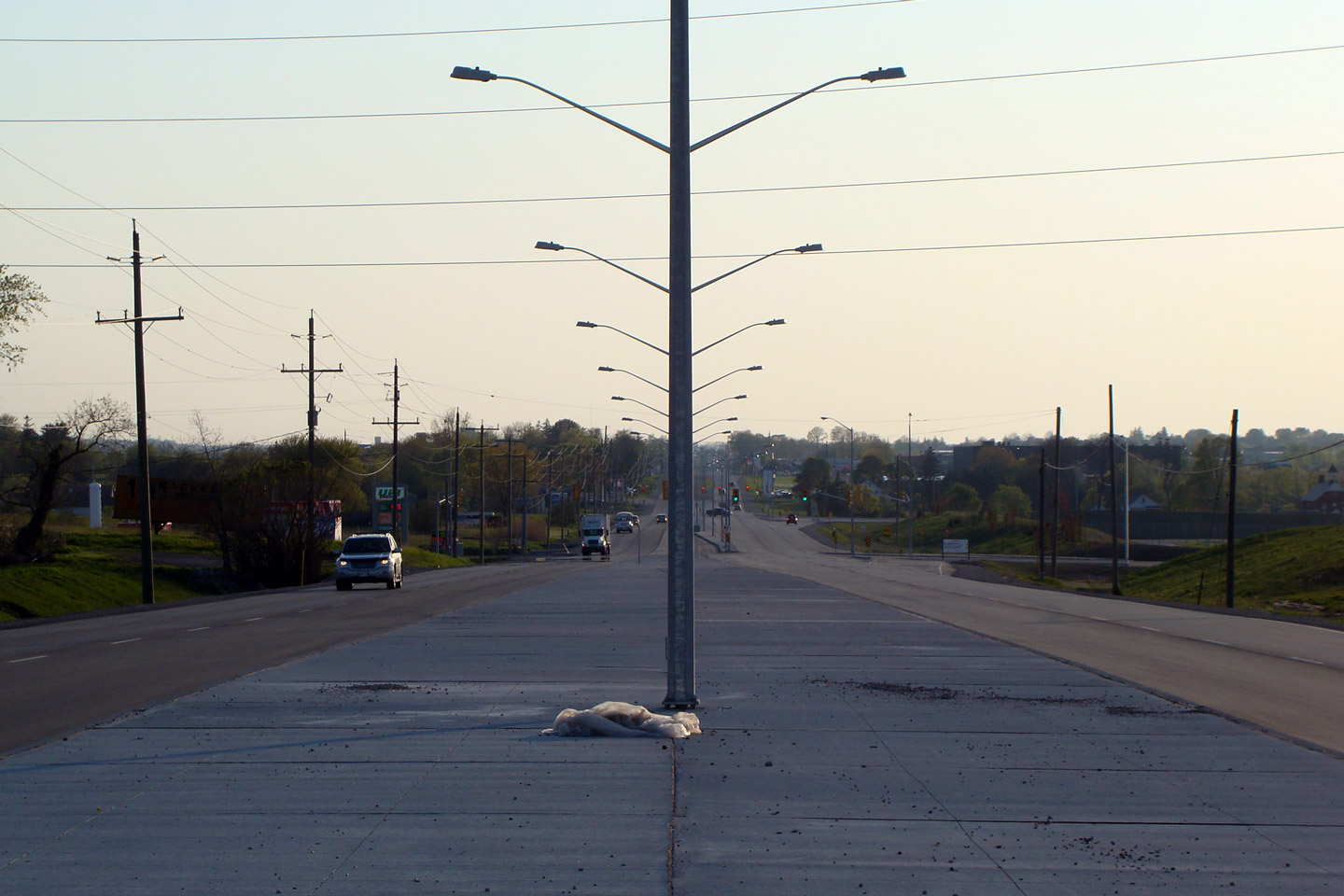
Looking
westerly into the setting sun from just west of the Highway 401 interchange.
Oxford County installed a large sanitary sewer along Highway 2 to service
Woodstock's new Toyota plant and adjacent industrial lands removing a
section of former depressed grass median.
Photo taken: May 12th, 2009. |

(720x480)
(1440x960) |
City of Woodstock
County of Oxford |
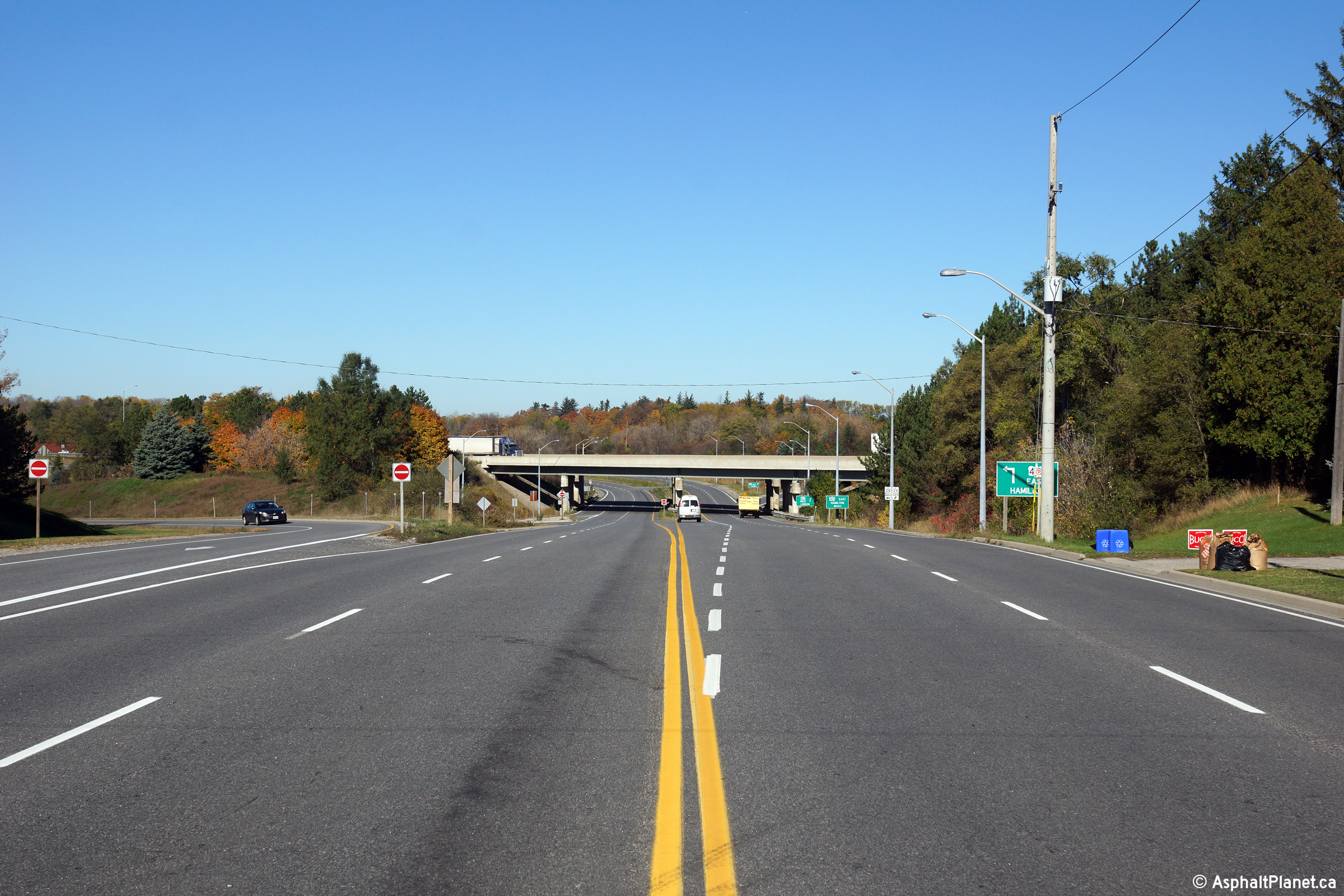
View
looking easterly along Highway 2 towards the Highway 401 interchange.
This photo was taken after the Woodstock Highway 401 interchange was
reconfigured from a cloverleaf to a parclo.
Photo taken: May 12th, 2009. |

(720x480)
(1440x960) |
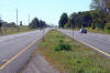
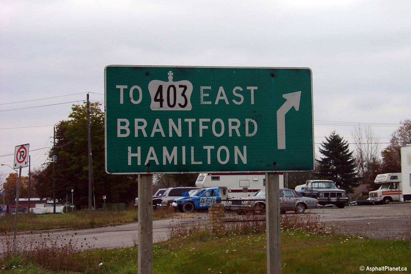
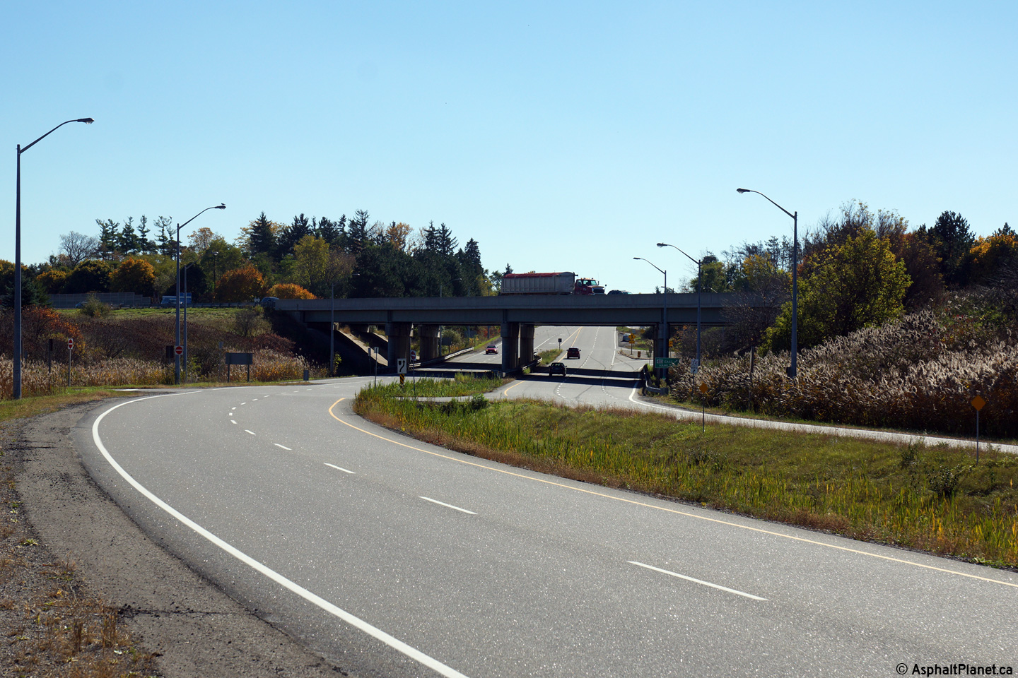
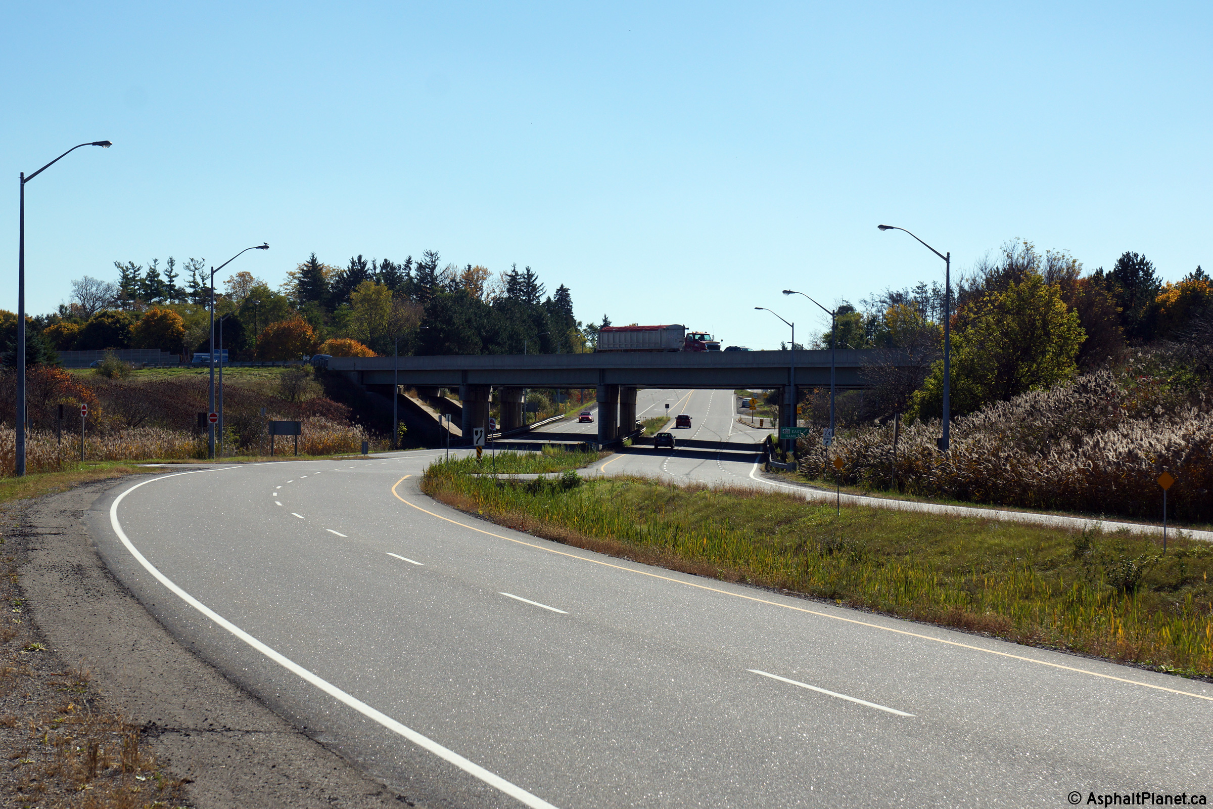
Blandford-Blenhiem / Norwich
Boundary
County of Oxford |
Eastbound signage approaching the Highway 53 intersection directing traffic
to Highway 403. This sign was likely installed when Highway 403 was
first extended westerly to the Highway 53 interchange in the early 1980s.
Before Highway 403 was finally extended to Highway 401 in 1987, motorists
bound for Highway 403 needed to utilize either Highway 2 or Towerline Road
to access the highway.
Photo taken: August 21st, 2004. |
 (720x480) (720x480)
(1440x960) |
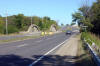
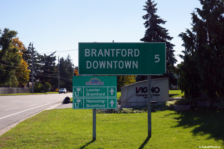
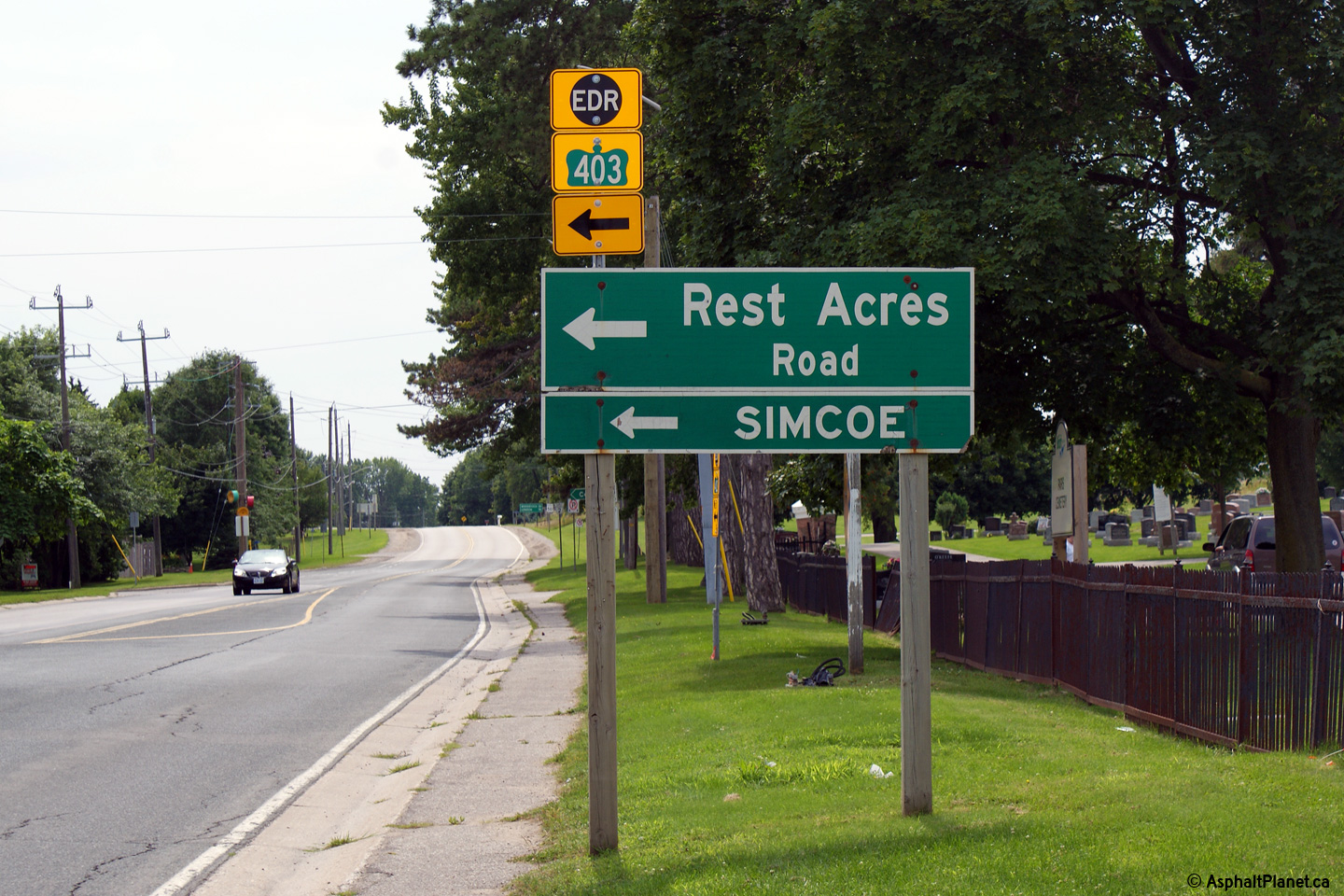
| City of Brant County |
Westbound signage at Rest Acres Road. Rest Acres Road was formerly
part of the MTO's highway network as Highway 7094. Rest Acres Road was
transferred to municipal control during the 1990s.
Photo taken: August 3rd, 2009. |
 (720x480) (720x480)
(1440x960) |
|
Highway 24A started in Paris, and led traffic
northerly to the Brant-Waterloo Boundary. Click here for Highway 24A
images. (Coming Soon!) |
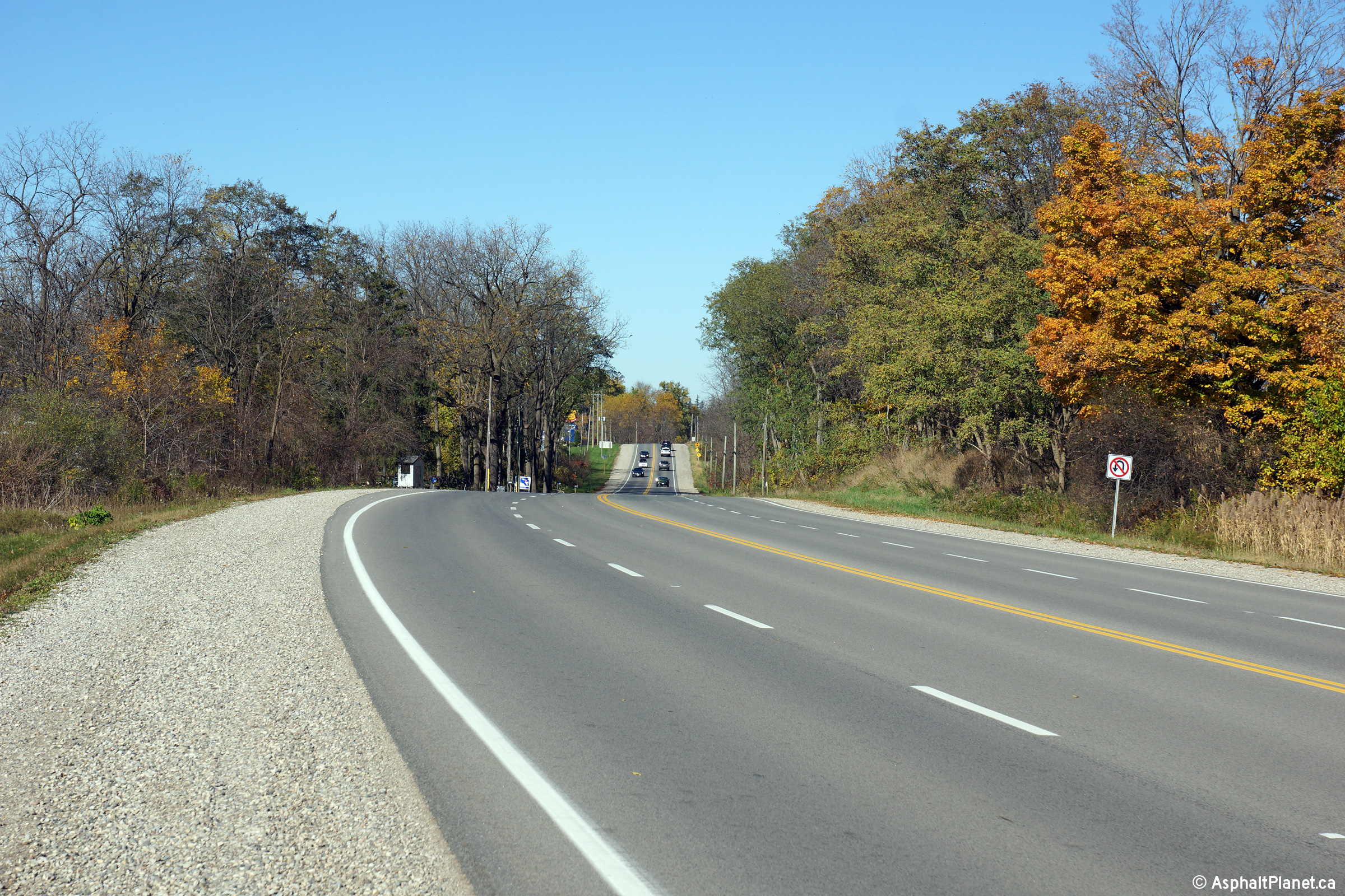
| City of Brant County |
View looking westerly along Highway 2 at the
Highway 24A junction. Just west of Highway 24A Highway 2 begins its
long climb up to the top of the Grand River Valley. Picture taken:
September 14th, 2007. |

(720x480)
(1440x960) |
| City of Brant County |
View looking westerly as Highway 2 nears the
Mount Elgin Road intersection. At this intersection, Highway 2 turns
abruptly easterly, after having abruptly turned south at the Highway 24A
intersection. Picture taken: September 14th, 2007. |

(720x480)
(1440x960) |
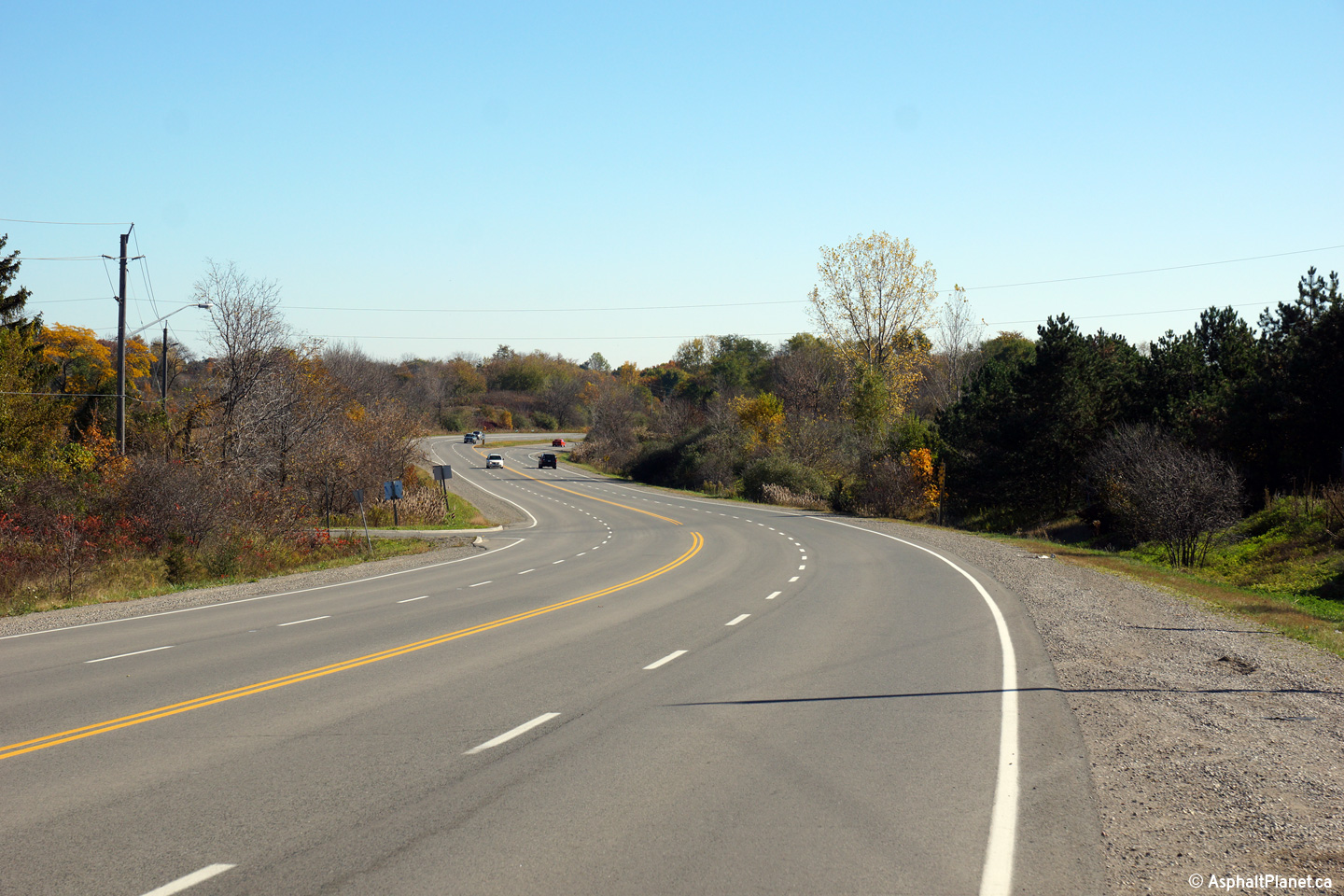
| City of Brant County |
View looking west as Highway 2 rounds the sharp
curve to avoid the Mount Elgin Hill. Before the 403 was pushed west to
Rest Acres Road, Paris was a major bottleneck between Hamilton and
Woodstock, since both Highway 2 and Highway 5 traffic had to navigate the
sharp turns and steep hills contained in the west end of the small town.
Picture taken: September 14th, 2007. |

(720x480)
(1440x960) |
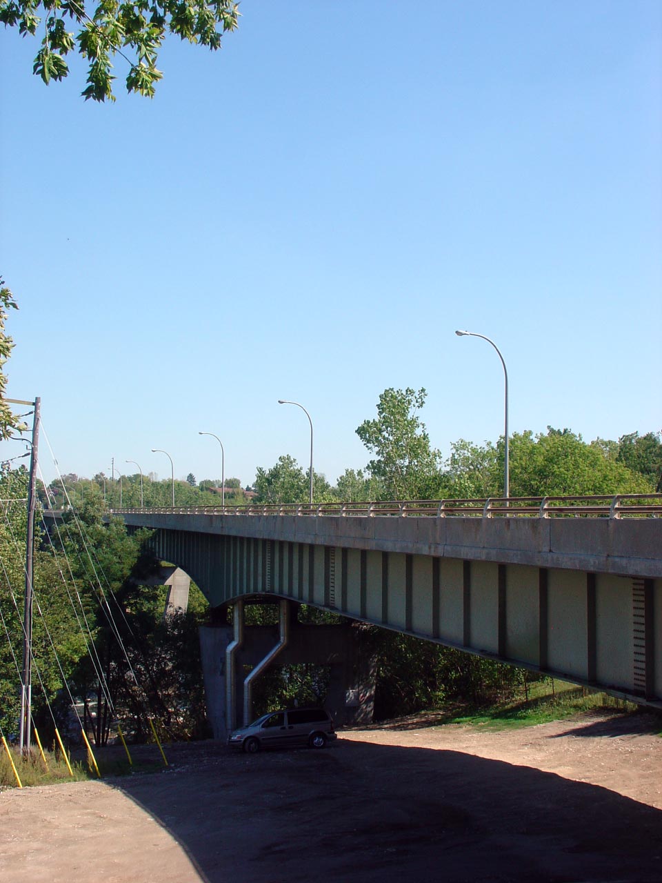
| City of Brant County |
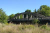
Looking east as Highway 2 crosses overtop the
Grand River on a modern high-level structure. Picture taken: September
14th, 2007. |

(720x480)
(1440x960) |
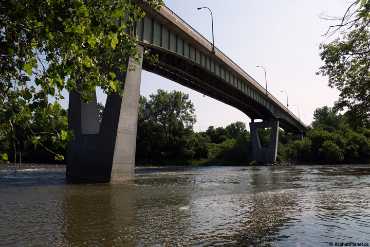
| City of Brant County |
The current Grand River bridge
was completed in 1967 and is a massive haunch steel girder design.
Notice the rounded light standards that were common along Ontario's highways
during the 1960s. Picture taken: September 14th, 2007. |

(720x480)
(1440x960) |
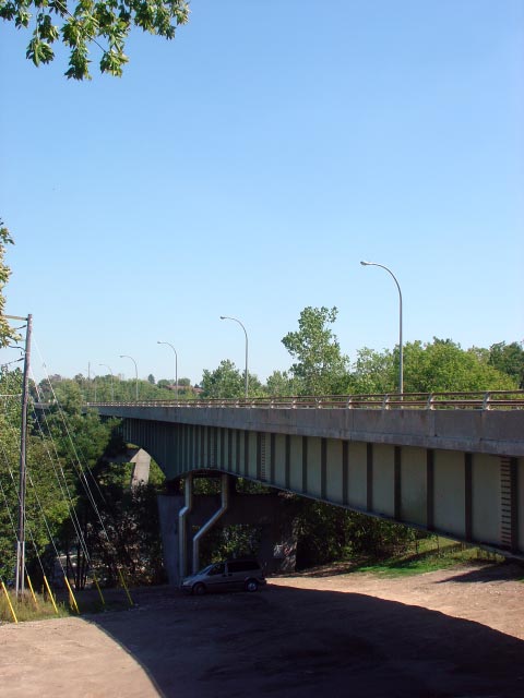
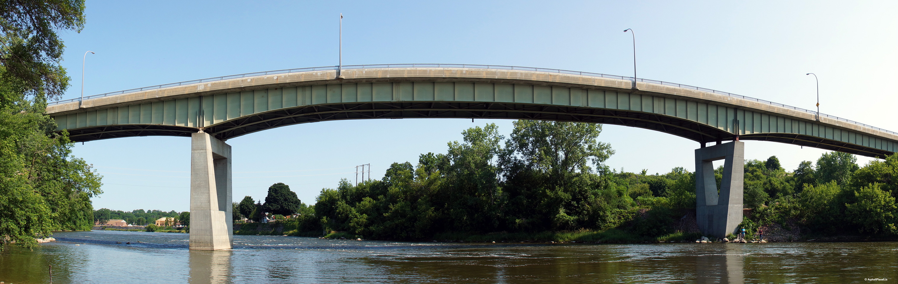
| City of Brant County |
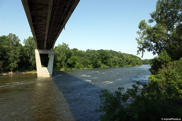
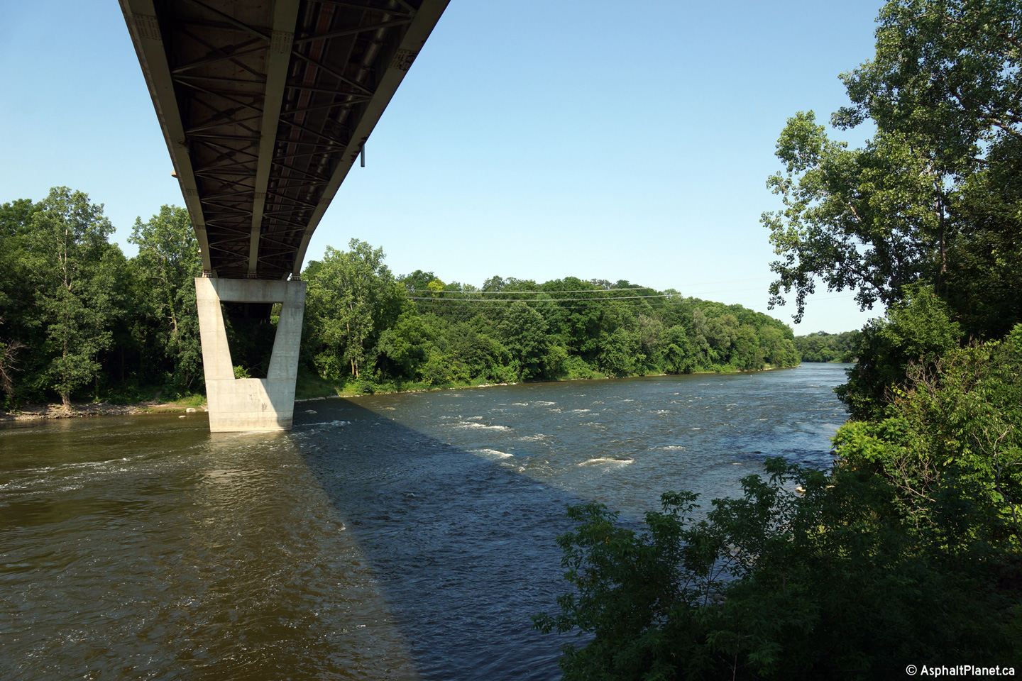
View looking easterly underneath the massive Grand River Bridge from the
western bank of the Grand River.
Photo taken: July 18th, 2014. |

(720x480)
(1440x960)
(2400x1600) |
| City of Brant County |
Two views looking northerly towards the Grand River Bridge from the western
bank of the Grand River. The immense length of the structure makes it
difficult to photograph.
Photos taken: July 18th, 2014. |

(720x480)
(1440x960)
(2400x1600)

(1517x480)
(3034x960)
(5057x1600) |
| City of Brant County |
View beneath the deck of the large Grand River Bridge from the eastern bank
of the river.
Photo taken: July 18th, 2014. |

(720x480)
(1440x960)
(2400x1600) |
| City of Brant County |
This view looks westerly approaching the Willow Street intersection.
Since this photo was taken, traffic signals have been added to this
intersection.
Photo taken: September 29th, 2006. |

(720x480)
(1440x960) |
| City of Brant County |
View looking westerly through Paris towards the Paris CNR Subway from just
west of the Highway 5 intersection.
Photo taken: September 29th, 2006. |

(720x480)
(1440x960) |
| City of Brant County |
Easterly view towards the Highway 5 intersection. Eastbound motorists
continuing along Highway 2 must follow the ramp to the right at this
intersection.
Photo taken: September 29th, 2006. |

(720x480)
(1440x960) |
|
Highway 5 formerly led easterly
from Highway 2 at Paris running parallel to Highway 2 until meeting Highway
2 once again in Scarborough.
Click here for Highway 5 images. |
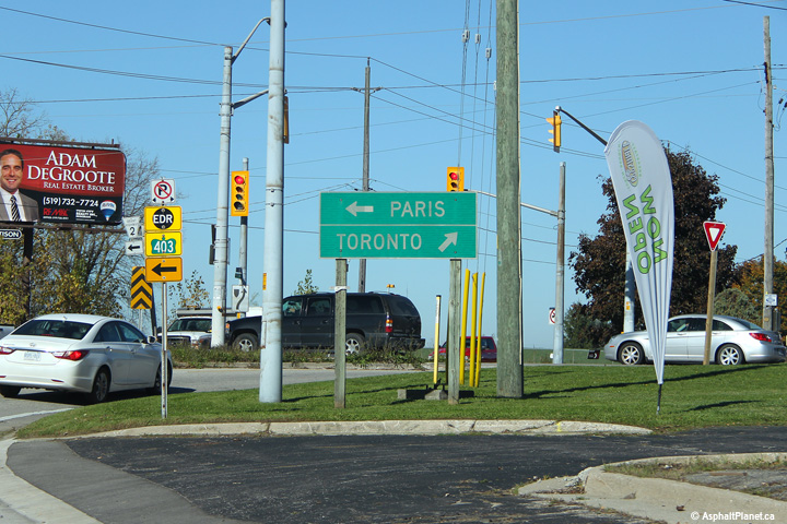
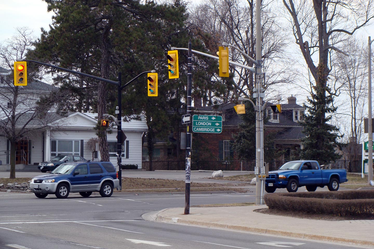
| City of Brant County |
Destination signage at the Highway 5 junction in Paris.
Photo taken: October 23rd, 2014. |
 (720x480) (720x480)
(1440x960) |
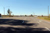
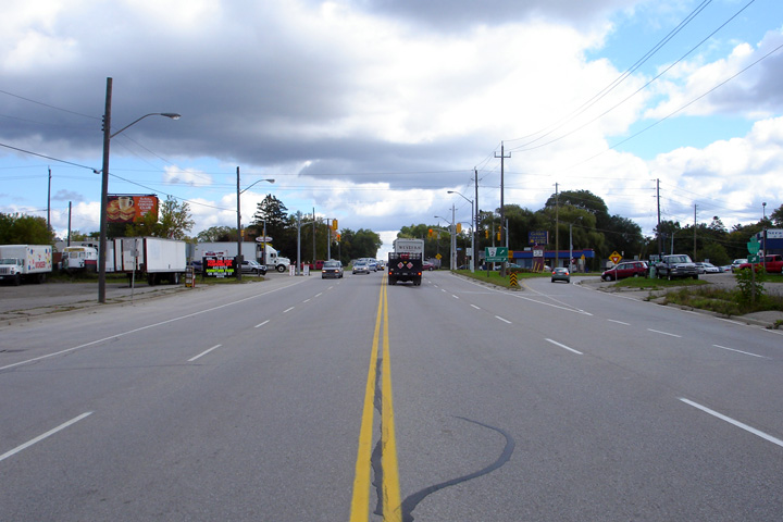
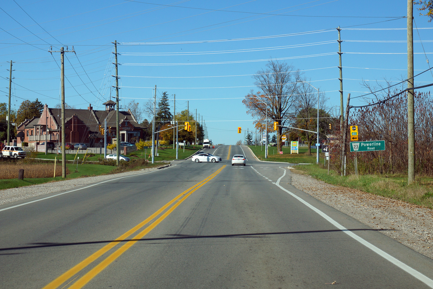
| City of Brant County |
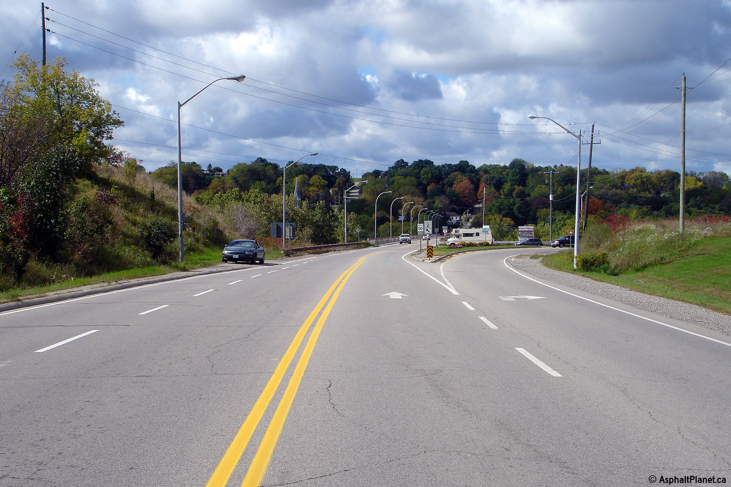
Westerly view along Highway 2 approaching the Powerline Road intersection
between Paris and Brantford.
Photo taken: October 23rd, 2014. |

(720x480)
(1440x960)
(2400x1600) |
| City of Brant County |
Westerly view as Highway 2 narrows from four to two lanes west of the
Highway 403 interchange in Brantford.
Photo taken: October 23rd, 2014. |

(720x480)
(1440x960)
(2400x1600) |
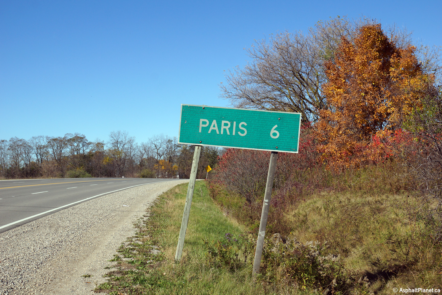
| City of Brant County |
Distance signage for Paris located along Highway 2 west of the Highway 403
interchange in western Brantford.
Photo taken: October 23rd, 2014. |
 (720x480) (720x480)
(1440x960) |
| City of Brant County |
This view looks easterly towards the western Highway 403 interchange in
Brantford from about 1km west of the interchange.
Photo taken: October 23rd, 2014. |

(720x480)
(1440x960)
(2400x1600) |
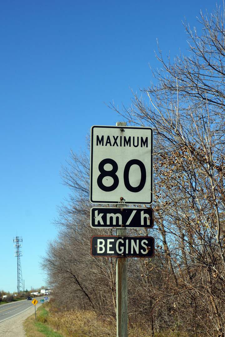
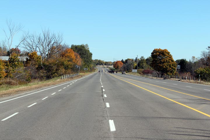
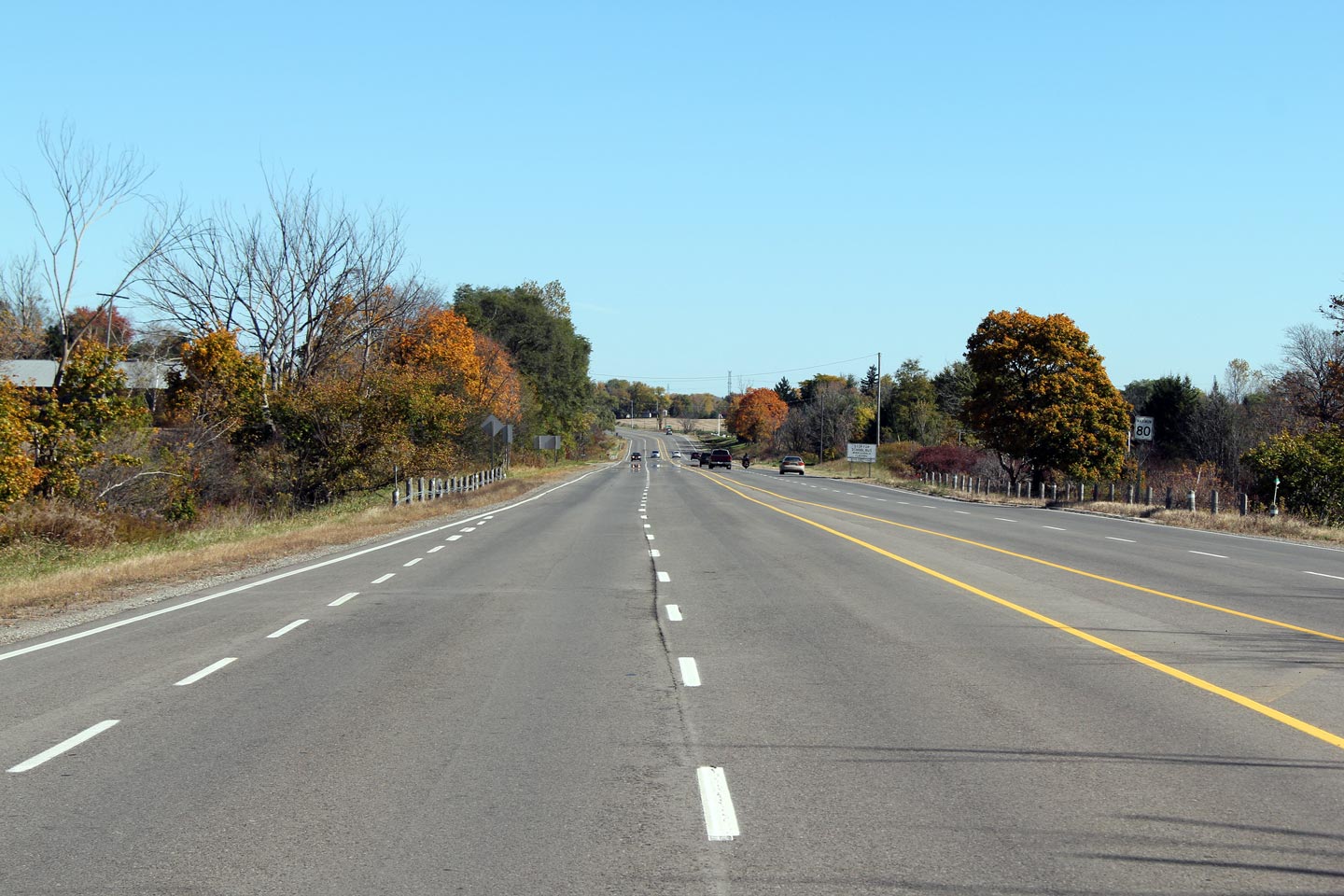
| City of Brantford |
Older style speed limit signage along Highway 2 west of Brantford.
Modern speed limit signs generally no longer use a separate sign for the
km/h tab.
Photo taken: October 23rd. 2014. |
 (720x480) (720x480)
(1440x960) |
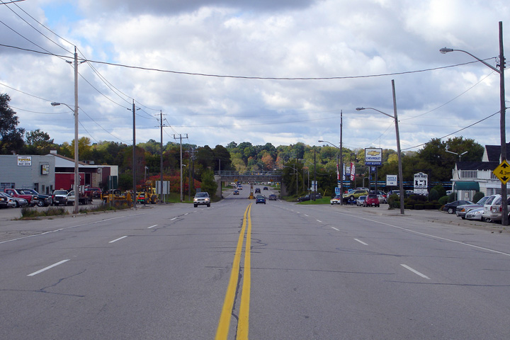
| City of Brantford |
This view looks westerly along Highway 2 from just west of the Highway 403
interchange.
Photo taken: October 23rd, 2014. |

(720x480)
(1440x960)
(2400x1600) |
| City of Brantford |
View looking easterly towards the Highway 403 interchange in western
Brantford. Eastbound traffic along Highway 2 cannot access Highway 403
Westbound at this interchange.
Photo taken: October 23rd, 2014. |

(720x480)
(1440x960)
(2400x1600) |
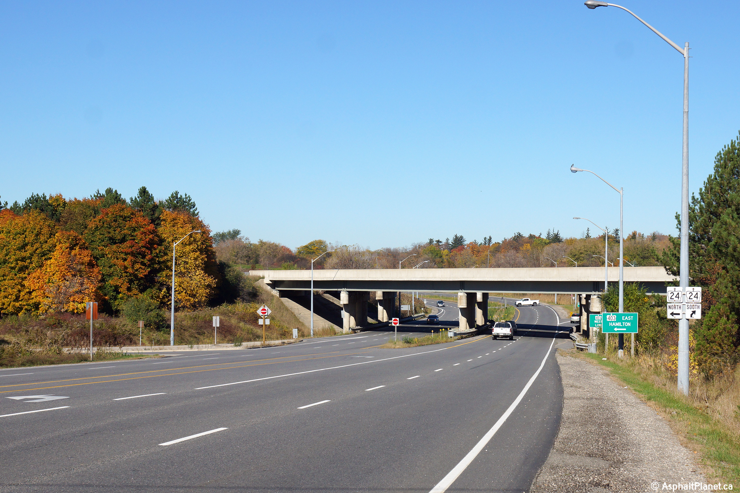
|
Highway 2 crosses Highway
403 at the western edge of Brantford. Click
here for Highway 403-West images and
here for Highway 403-East images. |
| City of Brantford |
View at the eastbound ramp terminal from Highway 403, looking westerly along
Highway 2. Note the junction assembly for Highway 24 at this
interchange. Since 1998, Highway 24 has been routed along Highway 403
between Paris and Brantford.
Photo taken: October 23rd, 2014. |

(720x480)
(1440x960)
(2400x1600) |
| City of Brantford |
Westerly view approaching the Highway 403 interchange west of Brantford.
Photo taken: October 23rd, 2014. |

(720x480)
(1440x960)
(2400x1600) |
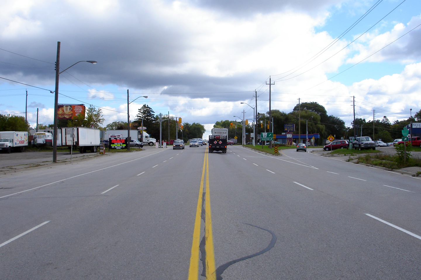
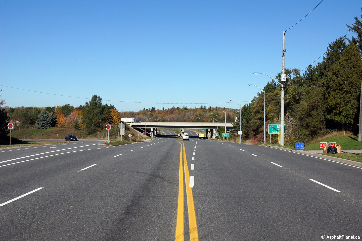
| City of Brantford |
Distance signage along Highway 2 just east of the Highway 403 interchange
for Downtown Brantford.
Photo taken: October 23rd, 2014. |
 (720x480) (720x480)
(1440x960) |
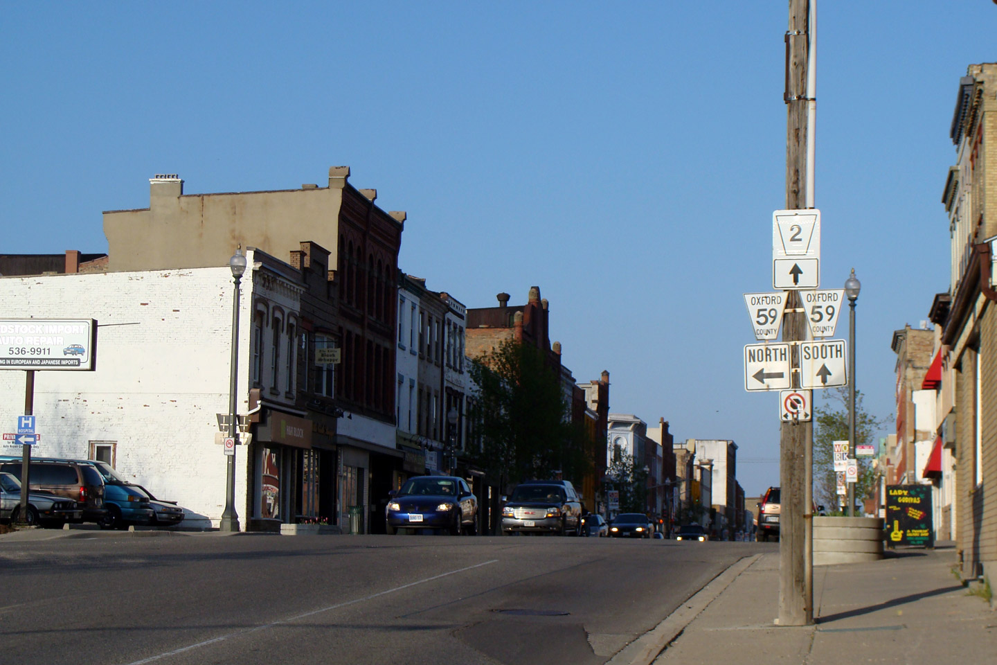
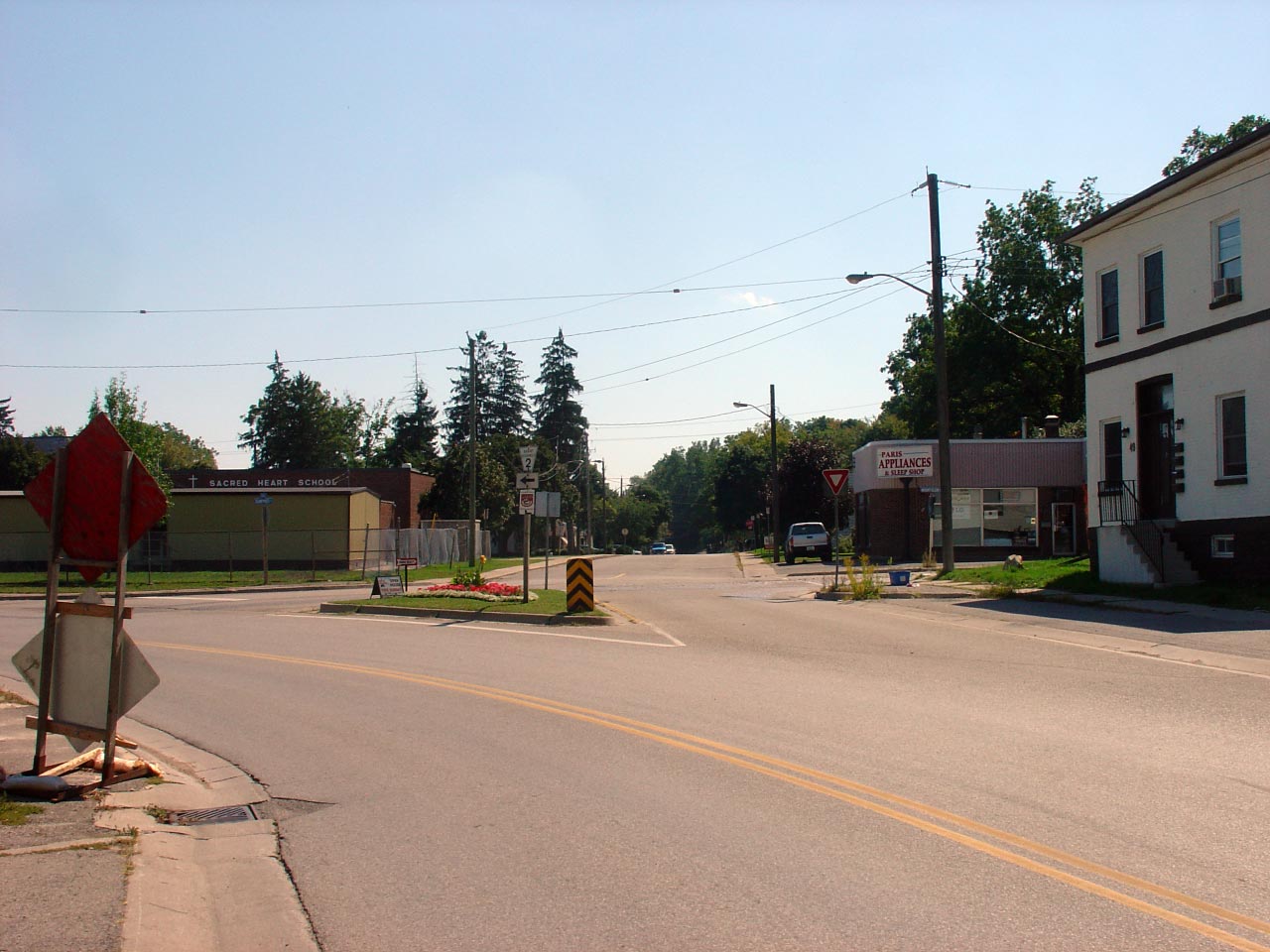
| City of Brantford |
Westerly view at the directional sign at the western end of Dalhousie Street
in Downtown Brantford. Historically, at this junction, Highway 2 and
Highway 24-North continued to the right bound for Paris and Cambridge, while
Highway 53 and Highway 24-South continued to the left bound for Burford and
Simcoe.
Photo taken: March 21st. 2009. |
|
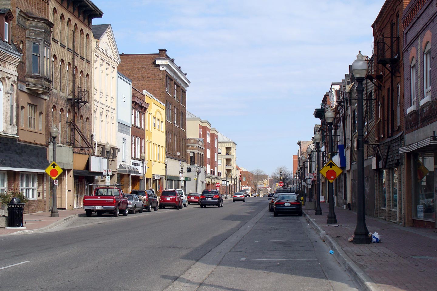
| City of Brantford |
Easterly view along Highway 2/53 along Colborne Street in Brantford.
Downtown Brantford has an alarming number of abandoned buildings.
Photo taken: March 21st, 2009. |
 (720x480) (720x480)
(1440x960) |
| City of Brantford |
View looking westerly as Highway 2/53 splits into a pair of single direction
two-way streets just east of Downtown Brantford.
Photo taken: March 21st, 2009. |
(720x480)
(1440x960) |
| City of Brant County |
View looking westerly along Highway 2/53 from the twin Fairchild Creek
bridges. Highway 2/53 is generally not a divided highway between
Brantford and Ancaster, in this case, however, the highway has widened only to cross
the twin Fairchild Creek bridges.
Photo taken: September 19th, 2004. |
(720x480)
(1440x960) |
| City of Brant County |
Easterly view along Highway 2/53 approaching the dual Fairchilds Creek
bridges.
Photo taken: September 19th, 2004. |
(720x480)
(1440x960) |
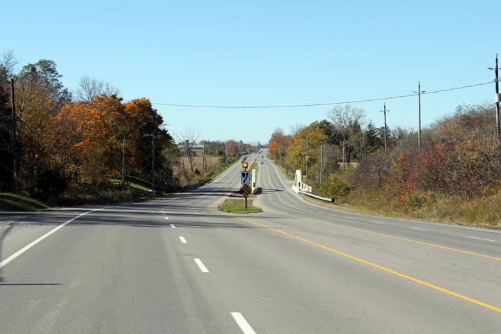
| City of Brant County |
View looking southerly at the northern elevation of the 1931 concrete bowstring bridge over Fairchilds Creek. When this photo was taken in 2004, the aging
bowstring bridge was in deteriorating condition. In 2005, the
structure was extensively rehabilitated.
Photo taken: September 19th, 2004. |
(720x480)
(1440x960) |
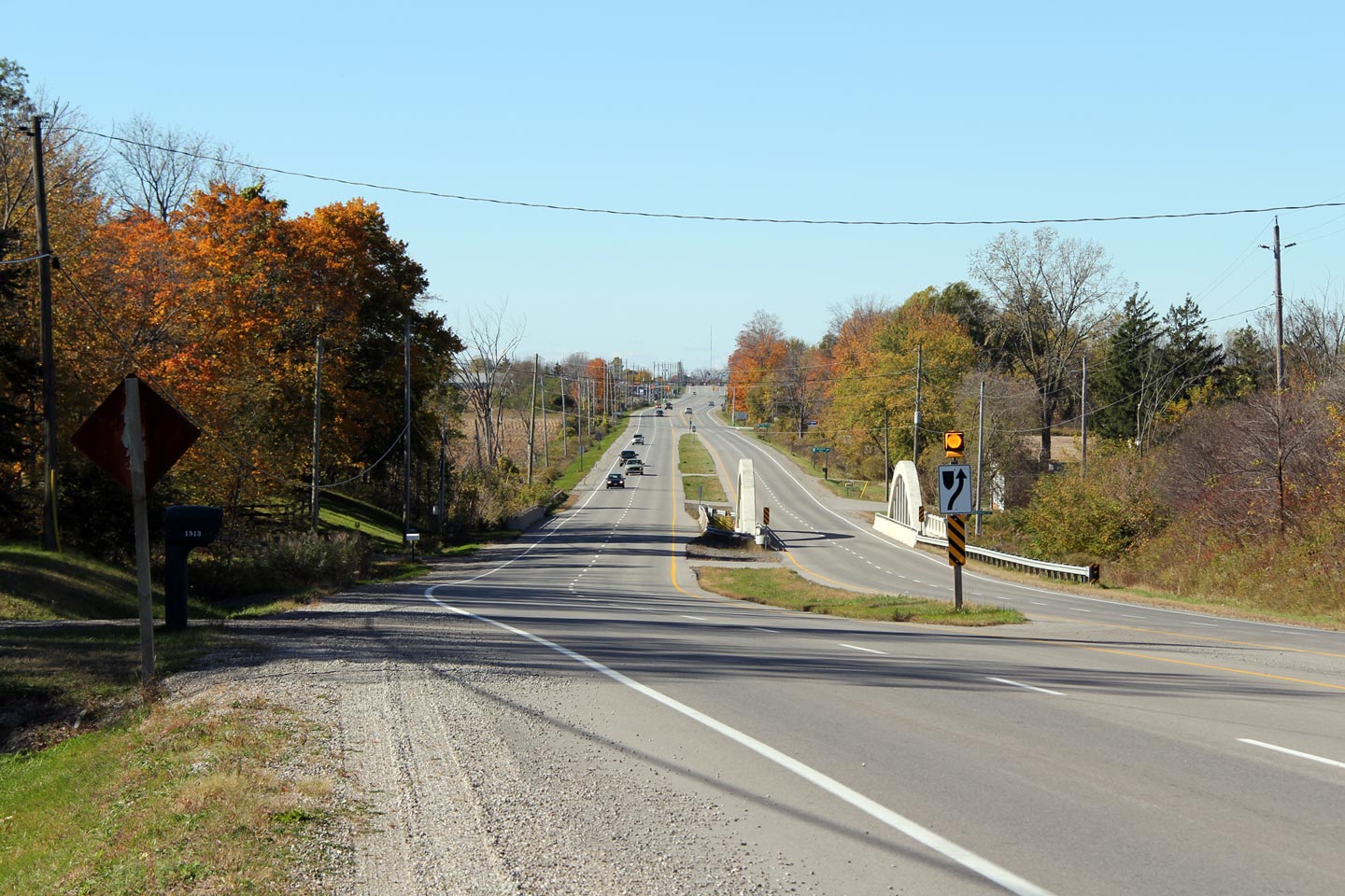
| City of Brant County |
Two views looking westerly across the twin Fairchilds Creek Bridges. The Bowstring Bridge on the right of the photo was
completed in 1931 and
rehabilitated in 2005. The rehabilitation of the 1931 Fairchilds
Creek bridge proved to be one of Ontario's most detailed and historically
accurate rehabilitations of a concrete bowstring bridge.
Photos taken: October 15th, 2010. |

(720x480)
(1440x960)
(2400x1600)

(720x480)
(1440x960)
(2400x1600) |
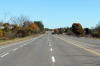
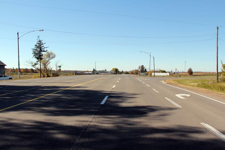
| City of Hamilton |
Westerly view along Highway 2/53 at the Sunny Ridge Road intersection.
Take notice of the vintage light standards that stand beside this near
deserted highway. The luminaries have new.
Photo taken: October 16th, 2010. |
(720x480)
(1440x960)
(2400x1600) |
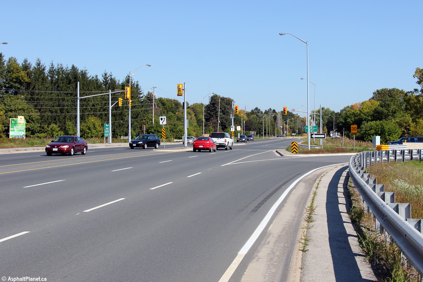
| City of Hamilton |
Looking easterly along Highway 2/53 from the Sunny Ridge Road intersection.
Photo taken: October 16th, 2010. |
(720x480)
(1440x960)
(2400x1600) |
|
Highway 52 progresses northerly
from Highway 2/53 bound for Copetown and Highway 5 and 8.
Click here for Highway 52 images. |
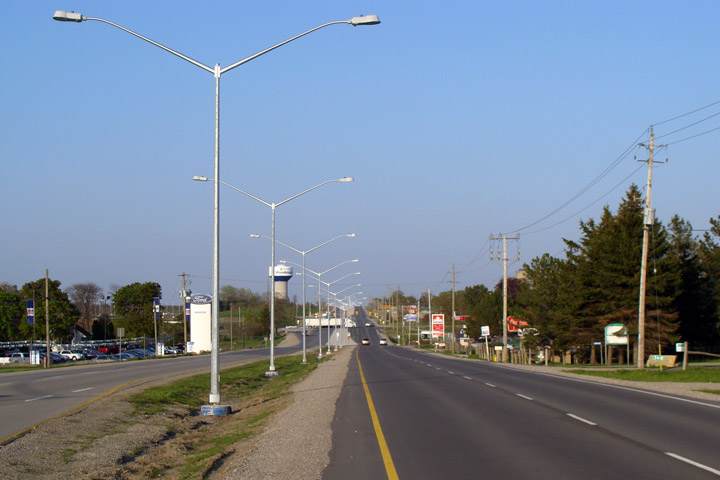
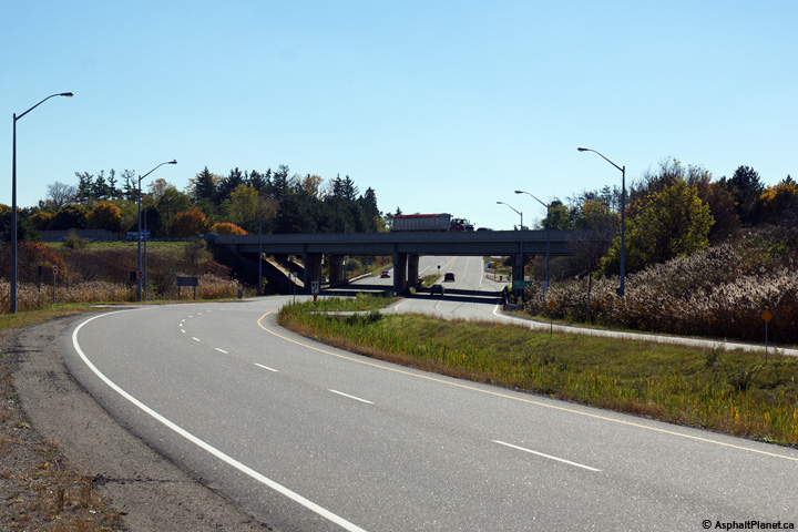
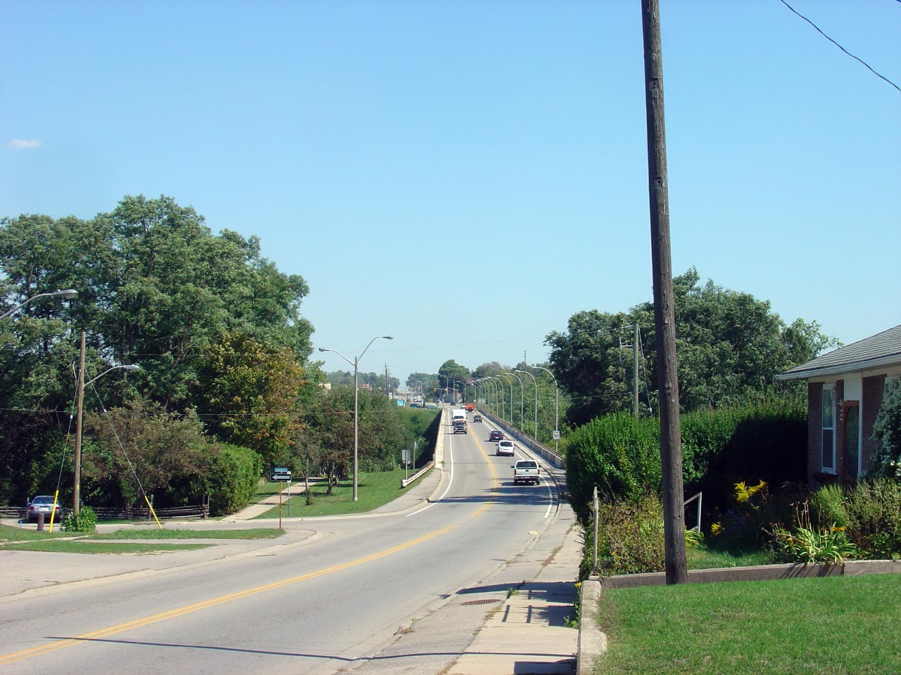
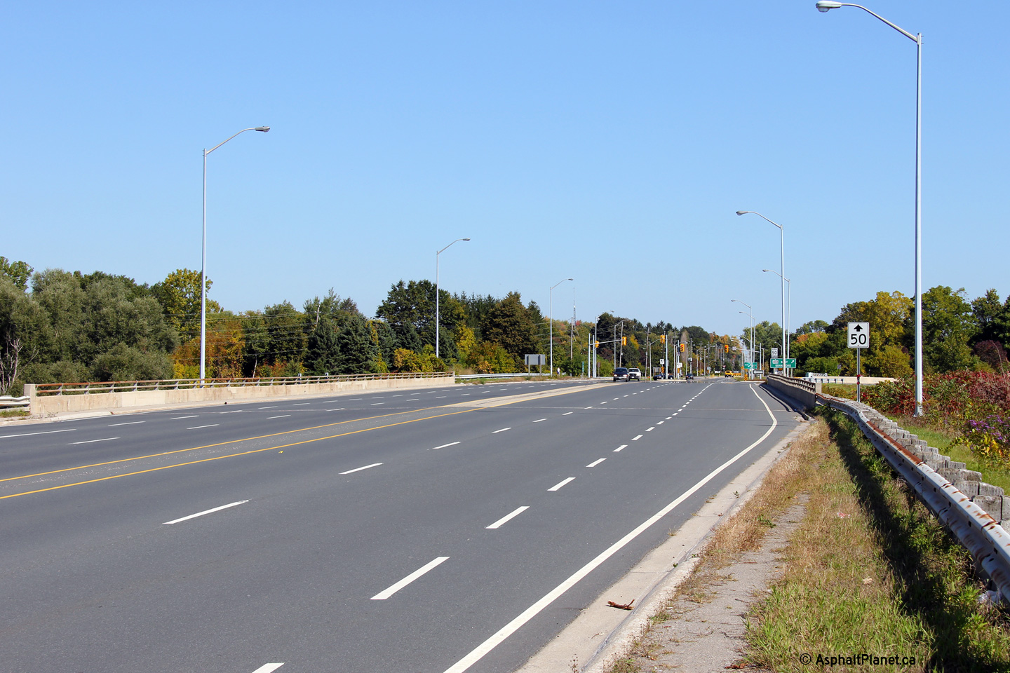
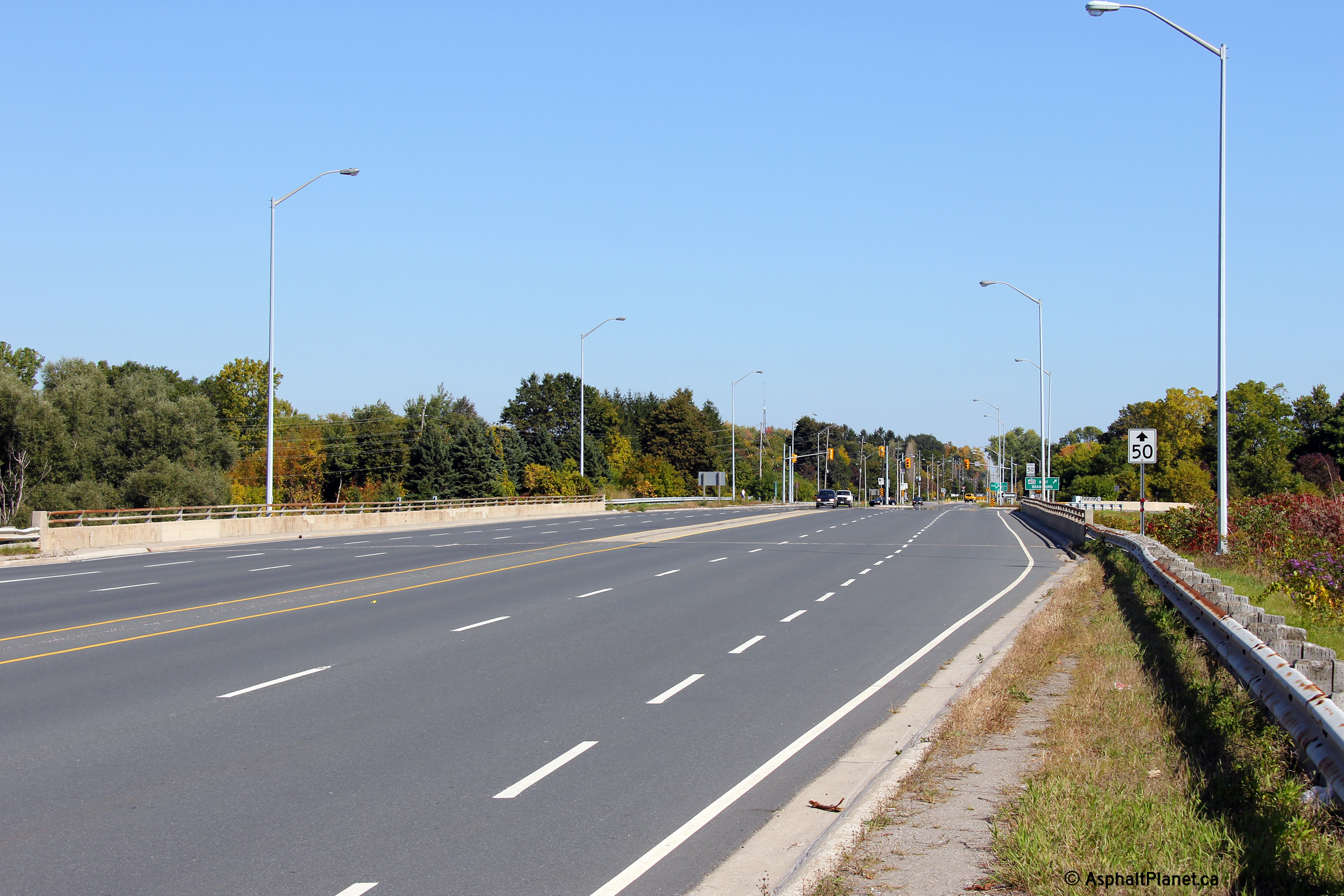
| City of Hamilton |
This view looks easterly along Highway 2 towards the Highway 403 interchange
in Ancaster.
Photo taken: October 7th, 2011. |

(720x480)
(1440x960)
(2400x1600) |
| City of Hamilton |
View looking westerly towards Duff's Corners along Highway 2 at the Highway
403 interchange. The pictured structure was rehabilitated during the 2014
construction season.
Photo taken: October 7th, 2011. |

(720x480)
(1440x960)
(2400x1600) |
| City of Hamilton |
Easterly view toward the the westbound off-ramp terminal from Highway 403.
Beyond the Highway 2 interchange, Highway 403 quickly narrows to two lanes.
Photo taken: October 7th, 2011. |

(720x480)
(1440x960)
(2400x1600) |
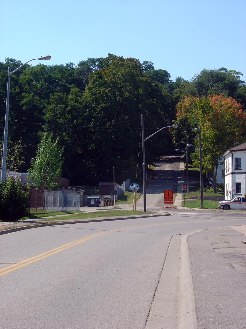
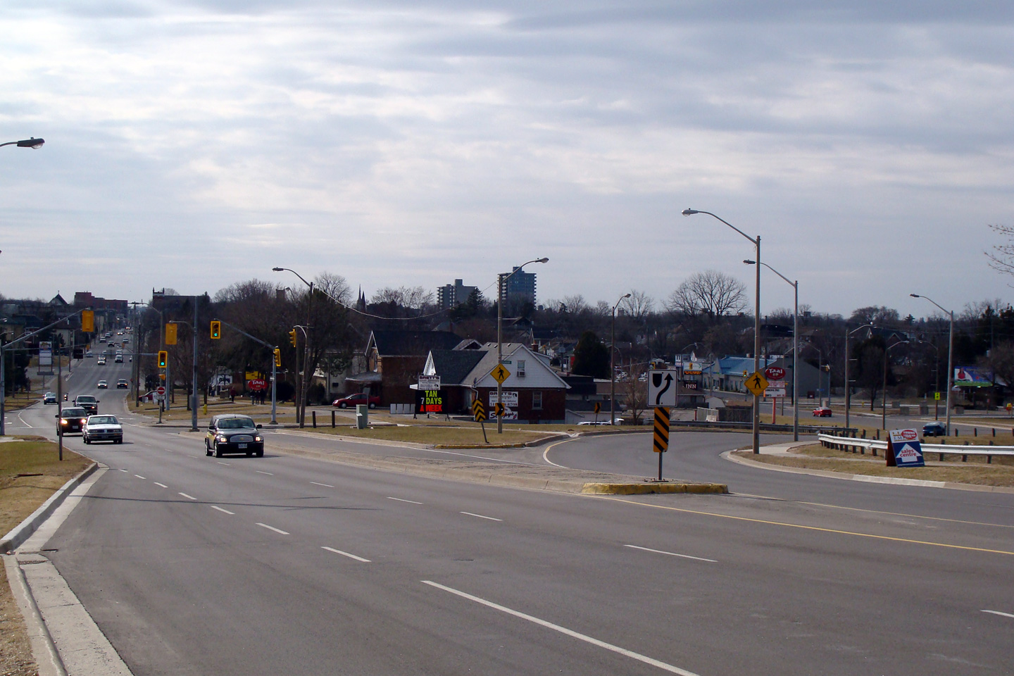
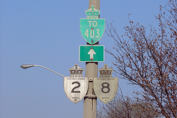
| City of Hamilton |
Easterly view at the intersection of Main and Osler Street in western
Hamilton. A right turn was required at this intersection for traffic
continuing easterly along Highway 2. This signage has long been
removed.
Photo taken: May 7th, 2005. |
|
|
West of Highway 2 in Hamilton,
Highway 8 continues for Kitchener/Waterloo and Beyond.
Click here for Highway 8-West images. |
| City of Hamilton |
Westbound signage approaching the western junction of Highway 8 and 2 in
western Hamilton.
Photo taken: May 7th, 2005. |
|
| City of Hamilton |
Eastbound reassurance signage in Hamilton for Highways 2 and 8.
Photo taken: May 7th, 2005. |
|
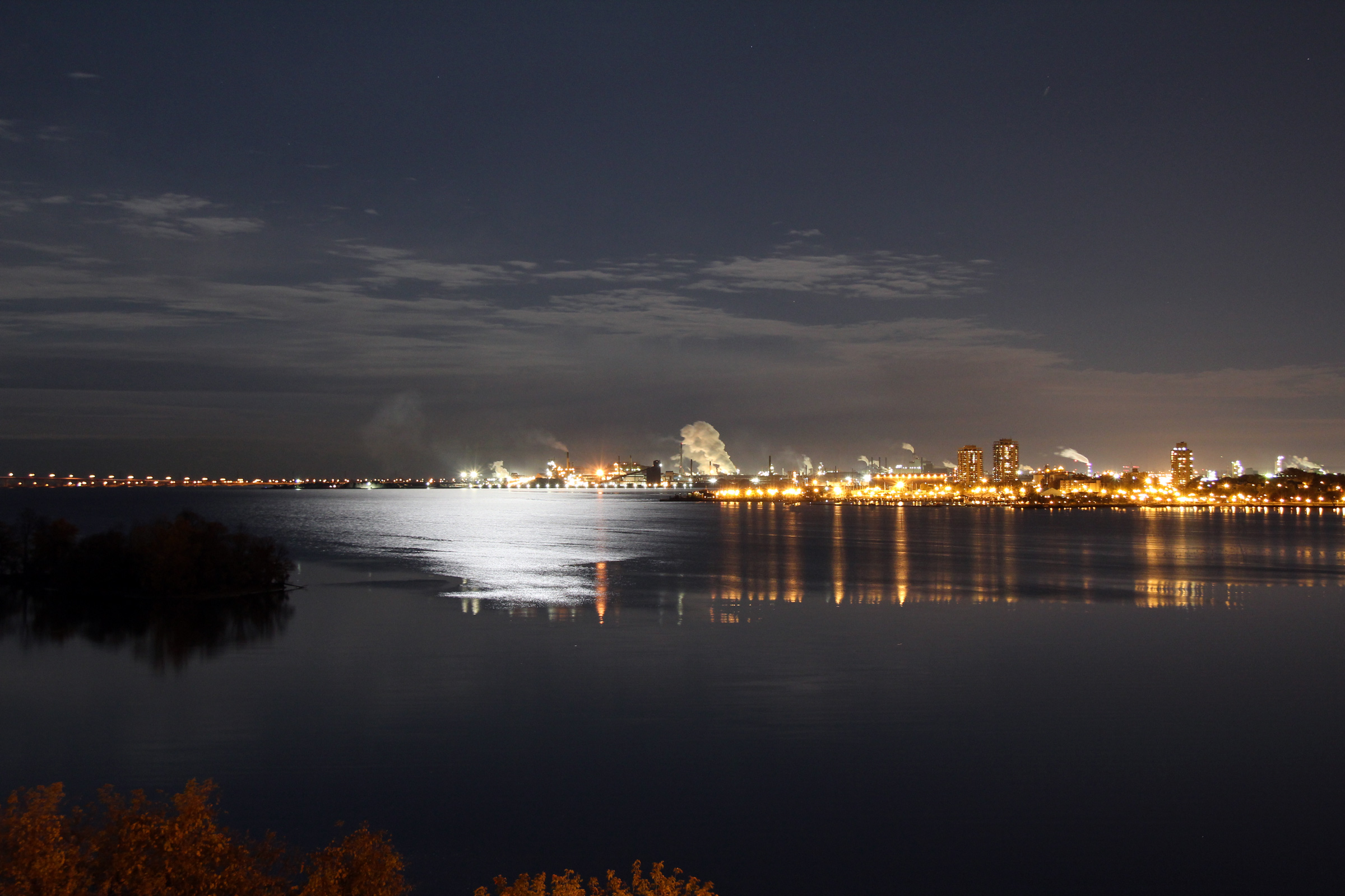
| City of Hamilton |
View looking across Burlington Bay towards Hamilton's Steel District from
the High Level Bridge. Hamilton is well known for its steel production
in Ontario.
Photo taken: October 22nd, 2010. |

(720x480)
(1440x960)
(2400x1600) |
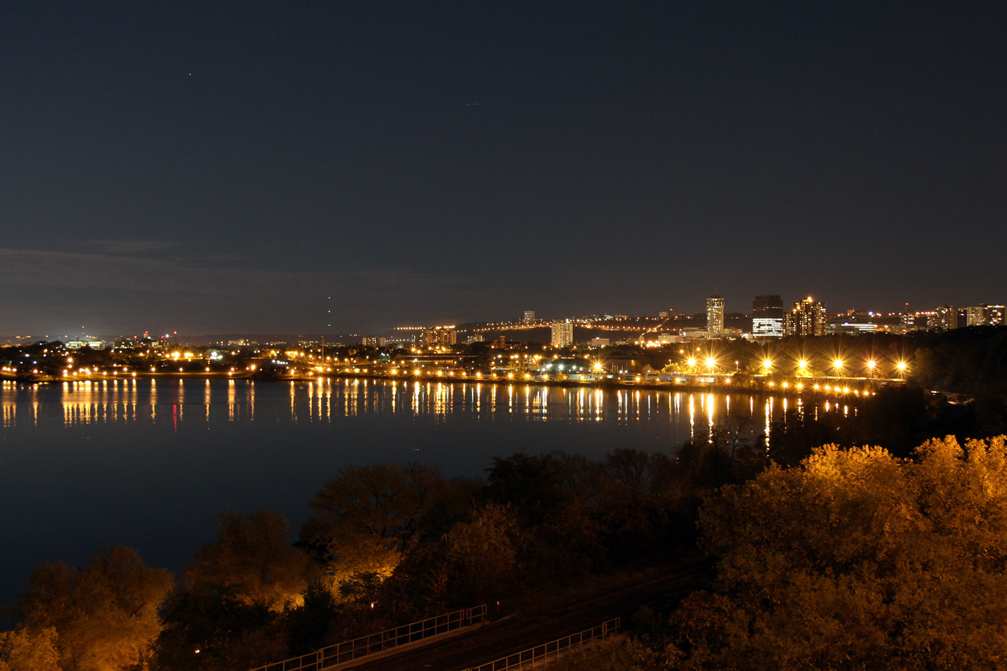
| City of Hamilton |
This view looks alongside Burlington Bay from the High Level Bridge towards
Downtown Hamilton. Contrast this photo to the above photo.
Hamilton often receives a bad rap because of its very visible industrial
district, however much of the city is quite pleasant, and actually very
scenic.
Photo taken: October 22nd, 2010. |

(720x480)
(1440x960)
(2400x1600) |
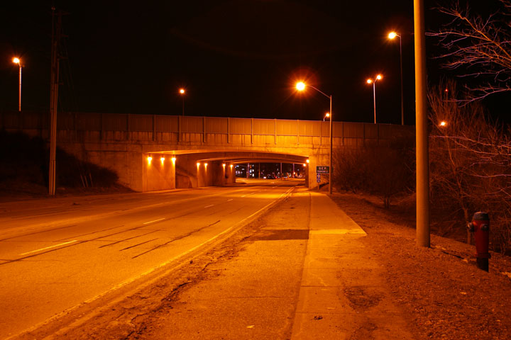
City of Burlington
Regional Municipality of Halton |
Looking
east as Highway 2 passes underneath of the Queen Elizabeth Way in Burlington
on a cold winter night. Picture taken: February 2nd, 2009. |

(720x480)
(1440x960) |
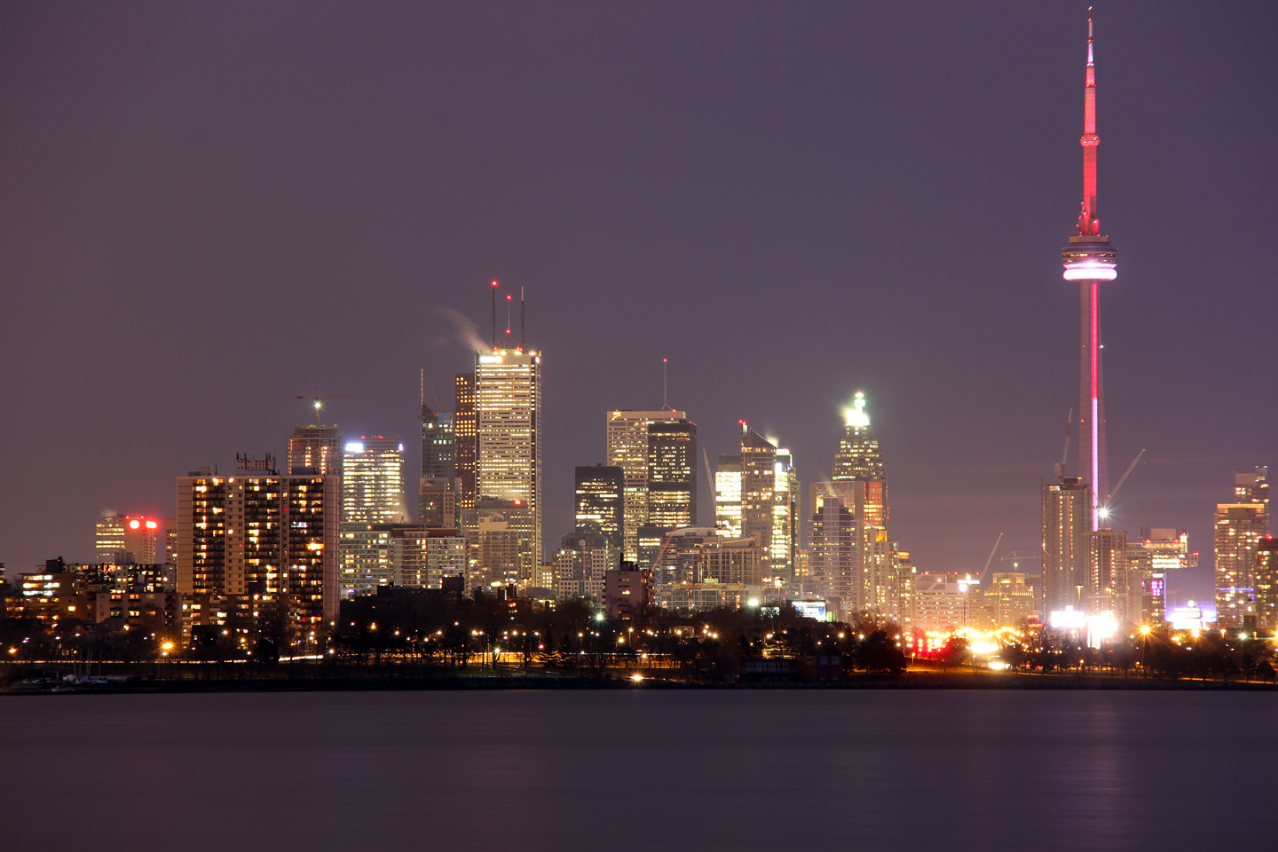
| City of Toronto |
View looking easterly towards the City of Toronto Skyline from a roadside
park adjacent to the Lakeshore Boulevard interchange with the Gardiner
Expressway.
Photo taken: January 8th, 2012. |

(720x480)
(1440x960)
(2400x1600) |
|
Click here for
Toronto to Kingston Images. |


 (720x480)
 (720x480)
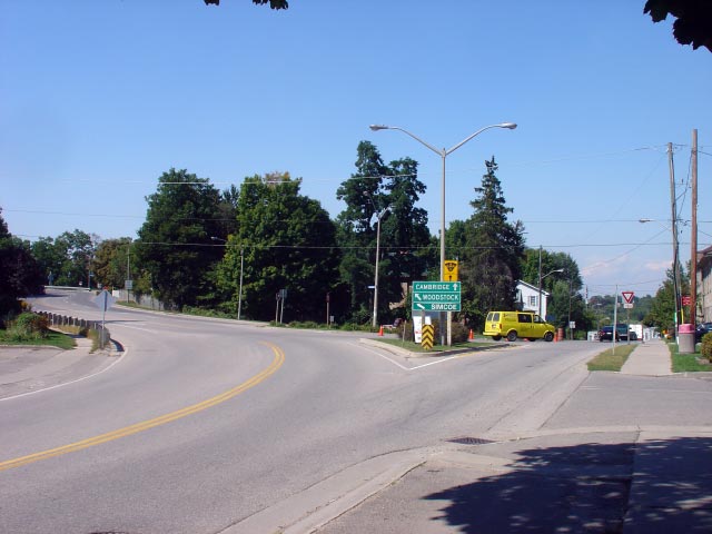


 (720x480)
 (720x480)
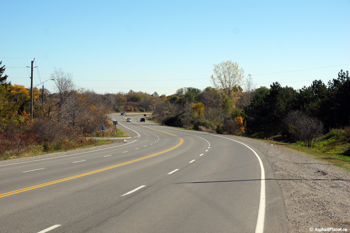
 (720x480)
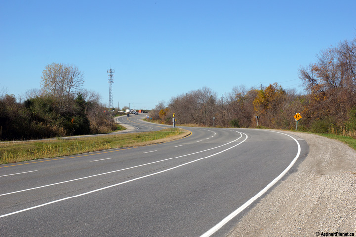


 (720x480)


 (720x480)
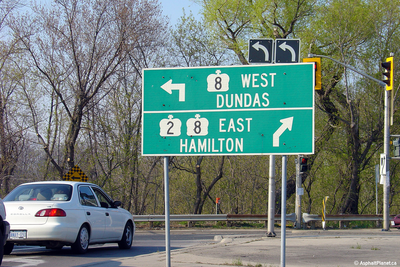
 (720x480)
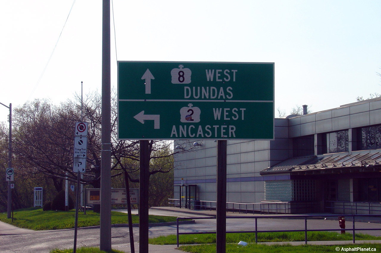
 (720x480)
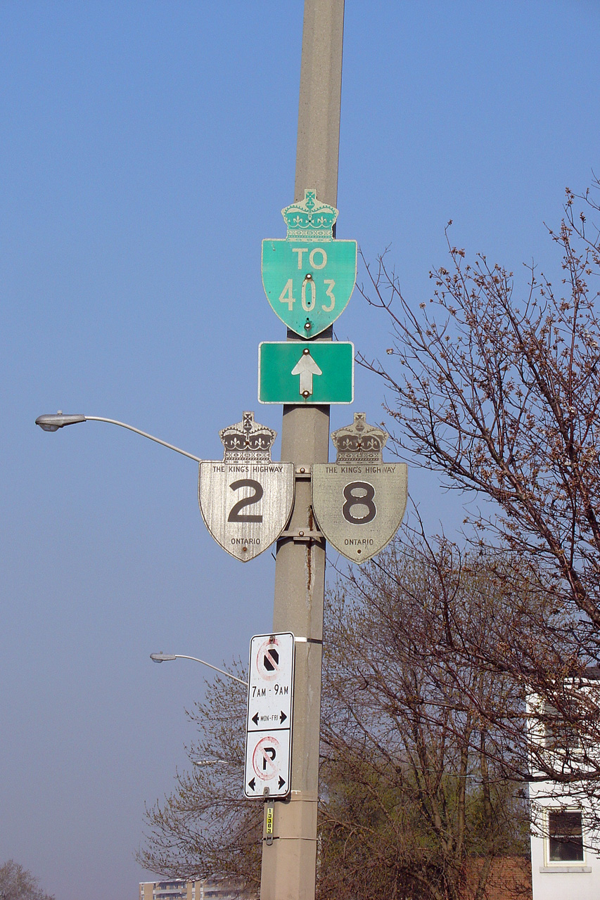


