|
Proper Municipality Name |
Photo Description |
Photo |
|
Pictures taken
from driver's perspective appear offset from centre-line pictures: |
East-
Bound |
West-
Bound |
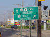
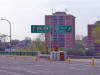
| City of Kitchener Regional
Municipality of Waterloo |
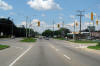
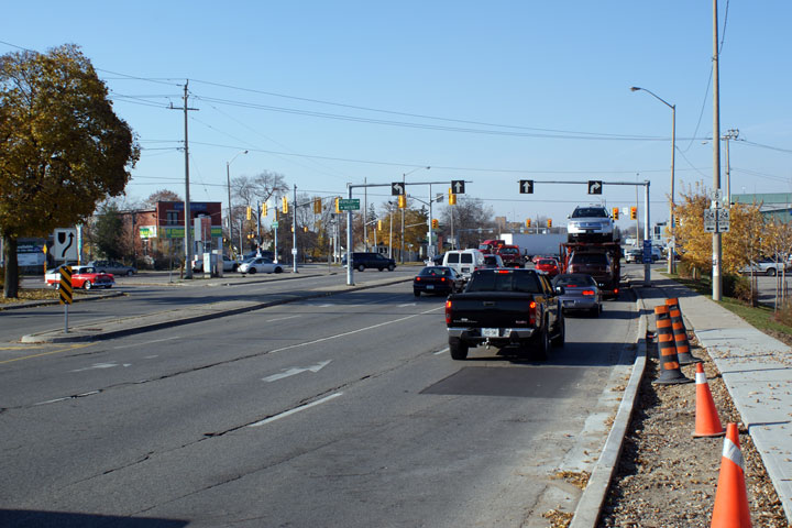
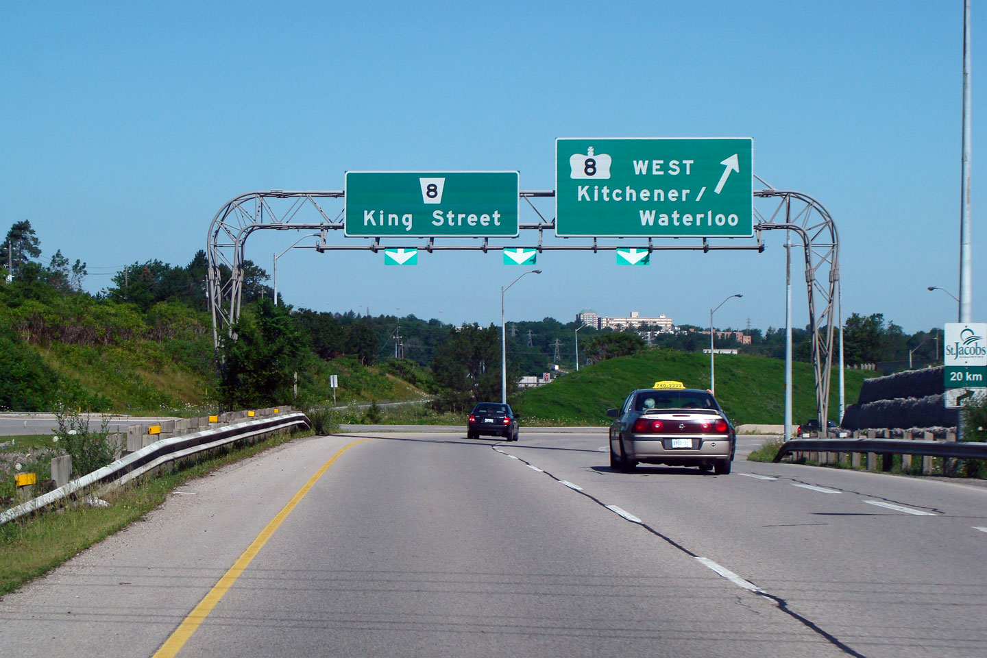
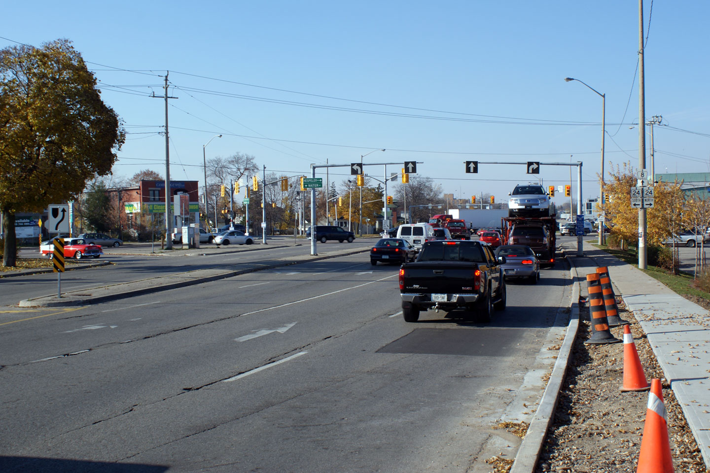
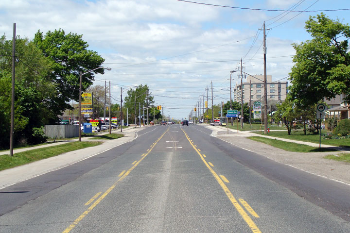
Overhead
signage along King Street for the loop ramp to the expressway.
Westbound Highway 8 traffic must negotiate this loop ramp.
Photo taken: July 2008. |
 Low
Res Low
Res
High Res |
|
The 401 crosses Highway 8 at
the Kitchener/Cambridge boundary.
Click here for Highway 401 images. |
City of
Cambridge
Regional Municipality of Waterloo |
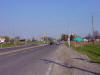
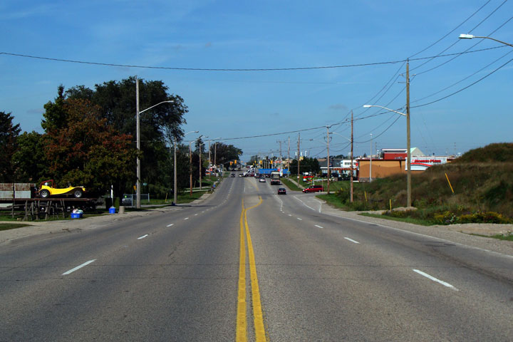
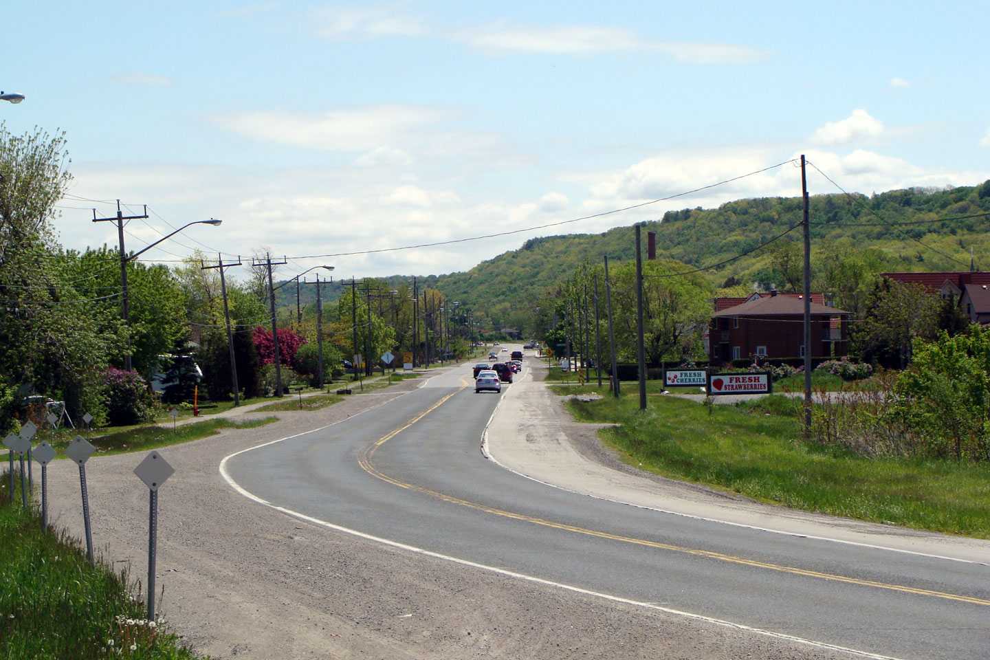
Between
Preston and Galt, Highway 8 is a pleasant divided parkway.
Photo taken: July 2008. |
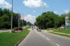
Low-res
High-res |
City of
Cambridge
Regional Municipality of Waterloo |
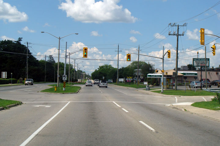
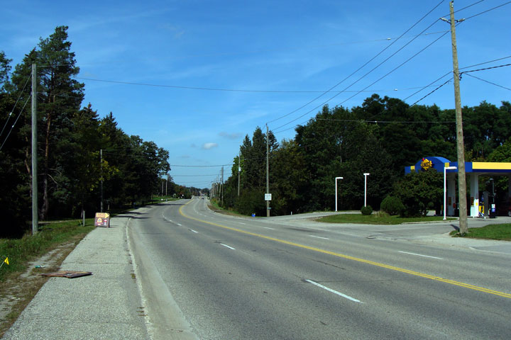
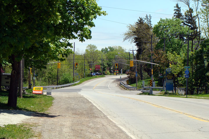
There
are several signals between Preston and Galt.
Photo taken: July 2008. |
Low-res
High-res |
|
Highway 8 meets Highway 24 at
the Delta.
Click here for Highway 24 images. |
City of
Cambridge
Regional Municipality of Waterloo |
View
looking northerly as Highway 8 meets Highway 24 in Cambridge. This
intersection is known locally as the Delta.
Photo taken: October 2008. |

Low-res
High-res |
City of
Cambridge
Regional Municipality of Waterloo |
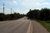
View
looking westerly at the Maple Bush Road intersection towards Franklin
Boulevard.
Photo taken: August 2008. |

Low-res
High-res |
City of
Cambridge
Regional Municipality of Waterloo |
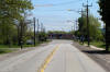
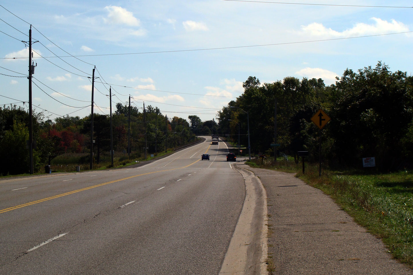
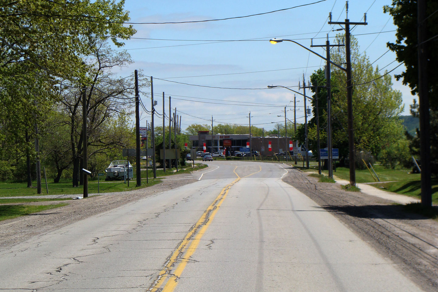
View
looking westerly from west of Branchton Road. This 4-lane
cross-section is a very old design, and is not typical of most modern king's
highways.
Photo taken: August 2008. |
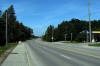
Low-res
High-res |
City of
Cambridge
Regional Municipality of Waterloo |
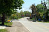
Easterly
view towards Branchton Road. MTO jurisdiction over Highway 8 begins
just past the Branchton Road intersection. |
Low-res
High-res |
| City of Hamilton |
View looking easterly towards the current
eastern terminus of Highway 8 at the Highway 5
junction at Peters Corners. This junction also marks the current
western terminus of Highway 5. Straight ahead, Hamilton Road 8
continues east through Dundas into Downtown Hamilton.
Picture taken: May 5th, 2005. Size: 35kb. |
 |
|
Highway 8 meets Highway 5 and 52
in Peters Corners. Click
here for Highway 5 images and here for
Highway 52 images. |
| City of Hamilton |
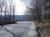
View looking easterly towards Highway 8's
descent down the Niagara Escarpment into Downtown Dundas. Picture taken:
March 28th, 2007. Size: 125kb. |
 |
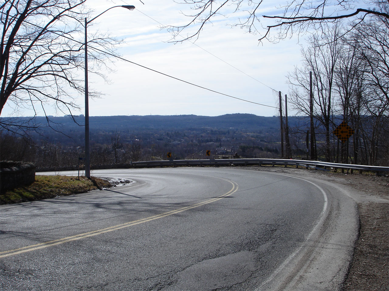
| City of Hamilton |
View closer to the mountain brow along Highway
8. At the mountain brow, Highway 8 has a sharp curve and quickly
begins to descend the escarpment via a steep access. This curve has a
posted advisory speed of 20km/h.
Picture taken: March 28th, 2007. Low-res: 95kb. High-res: 385kb. |
Low-res
High-res |
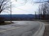
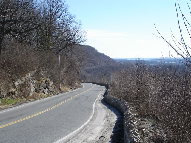
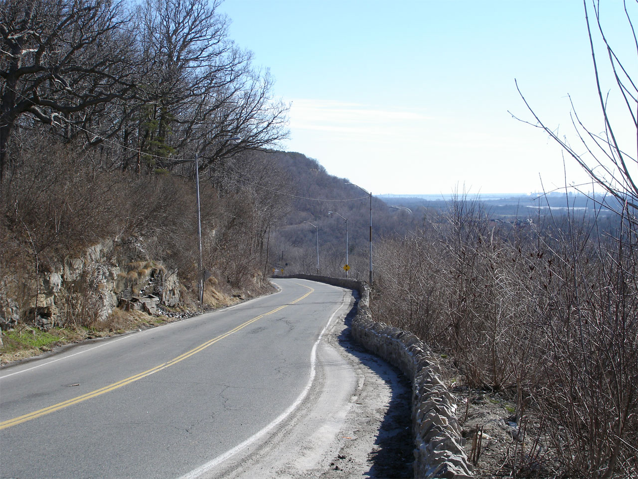
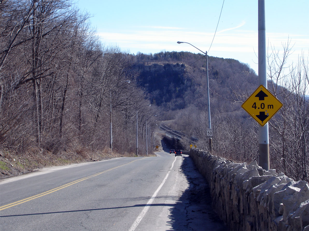
| City of Hamilton |
View looking east from the top of the escarpment
looking towards Dundas. Note the stone wall that guide rail on the
right side of the photo. The City of Hamilton recently rehabilitated
this stone wall paying careful attention to replicate the wall's ornate
detailing.
Picture taken: March 28th, 2007. Low-res: 90kb. High-res: 380kb. |
Low-res
High-res |
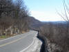
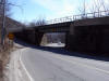
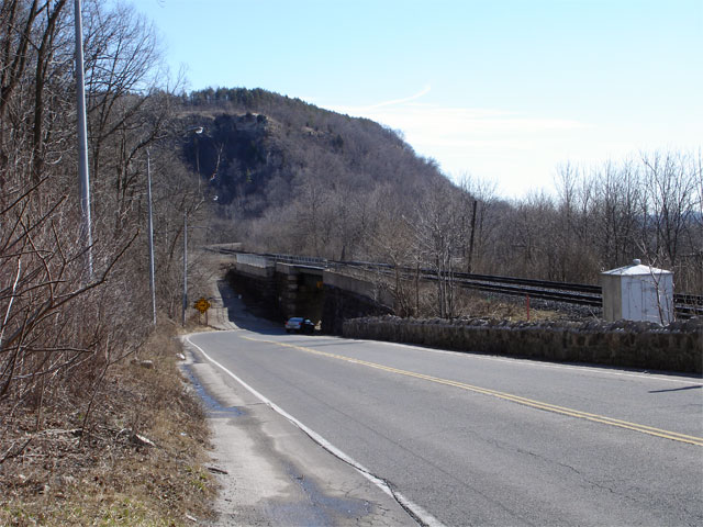
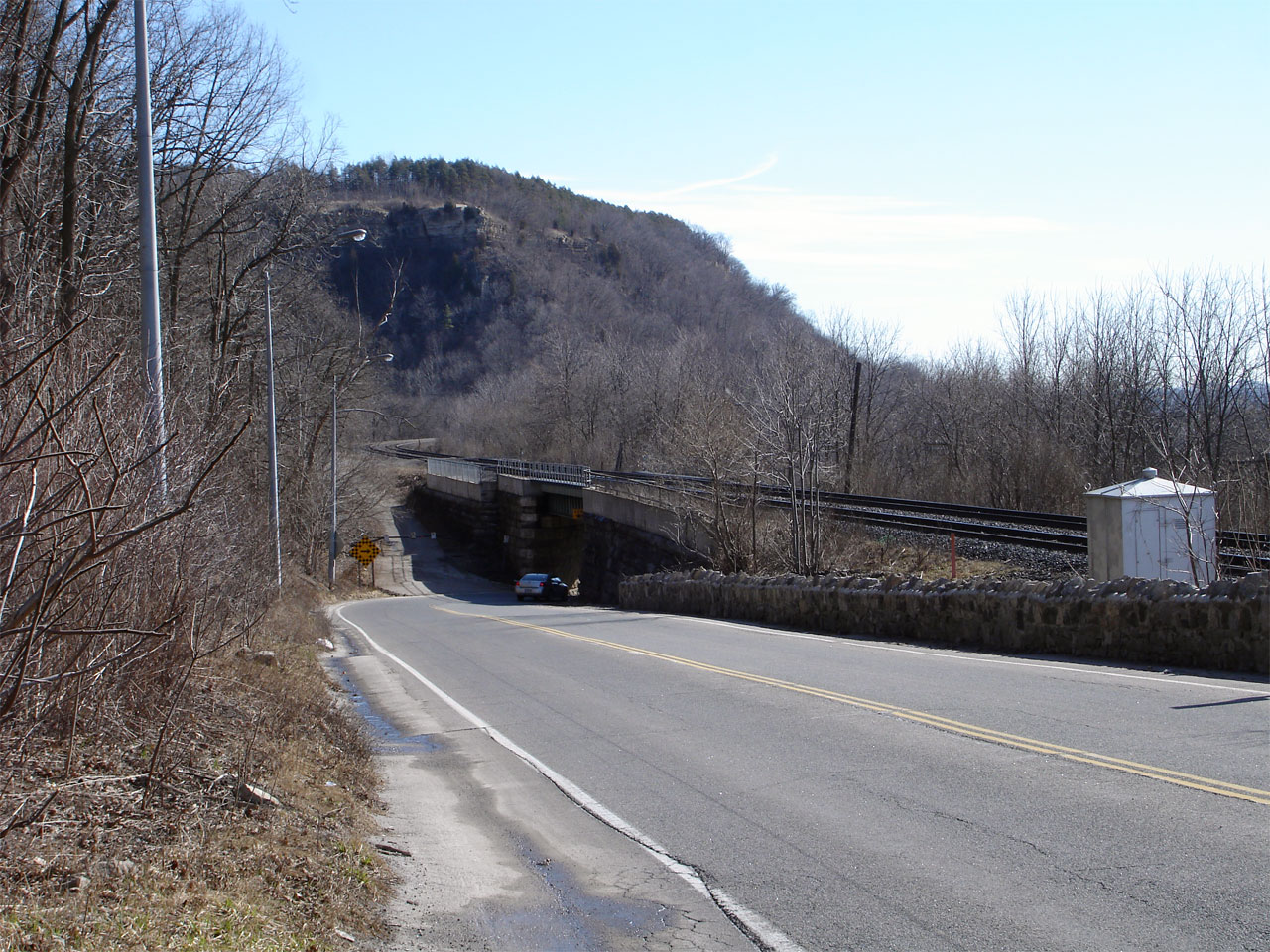
| City of Hamilton |
Looking east again down the escarpment access.
Highway 8 passes under the CN mainline railway halfway down the escarpment
through a narrow subway. Picture taken: March 28th, 2007. Low-res:
90kb. High-res: 350kb. |
Low-res
High-res |
| City of Hamilton |
Another view of Highway 8 descending the
escarpment access, this time showing the sharp curve traffic needs to
negotiate to pass under the railway overhead. Picture taken: March 28th,
2007. Low-res: 90kb. High-res: 355kb. |

Low-res
High-res |
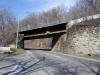
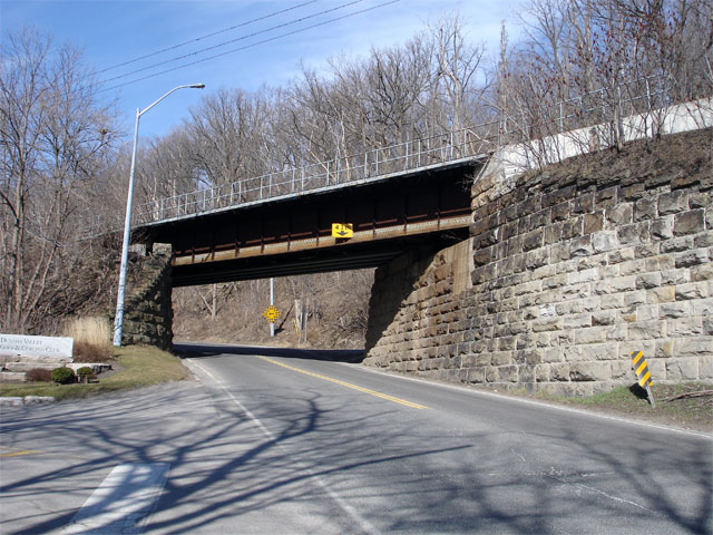
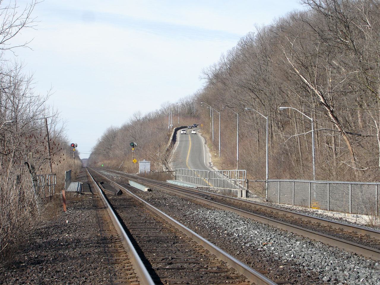
| City of Hamilton |
Eastbound view through the CN railway overhead.
Picture taken: March 28th, 2007. Low-res: 75kb. High-res: 320kb. |
Low-res
High-res |
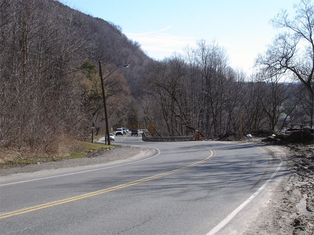
| City of Hamilton |
View looking west through the CN railway
overhead. Note the close proximity of the intersection to the railway
overhead. Vehicles departing this side road must do so with the utmost
care. Picture taken: March 28th, 2007. Low-res: 100kb.
High-res: 415kb. |
Low-res
High-res |
| City of Hamilton |
View of Highway 8 ascending the escarpment from
the railway tracks. Picture taken: March 28th, 2007. Low-res: 95kb.
High-res: 385kb. |

Low-res
High-res |
| City of Hamilton |
Looking east from just east of the railway
overhead as Highway 8 finishes its descent down the mountain into Dundas.
Picture taken: March 28th, 2007. Size: 85kb. |
 |
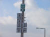
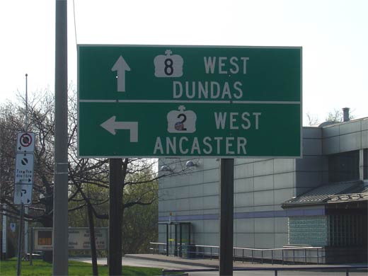
| City of Hamilton |
Green signage for the western Highway
2/8 junction in Hamilton. Click here
for Highway 2 images (Coming Soon!). Picture size: 40kb. |
 |
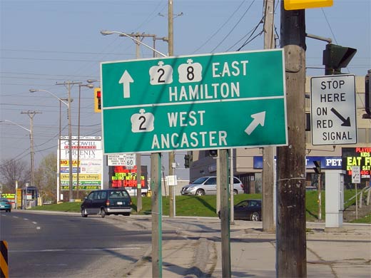
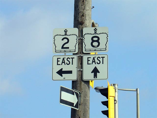
| City of Hamilton |
Westbound signage for the Highway
2/8 intersection. Click here for
Highway 2 images (Coming Soon!). Picture size: 25kb. |
 |
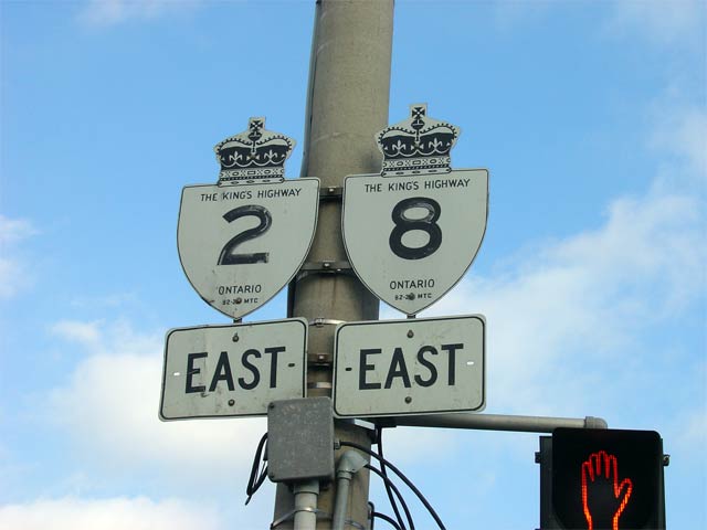
| City of Hamilton |
Highway 2/8 signage in Westdale. Like
other Highway 2/8 shield assemblies, this
sign has been replaced with a Hamilton Road 8 flowerpot. Picture size:
30kb. |
 |
|
Highway 403 passes through
Chedoke Valley in Hamilton.
Click here for Highway 403 images. |
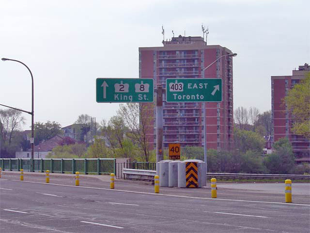
| City of Hamilton |
Butterfly gantry displaying Highway
2/8 signs along with Highway 403 signage at the ramp to Highway 403 east.
This sign was replaced early in 2007, and highlight King Street as Hamilton
Road 8 rather than Highway 2/8.
Picture size: 75kb. |
 |
| City of Hamilton |
Eastbound signage for the eastern Highway
2/8 junction. Click here for Highway 2
images. (Coming Soon!). Picture size: 30kb. |
 |
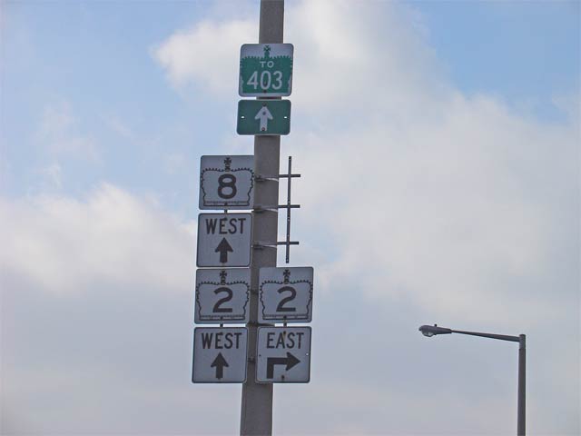
| City of Hamilton |
Westbound signage for the eastern Highway
2/8 junction. Click here for Highway 2
images (Coming Soon!). Picture size: 30kb. |
 |
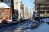
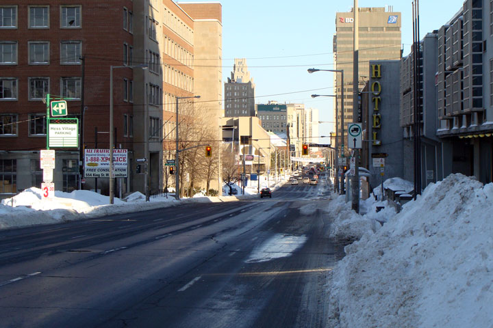
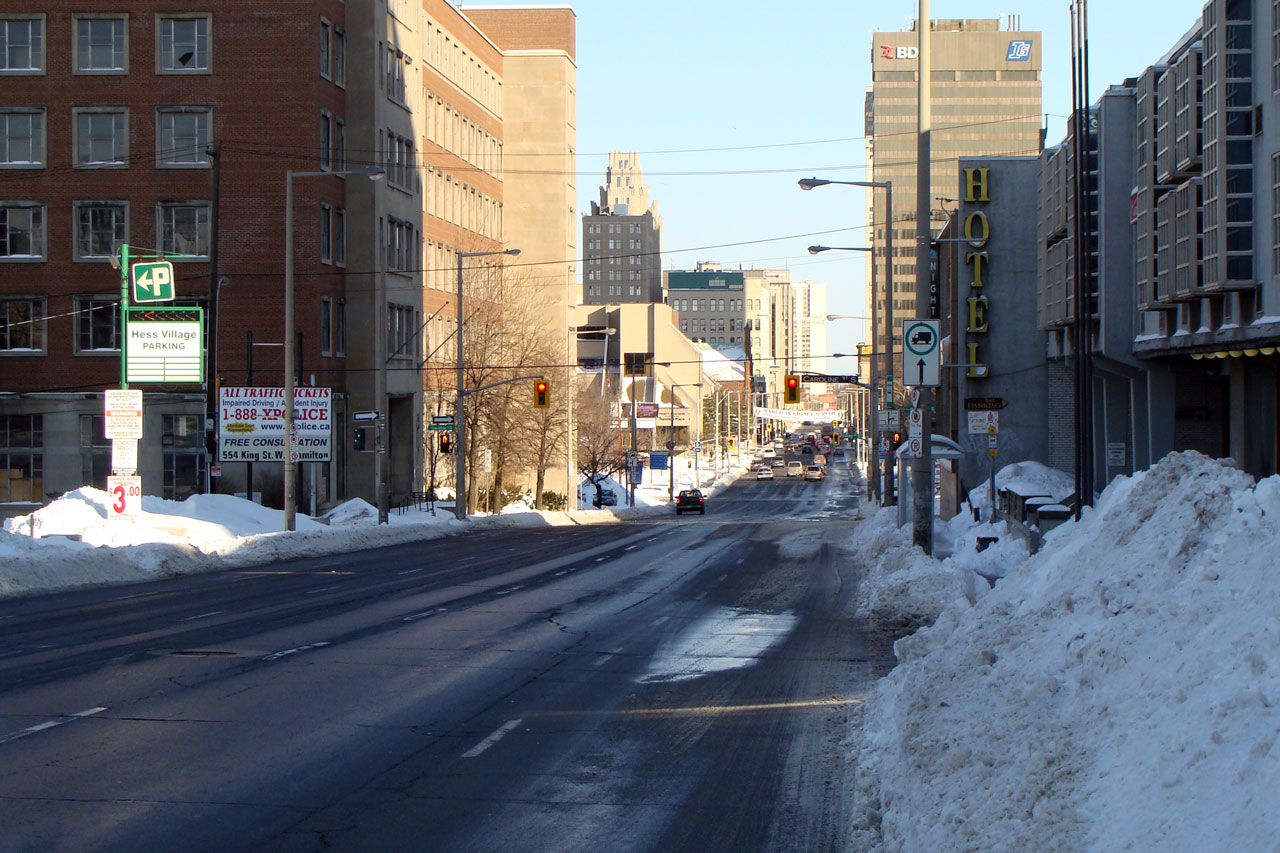
| City of Hamilton |
Main Street eastbound from just east of Queen
Street in Hamilton. Picture taken: March 9th, 2008. |

Low
Res
High Res |
| City of Hamilton |
View of Main Street looking east towards MacNab
and James Streets. Picture taken: March 9th, 2008. |
 Low
Res Low
Res
High Res |
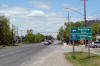
| City of Hamilton |
Westerly
view of Highway 8 as it nears Dewitt Road, and the suburban boundary of
Stoney Creek.
Photo taken: May 2008. |

Low-res
High-res |
| City of Hamilton |
View
looking west towards the Fruitland Road intersection.
Photo taken: May 2008. |
Low-res
High-res |
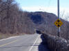
| City of Hamilton |
This
forgotten stretch of Highway 8 is dwarfed by the Niagara Escarpment.
Photo taken: May 2008. |

Low-res
High-res |
| City of Hamilton |
Its
hard to believe that this stretch of road was a provincial highway until
1997. This is the Fifty Road intersection.
Photo taken: May 2008. |
Low-res
High-res |
| City of Hamilton |
Between
1972 and 1997 Highway 8 ended at the Niagara border. At one time,
Number 8 continued as far east as Niagara Falls. Anyone who has driven
the old route of Highway 8 between this point and Niagara Falls will
understand why it was downloaded so early.
Photo taken: May 2008. |
Low-res
High-res |
 Low
Res
Low
Res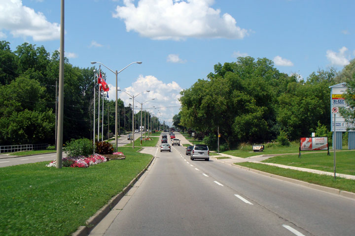


