AsphaltPlanet.ca > OntHighways > Highway 8 > Images > Page 2
King's Highway 8 - Images
<- Page 1 Page 2 - Stratford to Cambridge Page 3 ->
Photos shown in this table are arranged from West to East:
| Proper Municipality Name | Photo Description | Photo | ||||
|
Photos taken from driver's perspective appear offset from centre-line photos: |
East- Bound |
West- Bound |
||||
| West of Stratford, Highway 7 leads to St Mary's, Elginfield and eventually Sarnia. Click here for Highway 7-West Images. | ||||||
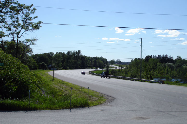
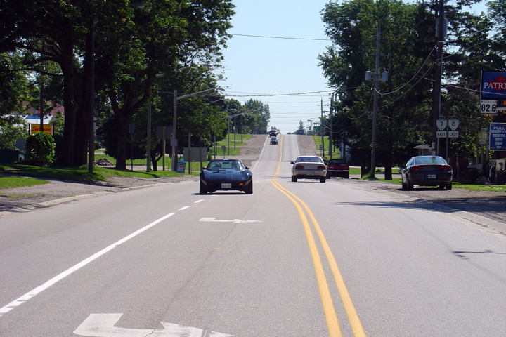
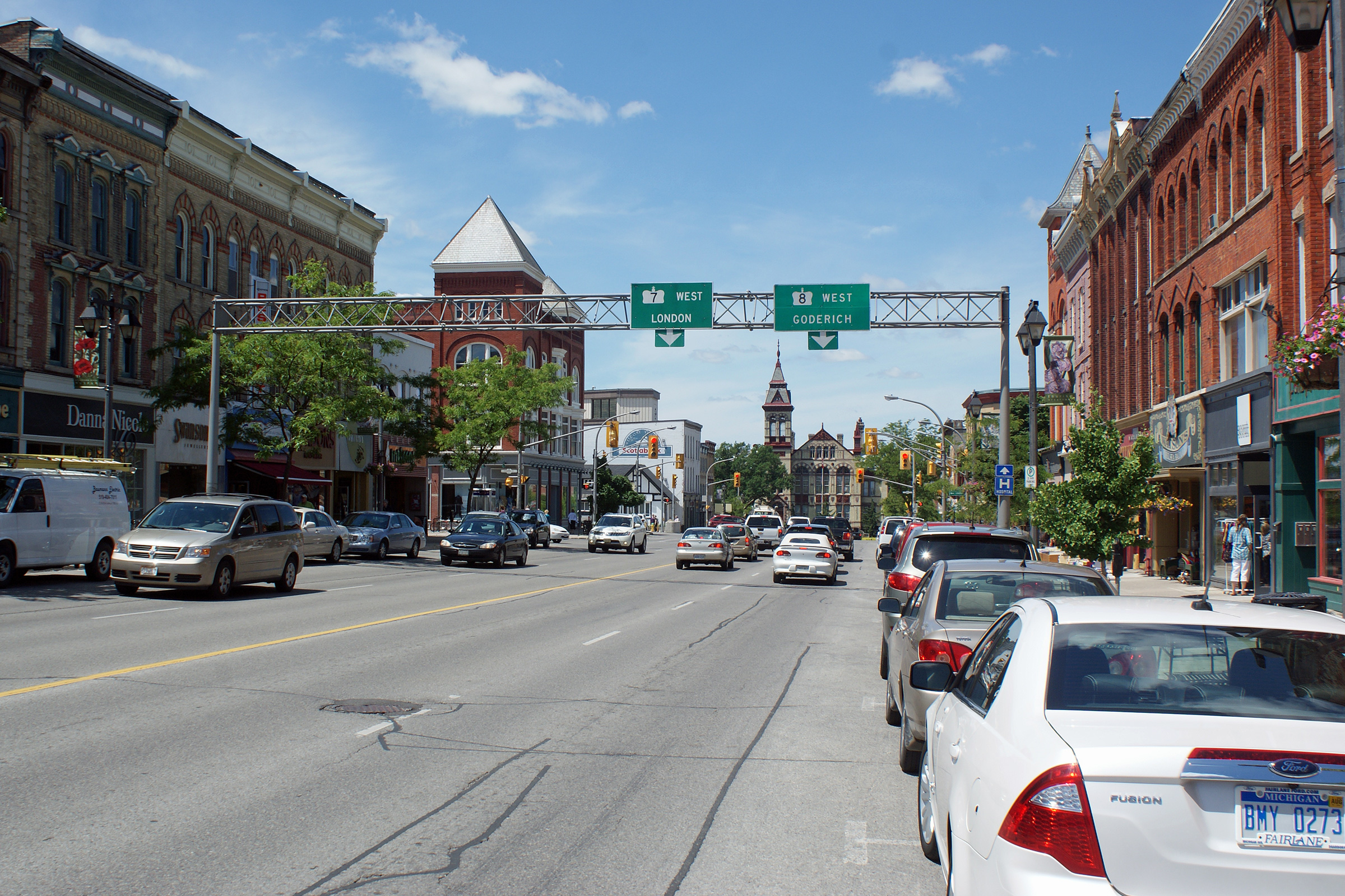
| City of Stratford | View looking
westerly along Highway 7/8 through Downtown Stratford. Photo taken: June 8th, 2010. |
 (720x480) (1440x960) (2400x1600) |
||||
| Waterloo Street in Stratford carried the Highway 19 designation until 1998. Click here for Highway 19-North Images. | ||||||
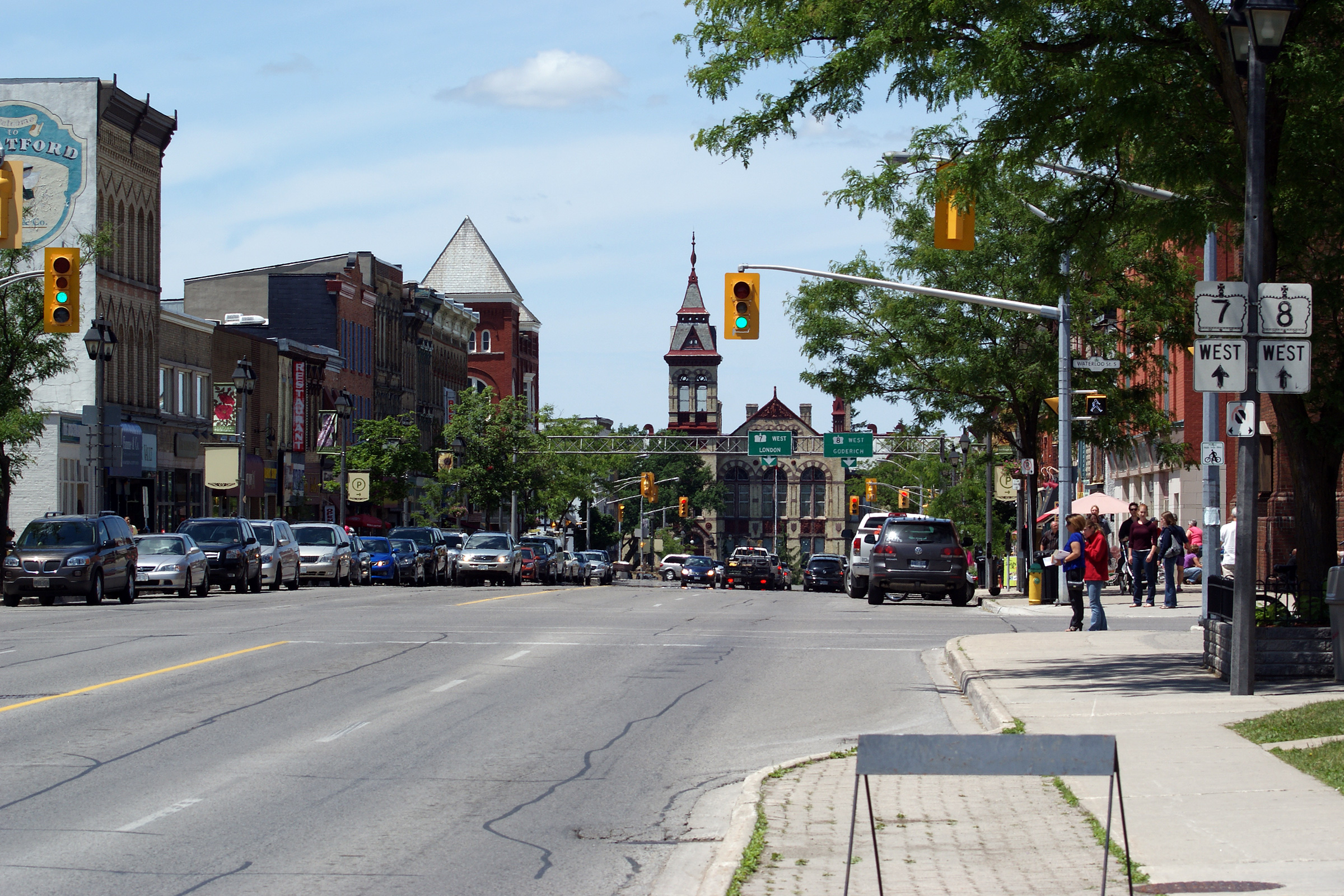
| City of Stratford | View looking westerly along
Highway 7/8 approaching Downtown Stratford. Before Highway 19 was
transferred to local municipalities, Highway 19 continued north from this
traffic light towards Tralee. Photo taken: June 8th, 2010. |
 (720x480) (1440x960) (2400x1600) |
||||
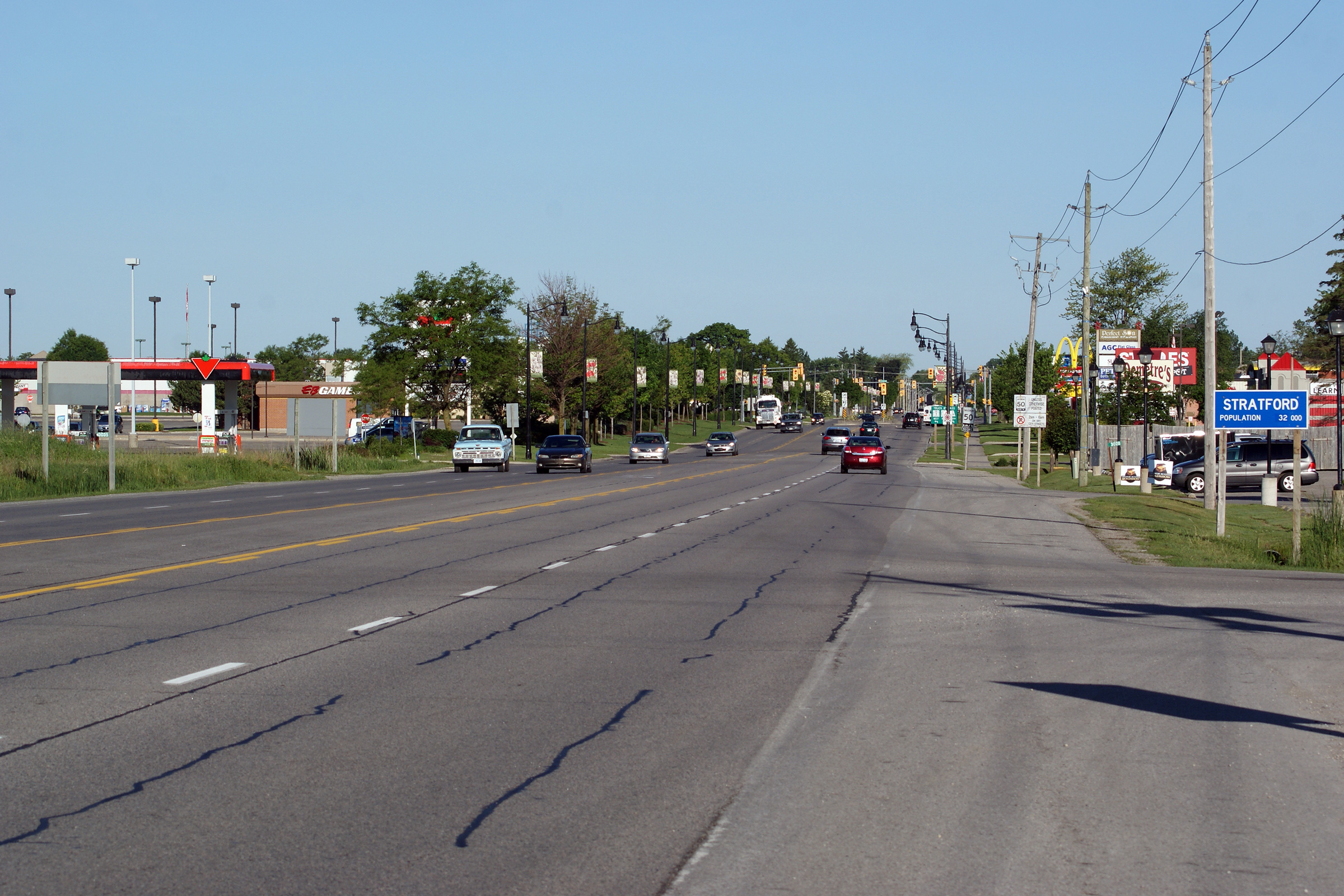
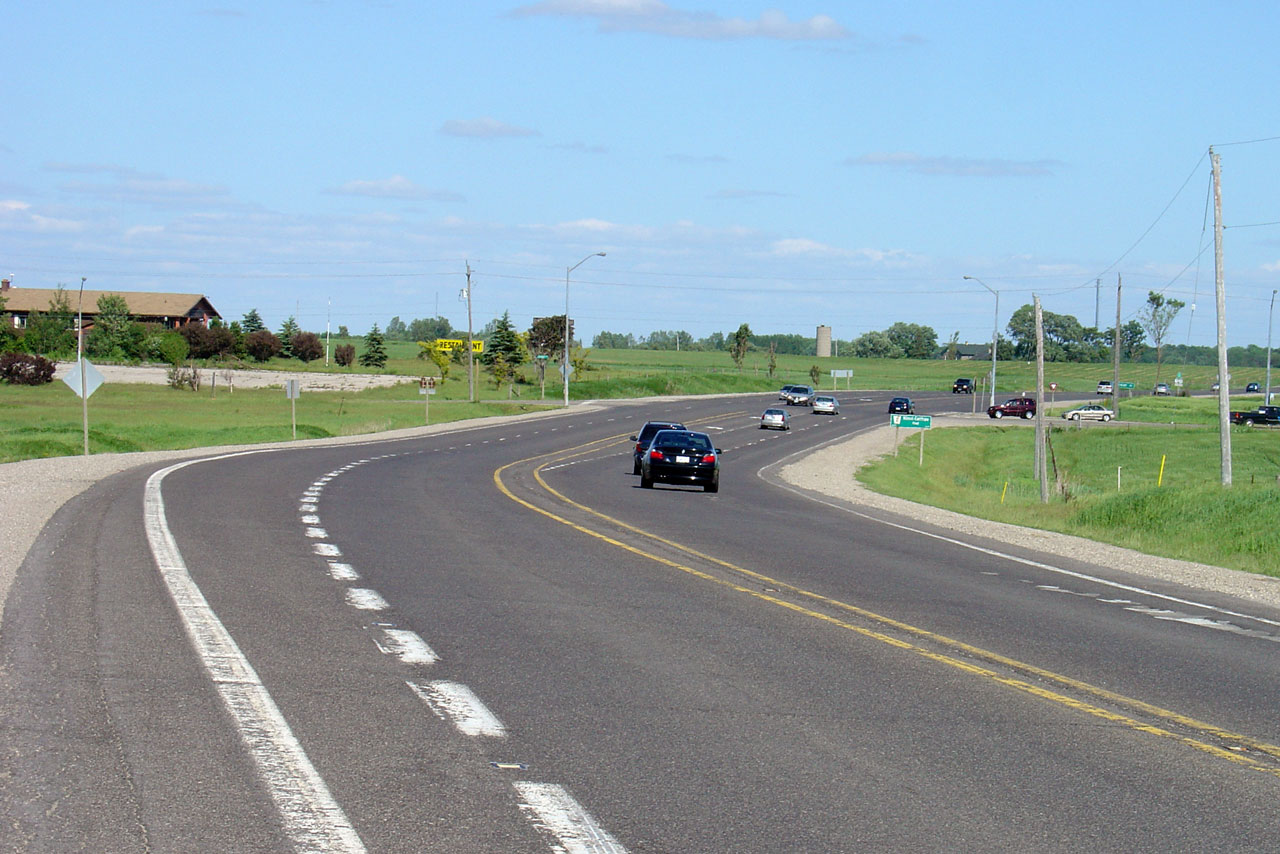
|
Township of Perth East County of Perth |
View looking westerly into
Stratford from the eastern city limits. Photo taken: June 8th, 2010. |
 (720x480) (1440x960) (2400x1600) |
||||
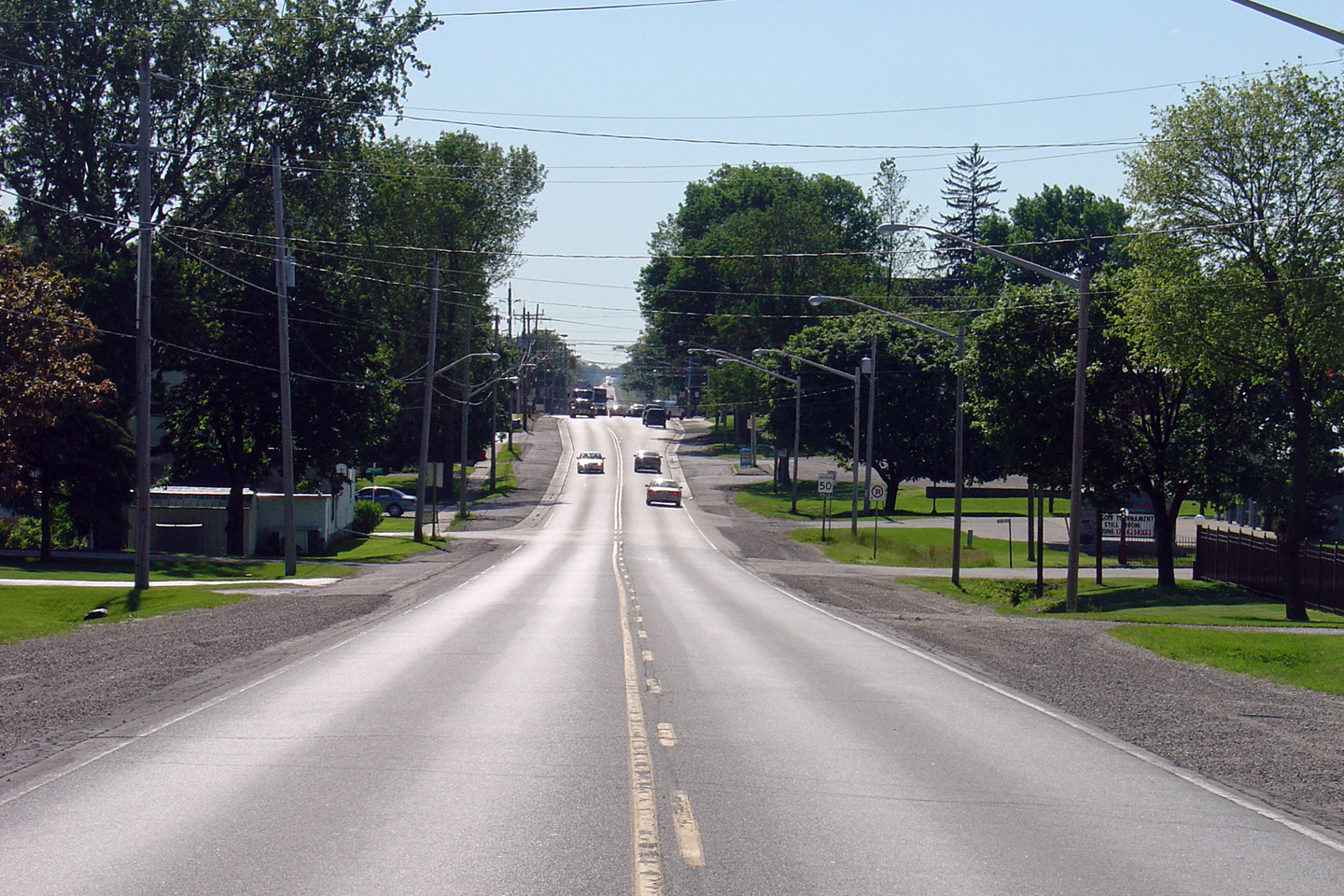
|
Township of Perth East County of Perth |
Looking east from
just east of Stratford. Photo taken: June 10th, 2005. |
 |
||||
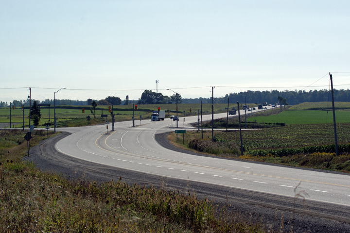
|
Township of Perth East County of Perth |
Highway 7/8 curves around a
small lake just to the east of Stratford to create this very pleasant scene. Photo taken: June 10th, 2005. |
 |
||||
|
Township of Perth East County of Perth |
View looking
west from Highway 59 in Shakespeare. Photo taken: August 1st, 2004 |
 |
||||
|
Township of Perth East County of Perth |
Easterly view
from Highway 59 along Highway 7/8. Photo taken: August 1st, 2004. |
|||||
|
Township of Perth East County of Perth |
View looking westerly through
Shakespeare along Highway 7/8. Photo taken: June 10th, 2005. |
 Low-res High-res |
||||
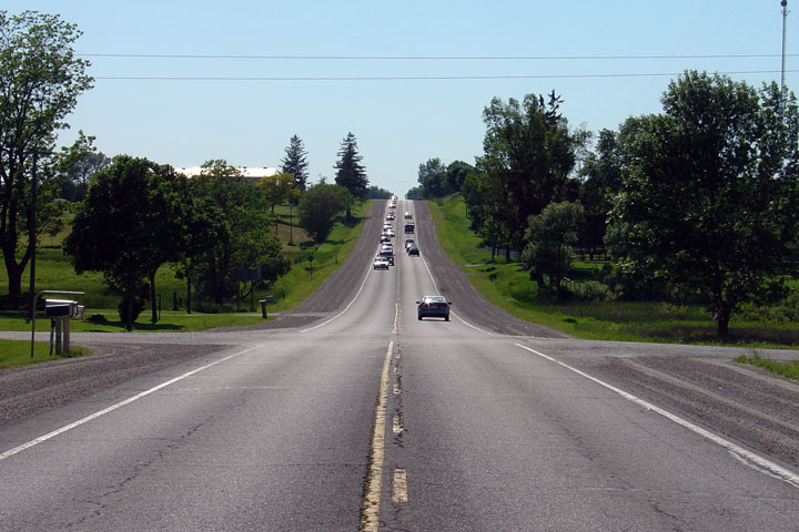
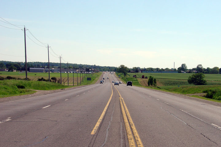
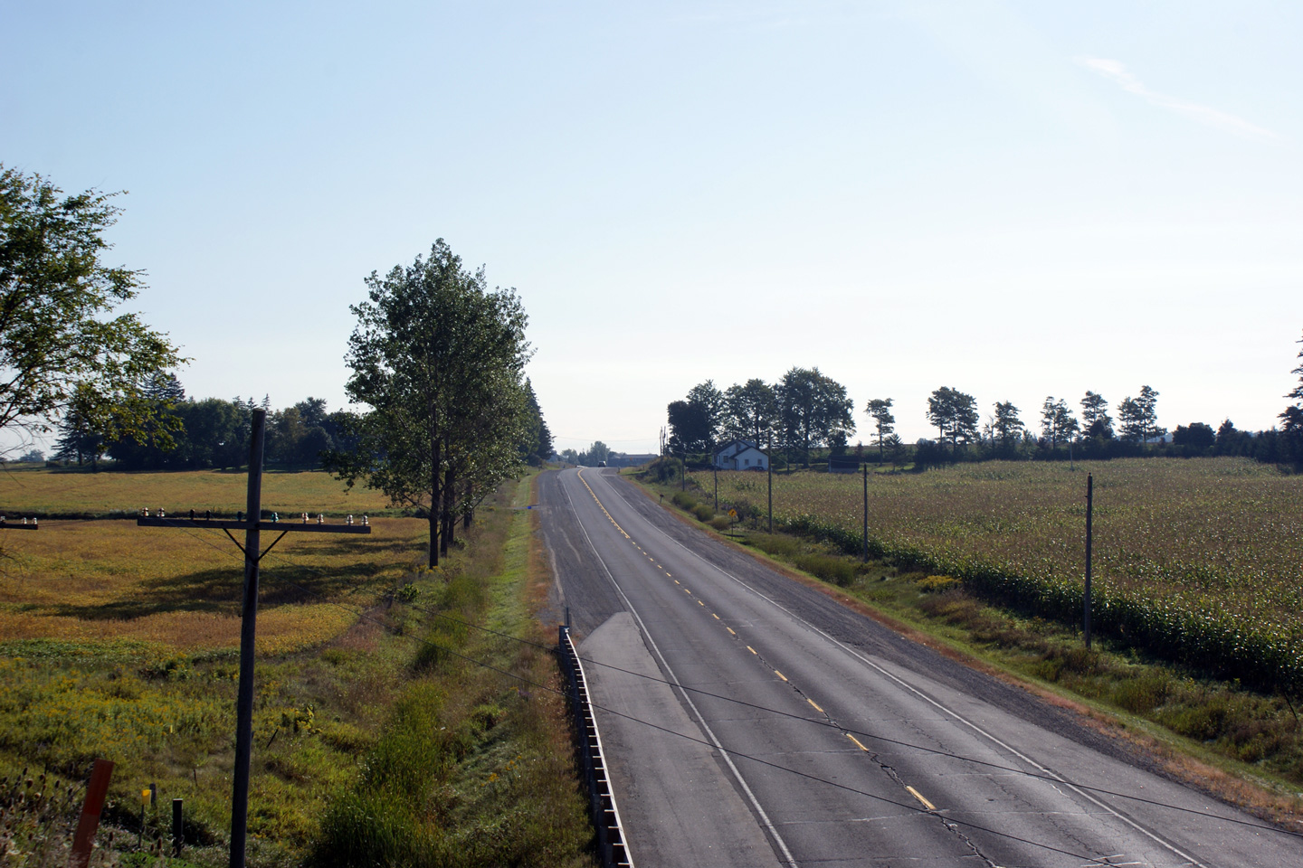
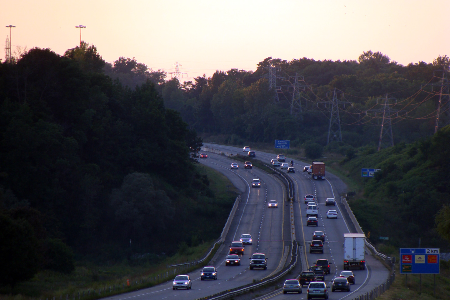
|
Township of Perth East County of Perth |
The drive from New Hamburg to
Stratford is very pleasant, despite the long lines of traffic that drivers
will
inevitably encounter. Photo taken: June 10th, 2005. |
 |
||||
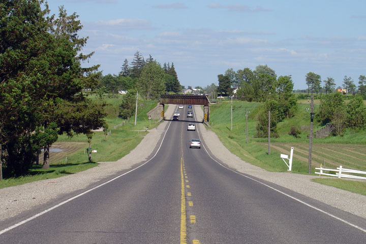
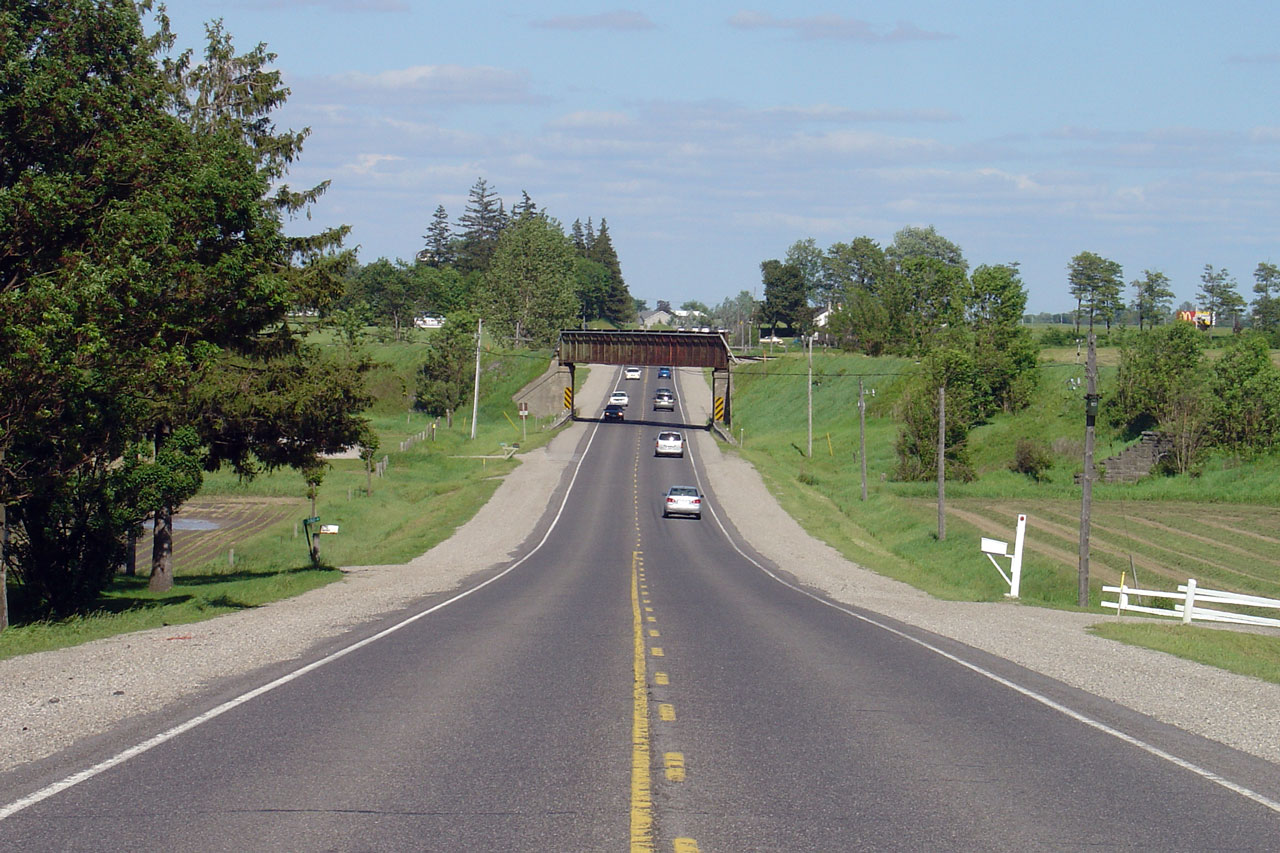
|
Township of Perth East County of Perth |
View of the
New Hamburg railway
overhead -- looking east. Photo taken: June 10th, 2005. |
 |
||||
|
Township of Perth East County of Perth |
Westerly view along Highway 7/8
from the New Hamburg Overhead. Photo taken: September 17th, 2009. |
 (720x480) (1440x960) (2400x1600) |
||||
|
Township of Perth East County of Perth |
View looking easterly from the
New Hamburg Overhead. Highway 7/8 widens to a four-lane cross section
just beyond the pictured curve. Photo taken: September 17th, 2009. |
 (720x480) (1440x960) (2400x1600) |
||||
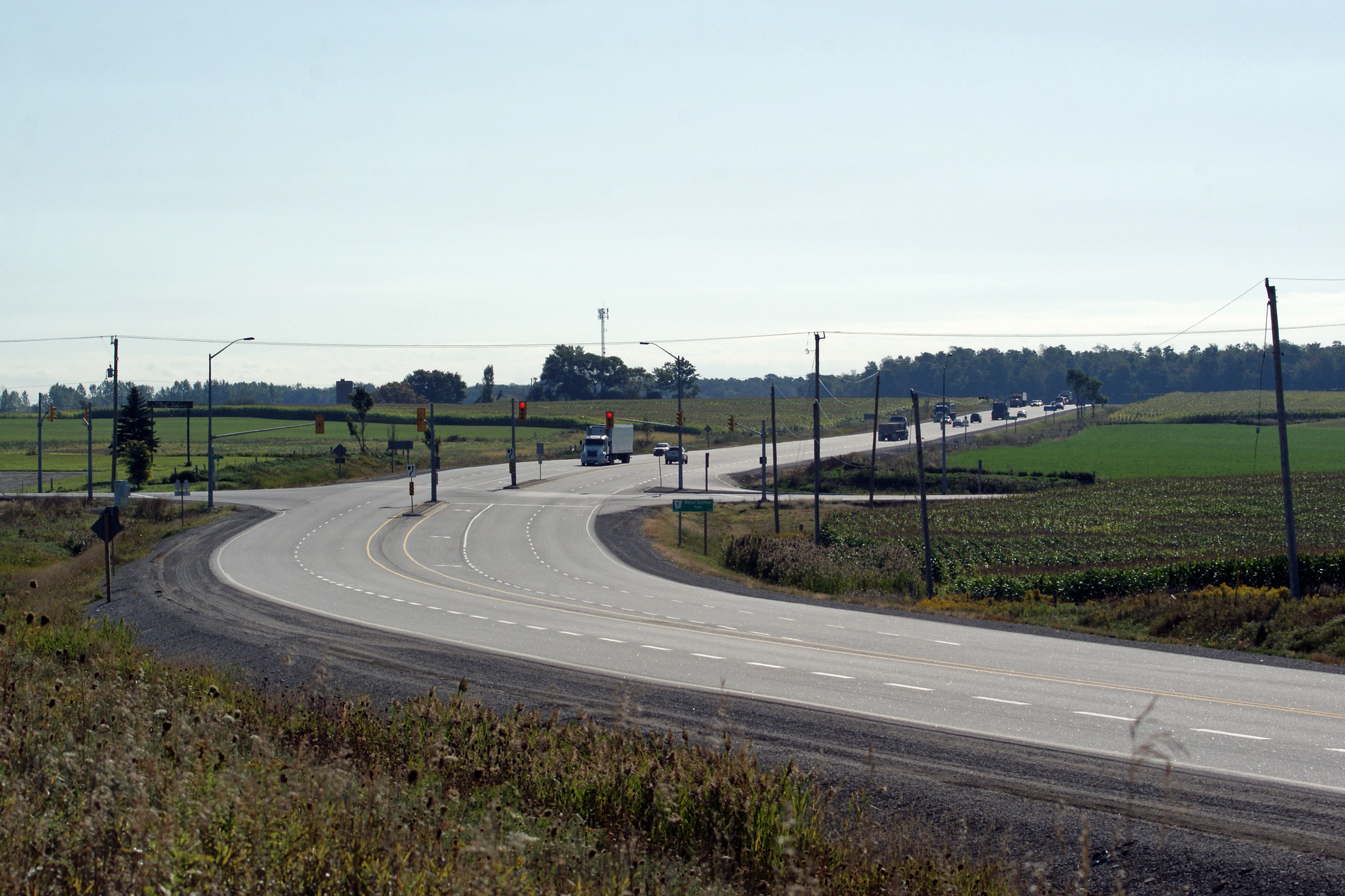
|
Township of Perth East County of Perth |
This view looks easterly towards
the New Hamburg Overhead from just east of the Wilmot-Easthope Road. Photo taken: September 17th, 2009. |
 (720x480) (1440x960) (2400x1600) |
||||
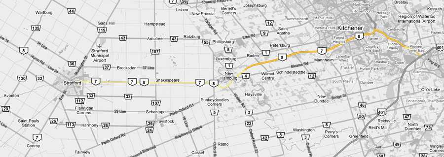
|
Township of Wilmot Regional Municipality of Waterloo |
Easterly view at the western
start of the New Hamburg By-pass. Traffic signals were added to this
intersection in 2007. Upper photo taken: June 10th, 2005. Lower photo taken: September 17th, 2009. |
 (720x480) (1440x960) (2400x1600) |
||||
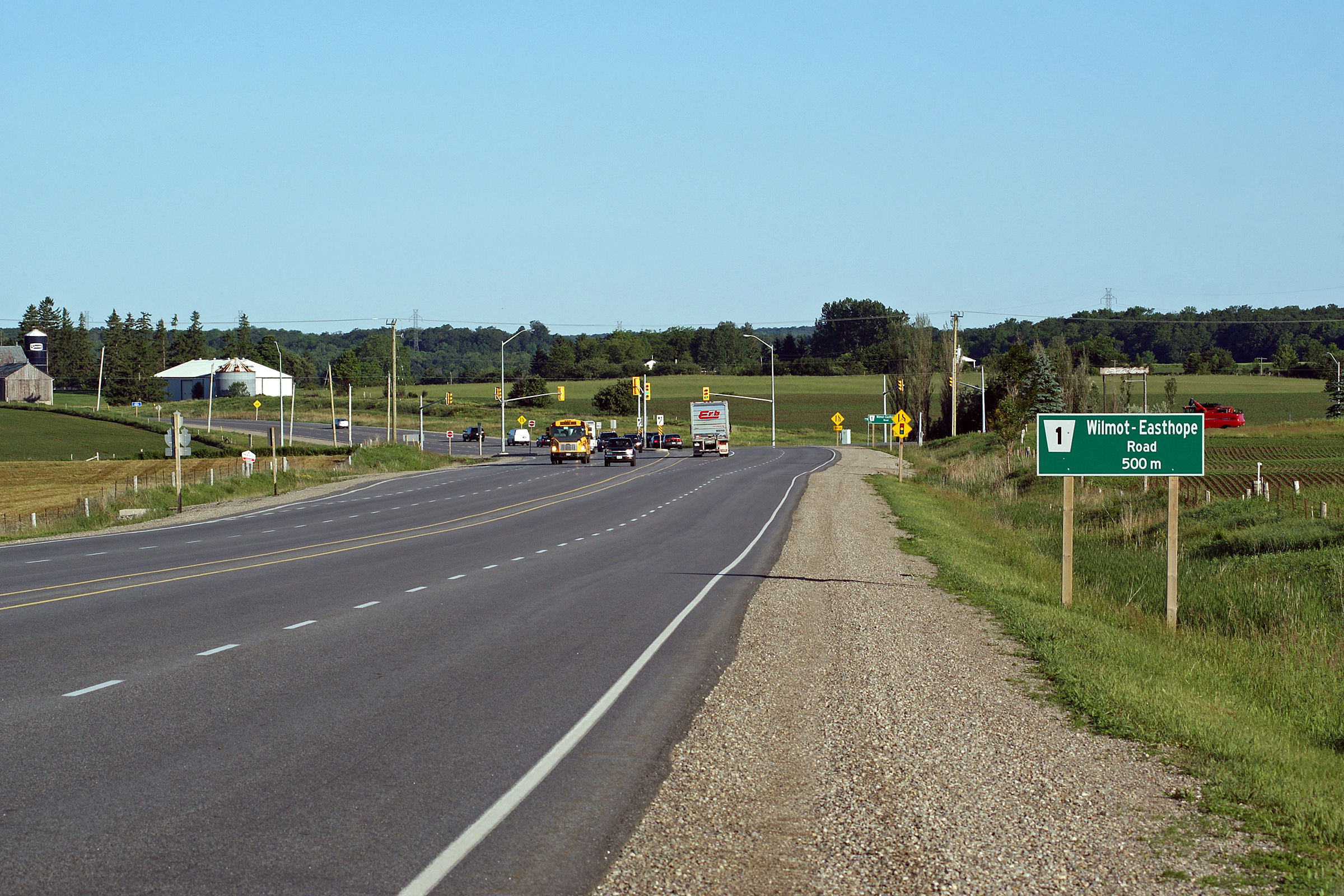
|
Township of Wilmot Regional Municipality of Waterloo |
View looking westerly towards the
Wilmot-Easthope Road intersection. The Wilmot-Easthope Road is a
popular short-cut route for traffic bound to Highway 7 West of Stratford. Photo taken: June 8th, 2010. |
 (720x480) (1440x960) (2400x1600) |
||||
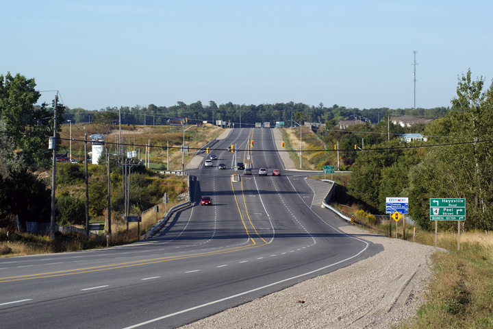
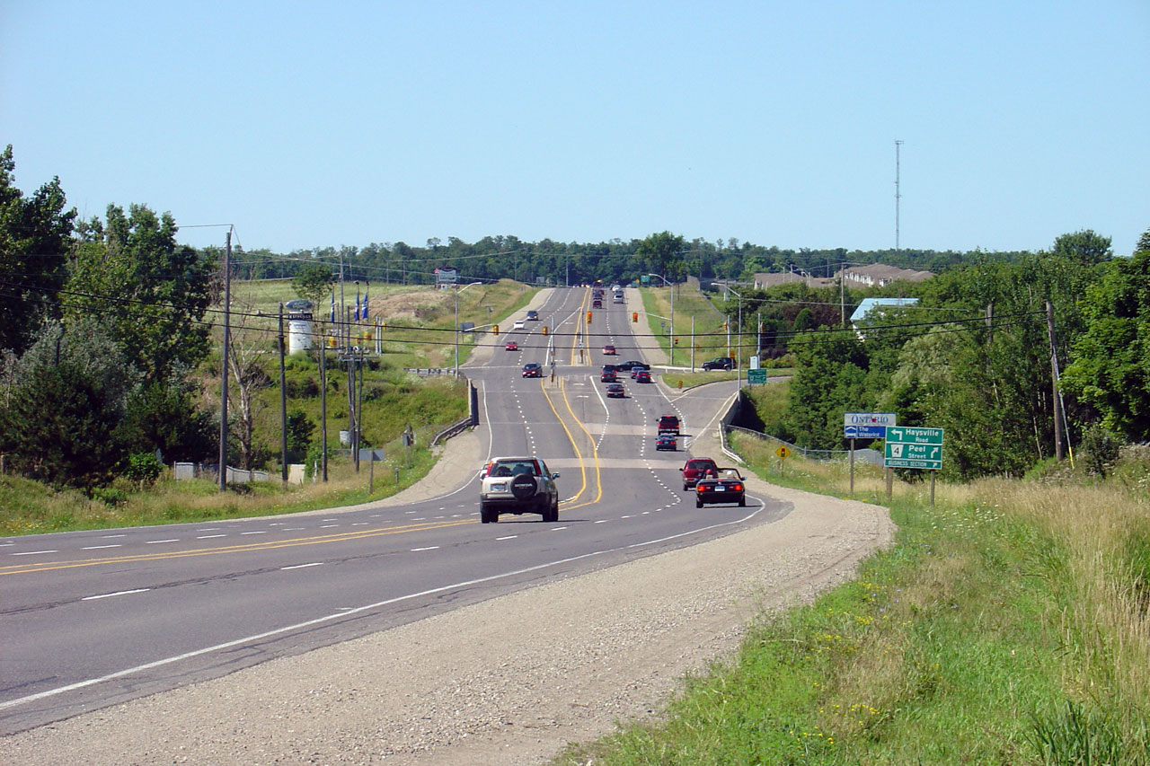
|
Township of Wilmot Regional Municipality of Waterloo |
View looking easterly
approaching the Peel Street intersection. The New Hamburg By-pass was
reconstructed during 2006 and 2007 to improve the pavement condition along
the road as well as
intersection geometry at several intersections. Upper photo taken: June 10th, 2005. Lower photo taken: October 15th, 2010. |
|
||||
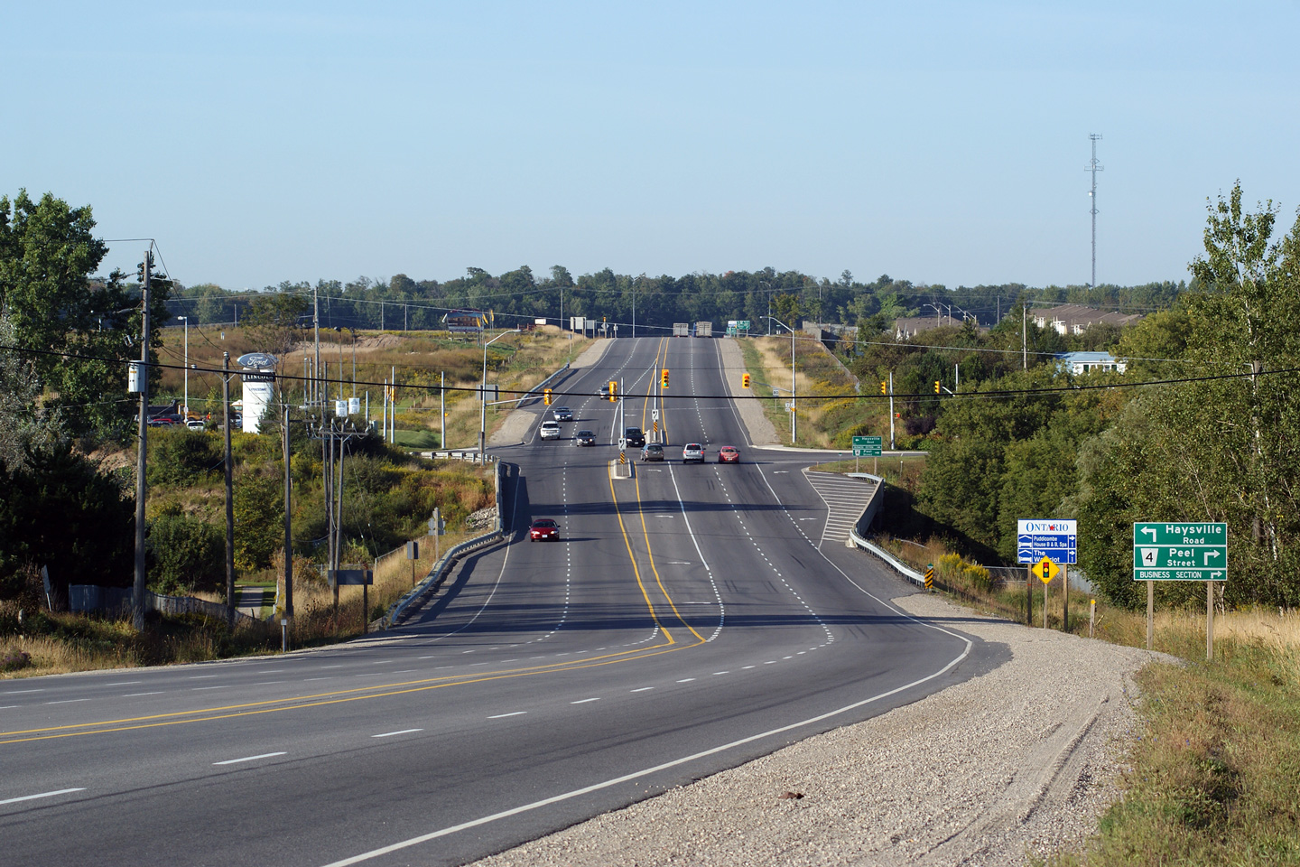
|
Township of Wilmot Regional Municipality of Waterloo |
View looking
west towards Peel Street. The right turn channel from Highway 7/8 to
Peel Street was removed during the 2006/07 reconstruction. There are
several residential driveways immediately north of Highway 7/8 along Peel
Street that conflicted with the ramp. Upper photo taken: August 1st, 2004. Lower photo taken: September 17th, 2009. |
|
||||
|
Township of Wilmot Regional Municipality of Waterloo |
Temporarily mounted traffic
signals at the Bleams Road intersection. Unlike neighbouring
Michigan, traffic signals are
very seldom mounted on overhead wires. A permanent traffic signal
installation was added to this intersection in 2006/07. Photo taken: June 10th, 2005. |
 |
||||
|
Township of Wilmot Regional Municipality of Waterloo |
View looking westerly from
Waterloo Road 5. The New Hamburg By-pass was completed in 1957 to
avoid a very awkward routing through the town. Photo taken: June 10th, 2005. |
 |
||||
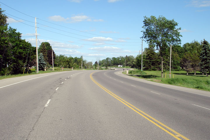
|
Township of Wilmot Regional Municipality of Waterloo |
View looking easterly at the
west end of the divided highway at the eastern end of the New Hamburg
By-pass. Photo taken: June 10th, 2005. |
 |
||||
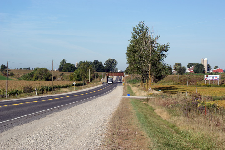
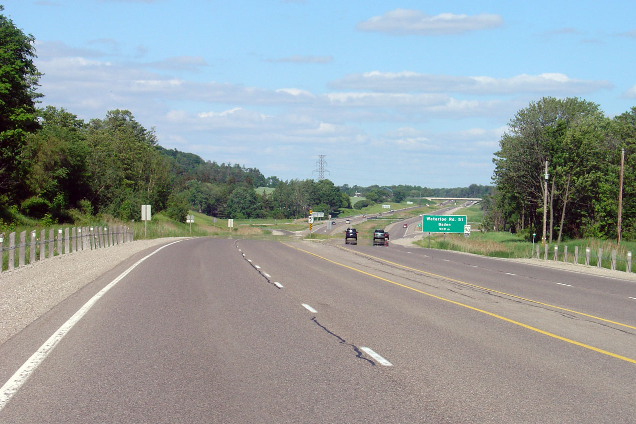
|
Township of Wilmot Regional Municipality of Waterloo |
View looking westerly from
Sandhills Road towards New Hamburg and Waterloo Road 51. Photo taken: June 10th, 2005. |
 |
||||
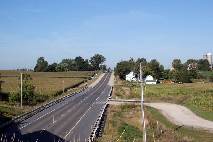
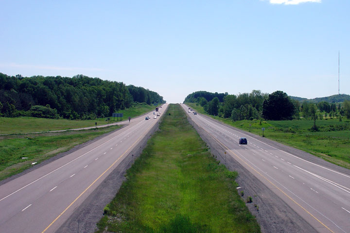
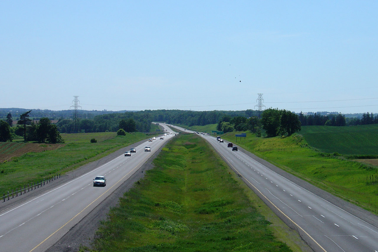
| Township of Wilmot Regional Municipality of Waterloo |
View looking easterly from
Sandhills Road. Despite the high design standard, Highway 7/8 is only
posted at 90km/h. Photo taken: June 10th, 2005. |
 |
||||
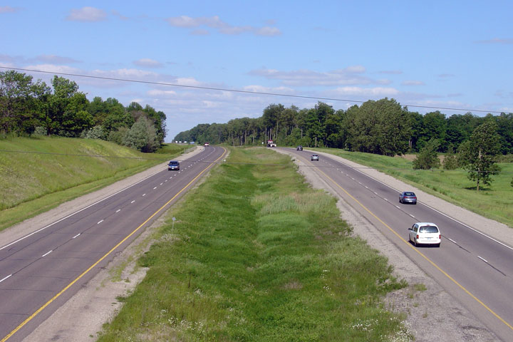
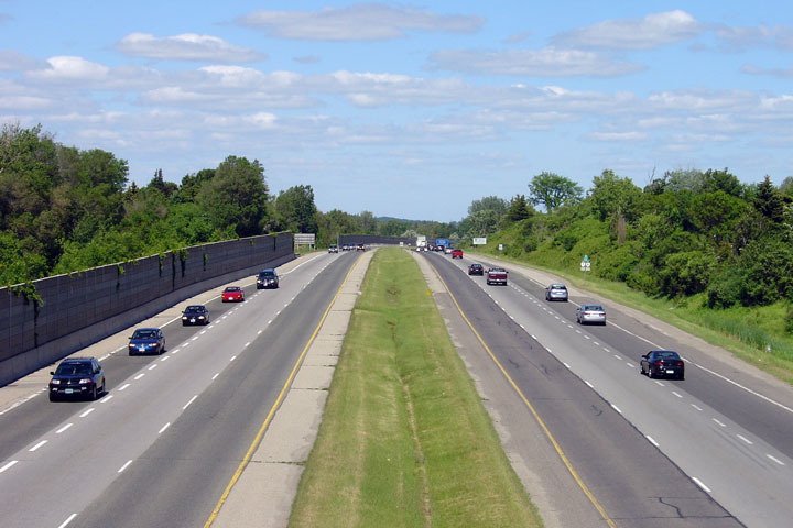
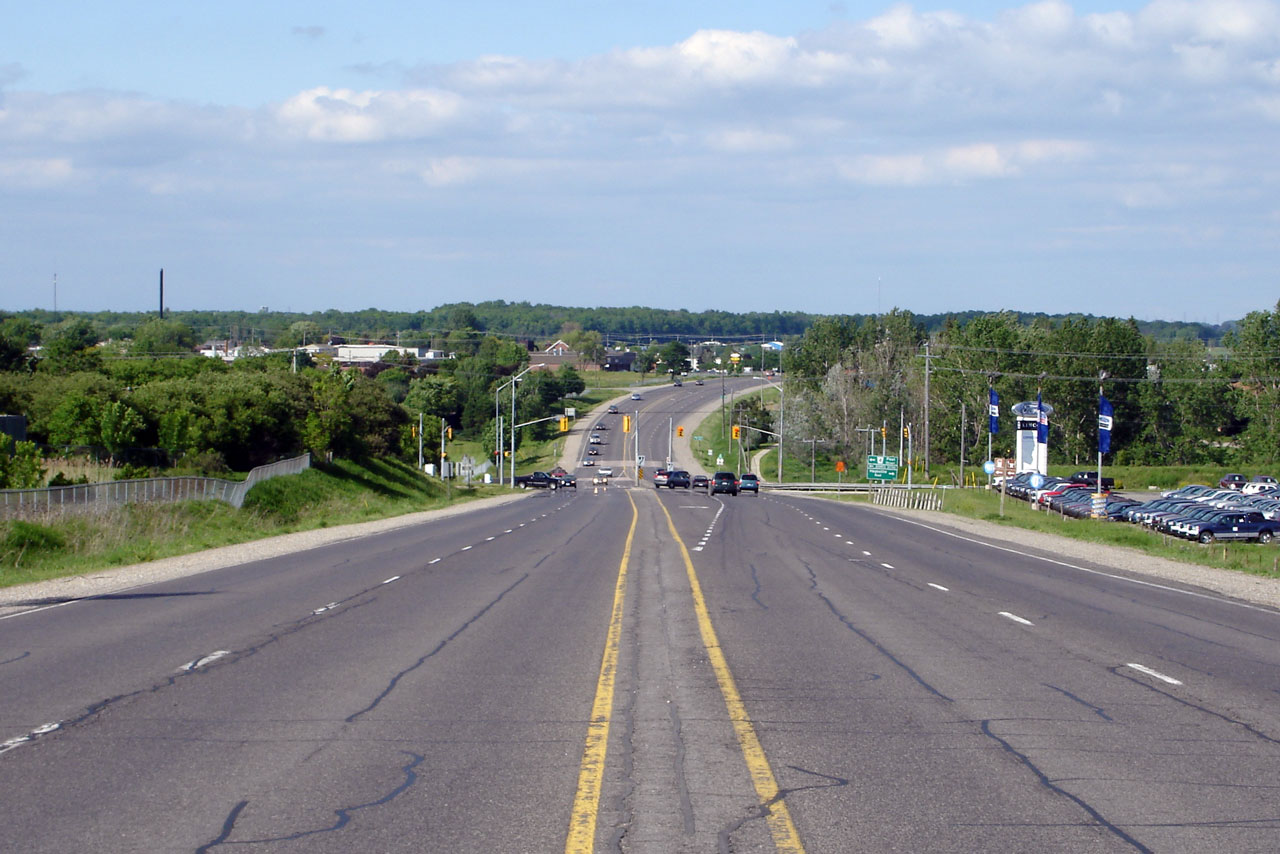
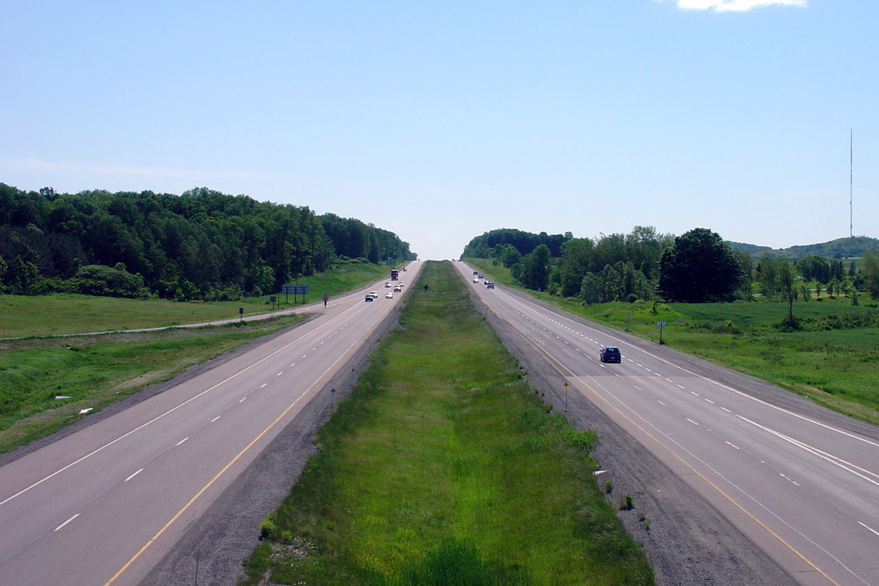
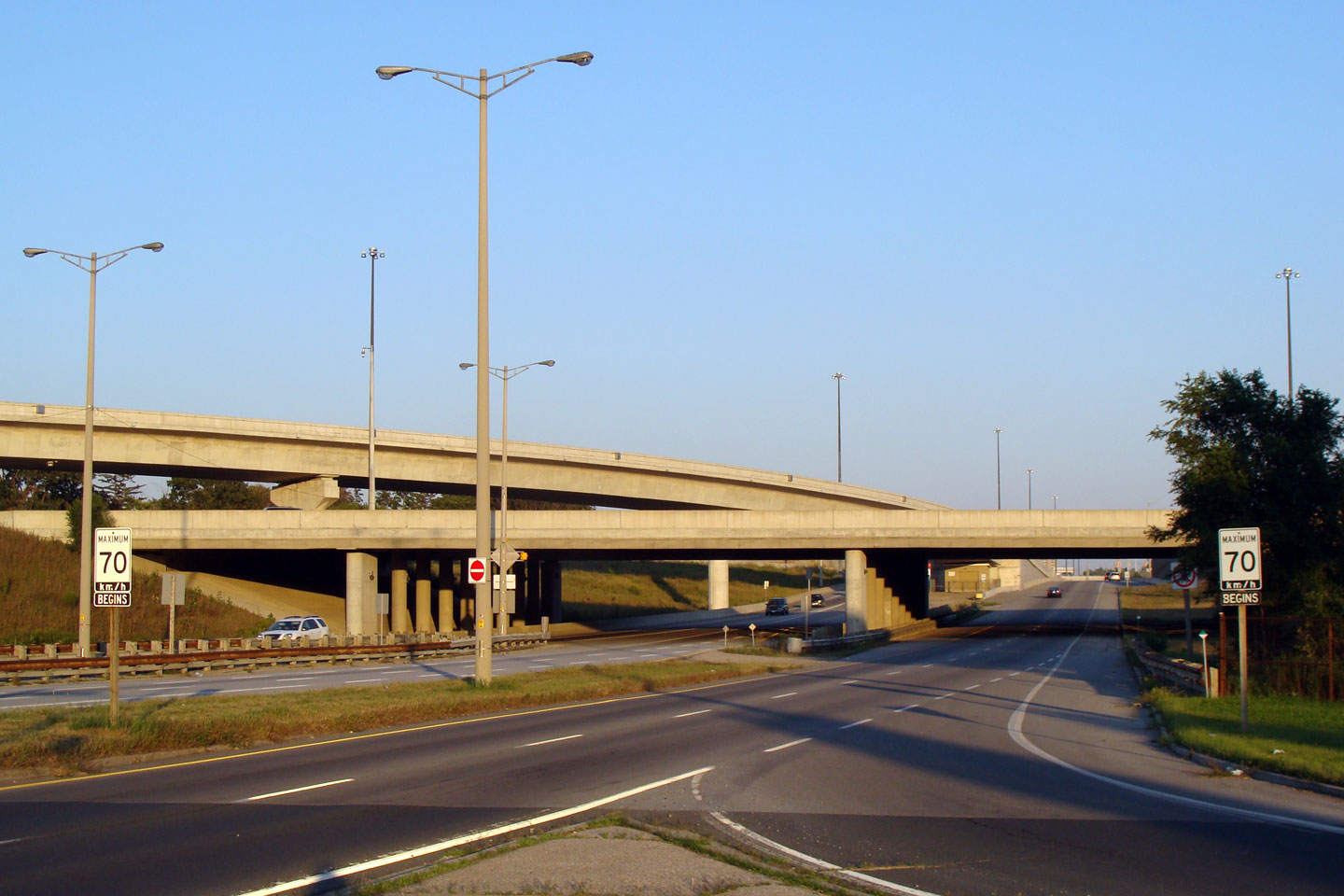
| Township of Wilmot Regional Municipality of Waterloo |
This picture is looking west off of the Waterloo
Road 12 overpass west of the city of Kitchener. Before the mid-1990s
the 4-lane divided expressway ended at this interchange, only to restart as
an at grade 4-lane undivided expressway a few kilometres west near New
Hamburg. Photo taken: June 10th, 2005. |
|
||||
| Township of Wilmot Regional Municipality of Waterloo |
View looking easterly from
the Waterloo Road 12 interchange. Photo taken: June 10th, 2005. |
 |
||||
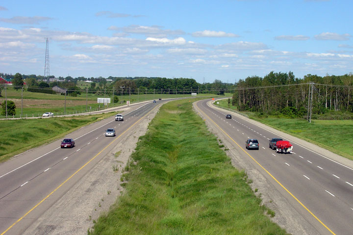
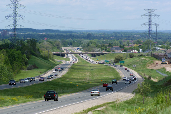
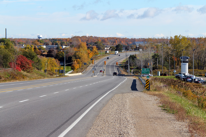
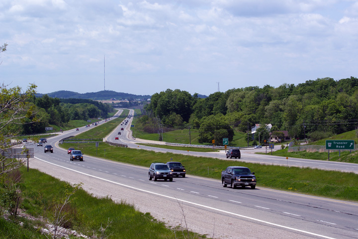
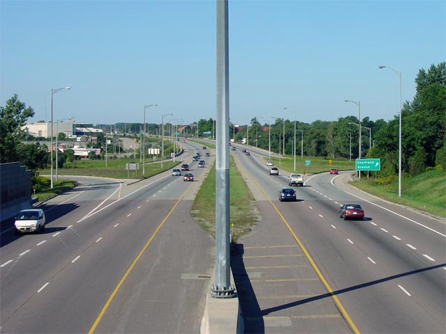
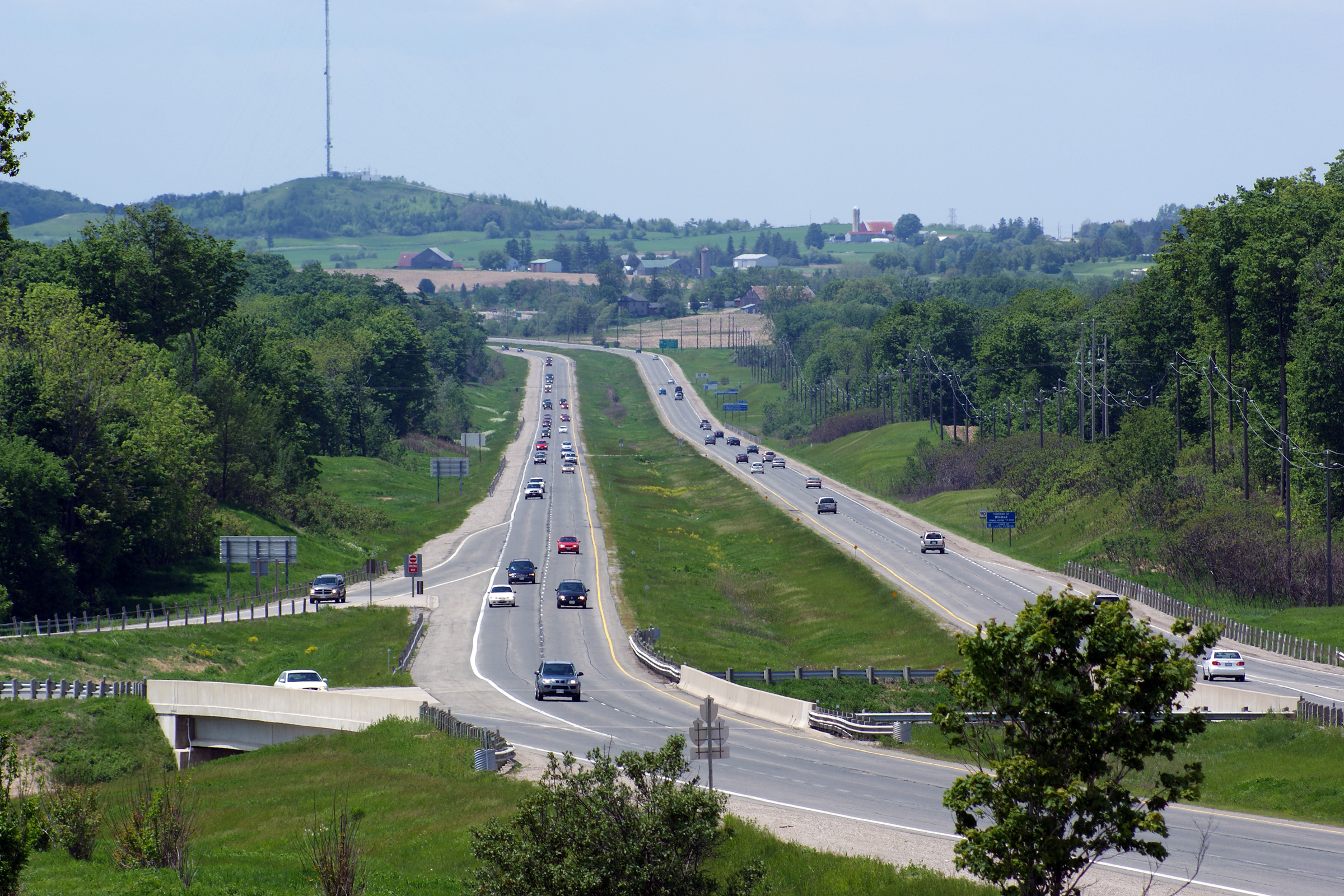
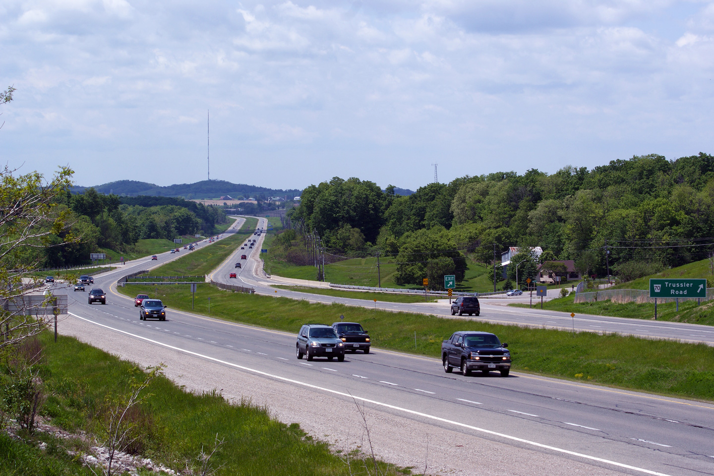
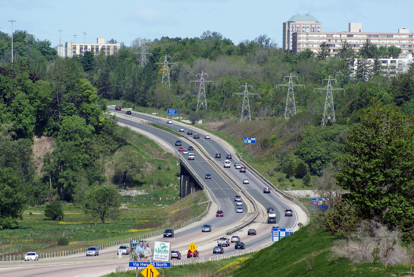
| City of Kitchener Regional Municipality of Waterloo |
These views look west towards
the Trussler Road interchange along Highway 7/8. Photo taken: June 10th, 2005. |
|
||||
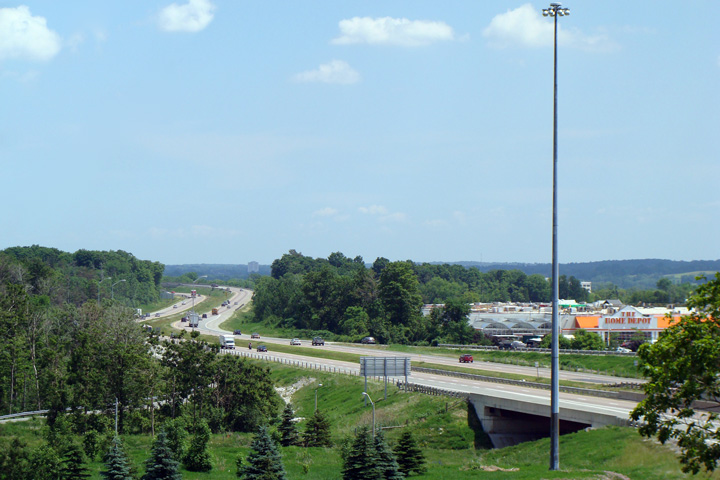
| City of Kitchener Regional Municipality of Waterloo |
Easterly views of Highway 7/8
towards the Fischer Hallman Road interchange. Photo taken: June 10th, 2005. |
(720x480)
(1440x960)
(2400x1600) |
||||
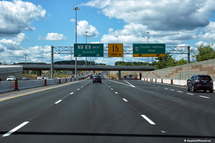
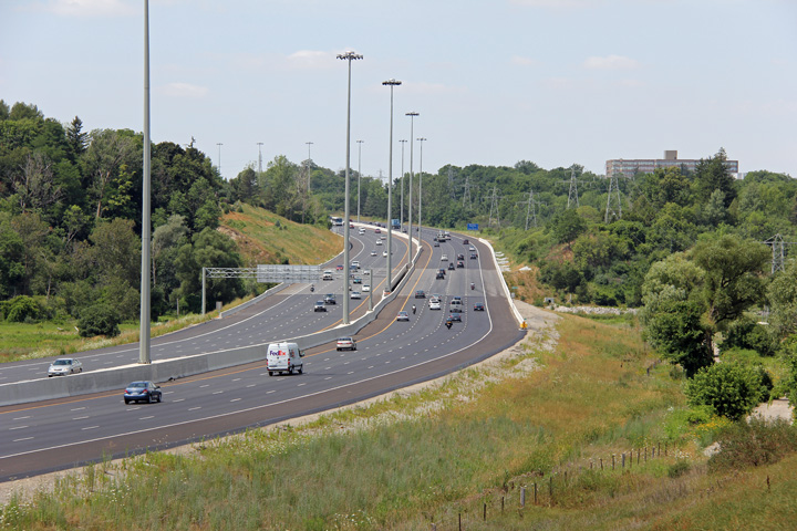
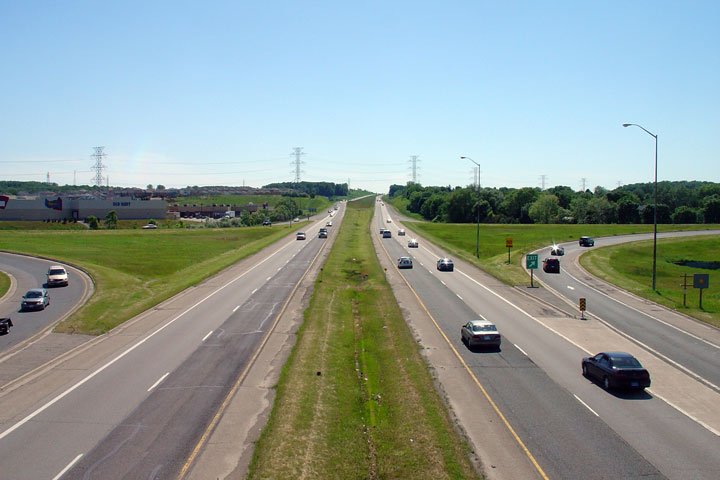
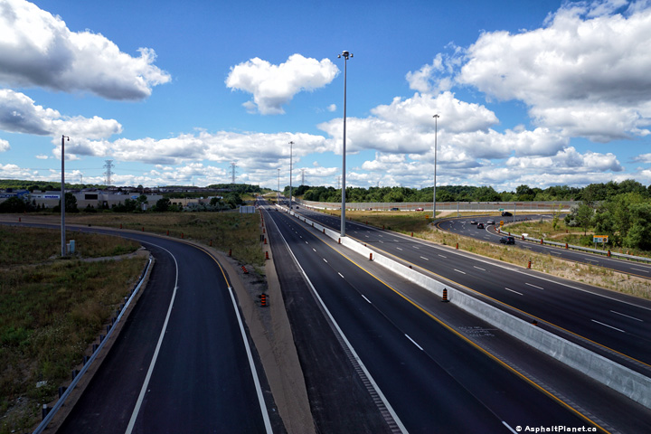
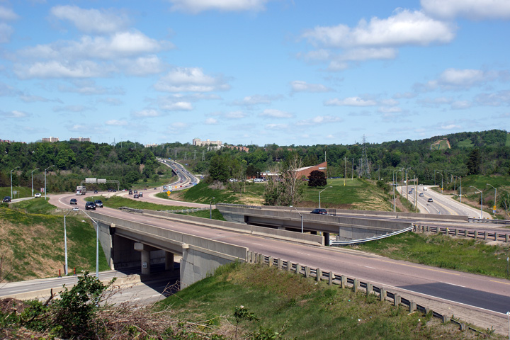
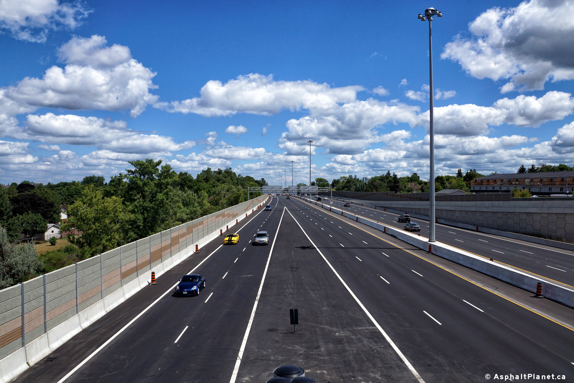
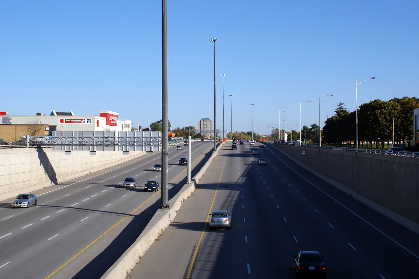
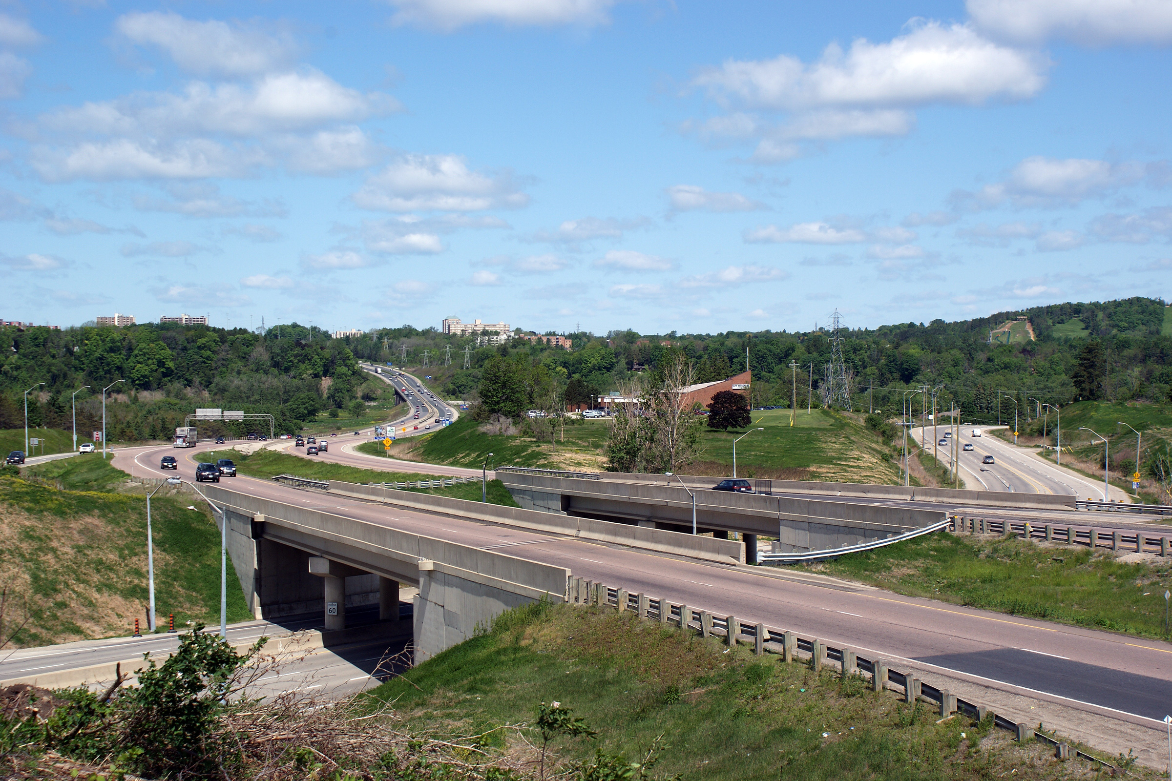
| City of Kitchener Regional Municipality of Waterloo |
These photos show Highway 7/8
looking west from the Fisher-Hallman Road overpass in Kitchener. The
highway's median widens considerably for a short distance
west of the Fischer-Hallman Road interchange. It would seem that
highway designers envisioned a considerably wider rural cross-section when
the initial portion of the highway was opened in the 1970s than what was
actually built later in the 1990s. Upper photo taken: June 10th, 2005. Lower photos taken: August 11th, 2016. |
|
||||
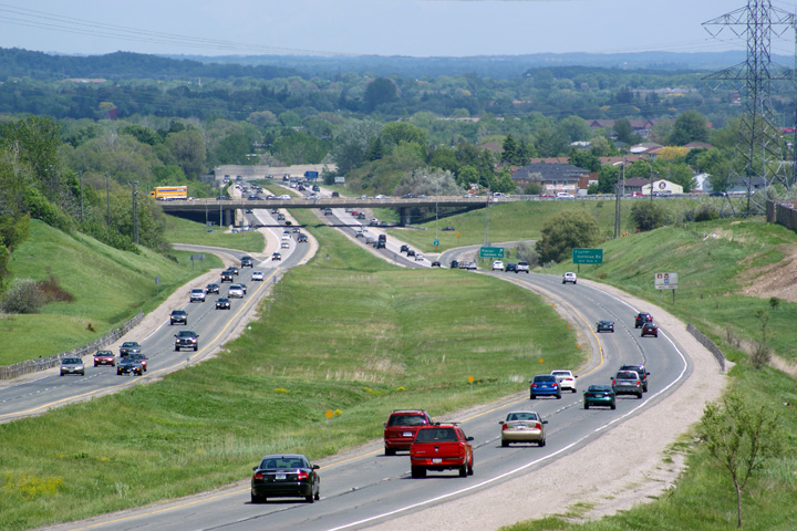
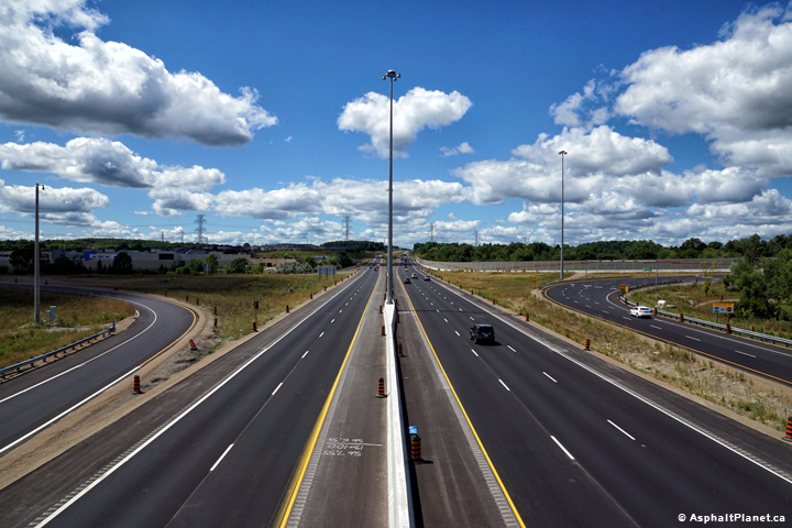
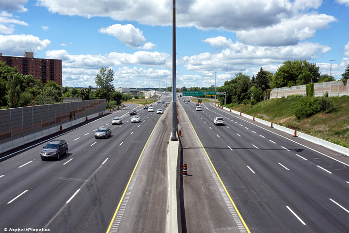
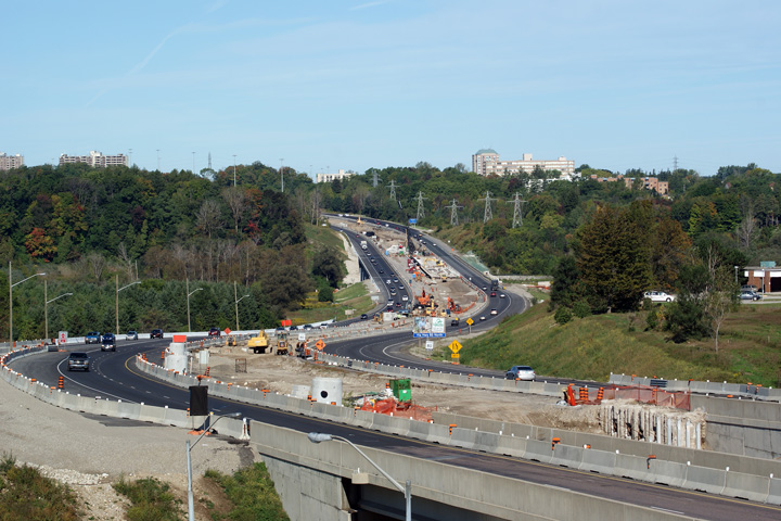
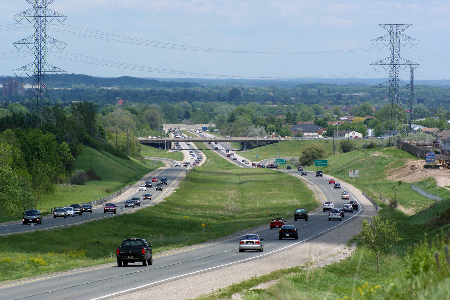
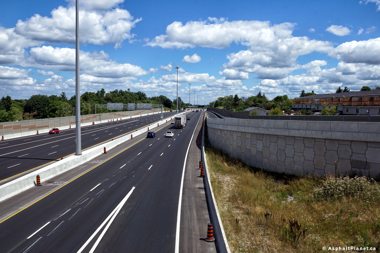
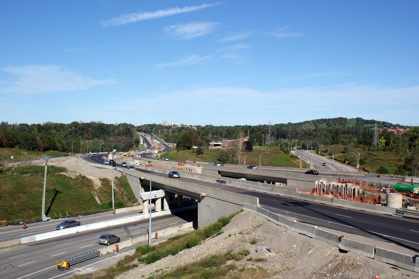
|
City of Kitchener Regional Municipality of Waterloo |
Easterly view of the
Conestoga Parkway from Fischer Hallman Road. The MTO is in preliminary
design to widen the Parkway from Fischer Hallman Road easterly to Courtland
Road. Upper photo taken: June 10th, 2005. Lower photos taken: August 11th, 2016. |
 (720x480) (1440x960) (2400x1600)
|
||||
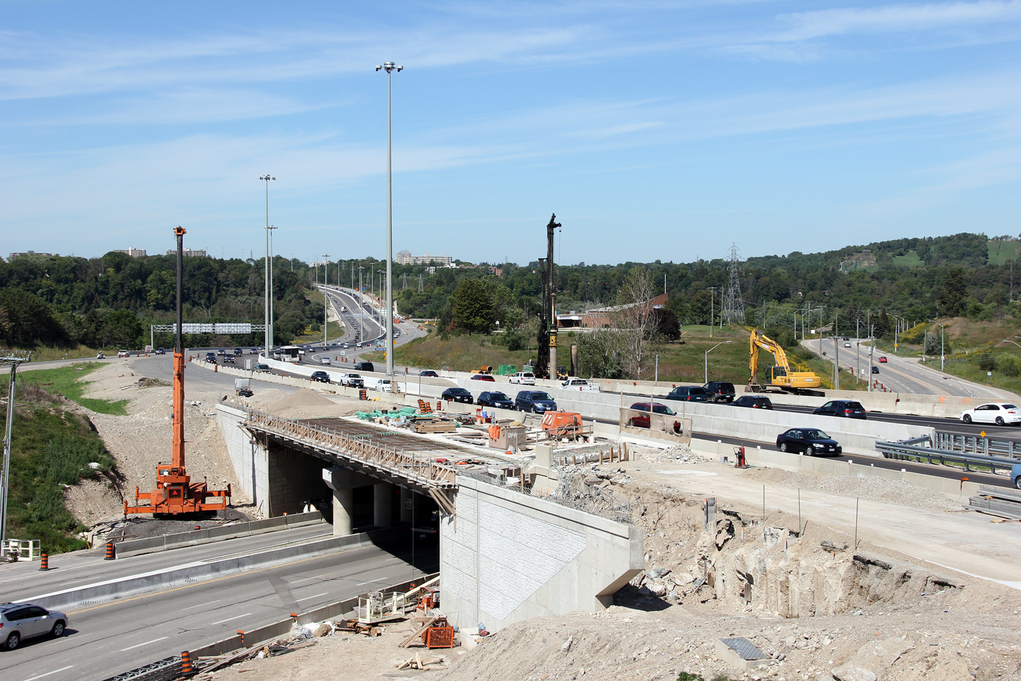
|
City of Kitchener Regional Municipality of Waterloo |
View looking westerly at the
off-ramp to Fischer-Hallman Road. Photo taken: August 11th, 2016. |
 (720x480) (720x480)(1440x960) (2400x1600) |
||||
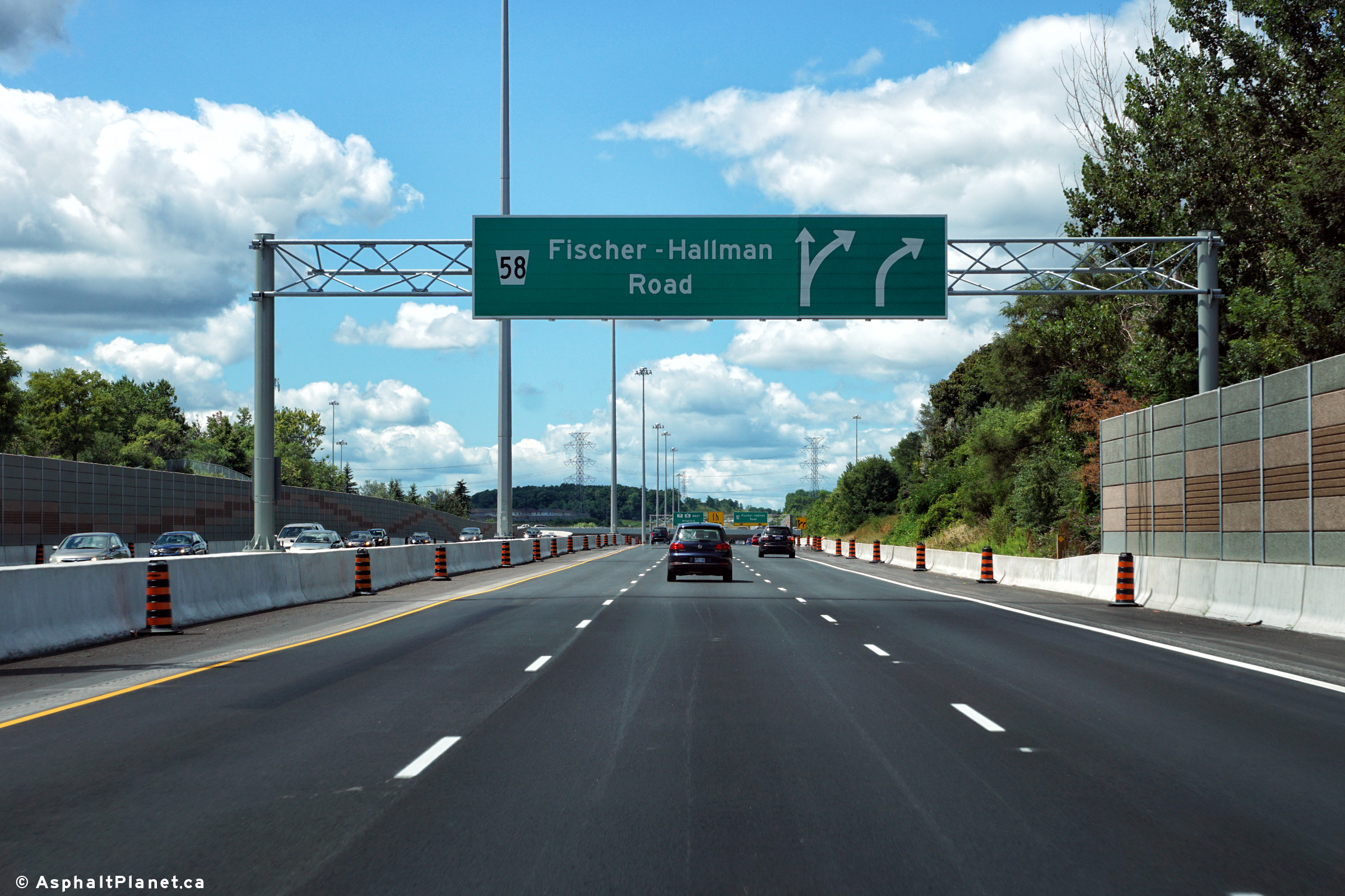
|
City of Kitchener Regional Municipality of Waterloo |
Westbound signage in advance of
the Fischer-Hallman Road interchange. Photo taken: August 11th, 2016. |
 (720x480) (720x480)(1440x960) (2400x1600) |
||||
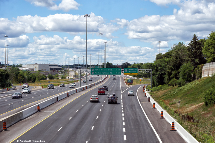
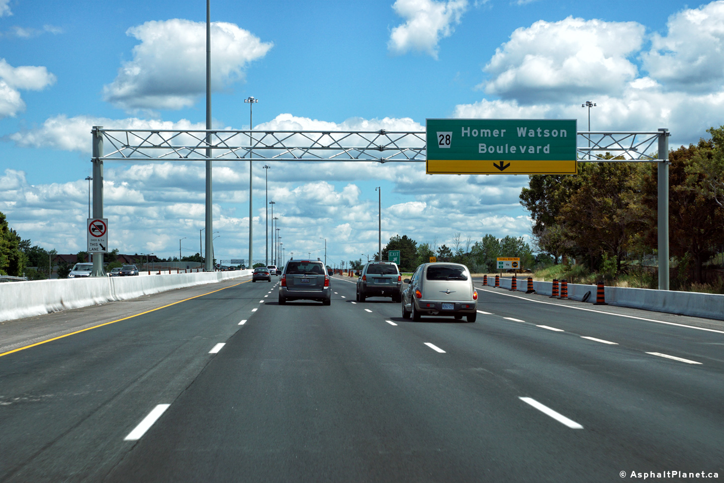
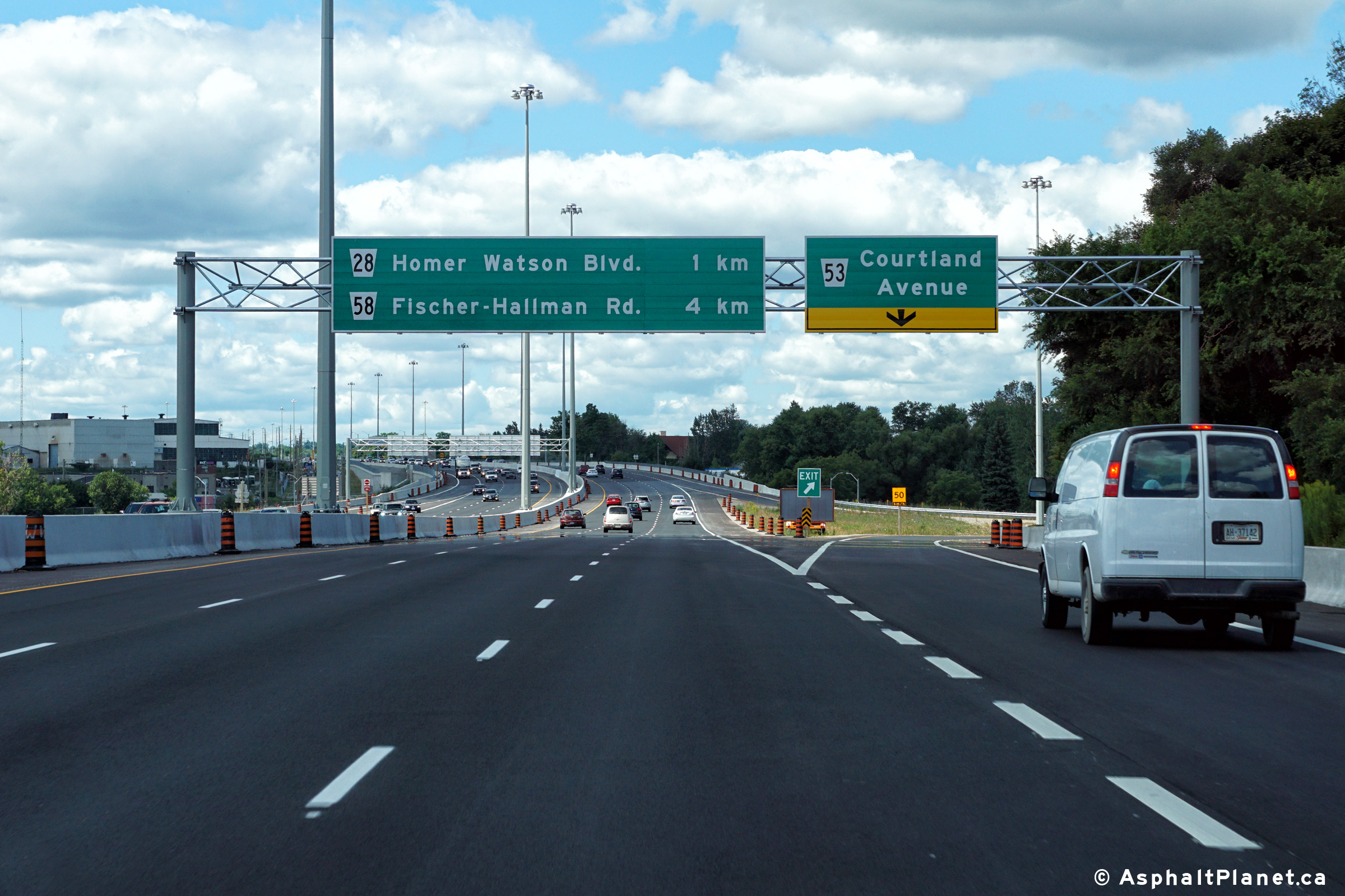
|
City of Kitchener Regional Municipality of Waterloo |
Eastbound advanced signage for
the Homer Watson Boulevard interchange. Photo taken: August 11th, 2016. |
 (720x480) (720x480)(1440x960) (2400x1600) |
||||
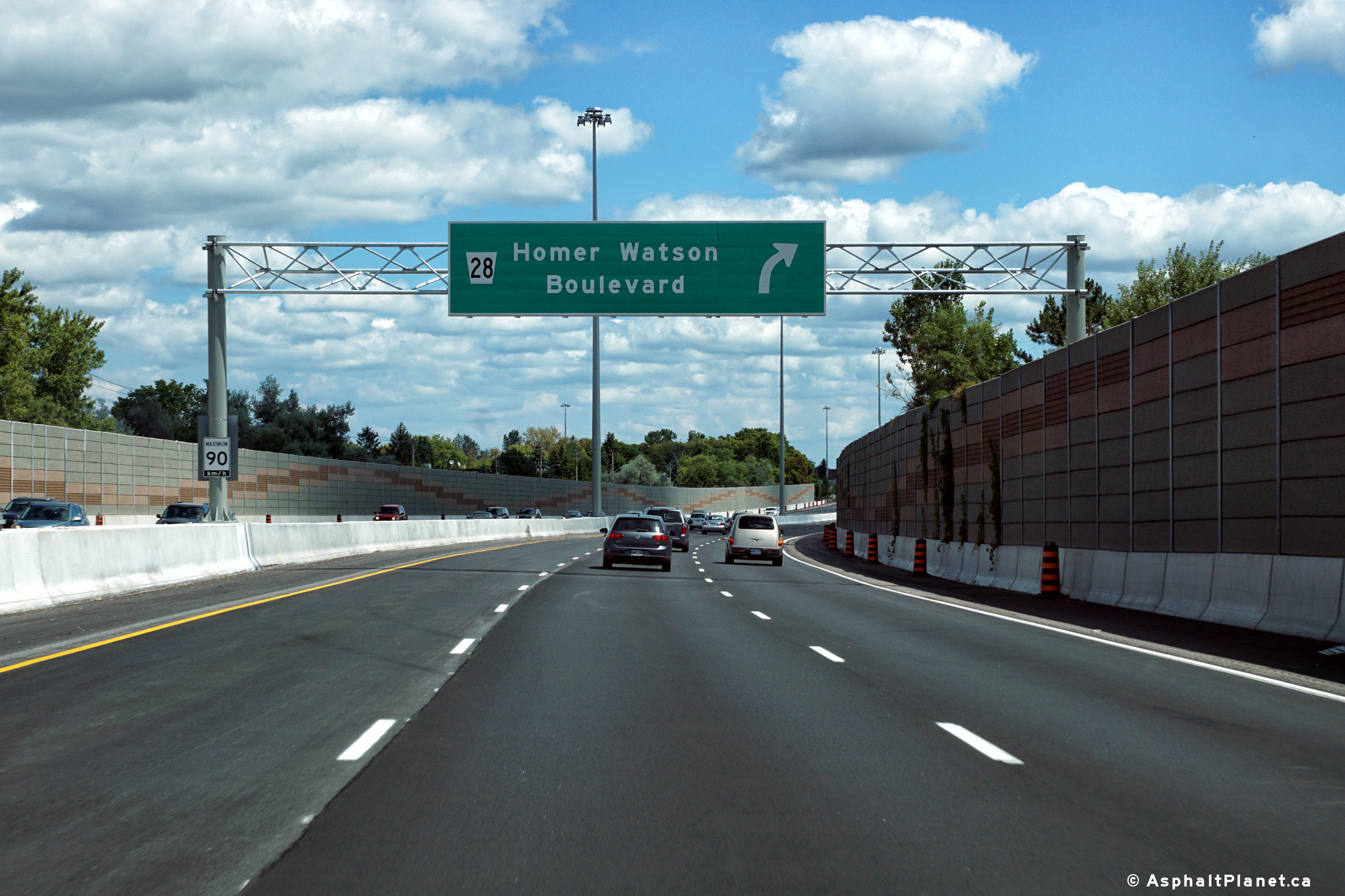
|
City of Kitchener Regional Municipality of Waterloo |
View looking easterly at the
off-ramp to Homer Watson Boulevard interchange. Photo taken: August 11th, 2016. |
 (720x480) (720x480)(1440x960) (2400x1600) |
||||
|
A multi-year construction project to widen Highway 7/8 to six lanes between Fischer Hallman Road and Courtland Avenue was completed in 2016. For photos of this construction project, click here. |
||||||
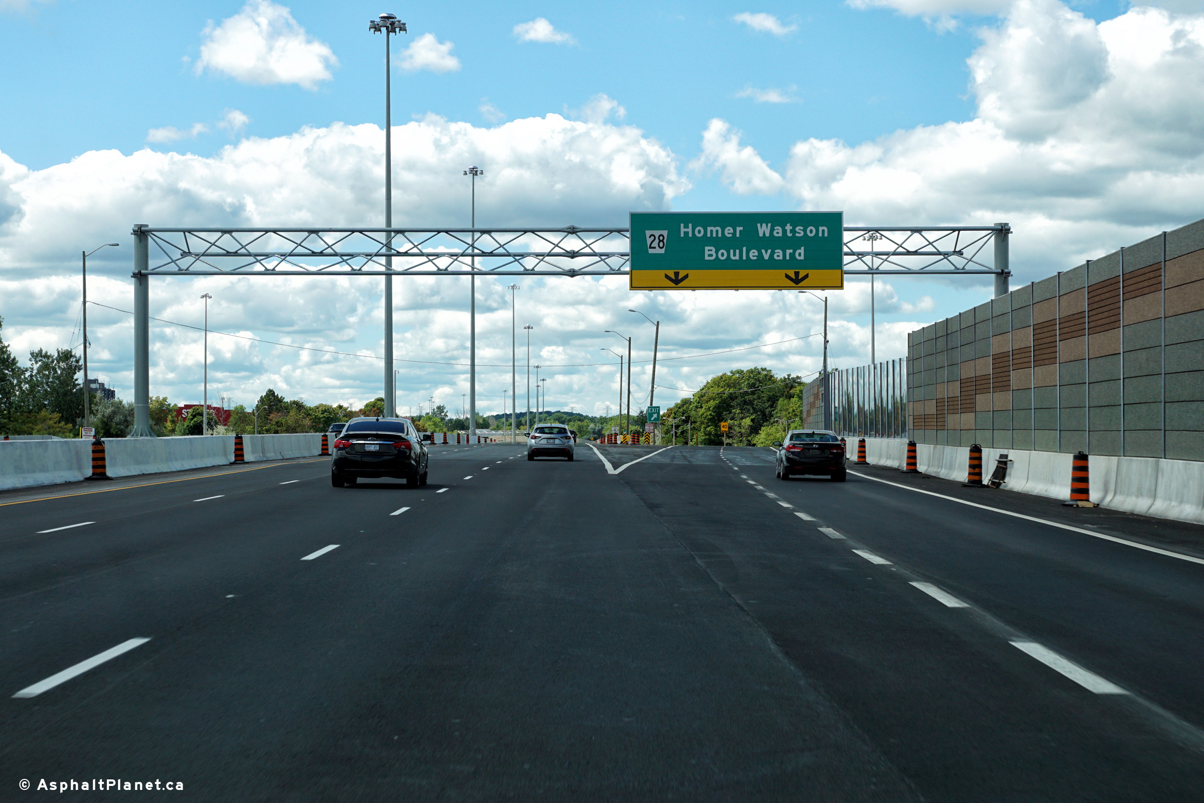
|
City of Kitchener Regional Municipality of Waterloo |
View looking westerly at the
off-ramp to Homer Watson Boulevard. This off-ramp was widened from one
to two lanes during a construction project that was completed in 2016. Photo taken: August 11th, 2016. |
 (720x480) (720x480)(1440x960) (2400x1600) |
||||
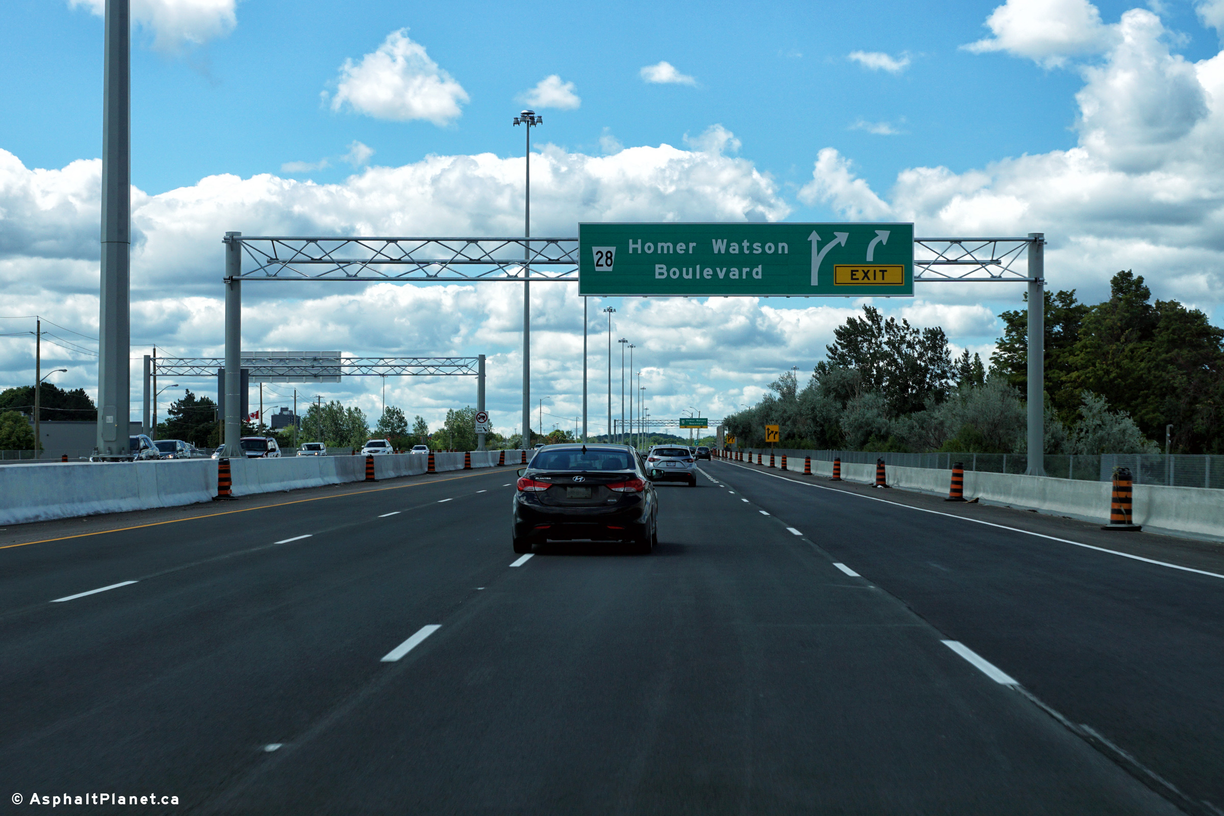
|
City of Kitchener Regional Municipality of Waterloo |
Westbound advanced signage for
the Homer Watson Boulevard interchange. Photo taken: August 11th, 2016. |
 (720x480) (720x480)(1440x960) (2400x1600) |
||||
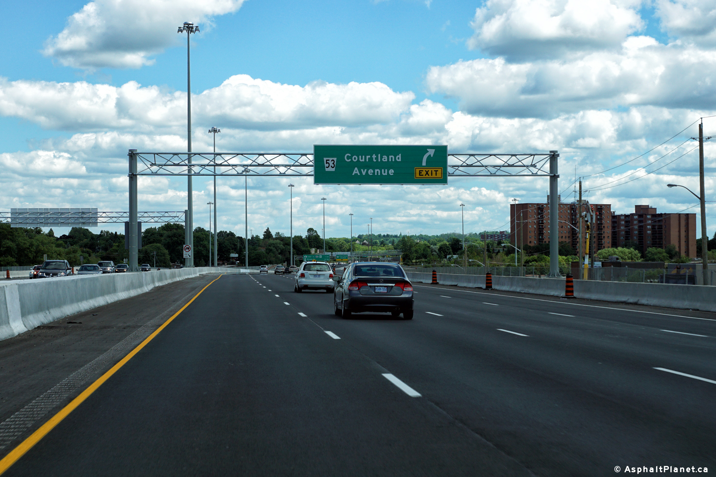
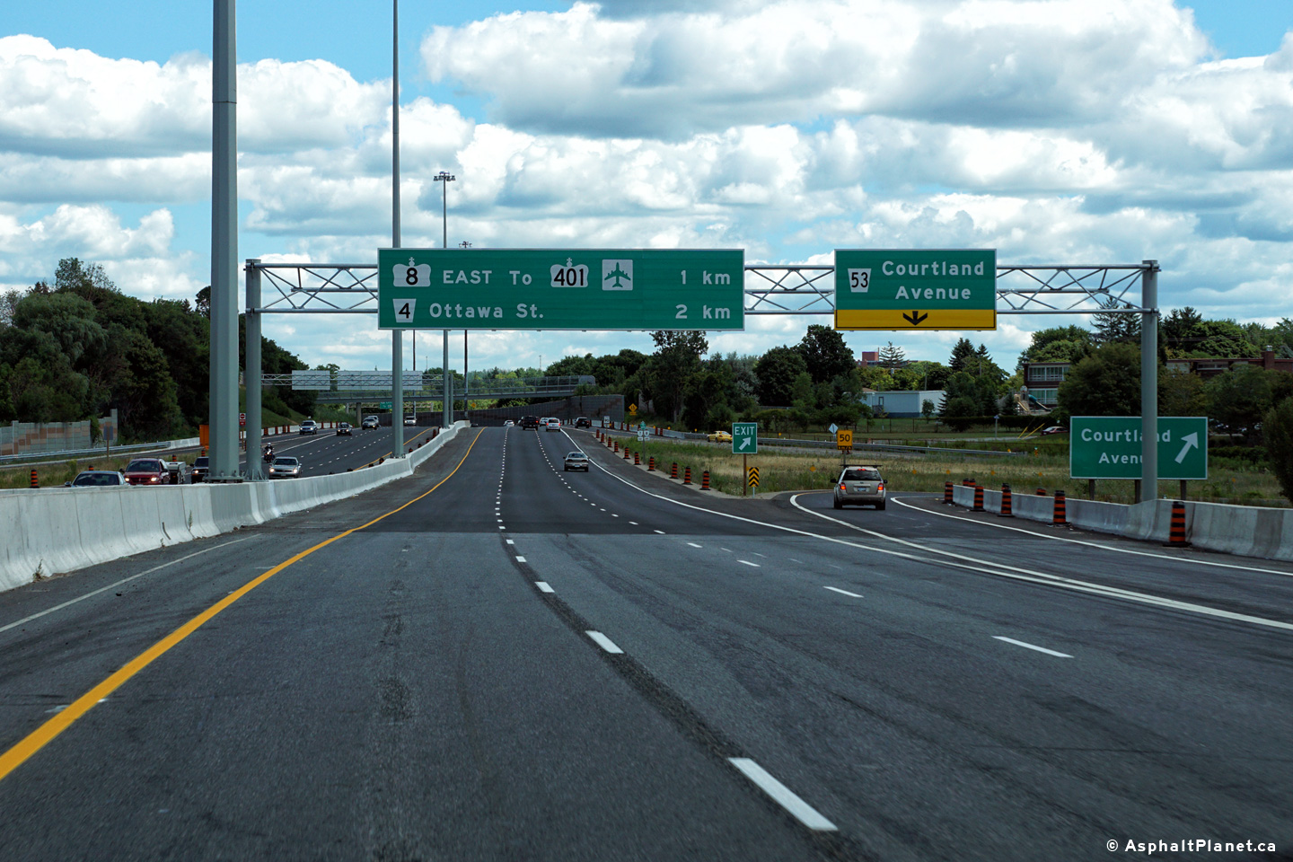
|
City of Kitchener Regional Municipality of Waterloo |
Eastbound advanced signage for
the Courtland Avenue interchange. Photo taken: August 11th, 2016. |
 (720x480) (720x480)(1440x960) (2400x1600) |
||||
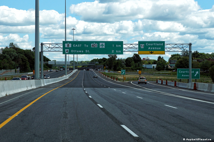
|
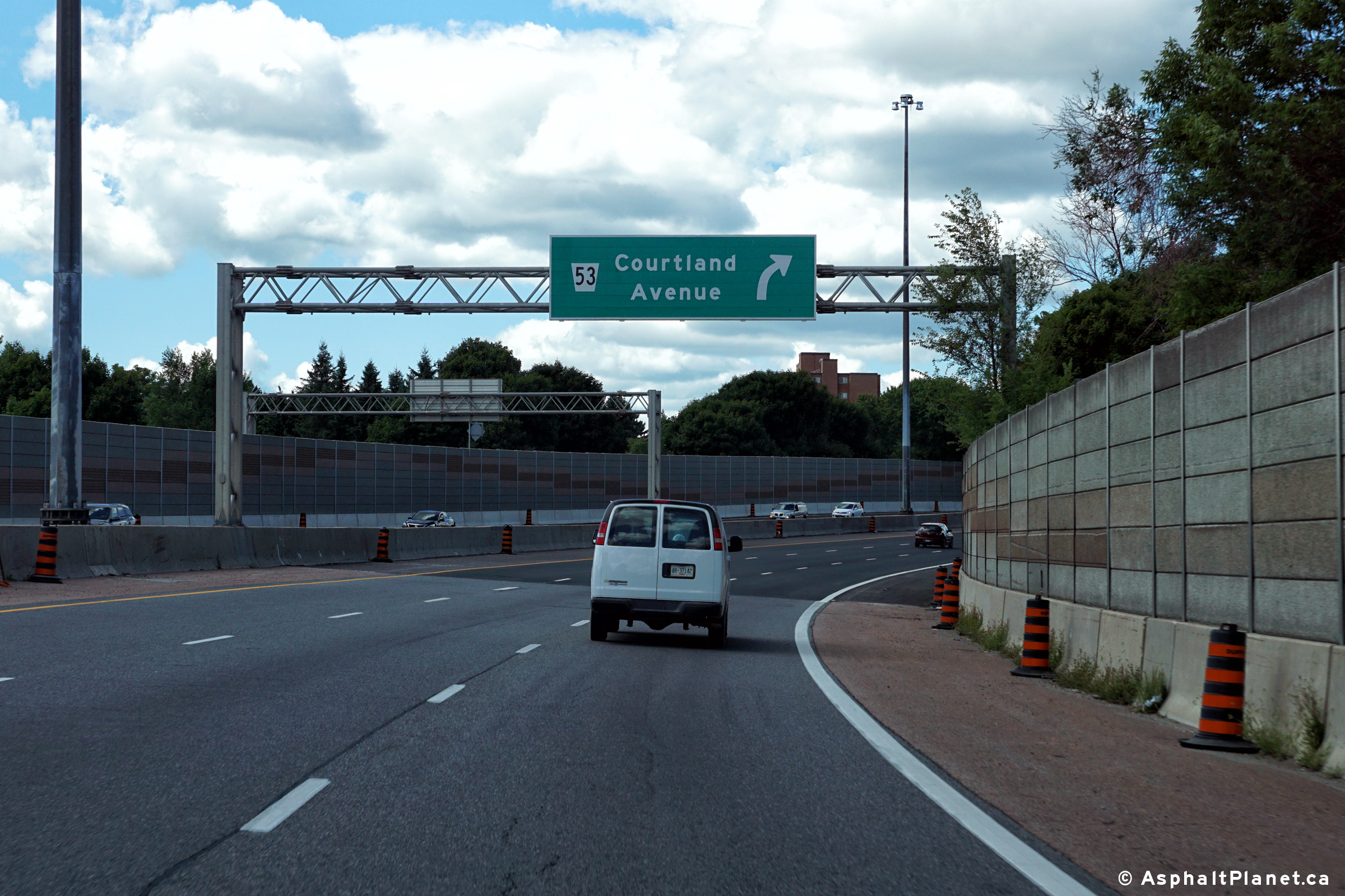
City of Kitchener Regional Municipality of Waterloo |
View looking easterly at the
off-ramp to Courland Avenue. The fourth lane that joined the highway
at the Homer Watson Boulevard interchange exits at Courtland Avenue. Photo taken: August 11th, 2016. |
 (720x480) (720x480)(1440x960) (2400x1600) |
||||
|
City of Kitchener Regional Municipality of Waterloo |
View looking westerly at the
off-ramp to Courland Avenue. Photo taken: August 11th, 2016. |
 (720x480) (720x480)(1440x960) (2400x1600) |
||||
|
City of Kitchener Regional Municipality of Waterloo |
Highway 7/8 looking west towards
the Courtland Avenue. interchange from the pedestrian overpass just east of
Courtland Avenue. Before, 2016, Highway 7/8 had a four lane
cross-section from Courtland Avenue westerly to New Hamburg. Upper photo taken: September 18th, 2005. Lower photos taken: August 11th, 2016. |
(720x480) (1440x960) (2400x1600)
|
||||
|
City of Kitchener Regional Municipality of Waterloo |
Highway 7/8 looking east
from the same pedestrian overpass as the previous picture. The Highway 7/8
interchange is located about 500m east of this overpass. Upper photo taken: September 18th, 2005. Lower photo taken: August 11th, 2016. |
 |
||||
|
City of Kitchener Regional Municipality of Waterloo |
Westbound advanced signage for
the Courtland Avenue interchange. Photo taken: August 11th, 2016. |
 (720x480) (720x480)(1440x960) (2400x1600) |
||||
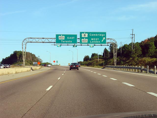
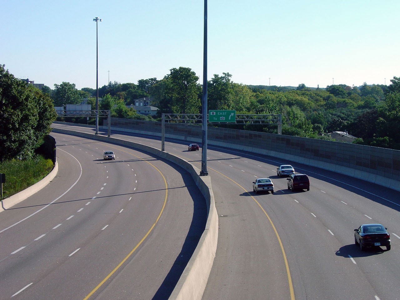
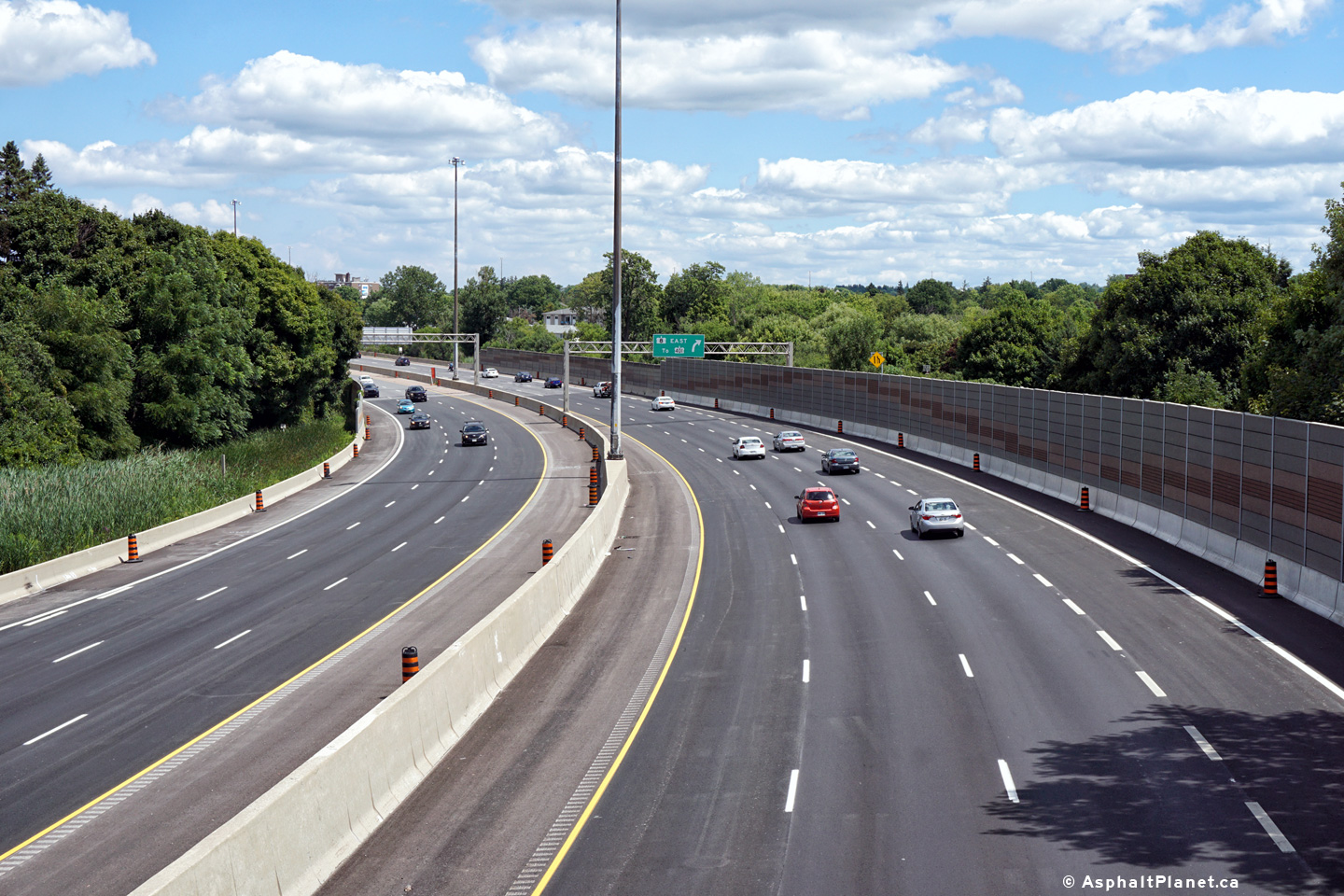
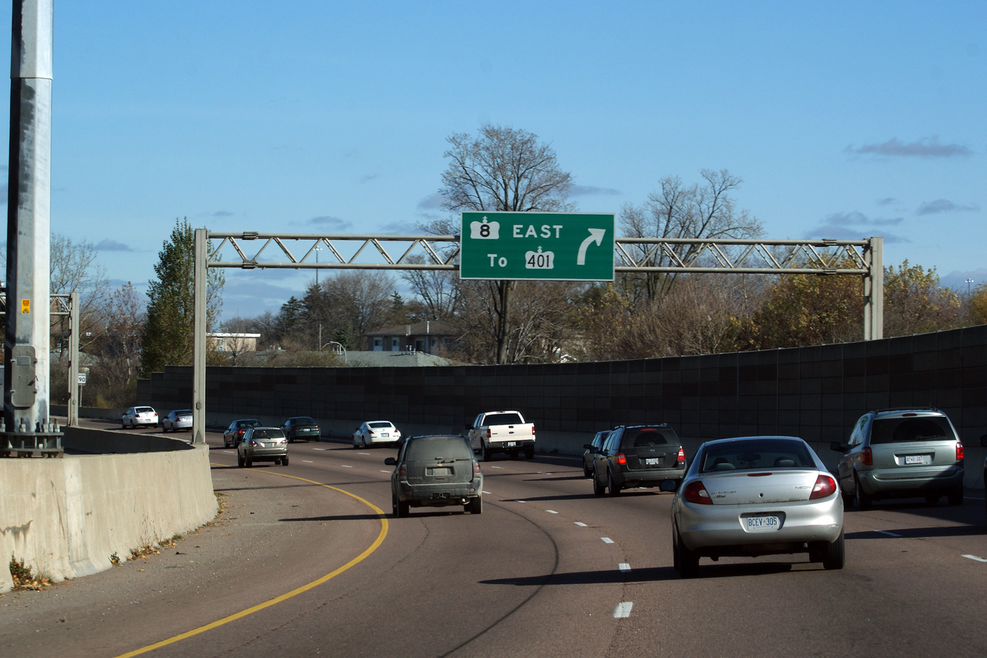
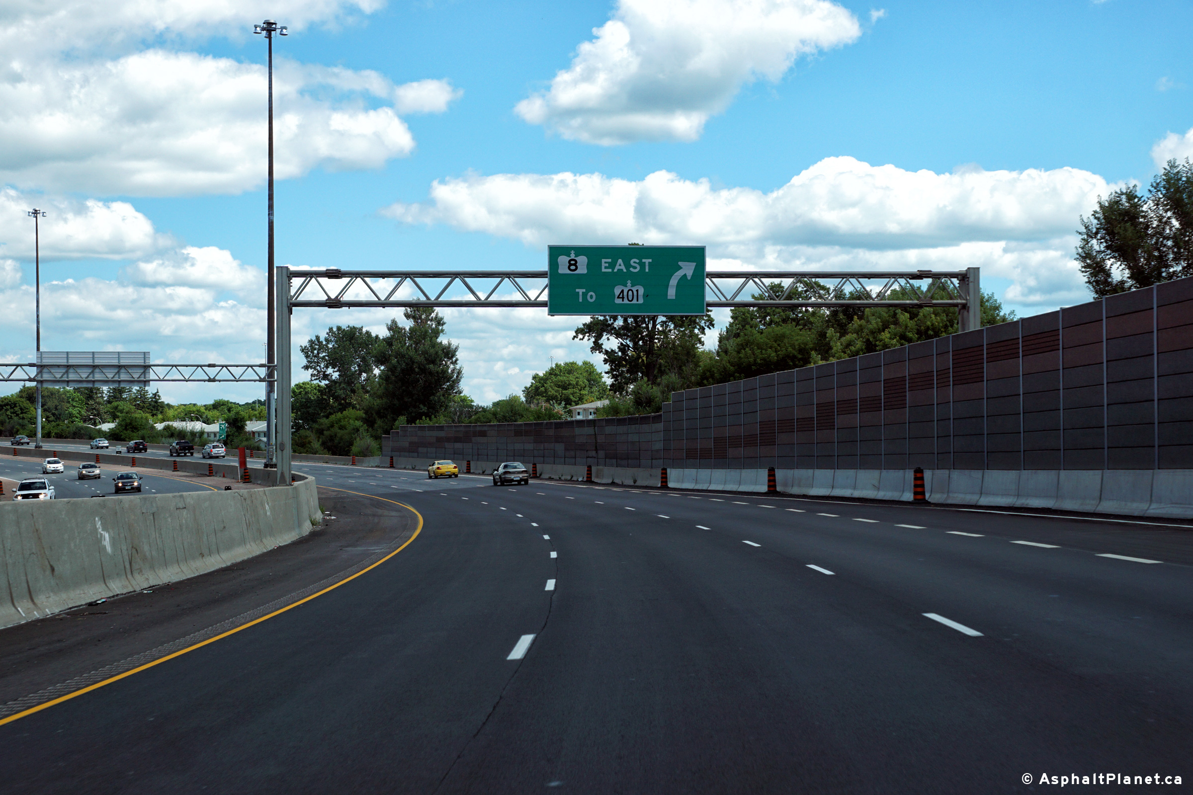
|
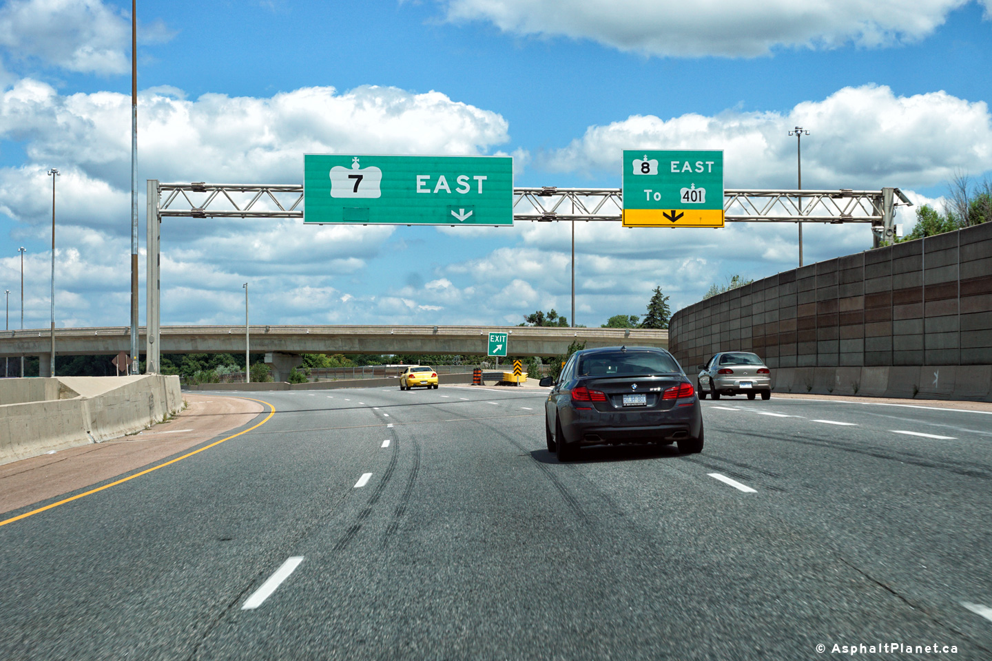
City of Kitchener Regional Municipality of Waterloo |
The advanced signage for the
Highway 8 split from the eastbound lanes of
the Conestoga Parkway. Traffic bound towards Highway 401 is directed
to follow Highway 8. Click
here
for an alternate photo of this signage taken in August, 2004. Photo taken: August 11th, 2016. |
 (720x480) (720x480)(1440x960) (2400x1600) |
||||
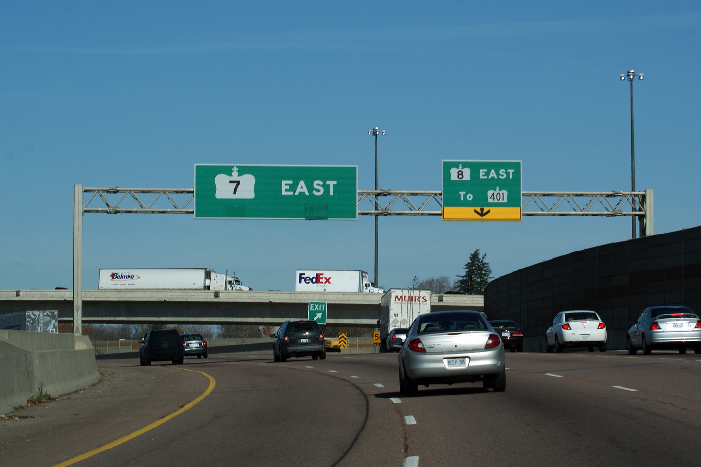
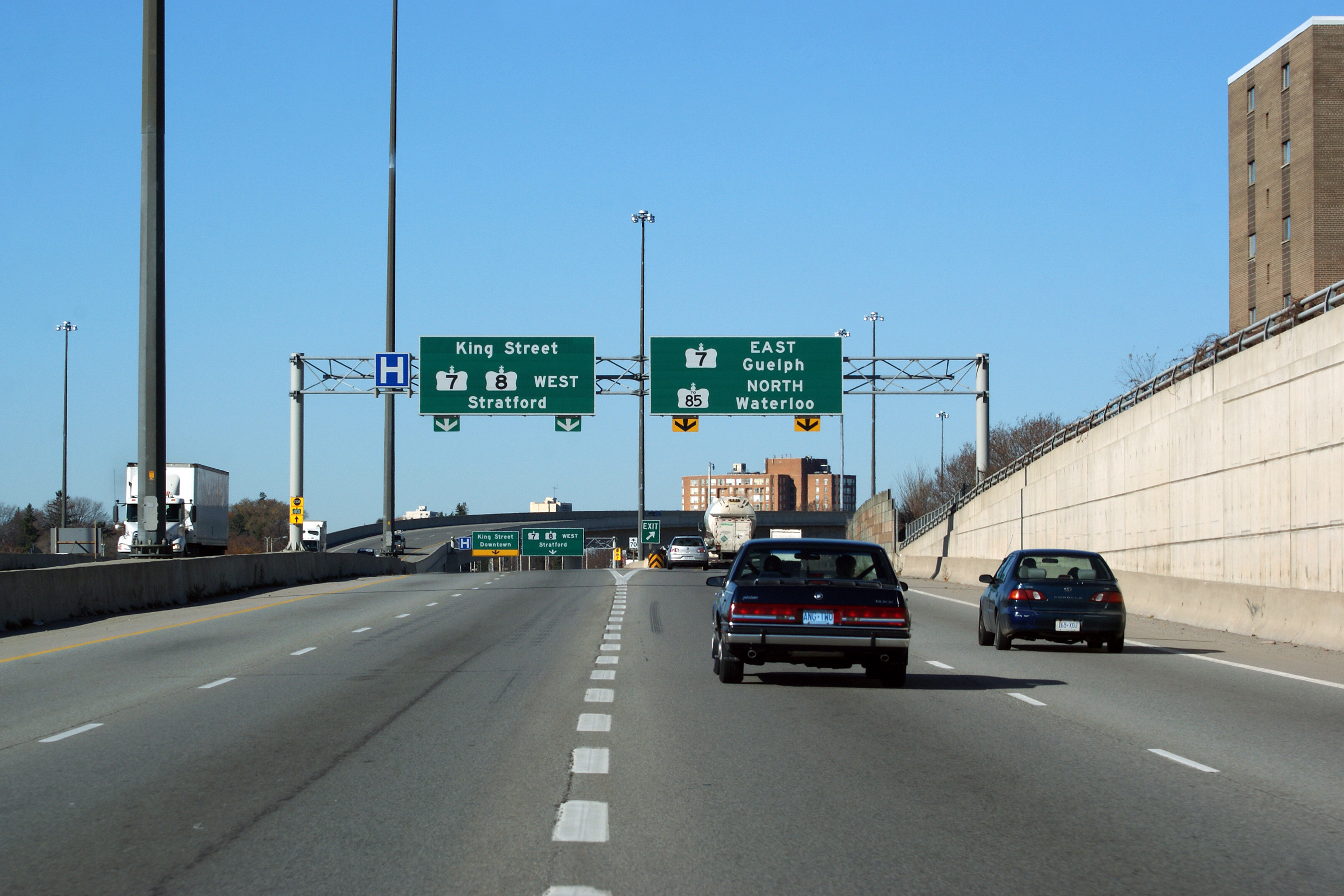
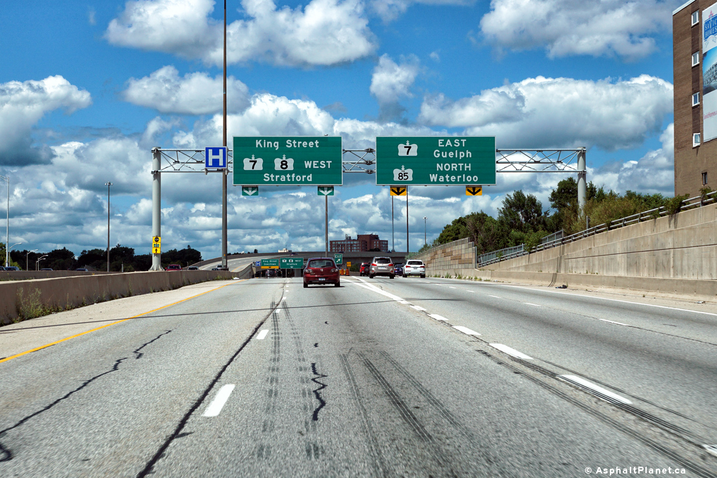
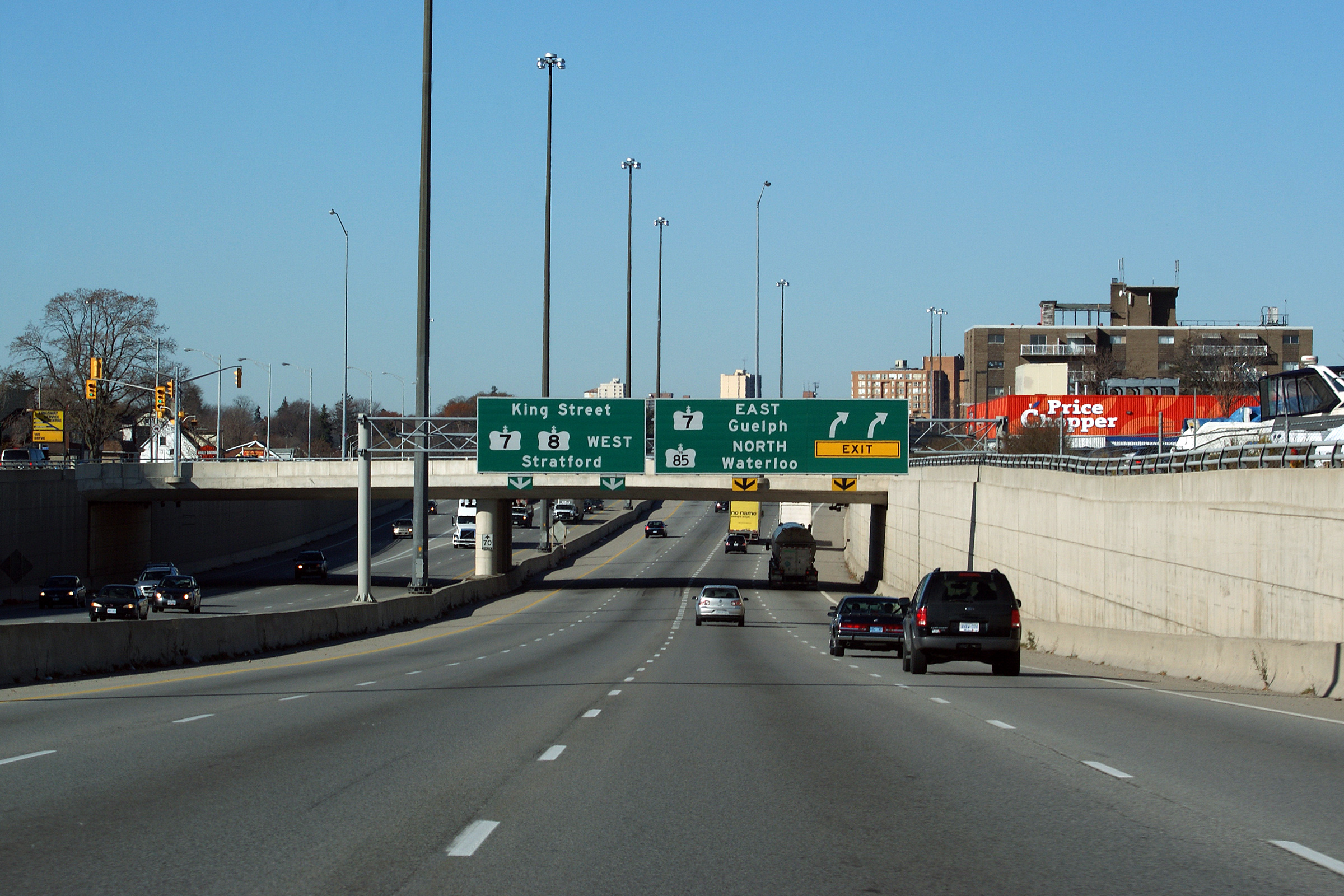
|
City of Kitchener Regional Municipality of Waterloo |
Three lanes
continue easterly along Highway 7, while the right lane departs for Highway
8. Click here for an alternate
photo of this signage taken in August, 2004. Photo taken: August 11th, 2016. |
|||||
| Highway 7 continues easterly along the Parkway before departing for Guelph and beyond. Click here for Highway 7-East images. | ||||||
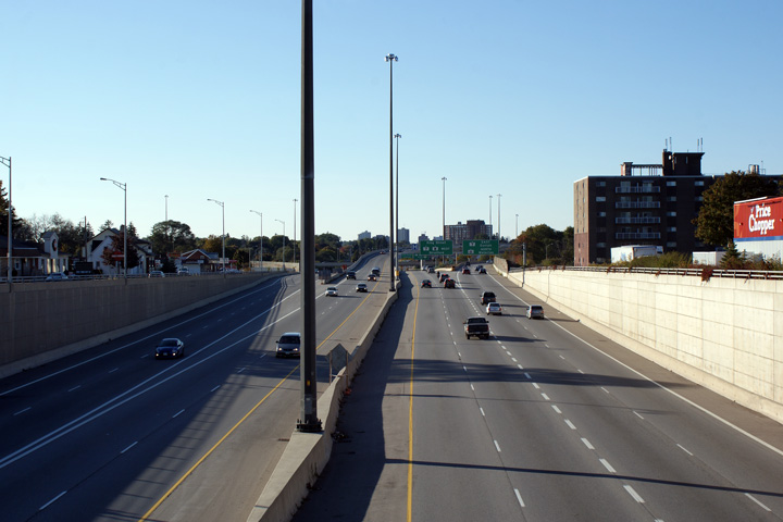
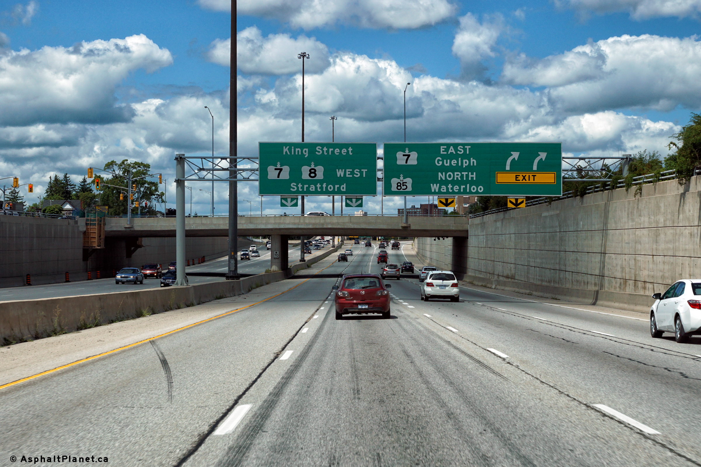
|
City of Kitchener Regional Municipality of Waterloo |
View
of the start of the Highway 8 freeway from King Street in Kitchener. Photo taken: September 2nd, 2008. |
 Low-res High-res |
||||
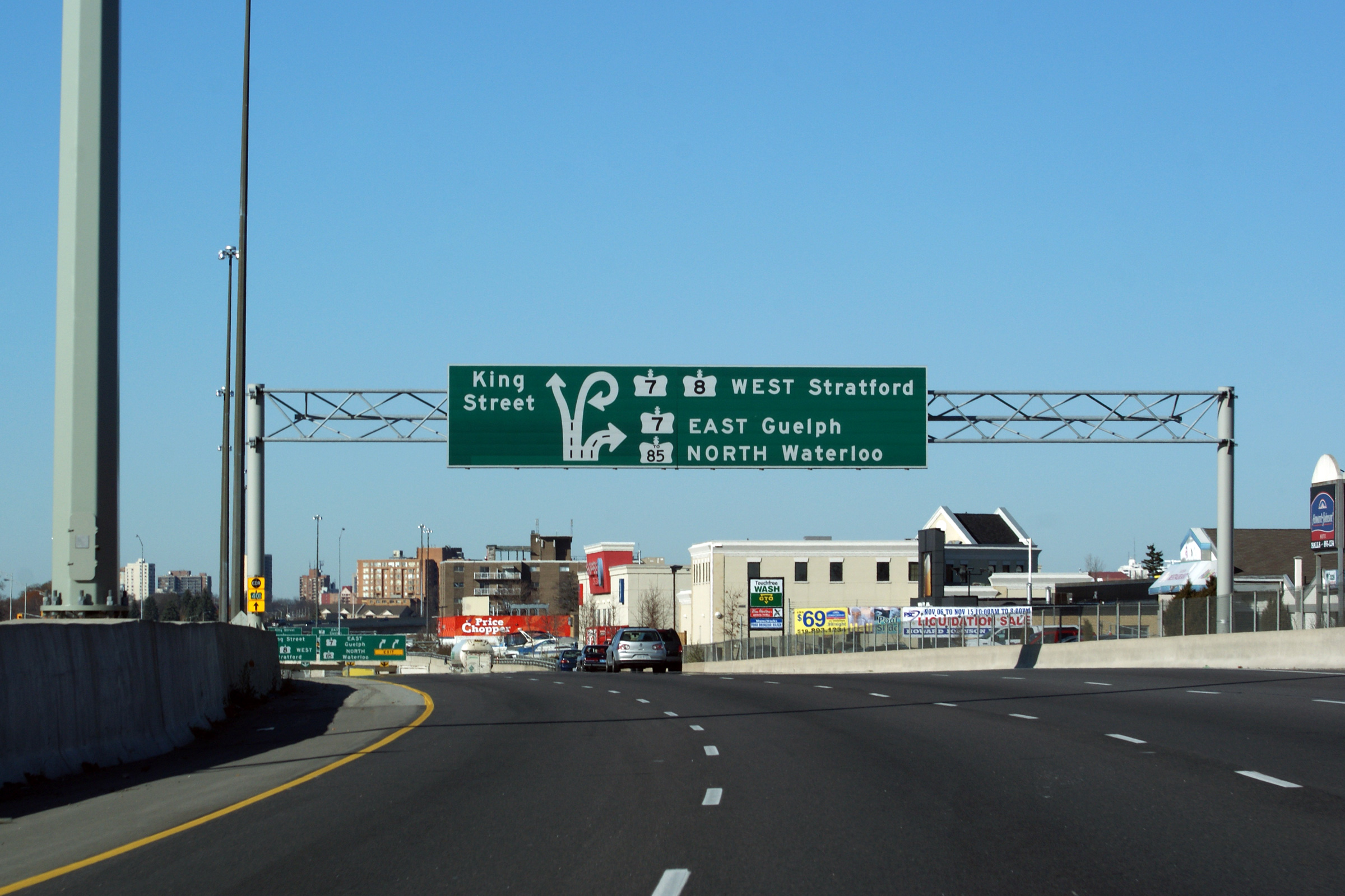
|
City of Kitchener Regional Municipality of Waterloo |
Highway 8 driving west at the King Street exit.
At King Street, Highway 8 departs the current freeway alignment heading to
the Conestoga Parkway via a loop ramp. King Street leads travelers
into Downtown Kitchener, and is the former route of Highway 8 before the
Conestoga Parkway was constructed in the late 1960s.
Click here for an alternate photo of
this signage taken in November, 2009. Photo taken: November 11th, 2009. |
 (720x480) (720x480)(1440x960) (2400x1600) |
||||
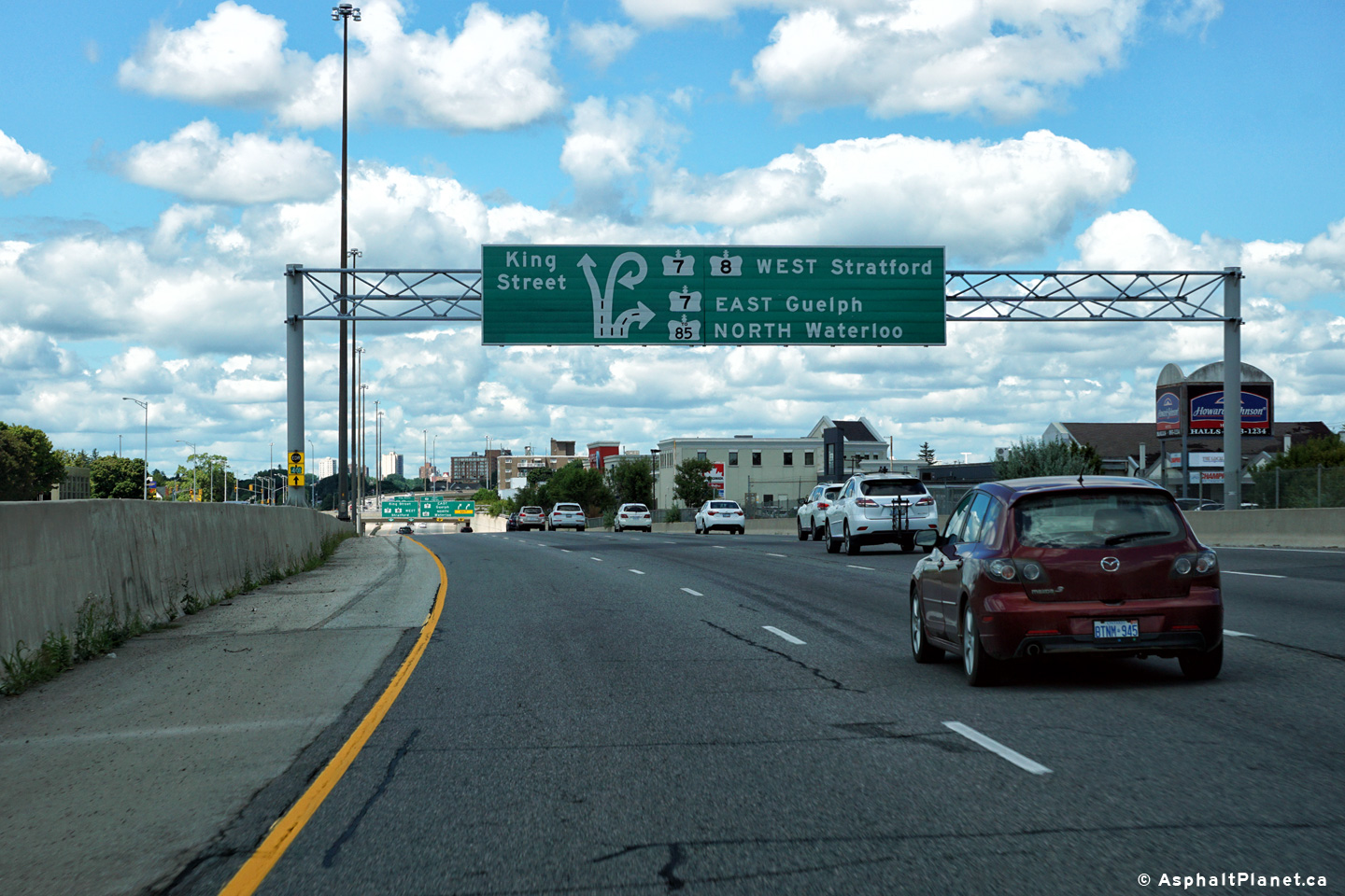
|
City of Kitchener Regional Municipality of Waterloo |
Signage located at the eastbound
Highway 7 split from the Highway 8 freeway.
Click here for an alternate photo of
this signage taken in November, 2009. Photo taken: November 11th, 2009. |
 (720x480) (720x480)(1440x960) (2400x1600) |
||||
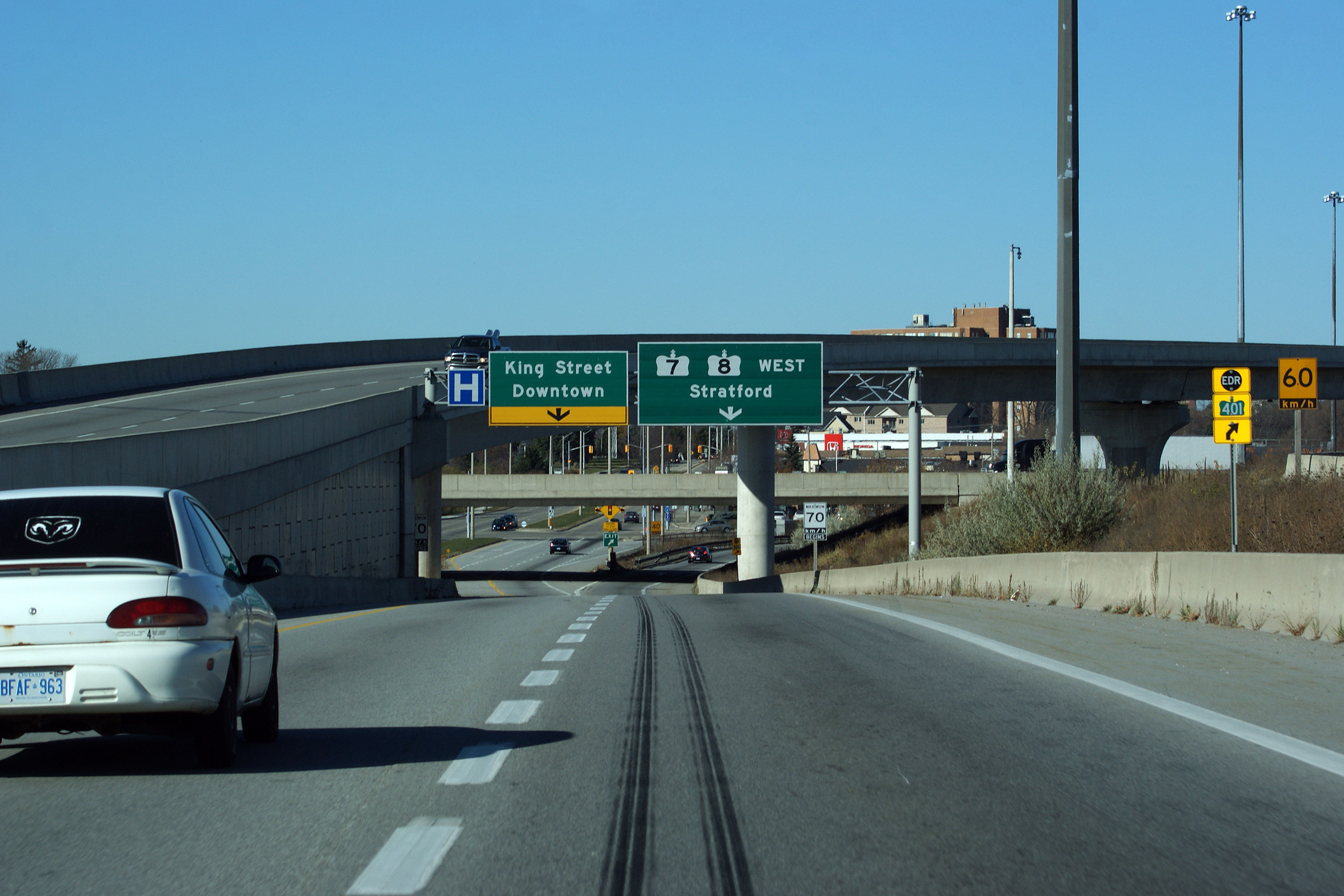
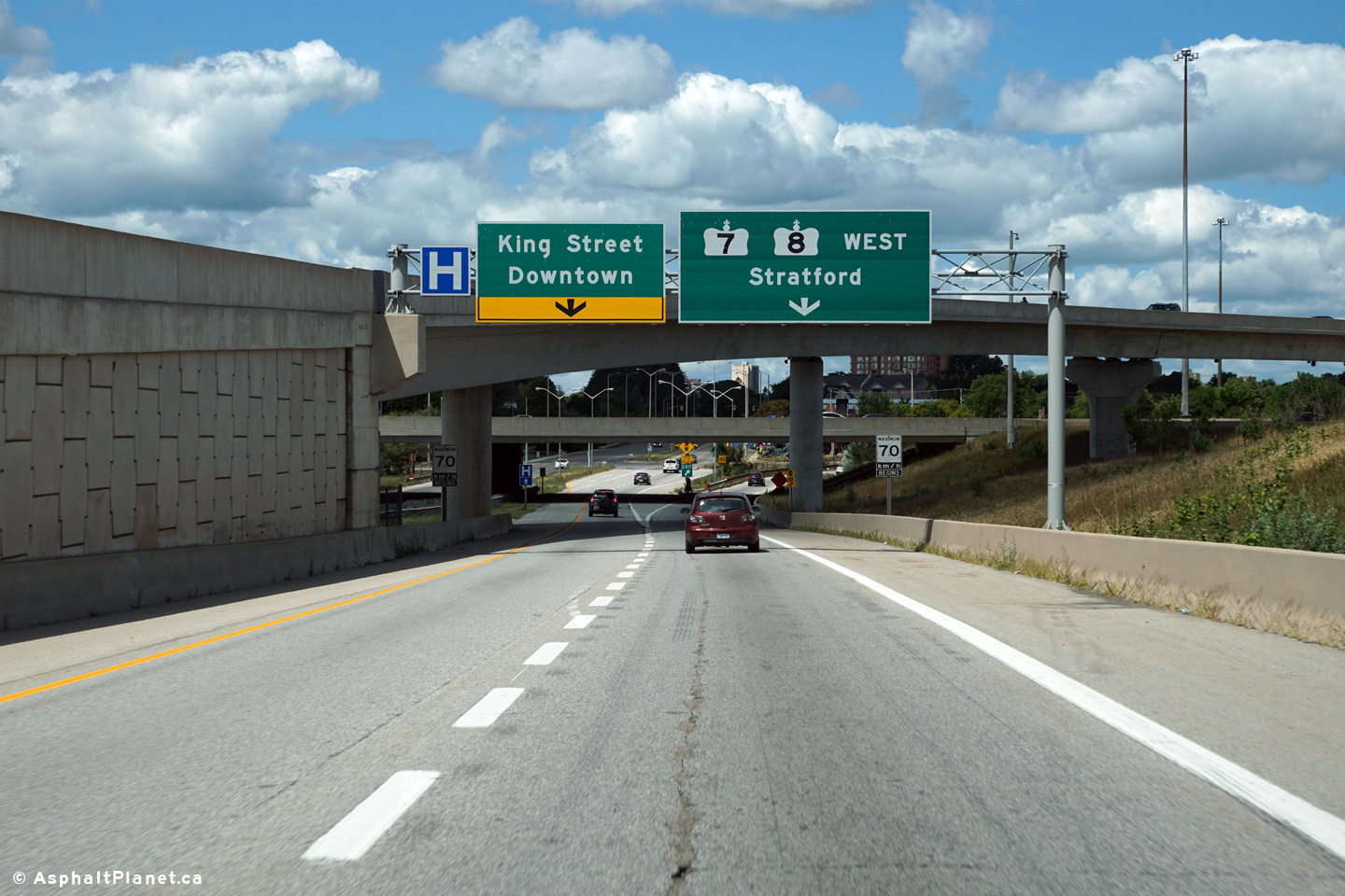
|
City of Kitchener Regional Municipality of Waterloo |
Looking west along Highway 8 from the Franklin
Street overpass. This picture shows the Highway
7/8 interchange in
good detail. The Highway 7/8
interchange was extensively reconstructed as part of a multi-year
construction project completed in 2004. During this construction a new
high-speed flyover ramp was constructed between westbound Highway 7 and
eastbound Highway 8 replacing an outdated loop ramp. Before the interchange
was reconstructed, it was a very congested half-cloverleaf design. Photos taken: October 18th, 2009. |
 (720x480) (1440x960) (2400x1600) 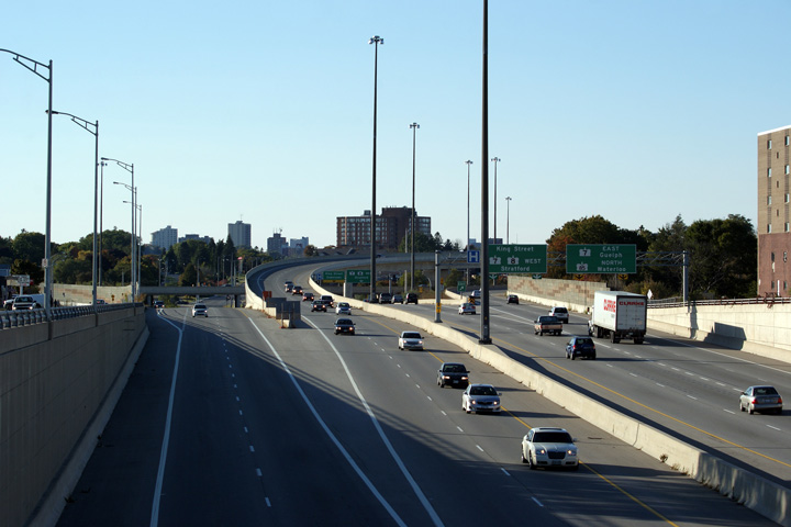 (720x480) (1440x960) (2400x1600) |
||||
| City of Kitchener Regional Municipality of Waterloo |
Highway 8 looking east from the Franklin Street
overpass. Photo taken: October 18th, 2009. |
 (720x480) (1440x960) (2400x1600) |
||||
| City of Kitchener Regional Municipality of Waterloo |
Advanced signage for the upcoming Highway
7/8 interchange located just east of the
Franklin Street overpass. Click here
for an alternate photo of this signage taken in November, 2009. Photo taken: November 11th, 2009. |
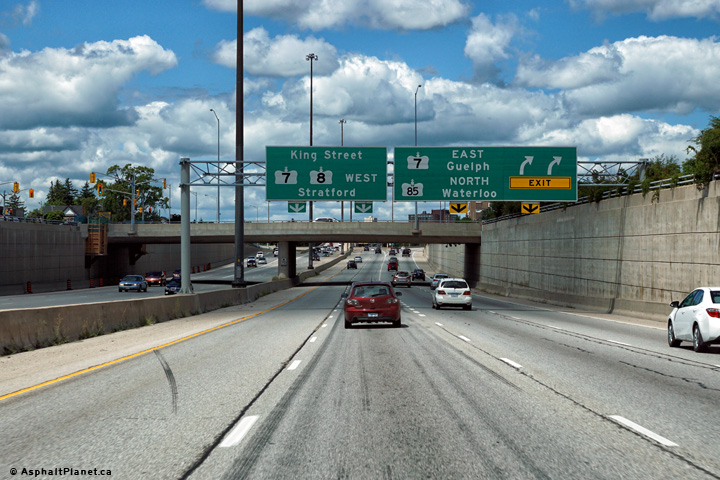 (720x480) (720x480)(1440x960) (2400x1600) |
||||
| City of Kitchener Regional Municipality of Waterloo |
Approaching the Highway 7 interchange along Highway 8.
Click here for an alternate photo of
this signage taken in November, 2009. Photo taken: November 11th, 2009. |
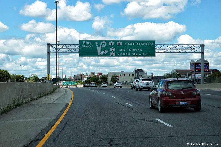 (720x480) (720x480)(1440x960) (2400x1600) |
||||
| City of
Kitchener Regional Municipality of Waterloo |
Eastbound advanced signage
approaching the Fairview Road interchange. Photo taken: August 11th, 2016. |
 (720x480) (720x480)(1440x960) (2400x1600) |
||||
| City of
Kitchener Regional Municipality of Waterloo |
Signage at the eastbound
off-ramp to Fairview Road. Photo taken: August 11th, 2016. |
 (720x480) (720x480)(1440x960) (2400x1600) |
||||
| City of
Kitchener Regional Municipality of Waterloo |
Partial
overhead signs are becoming quite common along Ontario Highways. Photo taken: November 11th, 2009. |
 (720x480) (720x480)(1440x960) (2400x1600) |
||||
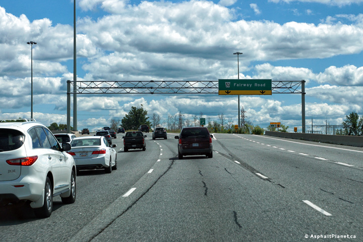
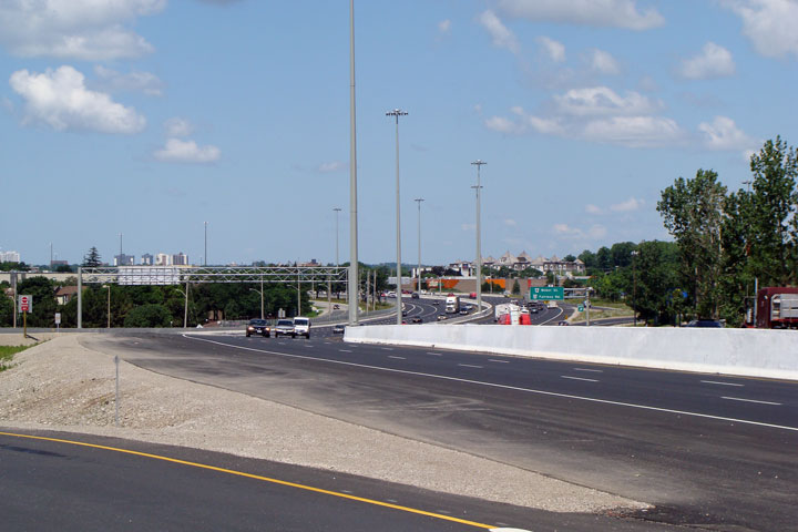
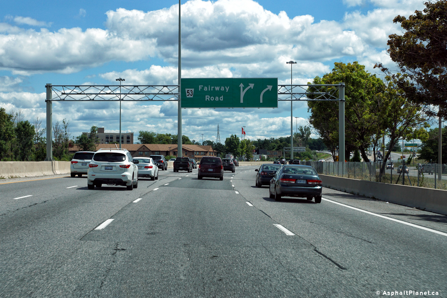
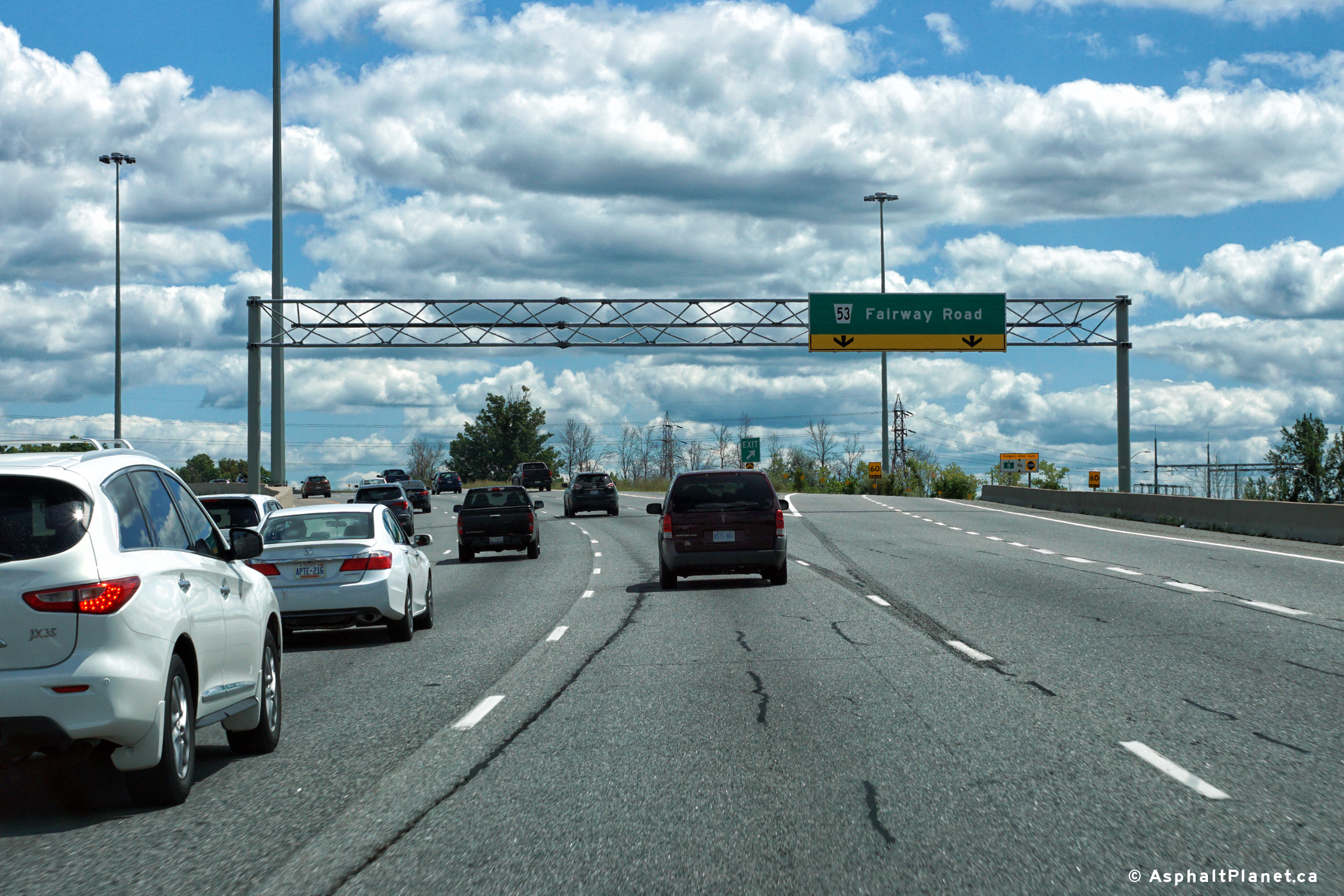
| City of
Kitchener Regional Municipality of Waterloo |
A
rather sharp reversing curve greets Highway 8 travelers just west of Fairway
Road. Photo taken: July 2008. |
 Low-res High-res |
||||
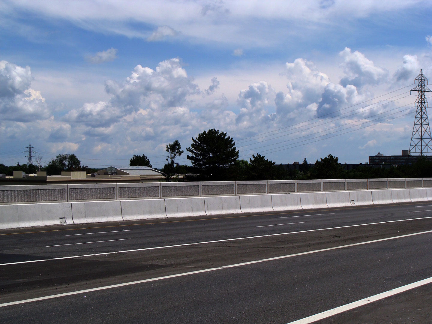
| City of
Kitchener Regional Municipality of Waterloo |
The
median barrier on the new Fairway Road overpass has been embossed with a
very attractive decorative pattern. Photo taken: July 2008. |
 Low-res High-res |
||||
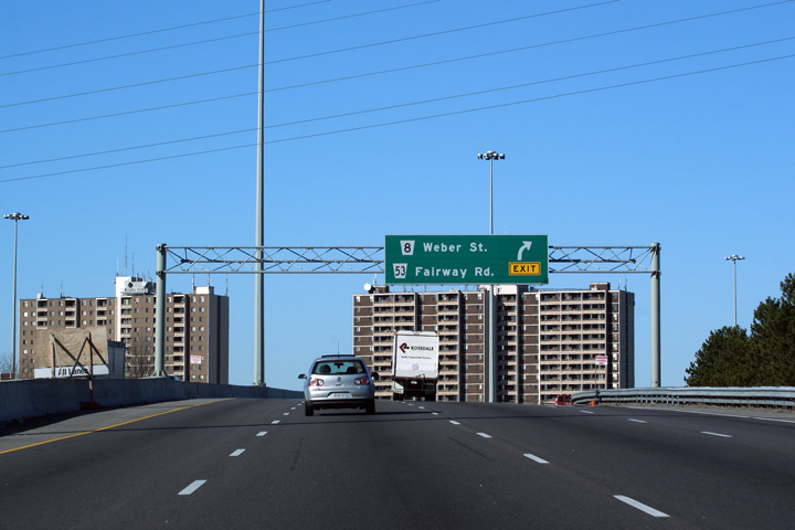
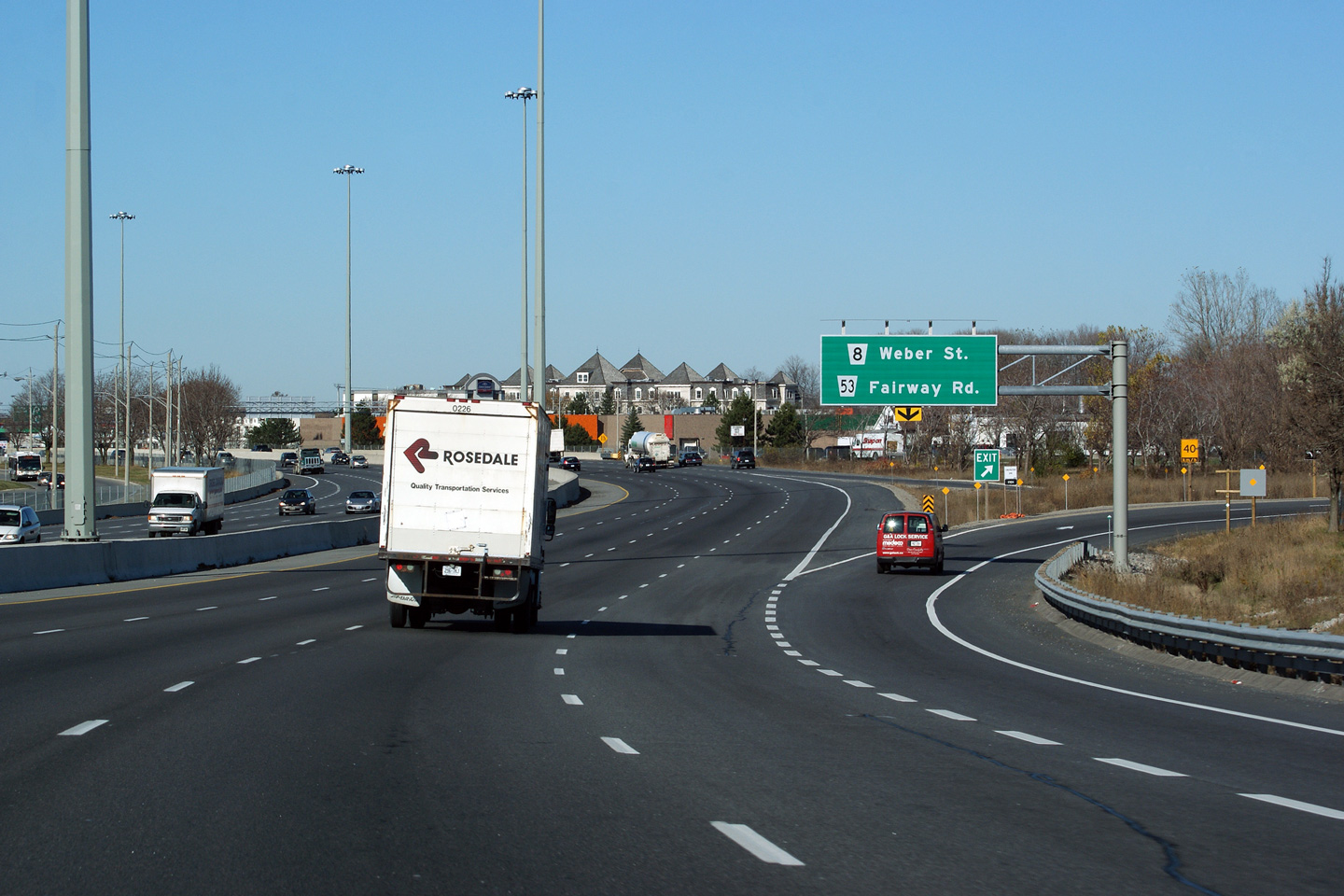
| City of
Kitchener Regional Municipality of Waterloo |
Oversized
junction assembly at the Fairway Road interchange. Photo taken: July 2008. |
 |
||||
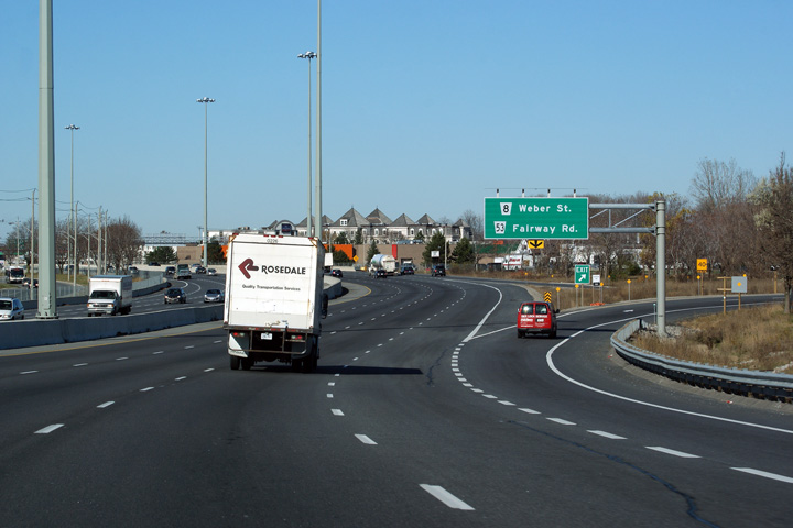
| City of
Kitchener Regional Municipality of Waterloo |
Westbound advanced
signage for the off-ramp to Fairway Road. Photo taken: November 11th, 2009. |
 (720x480) (720x480)(1440x960) (2400x1600) |
||||
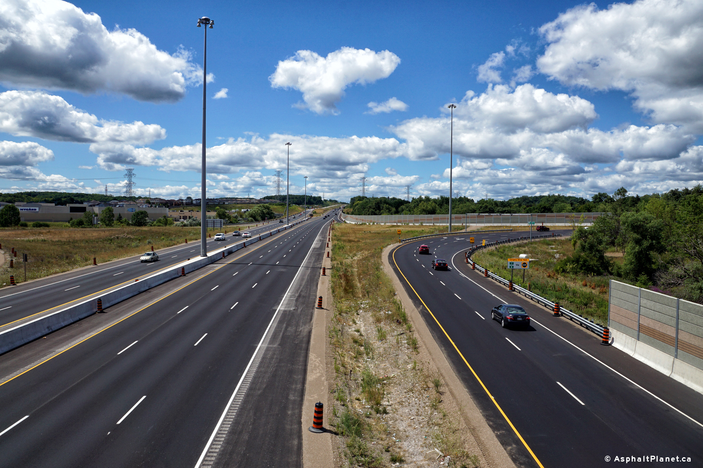
| City of Kitchener Regional Municipality of Waterloo |
A series of views as Highway 8 passes overtop of
the Grand River structures. The upper photos show the Grand River
structure while Highway 8 was a simple four lane freeway. From 2009 to
2012, Highway 8 was widened from four to eight lanes through eastern
Kitchener. This work involved building a new twin structure over the
Grand River in addition to a deck replacement on the existing 1960s era
structure. Upper photos taken: September 2nd, 2008. Lower photo taken: July 21st, 2012. |
 (720x480) (1440x960) (2400x1600) |
||||
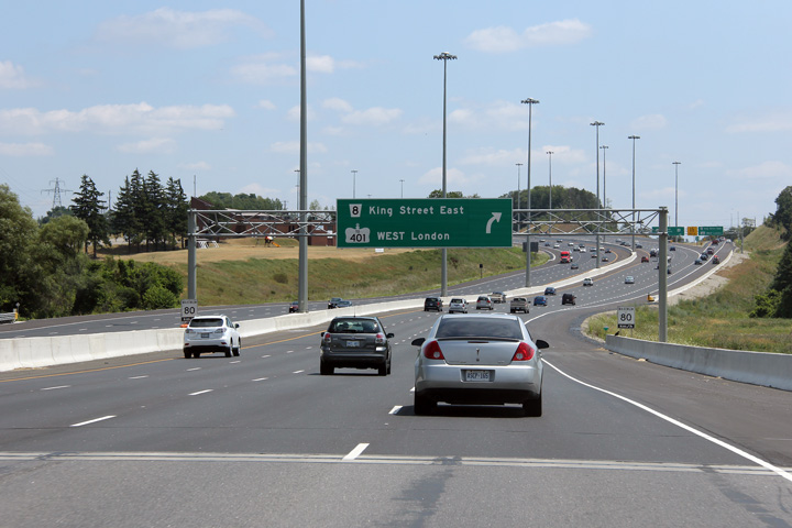
| City of Kitchener Regional Municipality of Waterloo |
Eastbound advanced signage for the ramp to King
Street. There is no direct connection from the freeway to the
westbound 401, so traffic bound towards London along Highway 401 is also
directed to exit at this interchange. Photo taken: July 21st, 2012. |
 (720x480) (720x480)(1440x960) (2400x1600) |
||||
| City of Kitchener Regional Municipality of Waterloo |
Driving east along Highway 8 approaching Highway
7187. At this interchange, Highway 8 departs the freeway section and
follows King Street to the 401, and into Cambridge. Although commonly
referred to as Highway 8, Highway 7187 carries freeway traffic bound for the
eastbound 401. (Travelers bound for
the westbound 401 must exit the freeway here). Upper photo taken: September 24th, 2005. Lower photo taken: July 21st, 2012. |
 (720x480) (720x480)(1440x960) (2400x1600) |
||||
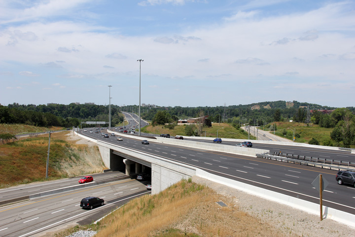
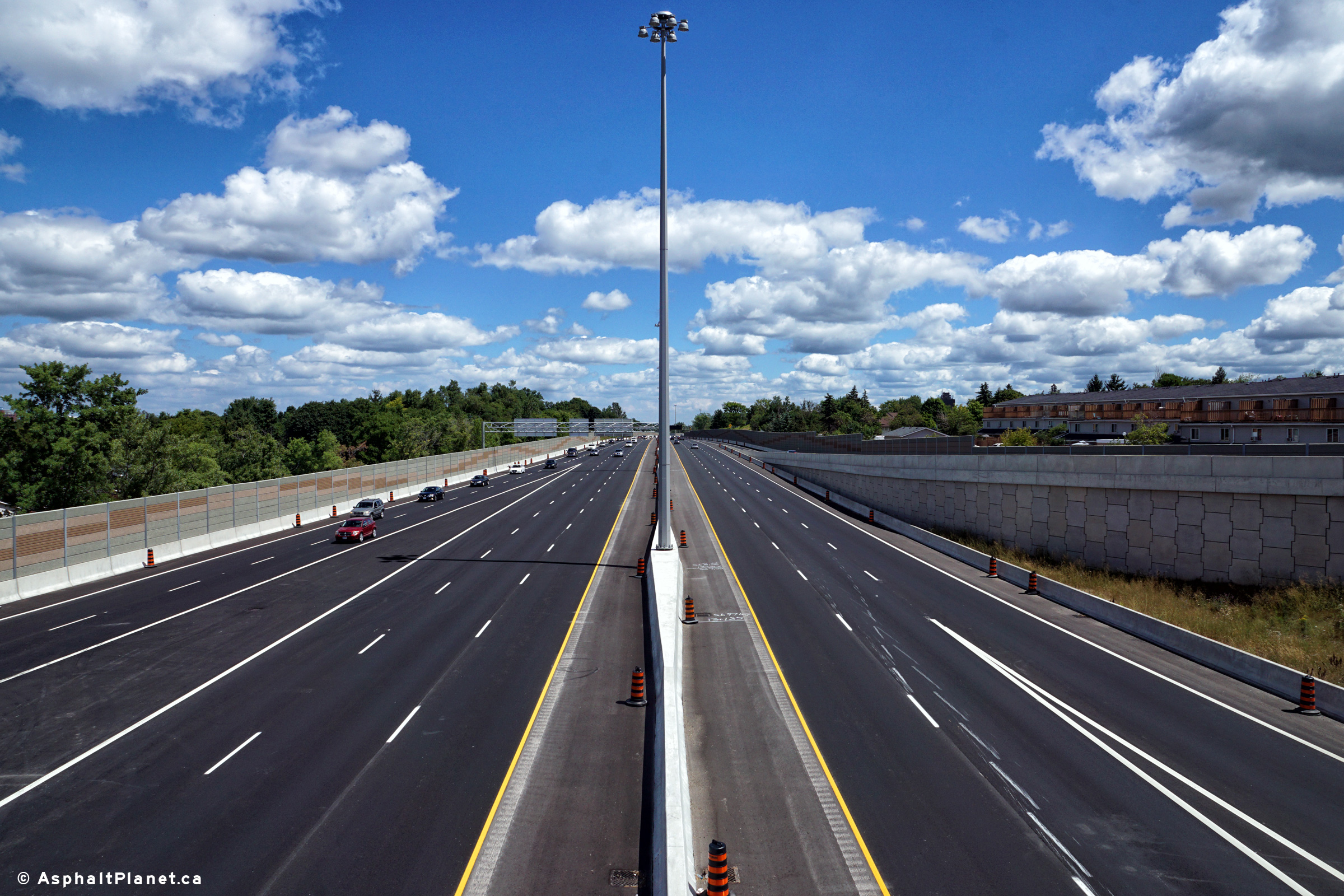
| City of Kitchener Regional Municipality of Waterloo |
A series of views showing Highway 8 as it
traverses the Grand River valley looking westerly from the King Street
underpass. The photo sequence gives a snapshot of some of the
construction work that was required in order to widen Highway 8 to eight
lanes through the Grand River valley. The upper (2009) photos were
taken before any work to widen the highway had begun. At that time,
little had changed along Highway 8 through the Grand River valley (the Freeport Diversion) since it had been completed
in the early 1960s.
The second (2010) photo was taken shortly after the new eastbound Grand
River structure had been completed and opened to traffic. Once the new
eastbound Grand River structure had been opened to traffic, crews began to
replace the deck on the pre-existing 1963 structure. The third (2011)
photo shows work continuing to re-deck the pre-existing Grand River
structure as well as extend the King Street structures to the outside.
The lowest (2012) photos show the project shortly after work had been
completed and all lanes had been opened to traffic. Photos #1 and #2 taken: May 29th, 2009. Photos #3 and #4 taken: September 19th, 2010. Photo #5 taken: September 9th, 2011. Photos #6 and #7 taken: July 21st, 2012. |
 (720x480) (1440x960) (2400x1600) 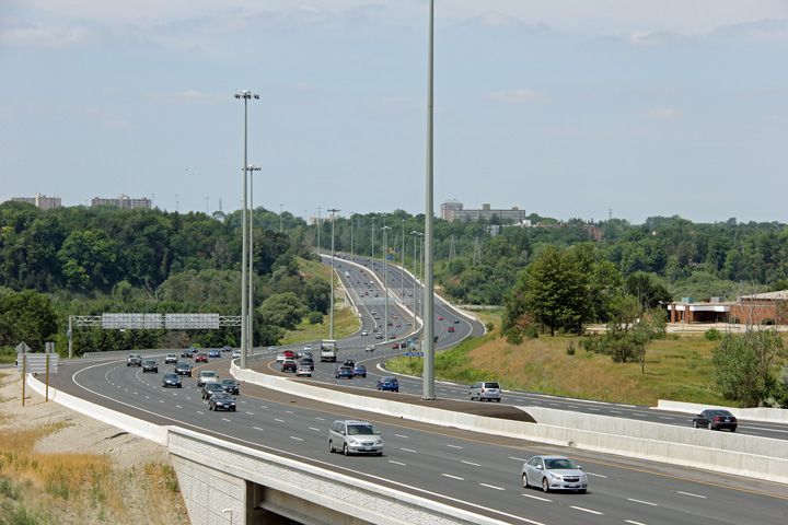 (720x480) (1440x960) (2400x1600) |
||||
| Before Highway 8 was transferred to the Region of Waterloo, Hwy 8 followed King Street through Kitchener and Cambridge bound for Hamilton. Click here for Cambridge to Hamilton Images | ||||||
| City of Kitchener Regional Municipality of Waterloo |
Two views looking easterly along the Highway
7187
freeway from just east of the King Street interchange. Upper photo taken: May 29th, 2009. Lower photo taken: July 21st, 2012. |
 (720x480) (1440x960) (2400x1600) |
||||
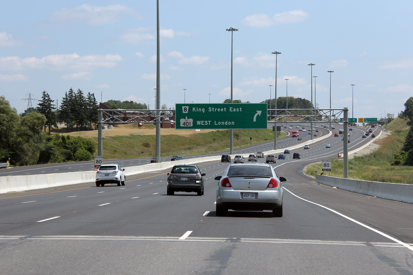
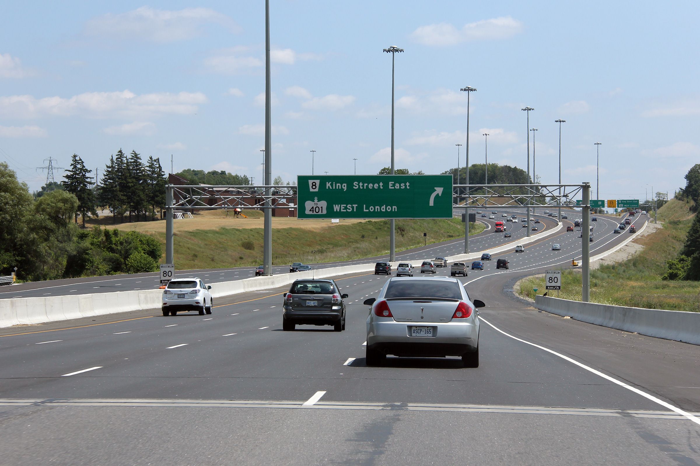
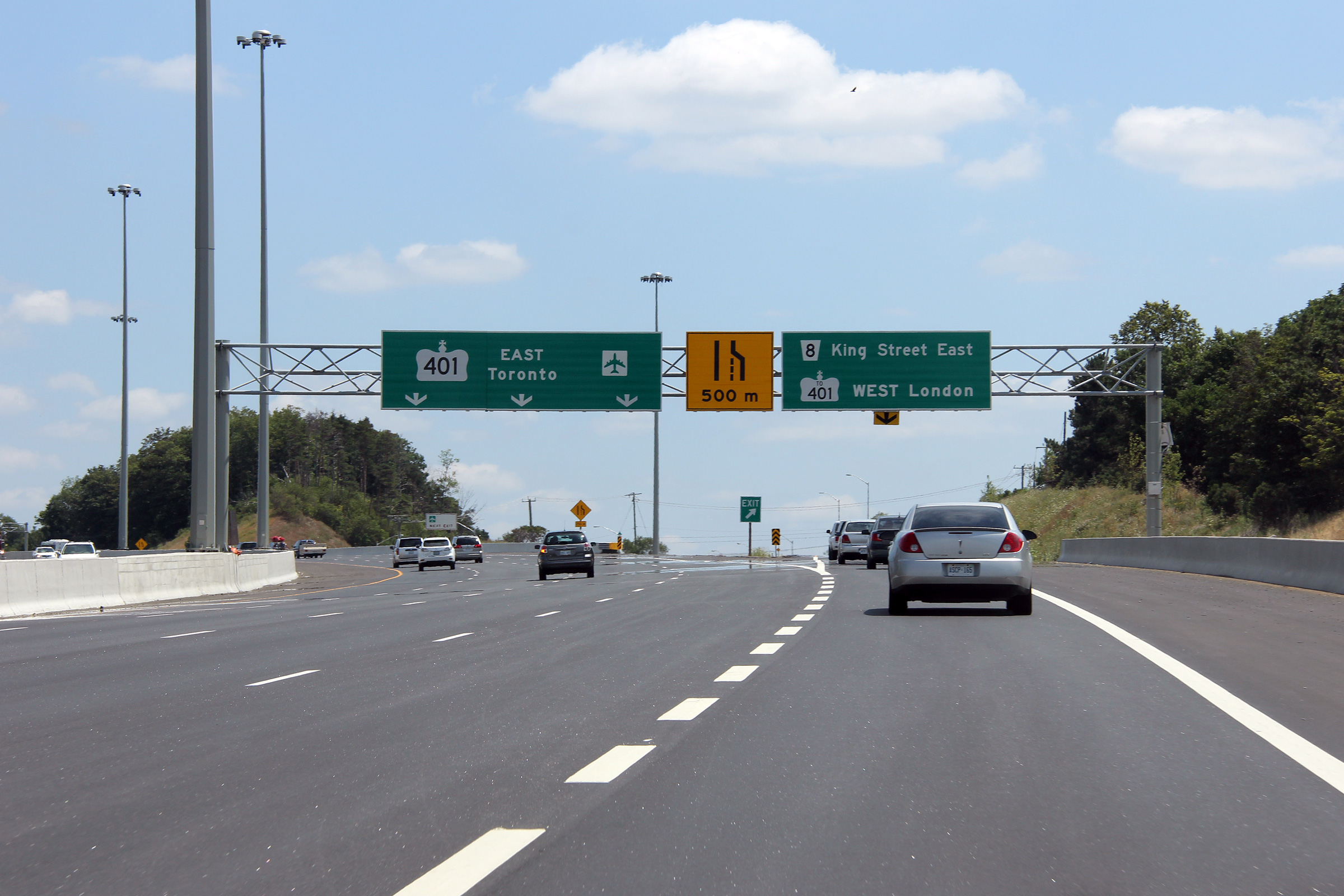
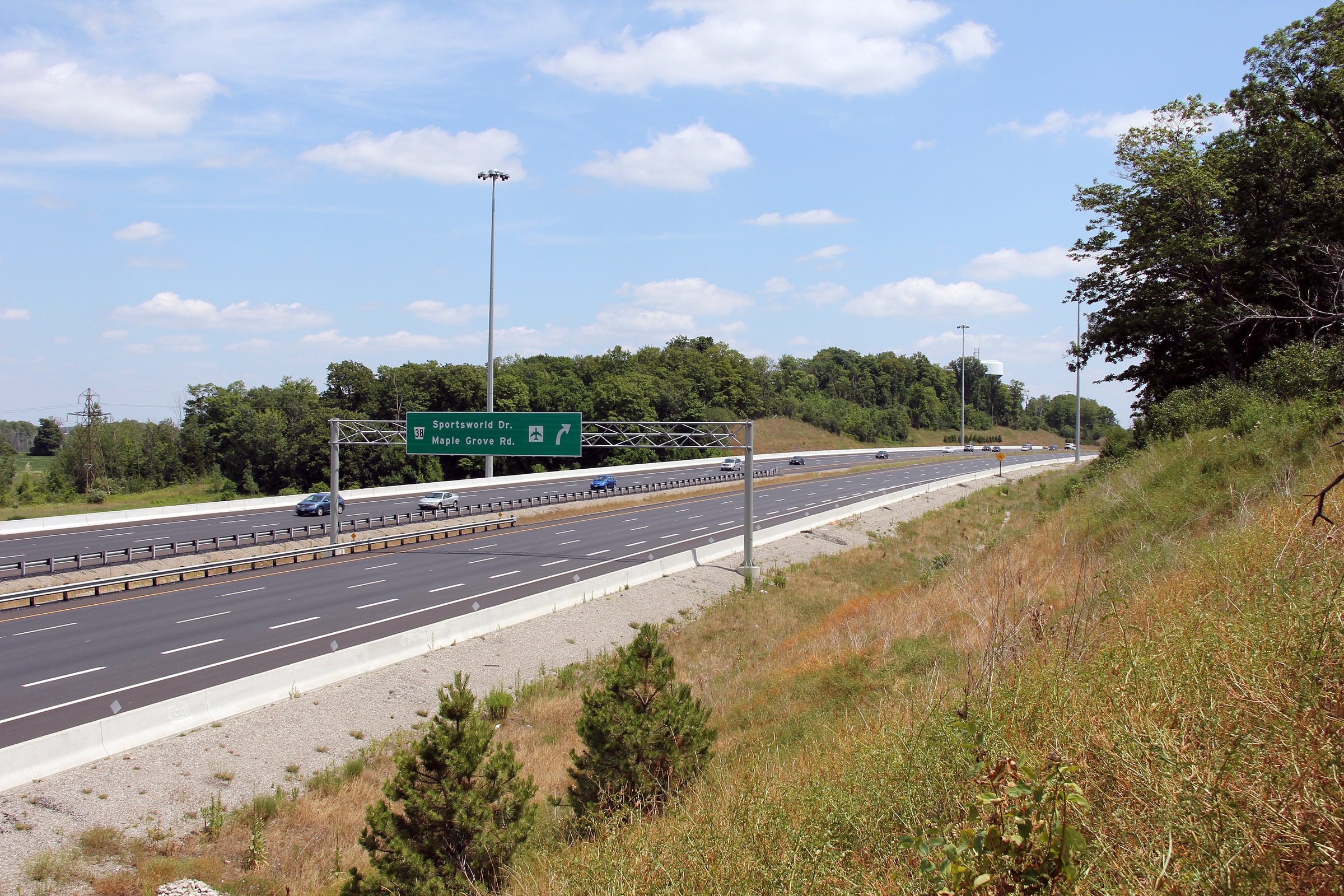
| City of Kitchener Regional Municipality of Waterloo |
View looking easterly along Highway 7187
approaching the Maple Grove Road / Sportsworld Drive interchange.
Highway 7187 was widened to six lanes between King Street and Sportsworld Drive
during the Grand River widening project. Photo taken: September 2nd, 2008. |
|
||||
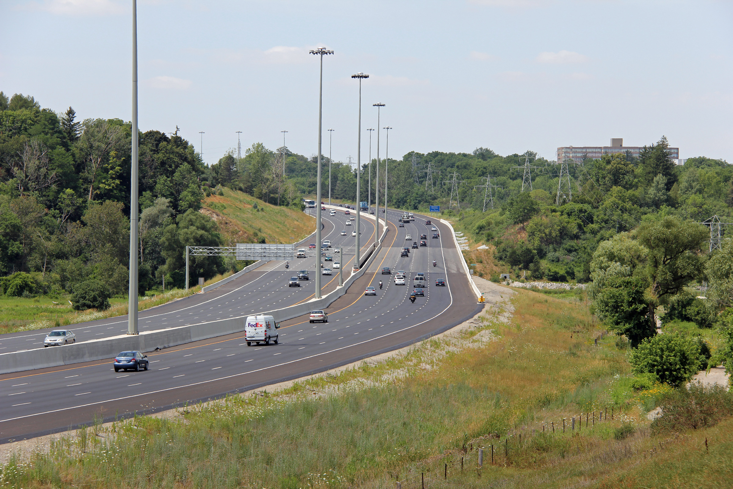
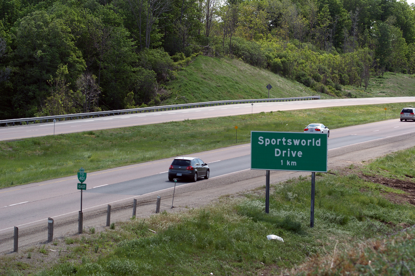
| City of Kitchener Regional Municipality of Waterloo |
Another easterly view at the Maple Grove Road /
Sportsworld Drive interchange. The Highway 401 interchange is located
at the final curve pictured in this photo. Photo taken: June 23rd, 2009. |
 (720x480) (1440x960) |
||||
| Beyond the Maple Grove Road / Sportsworld Drive interchange, Highway 8 leads to Highway 401. Click here for Highway 401 images. | ||||||
<- Page 1 Images Highway 8 Images Index Page 3 Images ->
<- Highway 7B (Carleton Place) Images Back to Highway 8 Highway 9 Images ->
Copyright (c) 2004-2017, Scott Steeves (Webmaster) AsphaltPlanet@asphaltplanet.ca


